April 17, 2019 – Cornwall-On-Hudson, NY
Difficulty: Moderate – Strenuous (1 continuous steep climb)
Length: Approximately 4.3 miles
Max elevation: 1,173 ft.– total elevation gain approximately 1,276 ft.
Route type: Circuit
Map: West Hudson Trails Map #113 – Scenic Hudson Web Map
Trailhead parking: US Rte 9W, Cornwall-On-Hudson, NY 12520
Park Overview:
Storm King State Park is a 1,972-acre state park in Orange County, New York. The park is in the southeast part of the Town of Cornwall, next to the Hudson River. The park offers unsurpassed views of the Catskills and the Hudson Valley. Hikers and hunters enjoy this undisturbed green space. Park is undeveloped. There are no toilets and limited parking.
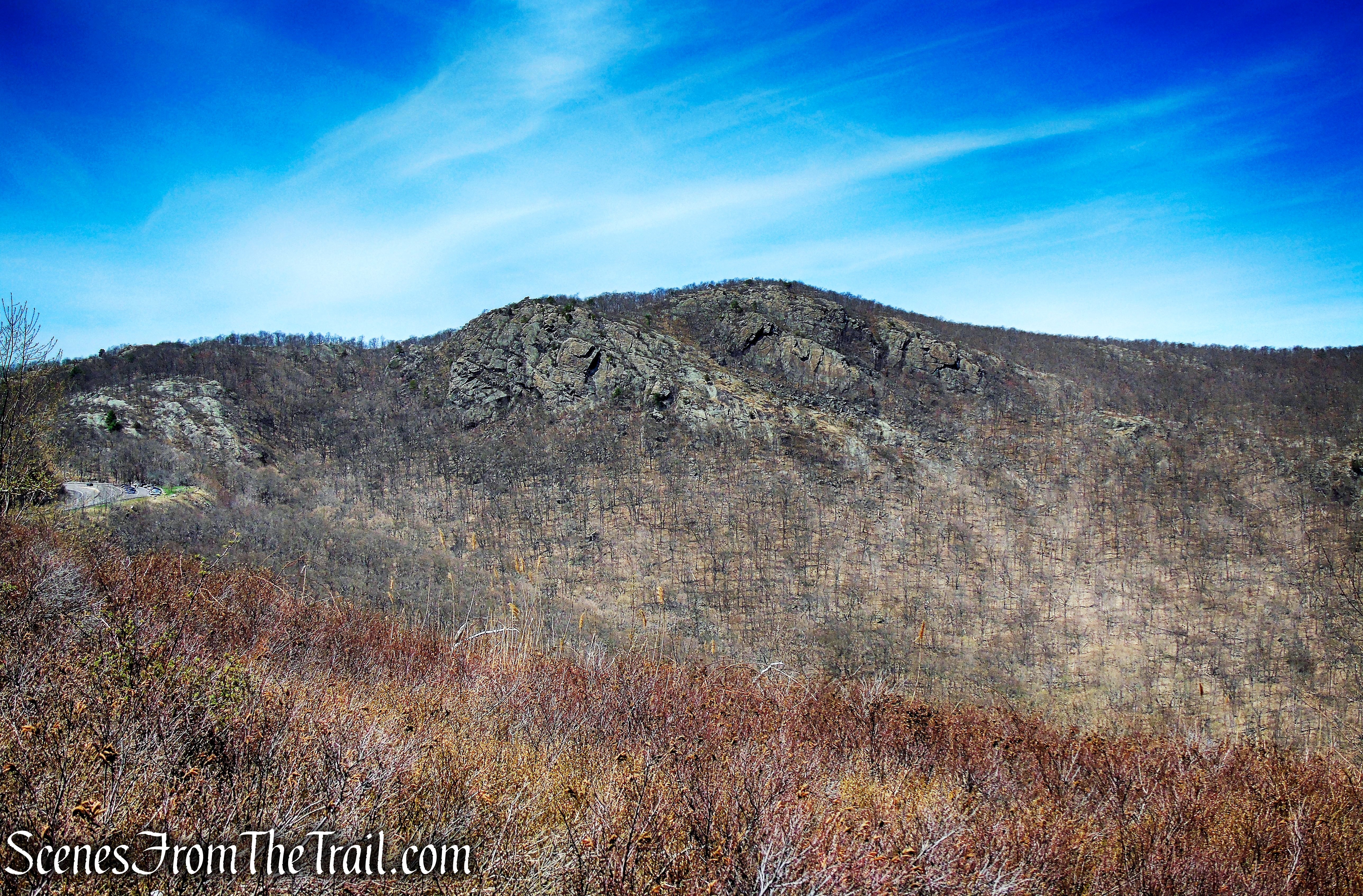
Crow’s Nest is a mountain along the west bank of the Hudson River in the Town of Highlands on the northern edge of the United States Military Academy (USMA) at West Point. US 9W passes just west of its summit and offers panoramic views of the Hudson River. A small portion of the northern slopes are within Storm King State Park, but most of the mountain is on USMA property and thus generally off limits to the public (it is fenced off along Route 9W). There is a television relay tower located near the summit.
Crow’s Nest Mountain as viewed from Butter Hill
Trails Overview:
Aside from the Bobcat Trail, there is nothing easy about the trails in Storm King State Park. However, views of the Hudson Highlands and the Hudson River reward hikers far beyond the effort required to arrive at a viewpoint. Since the network of trails is small, hikers can minimize retracing their steps, and various loop hikes are possible.
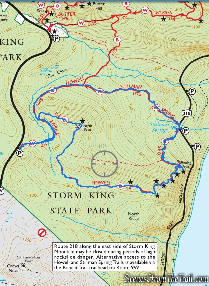
Trails used on this hike:
Please note: distances denoted are approximate and relate to this hike only and may not be the total length of the trails.
- Bobcat Trail (0.8 mile white) – This trail allows hikers wishing to enjoy the views from the North Ridge of Crows Nest without a climb. (This trail also provides access to the North Ridge of Crows Nest when NY 218 is closed.) It begins on the north side of a small parking lot off the northbound lanes of US 9W about two miles north of its intersection with NY 218 and NY 293 (there is no access to or from the southbound lanes of US 9W). After leaving the parking lot, the trail descends gently, loops to the left, and terminates at the Howell Trail (blue) in 0.4 mile.
- Howell Trail (2.8 miles blue) – This trail steeply climbs the eastern slope of the North Ridge of Crows Nest Mountain, passing a series of panoramic viewpoints over the Hudson River, the East Hudson Highlands, and Storm King Mountain. Limited parking is available on the east side of the road at the trailhead (additional parking is also available both north and south of the trailhead).
- Stillman Spring Trail (0.7 mile white) – Since many hikers do not wish to reclimb Crows Nest after hiking the Howell Trail, this trail offers a quick return to cars parked on NY 218.
Hike Overview:
The trailhead on Route 9W has room for about 6 – 8 vehicles. It is easy to miss and if you reach a larger parking area with a view (Butter Hill trailhead), you have gone too far. Access to the parking area via the northbound lanes of US 9W only.
Bobcat Trail parking area
This lollipop loop hike was done clockwise, with the Bobcat Trail being the stem (the only section that we hiked twice).
North Point Loop
The Hike:
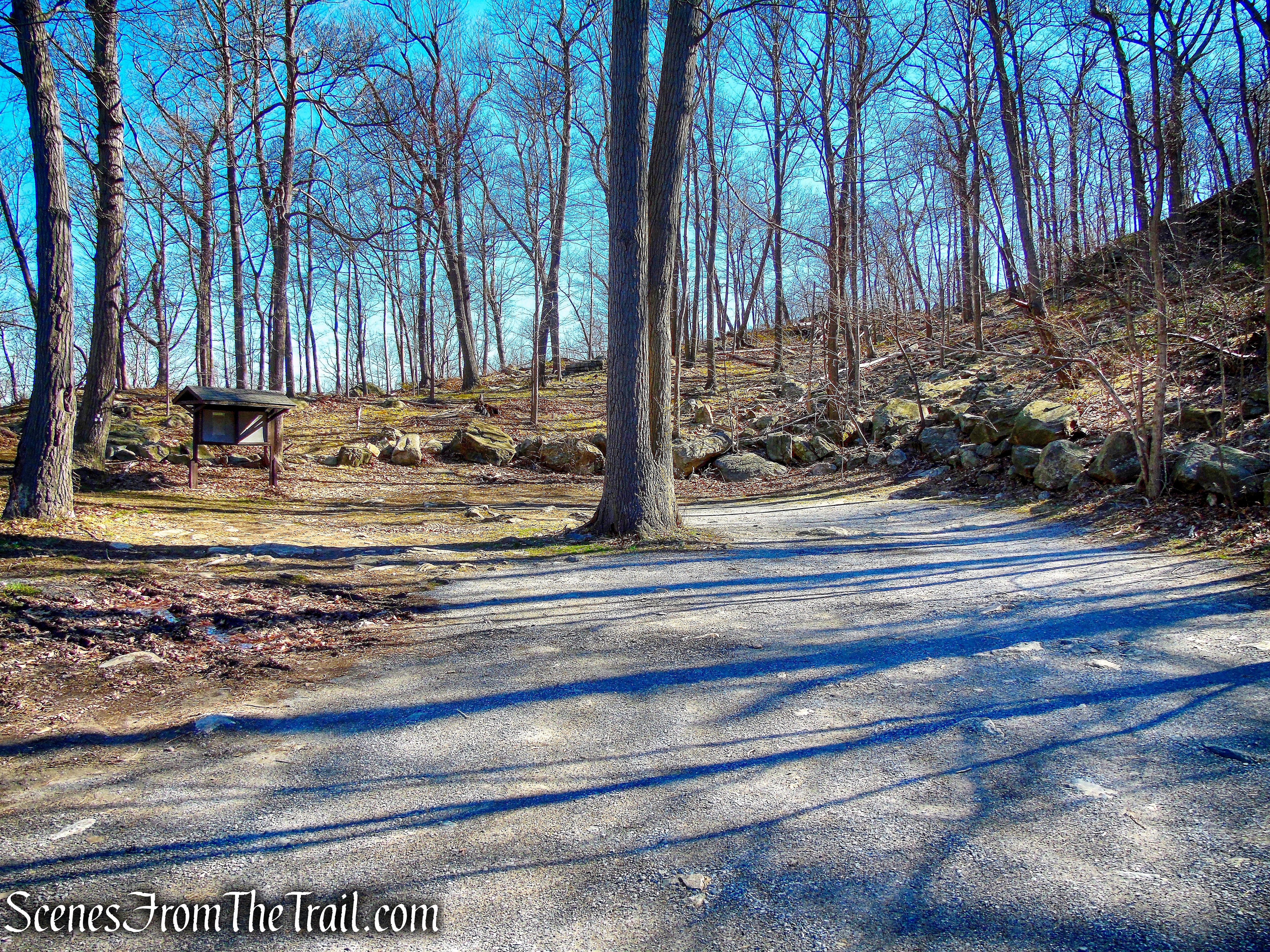
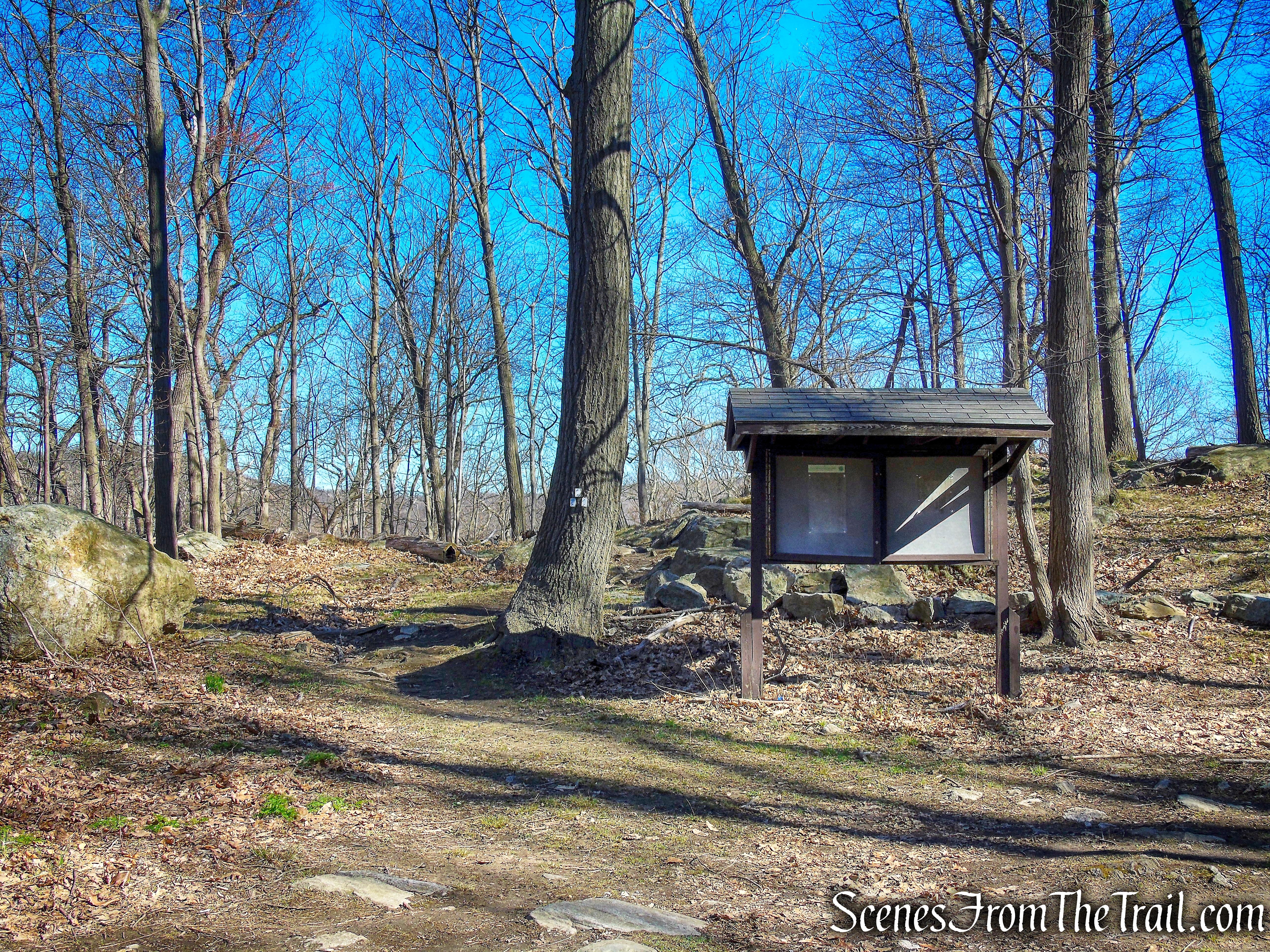
At the north side of the parking area, you will notice a triple blaze that marks the start of the Bobcat Trail. Follow this white-blazed trail, which descends steadily through an oak forest with an understory of blueberries. At the base of the descent, it crosses a stream on stepping stones, bears left, and soon begins to follow a faint woods road. About half a mile from the start, the Bobcat Trail ends at a junction with the blue-blazed Howell Trail.
start of Bobcat Trail
Bobcat Trail
Bobcat Trail
Bobcat Trail
Bobcat Trail
terminus of Bobcat Trail
Continue ahead on the woods road, which is now quite distinct, following the blue blazes. The trail descends steadily, paralleling a stream in the gorge on the left. As the trail curves to the right, views of Storm King Mountain appear through the trees to the left.
Howell Trail
In another ten minutes, the blue-blazed Howell Trail leaves to the left, but you should proceed ahead on the woods road, now following the white blazes of the Stillman Spring Trail, which continues to descend. Soon after crossing a stream on a stone causeway, the trail bears right, crosses a stream on rocks, and turns left to reach the paved Storm King Highway (N.Y. Route 218). You’ve now gone about a mile and a half from the start of the hike – mostly downhill.
start of Stillman Spring Trail
Stillman Spring Trail
Stillman Spring Trail
Stillman Spring Trail
Turn right, and follow the road for about 100 feet to a rock with a carved inscription in memory of James Stillman. Just beyond the adjacent Stillman Memorial Spring, you’ll notice three blue blazes above on the hillside. They mark the start of the Howell Trail, which you will be following for the next two miles. Follow the blue blazes as they steeply climb the hillside. The trail bears left and ascends on switchbacks, but the climb remains quite steep.
turn right on N.Y. Route 218
Stillman Memorial
start of the Howell Trail
Howell Trail
After about a third of a mile of steep climbing, the trail turns left onto an old woods road that descends slightly. Just before the end of the road at a “pitching point” (once used to toss logs down to the Hudson River below), the trail turns sharply right and climbs stone steps.
Howell Trail
Howell Trail
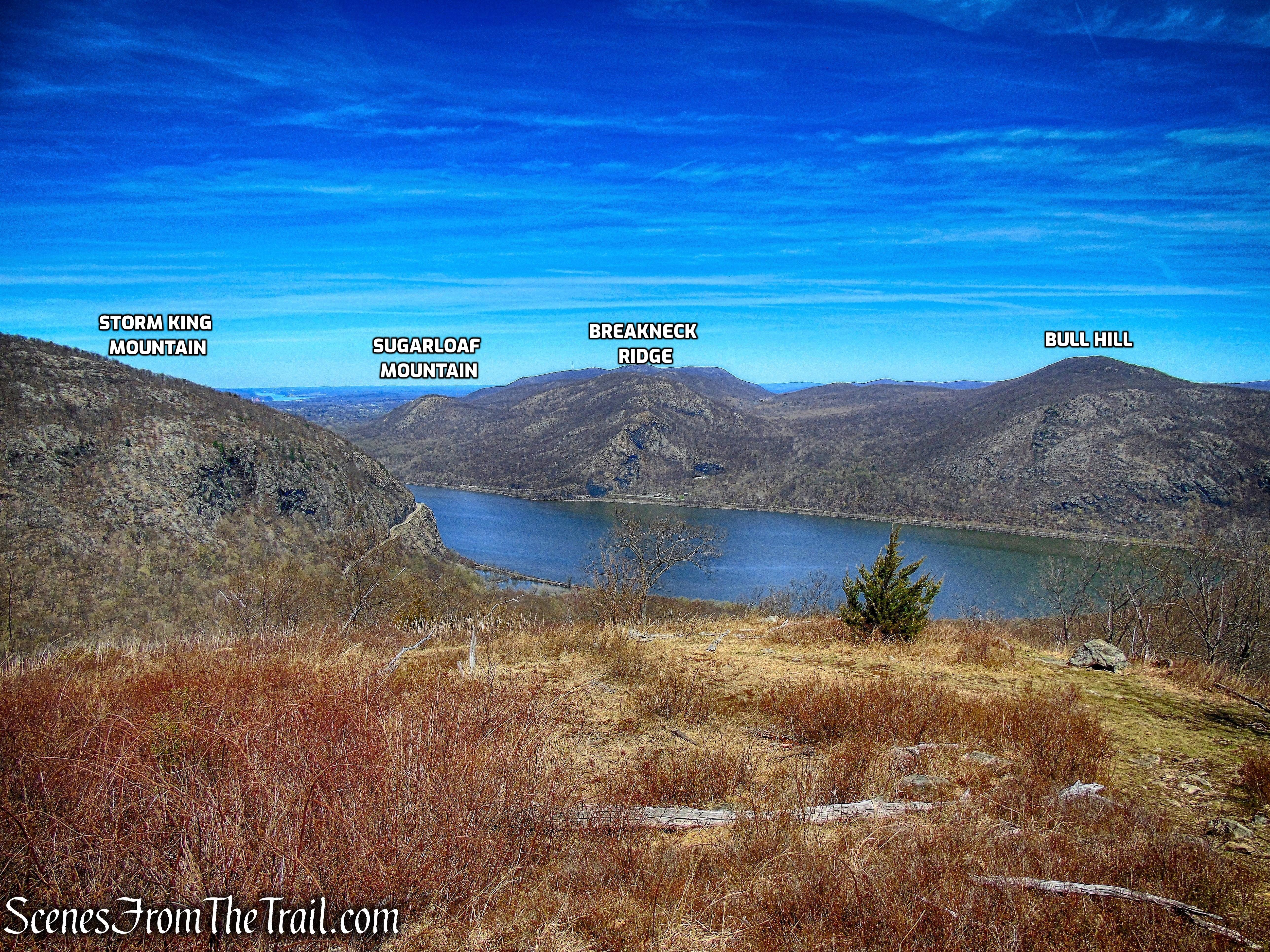
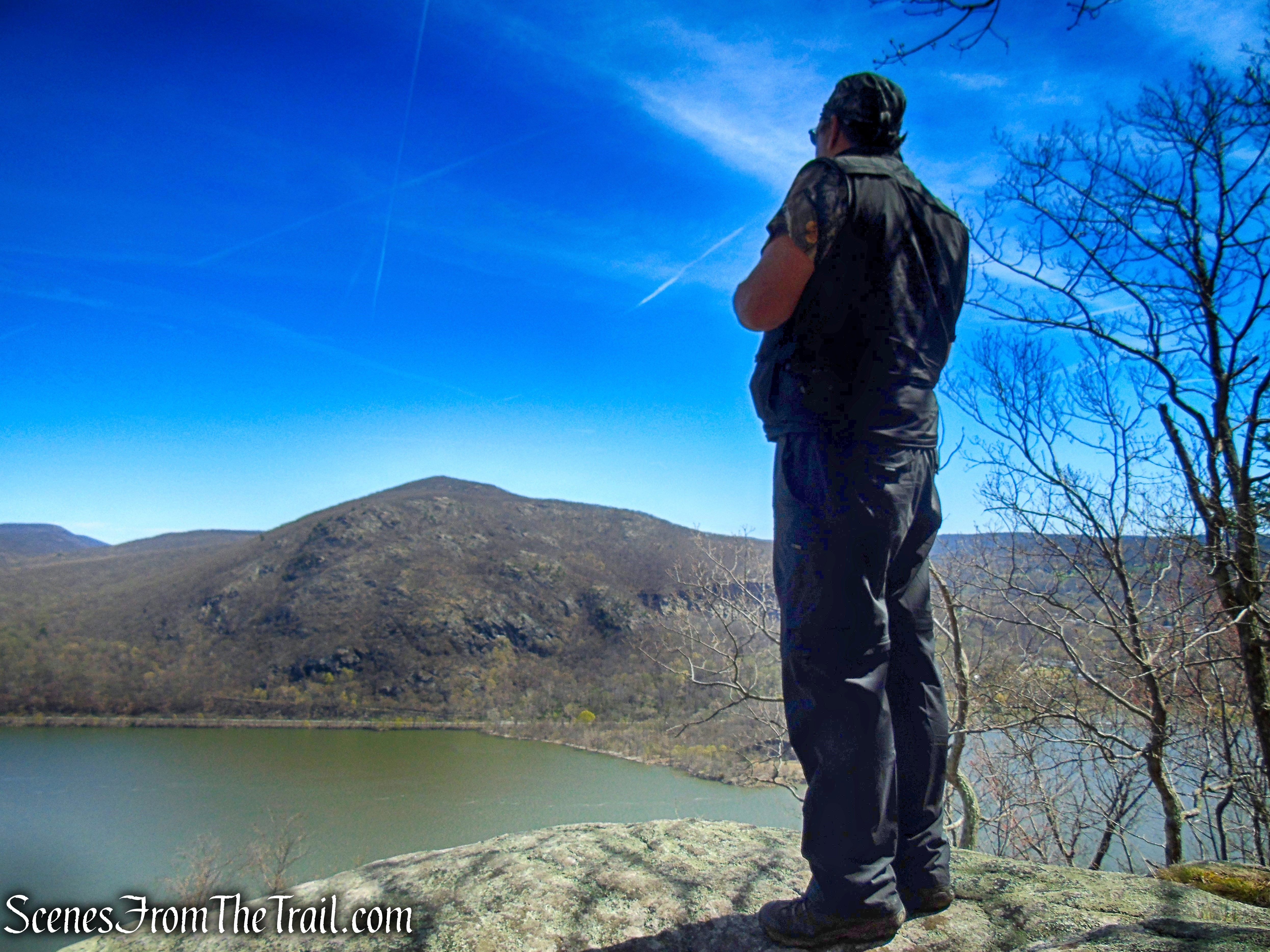
After climbing some more on switchbacks, the trail comes out at an east-facing viewpoint over the Hudson River. Bull Hill is directly across the river, with Little Stony Point jutting into the river, and the village of Cold Spring is to the right.
Howell Trail
Howell Trail
Bull Hill & Little Stony Point from Howell Trail
view southeast towards Cold Spring
As you continue your steep climb, more views appear. After following a curved set of rock steps through mountain laurel, you’ll reach a broader viewpoint over the river from a large rock ledge to the left of the trail. Breakneck Ridge is visible to the left, and Constitution Marsh (just south of Cold Spring) may be seen to the right.
Howell Trail
Howell Trail
view northeast from Howell Trail
Howell Trail
view southeast from Howell Trail
Howell Trail
Howell Trail
Howell Trail
Howell Trail
view southeast from Howell Trail
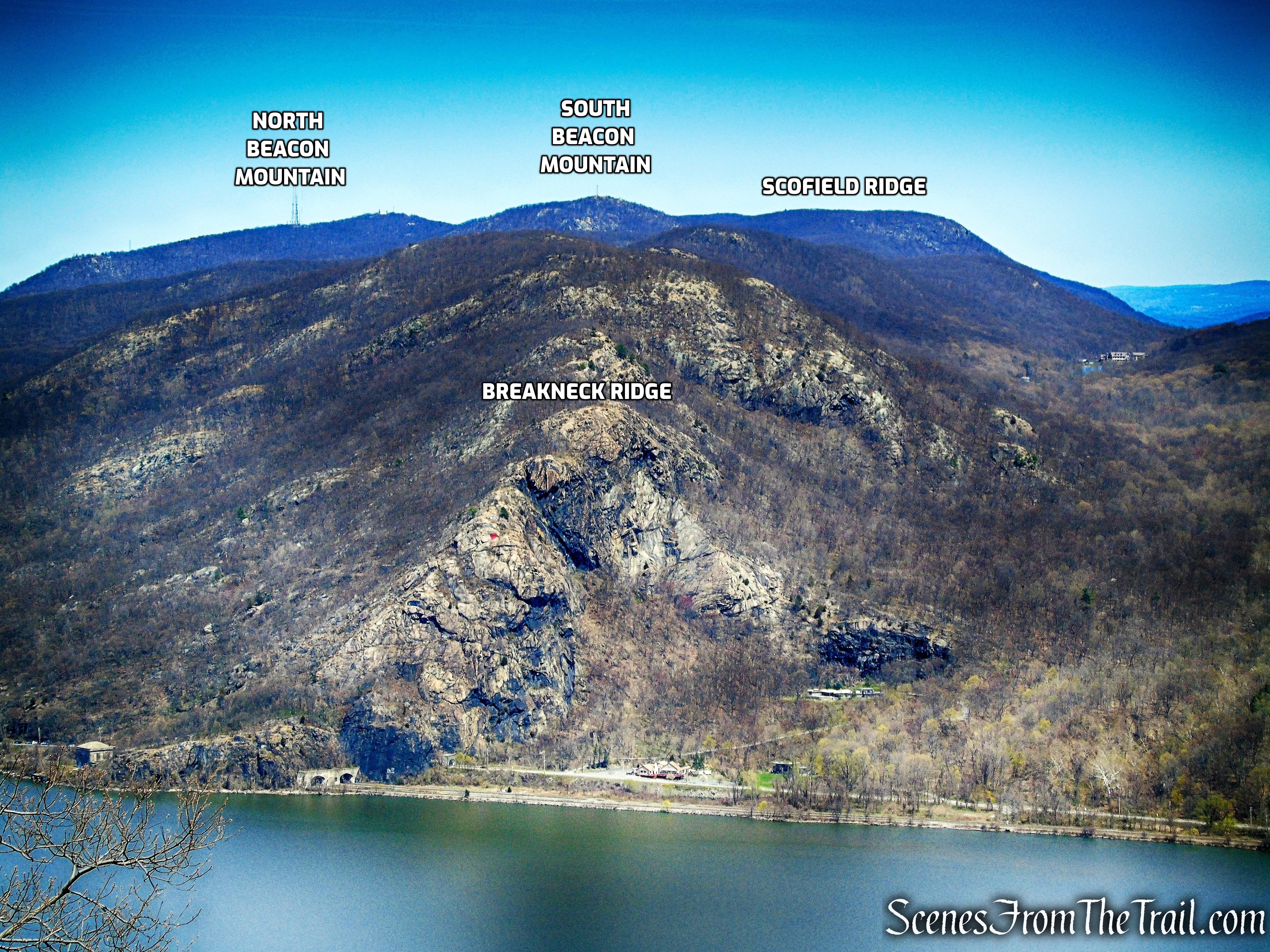
Just beyond, as the trail curves to the right and begins to head west, a panoramic north-facing view appears. Storm King Mountain is directly ahead, and the gash carved into the mountain by the construction of the Storm King Highway in 1922 is particularly stark from this vantage point. Pollopel Island, with Bannerman’s Castle, may be seen a little farther upriver.
Howell Trail
Howell Trail
view north from Howell Trail
After some more climbing, the trail reaches another east-facing viewpoint over Bull Hill and Cold Spring from a rock ledge, with Constitution Island jutting into the river to the south. This point marks the end of the steep climb – you’ve climbed 800 vertical feet from the road below in less than a mile! The trail now turns right and descends slightly, then resumes its ascent of the North Ridge of Crows Nest Mountain, but at a much more gradual pace.
Howell Trail
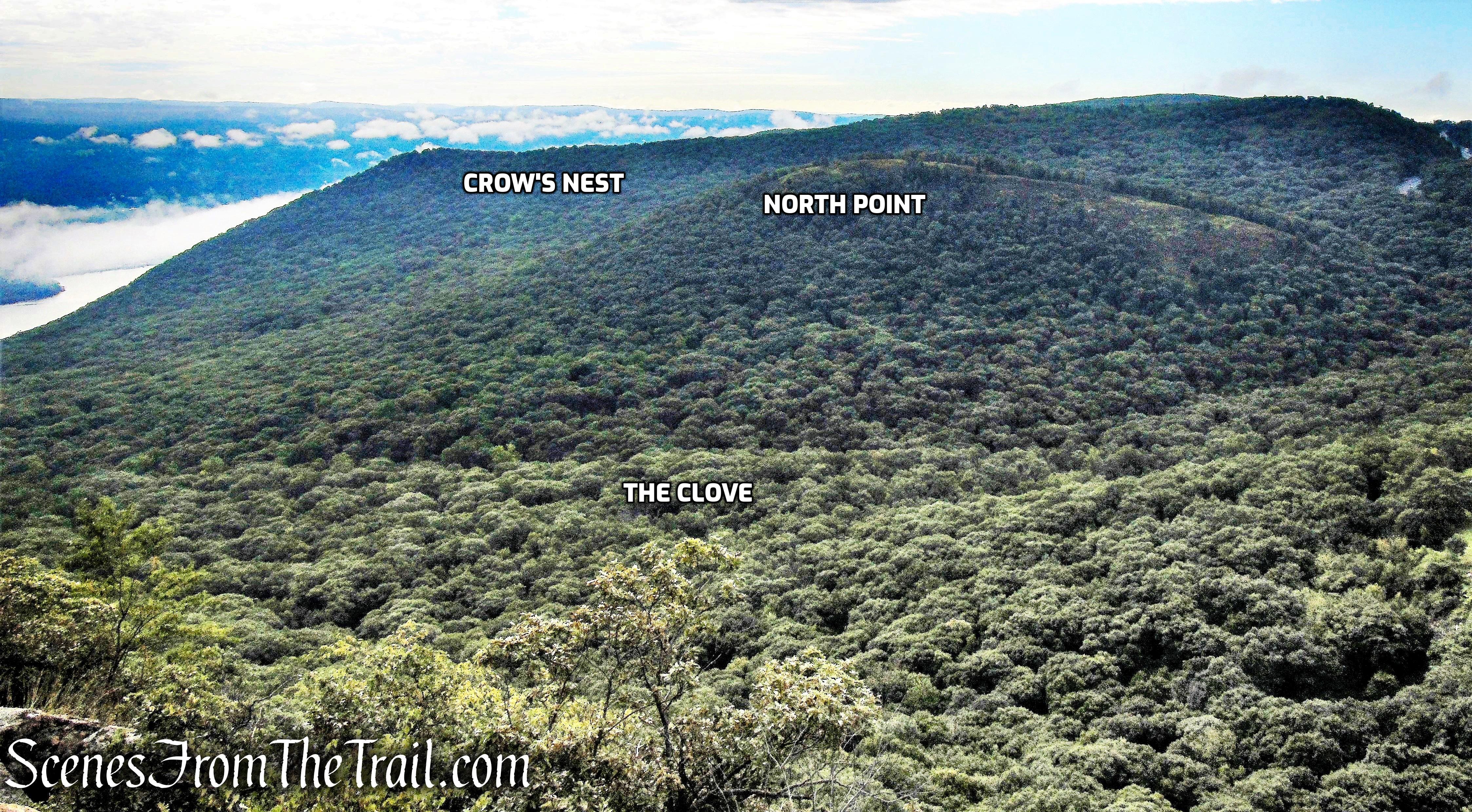
In about half a mile, before reaching the highest point on the ridge, the trail bears right and descends slightly. It continues through a valley, levels off, descends steadily, and finally climbs again to reach North Point, with views over the Hudson River and Breakneck Ridge to the east, and Butter Hill and Storm King Mountain to the north.
Howell Trail approaching North Point
view northeast from North Point
view from North Point
Butter Hill from North Point
East Hudson Highlands from North Point
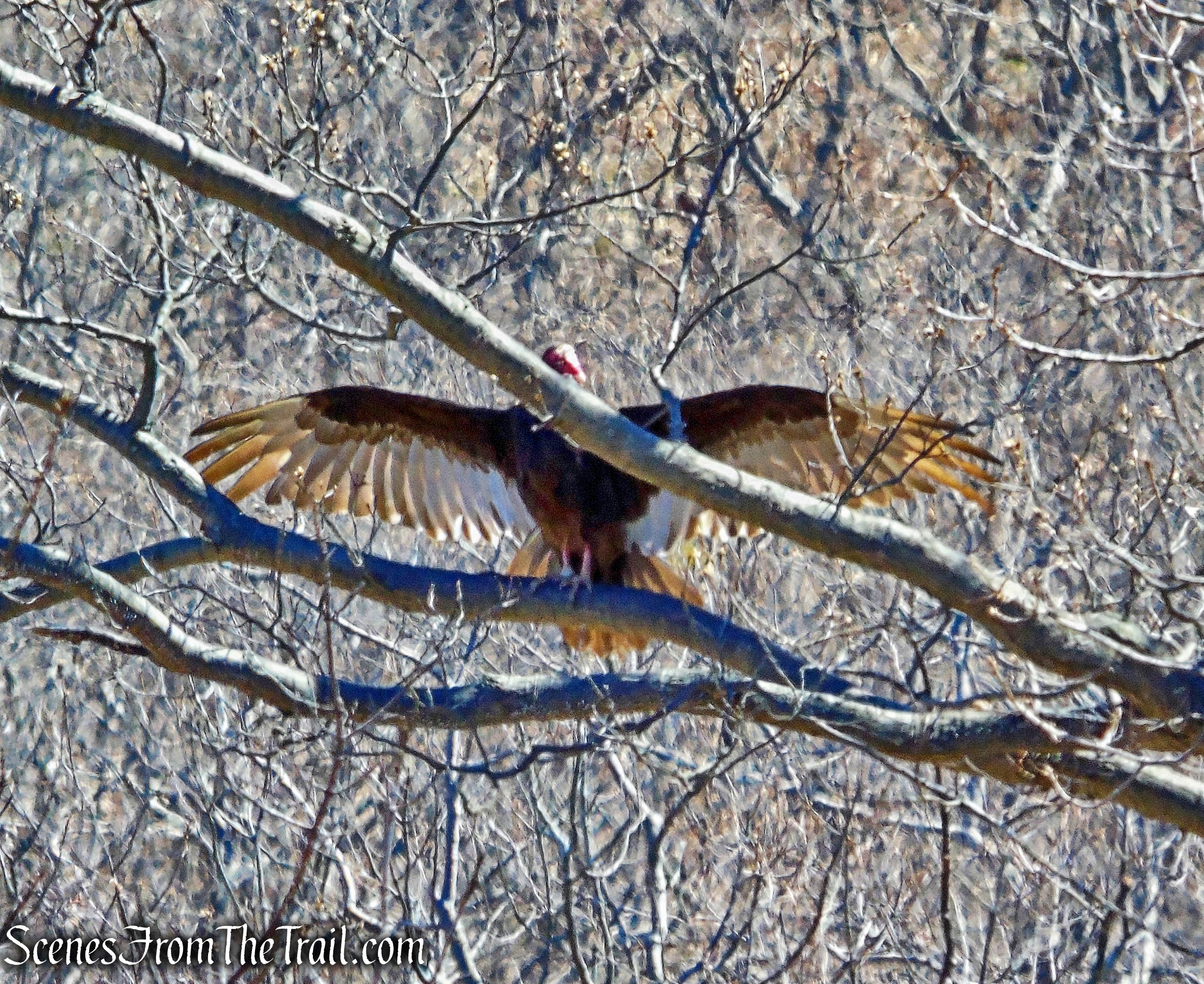
Turkey Vulture – North Point
The trail now bears left and soon begins a steady descent through an open area, with an understory of blueberries, scarred by a forest fire in 1999. A curve on Route 9W is visible on the right.
North Point – Howell Trail
Howell Trail
At the base of the descent, you’ll reach the junction with the woods road that you encountered earlier in the hike. The Howell Trail turns right, but you should turn left and follow the white-blazed Bobcat Trail, retracing your steps to the parking area on Route 9W where the hike began.
turn left on Bobcat Trail
Bobcat Trail
Review:
This is one of the better hikes that I have done in the Hudson Valley. The steep ascent was offset by constant views, which gave us some respite from the climb. The trails were deserted on this day and we only ran into a lone female hiker at North Point. The views are some of the best around and we got to see all of the nearby hills that we have hiked. The trails are well blazed and maintained. I highly recommend this hike.
Pros: Well blazed trails, fantastic Hudson River Valley views, lesser traveled trails.
Cons: Some road noise from Route 9W can be heard near the trailhead.
Take a hike!
North Point Loop – Storm King State Park
Sources:
