May 6, 2023 – Wurtsboro, NY
Difficulty: Easy to moderate
Length: Approximately 3.5 miles
Max elevation: 1,644 ft.– total elevation gain approximately 414 ft.
Route type: Out and back
Free map: Roosa Gap State Forest Trail Map – 2021
Free map: Shawangunk Ridge Trail Map – 2016
Buy Map (Paper & Avenza): Shawangunk Trails Map 106B – 2019
Trailhead parking: 159-143 Firetower Rd, Bloomingburg, NY 12721
Pull-off parking for several cars – No restrooms on site
Roosa Gap State Forest is a Carry-in/Carry-out area
Overview:
The 688-acre Roosa Gap State Forest (RGSF) is part of an interconnected and preserved corridor of land that stretches south from Ulster County, through Sullivan County and into Orange County, NY. It is sandwiched between two larger state forests. The Shawangunk Ridge State Forest (1,411 acres) to the north, and the Wurstboro State Forest (1,139 acres) to the south. Roosa Gap State Forest is part of the southern section of the Shawangunk Mountain range known as the Shawangunk Ridge. The most visible geological feature of the ridge is the white rock that forms its “backbone.”

Coaligned SRT/Long Path – Roosa Gap State Forest
Hunting and trapping are allowed during appropriate seasons.
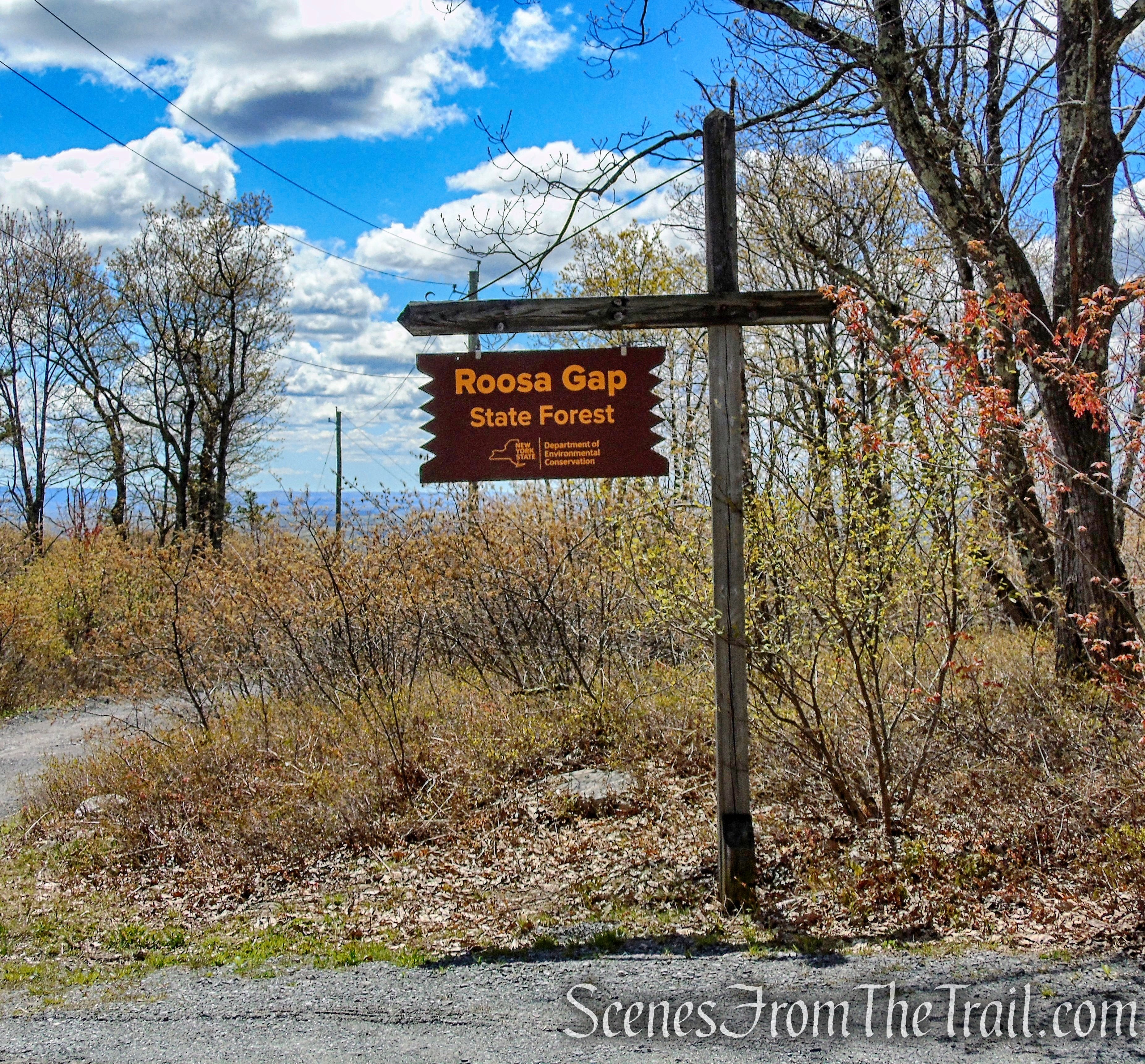
Roosa Gap State Forest
Parking:
There are several access points into this state forest.
- Cox Road Trailhead, which is the entry point into the Shawangunk Ridge State Forest.
- Ferguson Road Trailhead, which is about where the SRT/LP crosses the road.
- Wurtsboro Ridge State Forest Trailhead on Ferguson Road, near the intersection with Pickles Road and Shawanga Lodge Road.
- Fire Tower Road, at the end of the paved section there is pull-off parking for several cars. This is the parking area that we used.
- Fire Tower Road Trailhead, is at the top of Fire Tower Road along an unpaved section of road. The gravel road is severely rutted and eroded. I do NOT recommend this parking area unless you have 4-Wheel Drive and an SUV. There is a lot of loose gravel along this steep section of road and if you don’t want to damage your paint job, I would advise that you don’t attempt driving on this segment of the road.
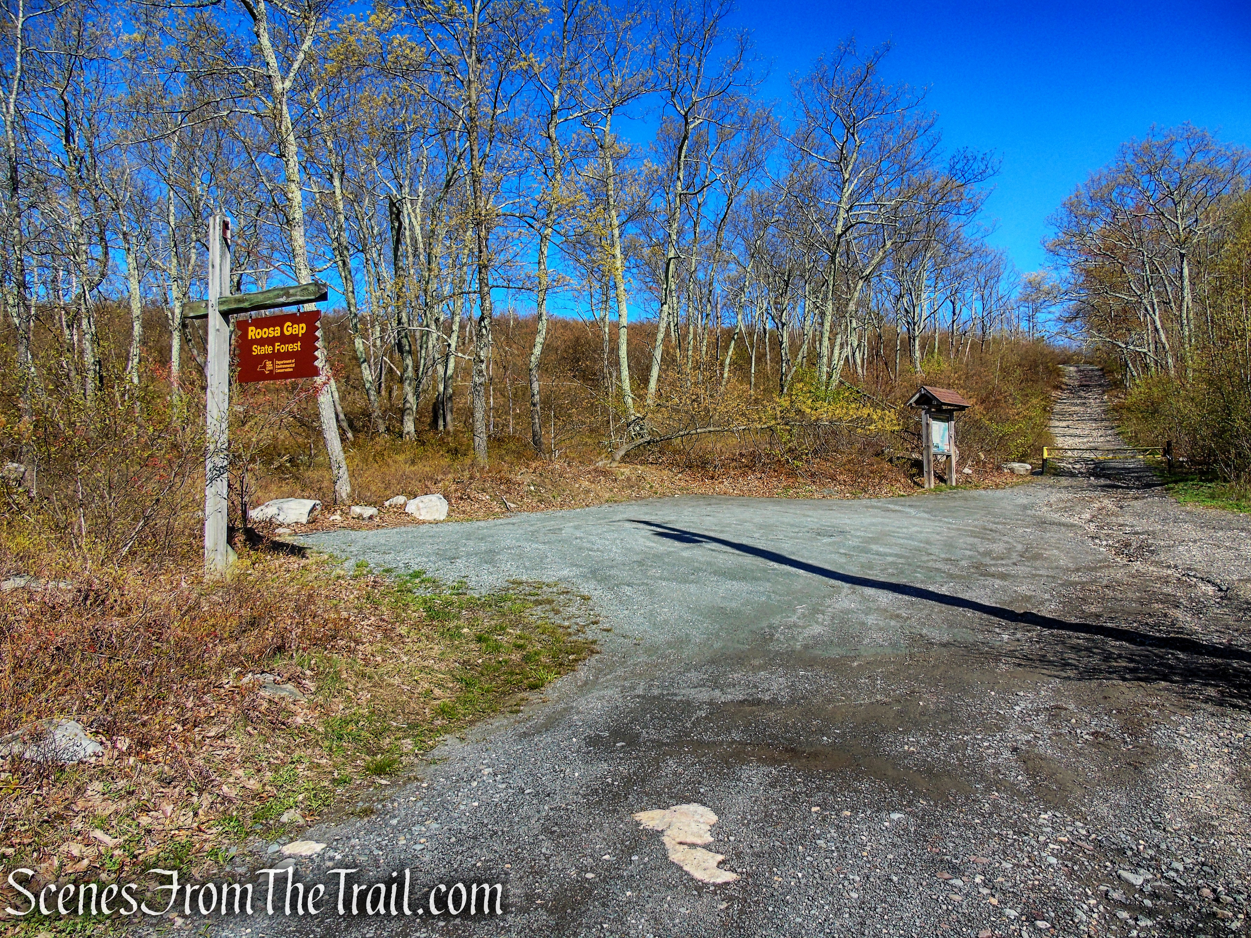
Fire Tower Road Trailhead – Roosa Gap State Forest
History:
The forested slopes were used in the 18th and 19th century for a variety of farming uses, including Silviculture. The summit of the ridge is mostly pitch pine and slab rock, and not terribly usable for agriculture.
The Open Space Institute (OSI) and the NY-NJ Trail Conference (NYNJTC) began acquiring parcels for the Roosa Gap State Forest in the 1990’s. The process continues today, with OSI buying additional parcels to further protect and expand the state forest. In all, OSI and its conservation partner, the NYNJTC, created or expanded seven state forests, protecting much of the Shawangunk Ridge between Minnewaska State Park Preserve and the New Jersey border, some 30 miles to the south. Most of these lands, after being acquired by OSI or the Trail Conference, are transferred to the DEC for ownership and management.
The name “Roosa,” can be traced to a family of early Dutch settlers and later to wealthy landowners of the area that dates back to 1660.
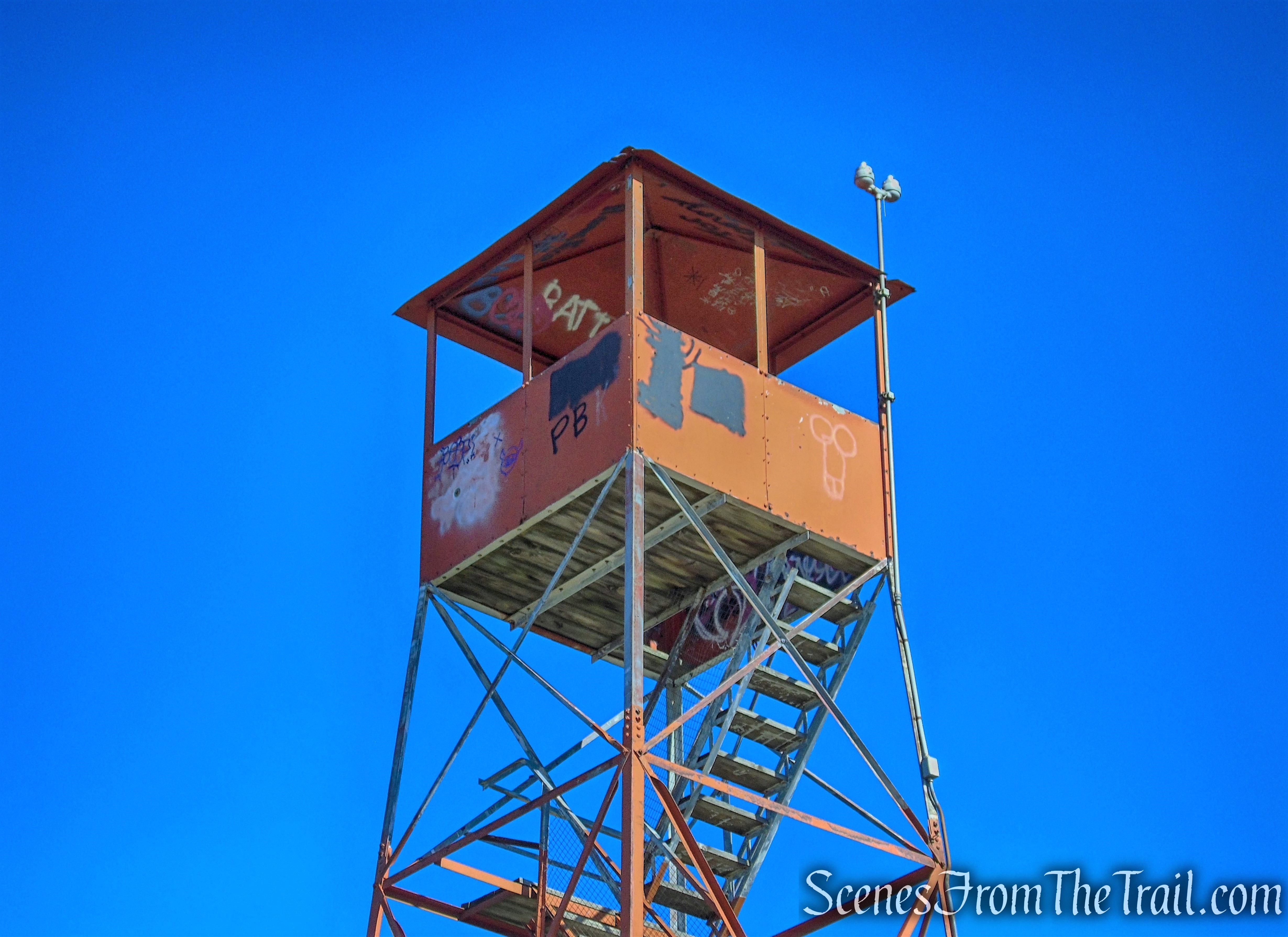
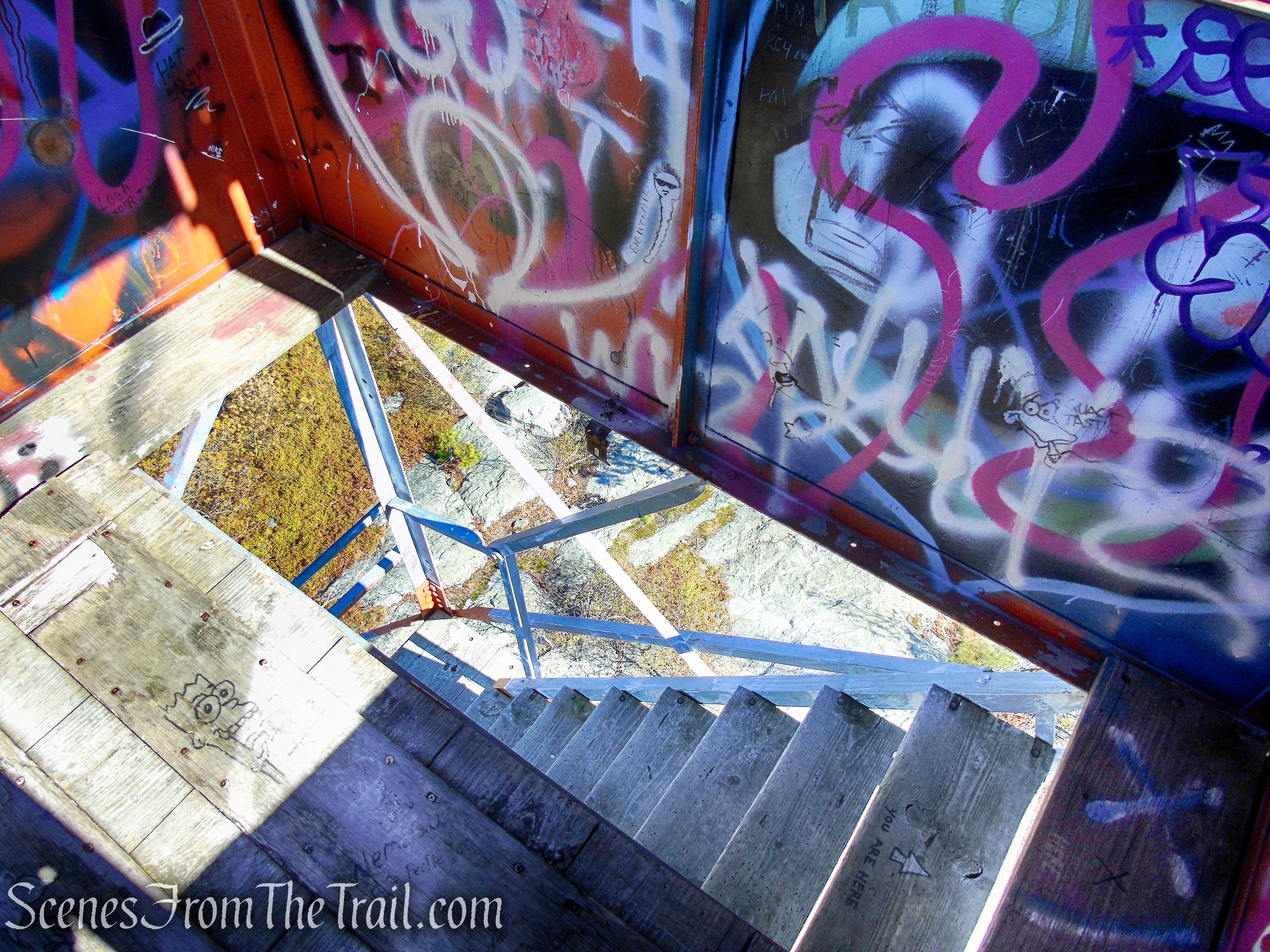
The fire tower at Roosa Gap is an Aermotor LS-40 35′ steel tower, erected by the Conservation Department in 1948 and closed in 1972. The stair risers run back and forth up the fire tower between large landings. It is now officially open to the public.
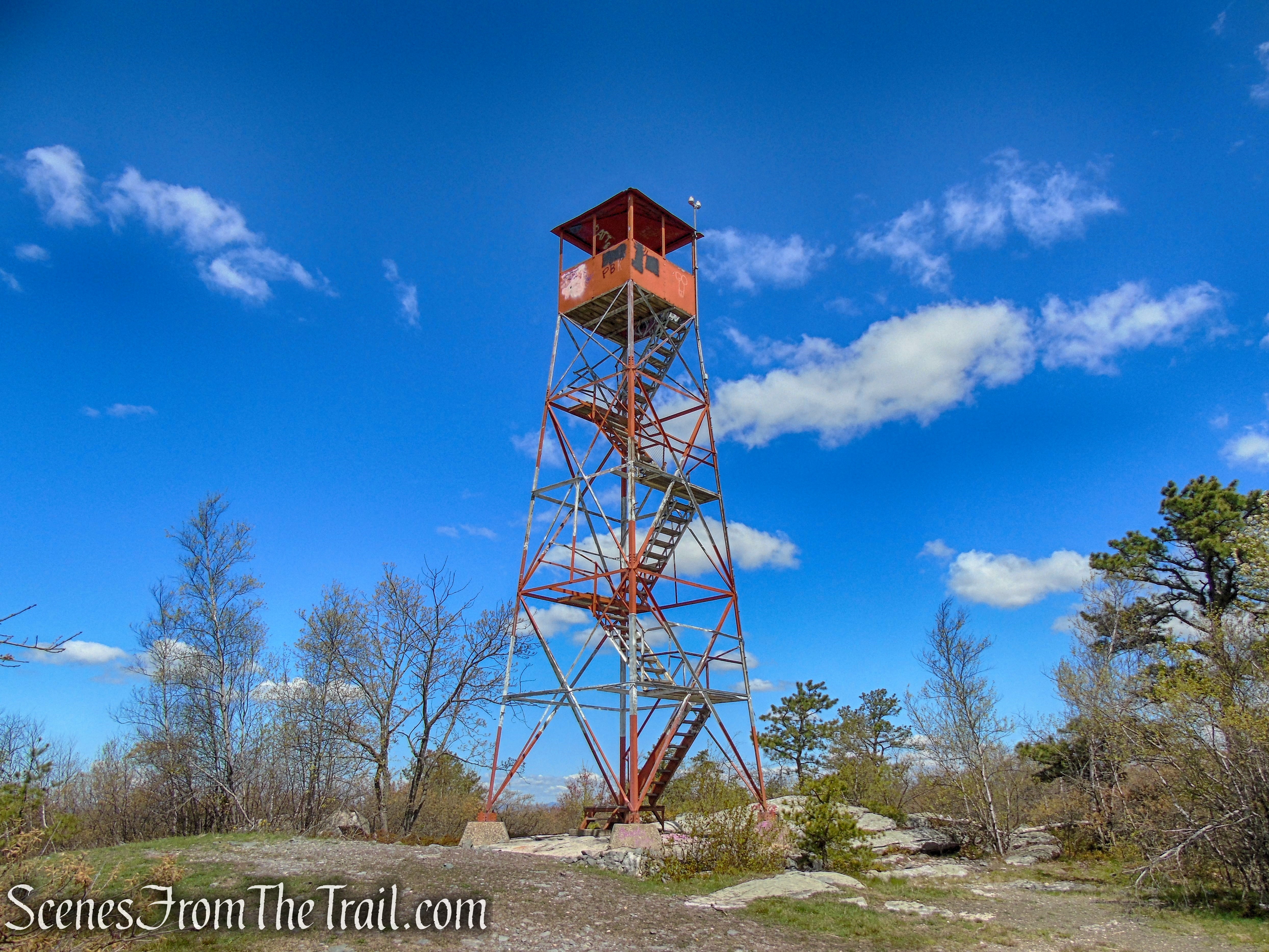
Roosa Gap Fire Tower
The observation room, a small, 7-foot by 7-foot square cab, is steel-framed, clad with metal sheeting, and topped with a hipped metal roof.
Roosa Gap Fire Tower
Trails Overview:
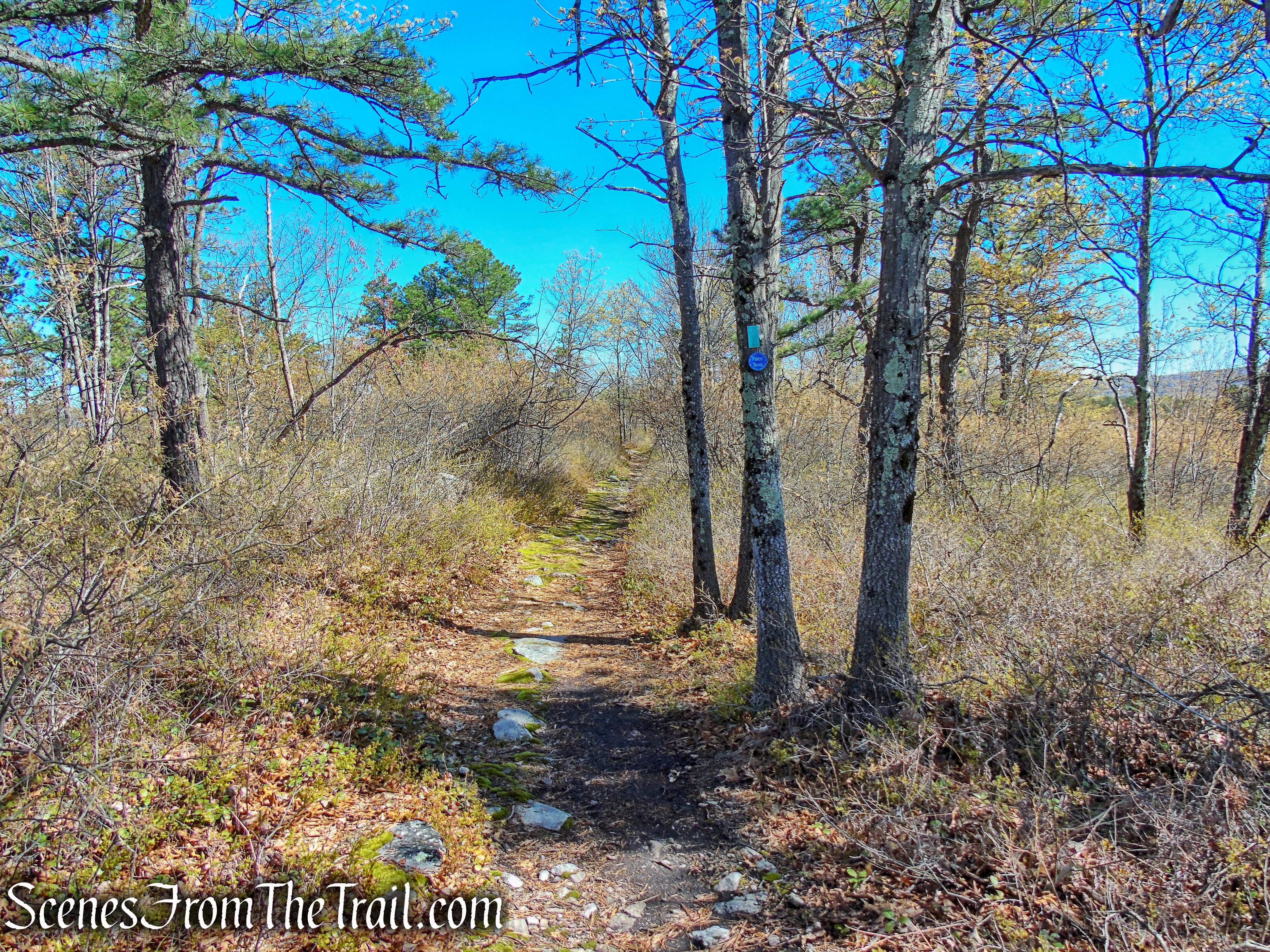
Roosa Gap State Forest features a three-mile section of the coaligned Shawangunk Ridge Trail (SRT) and the Long Path (LP). The SRT is marked with circular blue NYSDEC blazes. The Long Path is marked with rectangular aqua blazes.
Coaligned SRT/Long Path
In addition to this section, there are about 2 miles of unmarked multiple use trails that branch off from the Shawangunk Ridge Trail.
The coaligned SRT/LP is fairly well blazed and relatively easy to follow. The trail is well maintained and free of litter. Let’s keep it that way.
The trail is maintained by volunteers of the NY-NJ Trail Conference.
Hike Overview:
We drove up here several weeks earlier, but the dense fog didn’t allow for any views. In fact, just the drive up was a little scary with so little visibility. So we made a return trip when the weather decided to cooperate.
Roosa Gap State Forest
This is a pretty basic out-and-back hike, following the same marked trail for most of the hike. Once on the ridge, it’s a fairly level hike with little elevation gain.
Roosa Gap State Forest
elevation profile – Roosa Gap State Forest
The Hike:
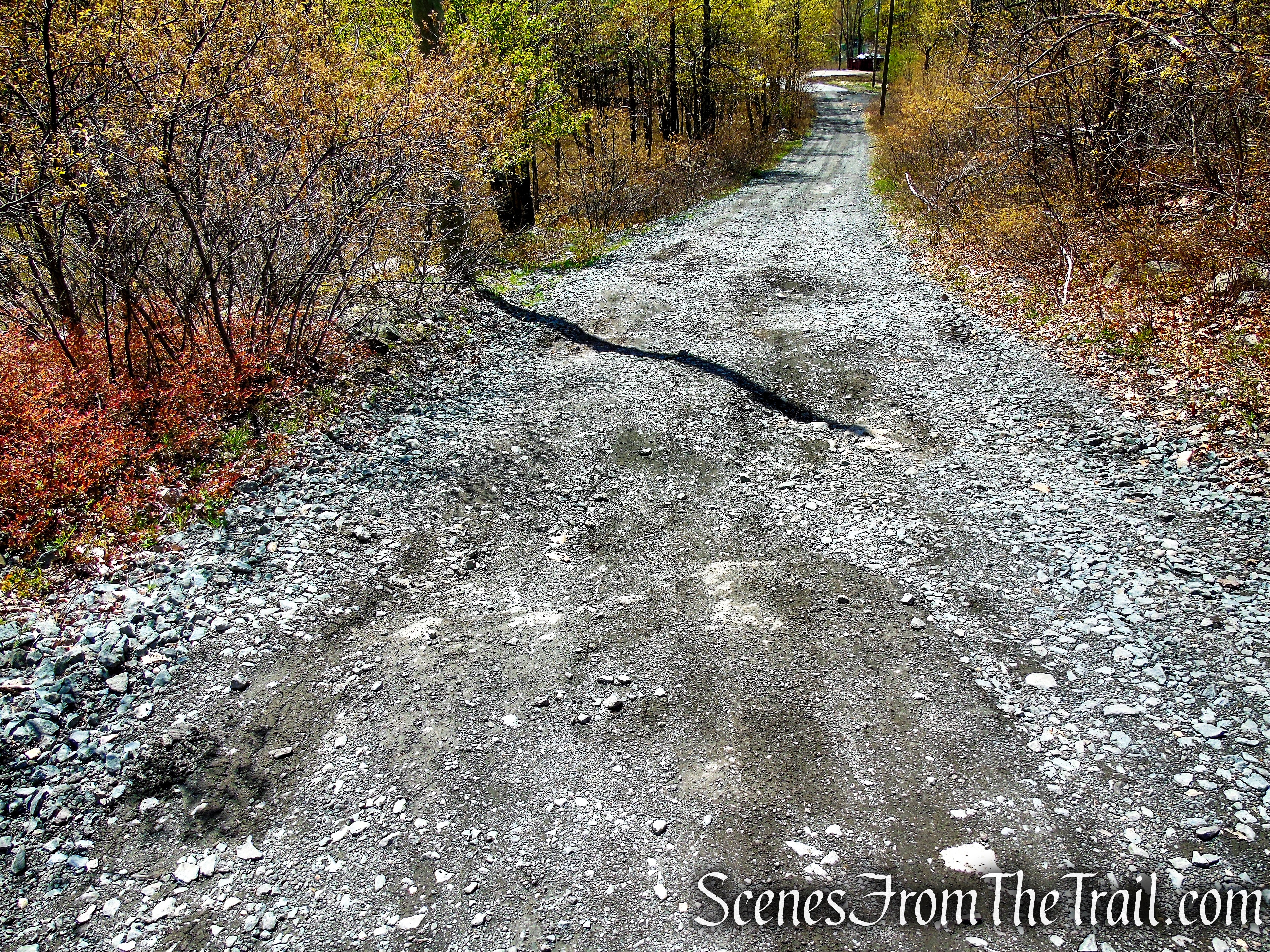
This hike begins at the end of the paved portion of Fire Tower Road. Proceed uphill on the gravel road, passing the Fire Tower Road Trailhead and past the gate. Continue uphill until you reach a junction with the coaligned SRT/Long Path. Turn left and in a short distance, you will arrive at the Roosa Gap Fire Tower.
Fire Tower Road

Fire Tower Road – Roosa Gap State Forest
Fire Tower Road Trailhead – Roosa Gap State Forest

Fire Tower Road – Roosa Gap State Forest
Fire Tower Road – Roosa Gap State Forest
Fire Tower Road – Roosa Gap State Forest
Climb the fire tower for 360° views of the area.
Roosa Gap Fire Tower
At one time, there were fire towers at 124 locations in New York State.
Roosa Gap Fire Tower
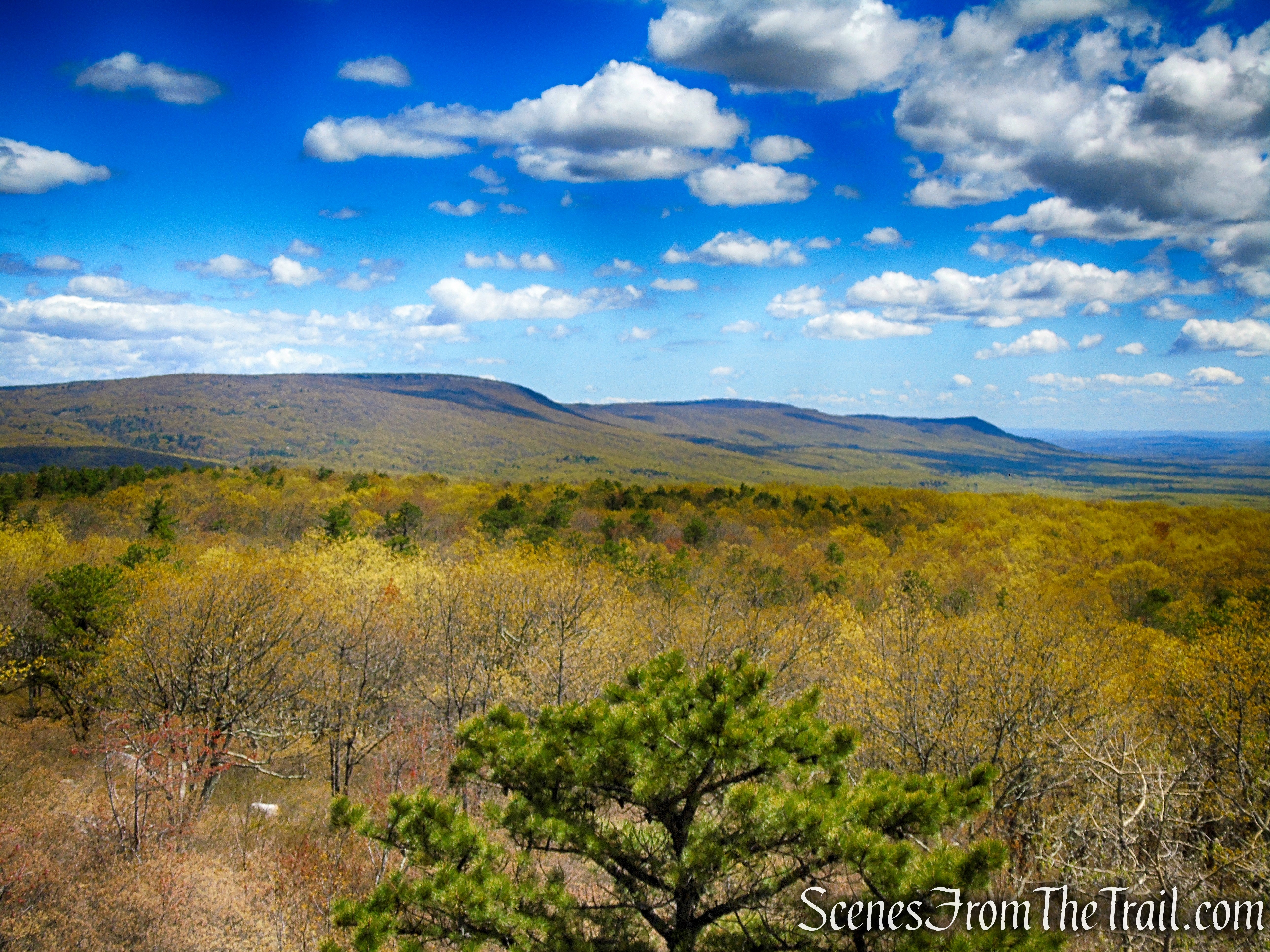
Looking south towards Wurtsboro Ridge State Forest and the Basha Kill.
Looking south towards Wurtsboro Ridge State Forest from the Roosa Gap Fire Tower
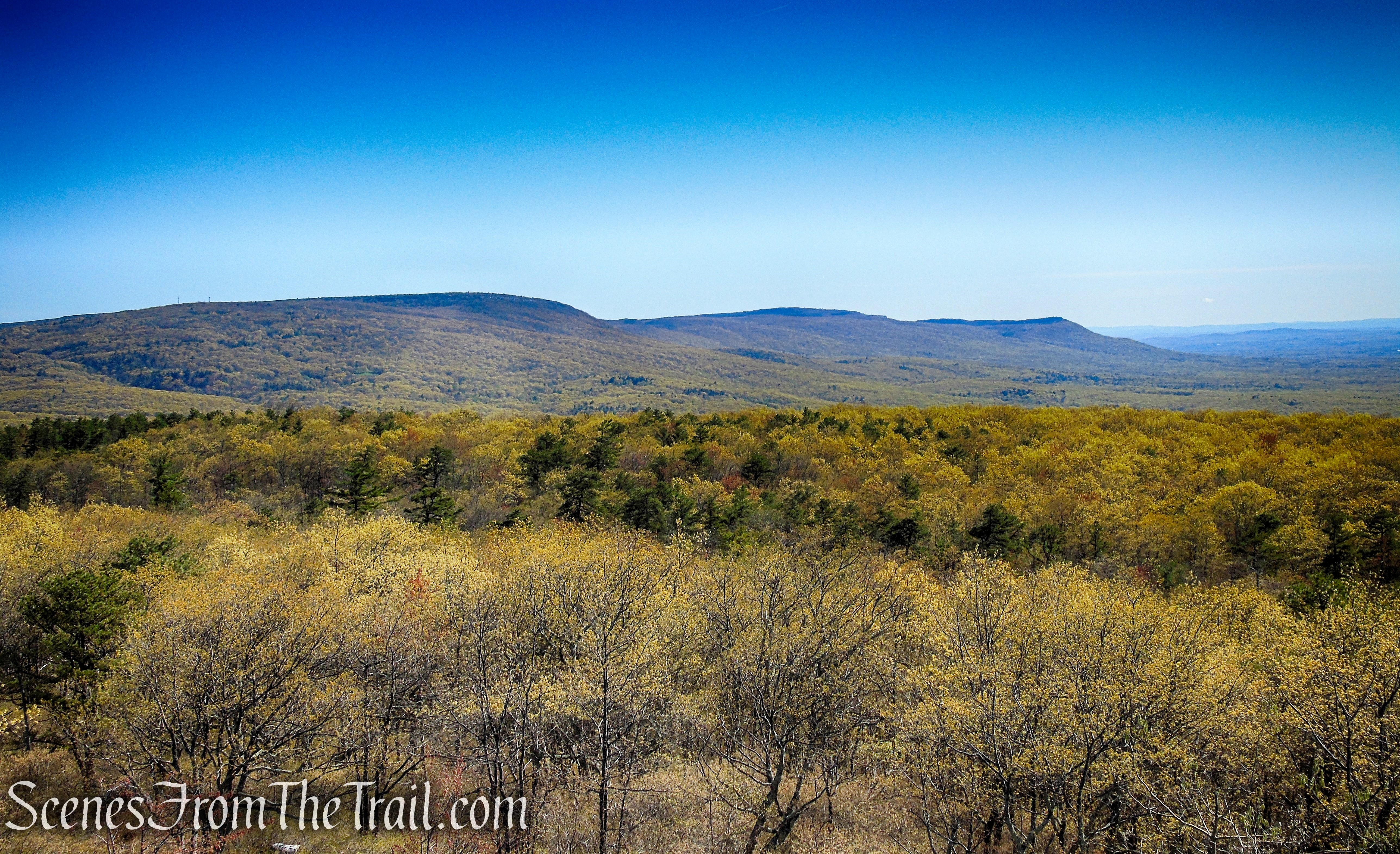
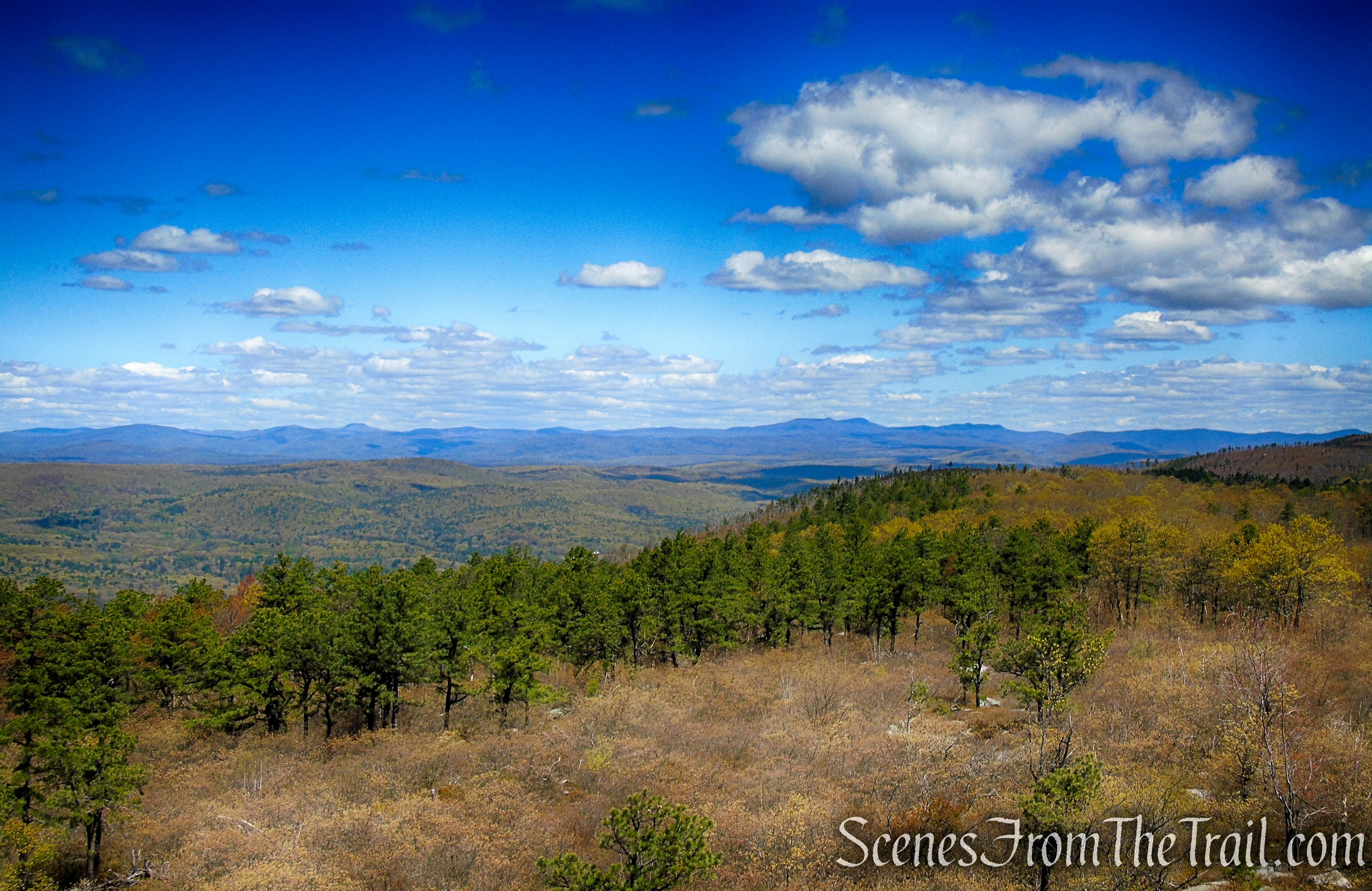
Looking northwest over the route of the SRT/Long Path and towards the Catskills.

Looking northwest towards the Catskills from the Roosa Gap Fire Tower
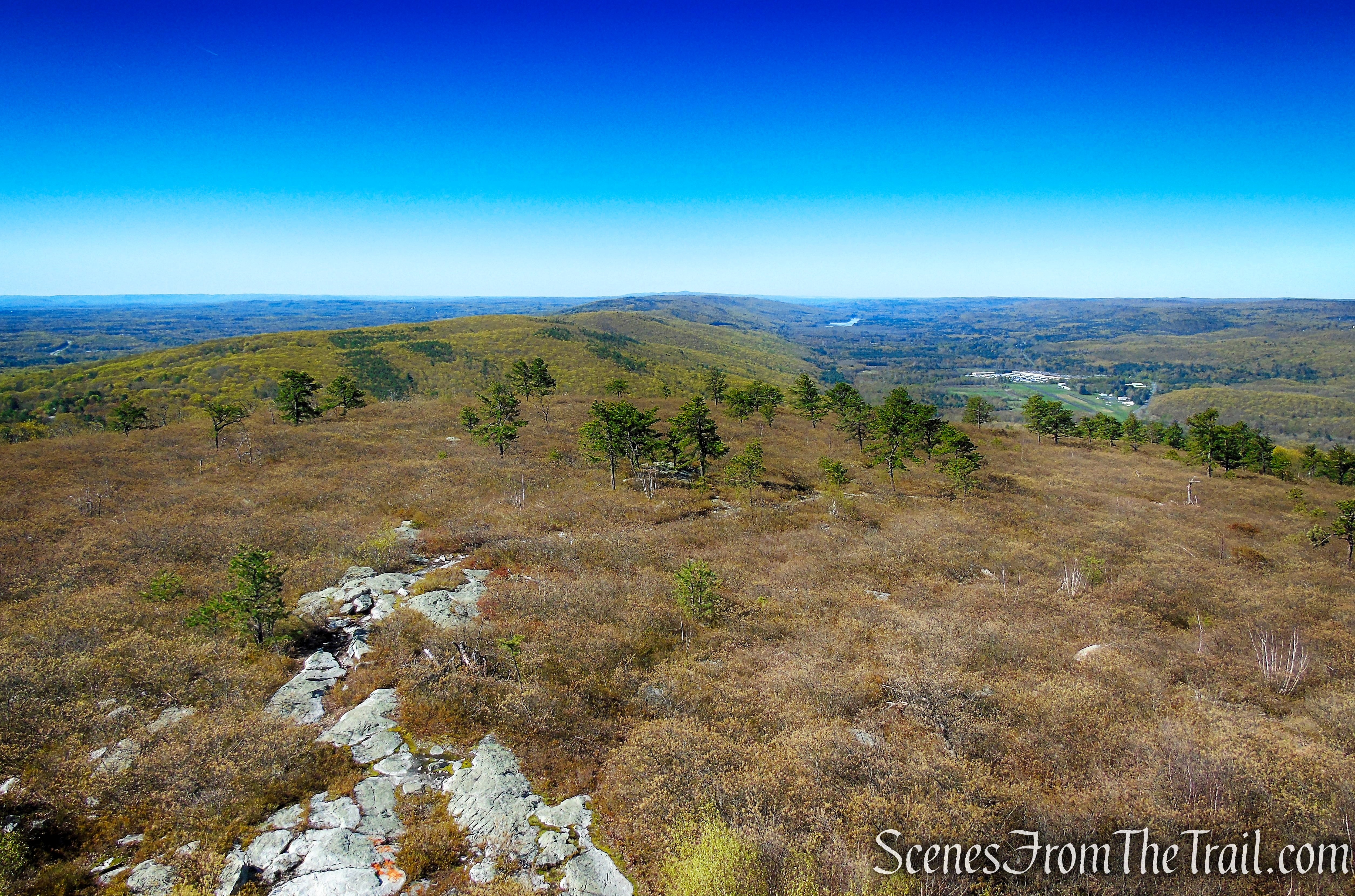
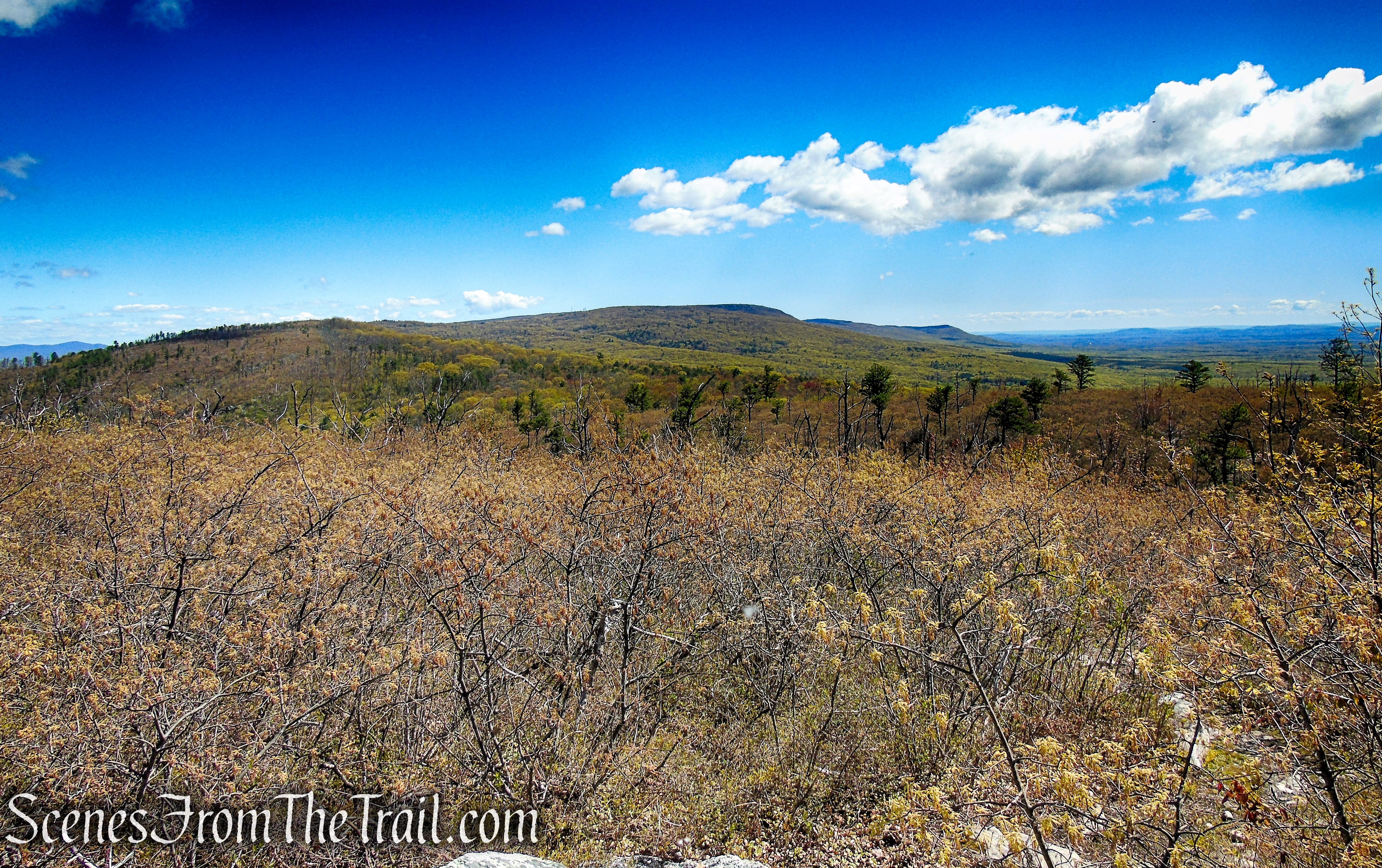
Looking northeast towards Sam’s Point and Minnewaska State Park.
Looking northeast towards Sam’s Point and Minnewaska State Park from the Roosa Gap Fire Tower
Looking west over Summitville and farmlands.
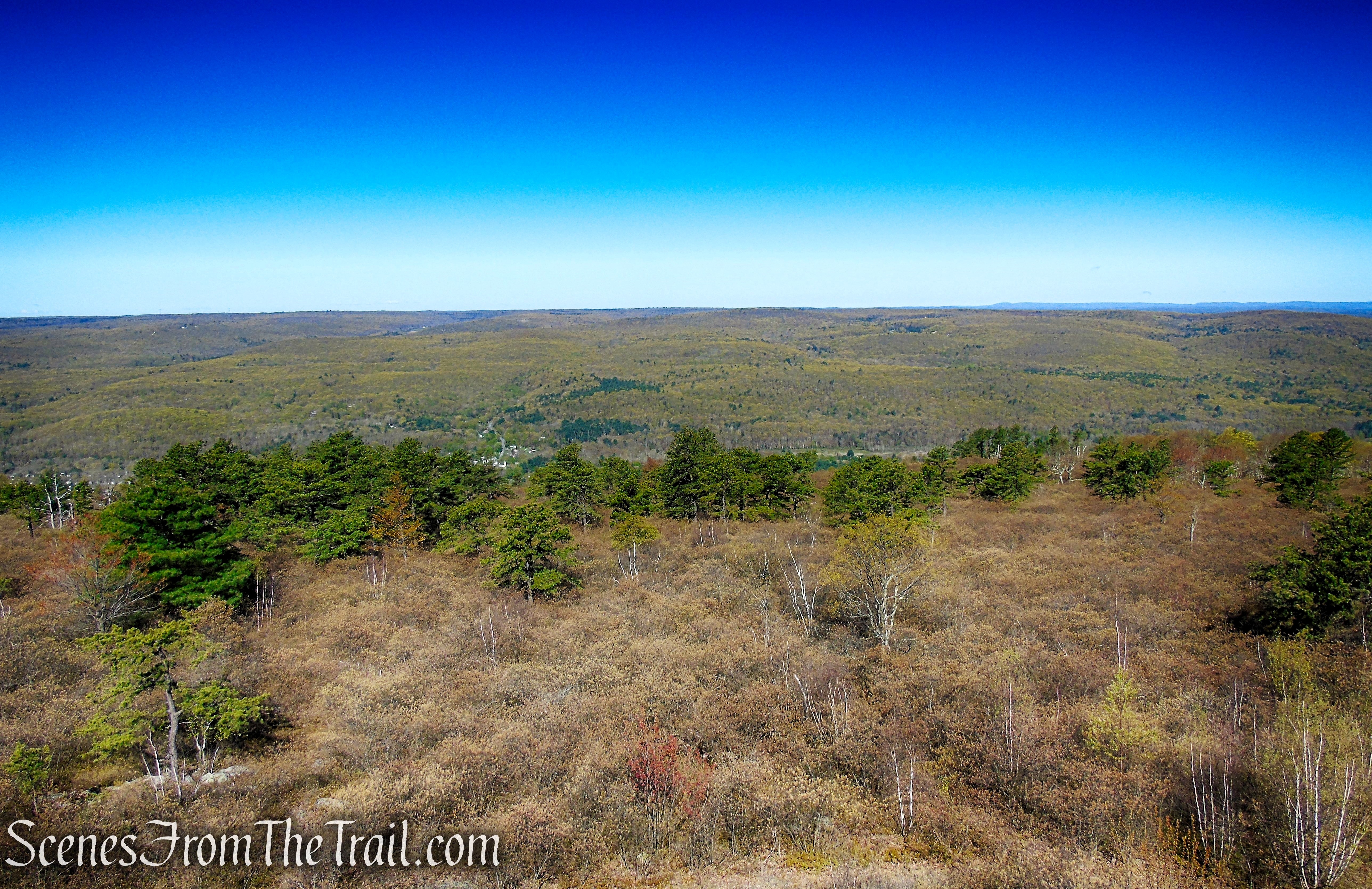
Looking west from the Roosa Gap Fire Tower
When you are done checking out the views, descend the steps of the fire tower carefully. If you came just for the views from the fire tower, then retrace your steps back to your vehicle. If you would like to continue the hike, head north on the coaligned SRT/Long Path.
Roosa Gap Fire Tower
You may not see any blazes at first, but once there are larger trees, the blazes will appear.

Coaligned SRT/Long Path
Coaligned SRT/Long Path
At a junction with an unmarked trail, which starts on the left, there is a memorial for John Hennessey, a dedicated volunteer trail maintainer.
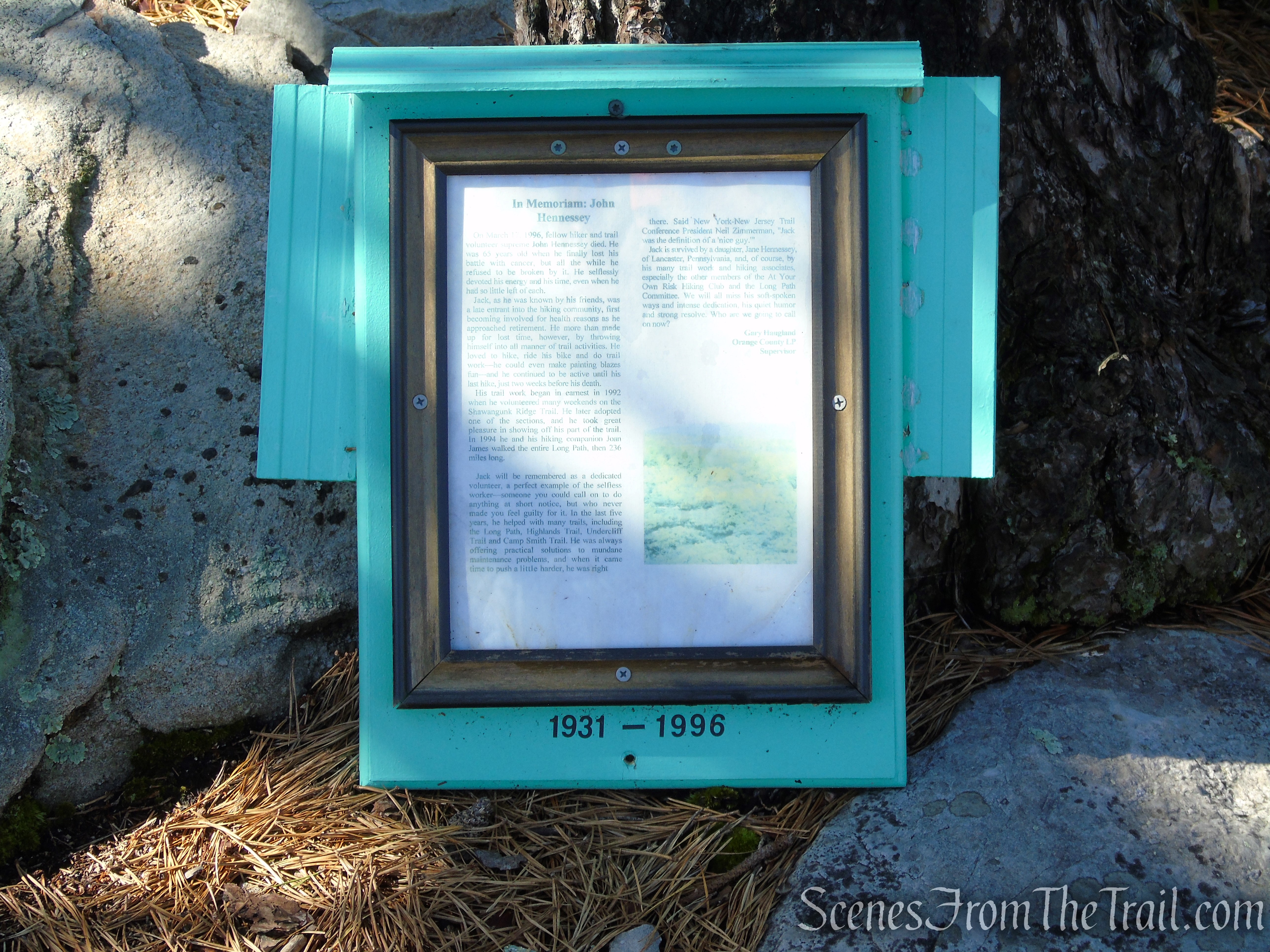
John Hennessey Memorial – Roosa Gap State Forest
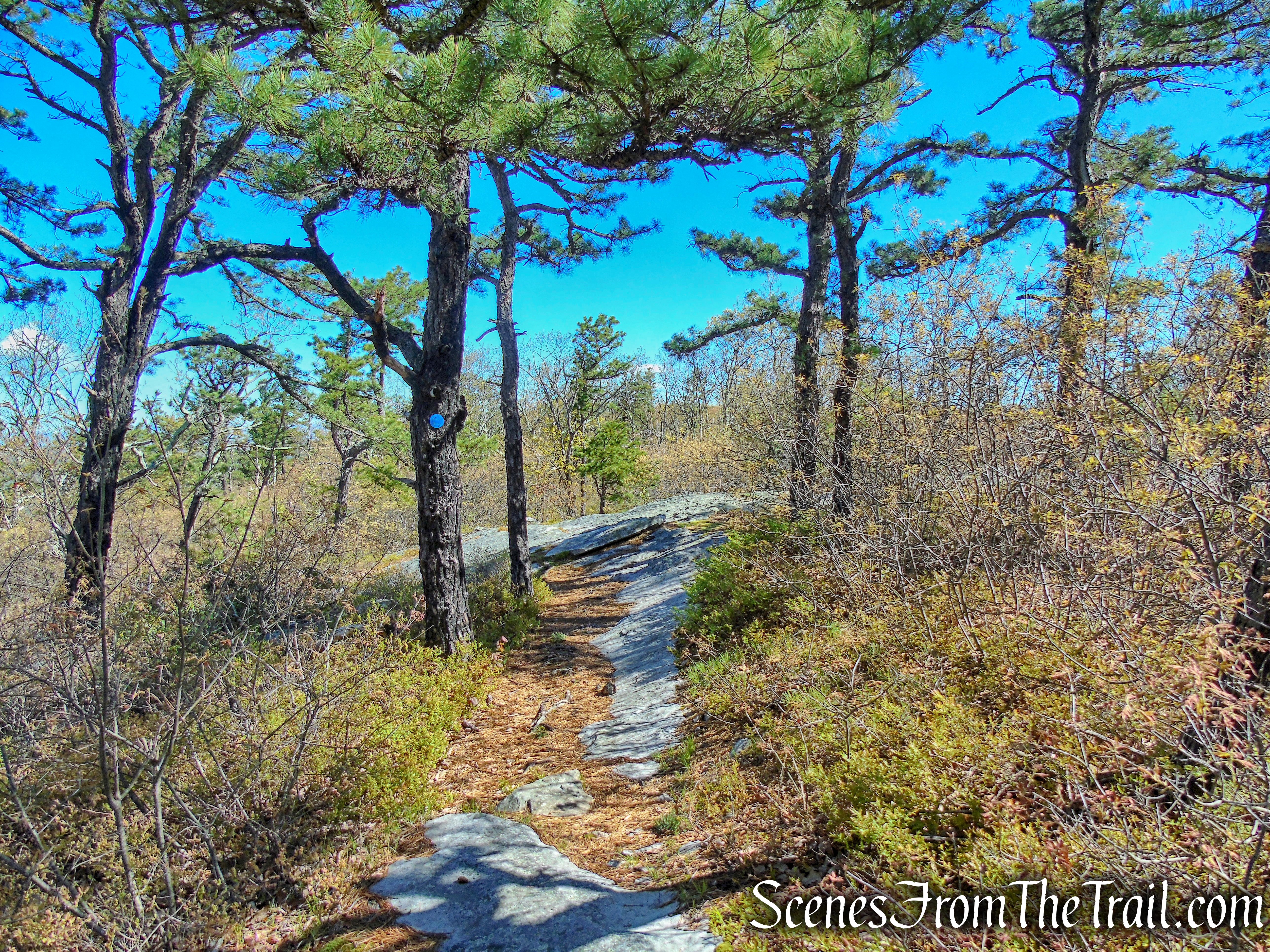
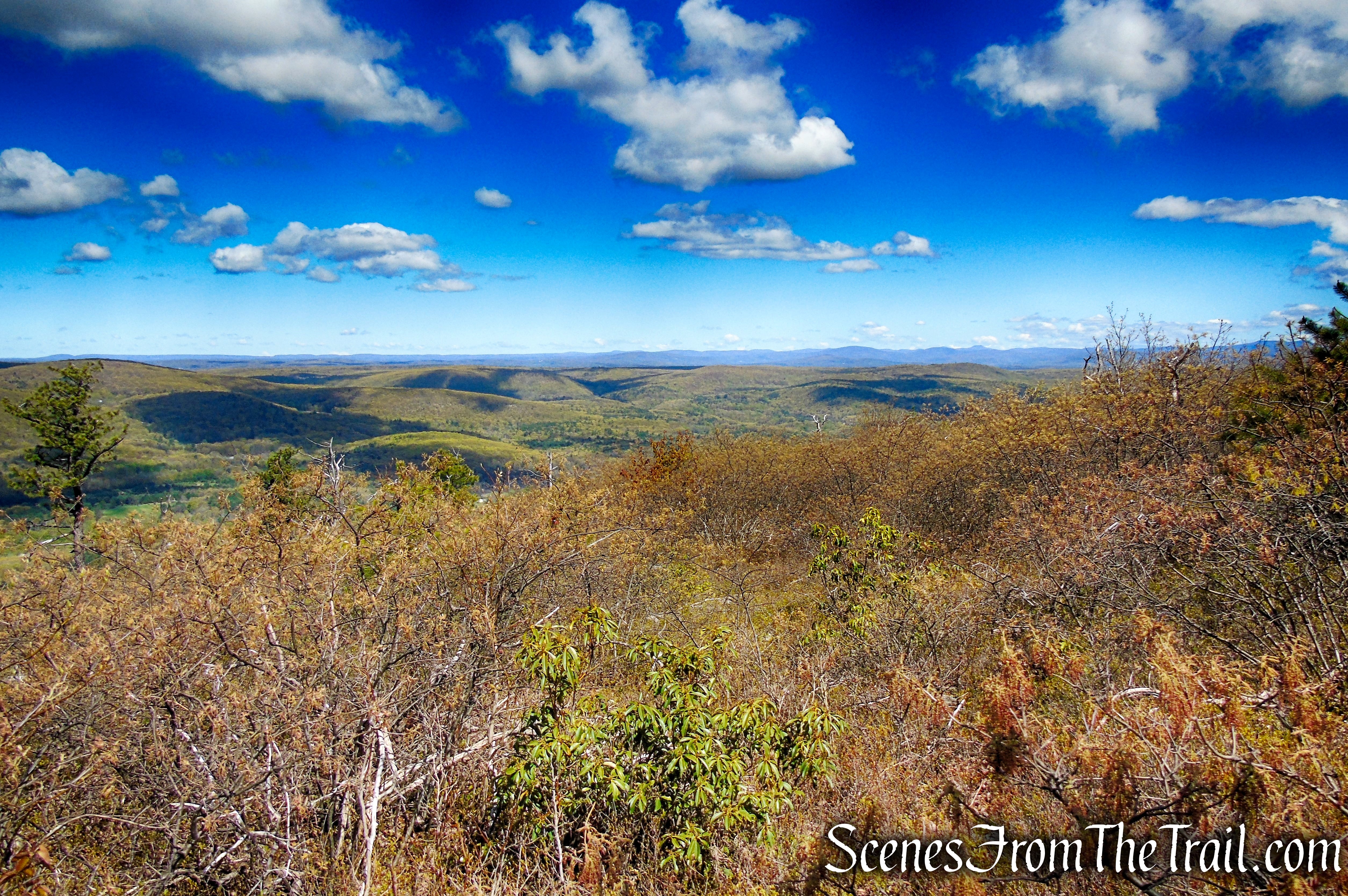
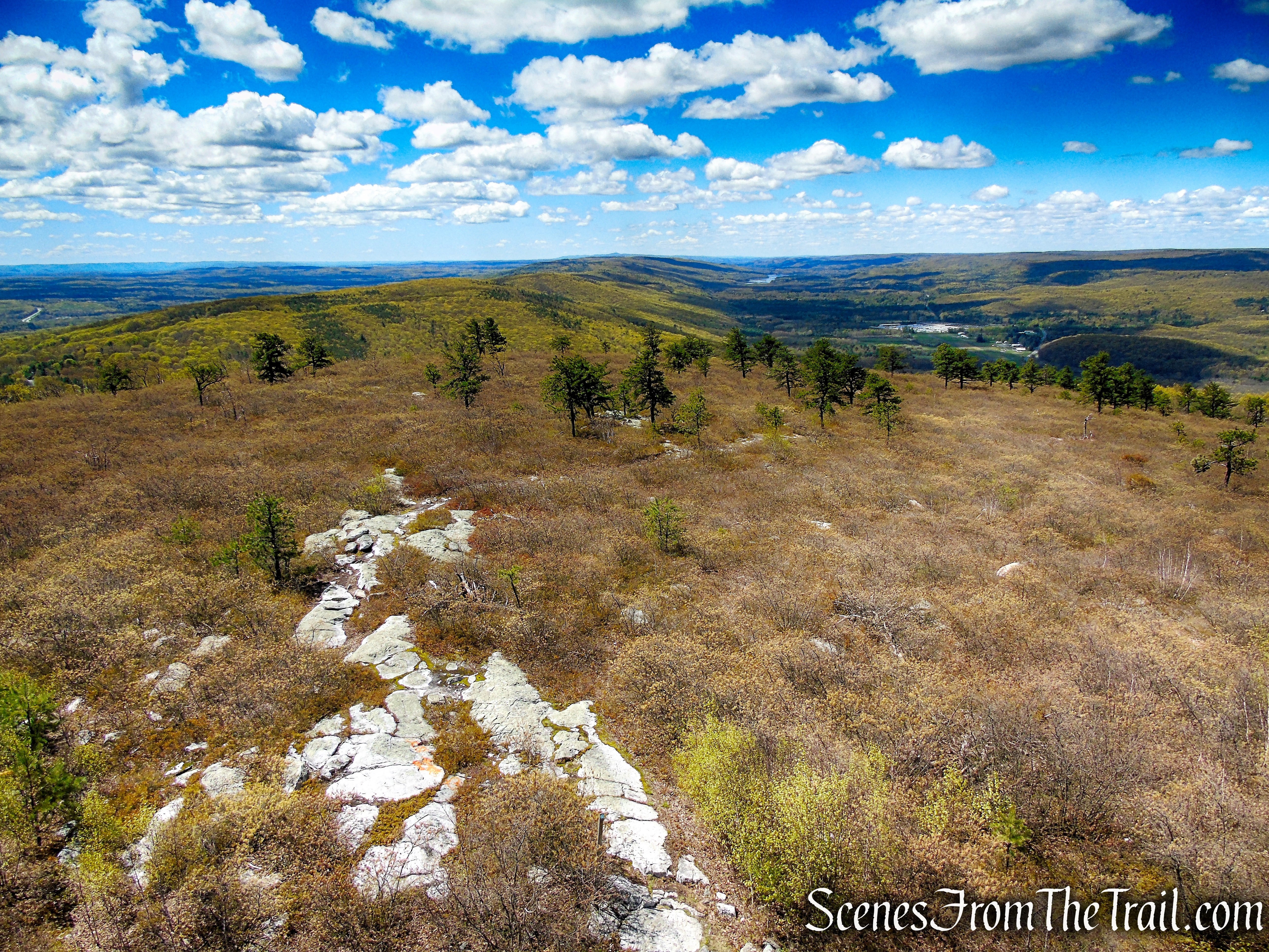
Continue heading north following the aqua/blue blazes. Soon the trail comes out of the forest and you’ll now be walking over slabs of Shawangunk conglomerate rock, with the vegetation including scrub oak and pitch pine. The trail continues along the ridge, with some ups and downs, with the scrub oak remaining the predominant vegetation, along with some blueberries and mountain laurel.
Coaligned SRT/Long Path – Roosa Gap State Forest
Coaligned SRT/Long Path – Roosa Gap State Forest
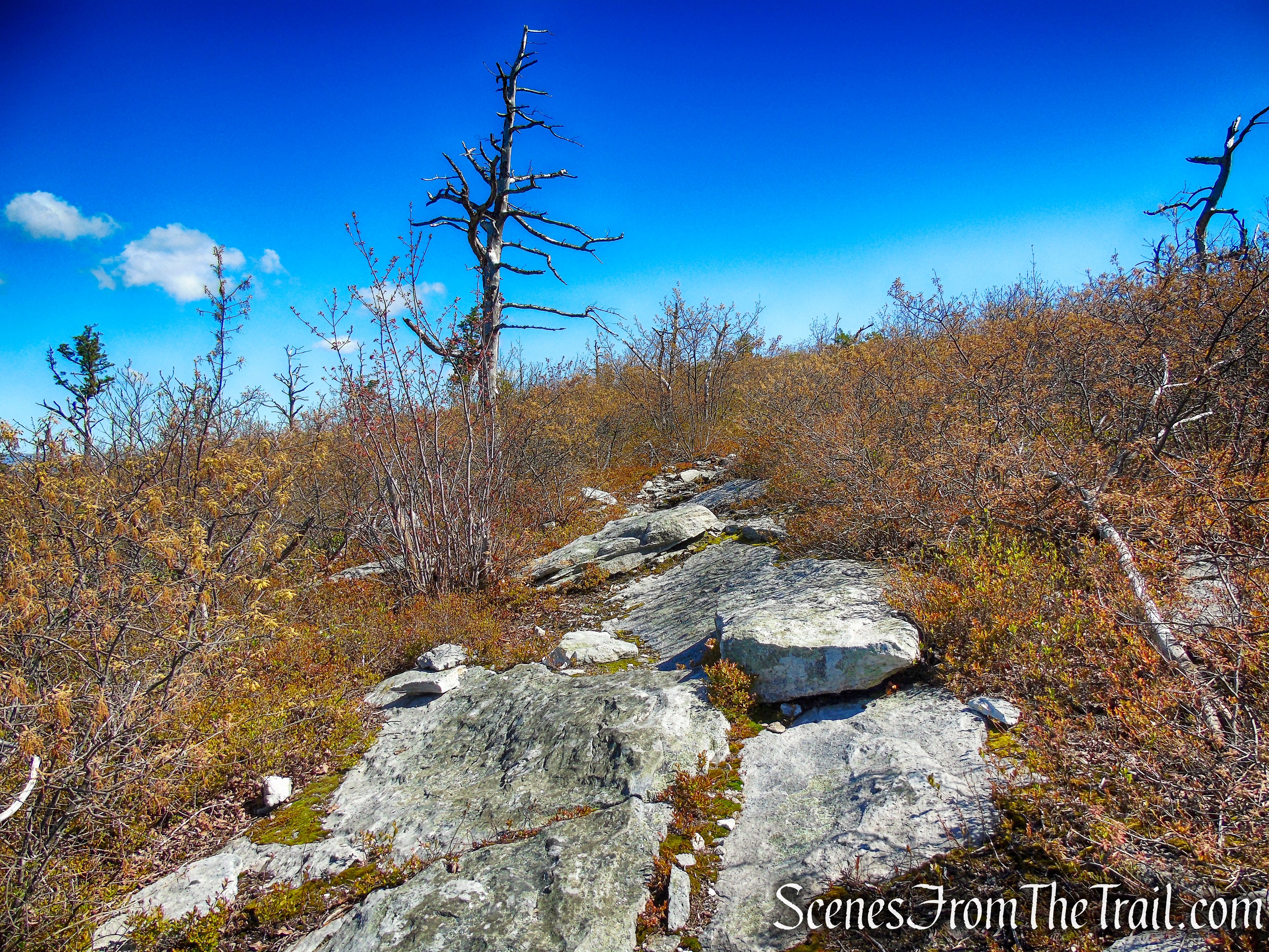
Coaligned SRT/Long Path – Roosa Gap State Forest
A short distance later, views begin to appear to the northwest and west.

Coaligned SRT/Long Path – Roosa Gap State Forest
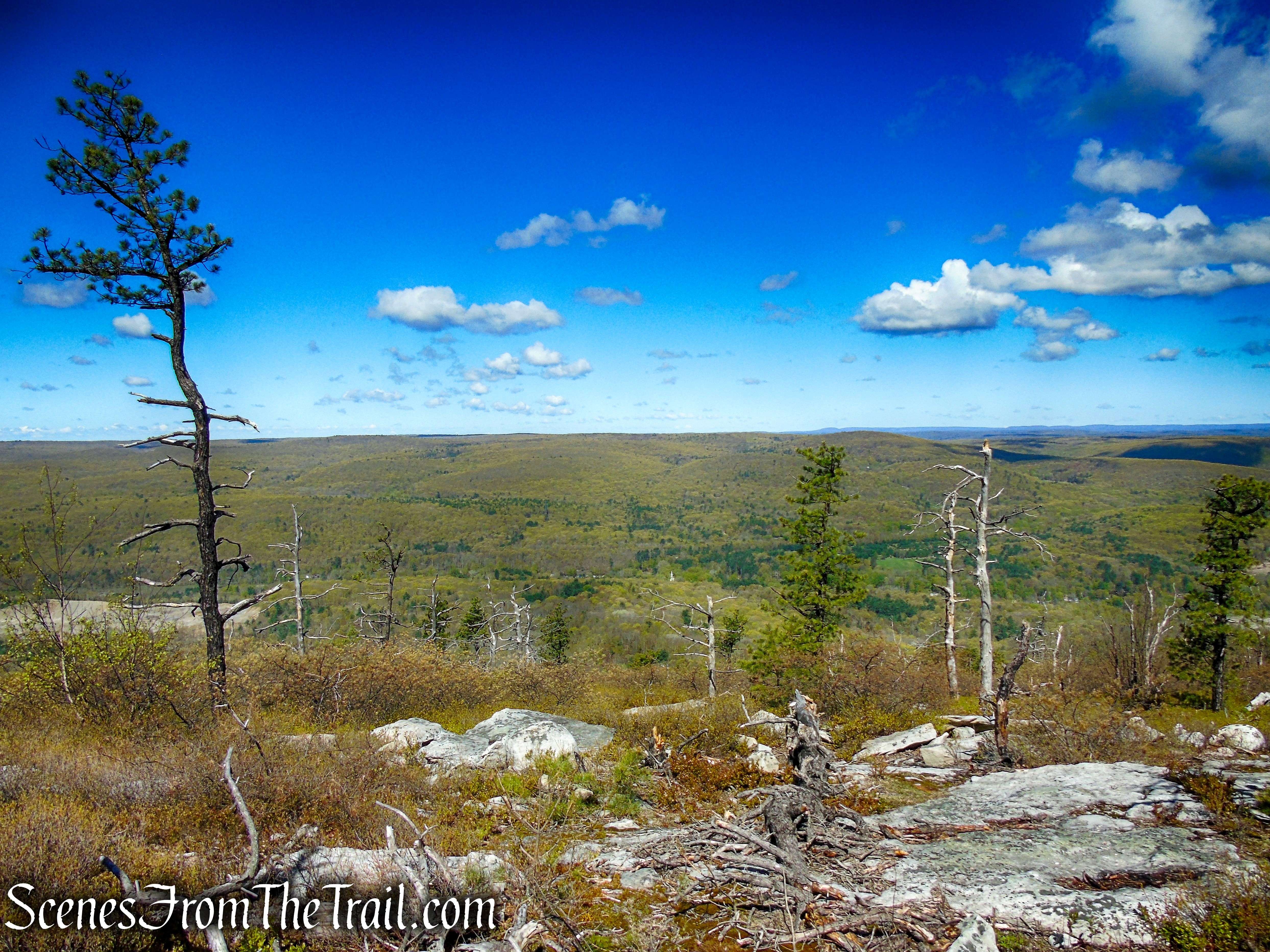
Coaligned SRT/Long Path – Roosa Gap State Forest
Coaligned SRT/Long Path – Roosa Gap State Forest
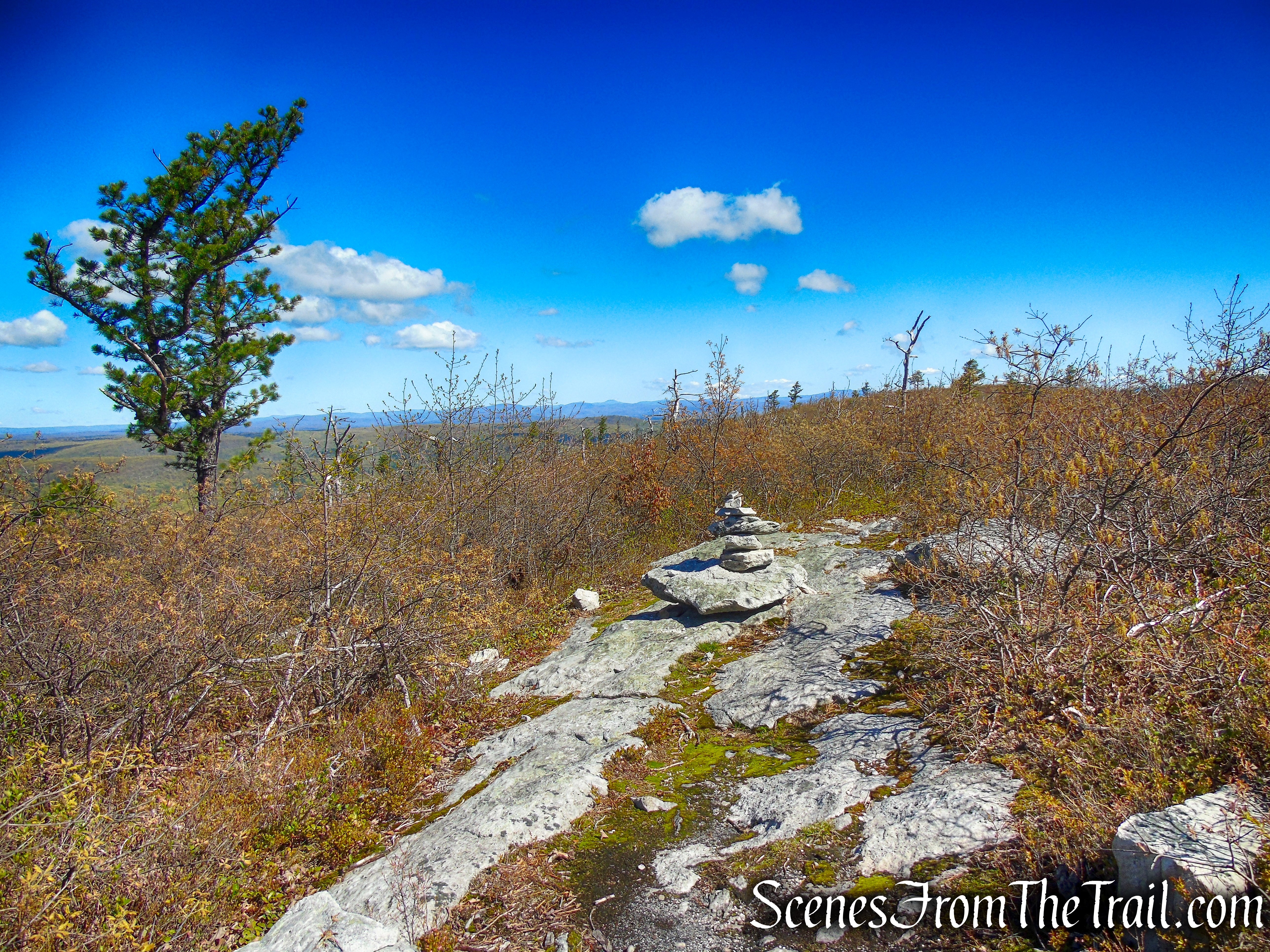
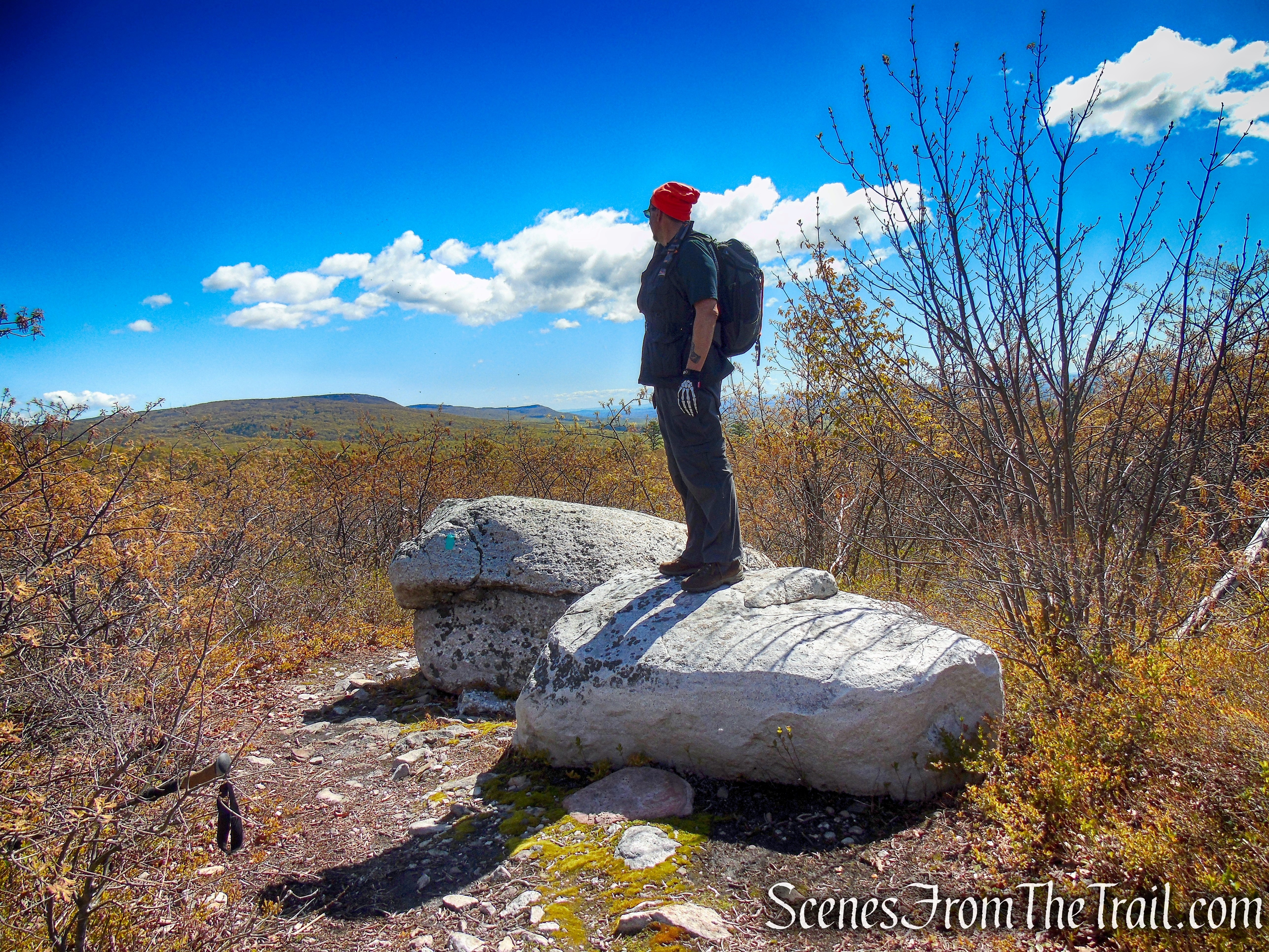
In just under a mile and a half from the start, you’ll come to two boulders on the trail with views north towards Minnewaska State Park. This is the turn around spot for this hike. After enjoying the north-facing views, retrace your steps along the coaligned SRT/Long Path back to the fire tower.
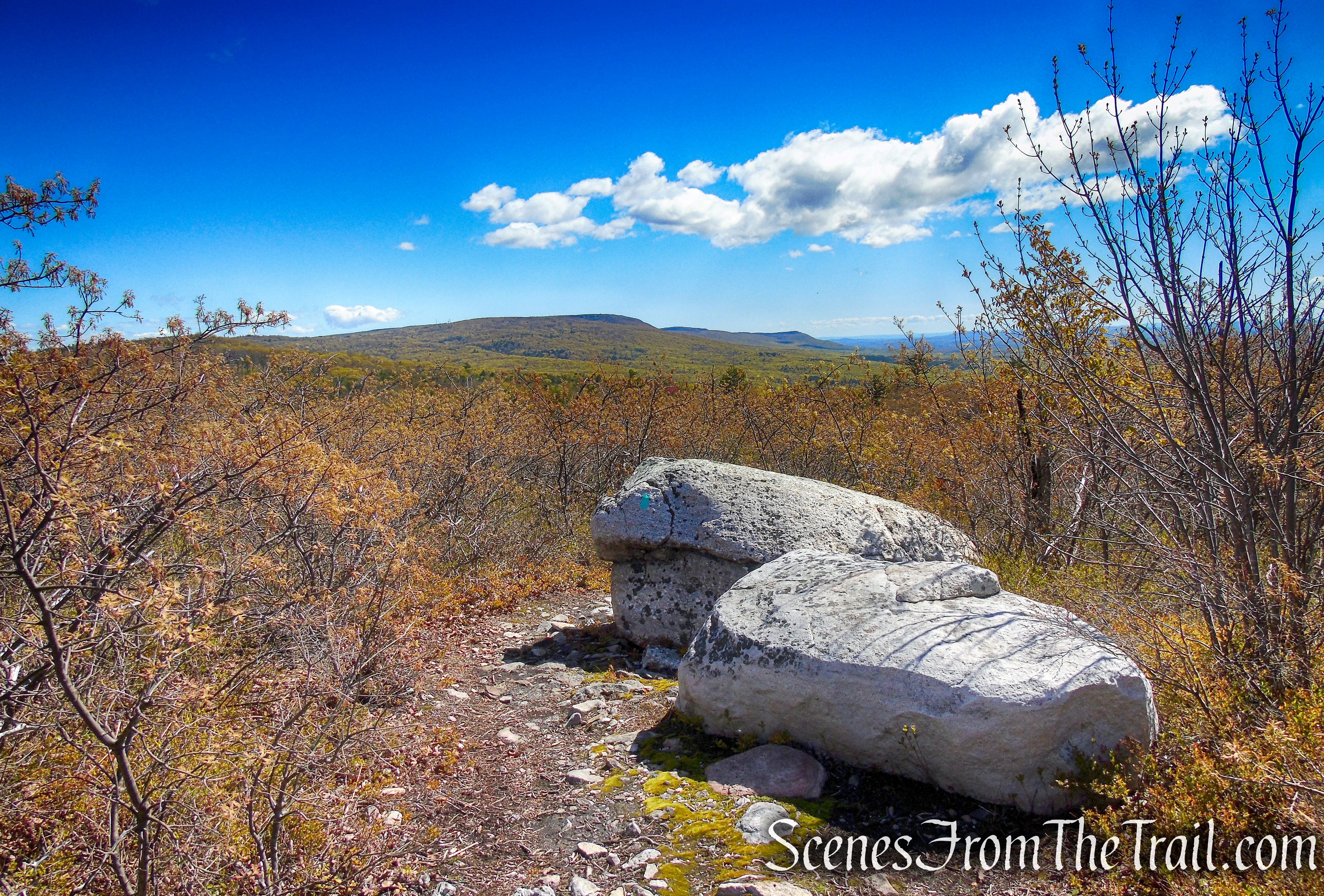
Coaligned SRT/Long Path – Roosa Gap State Forest
Looking northeast towards Sam’s Point and Minnewaska State Park
Looking northeast towards Sam’s Point and Minnewaska State Park
Coaligned SRT/Long Path – Roosa Gap State Forest
You may want to climb the fire tower again to enjoy the 360° views before you go.
Roosa Gap Fire Tower
A zoomed in view of the Bashakill Wildlife Management Area (center).
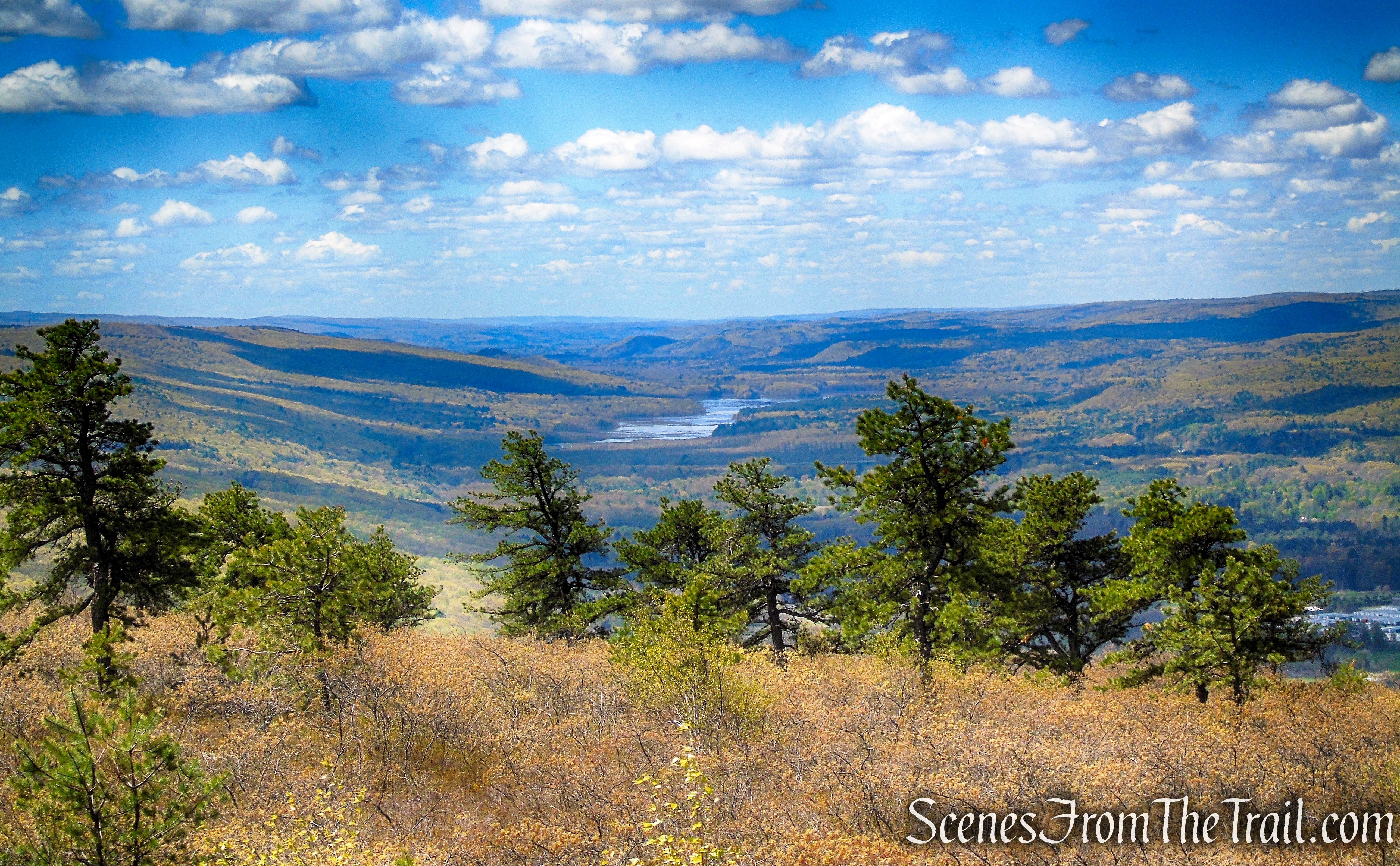
Looking south towards the Basha Kill from the Roosa Gap Fire Tower
Looking south to where the coaligned SRT/Long Path climbs the ridge from Ferguson Road..
Looking south towards Wurtsboro Ridge State Forest from the Roosa Gap Fire Tower
A nice view over Roosa Gap State Forest, with the Catskills in the distance.
Looking northwest towards the Catskills from the Roosa Gap Fire Tower
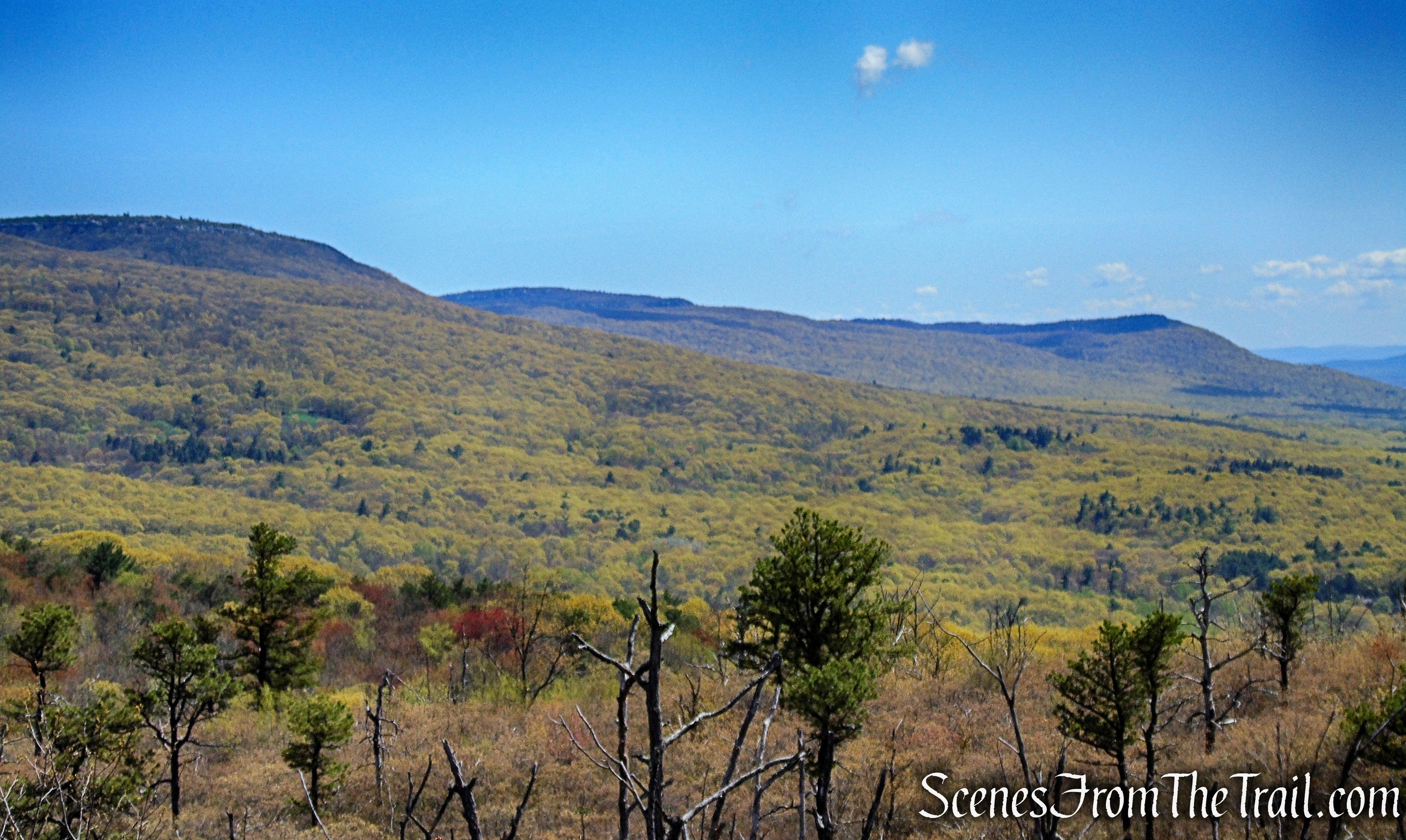
A zoomed in view of the northern Shawangunk Ridge.
Looking northeast towards Sam’s Point and Minnewaska State Park from the Roosa Gap Fire Tower
When you are done enjoying the fabulous views, retrace your steps along Fire Tower Road, past the gate, and back downhill to the paved section of the road, where the hike began.

Fire Tower Road – Roosa Gap State Forest

Fire Tower Road – Roosa Gap State Forest
Fire Tower Road – Roosa Gap State Forest
Review:
A really nice hike with some gorgeous views. The ridgetop is spectacular, as is most of the Shawangunk Ridge. We only saw 2 people by the fire tower at the beginning of the hike and 2 ladies near the end of the hike when we stopped at the fire tower a second time. Nice spot for an easy hike with great views.
Pros:
Roosa Gap Fire Tower, Shawangunk Ridge, scenic views, lightly trafficked.
Cons:
Parking situation could be better.
Take a hike!
Roosa Gap State Forest
Sources:
