April 18, 2023 – Highland Falls, NY
Difficulty: Moderate – Strenuous (1 steep climb, 1 steep descent and some light rock scrambling)
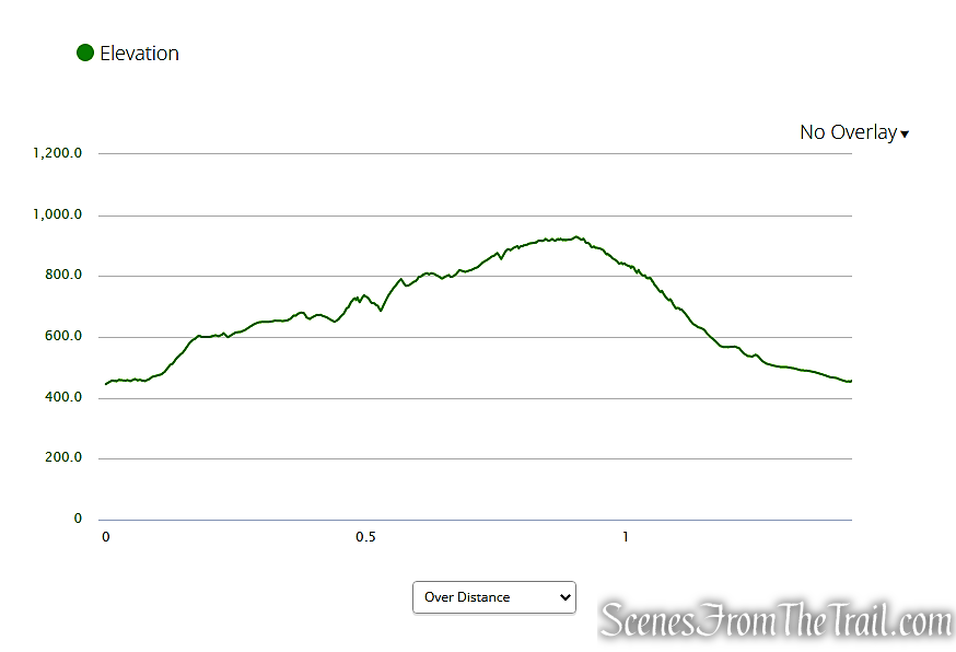
Length: Approximately 1.5 miles
Max elevation: 942 ft.– total elevation gain approximately 502 ft.
Route type: Circuit
Buy Map (Paper & Avenza): Harriman-Bear Mountain Trails Map #119
Free Map (Paper & Avenza): Bear Mountain State Park Trail Map
Trailhead parking: 288 Mine Rd, Highland Falls, NY 10928
Limited parking – no restrooms on site.
Details on longer hikes to Popolopen Torne via different routes:
Overview:
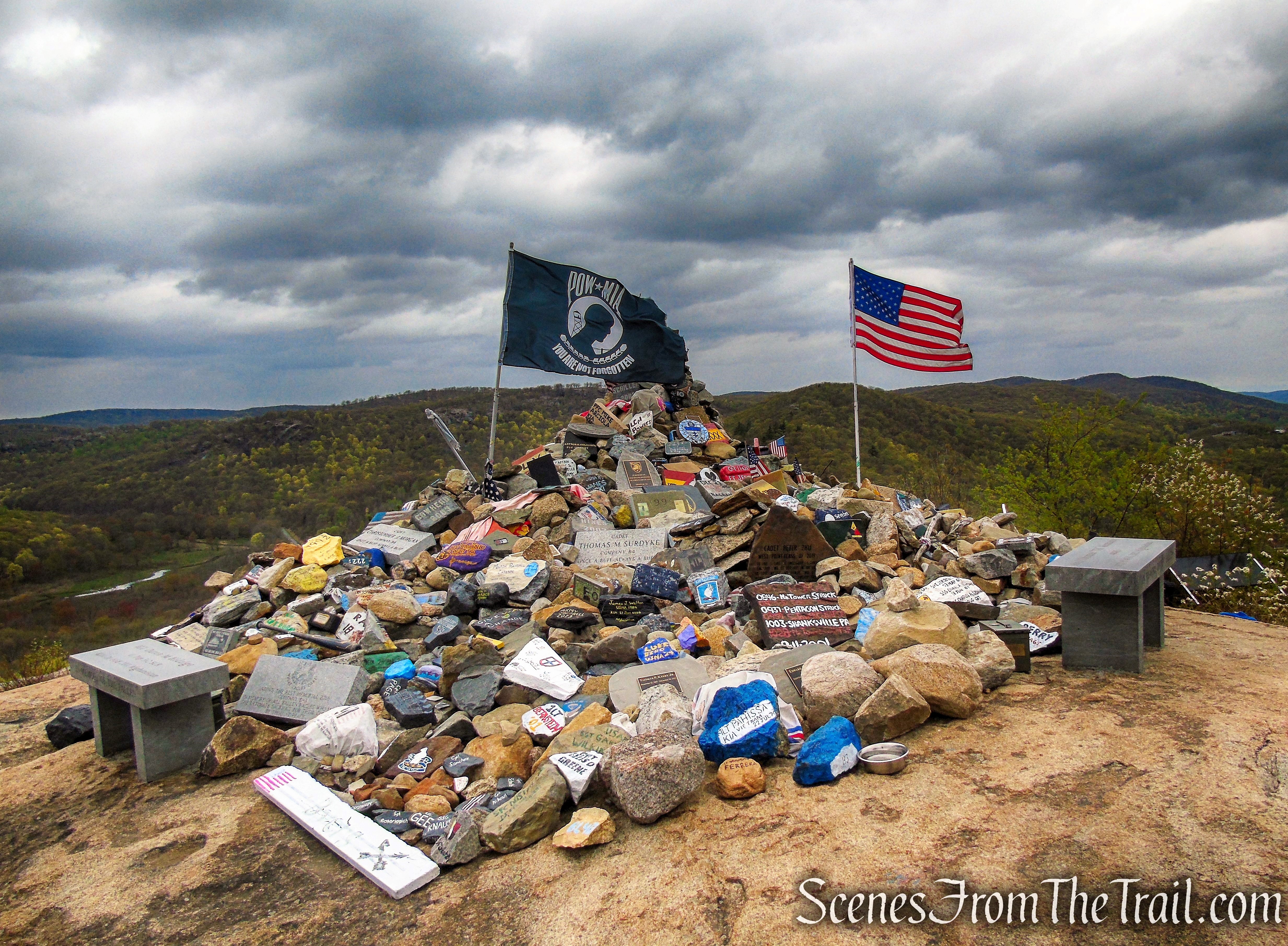
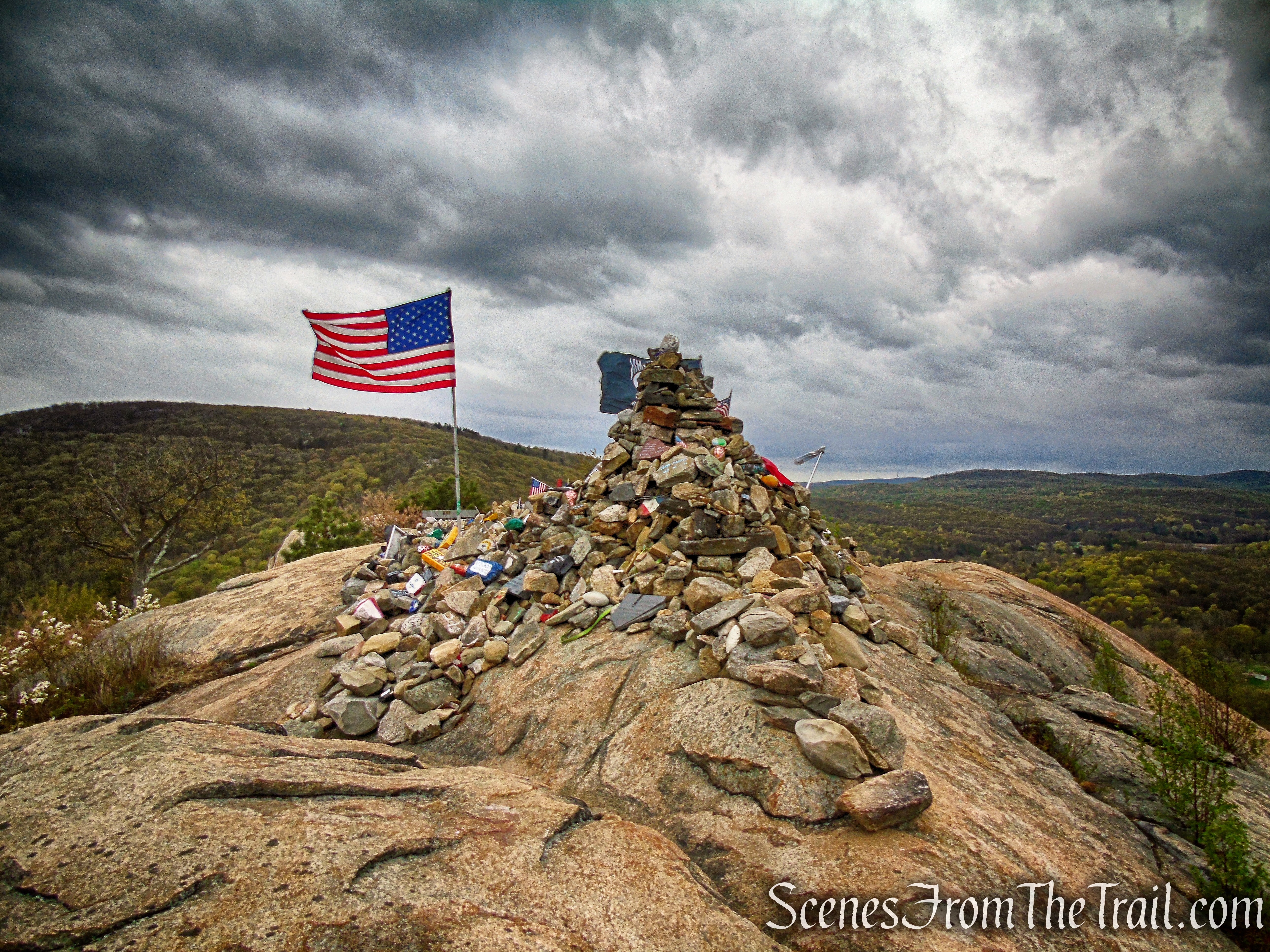
The Trail of the Fallen is a short but steep section of the Timp-Torne Trail that climbs and descends Popolopen Torne in Bear Mountain State Park. The Trail of the Fallen was formally opened on May 10, 2014. The revitalization of the trail was Grant Nawoichyk’s Eagle Scout Project. The trail originates near the top of Mine Road where there is a wooden kiosk. It is the site where rocks, some as heavy as 200 pounds, have been carried up to the summit of The Torne and placed in memory of soldiers who have died in recent military conflicts. Most of the stones are painted with names of soldiers that have paid the ultimate sacrifice. The stones are stacked as a tribute to these fallen servicemen and women. Two 400 pound memorial benches in honor of two West Point graduates killed in Afghanistan, were carried up the mountain and bolted in place.
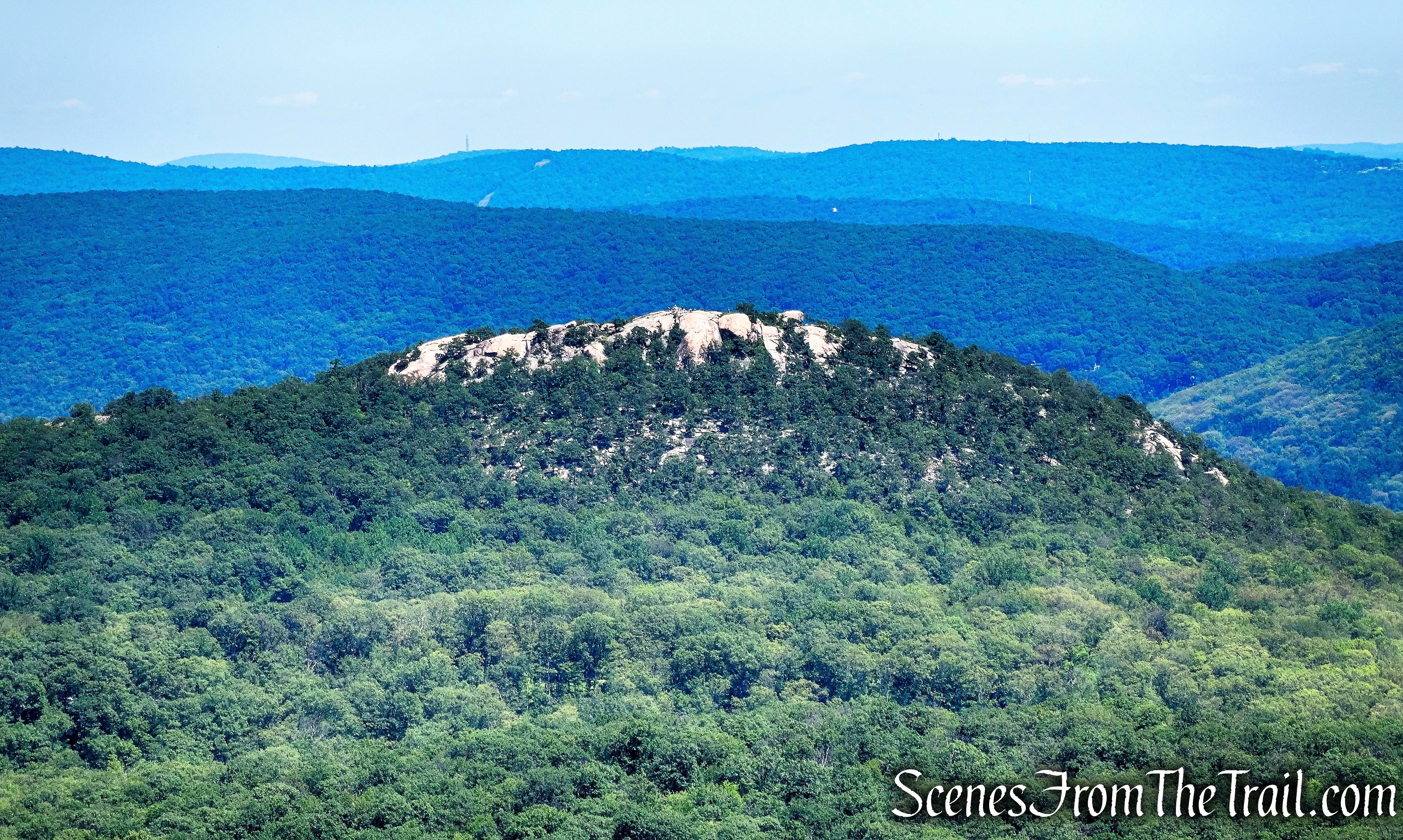
Popolopen Torne, officially called “The Torne,” is a small mountain with a relatively sharp and bald peak, part of the Hudson Highlands, with a summit of 942 feet above sea level. It is located in Bear Mountain State Park and has 360° views, with the Hudson River and the Bear Mountain Bridge to the east, the hills of the West Point Military Reservation to the west and Bear Mountain to the south.
Trail Overview:
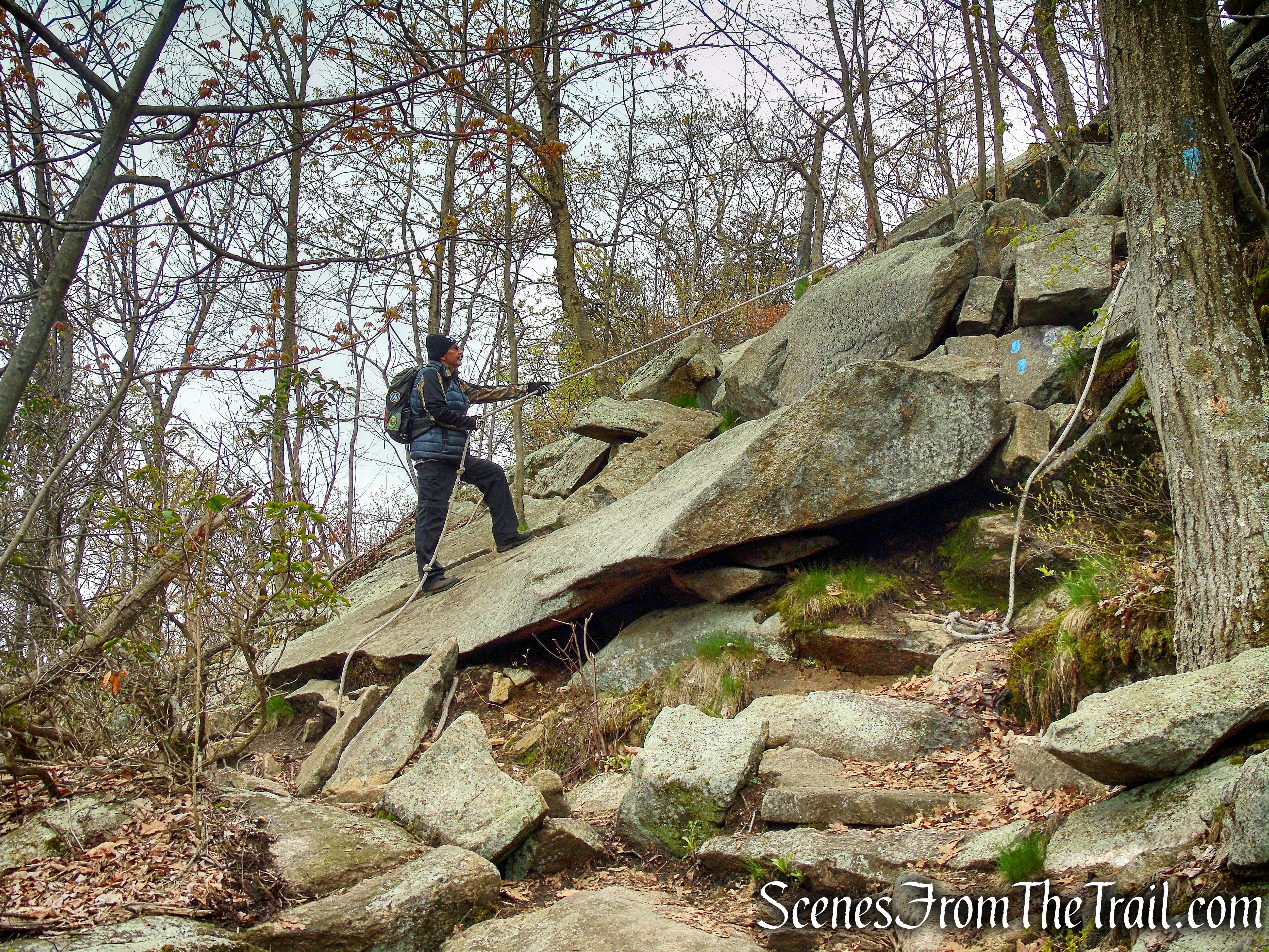
The Timp-Torne Trail is the only trail used on this hike. There is a short road walk at the end of the hike along Mine Road. It’s only about 3/4 of a mile from the kiosk to the summit, with about 500 feet of elevation gain in that span. The trail is quite rocky and some light scrambling over rocks and boulders is required. There are some ropes that have been placed at certain locations along the trail to help navigate some of the more difficult sections.
The route down is even steeper. Again, there are ropes in some places to help hikers descend some of the steeper sections.
The trail is relatively well marked, but there are a few spots where it could use additional blazes. I suggest using the free Avenza Maps app which will keep you on the trail. A good pair of hiking boots is strongly suggested as well.
Hike Overview:
I have done longer versions of this hike in 2017 and 2018. This hike is short, but if you feel ambitious, you can use connecting trails to lengthen the hike.
The parking area can accommodate 6-8 cars, depending on how well people park their vehicles. We did this hike on a somewhat chilly Tuesday morning and did not encounter anyone until we were getting ready to leave the parking area and a car pulled in, around 10:45 am.
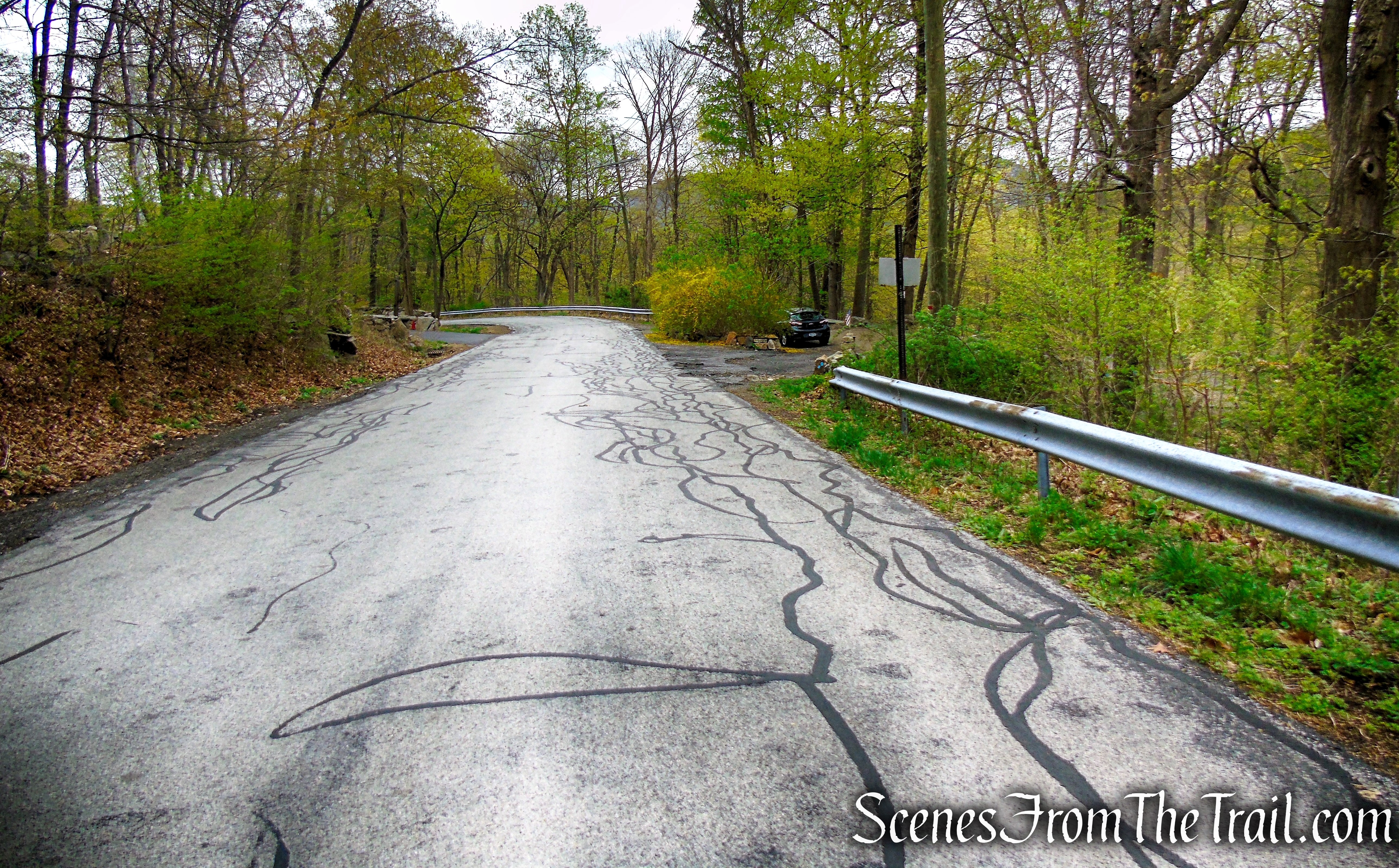
This is a counterclockwise loop beginning at a small parking area on Mine Road.

The Hike:
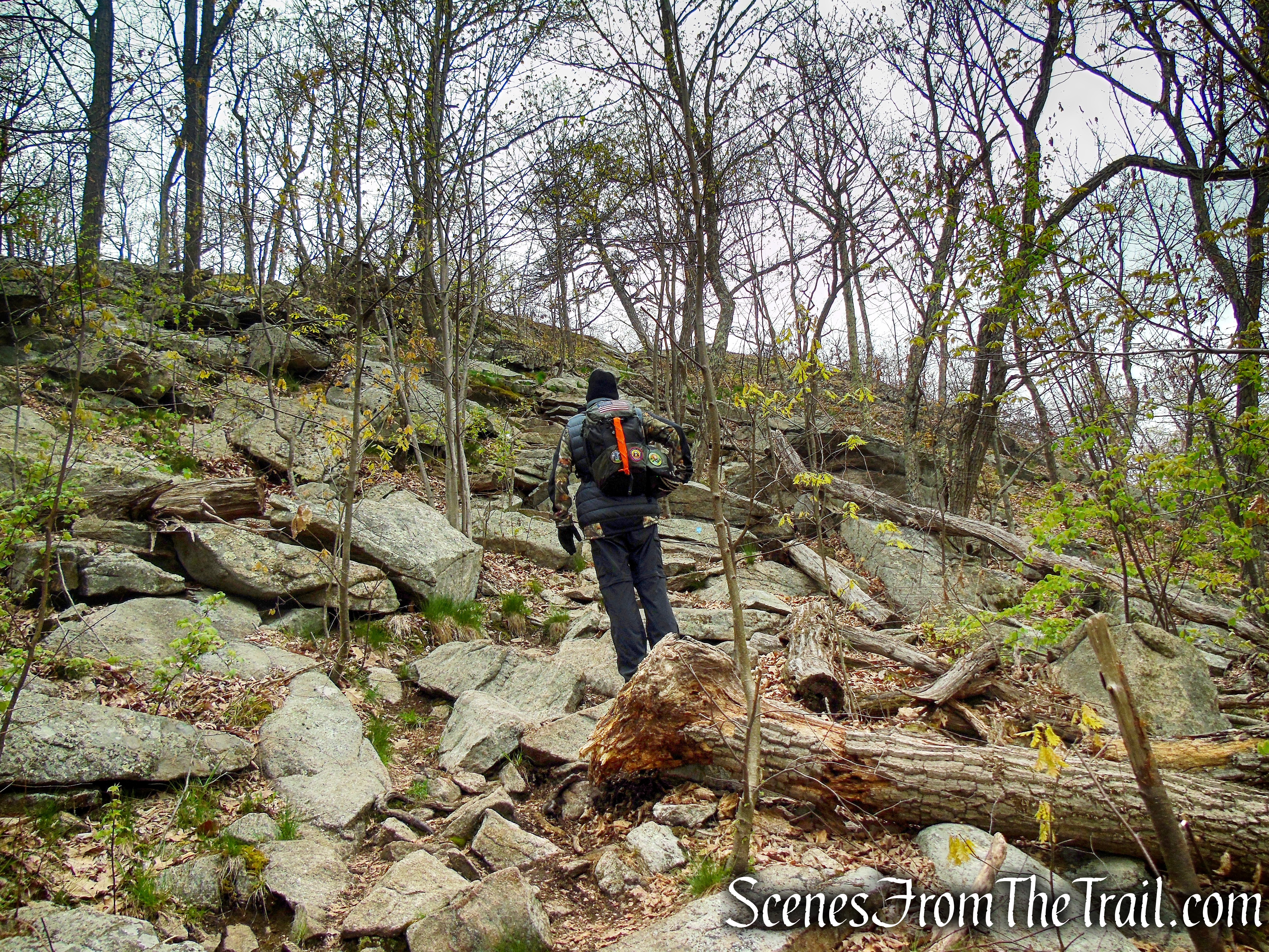
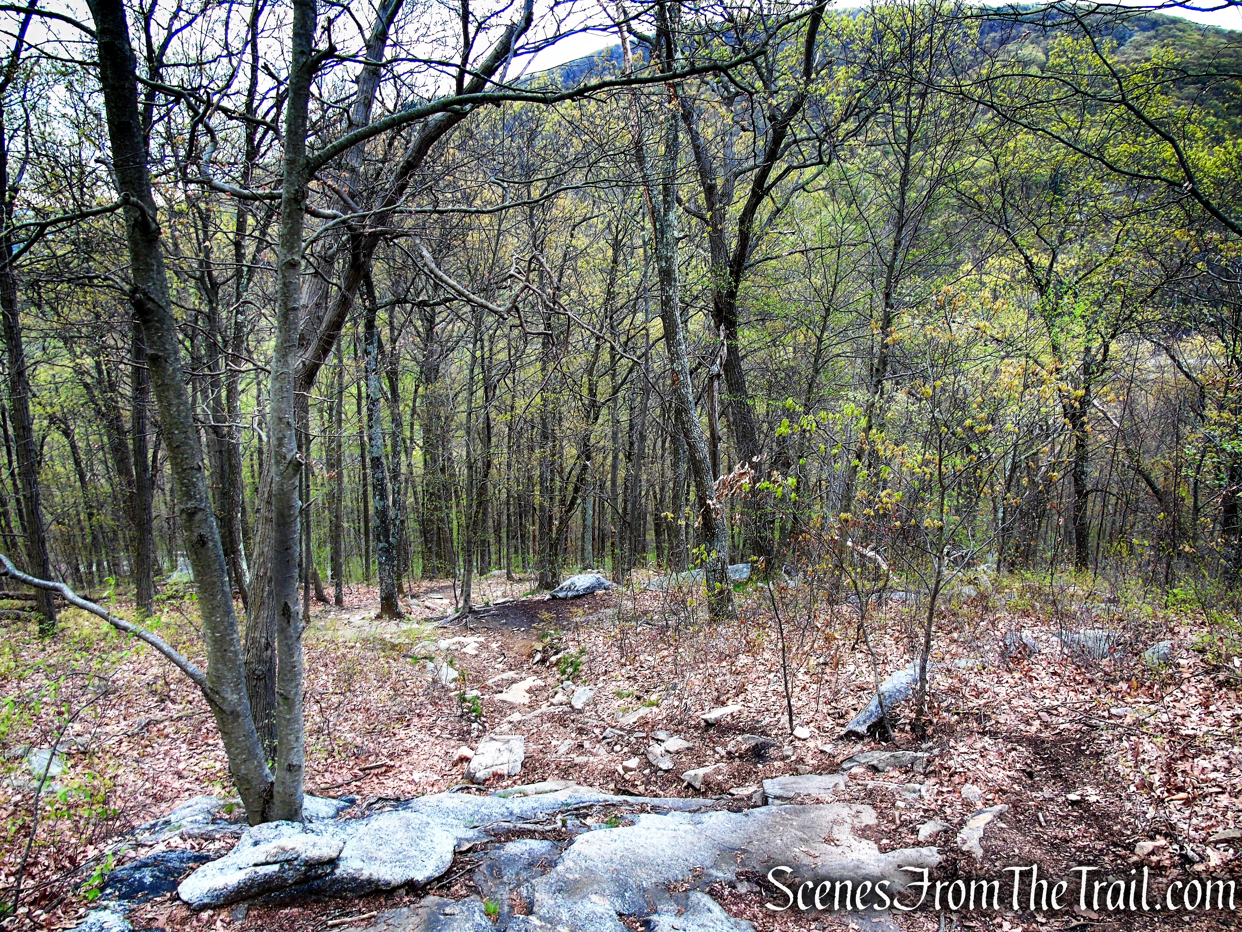
The blue-blazed Timp-Torne Trail passes through the parking lot and turns left on Mine Road. The trail follows Mine Road for 100 feet, then turns right at a kiosk, leaving the road and begins to climb Popolopen Torne on stone steps and switchbacks.


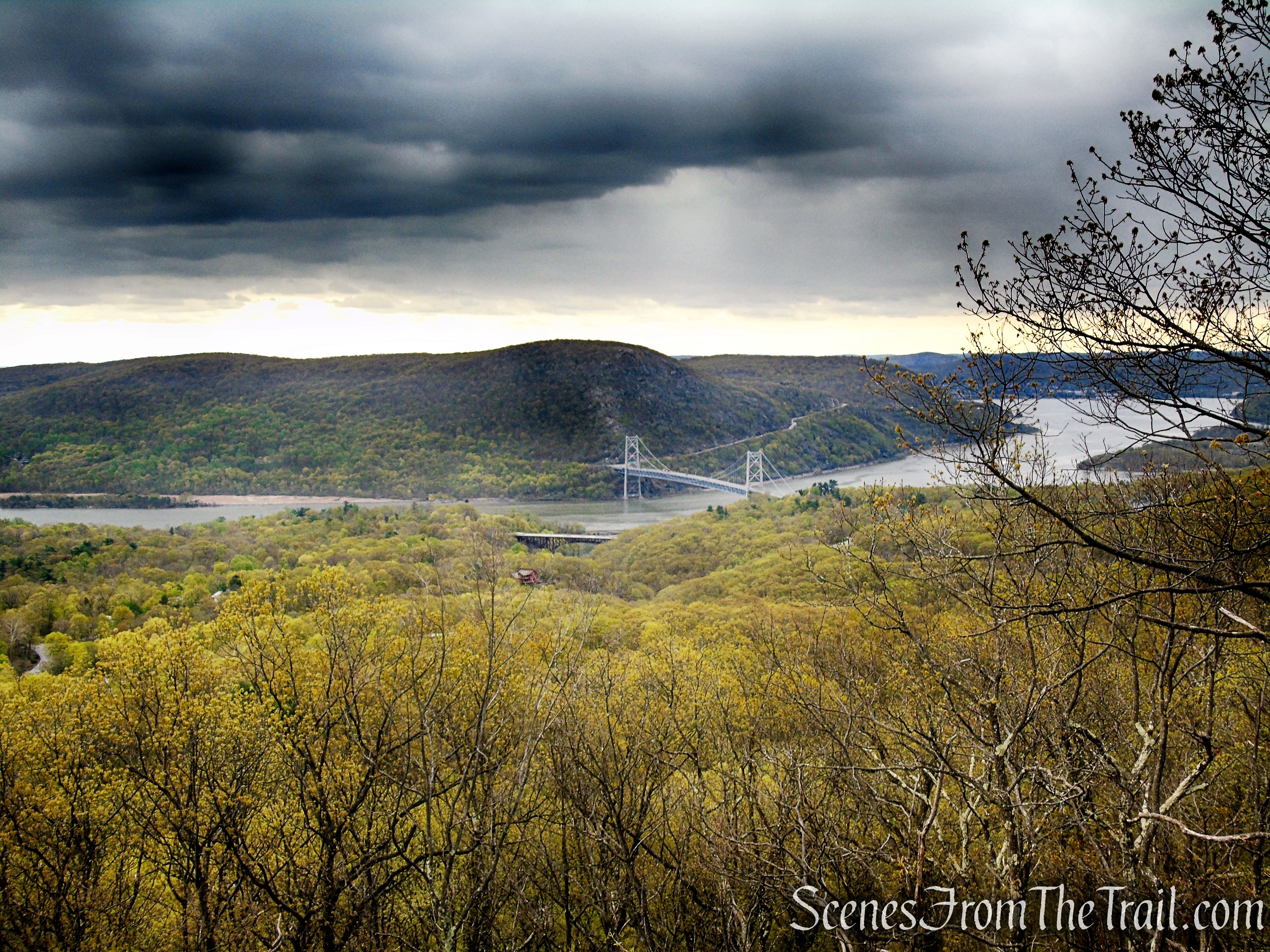
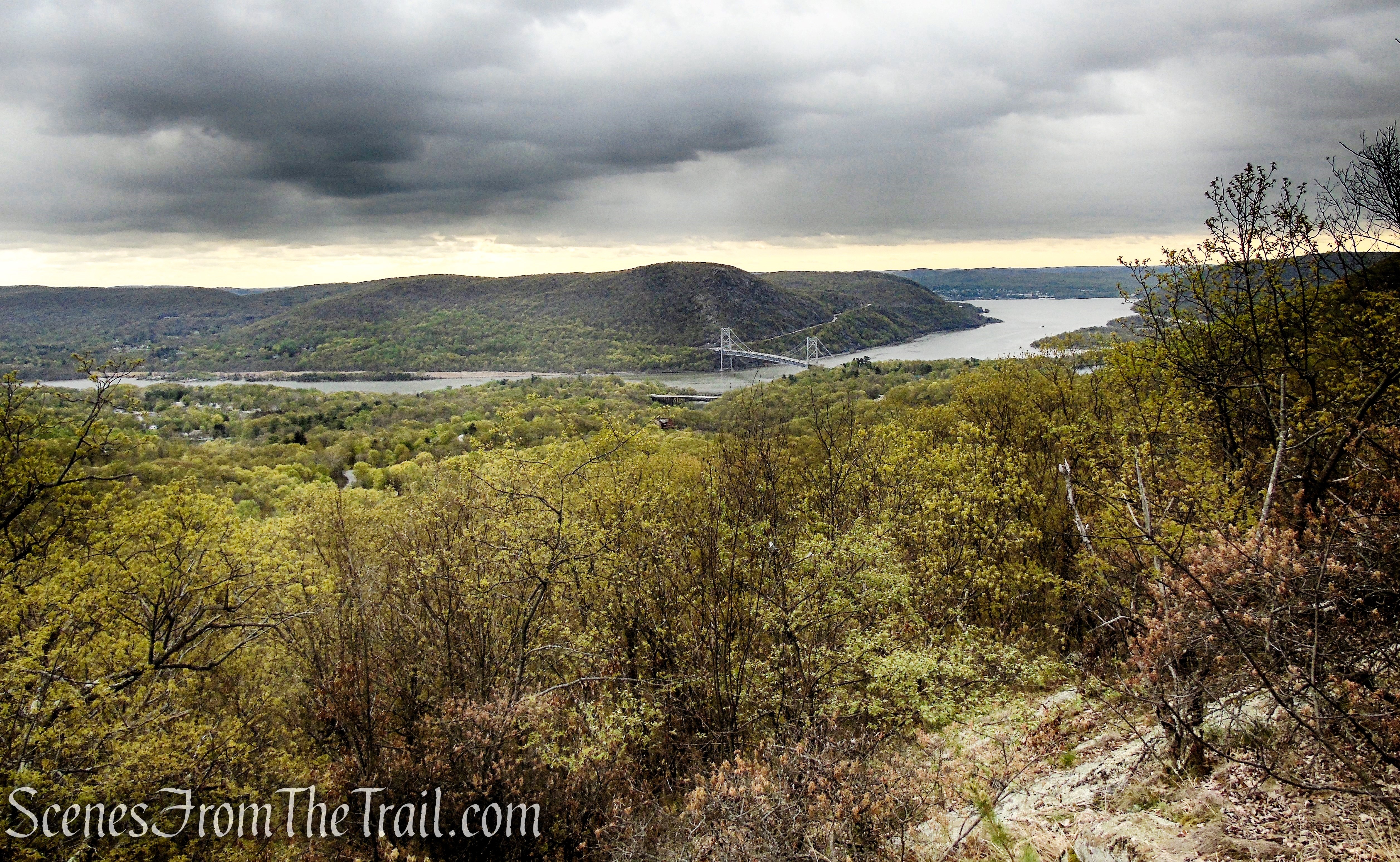
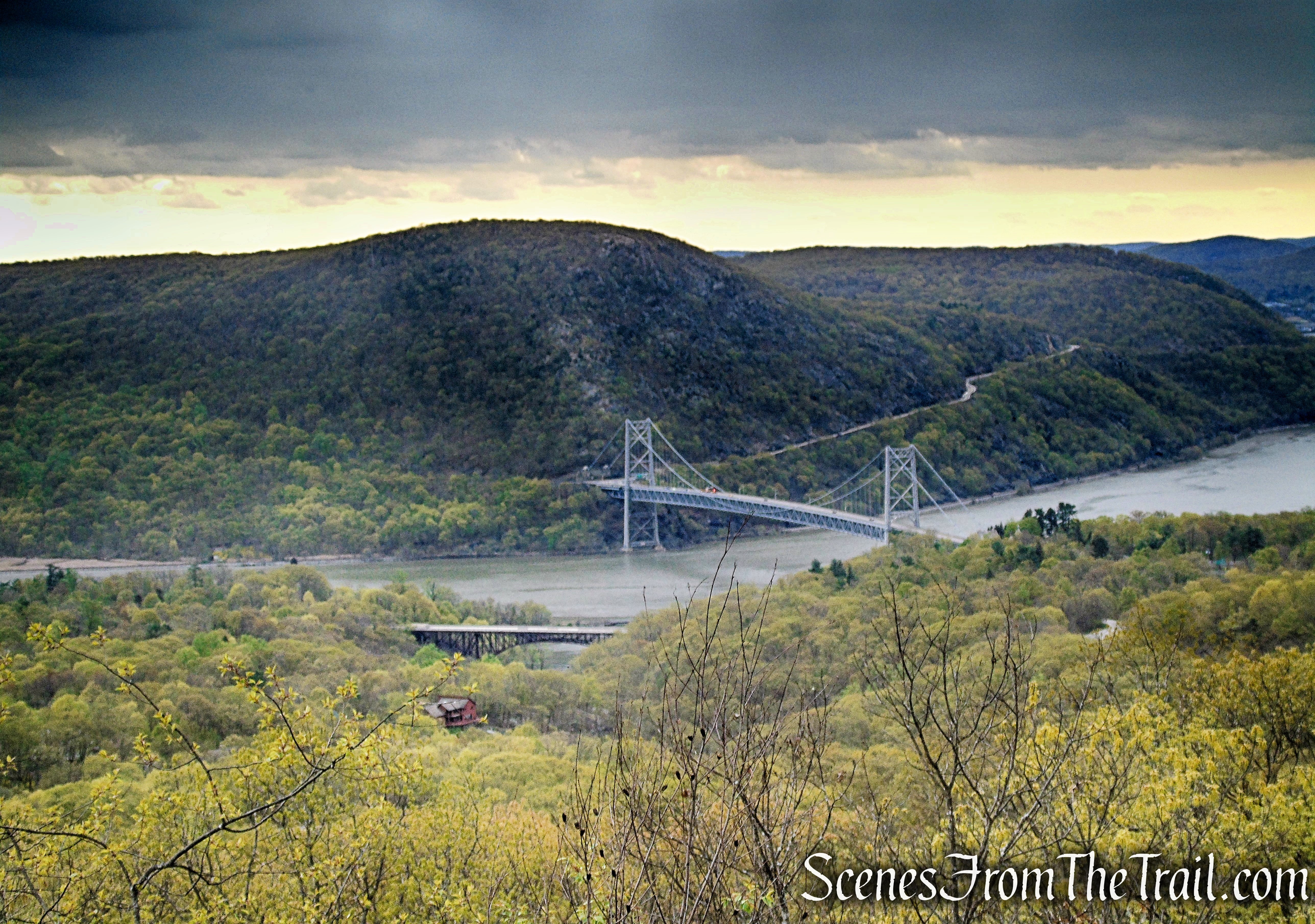
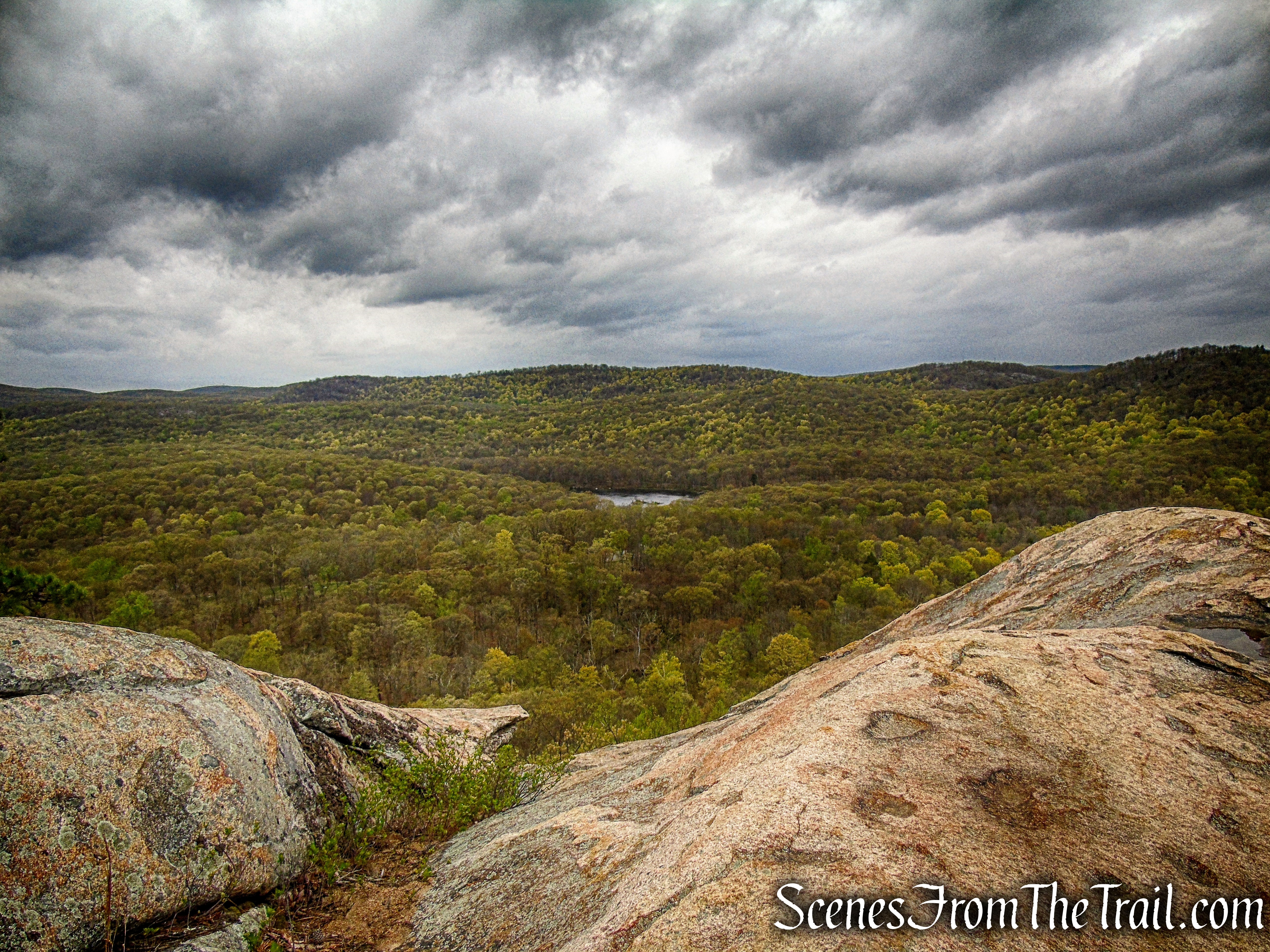
After a relatively level stretch, the trail turns left and climbs more steeply. Soon, it comes out on an east-facing viewpoint over the Hudson River, the Bear Mountain Bridge and the East Hudson Highlands from a rock ledge.


You’ll want to stop here for a short break, but despite what you might think, this is not the summit of The Torne.
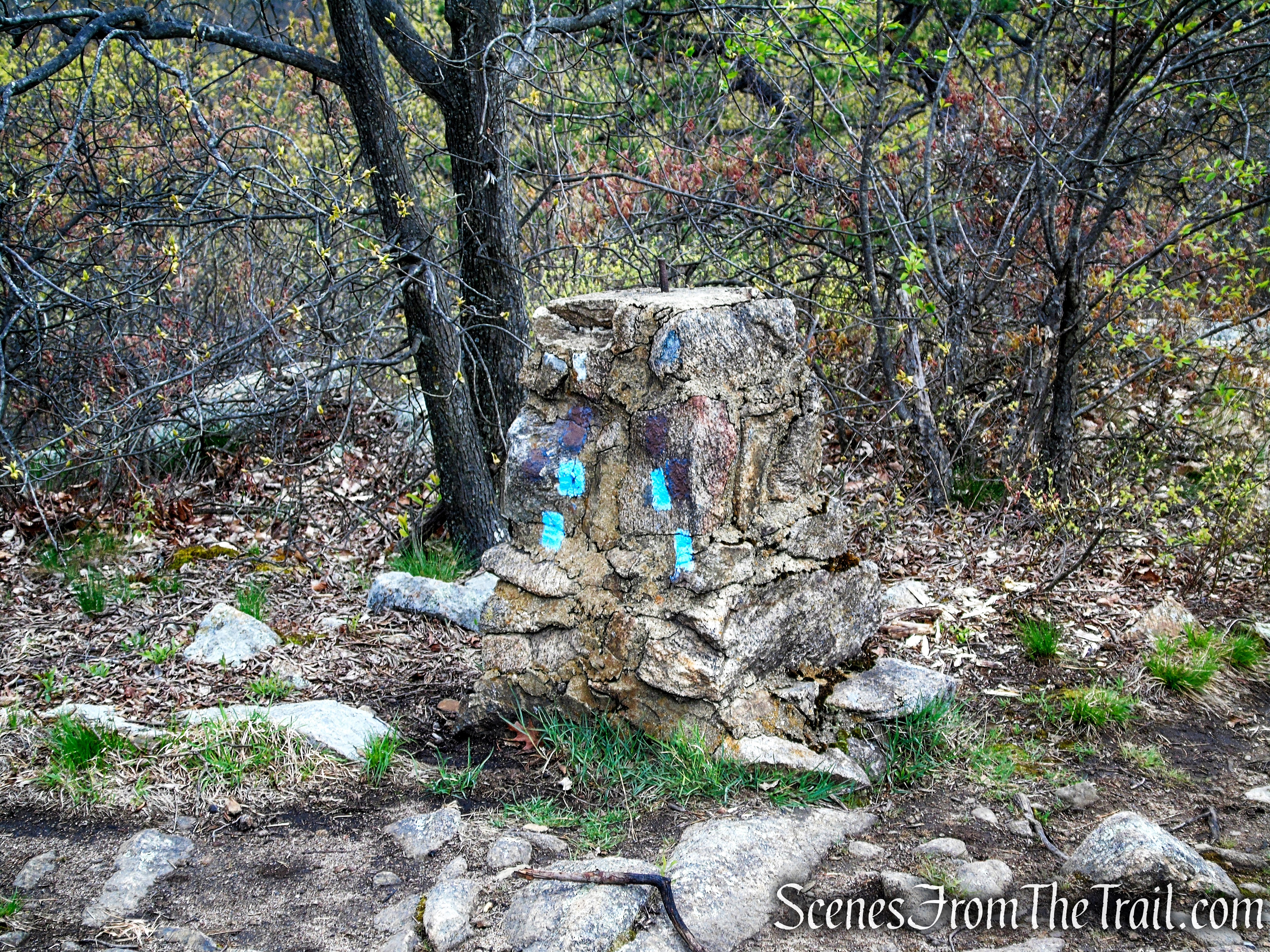
Continue ahead on the Timp-Torne Trail. When you reach a short stone column marked with blue blazes, there is a short spur trail to the right of the stone column with some lovely views from a small rock outcrop.
Looking north towards The Crown Ridge and West Point hills.

Looking southeast.
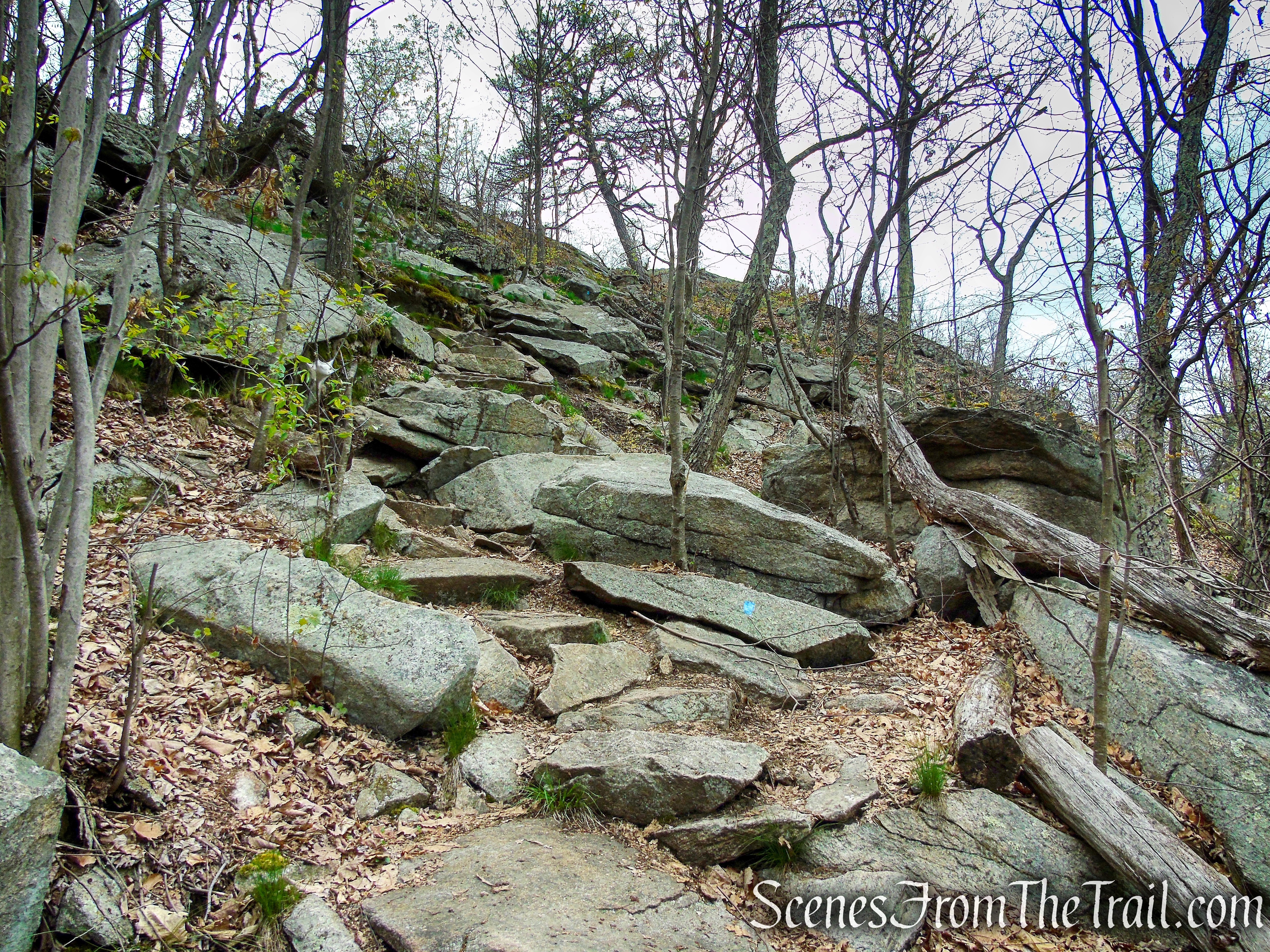
Continue ahead on the trail, which makes a sharp bend to the south and continues to climb over rock ledges.
In certain spots along this stretch of the trail, ropes have been placed along the way to assists hikers with the steep ascent over the bare rock slabs.
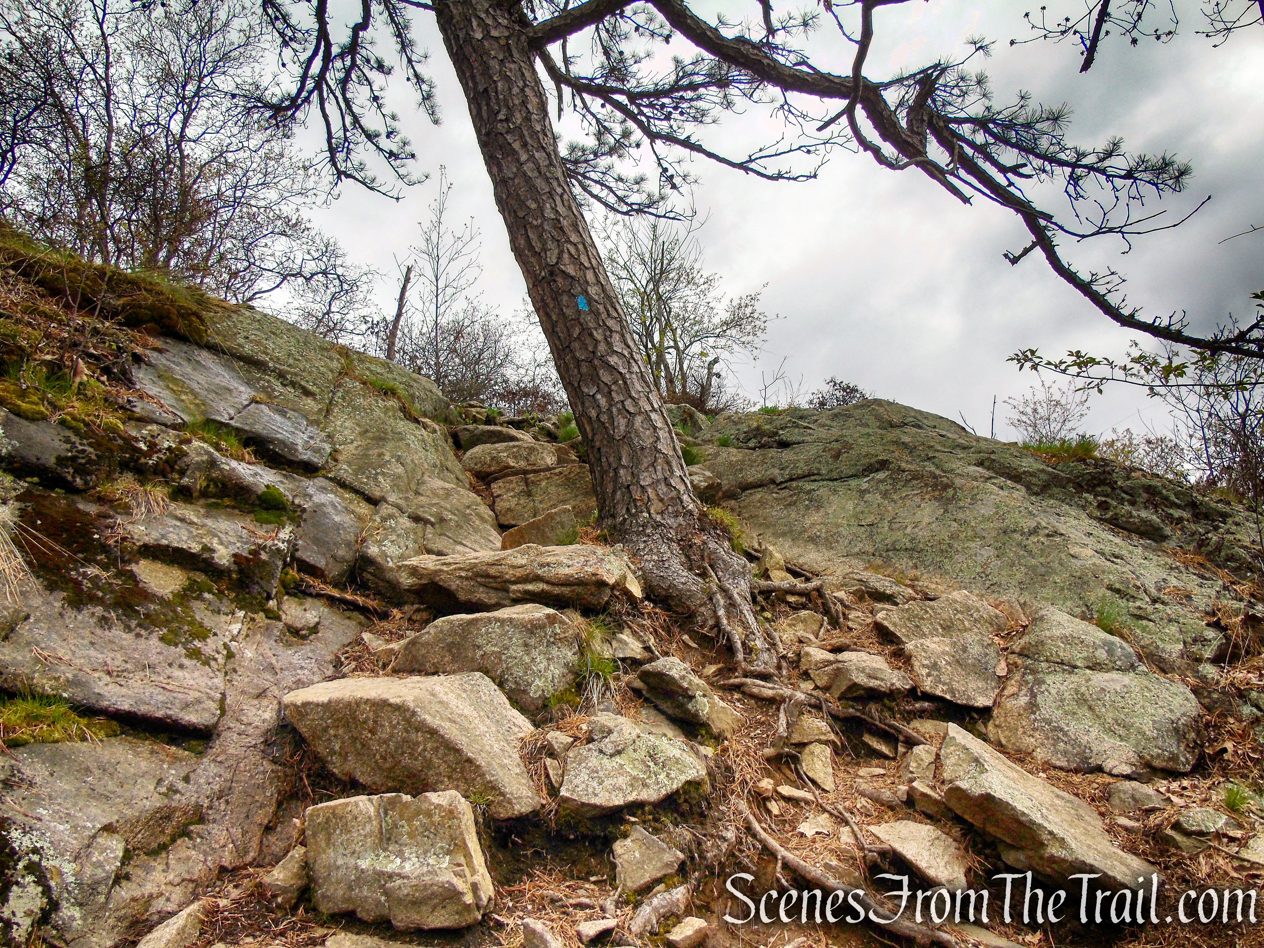
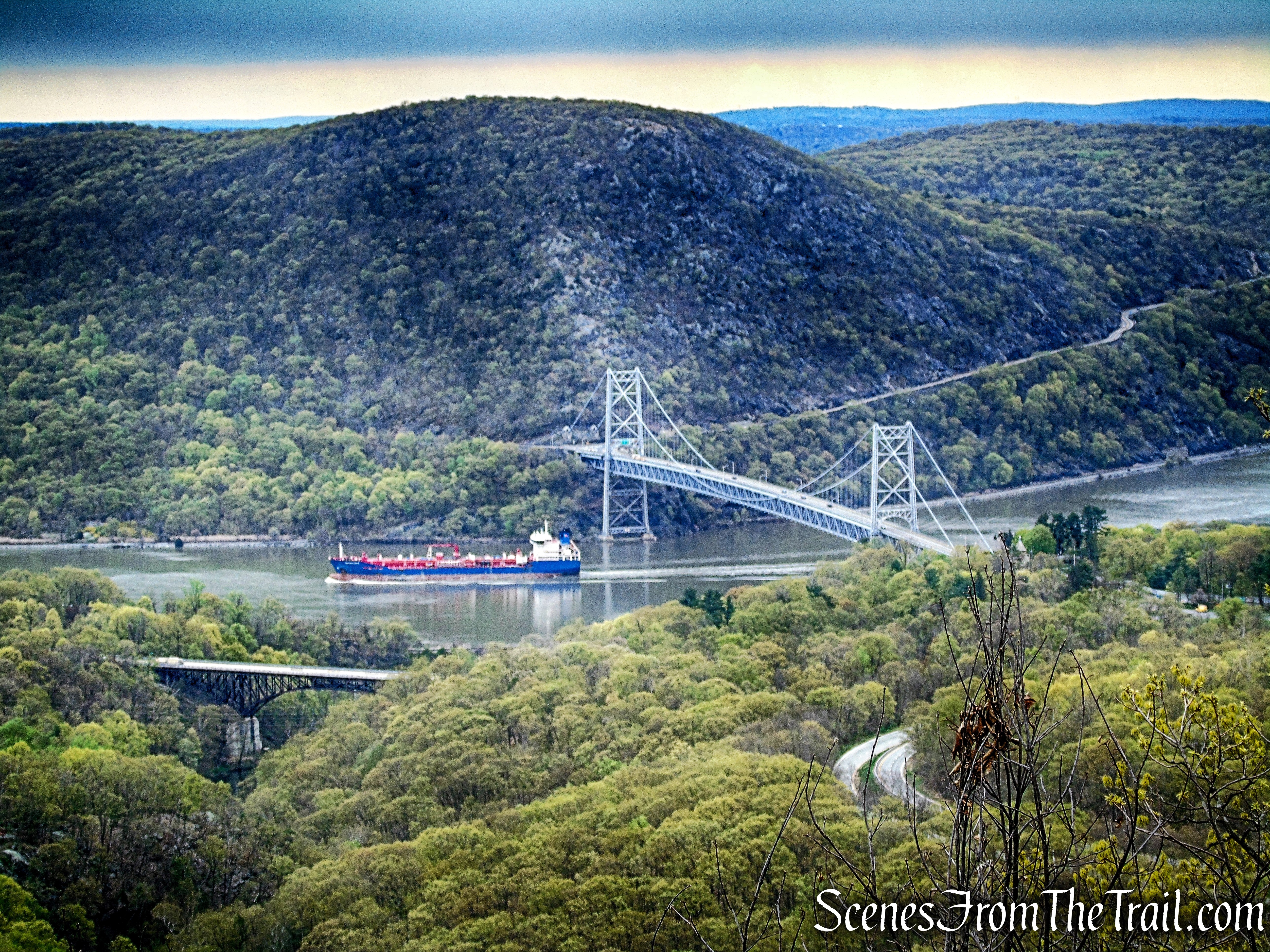
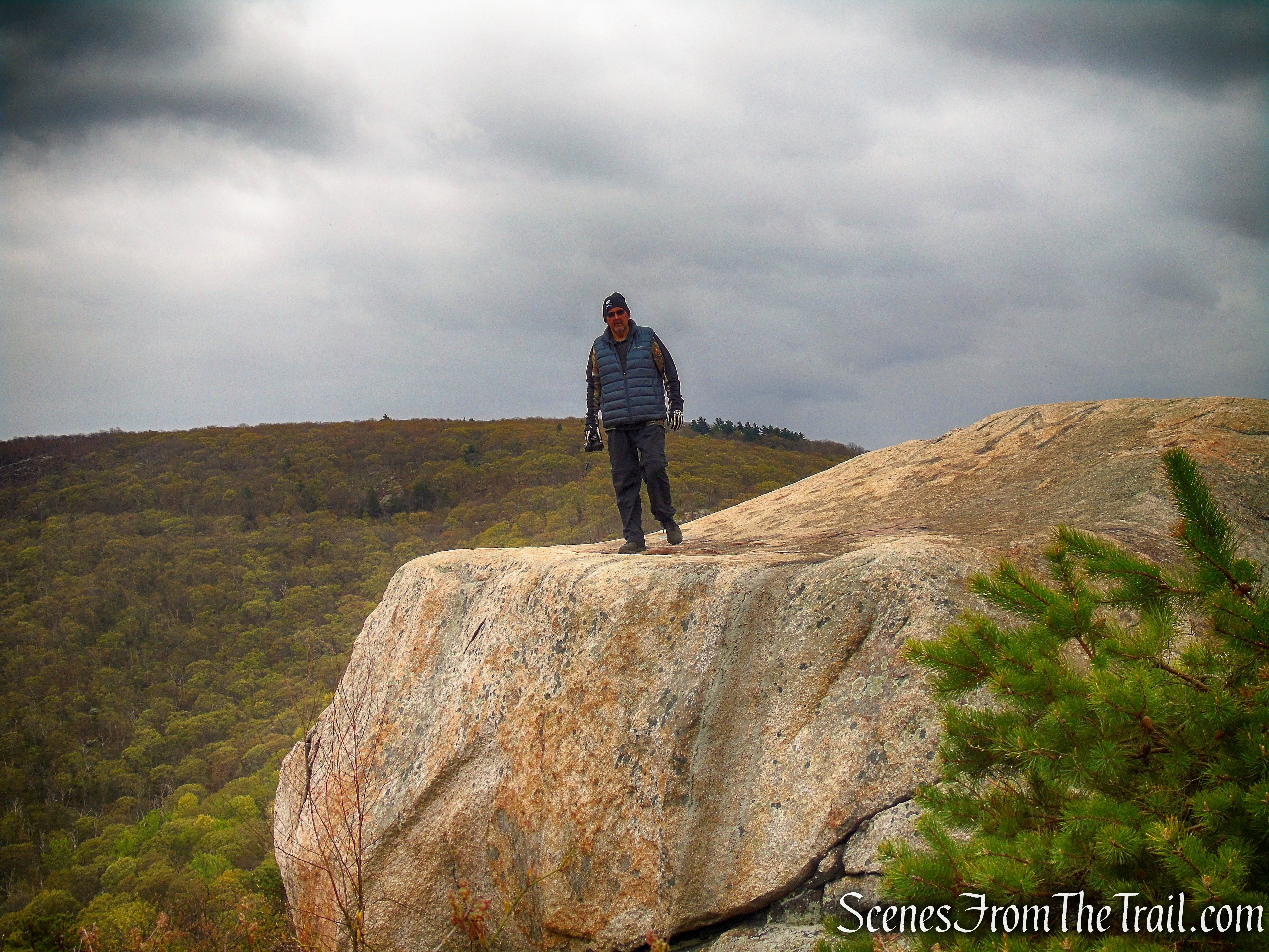
Soon, you will reach the true summit of Popolopen Torne, where open rock ledges afford a 360° view. From here, you can see not only the Hudson River and the Bear Mountain Bridge to the east, but also Bear Mountain to the south, and the hills of the West Point Military Reservation to the west.
At the summit of The Torne, is the memorial for fallen soldiers. You may want to take a moment here to honor these brave men and women who sacrificed their lives to protect our freedoms which we enjoy everyday.

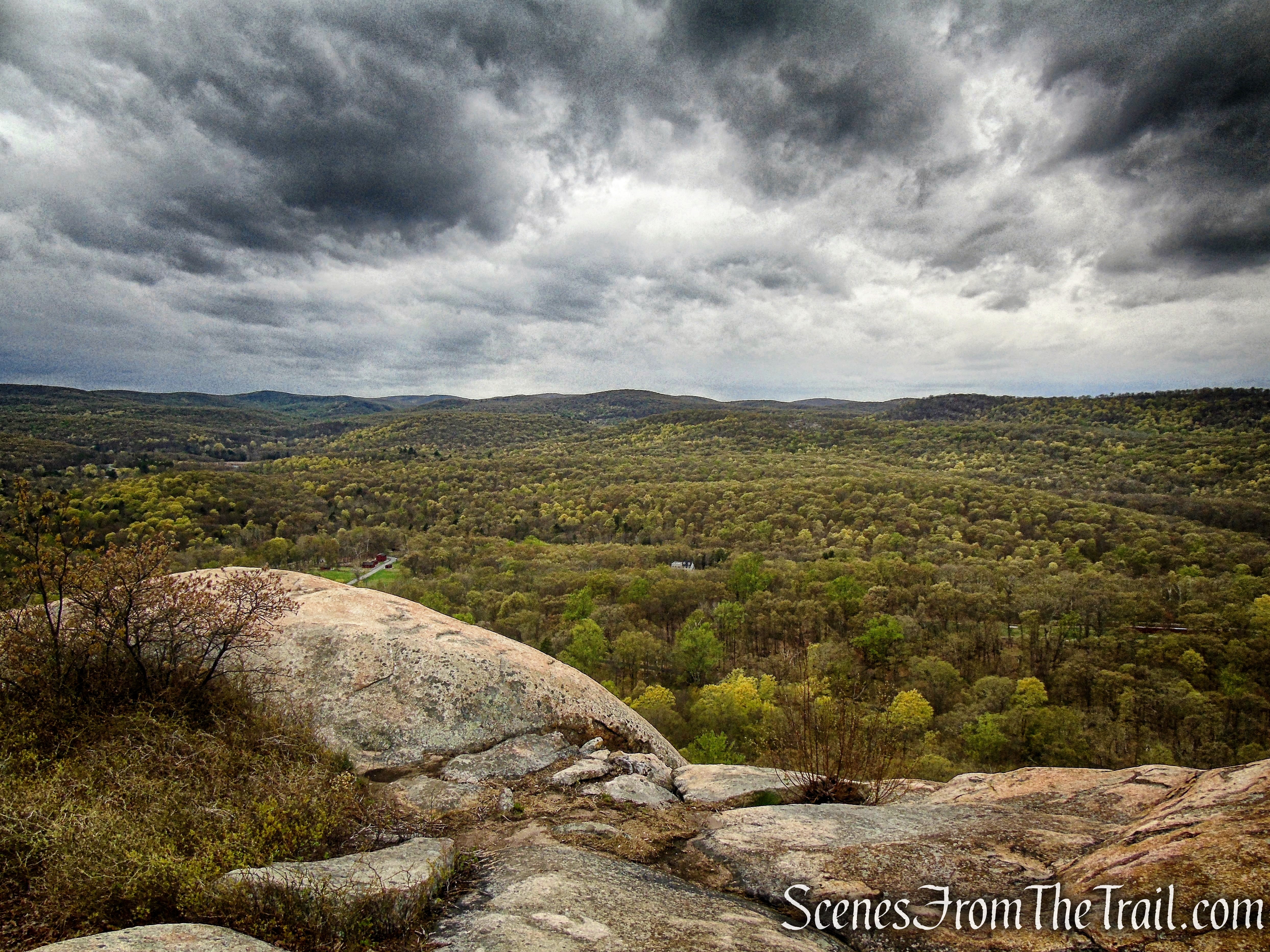
Looking west towards the hills of Harriman State Park.
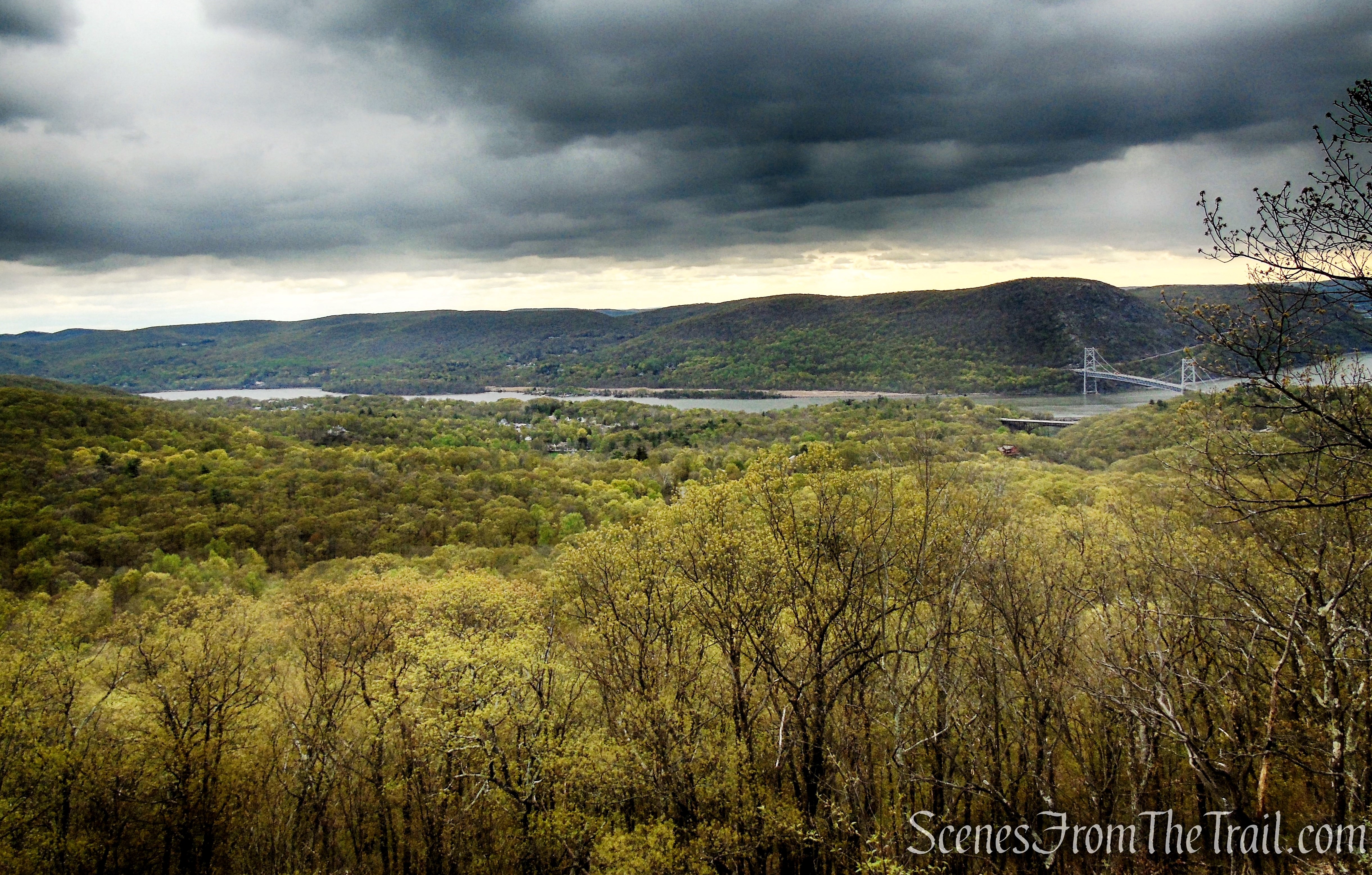
The Hudson River, Bear Mountain Bridge, Anthony’s Nose on the far side of the bridge and the Palisades Interstate Parkway down below.
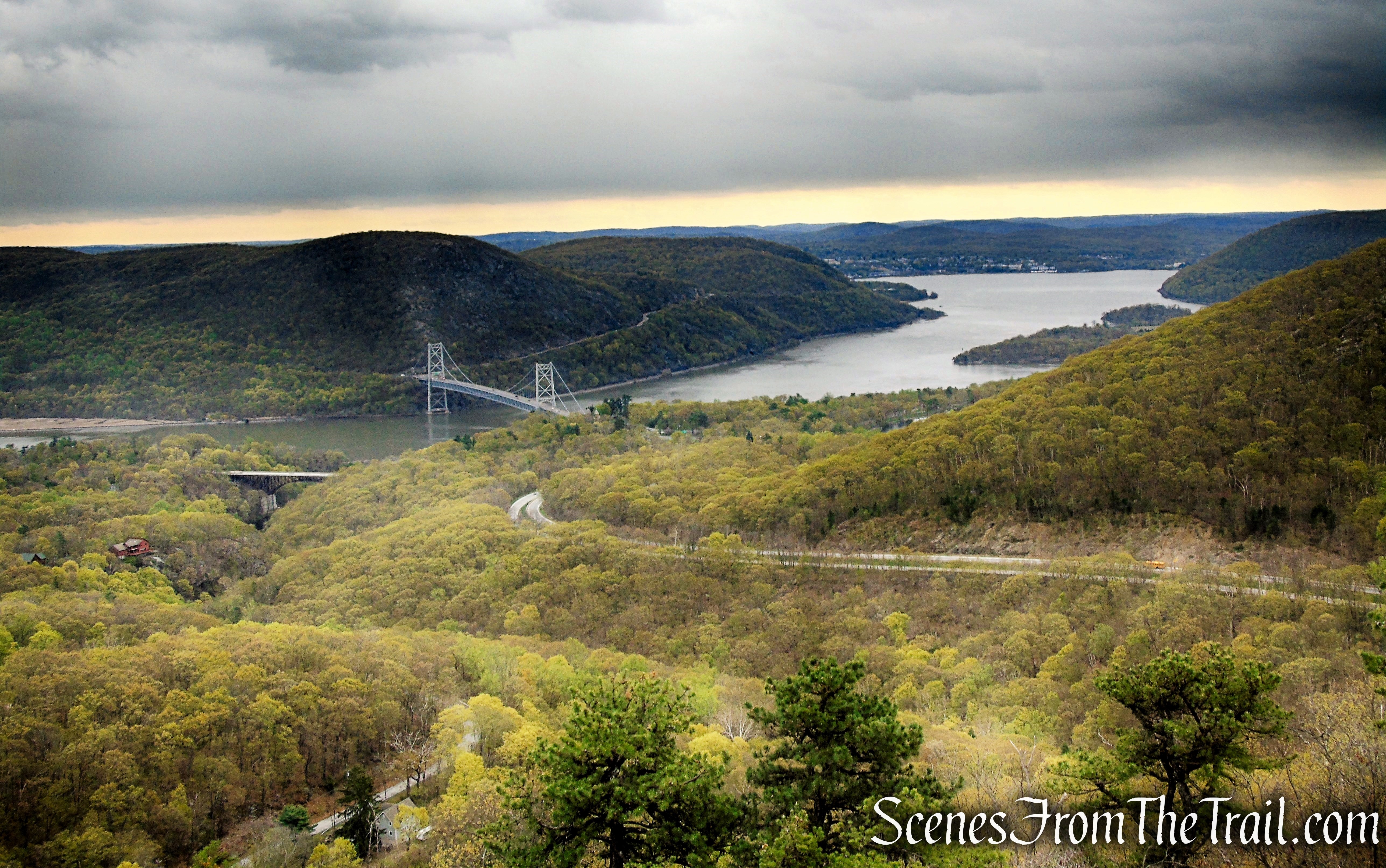
Palisades Interstate Parkway down below.

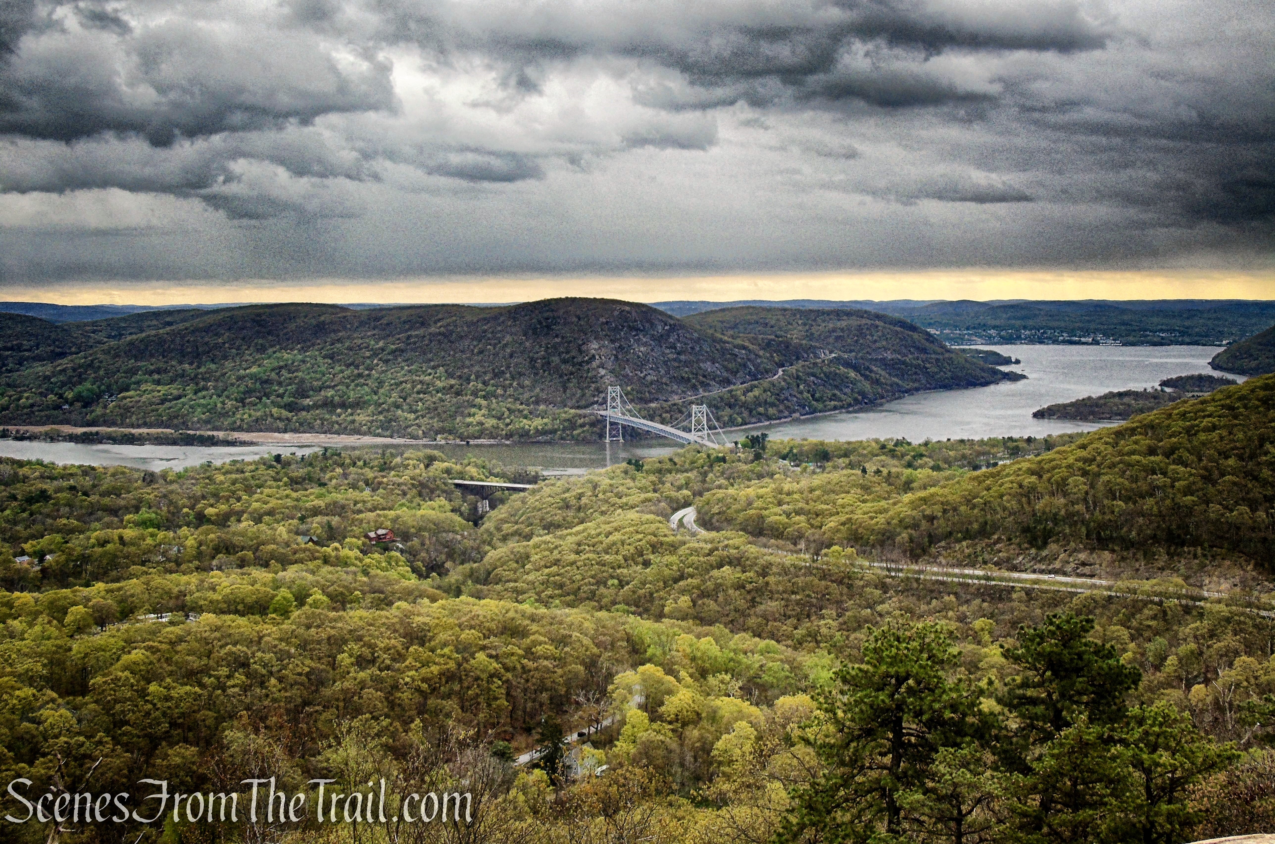
Bear Mountain Bridge and Anthony’s Nose.
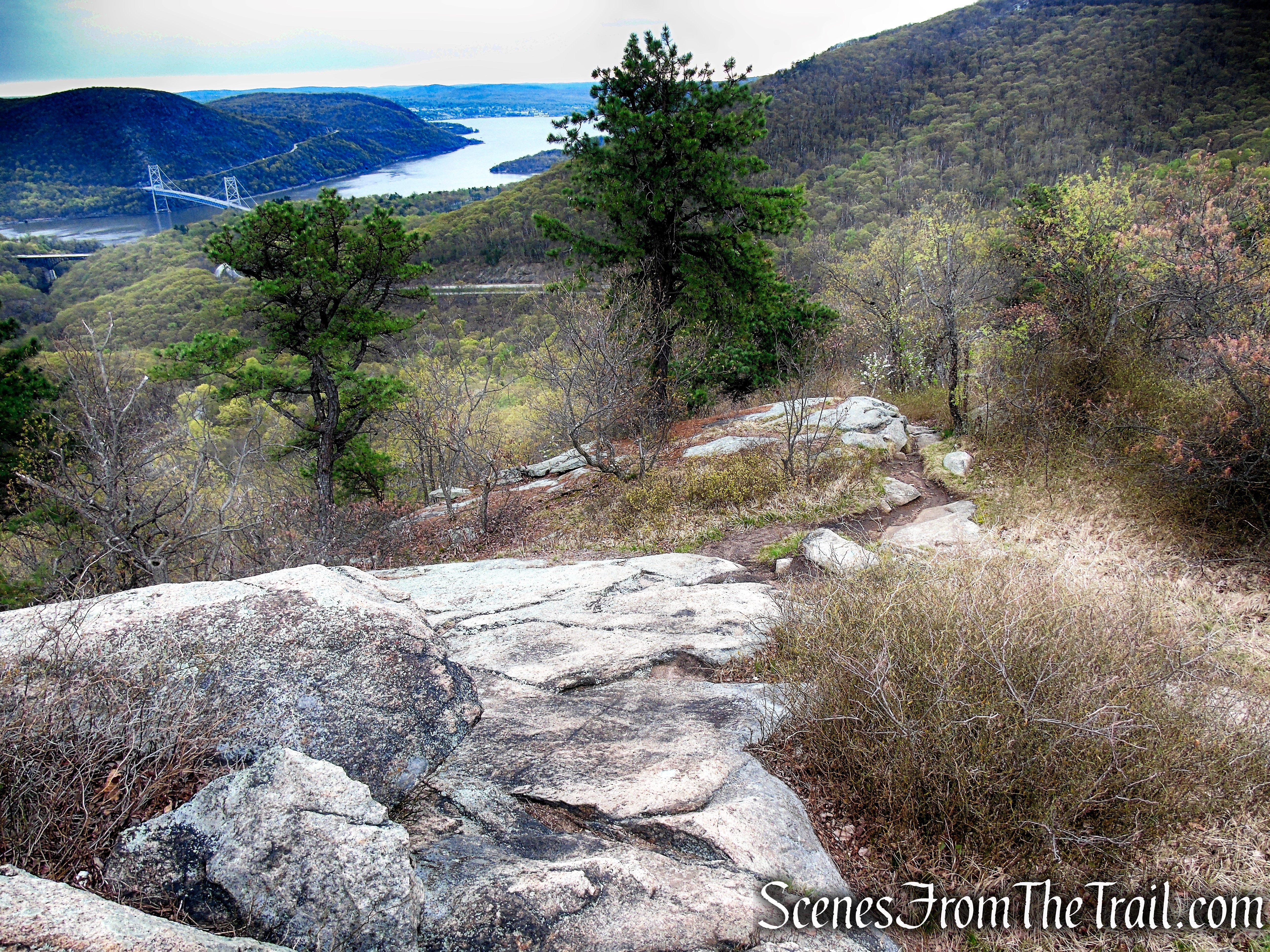
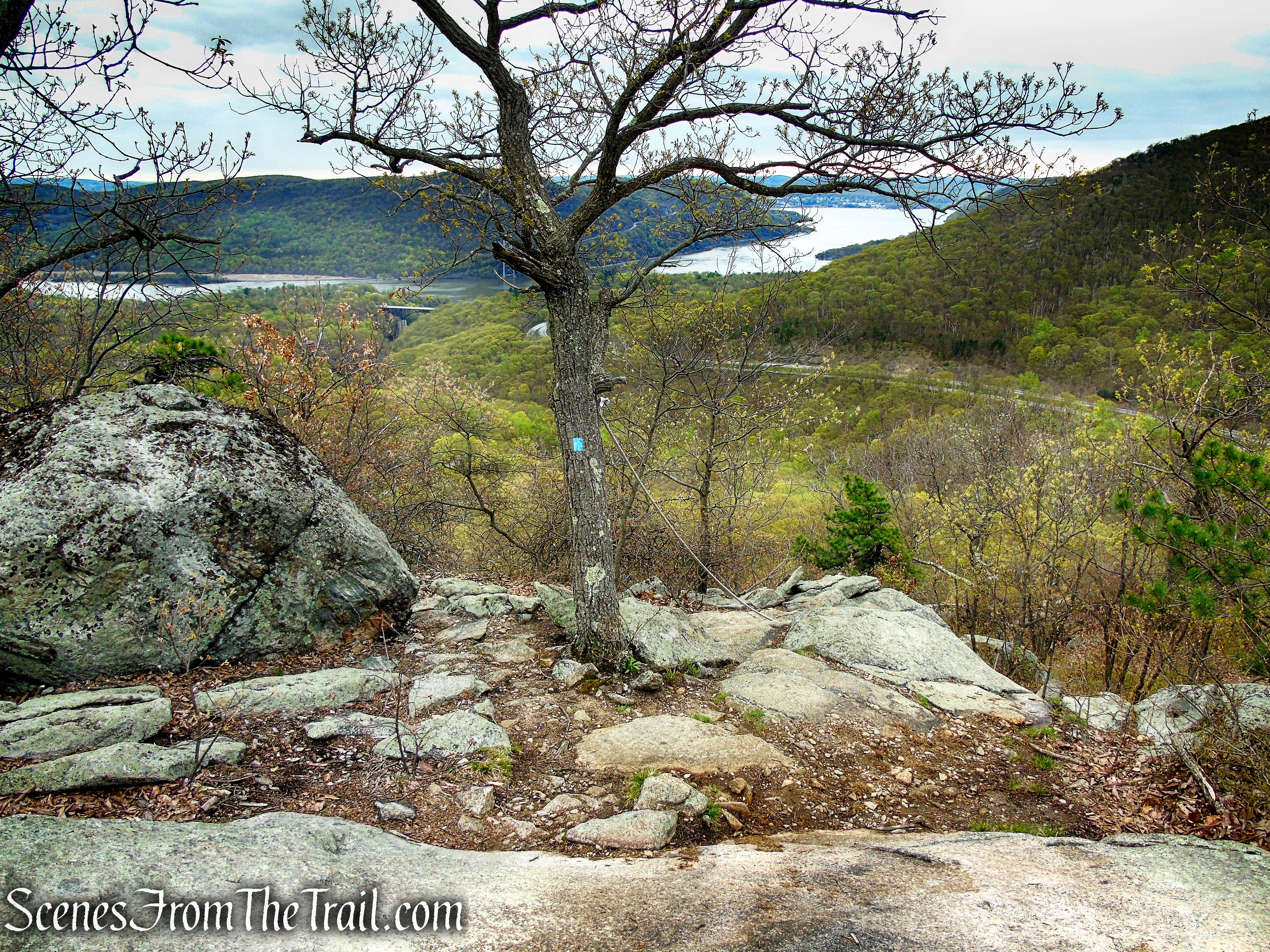
After spending some time at this beautiful spot, continue ahead as the trail steeply descends the mountain on rock ledges. The descent is much steeper than the climb, and you will have to use both your hands and your feet in places. Again ropes have been placed in certain spots to assist hikers on the descent.


Looking back after descending with the help of a rope.

On the way down there is another wide ranging viewpoint from a rock ledge.

Another steep section where ropes have been placed.
Looking back up after the steep descent.

About halfway down, the trail reenters the woods and continues to descend more moderately on stone steps and switchbacks.
A short distance later, the Timp-Torne Trail reaches Mine Road then crosses it, but you should turn left on the paved road and follow it down a short distance, back to the parking area, where the hike began.

Review:
A really good hike with fantastic views of the Hudson River Valley. A bit short, but can be combined with connecting trails for a longer trek. This hike is perfect for those short on time that want a good workout and views. Some more blazes along the trail would make for easier navigation, but using the Avenza Maps app comes in handy for situations like that. Definitely a must do for those that hike the Hudson Valley.
Pros:
Trail of the Fallen Memorial, 360° views, light rock scrambling, not as crowded as the surrounding peaks.
Cons:
Could be better blazed in some spots, limited parking, no restrooms.
Take a hike!
Sources:
- New York-New Jersey Trail Conference
- Trail of the Fallen
- ‘Trail of the Fallen’ Hike
- Trail of the Fallen Revitalization Project
- Bear Mountain State Park

Great posting. I did not know you could hike up to there, but always want to when I ride by. I will do this hike. Thank you.
LikeLiked by 1 person
Thank you for your good trail descriptions and beautiful photos. I usually do this going up the steep way. Just curious as why you chose to do it counterclockwise? The memorial on top is getting so big it’s a little challenging to go around but very moving.. The views are probably some of the best in Harriman/bear mountain
LikeLiked by 1 person
Thanks for reading. I chose to go up counterclockwise because this guide is geared more towards beginners that may be unfamiliar with the area. I figured it was the easiest way to go with the kiosk being right at the trailhead on the less steep side.
LikeLike