November 8, 2020 – Hopewell Junction, NY
Difficulty: Moderate
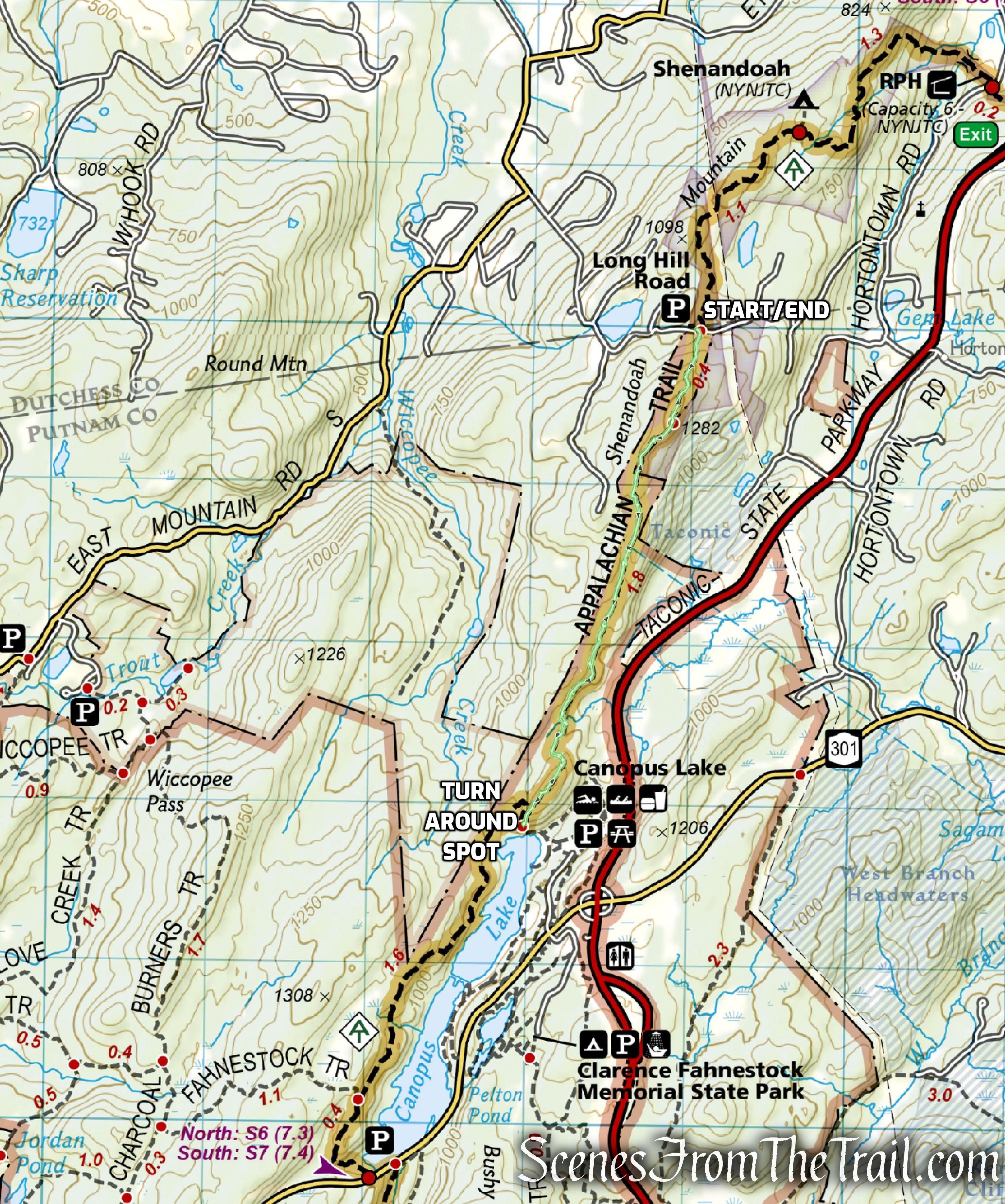
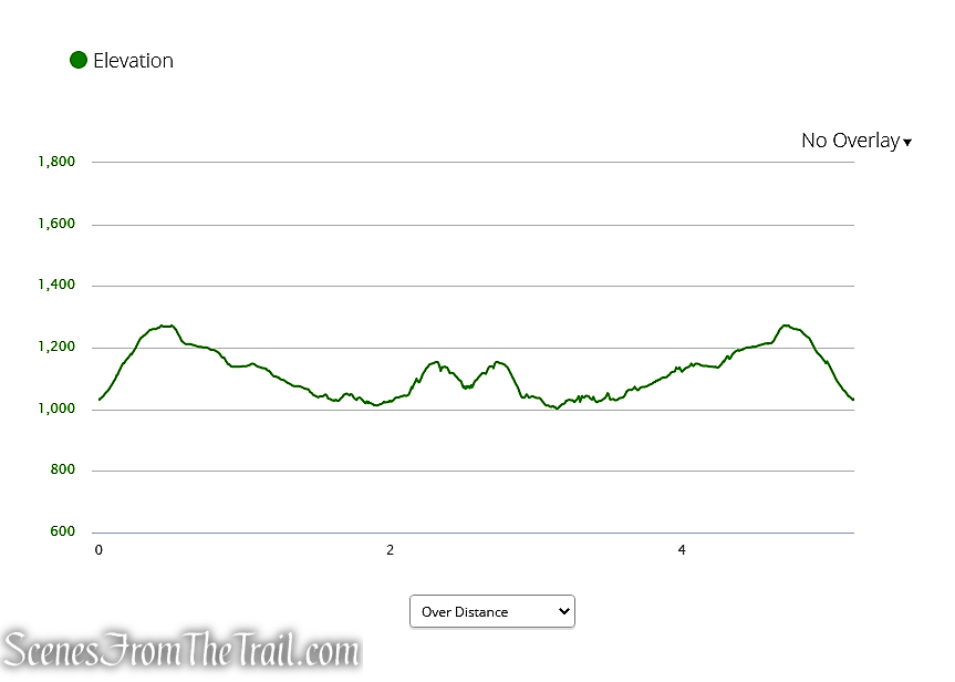
Length: Approximately 4.7 miles
Max elevation: 1,282 ft.– total elevation gain approximately 701 ft.
Route type: Out and back
Buy Map: East Hudson Trails Map
Free Web Map: Fahnestock State Park Trail Map
Avenza App Map (FREE): Fahnestock State Park Map for Avenza
Trailhead parking: 101-91 Long Hill Rd, Hopewell Junction, NY 12533
Overview:
Clarence Fahnestock Memorial State Park, also known as Fahnestock State Park, is a 14,337-acre state park located in north central Putnam County with portions in the towns of Carmel, Kent, Philipstown and Putnam Valley. The park is traversed by the Taconic State Parkway, US Route 9, NYS Route 301 and several local roads. Rail stations operated by Metro North Railroad are within ten miles of the park at Garrison, Cold Spring and Beacon. The park does not have a single, formal entrance. The park is managed and maintained by the New York State Office of Parks, Recreation and Historic Preservation.
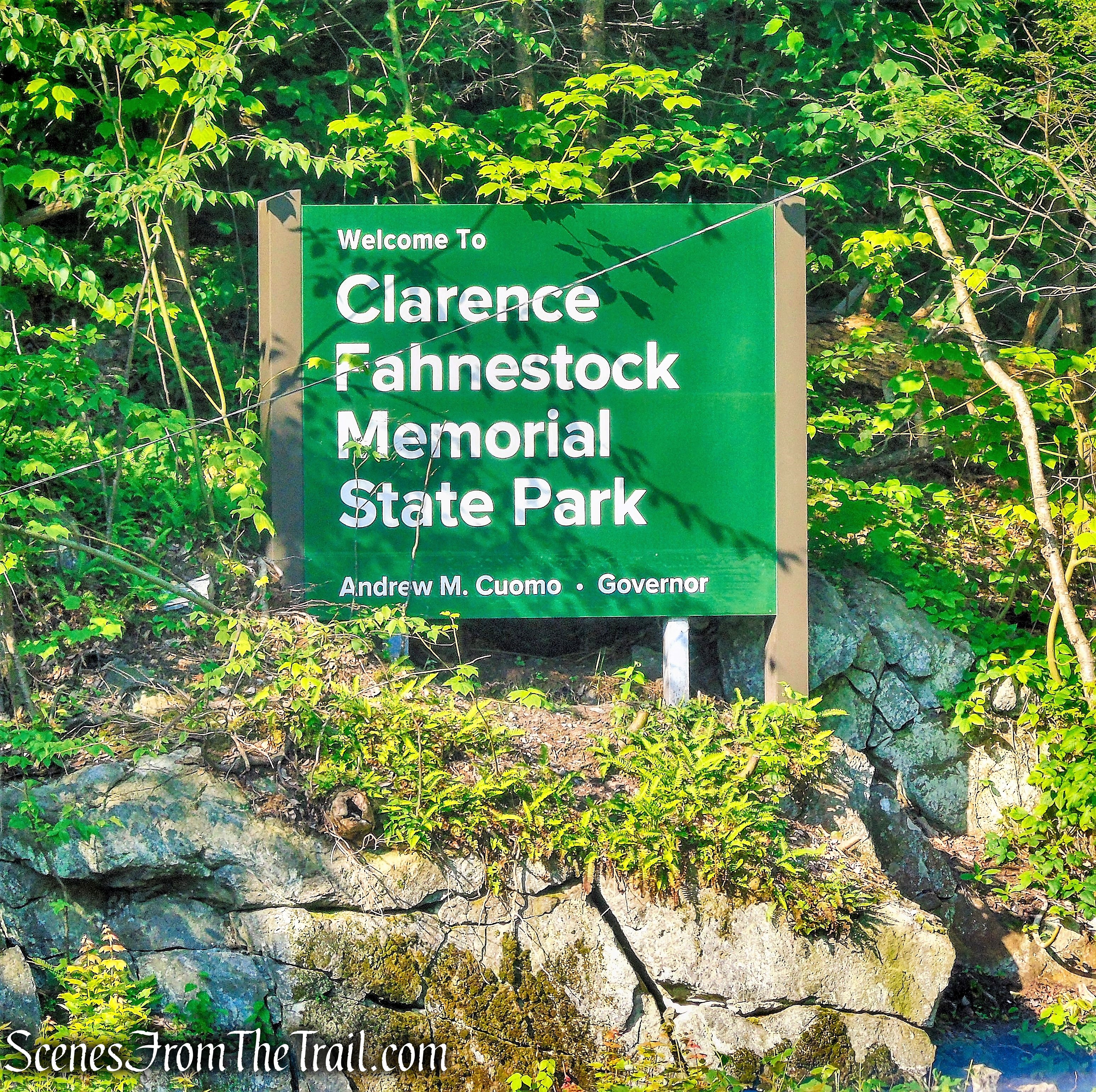
Clarence Fahnestock Memorial State Park
Fahnestock is characterized by parallel ridges and hills that trend in a southwest to northeast direction. Steep slopes are often found on the southeast and northwest aspects of some of these ridges. Elevations range from approximately 400 feet in the lowest area of the park along Clove Creek in the vicinity of U.S. Route 9, to a maximum of over 1300 feet on a ridge west of Canopus Lake. The majority of the park is at elevations greater than 600 feet. The Appalachian National Scenic Trail crosses the park in a southwest-northeast direction for over ten miles. The park receives substantial local use, and serves the New York City Metropolitan area to the south, as well as out-of-state users.
Trail Overview:
The Appalachian Trail traverses Fahnestock State Park for 10.24 miles, entering from the southern boundary of the park east of Catfish Pond, north across Route 301 past Canopus Lake, and exiting the northern end of the park at Long Hill Road, near the Dutchess-Putnam County boundary. There is parking on Long Hill Road where the trail crosses. The AT within state parkland is cooperatively managed by the Appalachian Trail Conservancy and the NYNJTC, under a formal Memorandum of Understanding with OPRHP and other entities.
Hike Overview:
Two weeks earlier, we did a hike to Canopus Lake Overlook, but due to circumstances beyond our control, we had to improvise and created a different hike on the fly. Long Hill Road is a good spot to do an out and back hike, entirely on the Appalachian Trail (AT). Please keep in mind that the approach to the parking area on Long Hill Road is not paved, steep, and in places, rutted. The road itself climbs on switchbacks with some extremely sharp curves. I would not recommend a low-lying vehicle to travel along this road. I would be hesitant as well if there is snow or heavy rain. There is room for about 8-10 cars, right where the AT crosses the road.
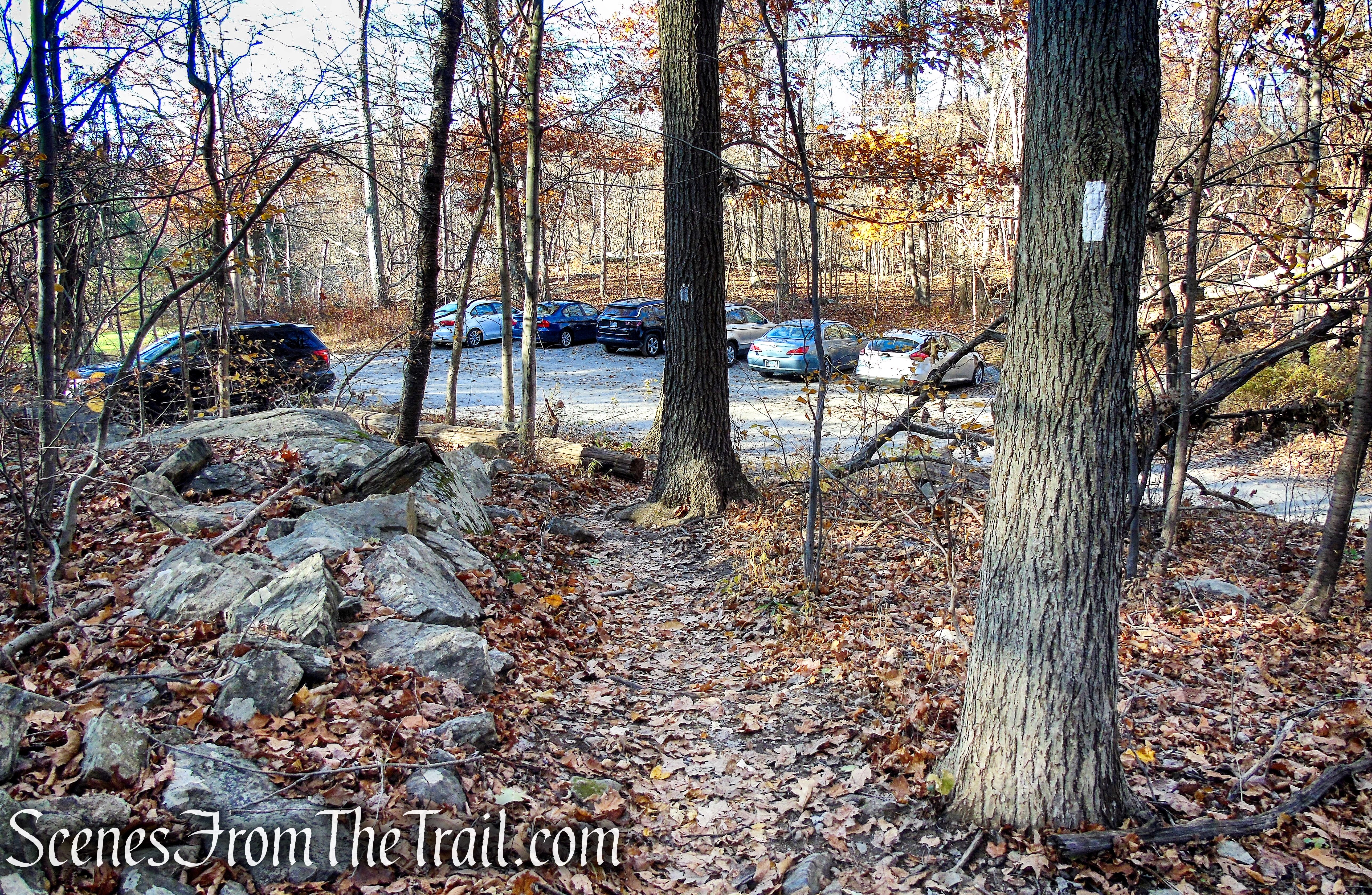
Long Hill Road trailhead
This is a straightforward out and back hike, entirely on the AT, that leads to several good scenic viewpoints. This long ridge is Shenandoah Mountain although the highpoint (1282 ft. above sea level), near Long Hill Road, is labeled as Looking Benchmark (Mountain?) on the USGS survey benchmark. The AT is well blazed and easy to follow, and for the most part, an unfrequented section of trail. We encountered three southbound through-hikers and several day hikers
Canopus Lake Overlook from Long Hill Road – Fahnestock State Park
Once the initial steep climb to the ridge is completed, it’s mostly a gradual downhill until the trail nears Canopus Lake, then it’s uphill to the Canopus Lake Overlook. From there, it’s simply a matter of retracing your steps back the way you came, to Long Hill Road.
Canopus Lake Overlook from Long Hill Road – Fahnestock State Park
The Hike:
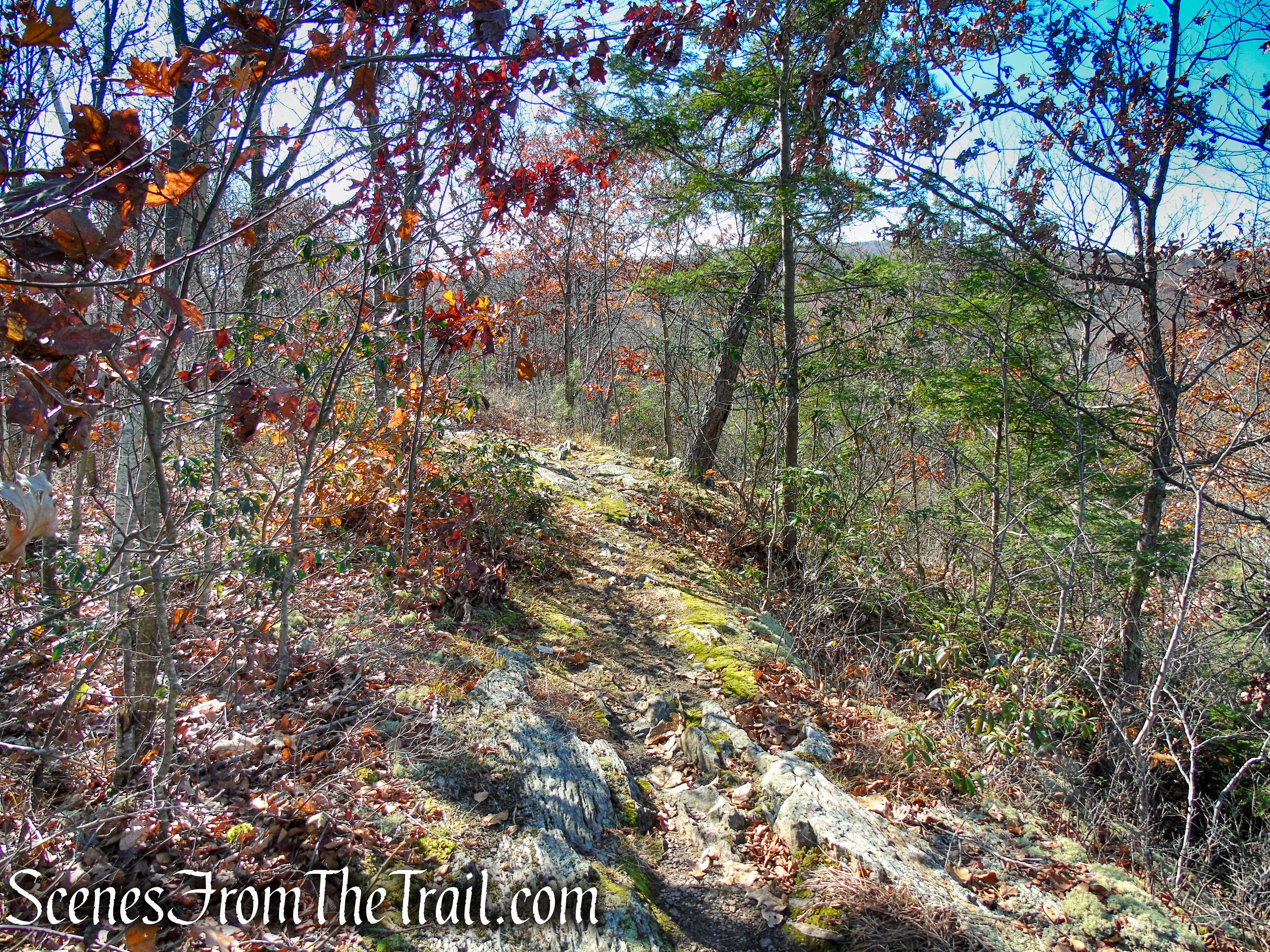
From the parking area, cross the road and head south on the white-blazed Appalachian Trail, which you will be following for the entire hike. Here, the trail enters Fahnestock State Park at its northern end and climbs Shenandoah Mountain, gradually at first then more steeply on rock steps.
Appalachian Trail – Shenandoah Mountain
Appalachian Trail – Shenandoah Mountain
Appalachian Trail – Shenandoah Mountain
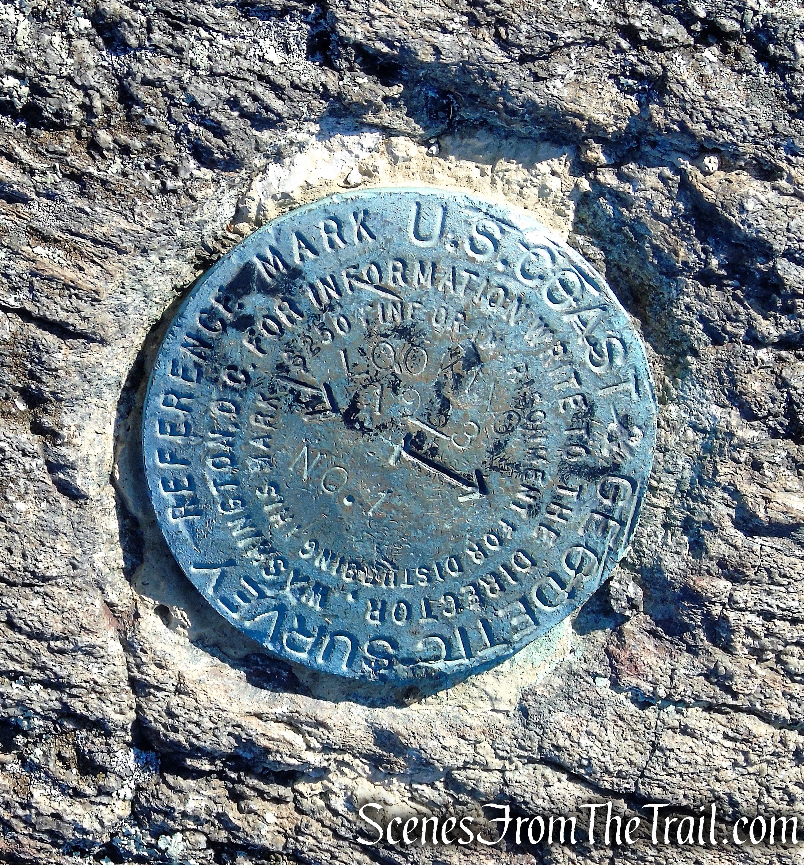
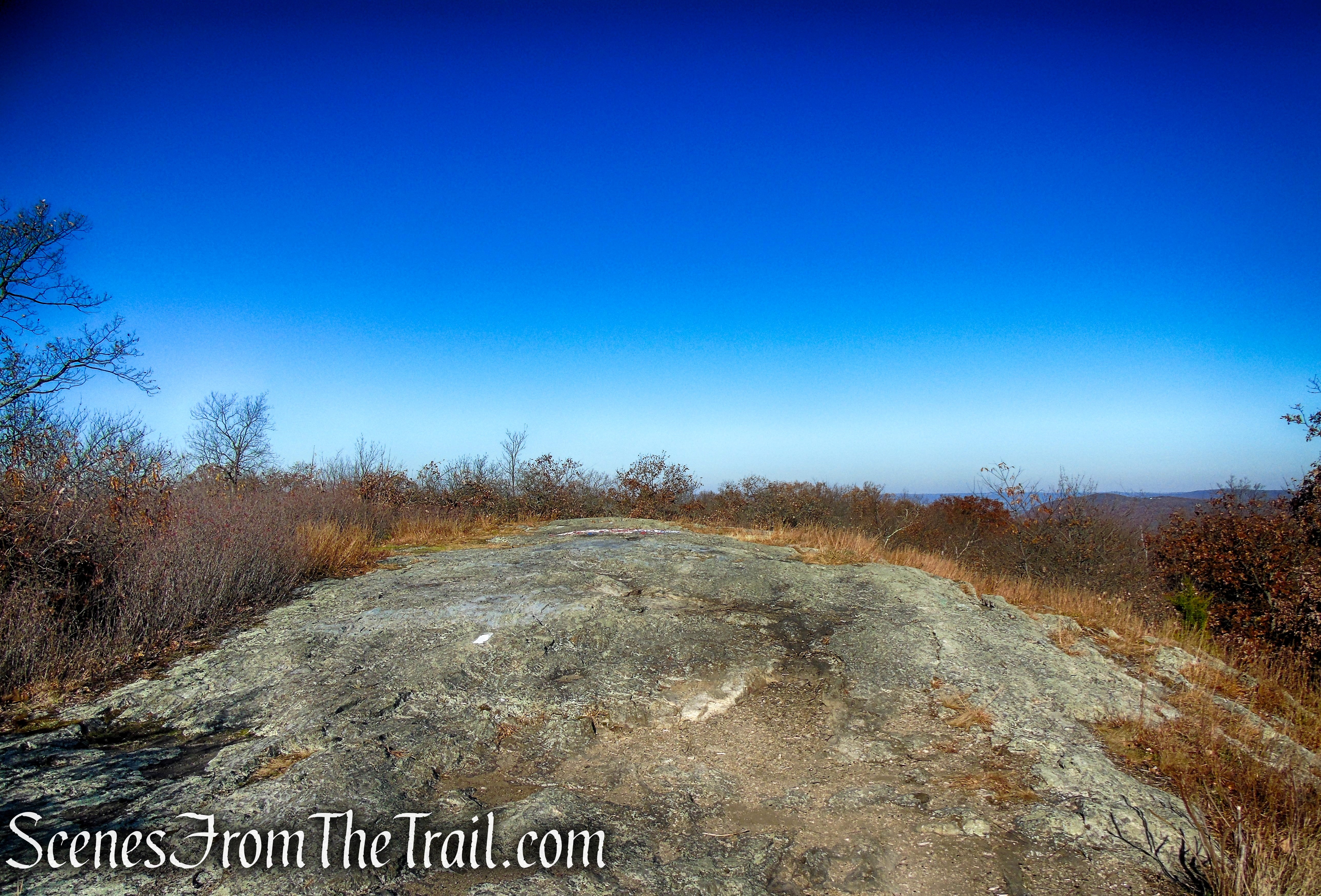
The trail levels off briefly, then continues its steep ascent. In about 0.4 mile, the AT reaches the 1282-ft. open summit of Shenandoah Mountain, marked by a USGS survey benchmark.
Appalachian Trail – Shenandoah Mountain
Appalachian Trail – Shenandoah Mountain
Appalachian Trail – Shenandoah Mountain
Appalachian Trail – Shenandoah Mountain

Appalachian Trail – Shenandoah Mountain
Appalachian Trail – Shenandoah Mountain

Looking Benchmark – Appalachian Trail
If you look closely, it is stamped LOOKING 1933. I have heard this spot referred to as Looking Rock and/or Looking Mountain, but on maps it is labeled as Shenandoah Mountain. When I inquired about it to the NY-NJ Trail Conference, I was told that the long ridge is all Shenandoah Mountain.
Looking Benchmark – Appalachian Trail
At the summit of Shenandoah Mountain, there is an American flag painted on the rock, in memory of September 11, 2001.

Appalachian Trail – Shenandoah Mountain
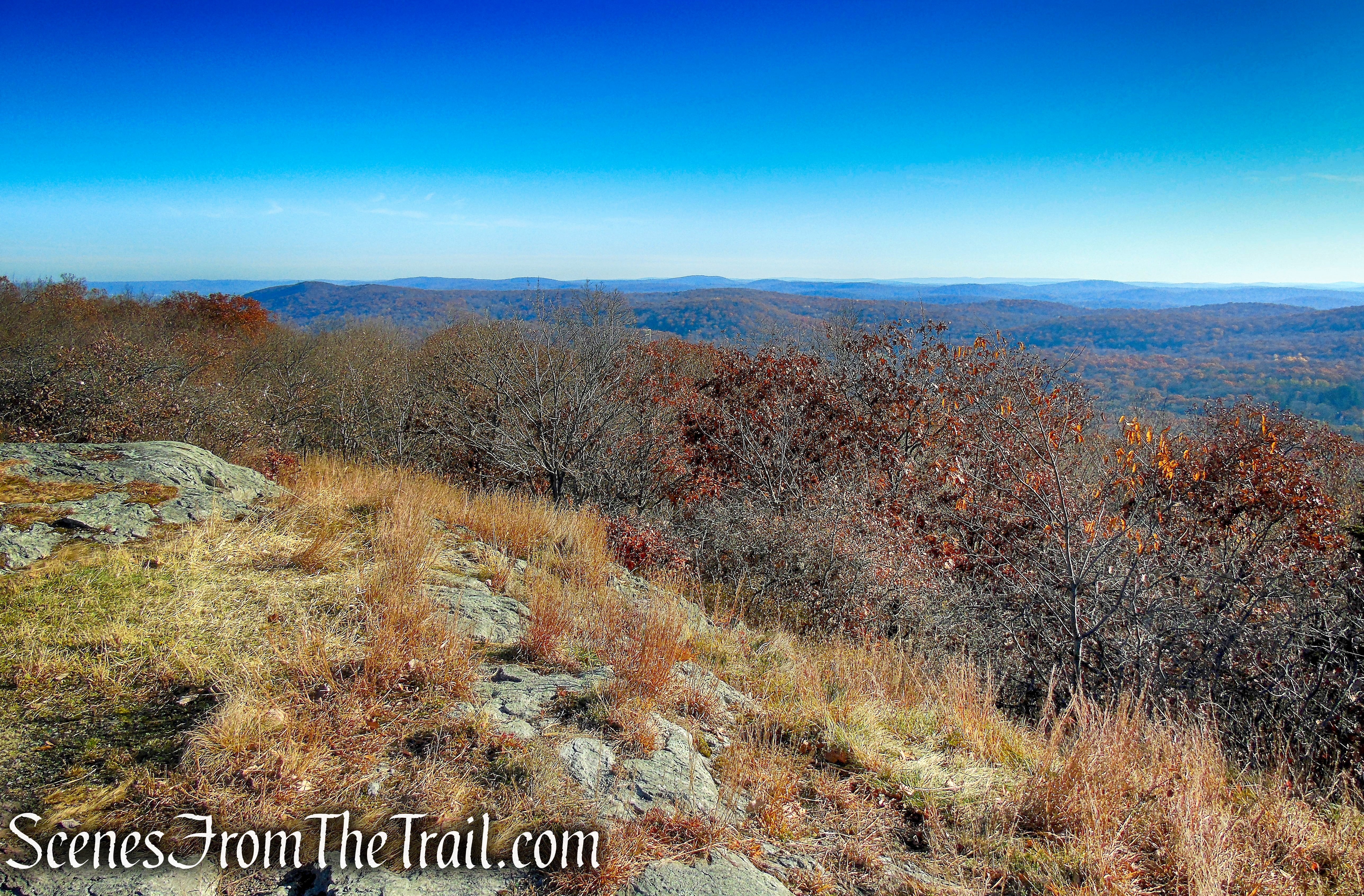
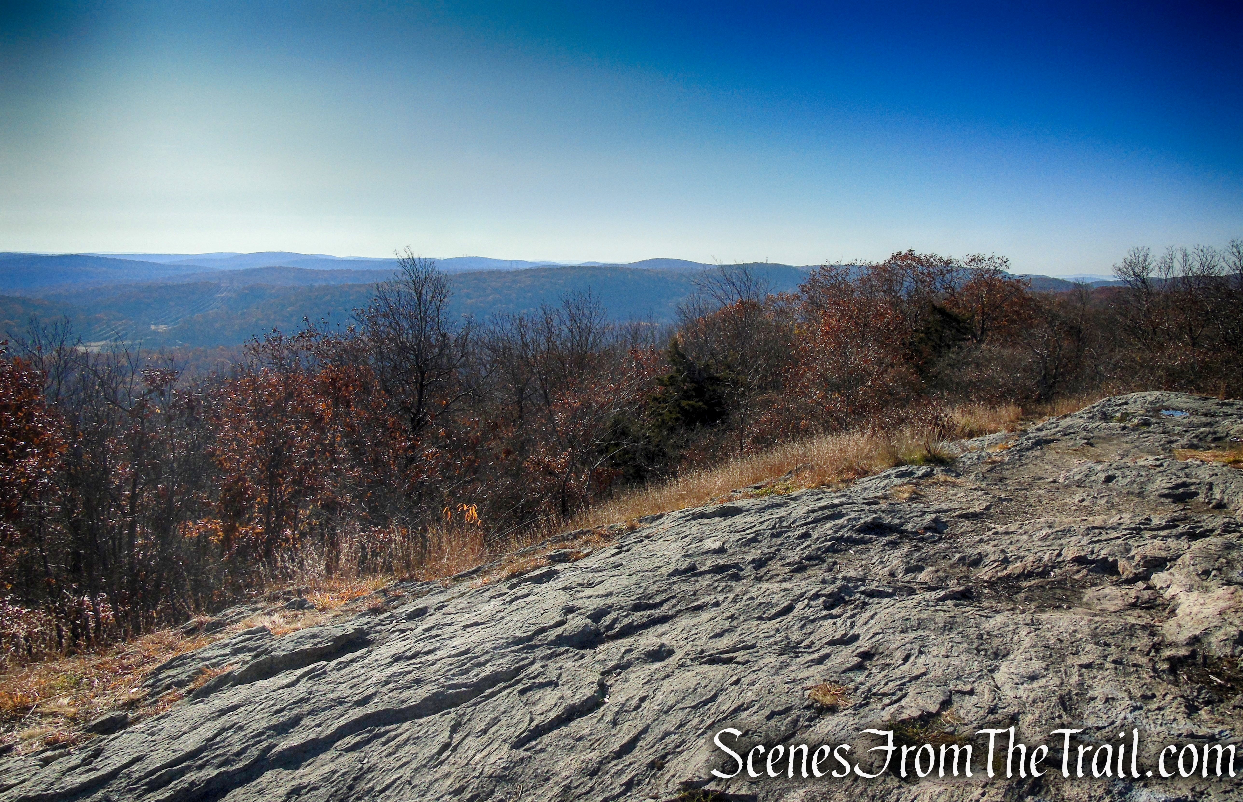
You have now hiked about 0.4 mile, with more than 250-ft. of elevation gain. This makes a good spot to take a breather and enjoy the views. The view southeast from the summit of Shenandoah Mountain.

Appalachian Trail – Shenandoah Mountain
The view northeast towards Dutchess County from the summit of Shenandoah Mountain.
Appalachian Trail – Shenandoah Mountain
South-facing view of the East Hudson Highlands.
Appalachian Trail – Shenandoah Mountain
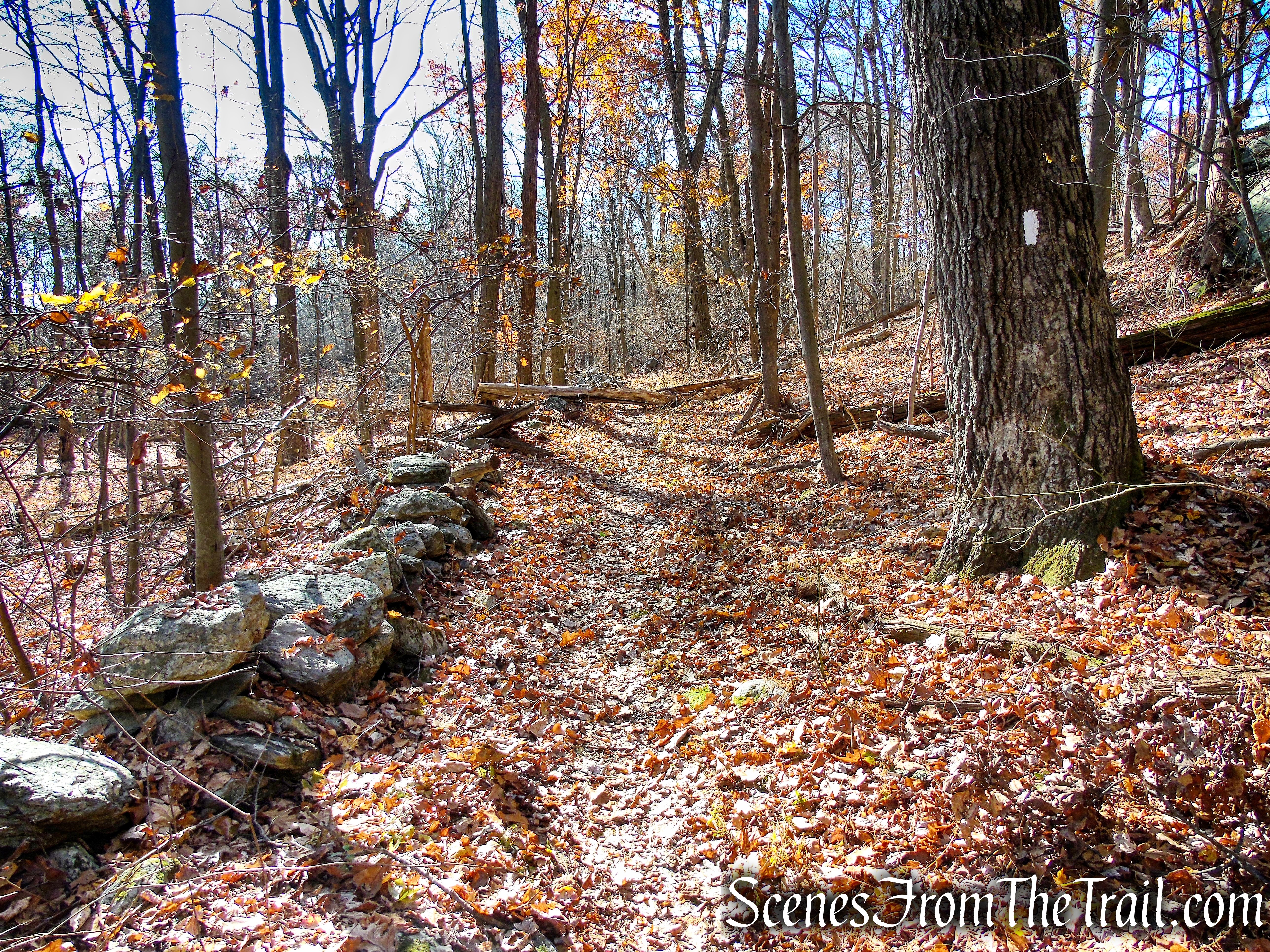
When you are ready to continue, proceed south on the AT as it leaves the summit and reenters the woods. The trail descends, dipping down into the valley and turns left on an old woods road, bordered by a stone wall. As you continue along the AT, you may notice more stone walls and some cellar holes from homesteads long ago. Imagine folks that called this home, cultivating the rugged landscape in order to survive.
Appalachian Trail – Shenandoah Mountain
In just over a mile from the summit, the AT comes to a junction with a blue-blazed trail and turns right. Continue to follow the white blazes as they begin a steady climb, gradually at first, then more steeply, passing some interesting rock formations along the way.
turn right to remain on Appalachian Trail
Appalachian Trail – Shenandoah Mountain
Appalachian Trail – Shenandoah Mountain

Appalachian Trail – Shenandoah Mountain
In another 0.6 mile, look for a short unmarked spur trail to the right that leads to a west-facing view of the surrounding hills.
Appalachian Trail – Shenandoah Mountain
When you are ready to proceed, continue south on the AT about another 750 feet to the Canopus Lake Overlook.
Appalachian Trail – Shenandoah Mountain
From this south-facing viewpoint, you can see most of Canopus Lake. Canopus Lake at an elevation of 915 feet, is a 104-acre lake with a shoreline of approximately 3.7 miles. The lake was created in the mid-1930’s by the Civilian Conservation Corps (CCC). If you look down below to the left, Canopus Beach is visible through the trees. This is your turn around spot and makes an excellent place to relax and enjoy a snack.
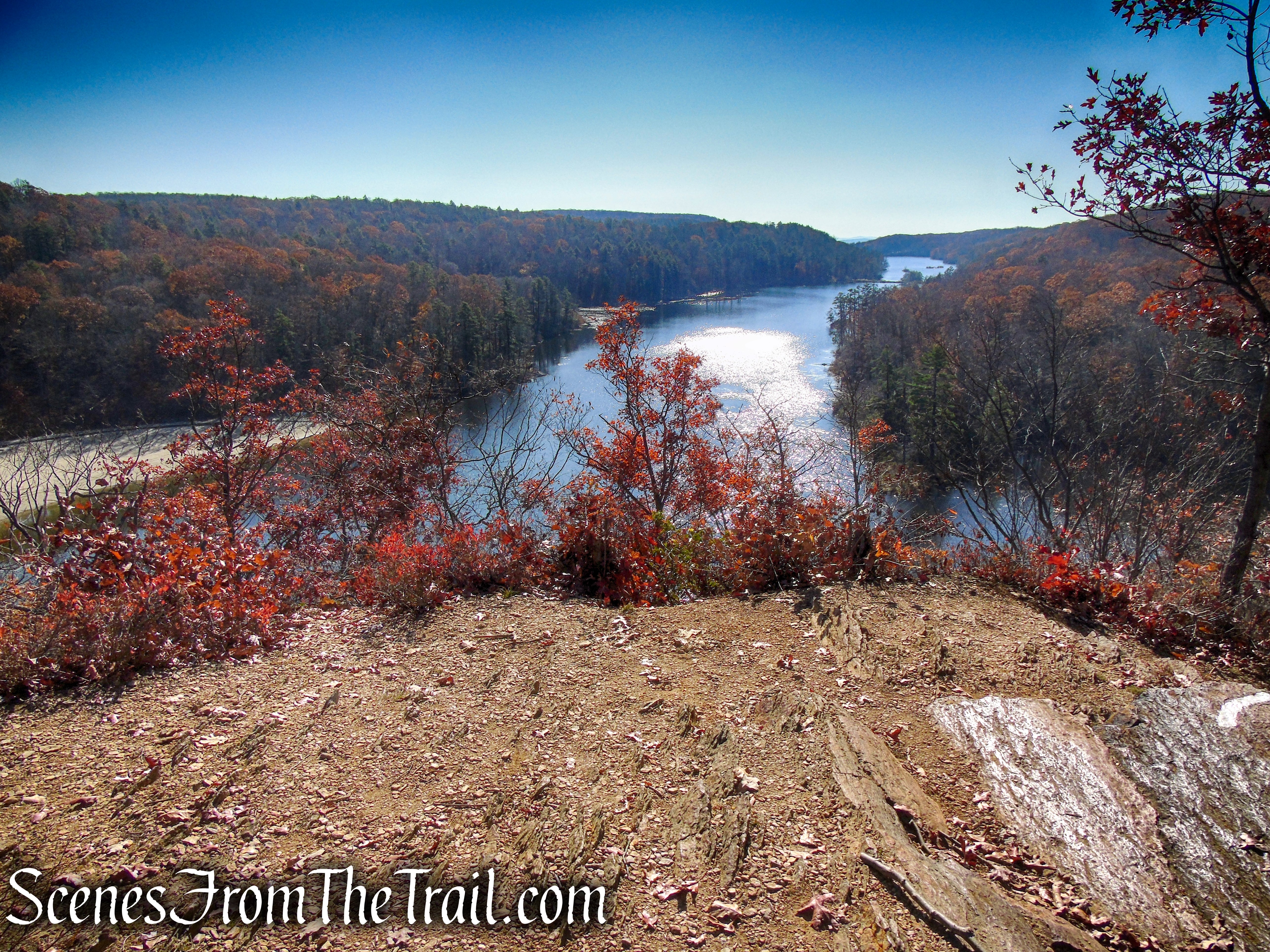
Canopus Lake Overlook Loop – Appalachian Trail
When you are done soaking in the scenery, retrace your steps along the AT (heading north), and in about 1.8 miles, you will be back at the Looking Rock Benchmark, where you may want to snap some more pics.

Appalachian Trail – Shenandoah Mountain
Appalachian Trail – Shenandoah Mountain

Appalachian Trail – Shenandoah Mountain
From the summit, it’s only 0.4 mile to the parking area on Long Hill Road, where the hike began.
Appalachian Trail – Long Hill Road trailhead
While eating and drinking post hike, we ran into an AT south bounder, trail name “Trouble.” We had a nice conversation and offered him some food and drink. A nice guy, hope he made it to his destination.
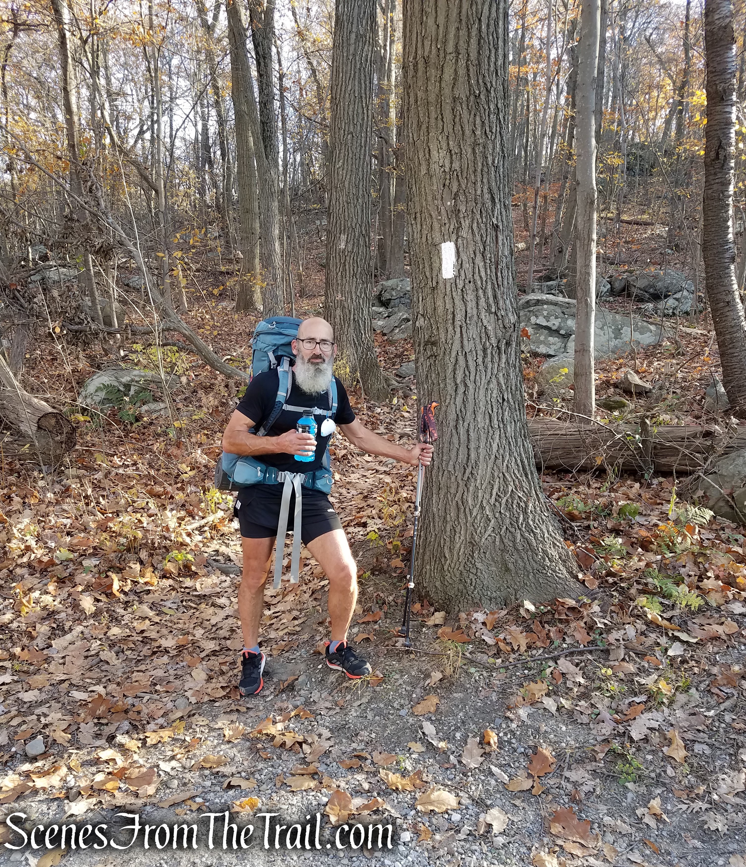
Trouble – AT south bounder
Review:
A very enjoyable hike along the Appalachian Trail. No crowds, great views and a September 11 Memorial at the summit. Even though I prefer loop hikes, this out and back was quite nice. The best thing about it was that we mostly had the trail to ourselves as well as the viewpoints. A good alternative to some of the more popular (and crowded) trails in the Hudson Valley.
Pros:
Appalachian Trail, scenic views, Shenandoah Mountain, lesser trafficked area.
Cons:
Long Hill Road can be treacherous in bad weather or with the wrong vehicle.
Take a hike!

Canopus Lake Overlook from Long Hill Road – Fahnestock State Park
Sources:
