September 20, 2020 – Washington, Connecticut
Difficulty: Moderate
Length: Approximately 5 miles
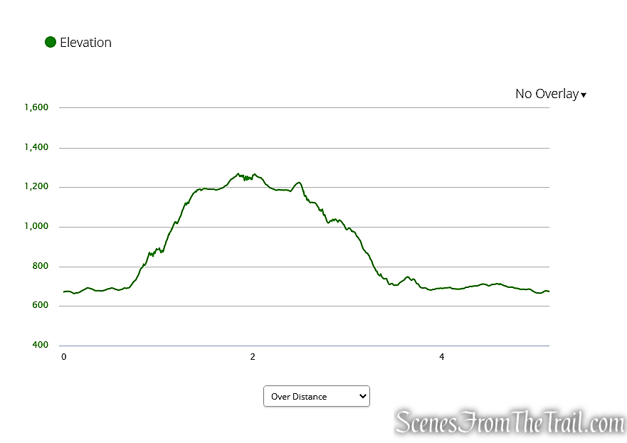
Max elevation: 1,280 ft.– total elevation gain approximately 712 ft.
Route type: Circuit
Free Web Map: Macricostas Preserve Trail Map 2020
Avenza App Map (FREE): Macricostas Preserve Trail Map
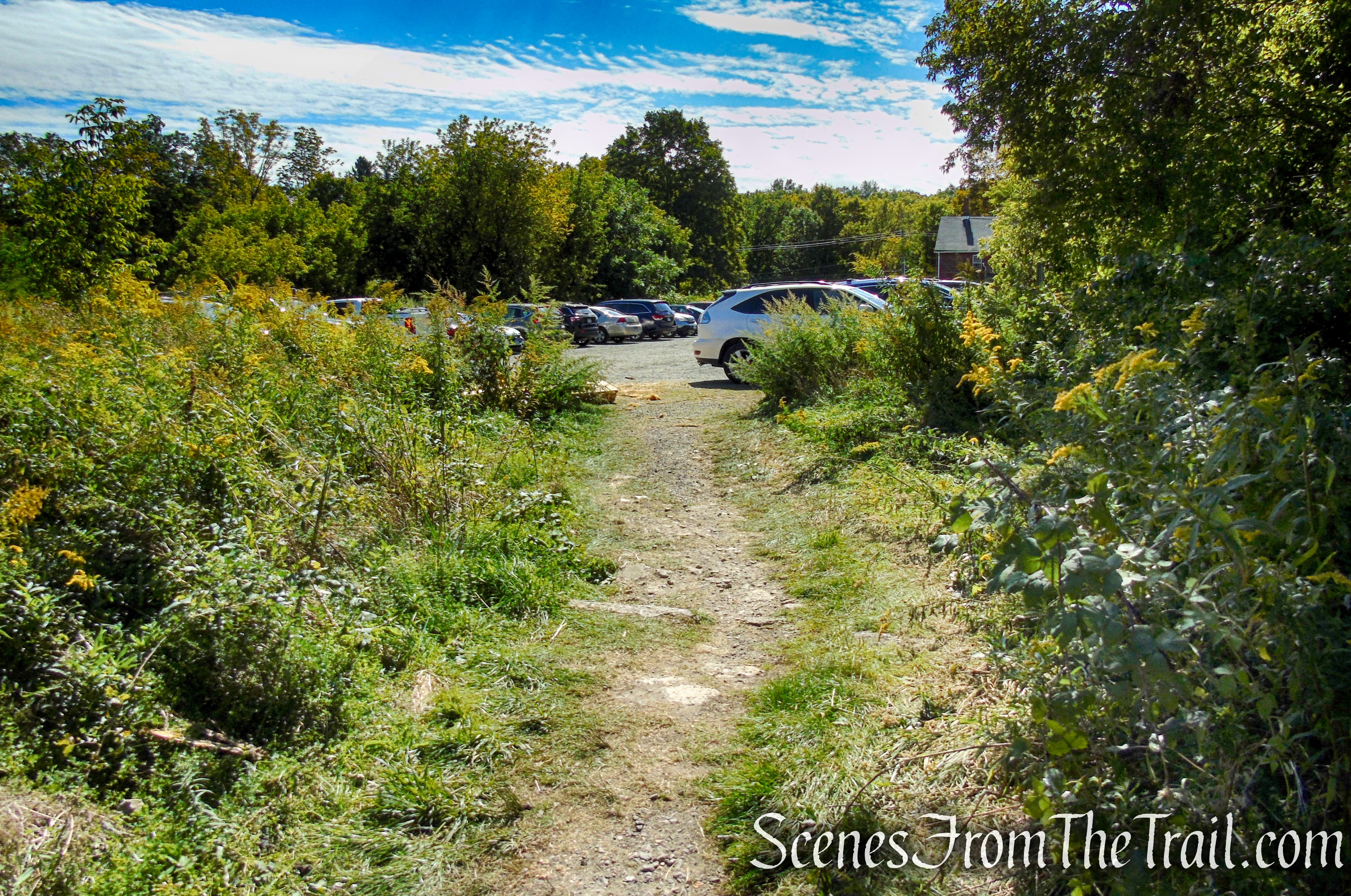
Trailhead parking: 124 Christian St, New Preston, CT 06777
The preserve is open daily, Sunrise to Sunset
Macricostas Preserve is “Carry in-Carry out,” Do not litter.
Overview:
The Macricostas Preserve is home to 490 acres of breathtaking landscapes, rare species of birds and blooming wildflowers. This patchwork of contrasting terrains; forest, ridges, swamplands, meadows, and running water, encompass a taste of all those landscapes that hikers have come to love. All starting from a single trailhead tucked away in the hills of Washington, Connecticut.
Meeker Swamp is located in the center of the preserve and essentially splits the remainder of Macricostas Preserve in two halves. The rocky ridge and woodlands to the north and the meadows to the south. The swamp itself acts as the headwaters of Bee Brook, which emerges from the wetlands to meander throughout the southern half of the Preserve on its way to feed the nearby Shepaug River.
Macricostas Preserve
Macricostas Preserve is one of three public preserves owned by Steep Rock Association (SRA). Steep Rock Preserve and Hidden Valley Preserve are the other two. SRA is is a non-profit land trust whose mission is to conserve ecologically and historically significant landscapes in and around Washington, CT and the Shepaug River Valley and to enhance the community’s connection with nature. SRA is entirely funded by donations from visitors.
History:
At one time, the property was slated for subdivision, destined to hold hundreds of private homes. In a 1978 development project known as The Washington Glen, investors envisioned an adult community of 265 one to three bedroom homes, 190 acres of shared recreational space and a community waste treatment plant.
Purchased in 2000 in a “bargain sale” from Constantine Macricostas, the 238-acre parcel was also commonly known as “Meeker Swamp.” It was bought with a combination of funds from the Town of Washington, Connecticut’s Open Space and Watershed Land Acquisition Program, and the Steep Rock Association, via individual contributions. Contiguous to four other previously donated parcels and subsequent adjacent land acquisitions, have expanded Macricostas Preserve to its current 490 acres.
Constantine “Dino” Macricostas is a Greek-born, award-winning entrepreneur who has held private business in Brookfield since 1960, before which he attended University in Hartford and served in the US Army. He is no stranger to philanthropy, and has given generously to Western Connecticut State University, The American School of Classical Studies in Athens and to the Steep Rock Association.
Trails Overview:
There are 6 miles of trails in Macricostas Preserve, with some new trails being established which would add to the total in the near future.
Hiking trails in the northern section of Macricostas Preserve ascend the slope of Waramaug’s Rock, a forested ridge that rises to an elevation of 1280 feet and rewards those who reach the summit with an excellent overlook of picturesque Lake Waramaug in the distance.
In the southern section, the trails loop around a hay field, with a short spur trail leading to a viewing platform over Meeker Swamp.
Hike Overview:
I happen to see an image of the view from Waramaug’s Rock online and decided that I wanted to hike to that spot. I was not disappointed, as this was worth the 70 minute drive from the Lower Hudson Valley in New York. As usual in this day and age of trails being crowded, we got an early start and arrived at the trailhead shortly after 8am on a Sunday morning. There were several cars in the ample parking lot when we arrived, but when we returned to the trailhead at approximately 12:30pm, the lot was full, and vehicles waiting to park.
The plan was to hit as many of the trails and points of interest as possible. With the exception of the Pinnacle Valley Trail (0.5 mile) and the Waramaug’s Trail (1 mile), we did just that.
This hike is mostly a loop that was done clockwise, but several times we did retrace our steps.
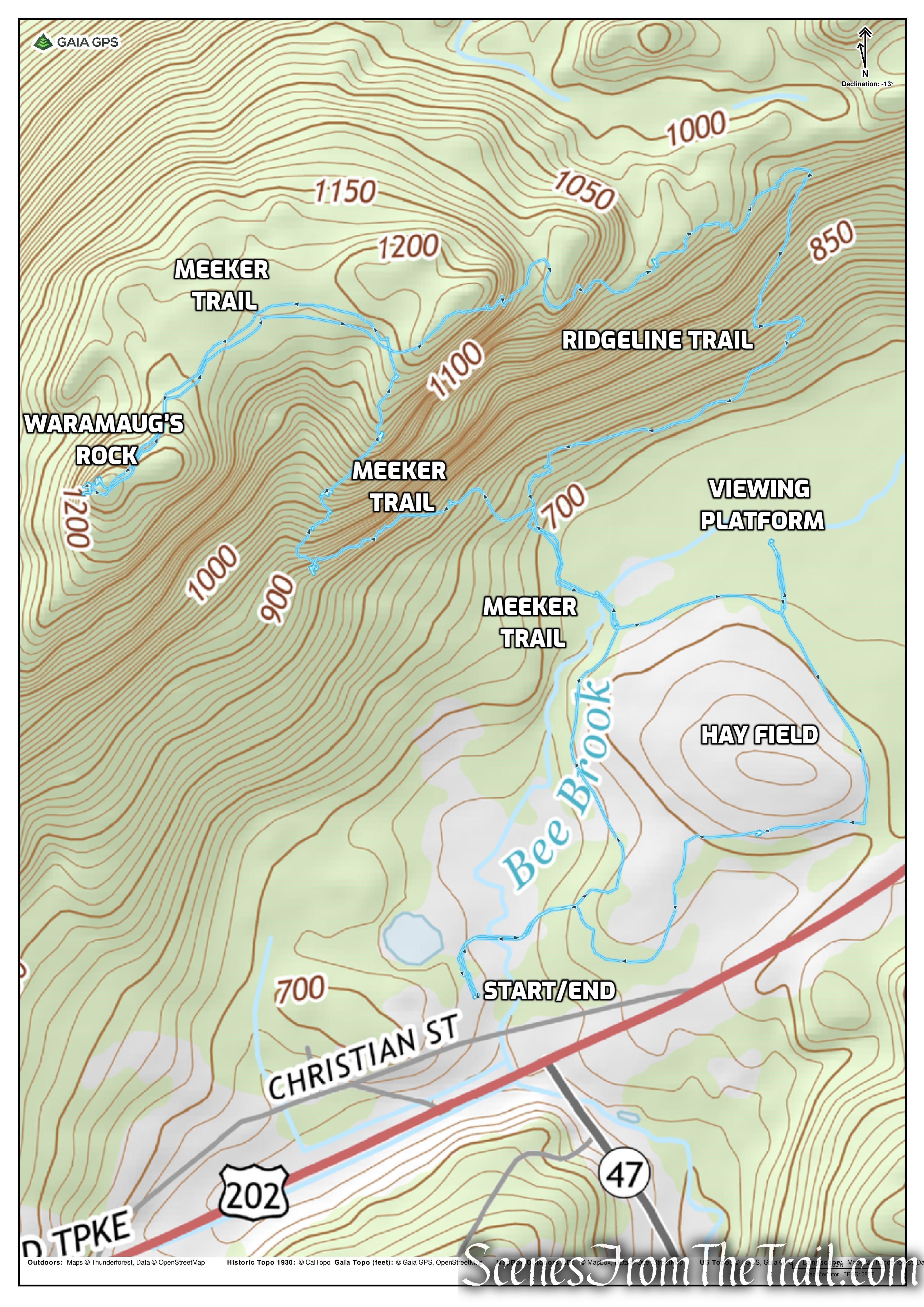
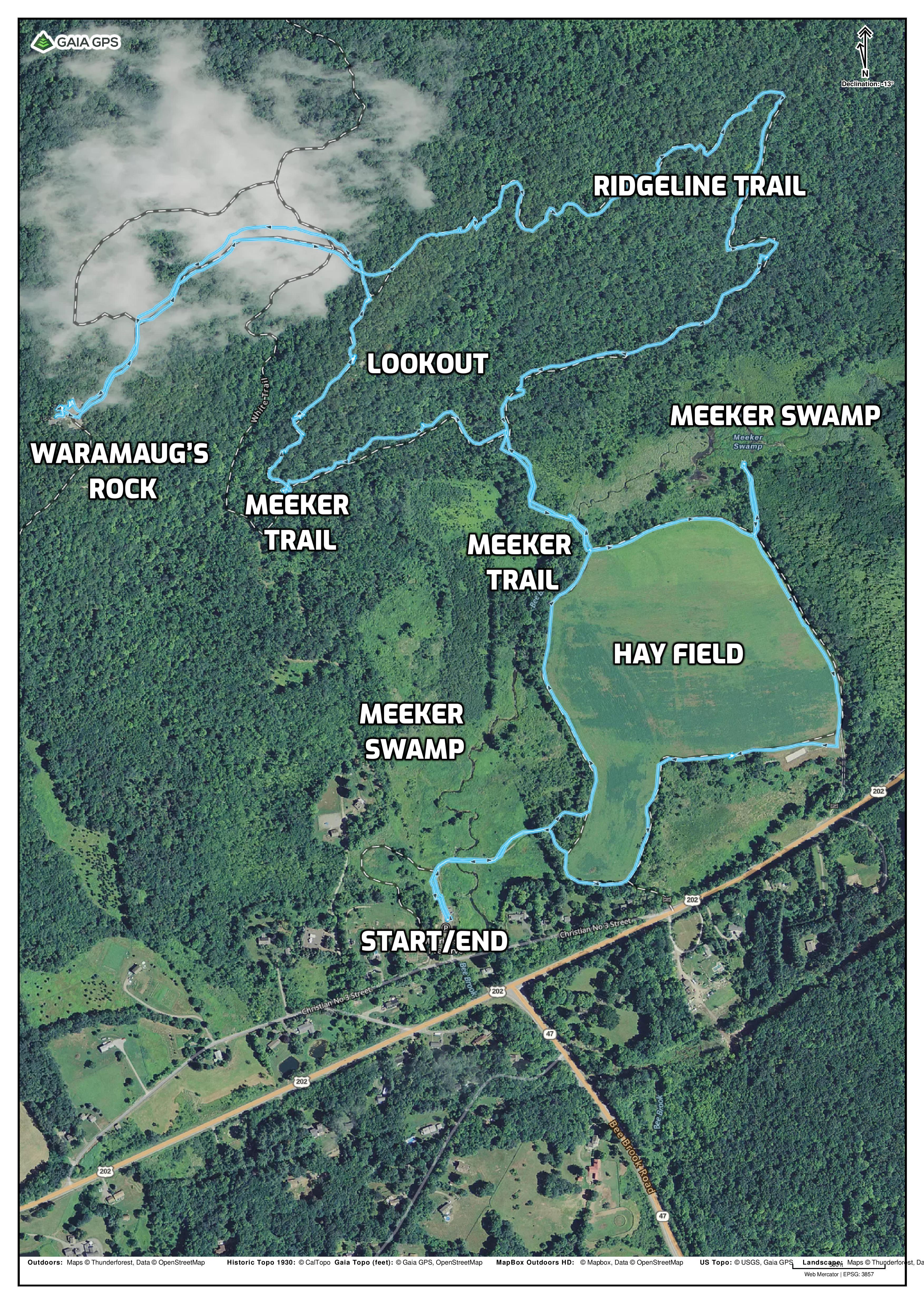
Macricostas Preserve Loop
Macricostas Preserve Elevation Graph
The Hike:
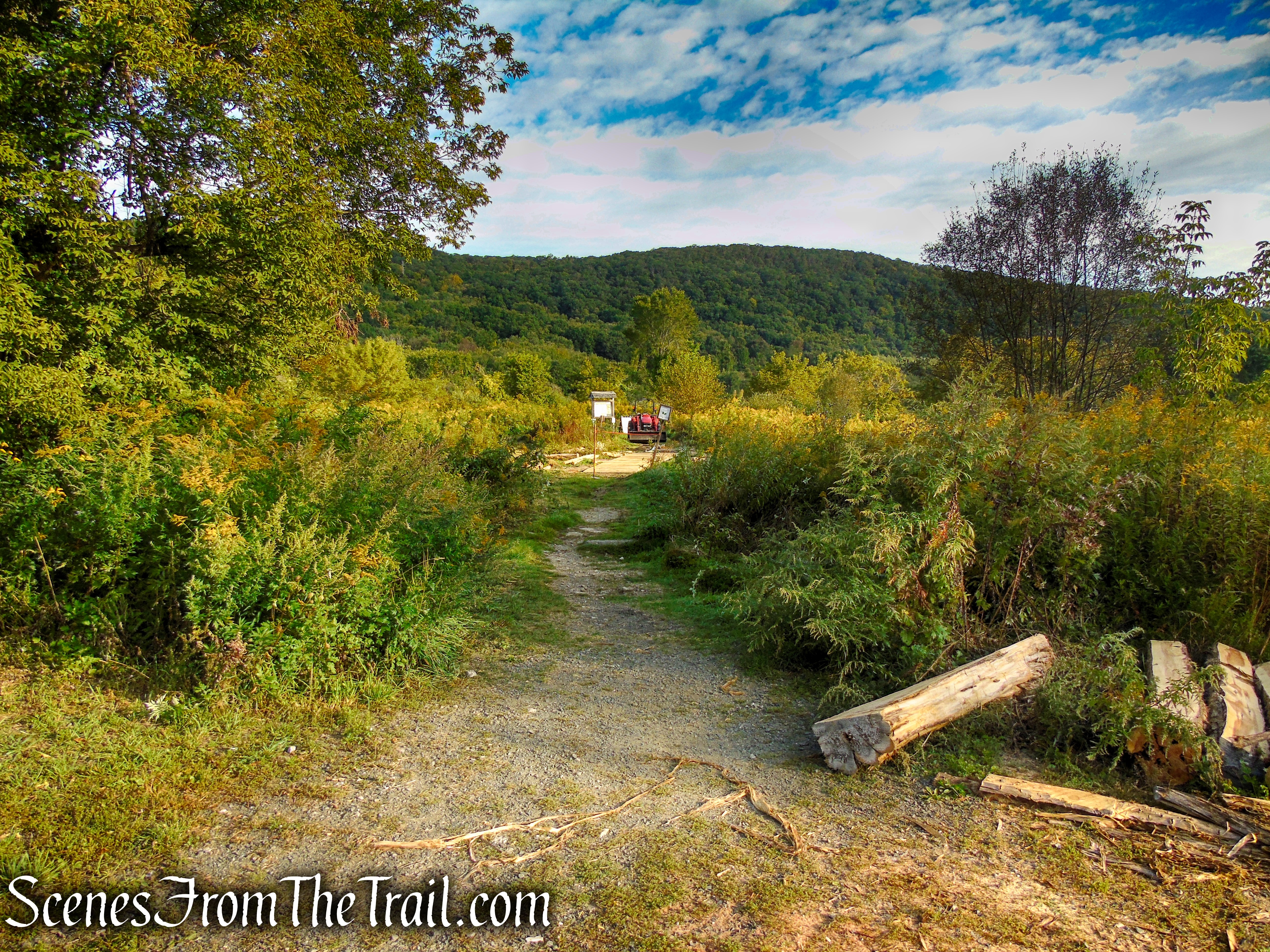
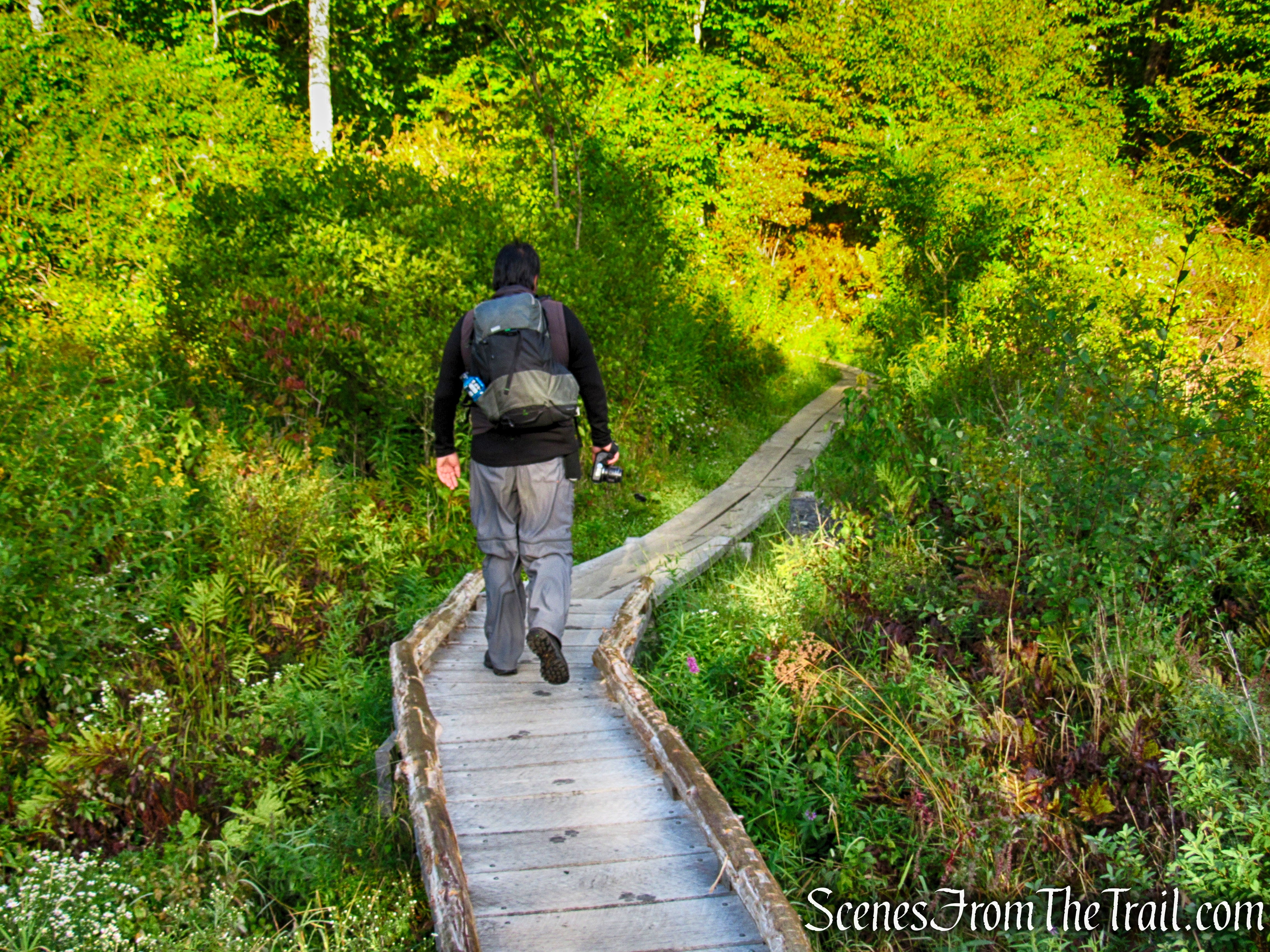
On the day of our hike, they were working on a new section of boardwalk from the parking lot to the kiosk. The work has since been completed.
trailhead – Macricostas Preserve
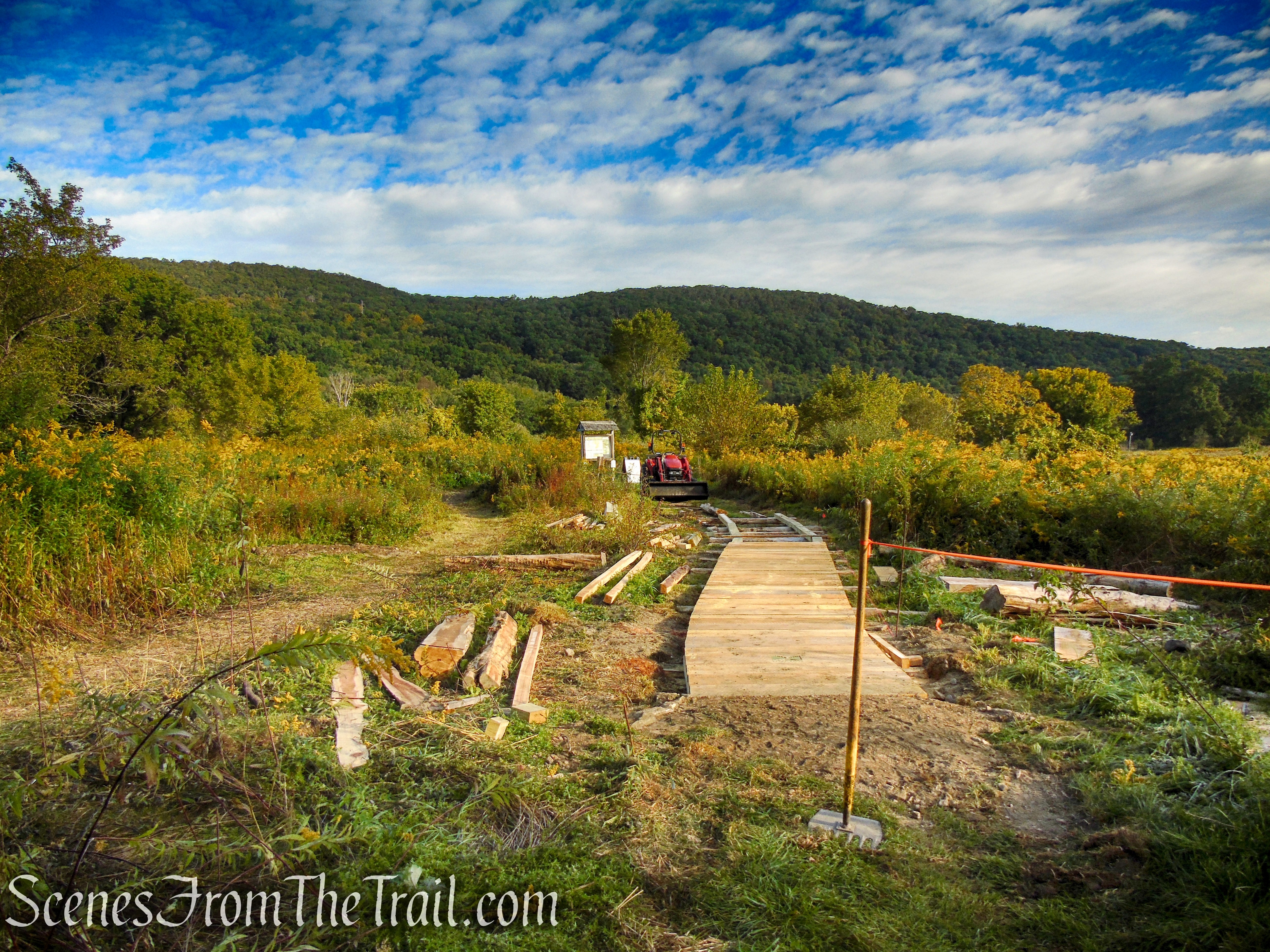
trailhead – Macricostas Preserve
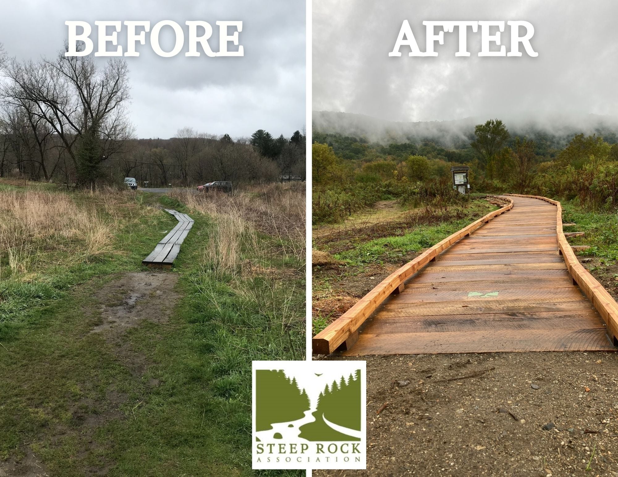
Macricostas Preserve Boardwalk
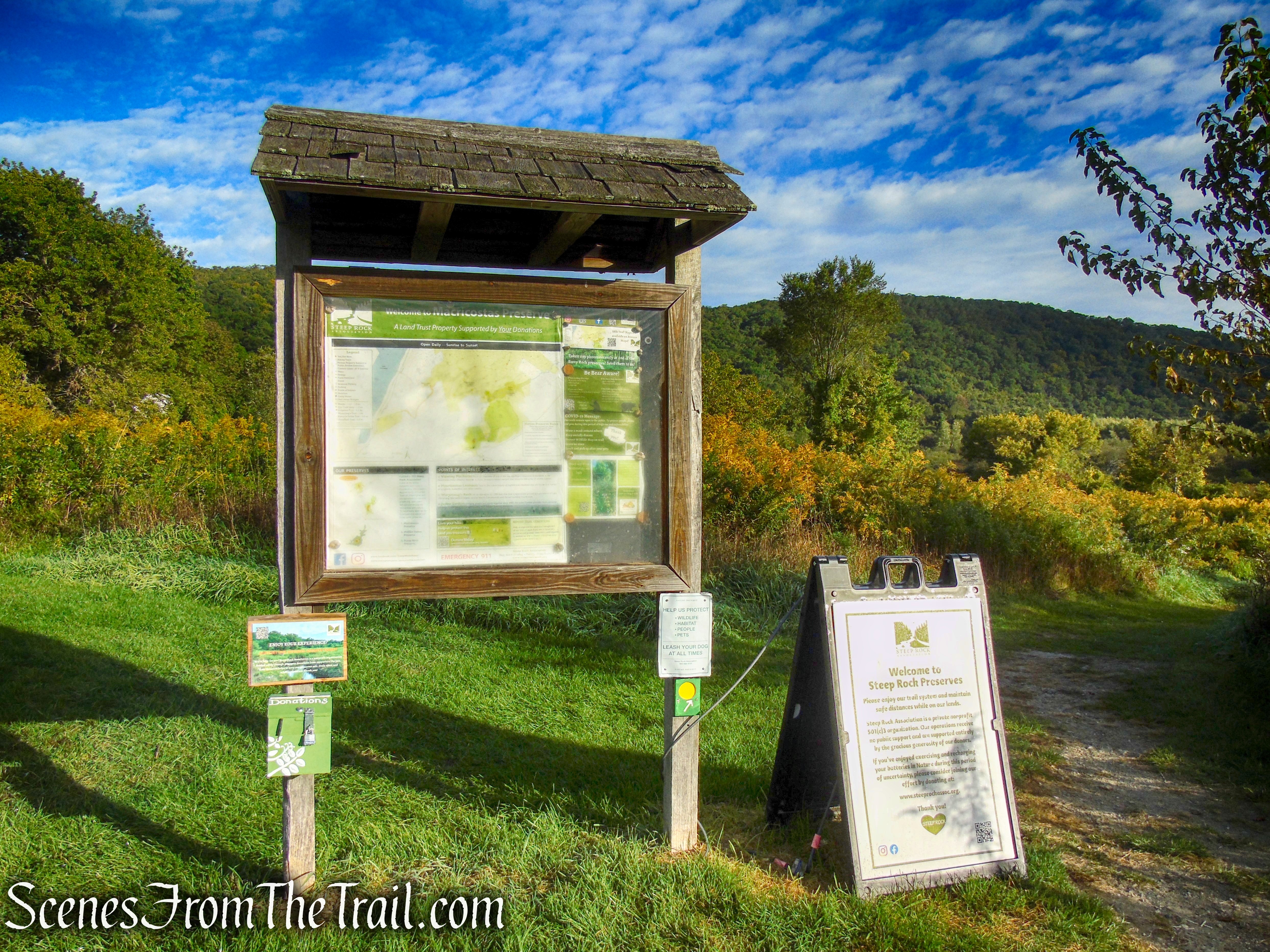
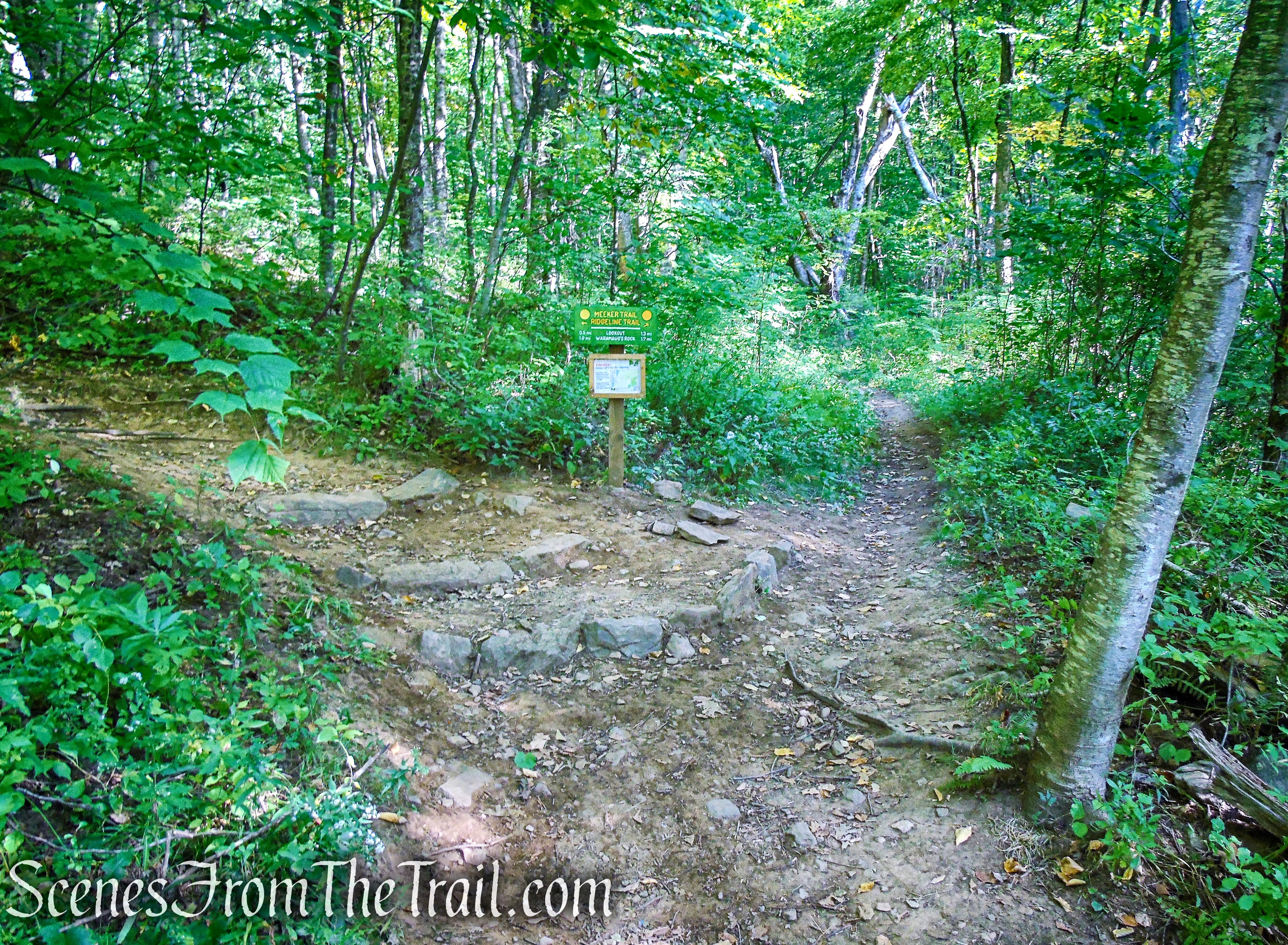
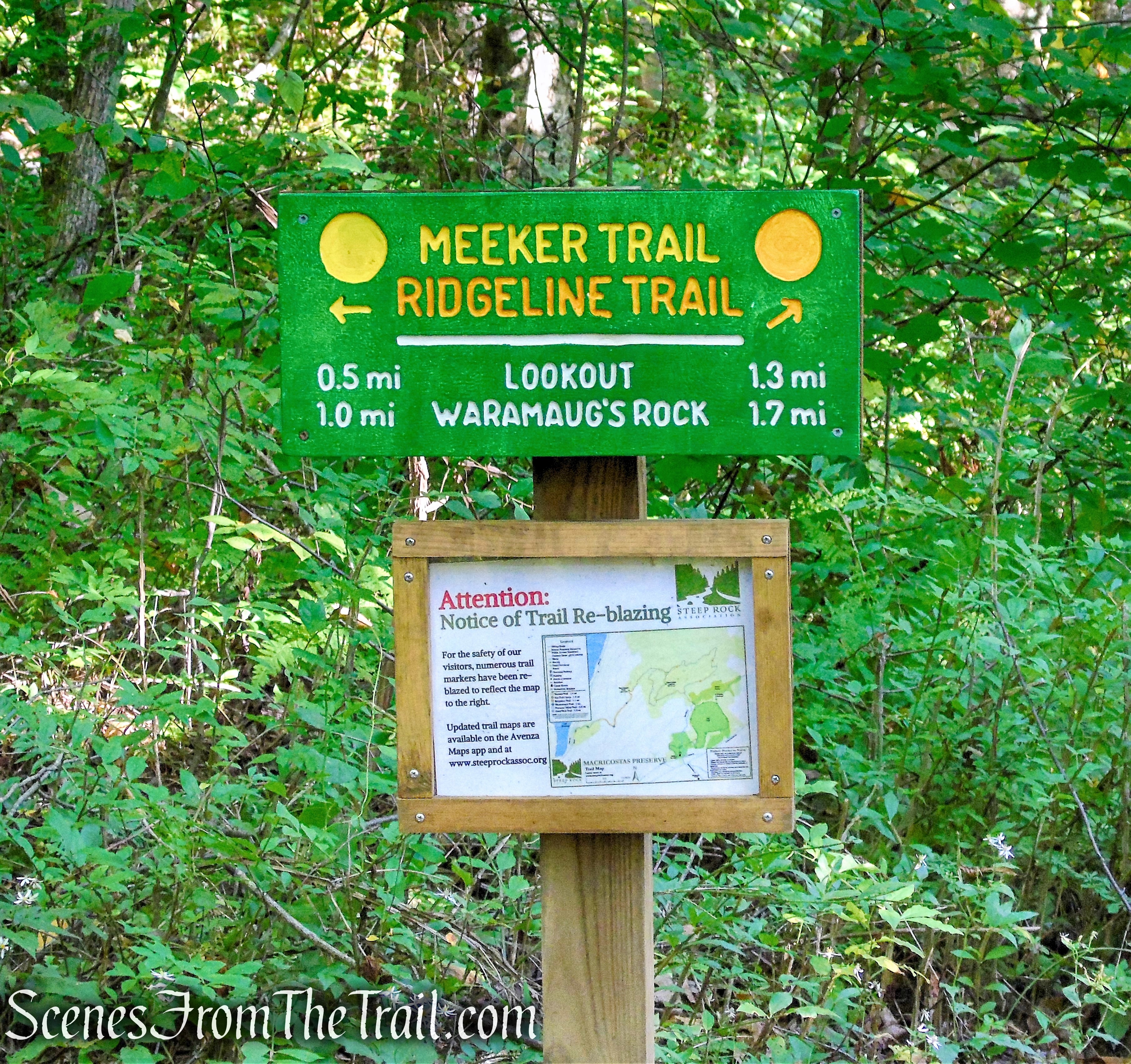
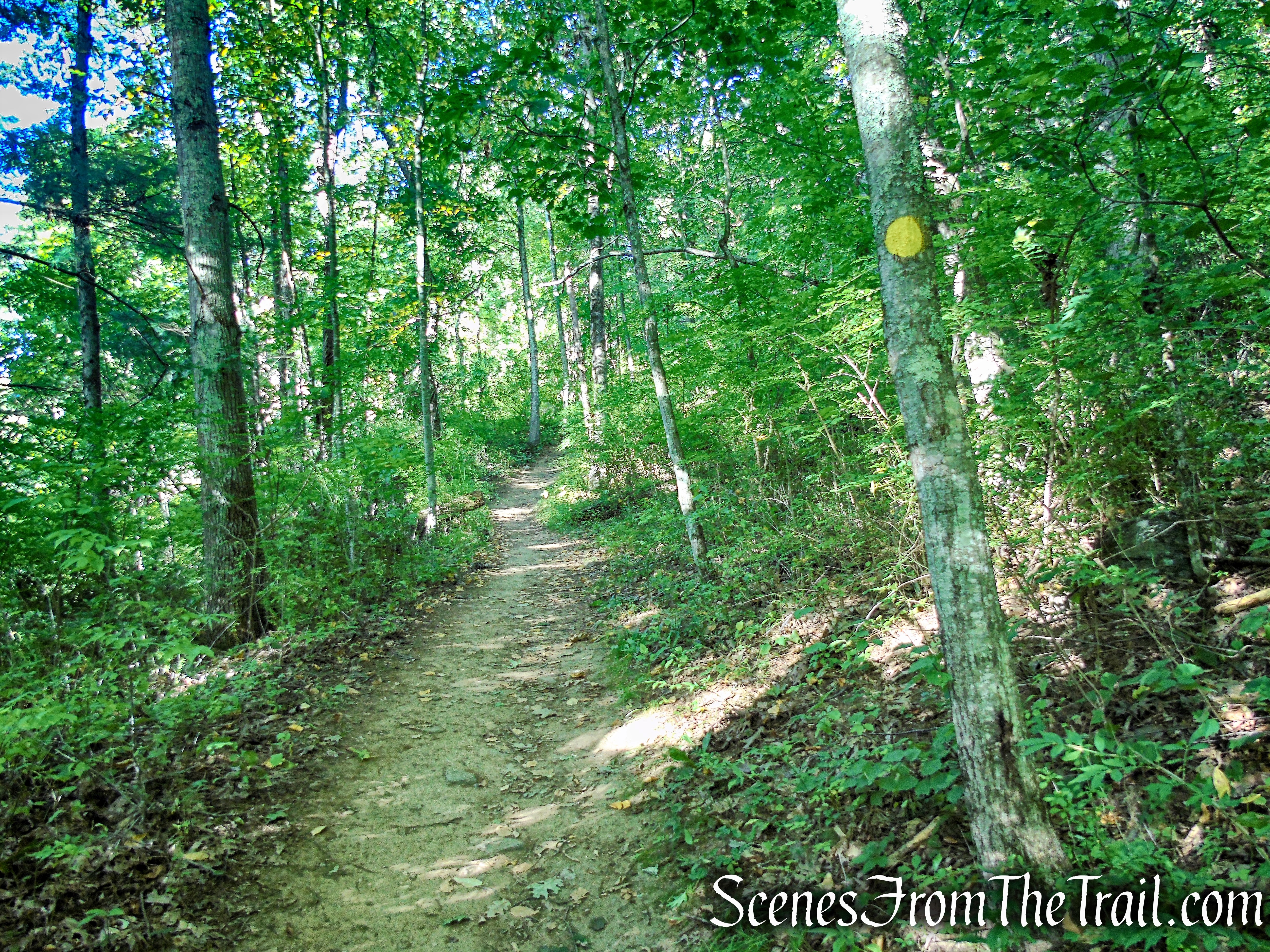
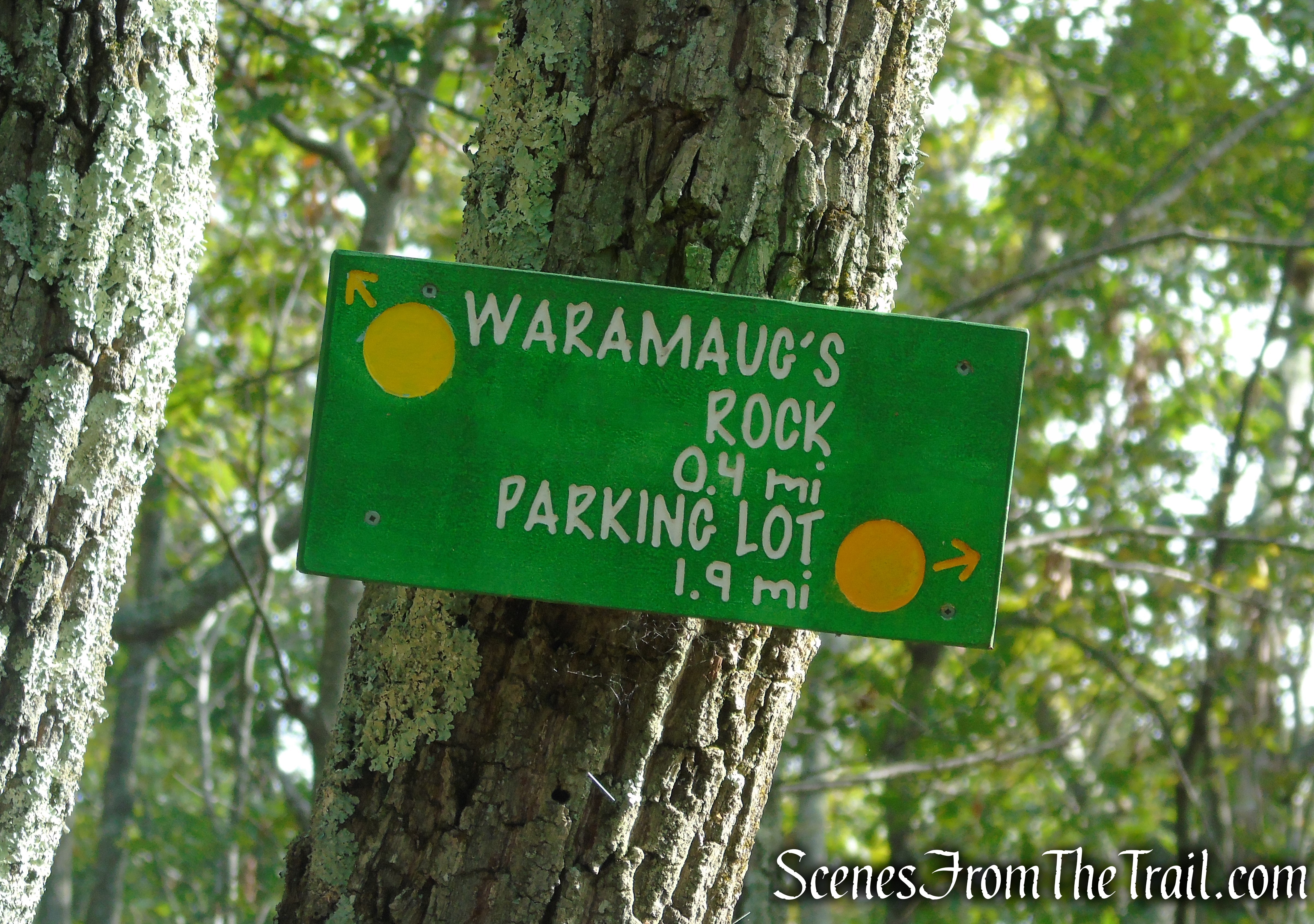
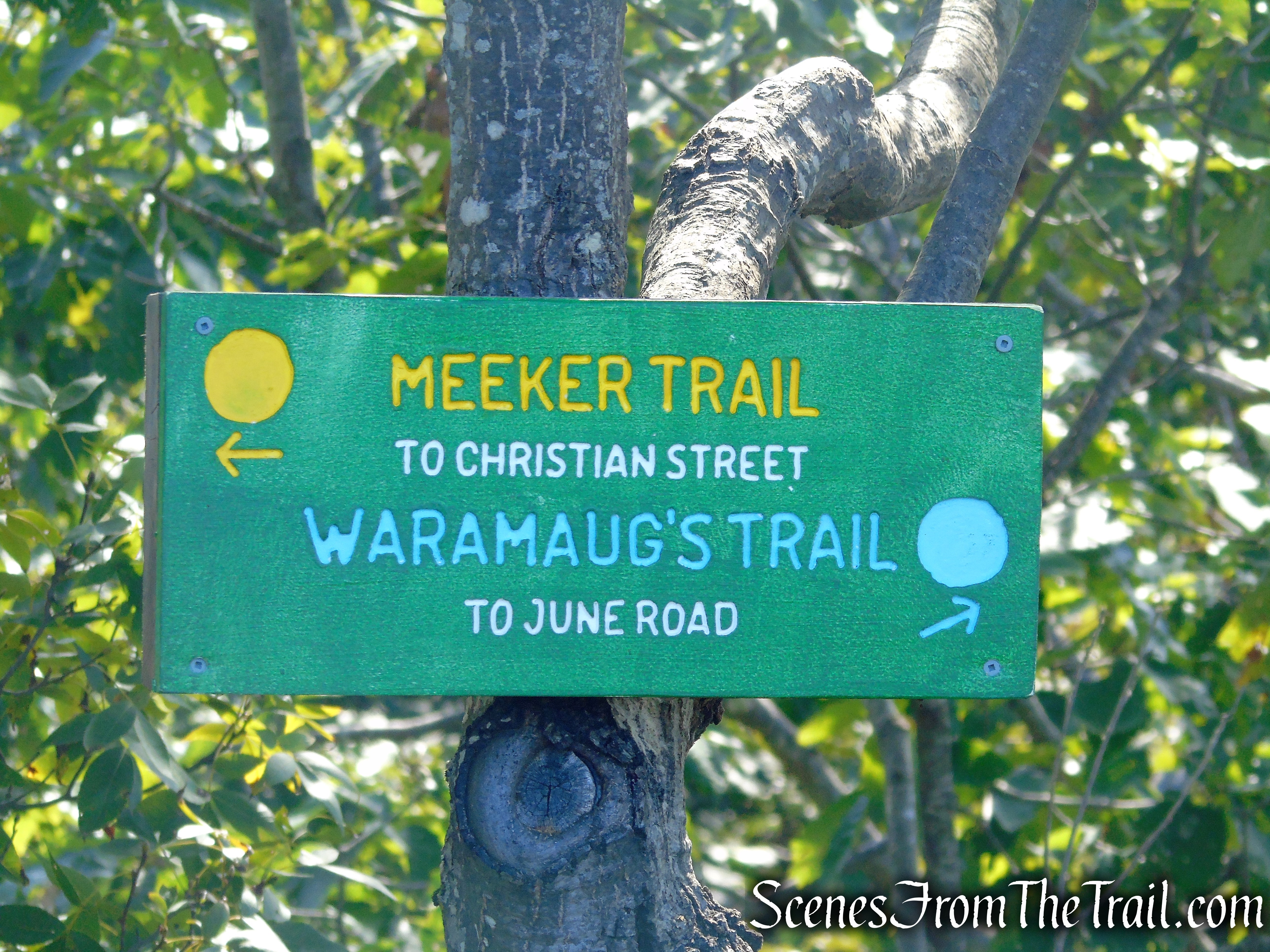
At the northern end of the parking lot, proceed ahead on a footpath that leads to the boardwalk. At the end of the boardwalk there is a kiosk marked with a yellow circle blaze. This is the start of the Meeker Trail. You will be following the yellow circles for the next 1.6 miles until you reach Waramaug’s Rock.
Meeker Trail – Macricostas Preserve
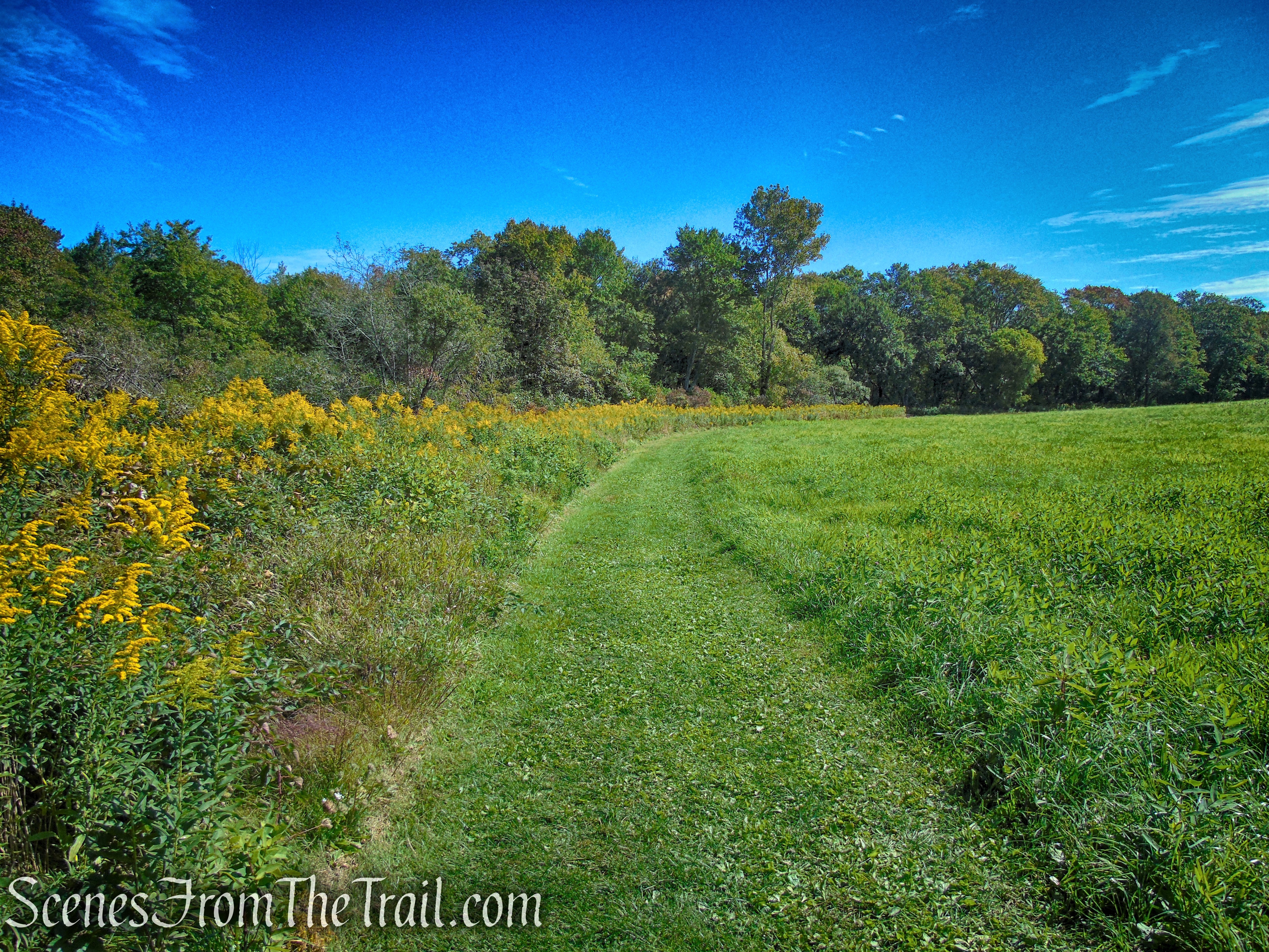
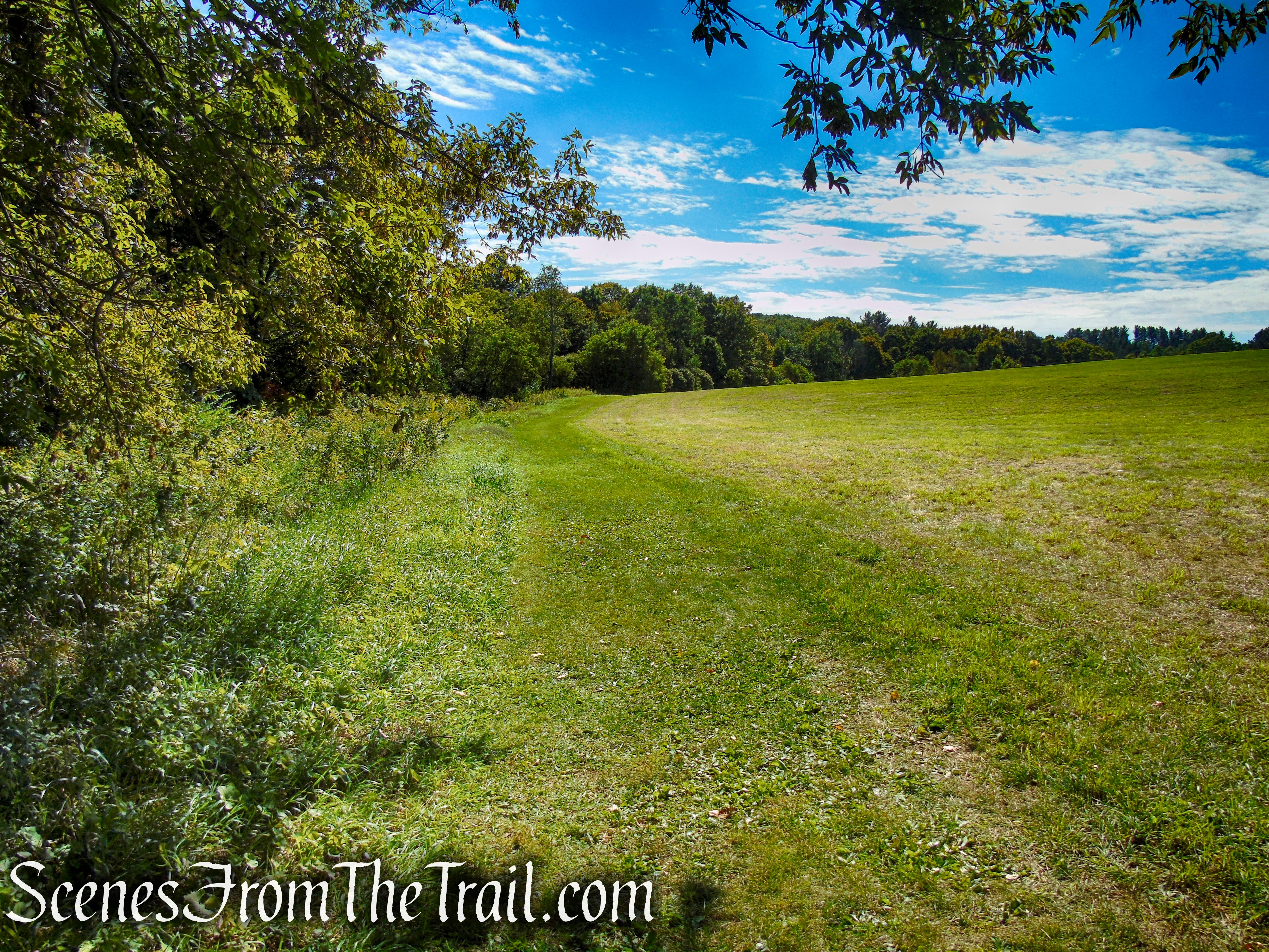
Continue ahead on the Meeker Trail which starts out level, crosses Bee Brook on a small footbridge and meanders through a large wildlife meadow. In about 450 feet after crossing the footbridge, The Meeker Trail reaches the hayfield and turns left, skirting the hayfield along the edge of the forest.

Meeker Trail – Macricostas Preserve
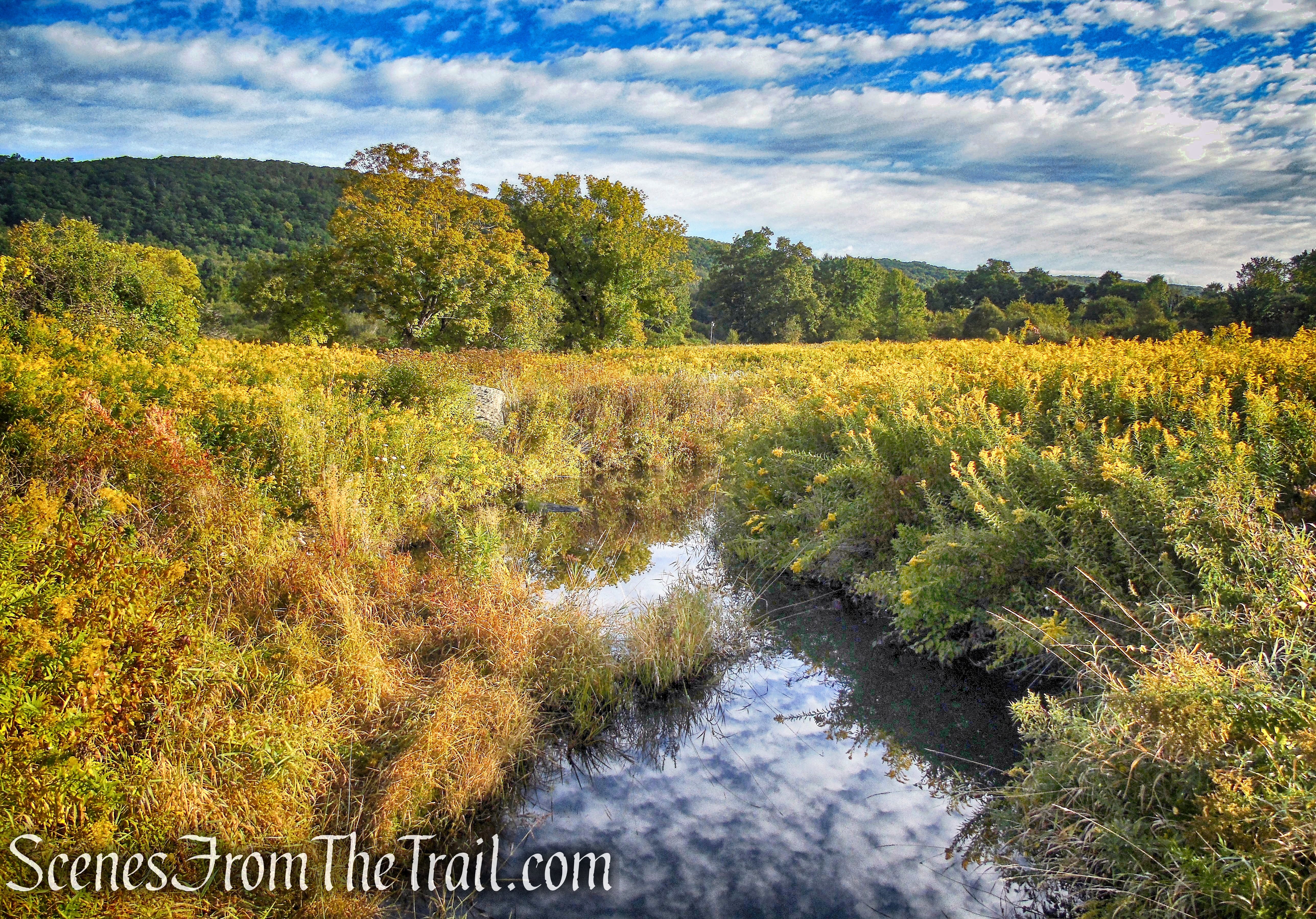
Bee Brook – Macricostas Preserve
Meeker Trail – Macricostas Preserve
Meeker Trail – Macricostas Preserve
Meeker Trail – Macricostas Preserve
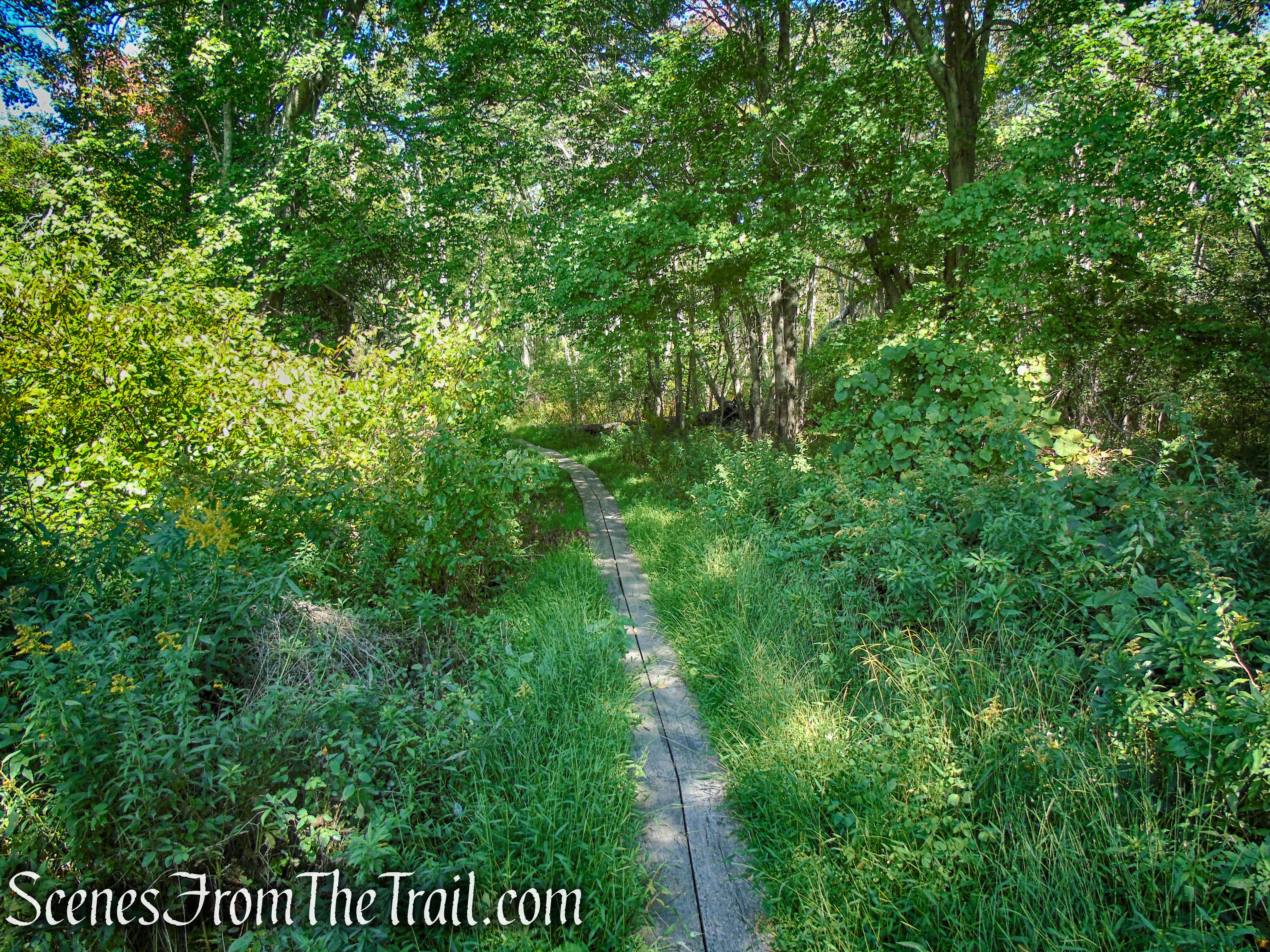
In another 620 yards, the Meeker Trail turns left and passes through Meeker Swamp on wooden planks, crosses Bee Brook again on a wooden footbridge and continues on a boardwalk and more planks.
turn left to stay on Meeker Trail
turn left to stay on Meeker Trail
Meeker Trail – Macricostas Preserve
Meeker Trail – Macricostas Preserve
Meeker Trail – Macricostas Preserve
In about another 860 feet, the Meeker Trail comes to a junction with the orange-circle-blazed Ridgeline Trail, which begins on the right. The Ridgeline Trail is your return route, for now, bear left at this junction and continue following the yellow circles.
turn left to remain on Meeker Trail
turn left to remain on Meeker Trail
The Meeker Trail ascends gradually at first and in about 460 yards, passes a junction with the white-square-blazed Pinnacle Valley Trail (this trail can be used as a shortcut to Waramaug’s Rock, bypassing the first viewpoint). The Meeker Trail turns right and climbs steeply along a series of switchbacks before emerging at the Lookout.
Meeker Trail – Macricostas Preserve
Meeker Trail – Macricostas Preserve

Meeker Trail – Macricostas Preserve
Meeker Trail – Macricostas Preserve
Meeker Trail – Macricostas Preserve
Meeker Trail – Macricostas Preserve
The Lookout is a rock outcrop that provides southeast-facing views over the hayfield below and the surrounding countryside. You have now hiked just over a mile and gained about 440 feet in elevation. This is a good place to take a break and enjoy the view.
Lookout – Macricostas Preserve
Lookout – Macricostas Preserve
Lookout – Macricostas Preserve
When you are ready to proceed, follow the yellow circle blazes of the Meeker Trail which turn left and continue to climb, but now more gradually.
Meeker Trail – Macricostas Preserve
In a short distance, the Meeker Trail comes to a junction with the other end of the Ridgeline Trail. You will return back to this spot on your way back from Waramaug’s Rock. For now continue following the yellow circles as they head in a westerly direction.
Meeker Trail – Macricostas Preserve
Meeker Trail – Macricostas Preserve
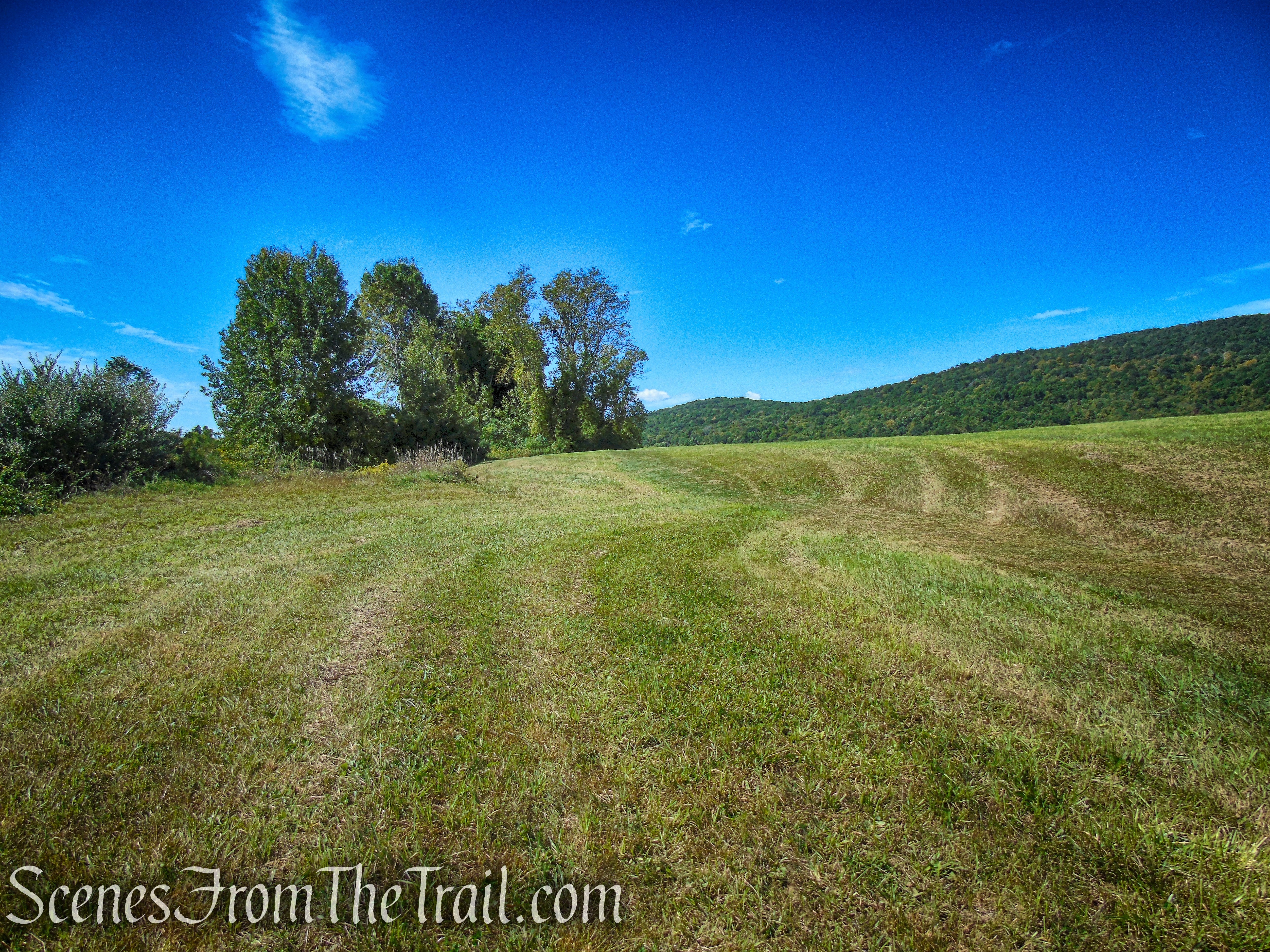
In another 250 feet, the Meeker Trail passes a junction with the other end of the Pinnacle Valley Trail, which begins on the left. In about another 590 feet, the Meeker Trail turns left and heads in a southwesterly direction.
continue past the junction with the Pinnacle Valley Trail
Meeker Trail – Macricostas Preserve
Meeker Trail – Macricostas Preserve
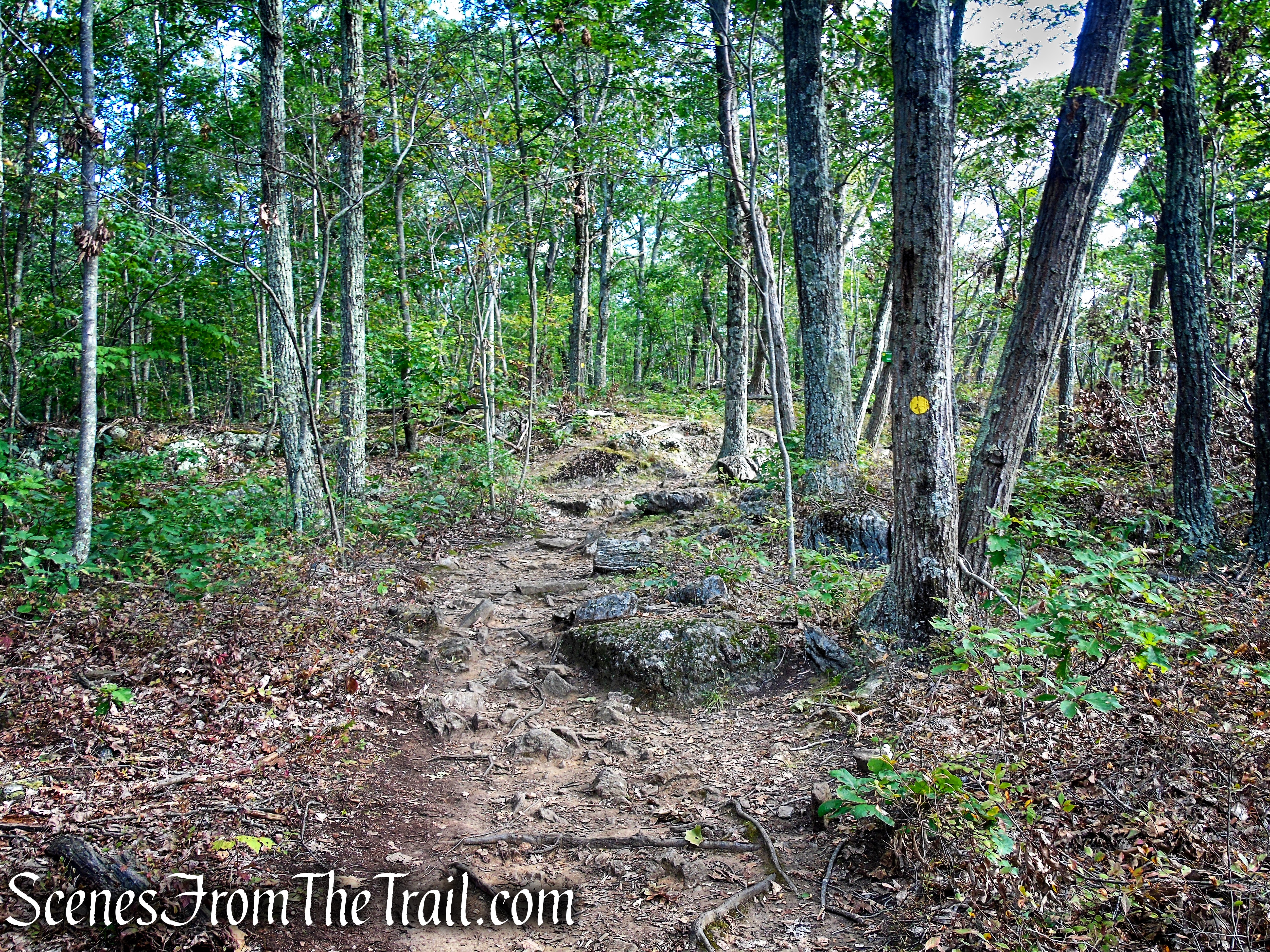
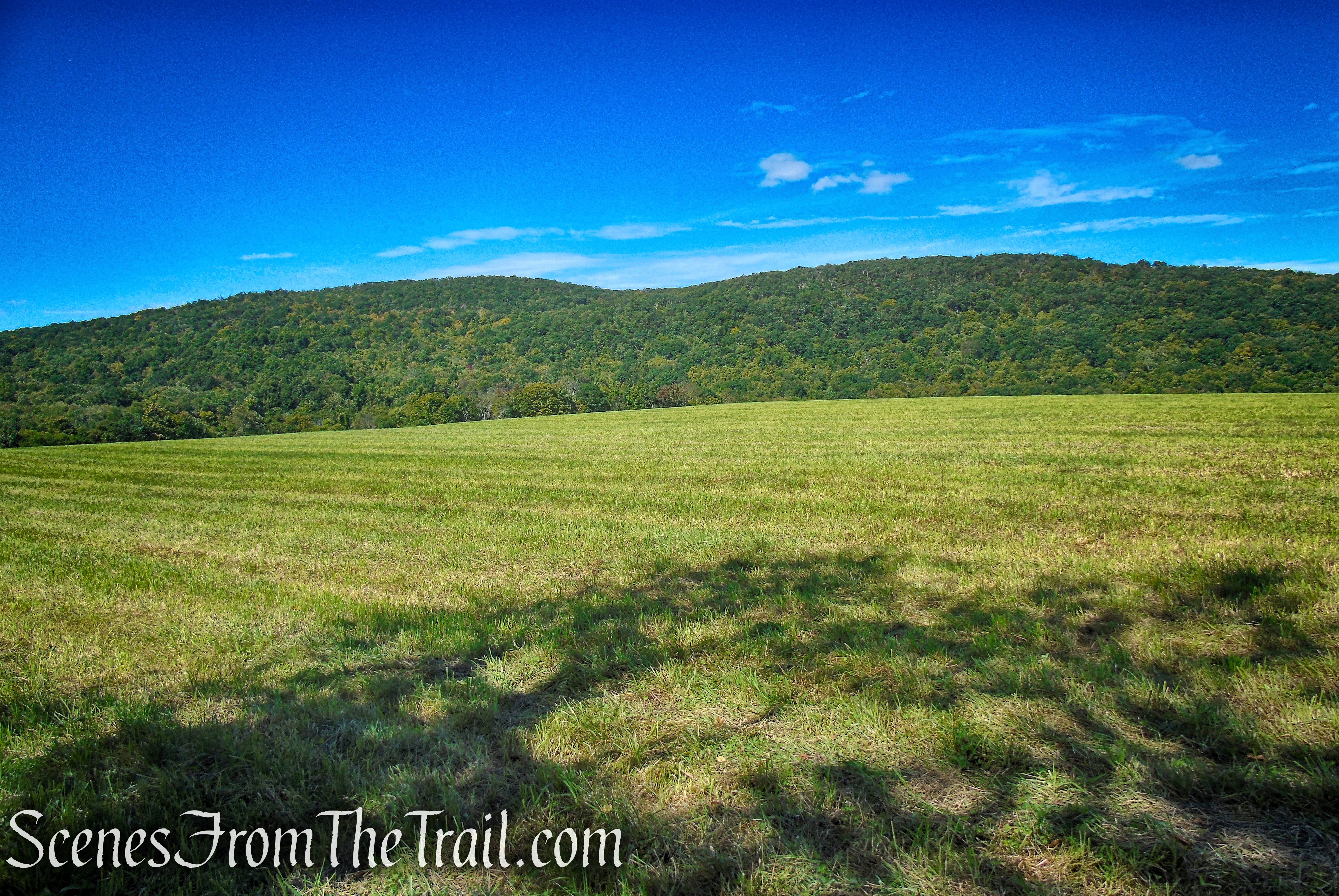
The Meeker Trail climbs a little over rock slabs and ends at the bald summit of Waramaug’s Rock.
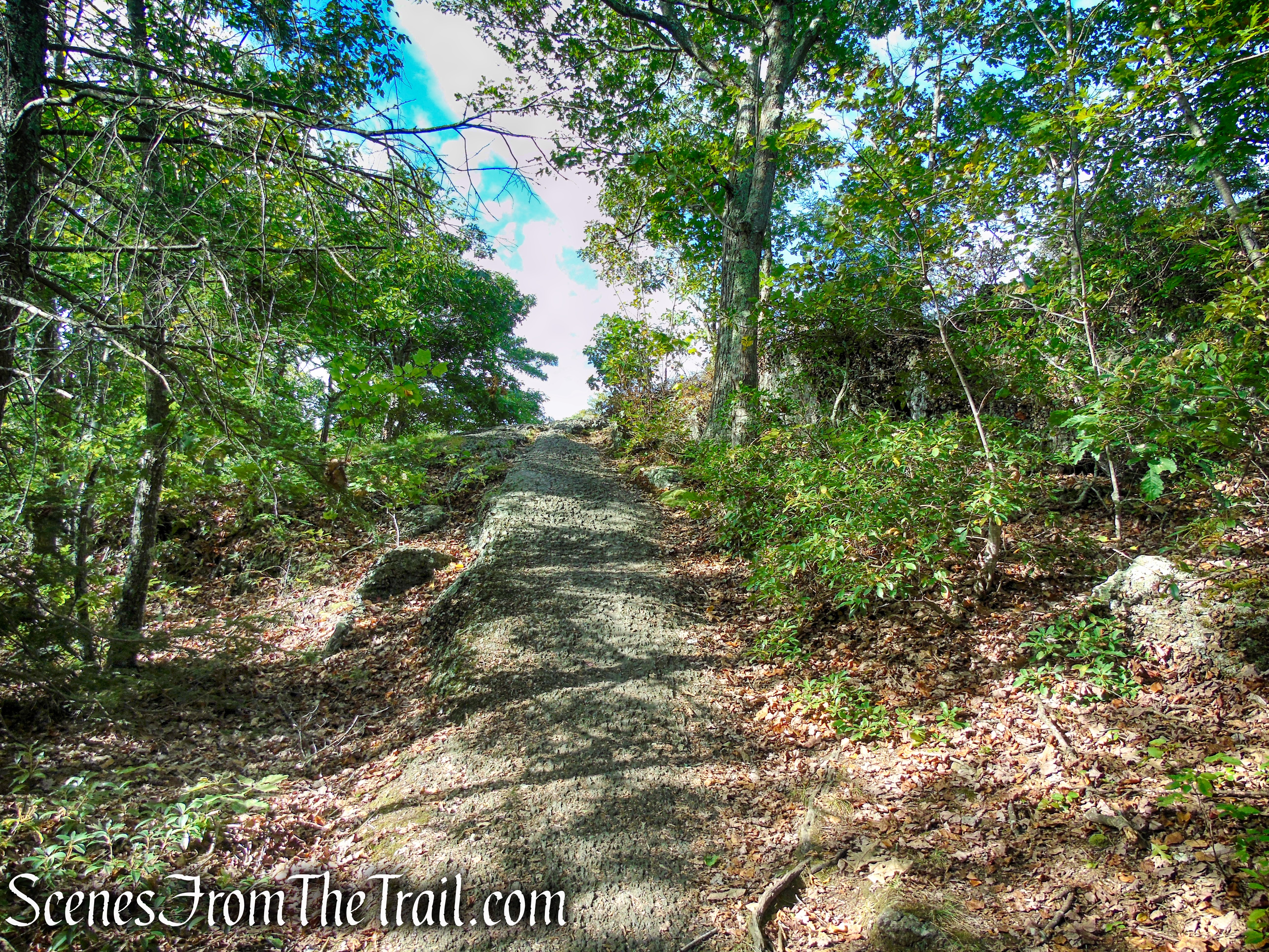
Meeker Trail – Macricostas Preserve
Waramaug’s Rock – Macricostas Preserve
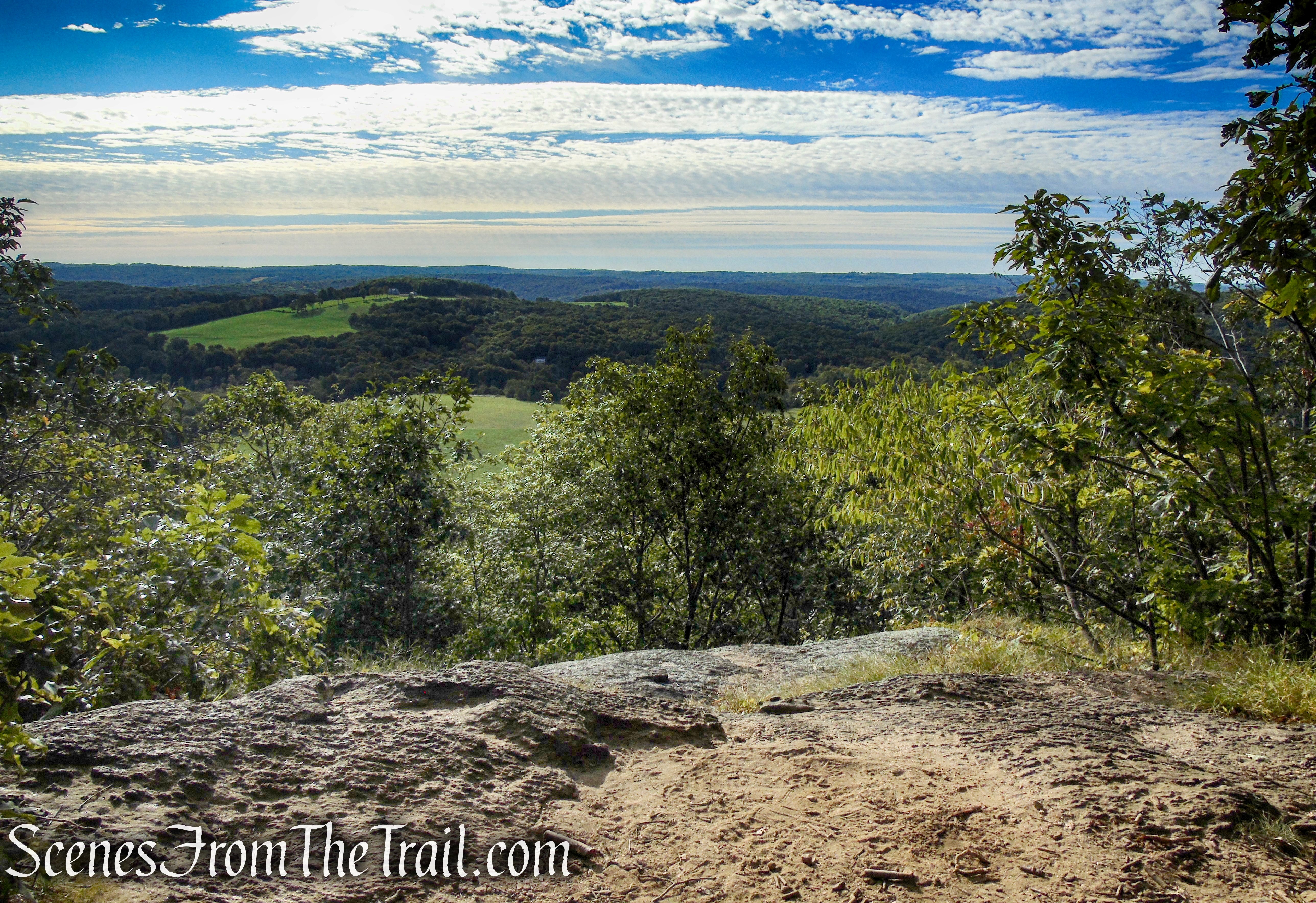
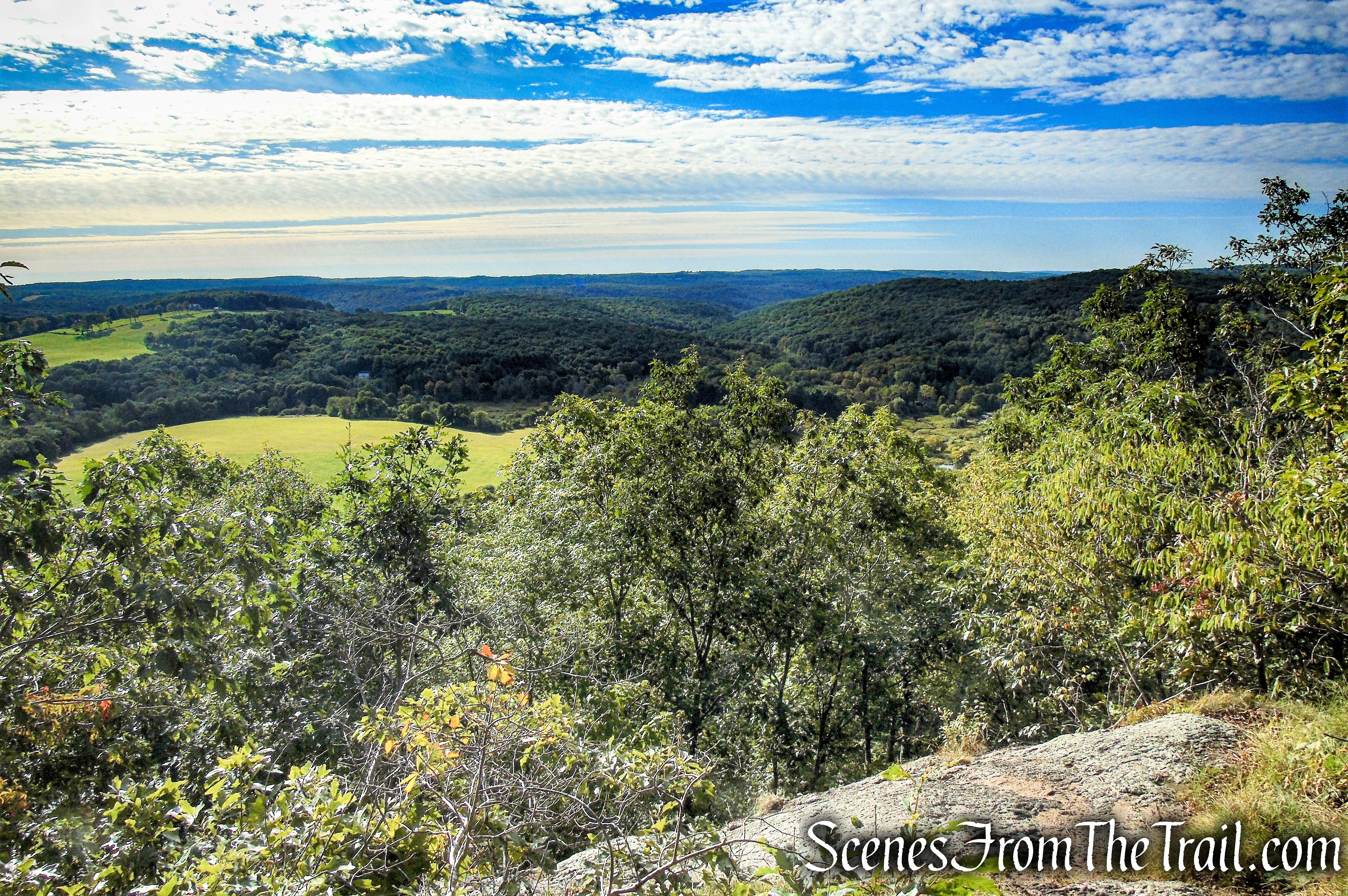
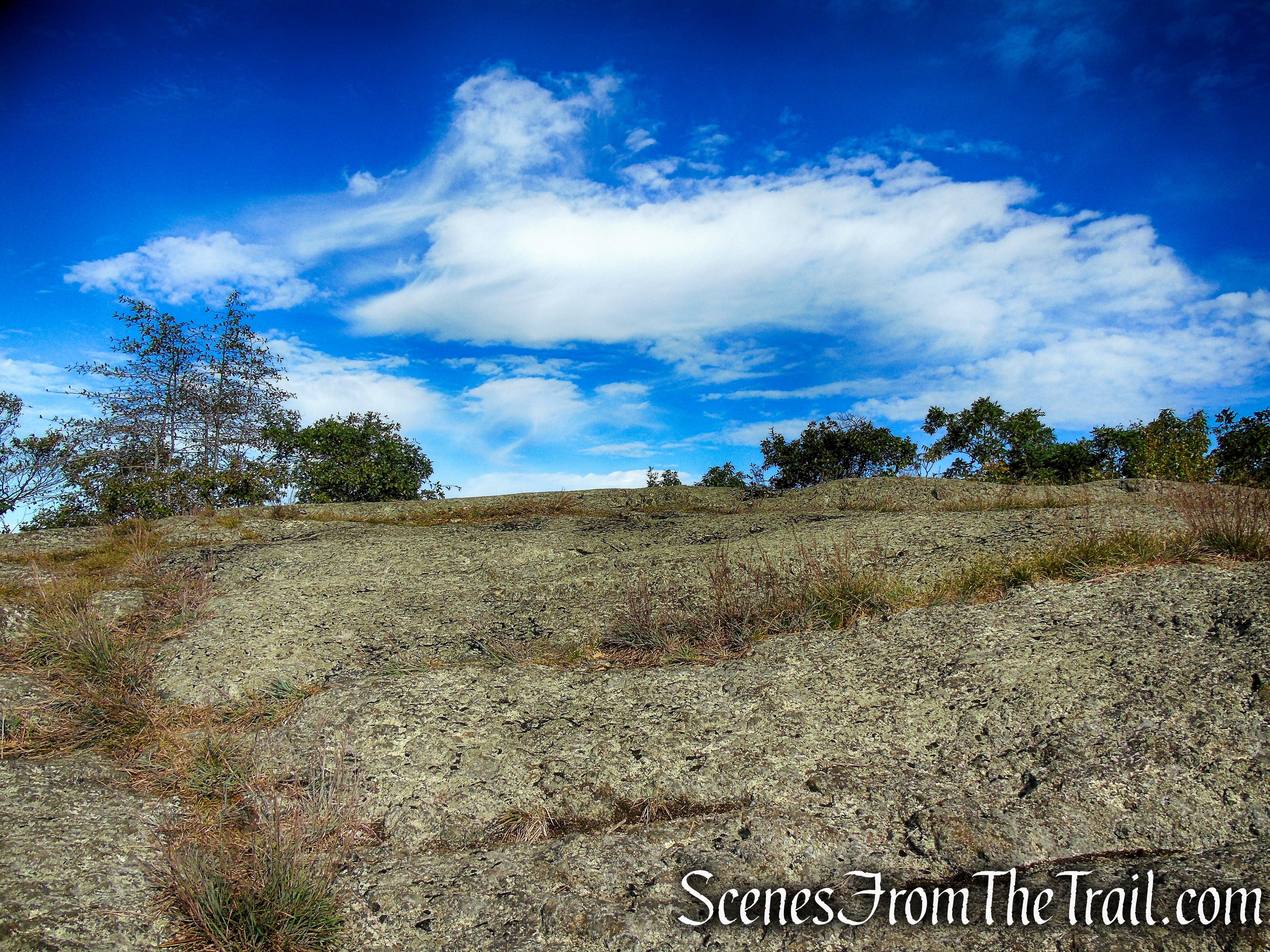
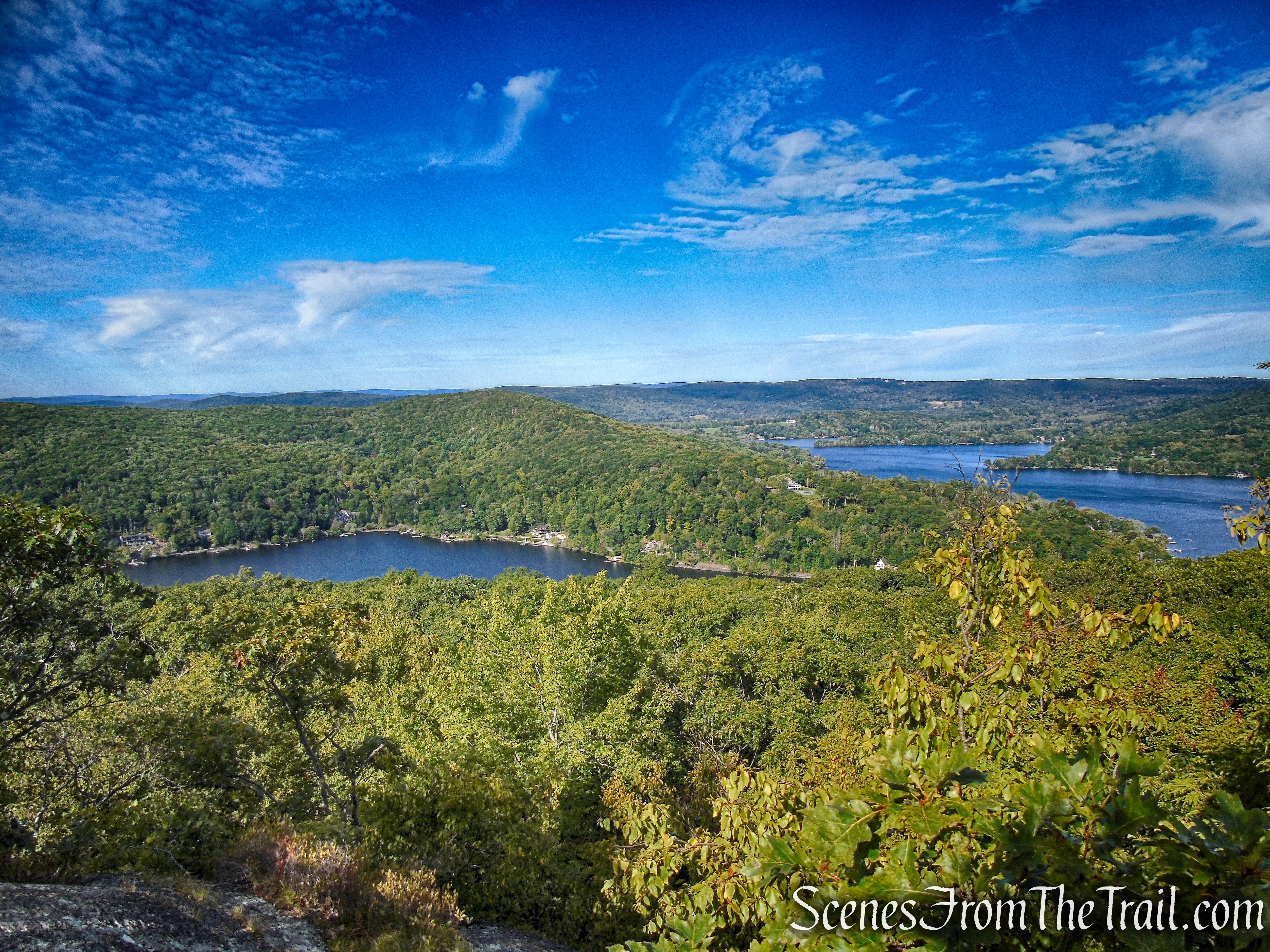
At an elevation of 1,280 feet, Waramaug’s Rock rewards hikers with panoramic views of Lake Waramaug and the surrounding countryside. The open summit has few trees so if visiting on a hot day, be prepared to be exposed to the sun while you’re here.
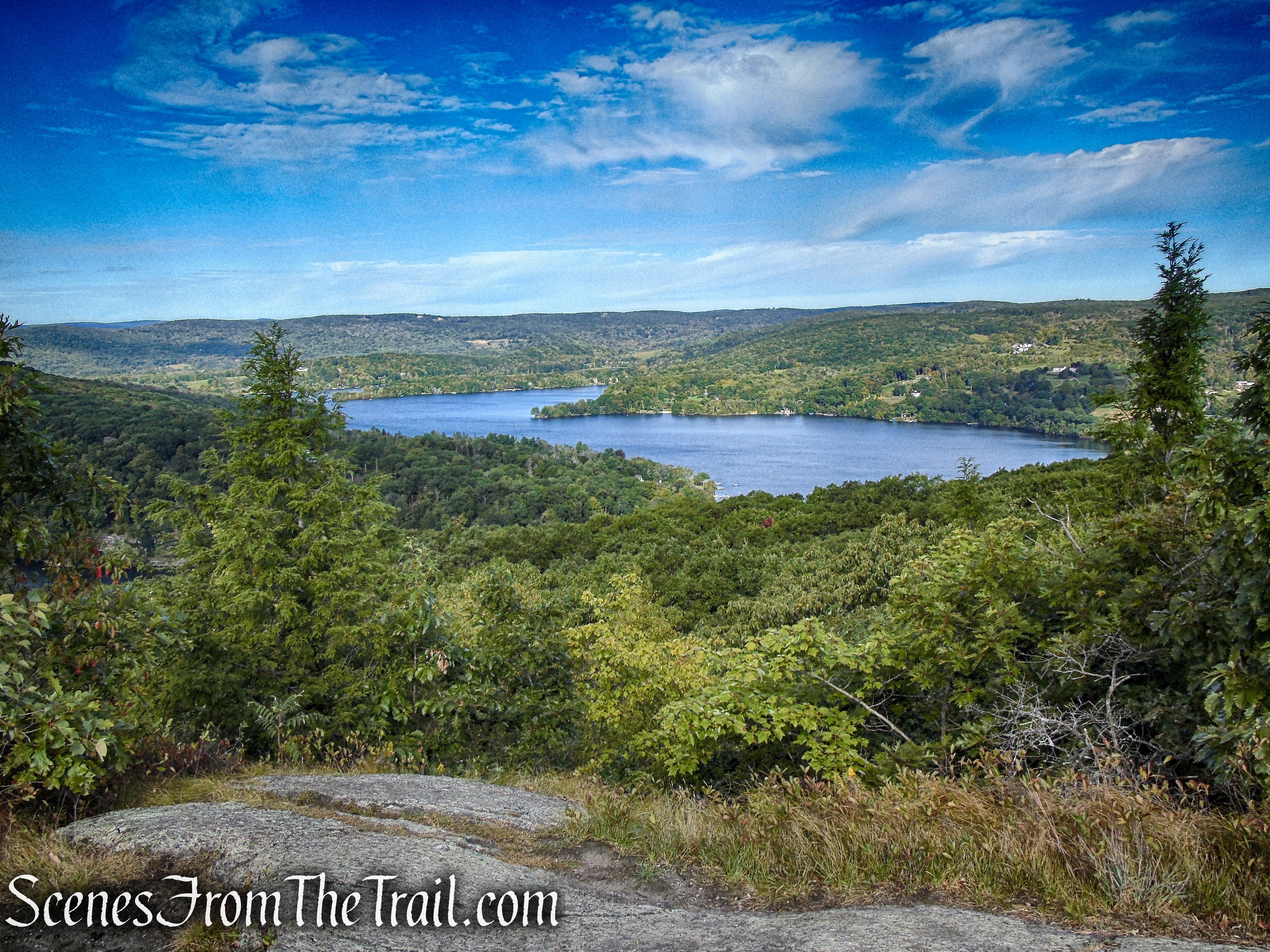
Lake Waramaug from Waramaug’s Rock
Looking southwest from Waramaug’s Rock.
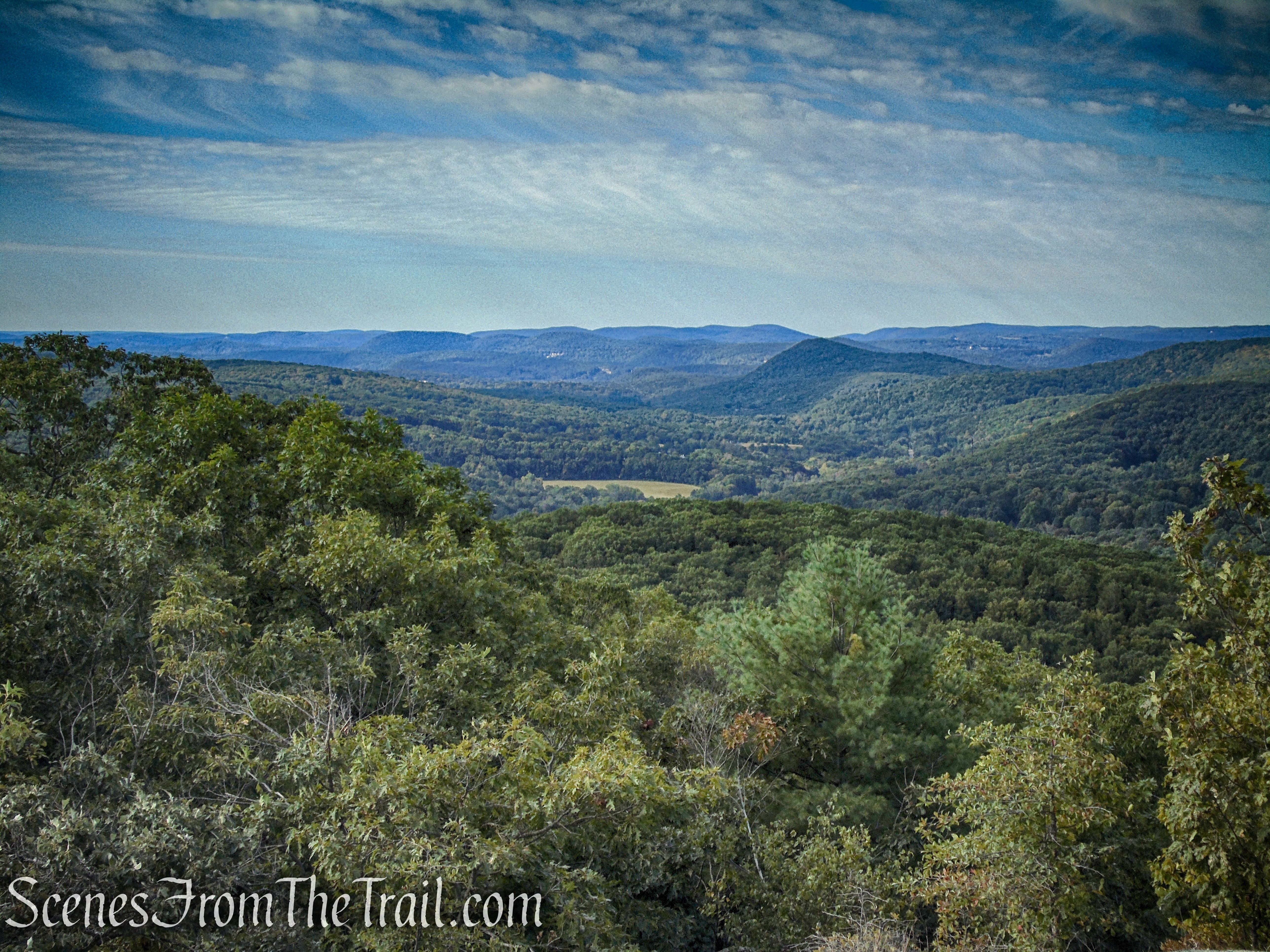
view southwest from Waramaug’s Rock
Lake Waramaug is a 656-acre lake occupying parts of the towns of Kent, Warren and Washington in Litchfield County. Waramaug is the name of an Indian chief (1650-1735) of the Wyantenock tribe who had hunting grounds near falls on the Housatonic River, now referred to as “Lover’s Leap,” in the town of New Milford. Chief Waramaug and his followers wintered in the area now covered by Lake Lillinonah, which was later created by damming the Housatonic, and made Lake Waramaug their summer residence.
Lake Waramaug from Waramaug’s Rock
Possibly a summit marker.
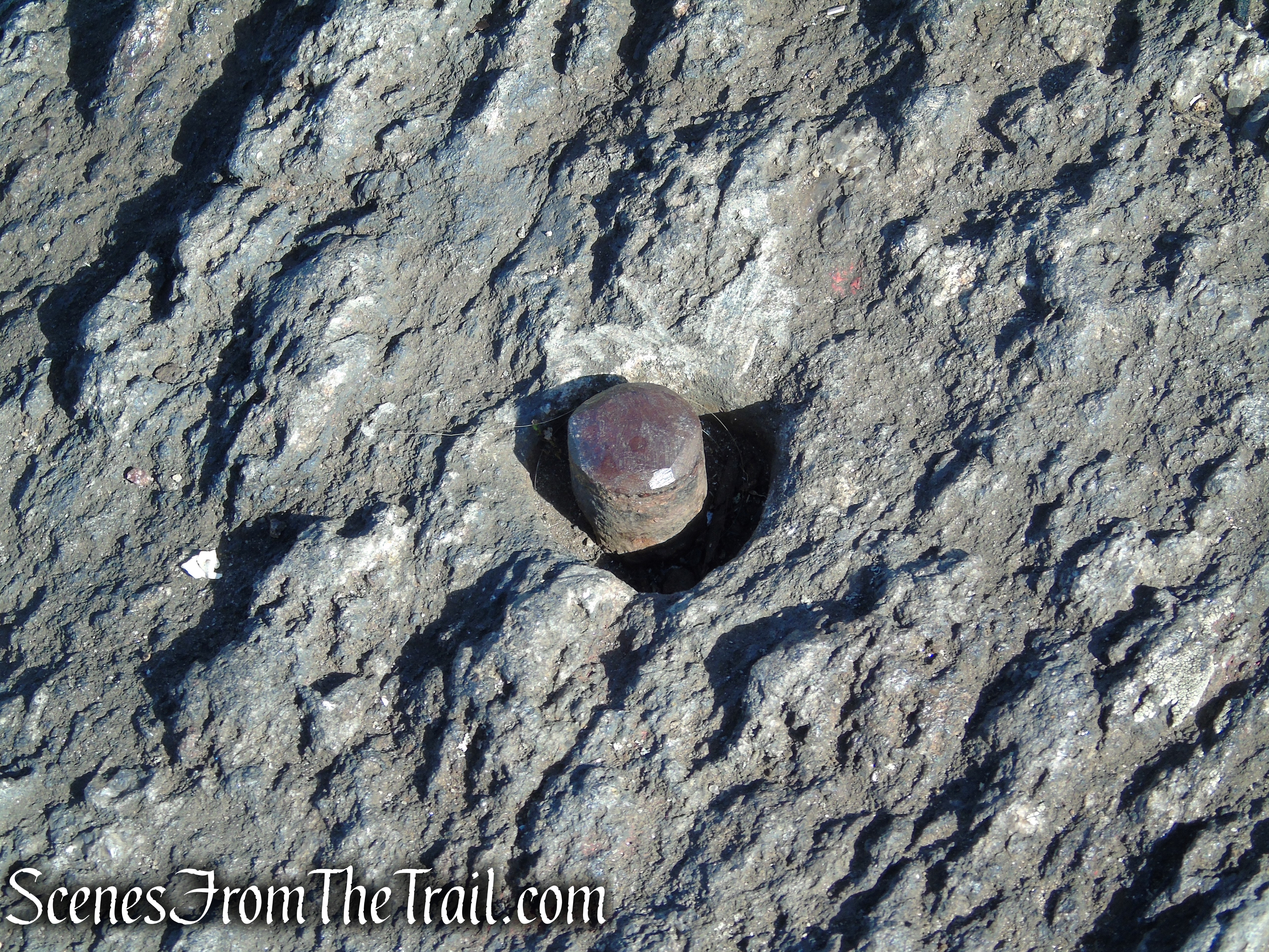
Waramaug’s Rock – Macricostas Preserve
When you are ready to continue, retrace your steps on the Meeker Trail.
turn left on Meeker Trail
In about 0.4 mile, the trail reaches the junction with the Ridgeline Trail that you passed earlier.
turn left on Ridgeline Trail
To continue on this loop hike, bear left, leaving the Meeker Trail and follow the orange-circle-blazed Ridgeline Trail. If you want to cut the hike short, bear right and continue following the yellow circles and retrace your steps the rest of the way back to the parking lot.
turn left on Ridgeline Trail
The Ridgeline Trail (1.1 miles) climbs briefly over rocks, then begins a steady descent along the rocky ridge, losing the elevation that you gained on the way up. For the next mile or so, you will be following the orange circles as they descend the ridge, sometimes steeply.
Ridgeline Trail – Macricostas Preserve
Ridgeline Trail – Macricostas Preserve
Ridgeline Trail – Macricostas Preserve
Ridgeline Trail – Macricostas Preserve
Along the way, you’ll pass some interesting rock formations and boulders.
Ridgeline Trail – Macricostas Preserve
Ridgeline Trail – Macricostas Preserve
Ridgeline Trail – Macricostas Preserve
Ridgeline Trail – Macricostas Preserve
In 1.1 miles, the Ridgeline Trail ends at the junction with the Meeker Trail, that you passed at the beginning of the hike. Continue ahead, now following the yellow circle blazes as they lead gradually downhill.
terminus of Ridgeline Trail
Cross the wooden planks, boardwalk and footbridge through Meeker Swamp until you come out to the hayfield.
Meeker Trail – Macricostas Preserve
To continue on the loop, turn left and follow the Hay Field Loop along the edge of the woods. To return to the parking lot, turn right and follow the Meeker Trail.
turn left on Hay Field Loop
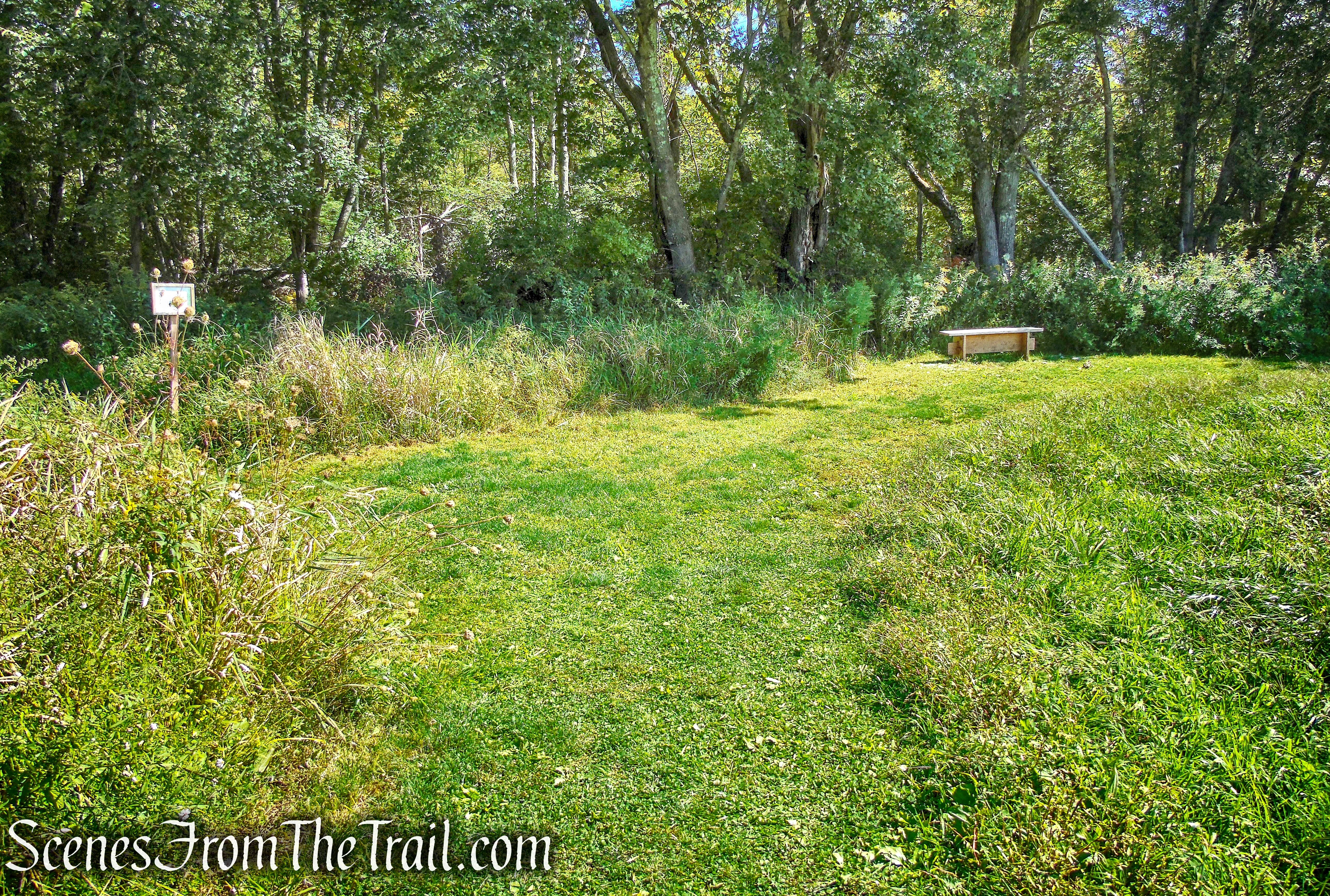
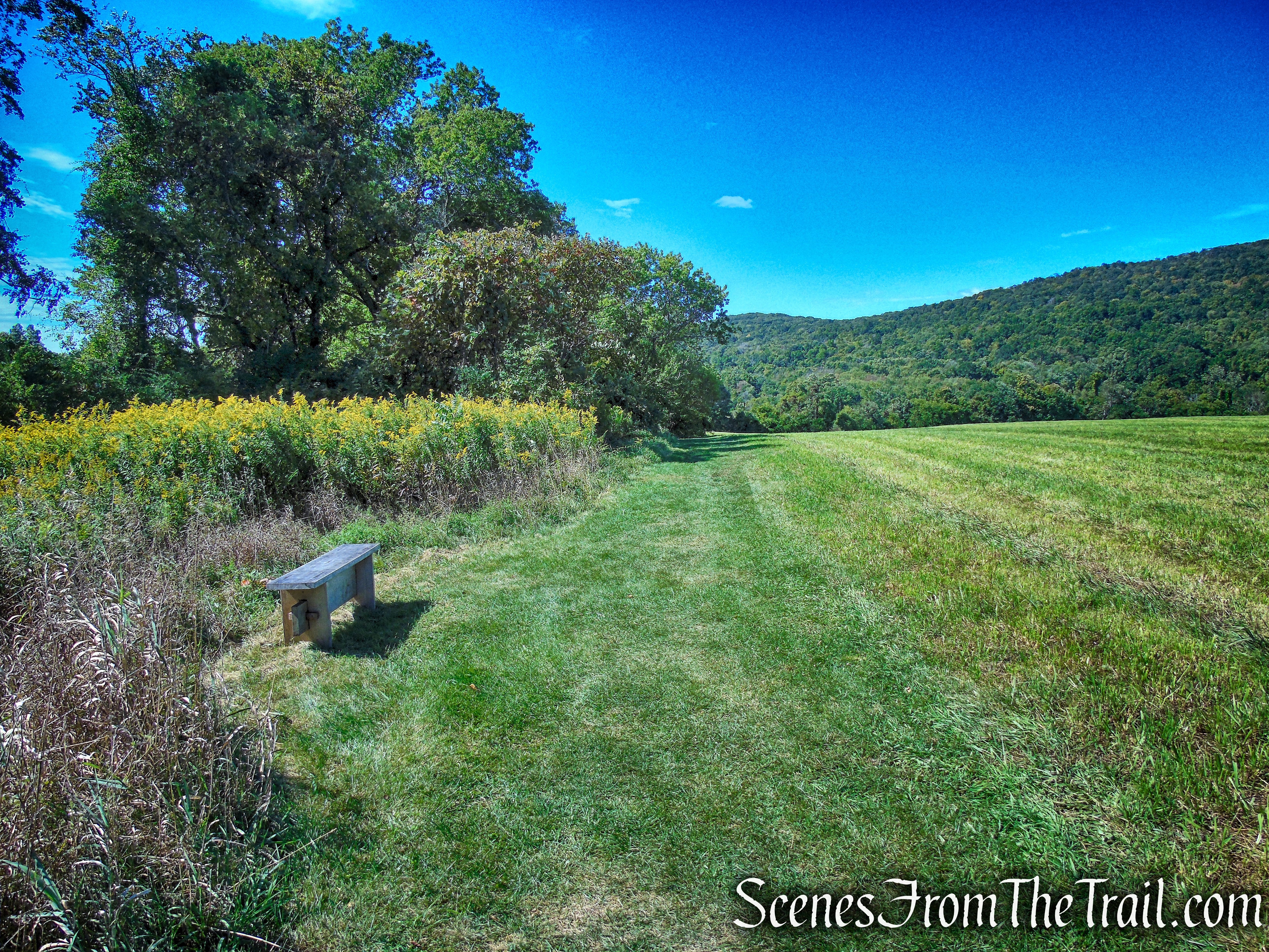
The Hay Field Loop runs along the edge of the woods on a mowed path. In about 900 feet, the trail comes to the entrance of Meeker Swamp.
Hay Field Loop – Macricostas Preserve
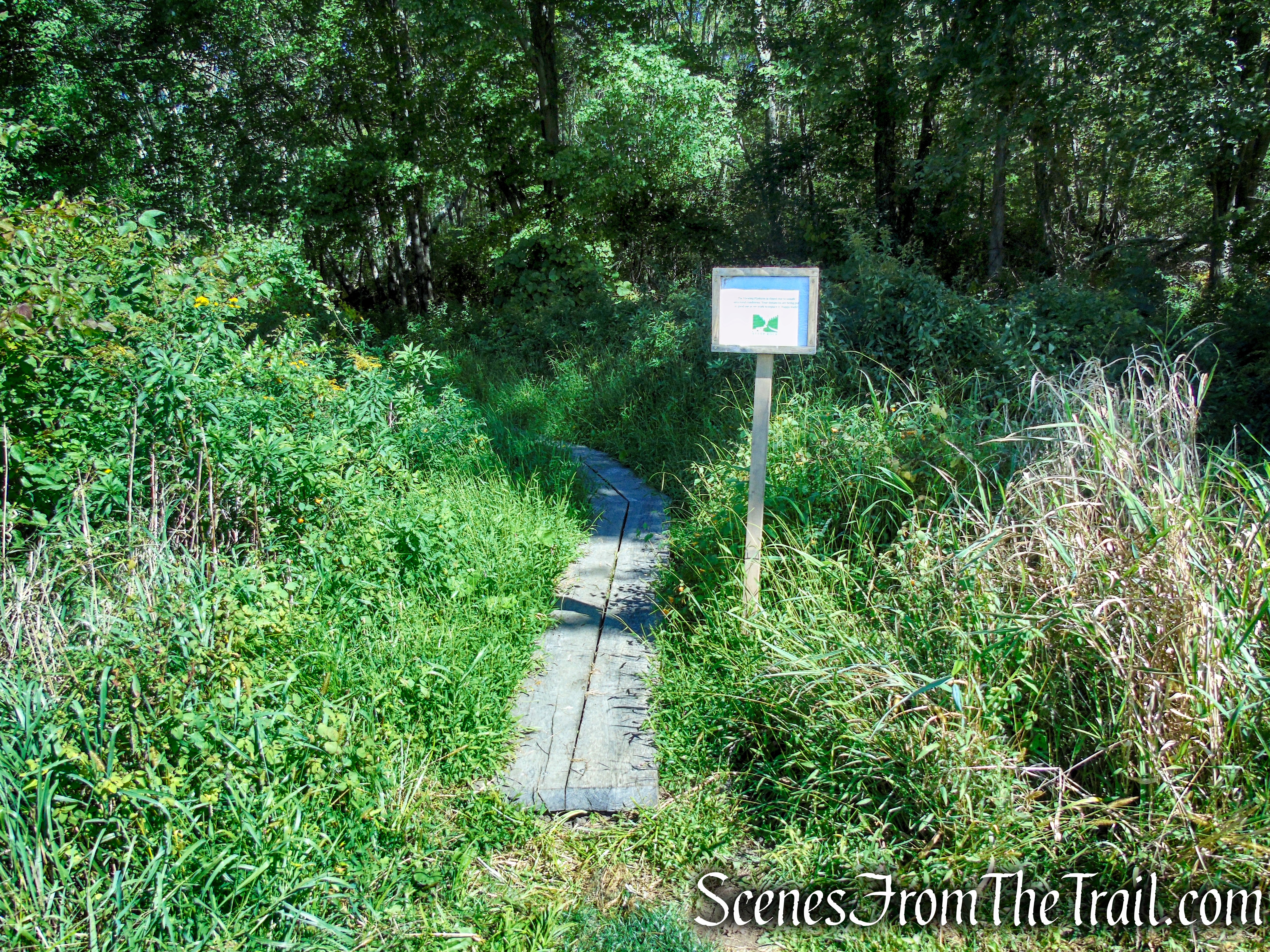
turn left to Meeker Swamp
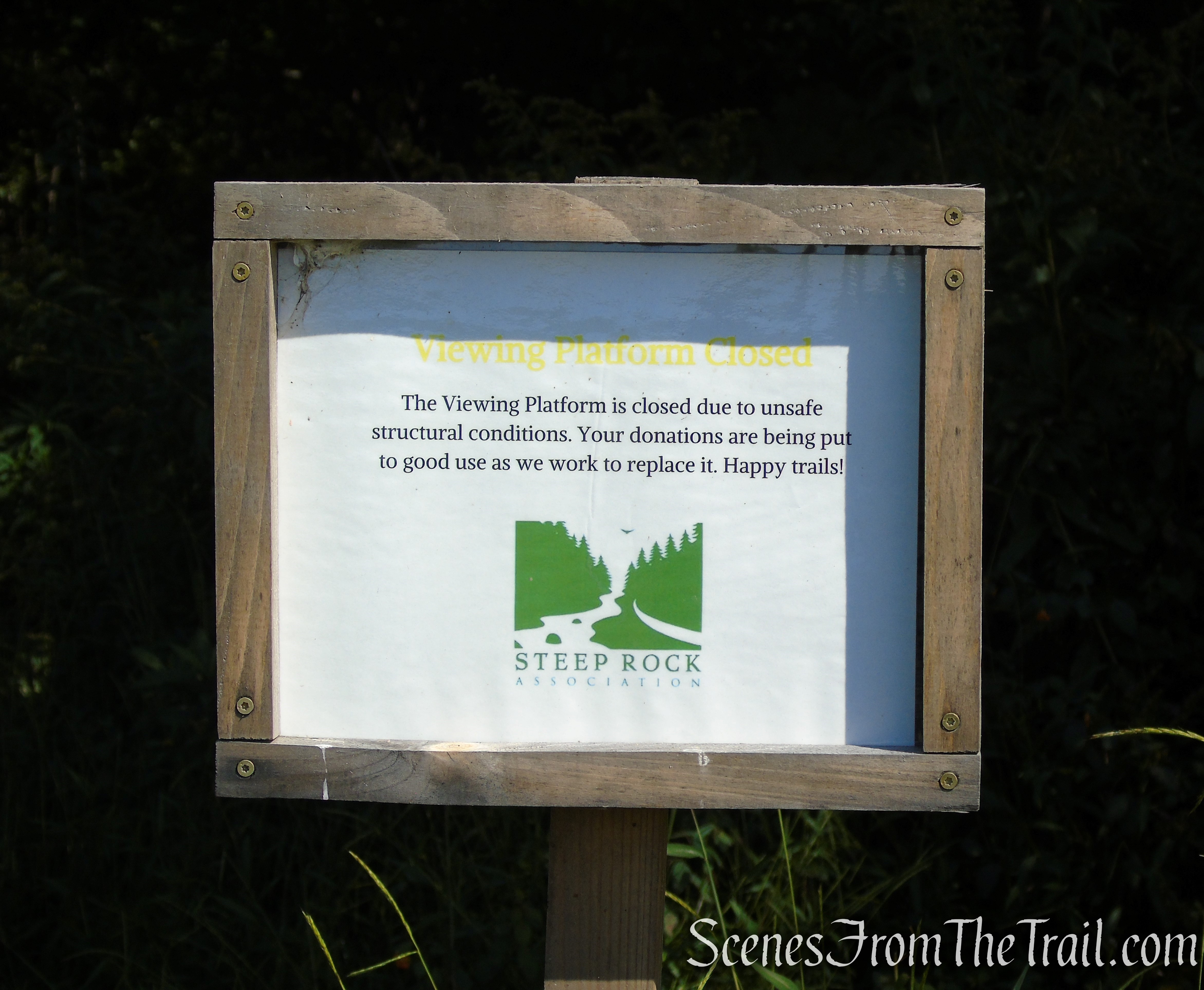
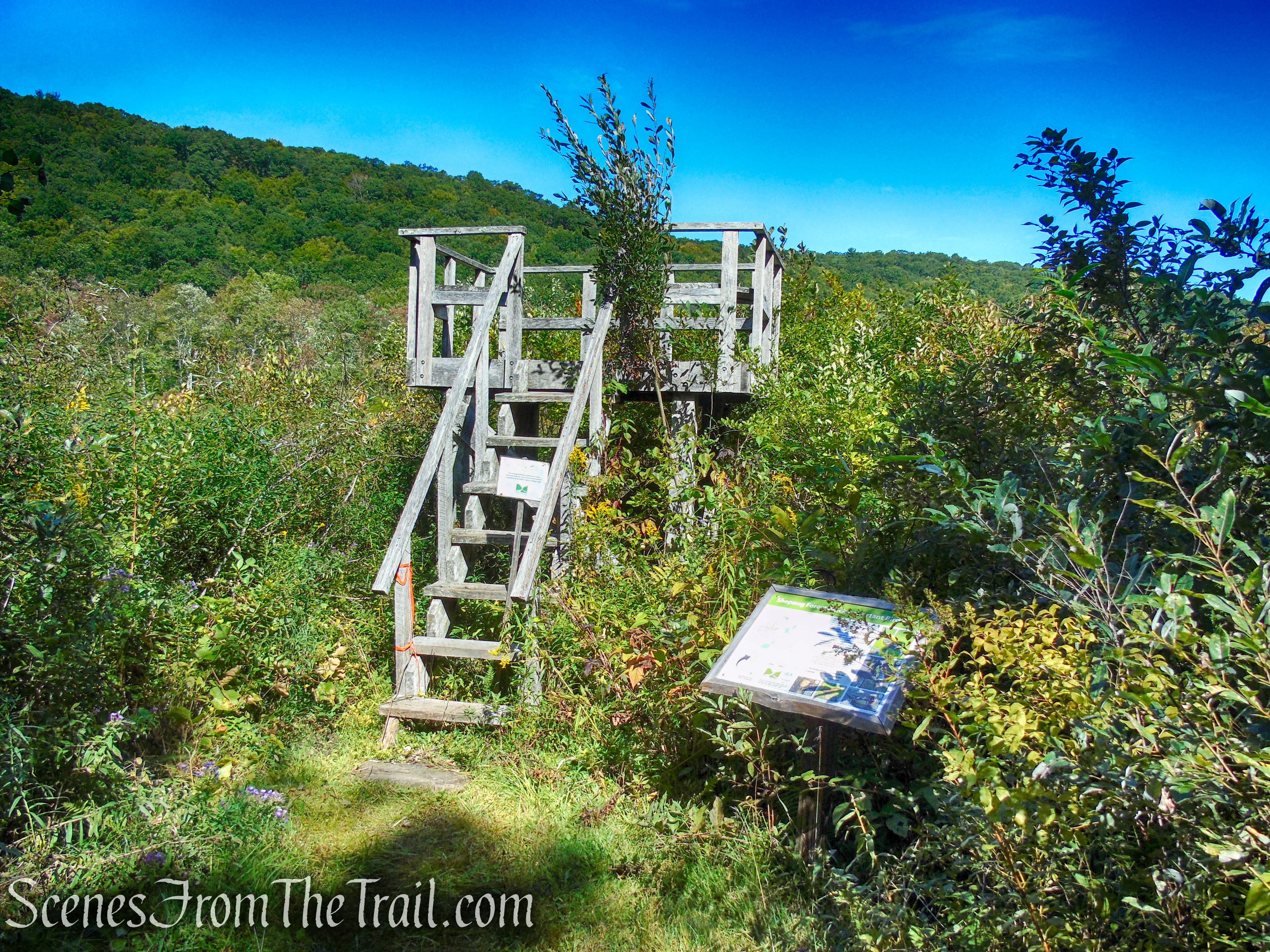
This short spur trail is part of the Hay Field Loop and is only about 400 feet long. The trail runs on wooden planks and leads to a wooden viewing platform that was closed due to unsafe structural conditions.
Meeker Swamp – Macricostas Preserve
Meeker Swamp – Macricostas Preserve
Meeker Swamp – Macricostas Preserve
Meeker Swamp – Macricostas Preserve
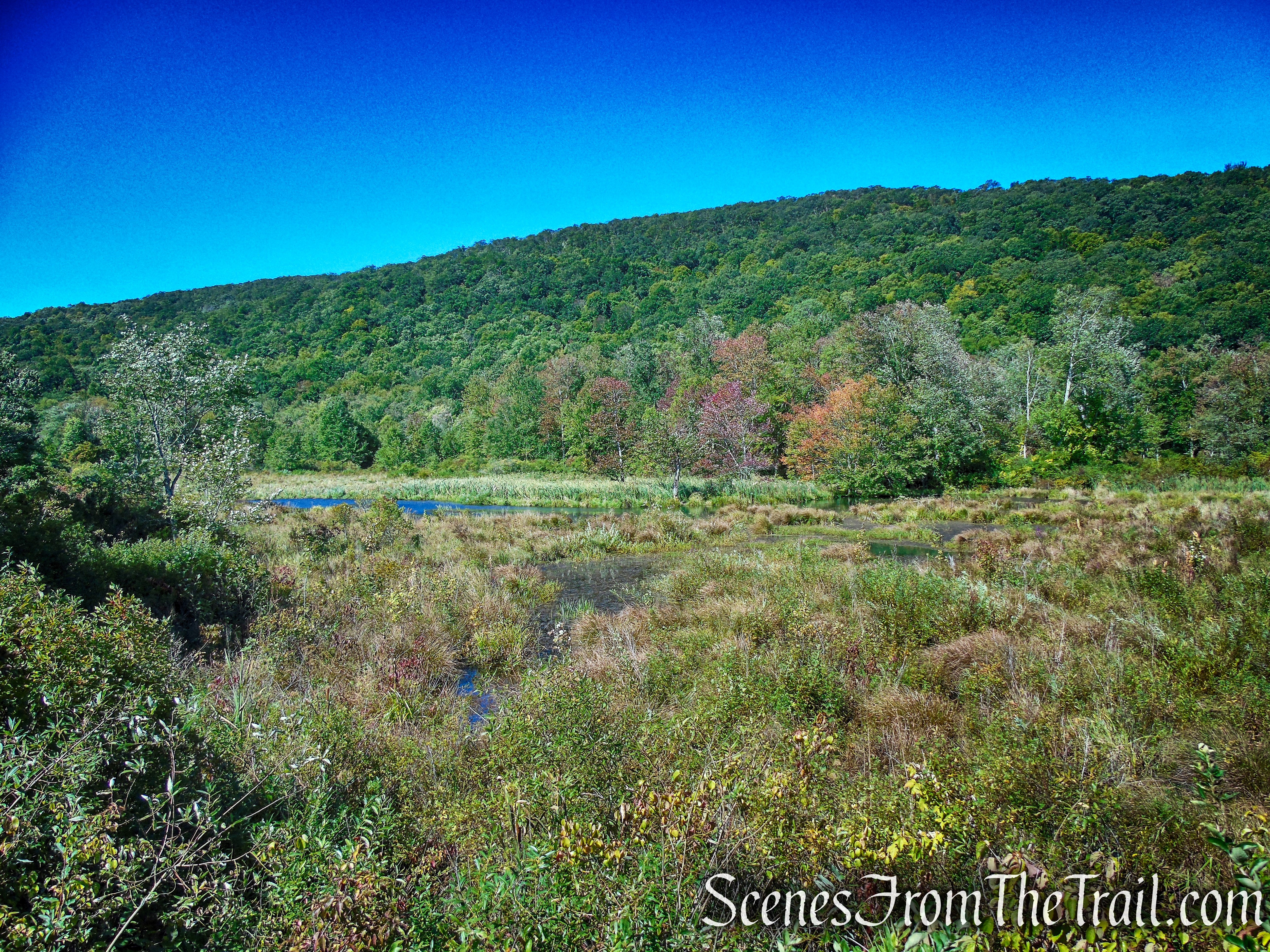
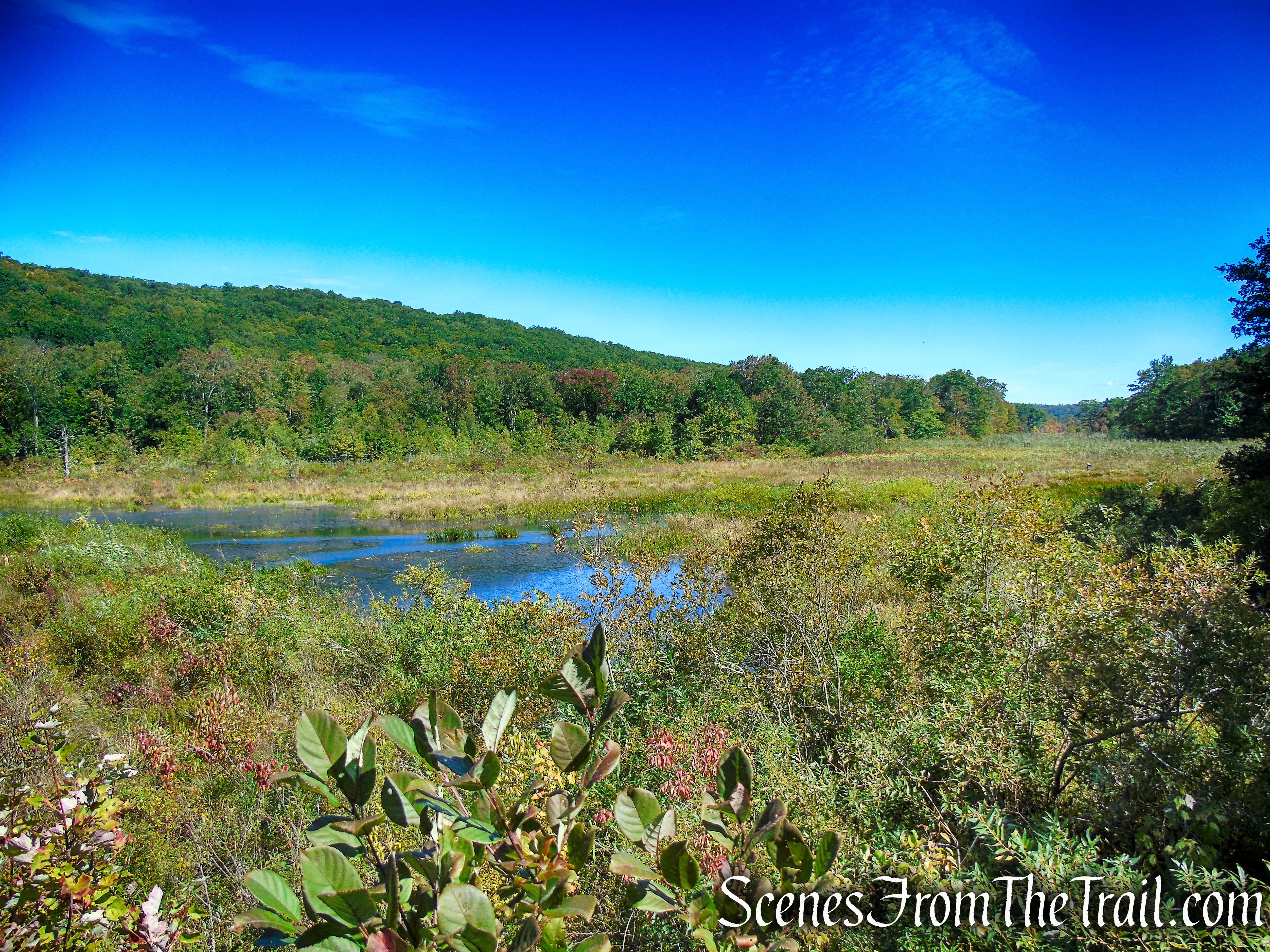
Meeker Swamp is a unique calcareous wetland, a chalky limestone-based geology rarely found east of the Appalachian Mountains. One of the last significant calcareous ecosystems in the Northeast Hills, it encompasses over 300 acres and includes part of the Bee Brook stream, wet meadows and agricultural fields as well as an adjacent ridge of talus slopes and rocky outcroppings. An excellent habitat for a variety of wildlife, the preserve overlies one of Washington’s largest aquifers and protects the town’s drinking water supply.
Meeker Swamp – Macricostas Preserve
Meeker Swamp – Macricostas Preserve
Retrace your steps back out to the hayfield and turn left. The Hay Field Loop continues along the edge of the woods and in about 420 yards, cuts across the field, heading west along another wooded section.
Hay Field Loop – Macricostas Preserve
Hay Field Loop – Macricostas Preserve
Looking north across the field, you can see the ridge that you just hiked.
Hay Field Loop – Macricostas Preserve
Continue heading west on the Hay Field Loop. When you reach a wooded area in front of you, turn right then take the next left on the StoryWalk Trail.
Hay Field Loop – Macricostas Preserve
turn left on Story Walk Trail
Story Walk Trail – Macricostas Preserve
At the end of the StoryWalk Trail, turn left on the Meeker Trail, and follow it back through the meadow, crossing the footbridge and returning back to the parking lot, where the hike began.
Meeker Trail – Macricostas Preserve
Meeker Trail – Macricostas Preserve
trailhead – Macricostas Preserve
Review:
An excellent hike through a very diverse topography. The climb up to Waramaug’s Rock is rugged, but doable by most novice hikers. The view speaks for itself and is the highlight of the hike. The bald summit is expansive enough that even with other groups up there, one can find a quiet spot to relax. The Ridgeline Trail is rocky and steep, but once you reach the Hay Field Loop, it becomes a casual stroll around the field. Meeker Swamp is worth a visit as well. It’s best to get here early or visit on a weekday as this place can get crowded on nice days. All in all, a great place for a hike and worth the drive.
Pros:
Diverse topography, Waramaug’s Rock, scenic views, Meeker Swamp, well maintained and free of trash, well marked trails.
Cons:
Meeker Swamp viewing platform in need of repair and closed on the day of our visit.
Take a hike!
Macricostas Preserve
Sources:

I’m so glad I found you LOL. I’ve been using AllTrails for my adventures. But You’ve got a few that aren’t listed (or I just don’t see). And all the info you have posted is great. Thanks for this. Keep on trailing.
LikeLiked by 1 person
Thanks for reading.
LikeLike