October 20, 2018 – Palenville, NY
Difficulty: Moderate – Strenuous
Length: Approximately 6 miles
Max elevation: 2,656 ft.– total elevation gain approximately 1,274 ft.
Route type: Circuit
Map: Catskills Trail Map #141 – Free Web Map
Fee: $10.00 per vehicle Day Use (in season) – Empire Pass Accepted
Trailhead parking: 874 N Lake Rd, Haines Falls, NY 12436
Catskill Park is not actually a single park but consists of public and private lands in the Catskills region open to hikers. It consists of 700,000 acres in Southeastern New York’s Ulster, Greene, Delaware and Sullivan Counties. The Catskill Forest Preserve is the state land within the Catskill Park.
North-South Lake is the biggest and most popular state campground in the Catskill Forest Preserve, offering extraordinary scenic beauty, and historical sites, such as: Alligator Rock, Kaaterskill Falls, and the former site of the Catskill Mountain House. The provinces around the lake have long provided visitors with exceptional views of the surrounding countryside. It is said that on a clear day, you can see five states from the escarpment. The campground offers access to numerous hiking trails. The short hike to the Catskill Mountain House site provides the reward of incredible vistas. Longer and more strenuous hikes can bring you to such spots as Artist’s Rock, Sunset Rock, Newman’s Ledge, Boulder Rock, and the Kaaterskill Hotel and Laurel House sites. Kaaterskill Falls lies outside the campground and can be reached by several connecting trails.

view from Catskill Mountain House site
At the end of our hike, Kaaterskill Falls & Inspiration Point Loop, the previous week, we stopped off at the Catskill Mountain House site to take in the view and have a snack. I was so enamored with the view that I just had to come back and explore the area a little further. This loop hike covers the northeastern section of the North-South Lake area which includes the most dramatic section of the Escarpment Trail.
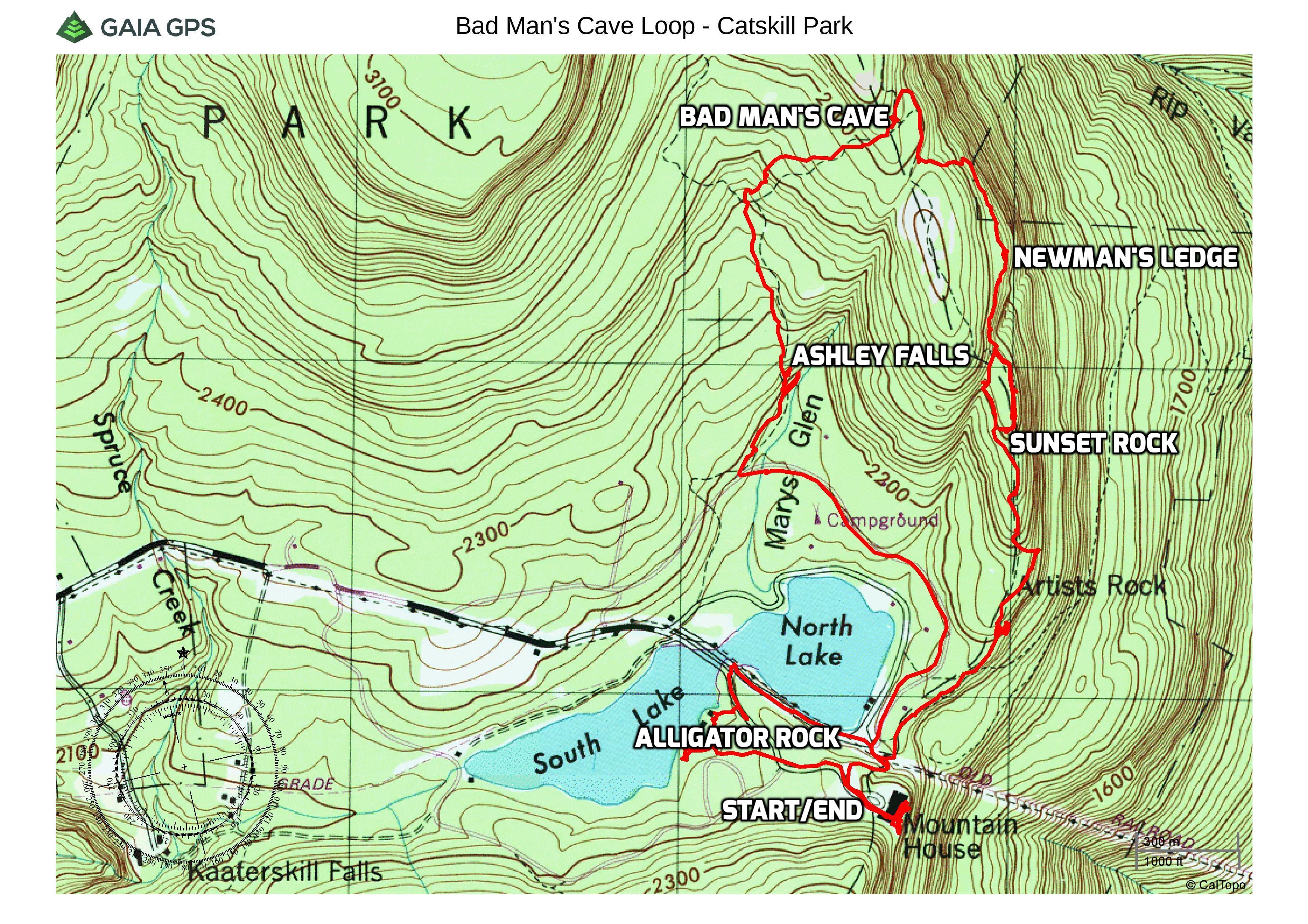
Bad Man’s Cave Loop – Catskill Park
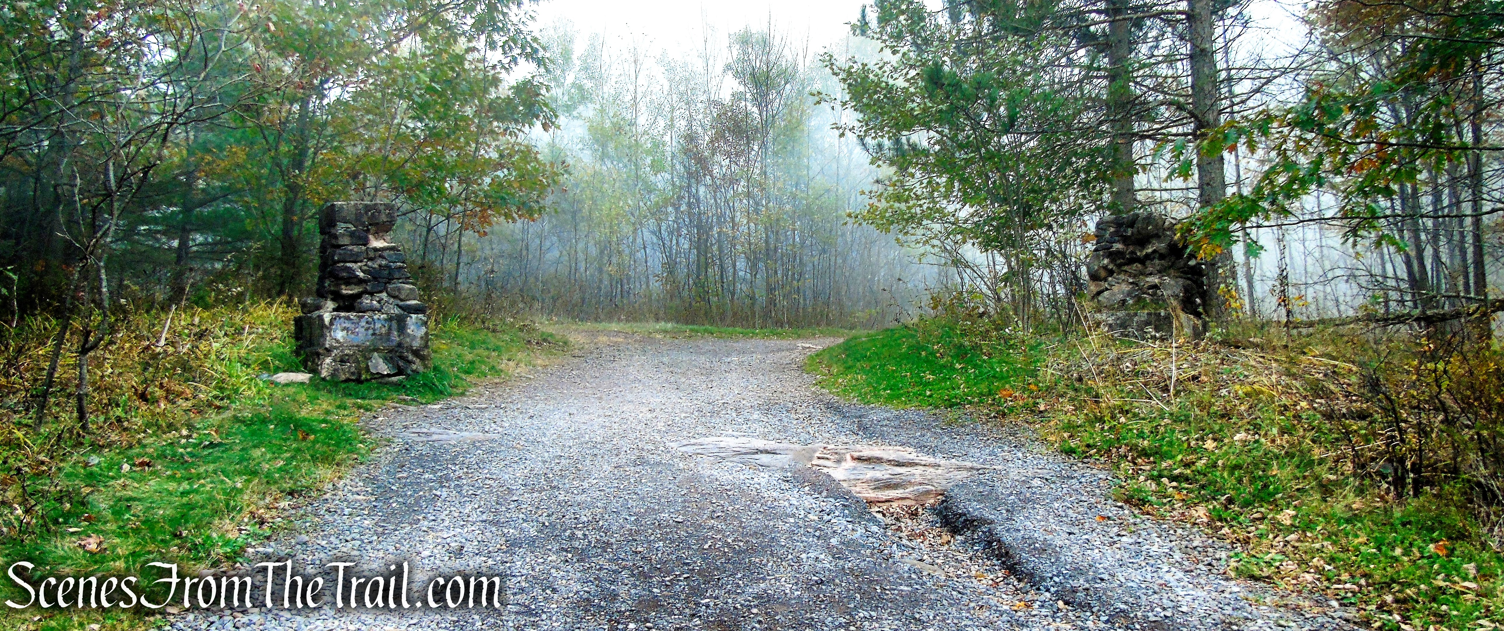
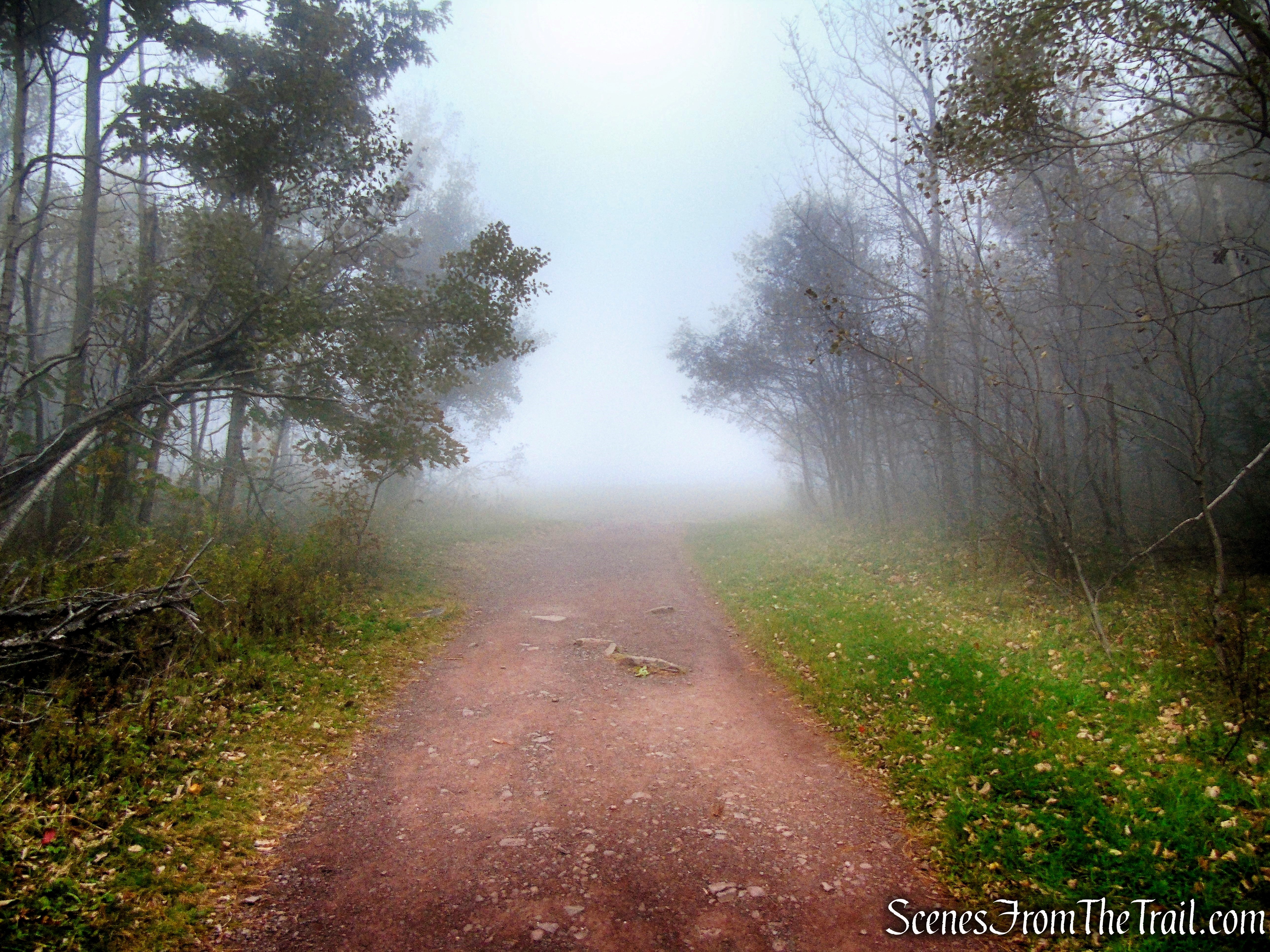
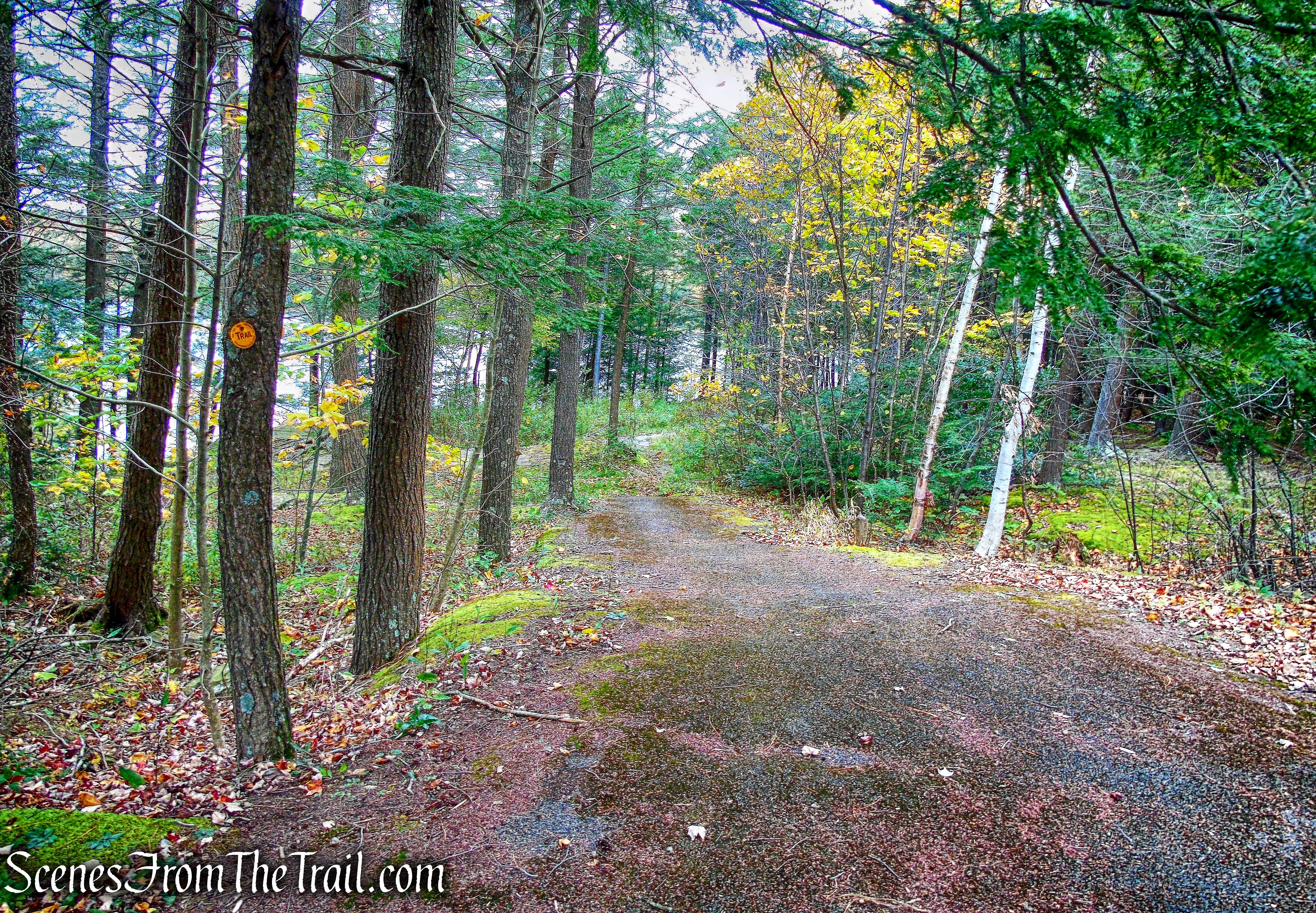
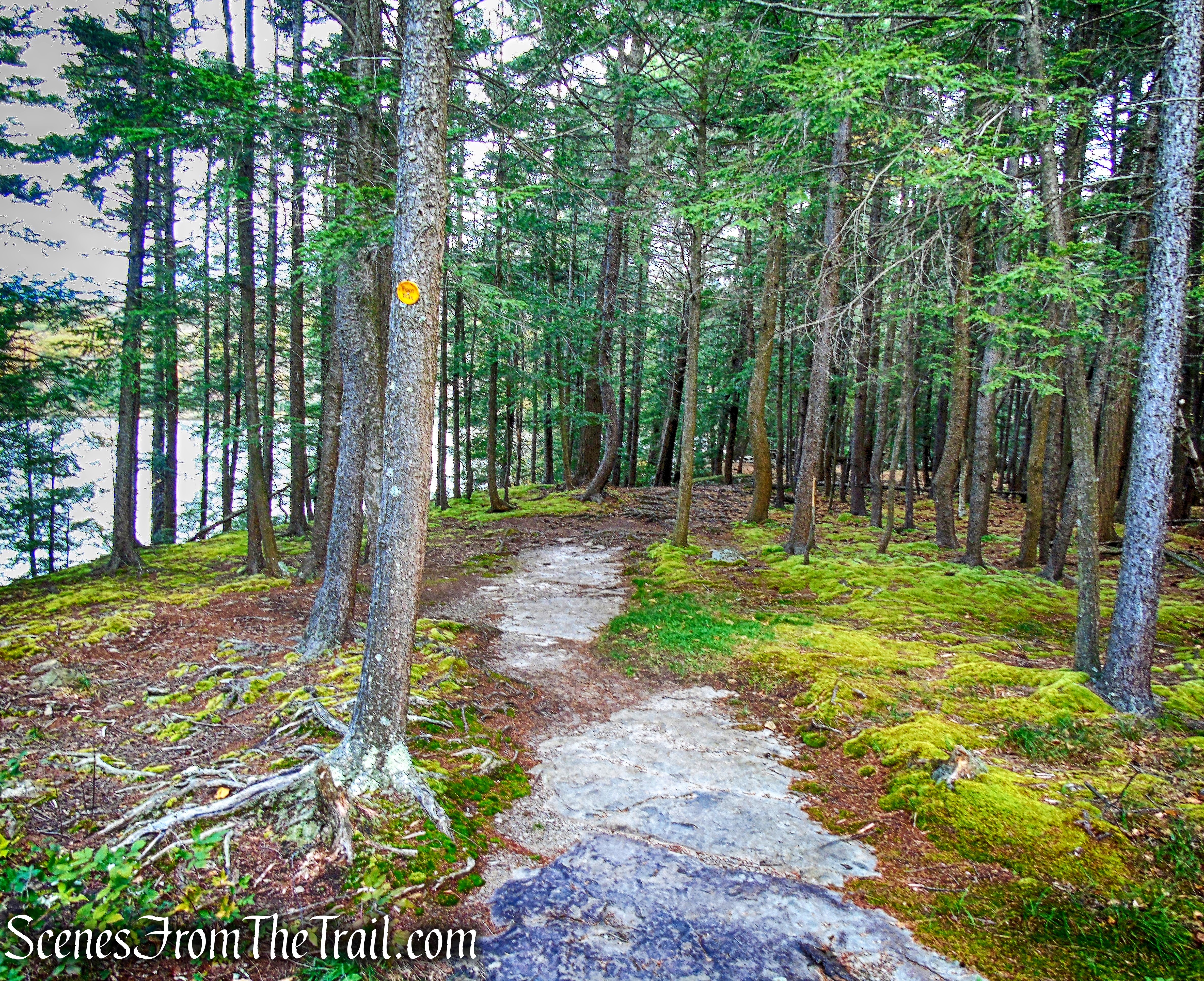
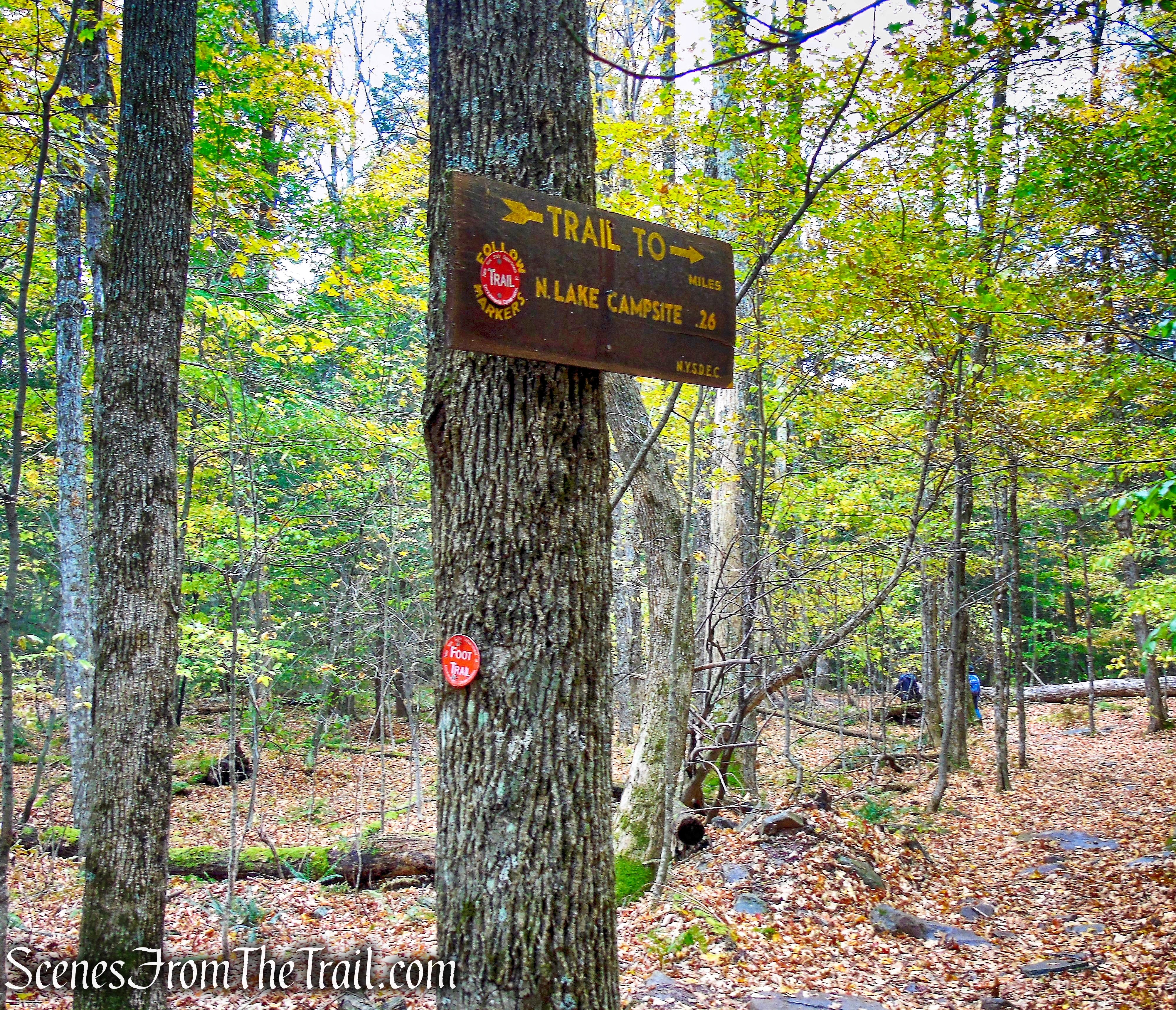
After entering the campground, we followed North Lake Road all the way to North Lake Beach and through the day-use area public lot, towards the large picnic pavilion, turned left and parked in a dirt lot. This is the closest one can park to the Catskill Mountain House site and the Escarpment Trail also passes through the upper portion of the parking area. As luck would have it, the morning started out with heavy fog so we adjusted the hike slightly until it cleared up. From the parking area, we headed east to the blue-blazed Escarpment Trail and began walking uphill on the gravel road. From the parking area it is a 0.2 mile uphill walk.
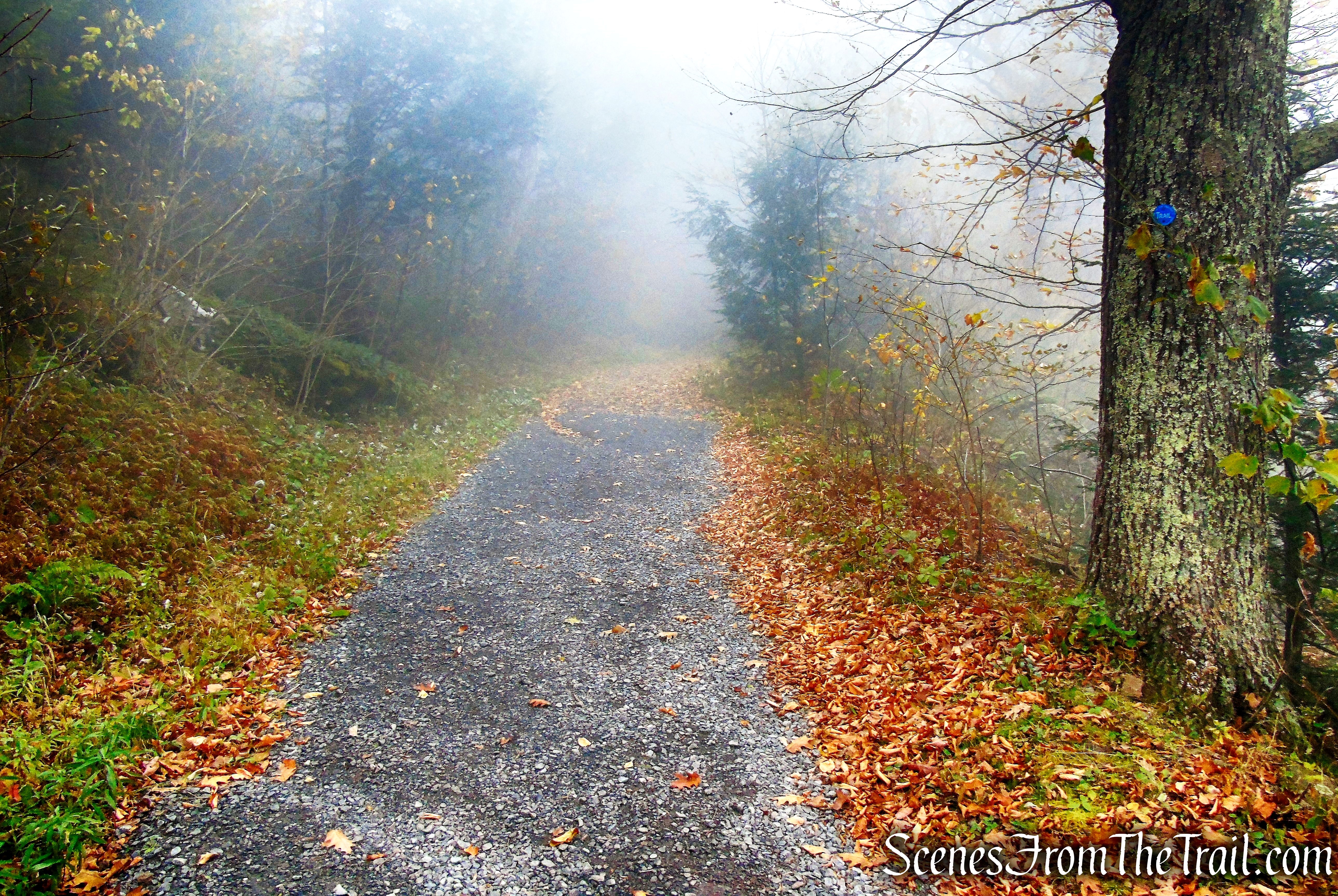
Escarpment Trail
In a short distance, the Escarpment Trail reaches a T-Intersection and turns left. The blazes indicating the left turn are well above eye level on a tree, a good distance away from the junction.
Escarpment Trail
Escarpment Trail
Almost immediately after turning left, the trail passes between what remains of the two stone gateposts of what was once America’s most fashionable resort.
Escarpment Trail
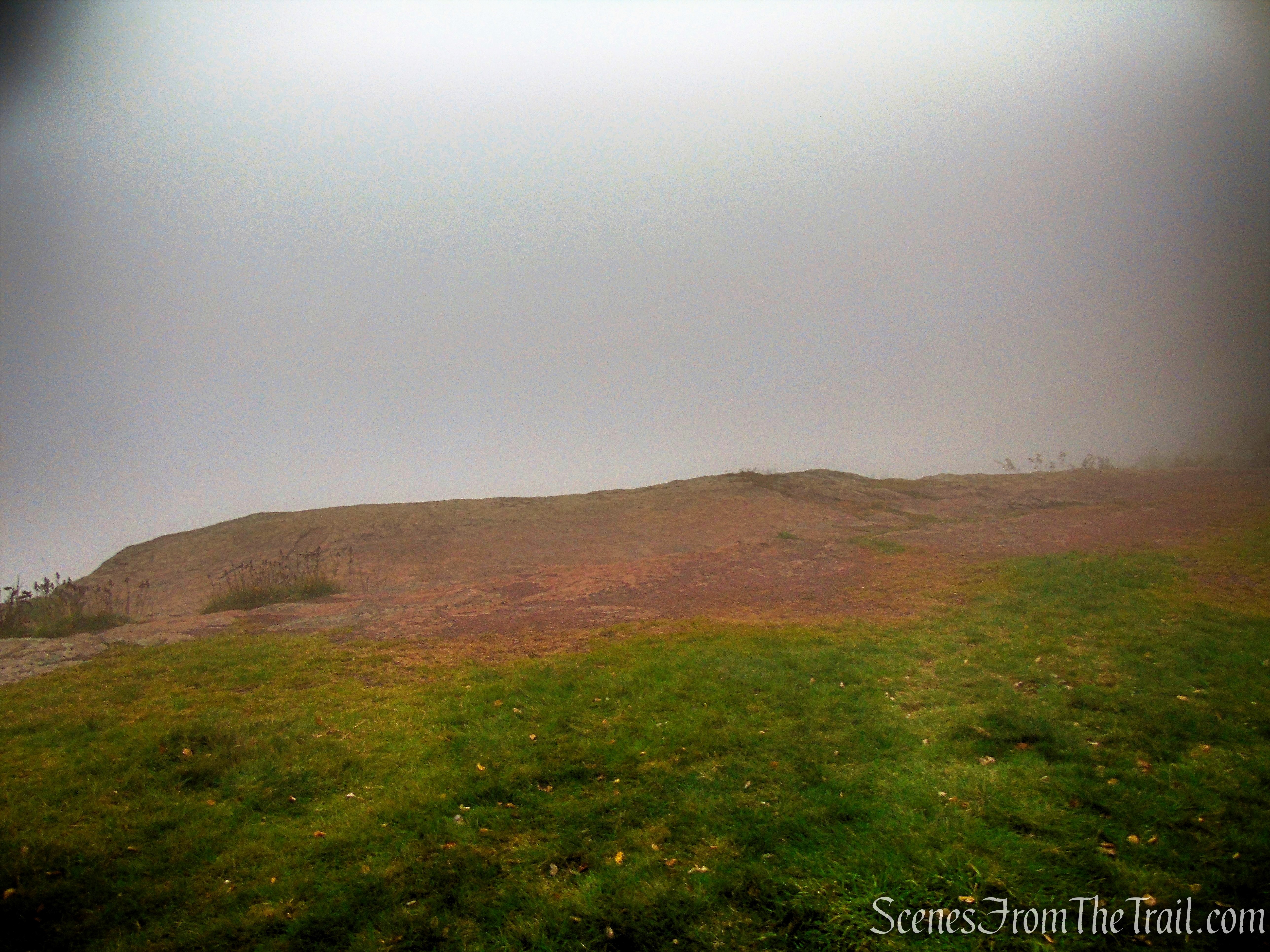
The trail continues out to an open field, the site of the Catskill Mountain House.
Catskill Mountain House Site
On this morning the fog was so thick that there were no views to be had.
Catskill Mountain House Site
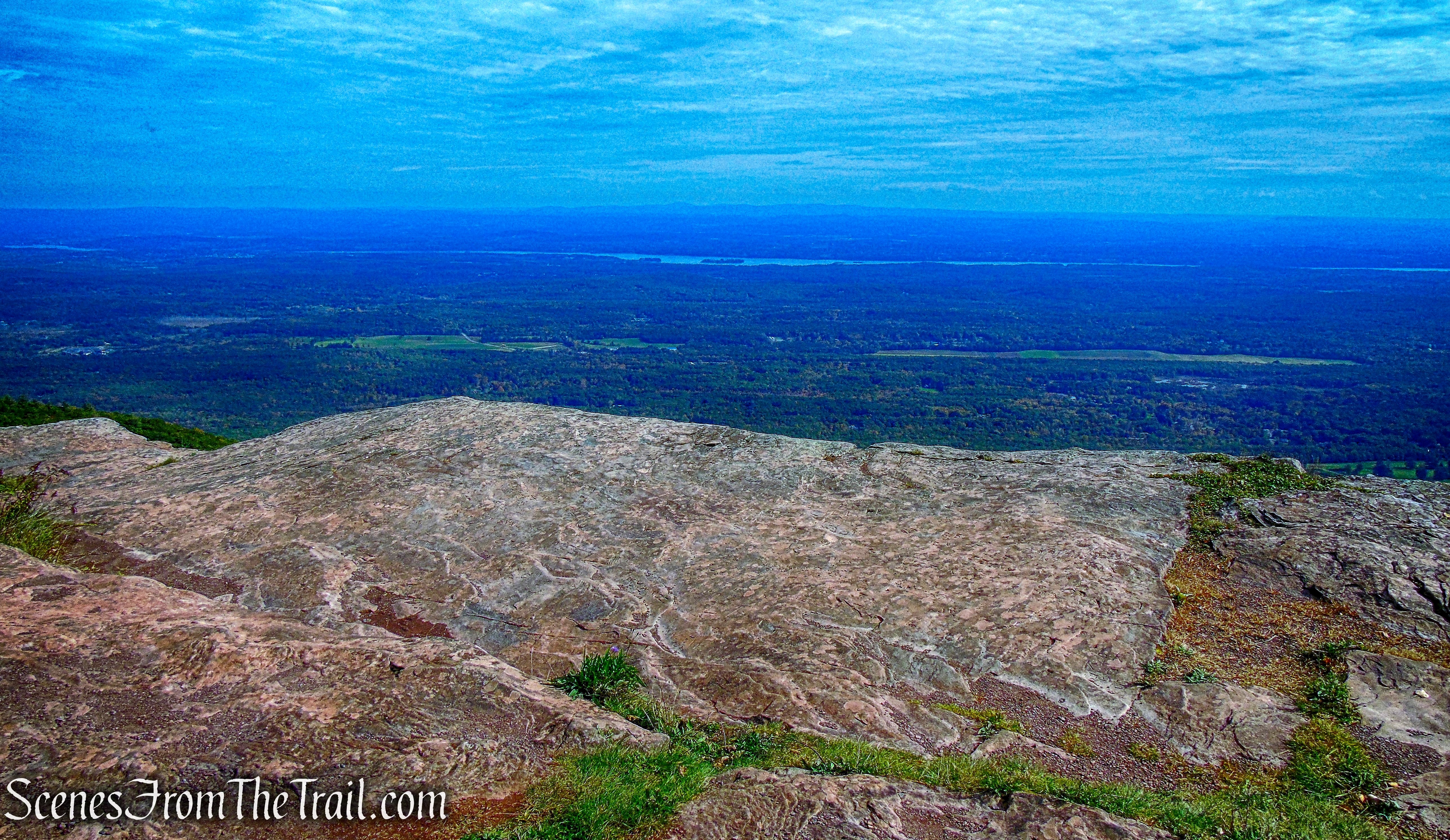
The same location and view the previous week. On a clear day you can see five states.
Catskill Mountain House Site
The Mountain House location had been famous for its panoramic views of the Hudson Valley before the building of the hotel. Artists and writers had discovered the Catskills earlier, and frequented the Mountain House once it was built. Washington Irving and artists of the new Hudson River School, most notably Thomas Cole, enjoyed and depicted the hotel.
Interpretive signage is located at the summit.
Catskill Mountain House Site
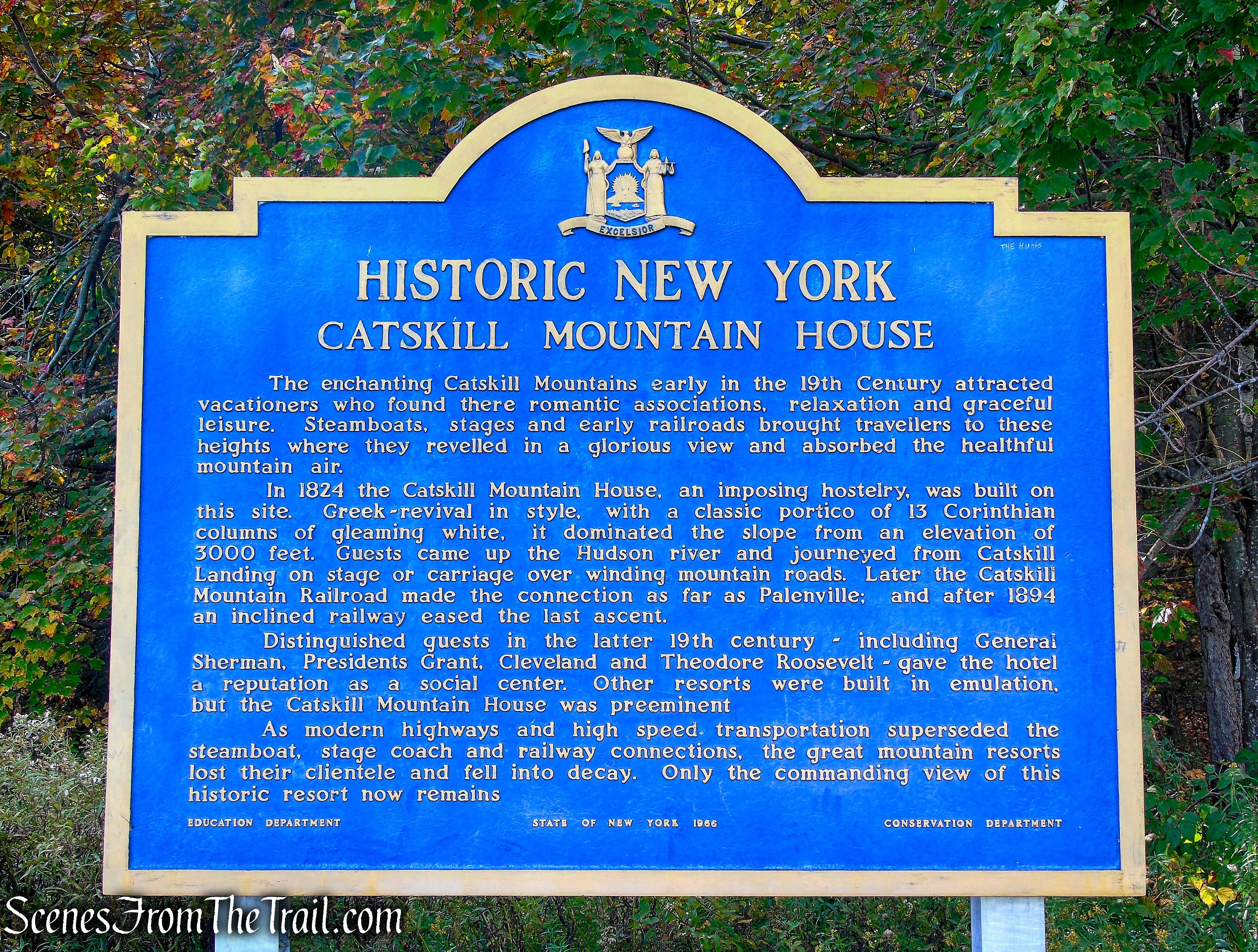
The Catskill Mountain House was built in the fall and winter of 1823, and opened in the summer of 1824. Located on a cliff 1,630 feet above the hamlet of Palenville, it offered sweeping views of the Hudson River Valley. In its heyday, “America’s Grandest Hotel” catered to 400 guests a night, including three United States presidents, Ulysses S. Grant, Chester A. Arthur, and Theodore Roosevelt, as well as other prominent figures of the day.
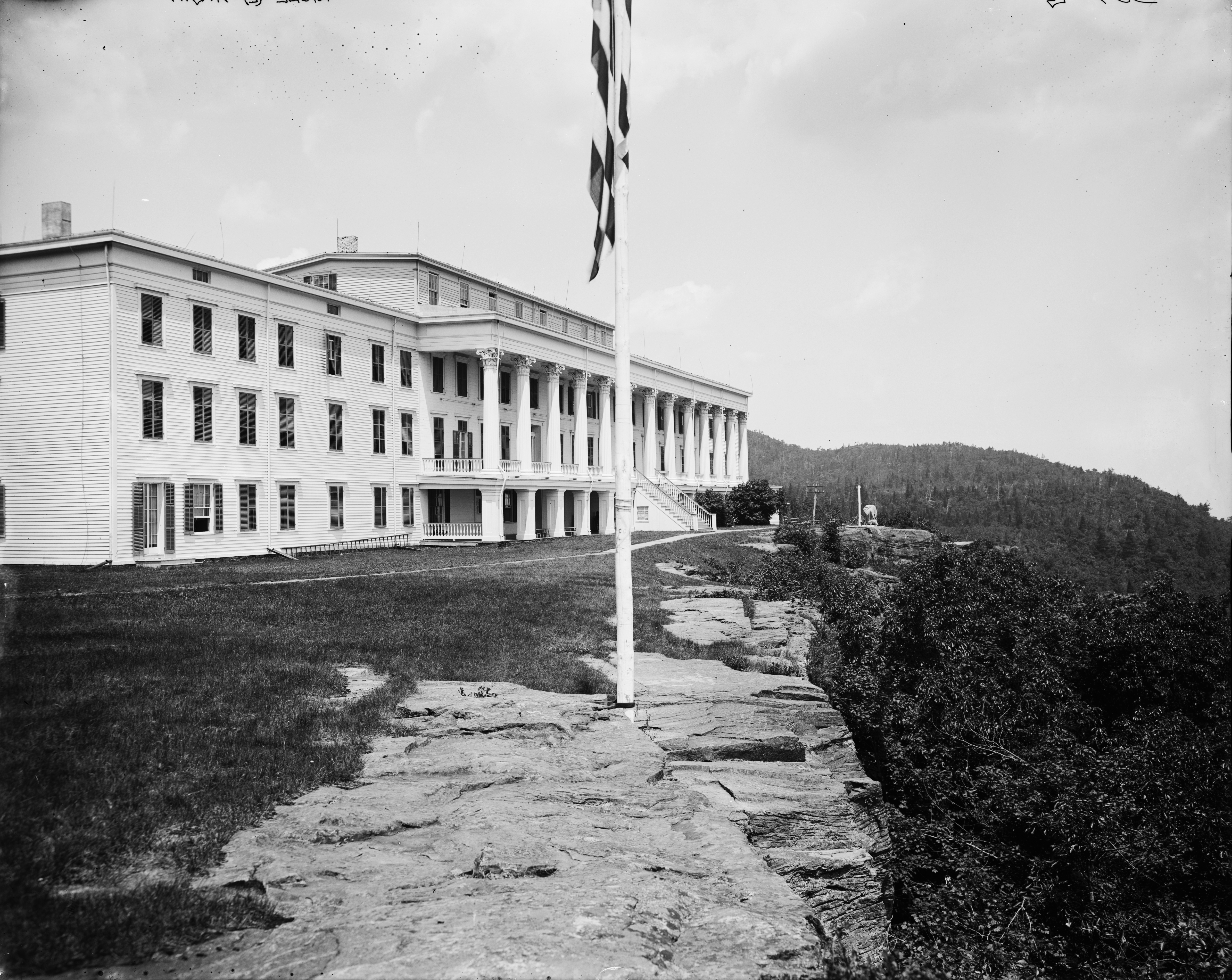
Catskill Mountain House
The view that made the Mountain House famous came at a cost, getting up the 1,600 ft. climb from the valley required a five-hour stagecoach ride. As more competing hotels that were easier to reach began to be developed, the Mountain House built the cable-operated Otis Elevating Railway to bring its guests directly from the Hudson to the hotel. But the railway proved to be expensive to operate, and was finally sold for scrap in 1918 during World War I.
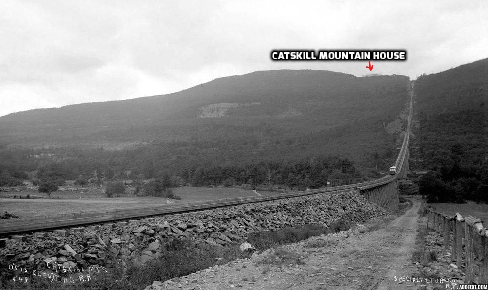
Otis Elevating Railway
The Mountain House hung on until the start of World War II, but the season of 1941 would be it’s last. In 1962 the State of New York acquired the property, and the hotel, severely damaged by weather, years of neglect and an unfinished attempt to renovate the hotel in 1952-1953, was burned by the New York State DEC on Jan. 25, 1963.
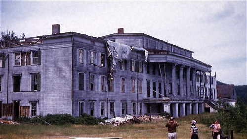
Catskill Mountain House circa 1953
All that remains of what was once America’s first mountaintop resort are the gateposts, the sweeping views from the cleared site and the carvings in the red sandstone rocks from visitors long ago.
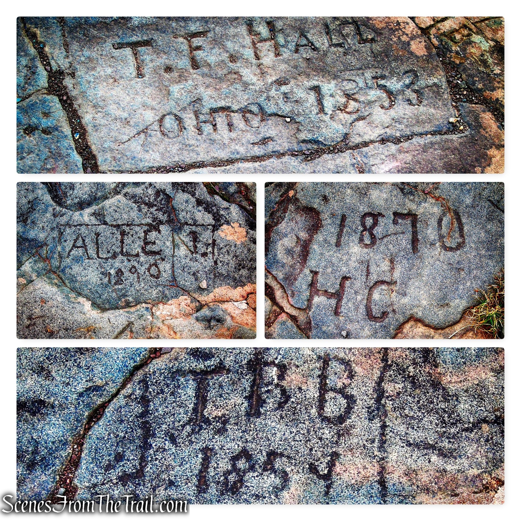
Catskill Mountain House Site
Since this hike was centered around views, we stayed at the Catskill Mountain House Site for a while, hoping for the fog to dissipate. The wind began to blow the fog past the cliff and we were hopeful, but that only lasted briefly. I was able to capture an image of the precipitous cliff in the few moments it was clear.
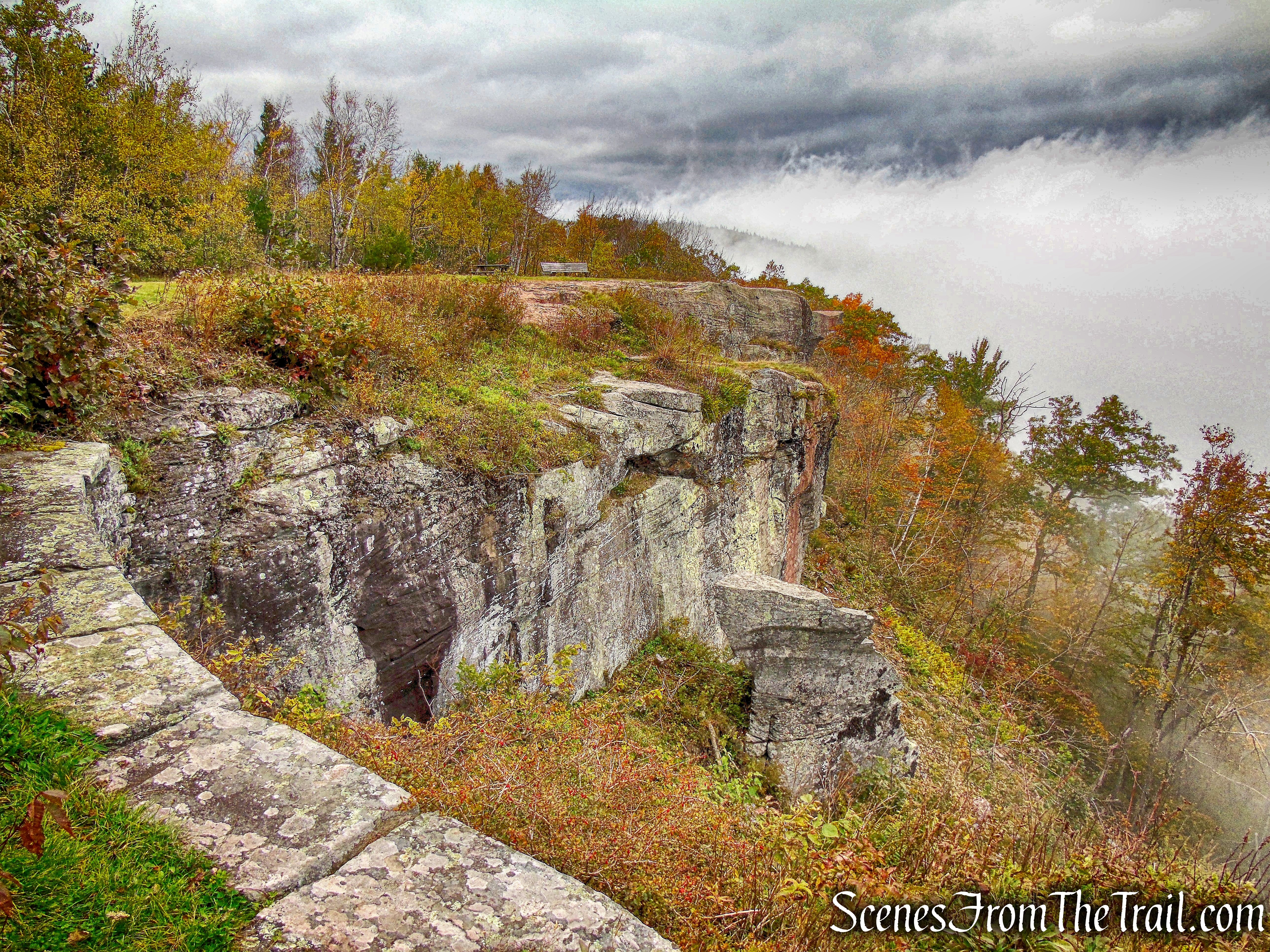
Catskill Mountain House Site
Since most of the views on this hike are to the east, we decided to head west towards North-South Lake and check out Alligator Rock. This was an optional end of hike detour, but instead, because of the fog, we decided to go there first. I figured by the time we were done at the lake and made our way back to the Escarpment Trail, the fog would be gone.
We retraced our steps on the Escarpment Trail, through the stone gateposts and past the intersection where the Escarpment Trail turns right. We followed the gravel road down towards the boat rentals on South Lake. As we neared the lake, we jumped on the yellow-blazed North-South Lake Loop Trail.
North-South Lake Loop Trail
When we reached the shore of the lake, the trail comes to a T-intersection with the yellow blazes going both left and right along the shoreline. I wasn’t quite sure of which way to go, so we turned left. In a short distance we reached the South Lake Beach and boat rentals. Originally the two lakes were separated by an earthen dam, but the two lakes that people enjoyed in the 1800’s were merged into one.
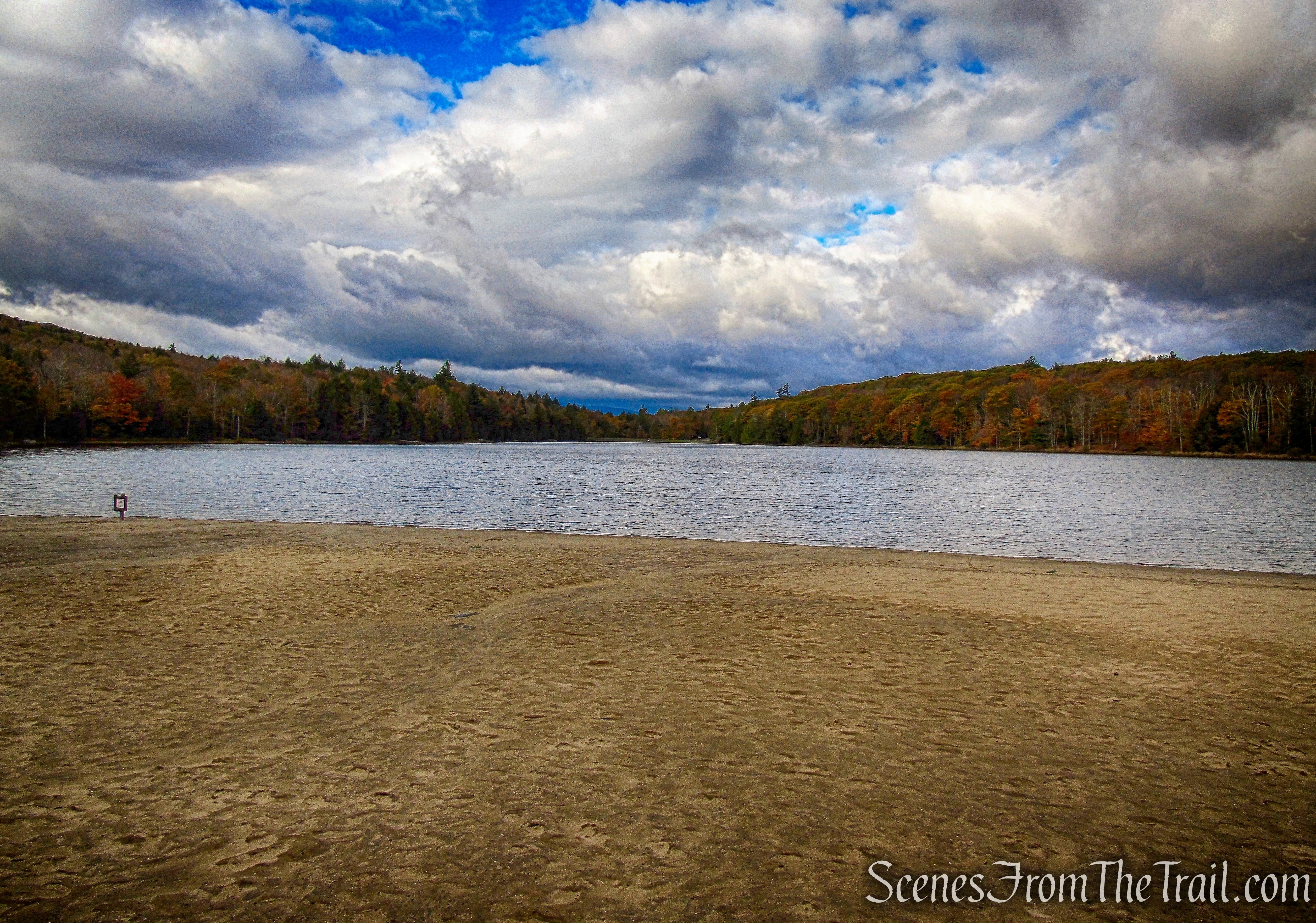
South Lake
It is a very scenic spot and most importantly, no fog. We wandered about a bit and asked the boat rental attendant where Alligator Rock is. She pointed us in the right direction and we retraced our steps on the North-South Lake Loop Trail, passing the junction where we first came from and continued along the lake. This stretch of the trail can be hard to follow.
North-South Lake Loop Trail
The trail leads away from the lake and passes alongside Dinosaur Rock, a massive glacial erratic.
Dinosaur Rock
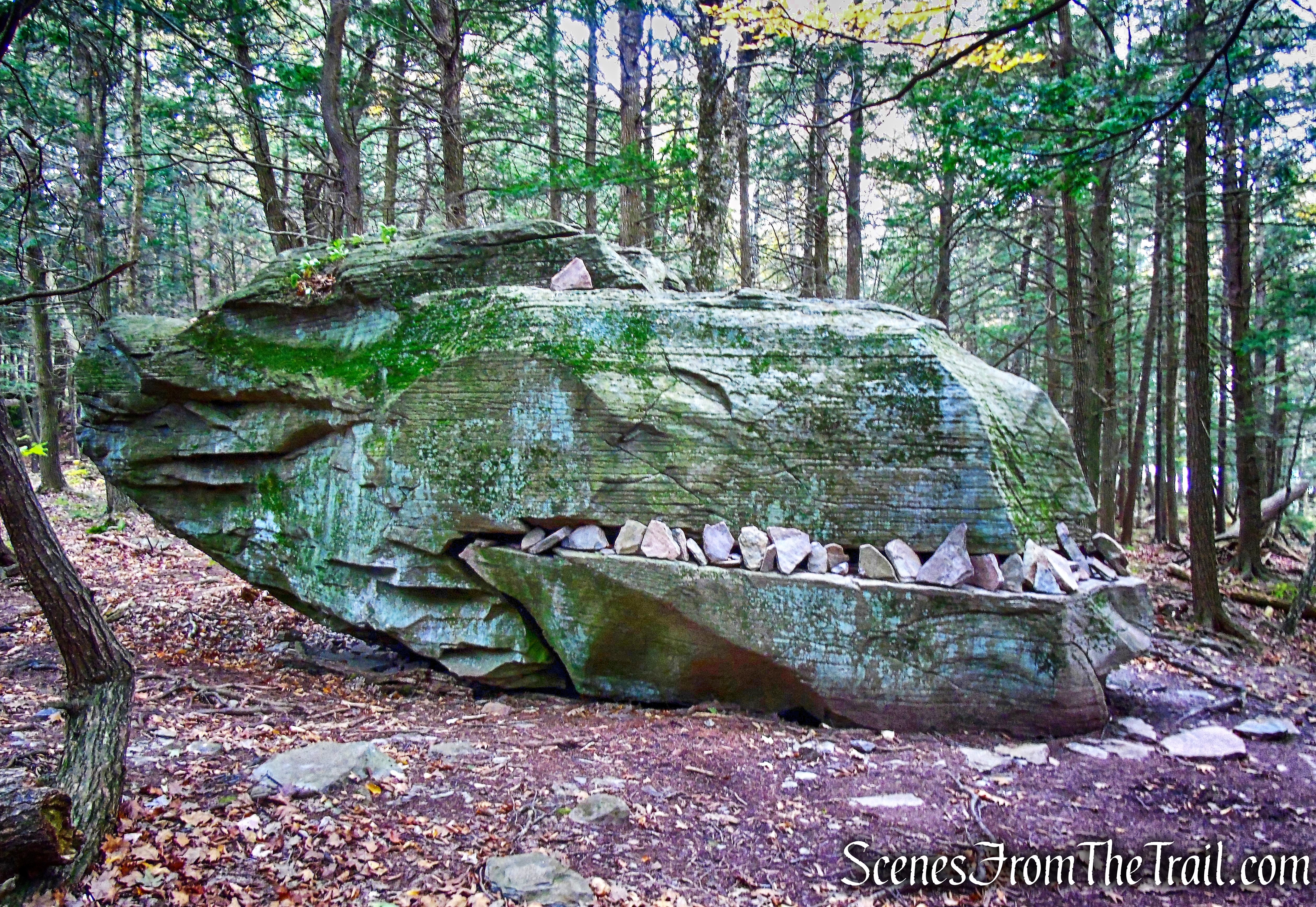
In about 500 feet, the trail reaches a gravel road and turns left. To the right, about 140 feet, on the side of the gravel road, is Alligator Rock, a pair of glacial erratics that formed an open mouth and had “teeth” added over the years so it looks like an alligator’s open mouth.
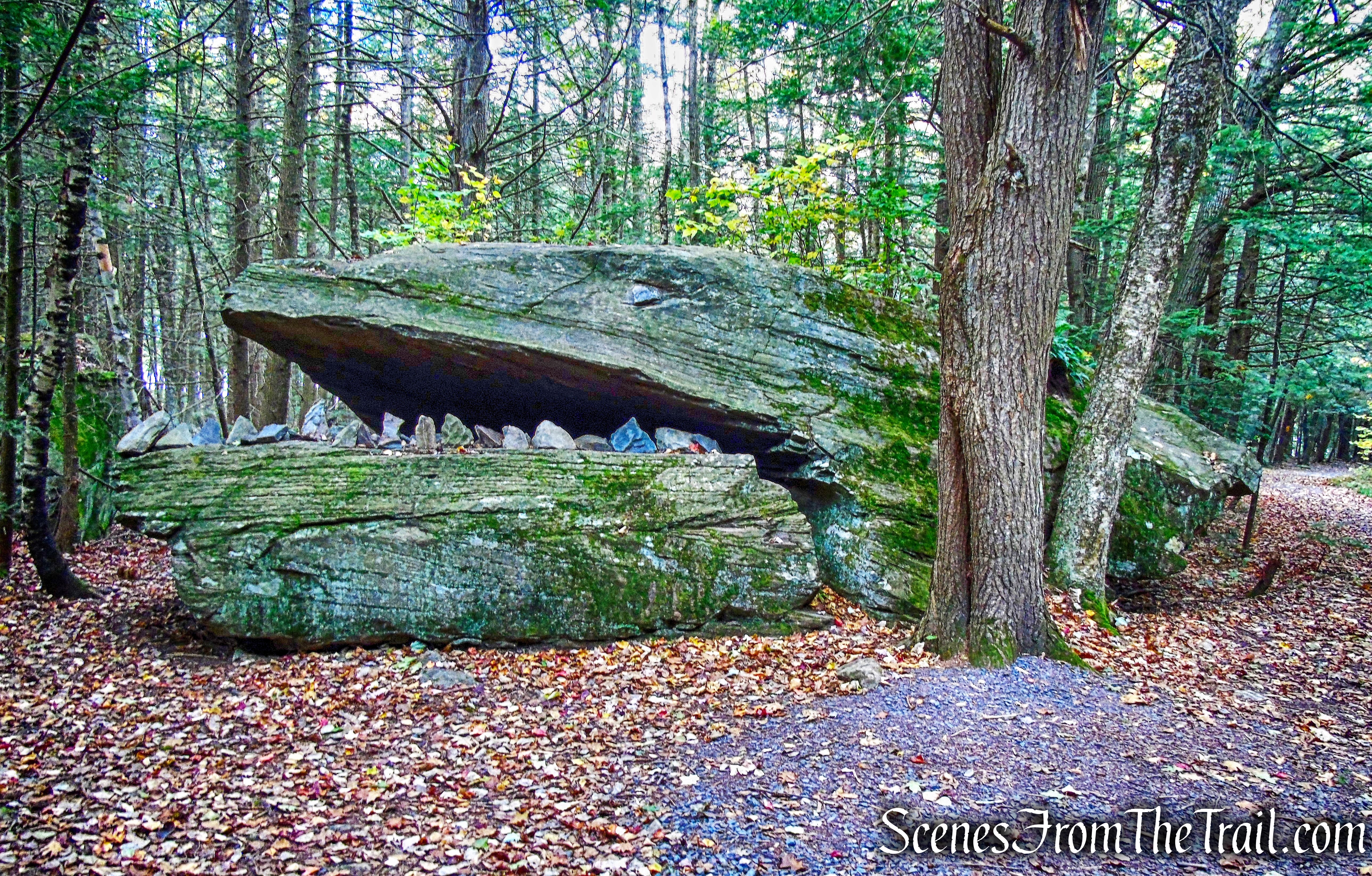
Alligator Rock
We retraced our steps and continued following the yellow blazes. There are many small rock outcrops along the shore with nice views of the lake.
North-South Lake
The wide gravel road heads southeast along the shore of North Lake and back towards the parking area.
North-South Lake Loop Trail
Once back in the parking area, we found where the Escarpment Trail ducks into the woods and began heading northeast. The blue-blazed trail continues straight ahead, with the lake on the left, picnic areas and a chain-link fence on the right. The trail then passes an overlook deck on the right, but it was still foggy, so we kept it moving.
Escarpment Trail
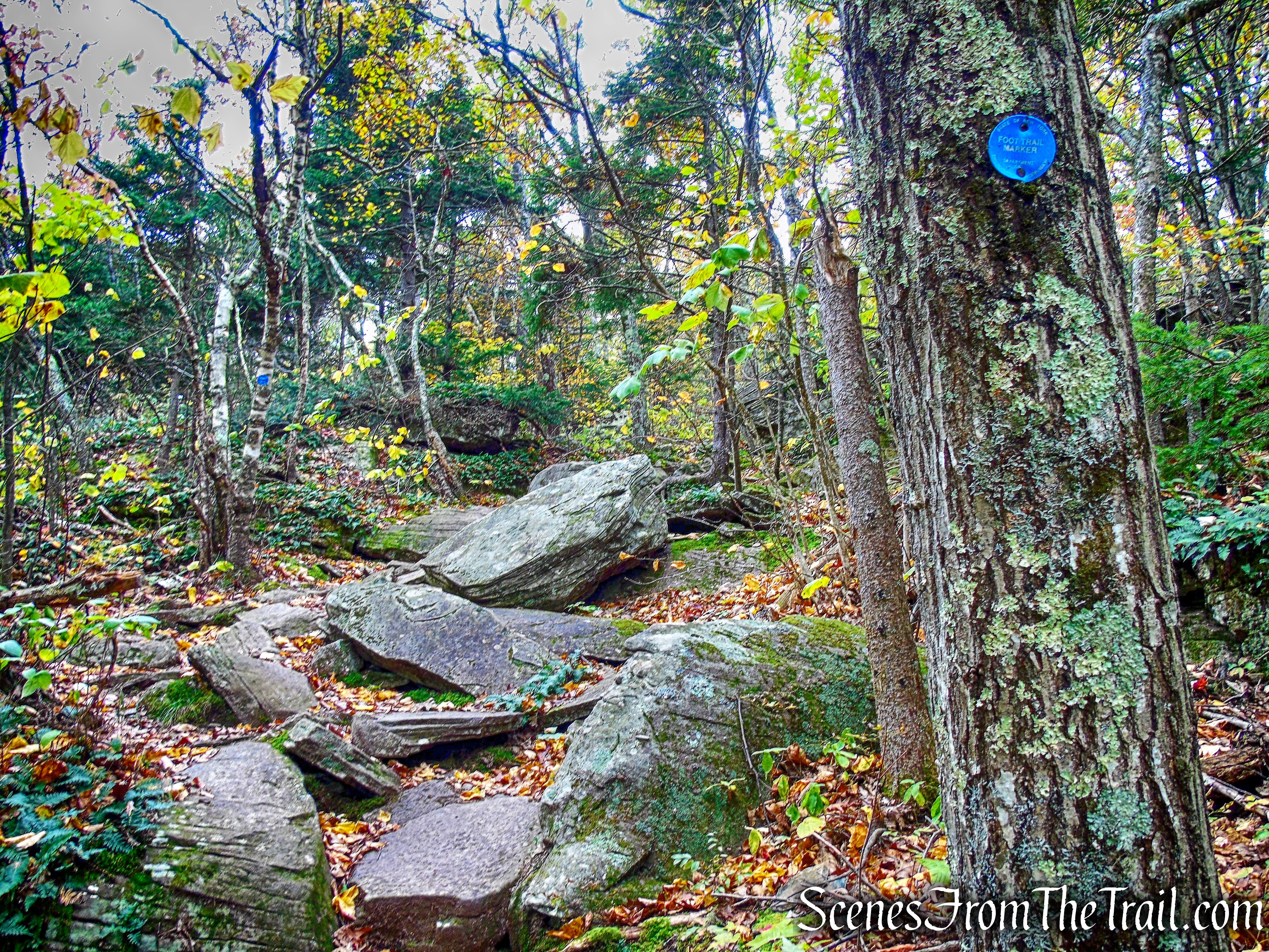
The Escarpment Trail soon climbs steeply over rock ledges.
Escarpment Trail
There are interesting rock overhangs to the right of the trail and we took a little time to explore them.
rock overhang – Escarpment Trail
We walked down a good distance then turned around and headed back to the trail. After climbing up, the trail passes right above.
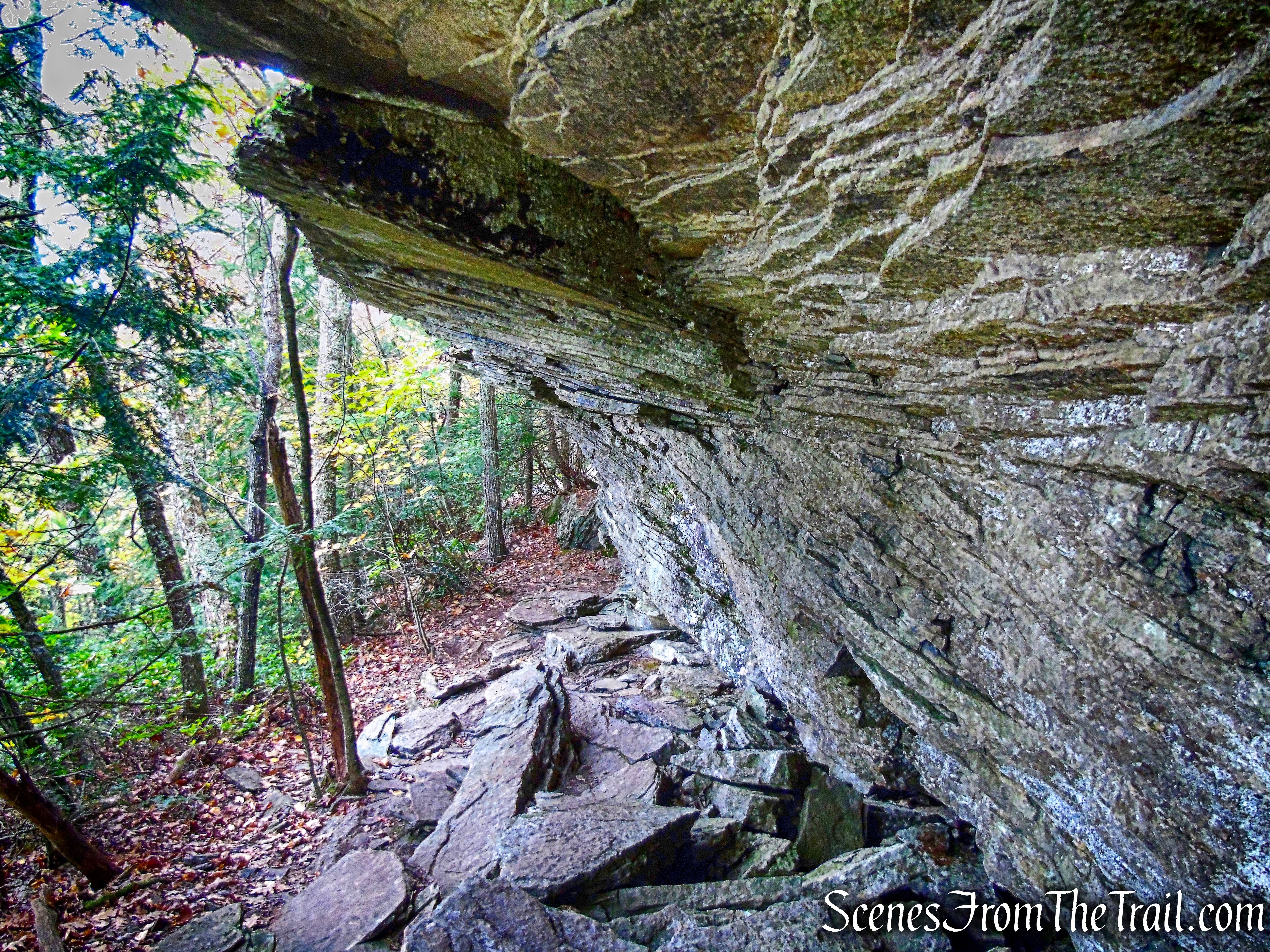
rock overhang – Escarpment Trail
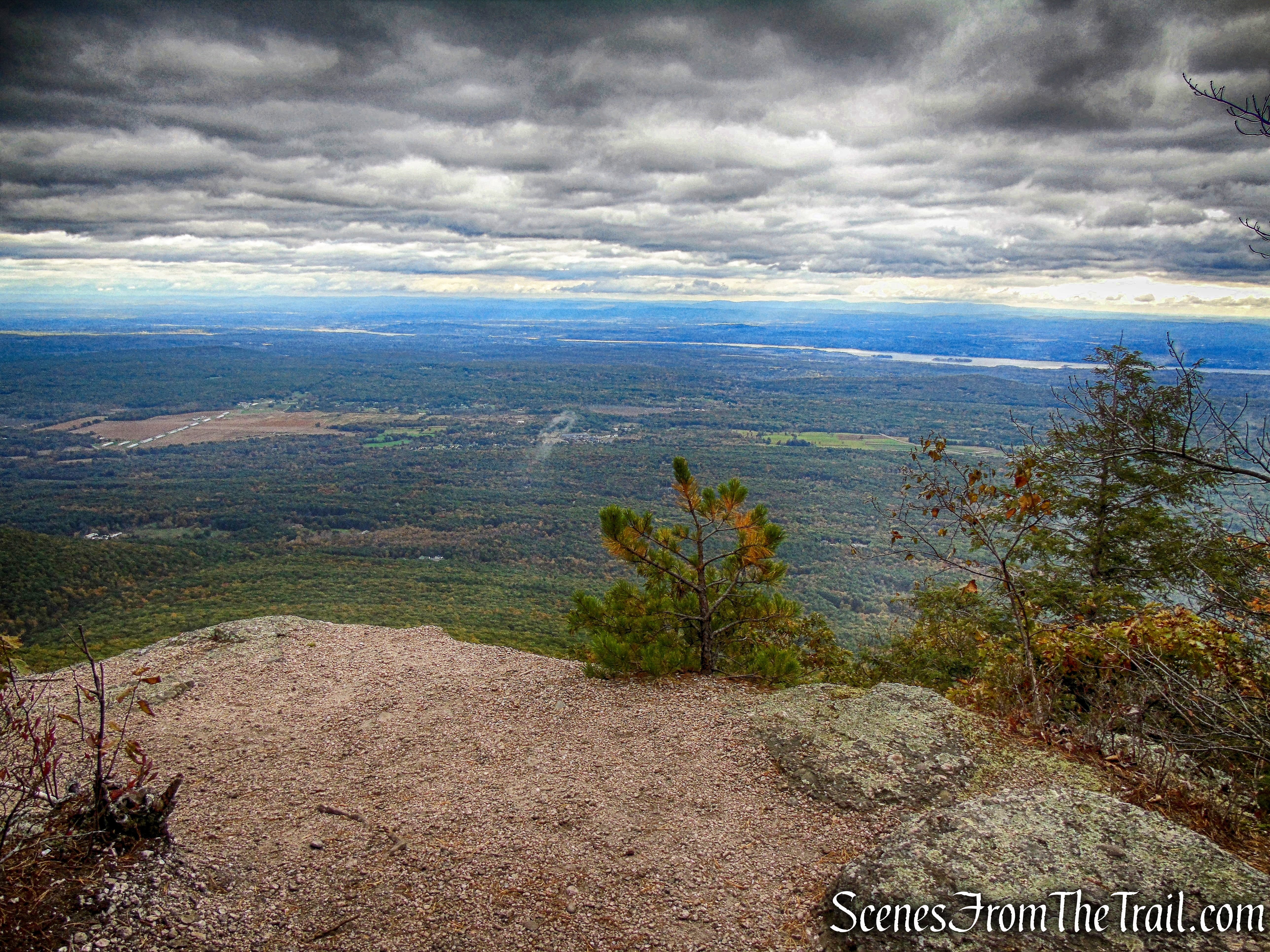
The Escarpment Trail passes a small rock outcrop with limited views, then closely parallels the cliff edge.
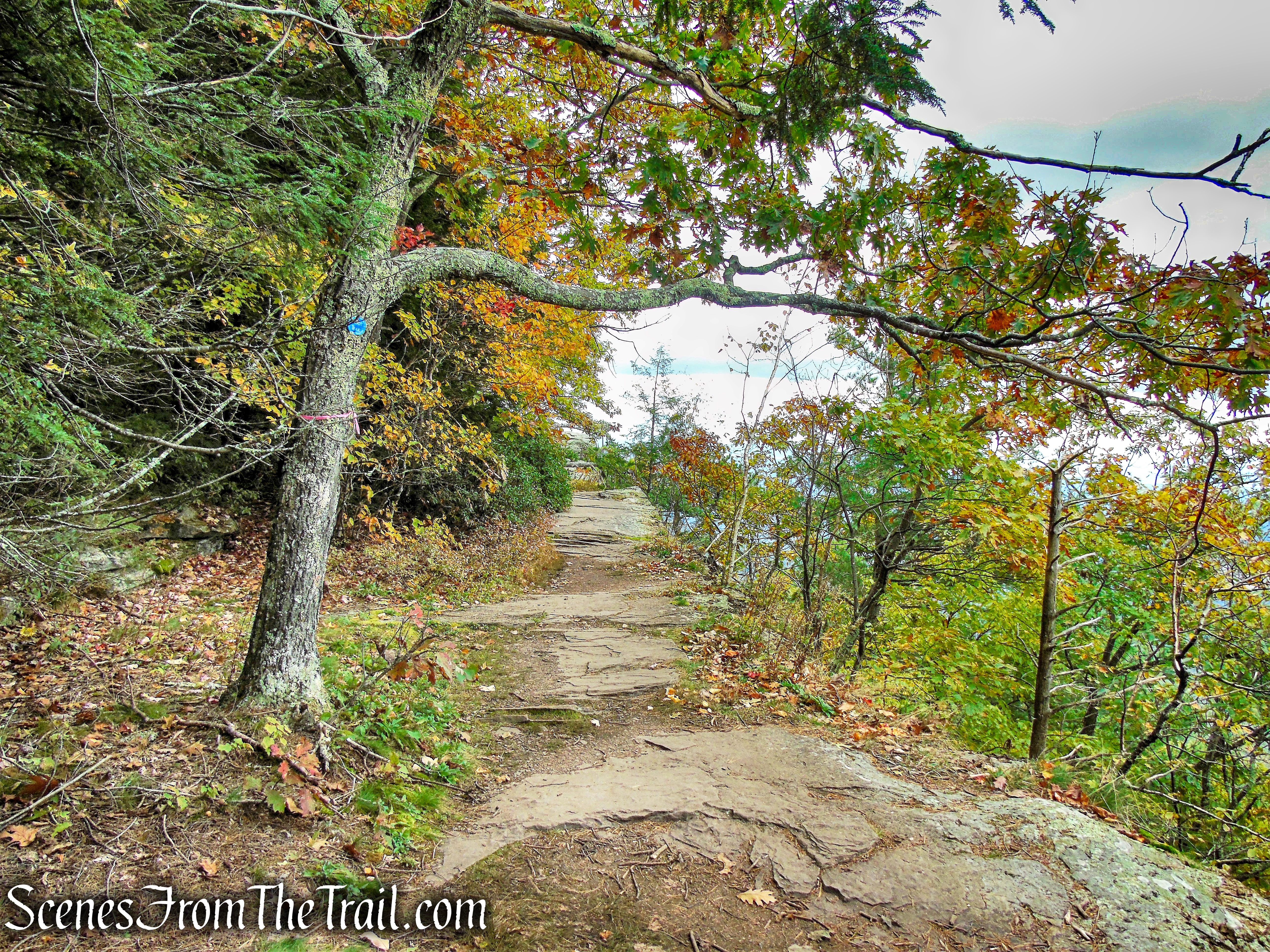
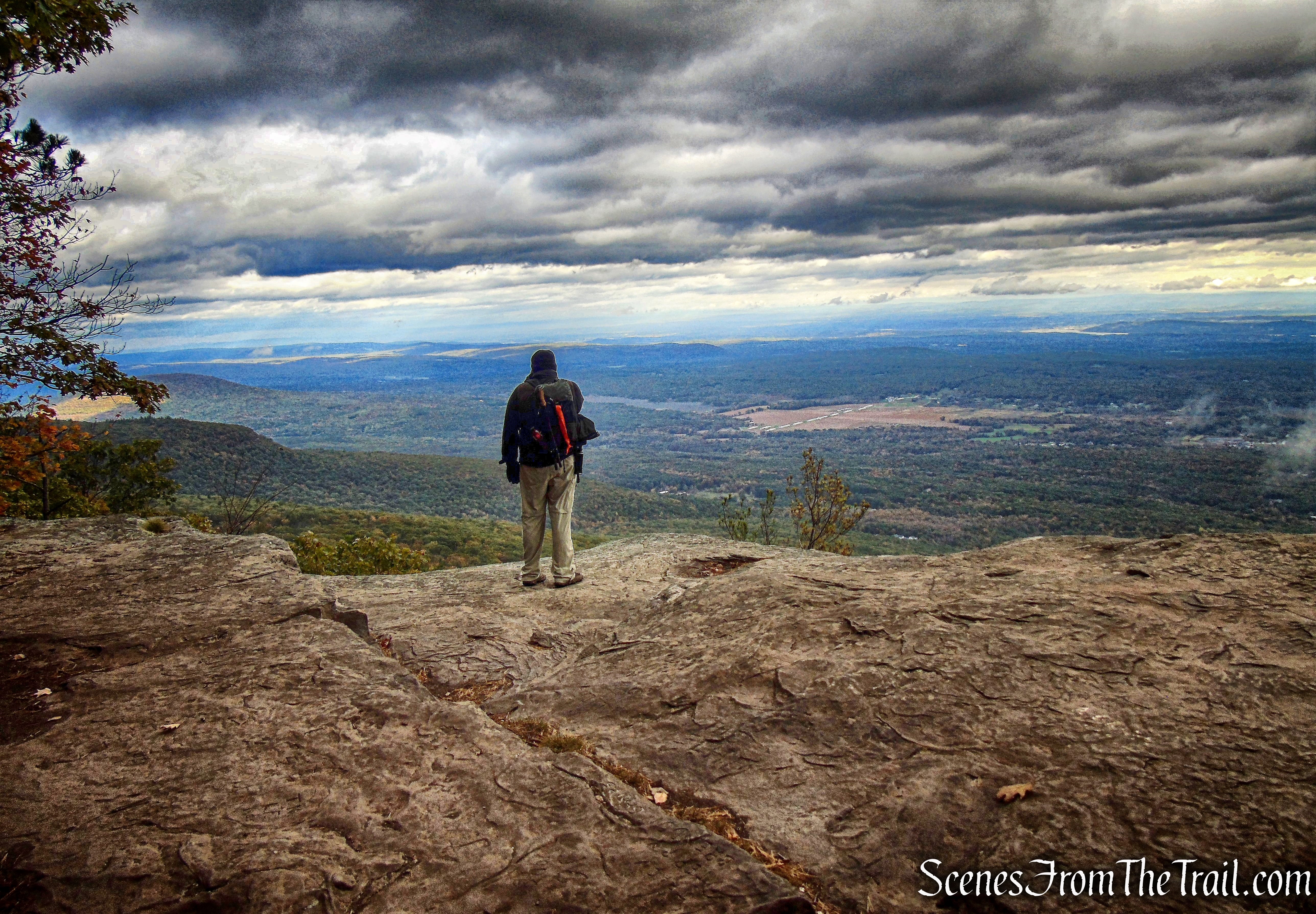
Escarpment Trail
A short distance later, we reached Artists Rock and our first fantastic view of the day. Artists Rock, where on a clear day it is possible to see four other states. Massachusetts and Connecticut are straight ahead at the South Taconic mountain range (behind the Hudson River, which snakes through the valley).
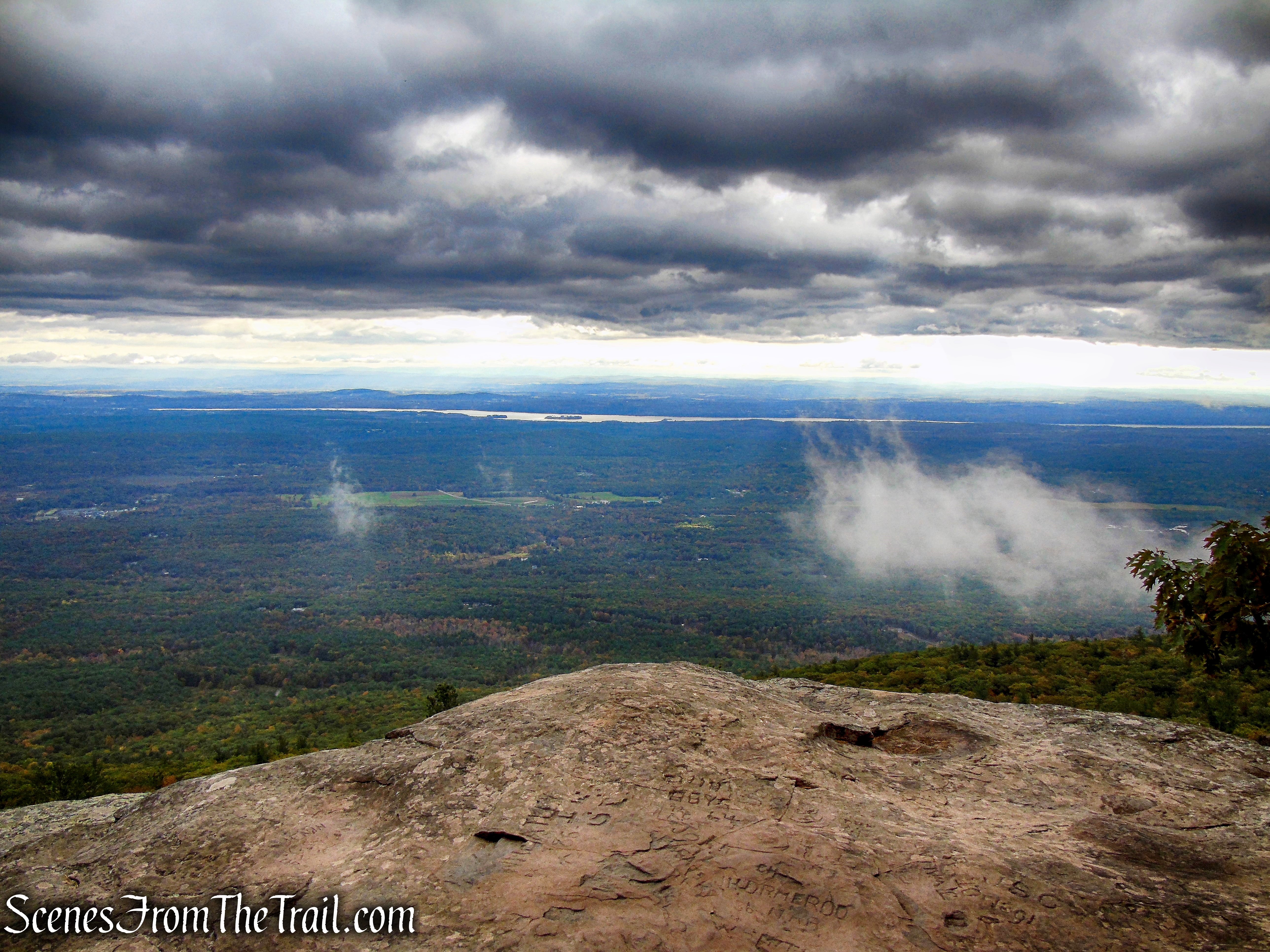
Artist’s Rock
Vermont and New Hampshire are to the left. Albany may be seen to the far left, with the Adirondack Mountains in the distance. This rock ledge was a favorite spot from which artists of the Hudson River School of Painting would paint scenes of the Hudson River Valley.
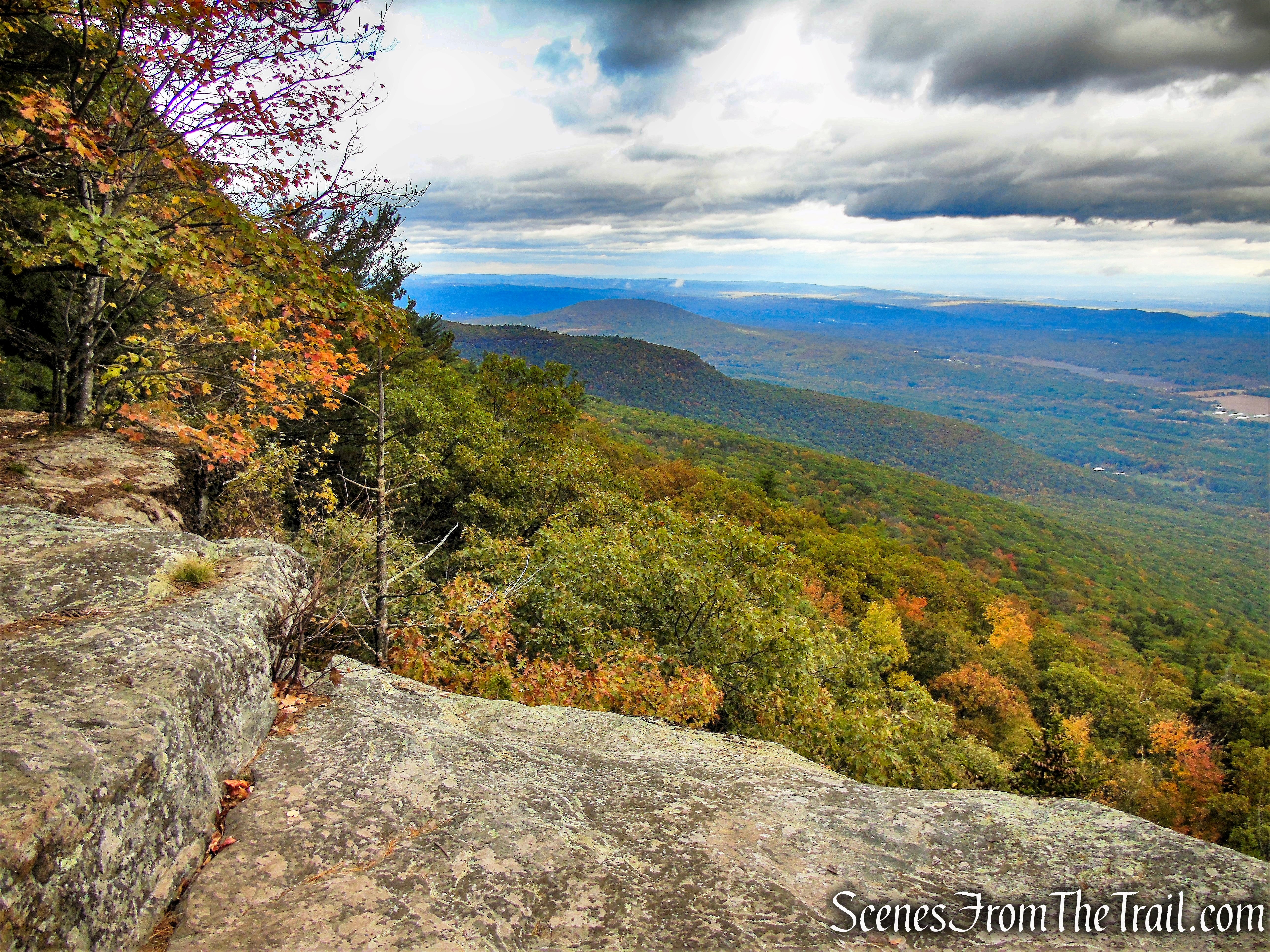
Artist’s Rock
From Artists Rock, the trail ascends steeply…..
Escarpment Trail
Escarpment Trail
The Escarpment Trail then passes by a massive outcrop of conglomerate rock to the right of the trail,
Escarpment Trail
with cliff walls to the left.
Escarpment Trail
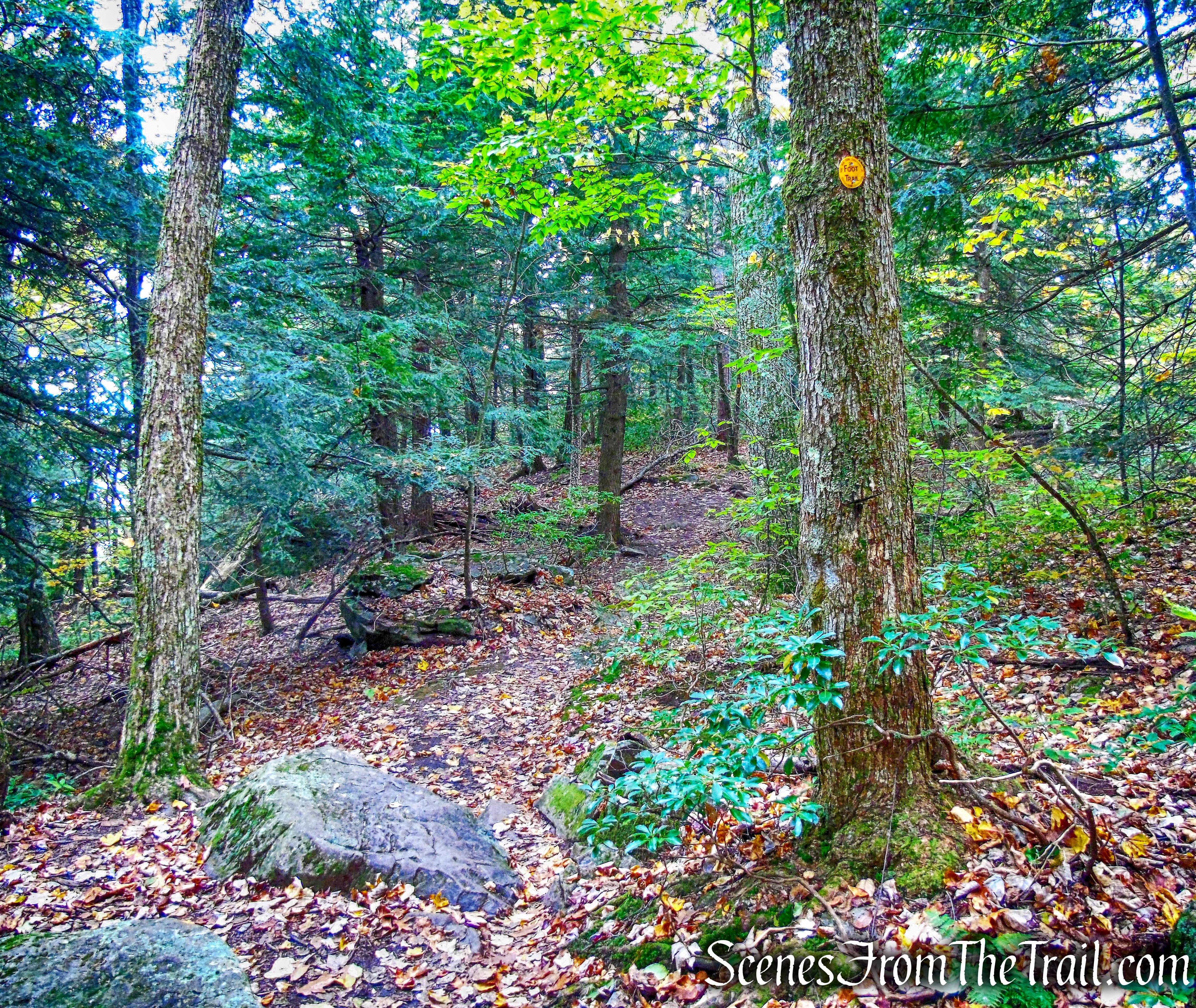
The trail parallels this rock outcrop until it reaches a junction where a yellow-blazed trail begins on the right.
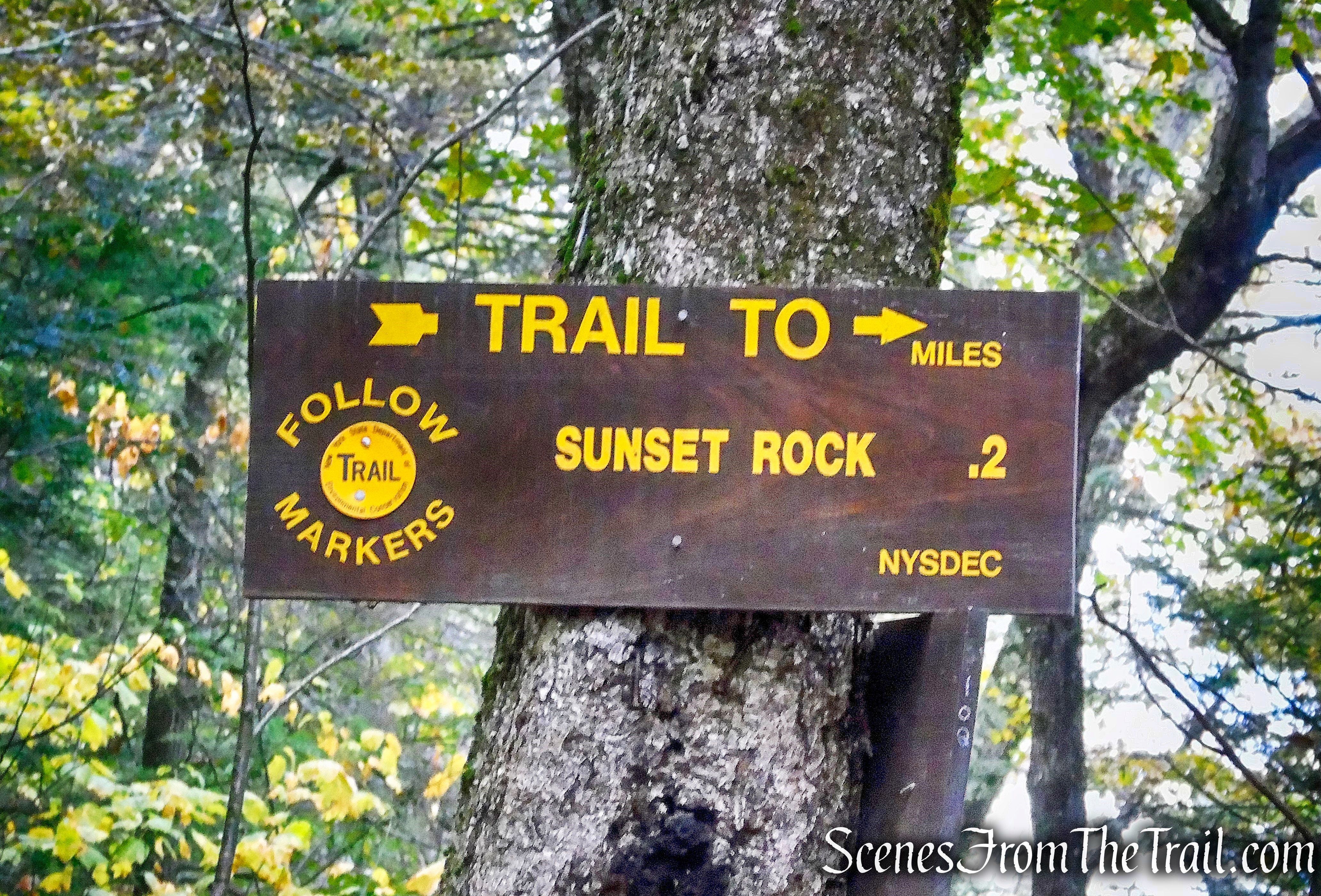
Sunset Rock Trail
This short trail leads to one of the best views in the Catskill Mountains.
Sunset Rock Trail
A short distance in, Lookout Rock is to the left. It offers similar views as Artists Rock, but a worthwhile stop.
Lookout Rock
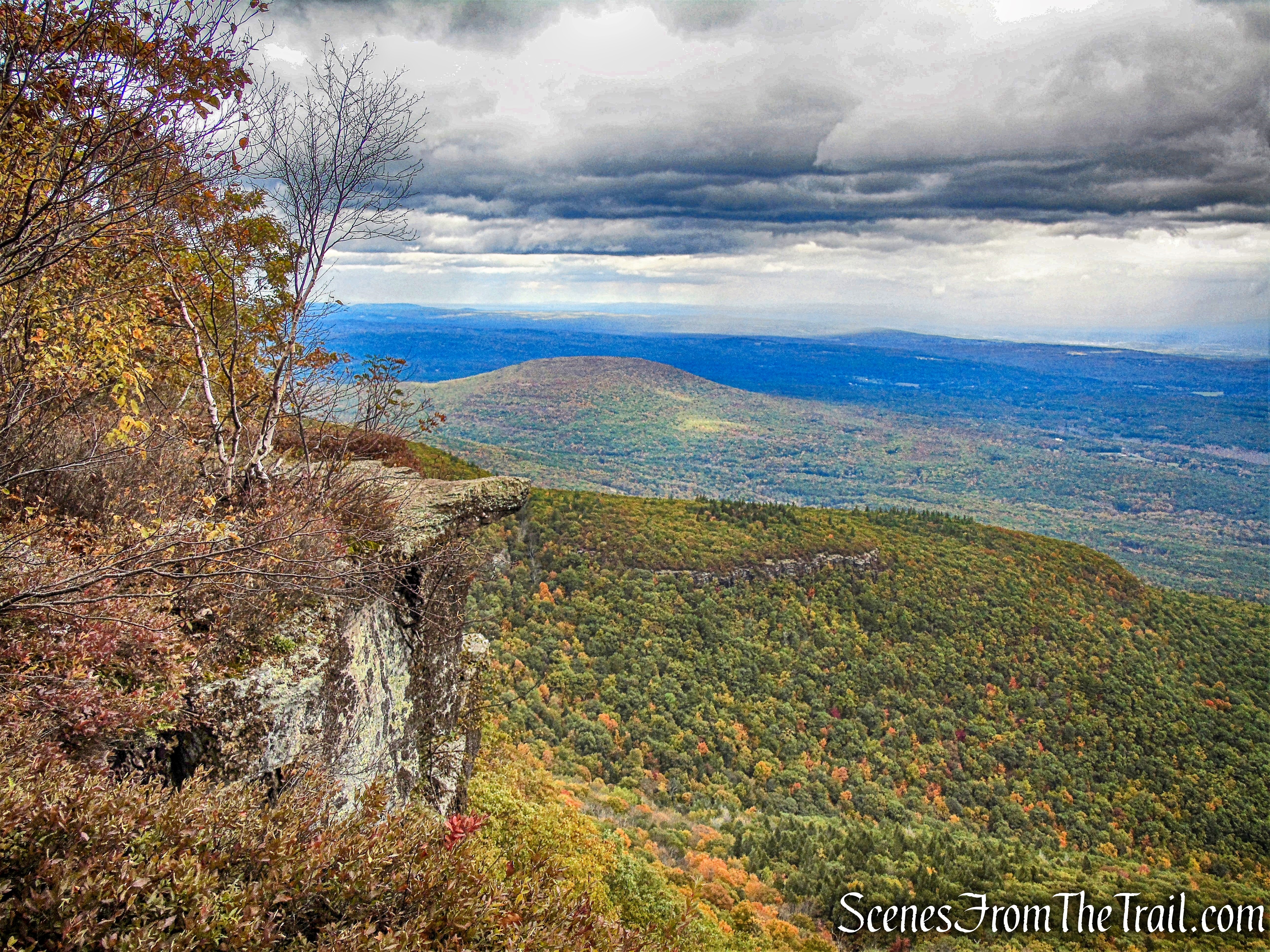
We then followed the yellow blazes to the end and arrived at Sunset Rock, my favorite view of the day.
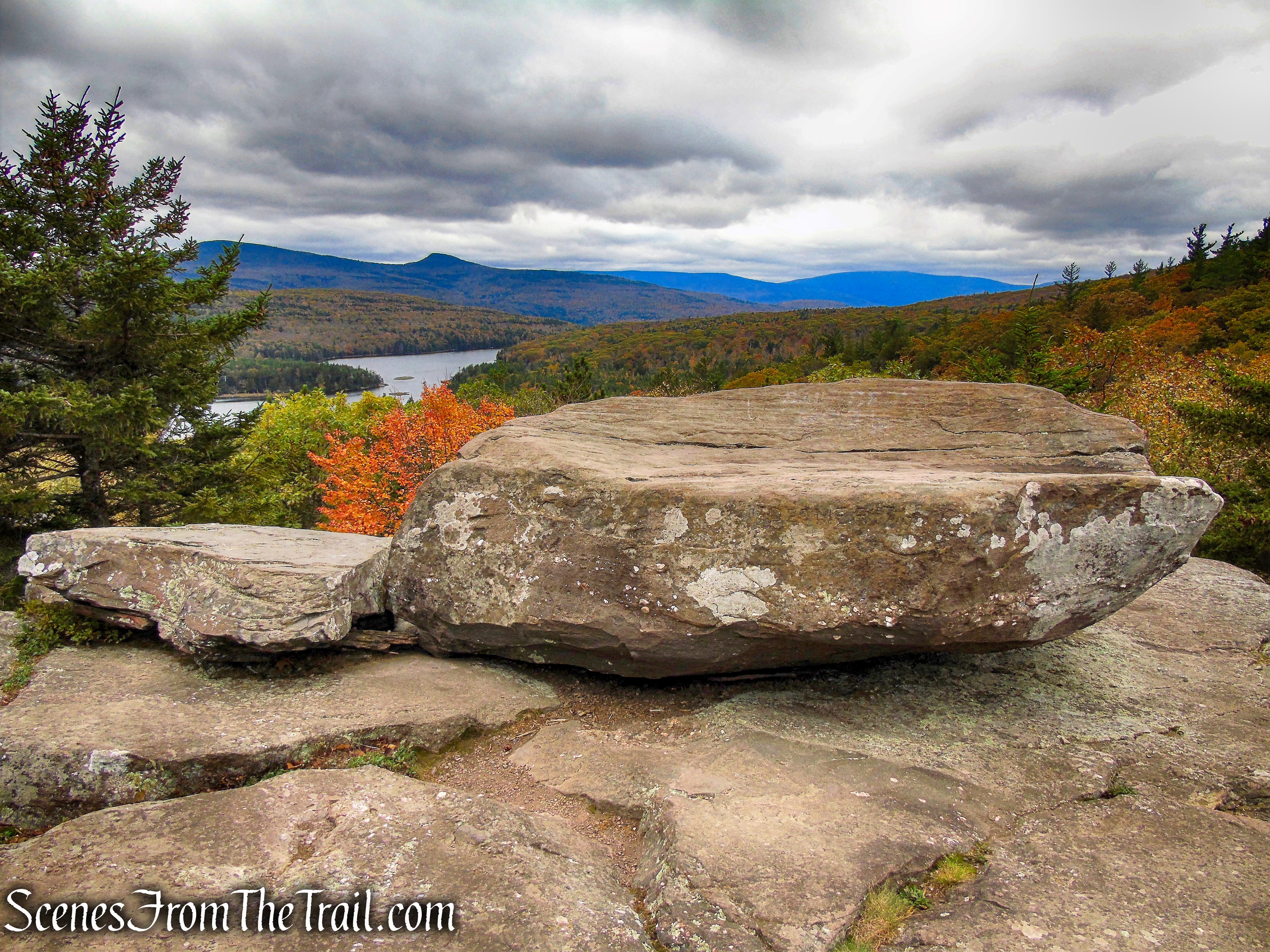
Sunset Rock
At least three major Hudson River School painters, Thomas Cole, founder of the School and his followers, Jasper Cropsey and Sanford Gifford, painted the spectacular view south along the eastern Catskill escarpment from the massive platform of conglomerate called Sunset Rock.
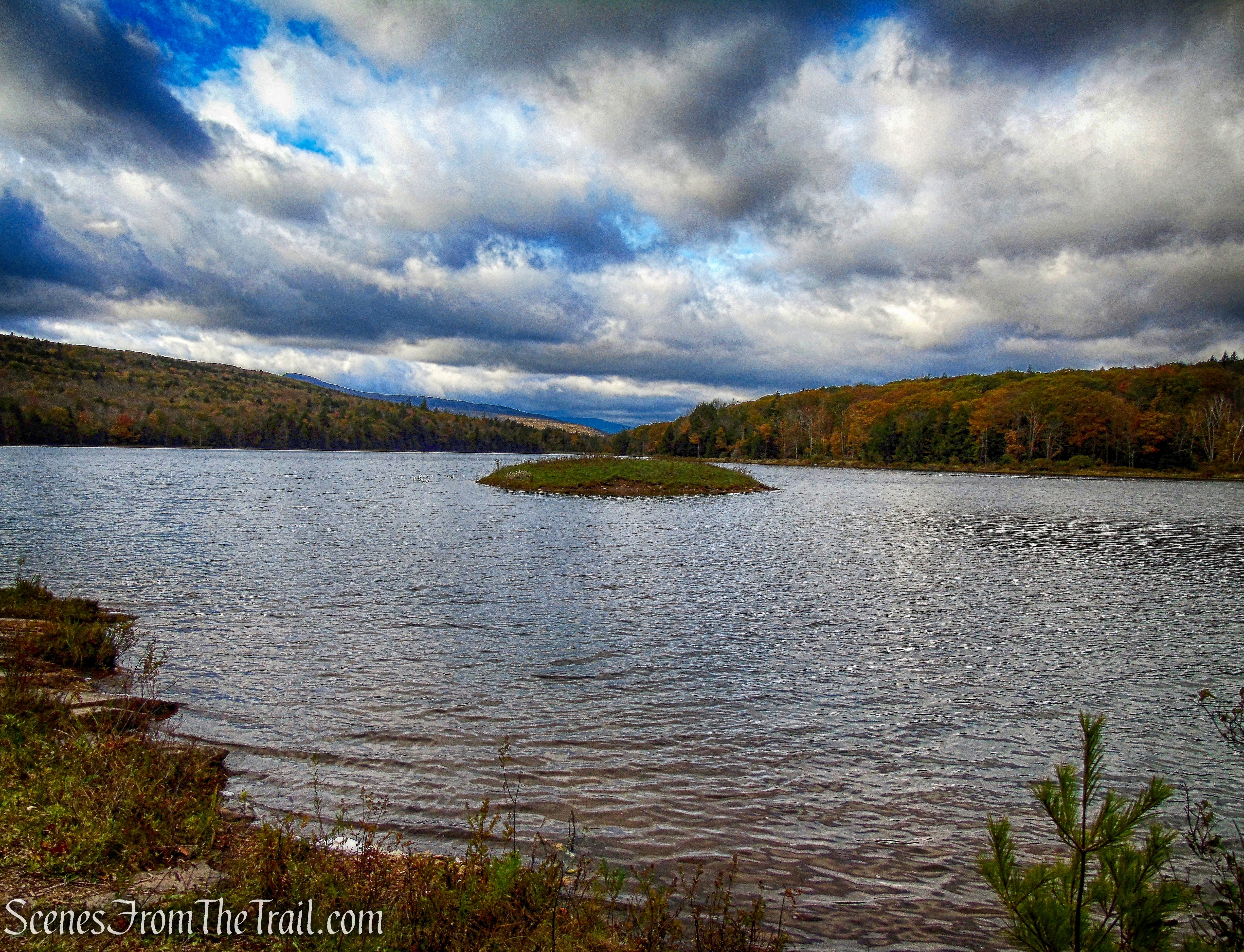
North-South Lake as viewed from Sunset Rock
We then retraced our steps back to the Escarpment Trail and turned right.
Escarpment Trail
The trail climbs rather steeply,
Escarpment Trail
then a short distance later, arrives at Newman’s Ledge.
Newman’s Ledge
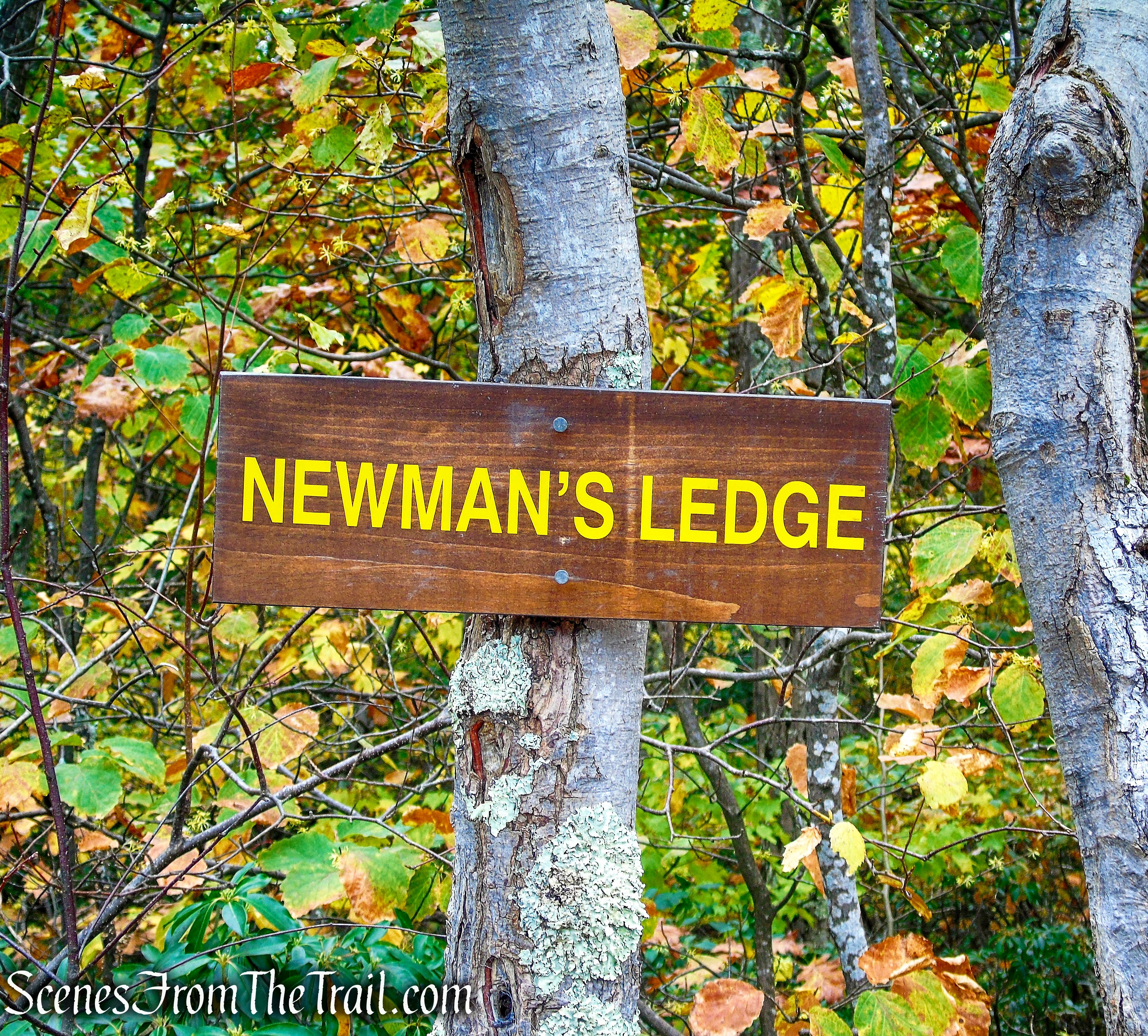
Newman’s Ledge
The vertical drop below Newman’s Ledge is estimated to be around 500 feet.
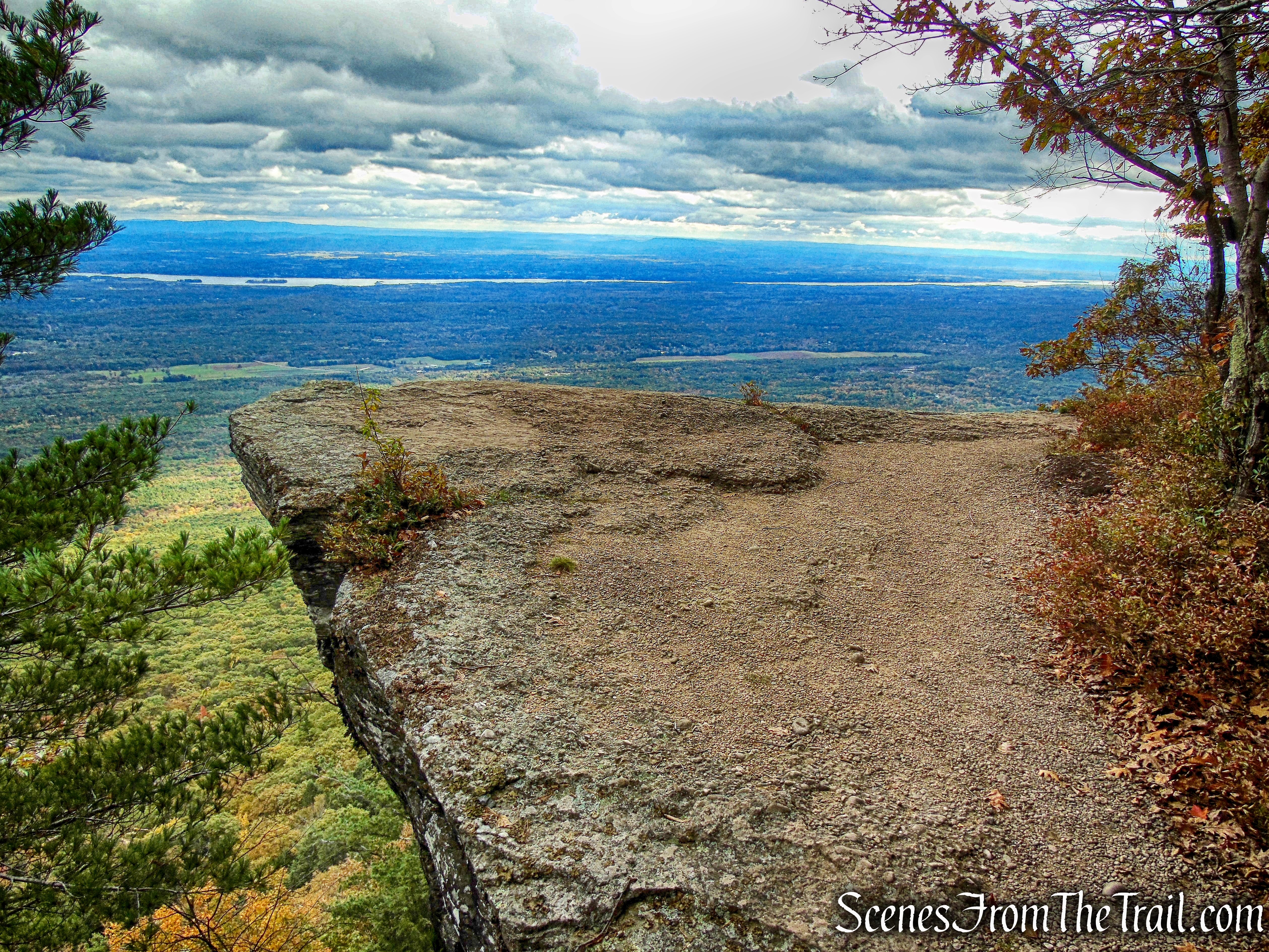
Newman’s Ledge
We encountered several groups of hikers at this spot and most of them posed for photographs on that ledge that juts out.
Newman’s Ledge
After we were done admiring the glorious view, we proceeded on our way.
Escarpment Trail
The trail climbs steeply again and at times we had to scramble over the rock ledges.
Escarpment Trail
The Escarpment Trail makes a U-turn and starts heading southwest and reaches the junction with the Rock Shelter Trail.
turn left on yellow-blazed Rock Shelter Trail
Off to the right, just up the hill, is Bad Man’s Cave. We had now hiked close to 4 miles.
Badman’s Cave
Legend has it that this is where outlaws hid during the eighteenth century after plundering the valley.
Badman’s Cave
It is more of a rock shelter than a cave, but it is large enough for a band of outlaws to hide out in.
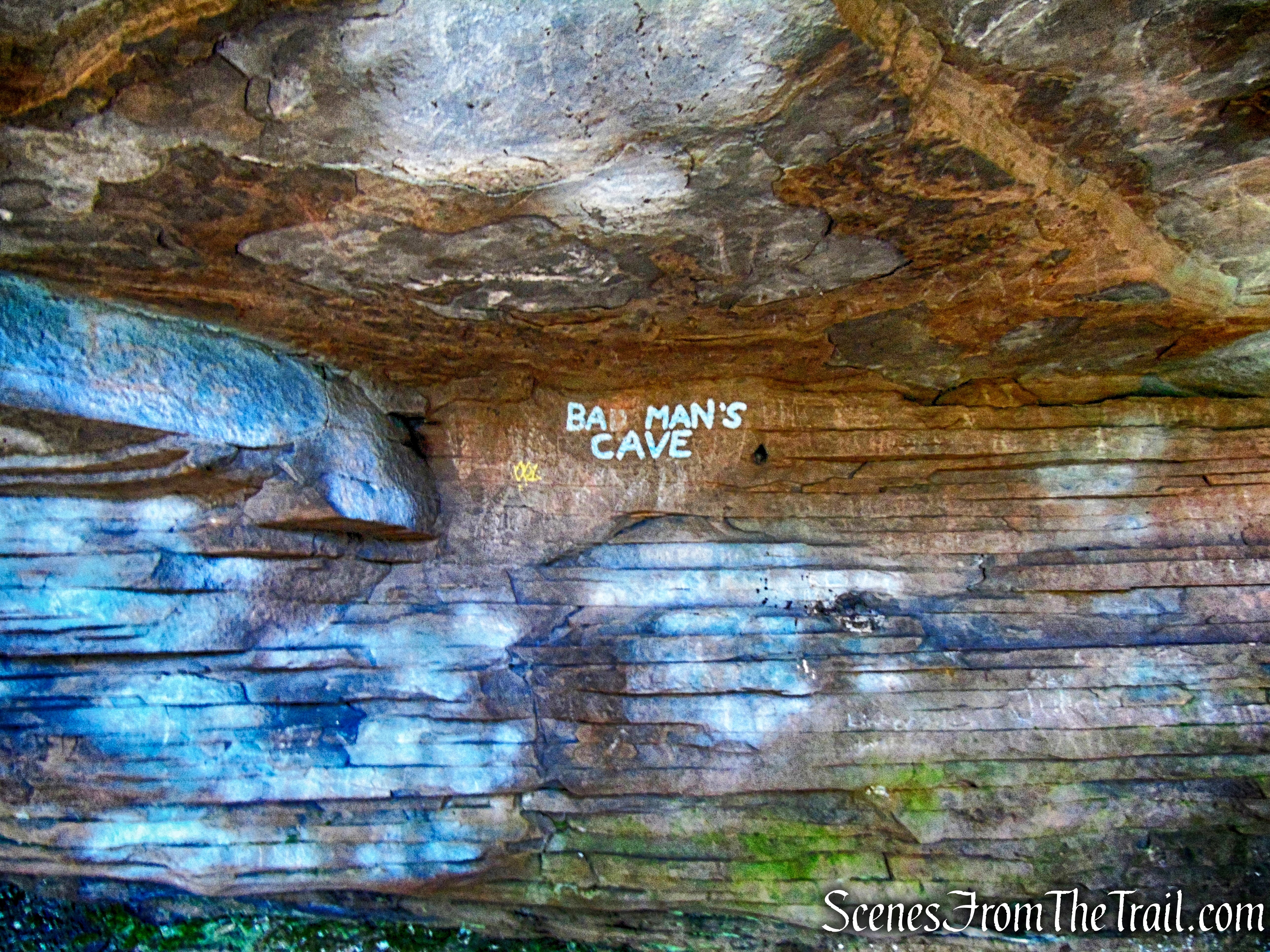
Badman’s Cave
We stopped here to catch our breath from the climb.
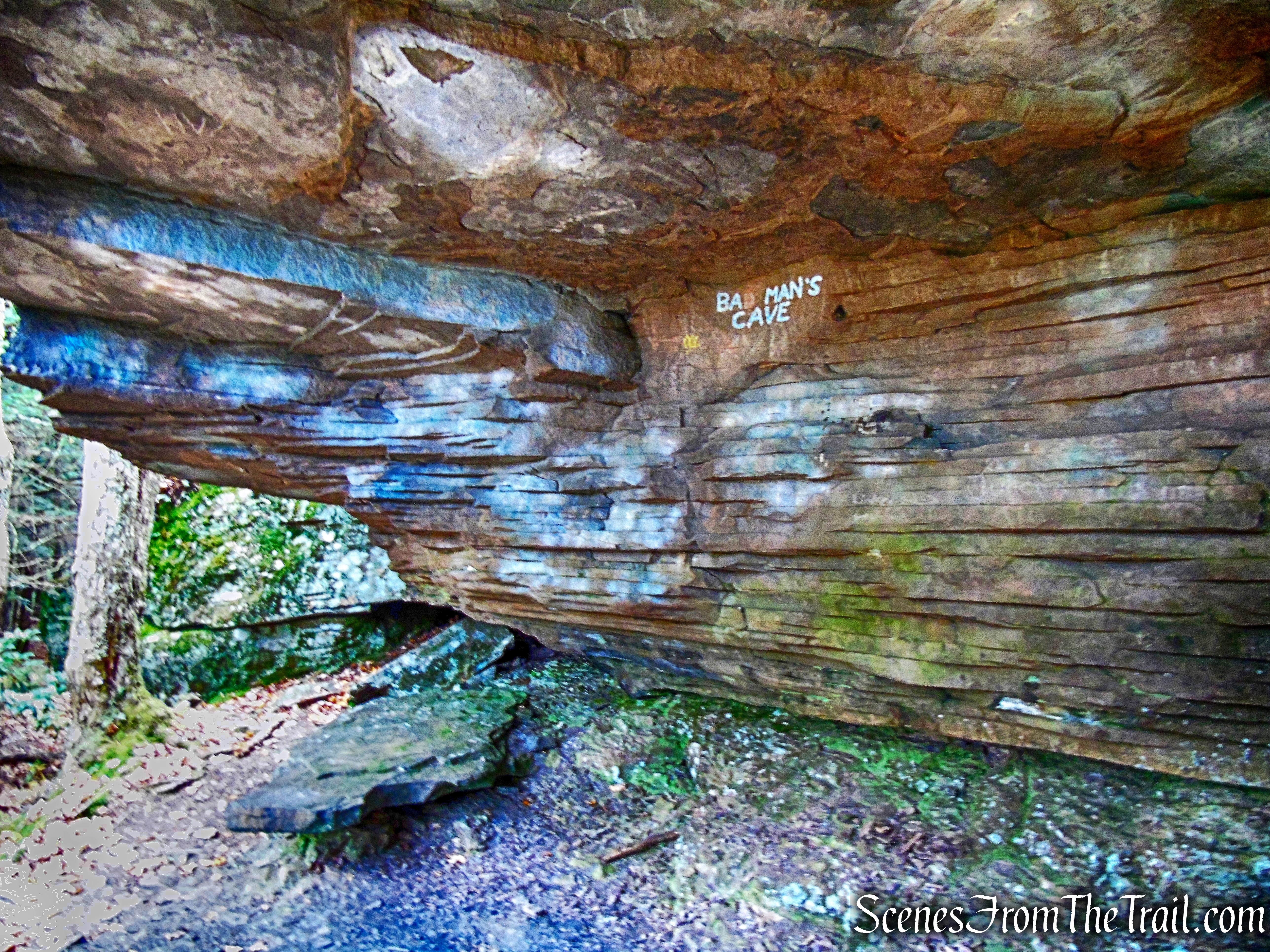
Badman’s Cave
We then began heading down North Mountain on the yellow-blazed Rock Shelter Trail.
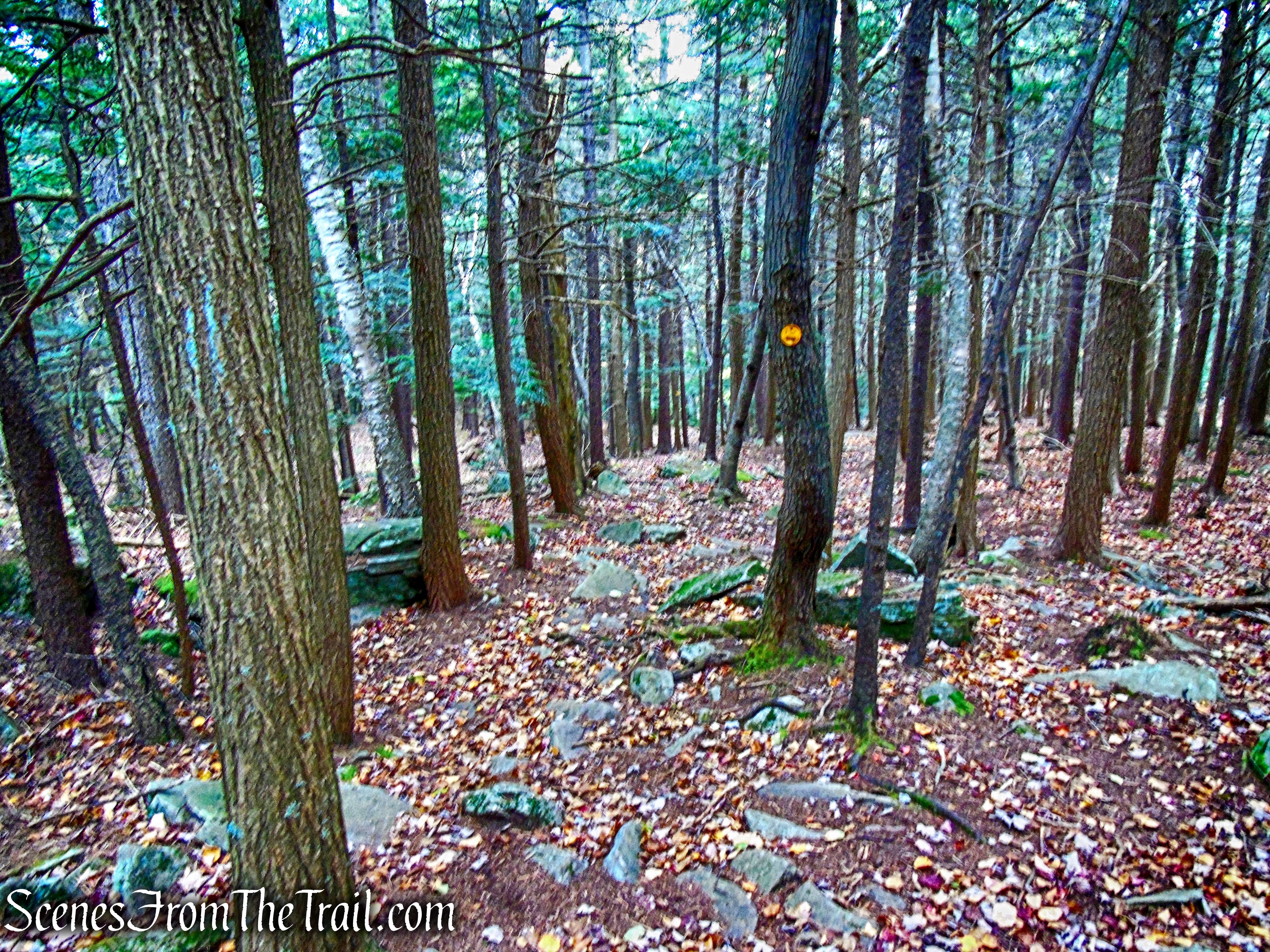
Rock Shelter Trail
As we began walking on the Rock Shelter Trail, to the right is another large rock shelter.
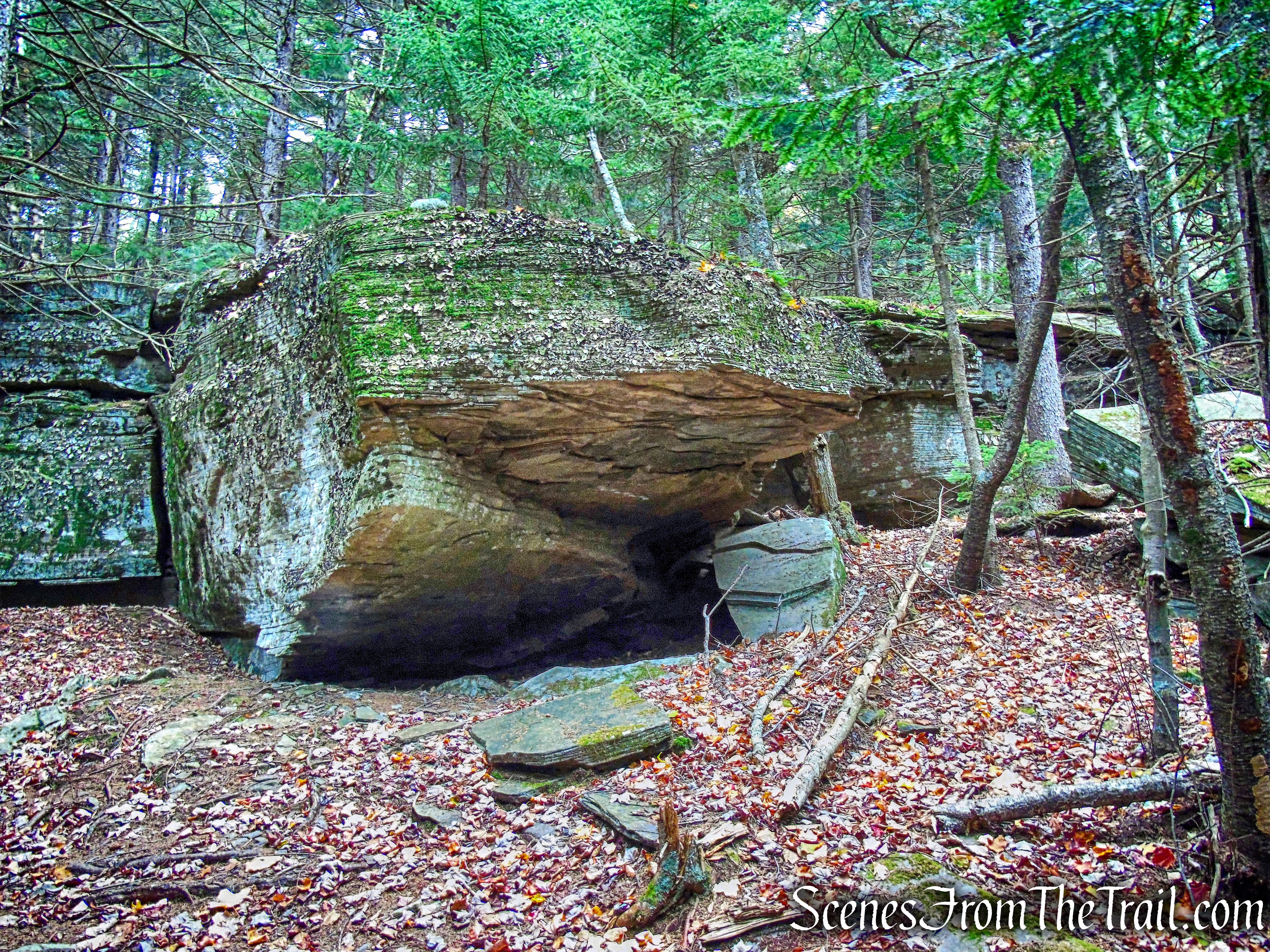
Rock Shelter Trail
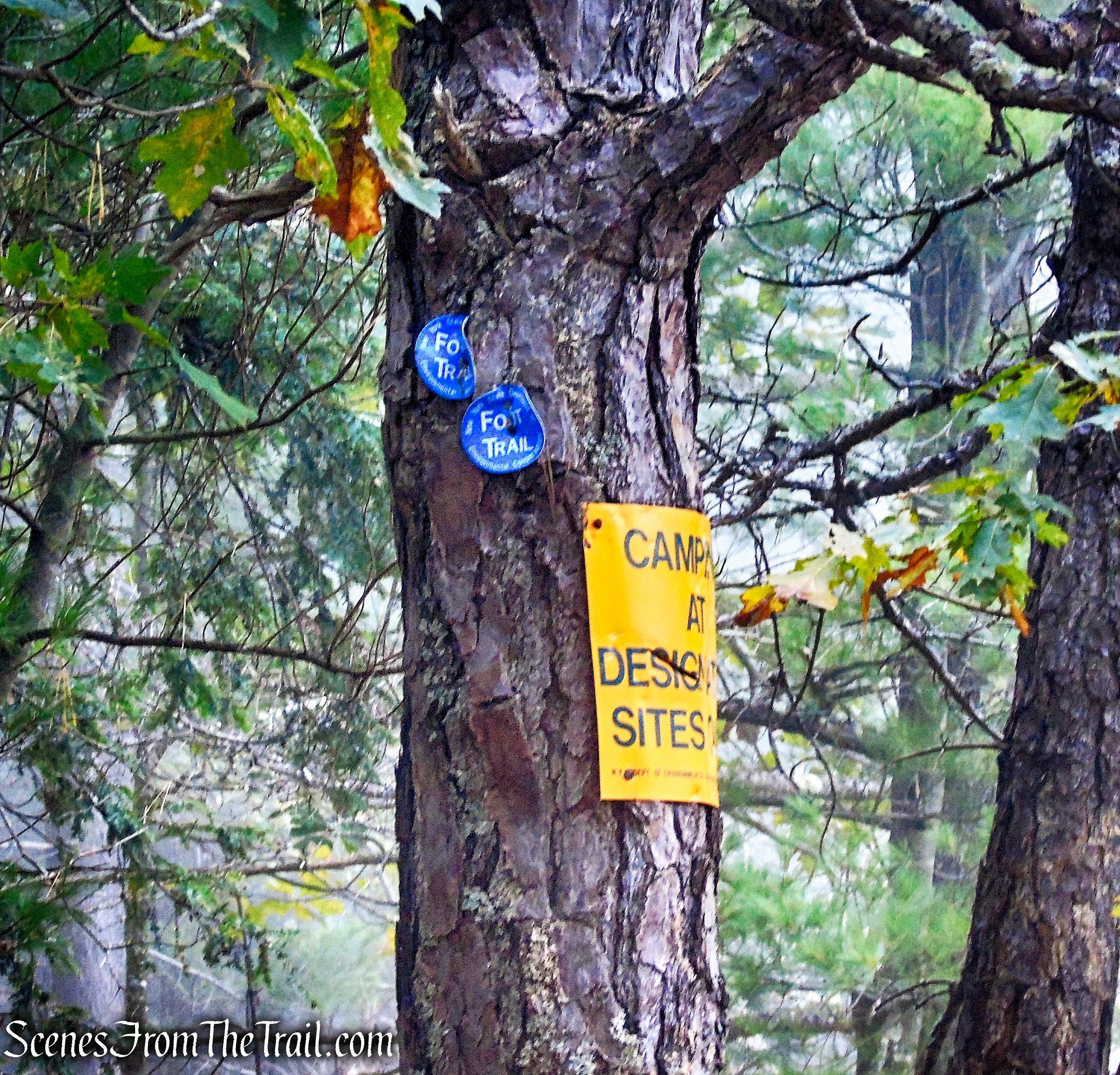
On our way down, it started raining steadily so I put the camera away. It also made the rocky trail a little slick and slower going. We then came to a junction with the red-blazed Mary’s Glen Trail and turned left. At the junction is Ledge Falls, a very long ledge that at times has water cascading over large sections.
Ledge Falls
The Mary’s Glen Trail descends steadily and crosses a log footbridge that spans Ashley Creek. Looking to the left, just a short distance down stream, the very top of Ashley Falls is visible.
Mary’s Glen Trail
I heard the sound of the water and ventured off trail on a faint footpath. That brought me up alongside the falls.
Ashley Falls
After climbing down some wet rocks, the Mary’s Glen Trail comes to a junction with a short spur trail that leads to the base of Ashley Falls. I walked down there to check it out, but since the falls were not at full force, the view from earlier was much better.
Ashley Falls Trail
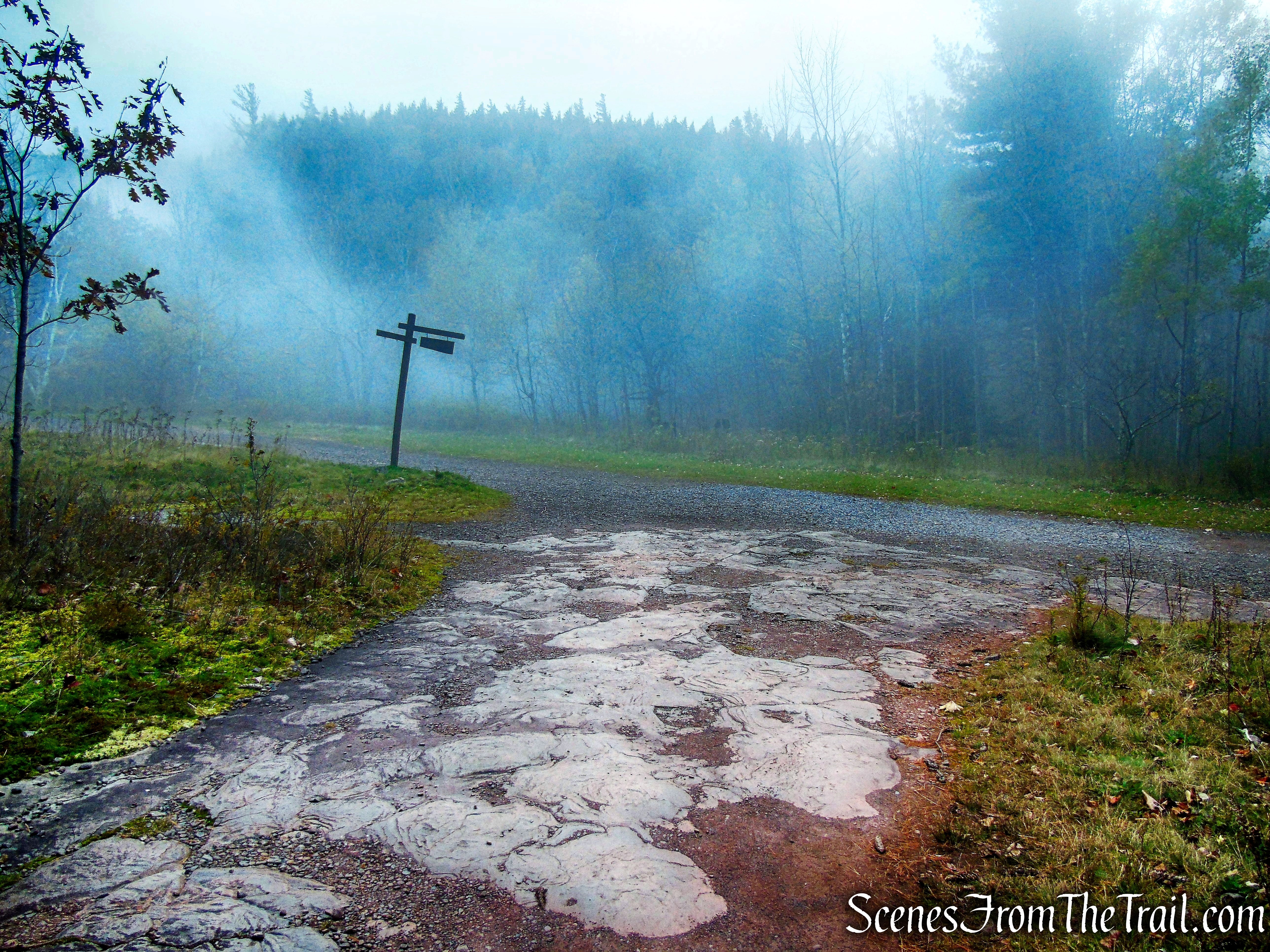
The Mary’s Glen Trail then reaches North Lake Road, the road we drove in on. The plan was to walk to the lake and pick up the North-South Lake Loop Trail, turn left, following the shoreline until we were close to the parking area, then cut across and back to the vehicle. Since by this time there was a steady downpour, my hiking buddies took shelter under a tree. I bit the bullet and walked the paved North Lake Road alone, almost a mile, to where we parked, then came back to pick them up.
Mary’s Glen Trail
Despite the early morning fog and afternoon rain, this hike was outstanding. The Escarpment Trail is fun and challenging along with the seemingly endless views it provides. This area is so rich in history and folklore that it made the hike that much more interesting. The trails at times could use a few more blazes, but the junctions are marked with signs, which are very helpful. I fully expect to explore some more of this area in the near future.
Guests of the Mountain House gave romantic names to many of the amazing view points and rock formations on the escarpment, and still today we can enjoy the likes of Artists Rock, Sunset Rock, Lookout Rock, Alligator Rock and Badman’s Cave. These scenic lookouts and rock formations of the eastern Catskills escarpment are truly unique and spectacular. It is definitely an area of the Catskills that is a must-see and must-explore for any hiker.
Pros: Escarpment Trail, Catskill Mountain House Site, sweeping Hudson Valley views, historical features, glacial erratics, Badman’s Cave.
Cons: Very popular area and can get crowded during warmer months when campground is in full swing.
Take a hike!
Bad Man’s Cave Loop – Catskill Park
Sources:
- North-South Lake Campground
- Catskill Mountain House Site
- The Catskill Mountain House
- Catskill Mountain House Historical Images
- Hudson River School: Catskill Mountain House
- Otis Elevating Railway
- New York-New Jersey Trail Conference

It’s remarkable that a large hotel once stood on the rather small ledge here. For those interested in such things, ‘The Catskill Mountain House: America’s Grandest Hotel’ by Roland Van Zandt is worthwhile reading. I’ve read my copy twice, and will probably go for a third read someday.
LikeLike