October 28, 2018 – Montrose, NY
Difficulty: Easy
Length: Approximately 4.3 miles
Max elevation: 144 ft.– total elevation gain approximately 314 ft.
Route type: Circuit
Map: Montrose Point State Forest Map – George’s Island Park Map (outdated)
Trailhead parking: Directly across from 215 Kings Ferry Rd. Montrose, NY 10548
The 50-acre Montrose Point State Forest is managed cooperatively with Westchester County Parks, which oversees the maintenance on the property. A brick factory was once on the site and the area was heavily mined for the raw materials for this industry, leading to the rolling nature of the topography.
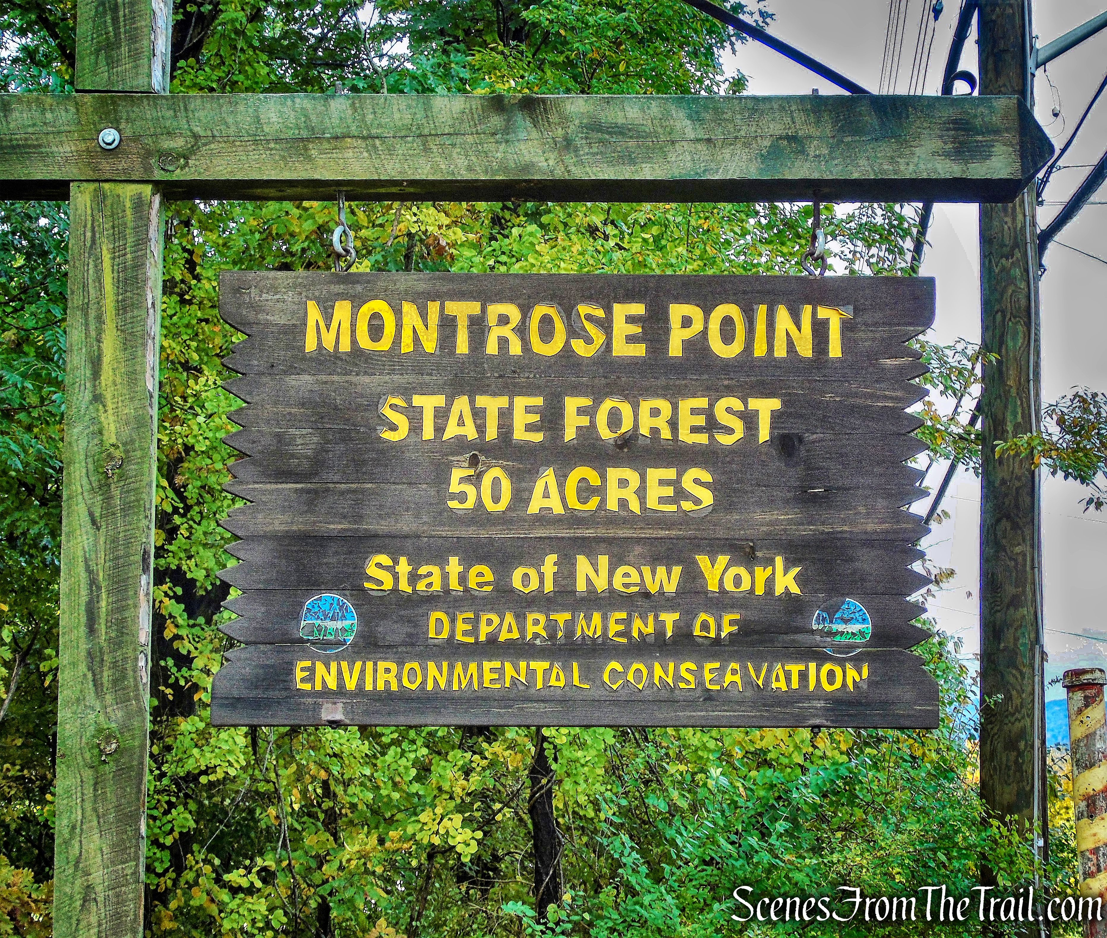
Montrose Point State Forest
George’s Island Park is a 208-acre waterfront park offering magnificent views of the historic Hudson River. It contains tidal wetlands, a fresh water pond and wooded trails. It is also an ideal spot for viewing wintering Bald Eagles on the Hudson. It is managed and maintained by Westchester County Parks.
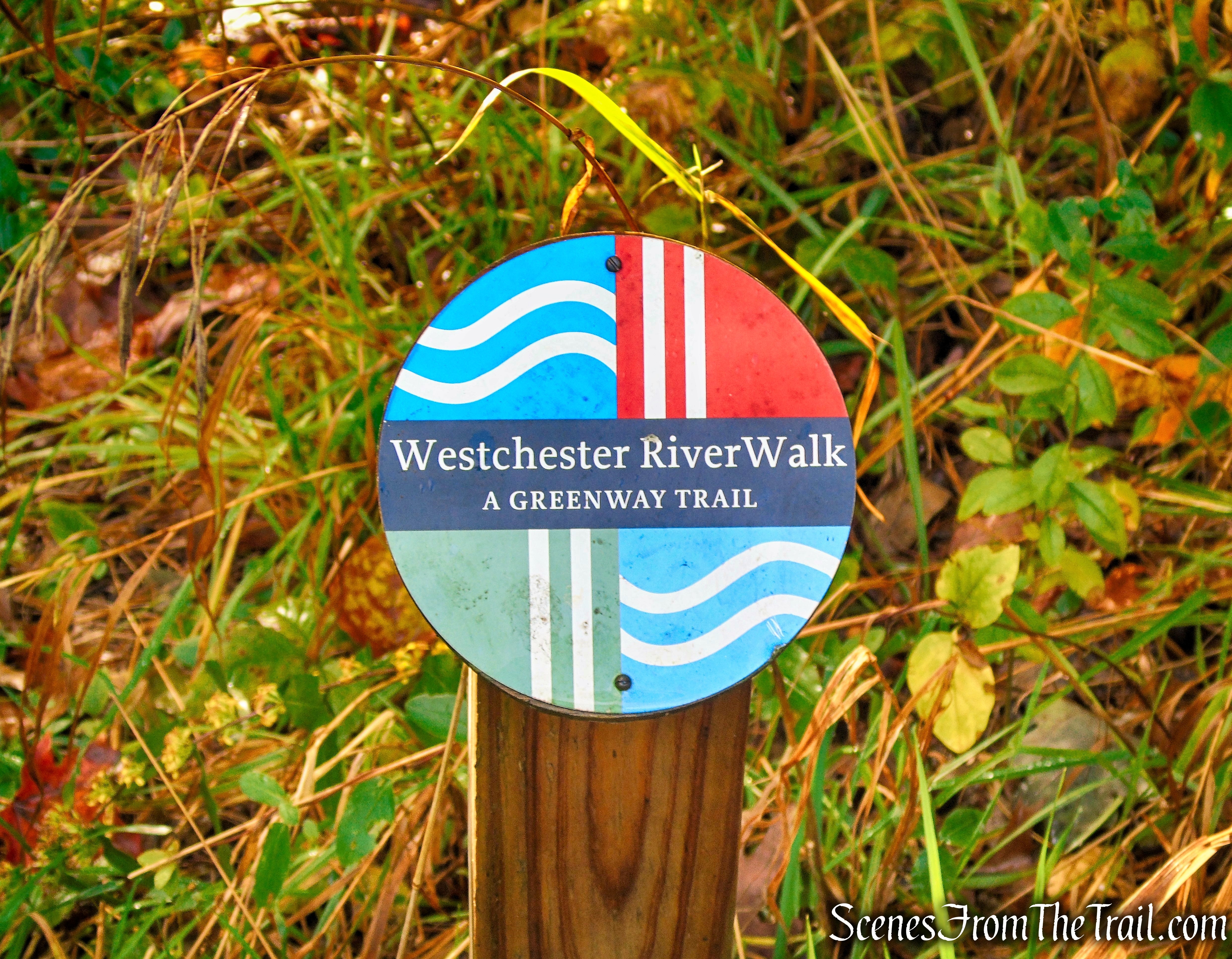
The Westchester RiverWalk, a planned 51.5-mile multi-faceted pathway paralleling the Hudson River in Westchester, runs through Montrose Point State Forest and George’s Island Park.
Greenway Trail – Montrose Point State Forest
There are 1.25 miles of trails that loop around Montrose Point State Forest. A trail splits off the loop, passes a brick arch bridge and leads down to a “brick beach” and a scenic viewing area. Along the way there are scenic views of the Hudson River. The trails to the south, link to George’s Island Park, making a longer hike possible.
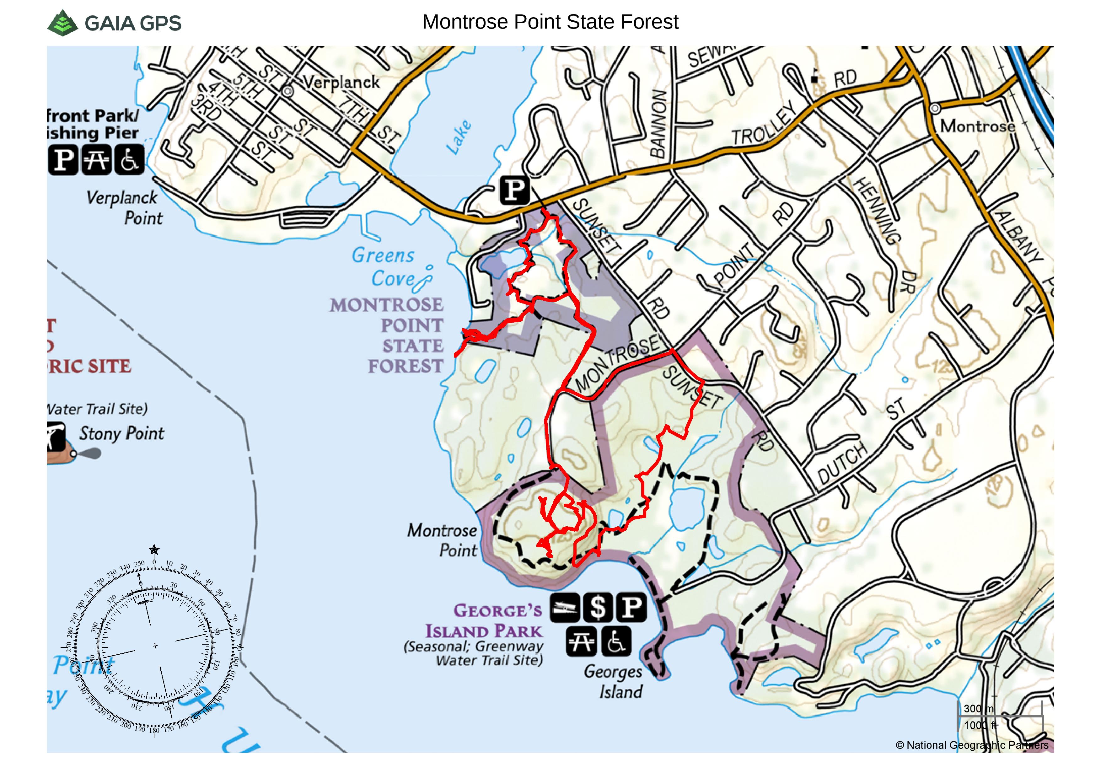
Montrose Point State Forest & George’s Island Park
Due to the steady rain the previous day and early morning, we started a little later than usual and arrived at the trailhead on Kings Ferry Road at approximately 9:30 am. While driving towards Montrose Point State Forest, several emergency vehicles passed us in the opposite direction with sirens blaring. While getting ready to hit the trail, a man that lives nearby offered up some info about what happened. He said that the woman that lives across the street had been feeding a deer by hand and was attacked and gored by that same deer. I only mentioned it because we may have run into that same deer during our hike.
We proceeded past the kiosk and into Montrose Point State Forest.
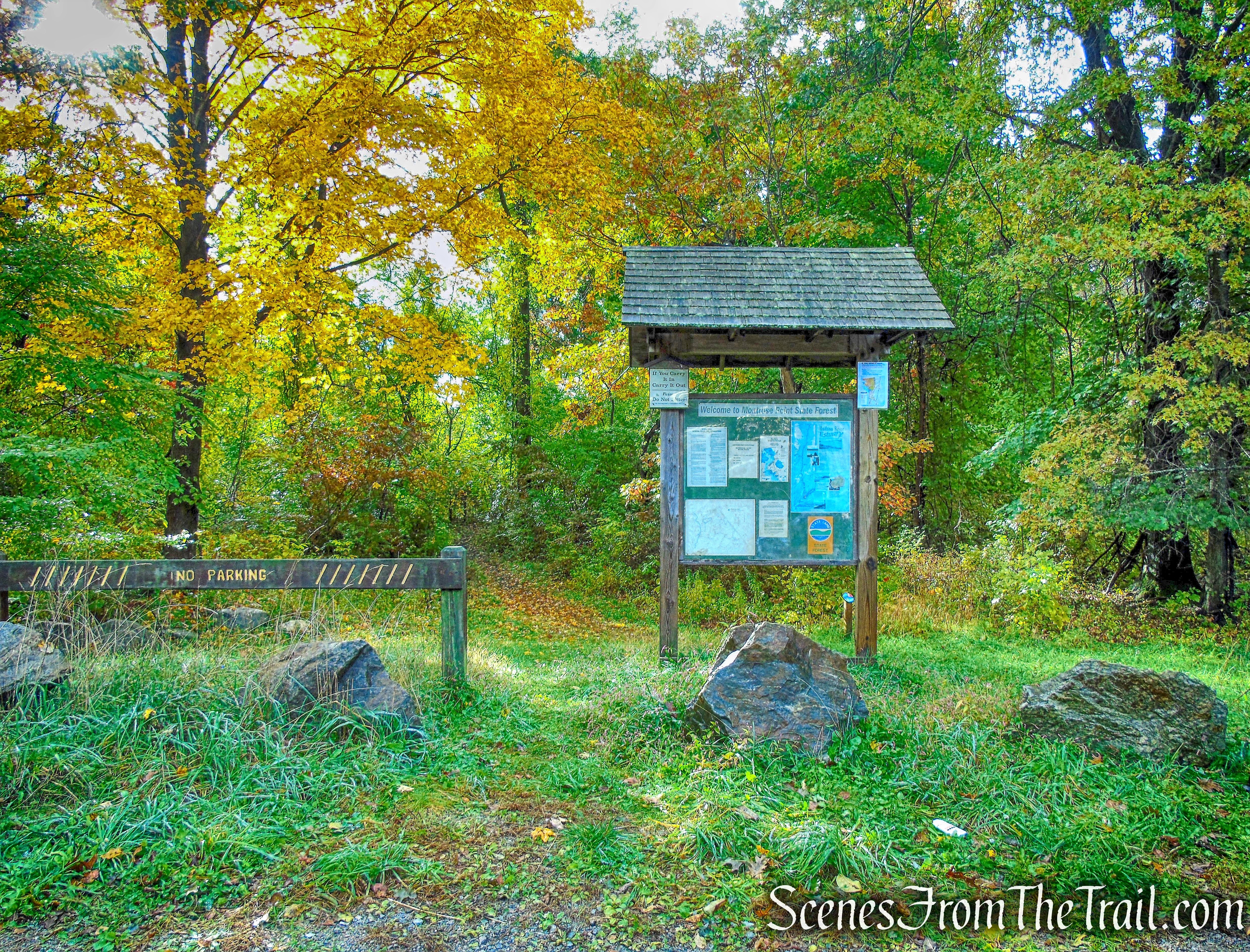
trailhead – Montrose Point State Forest
In a short distance, the footpath reaches a T-intersection with the Blue and Red Trails. The Blue Trail would be our return route, so we turned right onto the Red Trail.
turn right on Red Trail – Montrose Point State Forest
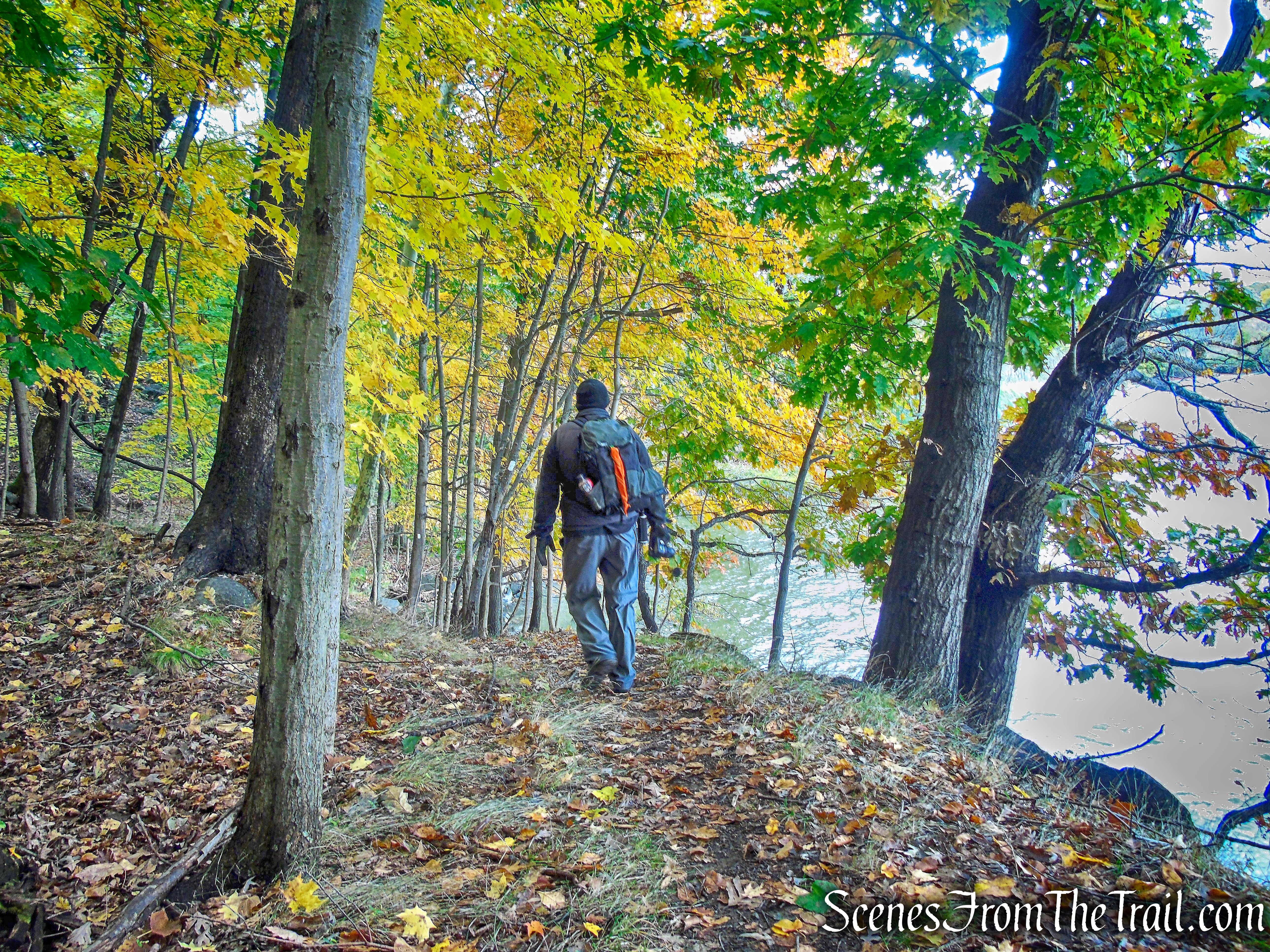
The Red Trail travels south through the woods on a relatively level grade.
Red Trail – Montrose Point State Forest
The trail then veers right and approaches a pond before it turns left and crosses a wooden footbridge. There are numerous water crossings on this hike and most of the footbridges are in poor shape. The railings are wobbly and we made sure to walk with our weight on the stringers. An easy way to tell is look for nail holes on the decking and follow them across the bridge.
Red Trail – Montrose Point State Forest
After crossing the footbridge, the Red Trail climbs a small hill.
Red Trail – Montrose Point State Forest
At the top of the rise, just off trail to the right, is a small foundation with stone steps.
Red Trail – Montrose Point State Forest
The Red Trail reaches a junction with the Yellow Trail marked by a sign. We turned right onto the Yellow Trail as it heads southwest towards the Hudson River. The image below was taken standing in front of the sign as it is not easily visible from the direction in which we were traveling.
turn right on Yellow Trail – Montrose Point State Forest
The Yellow Trail travels through an old growth forest as it heads toward the Hudson River.
Yellow Trail – Montrose Point State Forest
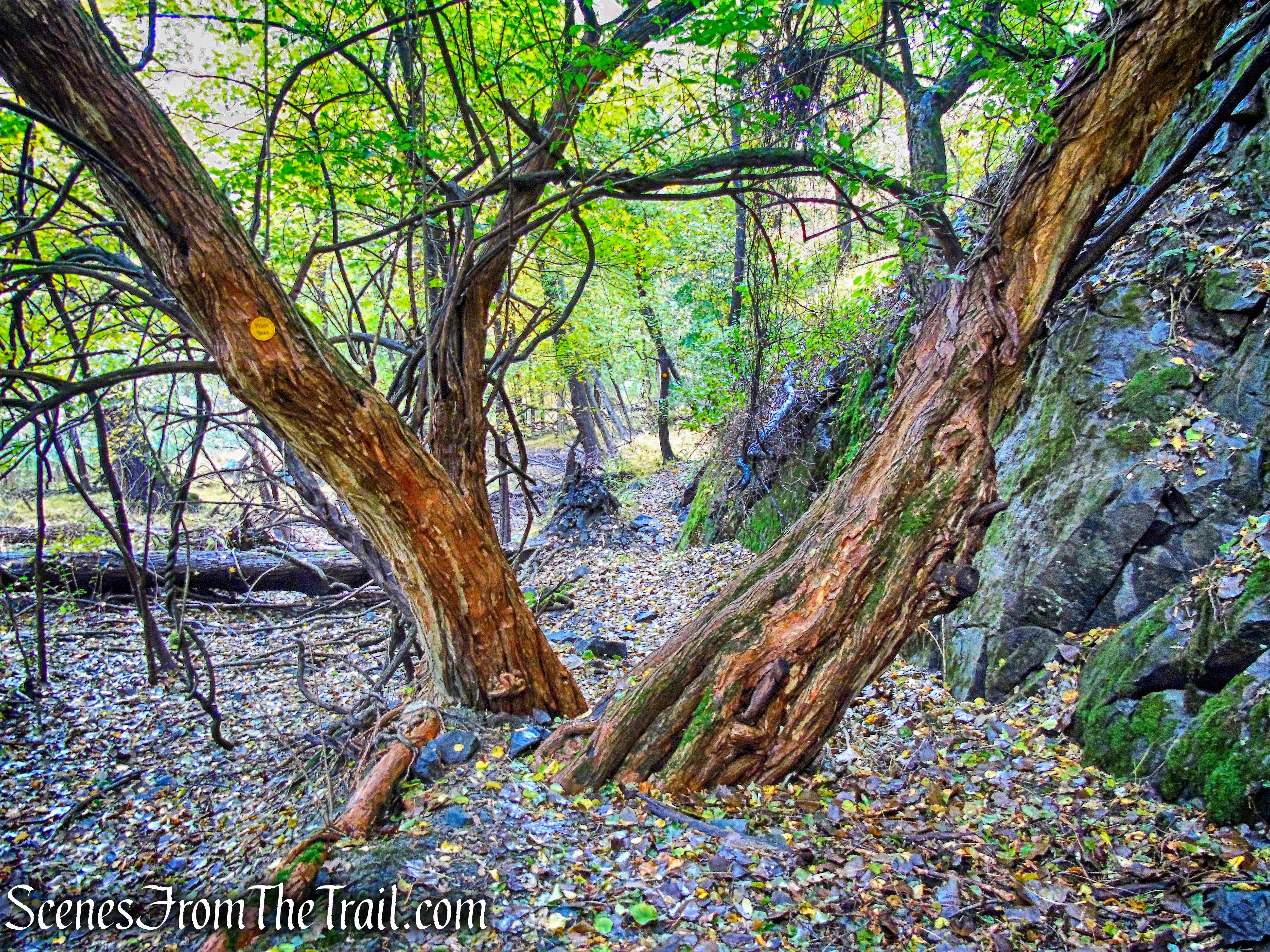
It also passes alongside an interesting looking brick arch bridge.
brick arch bridge – Montrose Point State Forest
brick arch bridge – Montrose Point State Forest
The trail crosses another wooden footbridge and passes a swamp on the right with cliff walls on the left.
Yellow Trail – Montrose Point State Forest
Yellow Trail – Montrose Point State Forest
The Yellow Trail comes to a Y-intersection with yellow blazes leading both uphill and towards the river. We stayed to the right and continued towards the river.
bear right on Yellow Trail – Montrose Point State Forest
Yellow Trail – Montrose Point State Forest
This branch of the Yellow Trail ends at the shore of the Hudson River.
Yellow Trail – Montrose Point State Forest
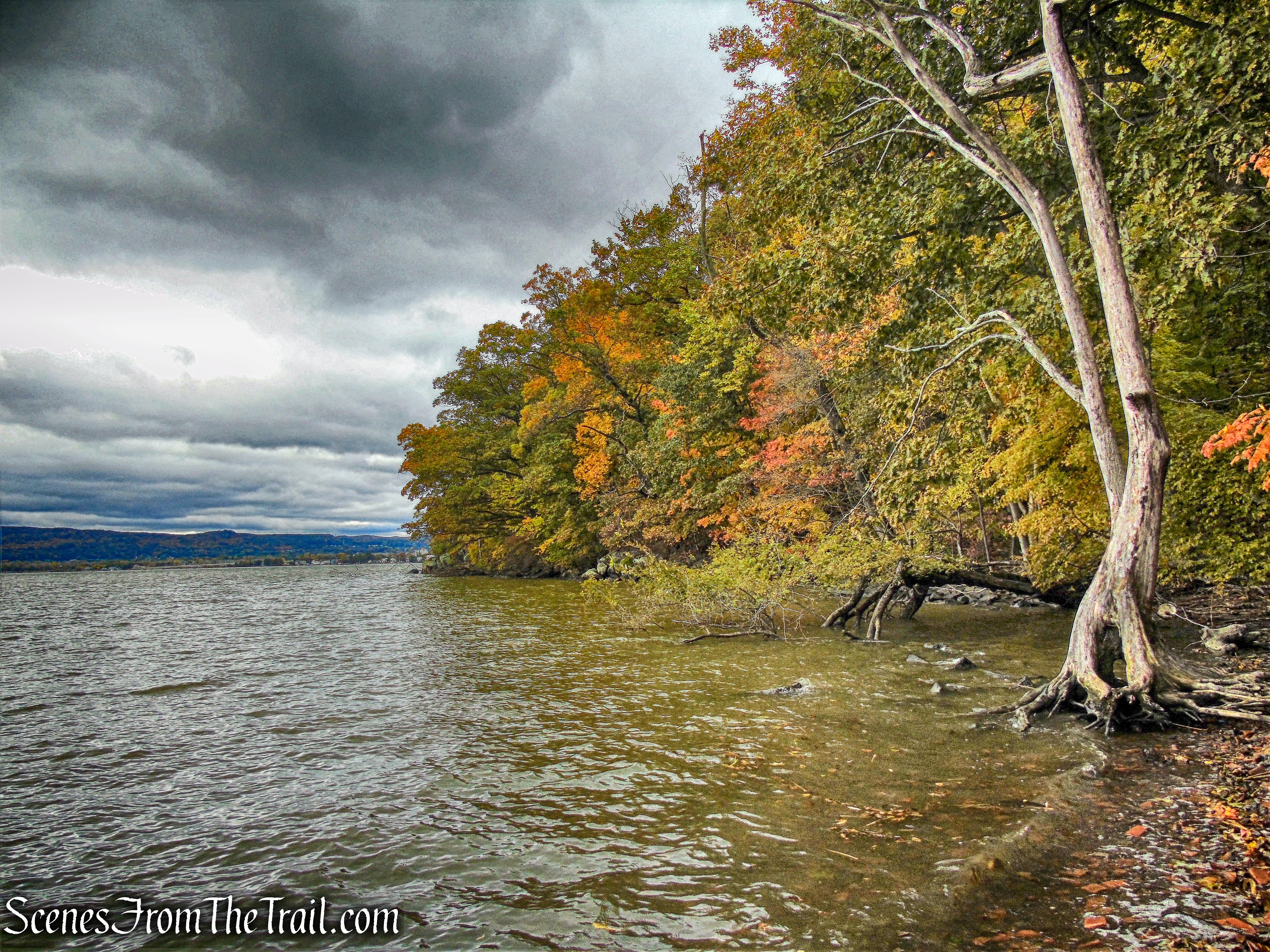
This area is referred to as “Brick Beach,” where bricks have been discarded along the shore.
Brick Beach – Montrose Point State Forest
We stopped here for a few minutes to take in the view. Directly across the Hudson River is Stony Point and Tomkins Cove.
Brick Beach – Montrose Point State Forest
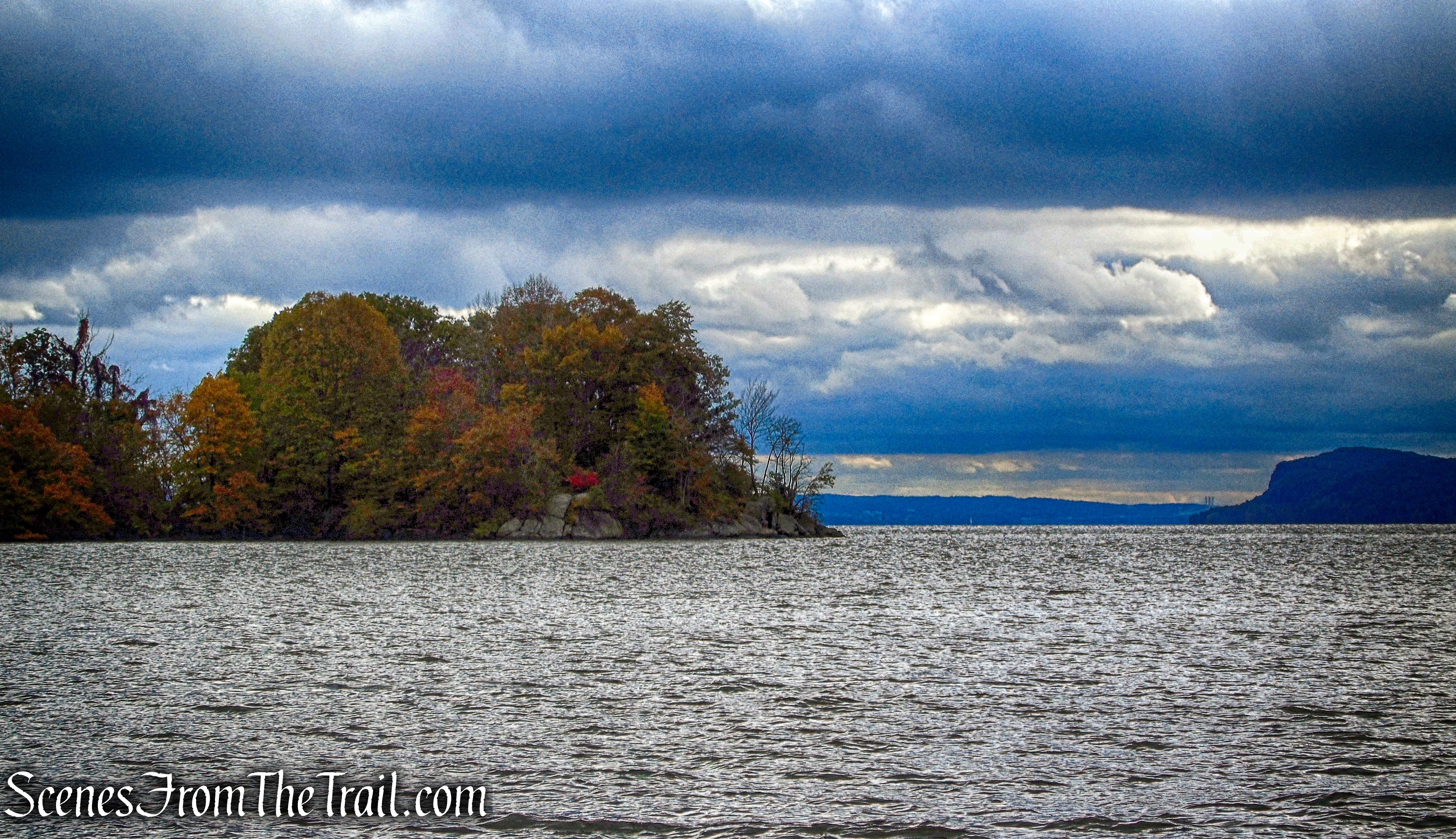
Looking southwest along the shoreline.
Brick Beach – Montrose Point State Forest
According to the N.Y. State Census of 1855, 37 brickyards were operating in the town of Cortlandt, employing more than a thousand workers.
Brick Beach – Montrose Point State Forest
Brick making along the Hudson started in the 1840’s and by the beginning of the 20th century the clay deposits were becoming exhausted and the brick-making era was coming to a close.
Brick Beach – Montrose Point State Forest
We then retraced our steps……

Yellow Trail – Montrose Point State Forest
and turned right onto the other branch of the Yellow Trail.
turn right on Yellow Trail – Montrose Point State Forest
The trail leads a short distance uphill….

Yellow Trail – Montrose Point State Forest
with crumbling stone walls to the left of the trail.
Yellow Trail – Montrose Point State Forest
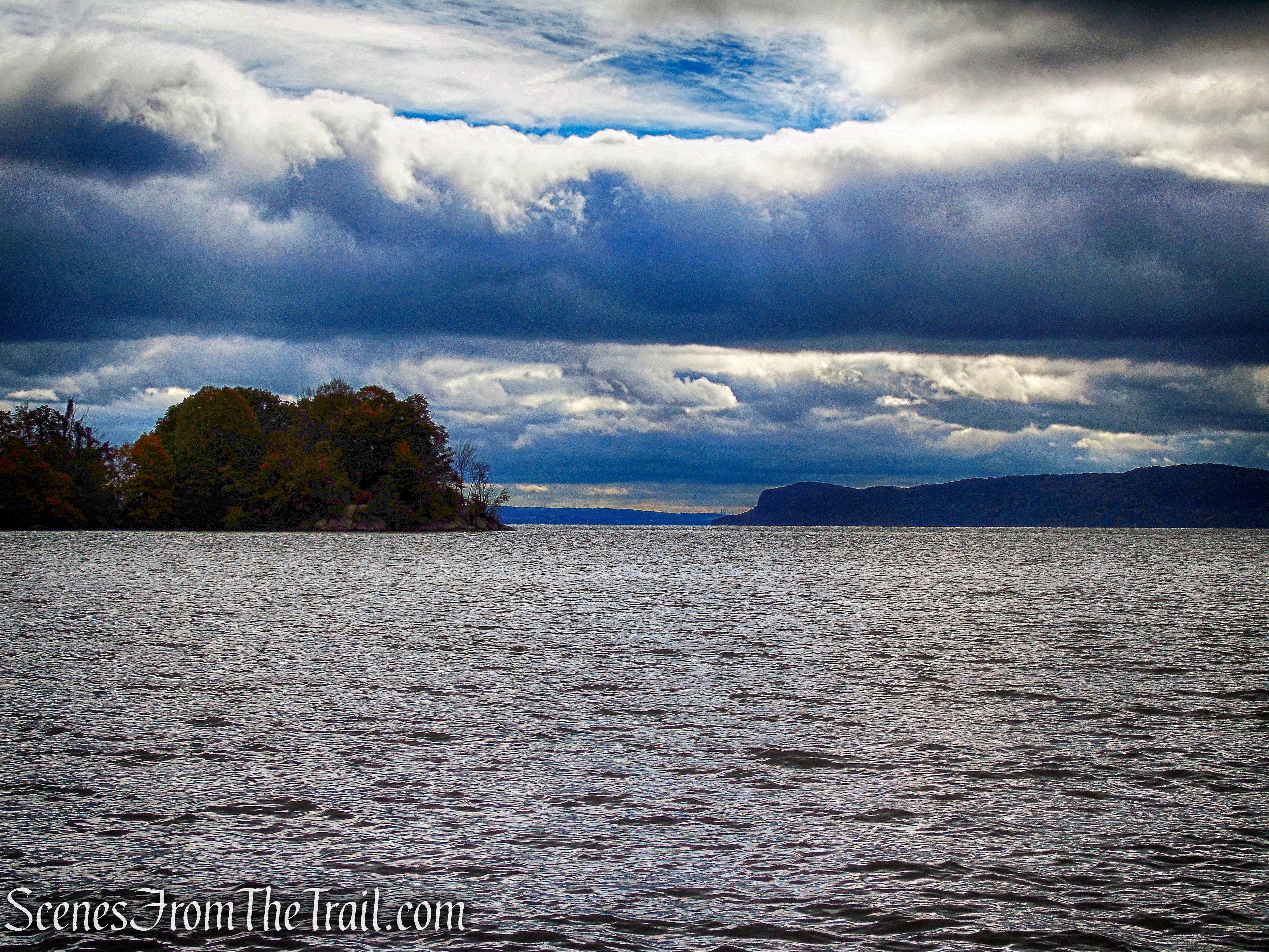
This branch of the Yellow Trail ends at an overlook with a bench.
Yellow Trail – Montrose Point State Forest
Looking southwest from the overlook.

Yellow Trail – Montrose Point State Forest
This is the view from the bench. The Cortlandt Yacht Club is visible below to the right and the hills of Bear Mountain and Harriman State Parks visible across the river..
Yellow Trail – Montrose Point State Forest
We then retraced our steps back to the junction and turned right on the Yellow Trail.
turn right on Yellow Trail – Montrose Point State Forest
Yellow Trail – Montrose Point State Forest
The largest Osage Orange Tree in NY can be found here in the forest.
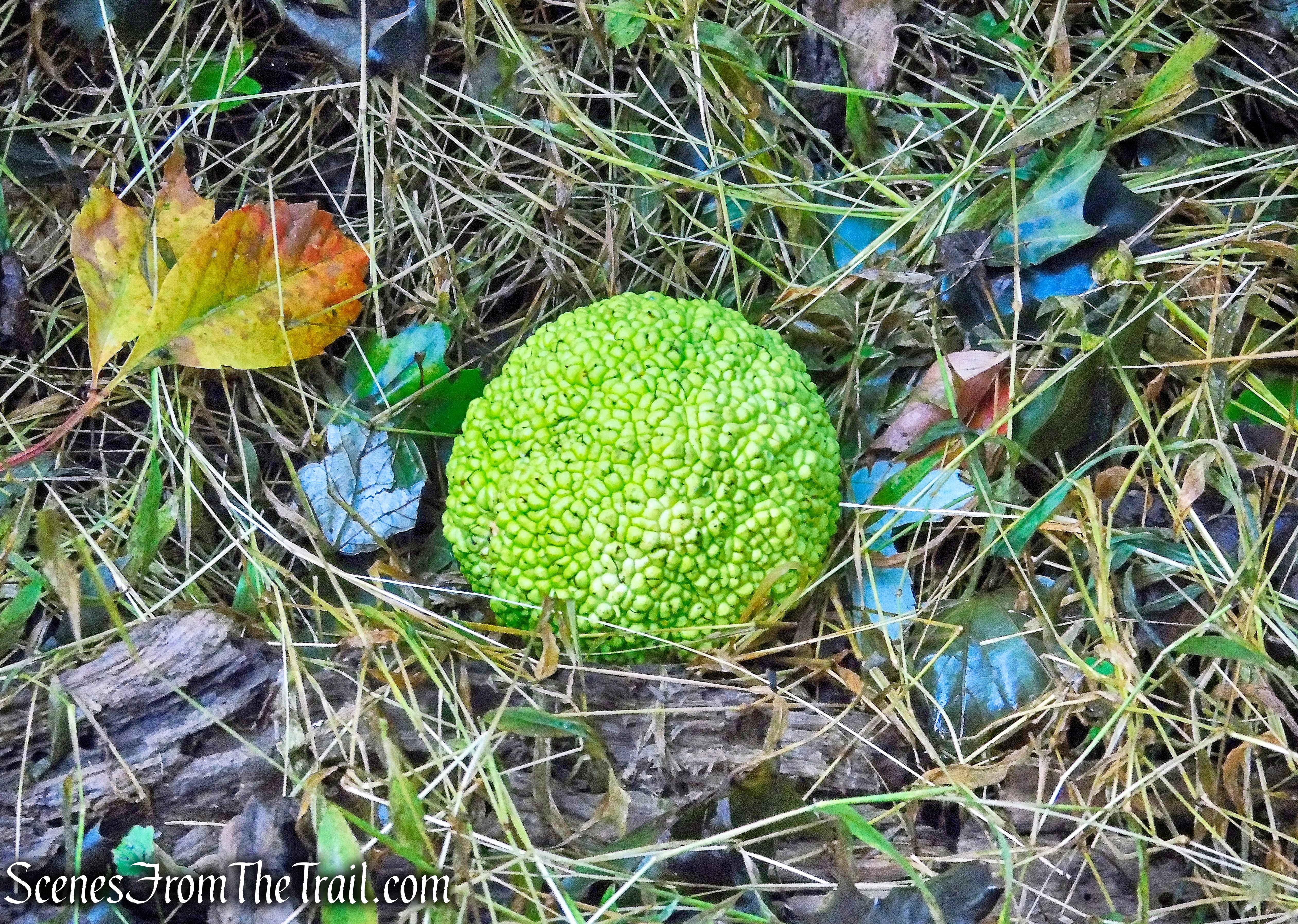
Osage Orange – Montrose Point State Forest Map
We recrossed the wooden footbridge and passed by the brick arch bridge again.
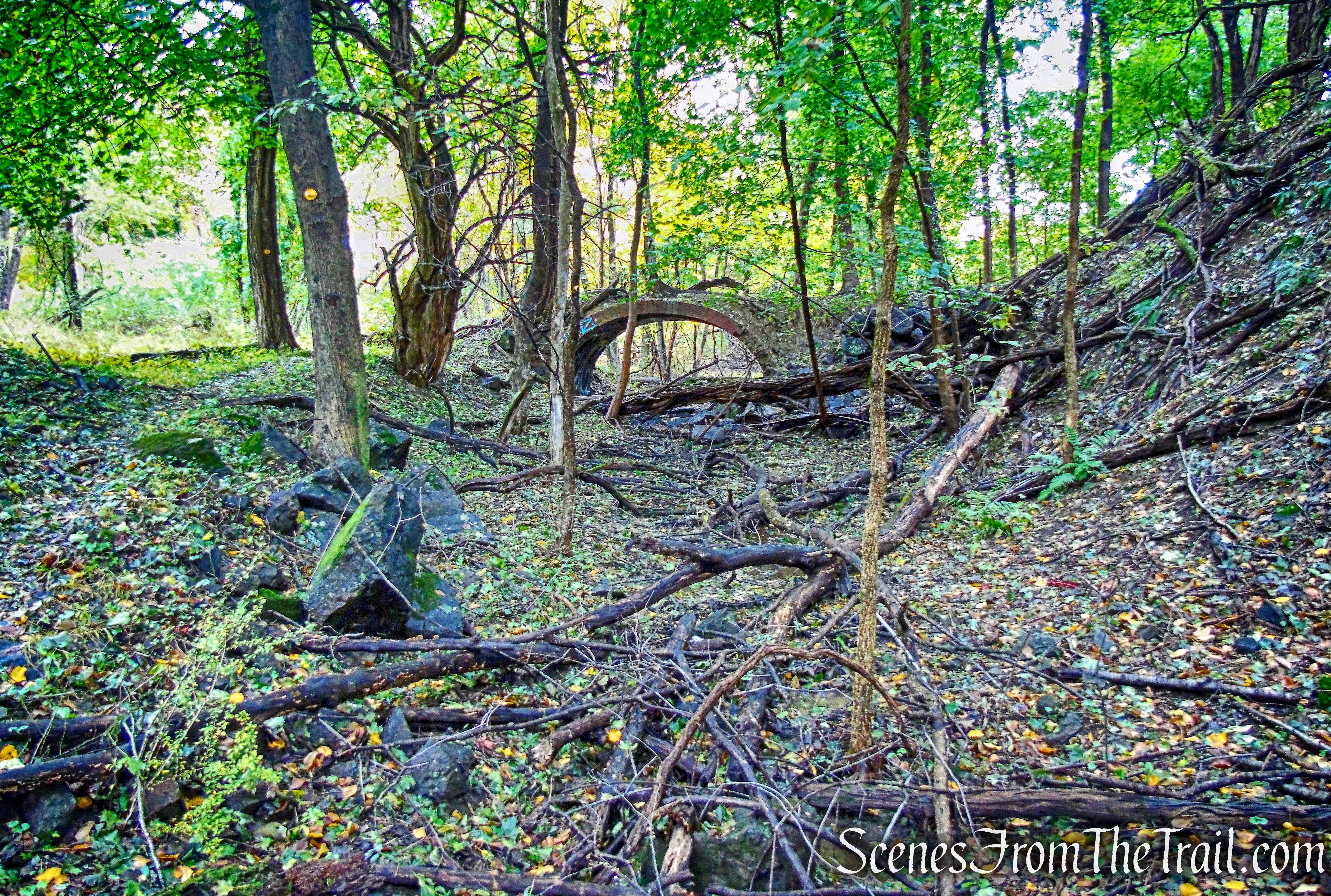
Yellow Trail – Montrose Point State Forest
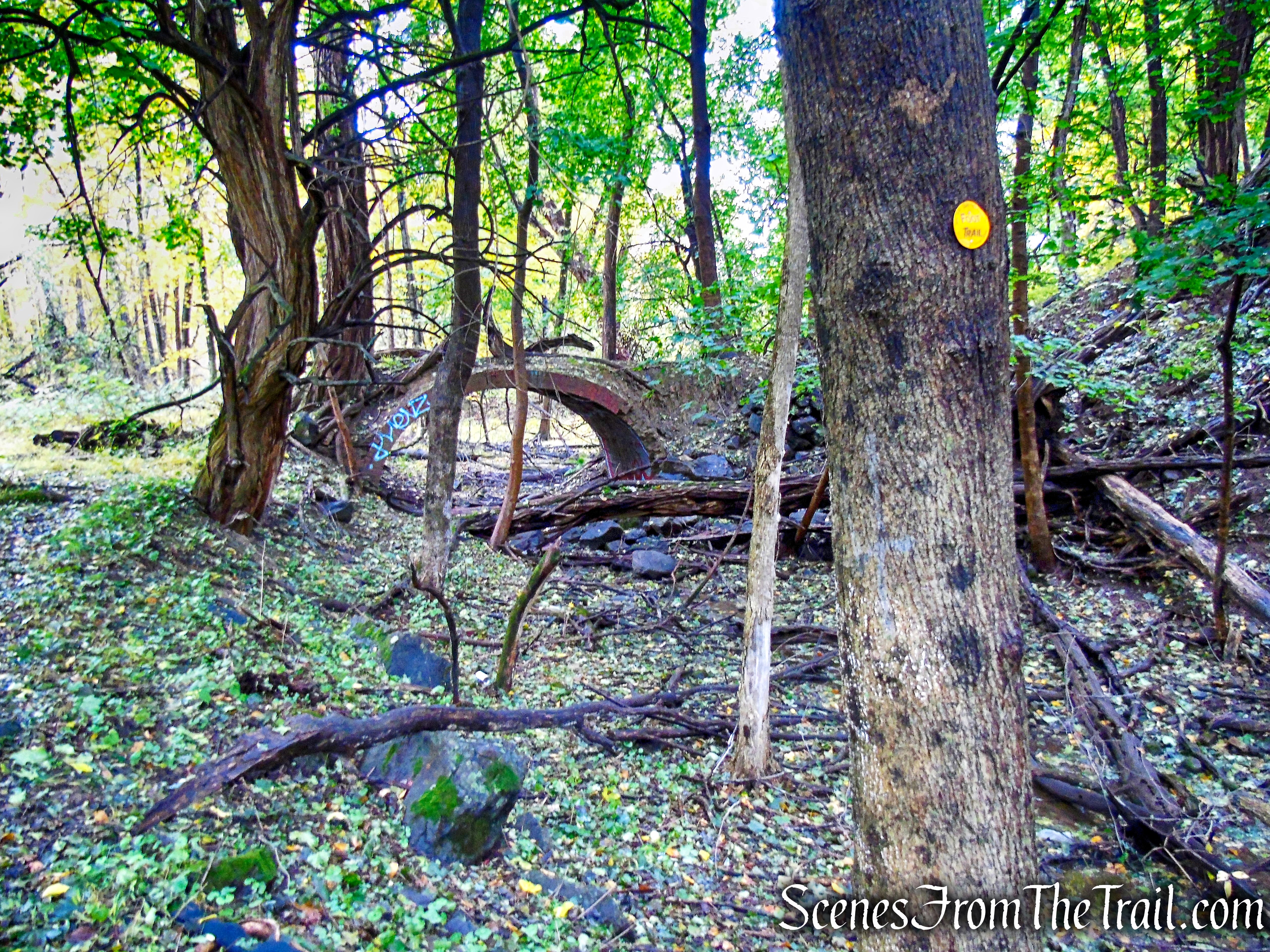
Yellow Trail – Montrose Point State Forest
Brick Arch Bridge – Montrose Point State Forest
We returned to the junction with the Red Trail and turned right.
turn right on Red Trail – Montrose Point State Forest
The Red Trail heads southeast through the woods on a level grade.
Red Trail – Montrose Point State Forest
Red Trail – Montrose Point State Forest
The Red Trail reaches a junction with the Blue Trail which begins on the left (our return route). We turned right and continued following the red blazes.
turn right on Red Trail – Montrose Point State Forest
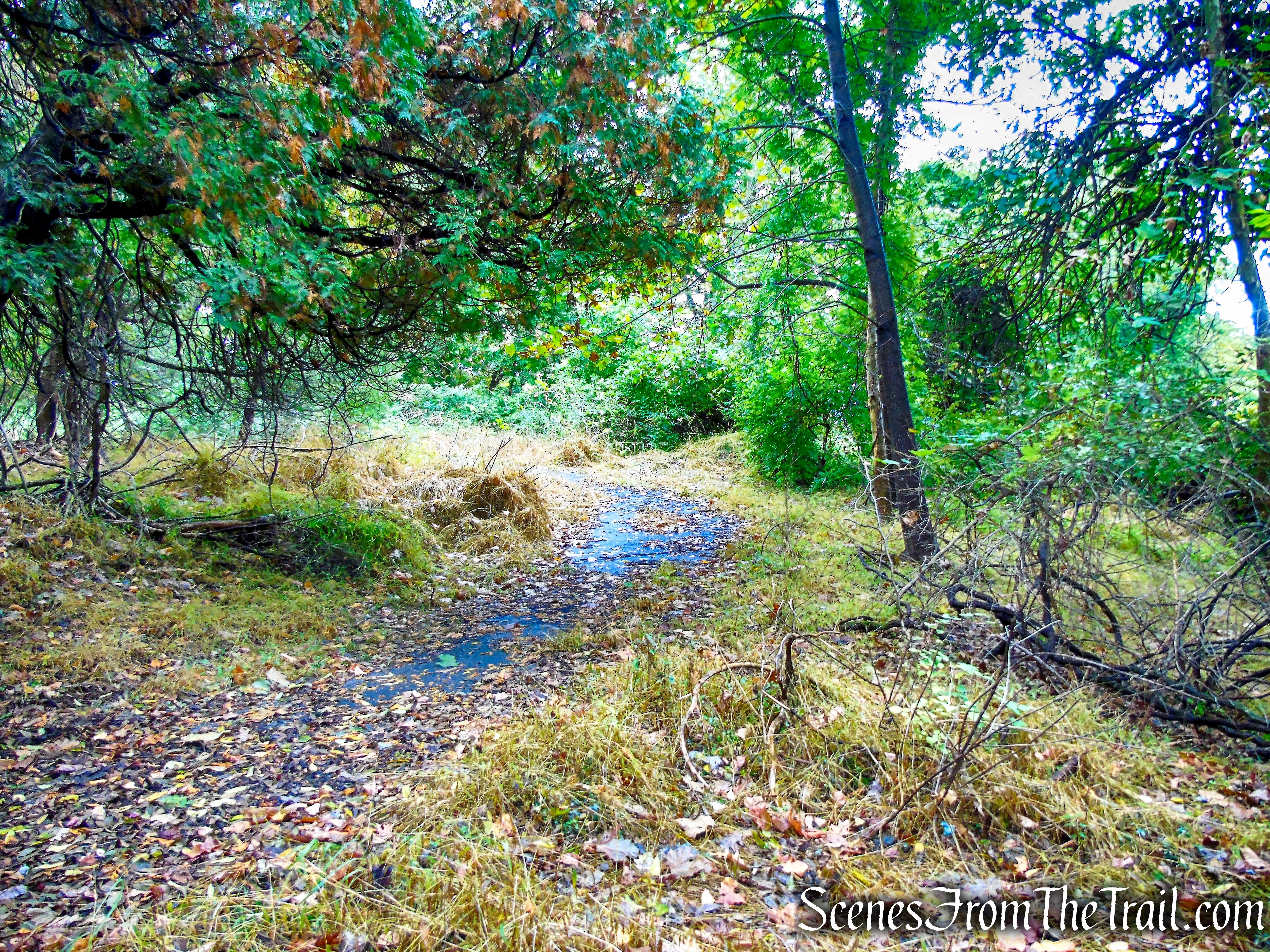
The trail is a little overgrown in this area.
Red Trail – Montrose Point State Forest
The Red Trail turns right and crosses a long wooden footbridge which is not in the best of shape. The railings are really loose and we took great care while crossing it.
Red Trail – Montrose Point State Forest
Red Trail – Montrose Point State Forest
The Red Trail continues ahead, skirting private property.
Red Trail – Montrose Point State Forest
A treehouse on property that adjoins the trail can be seen.
treehouse along the Red Trail – Montrose Point State Forest
The trail then passes through an easement, with private homes on the left and the Catholic Kolping Society on the right.
Red Trail – Montrose Point State Forest
The Red Trail ends at Montrose Point Road and we turned right onto the paved road, leaving Montrose Point State Forest.
terminus of Red Trail – Montrose Point State Forest
Montrose Point Road, a quiet back road, leads towards the back of George’s Island County Park. Green blazes for the Greenway Trail are visible on telephone poles.

Montrose Point Road
Montrose Point Road dead ends at the rear entrance driveway into George’s Island County Park. Three white blazes on a tree signify the start of the White Trail.
White Trail – George’s Island Park
Halloween decoration on a property that borders the trail.

skeleton
The White Trail ascends gradually on a paved road.
White Trail – George’s Island Park
There are a lot of blowdowns throughout the park.
White Trail – George’s Island Park
Just past the fire hydrant, we turned right onto an unmarked footpath.

White Trail – George’s Island Park
We followed the footpath into the woods and up a small hill.
George’s Island Park
There are remnants of brick structures and foundations in this area, but most are overgrown and hard to see.
ruins – George’s Island Park
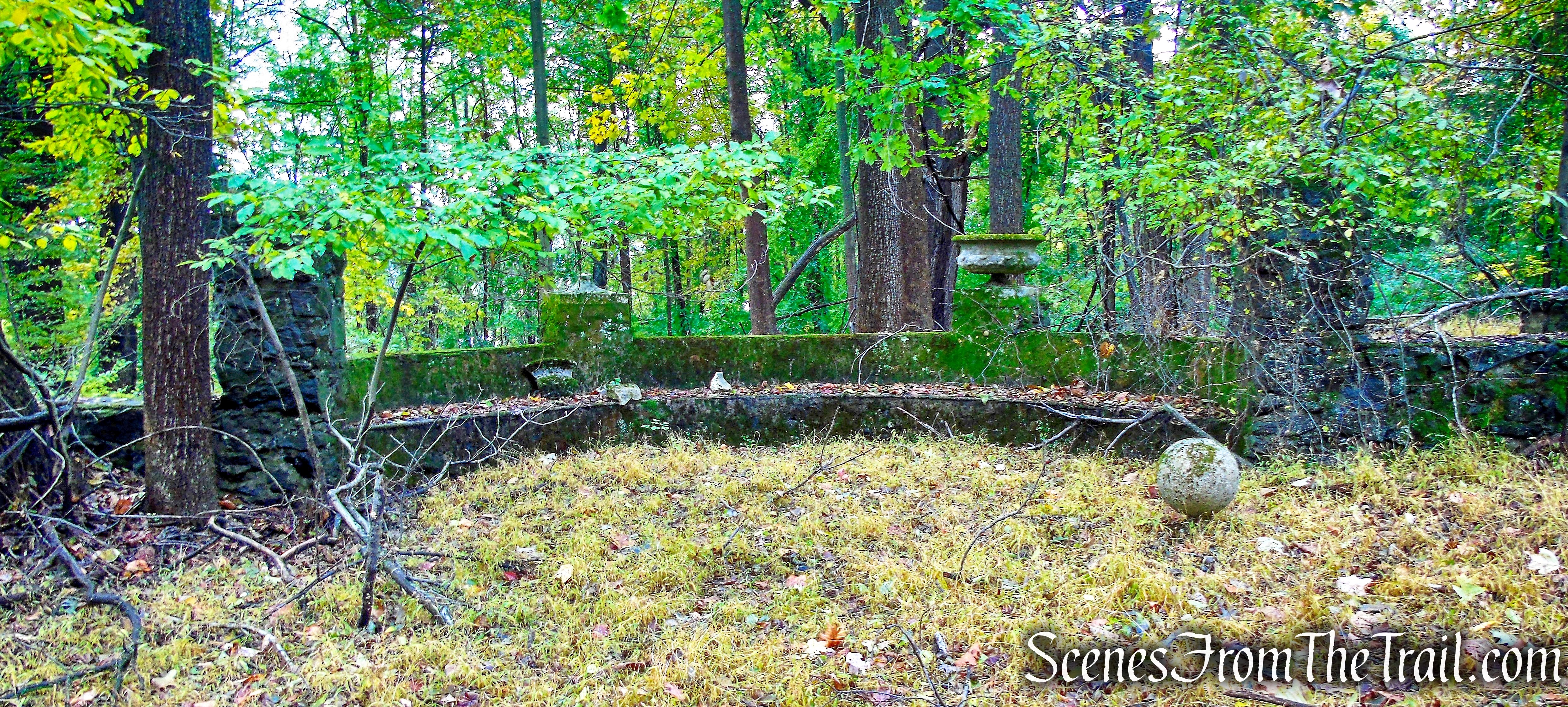
We walked back out onto the White Trail, turned right and a short distance later, extensive stone ruins came into view just to the right of the trail.
ruins – George’s Island Park
At first glance, George’s Island Park appears to be a picnic park and boat launch, but off to the side is a network of wooded trails with interesting features.
ruins – George’s Island Park
The information on this estate is very scant and somewhat contradictory. Some old maps that I have viewed put the estate just a bit north, on what is now the Kolping-On-Hudson property on the other side of Montrose Point Rd. Based on the design, these ruins could be from the same estate and possibly a large terrace or patio like structure.
ruins – George’s Island Park
The information that I have gathered, if true, give these stone ruins a very historic past.
ruins – George’s Island Park
The Seward Estate which was located on Montrose Point, was built and owned by Frederick W. Seward, son of William Seward, Secretary of State under Abraham Lincoln. Frederick was seriously injured, along with several other people, during an assassination attempt on his father’s life on the evening of April 14, 1865 in Washington D.C. at the same time Lincoln was being shot in Ford’s Theater. It was part of a plot to assassinate several government leaders in an attempt to destroy the government. Frederick suffered a fractured skull after being beaten with a pistol that misfired. Both Sewards survived the vicious attack, but it is said that Frederick lived out his life with a silver plate in his skull.
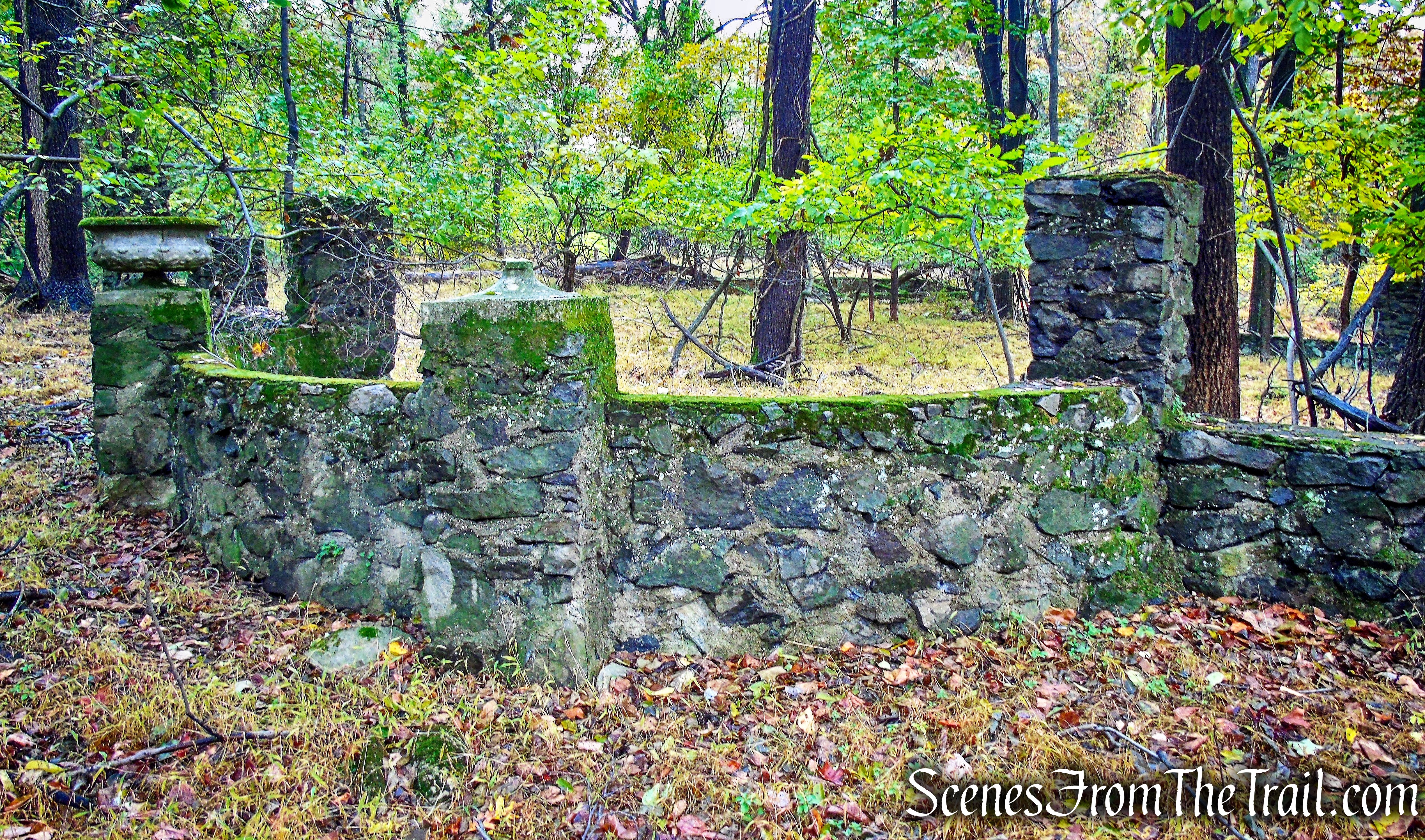
ruins – George’s Island Park
The handsome Seward Estate covered about 30 acres. A stately mansion with a beautiful Victorian garden and various outbuildings, it commanded a magnificent view of the Hudson River. The grounds of the estate were dotted by little ponds that had been made by excavating clay for the brickyards which flourished along the Hudson during that period.
ruins – George’s Island Park
Frederick had talked of living somewhere on the Hudson River and by 1870 he was ensconced in a pretentious Italianate villa that he called “Montrose.”
ruins – George’s Island Park
ruins – George’s Island Park
ruins – George’s Island Park
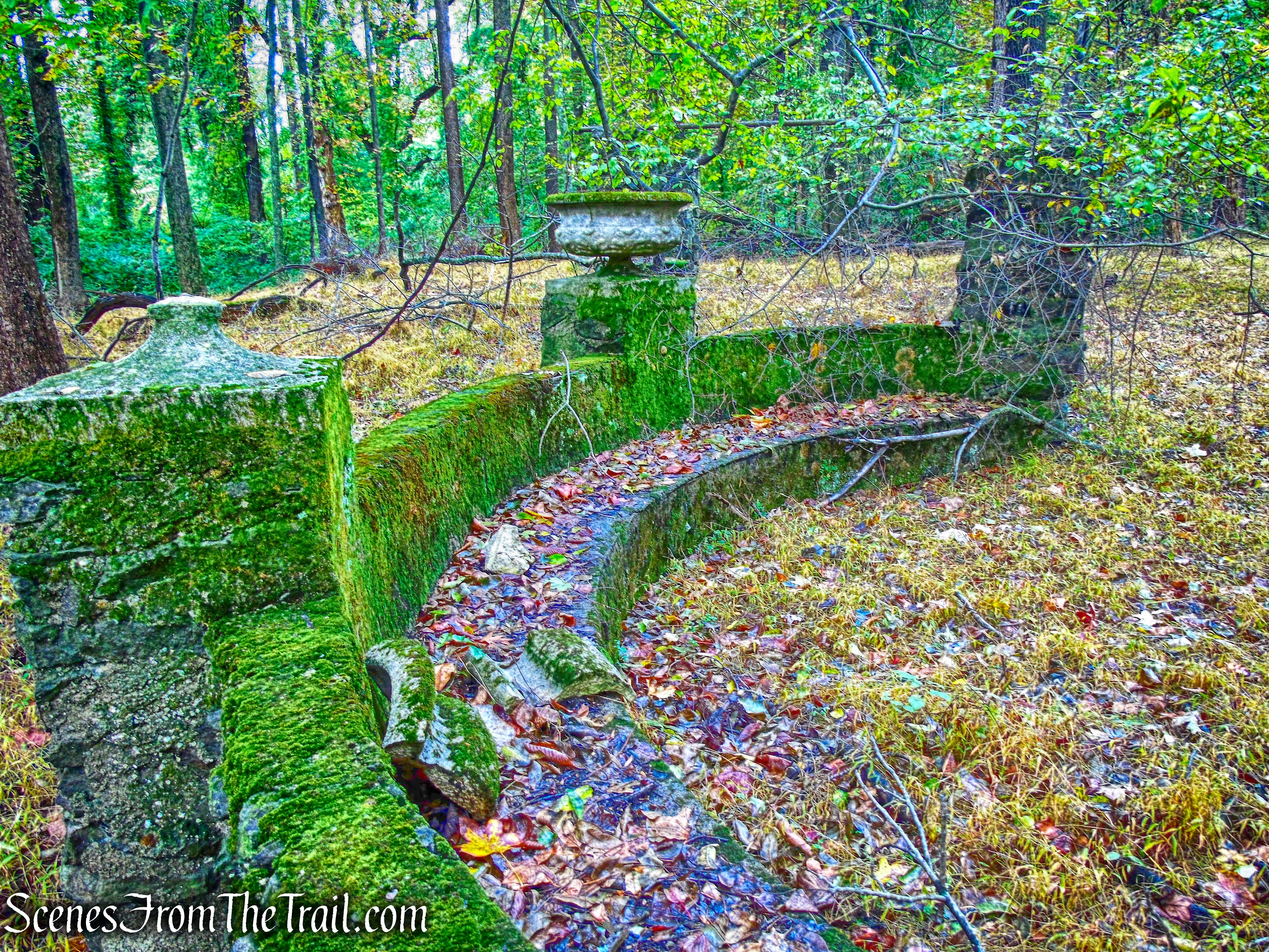
Away from the main ruins, there are several of these short stone columns scattered about.
ruins – George’s Island Park
Everything AND the kitchen sink.
ruins – George’s Island Park
We continued on the White Trail as it leads south.
White Trail – George’s Island Park
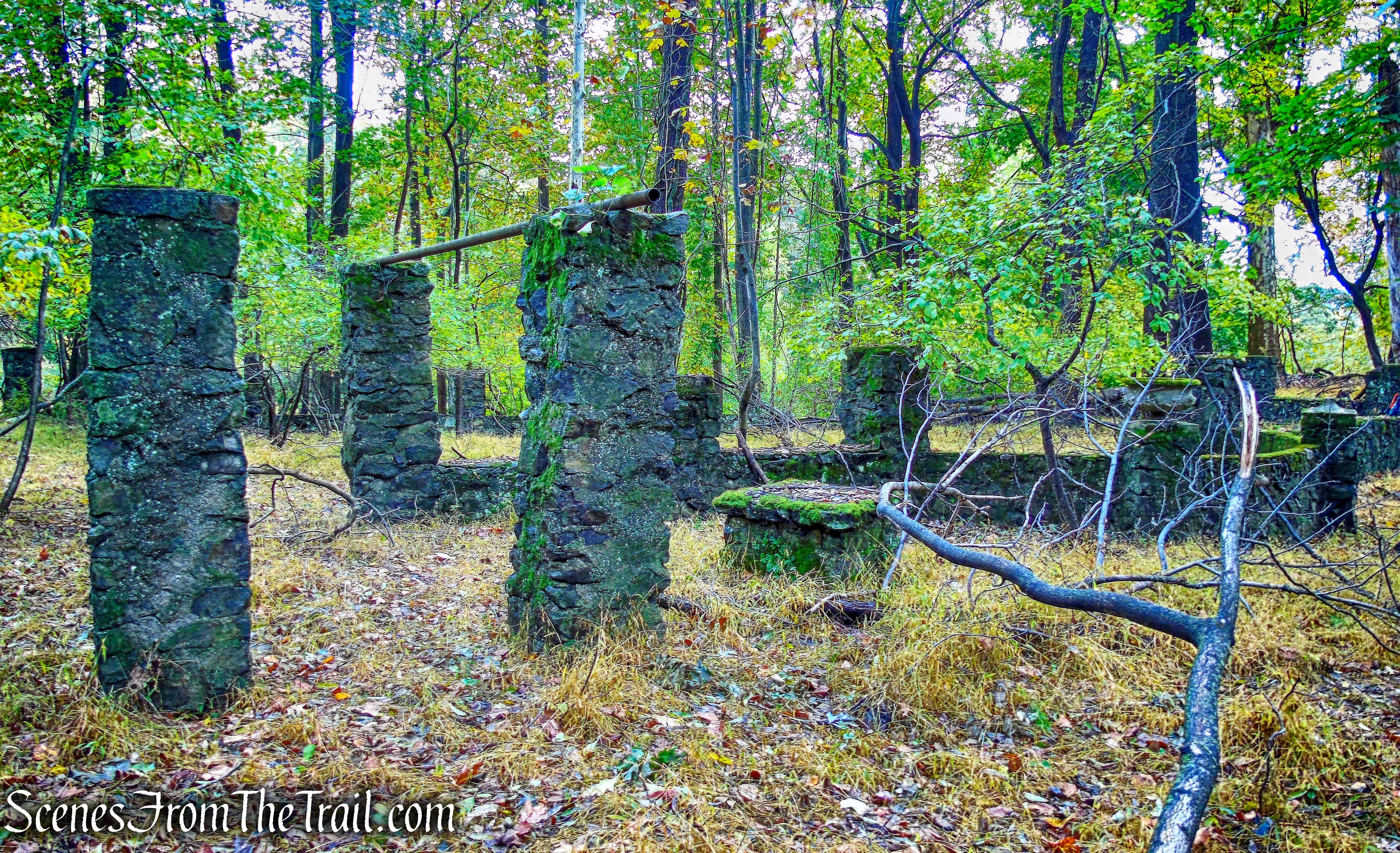
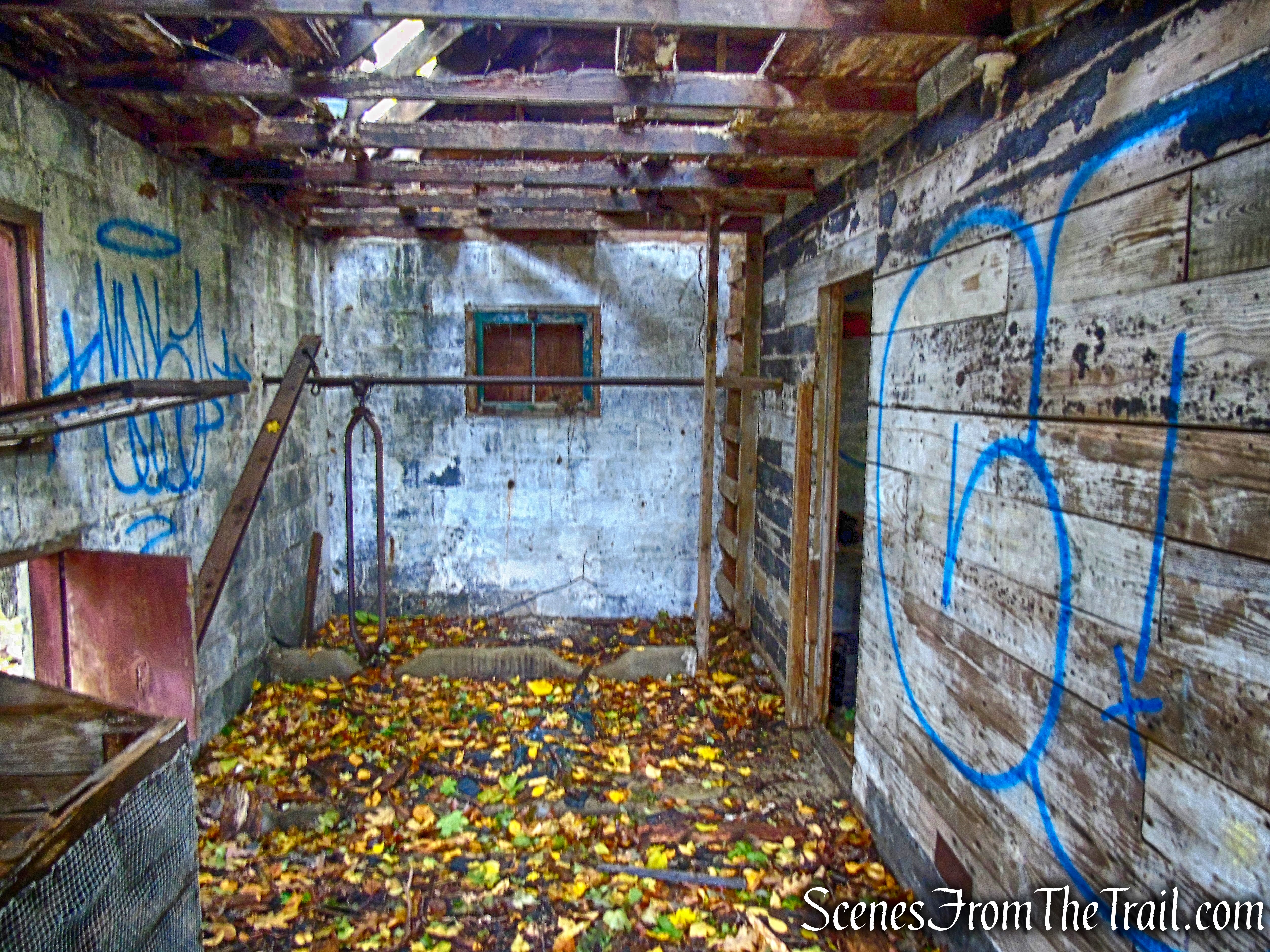
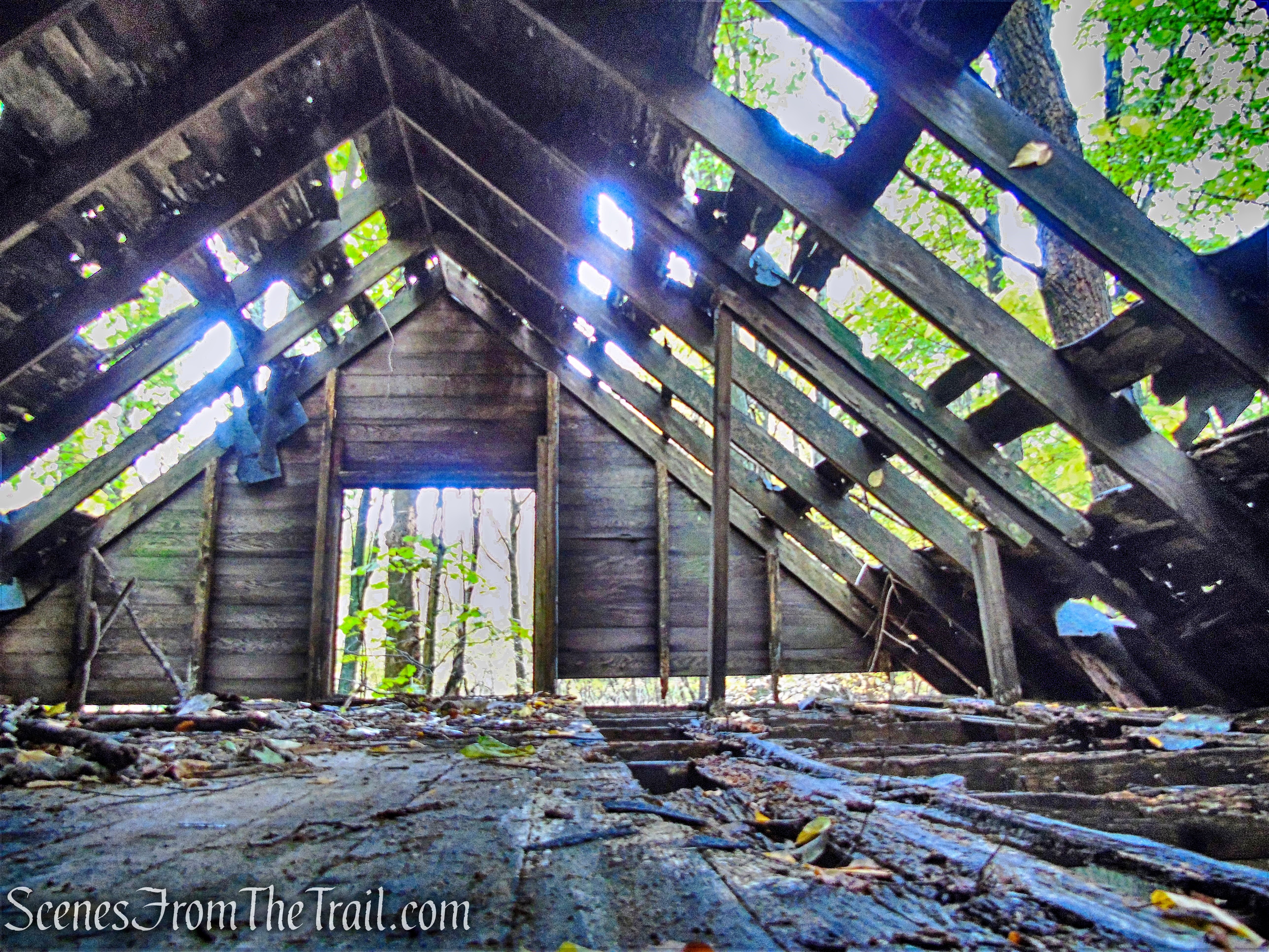
Wandering off trail, due to another blowdown, we spotted several foundations and a cinder block structure on the hill.
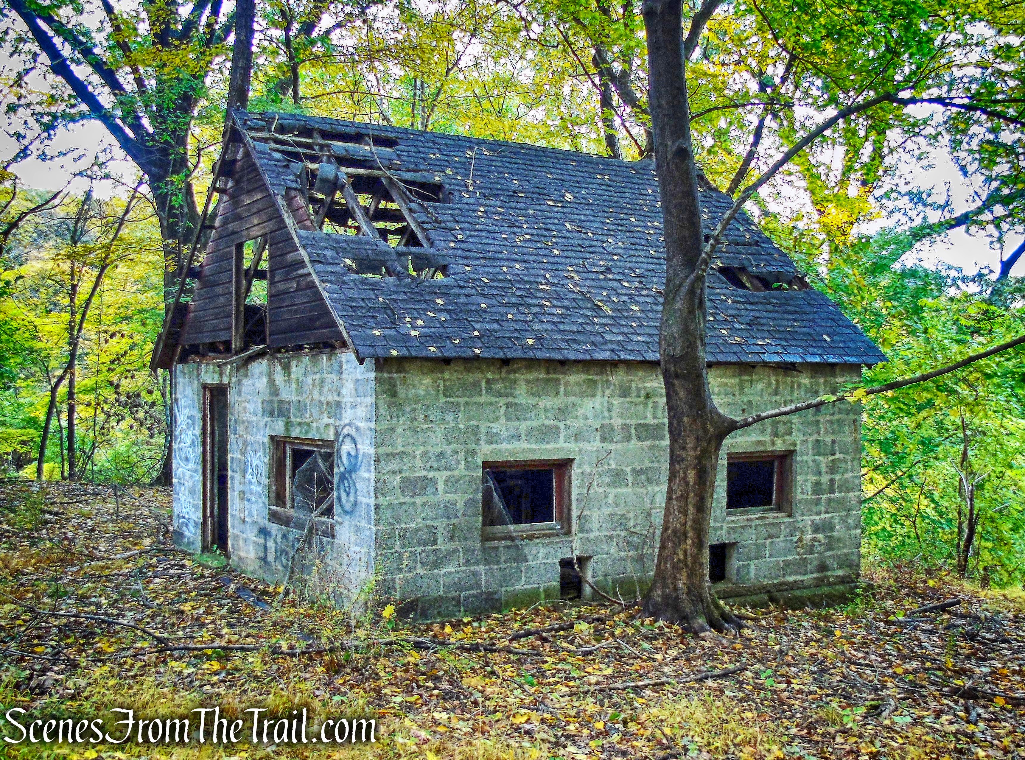
ruins – George’s Island Park
ruins – George’s Island Park
ruins – George’s Island Park
I spotted some white blazes down the hill, behind the cinder block house so we descended the hill until we caught up with the White Trail.
White Trail – George’s Island Park
The White Trail descends with the Hudson River visible through the trees on the right.
White Trail – George’s Island Park
Another small blowdown to get around.
White Trail – George’s Island Park
The trail passes another “brick beach” with great views of the Hudson River.
White Trail – George’s Island Park
Looking northwest to where we just came from.
White Trail – George’s Island Park
Looking southwest down river, with Sundance Point (George’s Island Park) on the left and Hook Mountain visible further down river on the right.
White Trail – George’s Island Park
The Tappan Zee Bridge can be seen peeking out from behind Hook Mountain.
White Trail – George’s Island Park
An interesting piece of steel laying on a picnic table by the river.
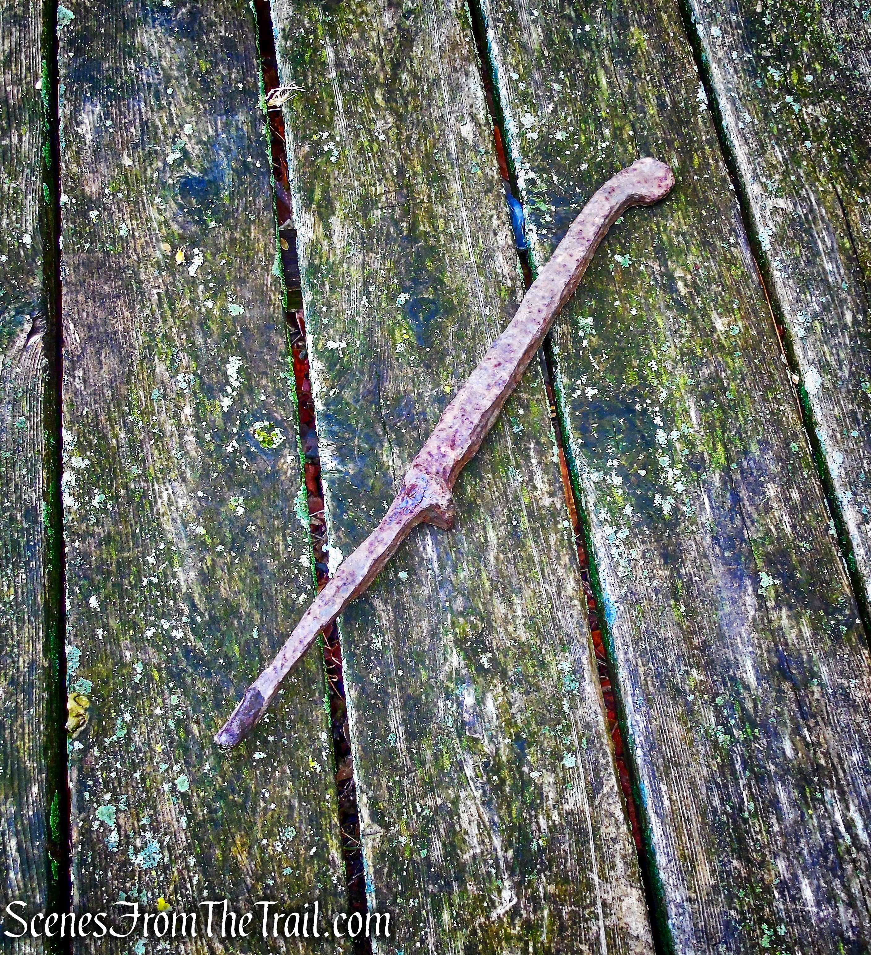
White Trail – George’s Island Park
We continued on the White Trail which becomes a bit overgrown as it heads inland and passes through wetlands.
White Trail – George’s Island Park
The trail travels through a grassy area that was a bit spongy.
White Trail – George’s Island Park
The trail then curves to the left as do the trees.
White Trail – George’s Island Park
White Trail – George’s Island Park
With all the recent rain, the trail was swampy in some sections.
White Trail – George’s Island Park
White Trail – George’s Island Park
A short distance later it passes by the scenic JK Pond.
White Trail – George’s Island Park
An old brick along the trail that dates back to 1905.
White Trail – George’s Island Park
The White Trail now widens to a woods road as it passes through an area listed on the map as “Boney Hollow.”
White Trail – George’s Island Park
Just off trail in the woods, there is what appears to be the remnants of an old mining steam engine.
White Trail – George’s Island Park
The image below, from a previous visit in December 2017, shows a better perspective of the steam engine ruins.
steam engine ruins
The White Trail comes to a T-intersection and turns right. We turned left on the Blue Trail which heads northeast.
Blue Trail – George’s Island Park
Blue Trail – George’s Island Park
A small blowdown on the Blue Trail.
Blue Trail – George’s Island Park
The Blue Trail crosses a wooden footbridge and ends at Sunset Road.
Blue Trail – George’s Island Park
We turned left onto Sunset Road and followed it uphill to the stop sign and then turned left on Montrose Point Road.
Sunset Road
We walked on Montrose Point Road, a quiet street that gets little traffic.
Montrose Point Road
I spotted this buck in a yard and thought that this could be the culprit that injured that woman earlier in the morning. The woman sustained some serious injuries, including a ruptured lung and a broken pelvis. Read about it HERE.

Montrose Point Road
We arrived at the start of the Red Trail on Montrose Point Road and entered Montrose Point State Forest.
Red Trail – Montrose Point State Forest
We again crossed the rickety bridge.
Red Trail – Montrose Point State Forest
A short distance later, we left the Red Trail and turned right on the Blue Trail.
Blue Trail – Montrose Point State Forest
The Blue Trail heads north through the woods.
Blue Trail – Montrose Point State Forest
It then crosses a wooden footbridge over a stream.
Blue Trail – Montrose Point State Forest
The Blue Trail ends at the junction with the Red Trail, where we turned right.
Blue Trail – Montrose Point State Forest
We then walked a short distance back to the parking area, where the hike began.
trailhead – Montrose Point State Forest
This was a really nice hike to do in an area of historical significance. We didn’t encounter anyone else on the trails during our visit. Updated maps and clearer trails would be nice, but it’s not that big an area to get lost in. Definitely worth the visit.
Pros: Hudson River, historical features, lesser traveled area, lots of bird activity.
Cons: Overgrown trails and numerous blowdowns, George’s Island Park map is outdated.
Take a hike!
Montrose Point State Forest & George’s Island Park
Sources:
- Montrose Point & George’s Island Brick Industry
- George’s Island Park
- Montrose Point State Forest
- Frederick W. Seward
- Former Seward Estate

I grew up in a home that once stood on this property. Beautiful memories. The walls in the small barn still standing (also photographed) have my
sister’s initials, and some drawings she and I put there as a child. They were in oil pastel, so still there if you look closely.
LikeLike