November 4, 2018 – High Falls, NY
Difficulty: Moderate – Strenuous
Length: Approximately 6.5 miles
Max elevation: 1,122 ft. – total elevation gain: 1,094 ft.
Route type: Circuit
Map: Shawangunk Trails Map #105 & #106
Trailhead parking: Undivided Lot Trailhead (Clove Chapel) – High Falls, NY 12440
Fees: $15.00 per hiker day use fee (Non-Member) – Purchase Membership
With over 8,000 acres on the Shawangunk Ridge, Mohonk Preserve is the largest member and visitor-supported nature preserve in New York State. The Mohonk Preserve is a private land conservation organization established to protect the Shawangunk Ridge. It is not public land funded by the government. Therefore, there is a day use fee to use the preserve which funds its maintenance and programs.

Mohonk Preserve
The Mohonk Mountain House property consists of 1,325 acres, and much of it is landscaped with meadows and gardens. It adjoins the Mohonk Preserve, which is crisscrossed by 85 miles of hiking trails and carriage roads. The Mohonk Mountain House charges $22.00 Monday-Friday and $27.00 weekends/holidays for a day hiking pass. A hiking pass does not include access to the interior of the house or lake swimming. The Mohonk Preserve (non-profit nature preserve) and the Mohonk Mountain House (resort hotel) are two separate places. The Mohonk Preserve charges $15.00 for a day pass (annual memberships available) which also allows access to the Mohonk Mountain House property. The only drawback is that you have to hike a couple of miles in order to get to the Mountain House grounds. That normally adds about five miles to any hike unless you pay to park on their property.
Starting from Clove Chapel on County Road 6, the light-blue-blazed Undivided Lot Trail travels approximately 2.7 miles southwest along the ridge, co-aligned with the Shawangunk Ridge Trail (SRT), until its terminus at a junction with the Old Minnewaska Trail. The trail features scenic views of the Catskills and is also accessible from either the Coxing or Spring Farm Trailheads.
Prior to the Revolutionary War, the 100-acre piece of land known as Undivided Lot was not usable for agriculture, so a town policy designated it a woodlot for community use and was owned jointly by several nearby valley residents. The ownerships were not designated by land boundaries, giving it the name “undivided,” and the owners were given shares of wood. There is also evidence that at one point, George Washington owned a share when he was stationed at the New Windsor Cantonment in Vails Gate from 1781–1783.
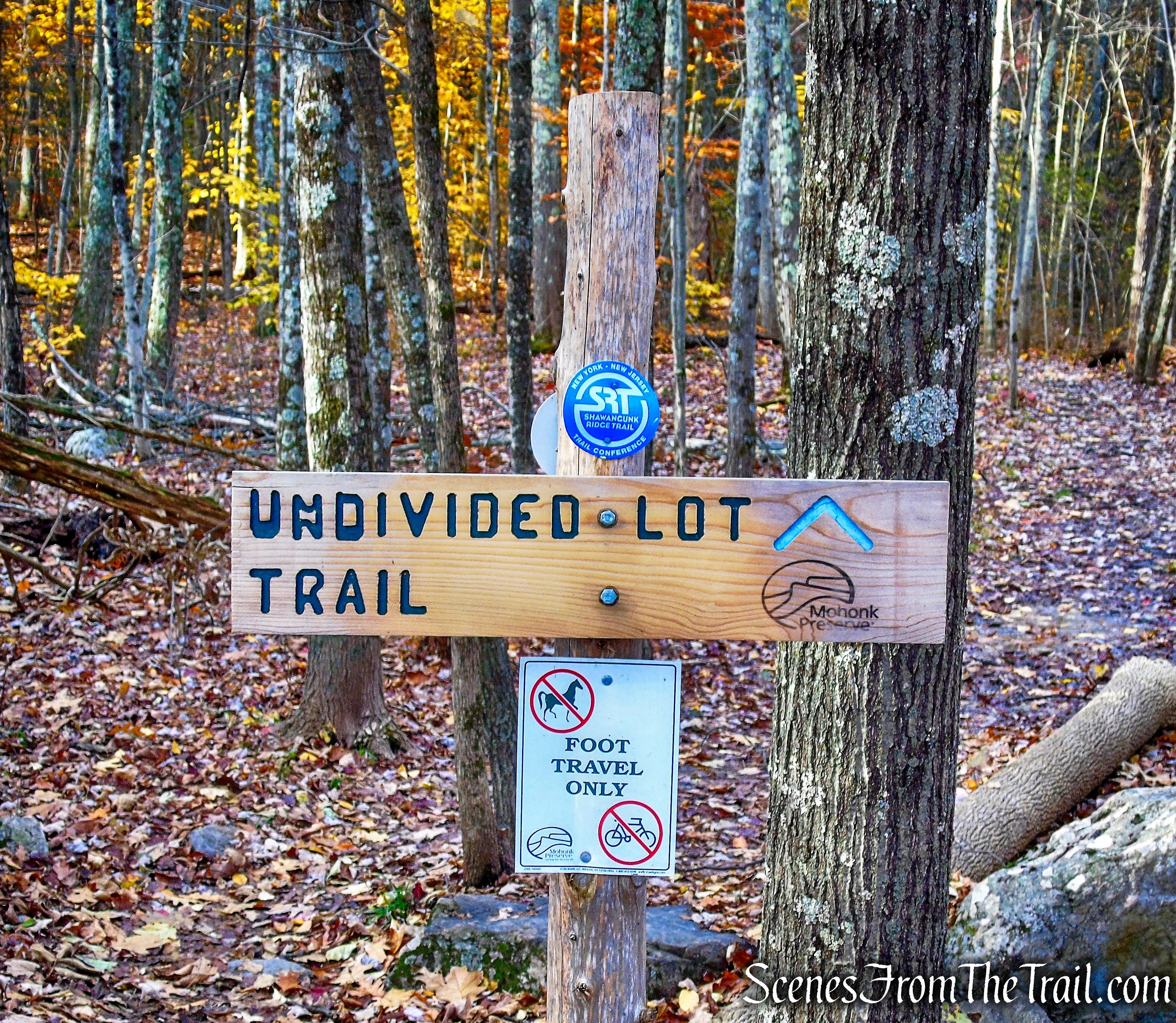
Undivided Lot Trail
This hike covers the entire Undivided Lot Trail southwest, from Clove Chapel to the Old Minnewaska Trail. It then returns northeast on Laurel Ledge Road, Maple Path, Stokes Trail and back to the Undivided Lot Trail.
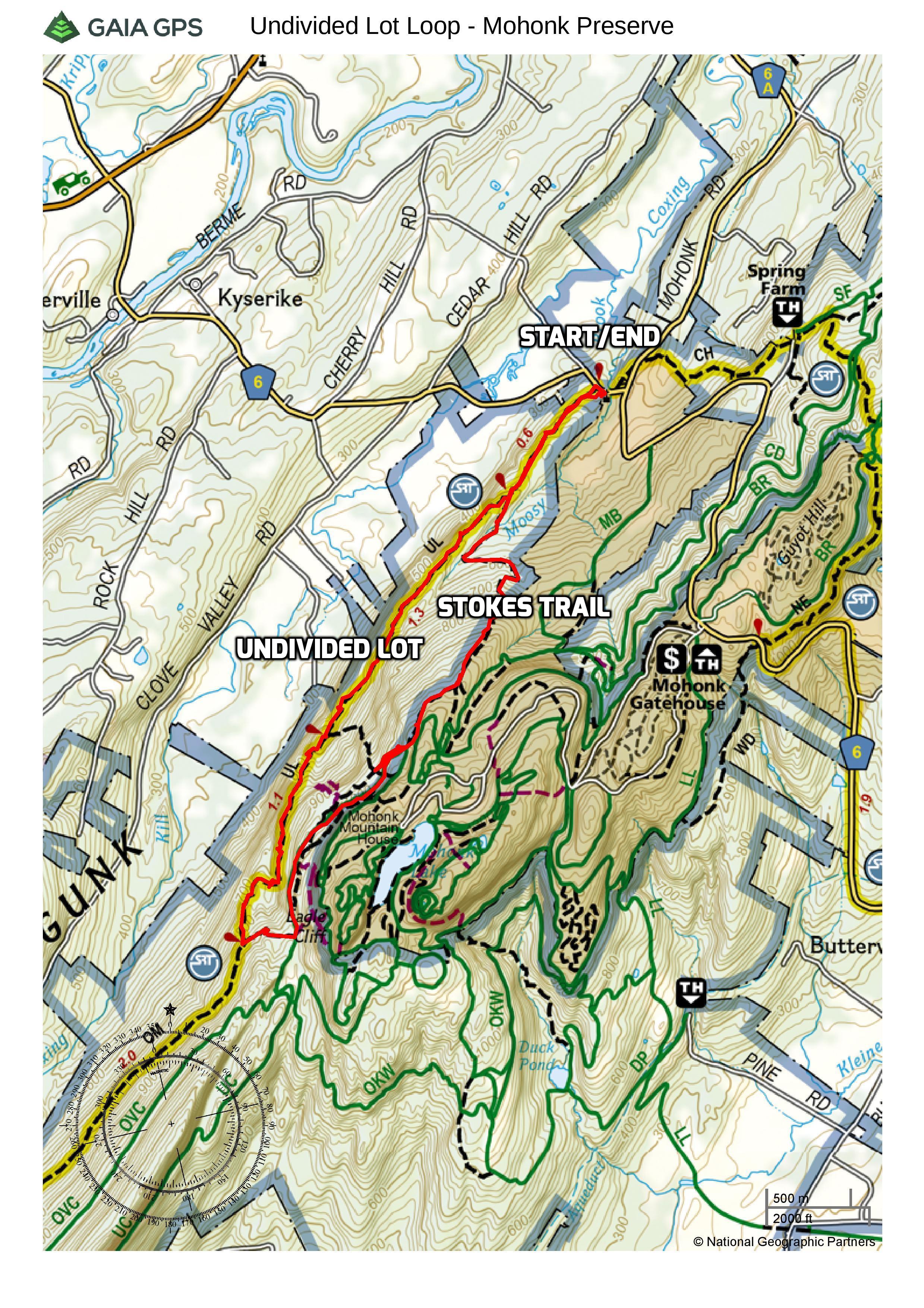
Undivided Lot Loop – Mohonk Preserve
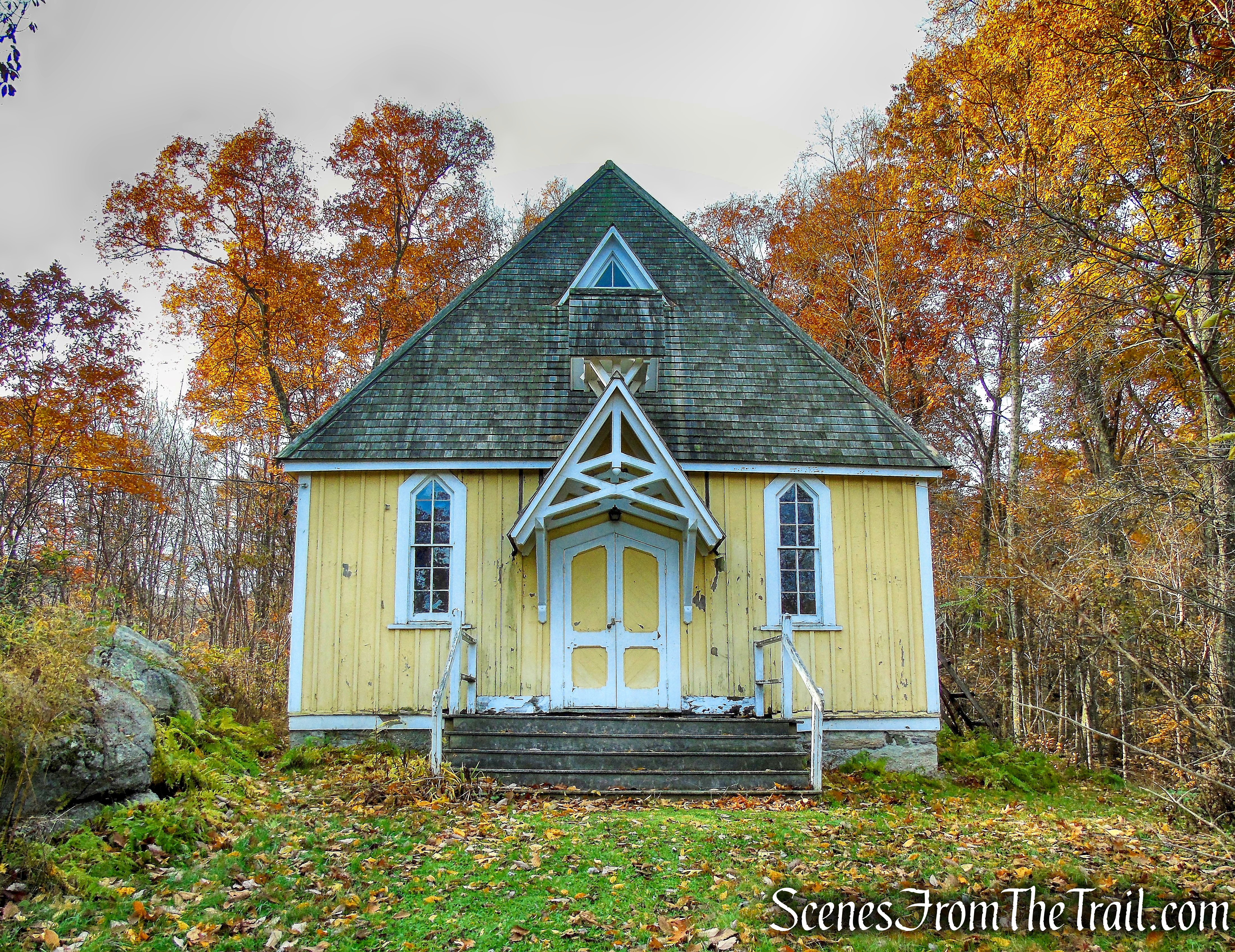
The trailhead parking has room for about 8-10 cars in front of Clove Chapel. When we arrived at approximately 9:15 am on a Sunday morning, the parking area was almost full. Before we began the hike, we walked over to take a look at the historic church.
Situated on the grounds of the Mohonk Preserve, this charming 1876 building was once used not only as a church but also as a library and community center. Today, it is owned by the Community of the Clove (a designated area of deeded land) and the Clove Chapel Board is charged with its the upkeep. Features include a vertical board-and-batten exterior painted yellow with white trim and dormer roof windows that emit natural sunlight (there is also electricity for nighttime events).
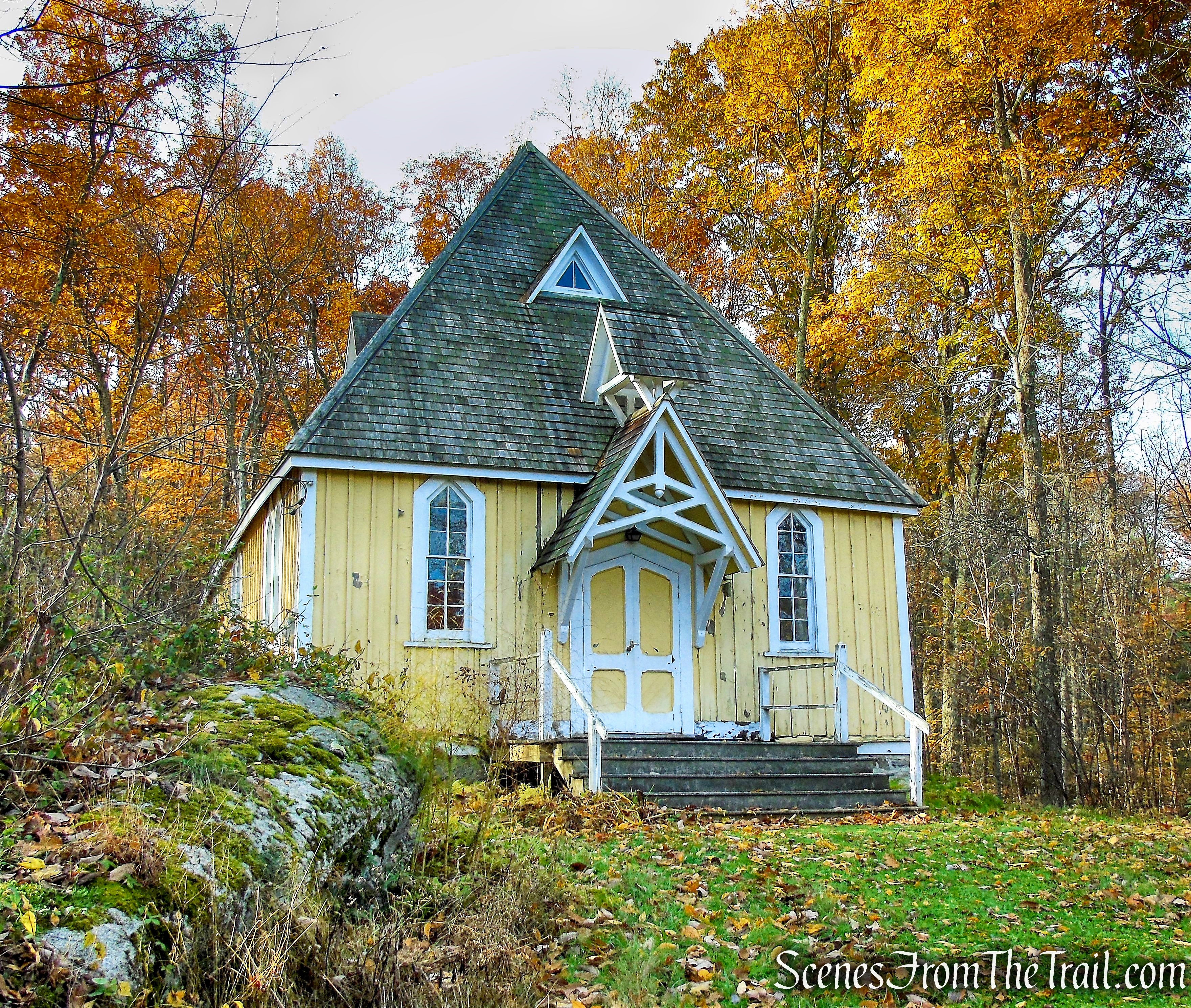
Clove Chapel
With 28-foot ceilings, the space has great acoustics, and if you whisper up front you can hear it in the back, making it perfect for simple country weddings or christenings. The chapel, which can accommodate 102 people, charges a reasonable fee (the money goes right back into maintenance). Lovely though it is, if you are visiting or attending an event in winter, dress warmly, there’s no heat!
Clove Chapel
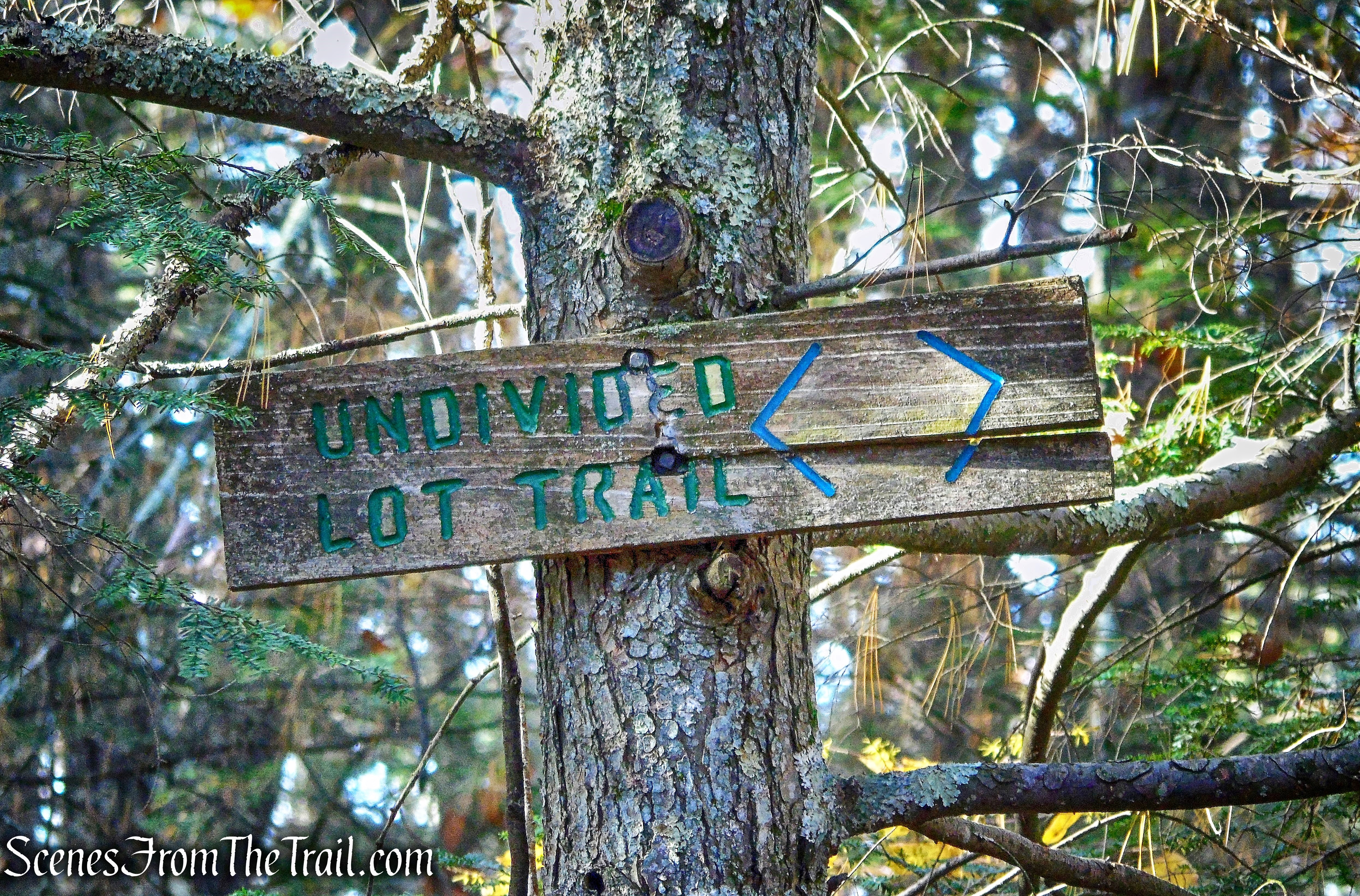
The light-blue blazed Undivided Lot Trail begins to the right of Clove Chapel (if you are facing it) and is marked by a wooden sign. This is also the route of the Shawangunk Ridge Trail (SRT), marked by blue discs.
Undivided Lot Trail
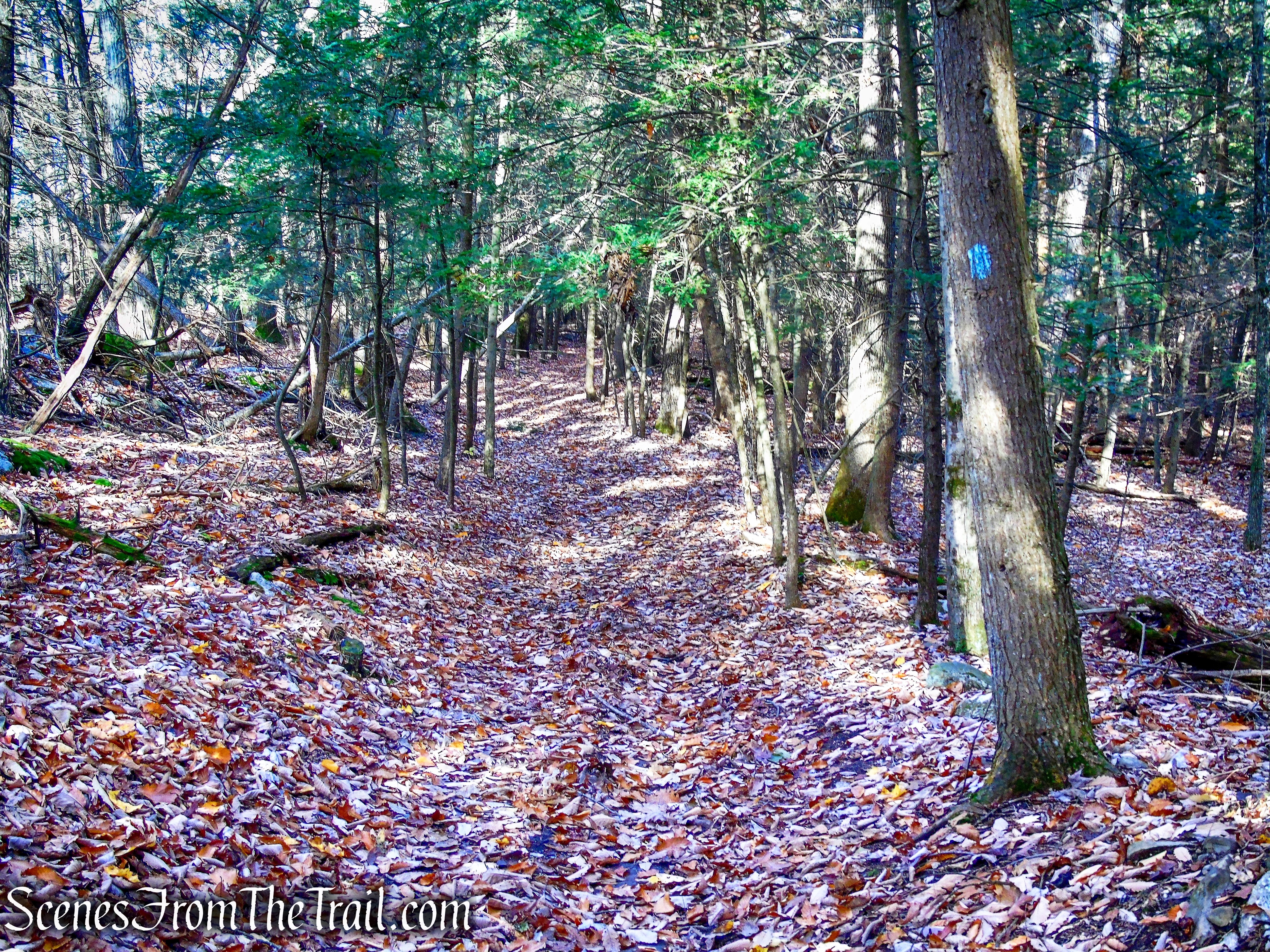
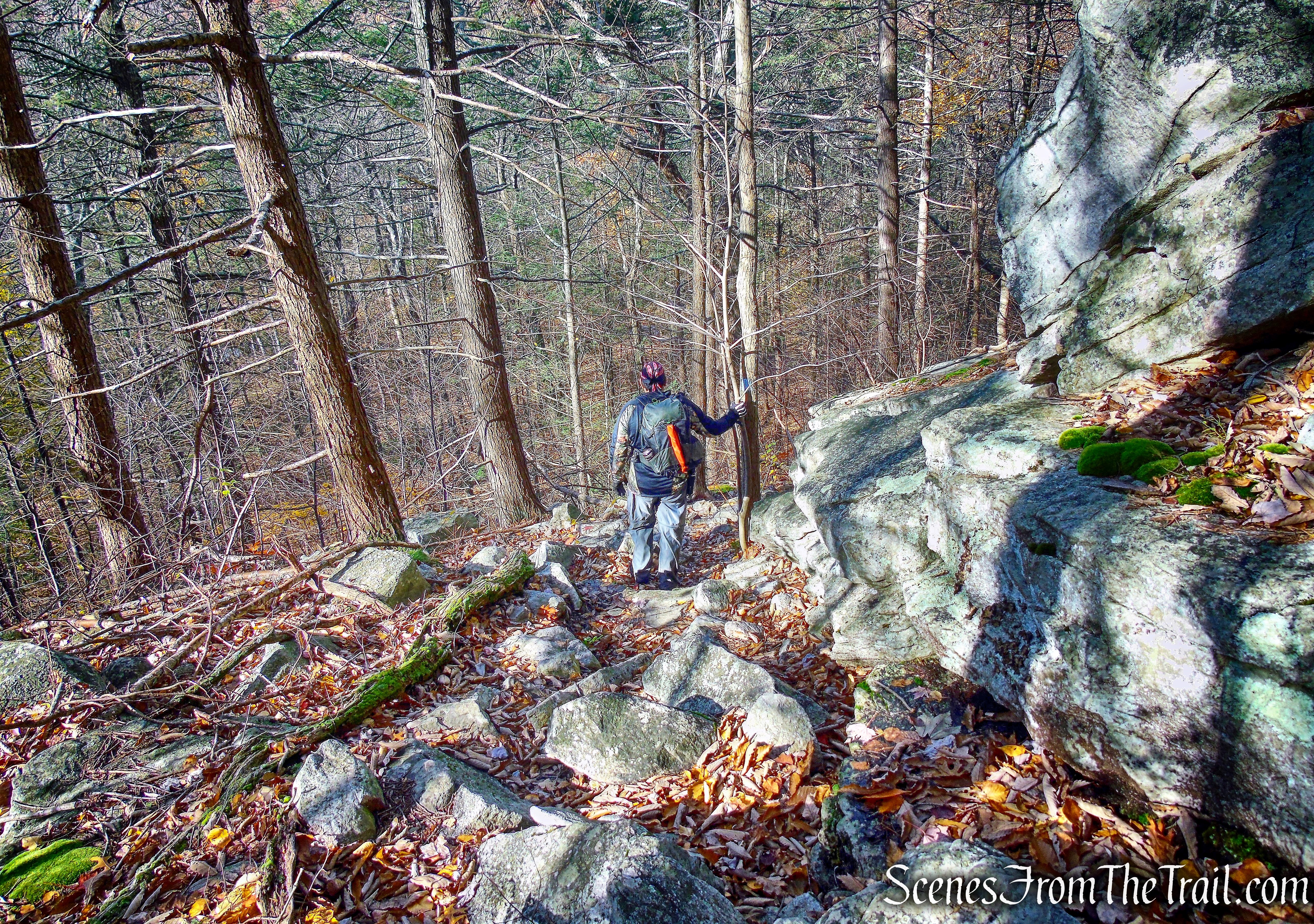
The trail heads southwest through the woods and climbs gradually. The trail was very swampy at the start, but that could be due to the previous day’s rain.
Undivided Lot Trail
The Undivided Lot Trail is one of the more remote areas of the Mohonk Preserve and we didn’t encounter any other hikers along the entire trail.
Undivided Lot Trail
In about 0.6 mile, the Undivided Lot Trail comes to a Y-intersection with the red-blazed Stokes Trail which starts on the left. That would be our return route, so we stayed to the right and continued following the light blue blazes of the Undivided Lot Trail.
Undivided Lot Trail
The trail continues to rise and skirts some cliffs on the right referred to as Outback Slab on some maps. According to my post hike research, there are views to be had from here. I didn’t bother to check it out because I thought that there would be views a little farther up, I was wrong. In hindsight, I wish I had bothered to stop.
Undivided Lot Trail
We continued on the Undivided Lot Trail, which has numerous stream crossings. Some wider than others, but all were manageable.
Undivided Lot Trail
Originally when I planned this hike, we were going to turn left here on the Clove Path, which connects with Laurel Ledge Road. Once we got to this junction, I suggested that instead of the steep climb up this trail (about 450 ft. elevation gain in about half a mile), we should continue on the Undivided Lot Trail and hike it from end to end. That added some mileage to the original hike and didn’t necessarily eliminate any elevation gain, but made for an interesting hike.
Undivided Lot Trail
The trail then turns right, crosses another stream and approaches the edge of the cliffs.
Undivided Lot Trail
A short distance later, we came to our first real view.
view from Undivided Lot Trail
Along the trail there is a stone fireplace.
fireplace – Undivided Lot Trail
The trail travels by and over some deep crevices in the rock.
Undivided Lot Trail
The trail then makes a right turn and descends steeply alongside the cliffs.
Undivided Lot Trail
Undivided Lot Trail
The Undivided Lot Trail then levels off somewhat and proceeds through the woods.
Undivided Lot Trail
The trail then crosses another stream, climbs again and comes to a rock outcrop with a western-facing viewpoint. It was about this time that after capturing several images of the view, I turned around and saw a large Black Bear about 30 yards away in the woods. It was like we both saw each other at the same time. The bear began to run parallel to the trail, in the same direction we were headed, then abruptly turned and ran up the hill. It all happened so quickly that even with camera in hand, I never even bothered to raise it. I didn’t want to take my eyes off him and was rather relieved that he ran away.
view from Undivided Lot Trail
We then continued on the Undivided Lot Trail, keeping our eyes and ears open in case the bear came back. Luckily, we didn’t see any more signs of the bear for the rest of the hike.
Undivided Lot Trail
The trail climbs over open rock slabs with more views to the west.
view from Undivided Lot Trail
After 2.7 miles, the Undivided Lot Trail ends at a junction with the Old Minnewaska Trail.
terminus of Undivided Lot Trail
We turned left on the Old Minnewaska Trail, now heading east, away from the ridge.
terminus of Undivided Lot Trail
The Old Minnewaska Trail heads uphill on a moderate grade towards Laurel Ledge Road.
Old Minnewaska Trail
Old Minnewaska Trail
After about 400 yards, the Old Minnewaska Trail ends at Laurel Ledge Road, where we turned left.
terminus of Old Minnewaska Trail
terminus of Old Minnewaska Trail
We began heading northeast on this carriage road, encountering several bikers and hikers along the way.
Laurel Ledge Road
Laurel Ledge Road is a hiking, biking, and horse trail that runs along the boundary of the Mohonk Mountain House property and Mohonk Preserve. It is 1.9 miles long and begins near Rhododendron Bridge and ends near the Copes Lookout viewpoint.
Laurel Ledge Road
This trail connects with the following: Old Minnewaska Trail, Overcliff Carriage Road, Clove Path, Cope’s Lookout Trail, Plateau Path, Zaidee’s Path, Sunset Path, Maple Path and Giant’s Workshop.
Laurel Ledge Road
It was a nice change from the rocky footpath we had just left.
Laurel Ledge Road
A bench along the trail made a perfect place to have lunch and…..
Laurel Ledge Road
enjoy a nice view of the Catskill Mountains.
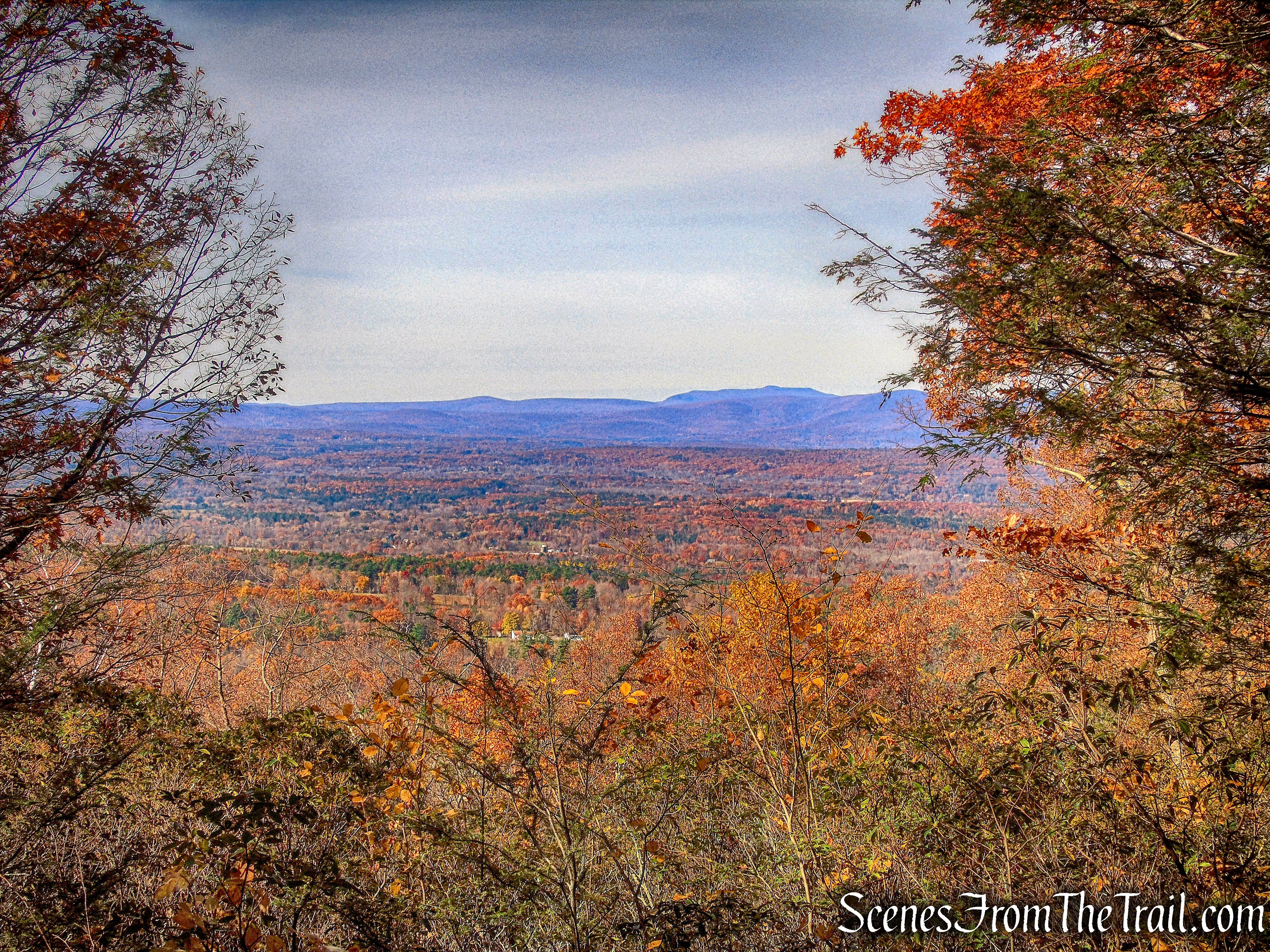
view from Laurel Ledge Road
After almost a mile, Laurel Ledge Road comes to a complex junction. At this point map #106 comes into play. It has an expanded view and is much easier to decipher which way to go. Maple Path, our next trail, is just to the right of the sign and large rock formation.
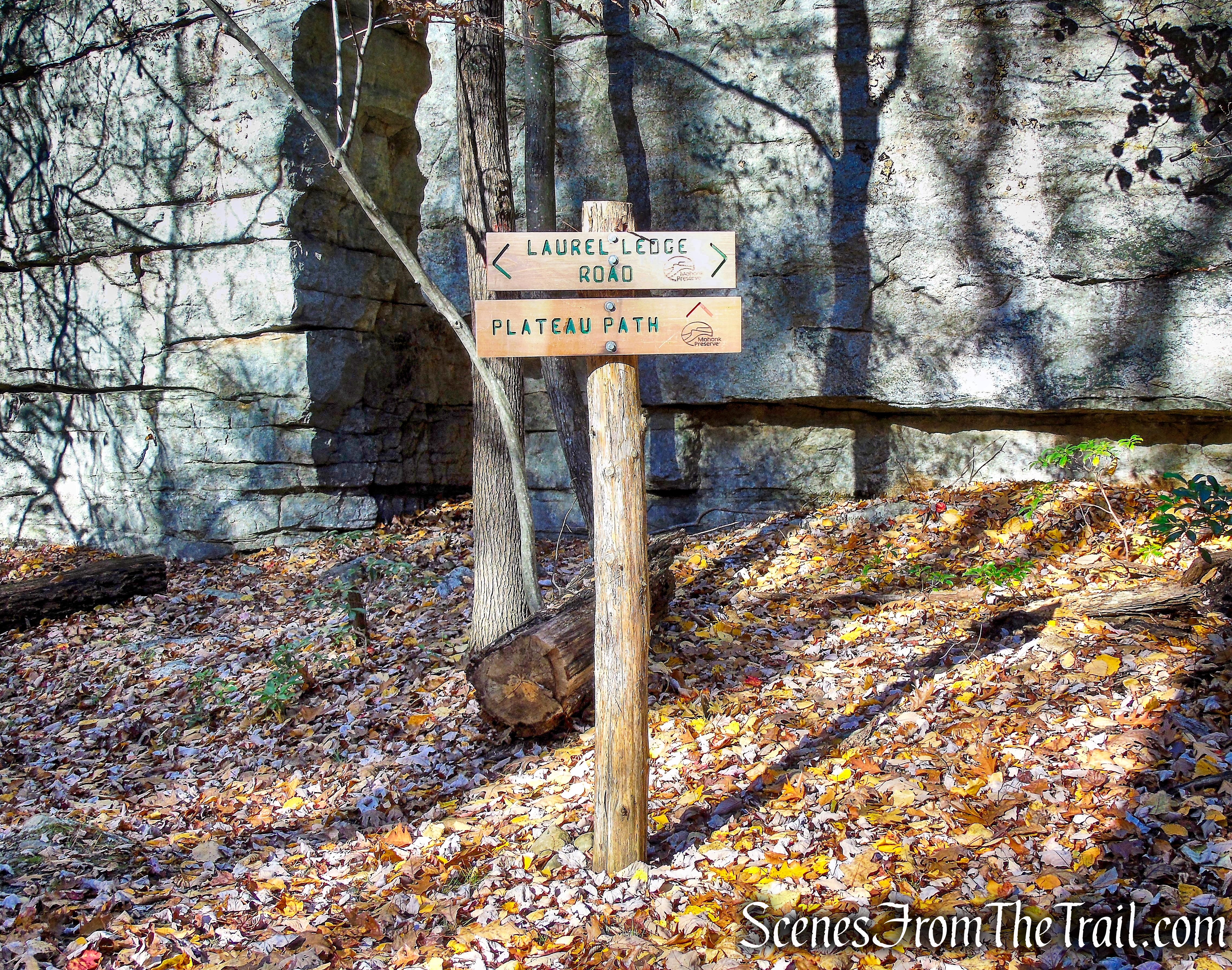
Laurel Ledge Road
Laurel Ledge Road
We turned left onto Maple Path, which is marked with light blue blazes..
Laurel Ledge Road
The Maple Path is 0.3 mile long and connects Laurel Ledge Road with the Stokes Trail
Maple Path
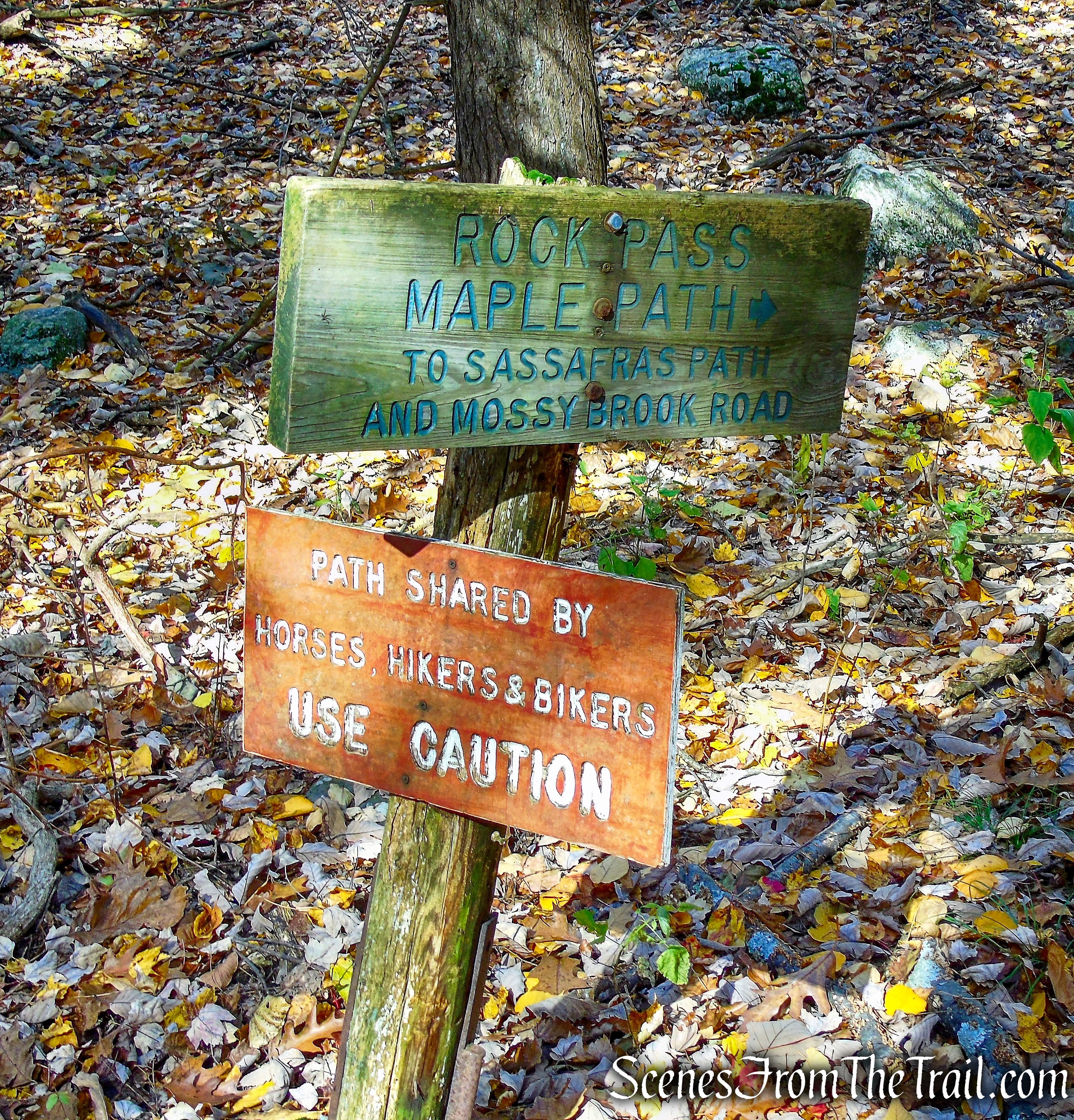
The Maple Path ends at a T-intersection with the red-blazed Stokes Trail. The Stokes Trail is 1.1 miles long and connects the Maple Path with the Undivided Lot Trail.
Stokes Trail
The Stokes Trail descends steadily through the forest and comes out on open rock slabs with views to the west.
view from Stokes Trail
The trail then continues its descent on a woods road.
Stokes Trail
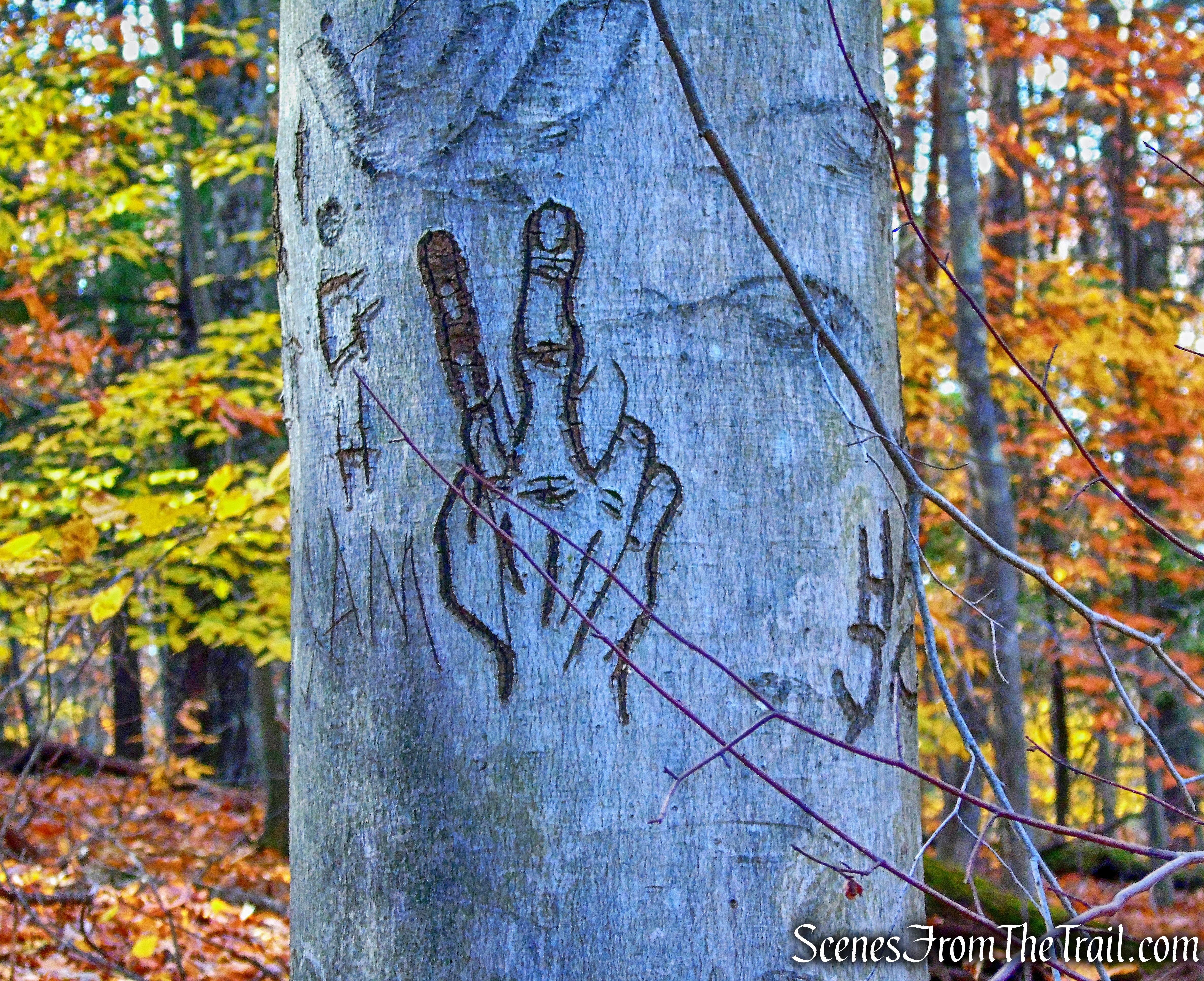
tree graffiti – Stokes Trail
At the base of the descent, the Stokes Trail ends at a junction with the Undivided Lot Trail.
terminus of Stokes Trail
We turned right onto the Undivided Lot Trail and began retracing our steps from the beginning of the hike.
turn right on Undivided Lot Trail
In about 0.6 mile, the Undivided Lot Trail ends at Clove Chapel on County Road 6, where the hike began.
Undivided Lot Trail
This was a very pleasant hike in a more remote section of Mohonk Preserve. The varied terrain along with the views, make this hike enjoyable. I plan on going back and checking out some of the side trails off of Laurel Ledge Road.
Pros: The Gunks, lesser traveled area, scenic views, stream crossings, good signage at junctions, I saw a bear.
Cons: Trail is swampy in some sections.
Take a hike!
Undivided Lot Loop – Mohonk Preserve
Sources:
- Shawangunk Place Names: Undivided Lot Trail
- Clove Chapel Facebook Page
- Clove Chapel – Hidden Hudson Valley Landmarks
- Clove Chapel – A Timeline
