July 21, 2018 – Gardiner, NY
Difficulty: Moderate
Length: Approximately 7.5 miles
Max elevation: 1,092 ft.– total elevation gain approximately 918 ft.
Route type: Circuit
Fee: $15.00 day hiking fee (Non-Member) – Purchase Membership
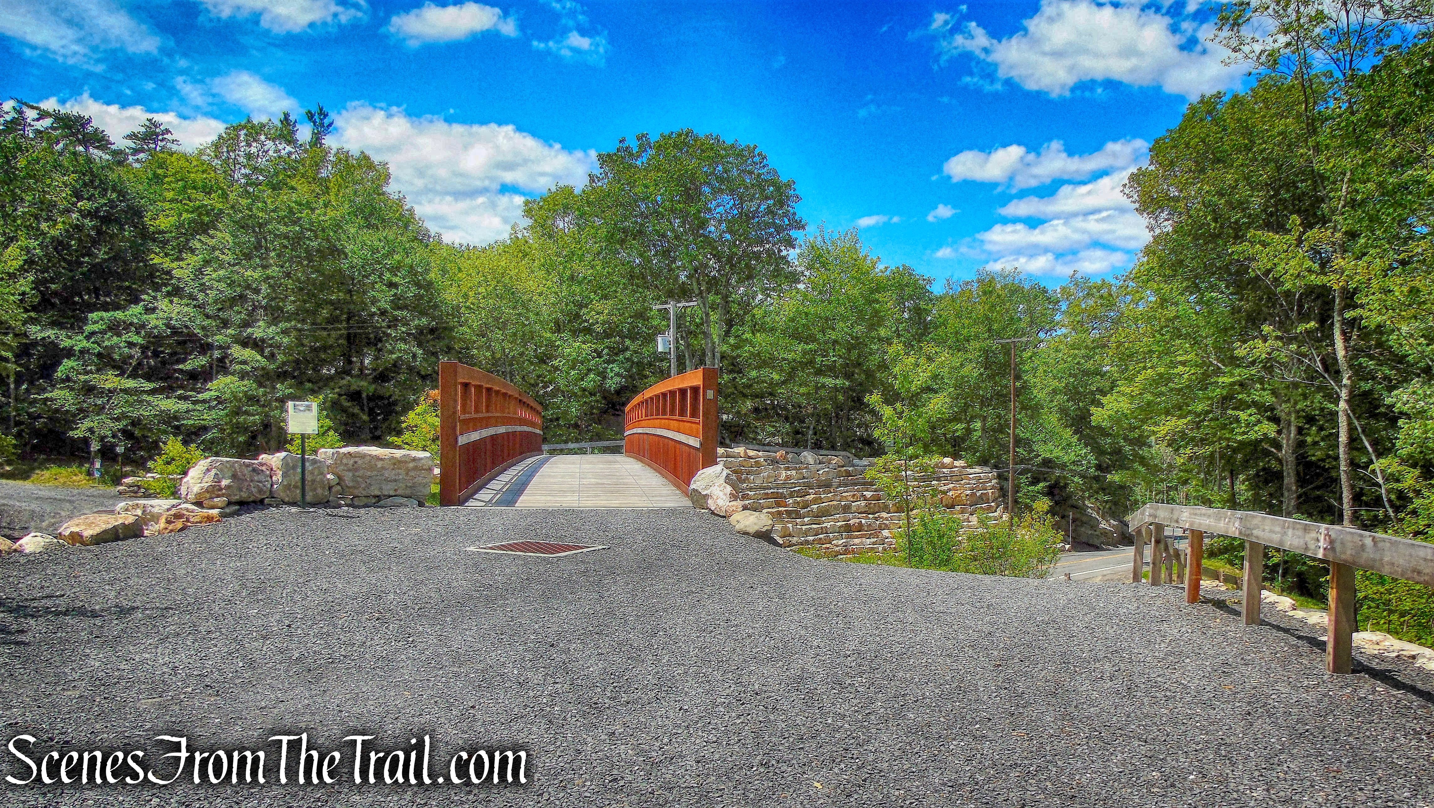
Trailhead parking: Mohonk Preserve West Trapps Trailhead Parking Area 3142 US-44, Gardiner, NY 12525
With over 8,000 acres on the Shawangunk Ridge, Mohonk Preserve is the largest member and visitor-supported nature preserve in New York State. The Mohonk Preserve is a private land conservation organization established to protect the Shawangunk Ridge, it is not public land funded by the government. Therefore, there is a day use fee to use the preserve which funds its maintenance and programs.
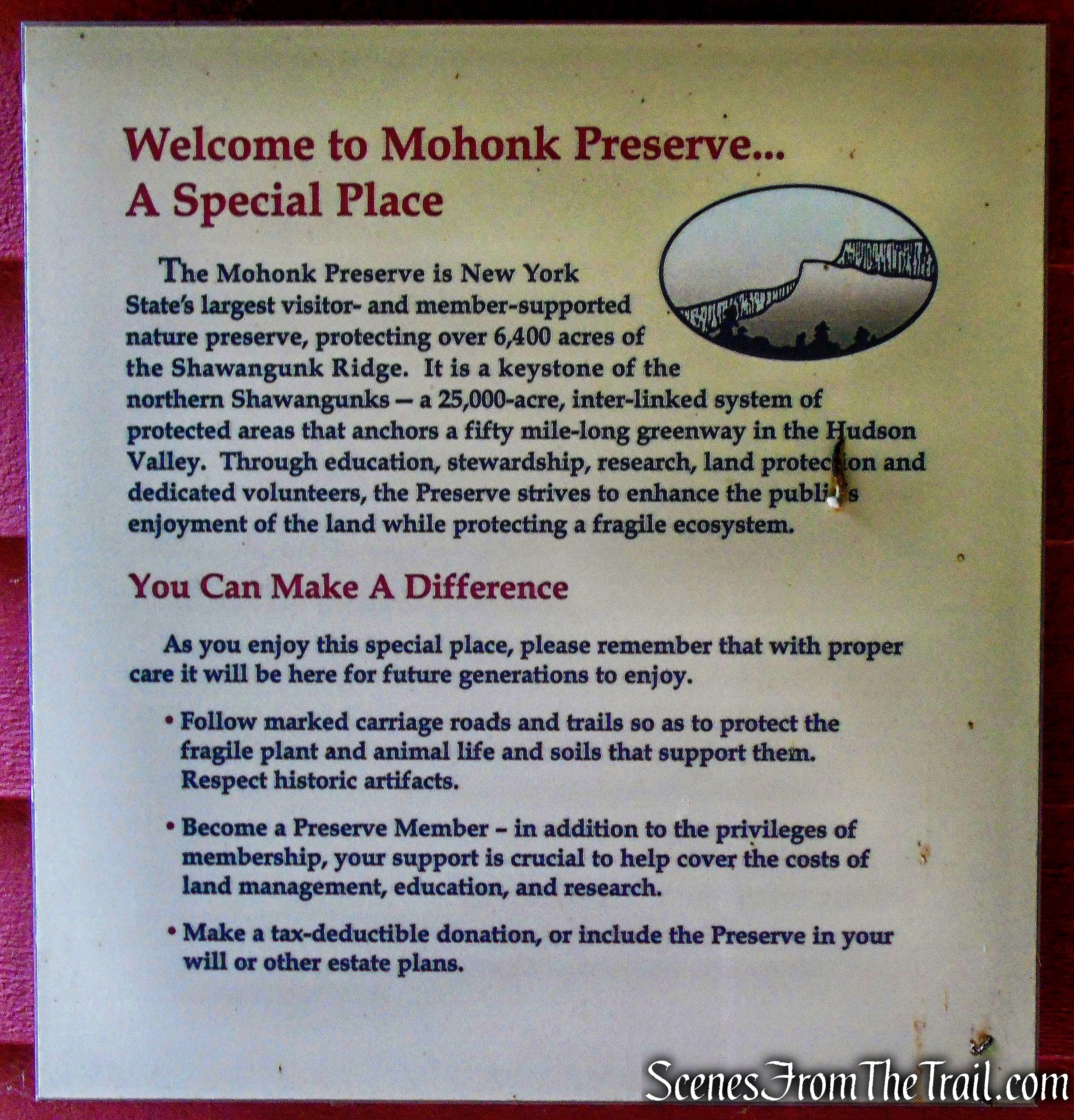
Mohonk Preserve
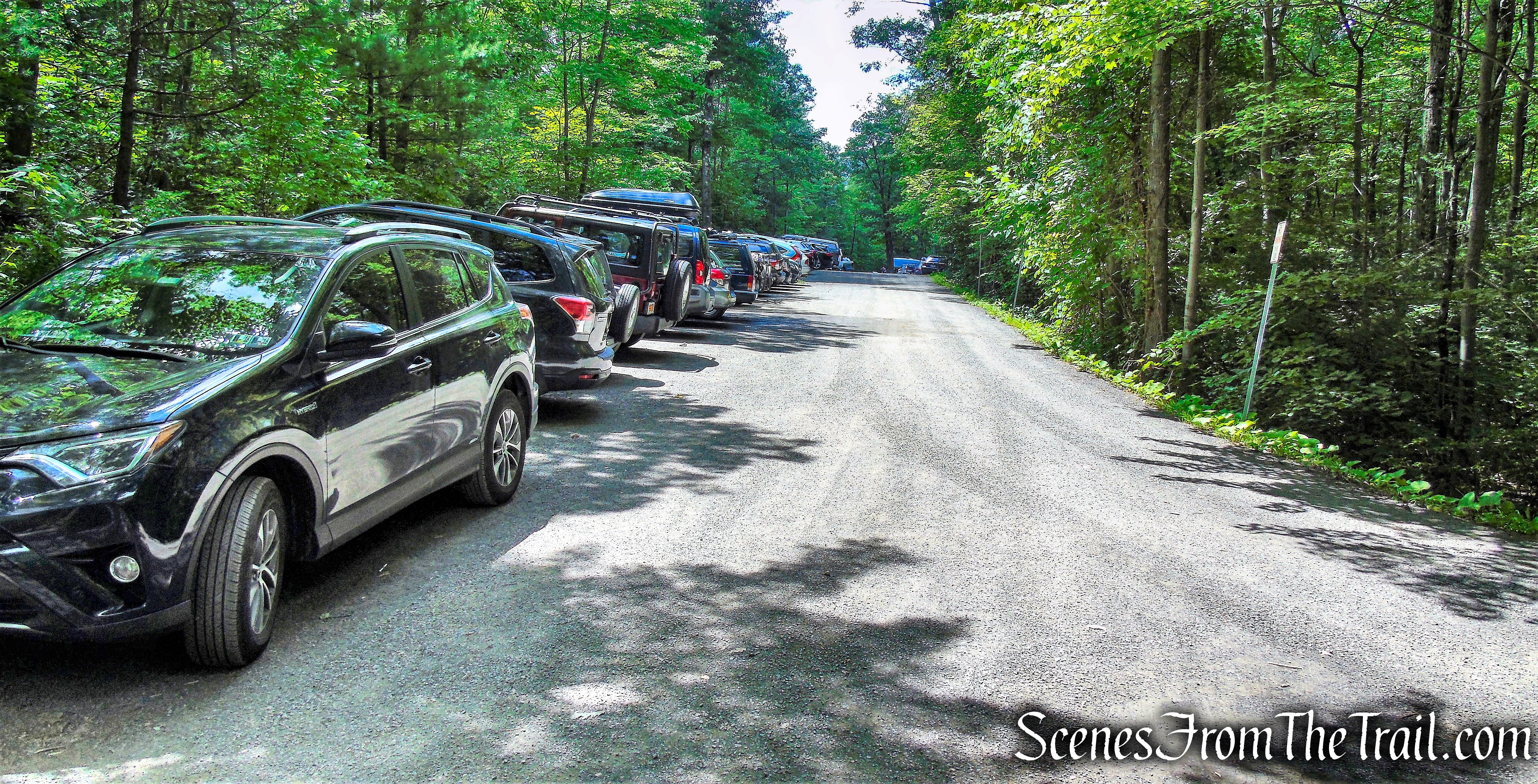
I normally prefer to hike the Mohonk/Minnewaska area on weekdays due to the large crowds on weekends. Having been gifted an annual Mohonk Preserve membership, I wanted to take advantage of it and hike some trails that I hadn’t yet done. Parking is always an issue when visiting the Mohonk Preserve, so it makes for an early rise. The preserve’s website lists the parking areas as opening at 9:00am on weekends, but when we arrived at about 8:30am, it was near capacity.

West Trapps Parking Area
This hike began from the West Trapps Parking Area, travels along several lesser used trails and returns along Undercliff Road. Undercliff Road is always filled with walkers, cyclists and rock climbers, but it is a very scenic walk. Originally, the hike was going to be a simple 6 mile loop, but upon arriving at the trailhead, We decided to visit Van Leuven’s Cabin. That added about 1.5 miles to the hike, but well worth it.
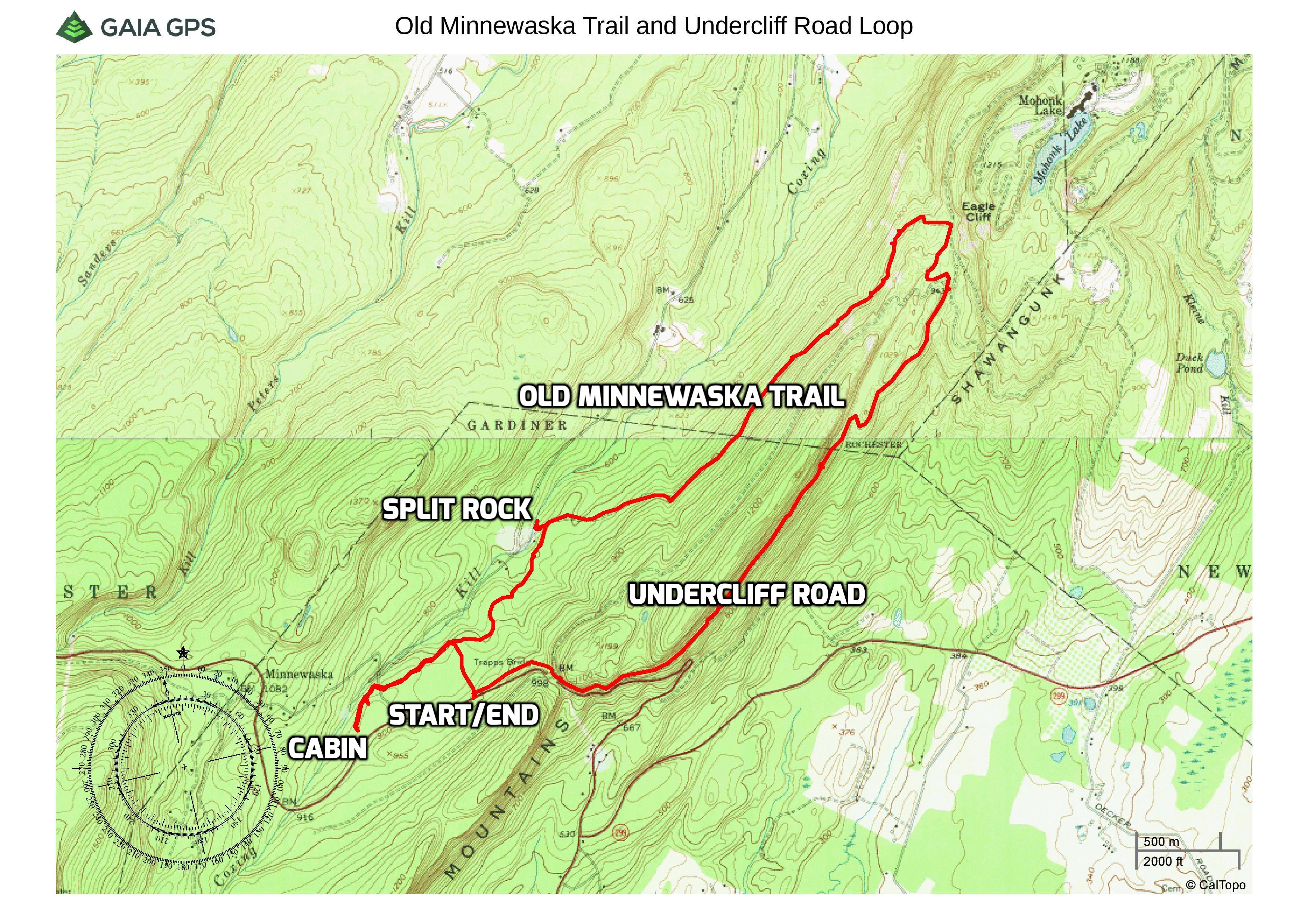
Old Minnewaska Trail and Undercliff Road Loop
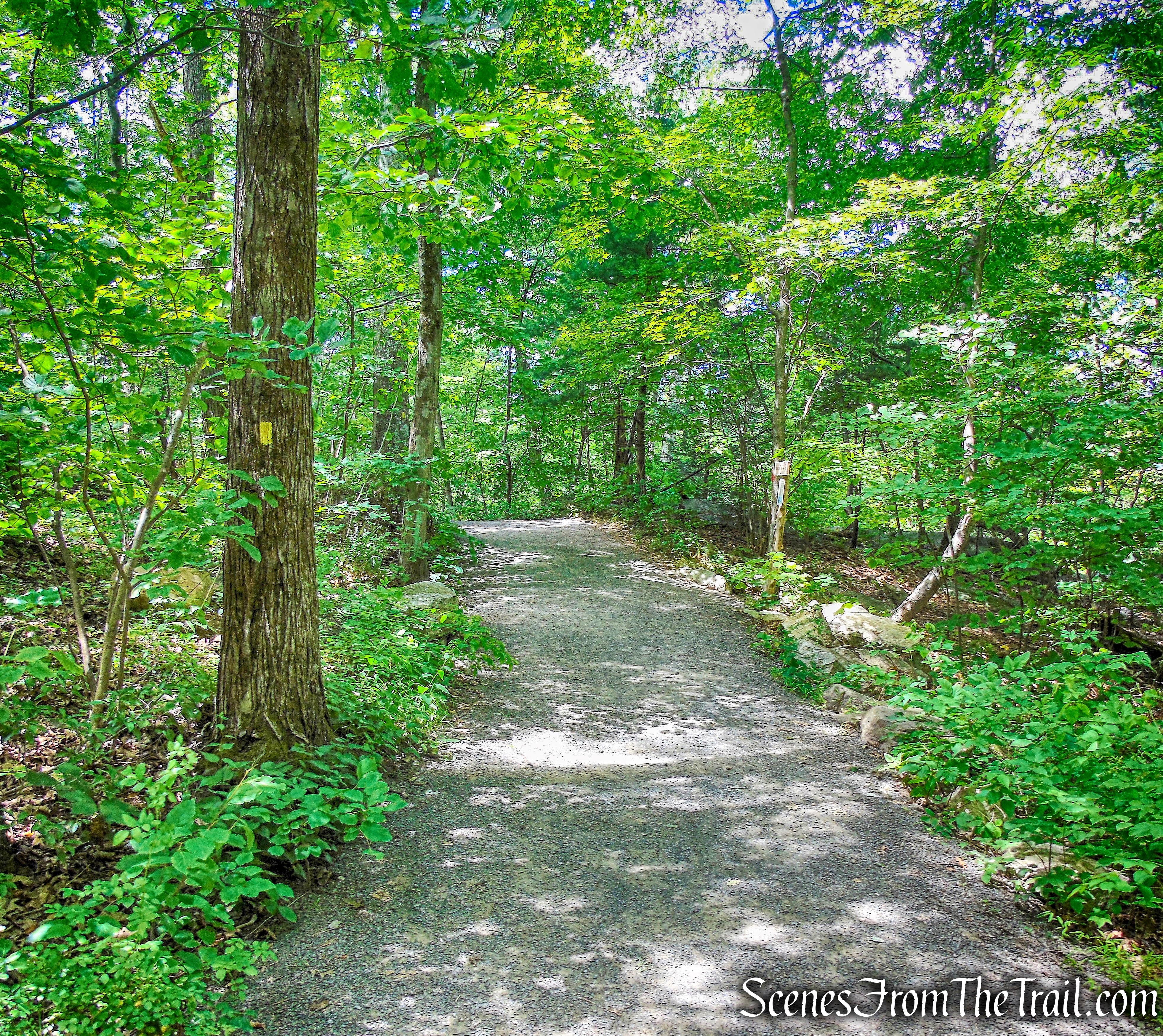
This hike begins on the Trapps Hamlet Path, which is located to the left of the booth when entering the parking area. The 0.8 mile long trail has numbered wooden posts along the way that mark areas of historical significance. A pamphlet with the history of the area is available in a box attached to the post at the start of the trail. On our visit, the box was empty, but the booth attendant supplied us with one.
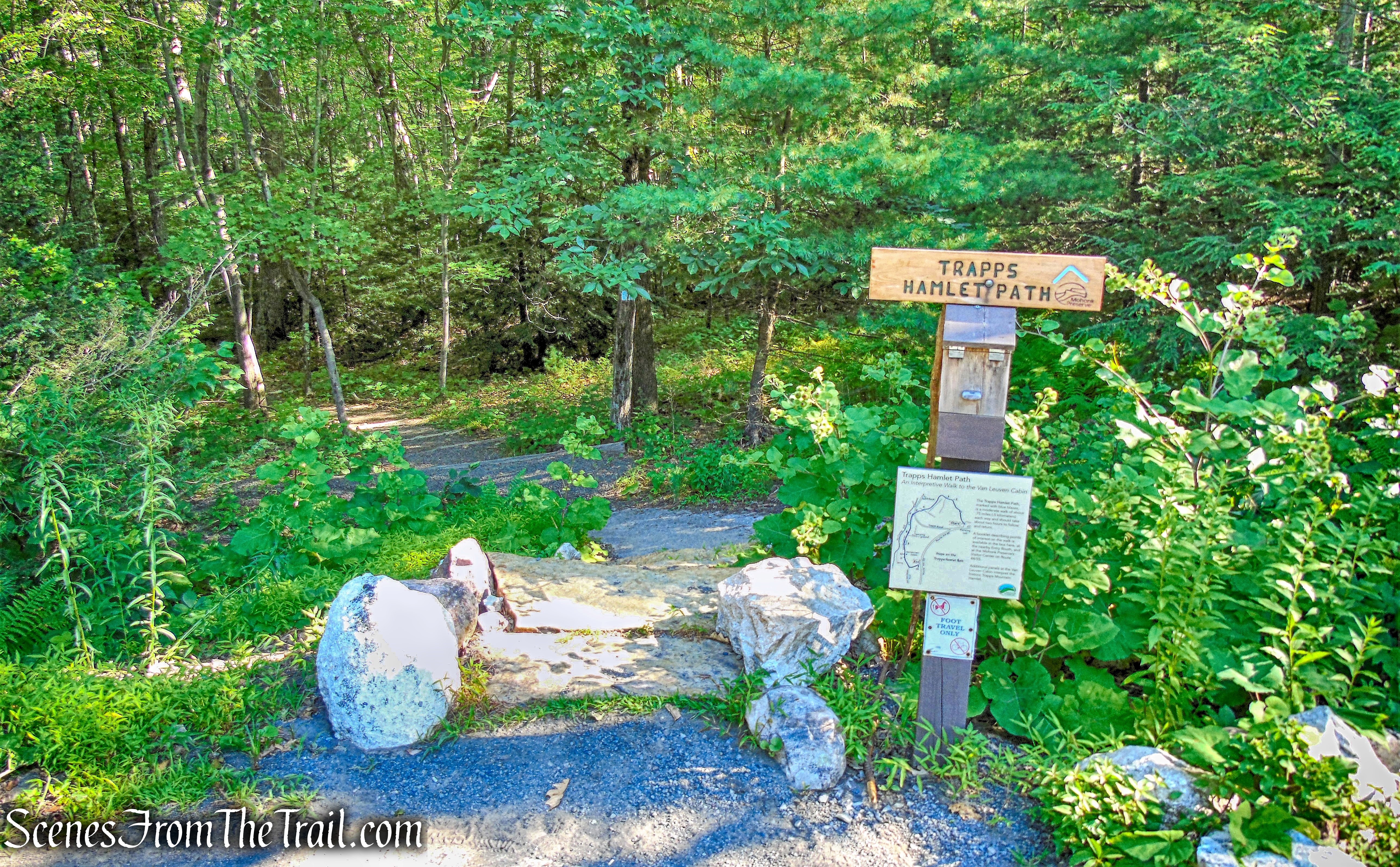
Trapps Hamlet Path
This blue-blazed trail travels through what was once a 19th century mountaintop community. Once home to the huckleberry-pickers and stone-cutters, the Trapps Mountain Hamlet housed as many as 40-50 families by the time of the Civil War.
Trapps Hamlet Path
This vanished hamlet now consists of the restored Van Leuven Cabin; 60 cellar holes and foundations of dwellings, mills, barns, a school, a tavern, a chapel, and other structures; over 40 charcoal pits; and four family burying grounds. This historic district is a subsistence hamlet listed on both the New York State and National Register of Historic Places.
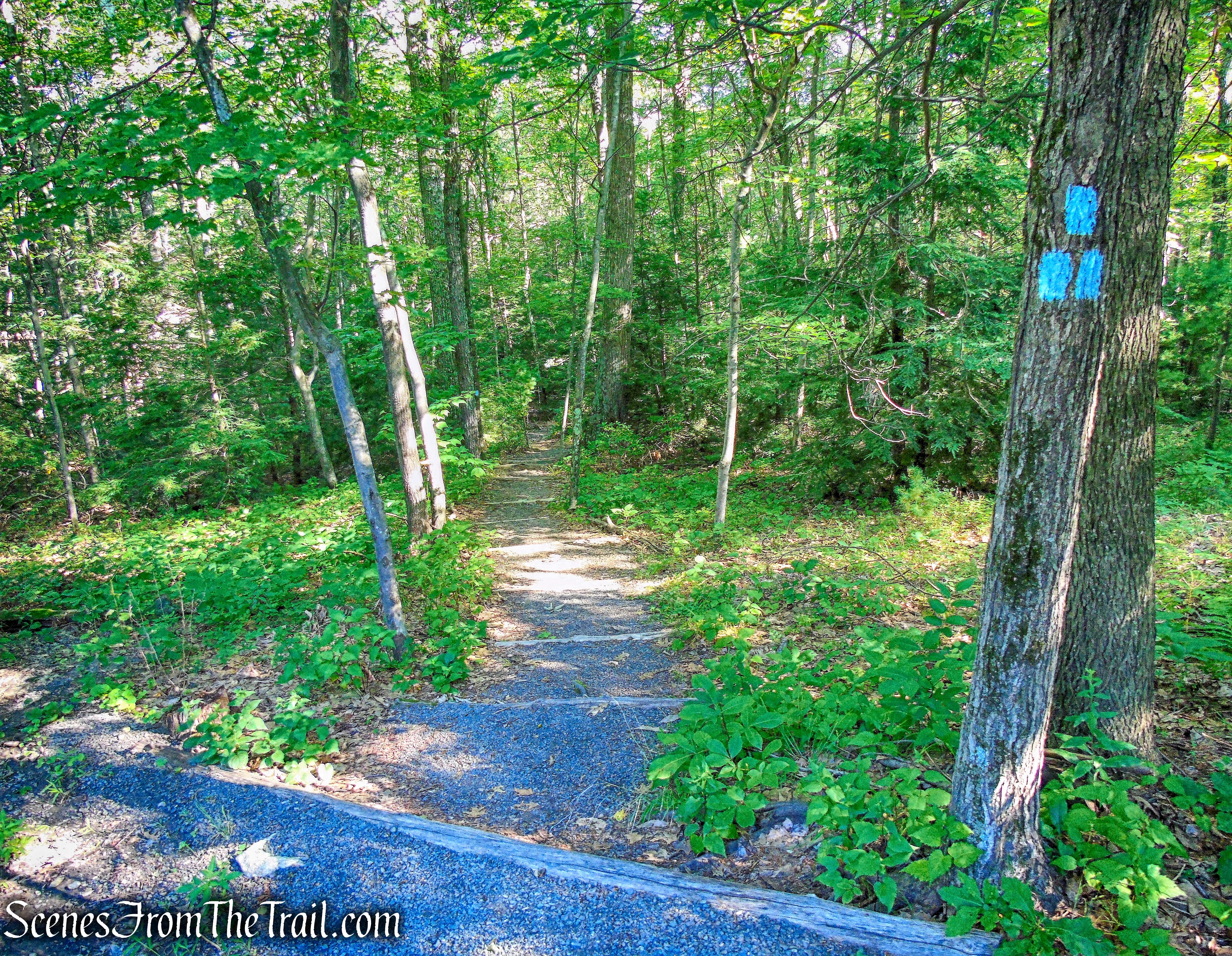
The trail is well marked and travels through an attractive forest. Most of the tall trees are from the 1920’s. The original forest had been cut down by the end of the 1800’s to clear land for pastures, meadows and to provide wood for local sawmills and firewood for cooking and heating.
Trapps Hamlet Path
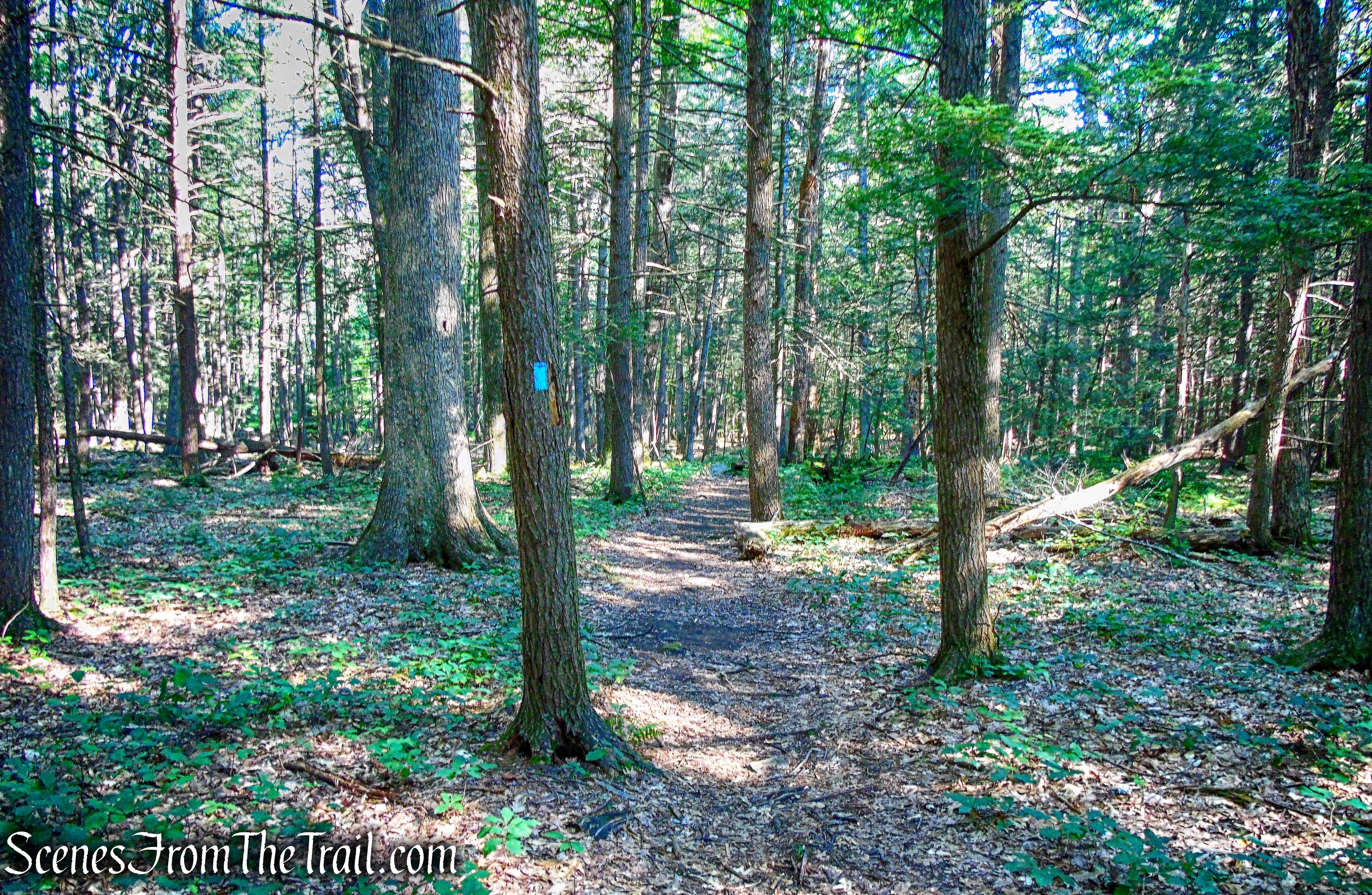
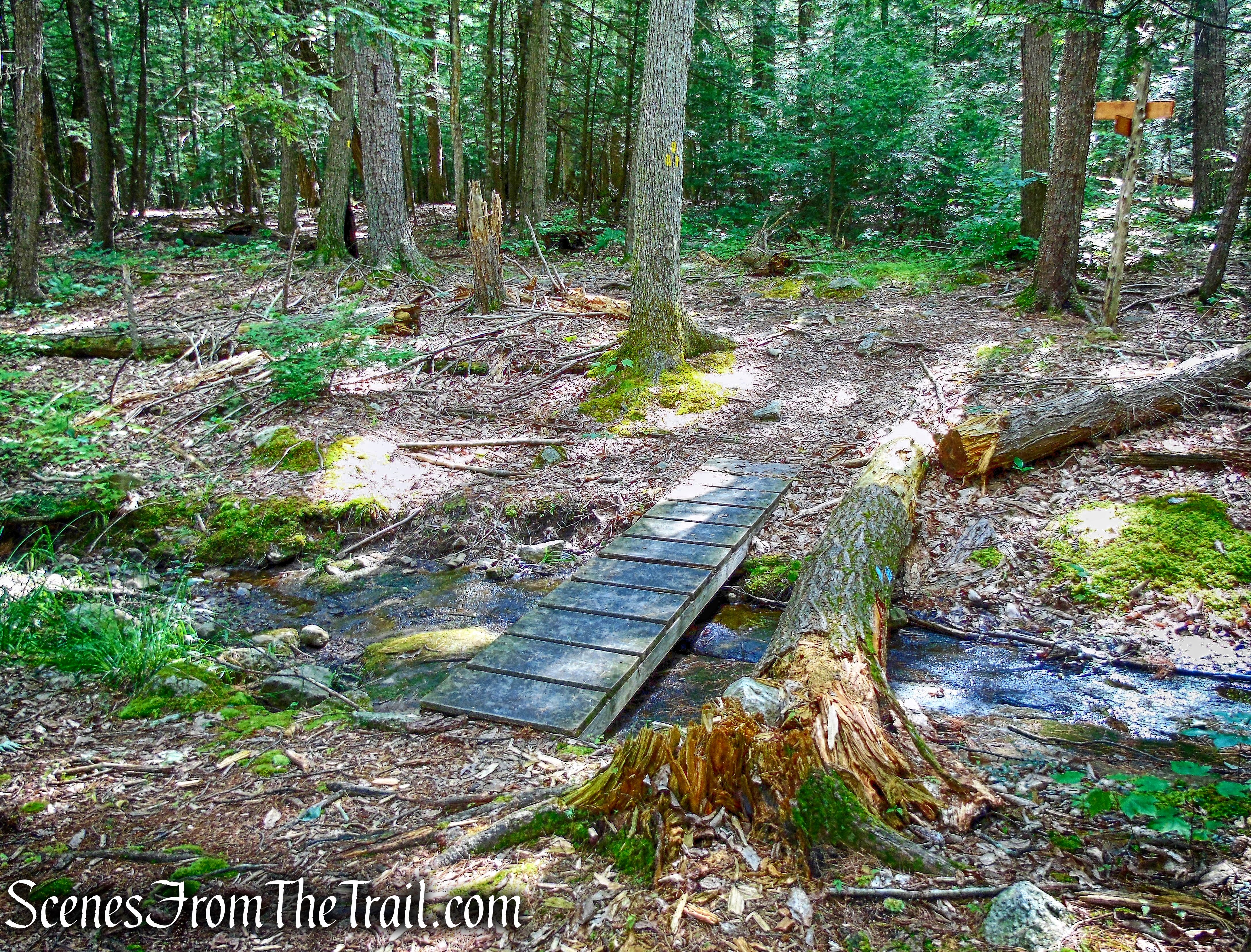
It’s an easy walk through the secluded and shaded woods. In about 400 yards, the trail crosses the start of the yellow-blazed Enderly’s Path. We continued following the blue blazes as they cross a small stream on wooden planks.
Trapps Hamlet Path
In a short distance, we came to a large, rounded piece of Shawangunk Conglomerate (sometimes called Shawangunk Grit) that a millstone cutter abandoned long ago.
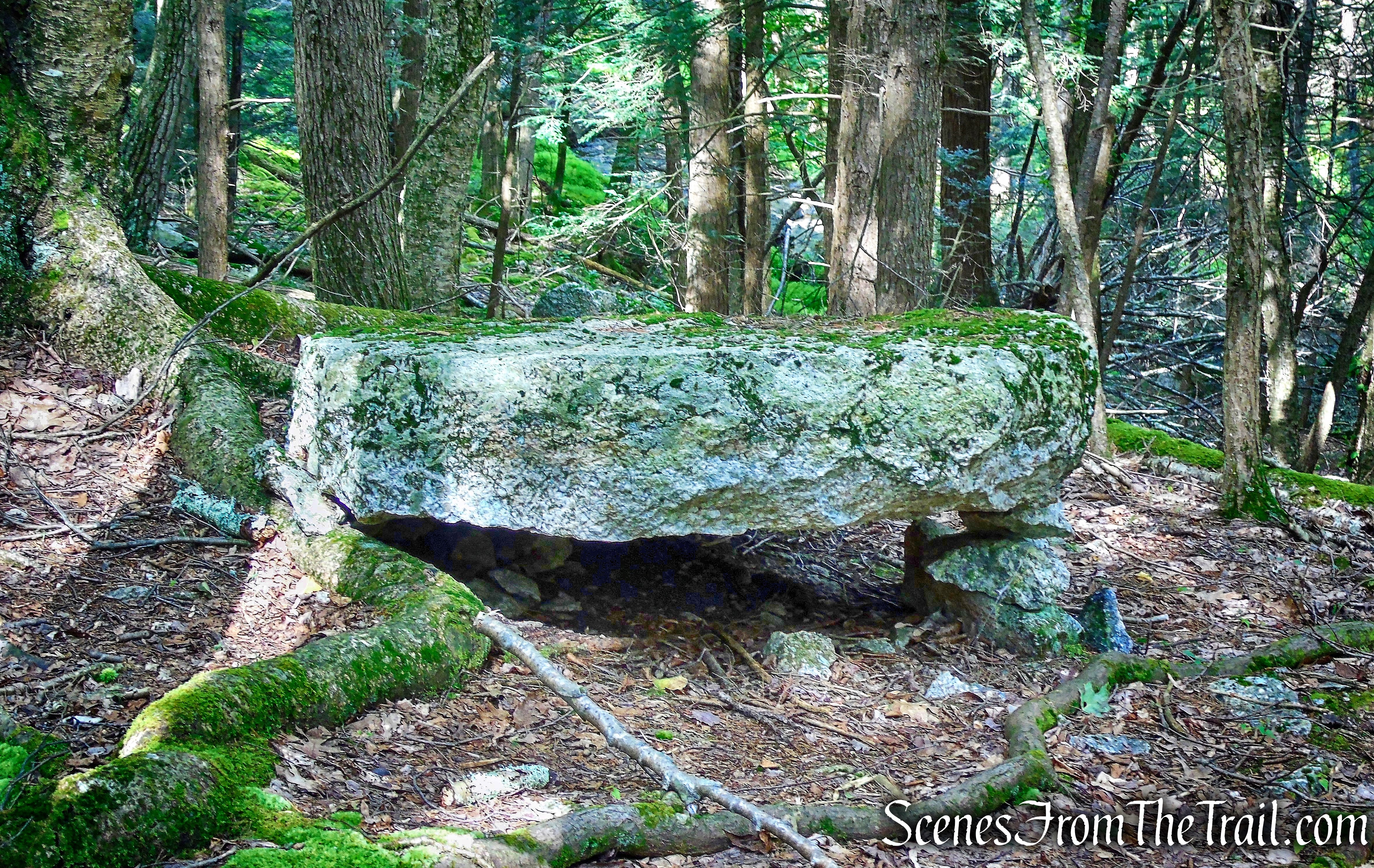
millstone – Trapps Hamlet Path
In some parts of the Shawangunks, ready access to more suitable exposures of the conglomerate bedrock made it possible to produce excellent gristmill stones, an important source of income for Trapps families in the 19th century.
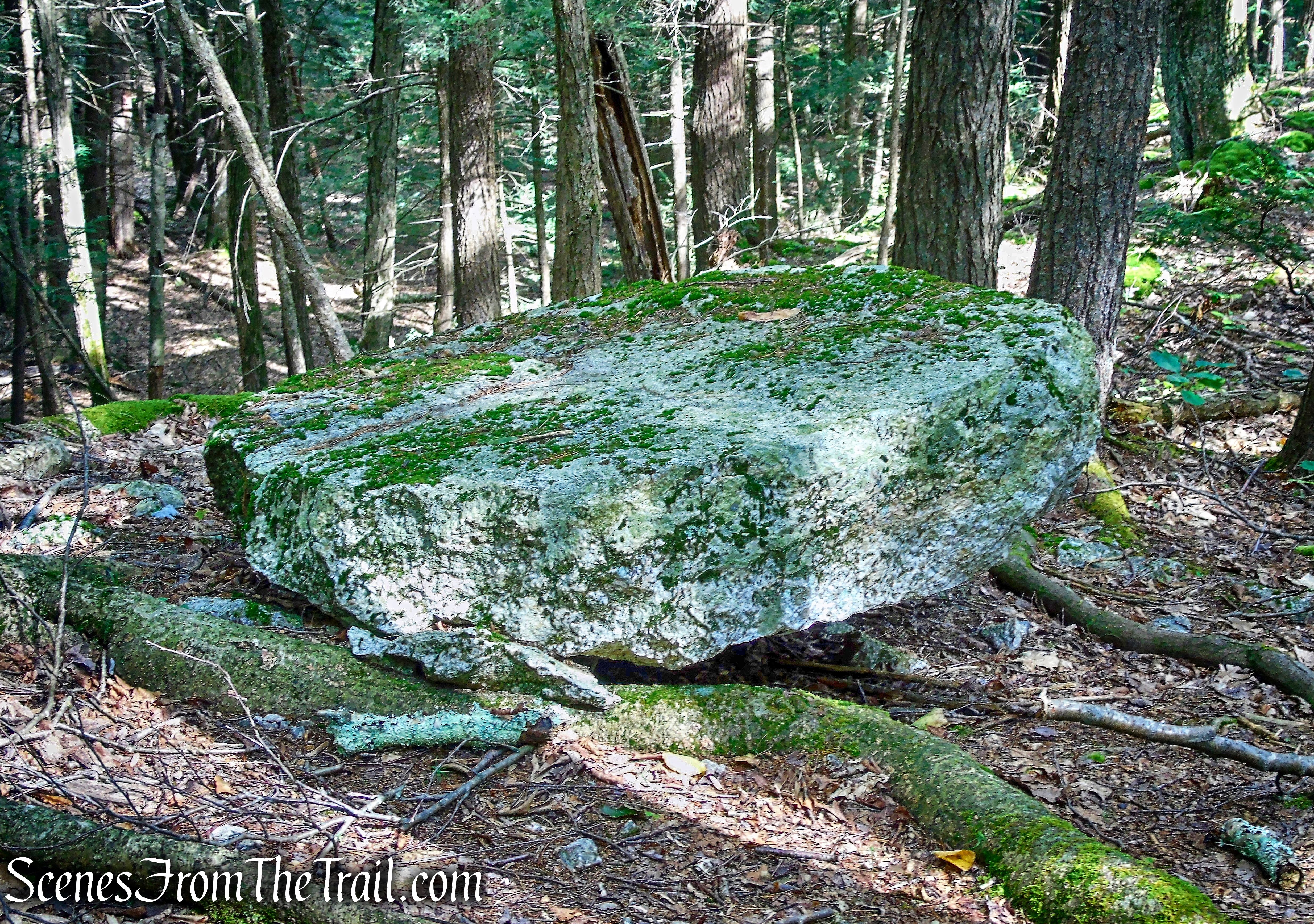
millstone – Trapps Hamlet Path
The trail then crosses a brook located at a point where a farm wagon road once crossed the stream. Its existence is indicated by a number of stones laid on top of one another on each side of the brook to form bridge abutments. The bridge would have allowed the passage of wagons carrying hay, firewood, or cut millstones.
Trapps Hamlet Path
The trail continues over an old stone fence, leaving one property and entering onto another. The lands ahead belonged to Ben Fowler who owned about 150 acres.
Trapps Hamlet Path
The trail continues through the forest then crosses Clove Road.
Trapps Hamlet Path
Shortly after crossing Clove Road, the trail turns left onto an old dirt road. This road was an early track, leading to the pioneer Van Leuven homestead. Later, this track became a Gardiner town road, well-traveled by pedestrians, horseback riders, horse-drawn wagons, and even an early Ford or two, before the road fell into disuse. The trail parallels the Coxing Kill which flows over conglomerate outcrops amid large boulders. The Coxing is a major stream flowing down from Lake Minnewaska, two miles upstream from here.
Trapps Hamlet Path
The trail ascends gradually and arrives at the Van Leuven Cabin. It is one of the few remaining homes of the nearly vanished Trapps Mountain Hamlet. Its small size and simple, unadorned lines were typical of the Hamlet. The cabin is a plank house built in 1889 or 1890 by William Hagen and bought by Eli Van Leuven in 1898. Eli’s family occupied the house into the 1920’s when the Mohonk Mountain House bought the property.
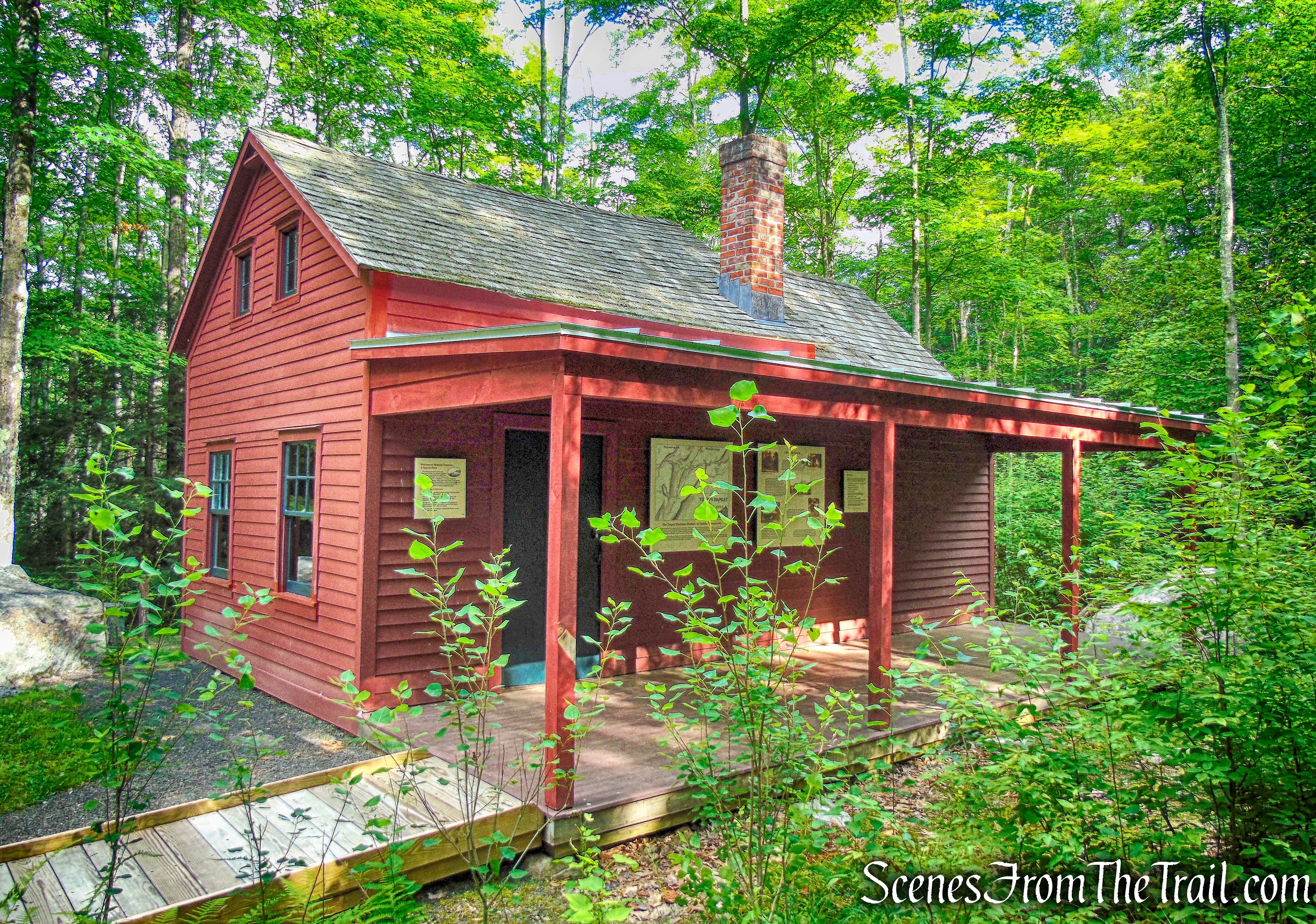
Van Leuven Cabin
After checking out the cabin and reading the informational signs, we turned around and began retracing our steps on the Trapps Hamlet Path. We stopped at post marker 8, which we had passed on our way to the cabin, to visit the Fowler Burial Ground.
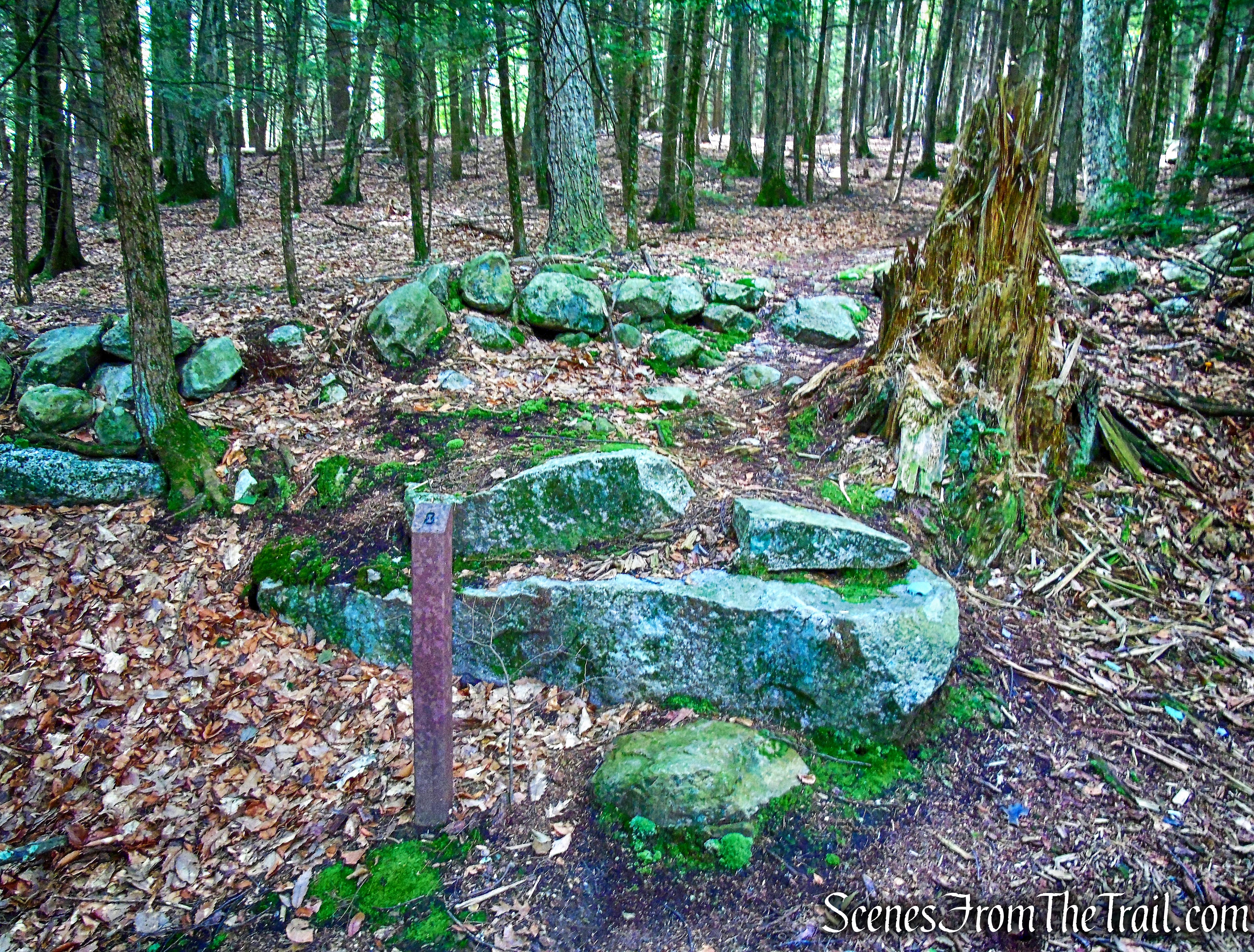
Fowler Burial Ground
A short walk up the spur path, is one of several family burying grounds established by the people of the Trapps Mountain Hamlet as an alternative to public cemeteries. The oldest headstone to be recognized here dates from 1866.
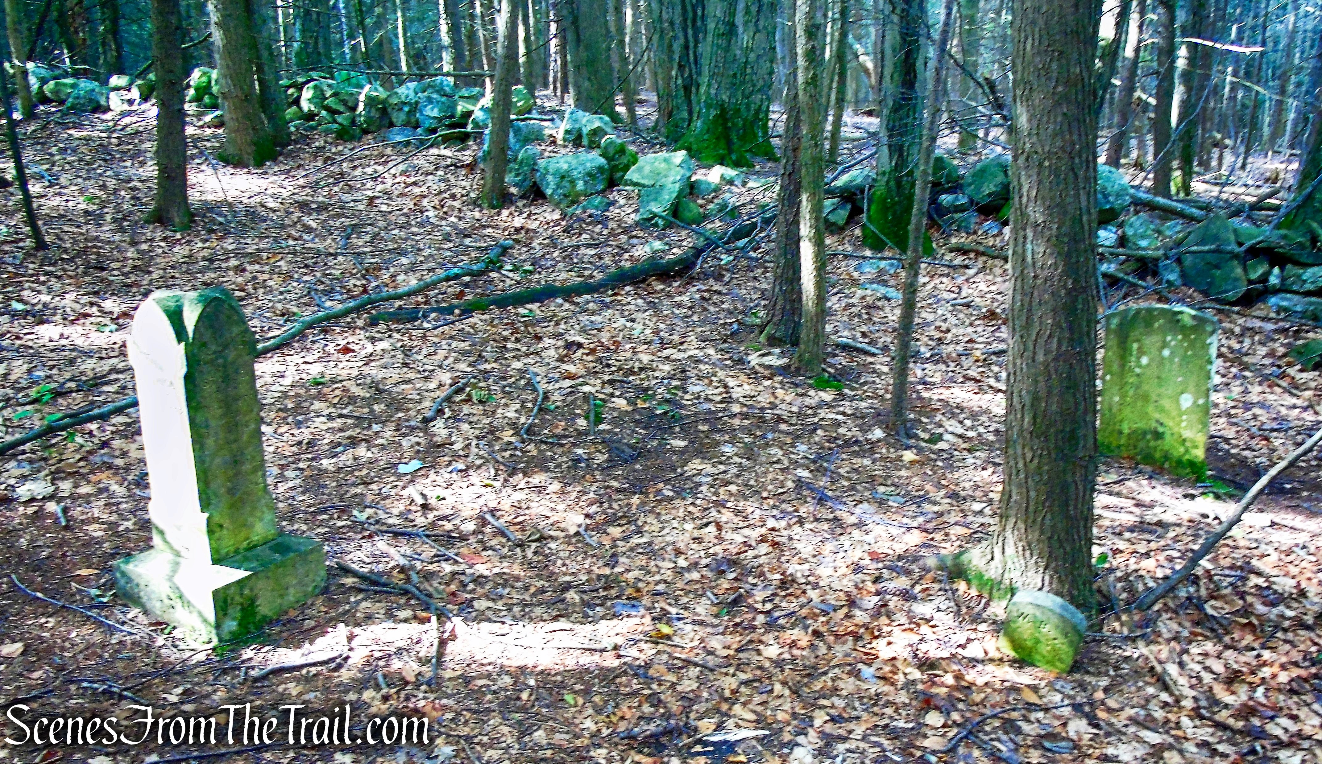
Fowler Burial Ground
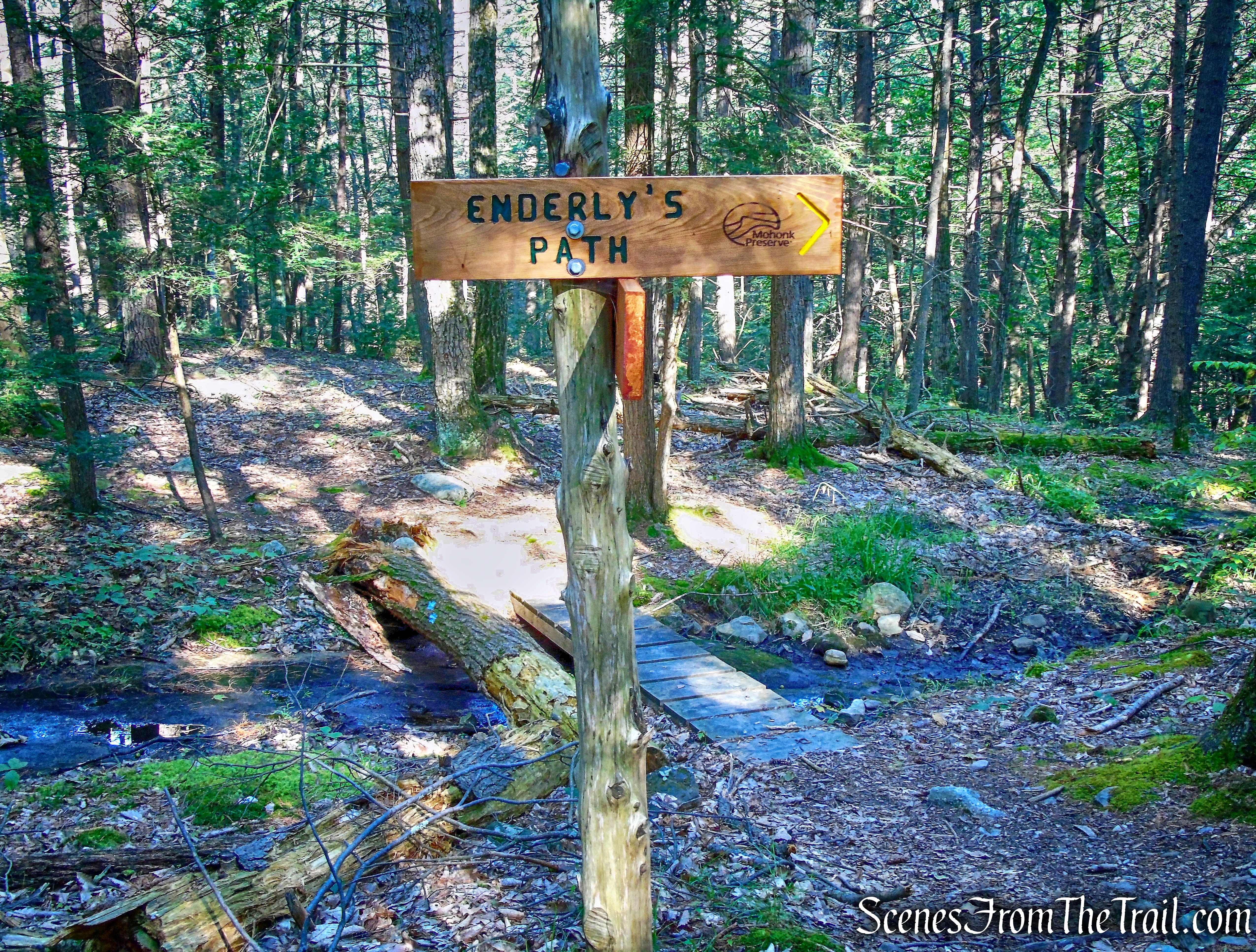
We then returned to the Trapps Hamlet Path and continued retracing our steps. When we reached the junction with Enderly’s Path, just beyond a stream crossing, we turned left.
junction with Enderly’s Path
The Enderly’s Path is a 0.7 mile footpath, marked by yellow blazes. It connects the Trapps Hamlet Path with the Shongum Path.
Enderly’s Path
We walked the Enderly’s Path to its terminus at the Shongum Path and turned left.
Shongum Path
Marked by signs and red blazes, the Shongum Path connects the Old Minnewaska Trail with the West Trapps Connector Trail, linking the Coxing Kill area with the West Trapps parking area.
Shongum Path
We hiked the Shongum Path to its terminus at a junction with the Old Minnewaska Trail. We turned left and crossed a wooden bridge that spans the Coxing Kill. We then turned right and walked down to check out Split Rock.

Split Rock
The Coxing Kill plunges into a small gorge of solid rock and streams out on the other end into a pool.

Split Rock
While there is no “official” swimming area or lifeguard, swimming seems to be allowed and this is a very popular swimming hole. The channel flows into a small sloped pool that is about 3-4 ft deep with a sandy/small rock bottom.

Split Rock
We relaxed here for a short while and had the place to ourselves. By mid afternoon on a nice day, this place is crawling with people. We walked back up to the Old Minnewaska Trail and turned left. We recrossed the wooden bridge over the Coxing Kill and continued ahead on the gravel road, known as the Old Minnewaska Trail.
Old Minnewaska Trail
Built in 1879 to link Mohonk with Minnewaska, this 2.3 miles long carriage road was abandoned in 1907. It is marked with light blue blazes and also with the dark blue plastic discs of the Shawangunk Ridge Trail.
Old Minnewaska Trail
At times the trail narrows to a footpath as it ascends gradually along the hillside. This was the steepest ascent of the day and it was relatively easy.
Old Minnewaska Trail
After climbing gradually, the trail descends slightly to cross a stream (the stream was dry on this day). The stone abutments of a former bridge can be seen ahead, but the trail dips down to the stream, which It crosses on rocks.
Old Minnewaska Trail
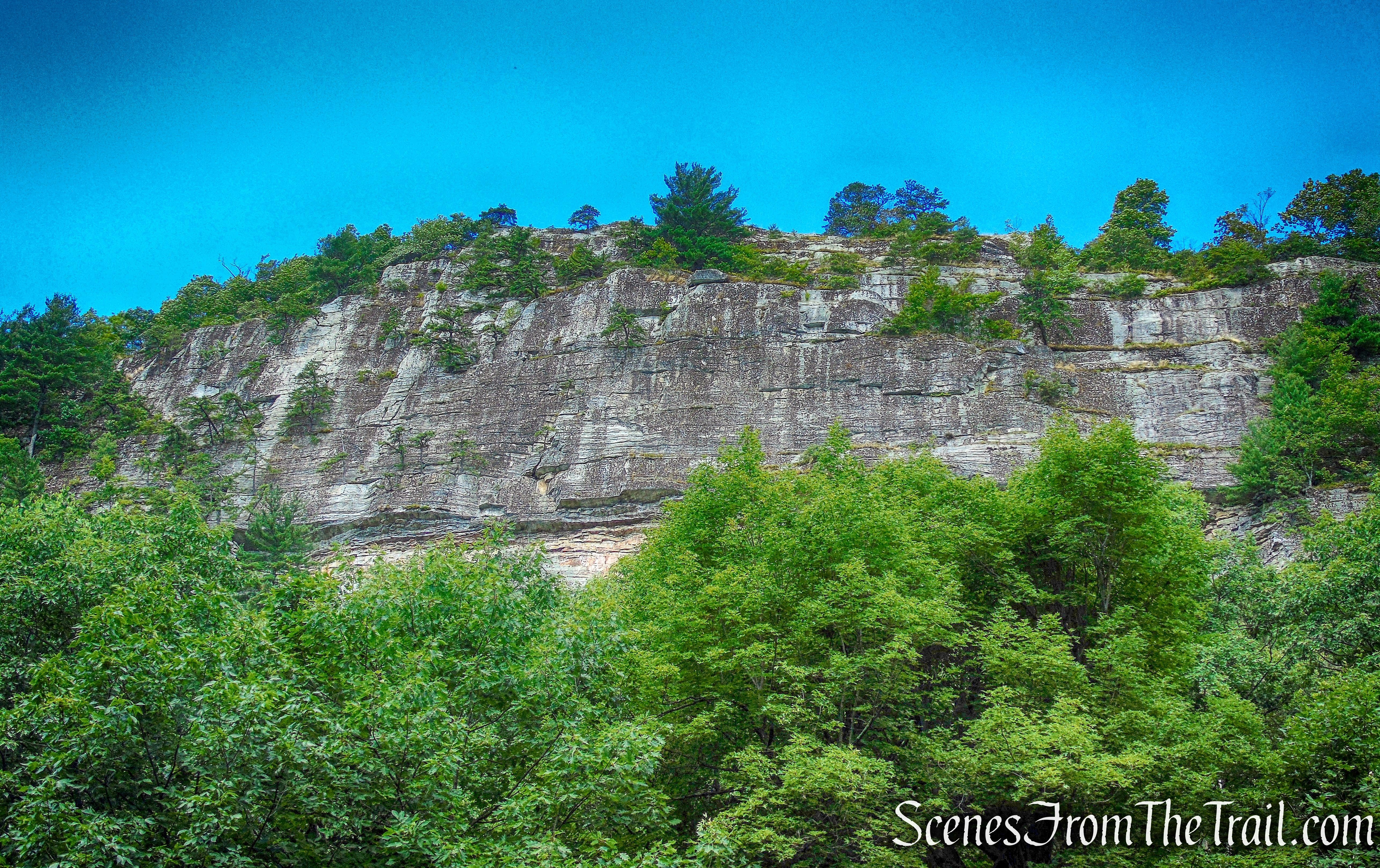
The road again narrows to a footpath and begins a gradual climb. As the trail levels off, the remains of an old quarry can be seen down to the left when there are no leaves on the trees. The hand-cut drill holes at the edges of the large conglomerate stone blocks are still visible. The trail continues along a relatively level route, with some minor ups and downs. Huge slanted rock slabs begin to appear on the right. After a while, we came to a broad viewpoint to the left, with pitch pines lining the slope below, and the Catskills visible in the distance.
View of the Catskills from the Old Minnewaska Trail
The trail now begins a steady but gentle climb through mountain laurel thickets. In half a mile, the trail begins to descend. Soon, we reached a spot where the old road has been eroded down to the bedrock. Here, a slanted rock slab on the left affords a superb view across the Rondout Valley to the Catskills. This is a good spot to take a break, and we did. Just beyond the viewpoint there is a trail junction with the start of the Undivided Lot Trail (marked by a signpost). We veered right to remain on the Old Minnewaska Trail.
stay on Old Minnewaska Trail
The Old Minnewaska Trail climbs on switchbacks and ends at a junction with Laurel Ledge Road.
junction with Laurel Ledge Road
Laurel Ledge Road is a wide, maintained carriage road, which is open to bicyclists as well as hikers.
Laurel Ledge Road
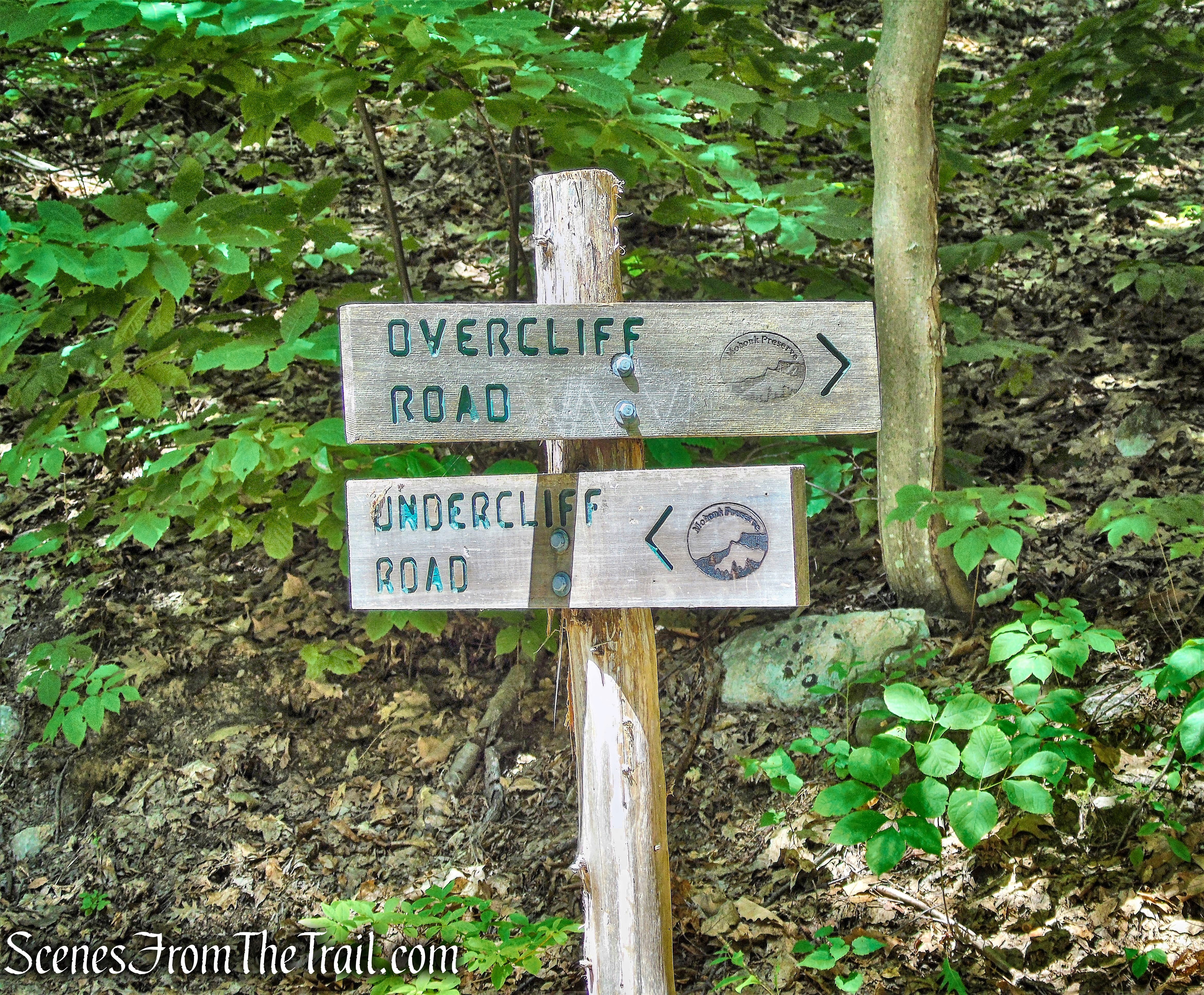
We continued ahead to the end of Laurel Ledge Road at Rhododendron Bridge and continued straight ahead at the intersection, to Undercliff Road (marked by a sign).
straight ahead at the intersection onto Undercliff Road
To the right is Overcliff Road, which connects with Undercliff Road at Trapps Bridge. Either carriage road can be used for this hike and both are the same distance. We opted for Undercliff Road because it’s on the eastern side of the cliffs and thus shaded for most of its entirety in the afternoon. Overcliff Road has less foot traffic and offers views similar to those of the Old Minnewaska Trail.
straight ahead at the intersection onto Undercliff Road
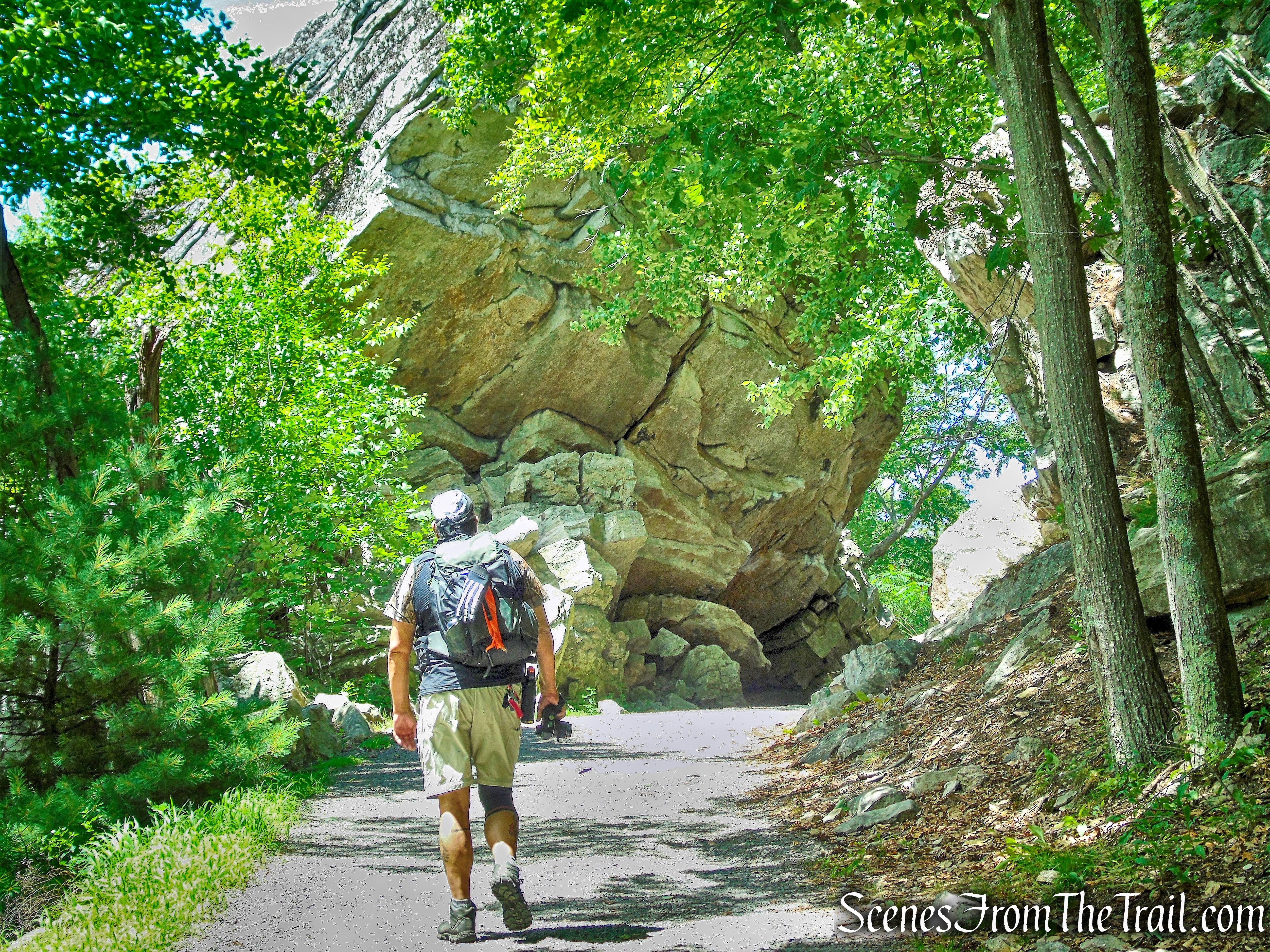
After the road makes a sharp S-curve, the trail reaches the famous Trapps Cliffs, considered the best rock climbing area in the East.
Trapps Cliffs
The cliffs sit away from the road, with many spur trails that lead up to them that are intended for rock climbers. Jumbled slabs of Shawangunk conglomerate sit piled near the edge of the road, some forming cave like structures.
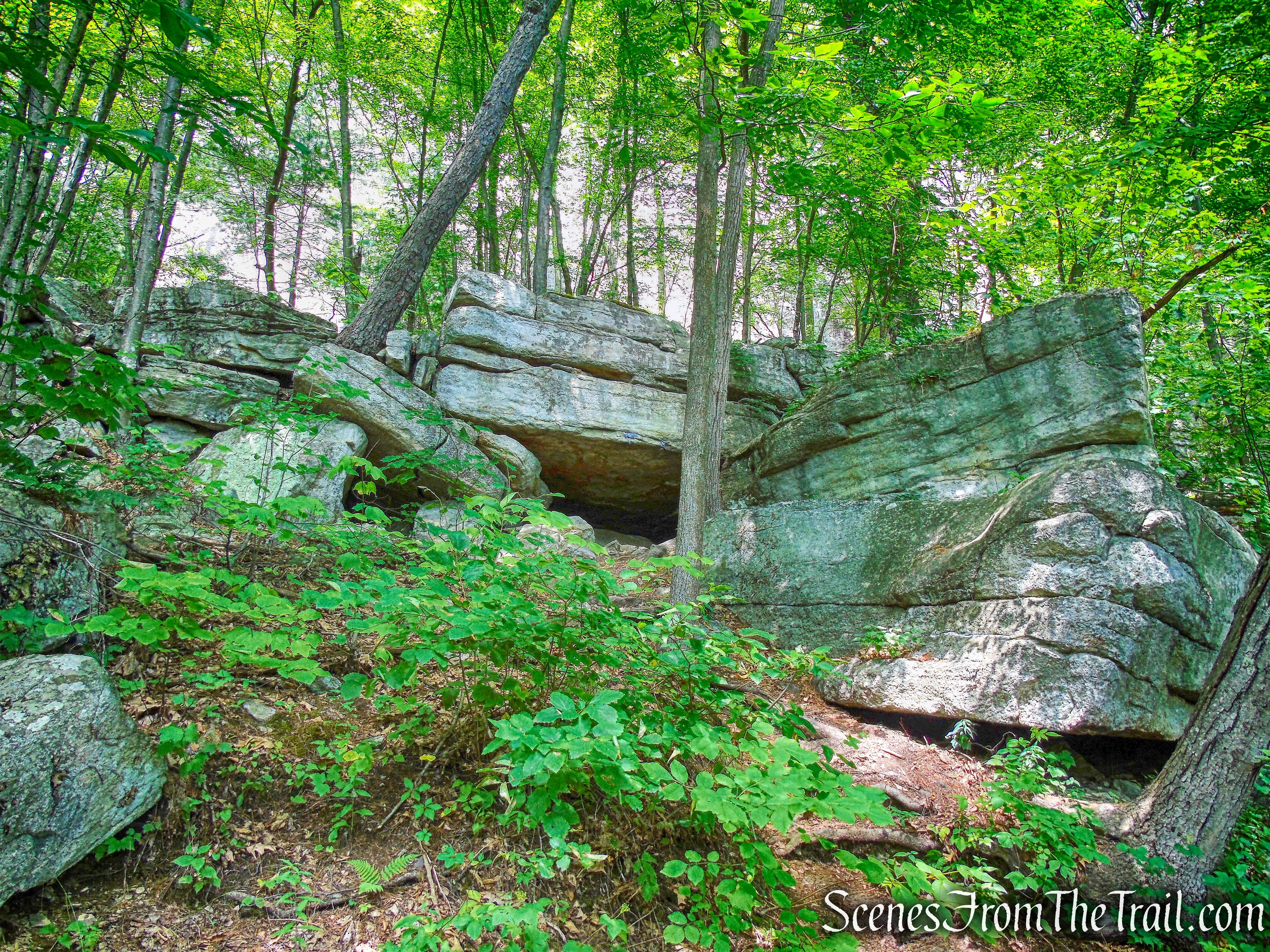
caves – Undercliff Road
After about two miles along Undercliff Road, we passed a junction with the yellow-blazed East Trapps Connector Trail, which begins on the left. Route 44-55 is visible below to the left, along with views of the Wallkill Valley. We continued ahead, along Undercliff Road.
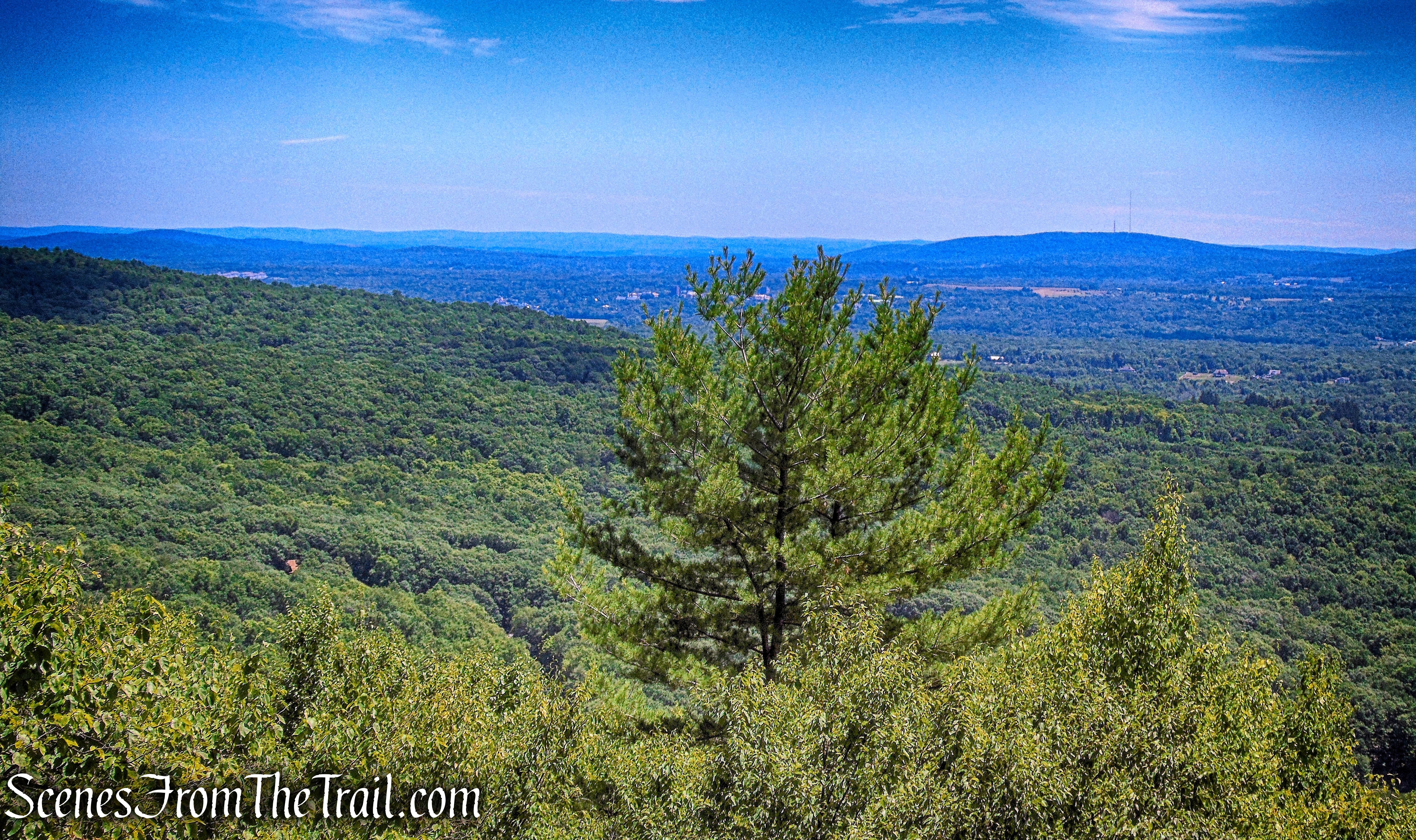
Wallkill Valley – Undercliff Road
The Trapps Cliffs begin more closely to approach the road, and we encountered many rock climbers along this stretch.
Undercliff Road
Undercliff Road
We stopped and watched them scale the cliffs.
climber – Undercliff Road
climber – Undercliff Road
From here to the Trapps Bridge, there are views to the left over the Wallkill Valley. Undercliff Road ends at a junction with Overcliff Road, with the Trapps Bridge to the left. We descended on a gravel road, the yellow-blazed West Trapps Connector Trail, just to the right of the bridge.
West Trapps Connector Trail, just to the right of the bridge
Soon after the road levels off, the trail reaches a junction with the red-blazed Shongum Path, marked by a sign, on the right. We continued ahead, following the yellow blazes.
West Trapps Connector Trail
The West Trapps Connector Trail ends at the West Trapps Trailhead parking area, where the hike began.
West Trapps Trailhead parking area
Another great hike in The Gunks, with some history and some views. With the exception of Undercliff Road, the trails we hiked were mostly deserted. The crowds on Undercliff Road were not overwhelming and we enjoyed watching the climbers scaling the cliffs and practicing their hand holds. This area has such an extensive network of trails that can be used for a variety of loop hikes. I will be back soon to explore some more trails.
Pros: The Gunks, views, Trapps Hamlet, Split Rock, cliffs, shaded trails, well marked trails.
Cons: Undercliff Road gets a lot of foot and bike traffic.
Take a hike!
Old Minnewaska Trail and Undercliff Road Loop
Sources:

one of my favorite places on the planet !!! hiked many times- really enjoying your pics as I sit at my office desk day dreaming on a Friday afternoon ! cheers !
LikeLiked by 1 person
One of my favorite places as well. I’ll be back up there hiking this weekend. Enjoy your daydreams and your weekend.
LikeLike