October 14, 2018 – Palenville, NY
Difficulty: Moderate
Length: Approximately 4 miles
Max elevation: 2,235 ft.– total elevation gain approximately 1,010 ft.
Route type: Loop
Map: Catskills Trail Map #141 – Free Web Map
Trailhead parking: 103 Laurel House Rd, Palenville, NY 12463
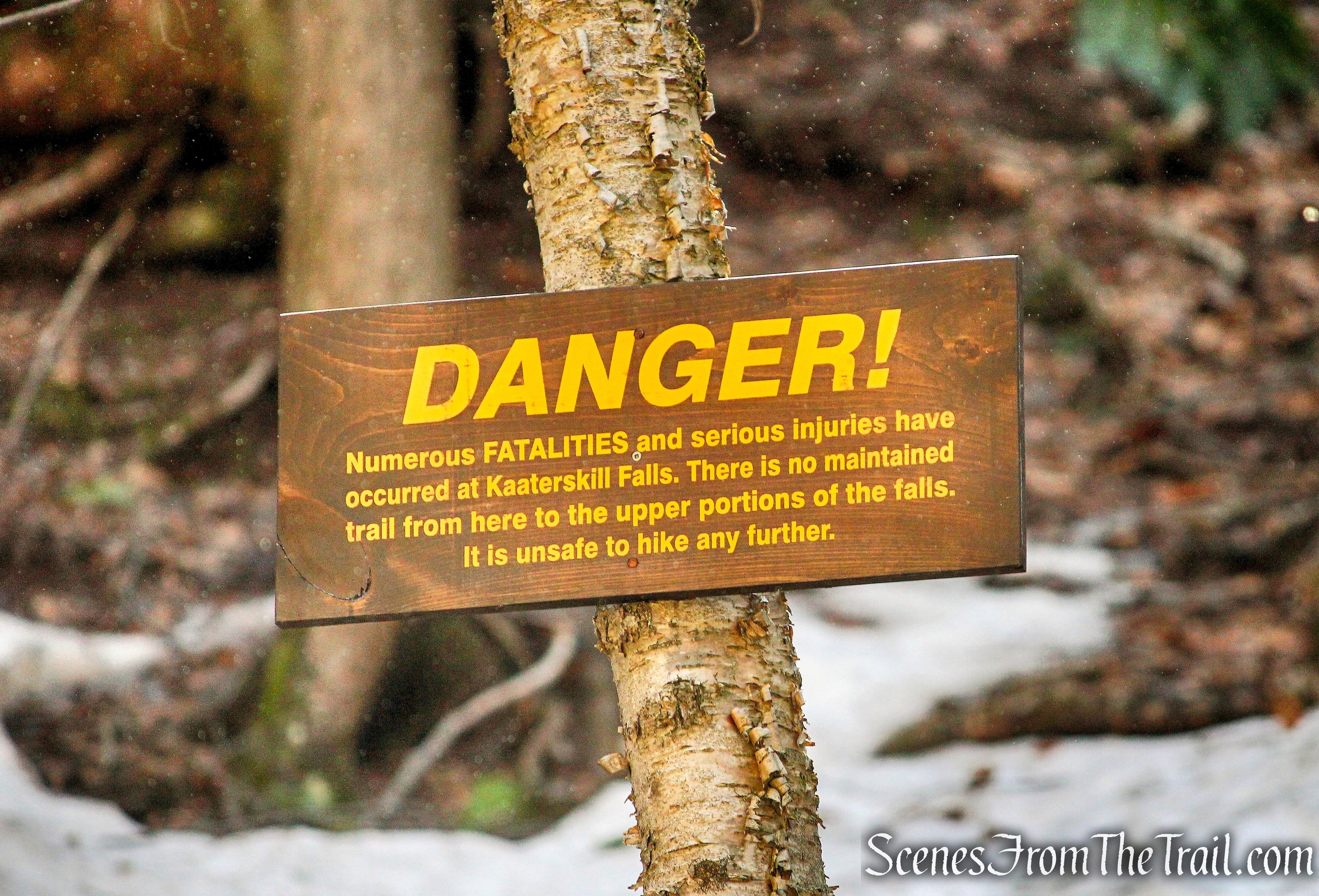
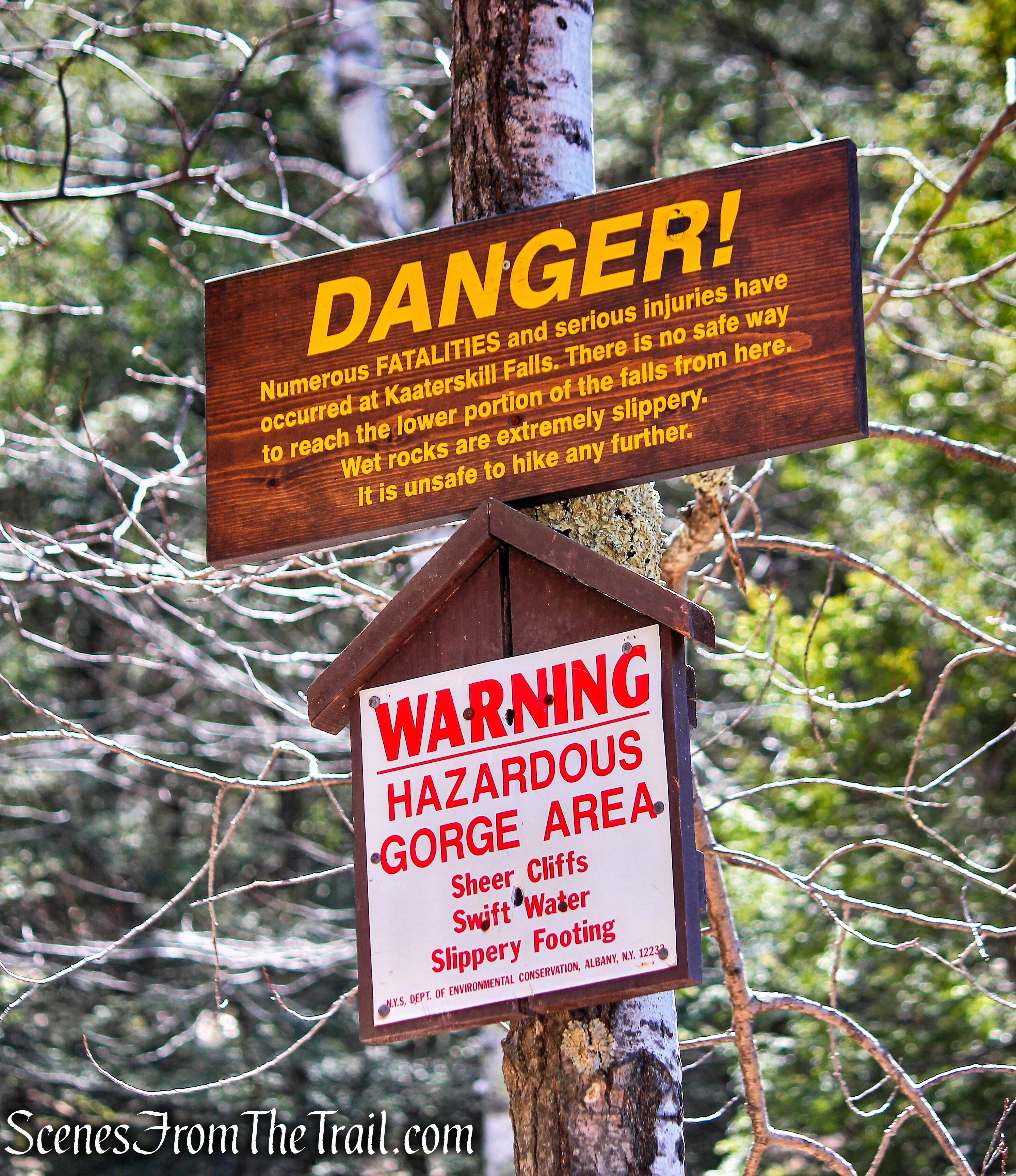
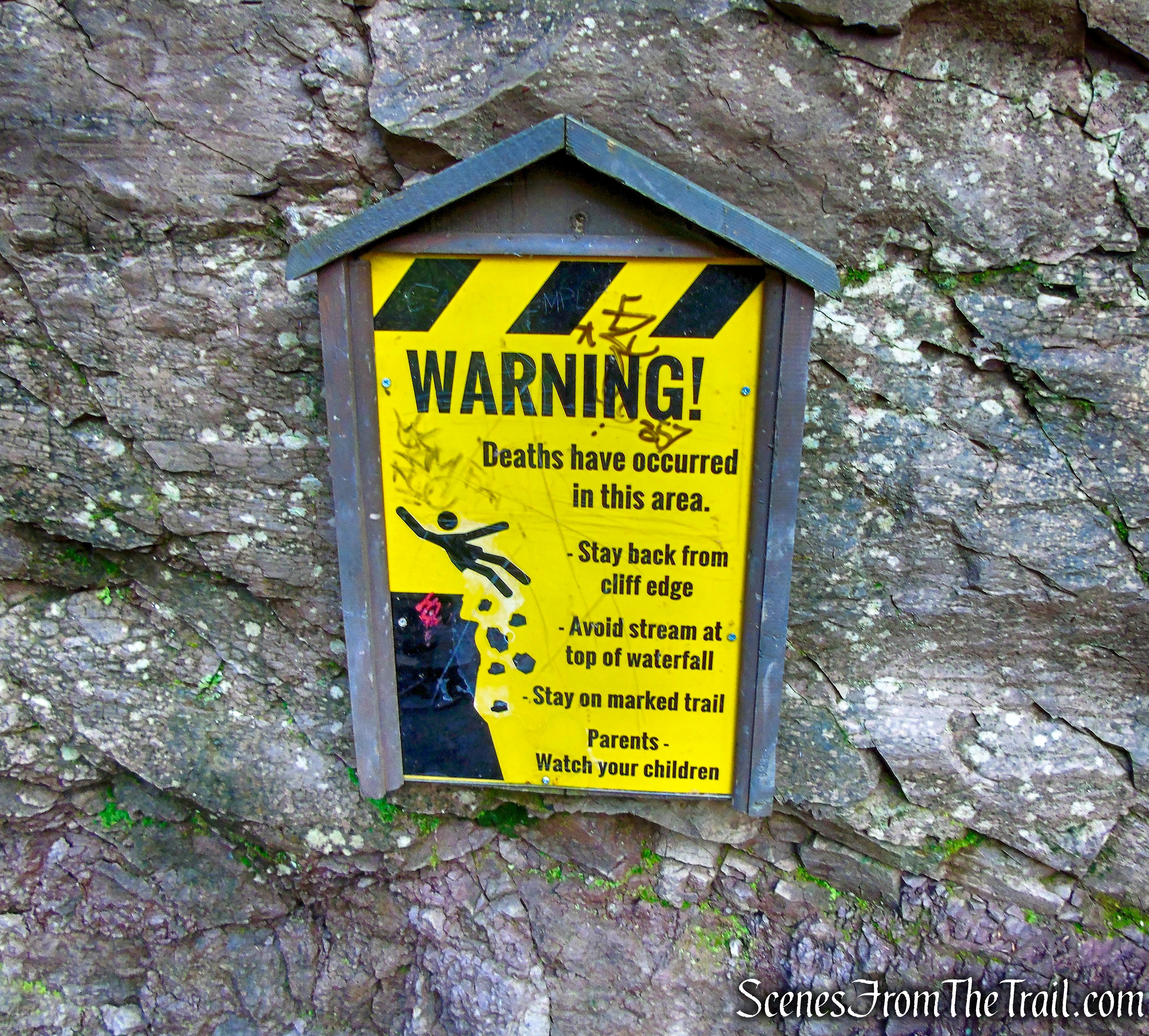
Please note: Although Kaaterskill Falls is one of the most popular destinations in the Catskills, it’s also one of the most dangerous, due to visitors ignoring posted warnings to hike only on marked trails. Hikers are strongly encouraged to stick to the marked path due to the treacherously slippery rocks located at the top of the falls. Take precautions along the path as erosion and water can create slick conditions. As a general rule, use common sense and be aware of the loose rocks, dirt and water-slick stones. There have been eight fatal accidents at the waterfall since 1992 and numerous serious injuries. The ranger covering Kaaterskill Falls says since 2014, at least four hikers who fell to their deaths there, were taking pictures.
Overview:
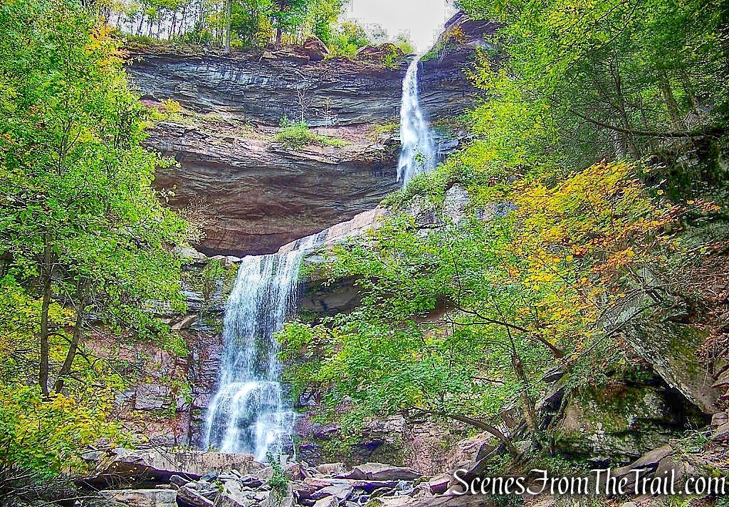
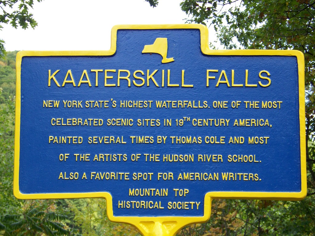
The Great Northern Catskills of Greene County are home to many treasures, from the stunning natural beauty of the landscape to the rich literary and artistic heritage immortalized by Thomas Cole and Washington Irving. Perhaps the crowning jewel is the highest cascading waterfall in New York State, Kaaterskill Falls. Dropping in two tiers over 260 feet, Kaaterskill Falls has been one of the region’s most popular destinations for centuries.
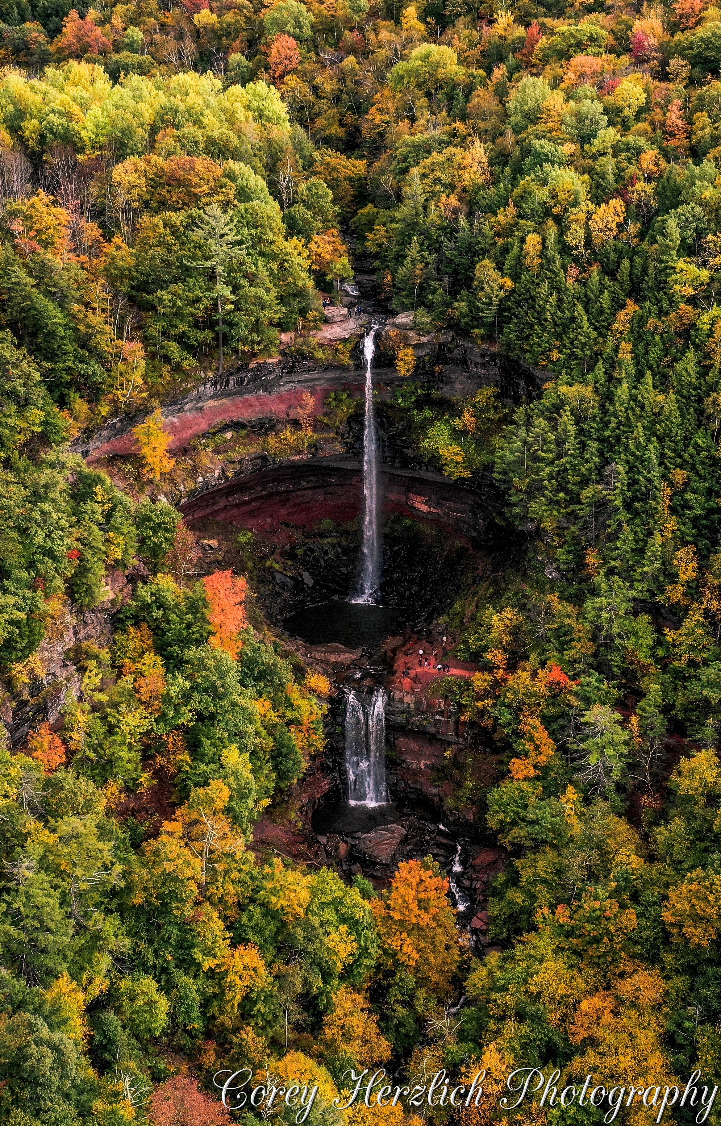
Kaaterskill Falls – image courtesy of Corey Herzlich Photography
Considered by Native Americans to be the resting place of the creator, a sacred place for the Mohican people who called the Catskills home, Kaaterskill Falls has captivated the hearts, pens and paintbrushes of poets, painters, filmmakers and photographers.
Kaaterskill Falls
Kaaterskill Falls
The 8,550-acre Kaaterskill Wild Forest includes all the state land on Kaaterskill High Peak, as well as the Kaaterskill Clove and South Mountain areas including Kaaterskill Falls. The terrain within Kaaterskill Wild Forest varies significantly in topography with sprawling mountains, dramatic cliffs, scenic waterfalls, and deep valleys.
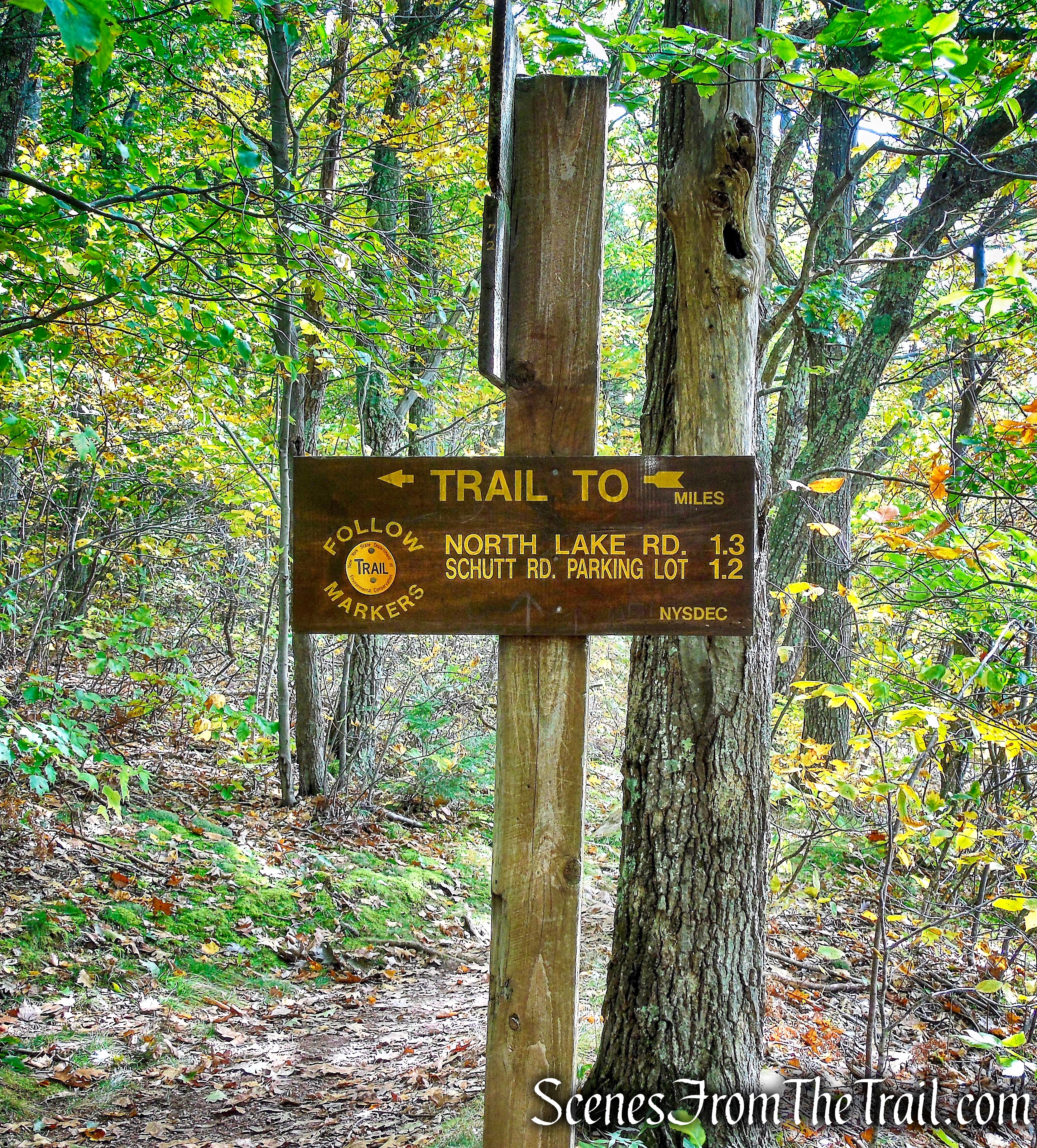
The Escarpment Trail is a 23.9-mile section of trail (9.8 miles in the Kaaterskill Wild Forest) that runs from the Scutt Road Parking Area in the Kaaterskill Wild Forest north along the northeast corner of the Catskill Mountains, ending at the Route 23 Parking Area in the Elm Ridge Wild Forest. Along the way, the Escarpment Trail connects to the yellow-blazed Kaaterskill Falls Trail and many others.
In 2017, the NYS Department of Environmental Conservation (DEC) completed significant safety improvements at Kaaterskill Falls, that began in 2014. My last visit here was in April of 2015 and the place was really crowded. At that time, the lower trail ended at the base of the falls. Beyond that point, the trail was closed off due to numerous injuries and fatalities suffered by hikers and tourists. Even though there were signs warning of the danger, I observed many people beyond the safety zones.
Kaaterskill Falls – April 12, 2015
The upper trail, which leads to the top of the falls, had no real good view of the falls. That caused many to go beyond the fence and closer to the cliff edge, in order to get a better look. I was guilty of that ill advised move.
Kaaterskill Falls – April 12, 2015
Kaaterskill Falls – April 12, 2015
Now that the two trails connect, along with a new viewing platform, it was time to pay Kaaterskill Falls a return visit. I also wanted to check out some views from the Escarpment Trail, while extending the hike a little. As always, I like to have options when I map out a hike and with so many intersecting trails in the area, I had no definitive route in mind. We ended up doing a very scenic and manageable hike, while avoiding most of the large crowds around the falls. We executed this hike in a counterclockwise direction.
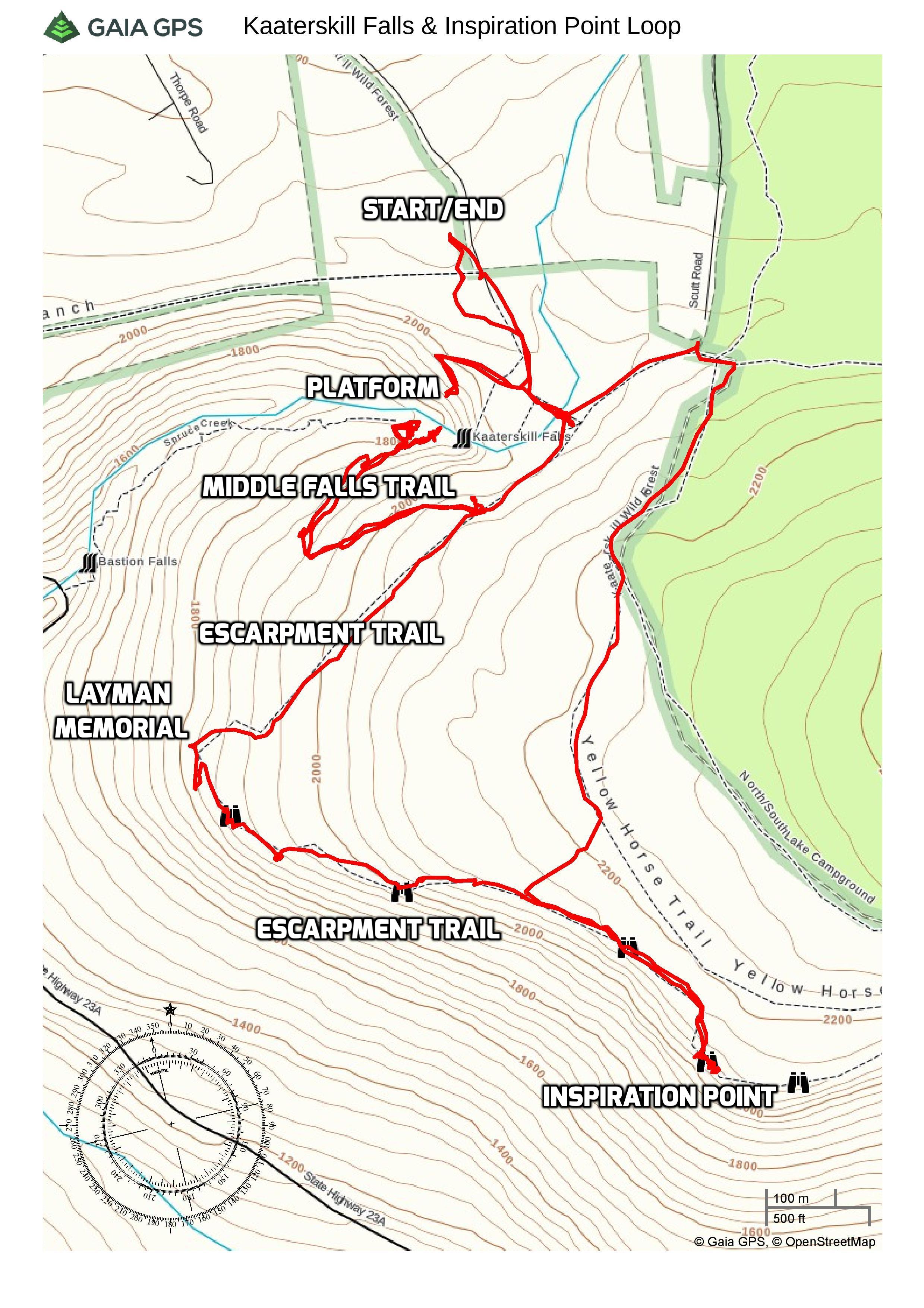
Kaaterskill Falls & Inspiration Point Loop
The Hike:
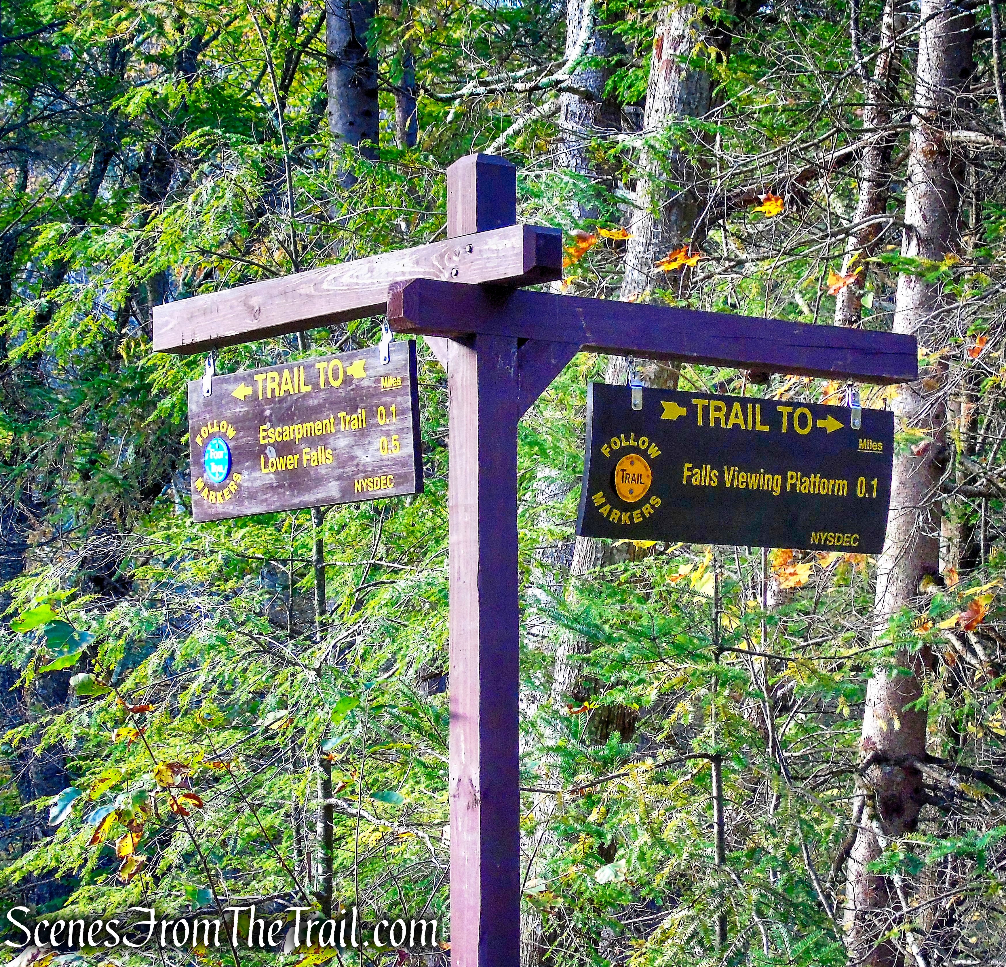
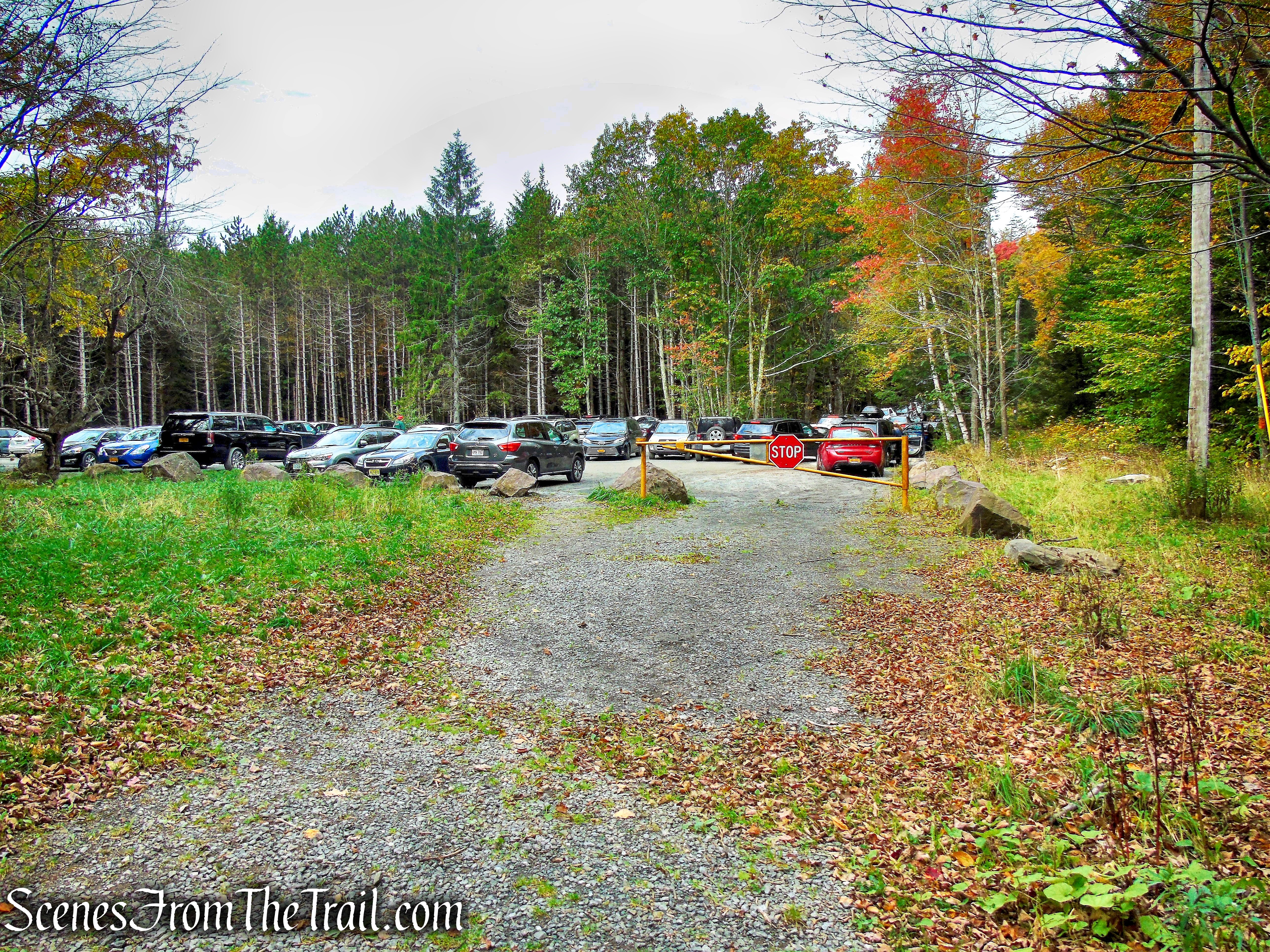
We got an early start, but with a two hour drive and a pit stop, we didn’t arrive at the Laurel House Trailhead until about 8:30 am. There were several cars in the lot when we arrived, but when we returned at the end of the hike, the lot was full and there were cars lined up on both sides of Laurel House Road. The lot was expanded to accommodate approximately 35 cars, almost tripling the previous amount of available parking spaces. We geared up and headed for the kiosk at the southern end of the parking lot.
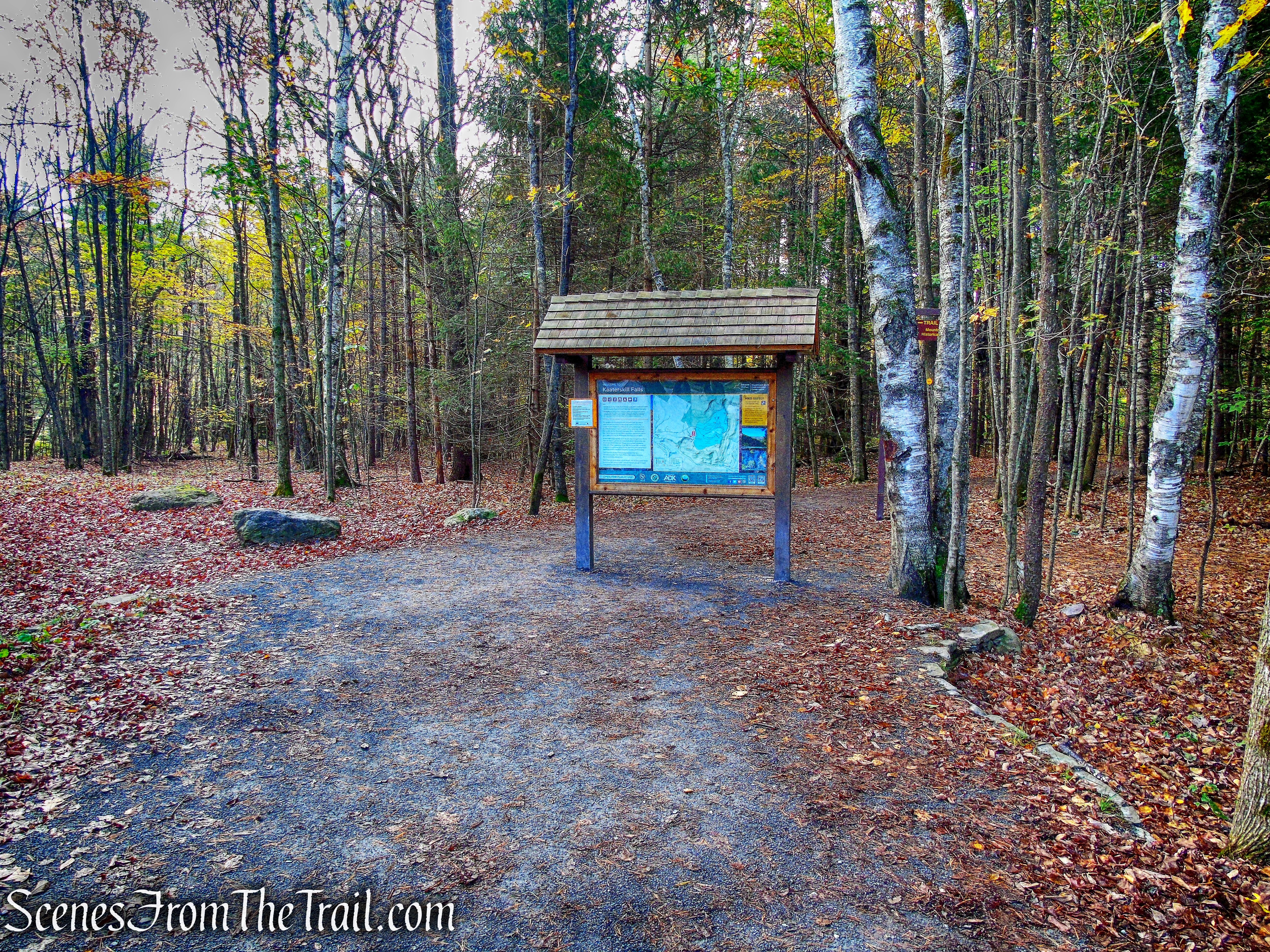
kiosk – Laurel House Trailhead
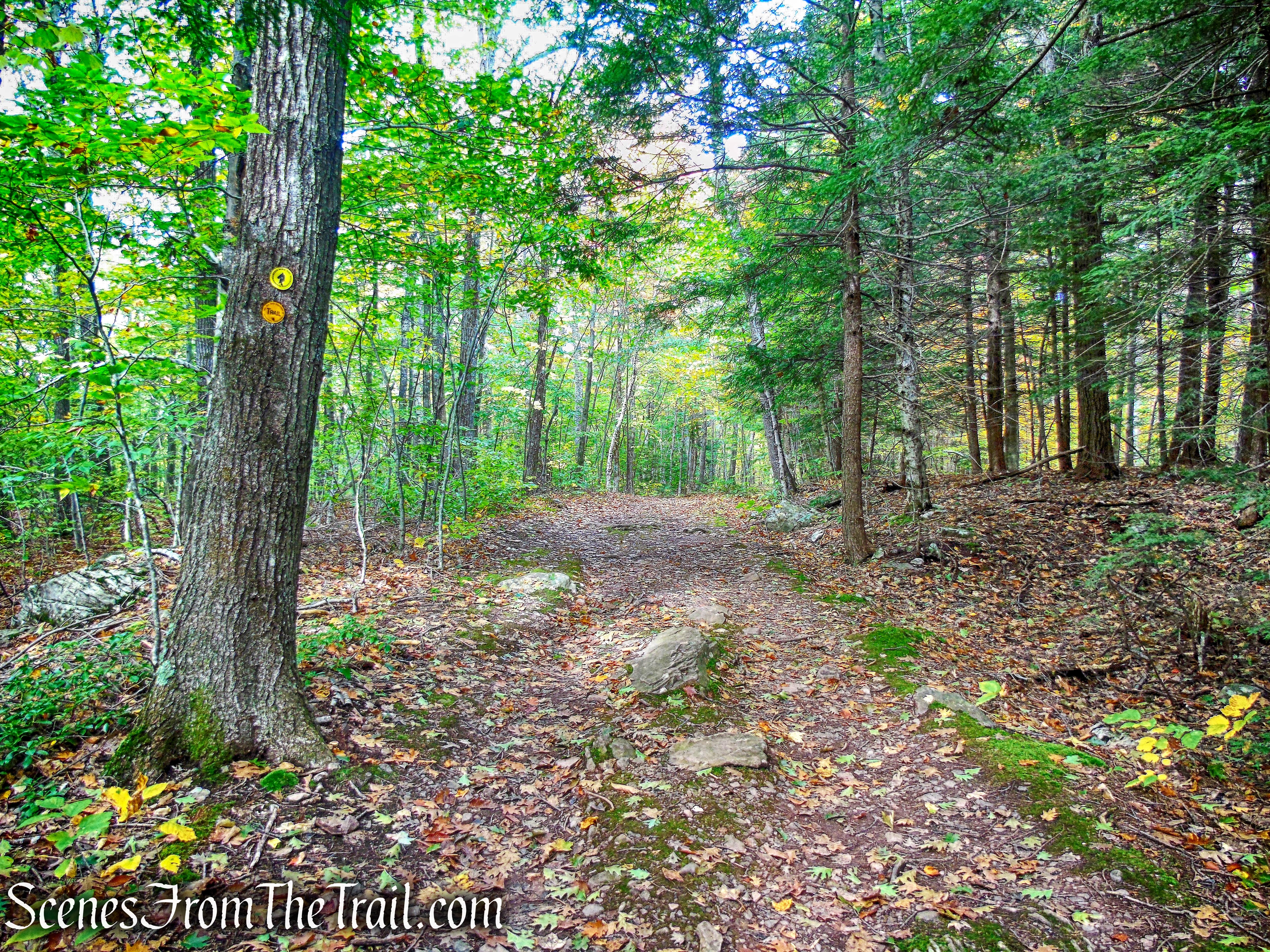
We proceeded straight along the trail, our first stop being the viewing platform.
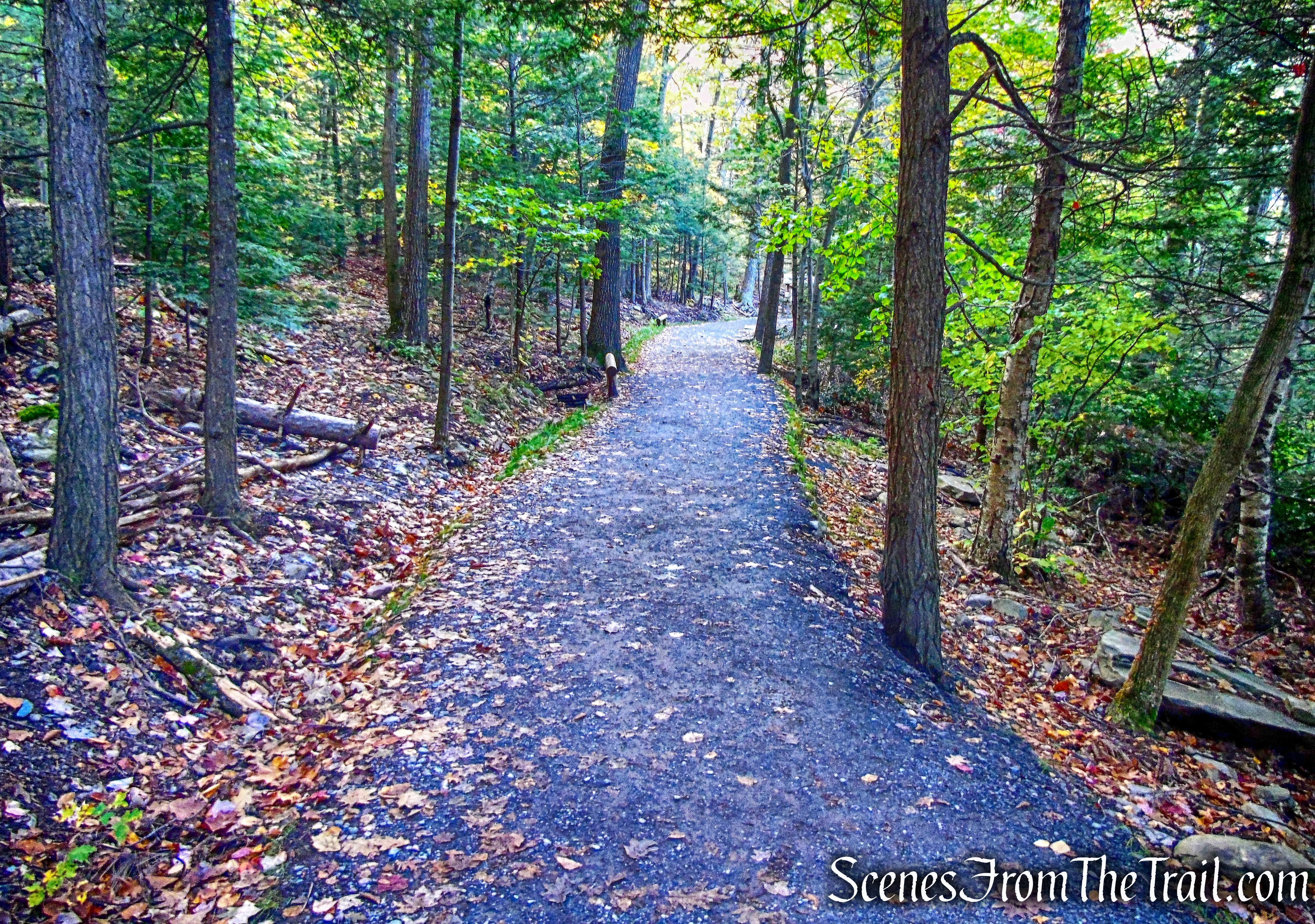
Kaaterskill Falls Trail
The upper falls viewing platform is just a short walk.
straight on Kaaterskill Falls Trail
Kaaterskill Falls Trail
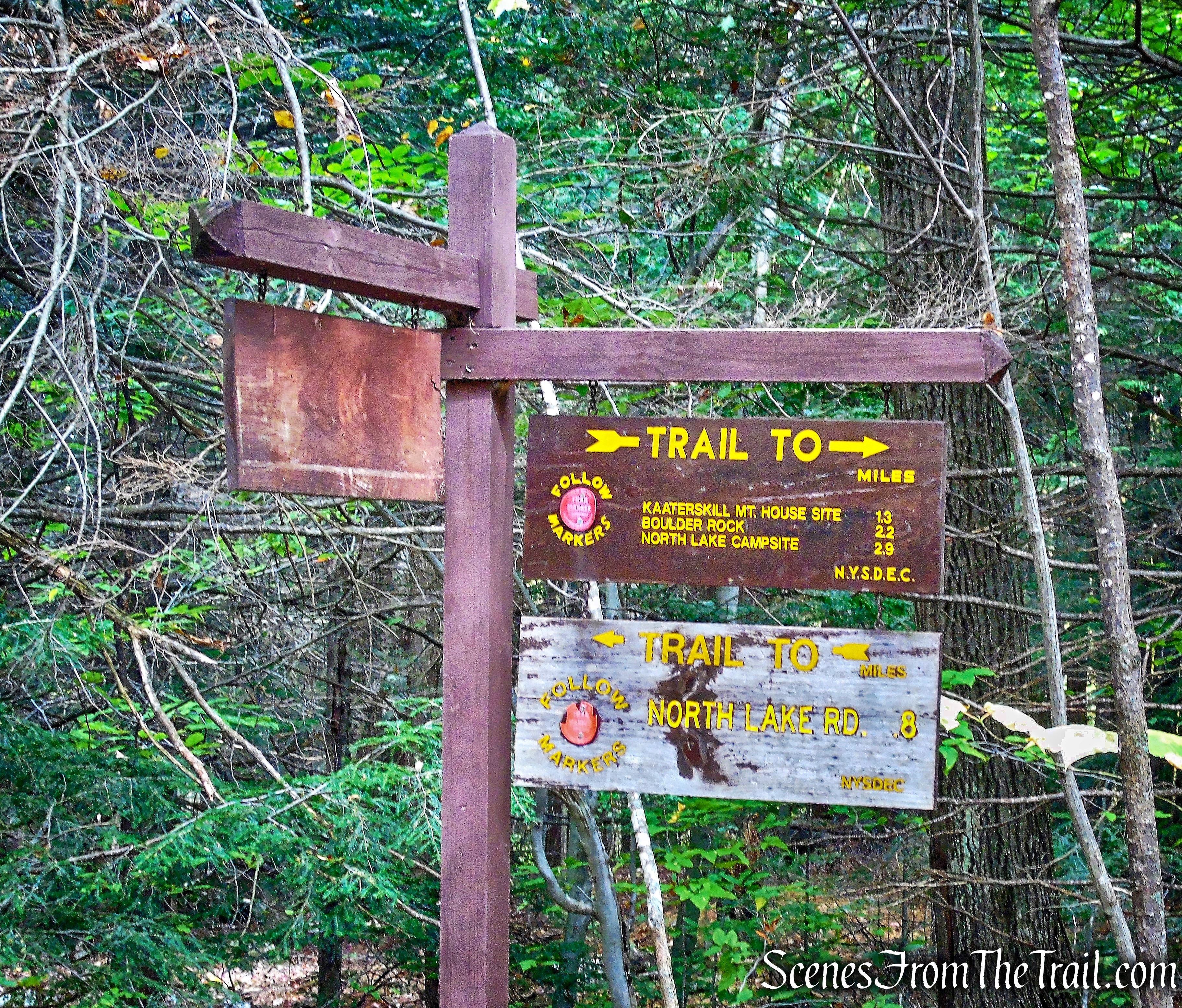
At the next junction we turned right. We would return to this junction after viewing the falls.
turn right on Kaaterskill Falls Trail
turn right on Kaaterskill Falls Trail
In 2015, DEC constructed a new, wide, smooth surface trail with level resting areas to an observation platform overlooking the top of the falls.
Kaaterskill Falls Trail
These new features improve the public’s view of the falls from the top and enhance safety by directing people to a safe viewing area away from the top of the falls, where people have fallen.
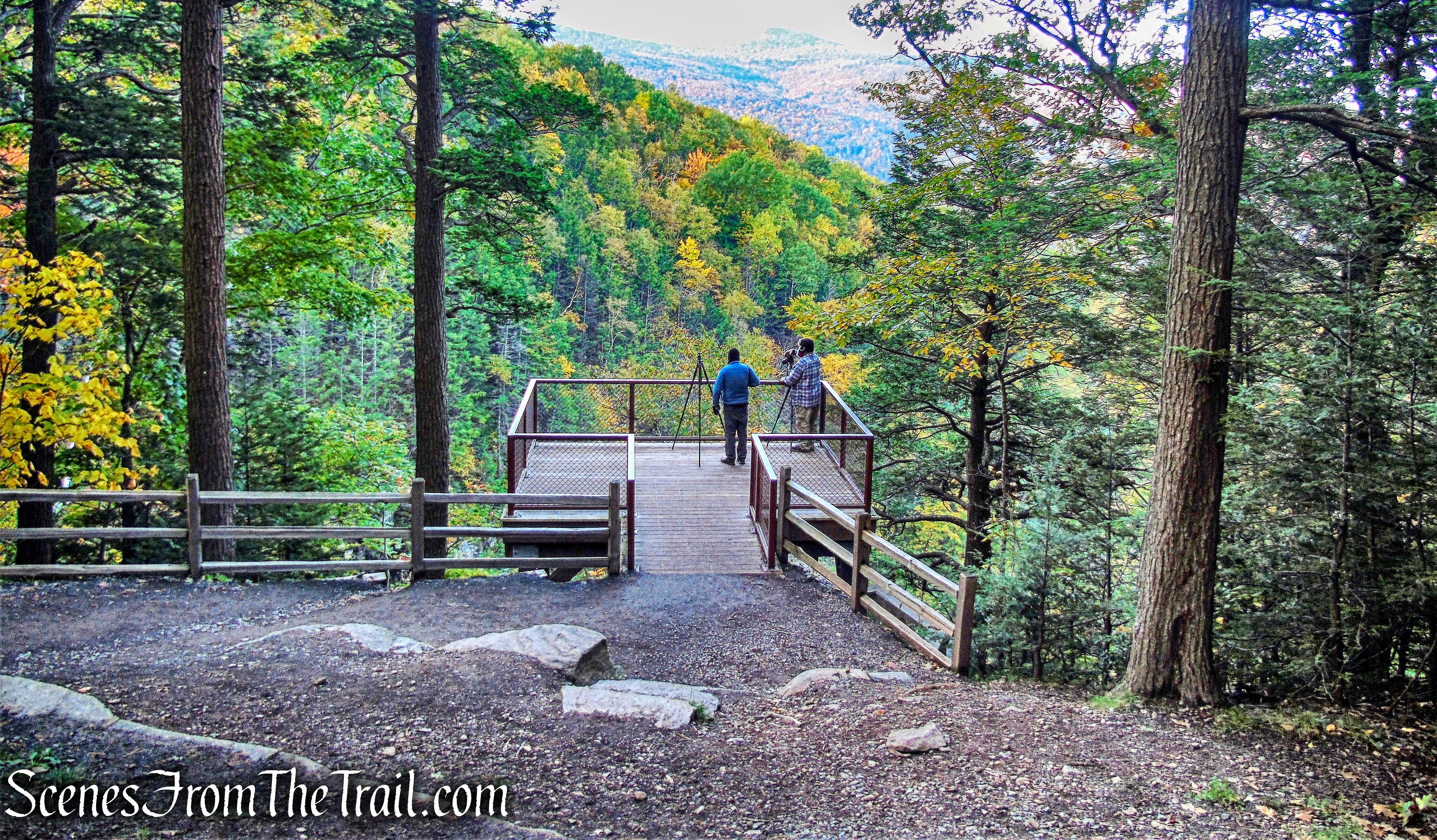
viewing platfrom – Kaaterskill Falls
The view of the upper falls is much better now since they installed the platform .
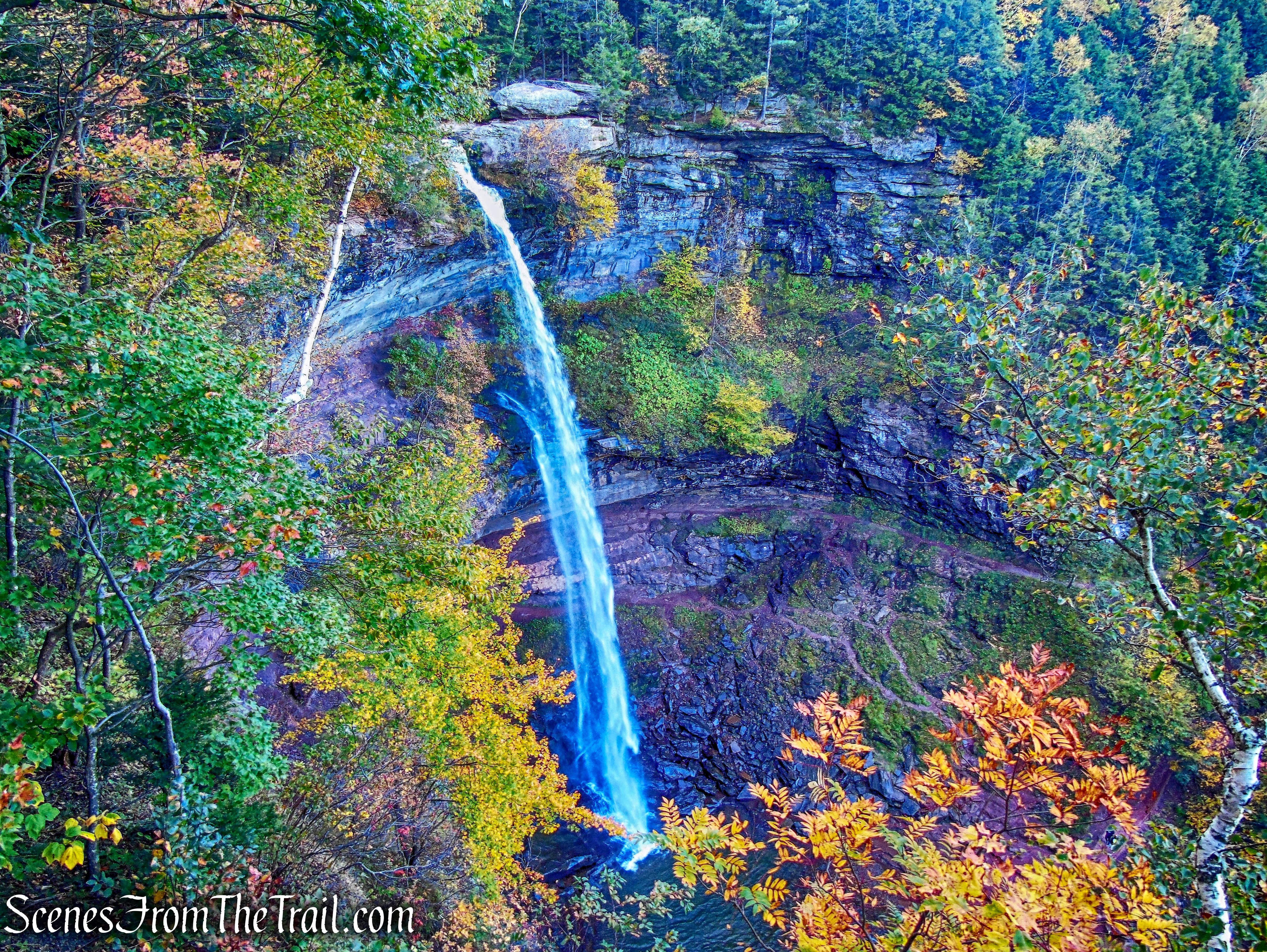
Kaaterskill Falls
The view extends to the surrounding mountains as well, with Kaaterskill High Peak visible in the distance, on the left.
view from platform
We retraced our steps back to the junction and turned right, crossing the bridge over Spruce Creek.
Among the 2016 improvements, was the installation of a 115-foot hiking bridge that spans Spruce Creek and connects the hamlet of Haines Falls to the Escarpment Trail and North/South Lake Campground. The bridge is part of a new 1.8-mile trail connection between Haines Falls and the existing trail system in the Kaaterskill Wild Forest and North/South Lake Campground, which DEC completed with the assistance of the Kaaterskill Rail Trail Committee.
Kaaterskill Falls Trail
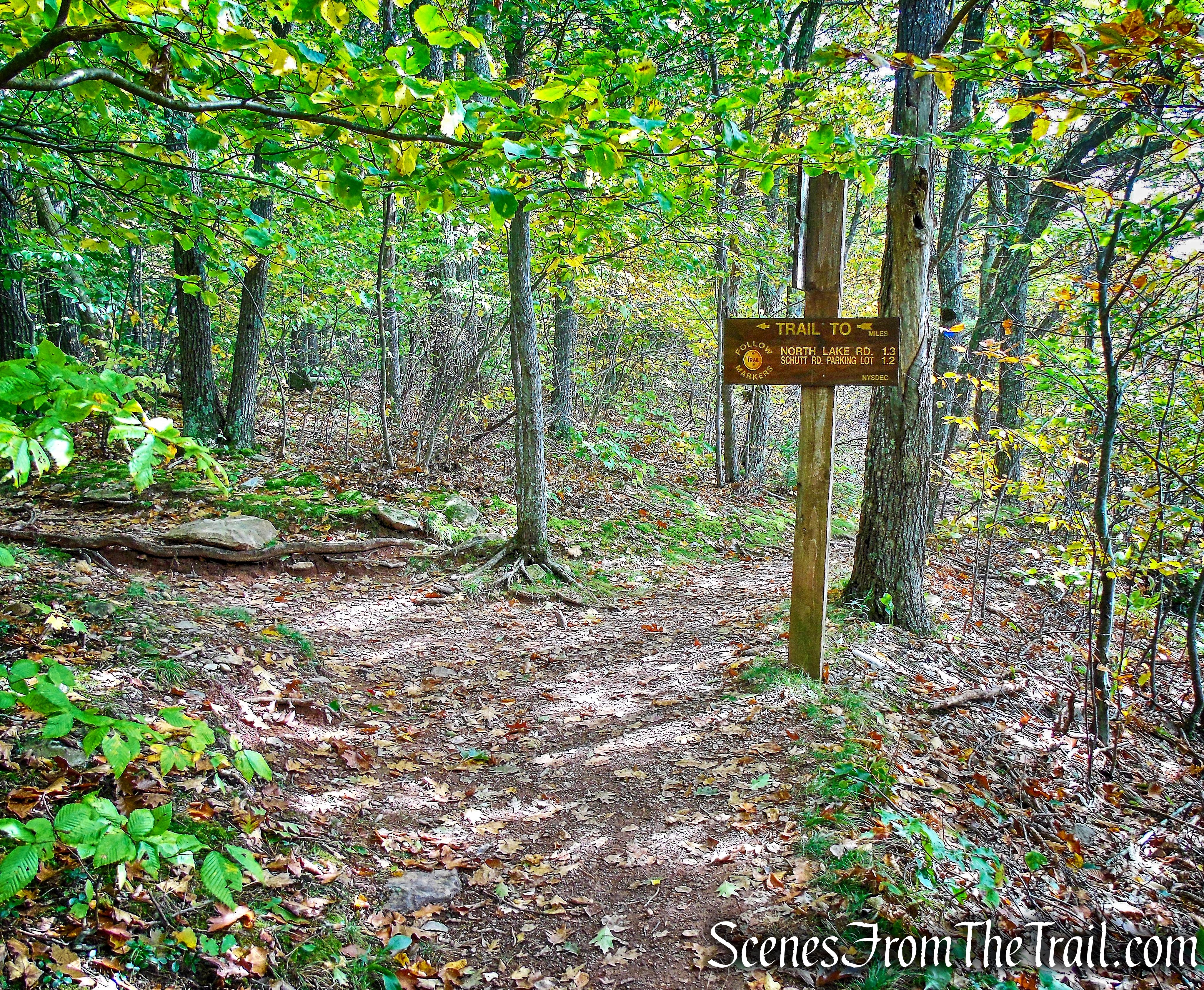
After crossing the bridge, we turned right, leaving the road and onto the blue-blazed Escarpment Trail. The road to the left would be our return route.
turn right onto the Escarpment Trail
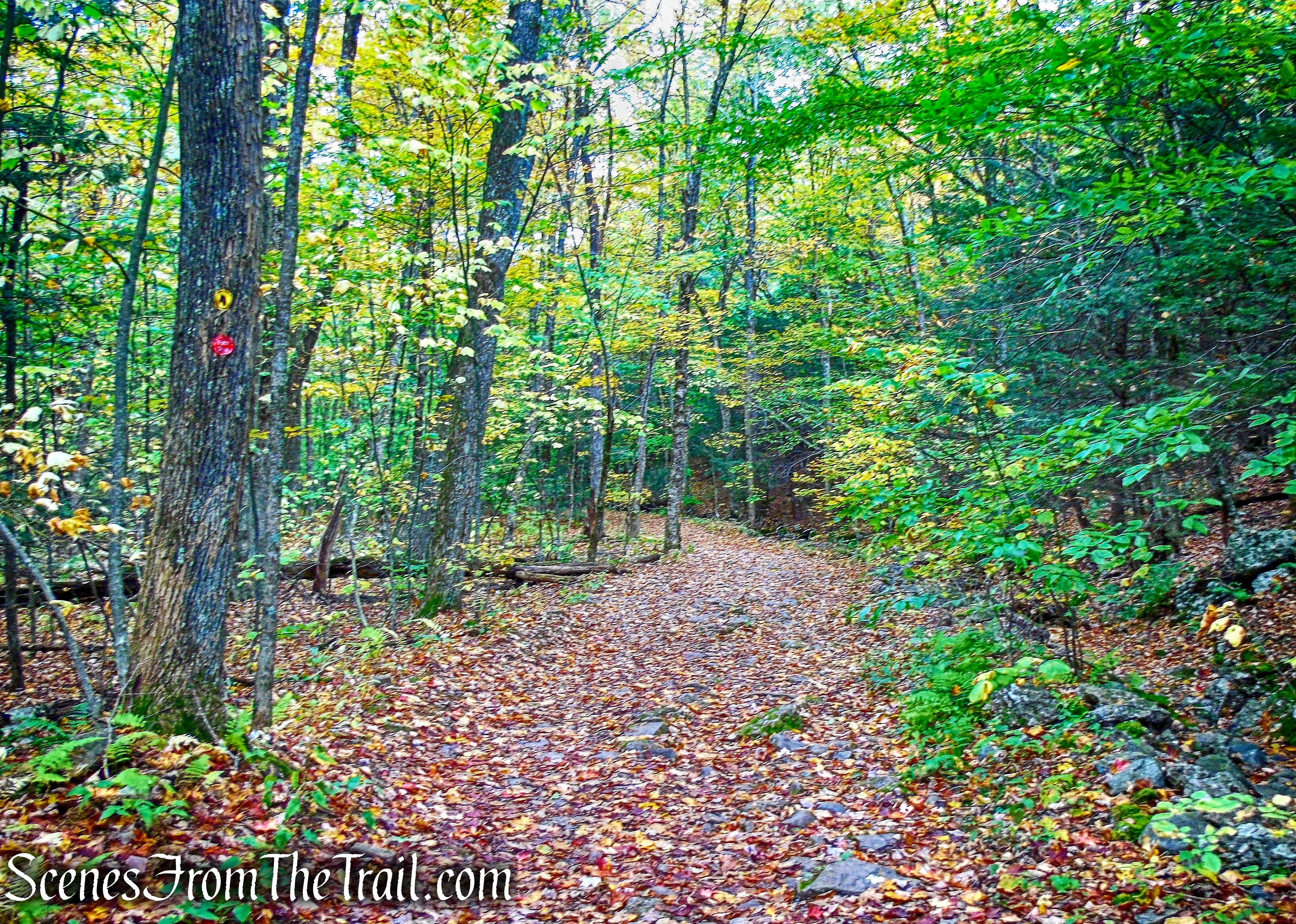
Escarpment Trail
The Escarpment Trail begins to climb then levels off somewhat.
Escarpment Trail
In a short distance, we came to another junction where we turned right.
turn right towards lower falls
We then began following the yellow blazes towards the lower falls.
turn right towards lower falls
The Kaaterskill Falls Trail was also extended from the middle pool to the Escarpment trail creating a key linkage between the top and the bottom of the falls, allowing hikers to avoid a potentially dangerous bushwhack between the two locations.
Kaaterskill Falls Trail
Even though it’s a short distance down (0.4 mile), the path is narrow and rocky in places. If it’s wet, it’s most likely slippery.
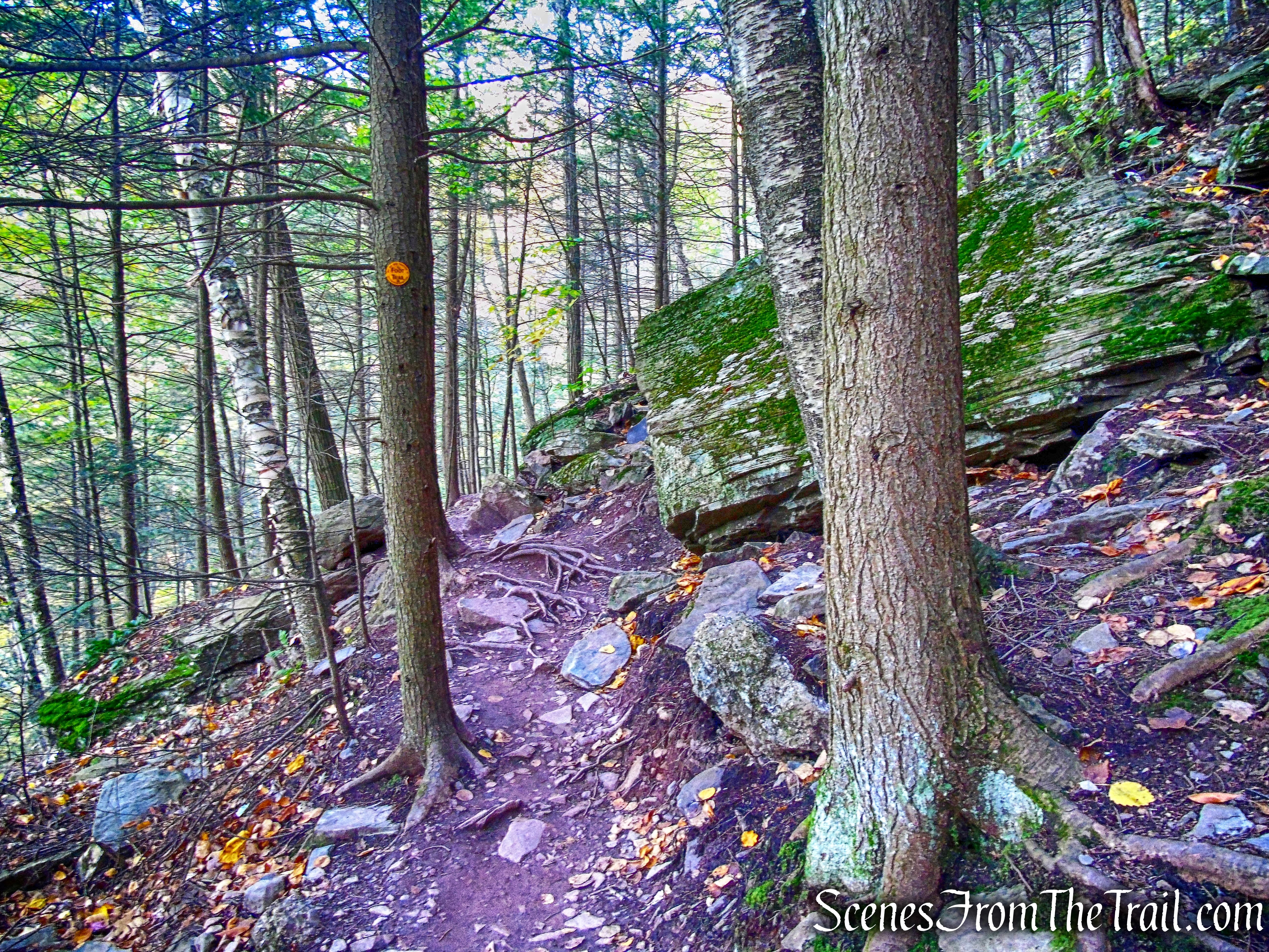
Kaaterskill Falls Trail
The steps help with the steep descent, but if they are covered with leaves, care should be taken while descending.
Kaaterskill Falls Trail
On the way down towards the lower falls, we left the staircase and turned right onto the middle falls trail.
turn right onto middle falls trail
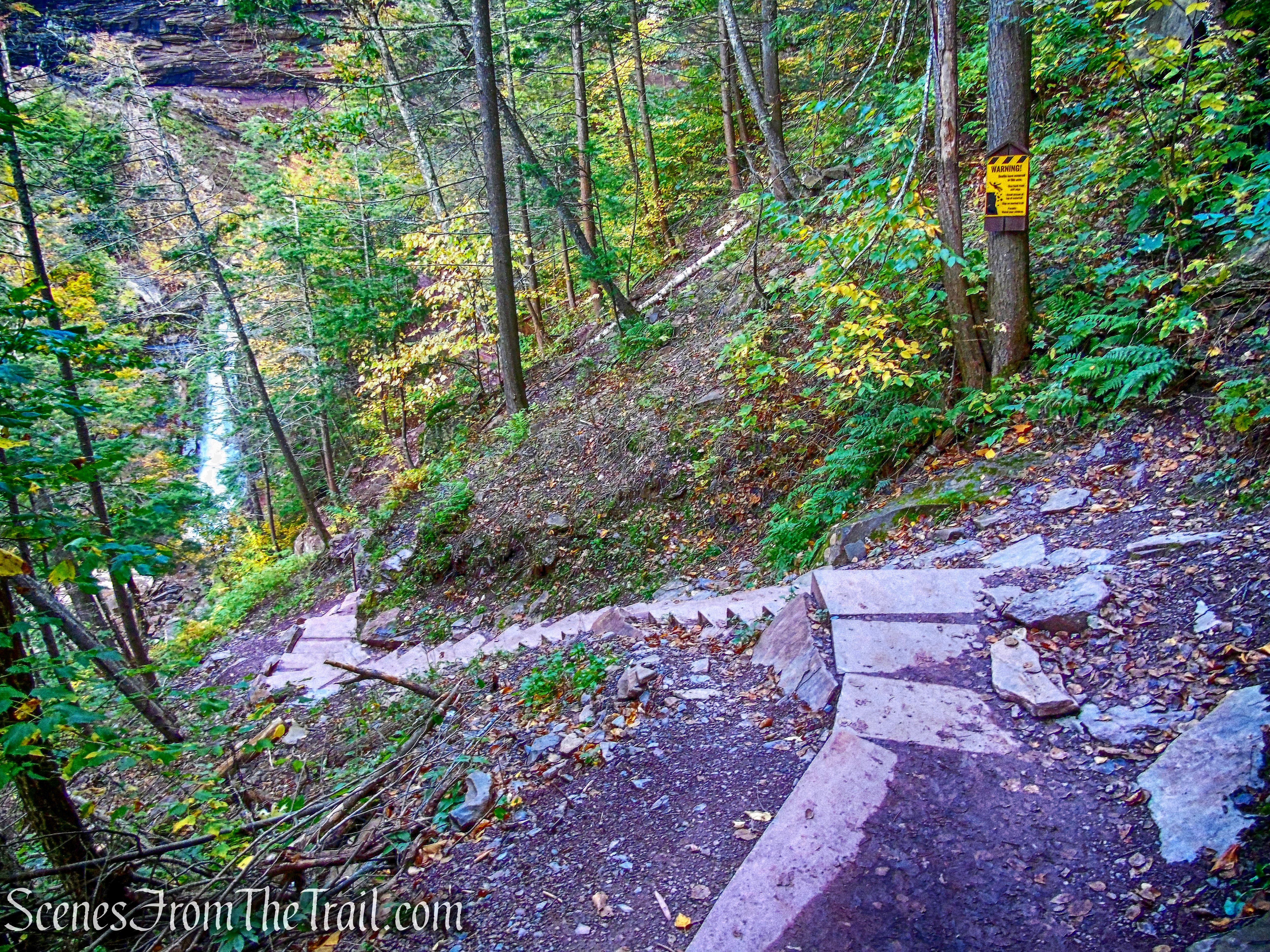
With all the safety improvements there are still significant dangers and care should be exercised around this area. People have slipped and fallen to their deaths here.
middle falls trail
One of the more recent improvements includes a new, 200-foot cable hand rail on the trail leading to the middle pool of Kaaterskill Falls. I used the handrail because due to the hard and slippery terrain, the ground was slick, almost like a wet floor.
middle falls trail
The trail leads to “the amphitheater,” a grand rounded cavity, roofed over by a massive ledge of thickly stratified sandstone. It’s one of the most popular destinations for hikers at Kaaterskill. In the summer, you can be assured that there will be lots of people wading in the water here.
Kaaterskill Falls
A view of the top of the lower falls.
Kaaterskill Falls
We wanted to sit here for a while and relax, but everything was wet, muddy and slick, so we retraced our steps along the middle falls trail.
middle falls trail
When we reached the staircase, we turned right and continued descending to the lower falls.
middle falls trail
On our way down we could see a lot of people around the base of the falls, including photographers with their tripods.
Kaaterskill Falls Trail
We opted instead to make a sharp right by the split rail fence and followed it to a rock outcrop with a great view of the lower falls.
Kaaterskill Falls
When done enjoying the falls, we made our way back to the stone staircase and retraced our steps back up the mountain.
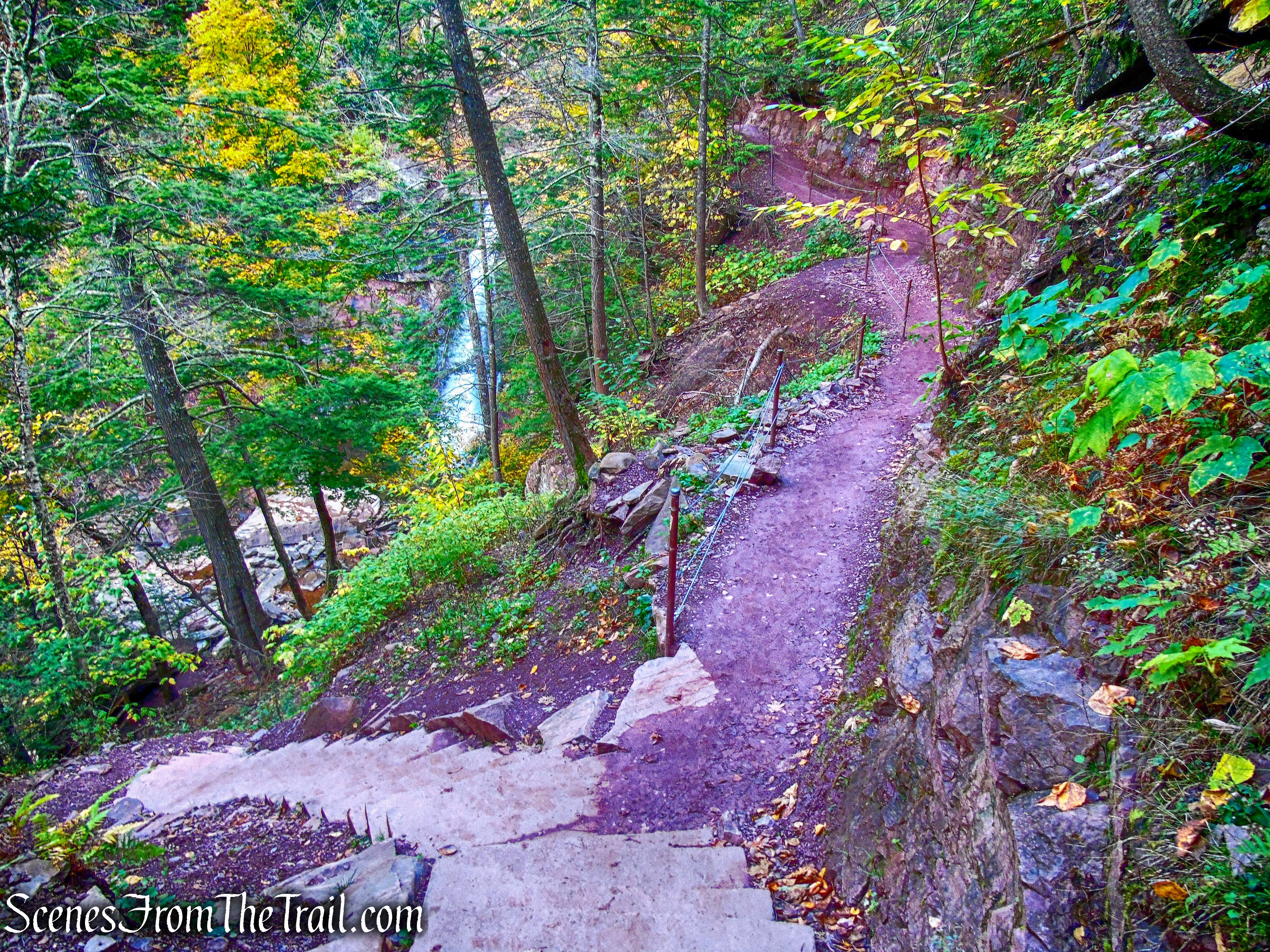
A new foot trail now leads from the end of the yellow-blazed Kaaterskill Falls Trail at the base of the falls, up to the middle pool of the falls, which included installation of a new 200-step stone staircase. The staircase was designed to blend in with the natural stone of the trail.
Kaaterskill Falls Trail
The staircase contractor, a professional trail crew from the Adirondack Mountain Club, built the staircase by hand, using an elaborate cable system and ramps to move each of the 700-pound stone steps from a staging area on the opposite side of the falls.
Kaaterskill Falls Trail
We then came to the junction with the blue-blazed Escarpment Trail and turned right.
Escarpment Trail
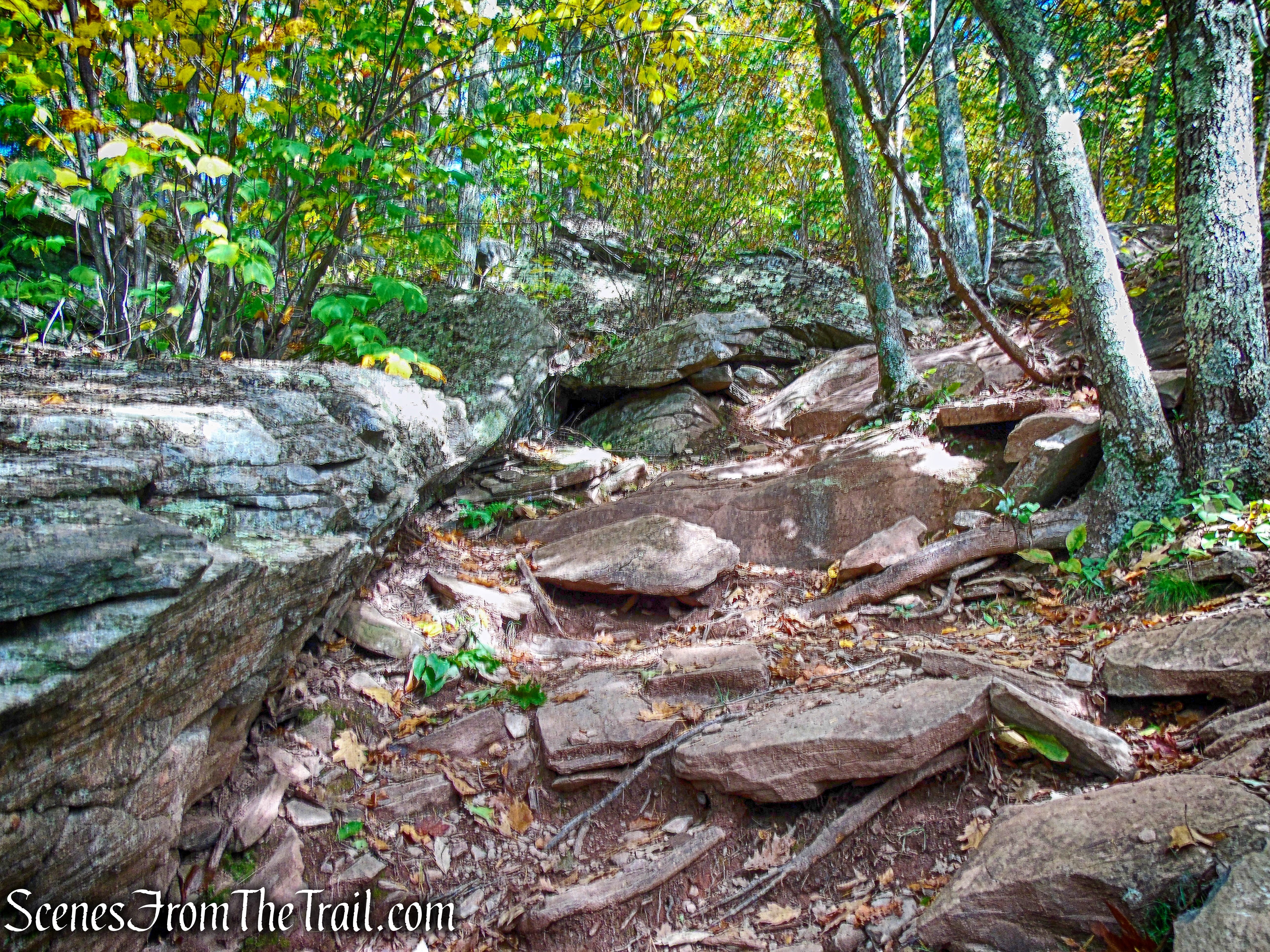
The Escarpment Trail is a rocky footpath and was very swampy on this day.
Escarpment Trail
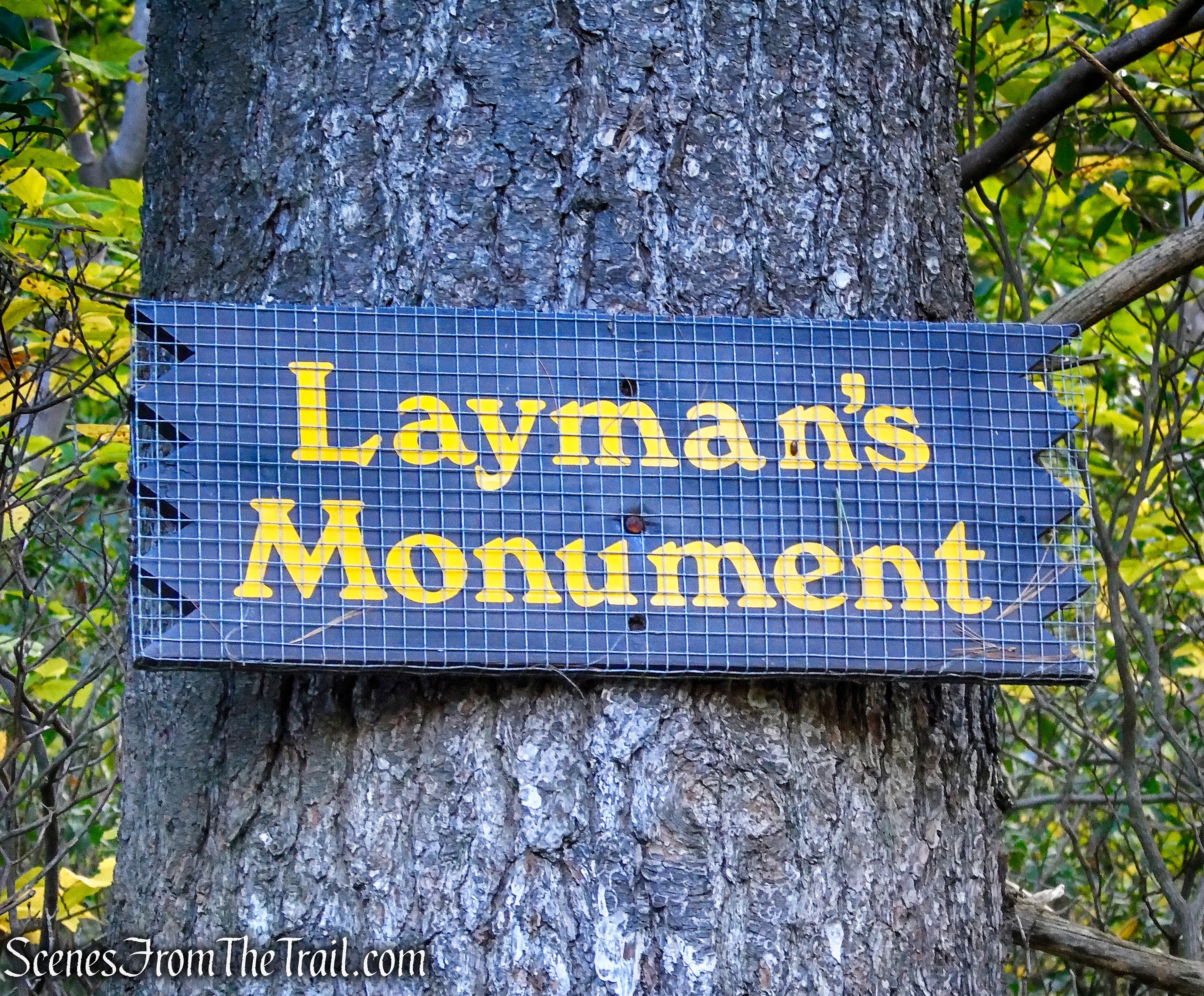
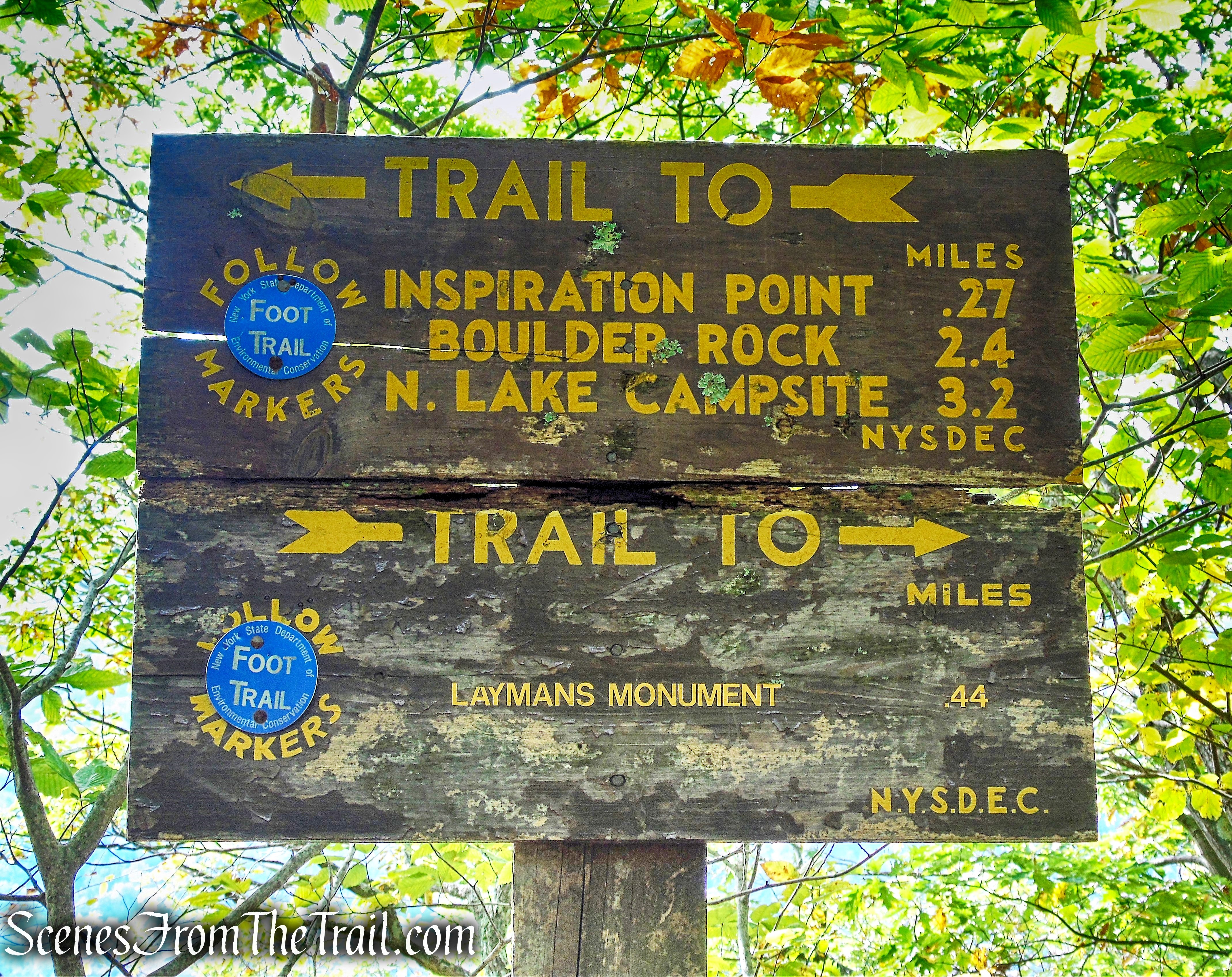
After a short descent, the Escarpment Trail reaches Layman’s Monument.
Frank D. Layman Memorial
The Frank D. Layman Memorial was erected in 1901 to commemorate Frank D. Layman, who died on the site of the memorial on August 10, 1900, while fighting a forest fire.
Frank D. Layman Memorial
It is pyramidal in shape, four sided, and rises upward from a base approximately seven feet in diameter to approximately 11 feet.
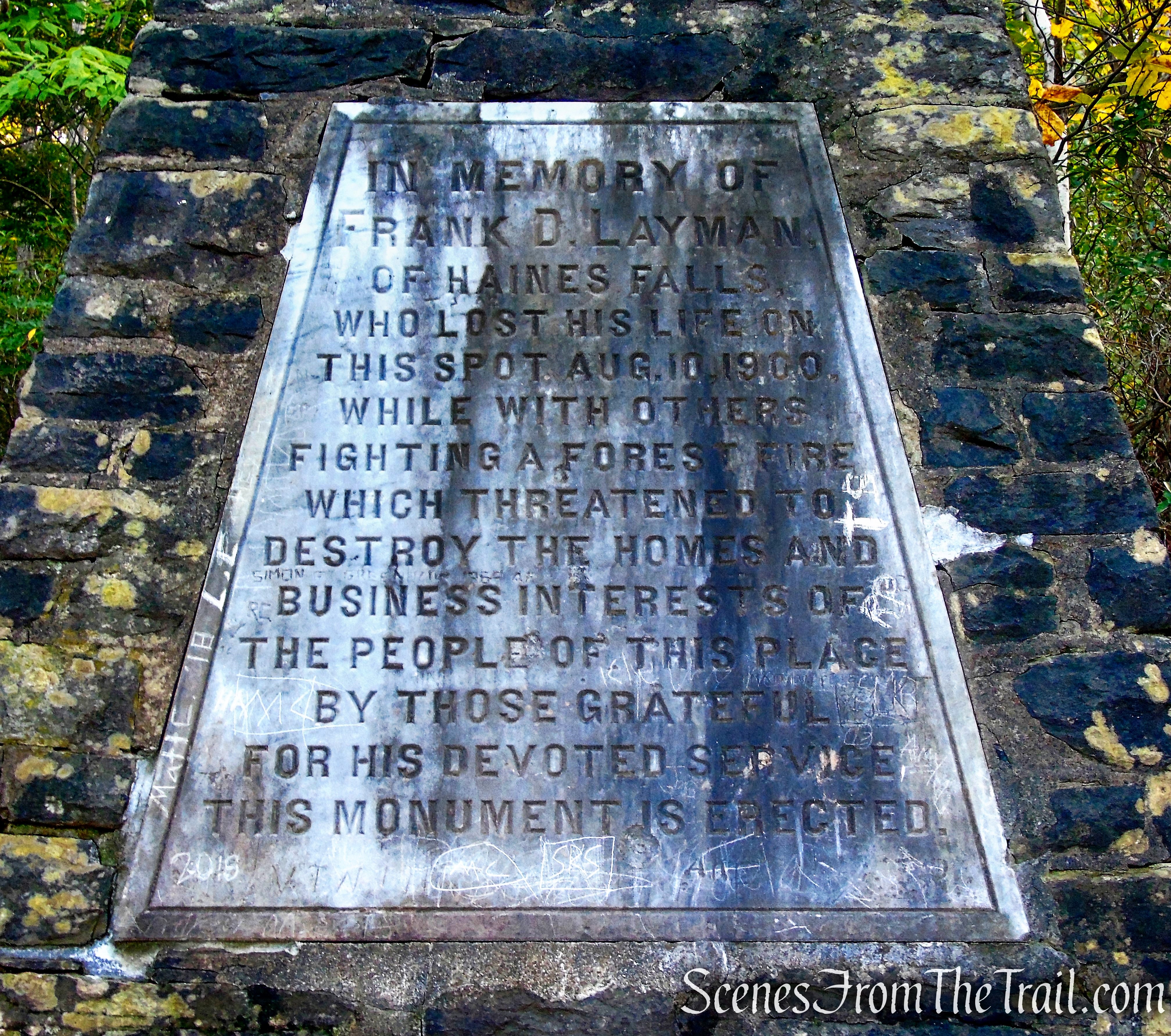
Frank D. Layman Memorial
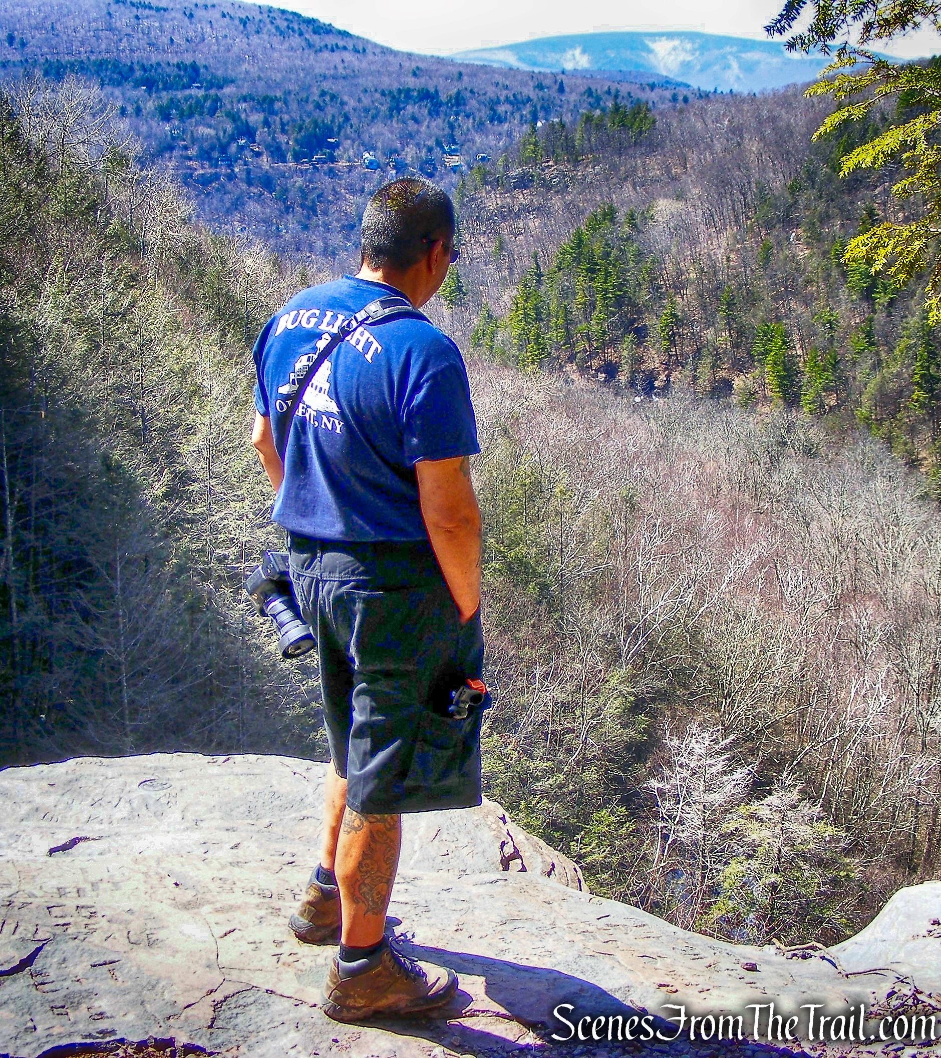
The trail now reaches the edge of the escarpment and turns left here. In a short distance, it turns left again and begins to climb. In 500 feet, after a steep climb up a large rock, it reaches a panoramic viewpoint. Kaaterskill Clove is directly below. Roundtop Mountain and Kaaterskill High Peak tower above the clove to the south, and the small community of Twilight Park may be seen to the right.
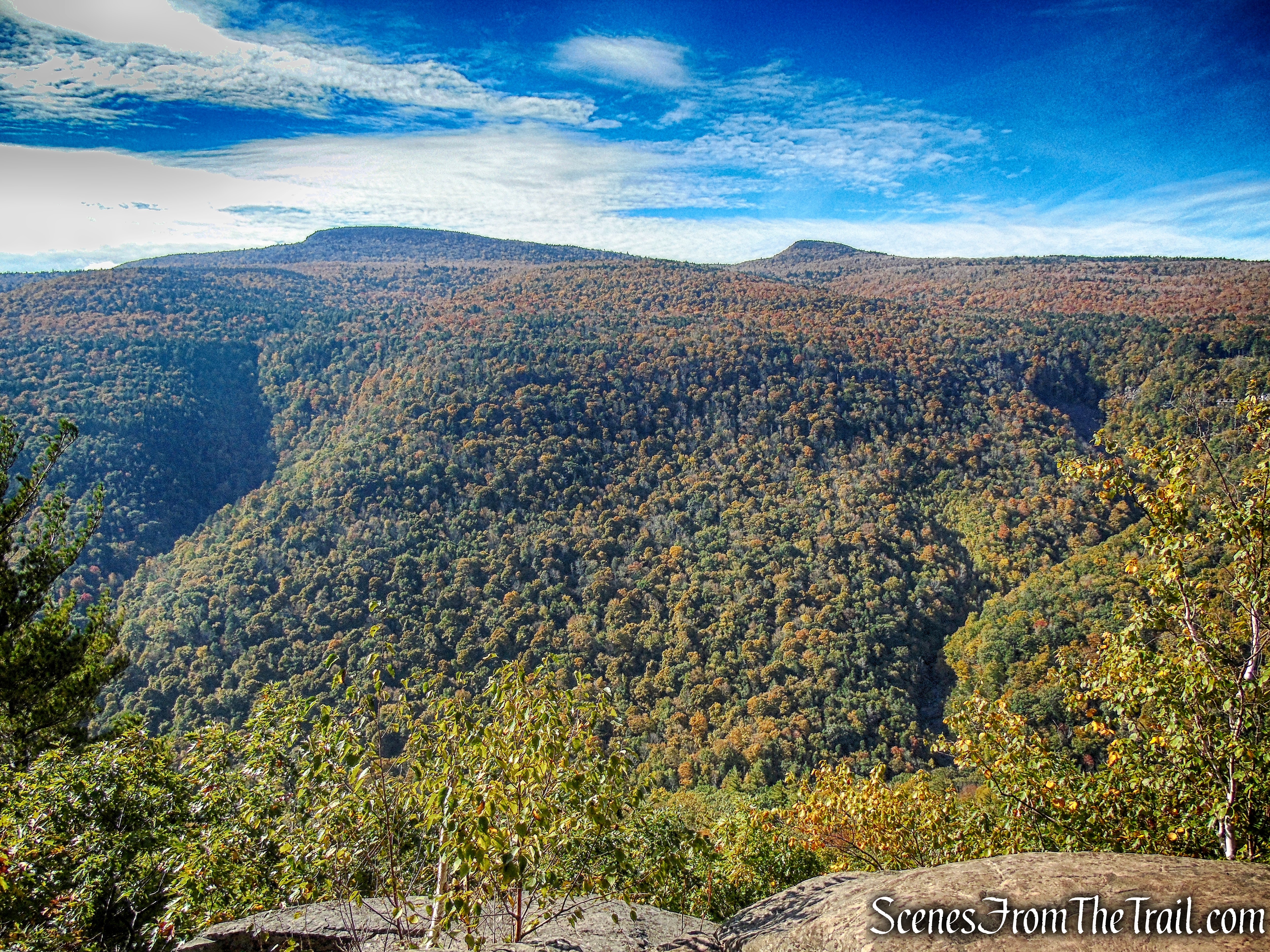
view from Escarpment Trail
This first viewpoint was very crowded. Since I knew there were numerous other viewpoints on this hike, we did not stay long and continued on.
Escarpment Trail
A little further along, we reached another expansive viewpoint on the right. This was a much smaller rock ledge, but it was perfect to take a short break here.
view from Escarpment Trail
The trail begins to climb away from the escarpment…..
Escarpment Trail
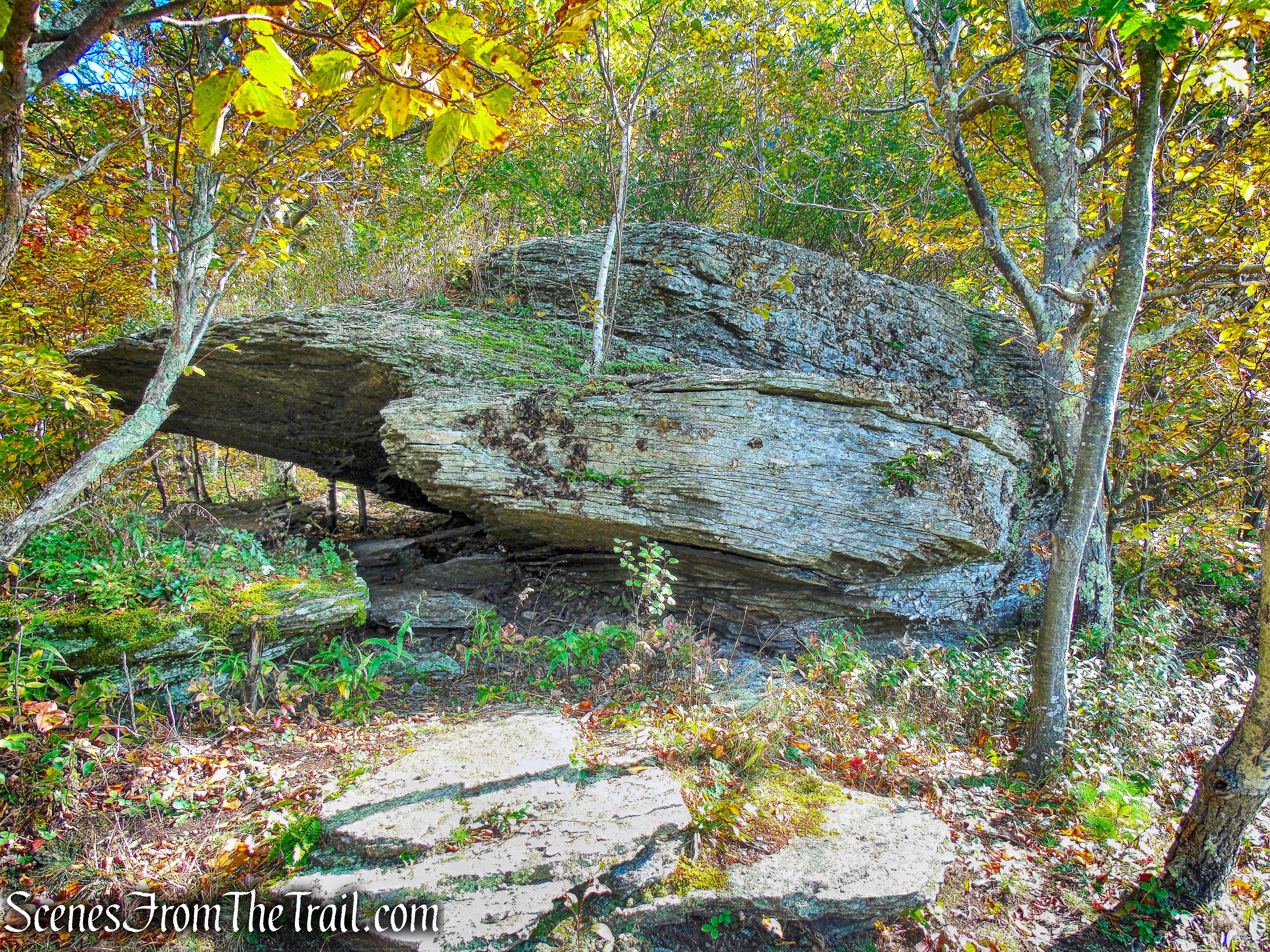
and passes through a very picturesque and rocky area.
Escarpment Trail
Escarpment Trail
Escarpment Trail
The Escarpment Trail can be dangerous since it is never far from the edge of the Kaaterskill Clove. It is strongly recommended that you wear proper hiking boots and use trekking poles to steady yourself in case you lose your balance.
Escarpment Trail
After a short climb, we came to a third viewpoint with a more limited view.
Escarpment Trail
Just beyond, the trail climbs steeply,
Escarpment Trail
then more gradually,
Escarpment Trail
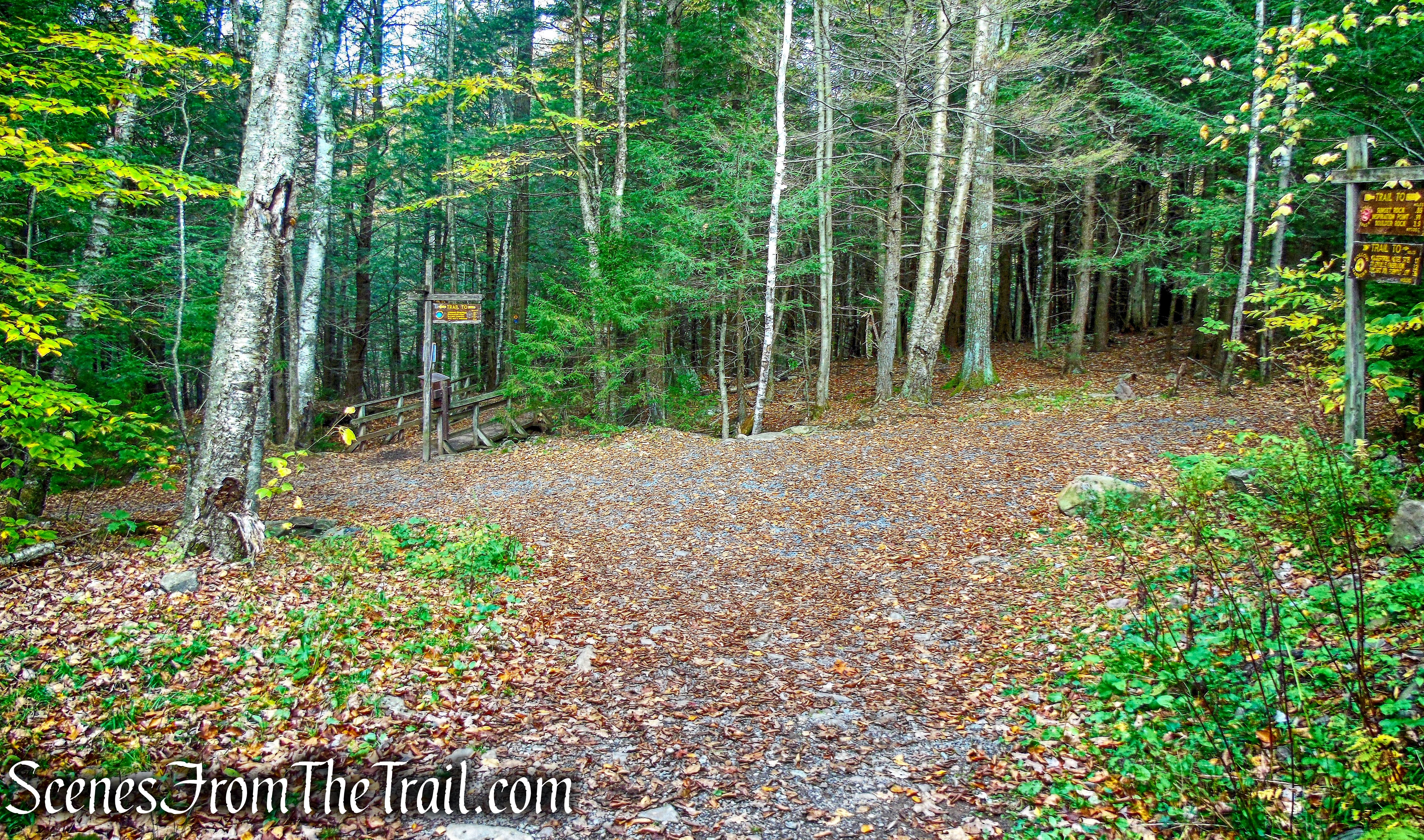
as it reaches a junction with a yellow-blazed connector trail that begins on the left.
junction with Yellow Connector Trail
We continued straight, but would return to this junction shortly.
junction with Yellow Connector Trail
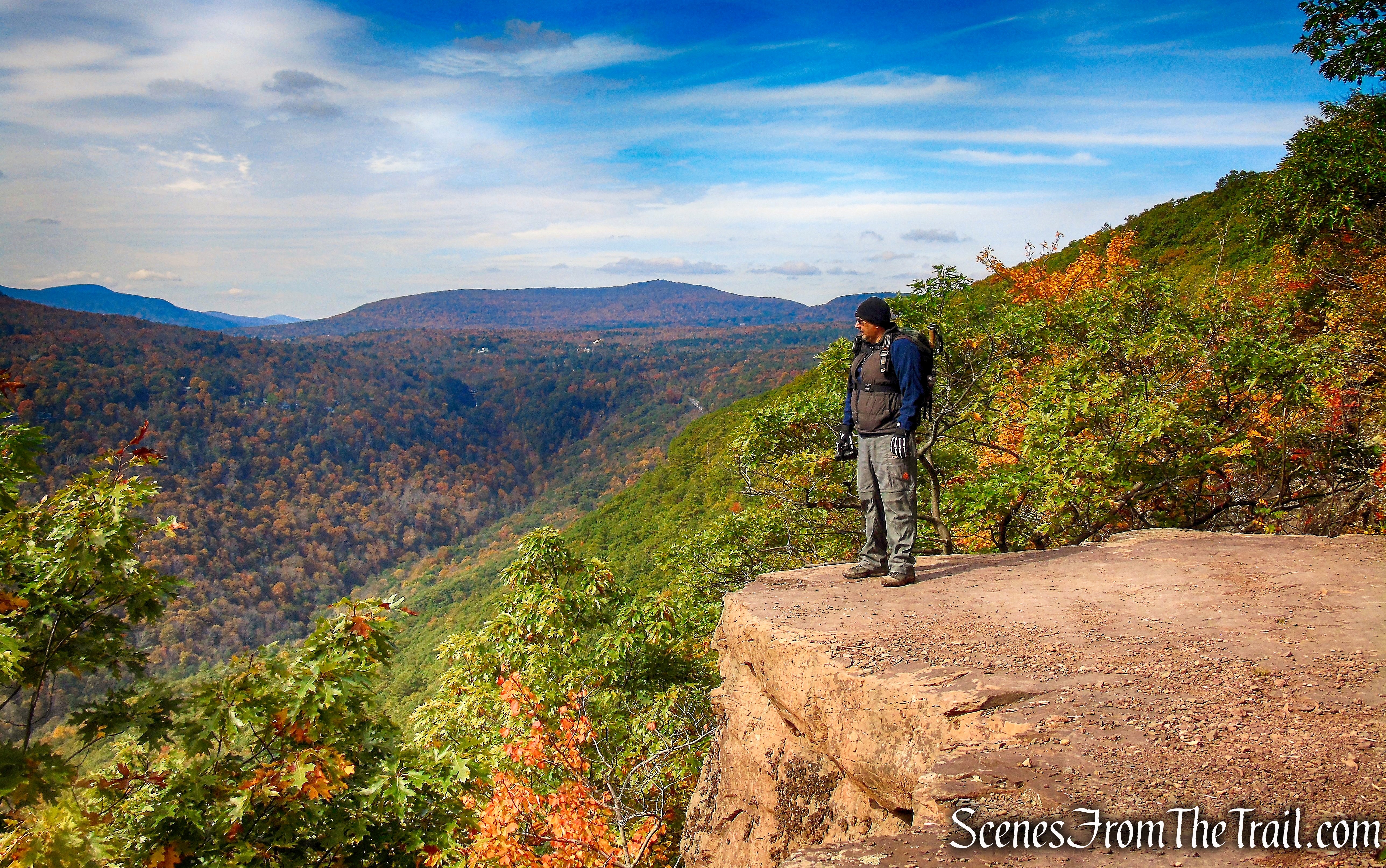
We continued a short distance to Inspiration Point.
Inspiration Point
We continued ahead on the blue-blazed trail,
Escarpment Trail
which shortly emerges onto Sunset Rock, with a somewhat limited south-facing view.
view from Escarpment Trail
After a short level stretch, the trail descends steeply over rock ledges to reach Inspiration Point.
view from Escarpment Trail
From here there are panoramic views to the west and south.
Inspiration Point
The two large rock ledges are covered with carved inscriptions, some of which date back over 100 years.
Inspiration Point
Inspiration Point
When we arrived at Inspiration Point, there were three hikers taking photographs, but they left almost immediately upon our arrival.
Inspiration Point
This is a gorgeous spot and we decided to stop here for a while and enjoy it.
Inspiration Point
Inspiration Point
We then retraced our steps on the Escarpment Trail and climbed over the rock ledges as other hikers approached. Timing is everything.
Escarpment Trail
When we reached the junction with the Yellow Connector Trail, we turned right.
turn right on Yellow Connector Trail
We followed the yellow blazes uphill a short distance.
Yellow Connector Trail
The trail turns left (as did we) and is joined by the yellow-blazed Horse Trail which joins from the right.
yellow-blazed Horse Trail
We followed the yellow-blazed Horse Trail as it leads downhill. When we arrived at the next junction, we turned left again.
turn left on co-aligned yellow-blazed Horse/red-blazed Scutt Road Trails
Now the yellow-blazed Horse Trail is joined by the red-blazed Scutt Road Trail.
co-aligned yellow-blazed Horse/red-blazed Scutt Road Trails
At the next junction, we turned left on the blue-blazed Escarpment Trail, as the Yellow Horse Trail continues ahead and crosses a wooden footbridge..
turn left on Escarpment Trail
The Yellow Horse Trail and the Escarpment Trail continue straight and cross a wooden footbridge. Going that way leads to the parking area on Scutt Road. We turned left on the wide woods road and continued downhill, with the creek to our right.
turn left on Escarpment Trail
A short distance later, we arrived at the junction with yellow-blazed Kaaterskill Falls Trail and turned right.
turn right on Kaaterskill Falls Trail
turn right on Kaaterskill Falls Trail
We crossed the bridge over Spruce Creek,
Kaaterskill Falls Trail
and continued straight towards the Laurel House Parking Lot, where the hike began.
Laurel House Trailhead
Review:
This was a fantastic hike that is doable by most beginners. By arriving early enough, we avoided the large crowds at Kaaterskill Falls. The improved trails, bridge, viewing platform and stone staircase make visiting Kaaterskill Falls much more enjoyable, not to mention safer. After the first viewpoint on the Escarpment Trail, we ran into only a few hikers. The Escarpment Trail is quite beautiful to hike and there are frequent views. Totally worth the two hour drive.
Pros: Escarpment Trail, Kaaterskill Falls, scenic views, Catskill Mountains, historical features.
Cons: Kaaterskill Falls gets crowded.
Take a hike!
Kaaterskill Falls & Inspiration Point Loop – Catskill Park
Sources:
