June 10, 2018 – Gardiner, NY
Difficulty: Moderate – Strenuous (1 steep ascent, 1 steep descent)
Length: Approximately 6.2 miles
Max elevation: 1,283 ft.– total elevation gain approximately 922 ft.
Route type: Circuit
Fee: $15.00 day hiking fee (Non-Member) – Purchase Membership
Trailhead parking: Mohonk Preserve West Trapps Trailhead Parking Area 3142 US-44, Gardiner, NY 12525
With over 8,000 acres on the Shawangunk Ridge, Mohonk Preserve is the largest member and visitor-supported nature preserve in New York State. The Mohonk Preserve is a private land conservation organization established to protect the Shawangunk Ridge, it is not public land funded by the government. Therefore, there is a day use fee to use the preserve which funds its maintenance and programs.

Mohonk Preserve
Having received an annual Mohonk Preserve membership for Christmas, it was high time that I used it. I normally prefer to hike the Mohonk/Minnewaska area on a weekday due to the large crowds on weekends. With that in mind, I tried to design a hike that utilized some of the lesser used trails. Not an easy task, but it worked out well on this day. Although this hike began in the Mohonk Preserve, it travels into Minnewaska State Park through the Peter’s Kill area as well.
This hike began from the West Trapps Parking Area, but passes through the Coxing Kill and Peter’s Kill parking areas, which can be used as alternative starting points. The West Trapps lot opens at 9:00 am and we arrived at 9:03 am. There were only a few spaces left by that time. This hike was done in a counterclockwise fashion, but if done in reverse order, it will be the same amount of elevation gain. I wanted to get to Split Rock early since it attracts crowds, being so close to the Coxing Kill Parking Area.
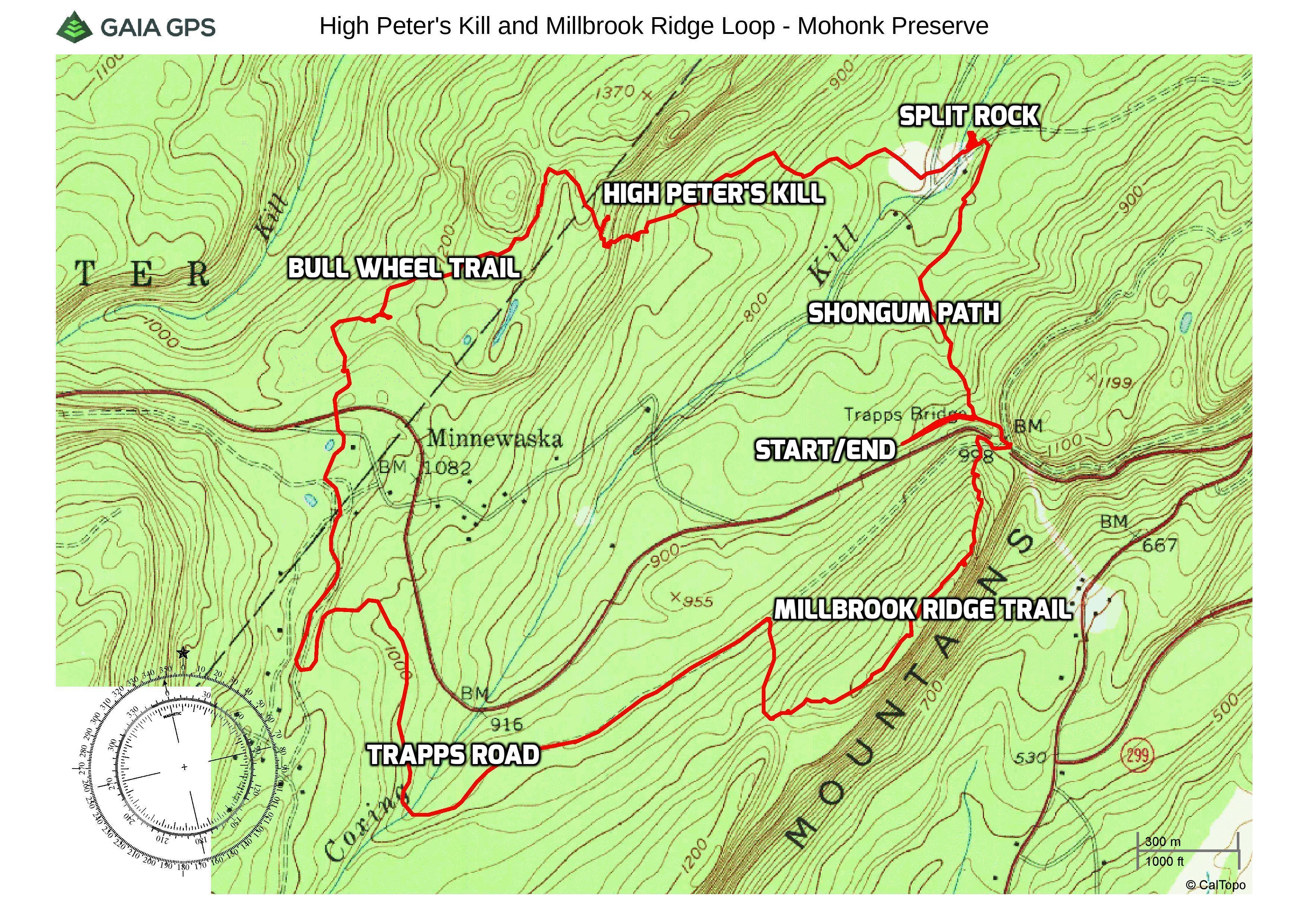
High Peter’s Kill and Millbrook Ridge Loop
Trails used: The distances shown in parentheses are approximately the distances traveled during this hike and not necessarily the total length of the actual trails.
- West Trapps Connector Trail – (600 ft. at start) (0.3 mile on return) This yellow-blazed gravel Road connects the West Trapps parking area to Overcliff and Undercliff Roads and also the Trapps Bridge over Route 44/55, which gives access to Trapps Road and the Millbrook Ridge Trail.
- Shongum Path – (0.8 mile) Marked by signs and red blazes, the 0.8 mile long Shongum Path connects the yellow-blazed West Trapps Connector Trail with the Old Minnewaska Trail, linking the West Trapps parking area with the Coxing Kill area.
- Old Minnewaska Trail – (550 ft.) Marked by signs and light blue trail blazes, this trail runs from Laurel Ledge Road and continues to opposite the Coxing Kill parking area.
- High Peter’s Kill Trail – (1 mile) Marked by signs and light blue trail blazes, this trail can be accessed from either Mohonk Preserve at the Coxing Kill parking area or from Minnewaska State Park.
- Bull Wheel Footpath – (0.5 mile) This white-blazed trail begins at the intersection with the High Peter’s Kill Footpath. The trail gradually descends through a former ski area and ends at an intersection with the Red Loop Trail.
- Awosting Falls Connector Footpath – (0.15 mile) This white-blazed footpath connects the Peter’s Kill Parking Area to the Awosting Falls Carriage Road.
- Awosting Falls Carriage Road – (1.9 miles) At the eastern boundary of the park preserve, this carriage road provides a multi-use connection between Minnewaska State Park Preserve and the Mohonk Preserve.
- Trapps Road – This unmarked wide gravel road begins on the south side of the Trapps Bridge over US-44/NY-55. The trail continues along US-44/NY-55 and dead ends into Lyons Road. This is the point at which it leaves Mohonk Preserve and enters Minnewaska State Park.
- Bayards Path – (0.21 mile) A red-blazed trail that connects Trapps Road to the Millbrook Ridge Trail, near the saddle in the ridge.
- Millbrook Ridge Trail – (0.8 mile) Marked by light blue blazes, the trailhead starts at Trapps Road just beyond the bridge over 44/55 and leads to the summit of Millbrook Mountain.
A new feature that I have added is the Google Earth Fly-Through. It follows the path that we hiked and it gives you a good idea of the terrain, layout, amount of parking etc. Check it out, it’s pretty cool.
View the Google Earth Fly-Through video of the hike below.
The hike begins at the eastern end of the parking area at the kiosk.
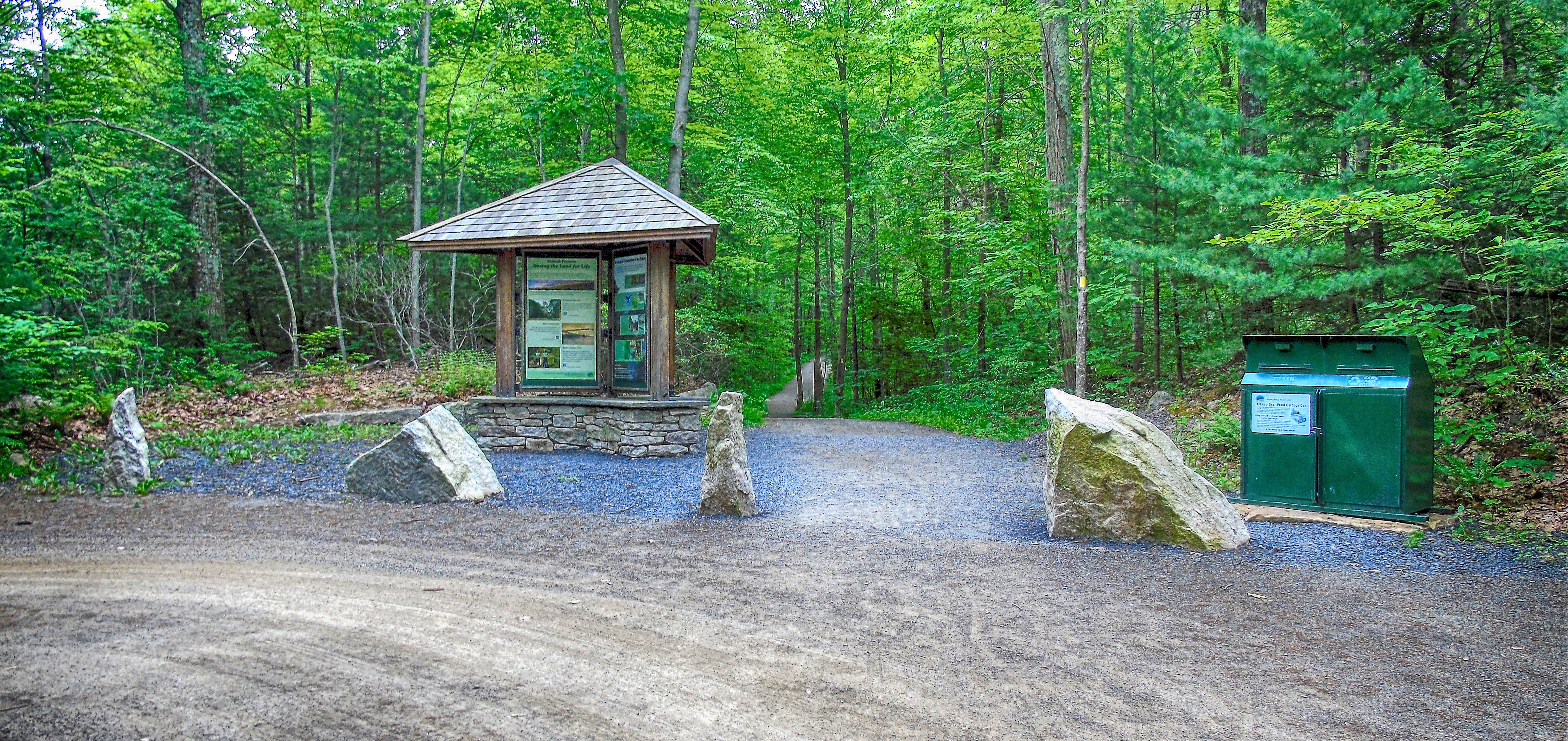
West Trapps Connector Trail
We followed the yellow-blazed West Trapps Connector Trail, which heads east, parallel to Route 44/55.
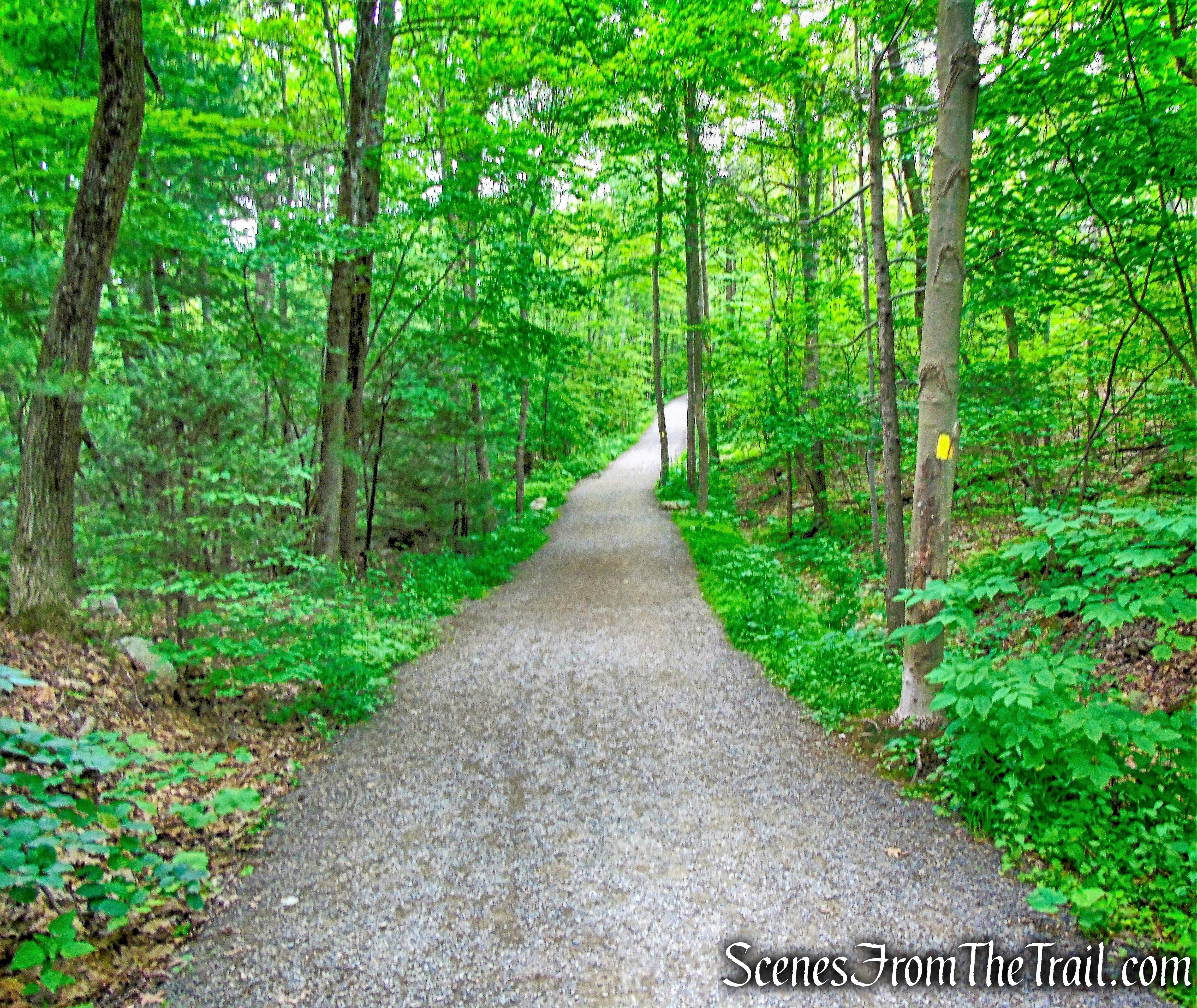
West Trapps Connector Trail
In about 600 feet, we turned left onto the start of the red-blazed Shongum Path, the route of an old Lenape Indian trail.
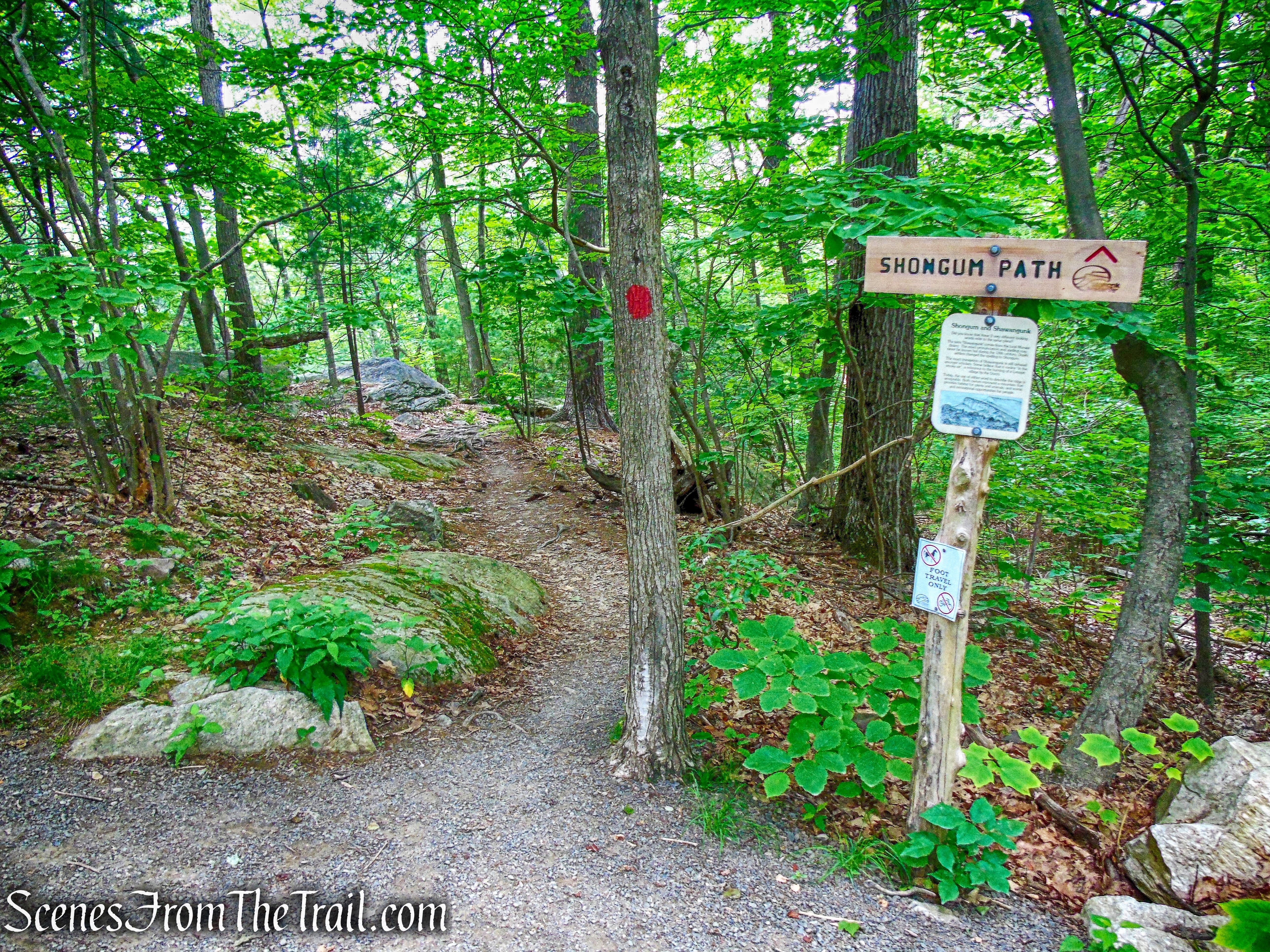
Shongum Path
The Shongum Path descends gradually over bare rock at first, as it heads north. Along the way, I heard a loud commotion in the woods. I saw what appeared to be a Black Bear about 30-40 yards ahead of me, to the left of the trail. I saw black fur through the trees and at first thought it was a large dog, but by the time I got near to where I first saw it, there was no trace of anyone or anything.
Shongum Path
The trail travels through several wet areas on wooden planks. Eventually the trail veers to the northeast and parallels the Coxing Kill (creek), which is visible through the trees.
Shongum Path
After about 0.8 mile, we came to the terminus of the Shongum Path at a T-intersection with the blue-blazed Old Minnewaska Trail, a gravel road, and turned left.
Shongum Path
Now heading southwest, we crossed a wooden bridge that spans the Coxing Kill. We turned right and walked down to check out Split Rock.
Old Minnewaska Trail
The Coxing Kill plunges into a small gorge of solid rock and streams out on the other end into a pool.
Split Rock
Located at the site of the former Enderly Family sawmill, Split Rock has long been a favorite place for picnicking by the Coxing Kill. Luckily, we arrived at this spot at approximately 9:30 am and had the place to ourselves.
Split Rock
While there is no “official” swimming area or lifeguard, swimming seems to be allowed and this is a very popular swimming hole. The channel flows into a small sloped pool that is about 3-4 ft deep with a sandy/small rock bottom.
Split Rock Swimming Hole
We walked back up to the Old Minnewaska Trail and turned right. Alongside the trail are the Fieldstone foundations of a house and barn, and other outbuildings, which tell of the Enderly family farm, which occupied this place in the 19th century.
The Enderly House
For about a century, the Enderly family operated their farm, sawmill, and blacksmith forge on the Coxing Kill.
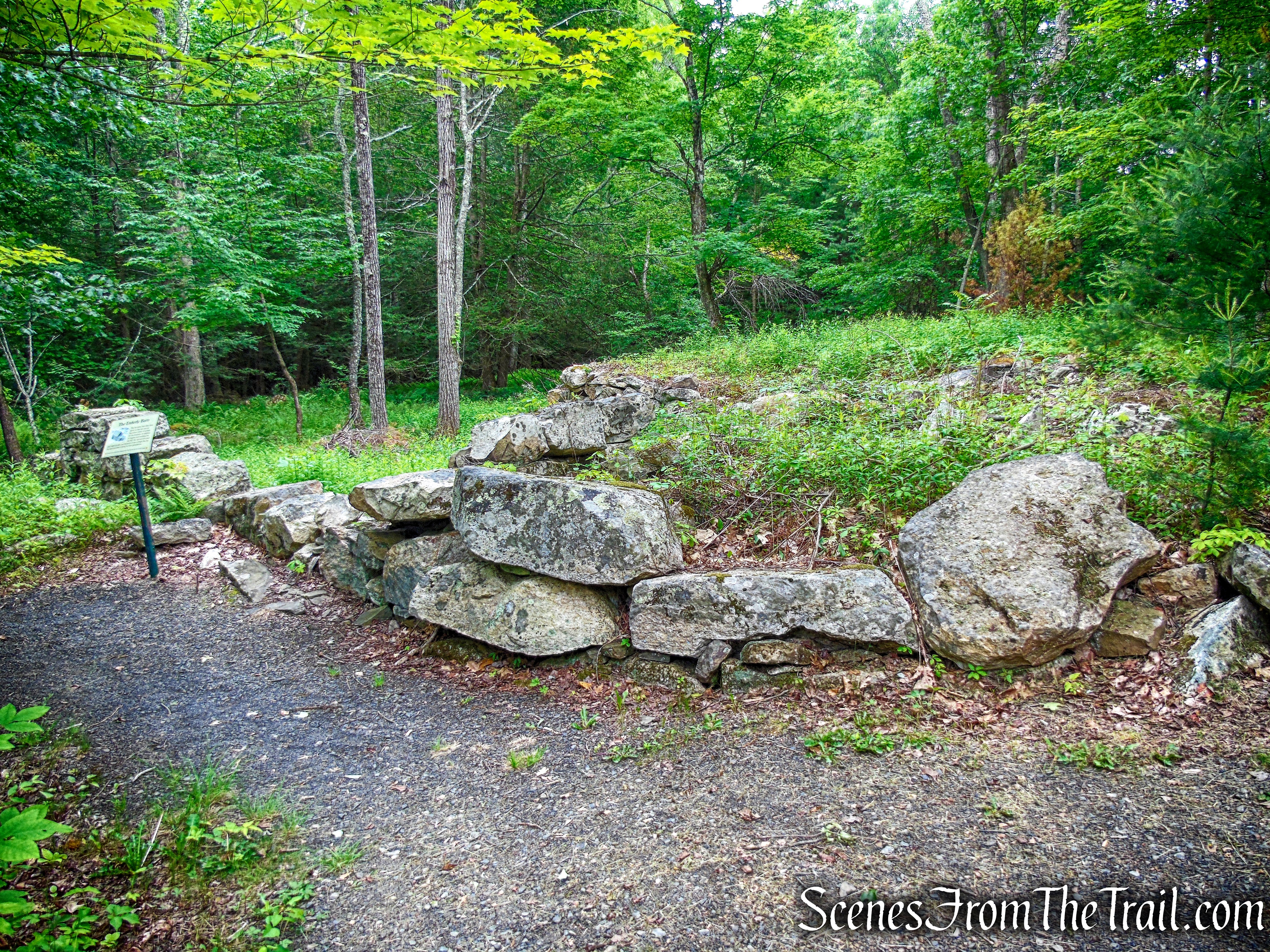
The Enderly Barn
A short distance ahead, we reached Clove Road and the end of the Old Minnewaska Trail. Just across the road is the Coxing Kill Parking Area.
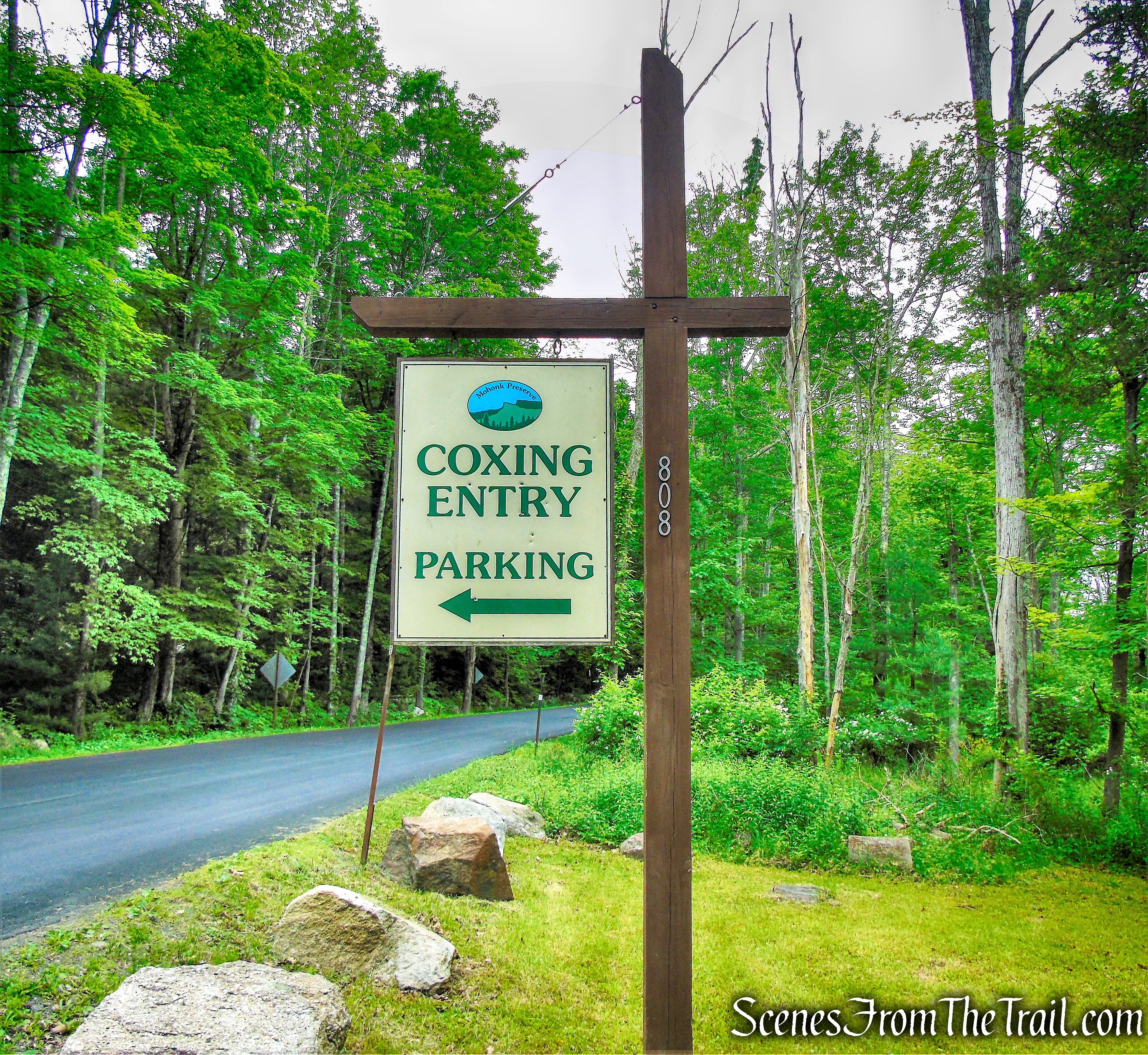
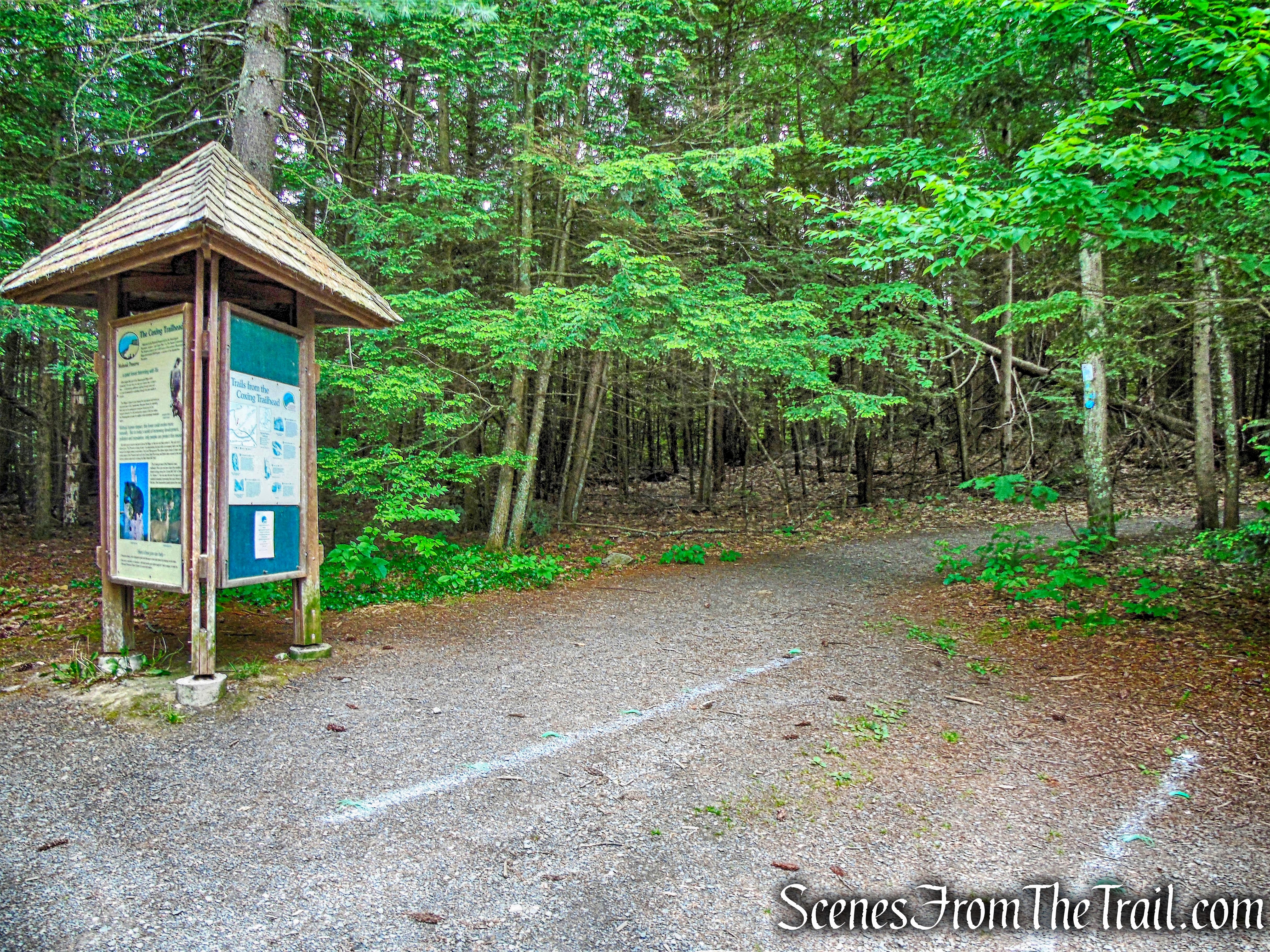
Coxing Kill Parking Area
At the southern end of the parking area, there is a kiosk, which marks the start of the light-blue-blazed High Peter’s Kill Trail. This is also the route of the blue-blazed Shawangunk Ridge Trail (SRT).
High Peter’s Kill Trail – Coxing Trailhead
The High Peter’s Kill Trail follows a woods road, passing the Enderly Burial Ground on the right.
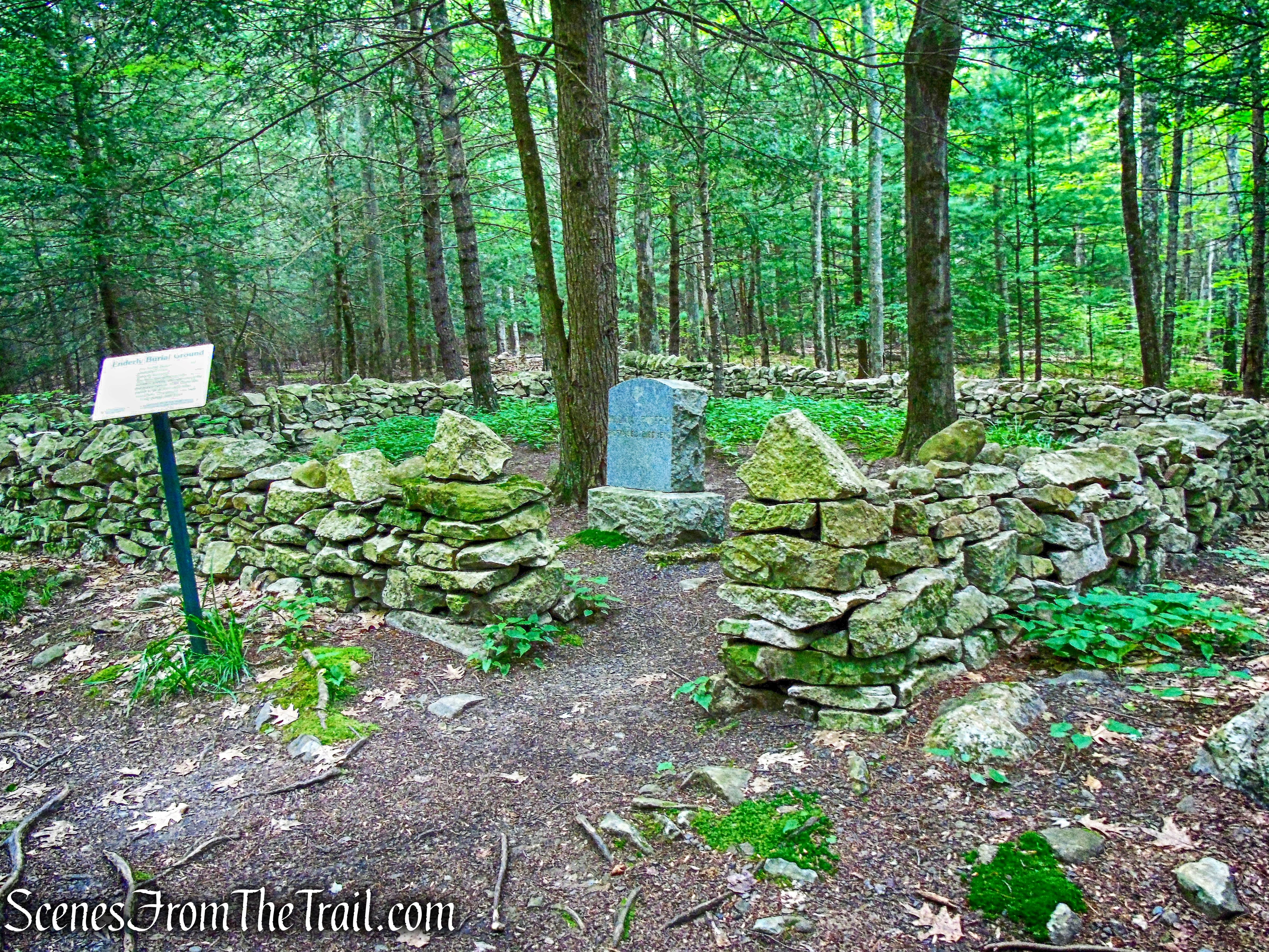
Enderly Burial Ground
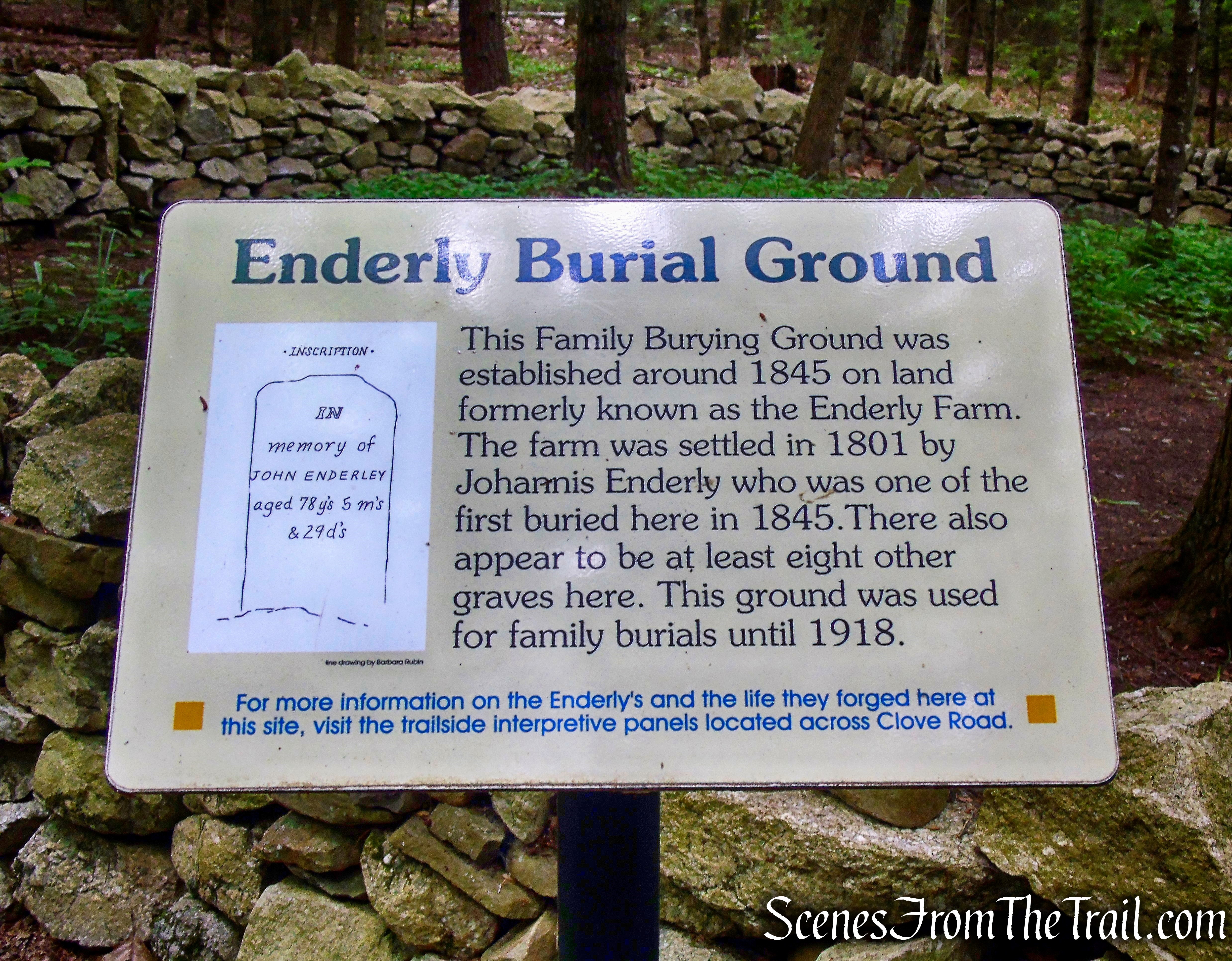
Enderly Burial Ground
The High Peter’s Kill Trail heads southwest then turns right, crosses a stream on rocks then turns left, now heading in a westerly direction.
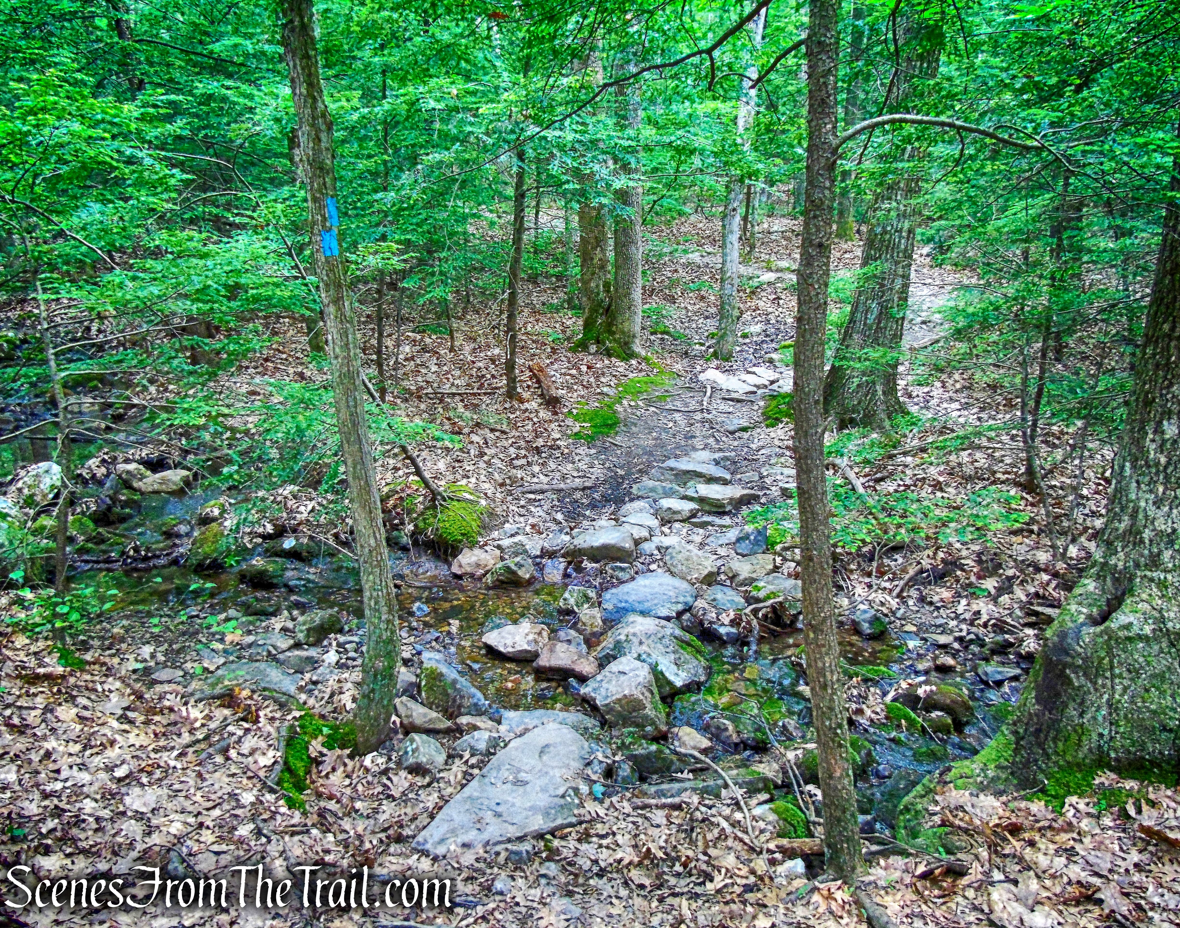
High Peter’s Kill Trail
The trail gradually ascends through the woods……
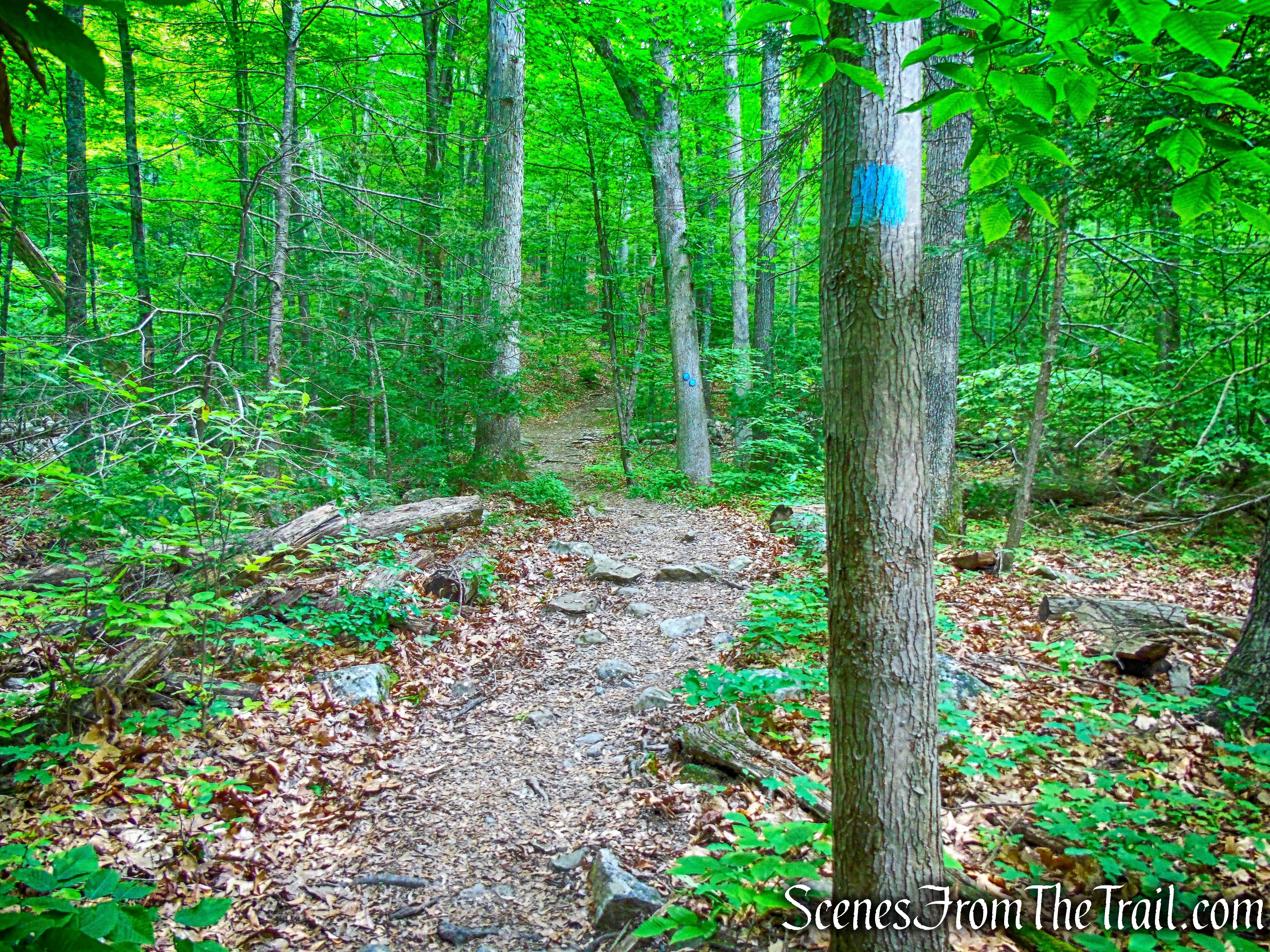
High Peter’s Kill Trail
and passes a junction with the King’s Lane Trail.
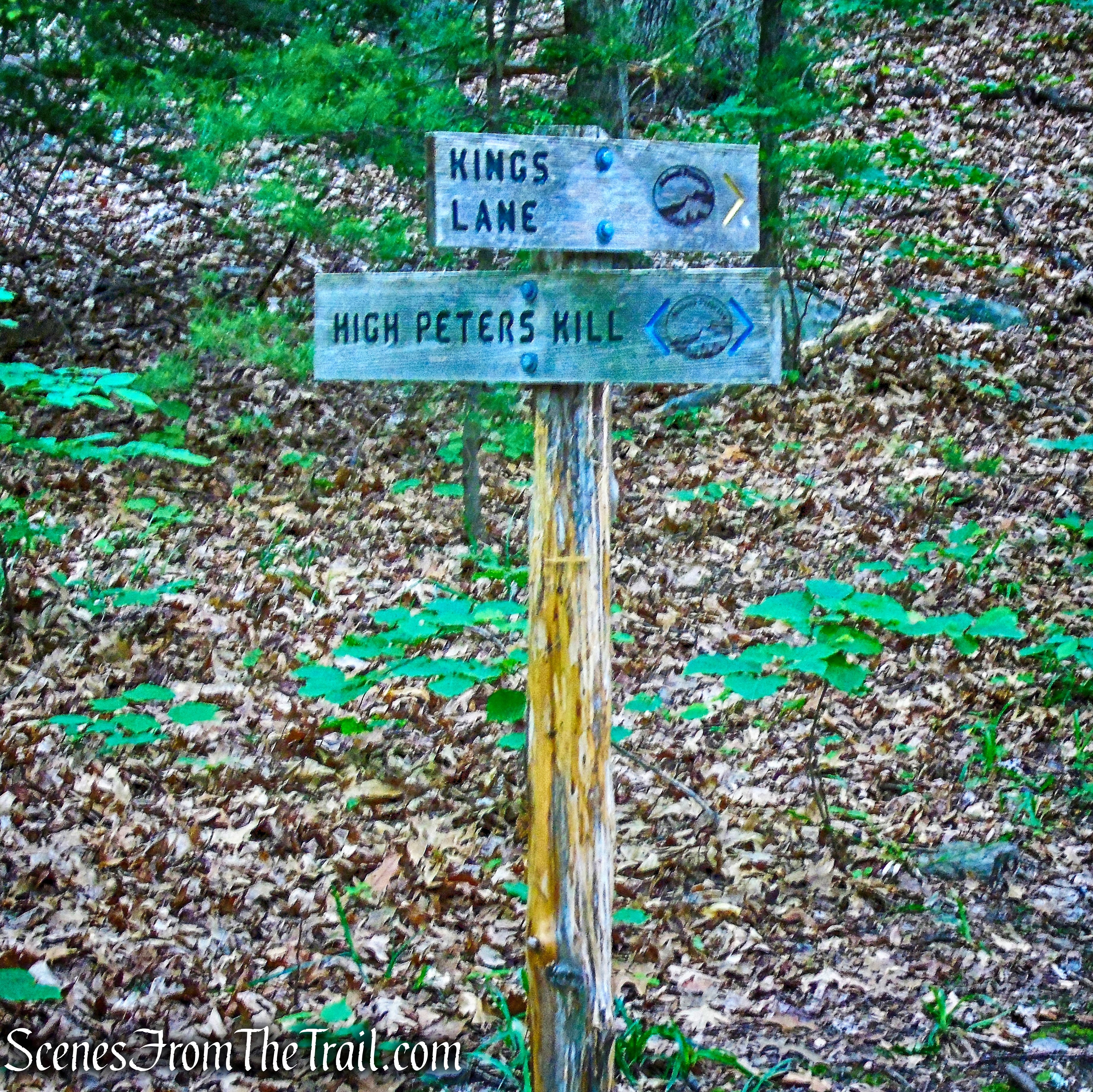
junction with the King’s Lane Trail
The ascent steepens as we continued heading west on the High Peter’s Kill Trail and entered Minnewaska State Park Preserve.
High Peter’s Kill Trail
The climb becomes very steep, with the trail routed over stone steps in places. For part of the way, the trail follows the Dugway, a 19th century woods road used to transport millstones quarried near here.
High Peter’s Kill Trail
High Peter’s Kill Trail
After passing lichen-covered rock outcrops and an interesting “cave” formed by an overhanging rock, the grade moderates.
High Peter’s Kill Trail
A short distance beyond the end of the steep climb, as the High Peters Kill Trail turns left, we veered right on an unmarked trail. In about 150 feet, there is an expansive east-facing viewpoint over the Trapps ridge, with the Sky Top tower of the Mohonk Mountain House visible to the northeast.
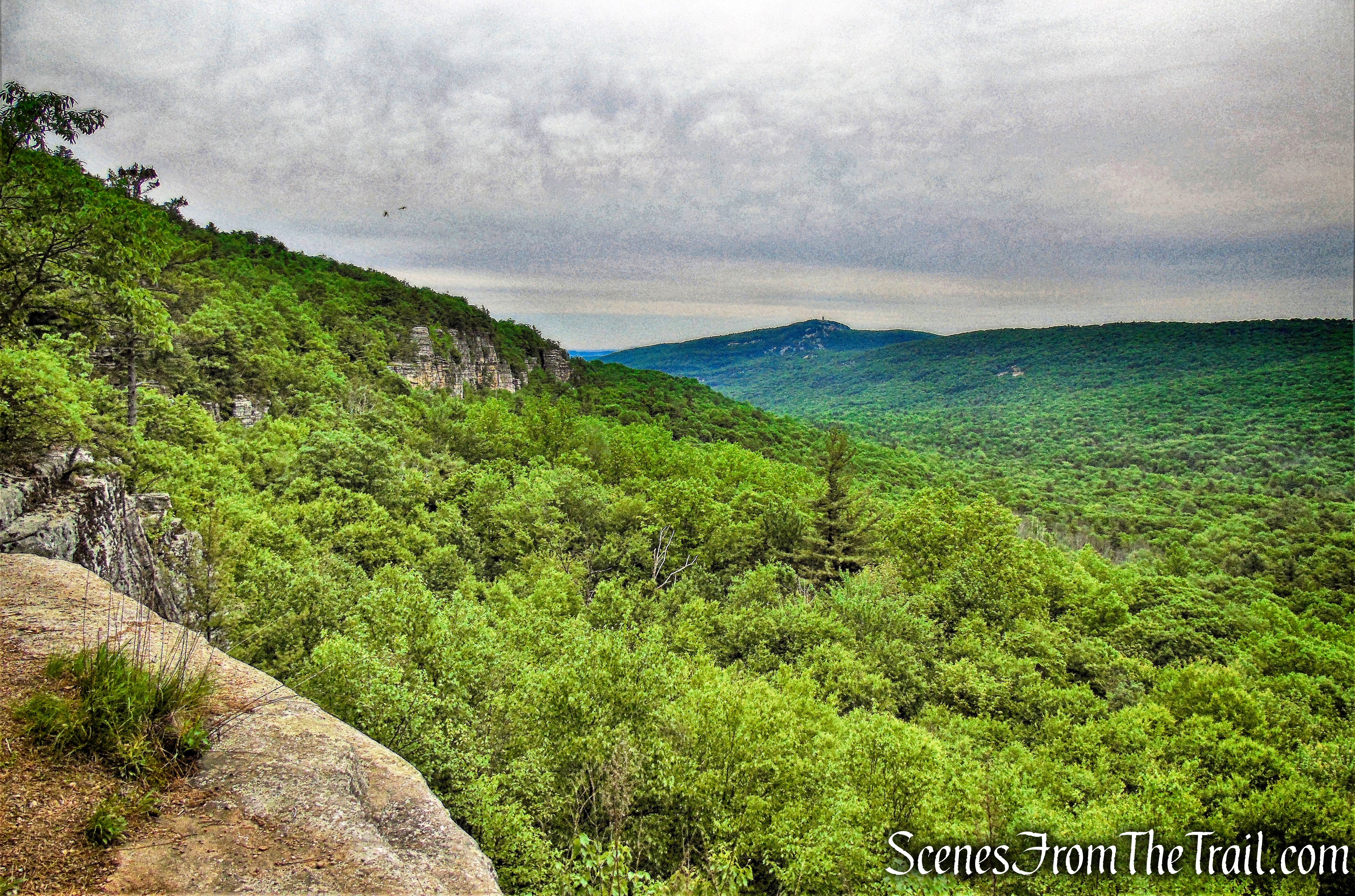
looking northeast with Dickie Barre on the left and Skytop (center) in the distance
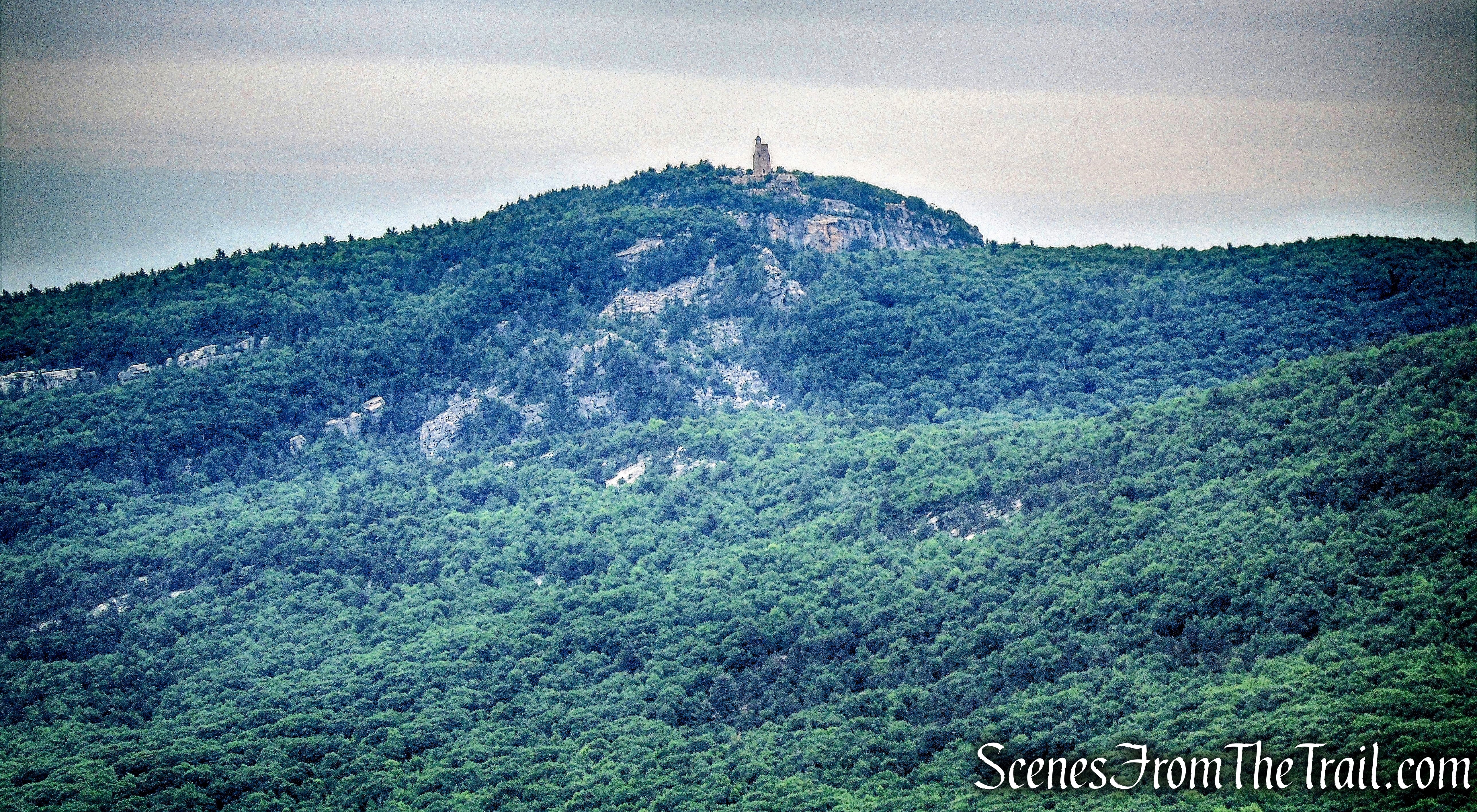
Sky Top tower
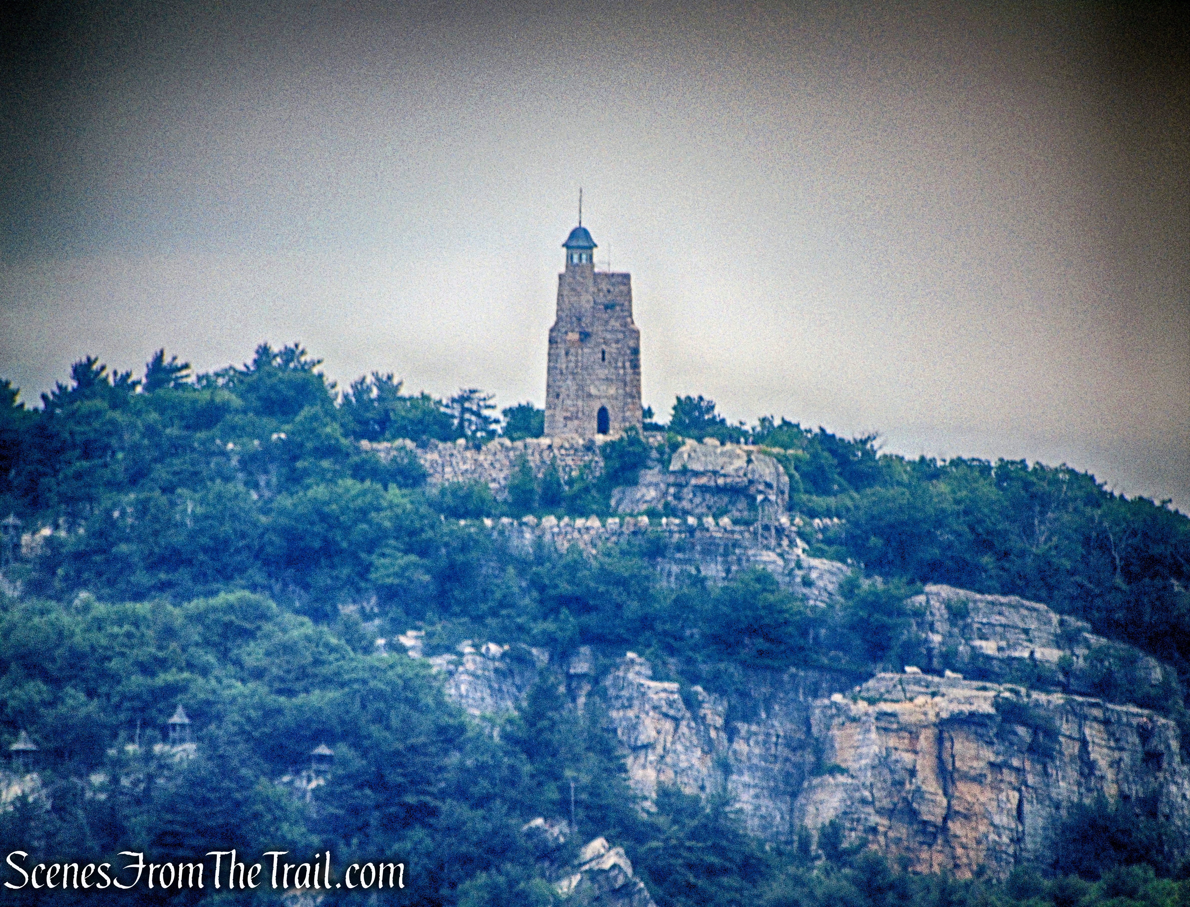
Sky Top tower
The cliffs of Dickie Barre.

cliffs of Dickie Barre
We sat here and took a short break while enjoying the view. To the left is the southern end of the Trapps ridge and the northern ridge of Millbrook Mountain is on the right. The Village of New Paltz may be seen through the narrow notch between The Trapps and Millbrook Mountain.
east-facing view
We returned to the High Peter’s Kill Trail and turned right. The trail now follows a relatively level path through blueberries and mountain laurel, with some pitch pines.
High Peter’s Kill Trail
Just below the crest of the rise, the white-blazed Bull Wheel Trail, which leads to the Peters Kill parking area on Route 44/55, begins on the left.
Bull Wheel Trail
Bull Wheel Trail
The Bull Wheel Trail descends gradually on an eroded woods road.
Bull Wheel Trail
In some sections, the trail narrows to a footpath.
Bull Wheel Trail
There are dual-colored-blazes on either side of the trail that are not on the hiking map. These trails are designated for rock climbing and bouldering, which require a permit, which can be purchased at the Peter’s Kill Parking Area.
rock climbing and bouldering trail
The trail then passes through a flat open area over rock slabs.
Bull Wheel Trail
The trail passes a concrete slab, with steel bolts protruding. A tower that was anchored to the slab via the bolts once supported a pulley for a ski lift, part of the Ski Minne downhill ski area, which operated from 1964 to 1978. The pulley is commonly referred to as a “bullwheel,” hence the name for the trail.
Bull Wheel Trail
The trail then widens back to a gravel road as it descends.
Bull Wheel Trail
After about 0.5 miles on the Bull Wheel Trail, it ends at a T-intersection with the Red Loop Trail.
T-intersection with the Red Loop Trail
We turned left on the Red Loop Trail and walked a short distance on the gravel road to the Peter’s Kill Parking Area. We took a short rest at a picnic table and enjoyed a snack.
Red Loop Trail
When we were ready to resume our hike, we walked out to Route 44/55 via the entrance road to the Peter’s Kill Area.
Peter’s Kill Area
Directly across the road from the entrance is the start of the white-blazed Awosting Falls Connector Footpath.
Awosting Falls Connector Footpath
This short white-blazed footpath connects the Peter’s Kill Parking Area to the Awosting Falls Carriage Road.
Awosting Falls Connector Footpath
We took this trail a short distance to its terminus, at a T-intersection with the red-blazed Awosting Falls Carriage Road.
Awosting Falls Connector Footpath
We then turned left on the Awosting Falls Carriage Road and walked about 350 feet to the paved Lyons Road. Just beyond, the carriage road crosses paved Lyons Road and re-enters the Mohonk Preserve (the red blazes end here).
Lyons Road
The carriage road, now known as Trapps Road,
Trapps Road
continues around a hairpin curve….
Trapps Road
and in another two-thirds of a mile, crosses the Coxing Kill on a wooden bridge.
wooden bridge – Trapps Road
Coxing Kill
Trapps Road continues to parallel Route 44/55, but for most of the way, the highway is located some distance from the carriage road and cannot be seen (although sounds of traffic can sometimes be heard).
Trapps Road
Along the way, we passed a junction for the Coxing Trail and about 0.5 mile later, we reached the junction with the red-blazed Bayards Path.
Bayards Path
Although carriage roads are normally nice to walk on, I was glad to leave it and jump back on a trail.
Bayards Path
The red-blazed Bayards Path ascends on a moderate grade to the saddle of Millbrook Mountain.
Bayards Path
The narrow footpath is overgrown in some spots.
Bayards Path
In about 0.21 mile, the trail ends at a T-intersection with the Millbrook Ridge Trail.
terminus of Bayards Path
Millbrook Ridge Trail
We turned left on the Millbrook Ridge Trail and began heading northeast along the ridge of Millbrook Mountain.
Millbrook Ridge Trail
This was the best part of the hike for me. The ridge walk was quite scenic and I enjoyed it very much. With no more real elevation gain, it was now a walk in the park, sort of speak.
Millbrook Ridge Trail
Millbrook Ridge Trail
Millbrook Ridge Trail
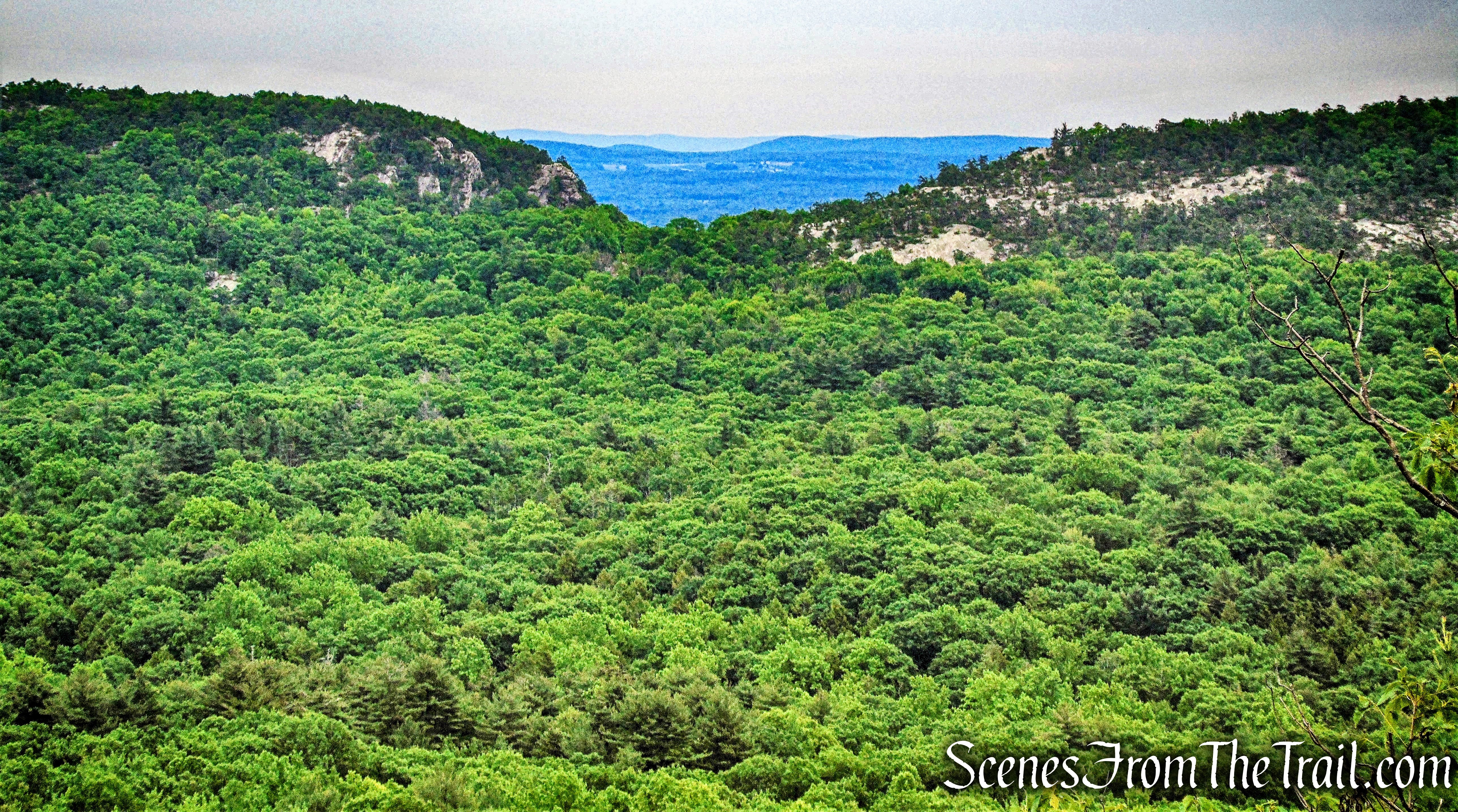
The trail passes some partial views along the ridge then comes to open rock ledges with more expansive views.
Millbrook Ridge Trail
Millbrook Ridge Trail
The trail continues over rock slabs along the ridge, with pitch pines.
Millbrook Ridge Trail
More views open up along the ridge, with the Catskill Mountains visible to the north. The Devil’s Path range of the Catskills.
Devil’s Path range of the Catskills – Millbrook Mountain
Directly northeast is the southern end of the Trapps.
Trapps – Millbrook Mountain
The trail comes out onto slanted rock with more views. The trail then descends steeply to the left of the boulder.
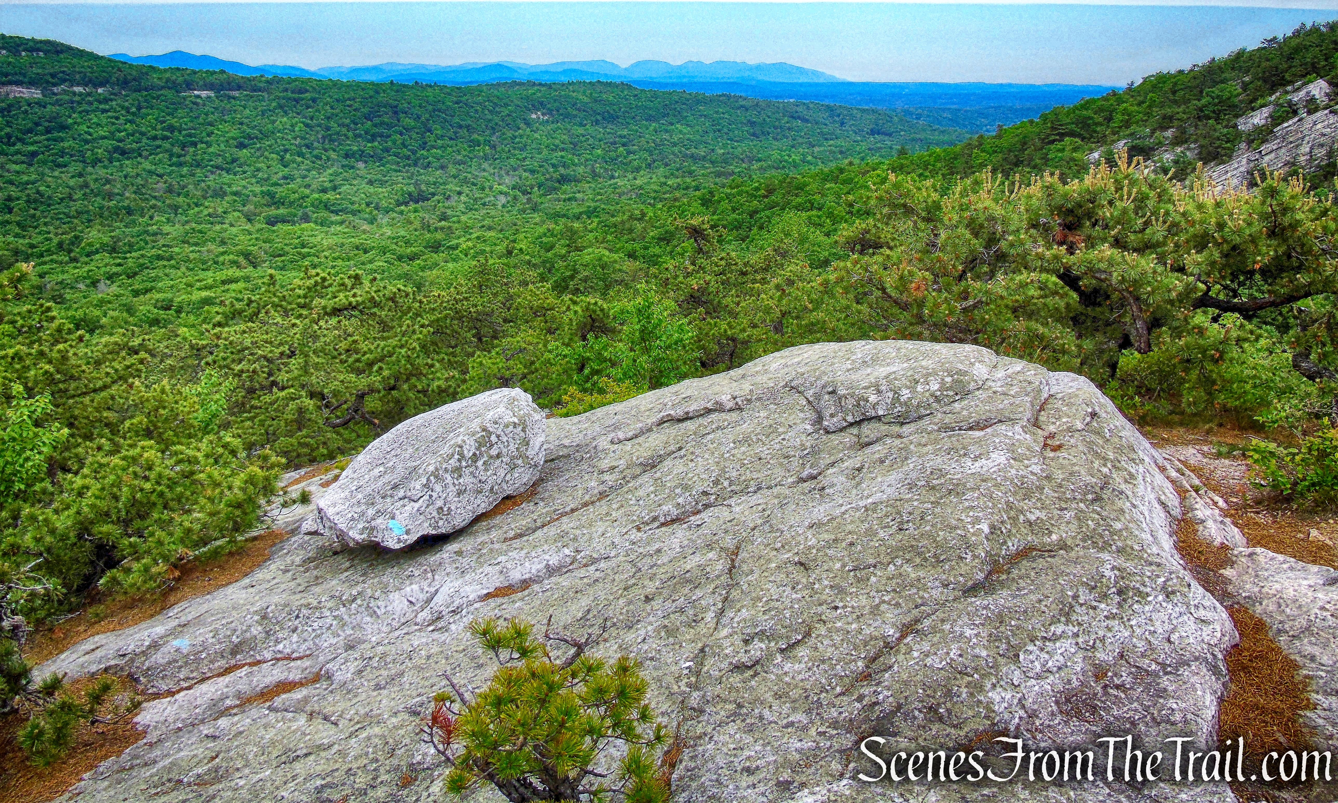
Millbrook Ridge Trail
I happened to see a survey marker along this spot as well.
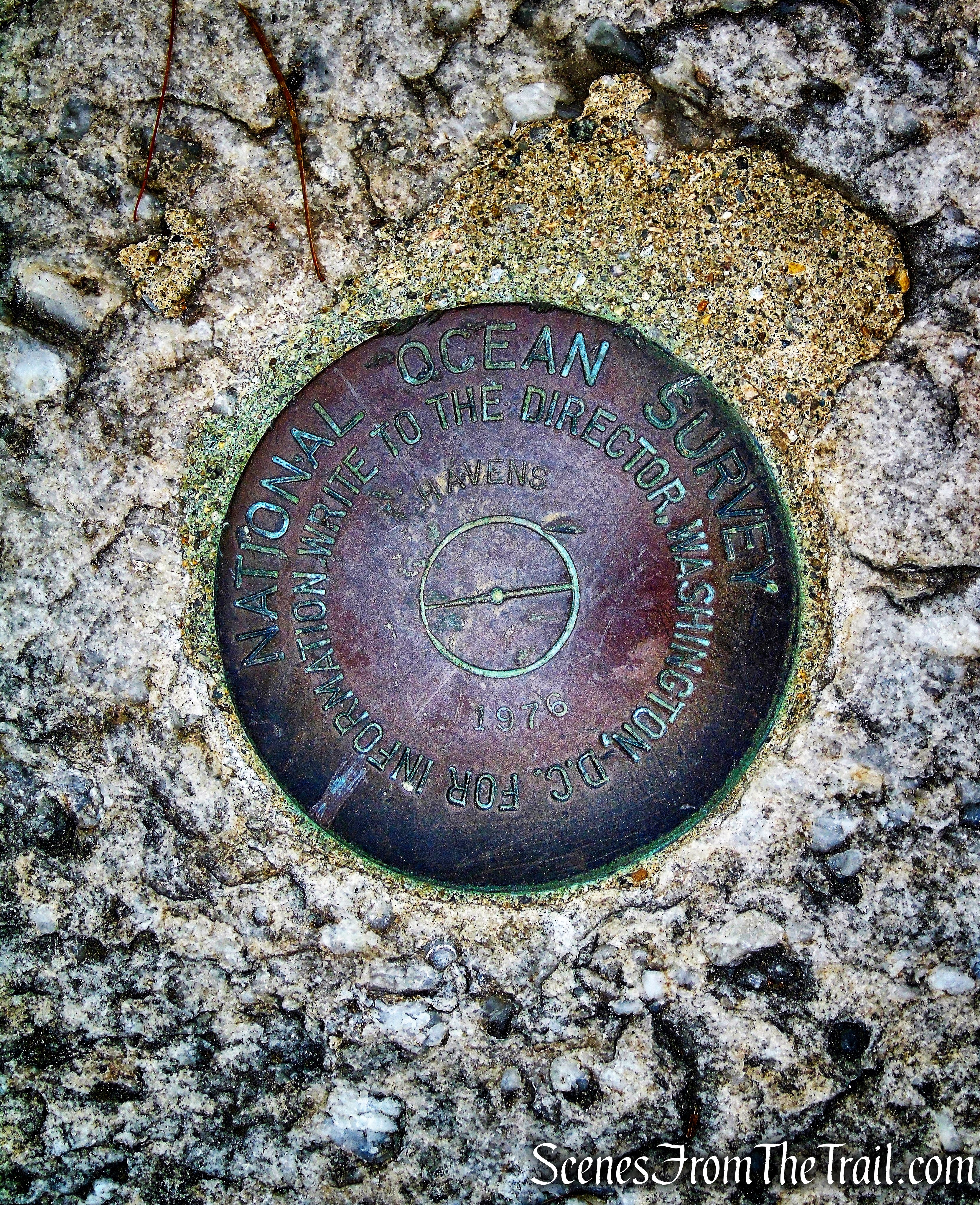
Millbrook Ridge Trail
There are still more views as the trail descends. Below, the cliffs of Dickie Barre.
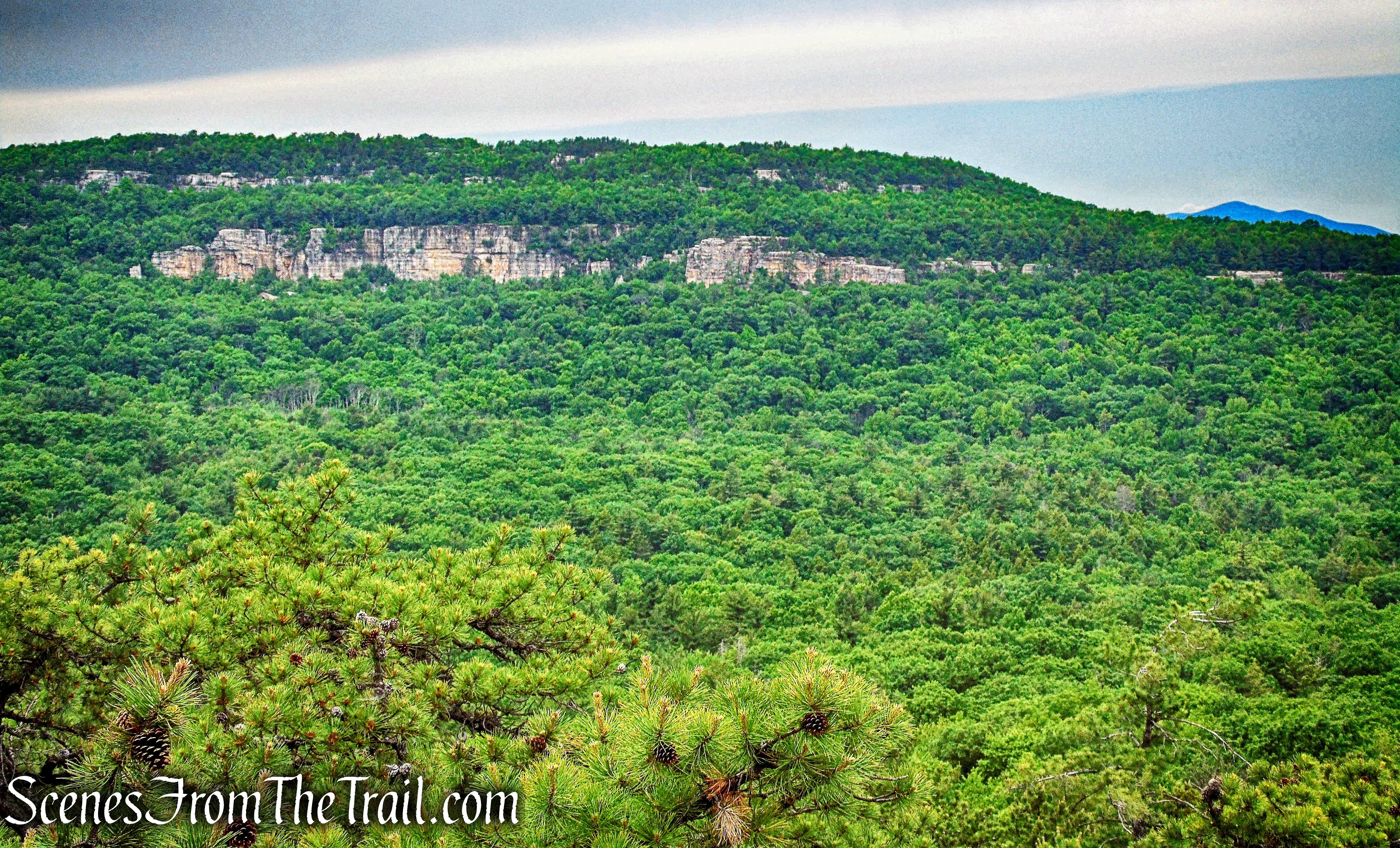
the cliffs of Dickie Barre
Ashokan Highpoint is visible to the right of Dickie Barre.
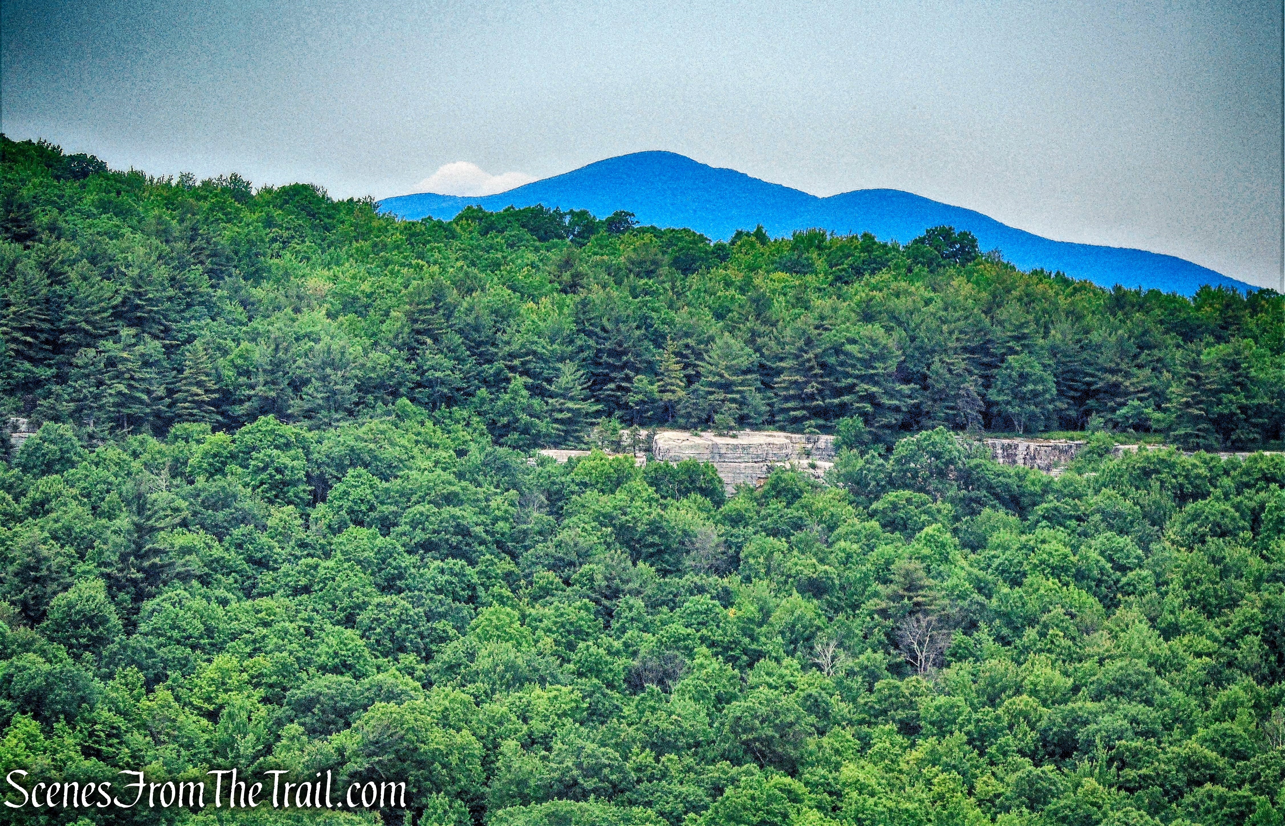
Ashokan Highpoint
The trail continues its steep descent over open rock slabs. This part of the hike was fun, especially because we didn’t have to climb up this way.
Millbrook Ridge Trail
After almost a mile of hiking the ridge, we descended to Trapps Road.
Trapps Road
We turned right on Trapps Road and walked about 150 feet to the Trapps Bridge.
Trapps Bridge
After crossing the Trapps Bridge over Route 44/55, we turned left, descended stone steps, and turned right on the yellow-blazed West Trapps Connector Trail that leads back to the parking area where the hike began.
On the way out, while driving by the visitor center on Route 44/55, a Black Bear came rolling down the hill and landed on the road. It promptly got up and crossed the road and I believe walked down into the visitor center parking area. I watched this through the rear view mirror as I drove.
This was another great hike in the Gunks. I was surprised at the lack of crowds along the way. We passed a few groups on the Millbrook Ridge Trail as we neared the end and several other hikers earlier. For a Saturday, we mostly had the trails to ourselves.
Pros: The Gunks, views, Split Rock, cliffs, well marked trails.
Cons: A little road noise along Trapps Road.
Take a hike!
High Peter’s Kill and Millbrook Ridge Loop – Mohonk Preserve
Sources:

Many years ago, I found the Millbrook Ridge to Minnewaska route. But it was a complete surprise to find myself at Lake Minnewaska, as I had taken a wrong turn after sunset. I wasn’t very happy with the long walk on the highway back to my car!
LikeLike