June 2, 2018 – North Castle, NY
Difficulty: Easy
Length: Approximately 3.6 miles
Max elevation: 490 ft.– total elevation gain approximately 347 ft.
Route type: Circuit
Map: Cranberry Lake Preserve Trail Map – Maps also available on site – History Trail Brochure
Trailhead parking: 1536 Old Orchard St. West Harrison, NY 10604
Cranberry Lake Preserve is a 190-acre park operated by the Westchester County Department of Parks, Recreation and Conservation. Since 1967, this park has been a safe haven for migratory birds, turtles, and dragonflies. The varied landscape includes a four-acre lake, cliffs, scrubland, mixed hardwood forest, vernal pools, and a swamp. Biking, fishing and dogs are prohibited to protect the nature reserve.
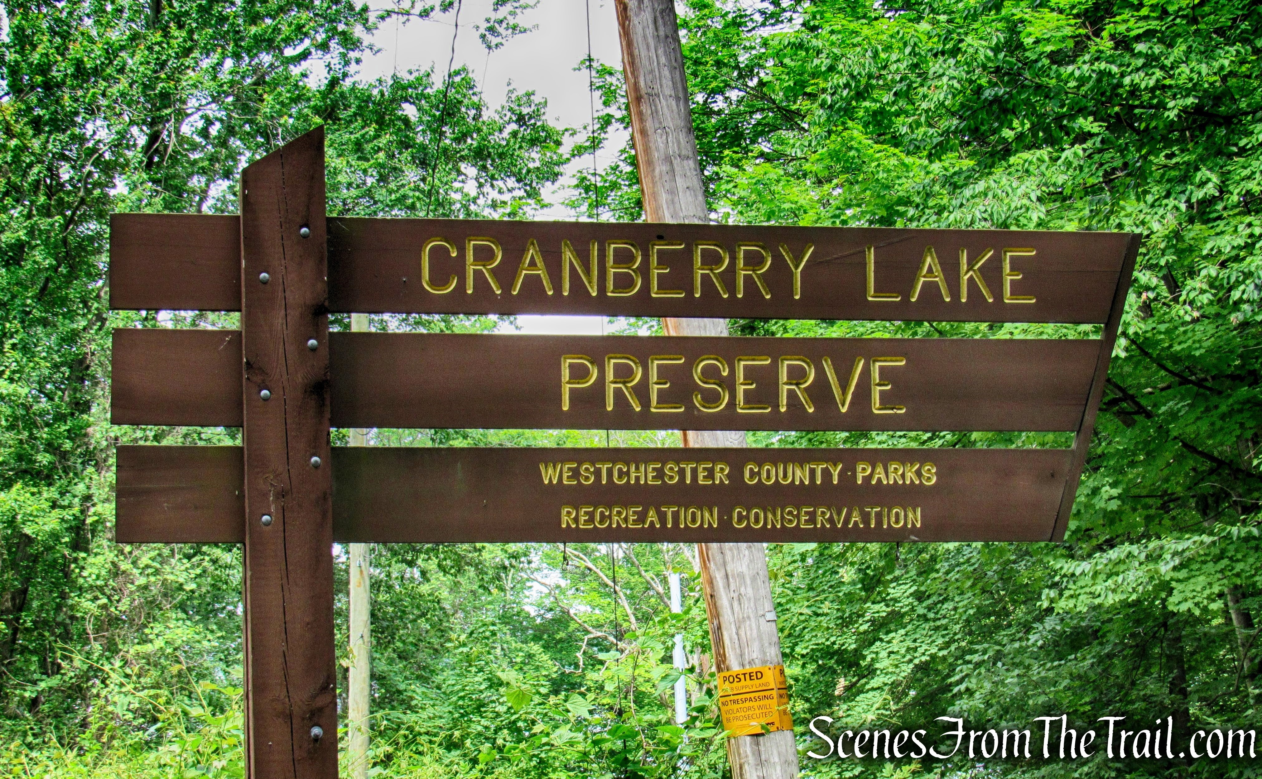
Cranberry Lake Preserve
Before Westchester County purchased much of what is now Cranberry Lake Preserve in 1967, the area played an instrumental role in the building of the Kensico Dam. Completed in 1917, the dam stands less than a mile away. Most of the stone used to build it, was mined from the area that is now the preserve.
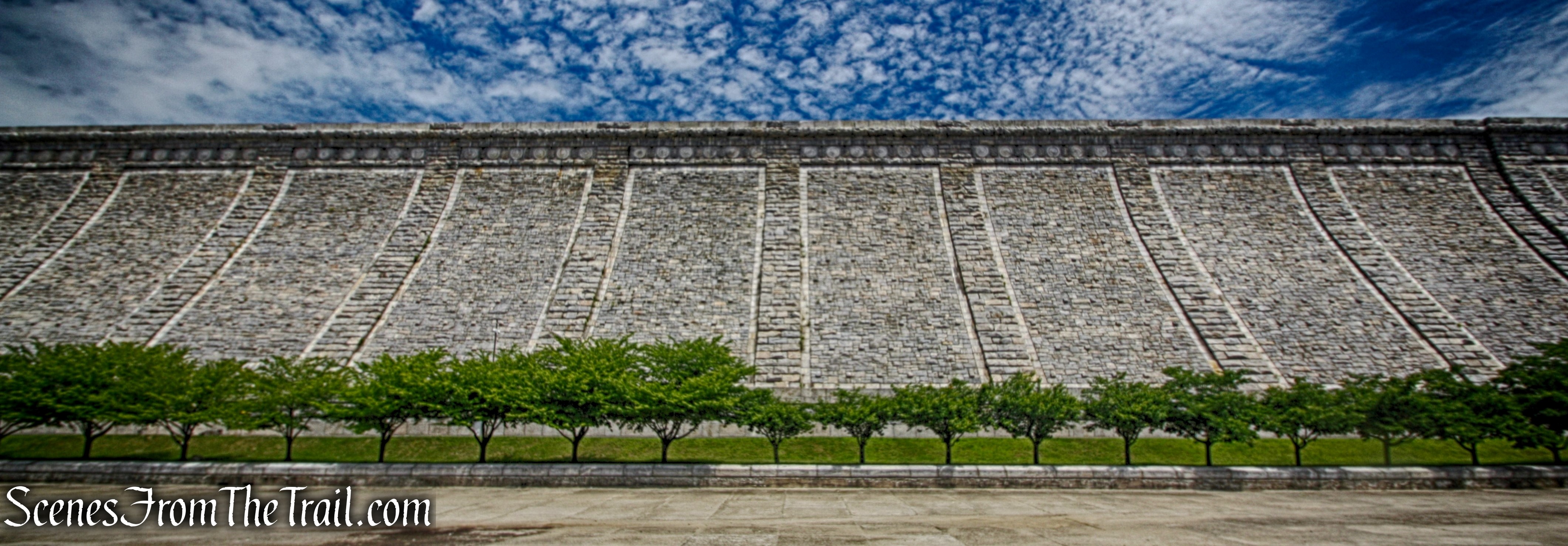
Kensico Dam
The dam was completed in 1917. It is 307 feet high and 1,843 feet long, and forms the Kensico reservoir. The construction of the dam began in 1913 and was concluded in 1917, three years ahead of schedule.
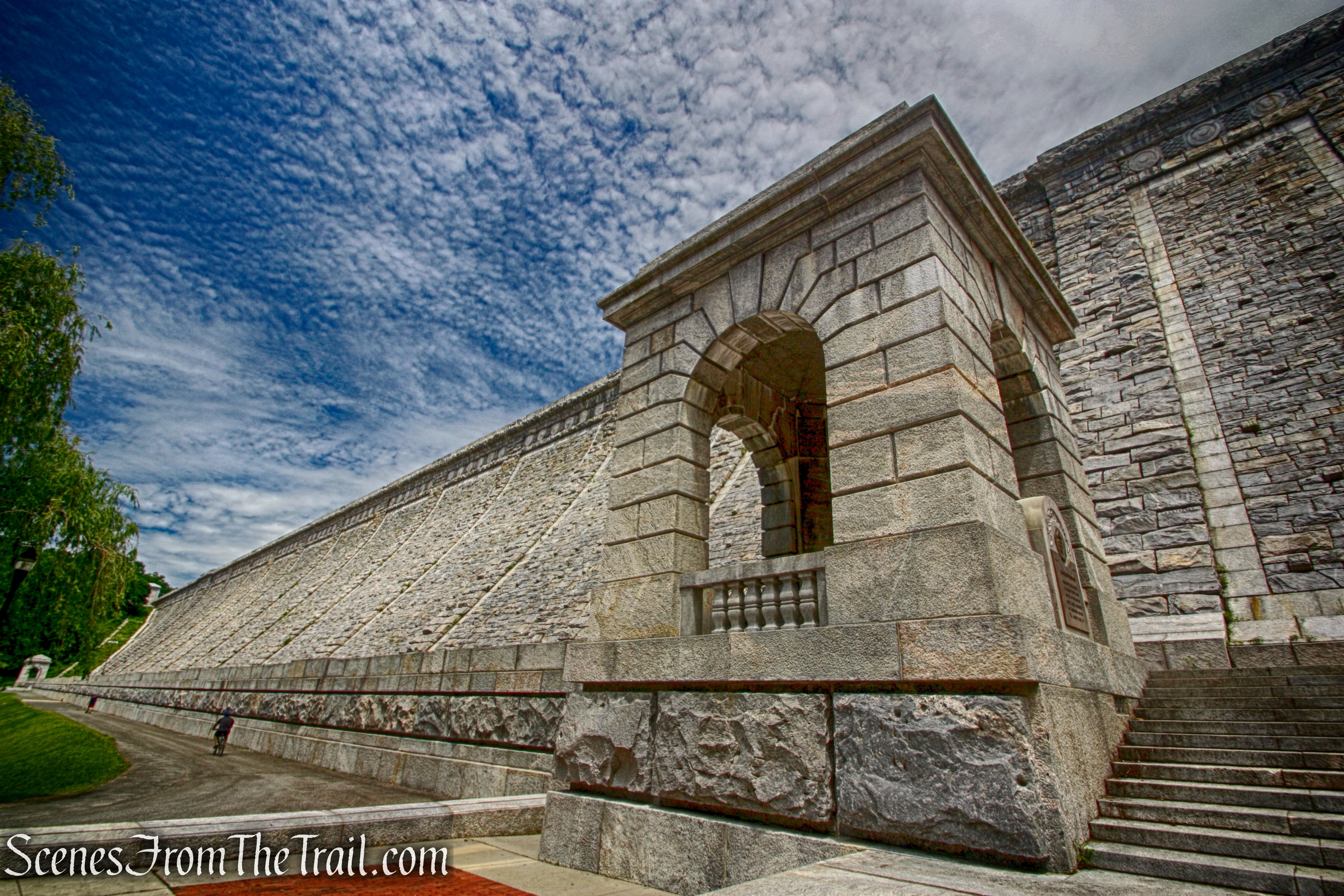
Kensico Dam
The history of the preserve and its role in the building of Kensico Dam, makes this place worthy of a visit in itself. There is a network of trails at the preserve and trail junctions are marked by numbered signs. This makes it easier to navigate the preserve with so many trails that intersect each other. The online map does not show the numbered junctions, but the kiosk near the nature center had plenty of maps that do.
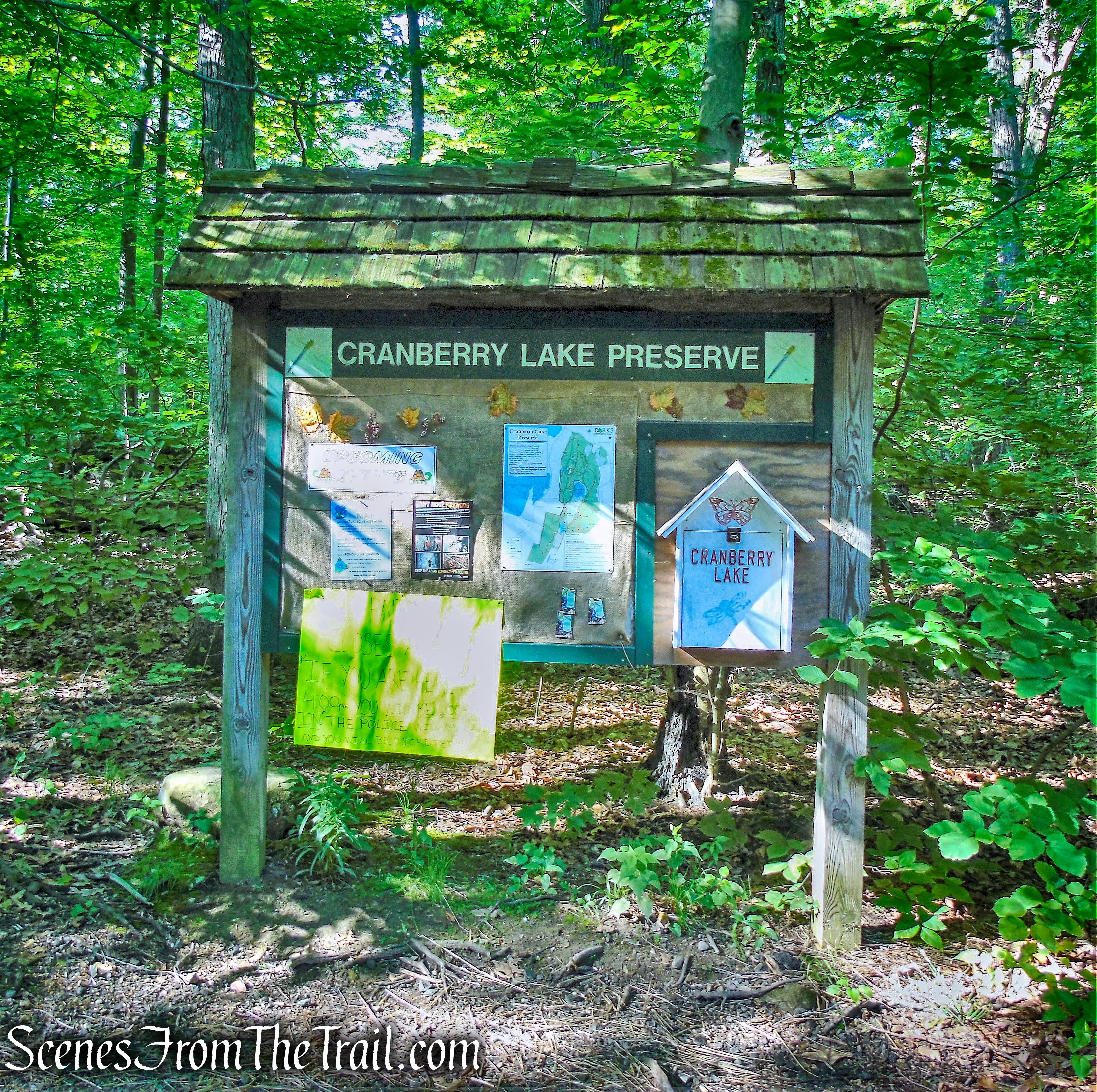
kiosk – Cranberry Lake Preserve
We arrived at the upper parking area, near the nature center, just before 8:30 am. The forecast was calling for possible showers around midday and I was trying to get a short hike in before the rains fell. Since this was close by, it was the perfect place to hike on this day. My thinking was that if the weather cooperated, we could extend the hike and if it rained, we could use any one of the number of connector trails to make a beeline back to the vehicle. We did this hike in a counterclockwise fashion from the nature center.
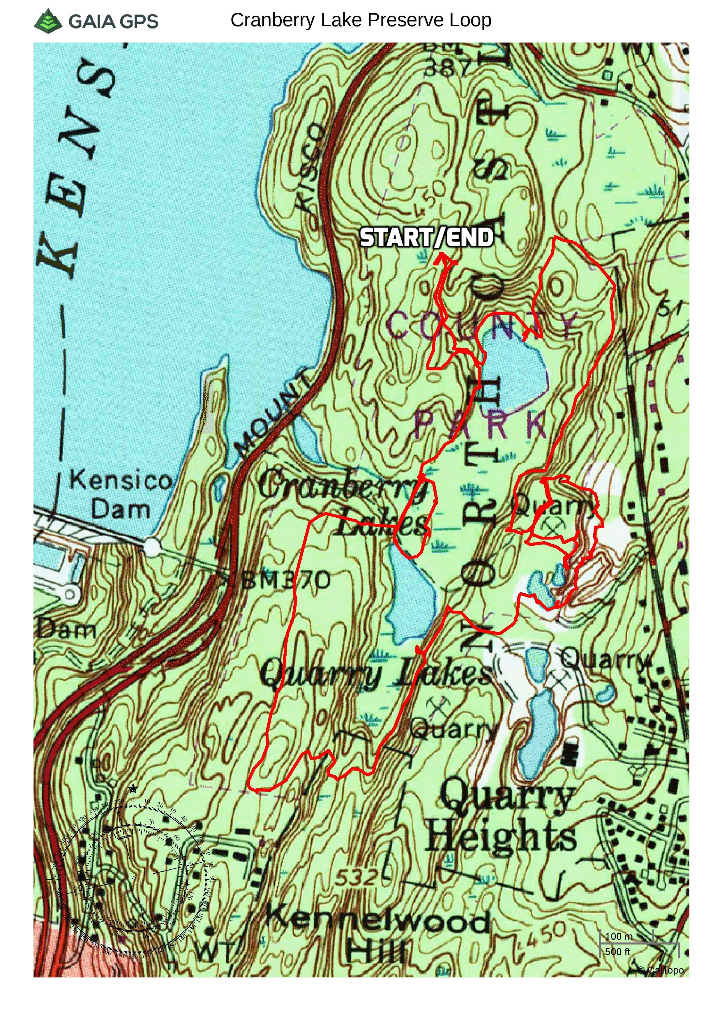
Cranberry Lake Preserve Loop
A new feature that I have added is the Google Earth Fly-Through. It follows the path that we hiked and it gives you a good idea of the terrain, layout, amount of parking etc. Check it out, it’s pretty cool.
View the Google Earth Fly-Through video of the hike below.
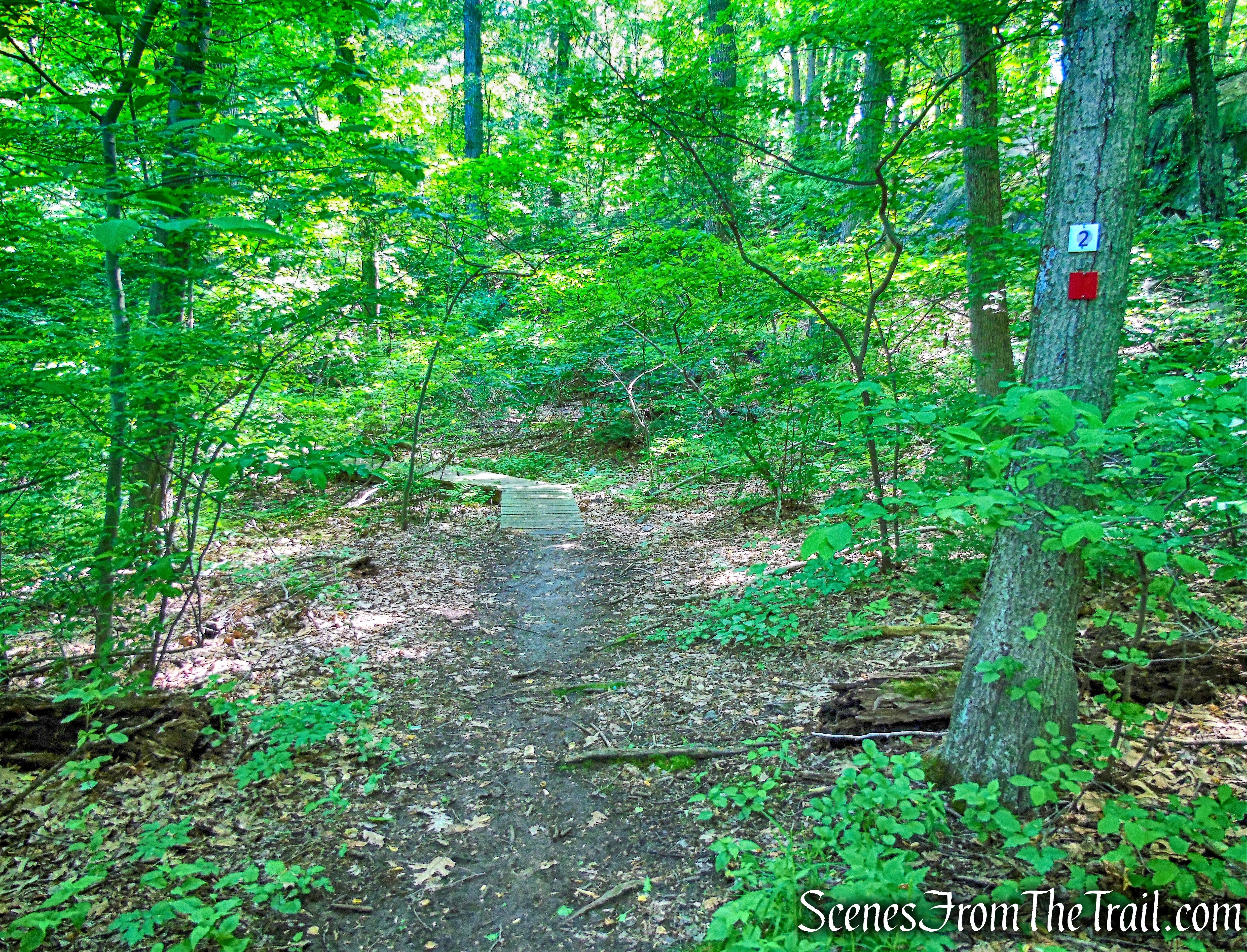
After obtaining a map at the kisok, we checked out the nature center briefly, then proceeded south on a wide yellow-blazed path.
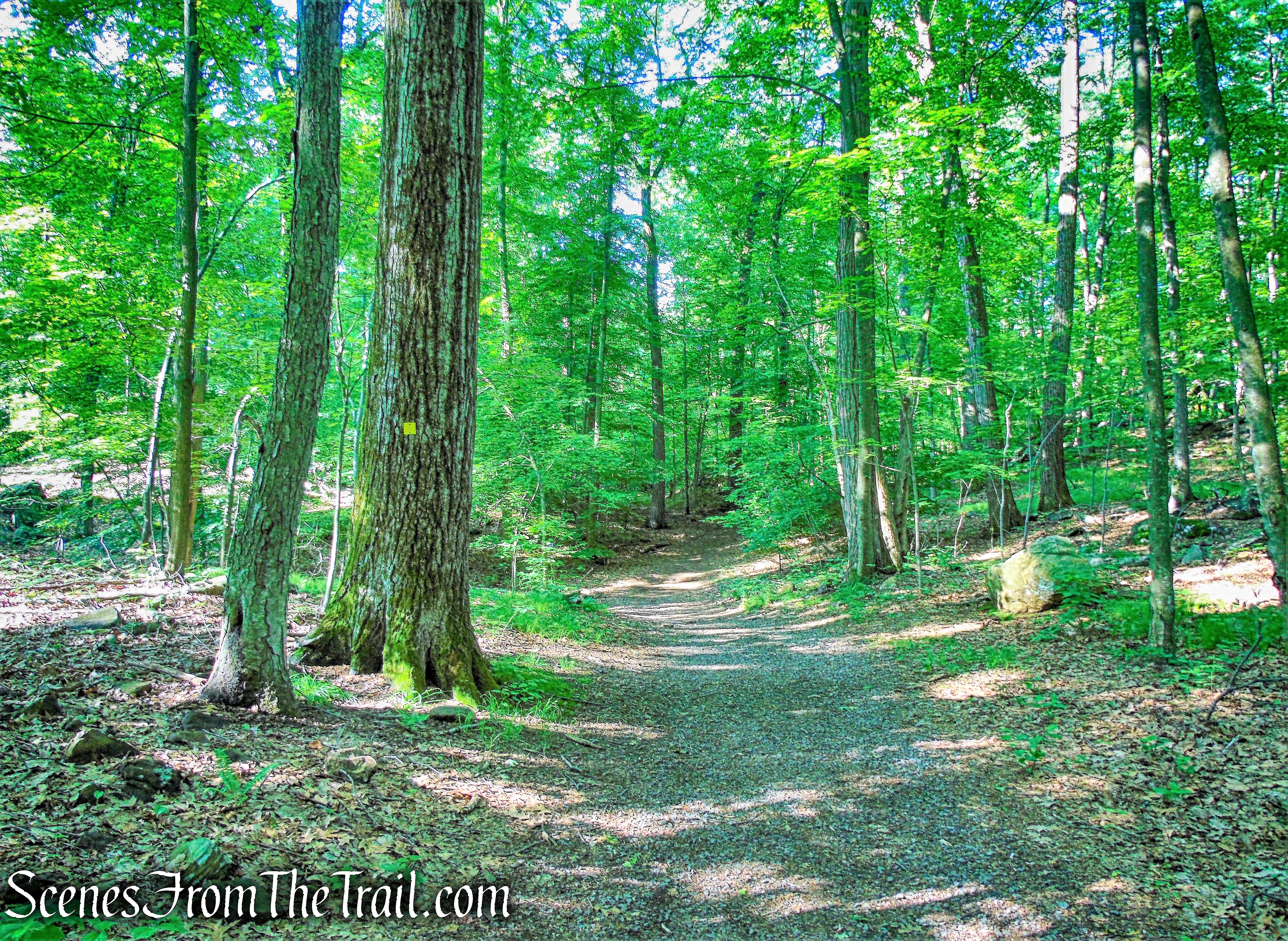
Yellow Trail
At a blue sign to the “Lake” (junction #4), we turned left and followed an orange-blazed trail downhill to the shore of Cranberry Lake.
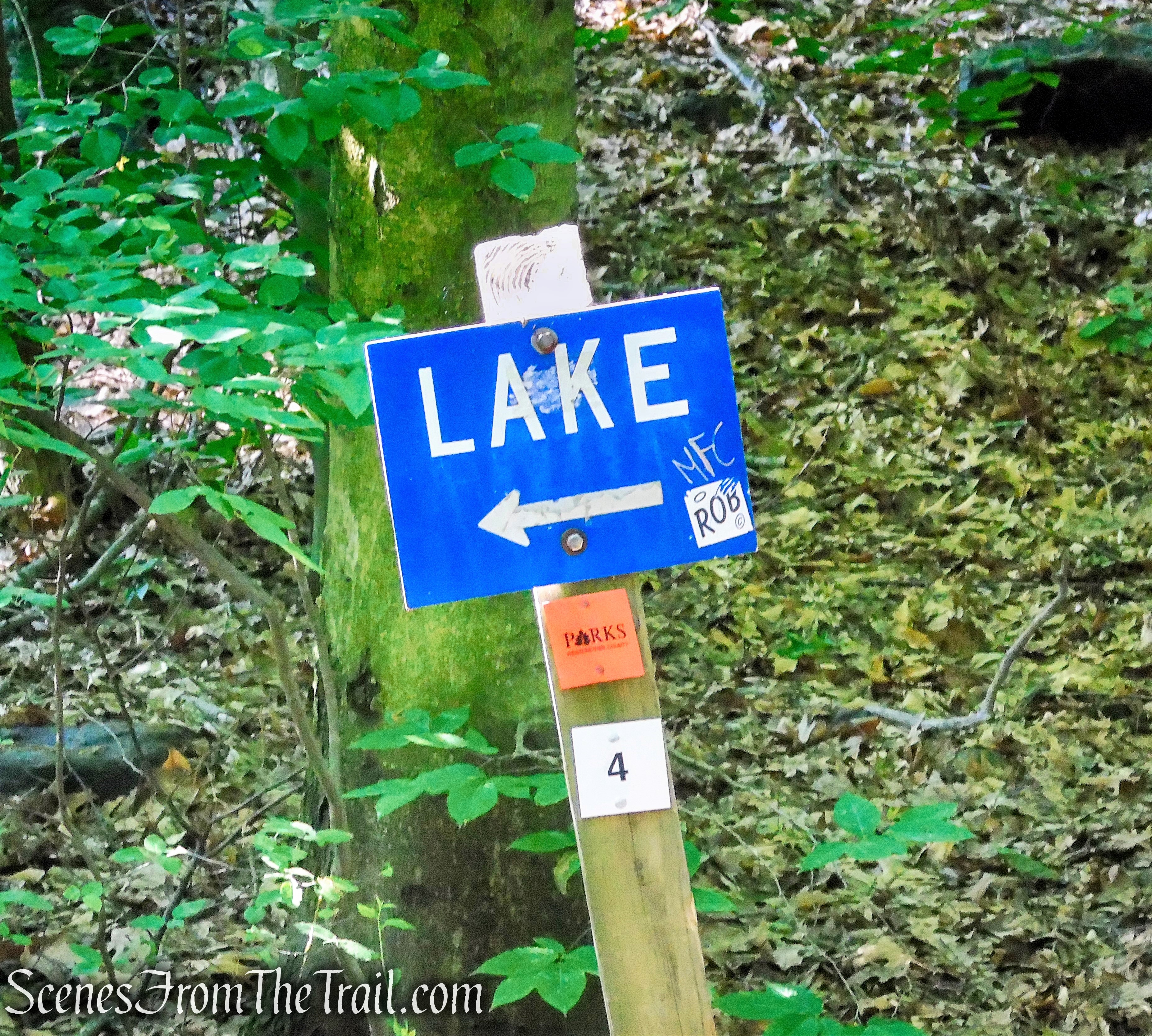
junction #4
Orange Trail
We then turned right (at junction #26) onto a trail with blue and yellow blazes, heading south along the west bank of Cranberry Lake.
Blue and Yellow Trail
After briefly following the lake shore, the trail climbs to ledges that overlook the lake. Cranberry Lake was carved out more than 18,000 years ago by a glacier during the last Ice Age. That glacier is estimated to have been one mile high and is the same one that formed Long Island. The lake is four acres with a maximum depth of 14 feet.
Cranberry Lake
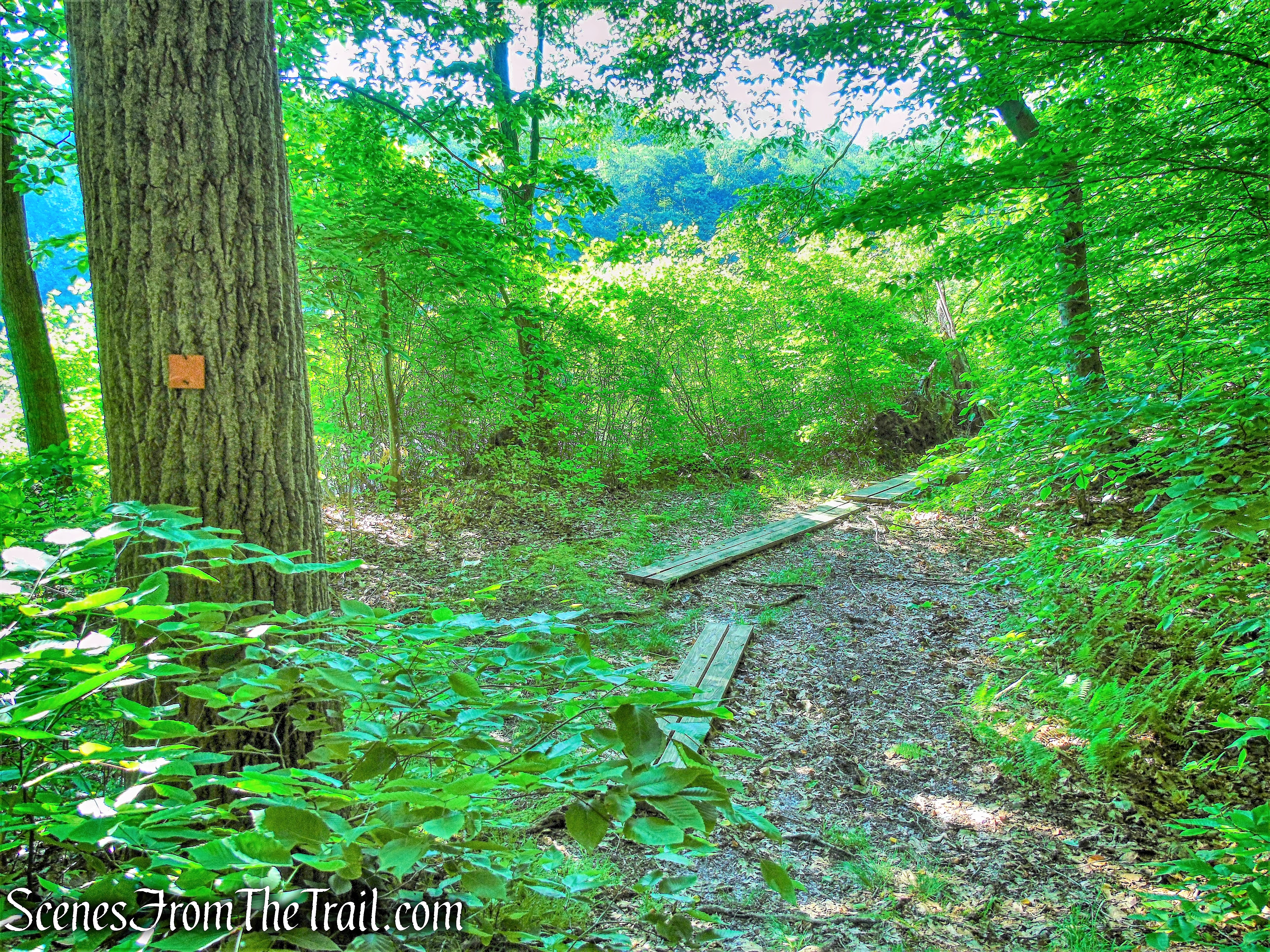
At the end of the lake, the trail descends, crosses a boardwalk and arrives at junction #6. We turned left onto a wide path, following blue, purple and red blazes, then turned left at the next junction (#7) onto an orange-blazed trail.

junction #7
junction #7
The trail immediately crosses the Bent Bridge over a swamp.
Bent Bridge
swamp
Bent Bridge
The trail runs along old stone walls and passes a stone chamber, possibly an old root cellar.
stone chamber
At the end of the orange trail (junction #16), we turned right onto a wide path (an old railroad bed) and followed it a short distance to a Y-intersection, with a sign for the New York City Watershed grown into a tree (junction #8).
junction #8
Bearing left here, we were now following the Red Loop Trail. On the right, marking the boundary between the park and New York City Watershed lands, is an expertly-laid dry stone wall, built over a century ago and still in nearly perfect condition today (except where damaged by fallen trees). Soon, the trail bears left and heads south, continuing to follow the wall.
Red Loop Trail
At the southern end of the park, with private homes visible ahead through the trees, the red trail turns left and begins to head east. The trail arrives at a sharp right turn, marked by a red arrow on a tree to the left, and heads downhill toward Hush Pond. The Red Loop Trail crosses the outlet of the pond on puncheons, bears left (north), and soon begins to parallel a wetland on the left. In a short distance, it joins a level dirt road, with cliffs on the right.
Red Loop Trail
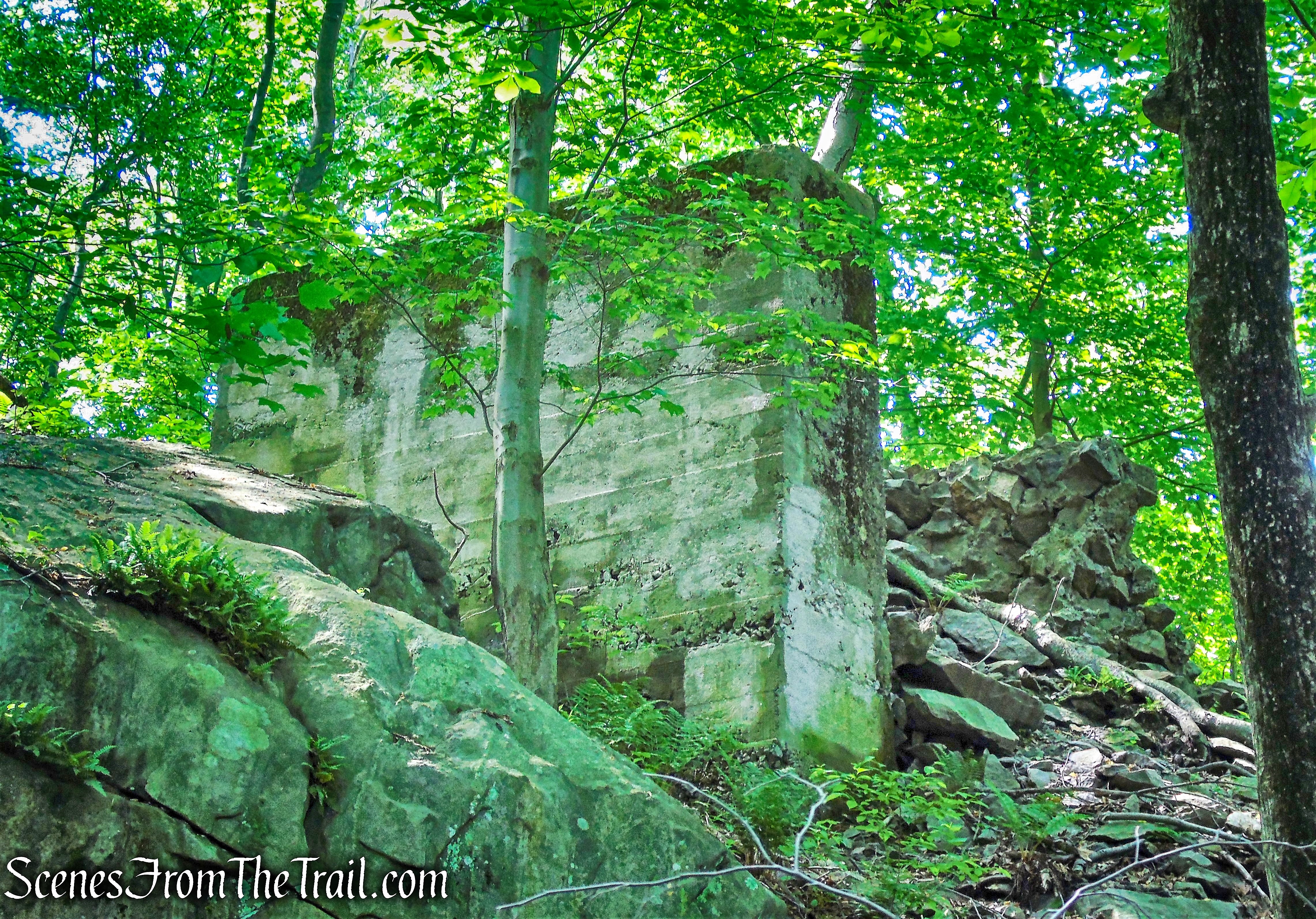
Soon, the cliffs are supplanted by a concrete wall. This is the foundation of the massive crusher used during the dam’s construction. It was built in 1912 and was capable of crushing 1000 cubic yards of gravel per day. Stone mined from the quarry that was too small to be used as dimension stone for the face of the dam was brought to the crusher to be minimized and used to make concrete.
crusher foundation – Red Loop Trail
Just beyond a crumbling section of the wall, the trail reaches junction #13, where a blue-blazed trail leads left to a wooden observation platform. Unfortunately, the view over South Pond is largely obscured by vegetation.
wooden observation platform
We returned to the main trail and turned left (north), now following both blue and red blazes. Soon, we reached a small cascade with a bench (junction #14).
junction #14
Here we turned right onto the Purple History Loop, marked with purple-on-white blazes, as it leads uphill.
Purple History Loop
The trail climbs briefly then levels off. It continues over a wet area on puncheons, then passes alongside an abandoned tennis court on the left.
Purple History Loop
The Purple History Loop continues past a junction with the White Trail and turns right. It then travels alongside the larger of the two quarry ponds. Formed during excavation, the larger pond was used by local residents in the 1960’s and became the “Birchwood Swim Club.” Up until its closure in the late 1990’s, members of the club also enjoyed use of the tennis courts, which we passed earlier.
quarry pond
As the trail continues into the quarry area, it passes by a wheelset, the wheel and axle assembly of a railroad car. 17 miles of railroad tracks once weaved through the area to deliver the stone while construction of the Kensico Dam was underway.
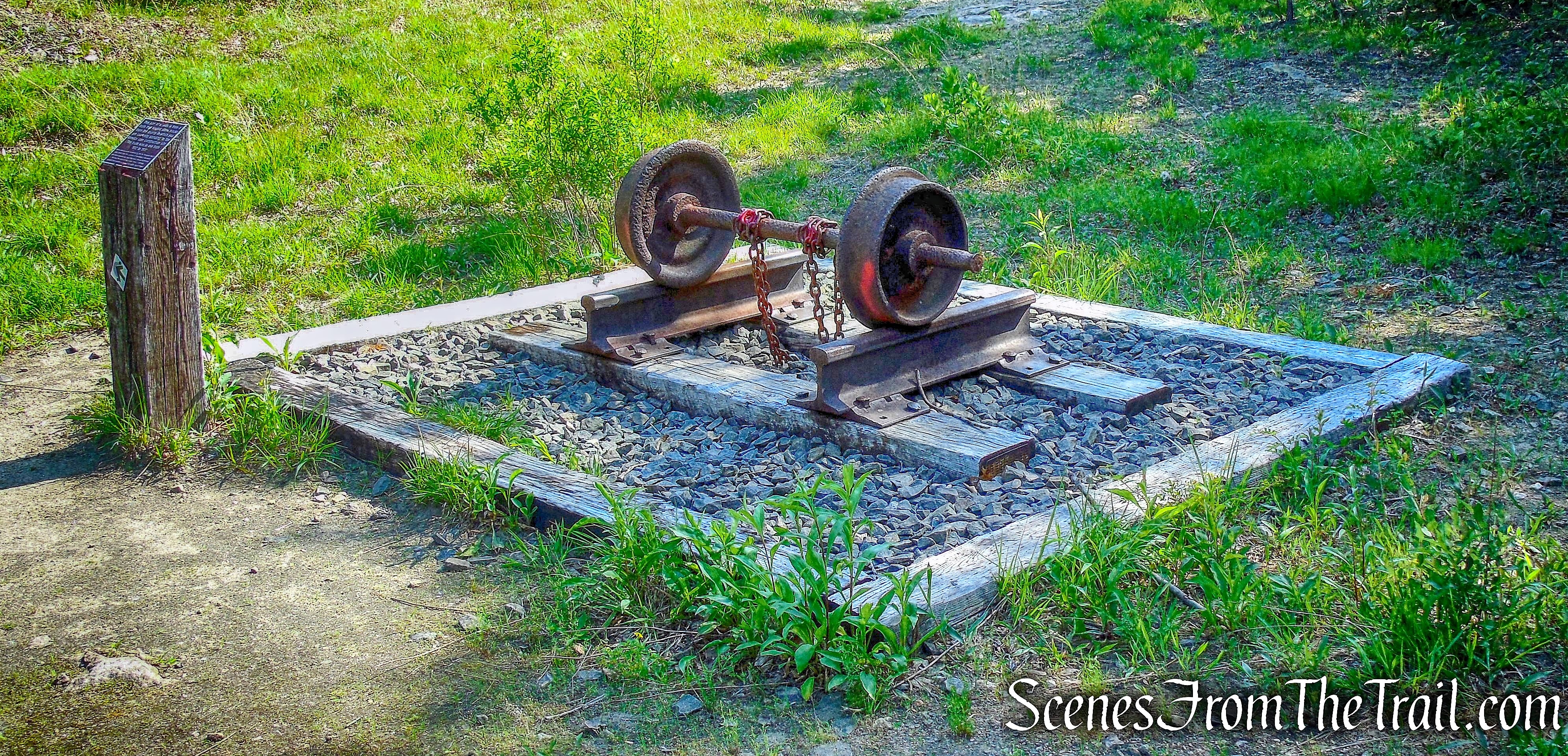
wheelset – Purple History Loop
Just past the wheelset, the trail climbs the quarry cliffs.
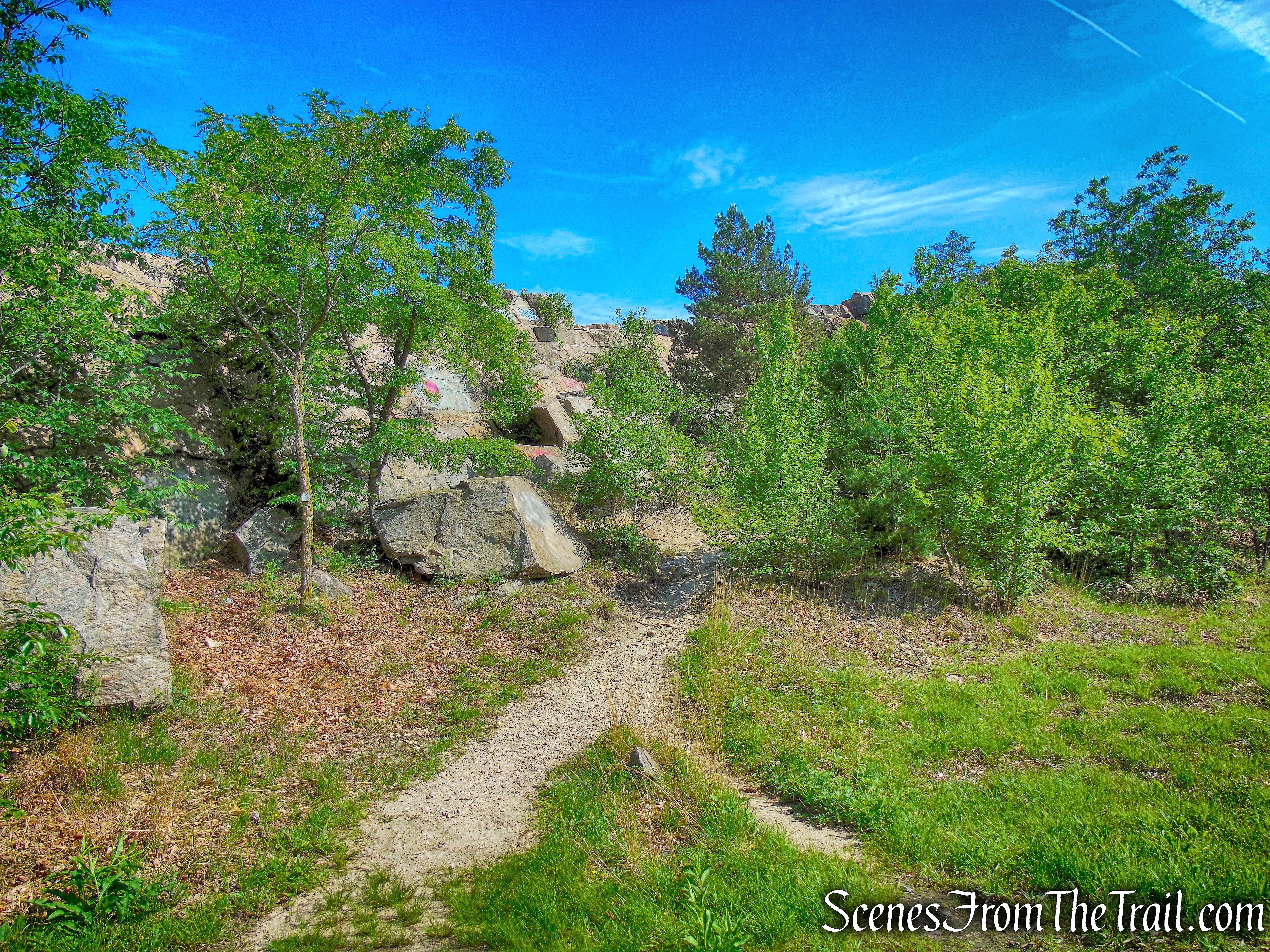
Purple History Loop
The first blast in the quarry occurred in 1913. A dozen huge derricks (large hoisting machines) were used to lift and load large stones for the face of the dam. In 1914, over two months time, 32.5 tons of dynamite were loaded into the
rock, creating the largest blast in the quarry, breaking up approximately 117,000 cubic yards of rock, that’s over 179 million pounds of stone.
quarry cliffs – Purple History Loop
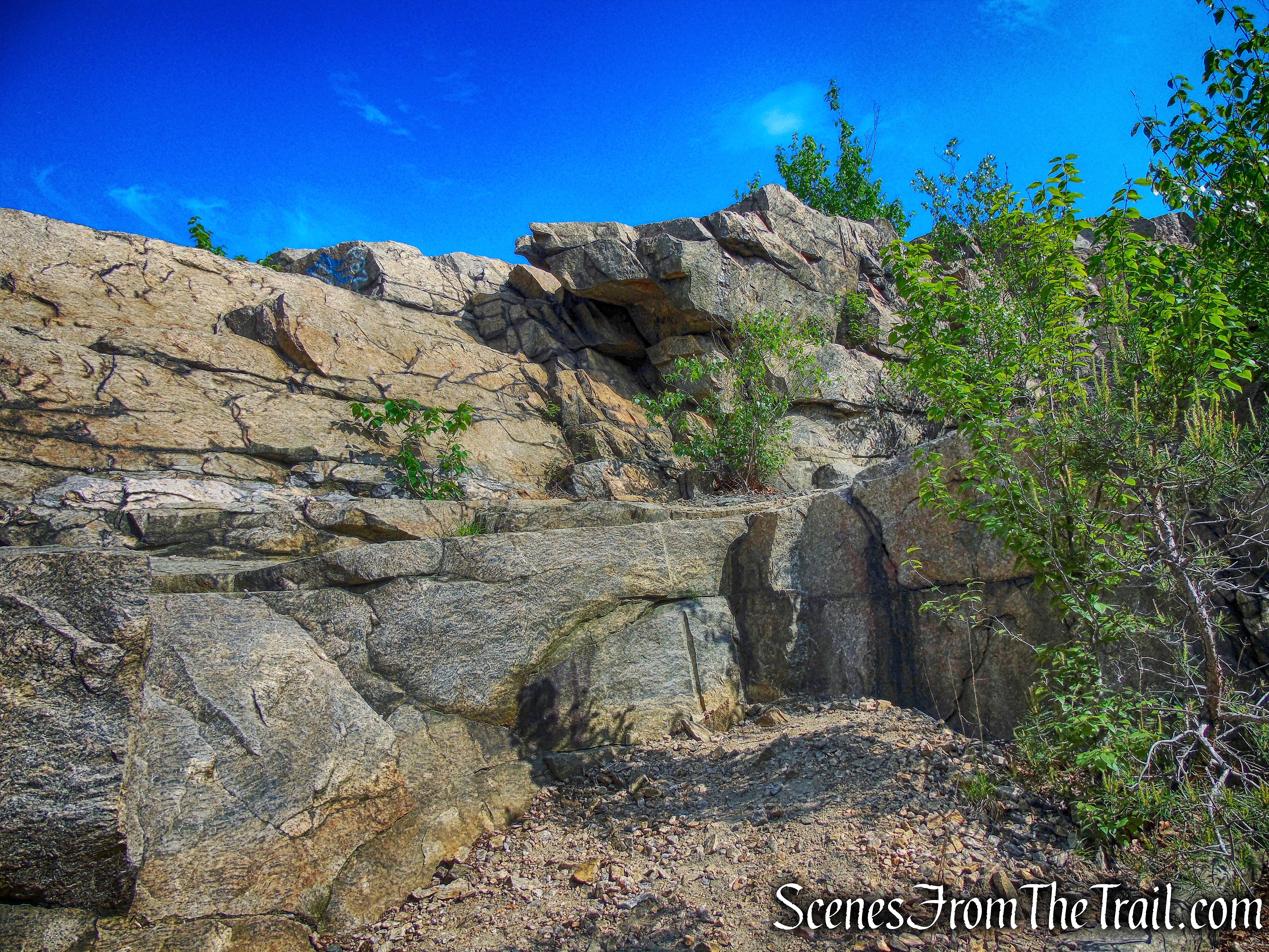
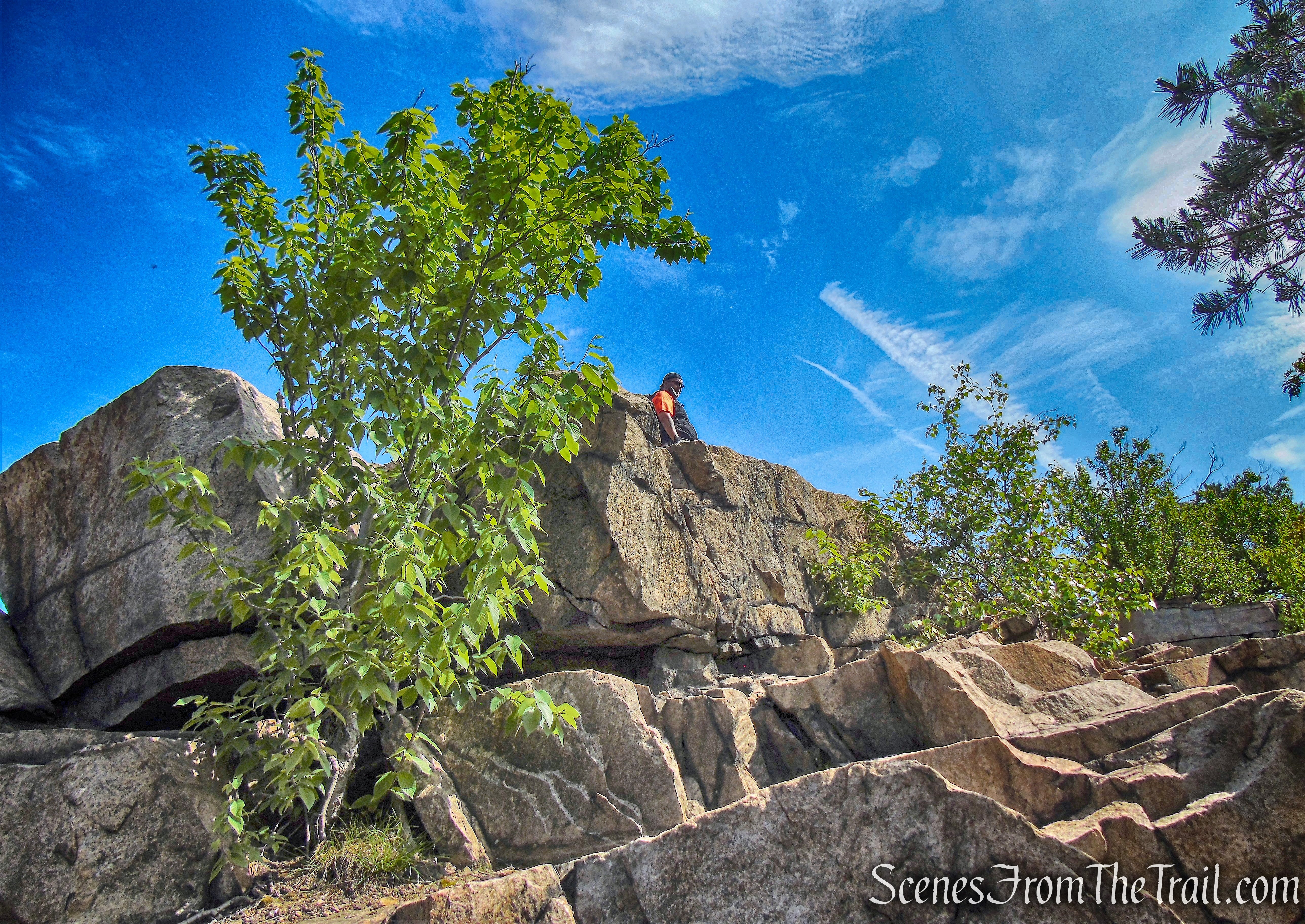
The trail continues to the top of the quarry cliffs which offers partial views of the surrounding area. It also makes a nice place to take a break.
quarry cliffs – Purple History Loop
We wandered around the top of the cliffs for a bit. There is a lot of loose stone and we were careful near the edge not to lose our footing. I had read that over the years, there have been accidents where children and adults alike, have fallen here.
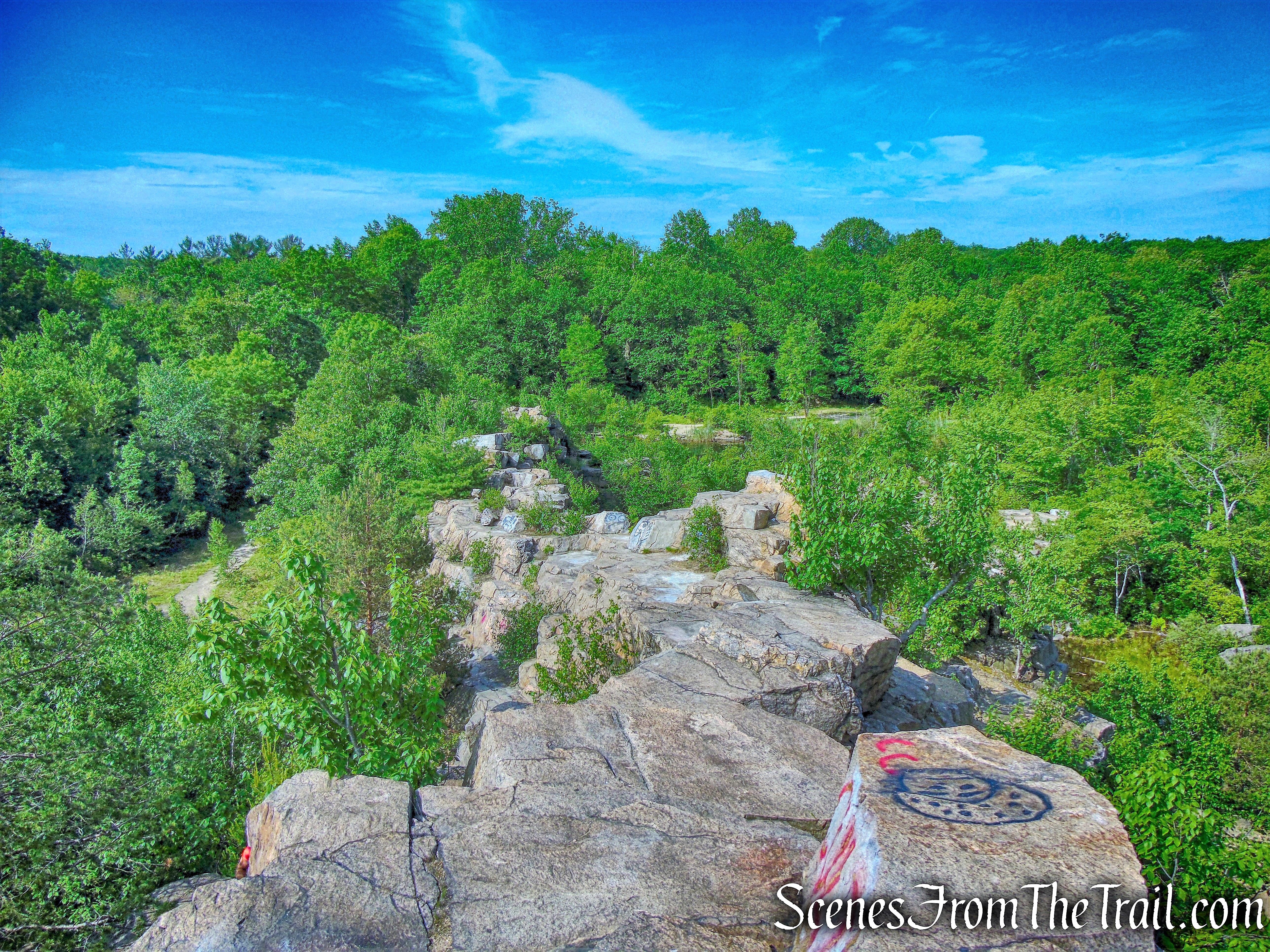
quarry cliffs – Purple History Loop
The quarry area was my favorite part of the hike. Even though the cliffs are not very high, they offer such a contrast to the woods trails we were previously on and are quite scenic.
quarry cliffs – Purple History Loop
Black Vultures soared above us as we sat, and one of them landed on a ledge and posed for me.
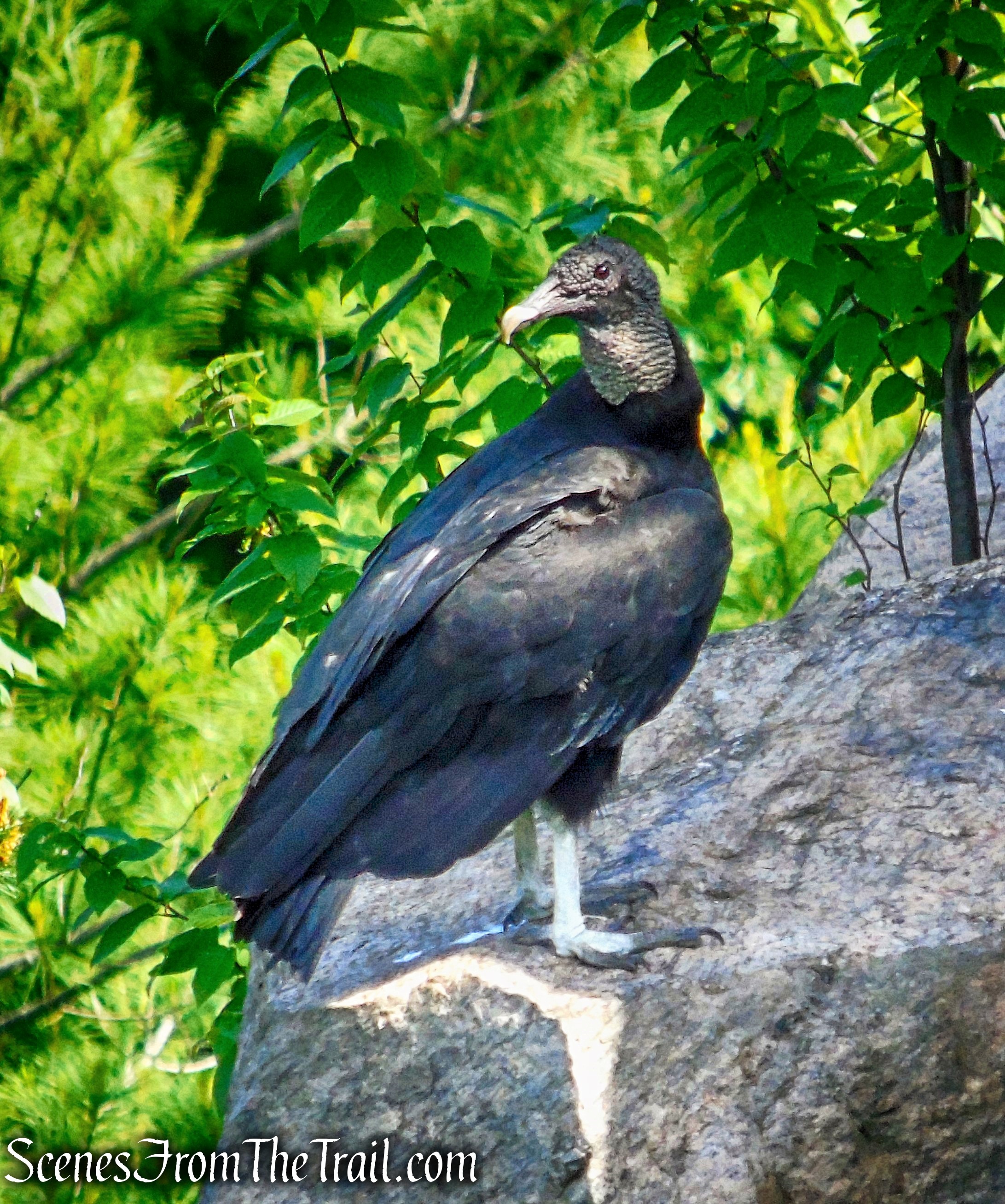
Black Vulture
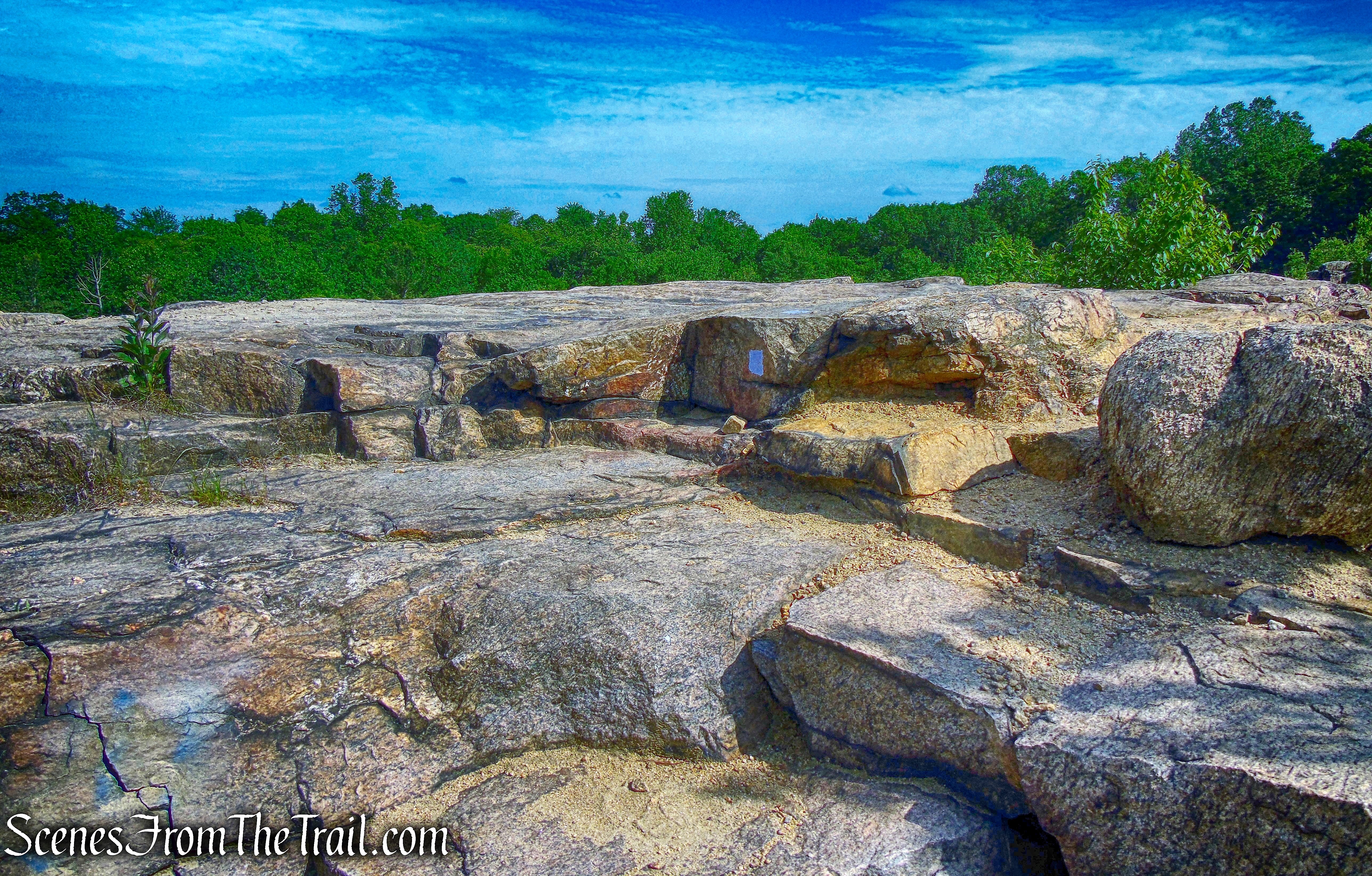
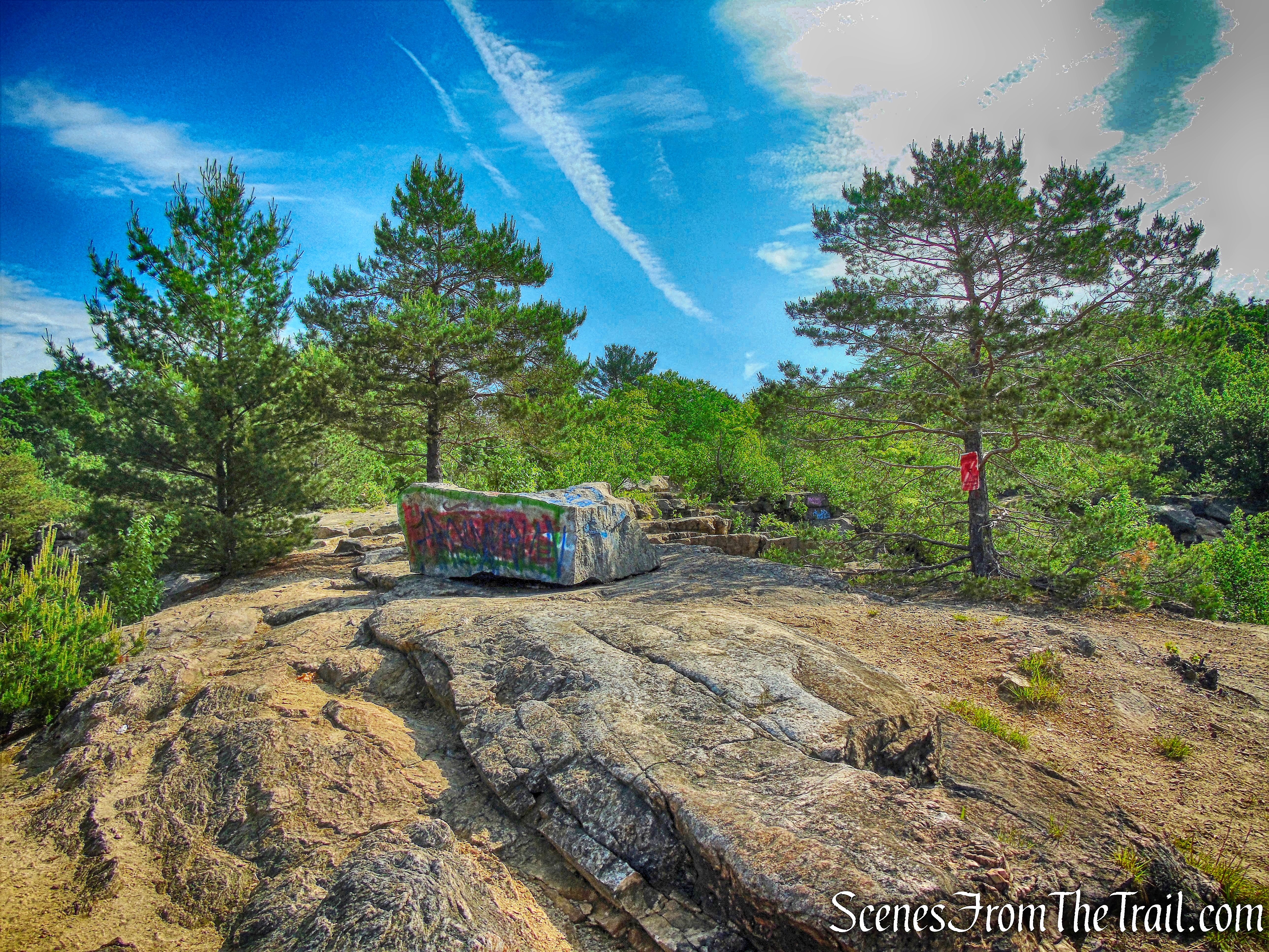
With the absence of trees on top of the cliffs, the purple blazes are painted on the ground and at times are hard to locate. We spotted several and they lead into the woods as the trail begins to descend.
Purple History Loop
We followed the purple blazes downhill, past some foundations. The trail turns left and heads south on a wide path.
Purple History Loop
The trails passes by the remains of a couple of abandoned vehicles.
abandoned vehicle – Purple History Loop
Years after the completion of the dam, locals, whether for fun or for easy disposal of their old cars, sent them zooming off the cliffs of the abandoned quarry.
abandoned vehicle – Purple History Loop
The trail loops around and passes by the smaller quarry pond. Its cliffs make for some fun climbing if you are so inclined.
smaller quarry pond
The Purple History Loop, loops back around and reaches junction 20, which intersects with the Red Loop Trail and turns right. The trail descends as it heads north through the woods. At the base of the descent (junction #21), the blue trail joins from the left, and the trails cross a boardwalk. Just beyond, at junction #22, the trails again split. Bearing right, to continue to follow the red and purple-on-white trails, which cross another boardwalk. We veered right at junction #23, continuing to follow the red and purple-on-white blazes.
Red Loop Trail/Purple History Loop
We looked up the hill to the right to see an old concrete facade. This remnant was once part of the area where the stone cutting shed stood, where large dimension stones were sculpted and transported to the dam.
stone cutting shed
After curving to the left, the trail reaches a T-intersection (junction #34), with cliffs ahead. Here, the red and purple-on white trails turn right, but we turned left, now following the yellow blazes.
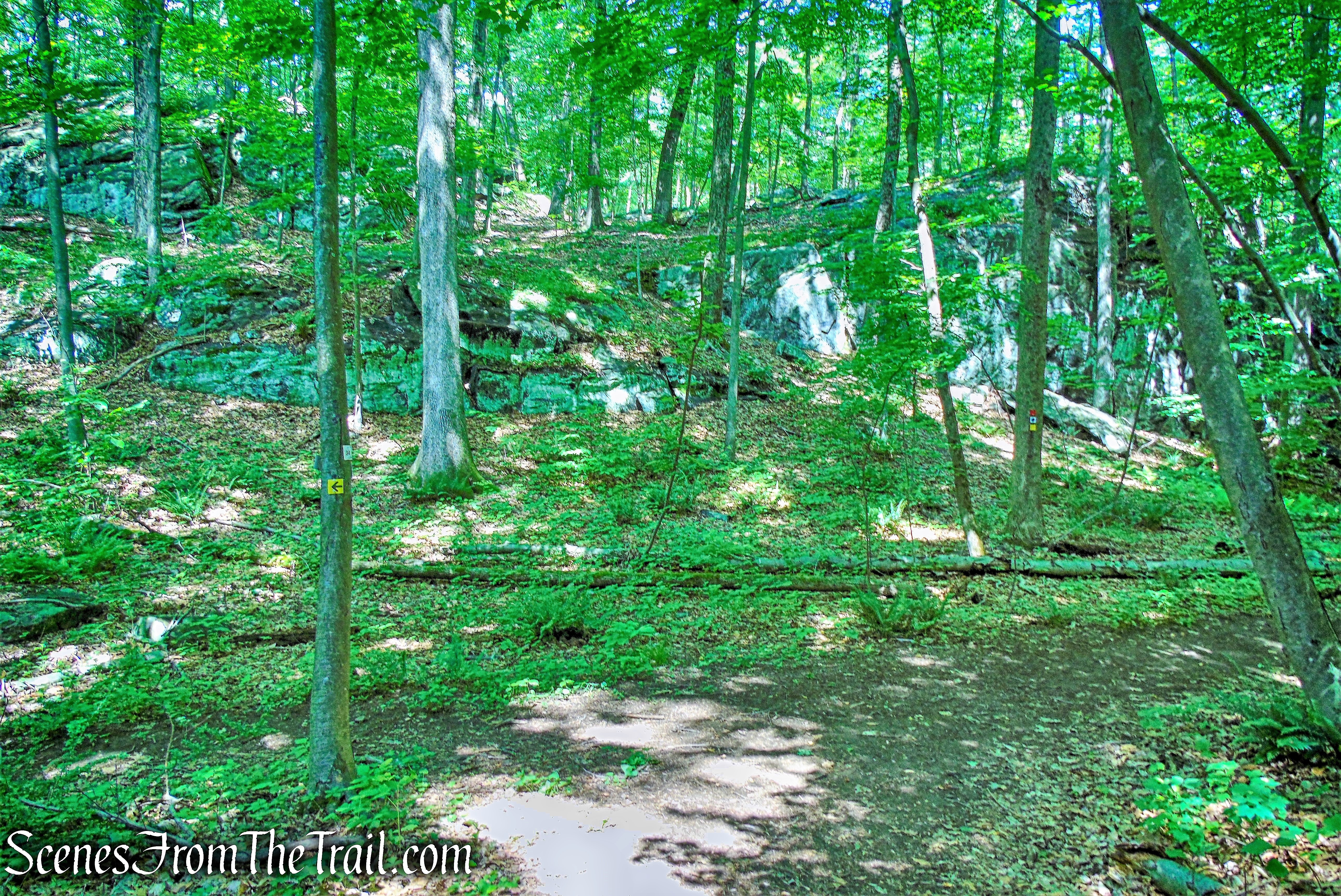
junction #34
At the next junction (#33), we veered left again, continuing to follow the yellow blazes and descend to the lake. At junction #24, we turned right and followed the yellow and blue blazes, with the trail paralleling Cranberry Lake. After passing junction #27, we reached a viewpoint over the lake from a rock outcrop, just off the trail.
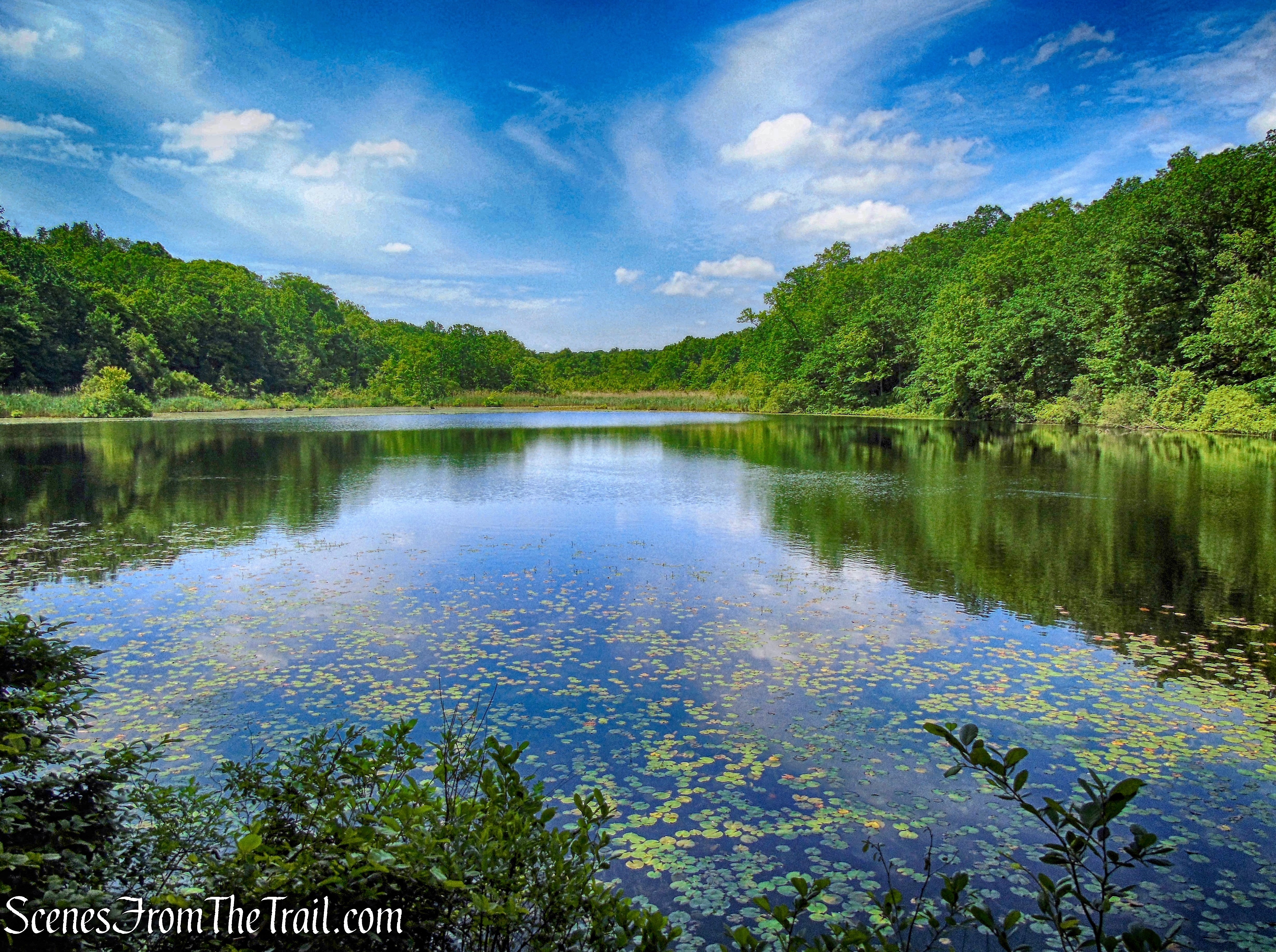
Cranberry Lake
While at the edge of the lake, I walked past a Black Rat Snake without even noticing it. I was able to capture an image of it as I made my way back to the trail.
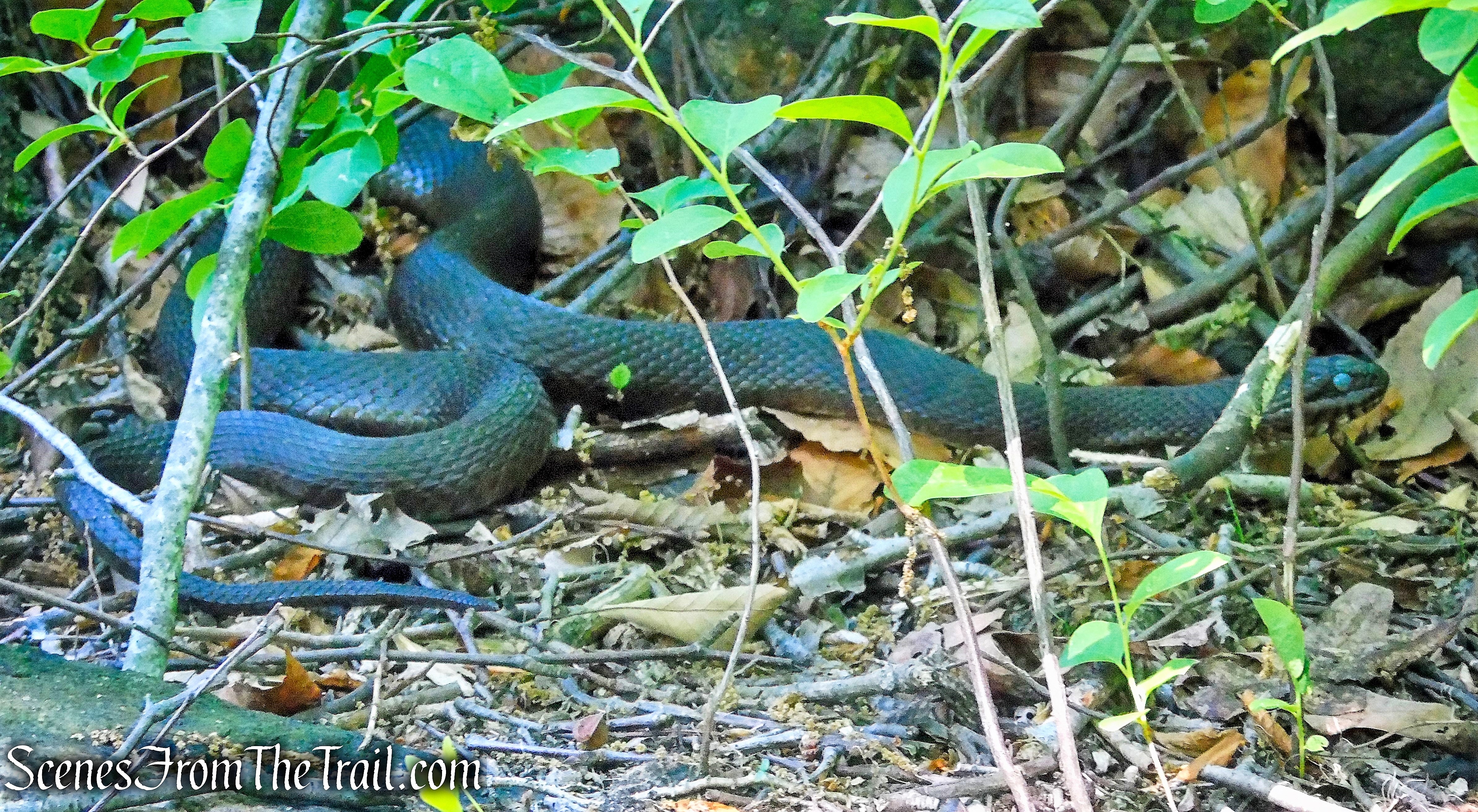
Black Rat Snake
Just beyond, we reached junction #26. Turning right onto the orange trail, we followed it back up to the yellow trail at junction #4, and turned right on the yellow trail to return to the Nature Center where the hike began.
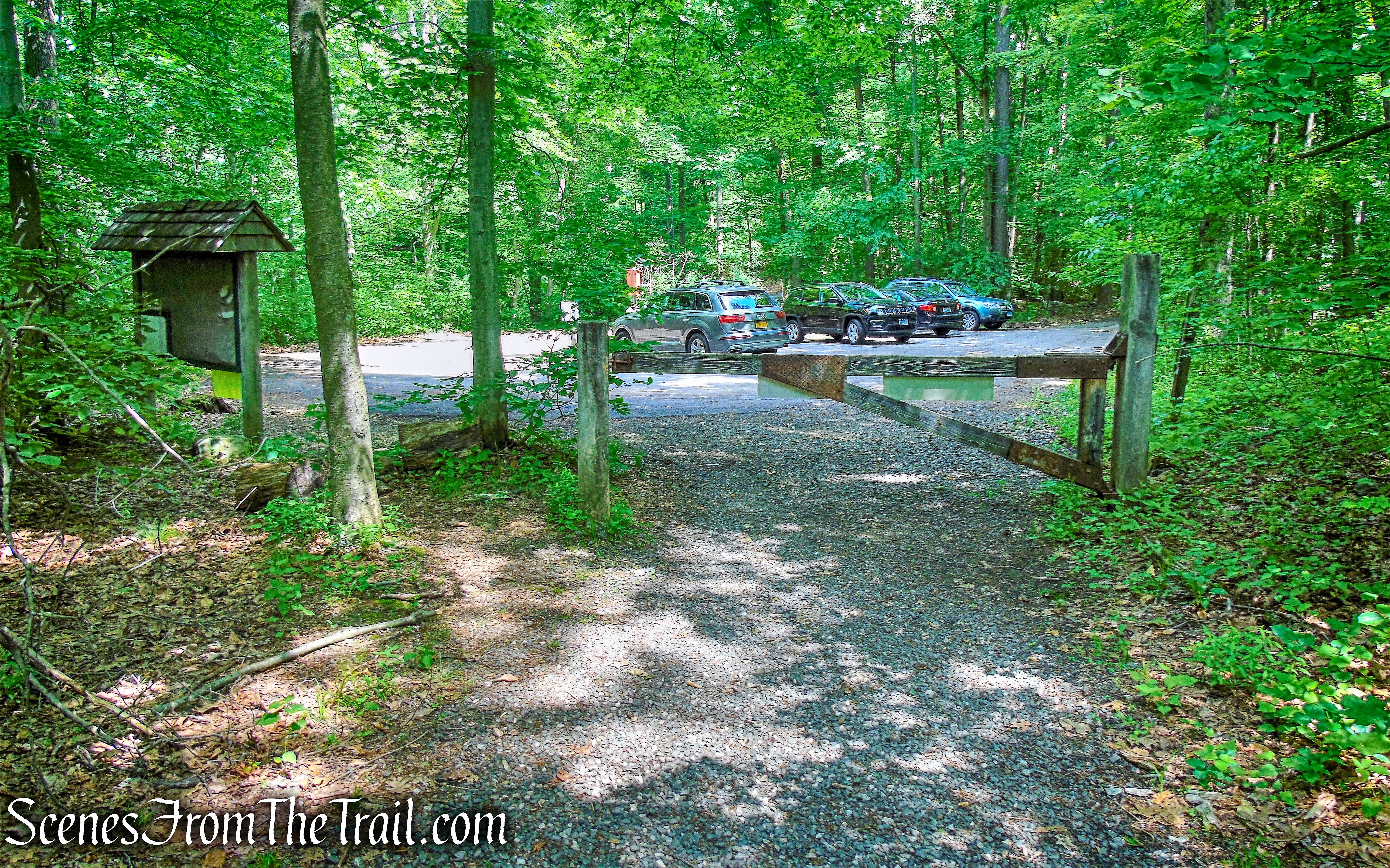
Nature Center parking
This was a really good hike and surprisingly there was not much foot traffic on the trails. With the vast network of trails in the preserve, any number of loop hikes can be done. Most junctions are numbered which correspond to your current location on the trail map. These numbers are found on trees or wooden posts alongside the colored blazes. Please note: the numbers do not appear on the online version of the trail map. For best results, pick up a map onsite at the kiosk or nature center.
Pros: Historical features, wildlife, quarry cliffs, lesser traveled.
Cons: Trails and junctions can be confusing.
Take a hike!
Cranberry Lake Preserve Loop
Sources:

Awesome play by play! and the images are pretty spectacular. Thanks for #TakingAHike
LikeLiked by 1 person