June 16, 2018 – Kerhonkson, NY
Difficulty: Moderate
Length: Approximately 7.2 miles
Max elevation: 1,893 ft.– total elevation gain approximately 858 ft.
Route type: Circuit
Fee: $10.00 per vehicle – Empire Pass Accepted
Trailhead parking: Lower Awosting Lot – Kerhonkson, NY 12446
The Shawangunk Ridge has become one of my favorite places to hike. “The Gunks” contain mainly public lands that are open to hikers. Most of the northern Ridge is protected by Minnewaska State Park Preserve, which now also manages Sam’s Point Preserve with more than 100 miles of hiking trails. With the network of trails and carriage roads available in Minnewaska State Park Preserve, hikers can connect to the various other preserves on the ridge.
This moderate loop hike was done using a combination of carriage roads and footpaths. Other trails and/or carriage roads can be used to shorten or lengthen this route. Last November I did a loop hike using the Mossy Glen Footpath and really enjoyed this scenic trail. I decided to map out a different hike that included this trail once again. We hiked the full length of the Mossy Glen Trail and used parts of the other trails and carriage roads to complete the loop.
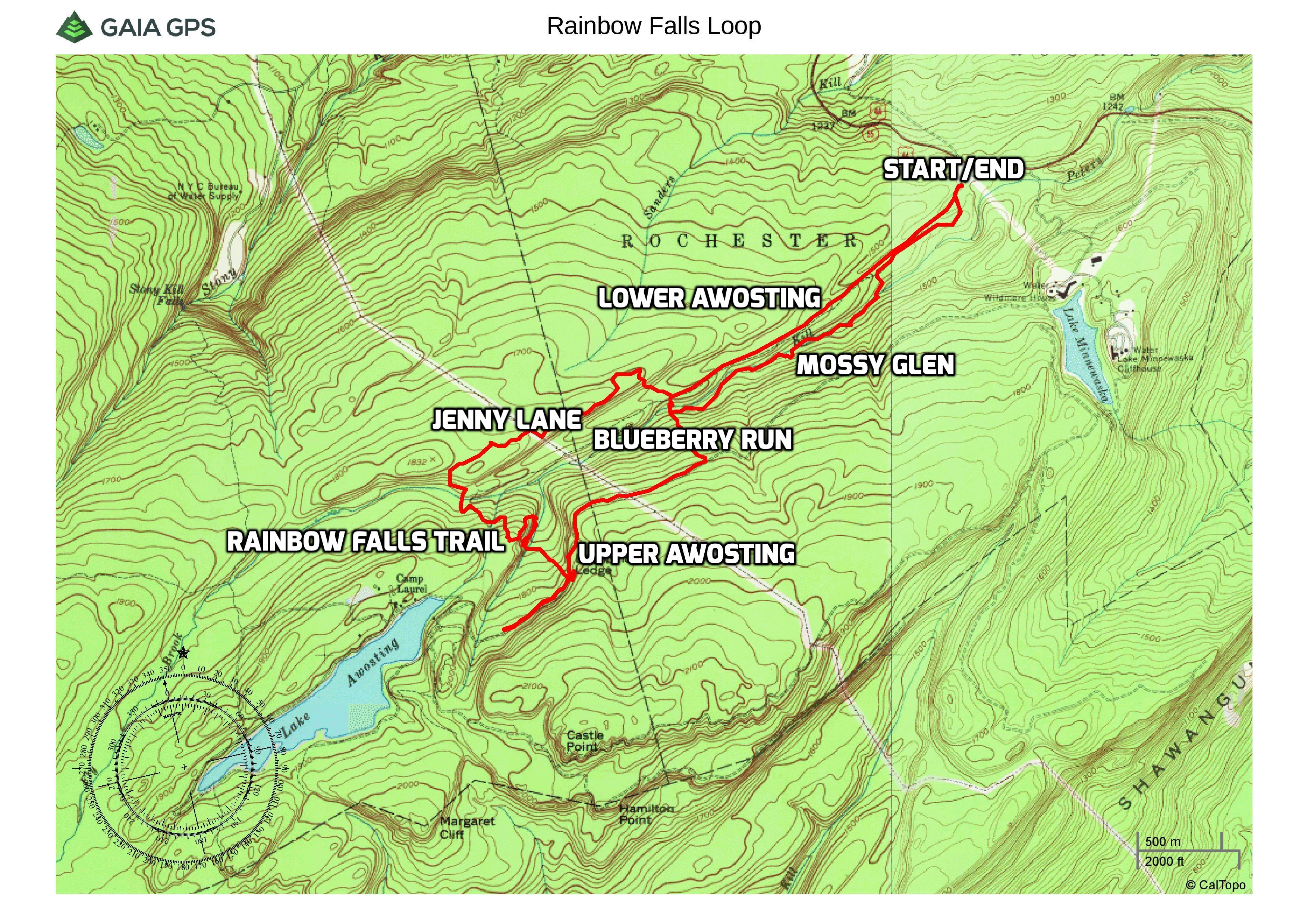
Rainbow Falls Loop
Trails used: The distances shown in parentheses are approximately the distances traveled during this hike and not necessarily the total length of the actual trails.
- Mossy Glen Footpath (1.7 miles) – This yellow-blazed trail travels near the scenic Peters Kill and is accessed from the Lower Awosting Carriage Road parking area.
- Blueberry Run Footpath (0.3 mile at start, 0.3 mile on return) This blue-blazed trail intersects the Upper Awosting Carriage Road, Lower Awosting Carriage Road and the Jenny Lane Footpath. It also forms a T-intersection with the end of the Mossy Glen Footpath.
- Jenny Lane Footpath (1.09 miles) This light-blue-blazed Footpath intersects with the terminus of the Blueberry Run Trail. This footpath follows along the crest of a modest ridge until descending to its terminus at the Lower Awosting carriage Road.
- Rainbow Falls Trail (1 mile) – This orange-blazed interior trail located near Lake Awosting, travels by Rainbow Falls. The waterfall can be dry in the summer months.
- Upper Awosting Carriage Road (0.8 mile) This green-blazed road travels from Lake Minnewaska to Lake Awosting and intersects numerous trails, making loop hikes possible.
- Lower Awosting Carriage Road (1.5 miles) – This black-blazed old road takes visitors from Lower Awosting Lot, off US 44 to Lake Awosting following the Peter’s Kill.
A new feature that I have added is the Google Earth Fly-Through. It follows the path that we hiked and it gives you a good idea of the terrain, layout, amount of parking etc. Check it out, it’s pretty cool.
View the Google Earth Fly-Through video of the hike below.
I love to hit the trails early, but like most of the preserves in The Gunks, Minnewaska doesn’t open until 9:00 am. Nevertheless, we got there just after 9:00 am and the lower lot, where we parked, was already starting to fill up. From the kiosk at the rear of the parking area, we walked past the gate onto the Lower Awosting Carriage Road.
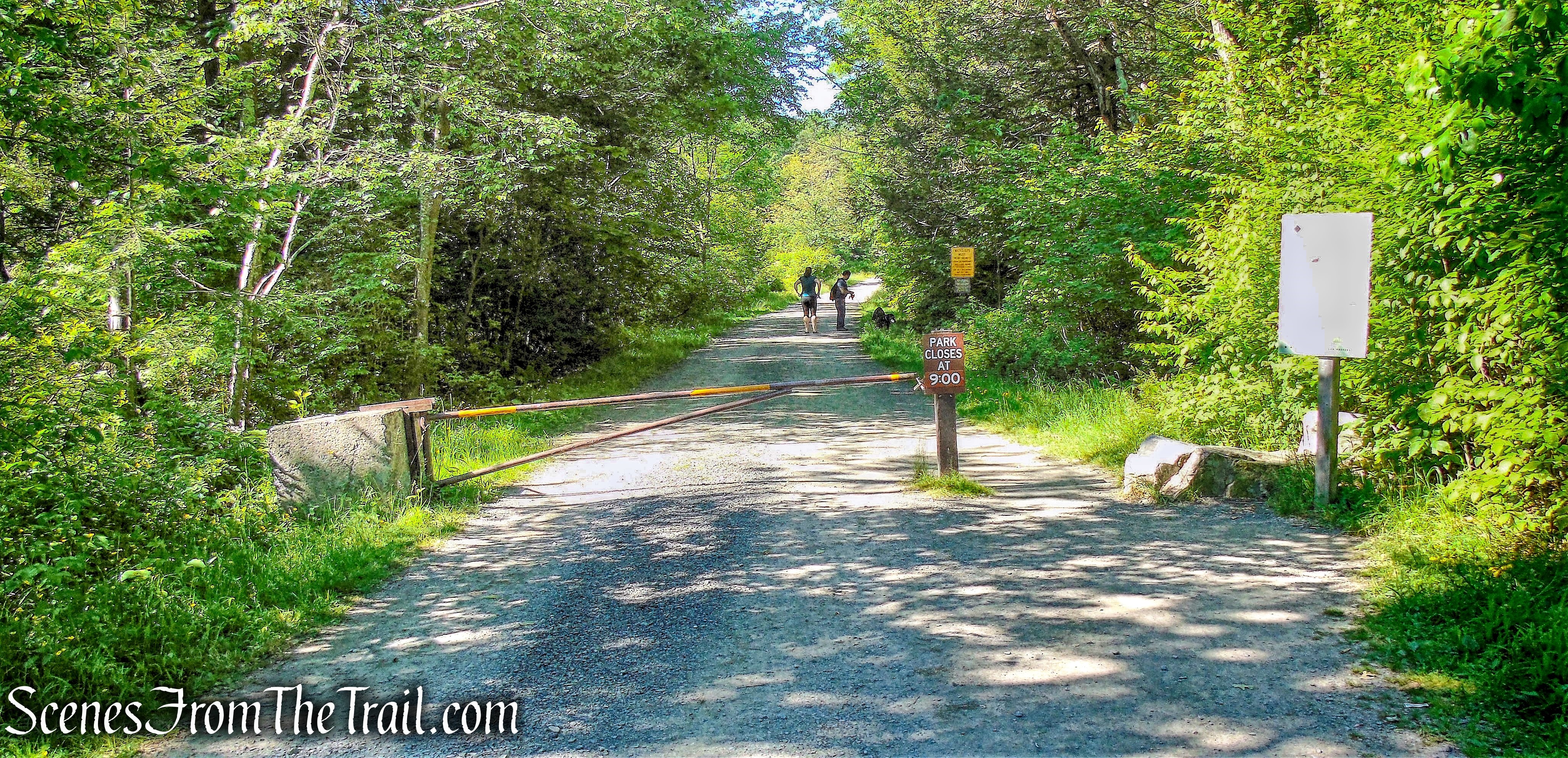
Lower Awosting Carriage Road
Almost immediately, we turned left onto the yellow-blazed Mossy Glen Footpath.

Mossy Glen Footpath
The trail passes through an attractive forest of hemlock and mountain laurel.
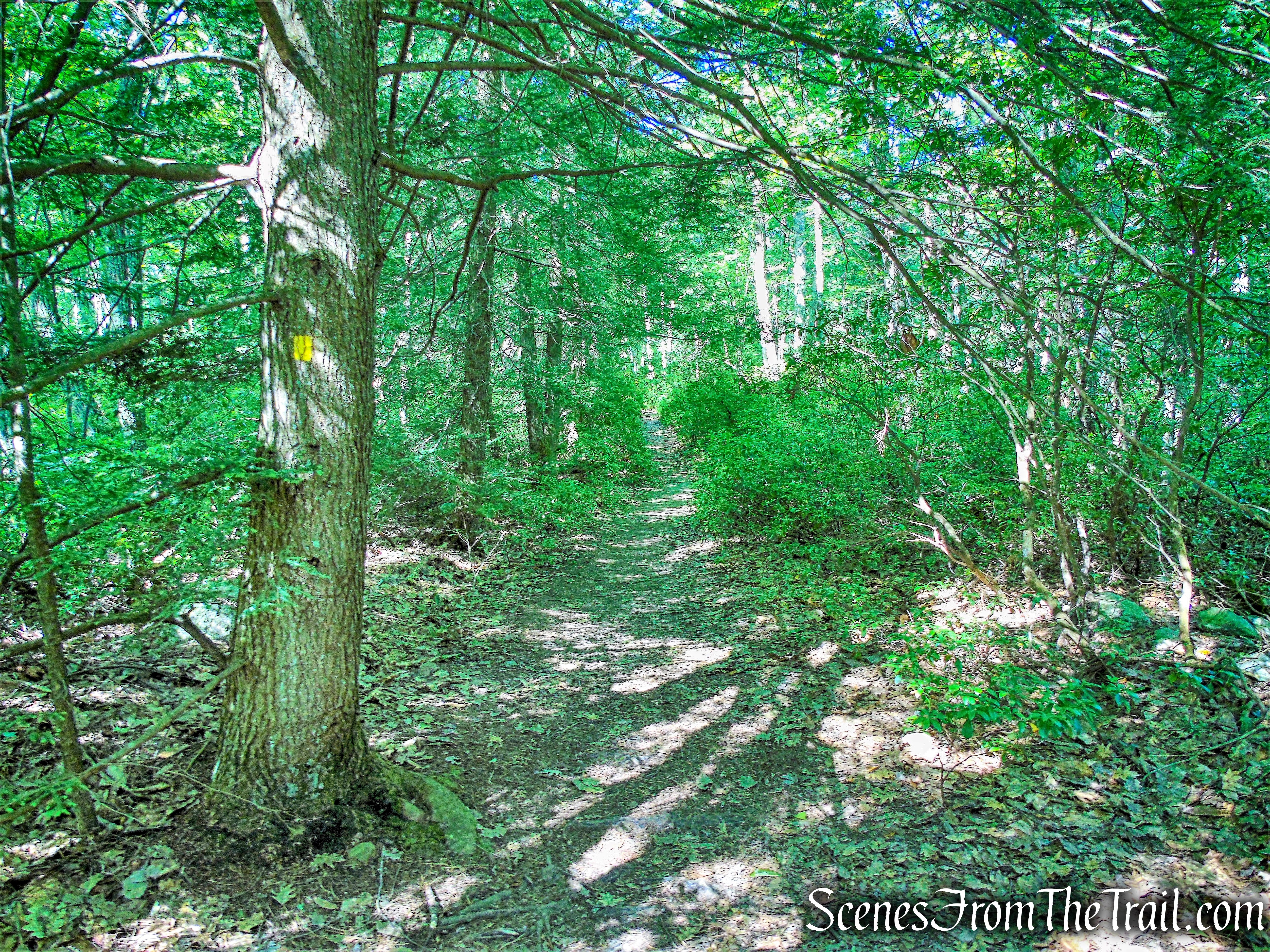
Mossy Glen Footpath
In about 0.5 mile, the trail approaches the carriage road, then turns left and descends to the Peter’s Kill, crossing it on a one-log footbridge.
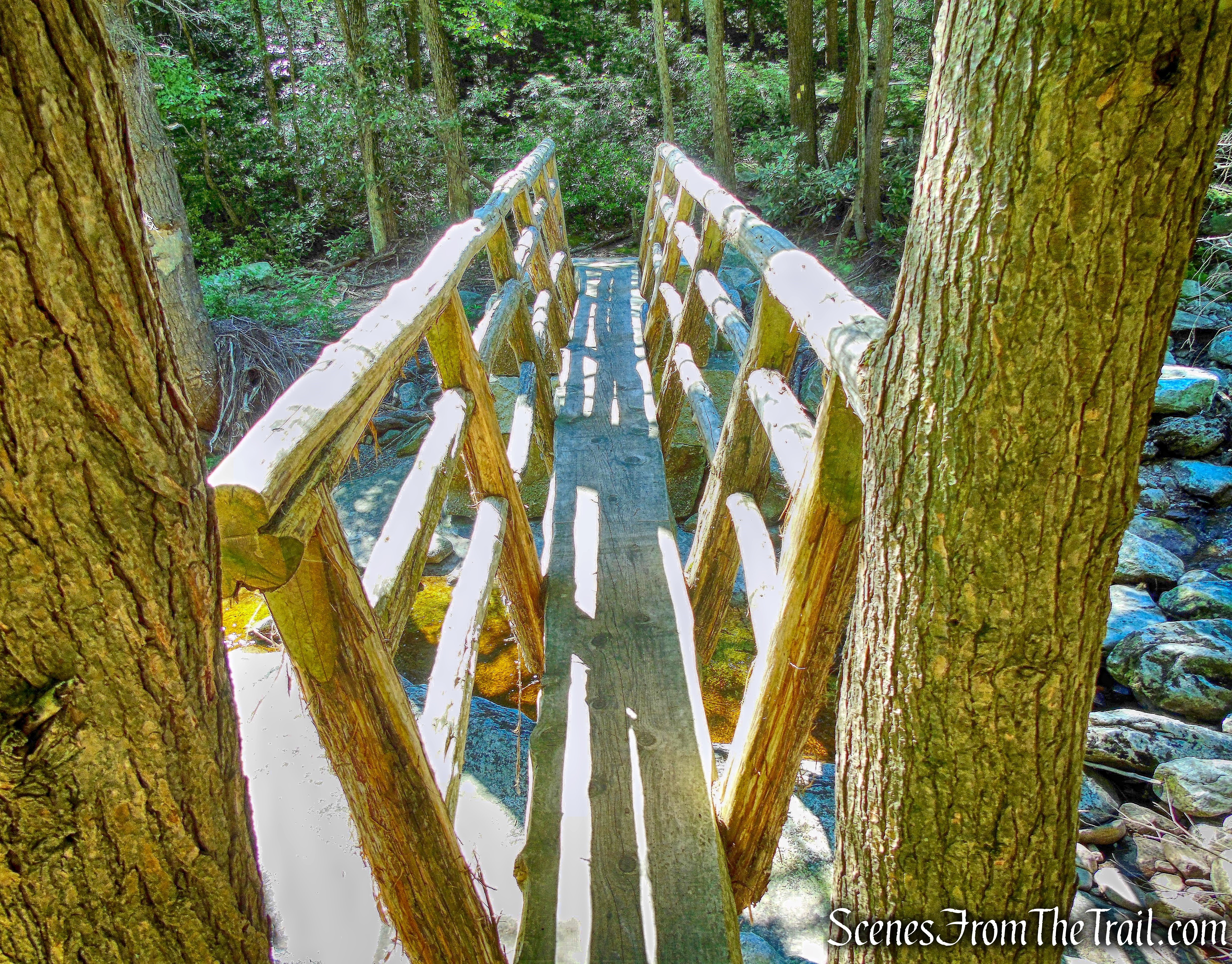
one-log footbridge – Mossy Glen Footpath
After crossing the bridge, the trail turns right and continues southwest, along the Peters Kill. For the next mile or so, it hugs the stream and comes out on rock slabs near the edge of the water.
Mossy Glen Footpath
The Peter’s Kill was mostly dry on this day, but on previous visits, the flow was much stronger.
Mossy Glen Footpath
After passing through a relatively open area, with stunted pitch pines and an understory of blueberries,
Mossy Glen Footpath
the Mossy Glen Trail ends at a T-intersection with the blue-blazed Blueberry Run Footpath.
terminus of Mossy Glen Footpath
We turned right and followed this blue-blazed trail downhill,
Blueberry Run Footpath
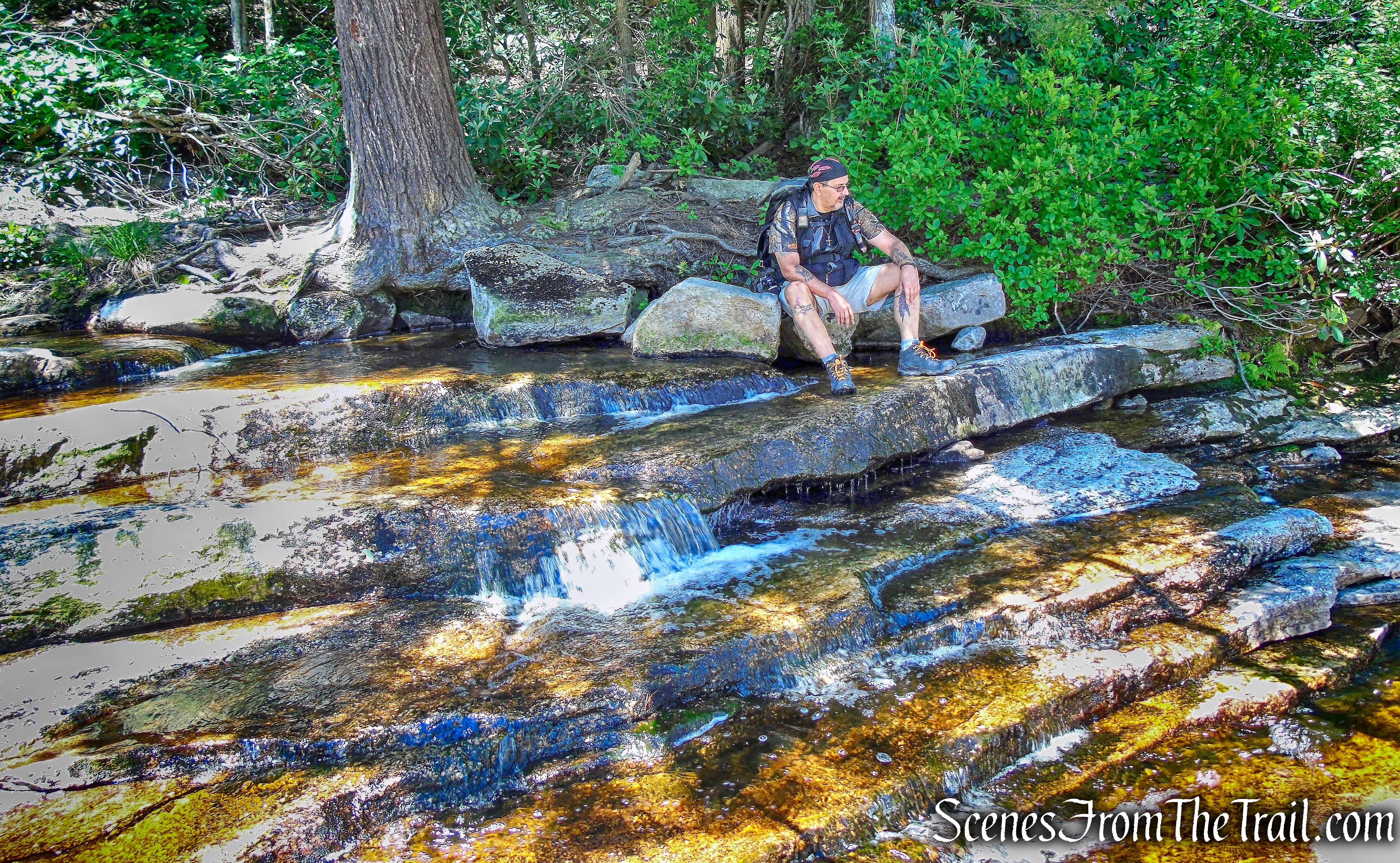
The trail comes out onto open rock with an attractive cascade of the Peter’s Kill. The flow was light on this day, but I have been here before when the cascade spanned the entire width of the rocks. We stopped here briefly to enjoy this spot.
cascade – Blueberry Run Footpath
The Blueberry Run Footpath crosses the Peter’s Kill on another one-log footbridge, with the attractive cascade on the left.
one-log footbridge – Blueberry Run Footpath
The trail climbs rather steeply……
Blueberry Run Footpath
to cross the Lower Awosting Carriage Road,
Blueberry Run Footpath crosses the Lower Awosting Carriage Road
then continues through mountain laurel and hemlock.
Blueberry Run Footpath
After another steep climb, the Blueberry Run Footpath ends at a junction with the blue-blazed Jenny Lane Footpath.
turn left onto the Jenny Lane Footpath
Standing on the Jenny Lane Footpath, looking back at the Blueberry Run Footpath, with the blue blazes visible on a tree, just beyond.
junction with the Jenny Lane Footpath
We turned left, now heading southwest and followed the Jenny Lane Footpath, which soon begins to run close to the edge of the ridge, coming out occasionally on open rocks, with views over Litchfield Ledge to the east.
view east – Jenny Lane Footpath
In about three-quarters of a mile, the trail reaches a power line.
power line – Jenny Lane Footpath
We followed the trail as it turns right, runs along the power line for a short distance, then turns left and continues on a wide path, the remnants of an old woods road.
Jenny Lane Footpath
The trail soon begins to descend. As it goes down a badly eroded section of the old road, the trail has been rerouted onto a footpath to the left. At the base of the descent, the Jenny Lane Footpath turns left onto a grassy woods road, which soon reaches the Lower Awosting Carriage Road, where we turned right.
turn right onto Lower Awosting Carriage Road
We followed the Lower Awosting Carriage Road, crossing a causeway and concrete bridge over Fly Brook.
Lower Awosting Carriage Road
Just past the brook crossing, the orange-blazed Rainbow Falls Footpath begins on the left.
turn left on Rainbow Falls Footpath
The orange-blazed Rainbow Falls Footpath is also the route of the Shawangunk Ridge Trail (SRT).
Rainbow Falls Footpath
We turned left, leaving the carriage road, and followed the Rainbow Falls Footpath, which descends briefly, then ascends steadily over slanted slabs of conglomerate rock dotted with pitch pines.
Rainbow Falls Footpath
The trail turns left, crosses a small stream, and continues to climb over slanted rock ledges. From the top, the Catskills may be seen in the distance.
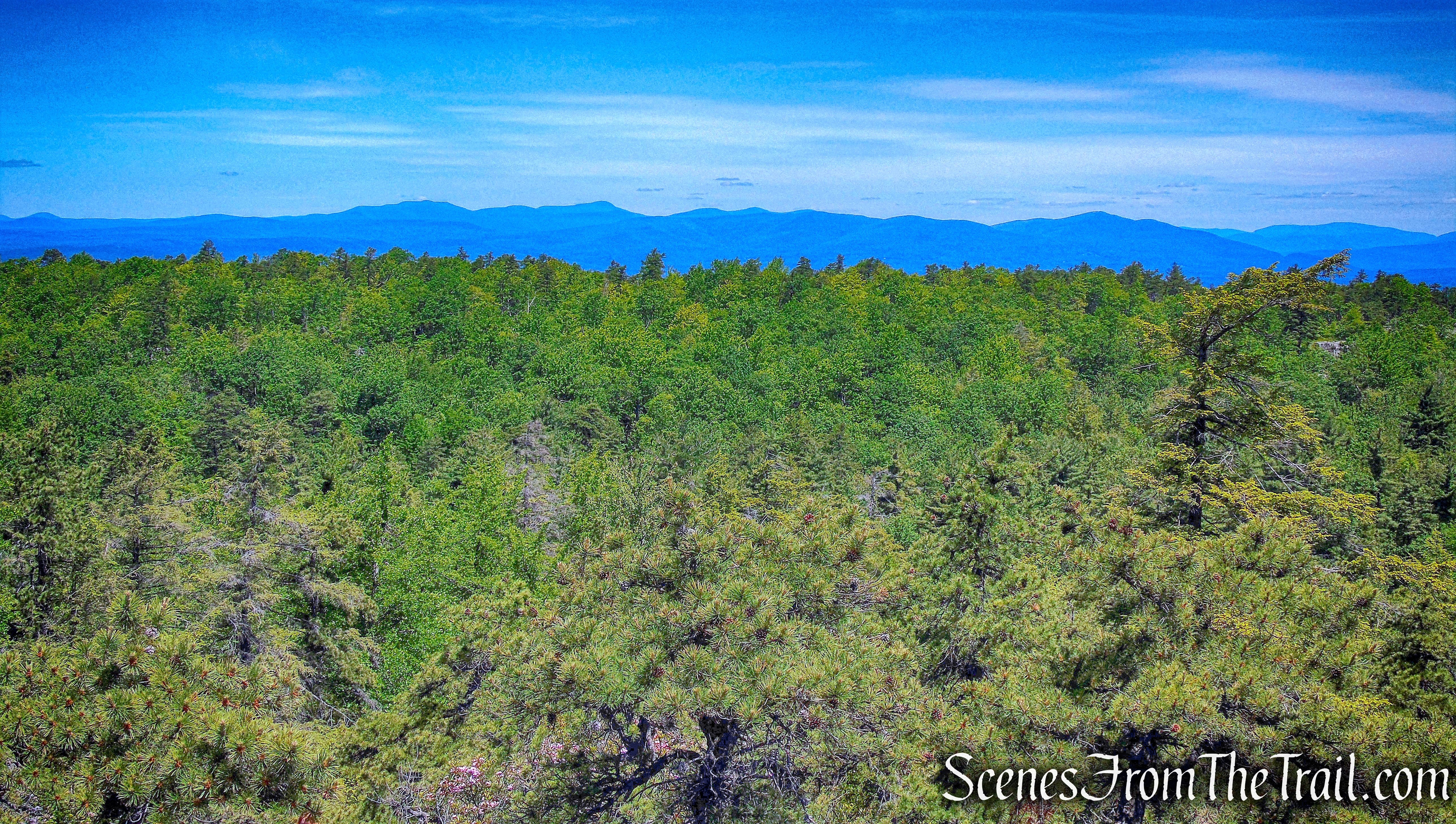
Catskills – Rainbow Falls Footpath
After a short but steep descent, the trail comes out on an open rock ledge. To the right is Huntington Ravine, with Litchfield Ledge beyond.
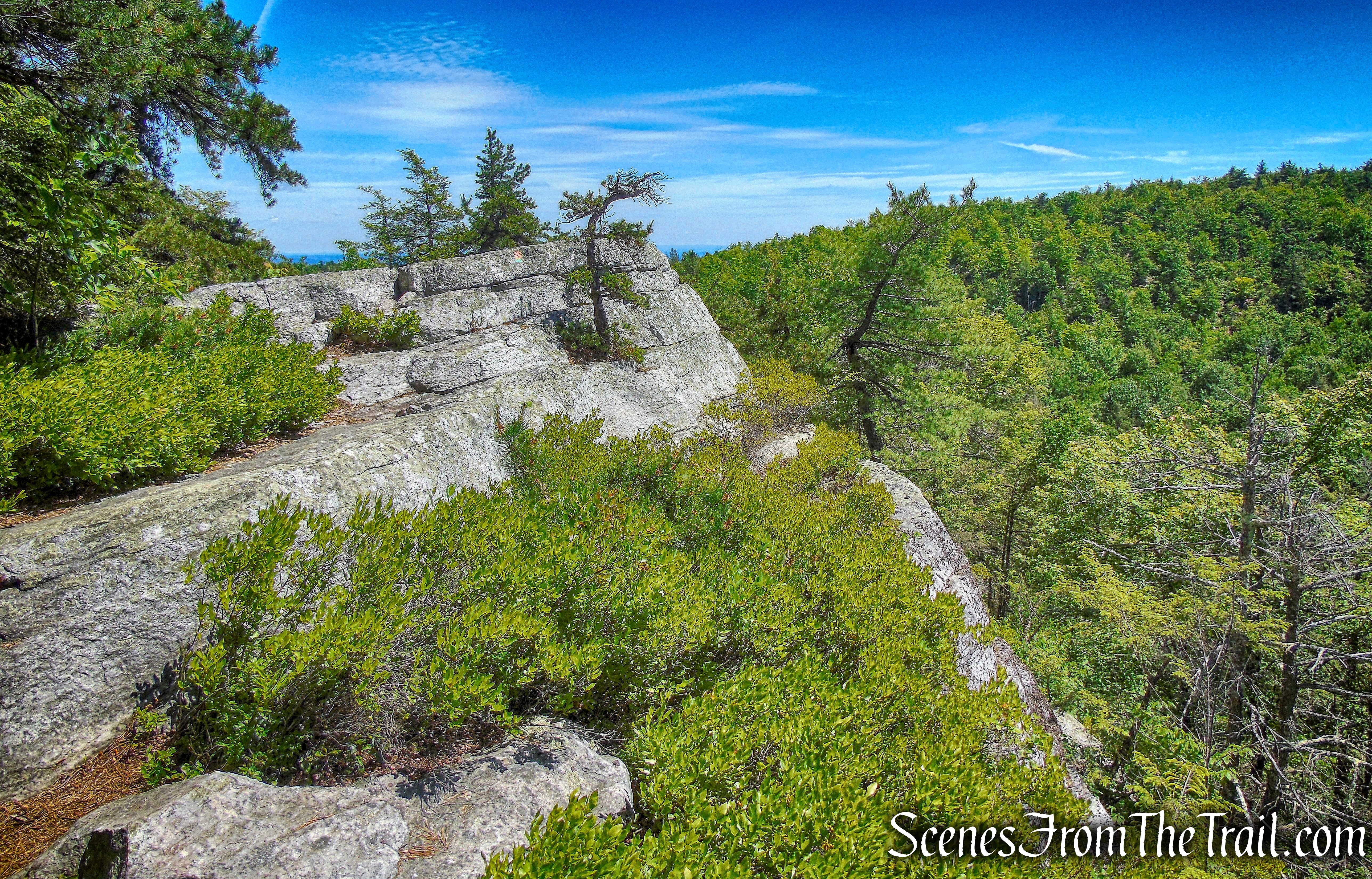
Rainbow Falls Footpath
The trail continues over open rock ledges, with Rainbow Falls just below.
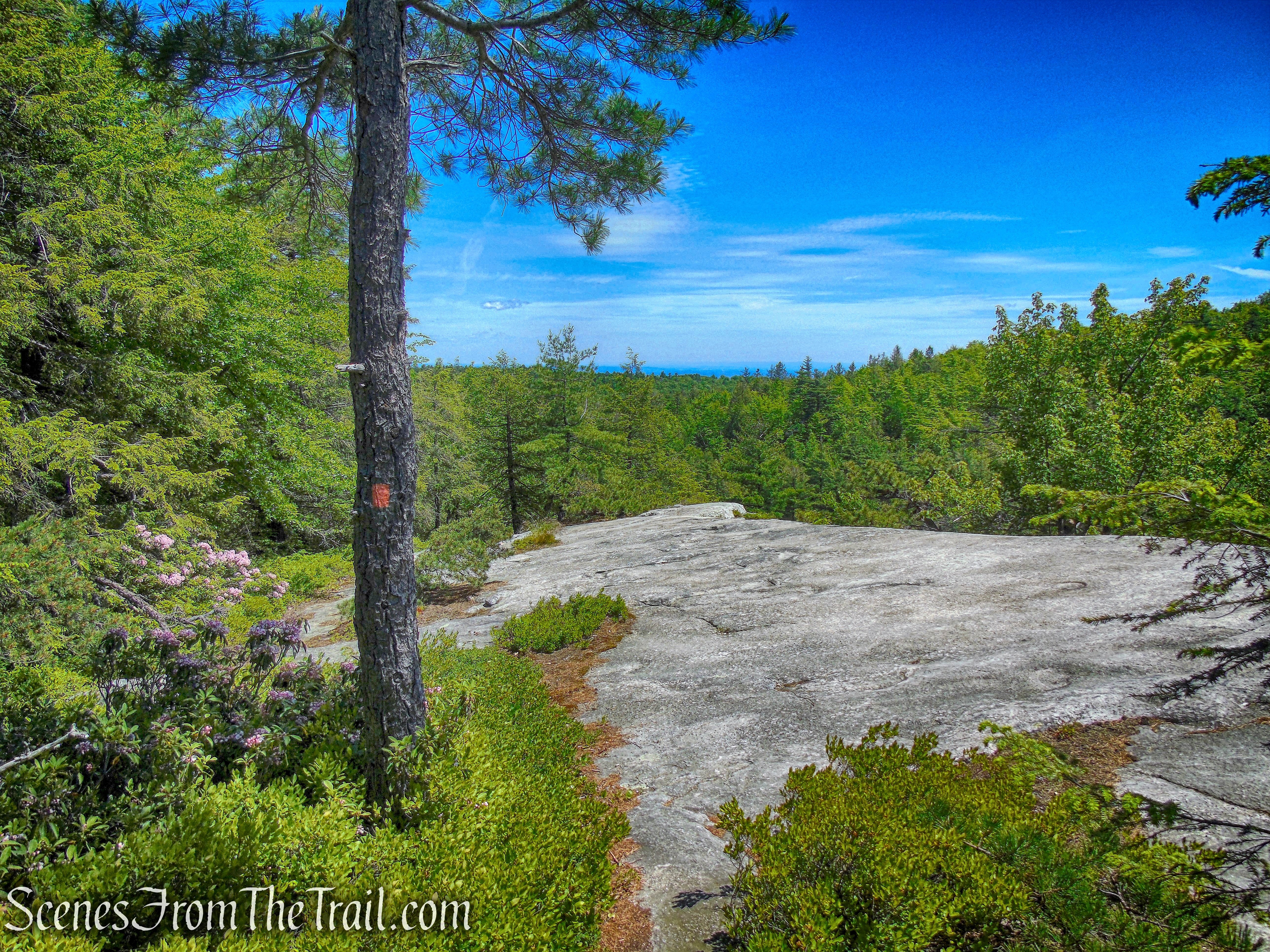
Rainbows Falls Footpath
The trail ducks back into the woods and we happened to pass a Deer grazing, just off the path.
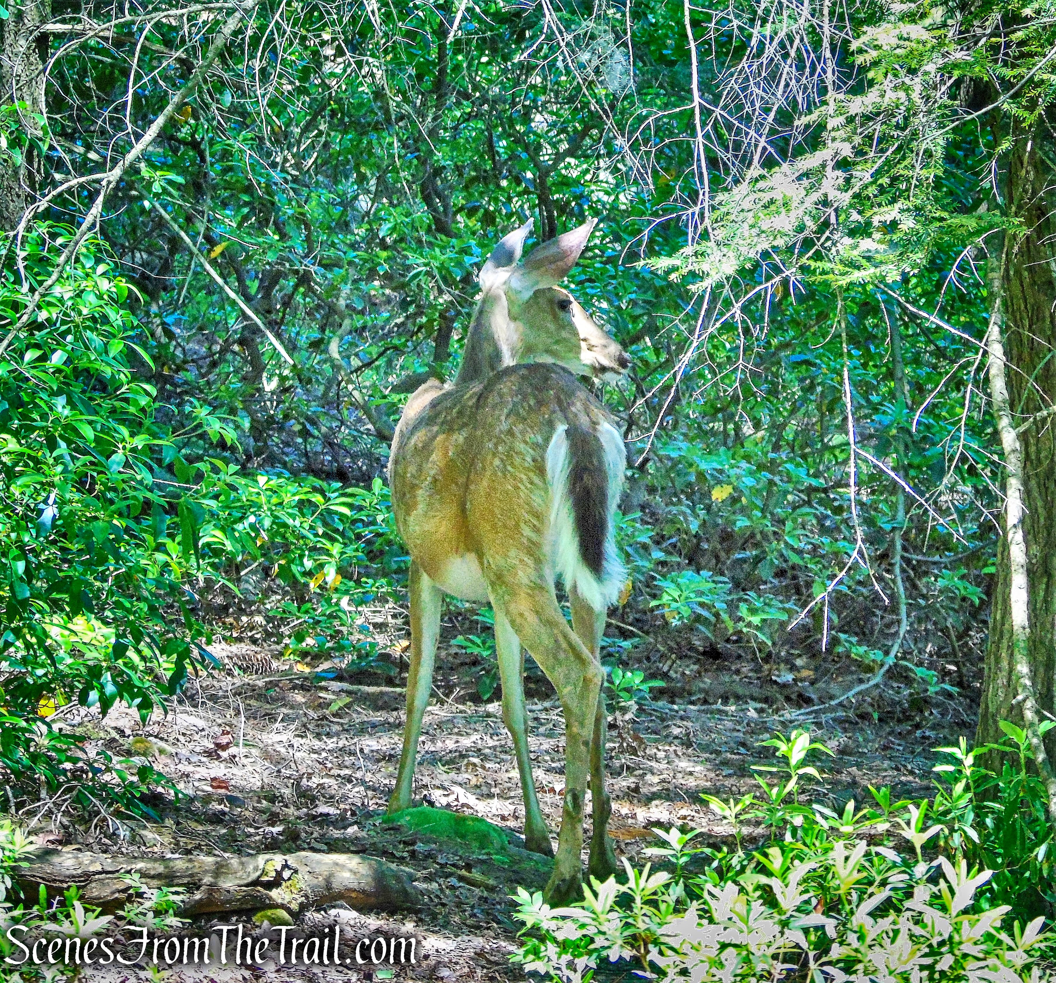
Deer – Rainbows Falls Footpath
The trail soon bears sharply right and descends very steeply, with cliffs to the right. At the base of the descent, Rainbow Falls comes into view.
Rainbow Falls
Although the falls were nothing more than a trickle on this hot and humid day, it was a perfect place to relax for a few minutes. Here the water drops from overhanging rock ledges, forming a cool mist.
Rainbow Falls
The trail now bears left, descends to cross a small stream, then climbs steadily to reach the Upper Awosting Carriage Road.
Rainbows Falls Footpath
Once on Upper Awosting Carriage Road, I turned right and wandered down the road searching for views, but did not find any, so I turned around. I also walked a bit further on the Rainbows Falls Footpath, but turned around when I didn’t see any viewpoints close by. I then returned to the Upper Awosting Carriage Road and began heading downhill (east).
Upper Awosting Carriage Road
After approximately 0.8 mile from the junction with the Rainbow Falls Footpath, the carriage road comes to a junction on the left, with the Blueberry Run Footpath.
Blueberry Run Footpath
The Blueberry Run Footpath heads north and descends steadily through mountain laurel and blueberries.
Blueberry Run Footpath
In about 430 yards, the trail passes the junction with the Mossy Glen Footpath, from earlier in the hike. In a short distance, we re-crossed the one-log footbridge over the Peter’s Kill.
one-log footbridge – Blueberry Run Footpath
After crossing the footbridge, we climbed the hill to the Lower Awosting Carriage Road and turned right. We then walked northeast along this carriage road for approximately 1.4 miles, as it descends gently, back to the parking area, where the hike began.
Lower Awosting Carriage Road
This was a pretty nice hike, which would have been much nicer with more water flowing through the Peter’s Kill and Rainbow Falls. Much better to do this hike in the Spring or after some heavy rain. The trails and the surrounding area are quite beautiful and we only ran into a handful of people and that was near the falls and on the carriage roads.
Pros: The Gunks, lesser traveled trails, well maintained trails.
Cons: Streams and waterfall mostly dry.
Take a hike!
Rainbow Falls Loop

We did your trail outline today and it was absolutely gorgeous! Rainbow Falls was so full that we weren’t sure we could even make it across at the bottom! But thank you for this guide. Made for a wonderful hike and beautiful photos.
LikeLiked by 1 person
I’m glad that you found my blog helpful and thanks for reading.
LikeLike