November 24, 2017 – Kerhonkson, NY
Difficulty: Moderate
Length: Approximately 5 miles
Max elevation: 1,706 ft.– total elevation gain approximately 602 ft.
Route type: Circuit
Fee: $10.00 per vehicle – Empire Pass Accepted
Trailhead parking: Lower Awosting Lot – Kerhonkson, NY 12446
The Shawangunk Ridge has become one of my favorite places to hike. “The Gunks” contain mainly public lands that are open to hikers. Most of the northern Ridge is protected by Minnewaska State Park Preserve, which also now manages Sam’s Point Preserve with more than 100 miles of hiking trails. With the network of trails and carriage roads available in Minnewaska State Park Preserve, hikers can connect to the various other preserves on the ridge.
I wanted to do a moderate hike the day after stuffing myself with Thanksgiving turkey and burn off some calories. Being that it was Black Friday, I was hoping that there would be more people in the malls than on the trails. Normally, I like to map out my own hikes, but I found a good hike on the NY/NJ Trail Conference and decided to follow it. The four trails described below are the trails that we used on this hike.
Mossy Glen Footpath (1.7 miles) – This yellow-blazed trail travels near the scenic Peters Kill and is accessed from the Lower Awosting Carriage Road parking area.
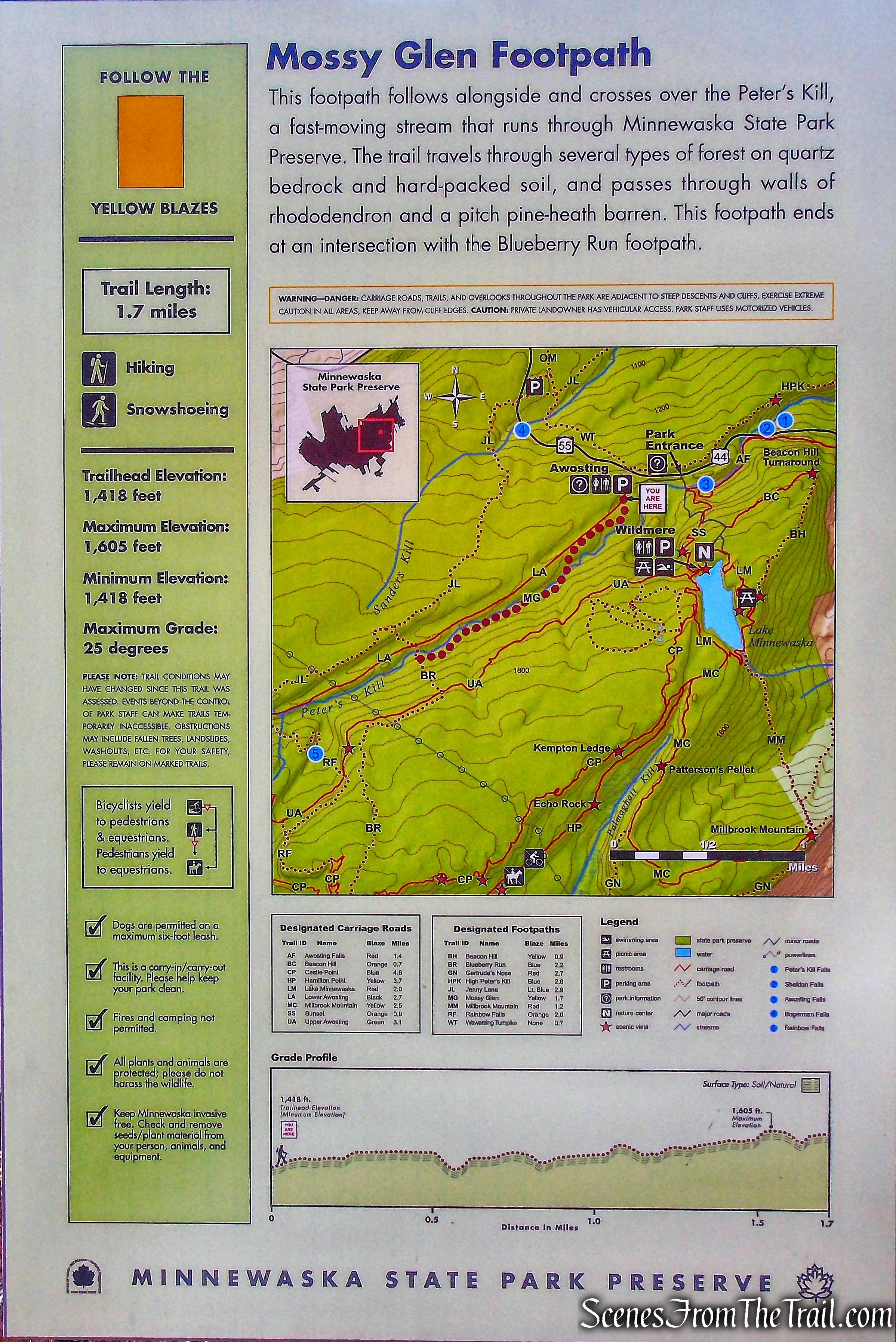
Mossy Glen Footpath
Blueberry Run Footpath (2.2 miles) – This blue-blazed trail ends at the crest of scenic Castle Point at the junction of the Long Path/Castle Point Carriage Road. The interior trail starts off the Jenny Lane Trail.
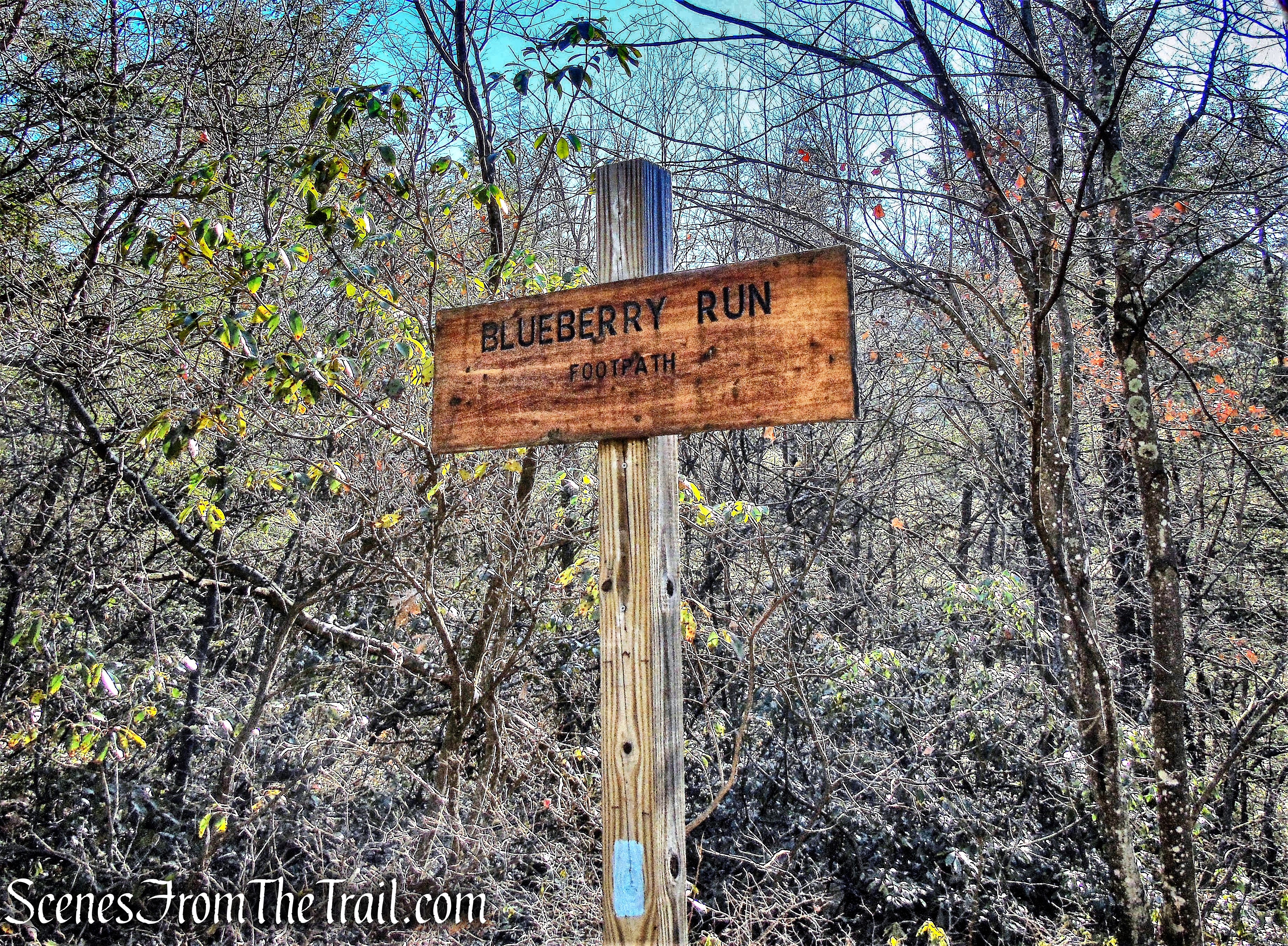
Blueberry Run Footpath
Jenny Lane Footpath (2.9 miles) – This blue-blazed trail features part of the famous Long Path that coincides with the trail.
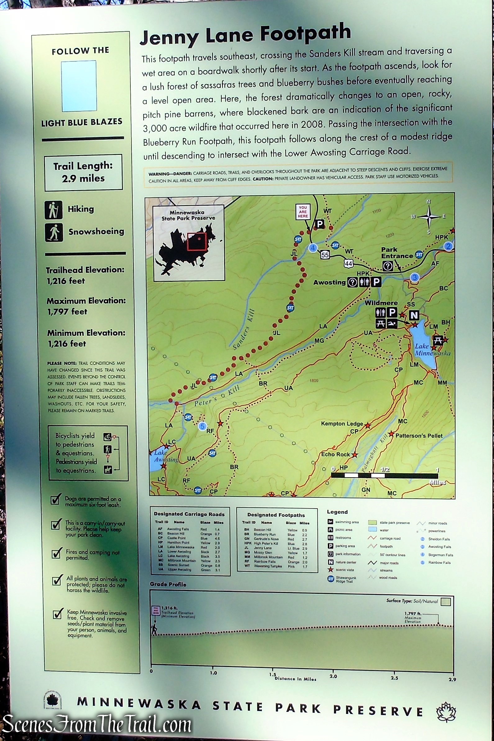
Jenny Lane Footpath
Wawarsing Turnpike Footpath (1.7 miles) – This pink-blazed trail follows follows a portion of the original toll road built to cross over the Shawangunk Ridge from New Paltz to Kerhonkson, called the New Paltz-Wawarsing Turnpike.
Wawarsing Turnpike Footpath
We hiked the full length of the Mossy Glen Trail and used parts of the other three to complete the loop.

Mossy Glen, Jenny Lane, Wawarsing Turnpike Loop
View the Google Earth Fly-Through video of the hike below.
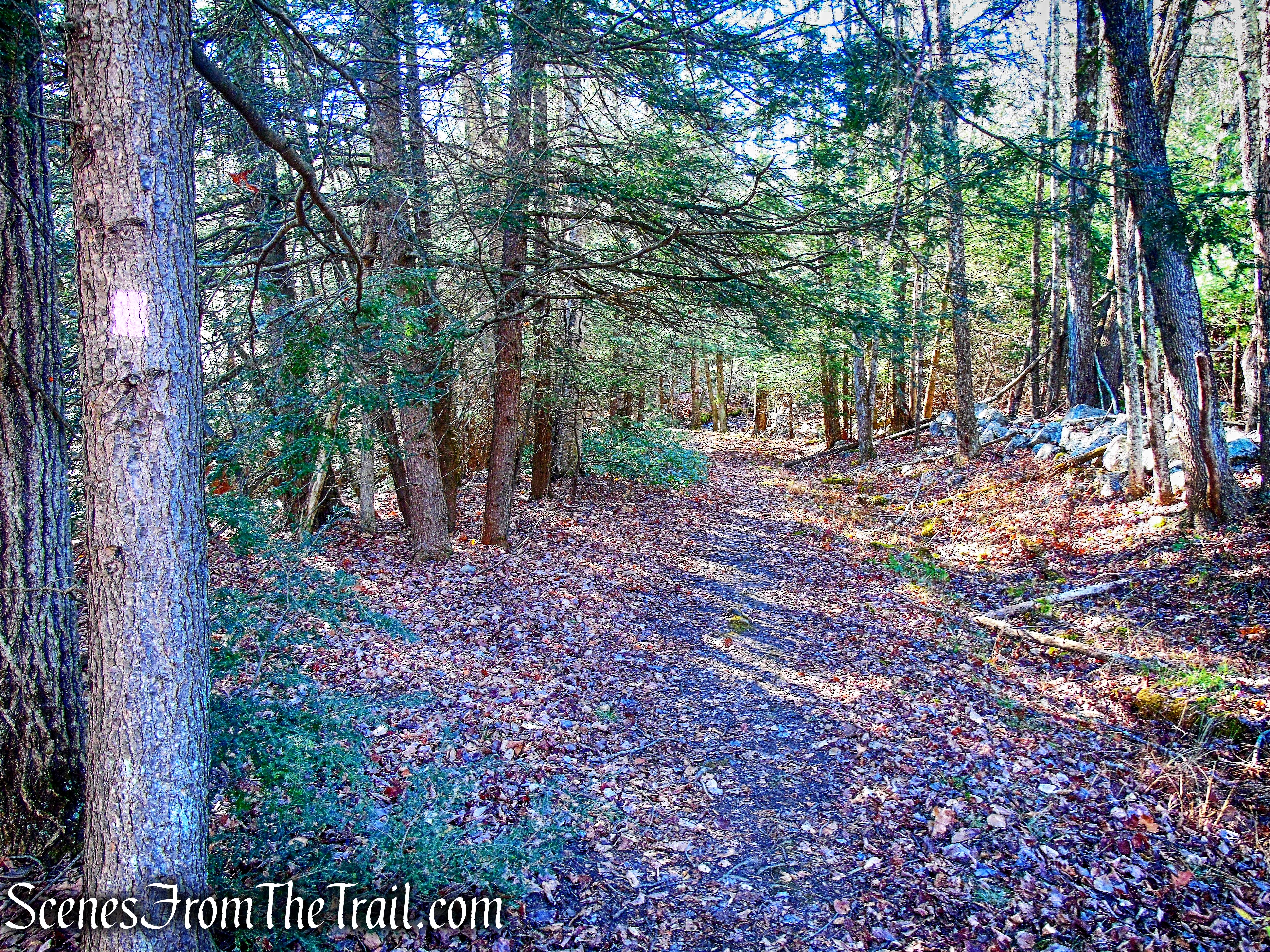
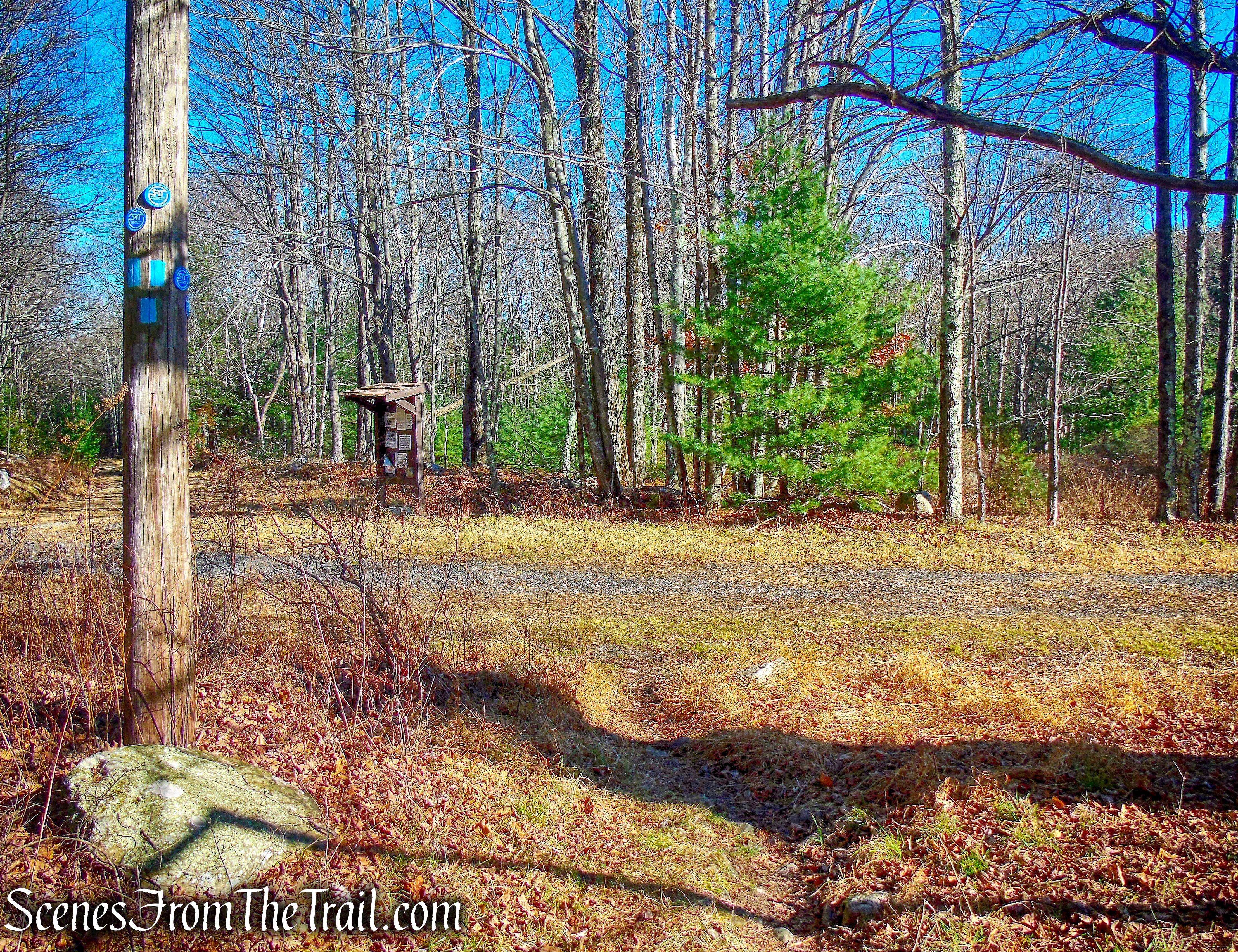
I love to hit the trails early, but like most of the preserves in The Gunks, Minnewaska doesn’t open until 9:00 am. Nevertheless, we got there just as they opened and there were only several cars in the lower lot, where we parked. From the kiosk at the rear of the parking area, we walked past the gate onto the Lower Awosting Carriage Road.
Lower Awosting Carriage Road
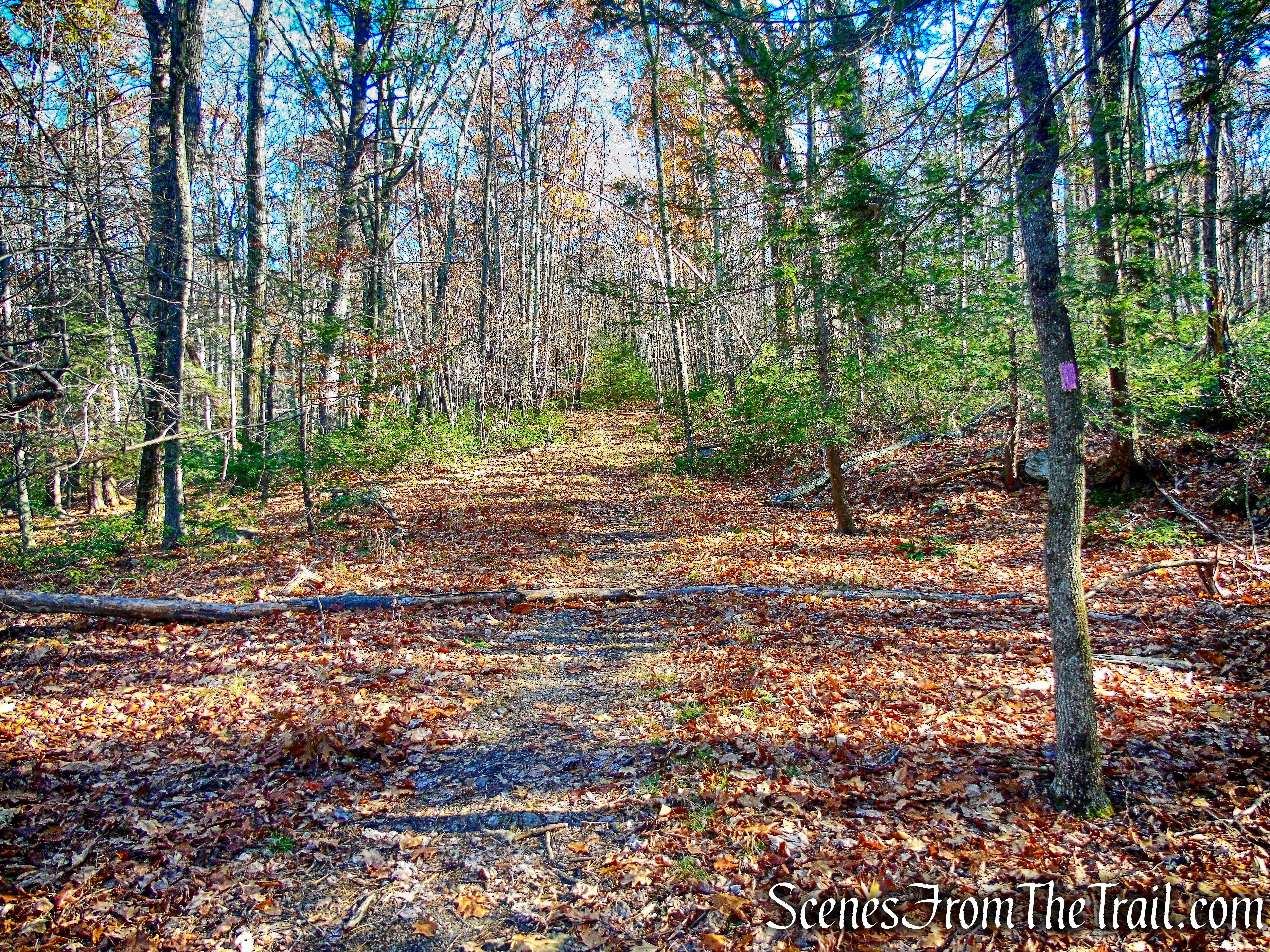
Almost immediately, we turned left onto the yellow-blazed Mossy Glen Footpath.
Mossy Glen Footpath
The trail travels southwest through the forest, paralleling the Lower Awosting Carriage Road.
Mossy Glen Footpath
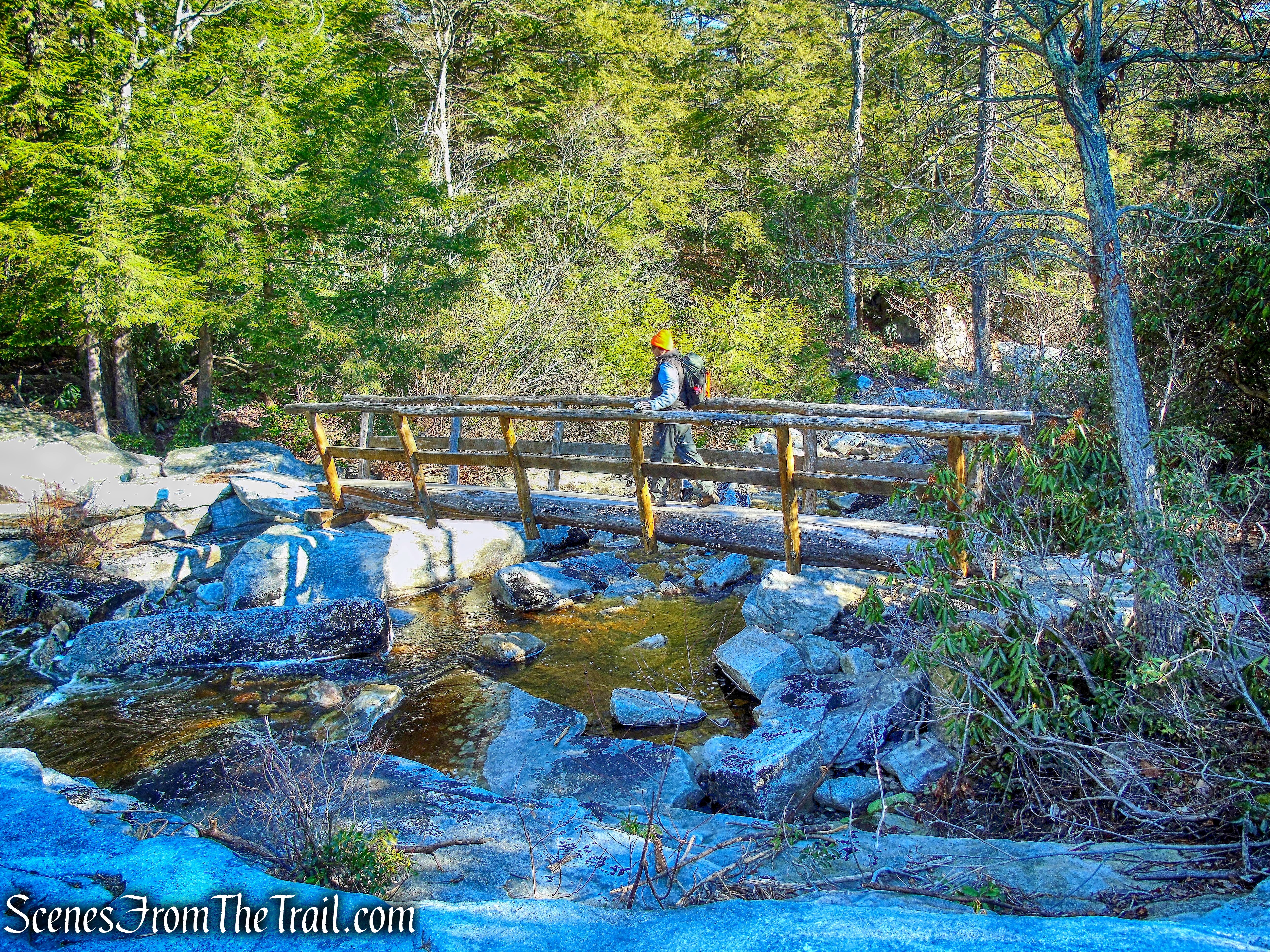
Approximately 0.53 miles from the start of the trail, the Mossy Glen Footpath crosses the Peters Kill on a log footbridge.
log footbridge – Mossy Glen Footpath
After crossing the bridge, the trail turns right and continues southwest, along the Peters Kill. For the next mile or so, it hugs the stream and comes out on rock slabs near the edge of the water. On the day of this hike, some of the rock slabs were coated with a thin sheet of ice.
Mossy Glen Footpath
After about 1.7 miles from the start, the Mossy Glen Footpath ends at a T-intersection with the blue-blazed Blueberry Run Footpath. We turned right and began heading northwest, now following the blue blazes.
Mossy Glen and Blueberry Run junction
The Blueberry Run Footpath descends slightly and crosses the Peters Kill on another log footbridge, just below an attractive cascade.
log footbridge – Blueberry Run Footpath
Peters Kill
The trail climbs some rock steps and crosses the Lower Awosting Carriage Road, reenters the woods and soon climbs steeply to the crest of the ridge.
Blueberry Run Footpath
After traveling on the Blueberry Run Footpath for about 0.4 miles, the trail ends at a junction with the blue-blazed Jenny Lane Footpath (also the route of the Shawangunk Ridge Trail). We turned right and began heading northeast on the Jenny Lane Footpath, which proceeds across rock slabs through an attractive forest of pitch pines.
Jenny Lane Footpath
Jenny Lane Footpath
After following the Jenny Lane Footpath for almost two miles, we crossed the Sanders Kill on a wooden footbridge and a wet area on puncheons. The trail then descends steeply, levels off and soon crosses a tributary stream on stepping stones, with a nice cascade on the left.
cascade – Jenny Lane Footpath
A short distance beyond, the Jenny Lane Footpath crosses Route 44/55 and reenters the woods. In about 0.4 miles, the Jenny Lane Footpath ends at a junction with the pink-blazed Wawarsing Turnpike Footpath.
junction with the pink-blazed Wawarsing Turnpike Trail
We turned right, now following the pink blazes of the Wawarsing Turnpike Footpath. This trail follows follows a portion of the original toll road, built in 1856 to cross over the Shawangunk Ridge from New Paltz to Kerhonkson, called the New Paltz-Wawarsing Turnpike. It was replaced in 1929 by Route 44/55.
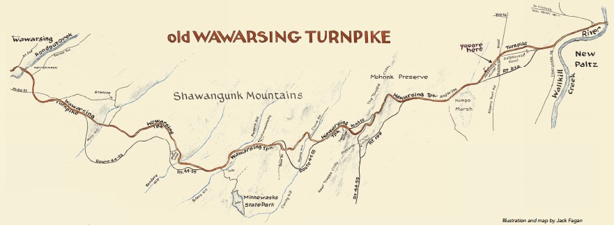
Wawarsing Turnpike – New Paltz Historic Preservation Commission
Wawarsing Turnpike Footpath
The trail descends and crosses the Sanders Kill on stepping stones.
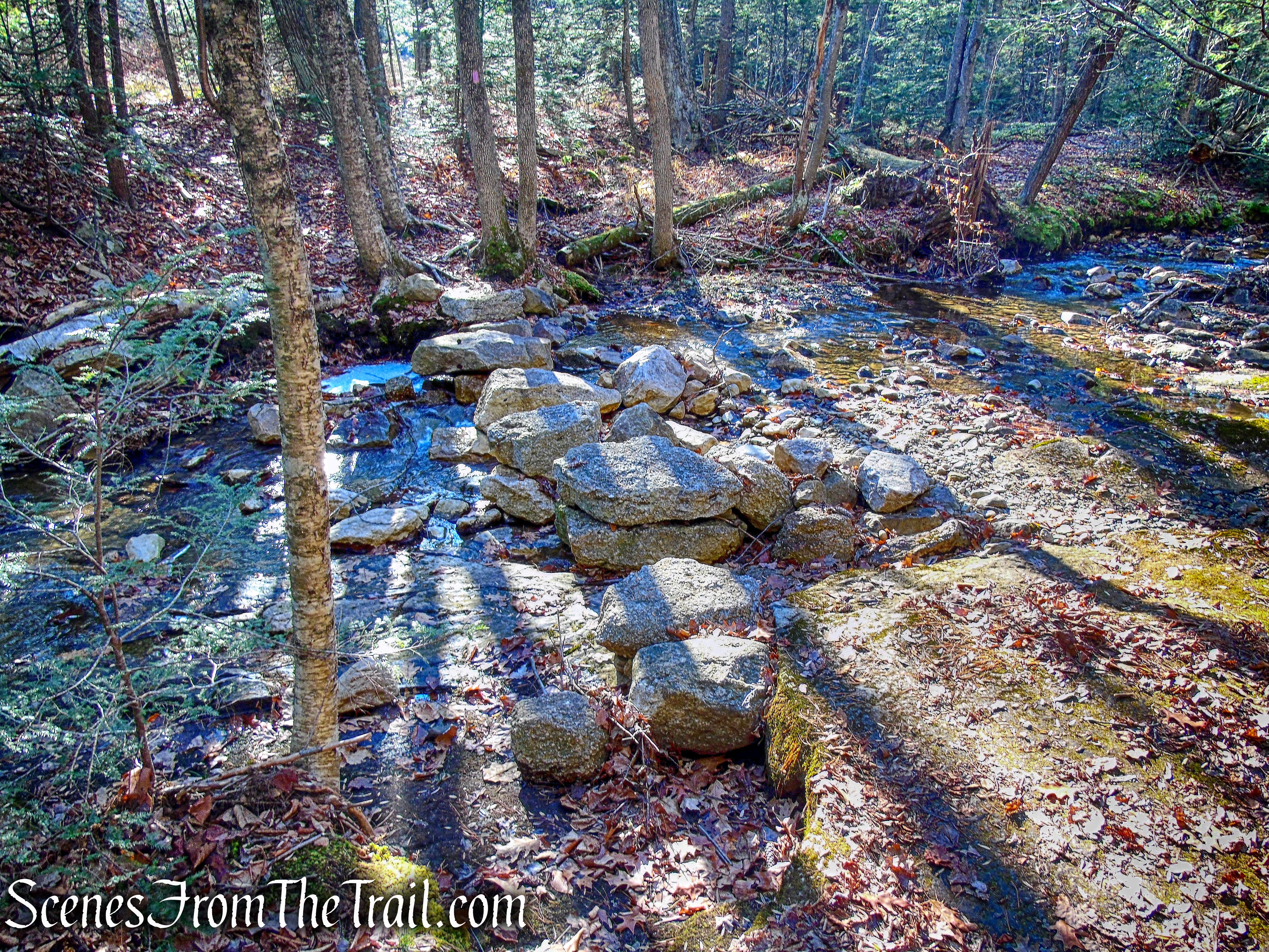
Wawarsing Turnpike Footpath
The trail climbs steadily on the eroded and rocky woods road, with a massive blowdown blocking the trail.
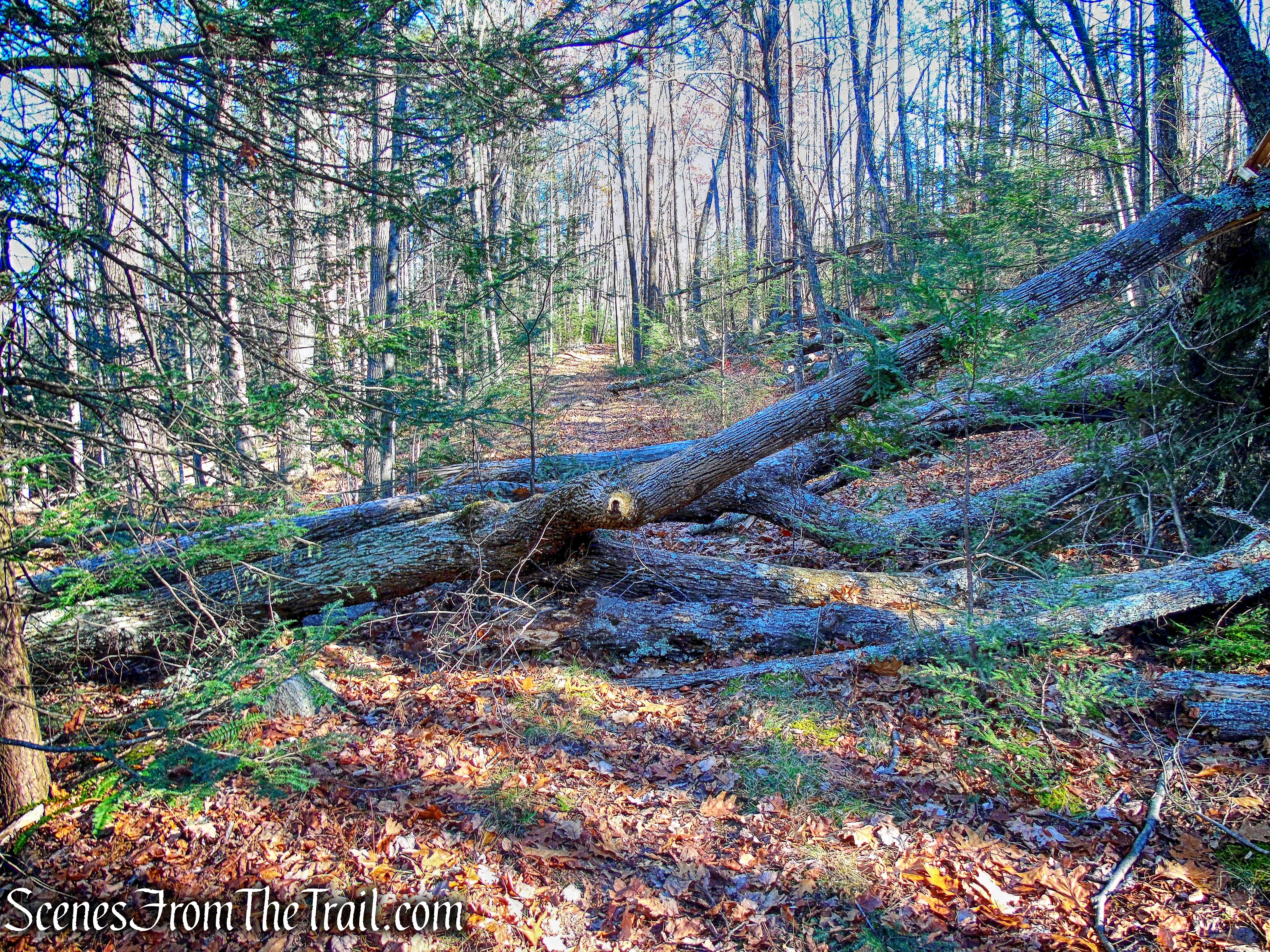
Wawarsing Turnpike Footpath
As it travels uphill, the trail gradually gets closer to Route 44/55, which can be heard and seen through the trees on the right.
Wawarsing Turnpike Footpath
The Wawarsing Turnpike Footpath exits the woods as it reaches Route 44/55 and turns left along the road. In about 100 feet, it ends at a junction with the blue-blazed High Peters Kill Trail. Here we crossed the road and walked to the parking area, where our hike began.
To get a better idea of what the hike is like, view the short video below, with additional images added.
This was a nice hike, although not one of the better ones at Minnewaska State Park Preserve. The Mossy Glen Footpath was the highlight of the hike which I would gladly hike again, but I would incorporate other trails.
Pros: Mossy Glen Footpath, Peters Kill, lesser traveled trails.
Cons: No mountaintop views, rock slabs on Mossy Glen Footpath get icy in cold weather.
Take a hike!
log bridge – Mossy Glen Footpath

Are there any trailheads accessible prior to 9am in the Gunks? Looking to do a sunrise hike but seems to be a challenge to find an accessible lot at that hour. Thank you!
LikeLike
Try the Jenny Lane parking lot, about a mile northwest from the main entrance.
https://goo.gl/maps/YeBsogJELSXGB9QN9
LikeLike