December 3, 2017 – Kerhonkson, NY
Difficulty: Moderate
Length: Approximately 6.5 miles
Max elevation: 1,781 ft.– total elevation gain approximately 748 ft.
Route type: Circuit
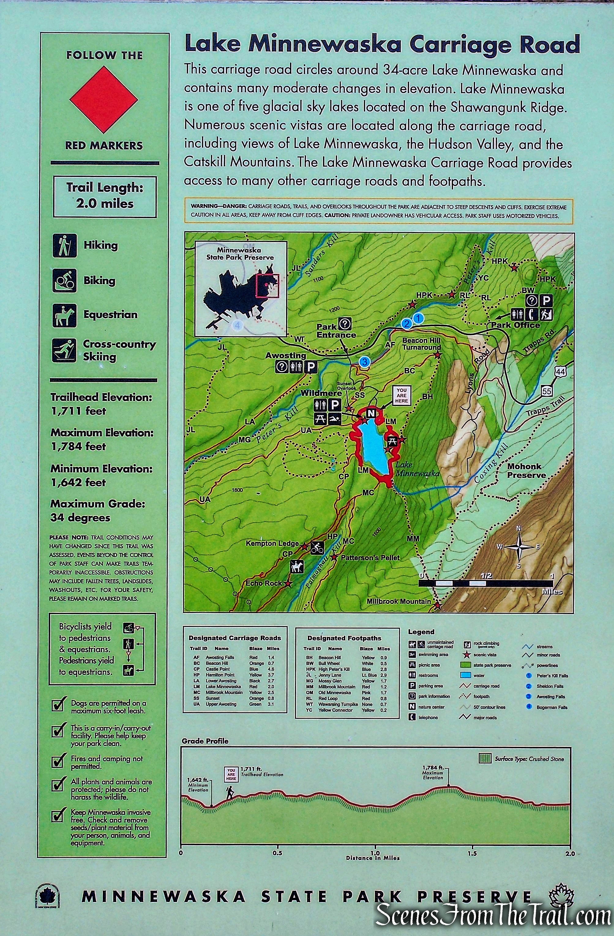
Map: Shawangunk Trails
Fee: $10.00 per vehicle – Empire Pass Accepted
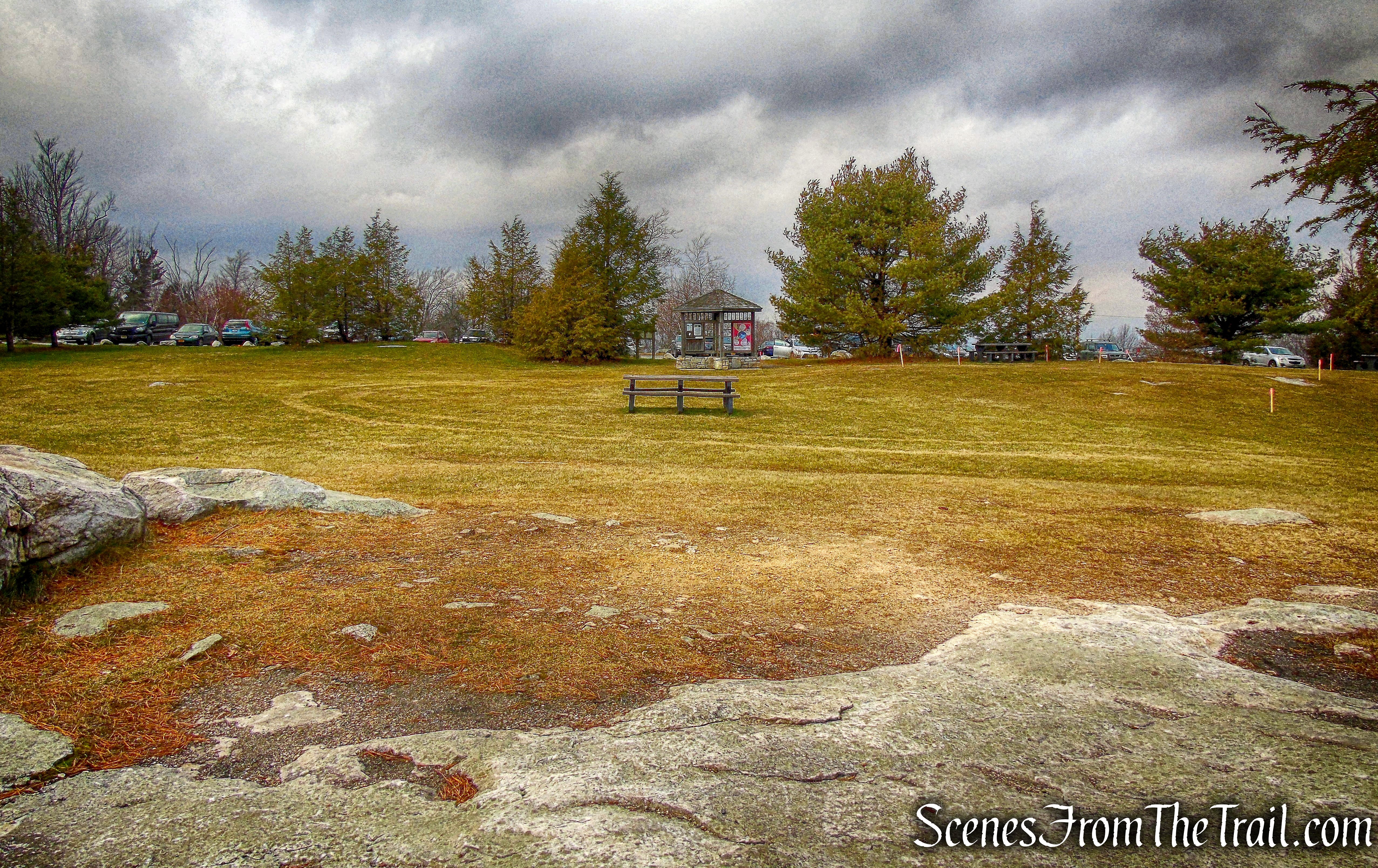
Trailhead parking: 5281 Route 44-55, Kerhonkson, NY 12446
Whenever I do a hike that I truly enjoy, I instinctively want to go back and explore different parts of the area. “The Gunks” is one of those places. With its sky lakes, waterfalls, Carriage roads, rugged terrain and sheer white cliffs, it’s easy to fall in love with the Shawangunk Ridge. It is well worth the hour and a half hour drive from Westchester County to take in its splendor. This hike combines easy walking carriage roads, a gorgeous lake, a steep climb on a rugged trail and views that last for days. We did the hike clockwise from the northern end of Lake Minnewaska where there is a sizable parking area that fills up really early.
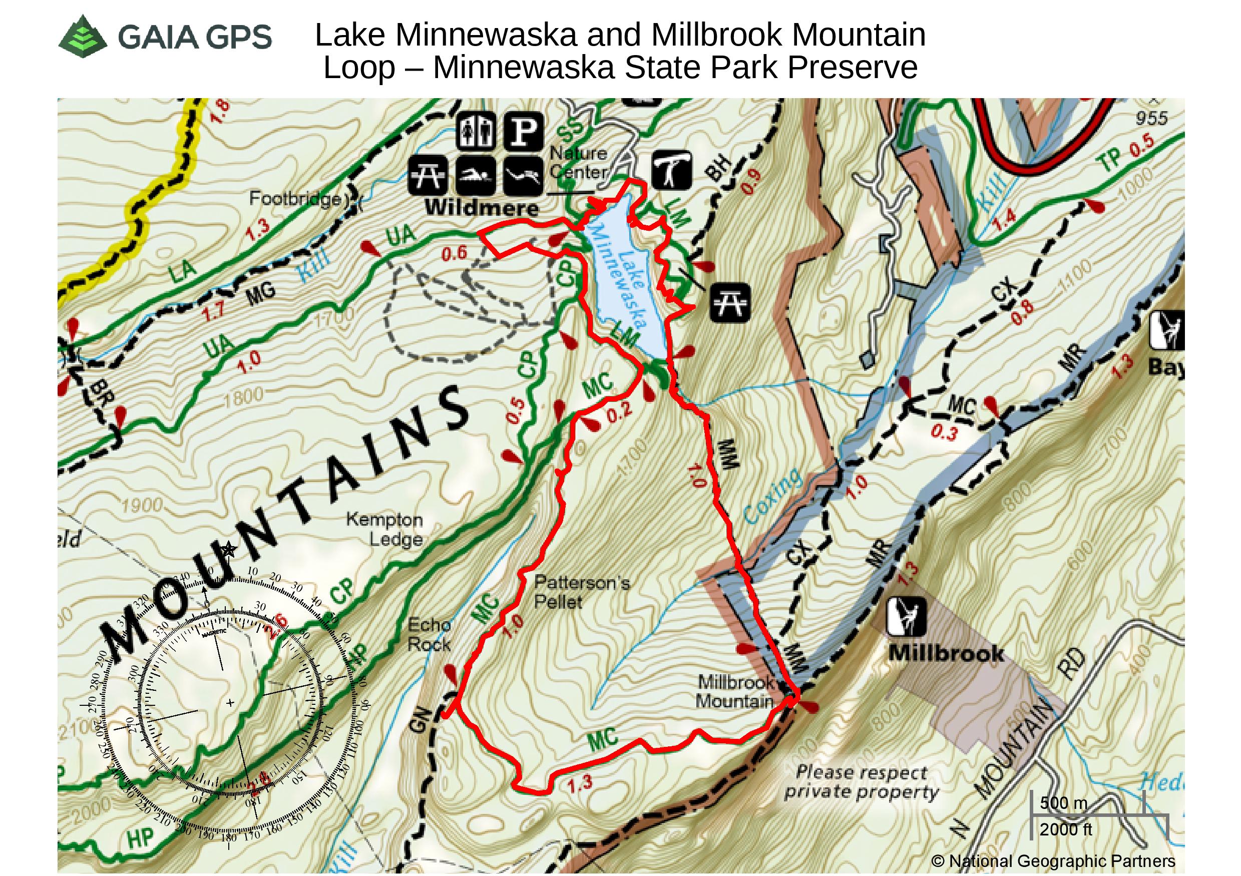
Lake Minnewaska and Millbrook Mountain Loop
View the Google Earth Fly-Through video of the hike below.
Once geared up, we headed towards Lake Minnewaska.
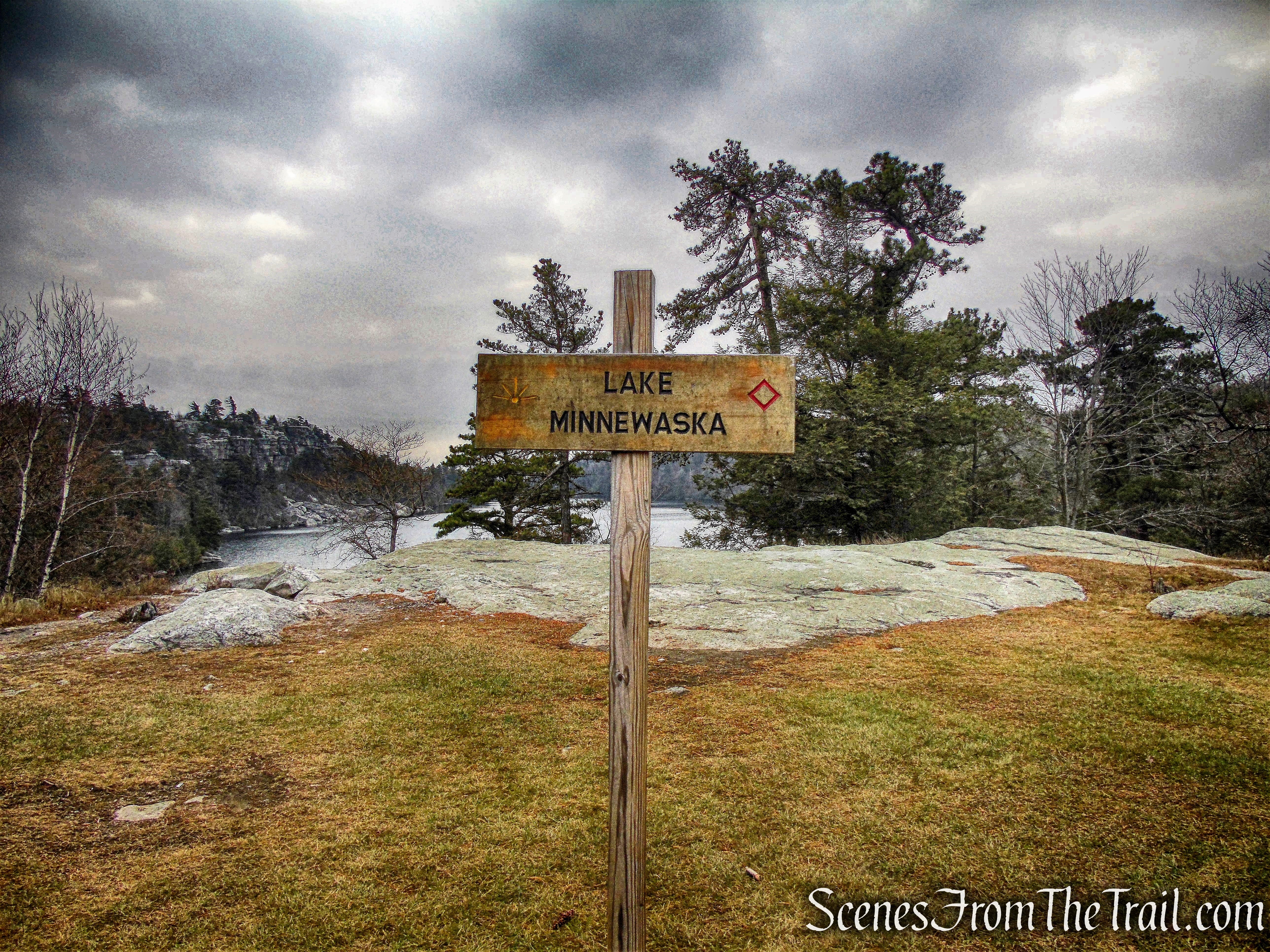
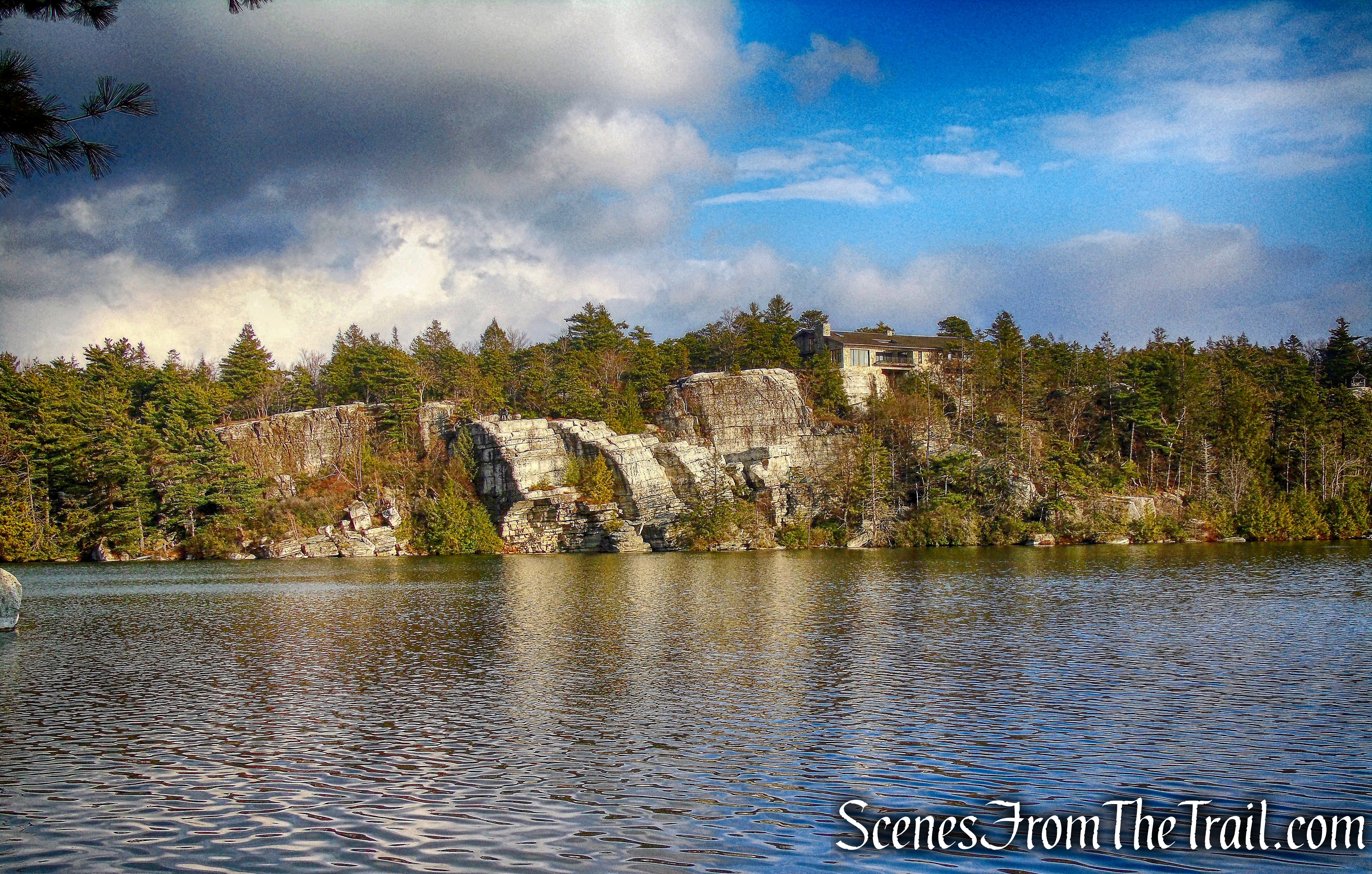
Lake Minnewaska
The 34-acre “sky lake” is approximately one mile long by one-quarter mile wide at its widest point.
Lake Minnewaska
A sky lake is a pristine and often unusually clear lake that is fed only from rain water.
Lake Minnewaska
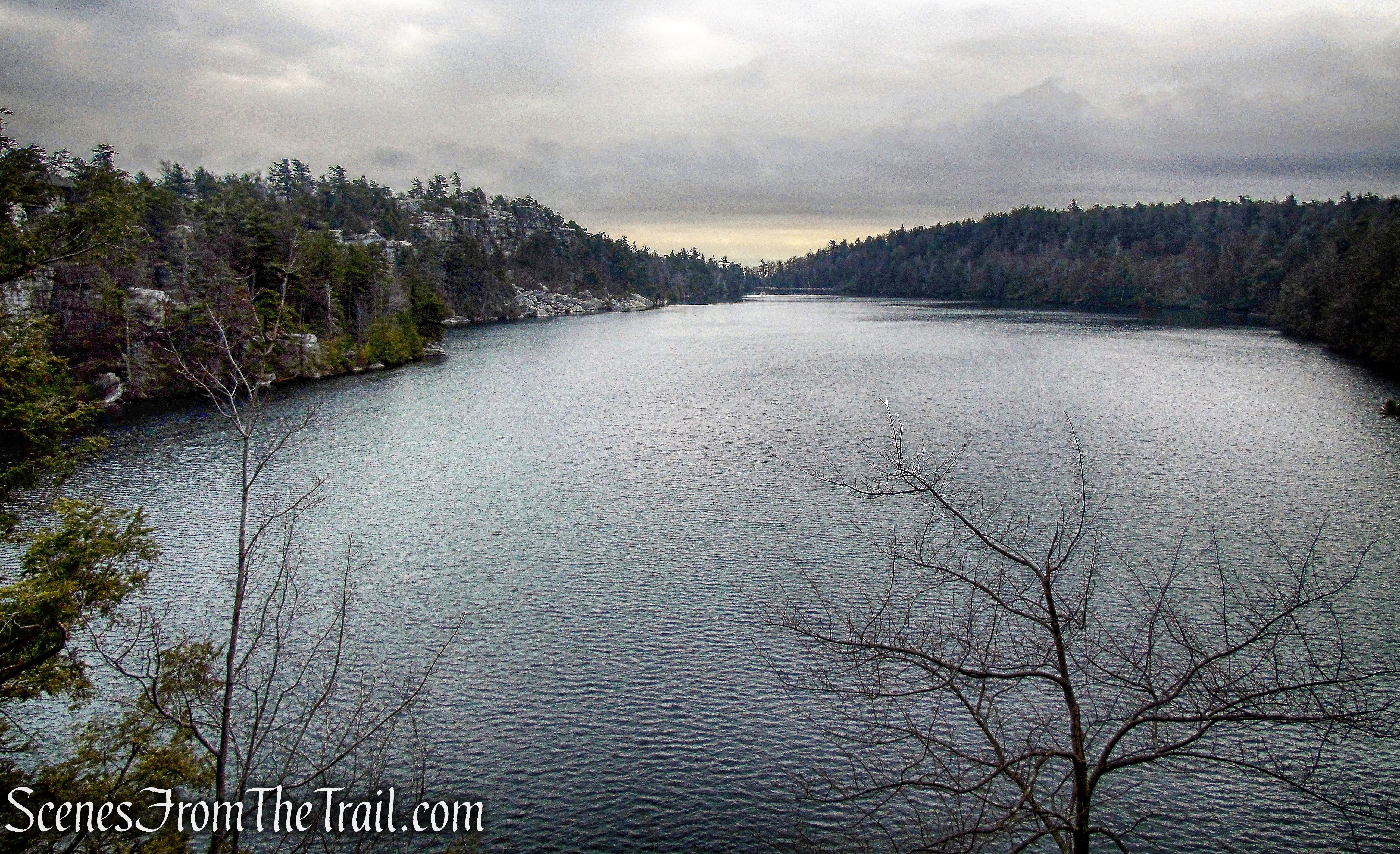
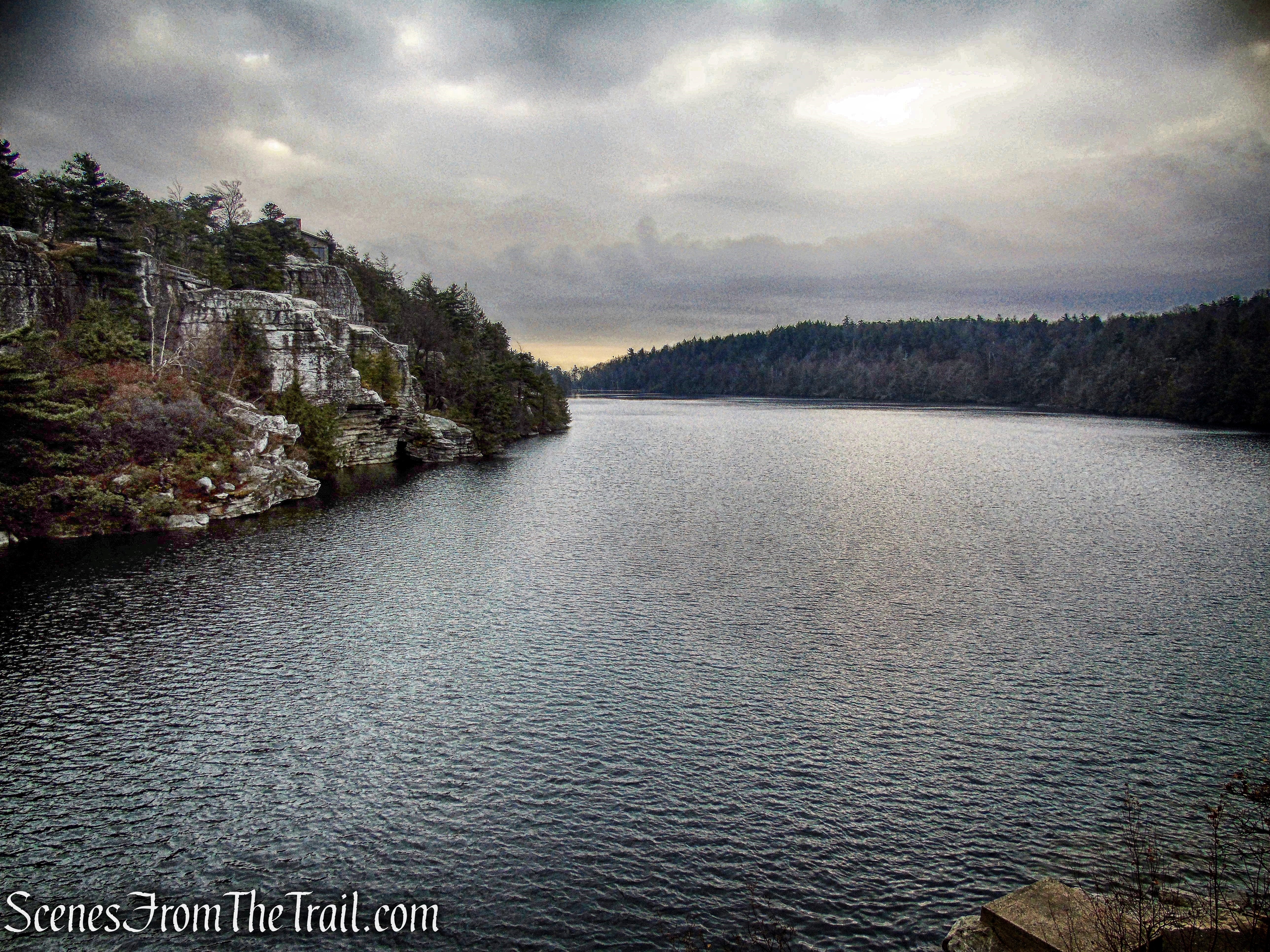
We began our hike on the red-diamond-blazed Lake Minnewaska Carriage Road. This carriage road is 2 miles long with moderate changes in elevation as it circles the lake. On a nice day there is a lot of foot traffic on this road.
Lake Minnewaska Carriage Road
The Lake Minnewaska Carriage Road climbs gradually along the eastern side of the lake.
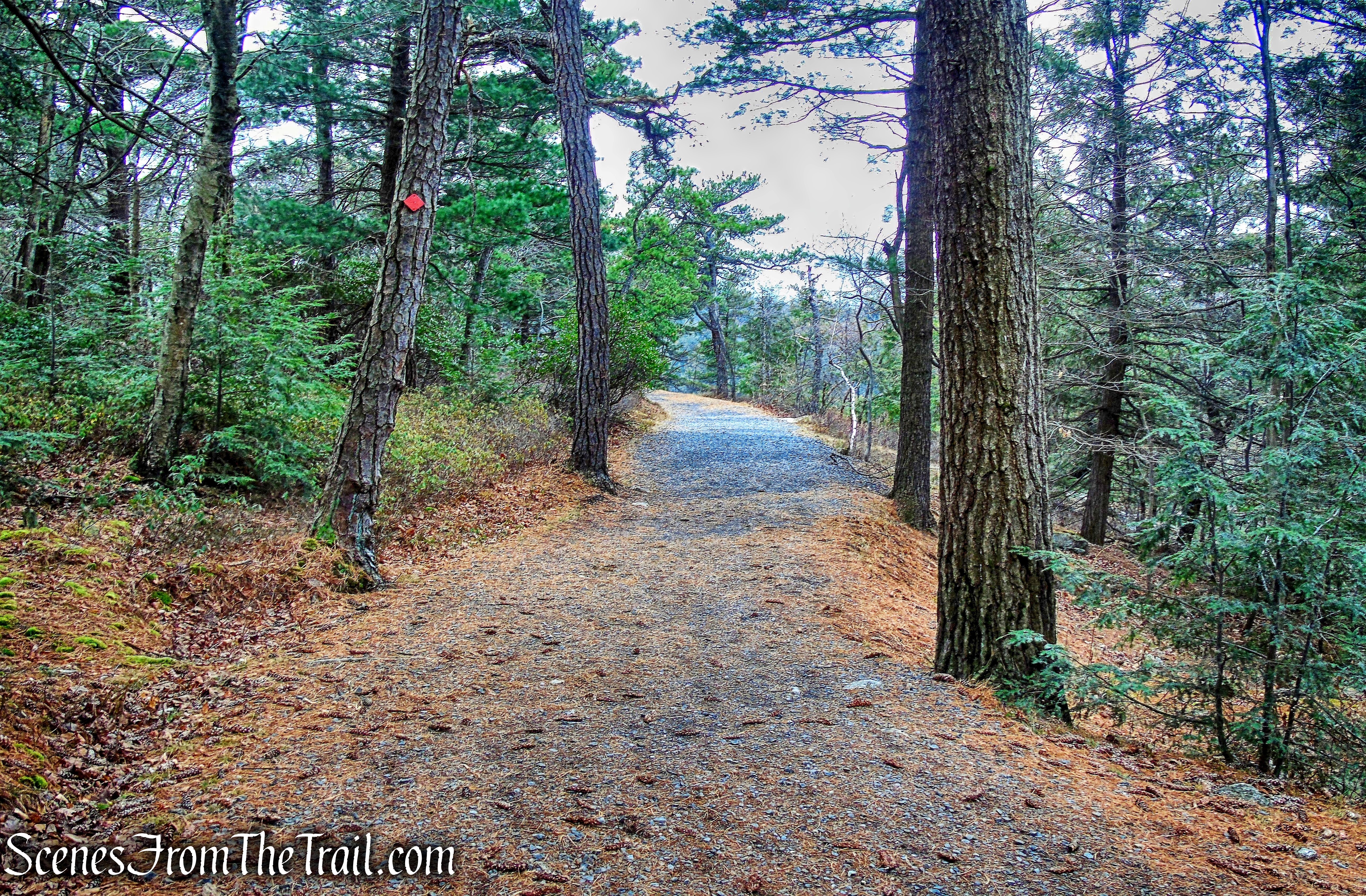
Lake Minnewaska Carriage Road
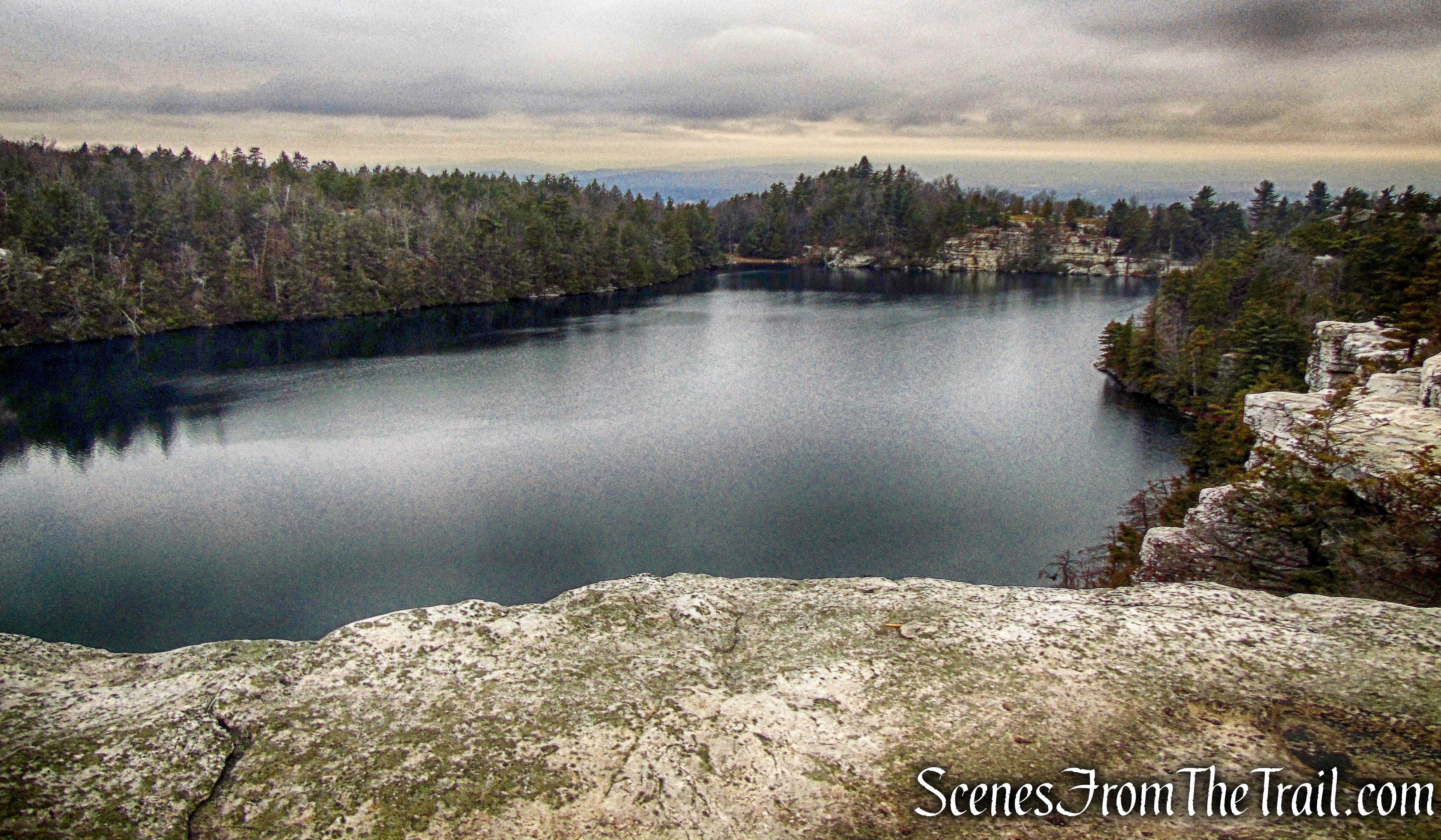
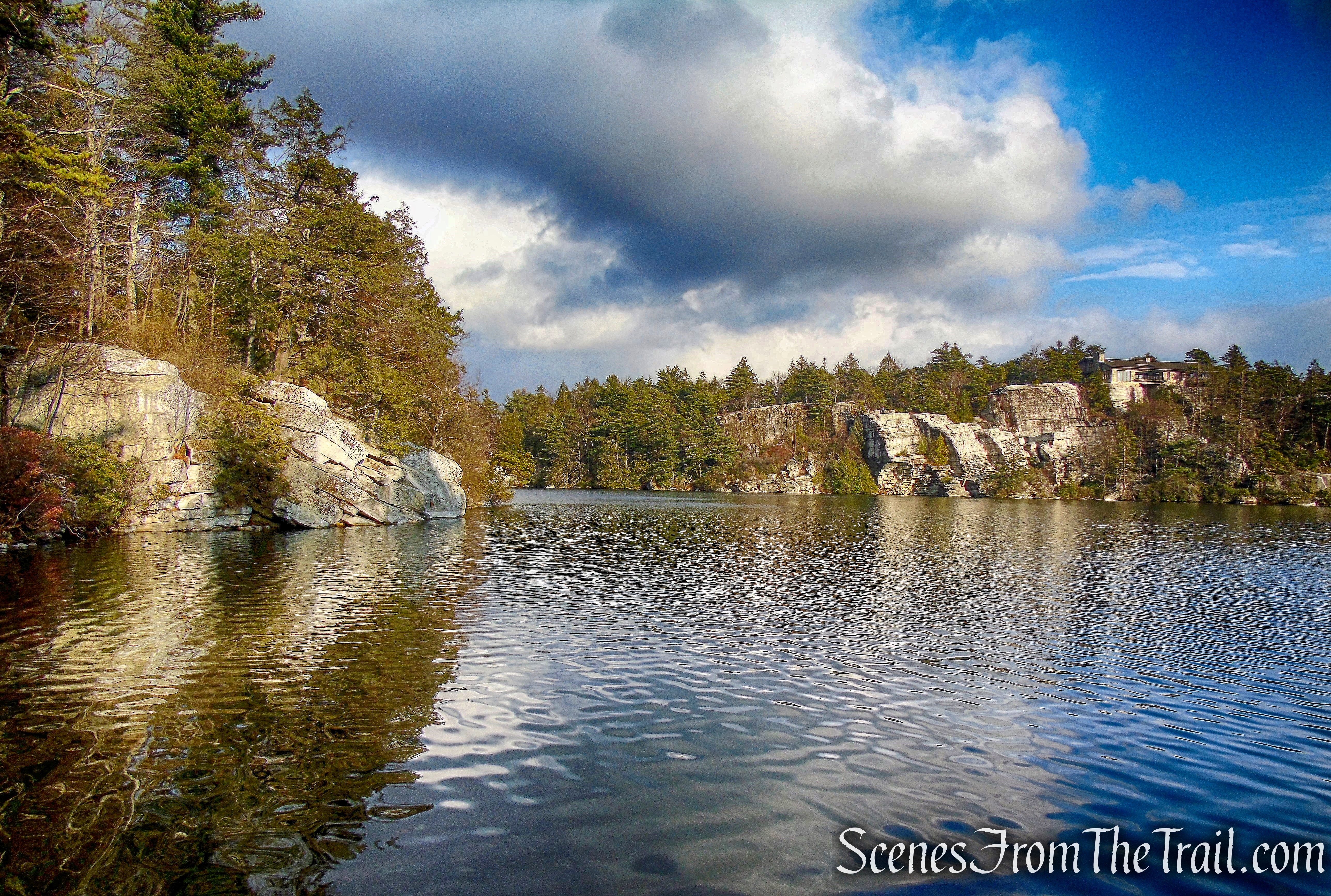
In a short distance, we came to a nice viewpoint from the cliffs and hadn’t even broken a sweat yet. The cliffs on the other side of the lake is where we began our hike.
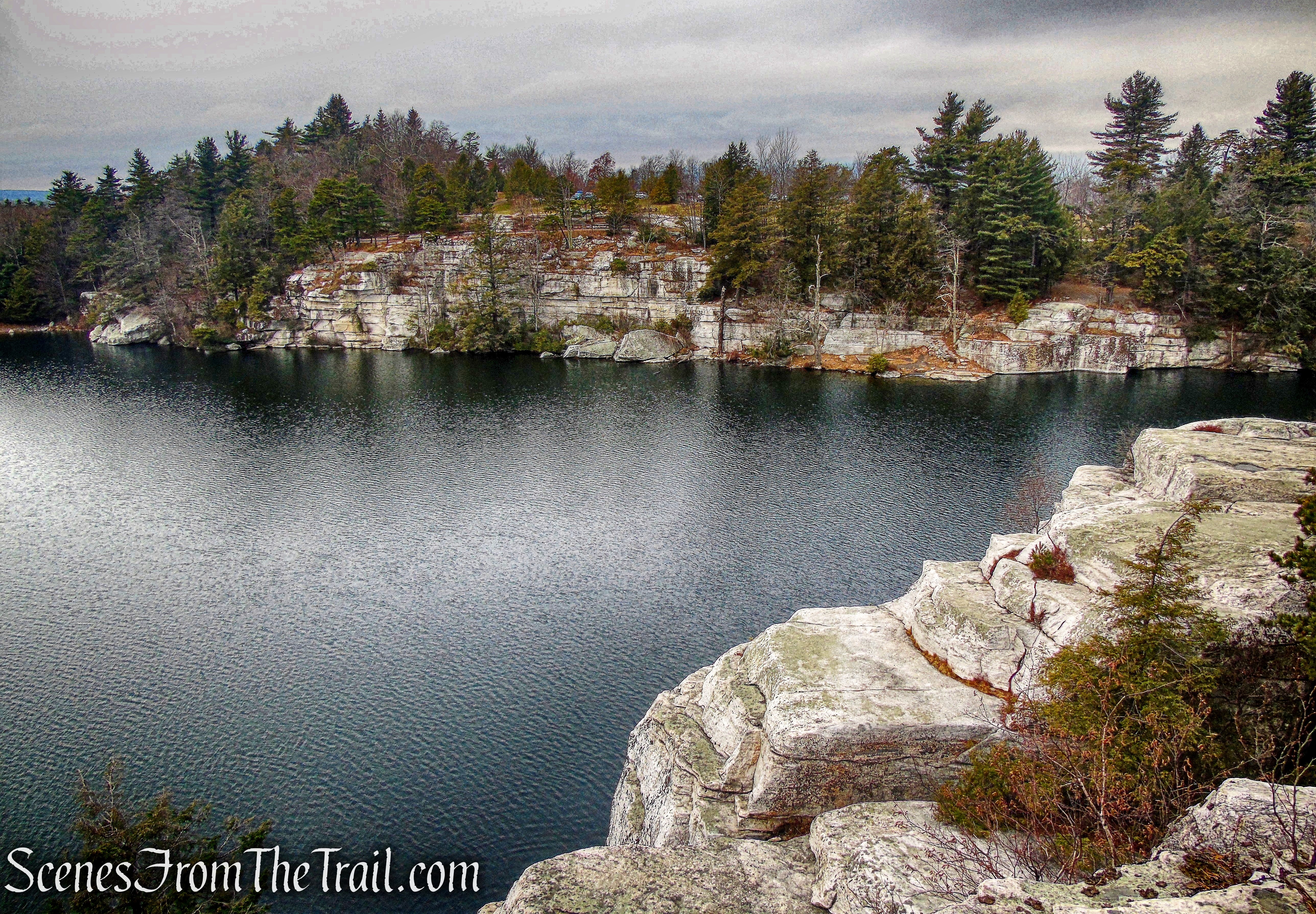
Lake Minnewaska
We wandered off the road and walked along the cliffs enjoying the scenery. We found our way back to the carriage road and walked over a picturesque wooden footbridge, known as the “Dry Bridge.”
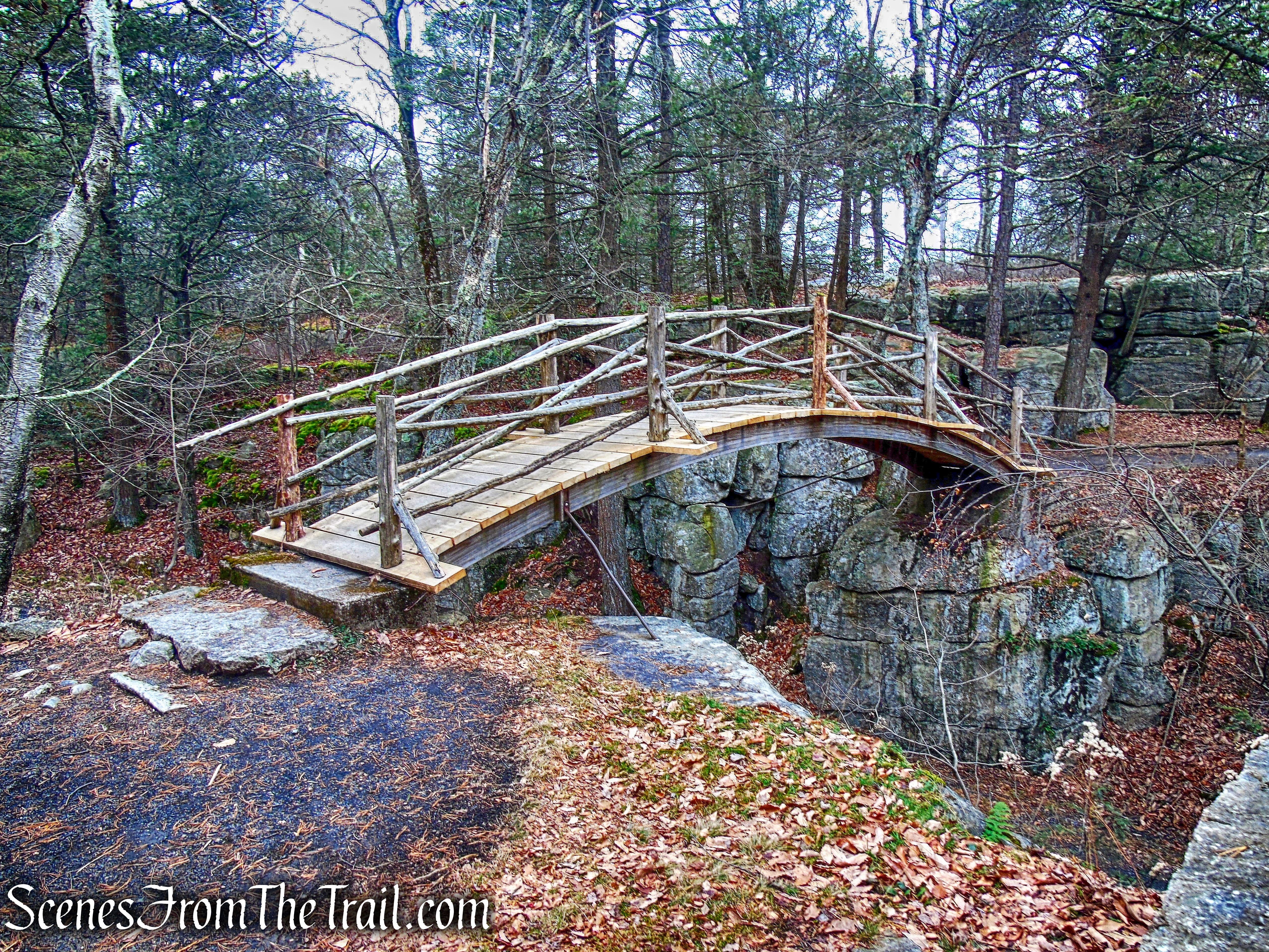
Dry Bridge
Continuing uphill, the road leads up to the former site of the Cliff House, now a picnic area, that overlooks the lake. Opened in 1879 at an elevation greater than that of the Lake Mohonk Mountain House, Cliff House boasted even more expansive valley and mountain views.
view northwest from near the site of the Cliff House
After a long decline, Cliff House was abandoned in 1972 due to disrepair and soaring maintenance costs. At the New Year in 1978, Cliff House burned to the ground in a spectacular fire.
view south from near the site of the Cliff House
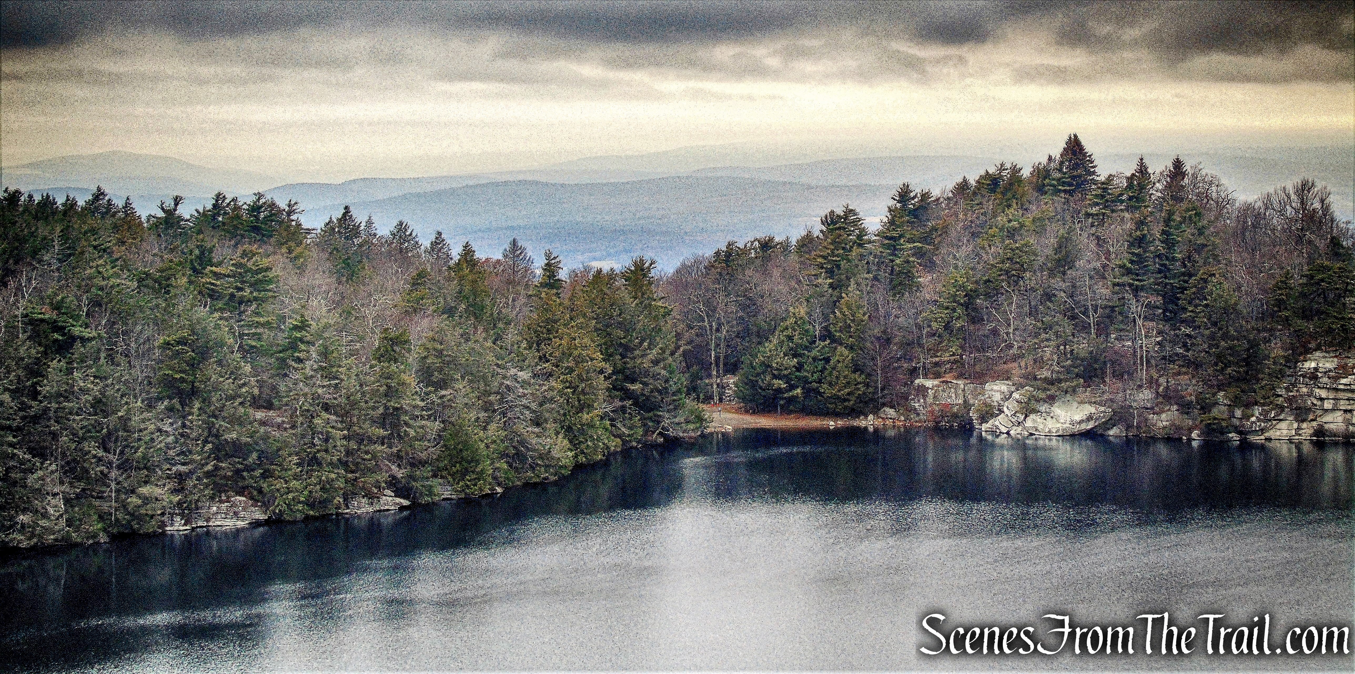
We continued on the Lake Minnewaska Carriage Road as it heads south and gently descends. Just before the trail turns right, there is panoramic east-facing view from a rock ledge to the left of the trail.
east-facing view – Lake Minnewaska Carriage Road
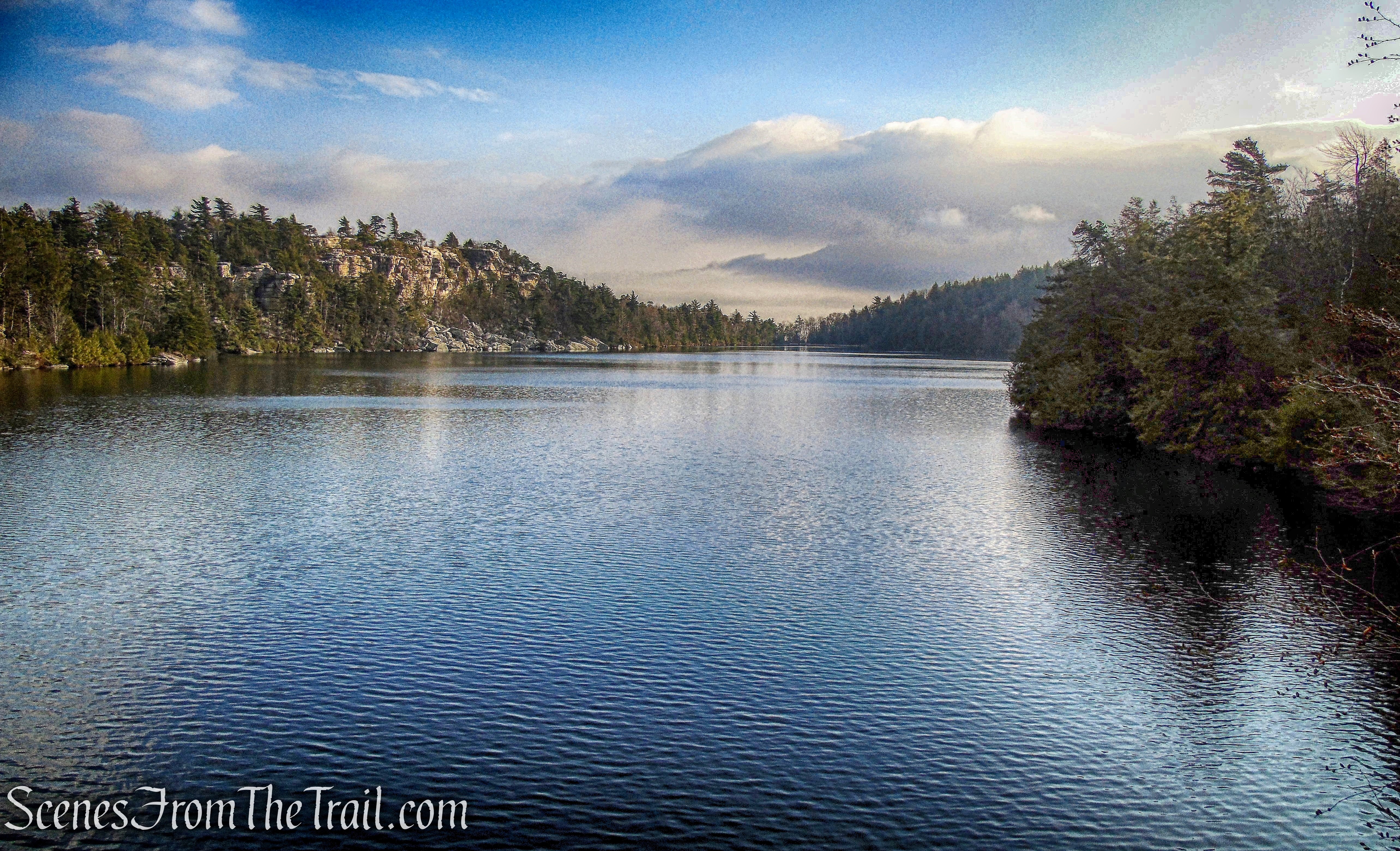
The Lake Minnewaska Carriage Road continues downhill to the southern end of Lake Minnewaska.
southern end of Lake Minnewaska
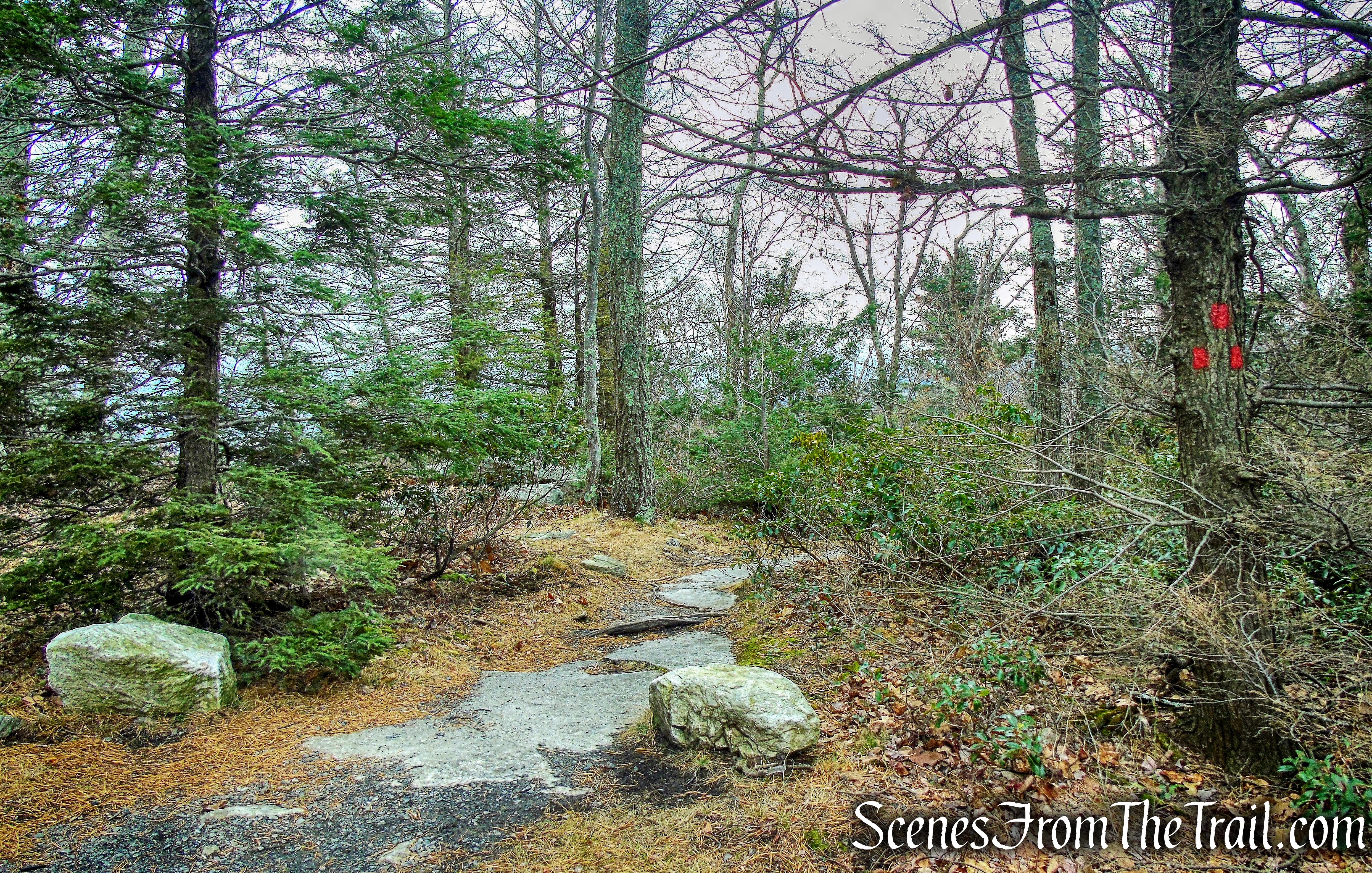
Just to the left is the start of the red-blazed Millbrook Mountain Footpath. It is a 1.2 mile long somewhat rugged trail.
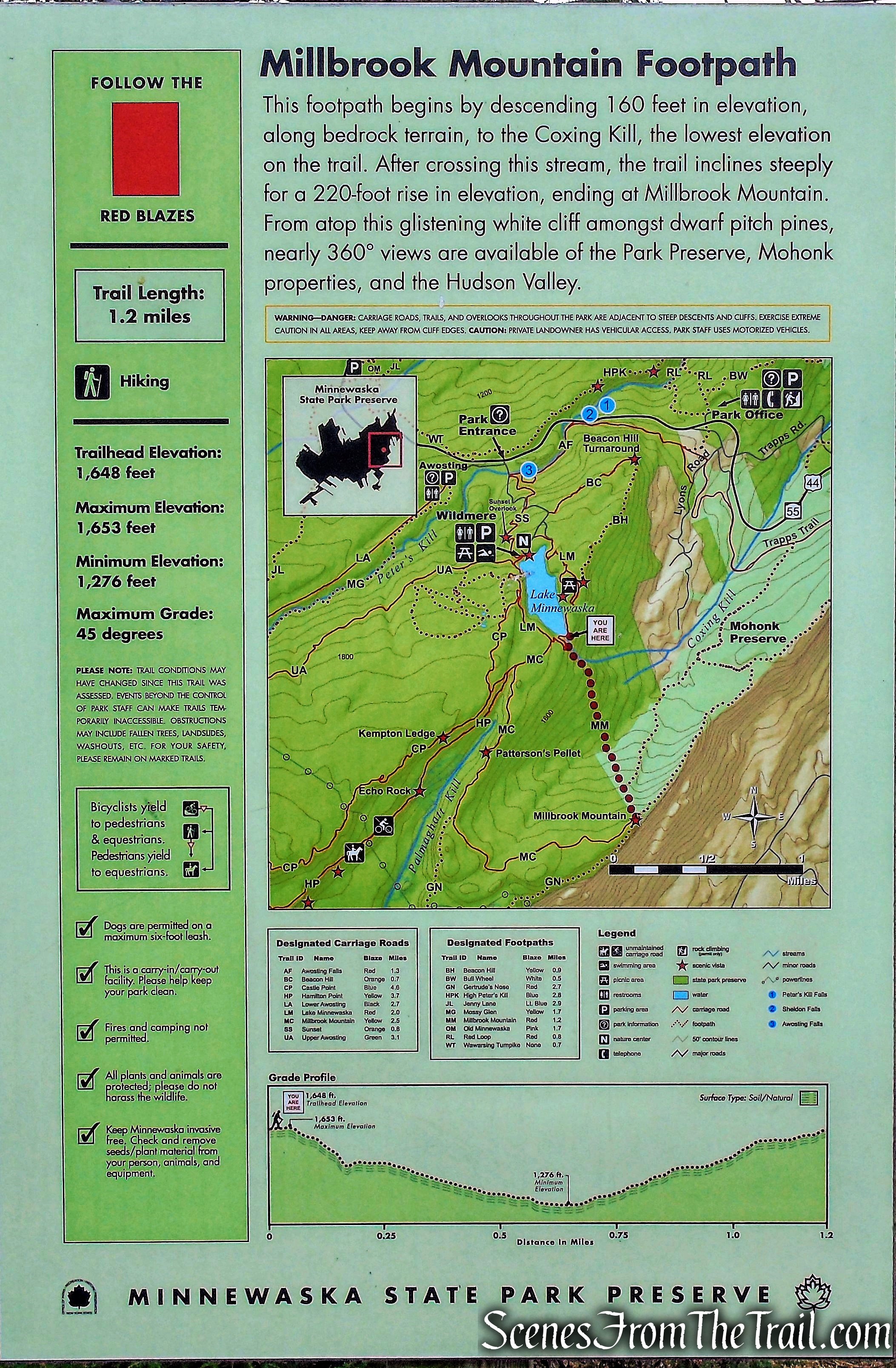
Millbrook Mountain Footpath
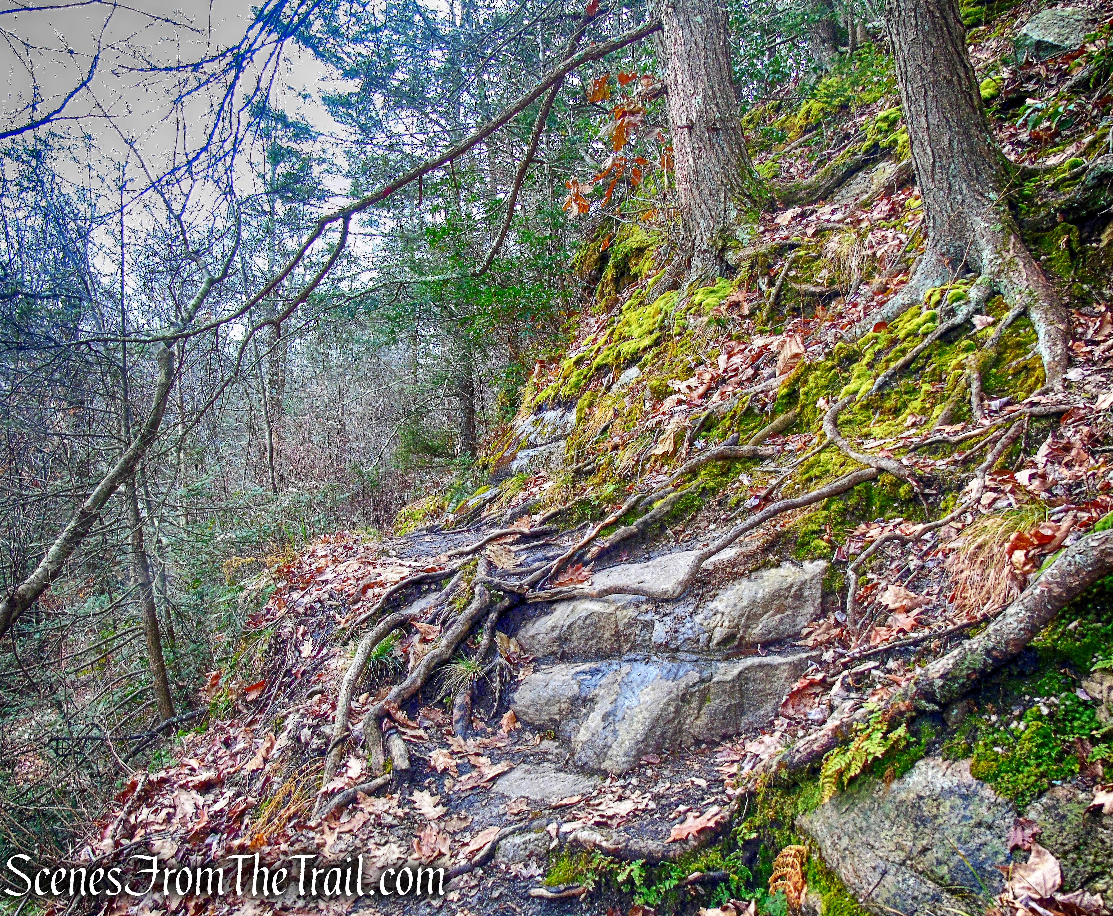
This trail begins by descending 160 feet in elevation along bedrock terrain.
Millbrook Mountain Footpath
This trail is narrow in places, often wet, muddy and the rocks slippery.
Millbrook Mountain Footpath
At the base of the descent, the trail reaches the Coxing Kill, the lowest elevation on the trail.
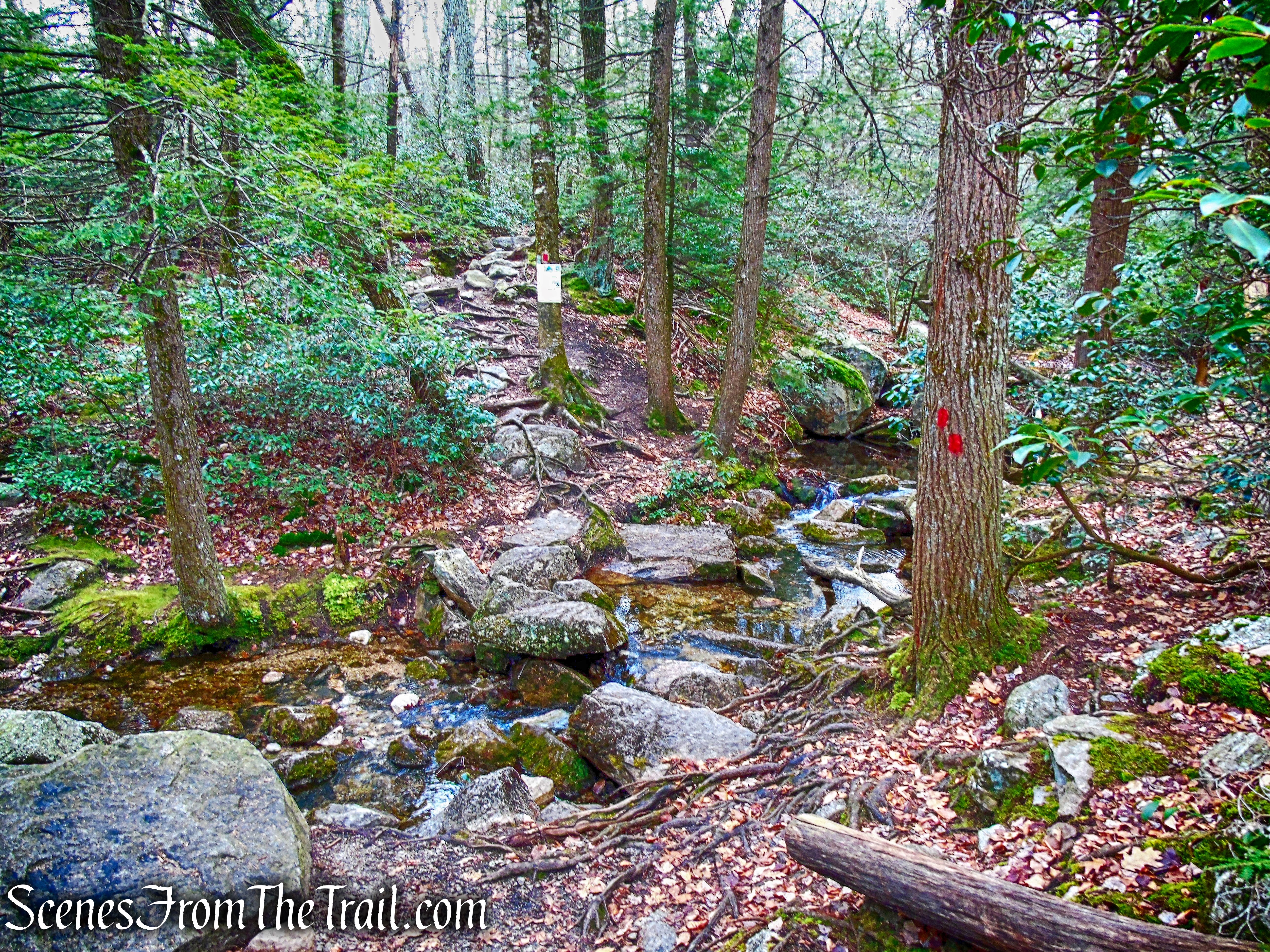
Coxing Kill – Millbrook Mountain Footpath
After rock hopping over the Coxing Kill, the Millbrook Mountain Footpath enters the Mohonk Preserve. Once at the summit and heading a few feet to the west, we would be back in Minnewaska State Park Preserve.
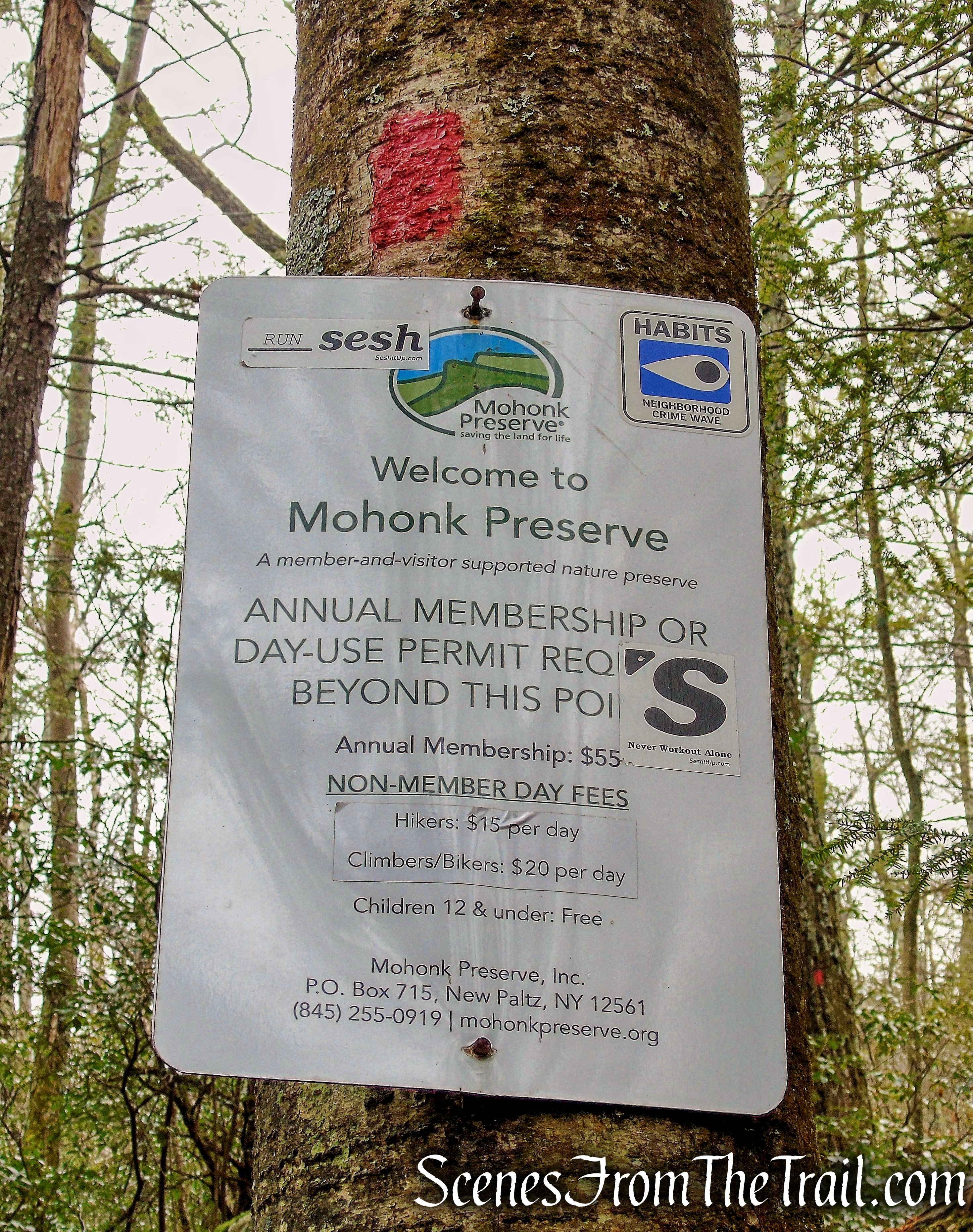
Mohonk Preserve – Millbrook Mountain Footpath
The trail now ascends steeply, gaining 220 feet of elevation in the next 0.4 mile, ending at the summit of Millbrook Mountain. The trail is rocky and often wet.
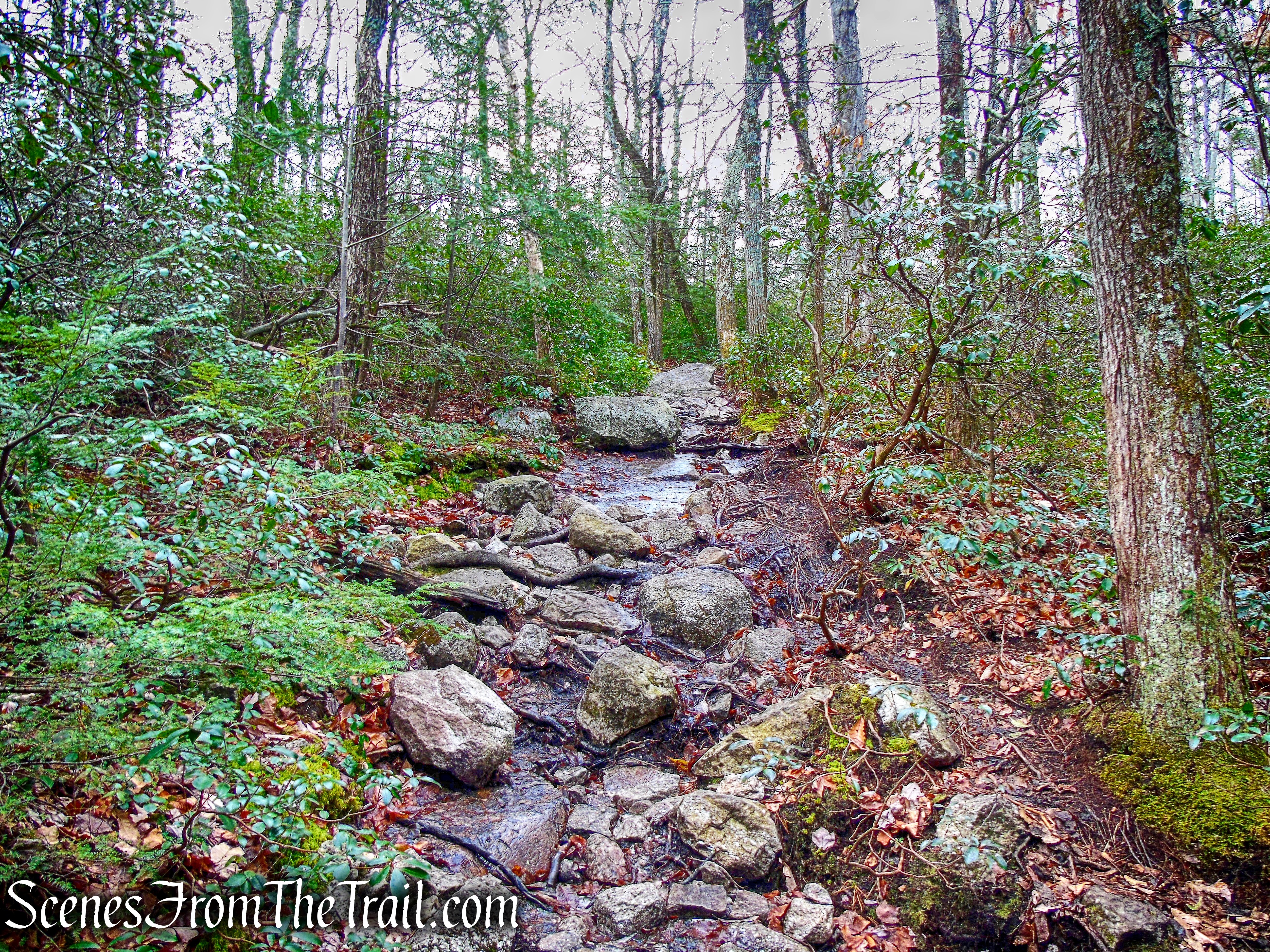
Millbrook Mountain Footpath
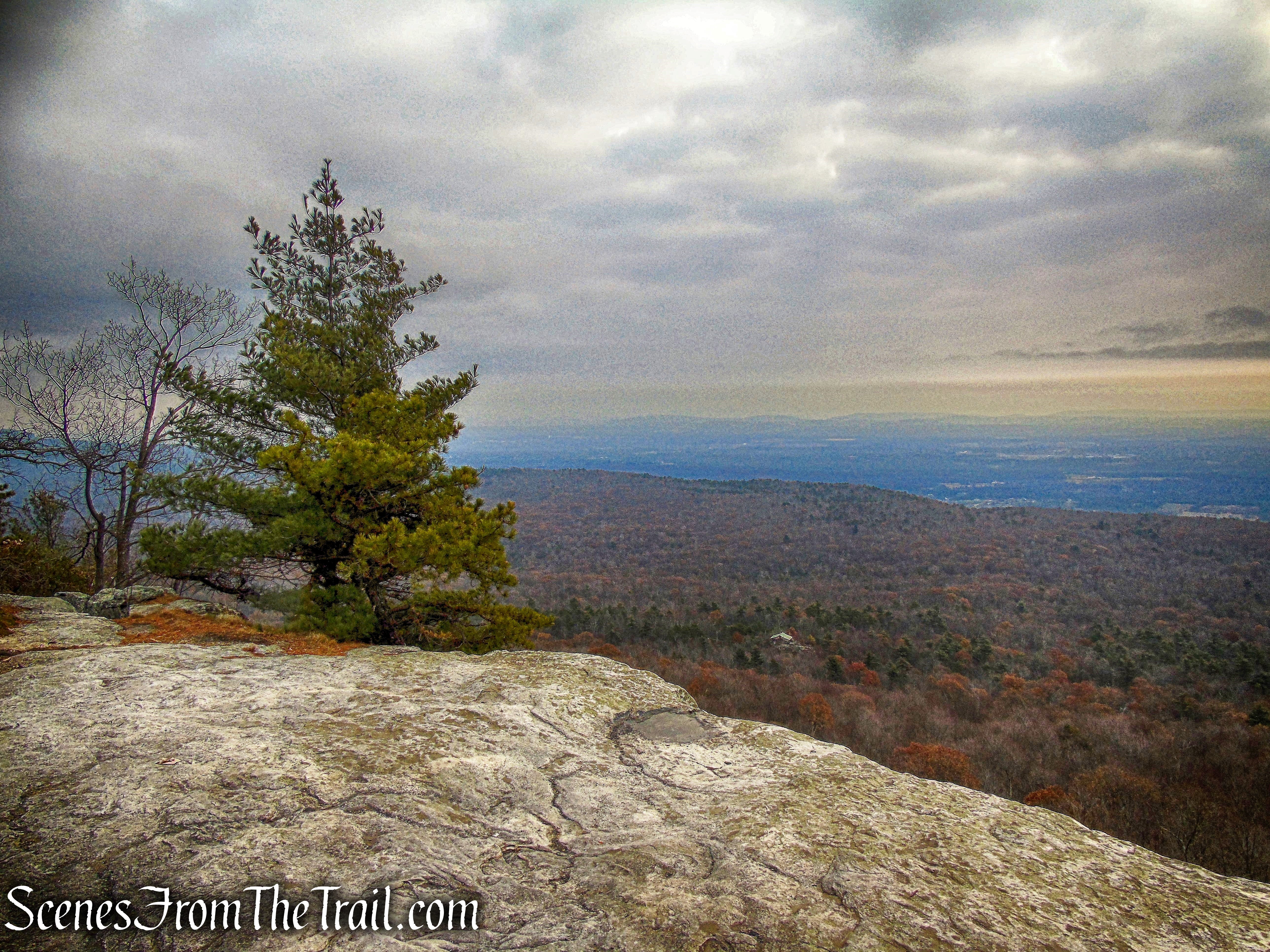
Along the way, the trail passes the start of the blue-blazed Coxing Trail that heads northeast to the Mohonk Preserve. We continued following the red blazes of the Millbrook Mountain Footpath until its terminus at the summit of Millbrook Mountain. Here we took a well deserved break.
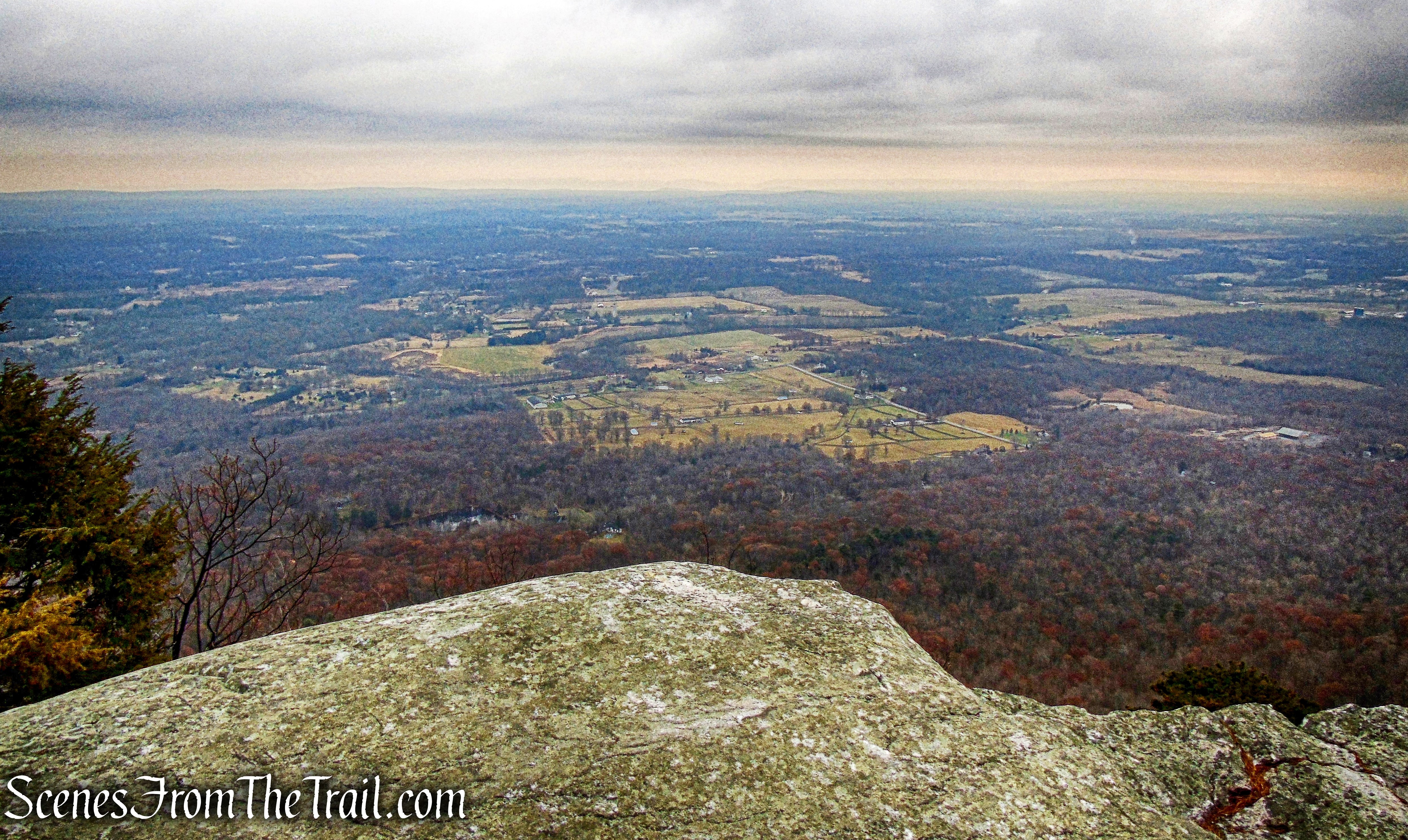
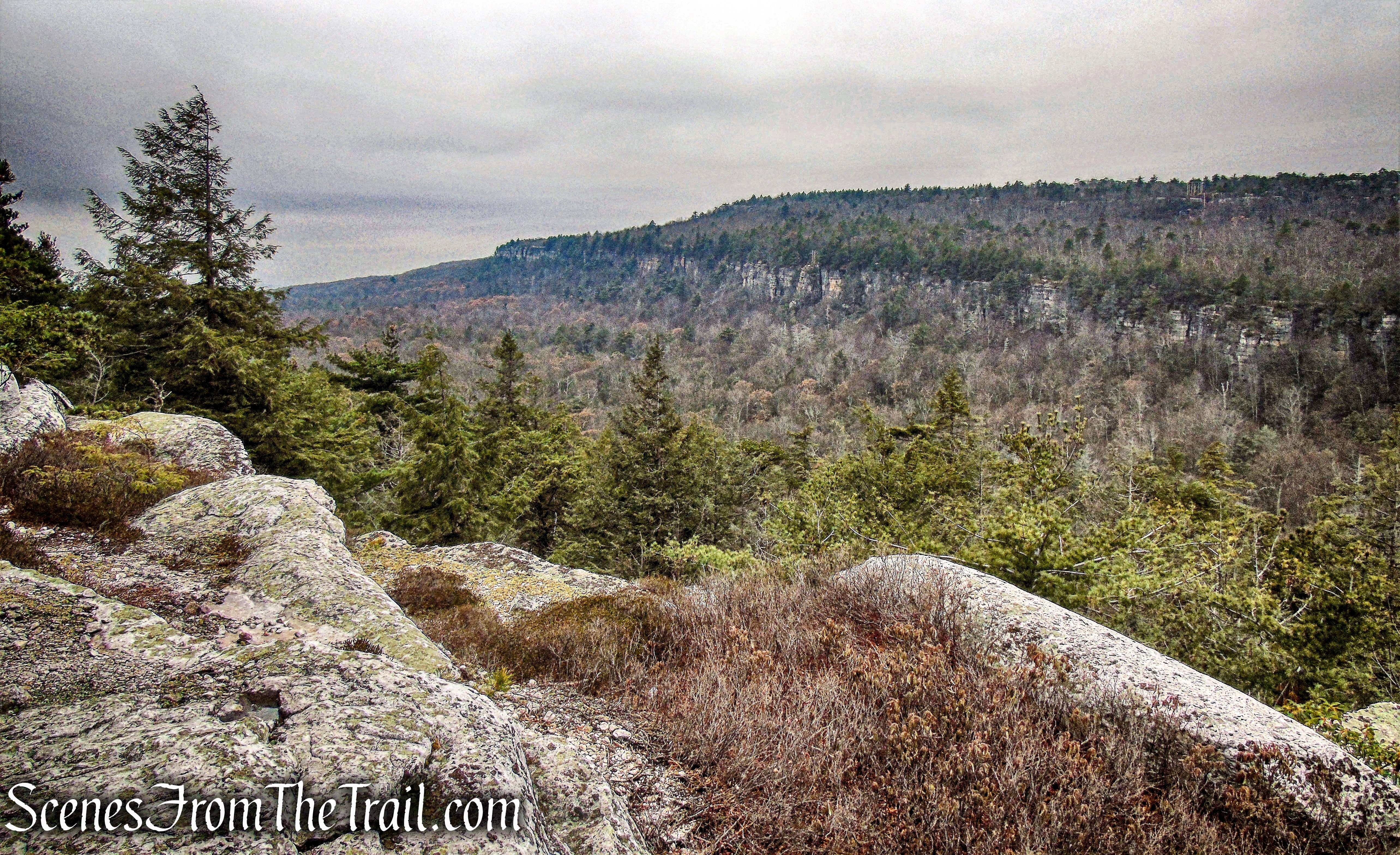
view from Millbrook Mountain
We wandered along the edge of the cliffs for a little while, taking in the different views.
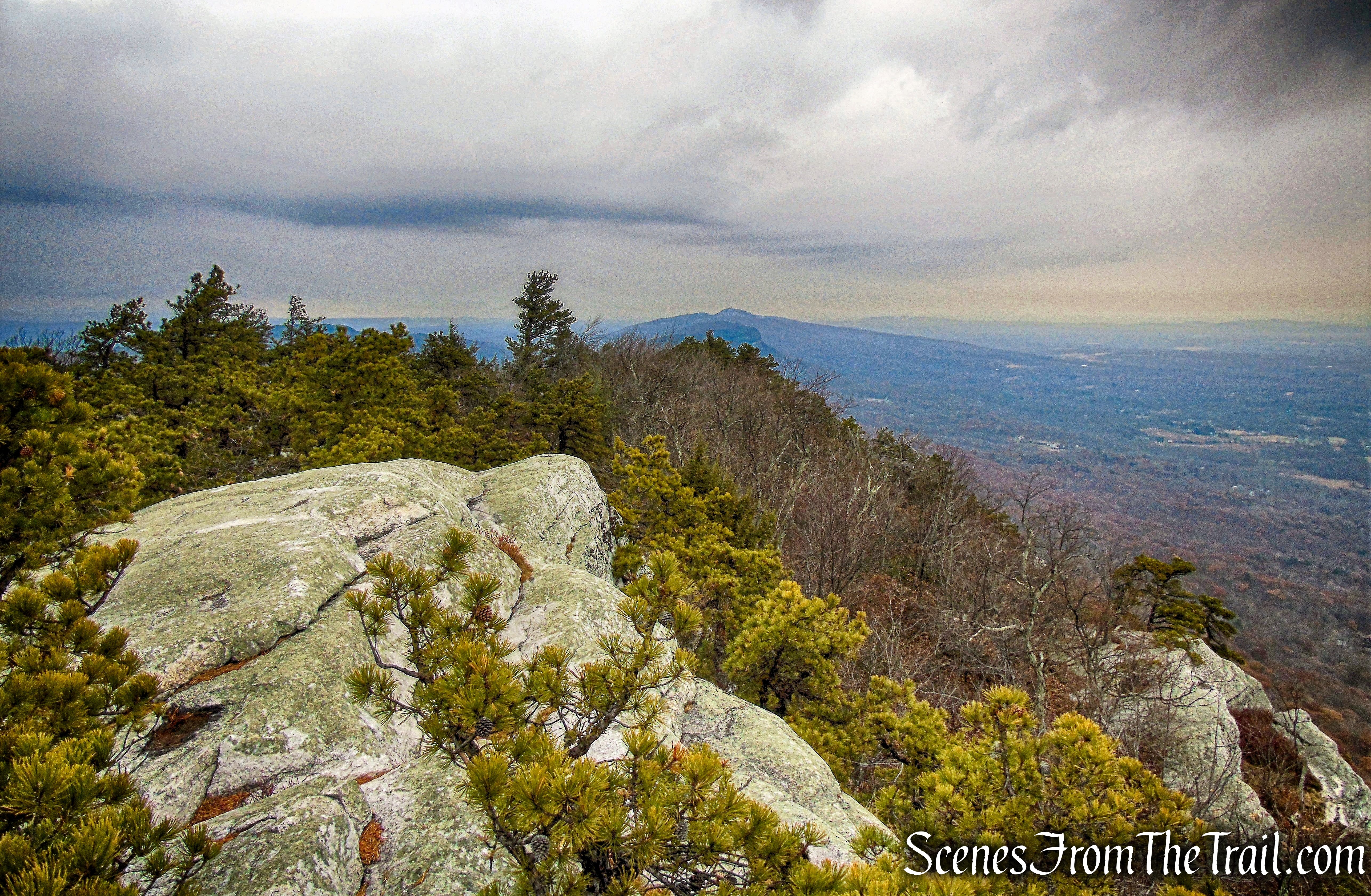
view from Millbrook Mountain
We then walked down a few feet and hopped on the Millbrook Mountain Carriage Road.
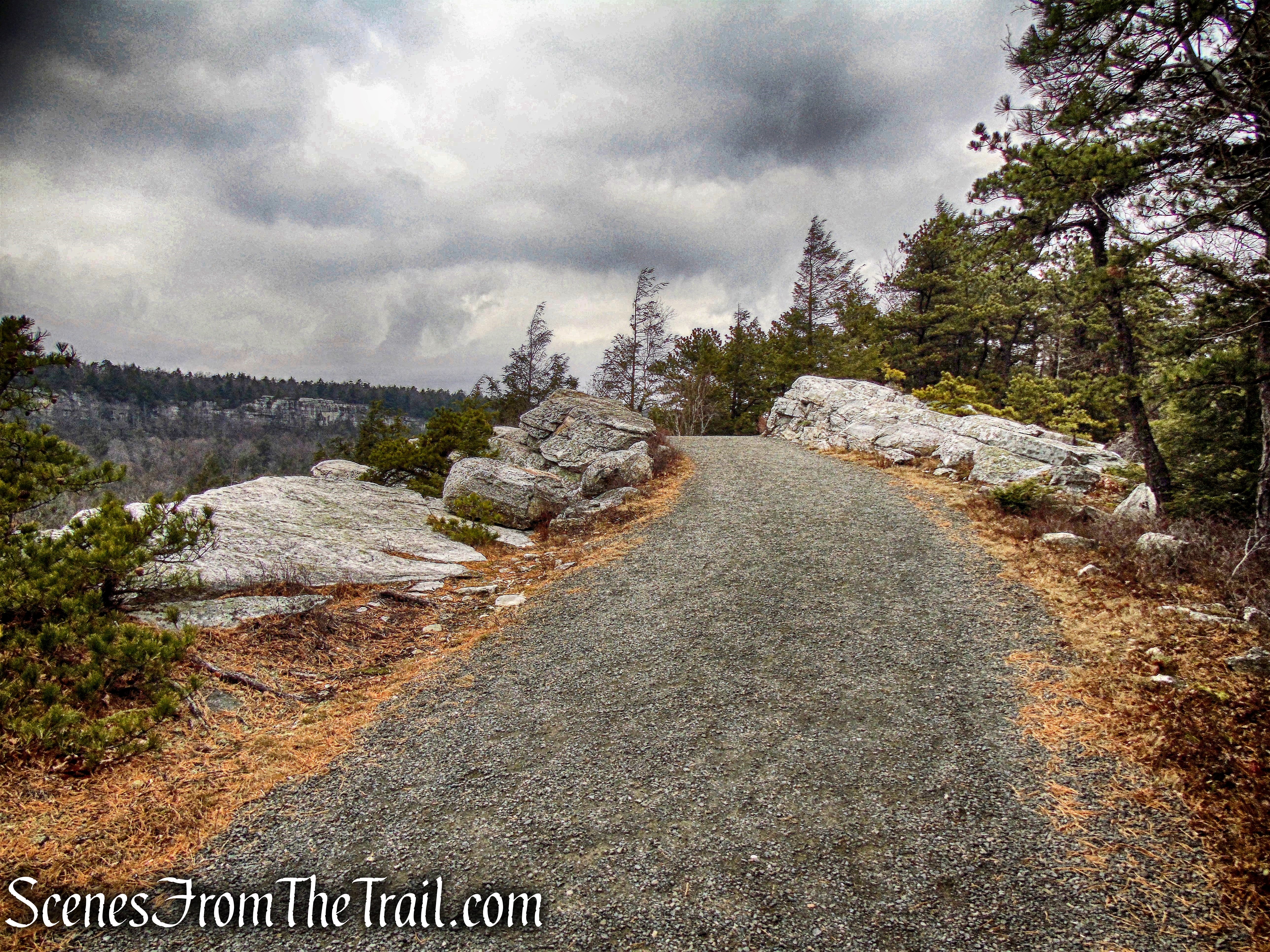
Millbrook Mountain Carriage Road
The Millbrook Mountain Carriage Road heads southwest and snakes its way gently down the mountain. It begins close to the cliffs then veers away at times and then back again.
Millbrook Mountain Carriage Road
After about 1.3 miles on the Millbrook Mountain Carriage Road, we came to the start of the red-blazed Gertrude’s Nose Footpath. According to my map there is a viewpoint a short distance down the trail, so we decided to have a look.
Gertrude’s Nose Footpath
There are short spur trails that lead to rock ledges.
rock ledges just off the Gertrude’s Nose Footpath
Looking southwest, Hamilton Point is visible in the distance. We stopped here and had a snack while enjoying the view.
view of Hamilton Point – Gertrude’s Nose Footpath
We retraced our steps back to the Millbrook Mountain Carriage Road, turned left and continued our descent. The views begin to open up in this area with many ledges to the left of the road.
Millbrook Mountain Carriage Road
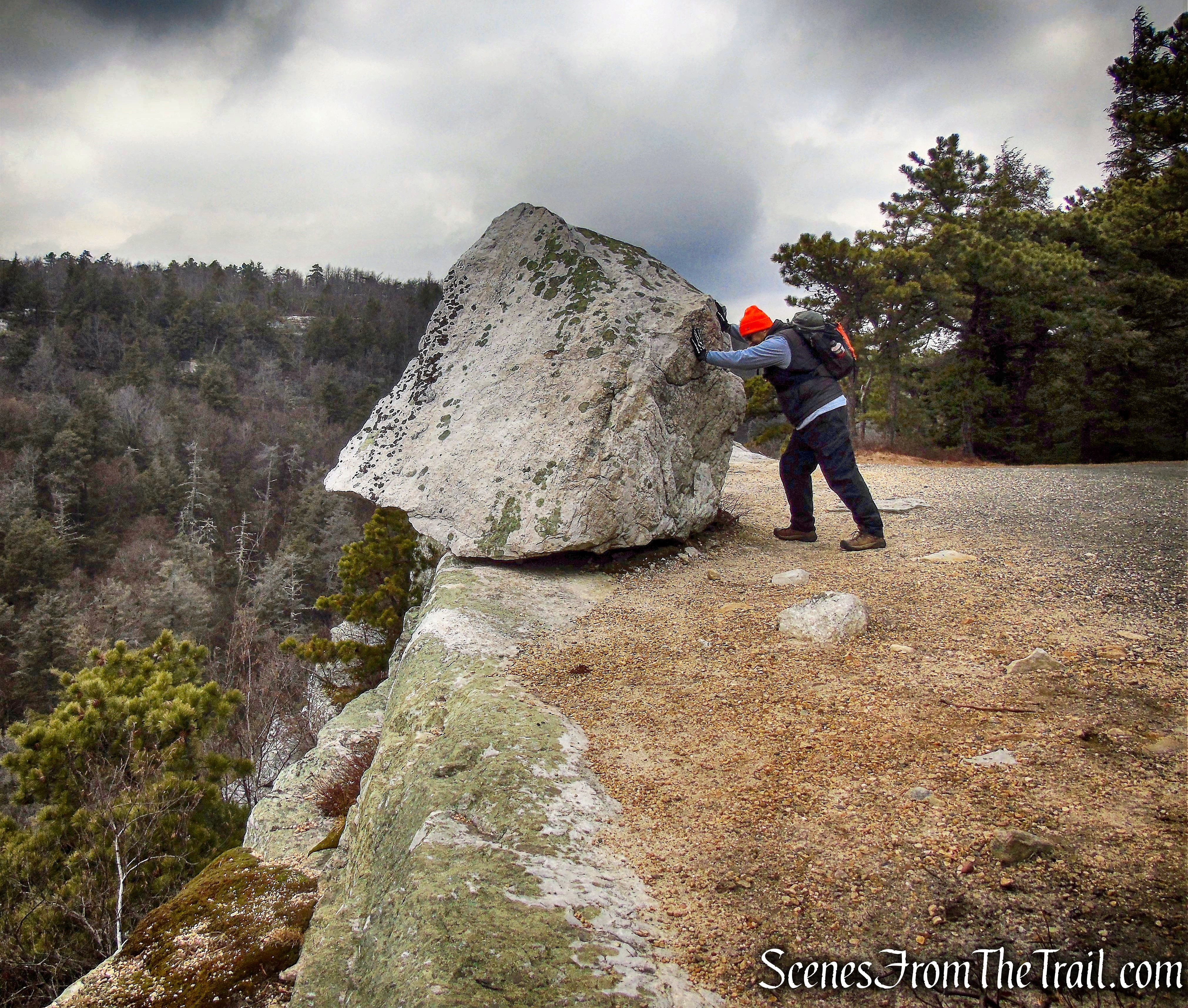
We then reached one of the interesting geologic features at the park, Patterson’s Pellet.
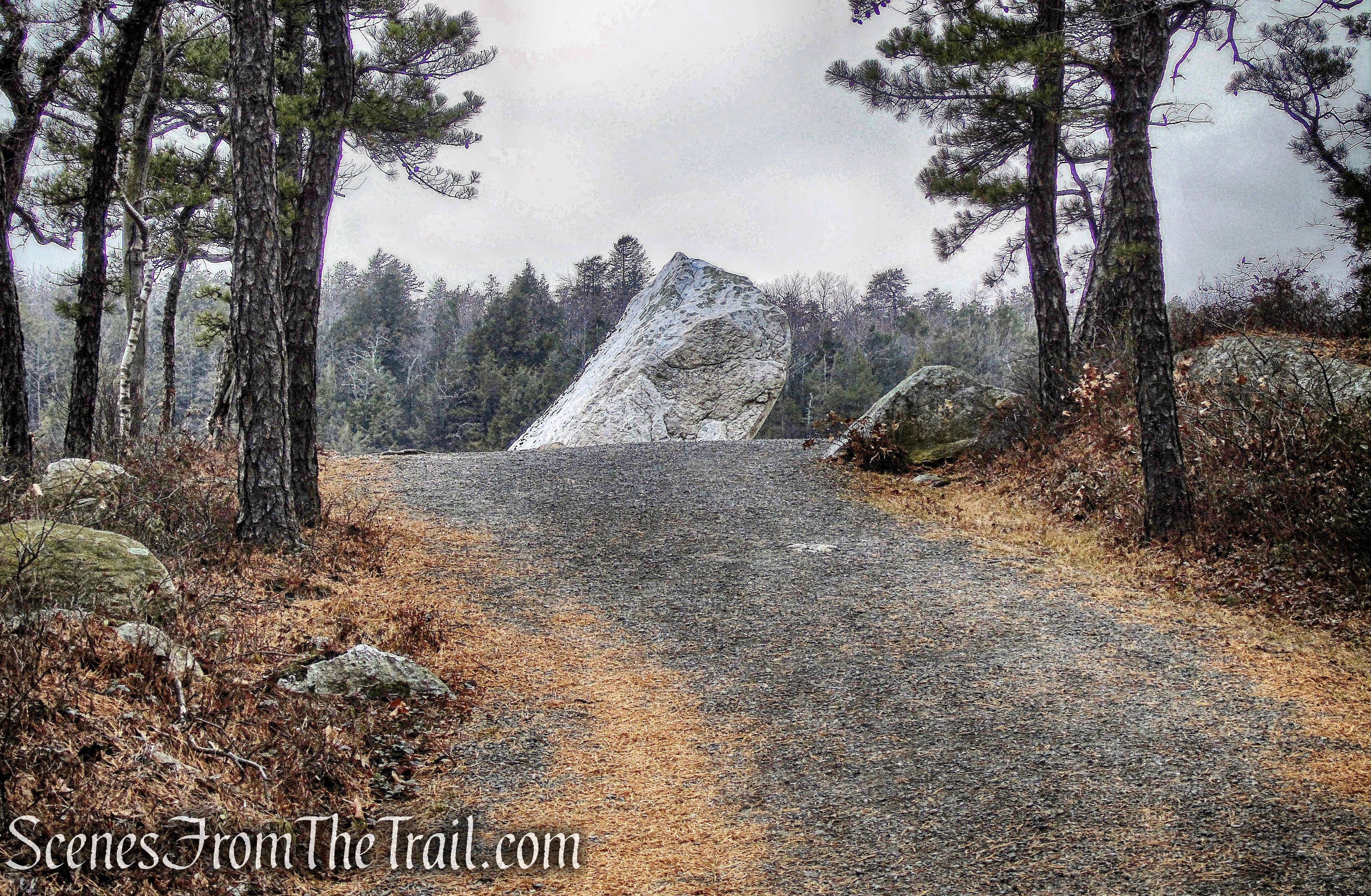
Patterson’s Pellet – Millbrook Mountain Carriage Road
It is a large glacial erratic perched atop the cliffs above Palmaghatt Ravine.
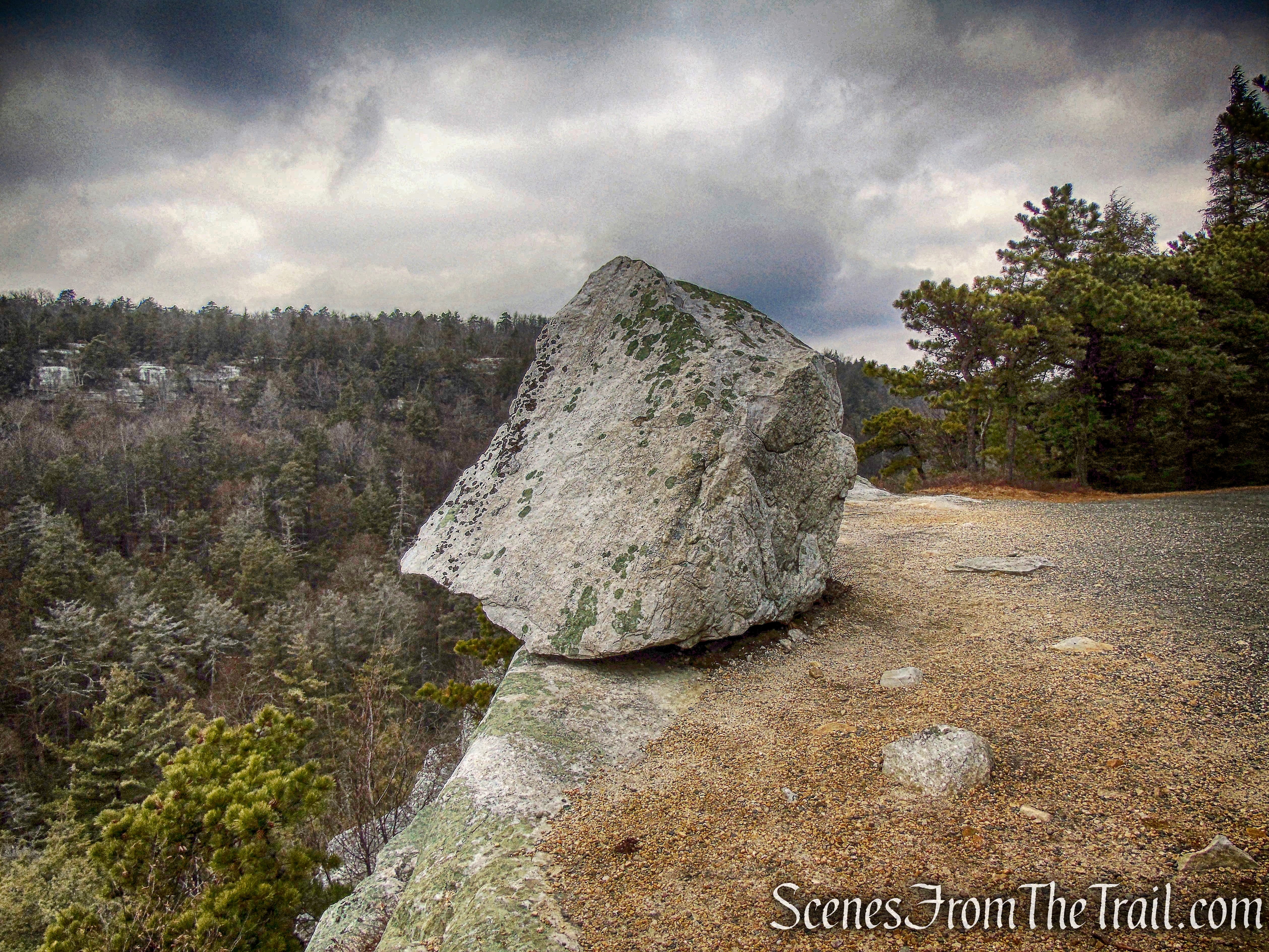
Patterson’s Pellet – Millbrook Mountain Carriage Road
Patterson’s Pellet – Millbrook Mountain Carriage Road
Continuing down the Millbrook Mountain Carriage Road, we stayed right at a Y-intersection with the Hamilton Point Carriage Road. We then came to a T-intersection with the Lake Minnewaska Carriage Road and turned left.

T-intersection with the Lake Minnewaska Carriage Road
The Lake Minnewaska Carriage Road travels along the western side of Lake Minnewaska. Since it was early afternoon, there was considerable foot traffic in this area. We passed several carriage roads that began on the left, but continued following the red-diamond-blazes until I saw a grassy woods road that went to the left. I decided that we would take a detour and avoid the crowds.
Lake Minnewaska Carriage Road
Turns out there were several grassy roads that went in different directions. Luckily I have a great sense of direction and a GPS device. We ended up on the Upper Lake Awosting Carriage Road. We turned right and in a short distance we were treated to west-facing view of the Catskill Mountains.
view west – Upper Lake Awosting Carriage Road
We then ended back at the Lake Minnewaska Carriage Road and walked over to the edge of the lake. At this point my fellow hikers were tired and a bit cranky, but we were near the finish line.
Lake Minnewaska
The sun came out and Lake Minnewaska looked spectacular.

Lake Minnewaska
Lake Minnewaska
Lake Minnewaska
A dirt path that leads to a rock outcrop offers a great view of the lake looking south.
Lake Minnewaska
We then continued on the red-diamond-blazed Lake Minnewaska Carriage Road back to the parking area, where our hike began.
Minnewaska State Park Preserve
To get a better idea of what the hike is like, view the short video below, with additional images added.
A truly great hike that had plenty of highlights. I highly recommend this hike to everyone.
Pros: Carriage roads, Lake Minnewaska, Millbrook Mountain, Patterson’s Pellet, great views, The Gunks!
Cons: None.
Take a hike!
Patterson’s Pellet
