January 20, 2018 – Stony Point, NY
Difficulty: Moderate
Length: Approximately 5.3 miles
Max elevation: 1,161 ft.– total elevation gain approximately 412 ft.
Route type: Figure 8 Loop
Map: Harriman-Bear Mountain Trails Map #118
Trailhead parking: 14-32 St Johns Rd – Stony Point, NY 10980
Please note: Hikers should use caution in the vicinity of the mines, as their deep water filled pits and unstable overhanging rocks can be dangerous.
Barnes Mine is located on the southern slope of Pole Brook Mountain and is on the north side of Lake Welch Drive in Harriman State Park. The mine is on a 17-acre parcel bought in 1846 by Isaac Barnes. Barnes Mine ceased operating about 1880. This mine does not appear to have been extensively worked.
Barnes Mine
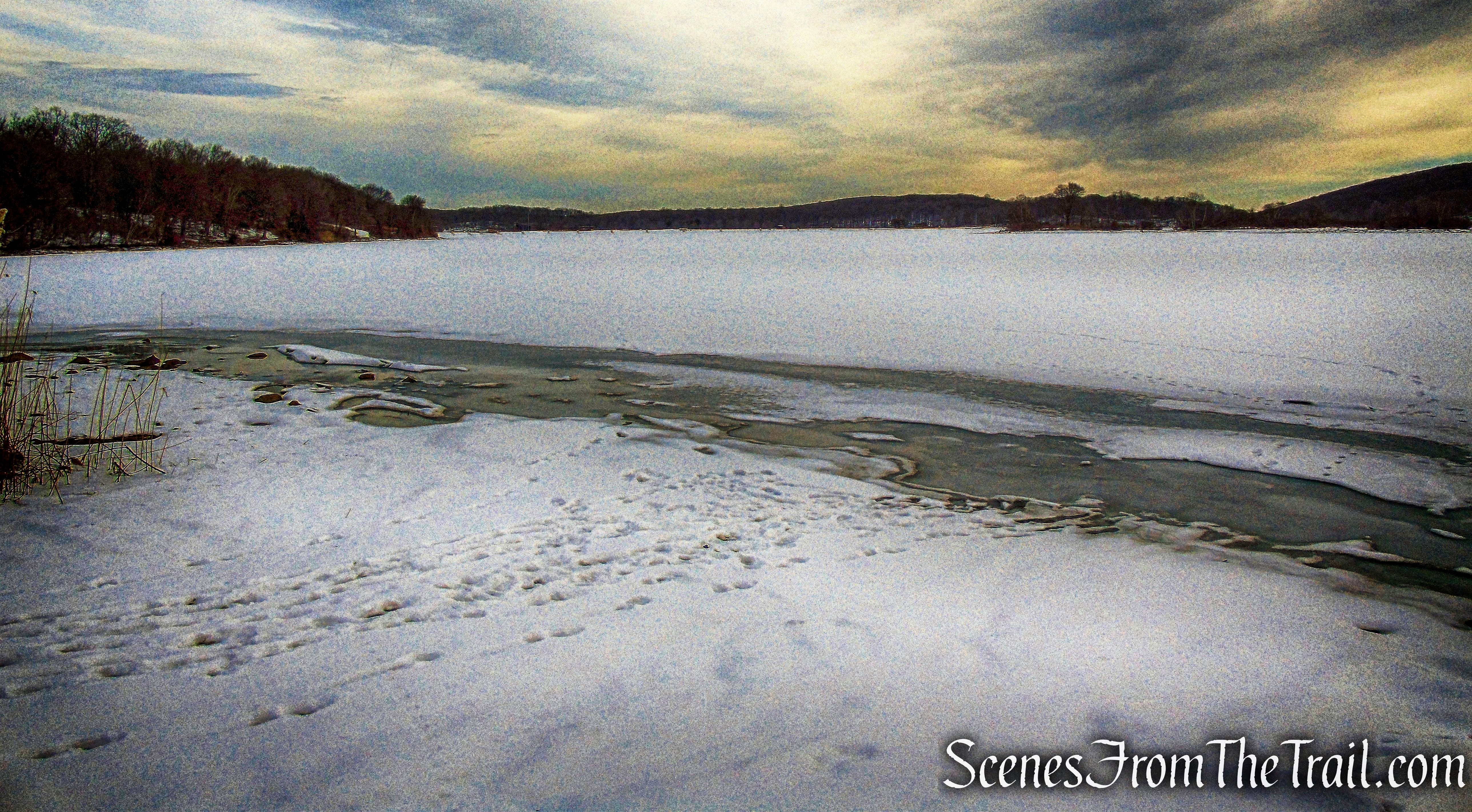
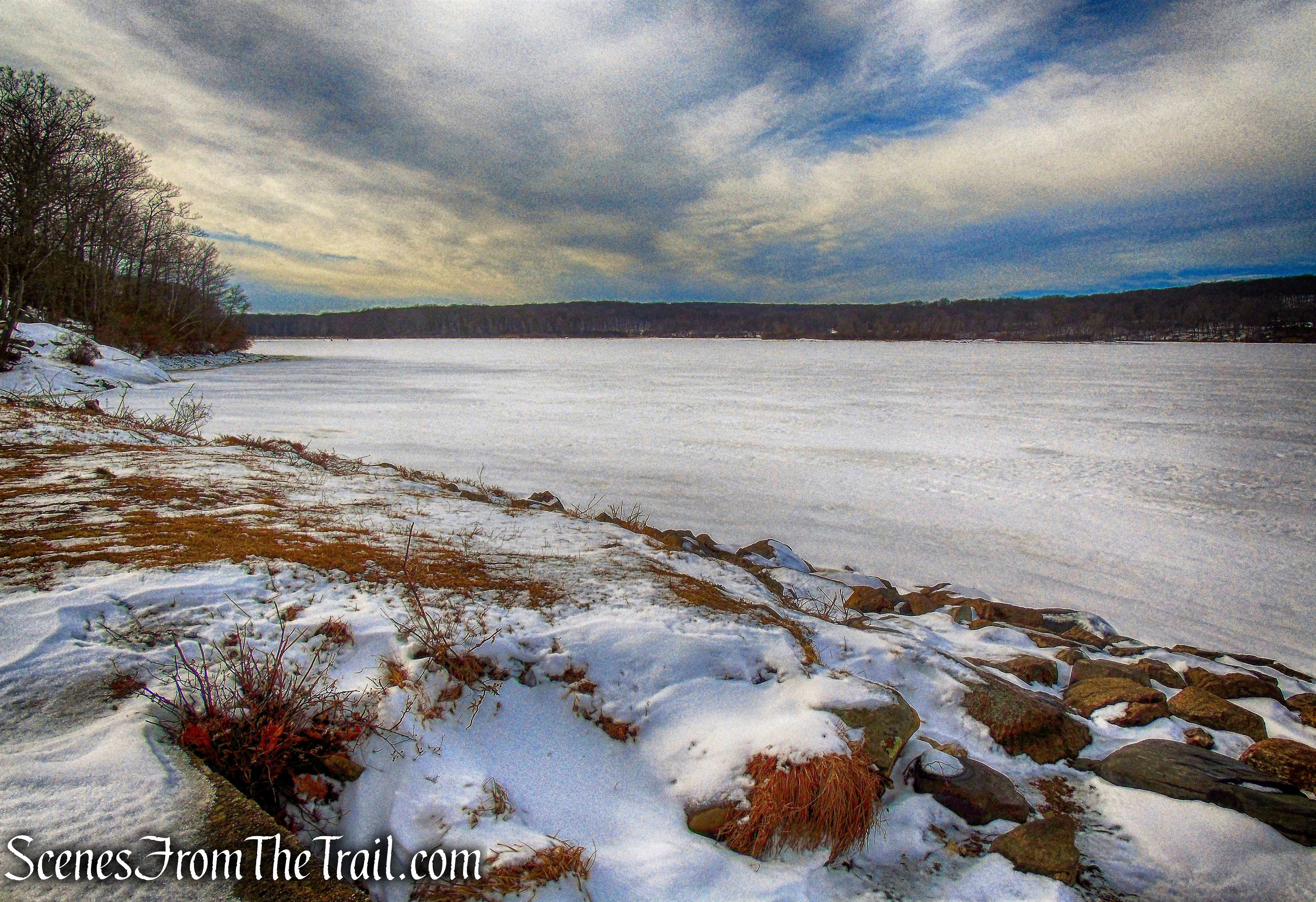
Lake Welch was started in 1928 on what was then known as Beaver Pond. Sandyfield was a settlement of about 30 houses that was submerged when swampy Beaver Pond was dammed to create the 216-acre lake by the Palisades Interstate Park Commission.
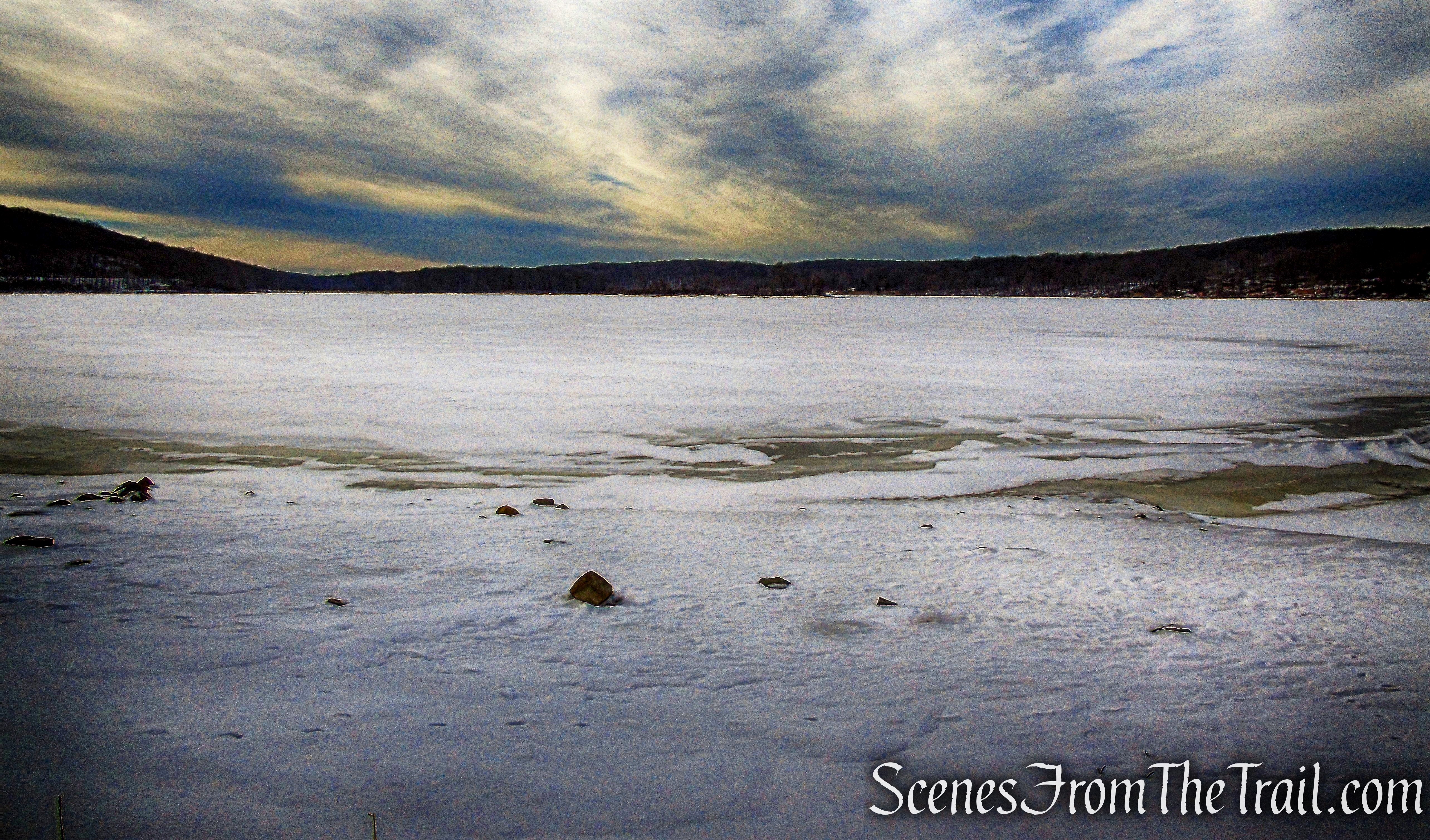
Lake Welch
While planning a hike when there is snow on the ground, I try to be reasonable about the distance and difficulty of the trail. While it might be a breeze to do a 8-mile loop in warm weather, hiking in snow has its issues. It is far easier to walk in the tracks of someone else who has already “broken” the trail than on virgin snow. I chose this hike because of the minimal elevation gain while keeping it at a tolerable distance.

Barnes Mine and Lake Welch Loop
Below is a map of the same area from 1930, notice that there is no Lake Welch.

1930 map of Sandyfield area
We arrived shortly before 9:30 am on a crisp, but clear Saturday morning with temps in the low-mid 30’s. We parked in the hikers parking lot on St. Johns Road.
hikers parking – St. Johns Road
The lot has room for about 6-8 cars and was empty when we arrived. The image below shows how it looked like shortly before 2:00 pm as we concluded the hike.
hikers parking – St. Johns Road
At the far end of the driveway, facing northwest, where there are two boulders, is where we began our hike.

start of hike – hikers parking
We proceeded on the unmarked woods road that heads northwest towards Lake Welch Drive.

unmarked trail
The stone foundation ruins in the overgrown field were part of the Charleston Homestead, the 17-acre parcel that includes Barnes Mine. The Barnes Mine is inextricably linked to the Charleston family, which once lived in the Sandyfields-Johnsontown area near what is now Lake Welch and St. John’s-in-the-Wilderness Church. The trail leads around to the left of the stone foundation.
ruins
The old road then leads out to Lake Welch Drive which is closed in winter.
Lake Welch Drive
Across Lake Welch Drive is the base of Pole Brook Mountain and where we were headed.

cross Lake Welch Drive
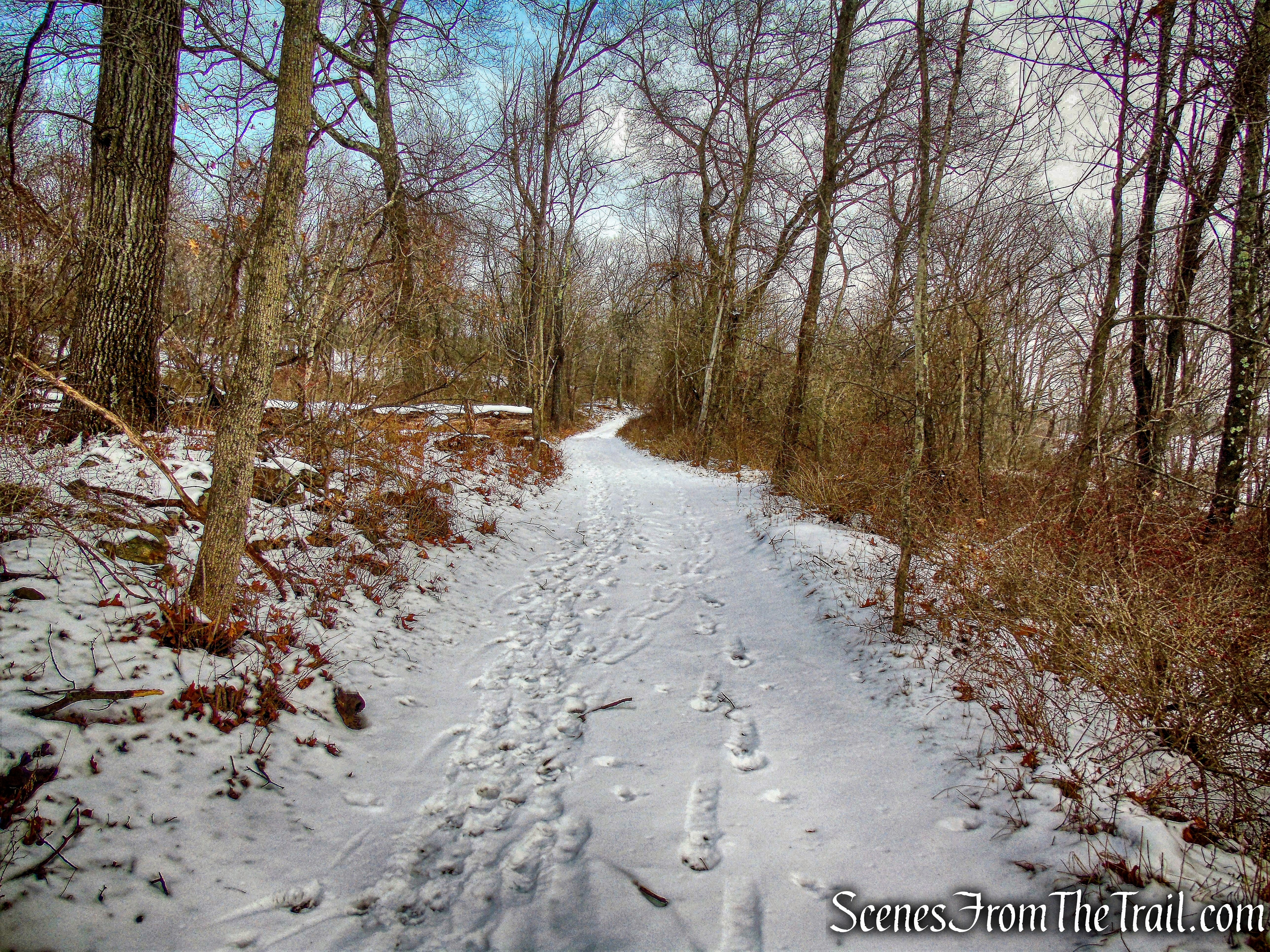
We walked up the hill and then veered left onto an old overgrown road. I can only imagine that the old road would have been more discernible if there was no snow on the ground. Since I did some research prior to the hike, I knew the general direction that we had to go.
unmarked woods road
We had to maneuver around a large blowdown that was blocking the trail.
large blowdown
In a short distance we came to a rock cut along the woods road that leads to the mine.
rock cut along the road
We walked through the cut and there it was. Barnes Mine is on a 17-acre parcel bought in 1846 by Isaac Barnes. It probably was he who first opened a mine there. By 1864, it belonged to John Charleston. In 1871, he leased the mine to the Rockland Nickel Company, which operated the Nickel Mine on nearby Grape Swamp Mountain.
Barnes Mine
The main feature of this mine is a large cruciform-shaped open pit from which rock and ore have been extracted. This north-to-south cut measures eighty-three feet in length and varies in width from ten to thirteen feet.
Barnes Mine
At the extreme north end of this cut, the excavation is somewhat wider and deeper. Here the mine pit undercuts the rock ledge and contains water. The east-to-west crossing mine cut is 113 feet in total length, and thirteen to seventeen feet wide.
Barnes Mine
The mine was filled with water, frozen over and a blanket of snow covered the ground and ice. It was hard to determine what was solid ground and what was ice so we took great caution in this area. Some of these water filled pits can be extremely deep and there could be multiple pits in the area which may be covered with leaves and look like puddles.
Barnes Mine
Once done exploring the mine, we headed back out to the old road and turned right, heading southwest. The road is easily followed at this point, but it doesn’t stay that way. It soon becomes wildly overgrown and kind of disappears so we ended up bushwacking. It was short lived though because the Long Path was just ahead. We turned right on the aqua-blazed Long Path. The trail goes northwest along a farm road, this farm, part of the Sandyfield community, was the home of Charles Conklin until September 1938.
Long Path
In a short distance, the Long Path turns right and leaves the farm road onto a footpath, now heading northeast.
Long Path
Along the way, we passed a cellar hole by the side of the trail.

cellar hole – Long Path
After 0.4 mile, we came to a junction with the start of the blue-blazed Beech Trail.
junction – Beech Trail
The Beech Trail starts out as a footpath and at times widens to a woods road then narrows again. The blazes also vary in shades of blue. Sometimes dark blue, light blue or just faded blue. Nevertheless, they are blue and it wasn’t confusing. This is one of the newer trails, blazed in 1972. It was during the construction of this trail that the method of using offset double blazes to show the direction in which the trail turns was invented.
Beech Trail
The trail goes northeast on a woods road (the old Green Swamp Trail). The Beech Trail passes Green Swamp on the right and impressive boulders and cliffs on the left.
Beech Trail
I’ve hiked this trail before, it is quite scenic in a less traveled area.
Beech Trail
We followed the blue blazes of the Beech Trail until it reaches CR 106. The Beech Trail crosses the road and reenters the woods, but we turned right and began walking along the road.
CR 106
We walked along County Route 106 for about 600 yards. Several cars drove by on this day, but I could imagine it being a little busier in the warmer weather.
CR 106
After walking under Lake Welch Drive, we turned left into the entrance to the Lake Welch Boat Launch.
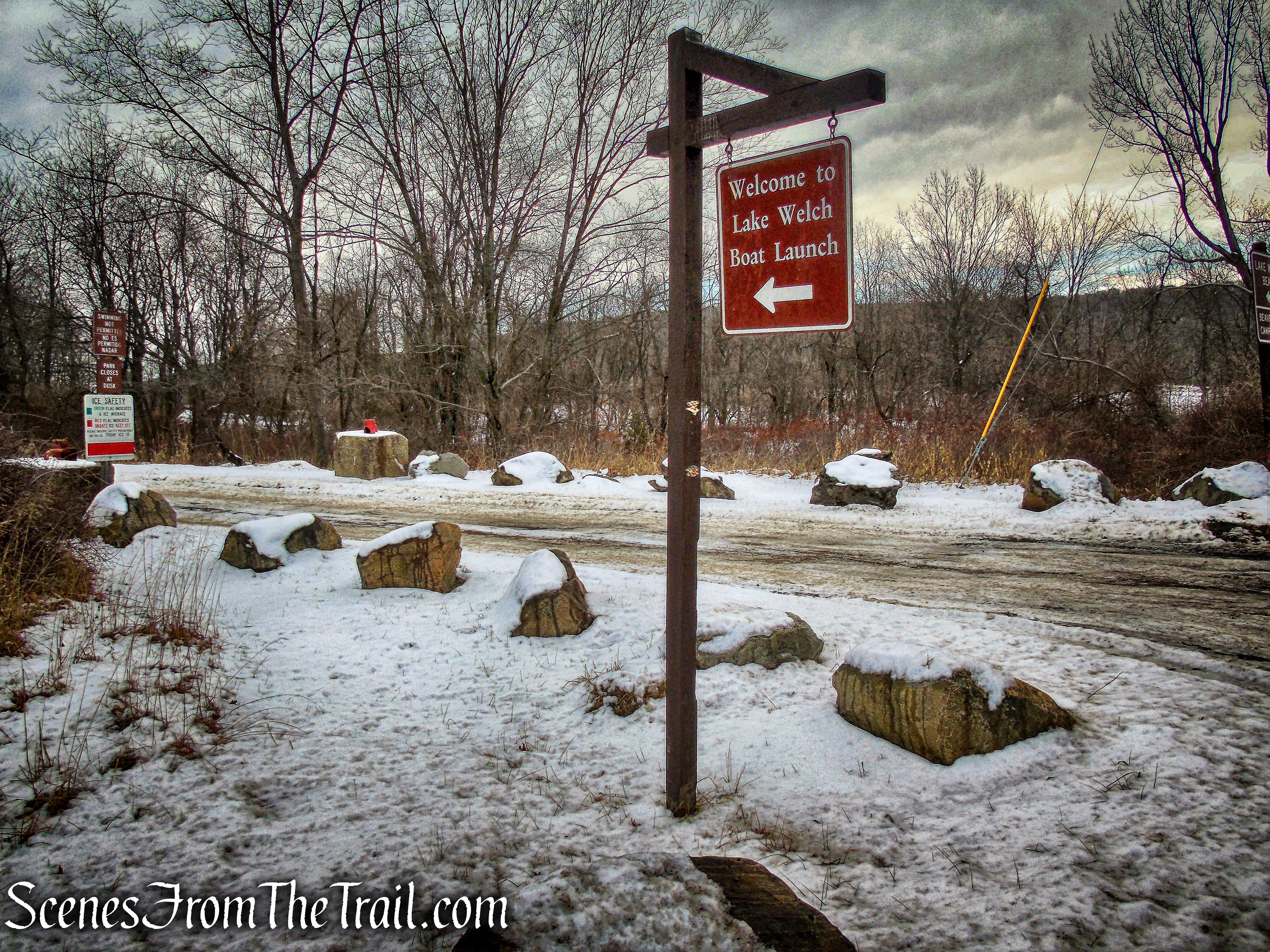
Lake Welch Boat Basin
Just past the entrance, we turned right and began walking down the boat ramp towards Lake Welch. On the left, there is a boulder with a plaque to commemorate the Sandyfield School Site.
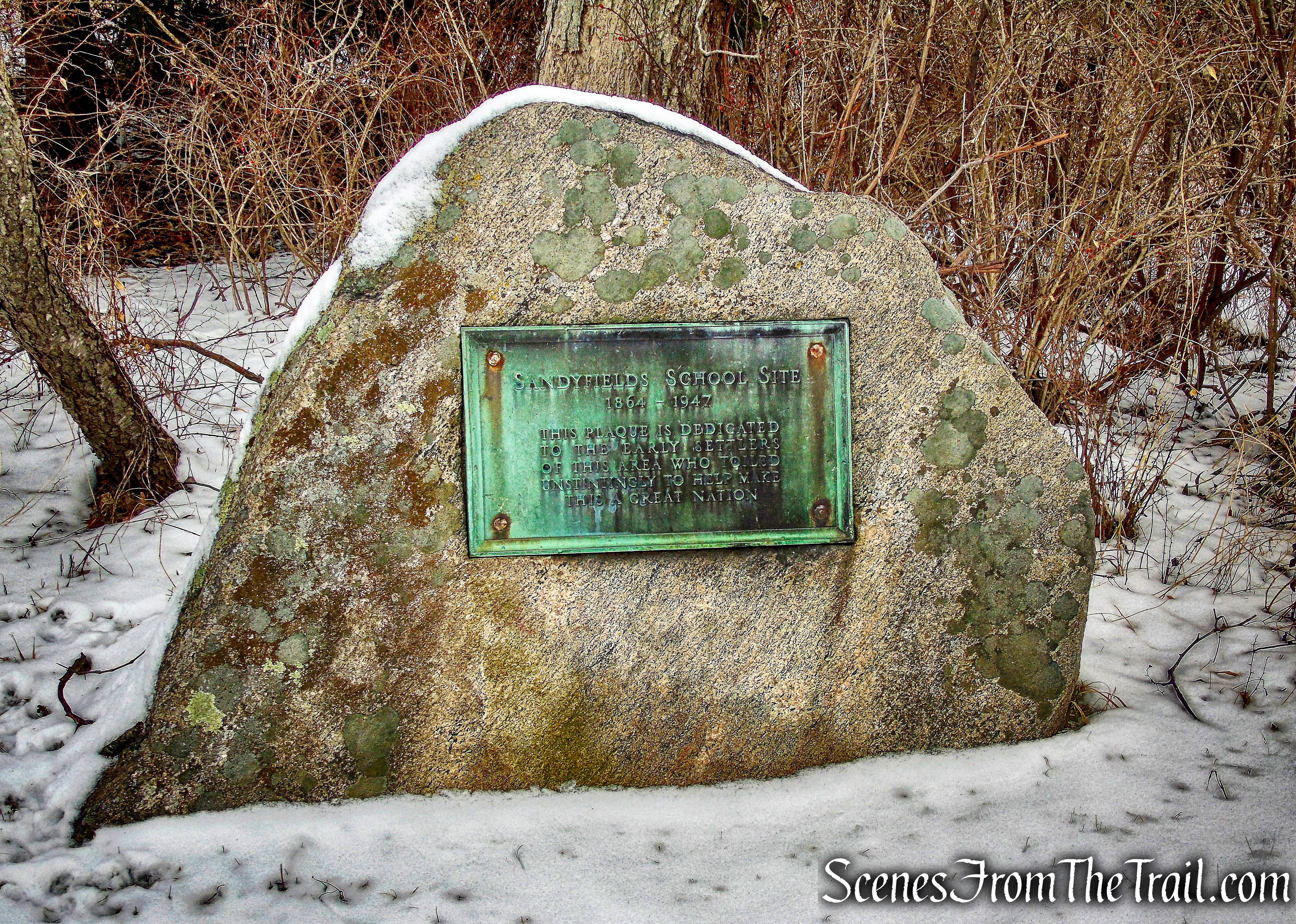
Sandyfields School Site plaque
The community of Sandyfield, where there were about 25 homes, with about 100 residents, was located on high ground to the north and west of the swamp (now Lake Welch). Sandyfield had been founded about 1760 when the first road through the hills had been built from Stony Point to Central Valley. Hikers now know this road as the Hasenclever Road.
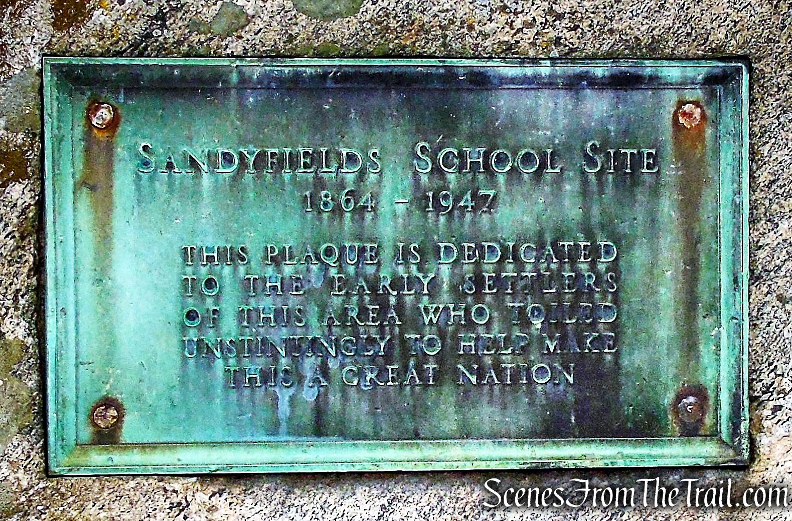
Sandyfields School Site plaque
In 1910, when the state park was created, the residents were notified that they would have to leave their homes. There was an attempt to resist through political channels, but in 1939 the last residents were ordered to leave.
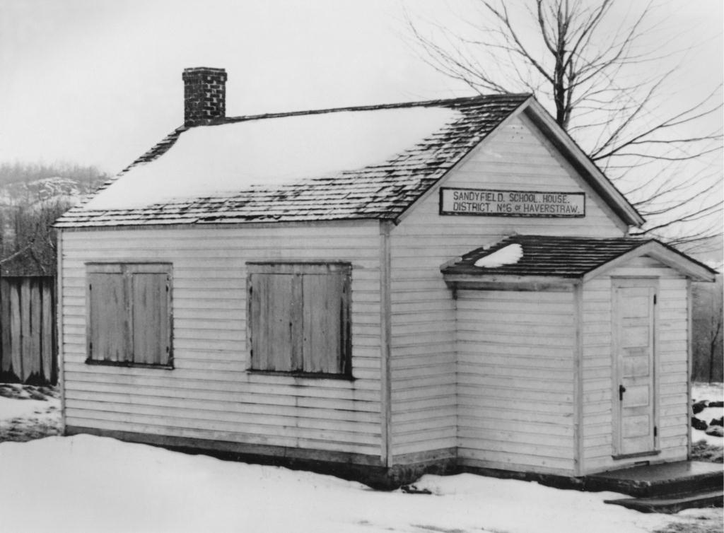
Sandyfield School 1946
By 1942, the lake was completed using workers from the Civilian Conservation Corps that was building the park. The new lake was named in honor of William A. Welch the first chairman of the Palisades Interstate Park Commission that built Harriman.
Lake Welch
Down at the edge of the boat launch, the Jackie Jones Fire Tower is visible to the southeast.
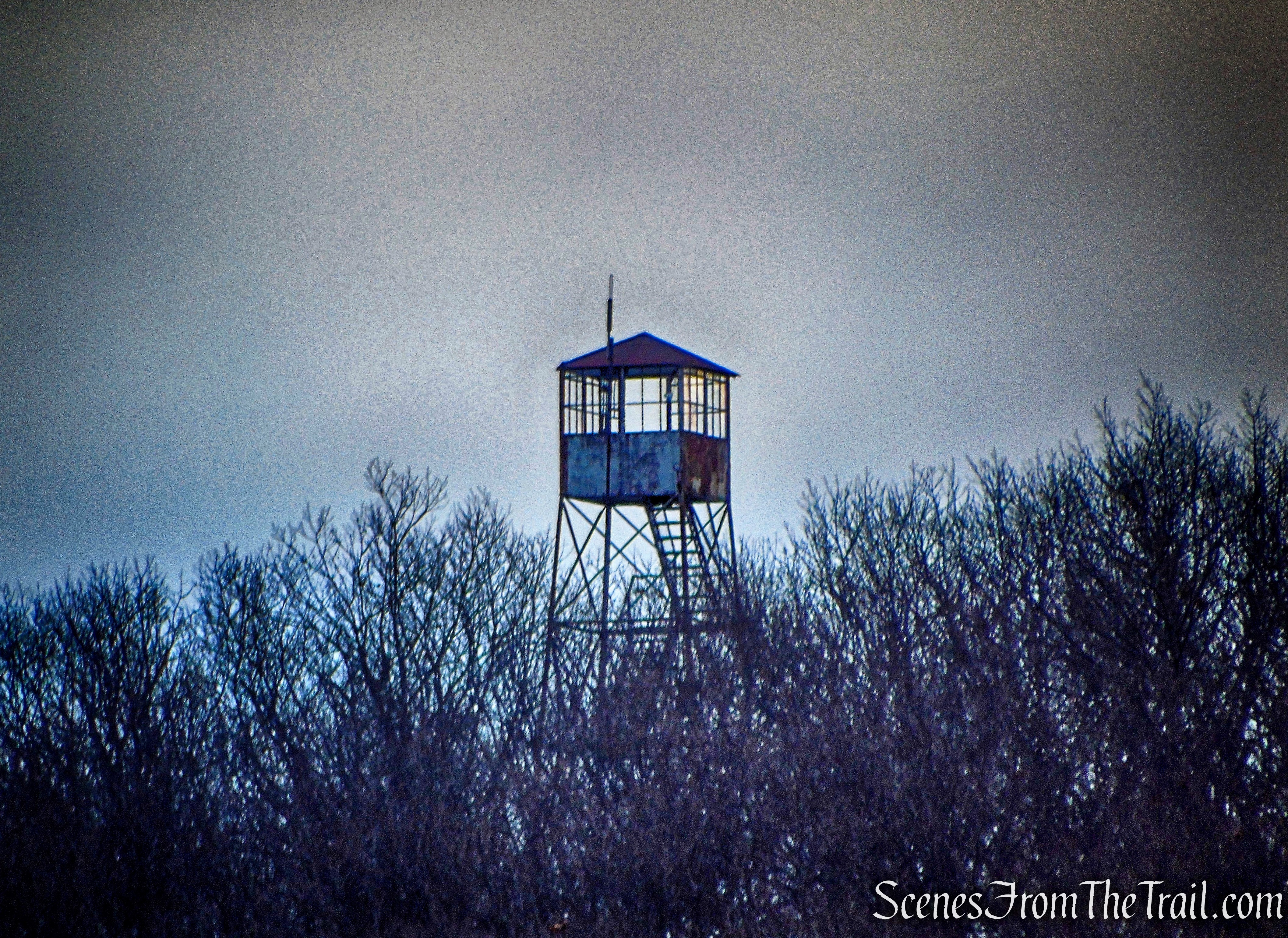
Jackie Jones Fire Tower
We then jumped on a park road that runs along the west side of the lake, now heading northeast.
park road – Lake Welch
We saw a lot of different animal tracks along this road, I wasn’t sure what any of them were, but some were pretty large. We proceeded up a road on the left and visited what is referred to as the Odell Cemetery, but is officially named Lake Welch Burials.
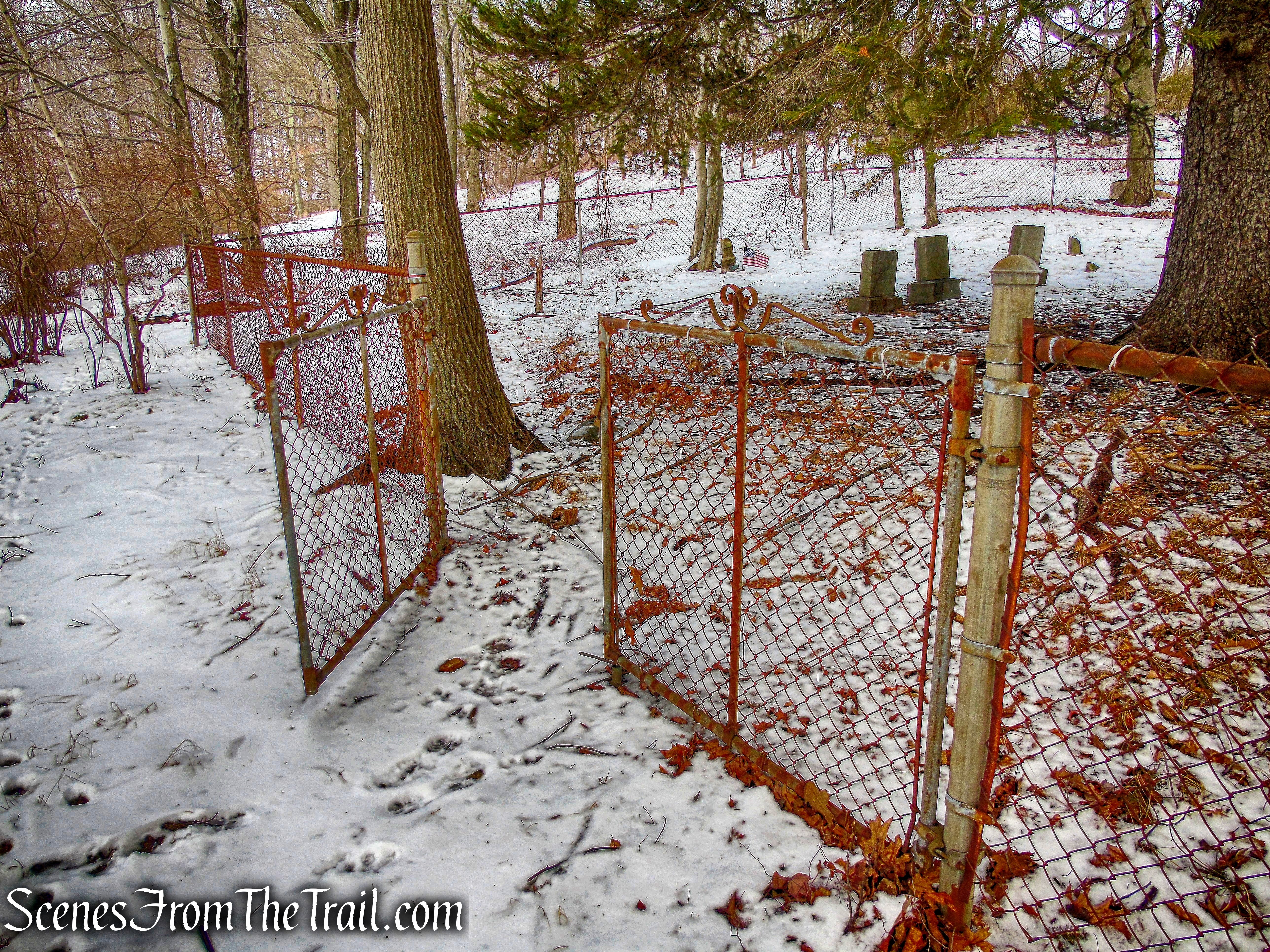
Odell Cemetery
We paid our respects to those that are interred here who at one time lived on this land. In 1939, the Park ordered residents Fred Odell, Albert and Aaron Baisley, and Sarah Benson to move out. The residents finally moved out in 1942.
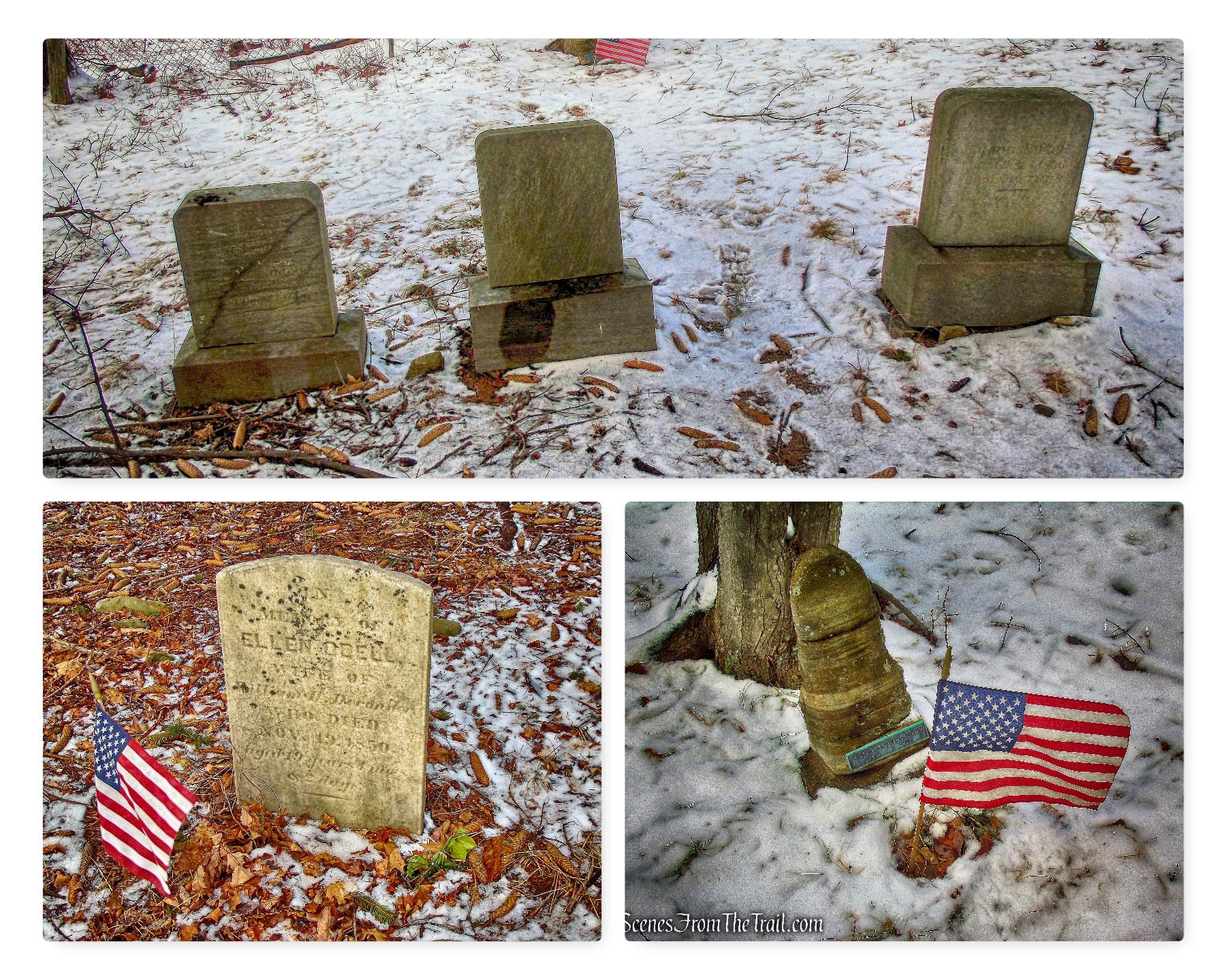
Odell Cemetery
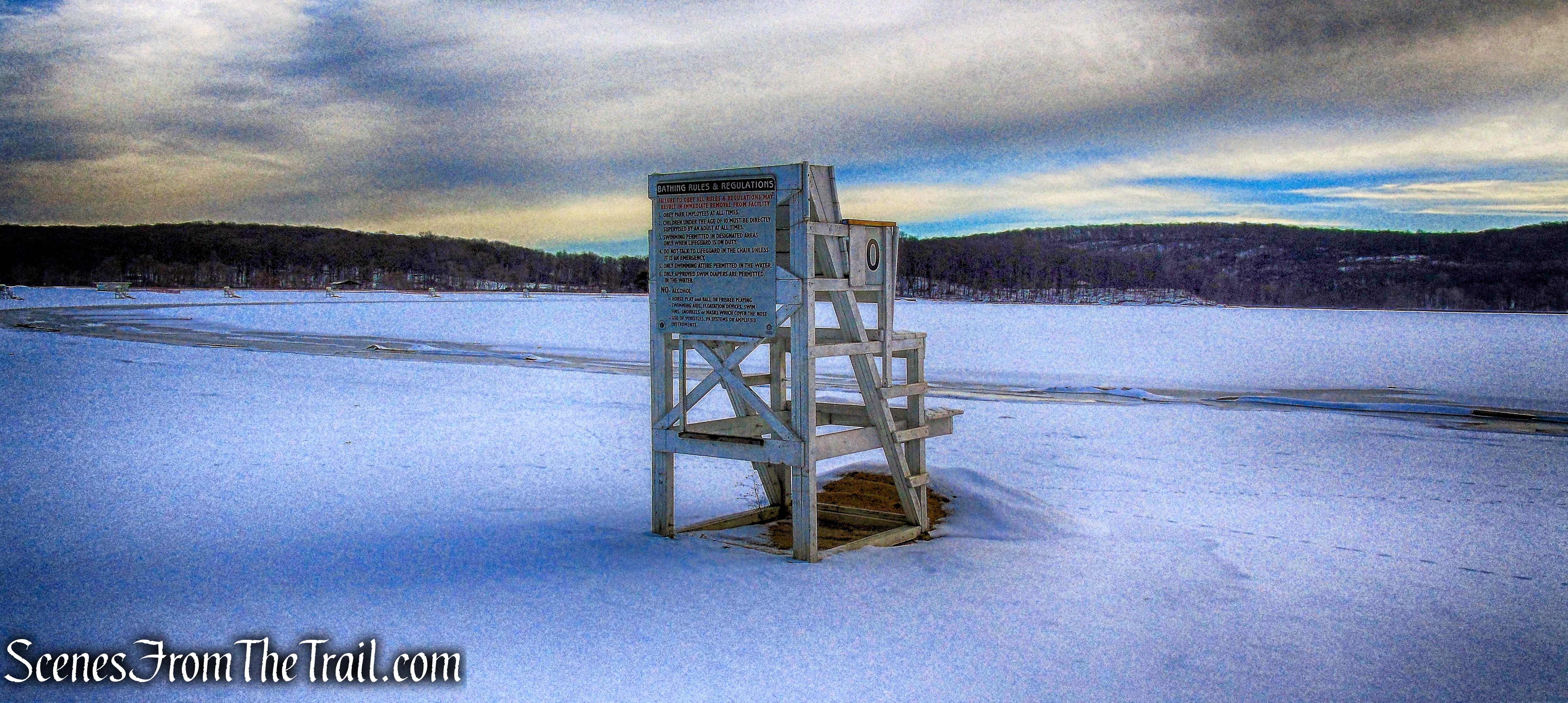
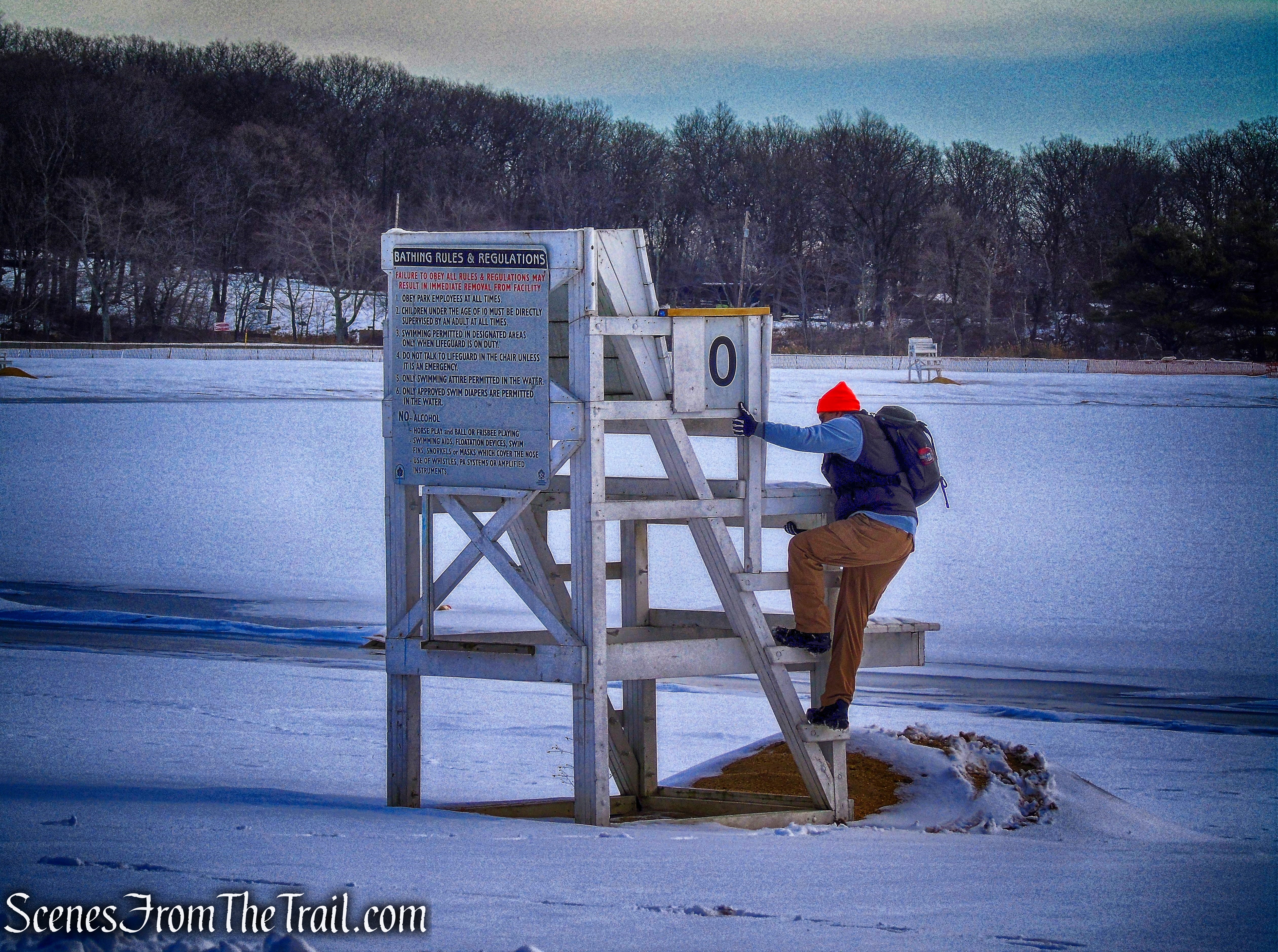
We walked back out to the park road and turned left, continuing our walk around Lake Welch and arrived at the beach area. We stopped at the beach, but unfortunately there were no lifeguards on duty.
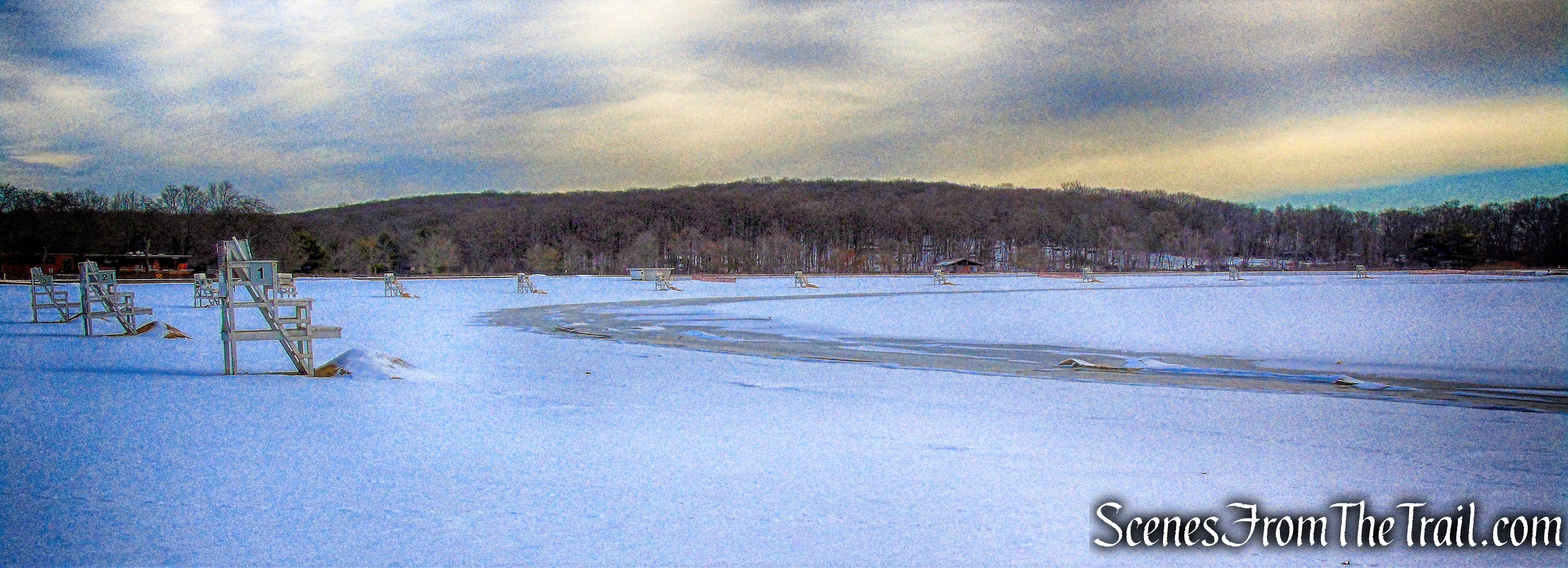
Lake Welch
We took a short break here and had a snack. We saw several people walk by, the only people we saw on the hike.
Lake Welch
We continued on the road around the beach which brought back many childhood memories.
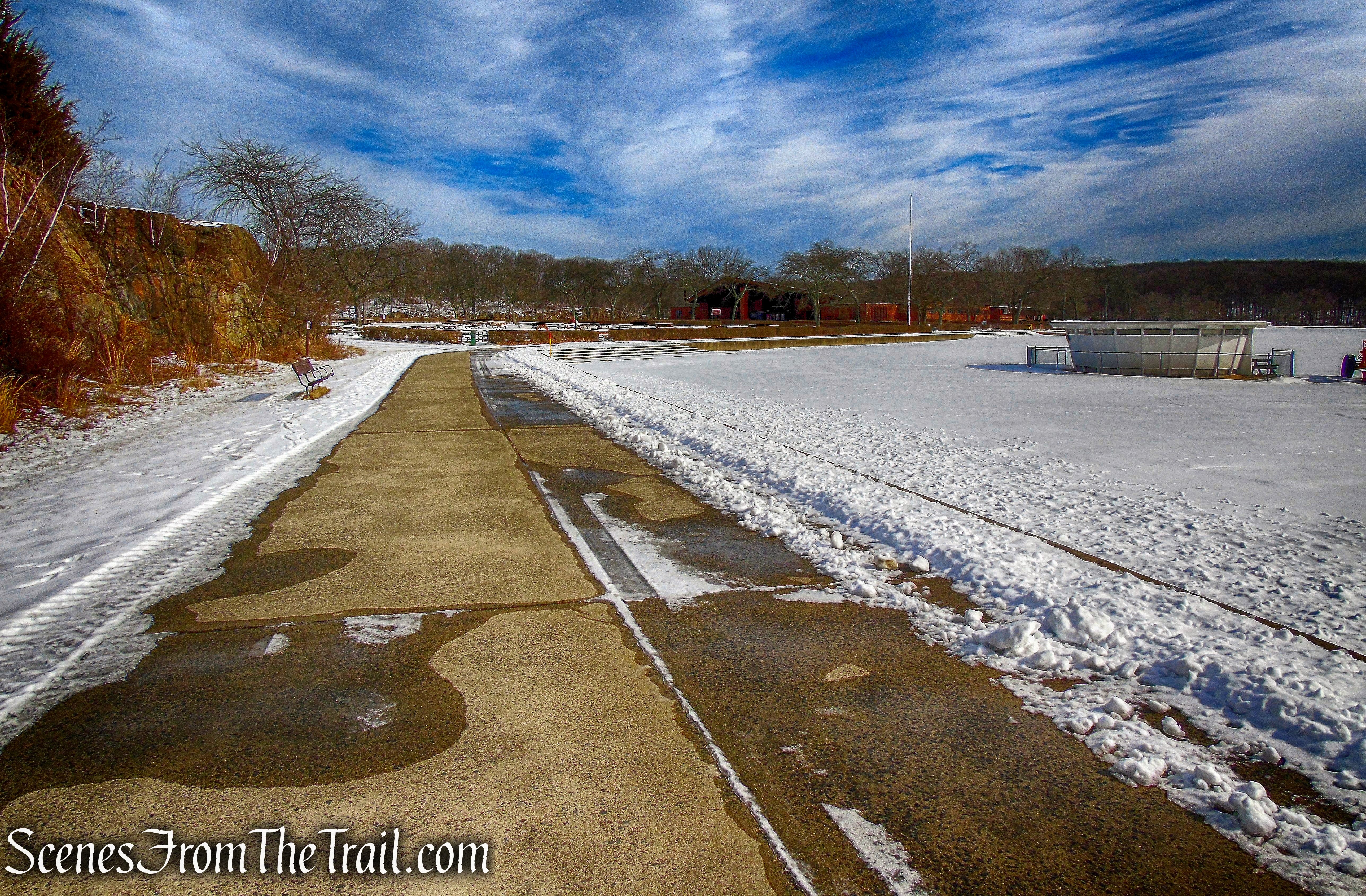
Lake Welch
I remember climbing up and down this rock formation when I was very young. I also remember be yelled at to stop. It seemed as big as a mountain back then.
Lake Welch
Lake Welch
It was about this point where my friend realized that she had lost one of her microspikes. She walked back looking for it, to no avail. If found, please let me know.
Lake Welch
I remember running across the grass here and yes, I got yelled at for that as well.
Lake Welch
Looking southwest from the beach.
Lake Welch
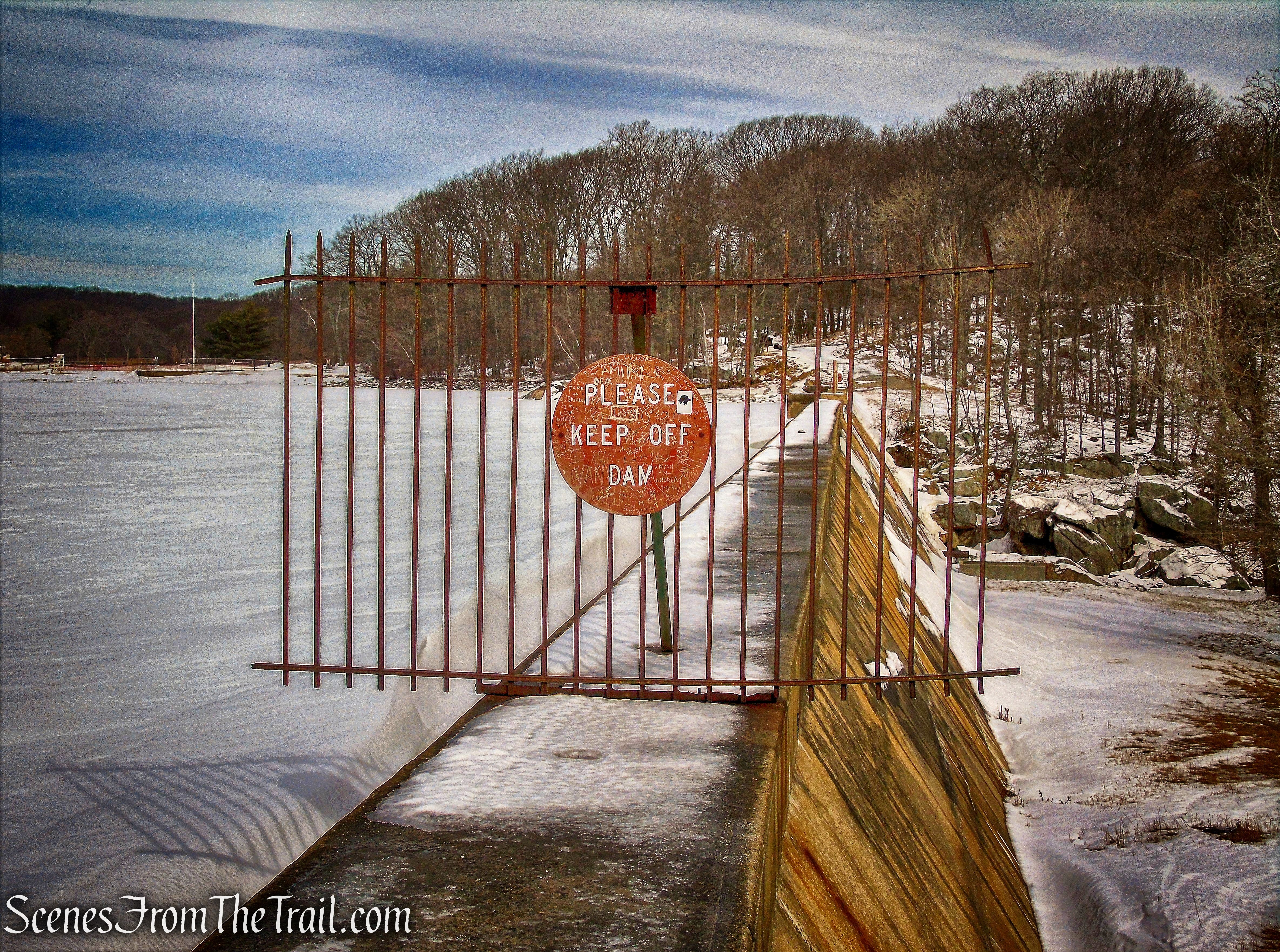
Heading towards the dam at the northeast end of the lake.
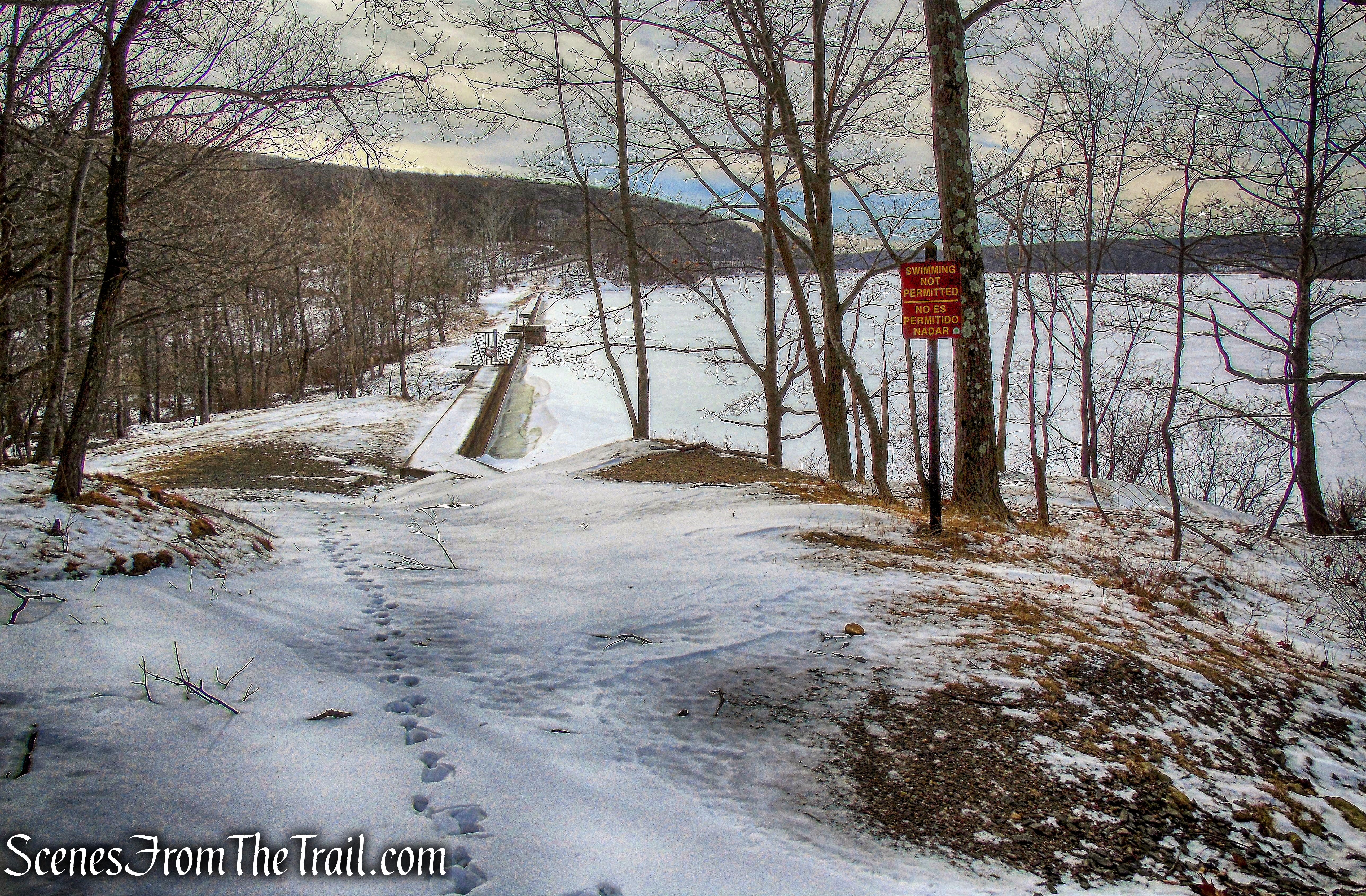
Lake Welch
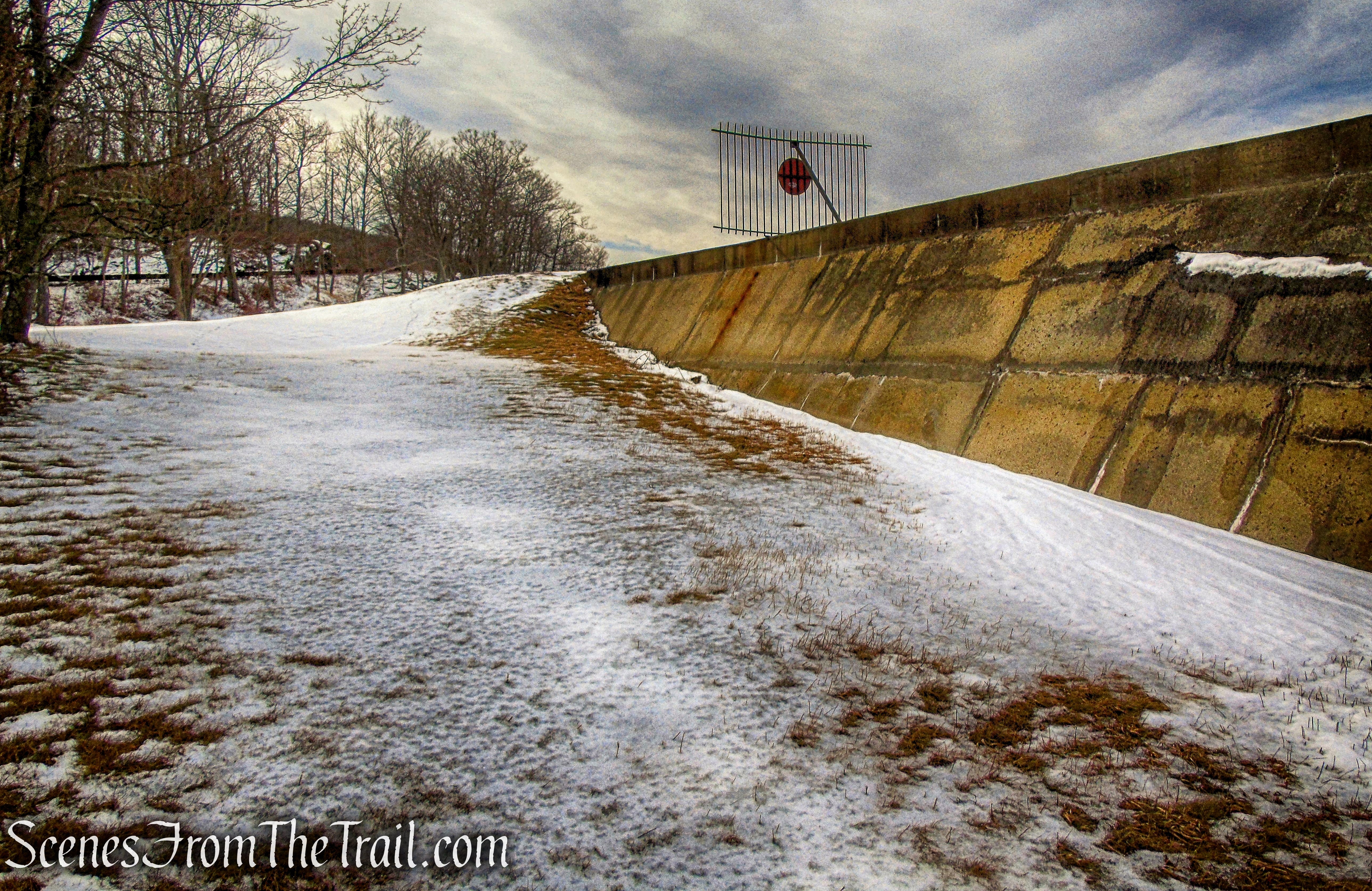
The dam was completed in 1929. Apparently, it was not high enough, because a new dam was started in 1934 using workers from CCC Camp SP-26.
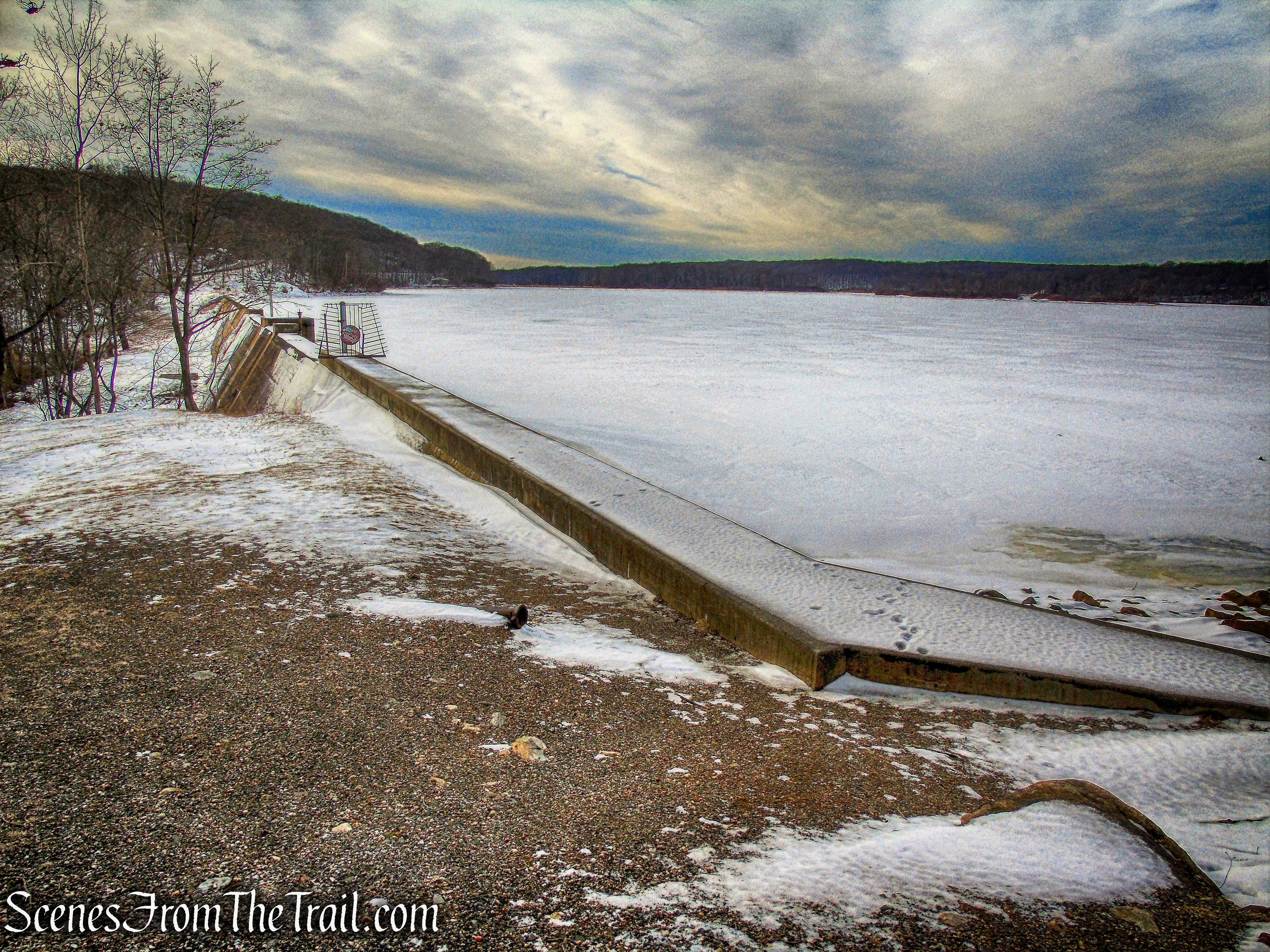
Lake Welch dam
Sandyfield residents, who opposed the construction of the dams, petitioned Governor Lehman and President Roosevelt to abolish the Park Commission (N.Y. Times, 11/22/34).
Lake Welch dam
Lake Welch
Lake Welch dam
There are no real good places to walk along the east side of the lake, at least not in the snow. We began a road walk along CR 106.
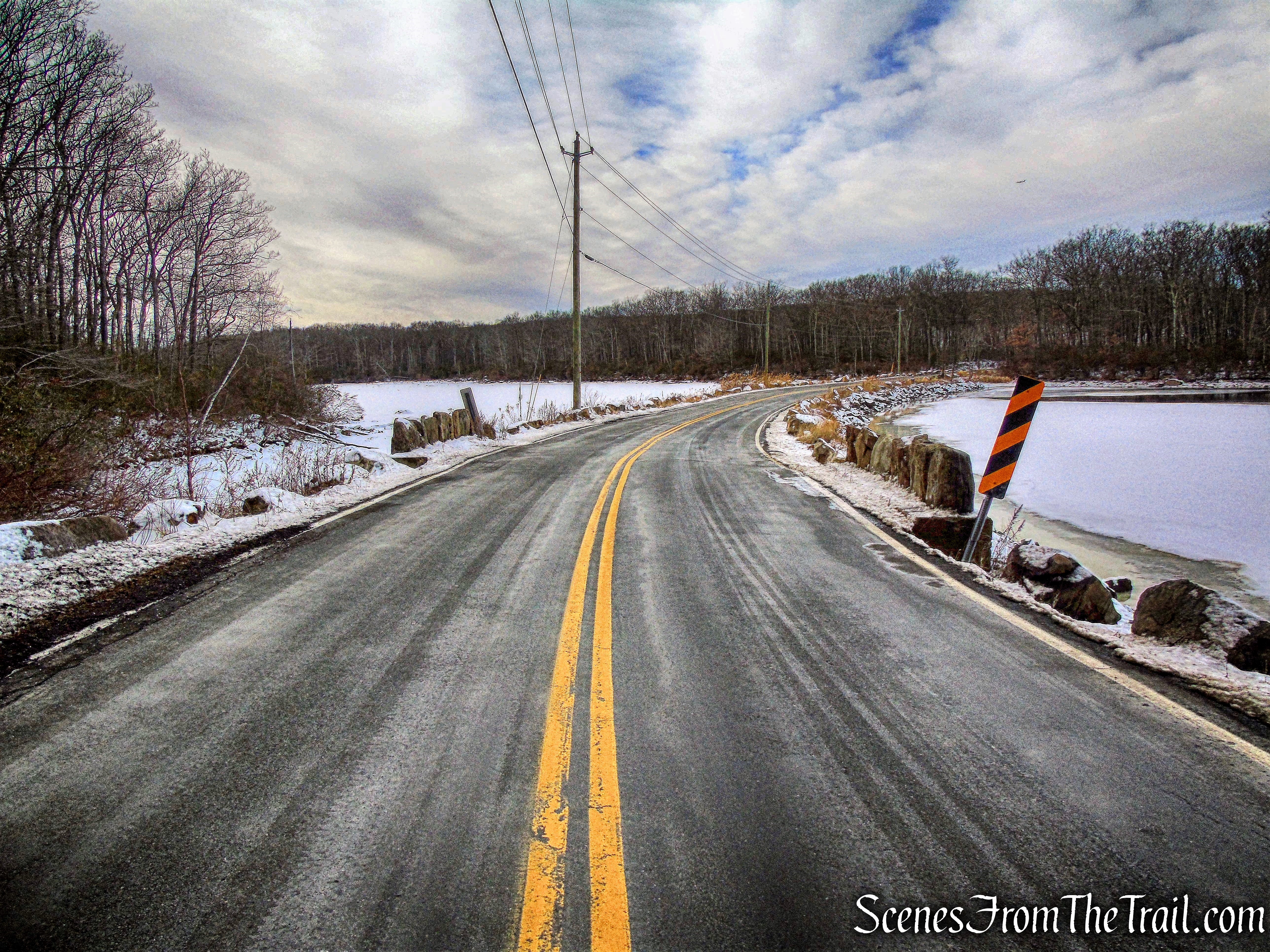
CR 106
There weren’t many cars driving by on this chilly Saturday so it was an easy and scenic walk along the road.
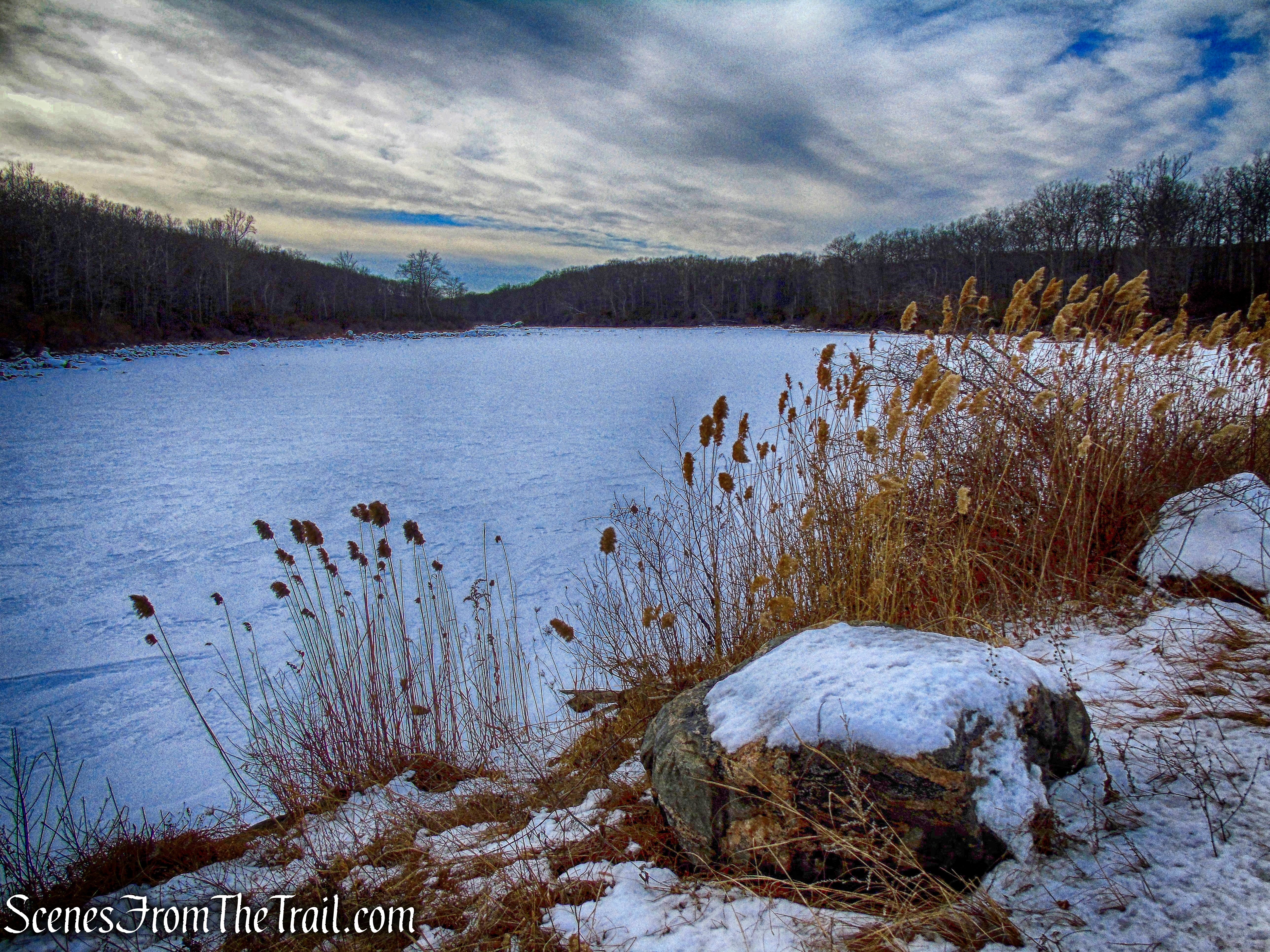
the southwest section of Lake Welch as it flows towards Beaver Pond Brook
Lake Welch as viewed from CR 106
We got to St. Johns Road and turned left.

St. Johns Road
We then walked down the road and turned right towards the hikers parking area where our hike began.
St. Johns Road
We then got in the car and drove a very short distance on St. Johns Road to visit the church. Mrs. Margaret Elizabeth Zimmerman built this memorial to her late husband after he passed away on their honeymoon. The cornerstone was laid on June 23, 1880. Read the full history of St. John’s in the Wilderness.
St. John’s in the Wilderness Episcopal Church
A Memorial to Lost Love.
St. John’s in the Wilderness
A visit to St. John’s is a walk through another place in time.
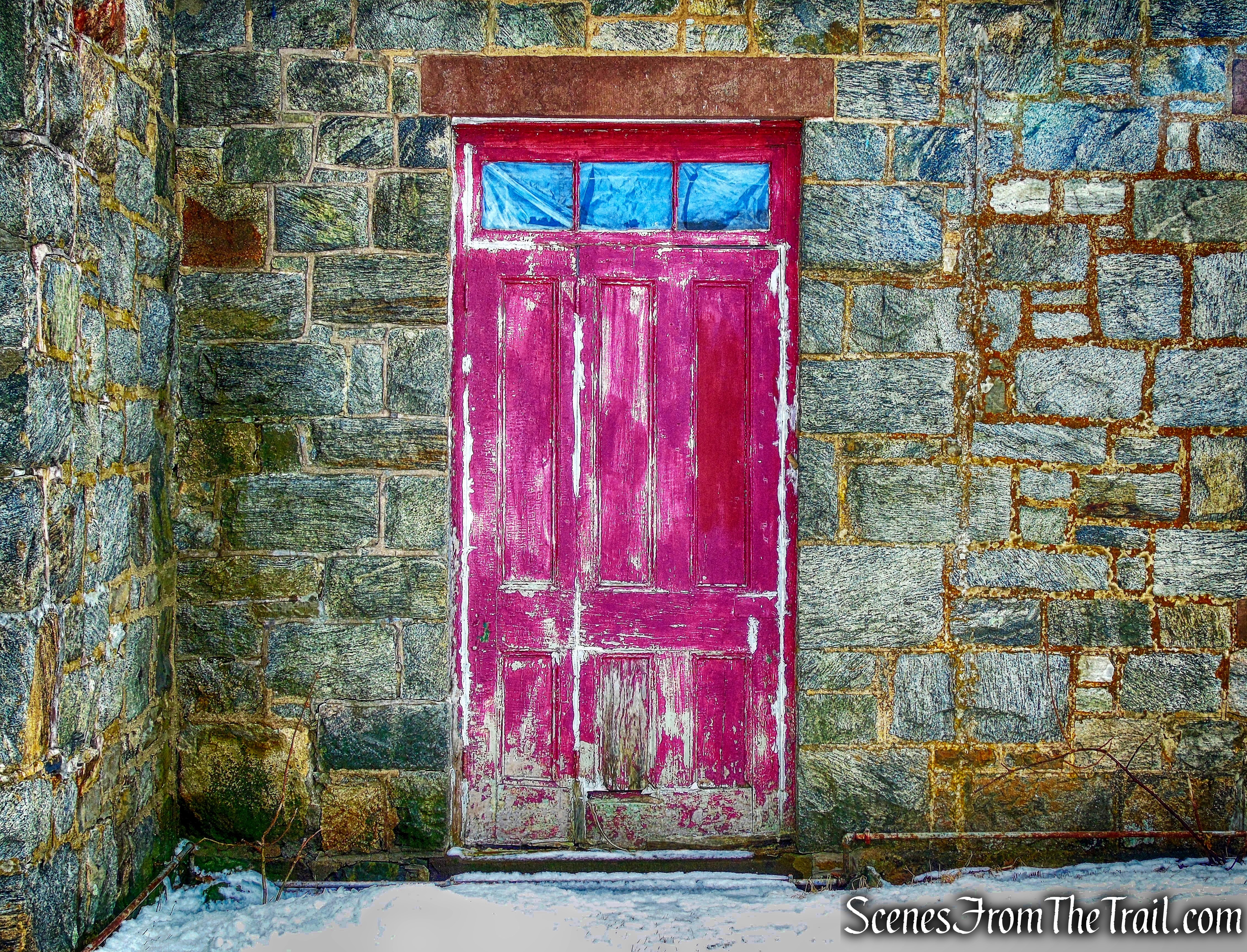
St. John’s in the Wilderness
Behind the church is a ruined structure with a doorway.
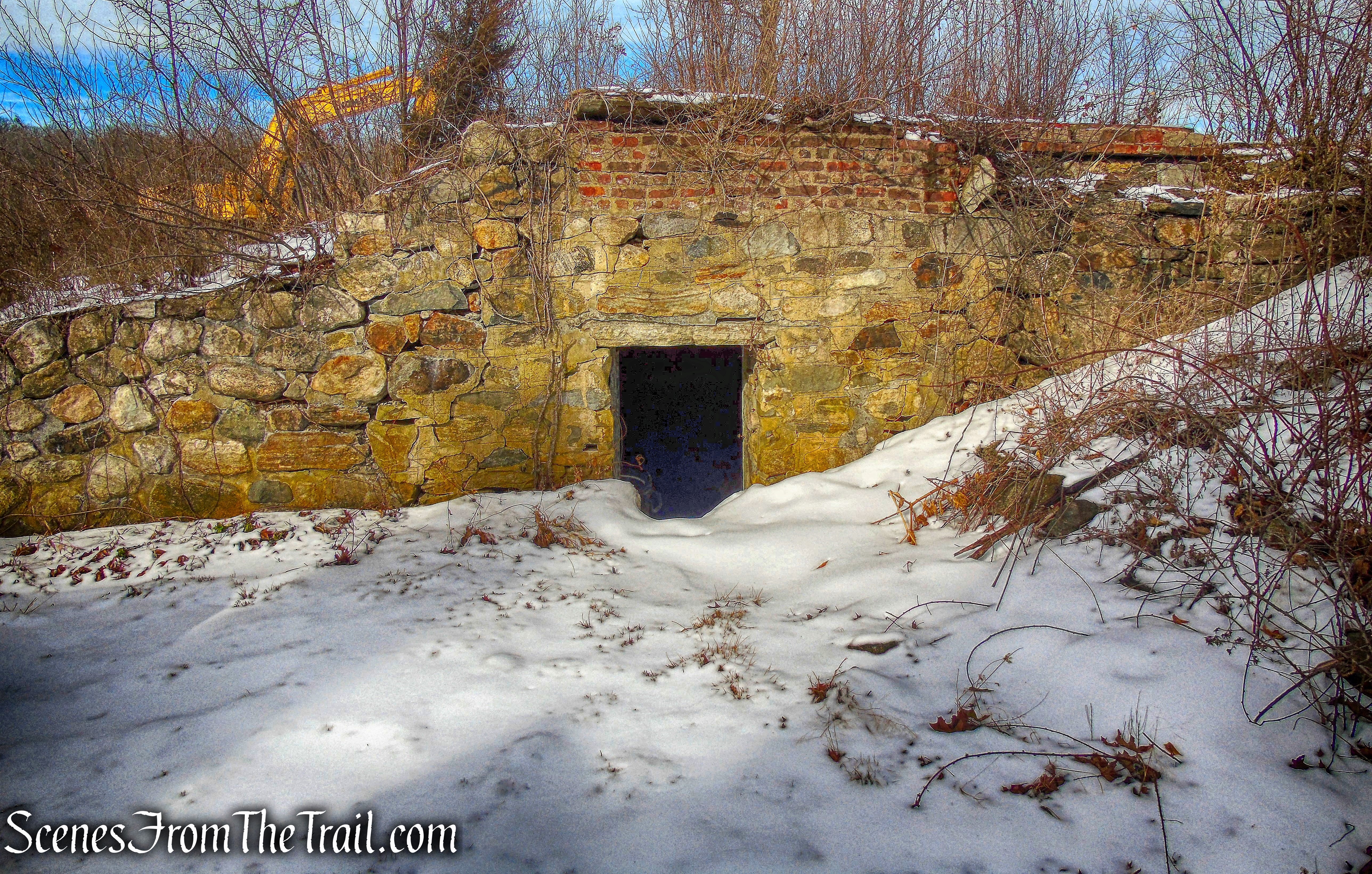
ruins behind St. John’s in the Wilderness
This cemetery was used by the old families from the Sandyfield, Johnsontown, plus the other old hamlets of the Harriman State Park area.
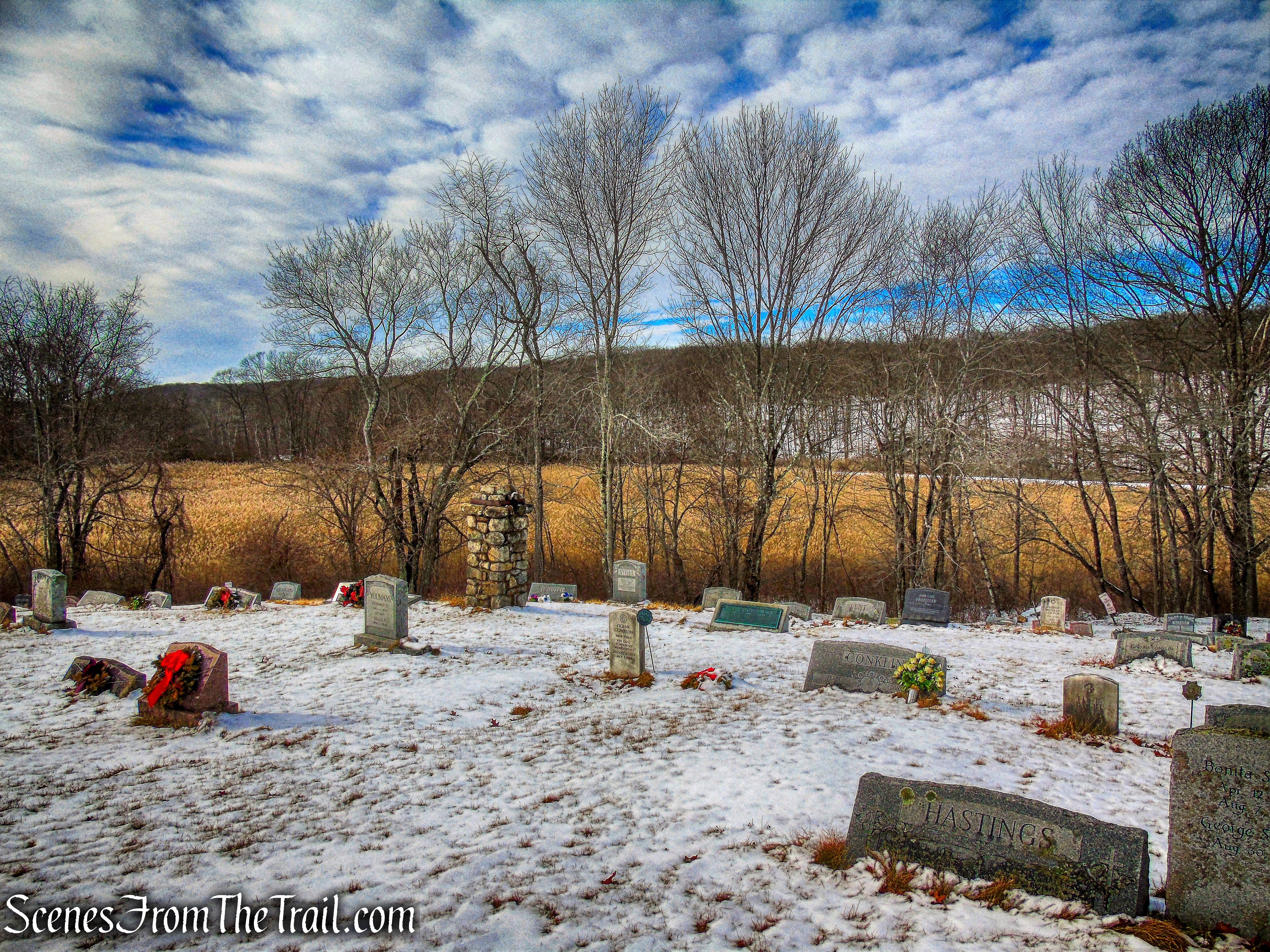
St. John’s Cemetery
Thank you for your service Mr. Conklin.
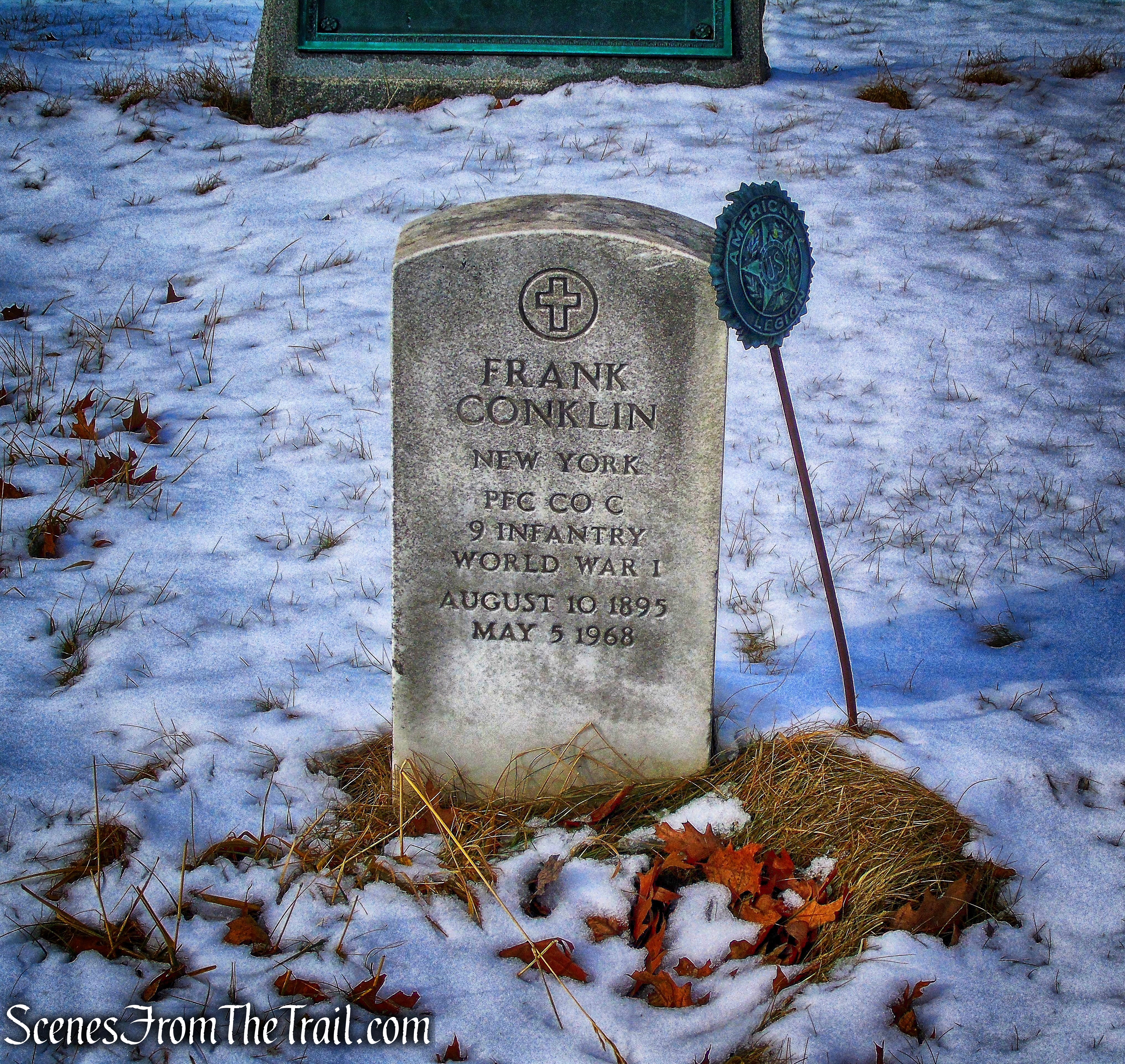
Frank Conklin – St. John’s Cemetery
I hope that you enjoyed the hike and please don’t forget to follow my blog. Feel free to share my posts with your friends as well. As always, I welcome any comments or suggestions regarding past or future hikes.
Pros: Barnes Mine, Lake Welch, historic features, scenic area, lesser traveled area.
Cons: My friend lost her microspikes.
Take a hike!
Barnes Mine – Lake Welch Loop
Sources:
Myles, William J.. Harriman Trails: A Guide and History (Kindle Location 5906). New York – New Jersey Trail Conference. Kindle Edition.
Lenik, Edward J.. Iron Mine Trails (Kindle Location 1780). New York – New Jersey Trail Conference. Kindle Edition.
St. John’s in the Wilderness Church Cemetery
