January 27, 2018 – Fort Lee, New Jersey
Difficulty: Moderate
Length: Approximately 7.5 miles
Max elevation: 344 ft.– total elevation gain approximately 559 ft.
Route type: Circuit
Map: Hudson Hudson Palisades Trails Map #108 – Free map
Trailhead parking: Hudson Terrace, Fort Lee, NJ 07024
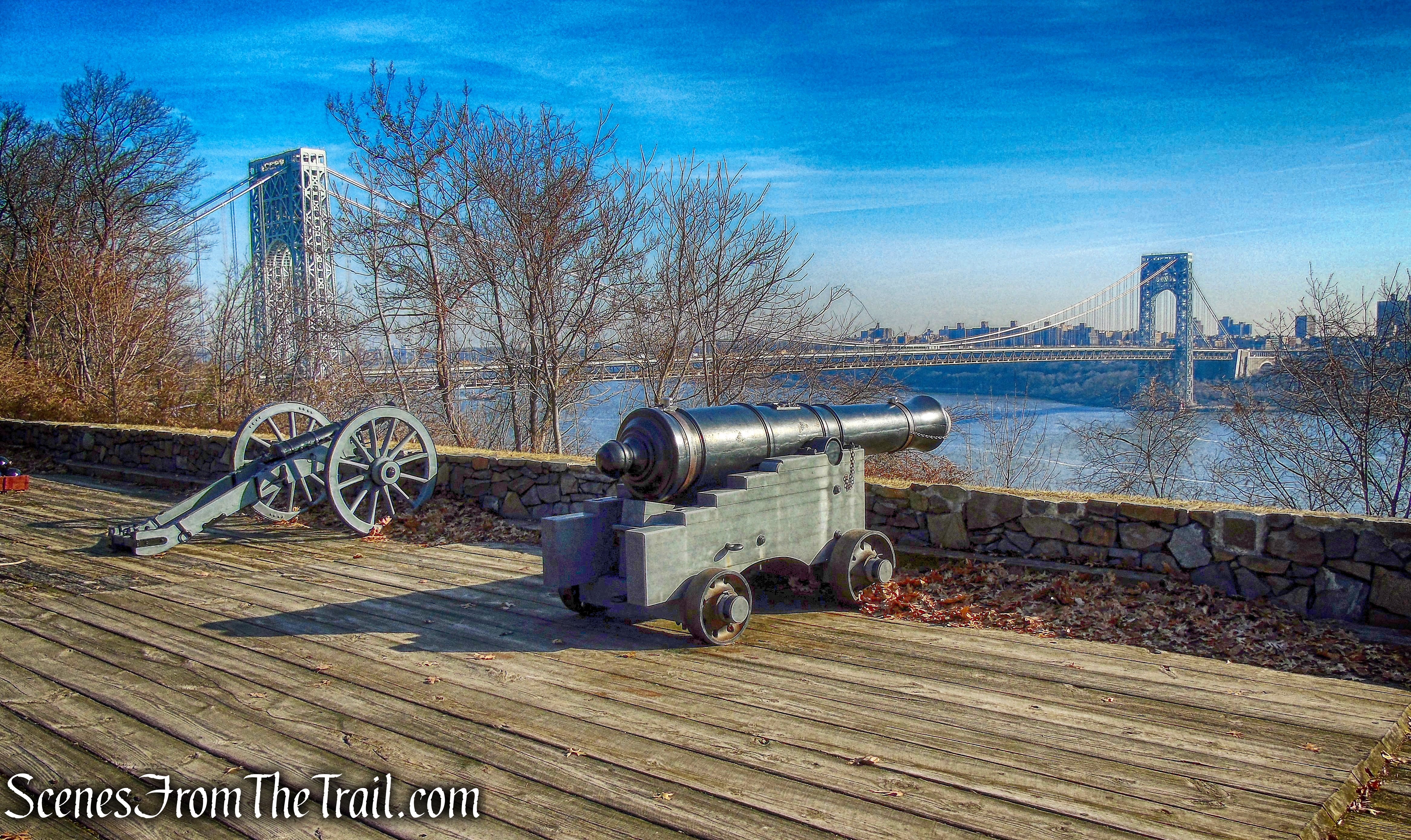
Fort Lee Historic Park is a 33-acre cliff-top park area with scenic overlooks, a reconstructed Revolutionary War encampment, and a Visitor Center. It was named for General Charles Lee, who aided in the defense of New York City. It is managed by the Palisades Interstate Park Commission.
Fort Lee Historic Park
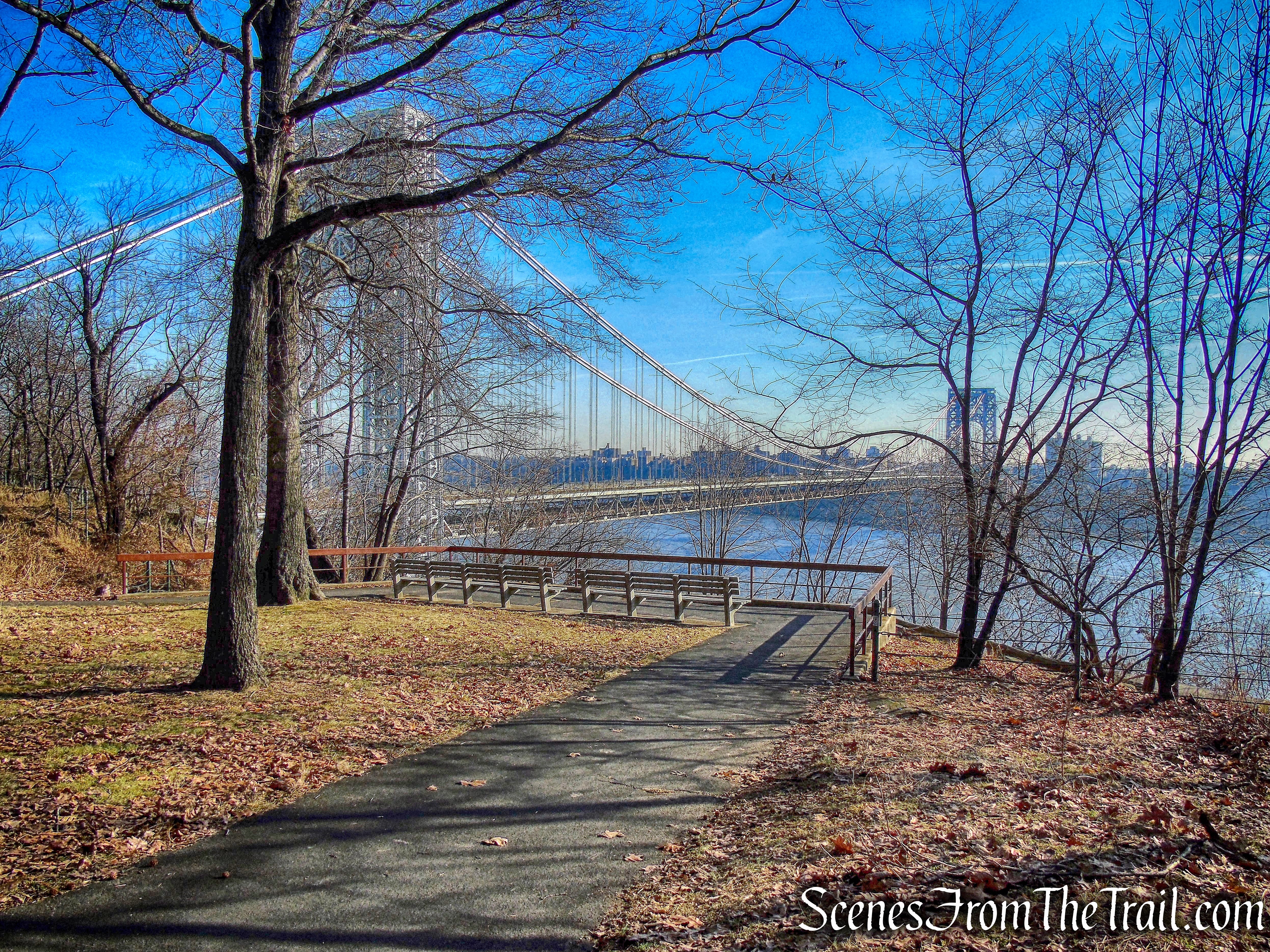
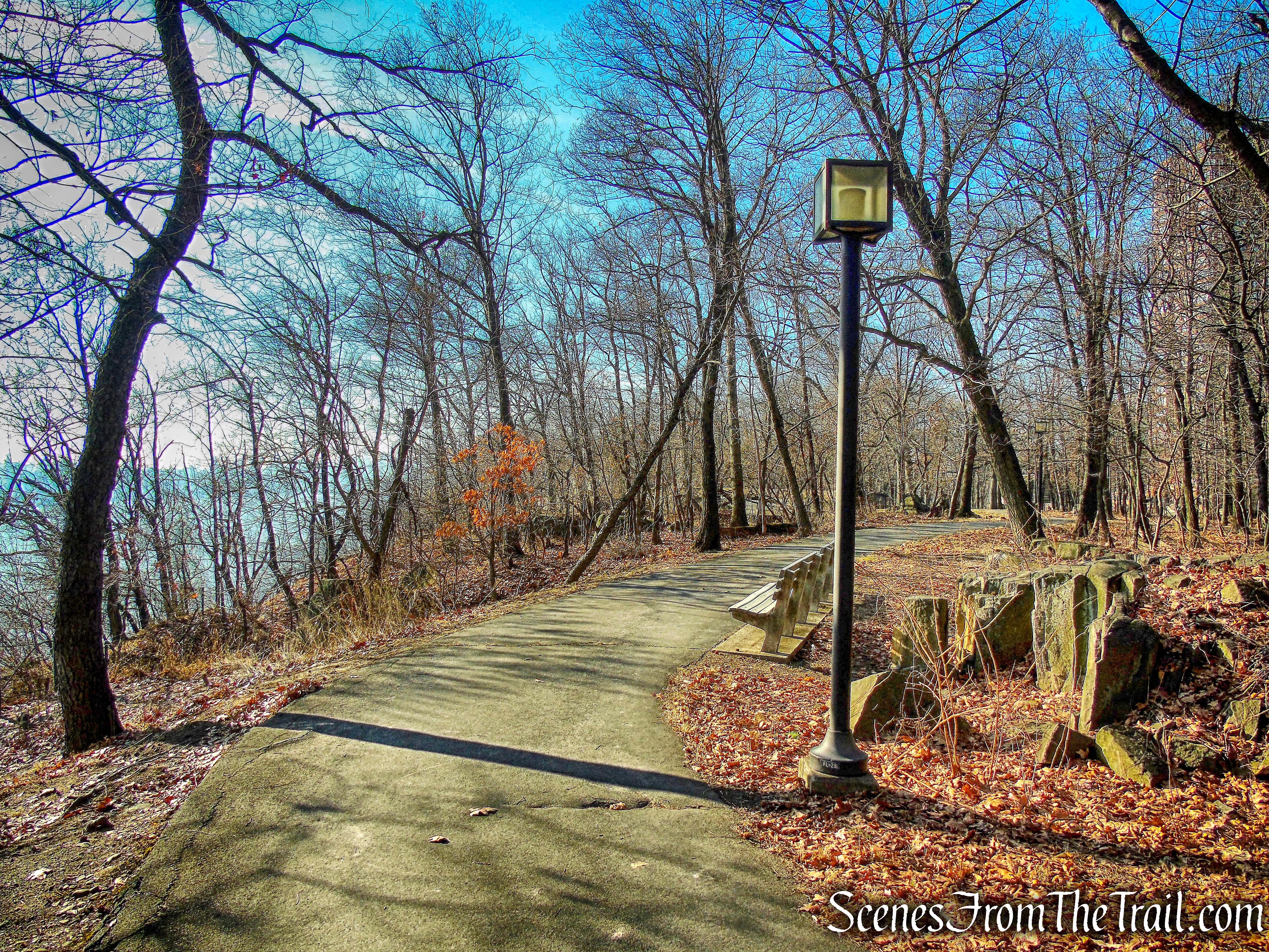
At the north end of the park there are two overlooks with views of the George Washington Bridge, the Hudson River, and the skyline of upper Manhattan.
overlook – Fort Lee Historic Park
Fort Lee, originally Fort Constitution, was an American Revolutionary War fort located on the crest of the Hudson Palisades in what was then Hackensack Township, New Jersey. Selected as a site to help defend New York City and the Hudson Valley against the onslaught of the British during the Revolution, Fort Lee Historic Park today stands as a monument to those who battled for independence.
Fort Lee Historic Park
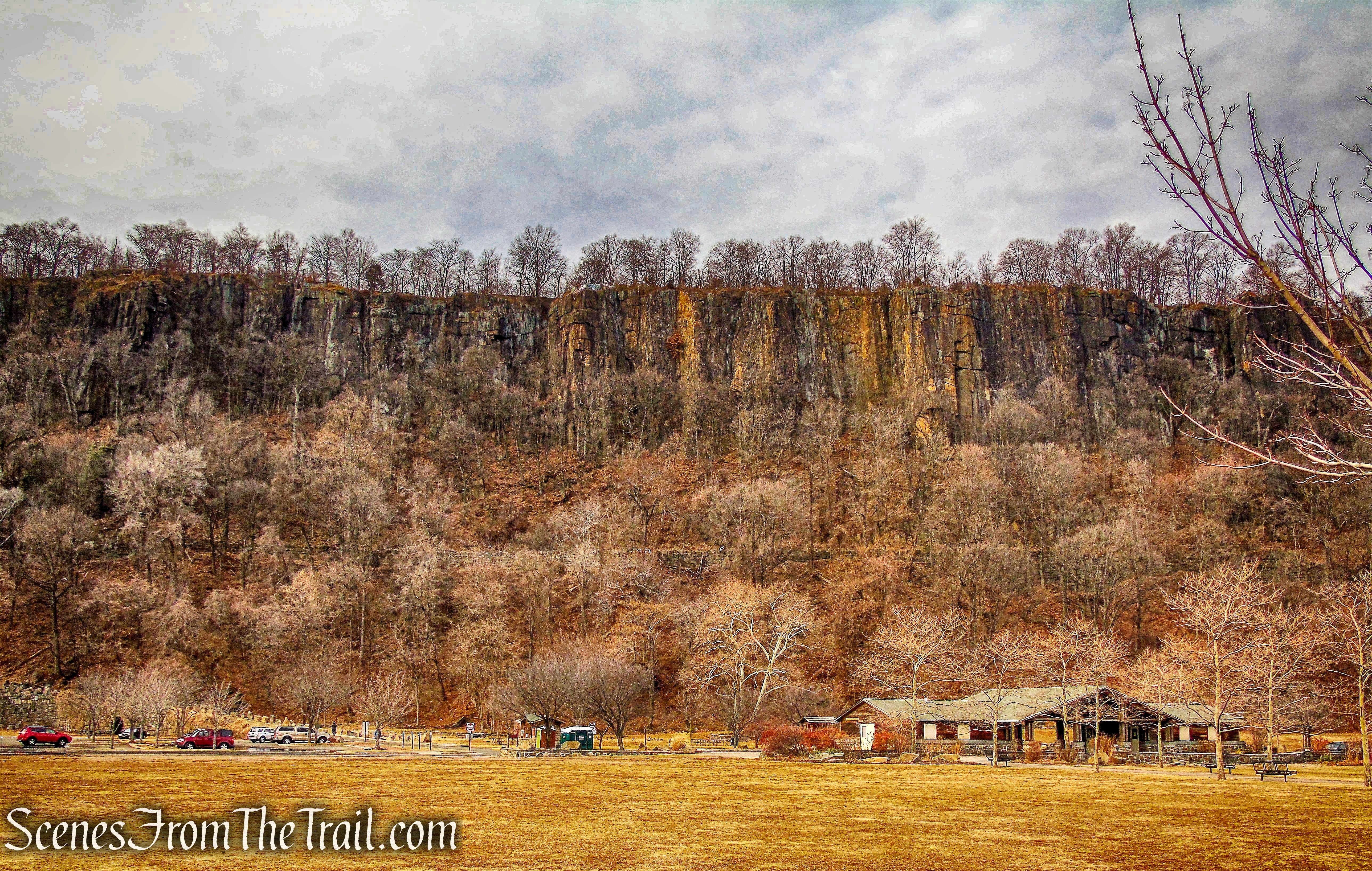
The New Jersey section of the Palisades Interstate Park encompasses about 2,500 acres along the Hudson River from Fort Lee to the New Jersey state line, where it continues into New York State. It is a long narrow park averaging less than an eighth of a mile wide. Loop hikes are possible for hikers willing to ascend/descend 300 feet in a short distance on marked trails.
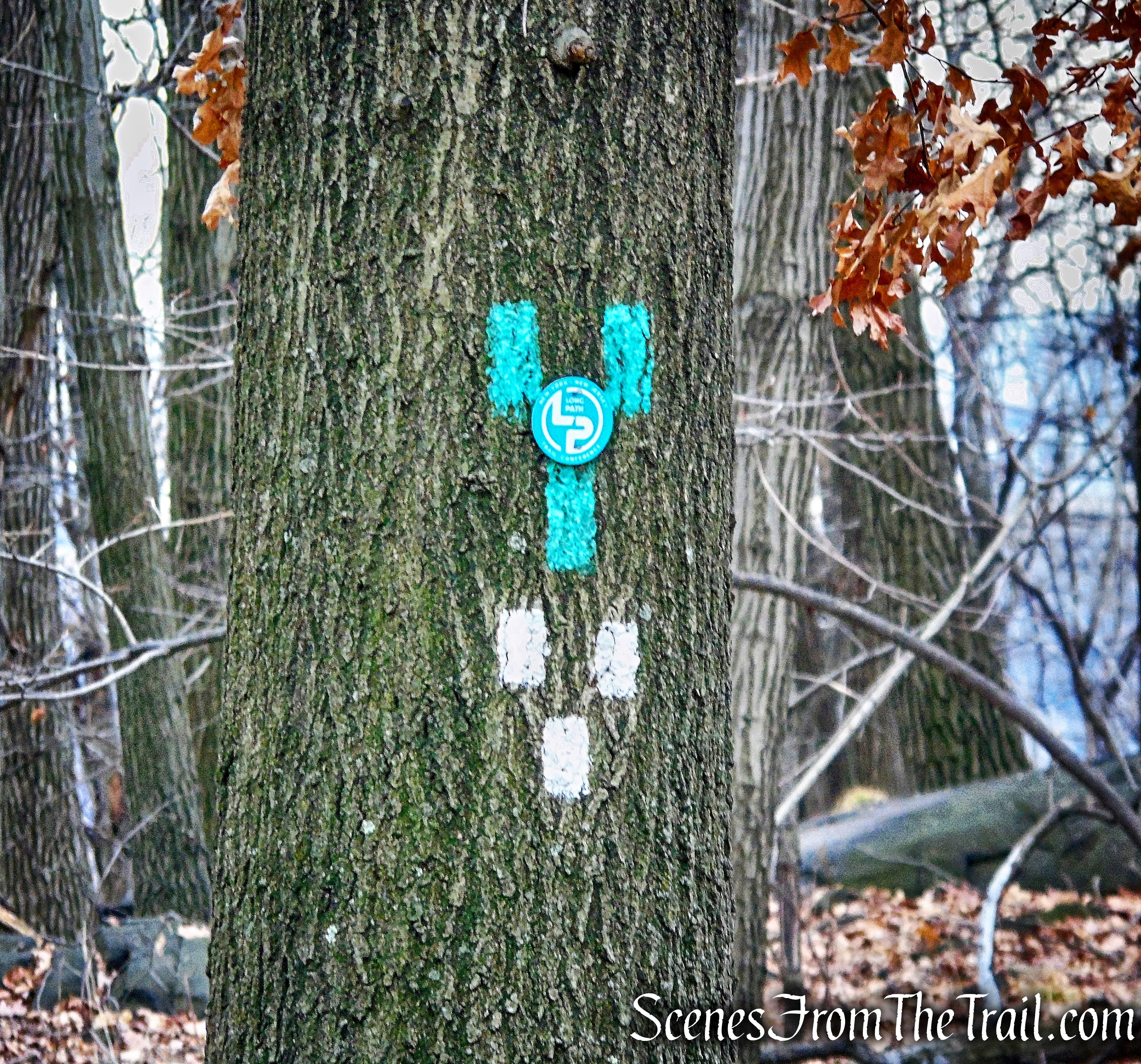
The Long Path (13 miles in NJ; aqua blaze) extends north from the George Washington Bridge and follows the level cliff-top of the Palisades. For most of the way to the State Line Lookout it runs along a narrow strip of the land between the four-lane Parkway and the cliff edge. As a result the sounds of traffic can be heard along the trail.
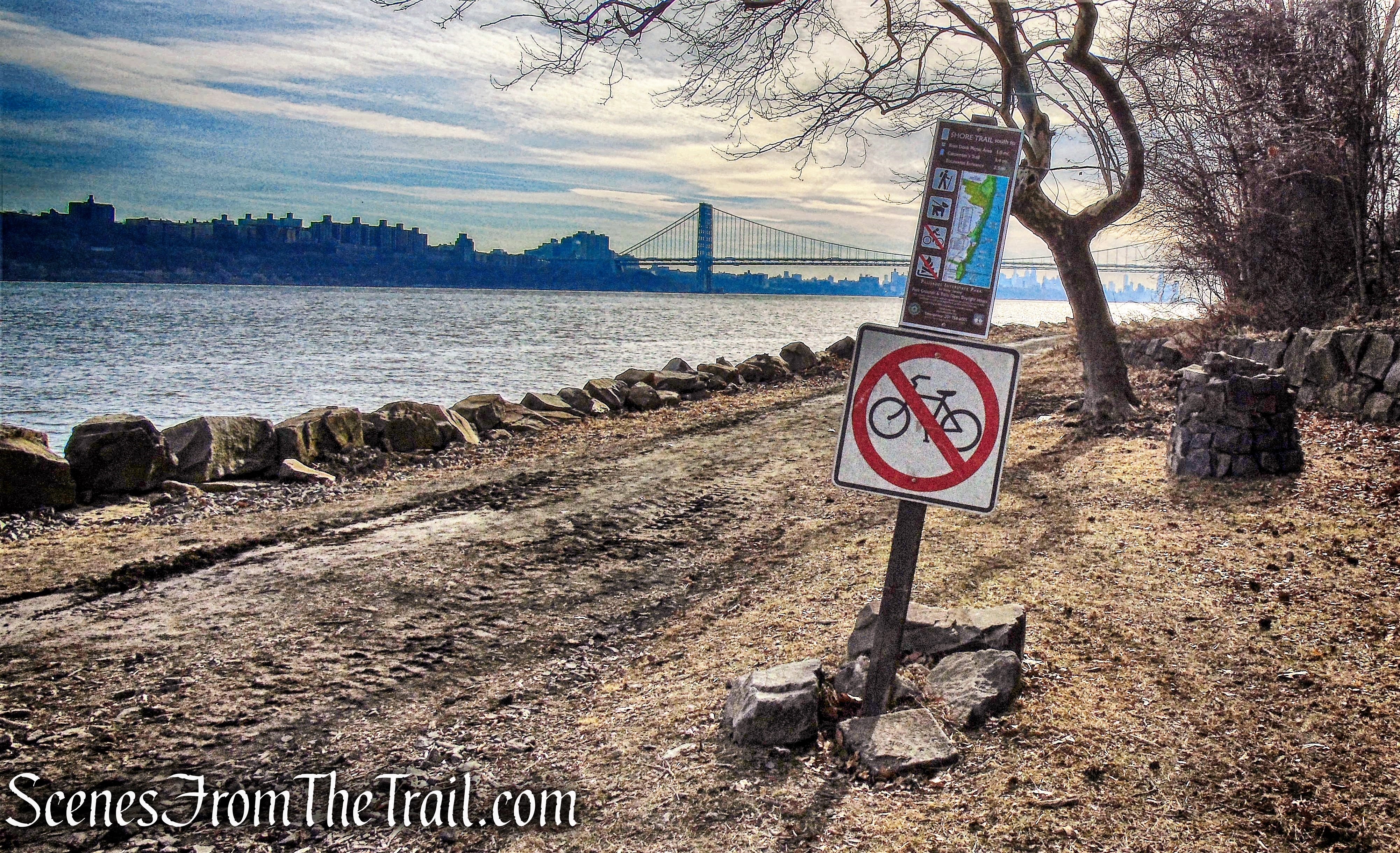
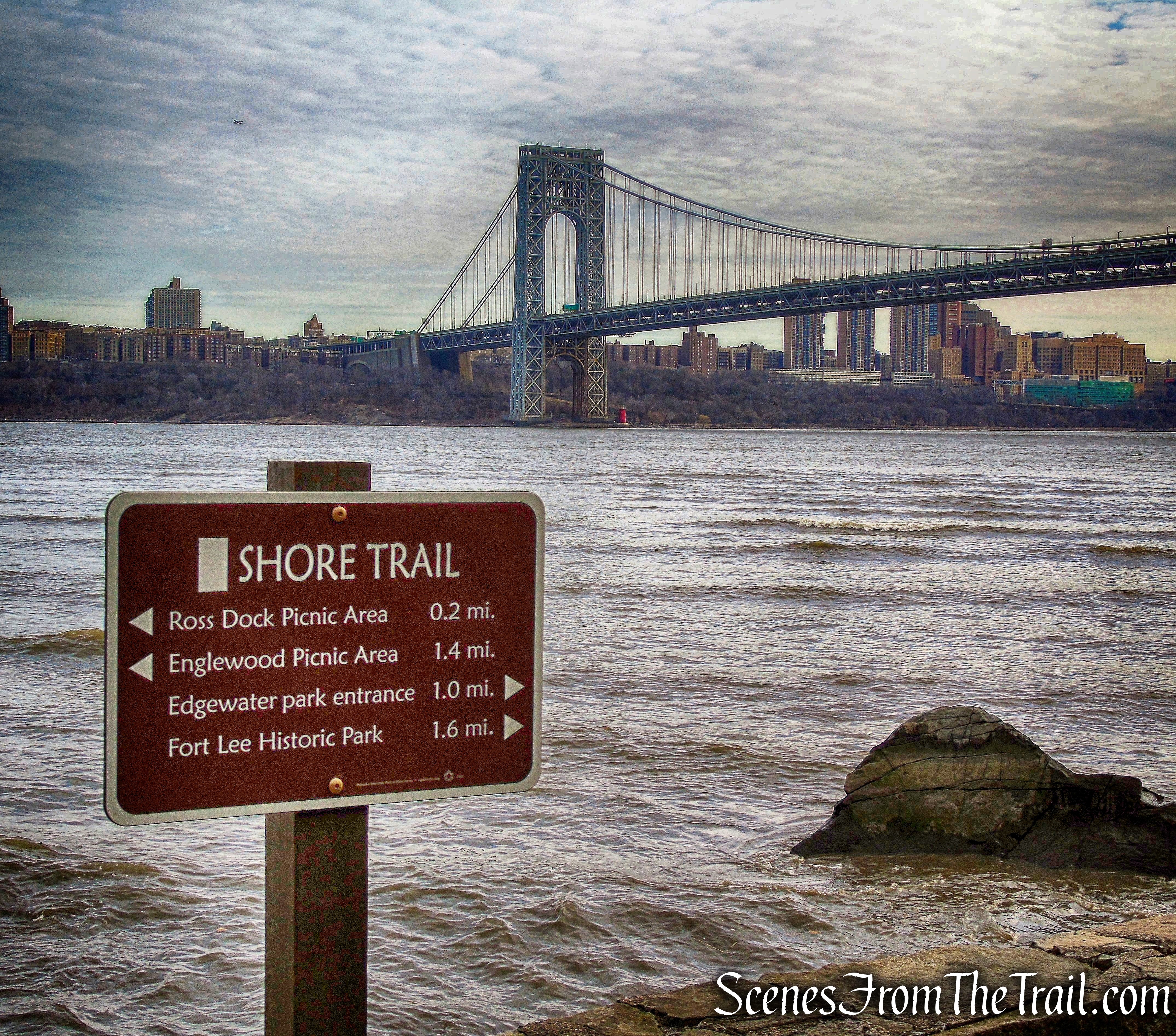
The Shore Trail (12.2 miles; white blaze) runs along the Hudson River from Fort Lee Historic Park to 0.7 mile beyond the New Jersey-New York state line. For most of its route, it follows a nearly-level path that closely hugs the shoreline.
I had visited Fort Lee Historic Park several times in the past and found it an interesting place. Since it was going to be a warm day for January, I decided to head a little further south than usual to take advantage of the warmer temps. The hike begins in Fort Lee Historic Park, where we explored the historic features and views. We then proceeded to follow the Long Path north along the top of the cliffs, with yet more views. We then descended on the Dyckman Hill Trail to the river and returned on the Shore Trail along the edge of the Hudson River.
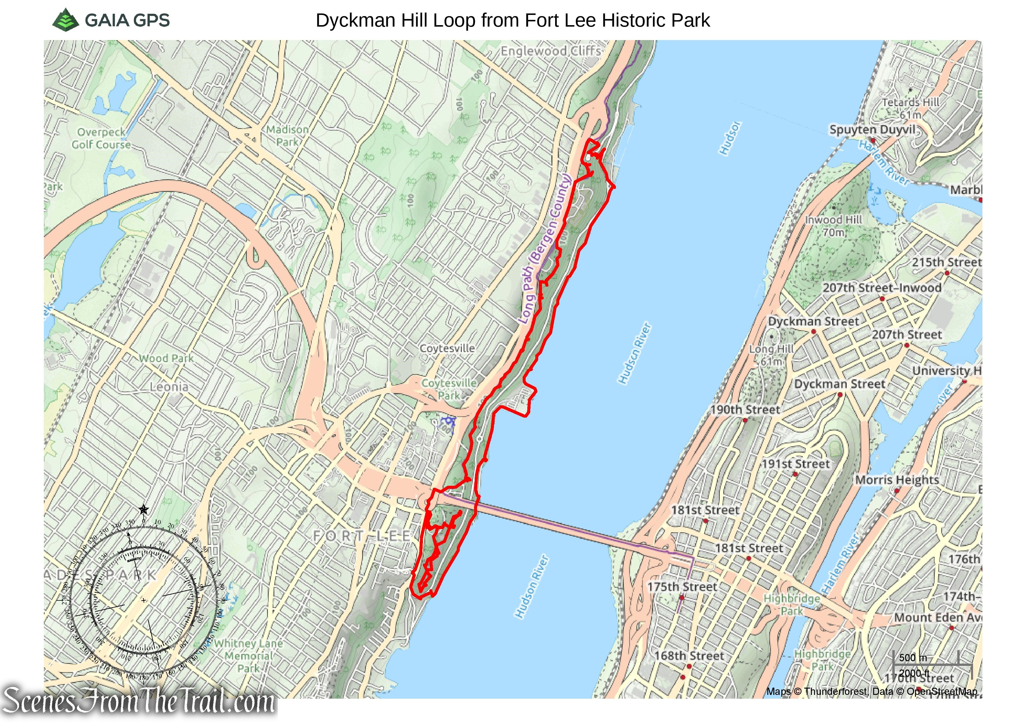
Dyckman Hill Loop from Fort Lee Historic Park
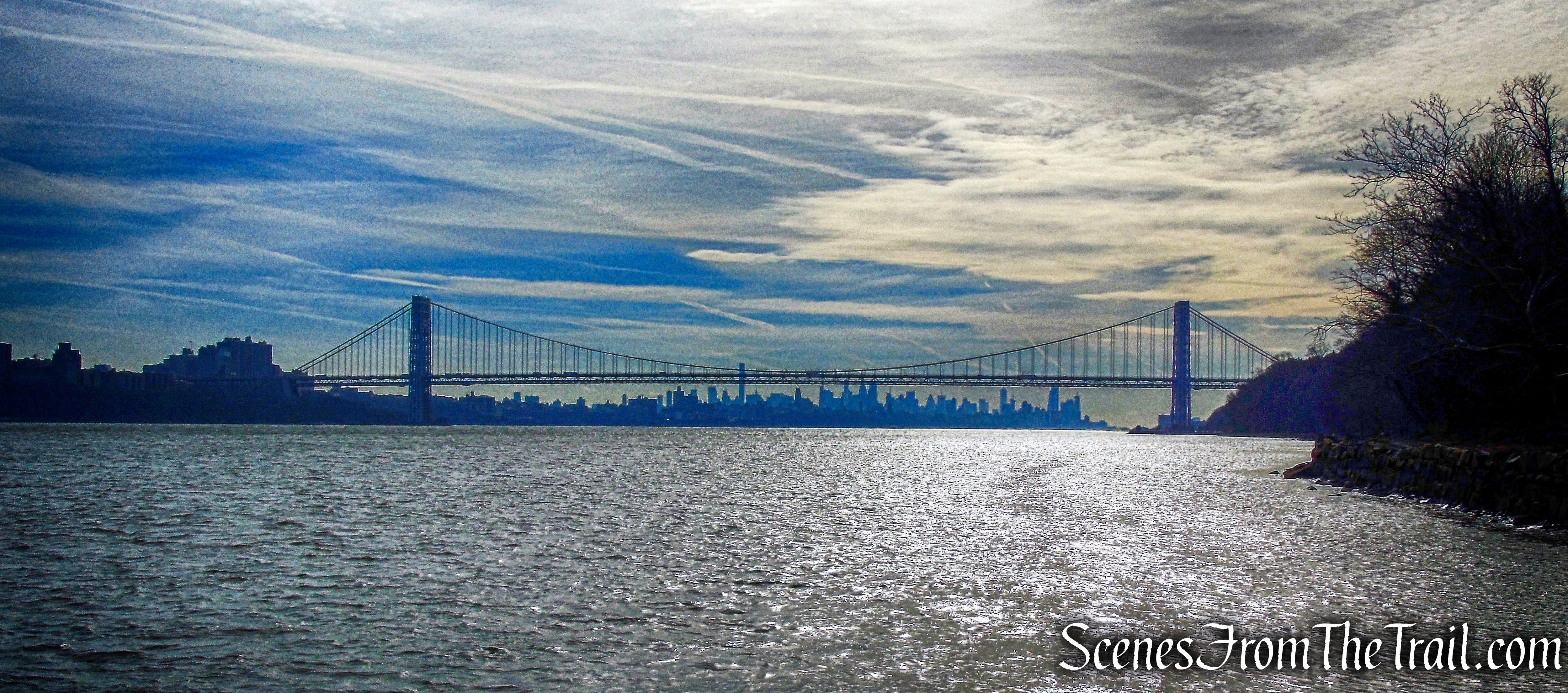
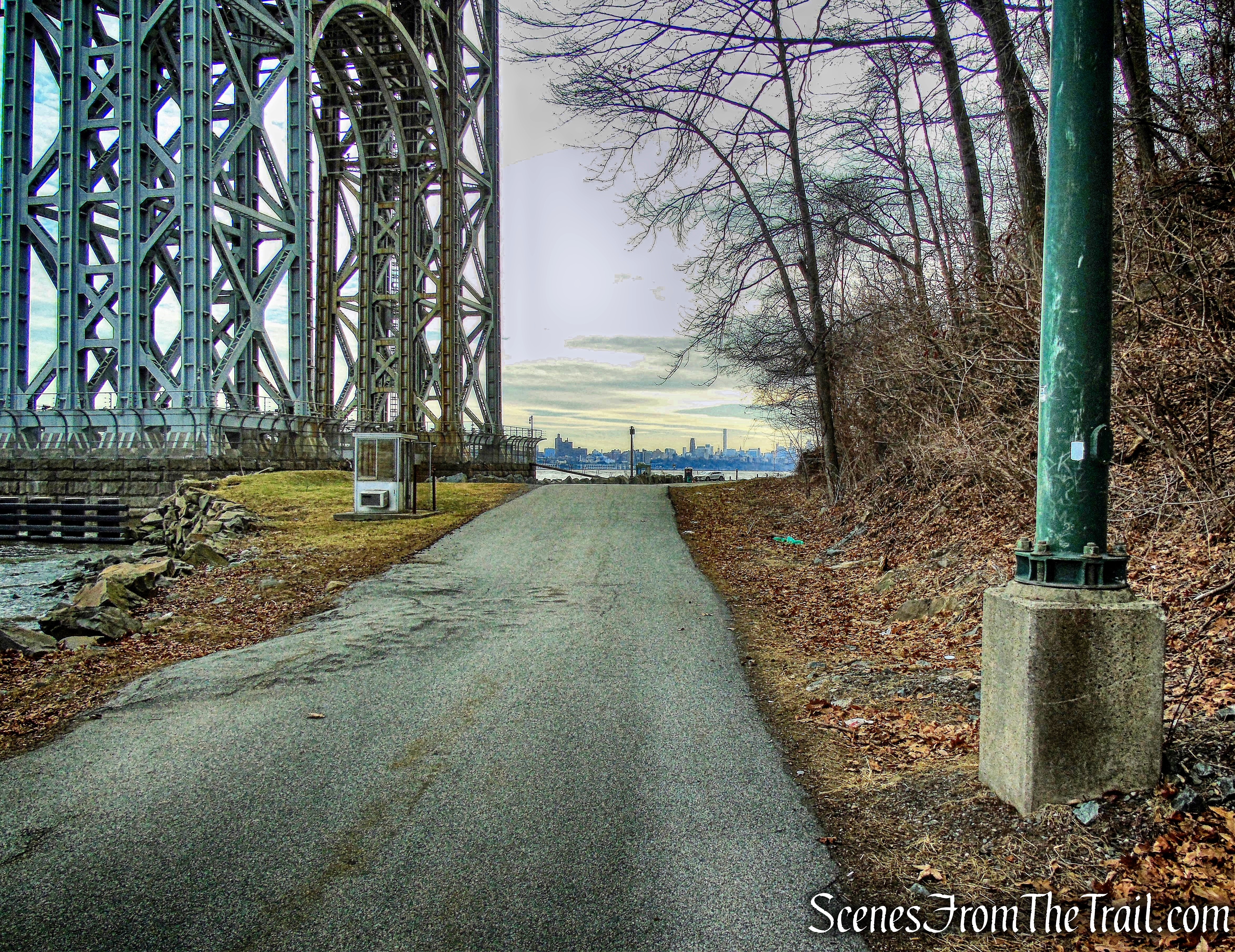
Before we began the actual hike, we walked over to the northern end of the park to check out the view. This giant bridge has a 3,500-foot center span and its towers are 570 feet tall. The George Washington Bridge connects Fort Washington Park in Manhattan to New Jersey’s Fort Lee Historic Park and the Palisades. The bridge first opened in 1931.
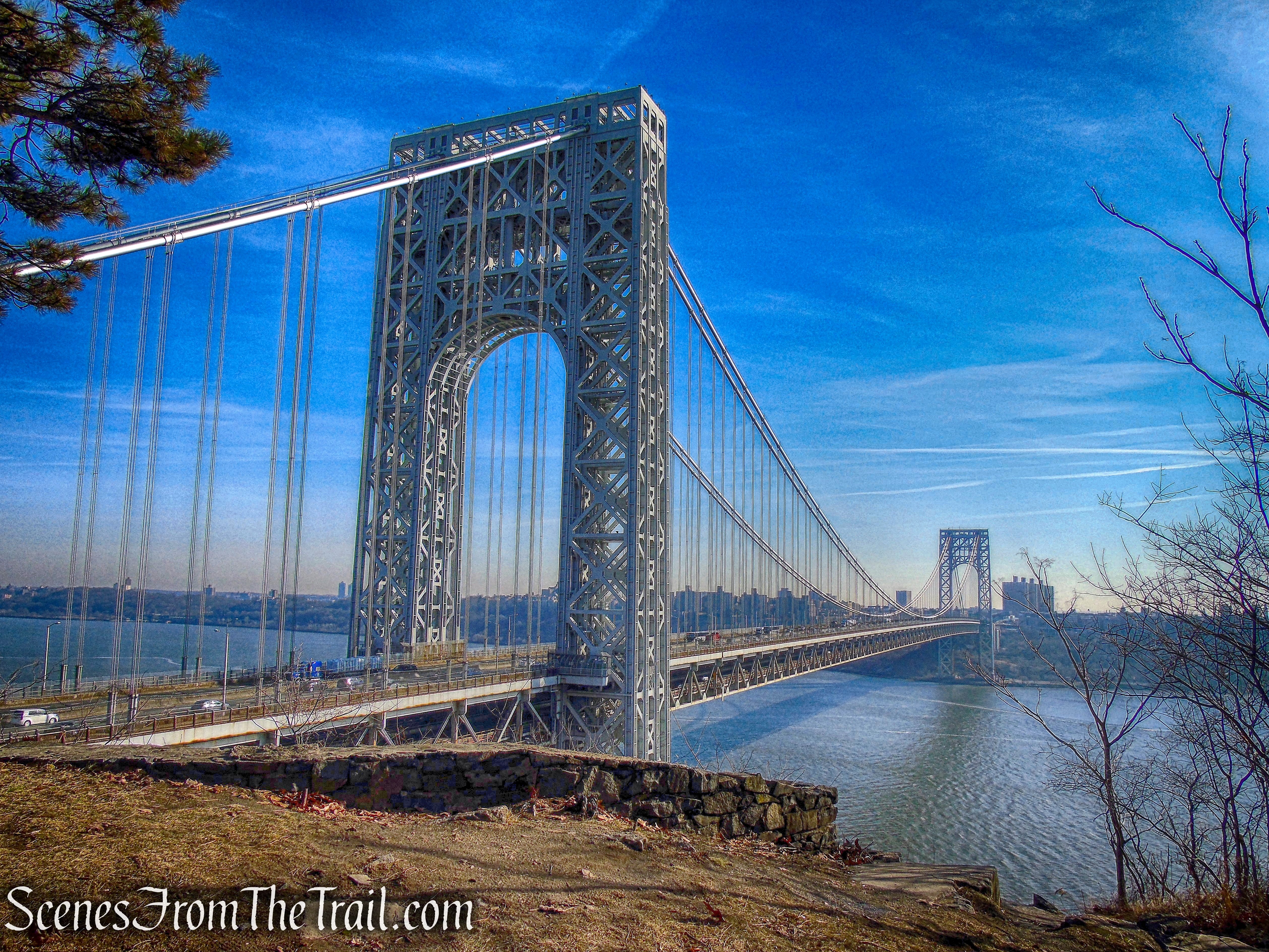
George Washington Bridge
Just under the bridge on the Manhattan side, is the Little Red Lighthouse (AKA Jeffrey’s Hook), Manhattan island’s only lighthouse. This 40-foot-high structure had been erected on Sandy Hook, New Jersey in 1880, where it used a 1,000 pound fog signal and flashing red light to guide ships through the night. It became obsolete and was dismantled in 1917. In 1921, the U.S. Coast Guard reconstructed this lighthouse on Jeffrey’s Hook in an attempt to improve navigational aids on the Hudson River. When the George Washington Bridge opened in 1931, the brighter lights of the bridge again made the lighthouse obsolete. In 1948, the Coast Guard decommissioned the lighthouse, and its lamp was extinguished.
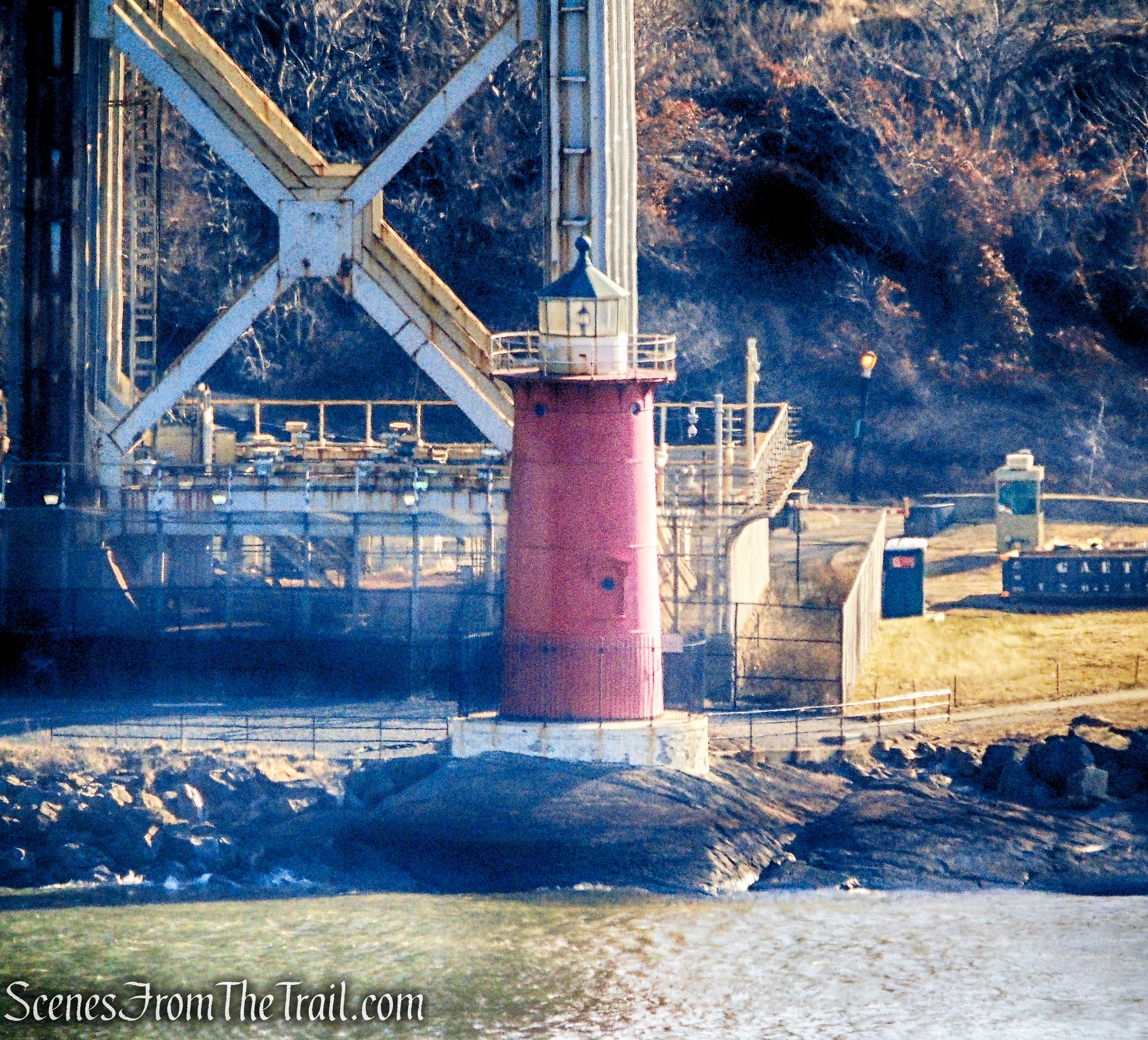
Little Red Lighthouse
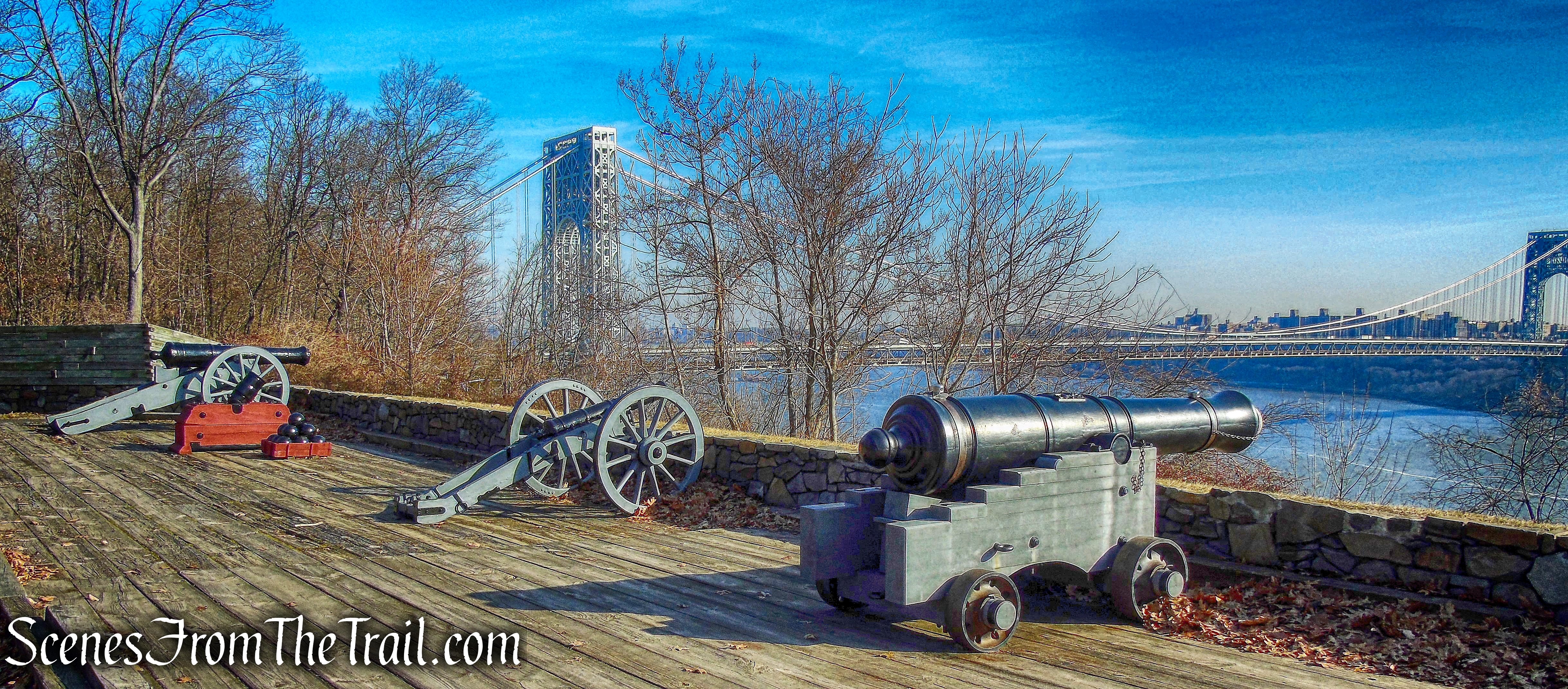
In the southern portion of the Historic Park, winding pathways lead past a reconstructed blockhouse to gun batteries and firing steps.
Fort Lee Historic Park
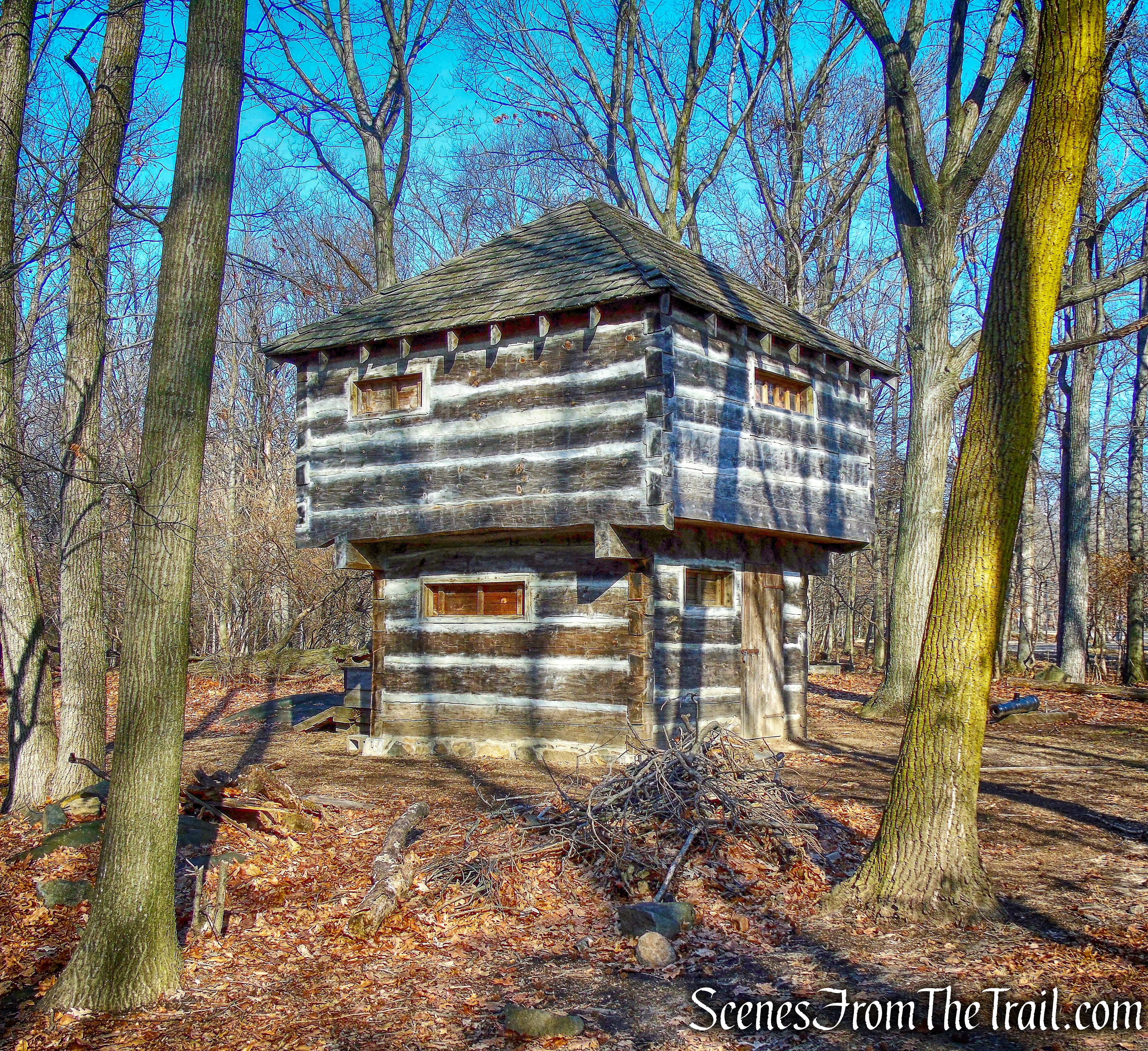
blockhouse – Fort Lee Historic Park
Fort Lee Historic Park
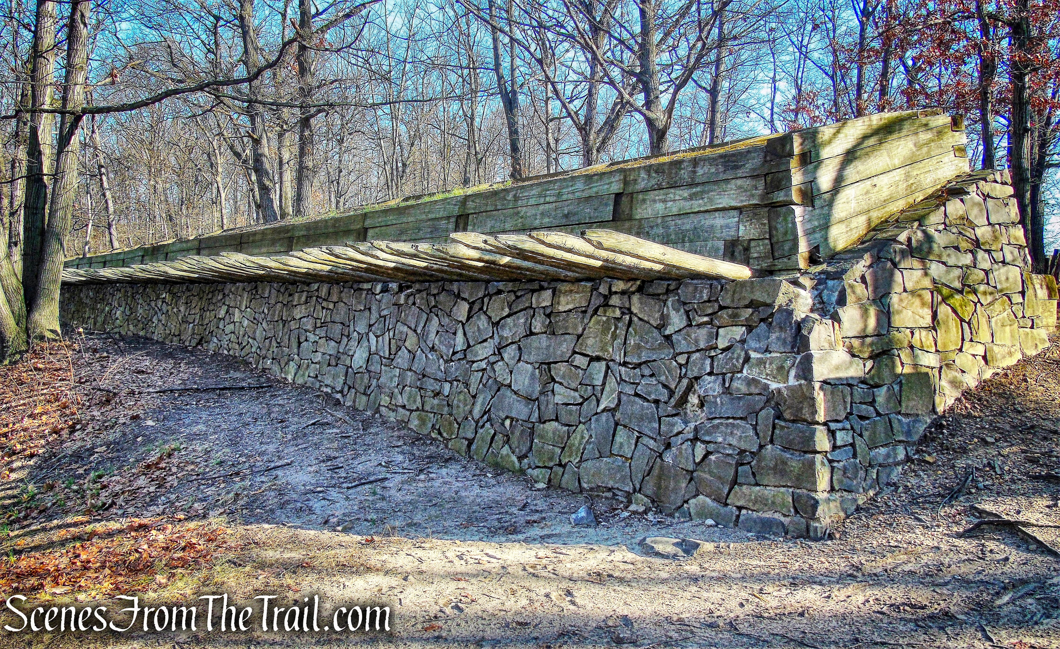
firing steps – Fort Lee Historic Park
At the southernmost end of the park, the Manhattan skyline is clearly visible.
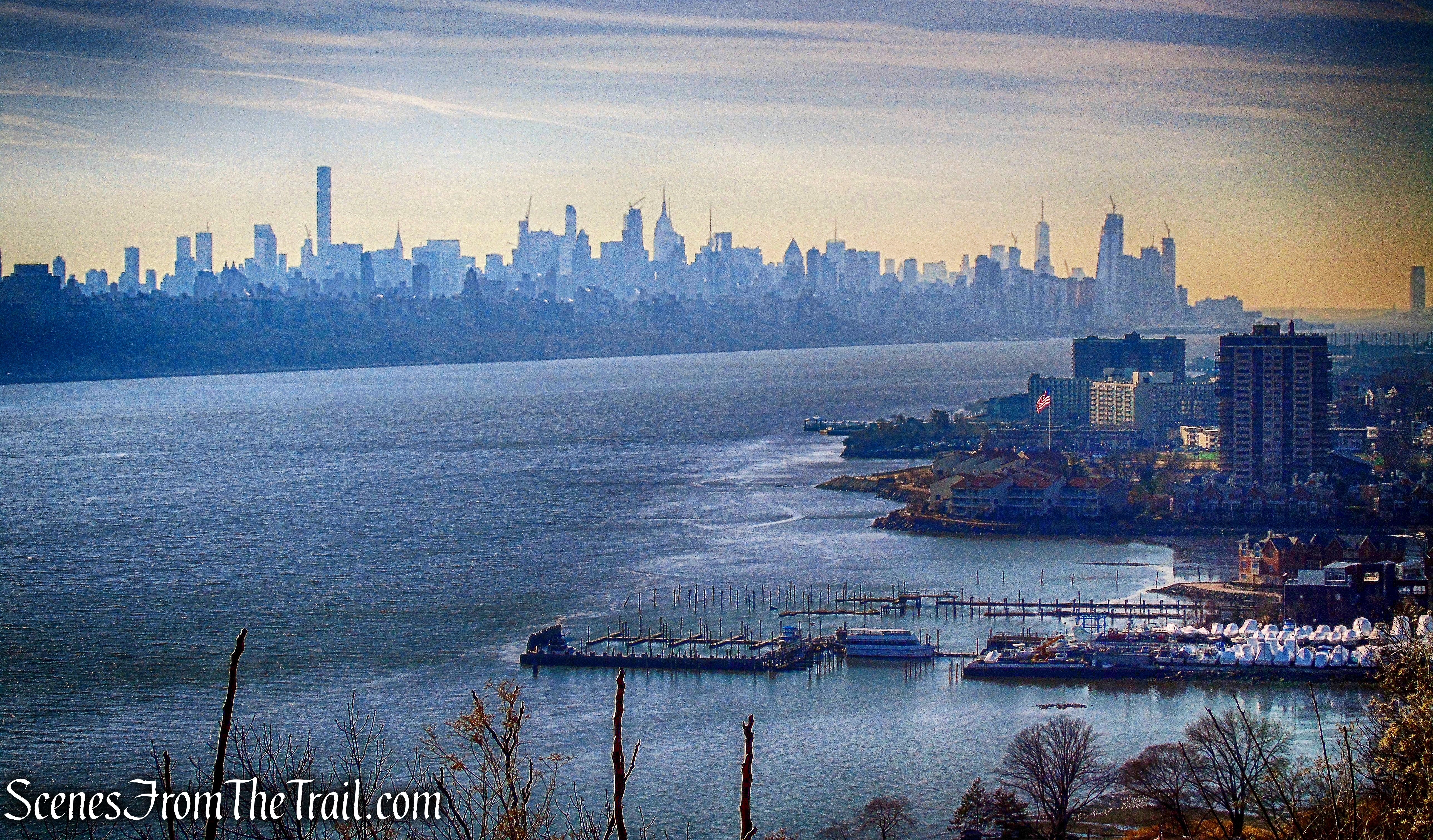
view of NYC – Fort Lee Historic Park
There are authentically recreated eighteenth-century soldiers’ and officers’ huts, with a well, woodshed, and baking oven. They serve as the focal point for interpretive programs.
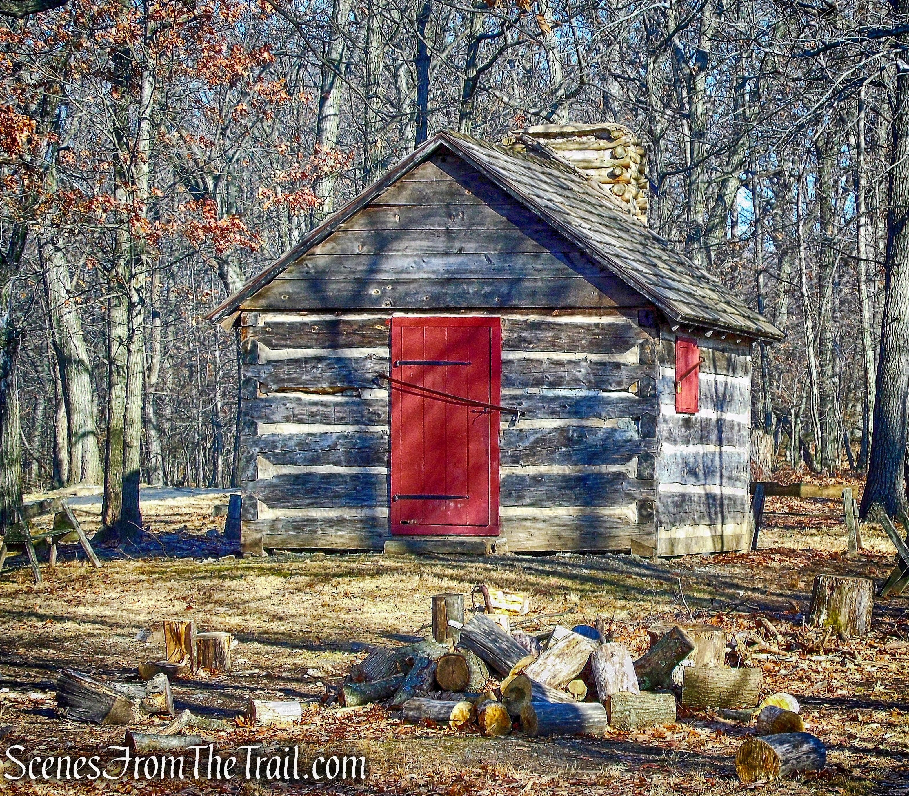
soldier’s hut – Fort Lee Historic Park
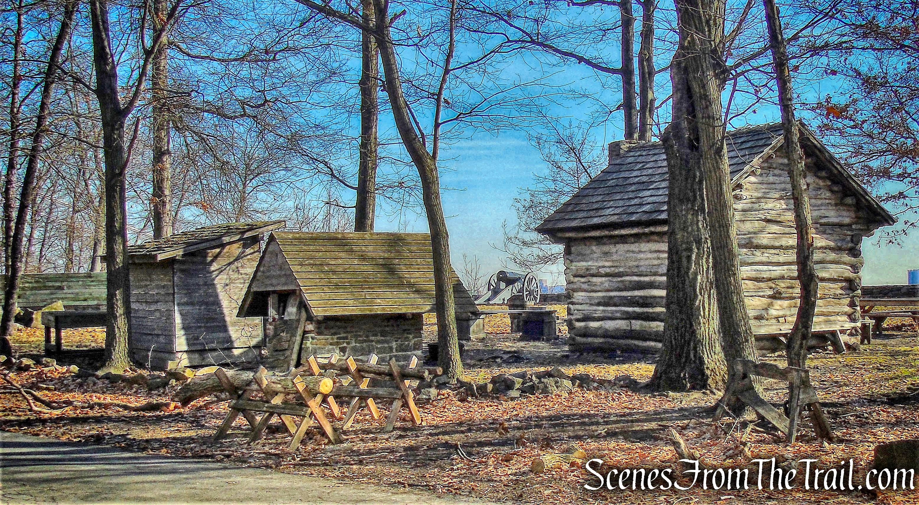
Fort Lee Historic Park
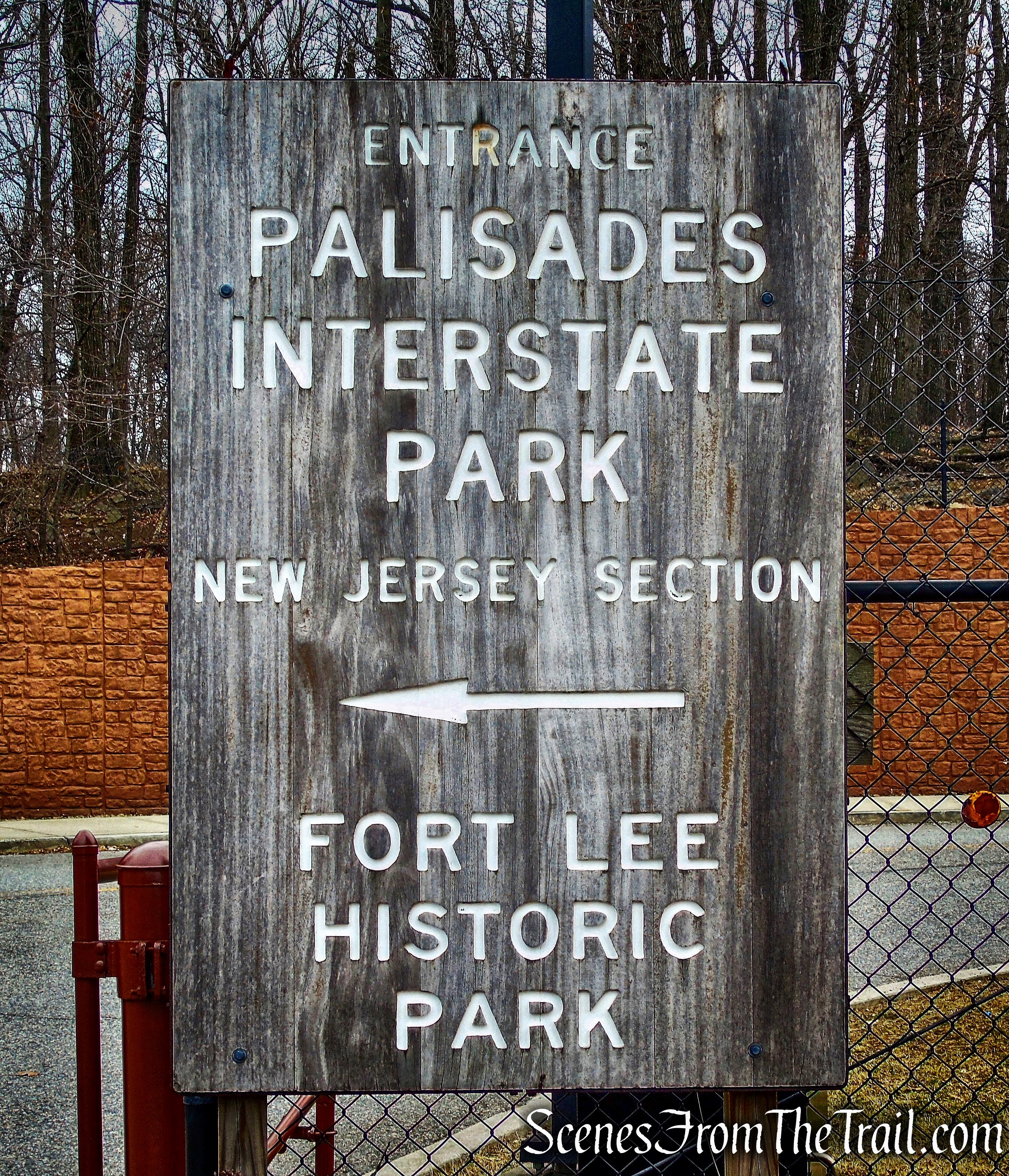
When we were done exploring the park, we headed back towards the entrance road. The sign near the visitor center indicates the start of the Long Path (in New Jersey) and the distances to the other trails.
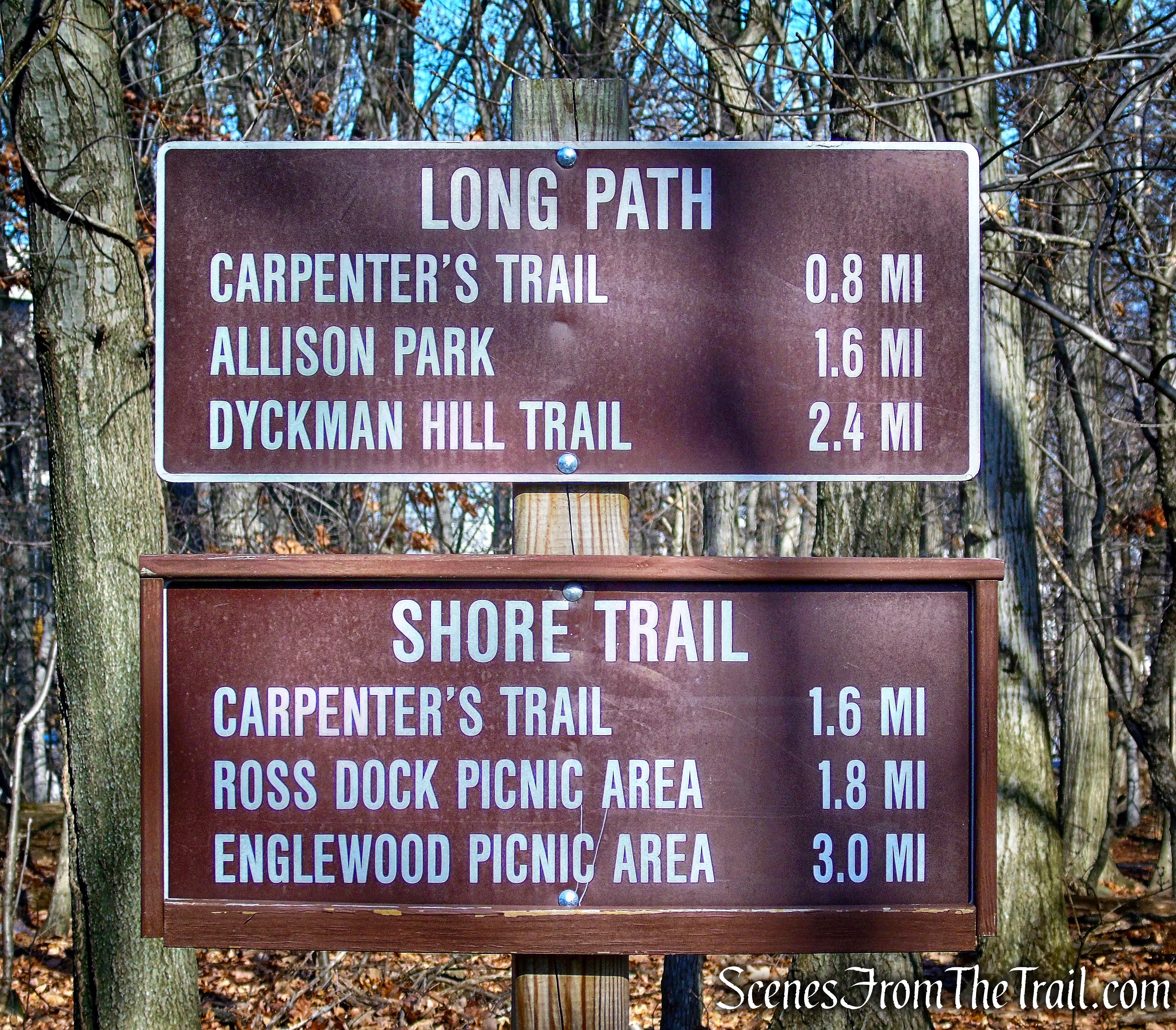
trail sign – Fort Lee Historic Park
Since we would be using the Long Path for the first part of the hike, we began following the aqua blazes. The Long Path and the Shore Trail are co-aligned at the start. The Shore Trail would be our return route.
Long Path
The Long Path travels on the paved walkway out of the park and onto Hudson Terrace, where it turns right, heading north. The two trails split when they reach Hudson Terrace, with the Shore Trail going left.
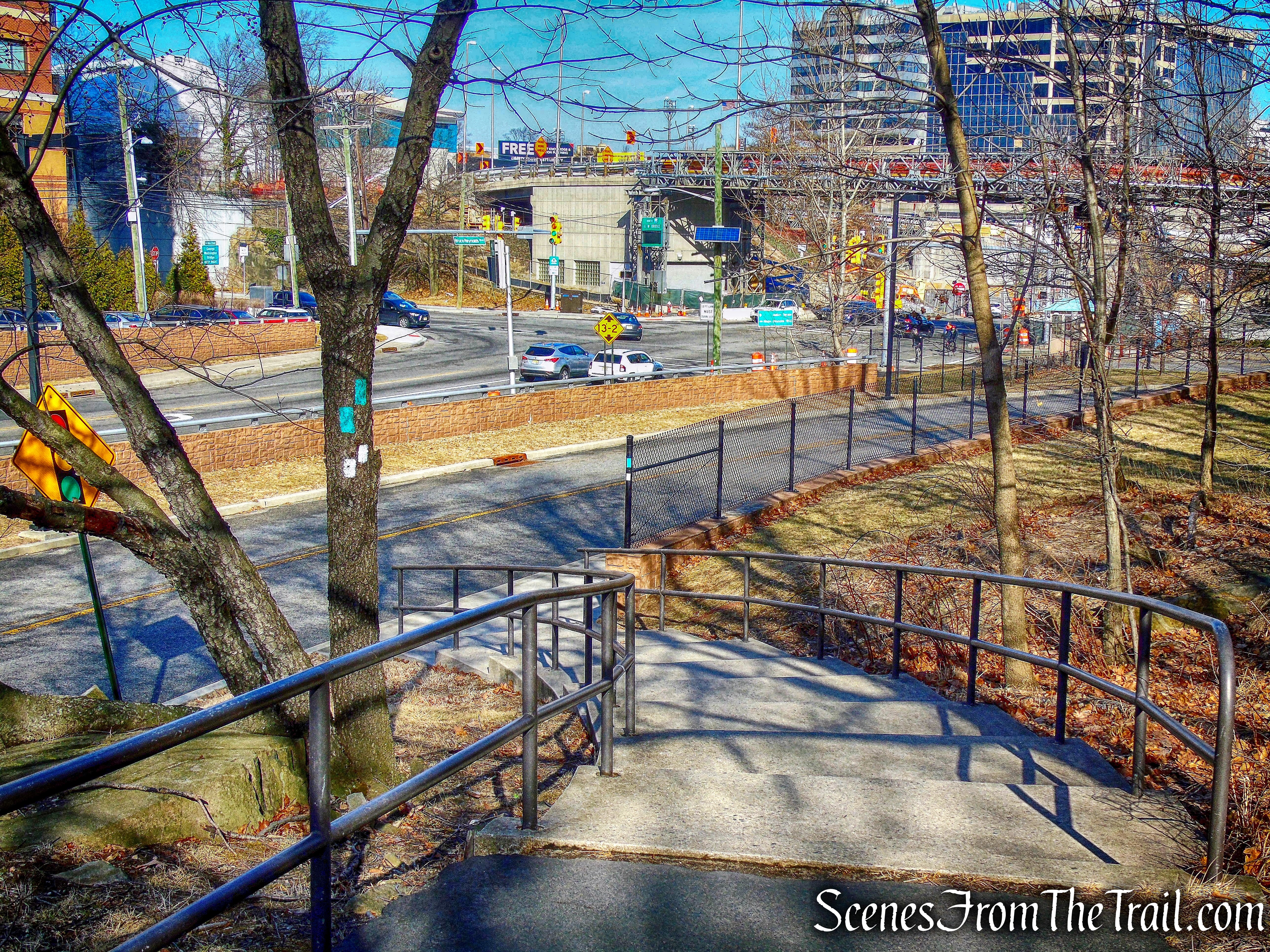
Long Path
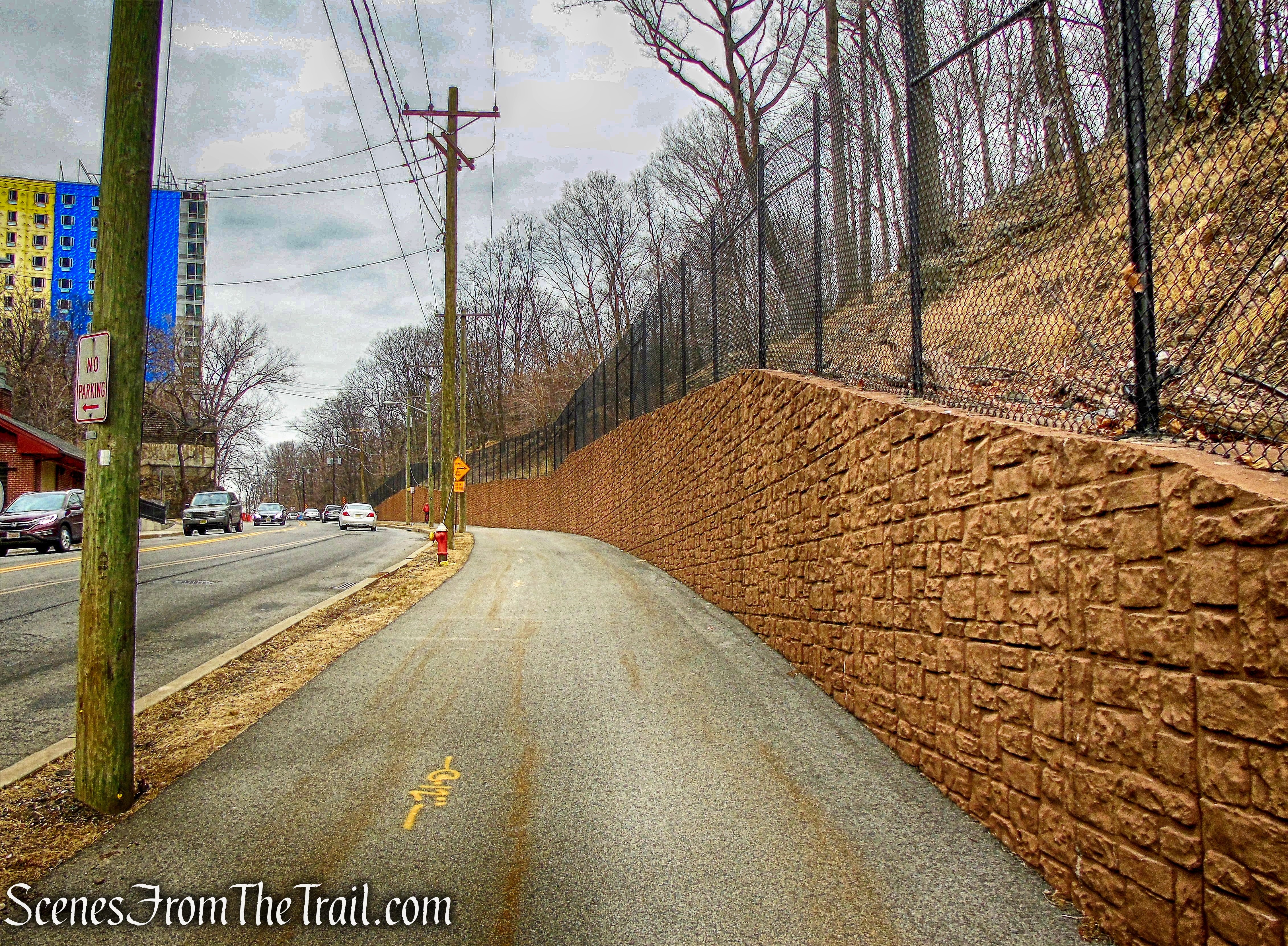
The Long Path continues along Hudson Terrace towards the George Washington Bridge.

Hudson Terrace – Long Path
After passing beneath the I-95 overpass, the Long Path turns right and climbs two sets of steps alongside the GW Bridge.
Long Path
The trail leads up the stairs, turns left and crosses a pedestrian bridge.
pedestrian bridge – Long Path
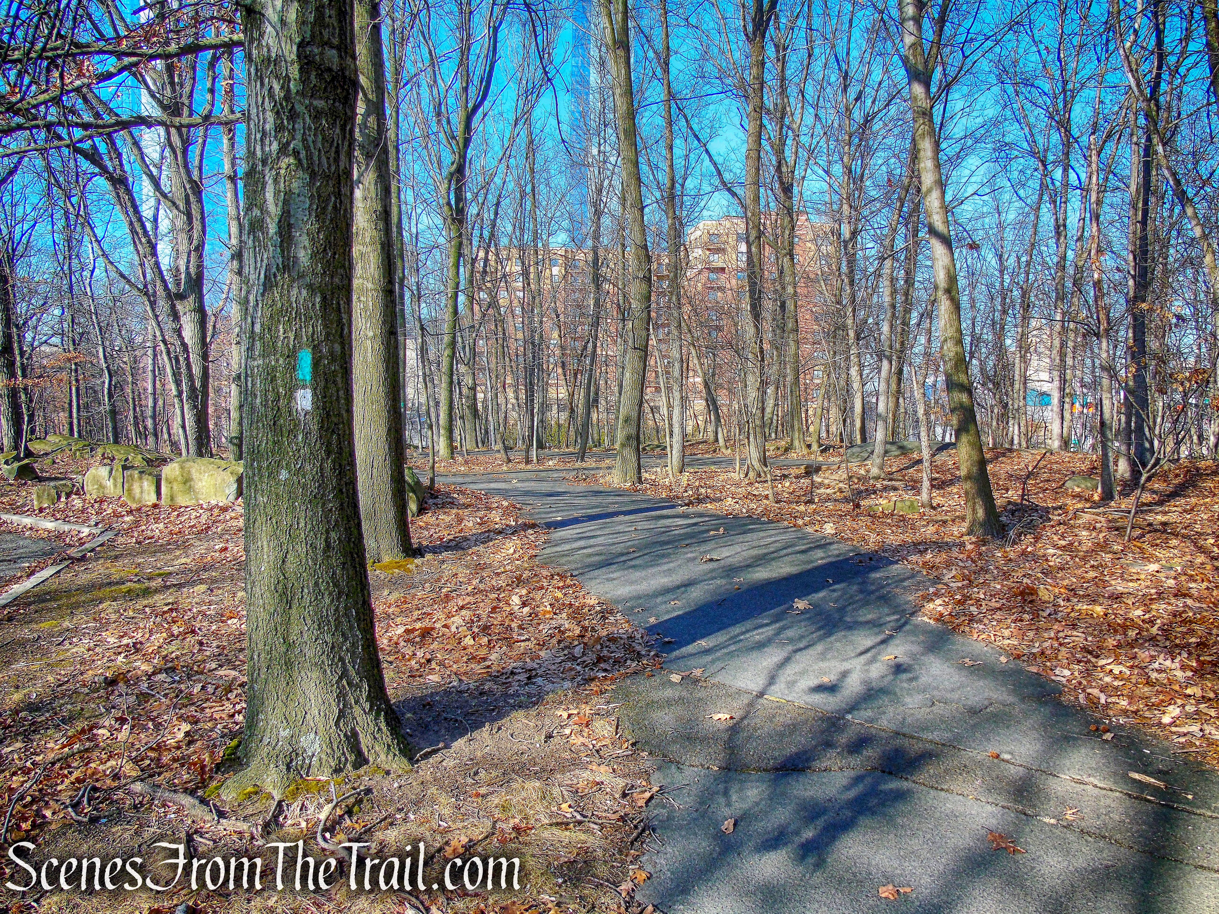
After crossing the pedestrian bridge, the Long Path enters the woods on a broad gravel track.
Long Path
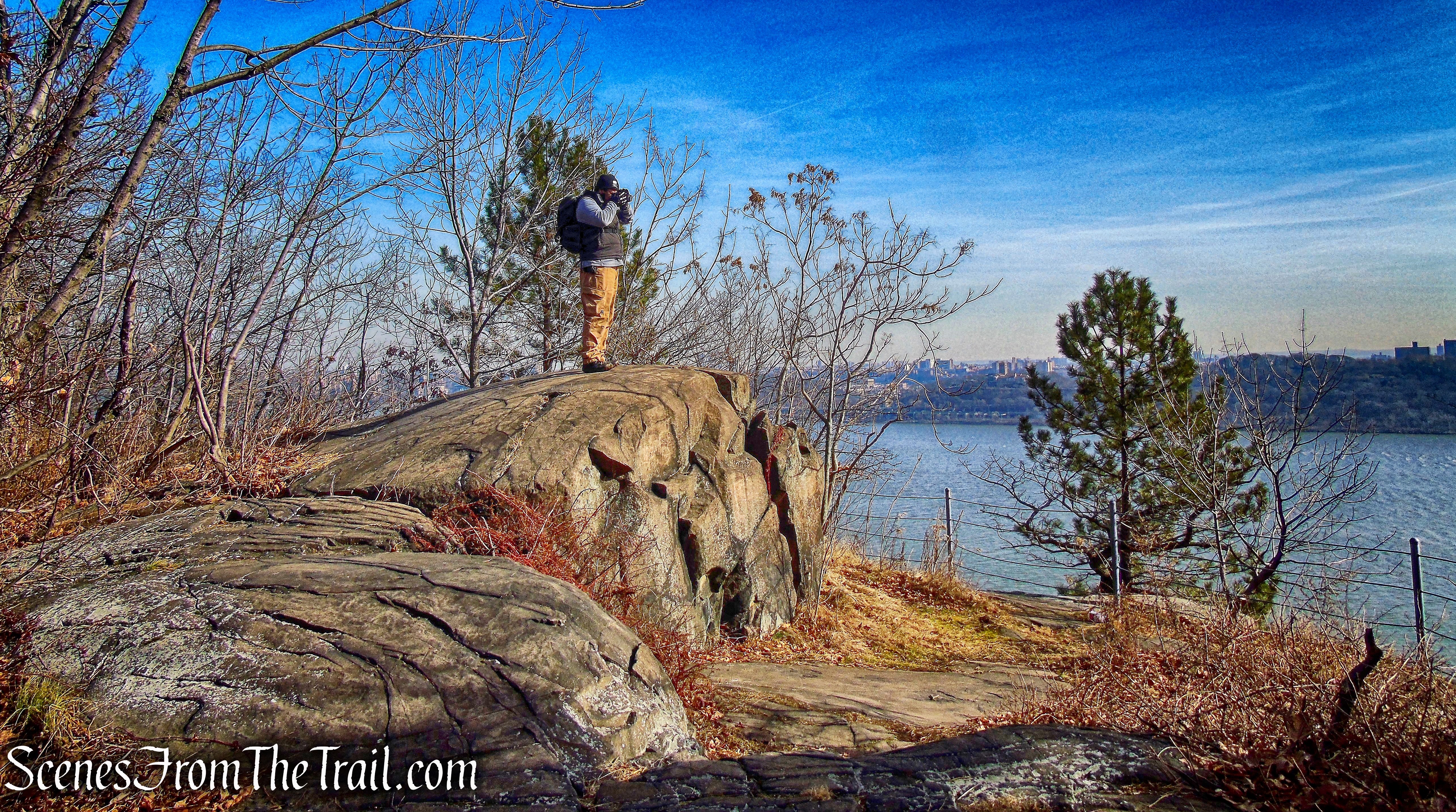
The views open up almost immediately. Looking north, the Ross Dock Picnic Area is visible jutting out into the Hudson River. We would pass through there on our way back.
view north – Long Path
There are short spur trails that lead to views over the river, this one has a bench.
Long Path
The Long Path then arrives at a junction with the blue-blazed Carpenter’s Trail, which turns right and descends to the river. We had now hiked just under a mile (not including the walk around the park). We continued straight, still following the aqua blazes of the Long Path.
Long Path
It is easy walking on this section of the Long Path, as it is very level with many views along the way. The Manhattan skyline is visible through the GW Bridge.
view south – Long Path
It wouldn’t be a hike without a blowdown blocking the trail.
blowdown – Long Path
We then entered Allison Park, marked by the iron fence surrounding it that was erected in the 1930’s. Allison Park was named for William O. Allison (1849–1924), the first mayor of Englewood Cliffs and a leader in preserving Palisades lands. Allison once had an estate here.
Allison Park – Long Path
Allison’s picturesque Colonial Revival Mansion burned in 1903, but there is a small stone building along the edge of the cliffs.
Allison Park
We sat on the porch of this old house and took a short break as we looked out over the Hudson.
Allison Park
Allison Park is an 8-acre scenic cliff-top park area overlooking the Hudson River in Englewood Cliffs, New Jersey.
Allison Park
At the northern end of the park is a boulder with a plaque for William Outis Allison.
Allison Park
Leaving the park, the Long Path continues along the paved access road, passes the entrance road to St. Peter’s College, and enters a narrow strip of woods near the Parkway before heading back toward the edge of the Palisades’ cliffs.
Long Path
Back near the edge of the cliffs, there are some stone ruins. This building more likely housed equipment for the antenna, that lays alongside it. I believe it was for relaying the signal for the Park Police and/or maintenance dept.
stone ruins – Long Path
According to Eric Nelsen, Palisades Interstate Park Museum Technician, this site was owned and operated by the park as a campground through the late twenties and the 1930’s. It was called “Camp Palisades” and was mostly for RV and car campers.
stone ruins – Long Path
It was in this area that I spotted a Peregrine Falcon sitting in a tree.

Peregrine Falcon
There were a number of buildings, like restrooms, camp store, etc., but all were torn down. I think a big piece of it is buried by the Parkway.
abandoned emergency call box – Long Path
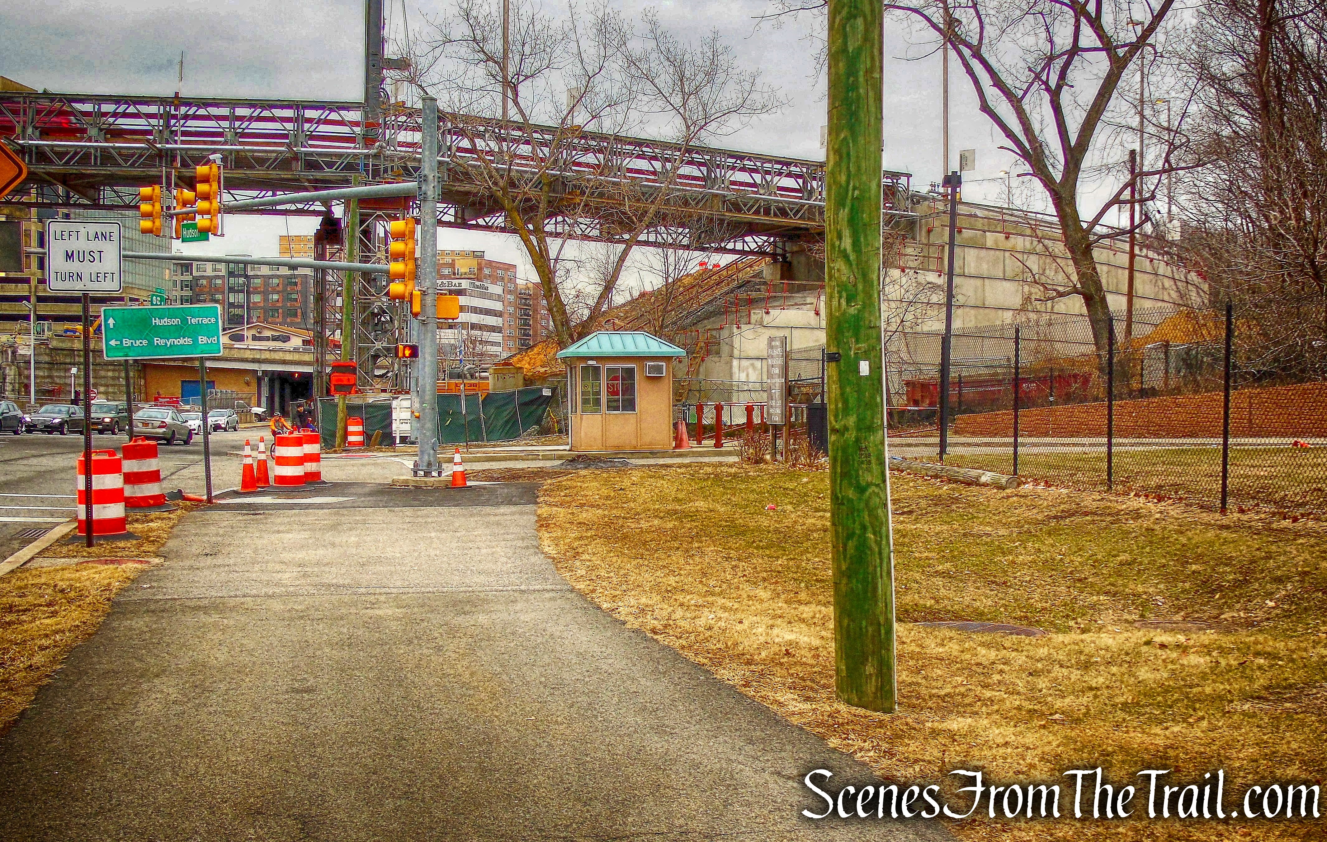
The Long Path comes out on Palisades Avenue and continues north. To the right is the start of the yellow-blazed Dyckman Hill Trail, which starts down the Palisades to the Englewood Boat Basin This was as far north as we would go today and were now approximately at the halfway point.
Start of Dyckman Hill Trail
We walked down the hill on the sidewalk, following the yellow blazes. In 1912 the Interstate Commission first proposed a road from the “top of the Cliffs at the head of Palisades Avenue at Englewood, running down the face of the Palisades” to Englewood Landing to connect with a ferry that would cross the river from the base of Dyckman Street in Manhattan.
Dyckman Hill Trail
In 0.4 mile, the Dyckman Hill Trail descends 340 feet to the Englewood Boat Basin.
Englewood Boat Basin
Known as Dyckman Hill Road, this steep and winding section of the Drive follows a carriage road, which had in turn been built around 1870 for the Palisades Mountain House, a grand hotel on the summit (the Mountain House burned down in 1884). Workers spent two years widening and improving the old road, cutting into the cliff face, building the tall gray stone walls alongside the roadway.
Dyckman Hill Trail
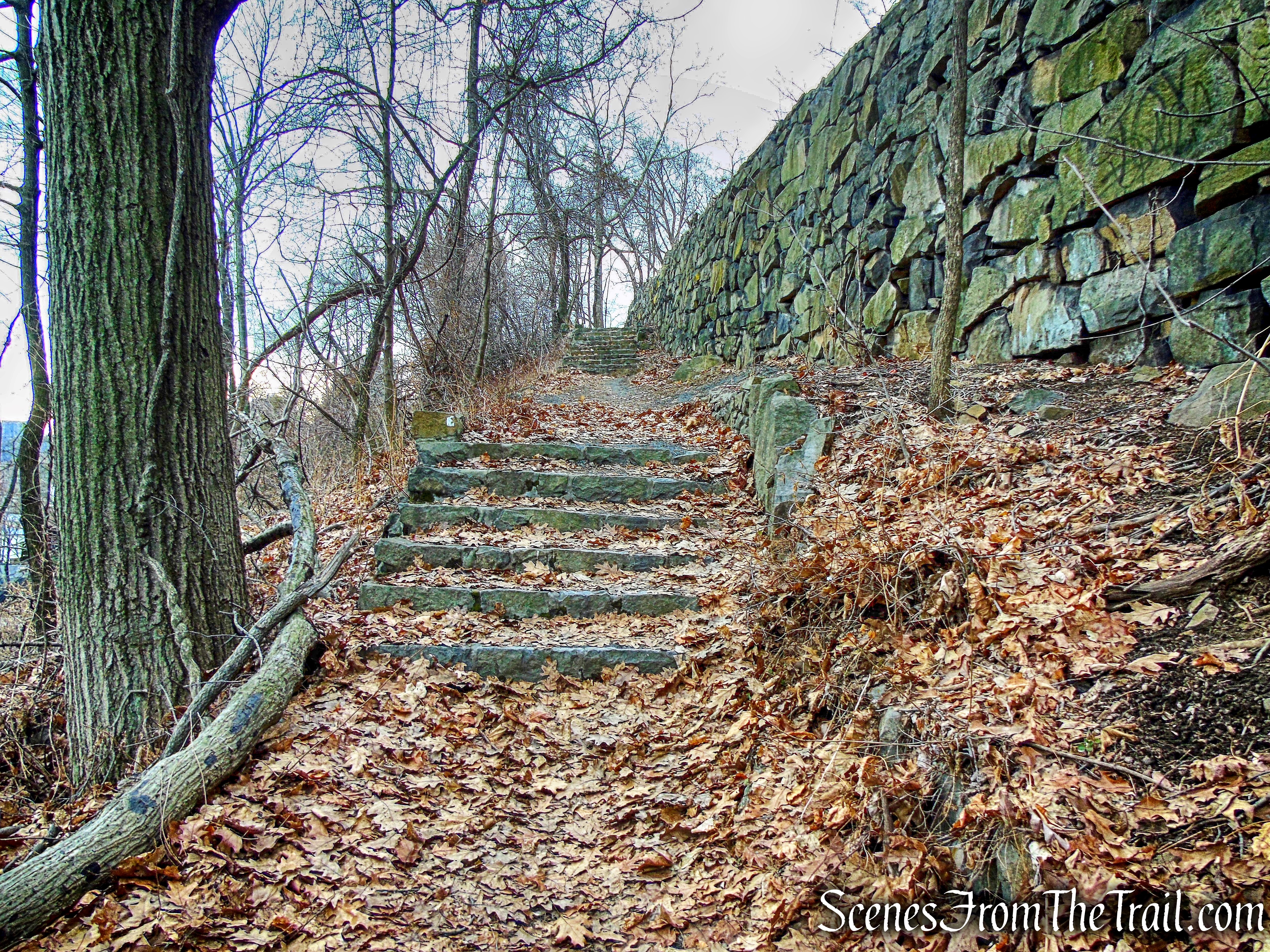
Just beyond a waterfall on the right, the yellow blazes turn left and descend stone steps,
stone steps – Dyckman Hill Trail
stone steps – Dyckman Hill Trail
passing by another waterfall
waterfall – Dyckman Hill Trail
and then going through an underpass beneath the entrance road.
underpass – Dyckman Hill Trail
The Dyckman Hill Trail then turns right and continues to descend on stone-paved switchbacks and stone steps.
stone-paved switchbacks – Dyckman Hill Trail
Caution should be exercised in this area, as the stone paving may be uneven, and the route may be slippery when wet or covered by leaves.
stone-paved switchbacks – Dyckman Hill Trail
At the base of the descent, we followed the road towards the river. The Dyckman Hill Trail ends near the river, at the Englewood Picnic Area.
Dyckman Hill Trail
We sat at a picnic table, relaxing and enjoying the warm January weather. To the south, we had a nice view of the George Washington Bridge and the Manhattan skyline just beyond.
George Washington Bridge from the Englewood Boat Basin
Aptly named, the Shore Trail runs along the edge of the Hudson River.
Shore Trail
The Shore Trail passes numerous small beach areas along the way that make great places to stop and take in the scenery.
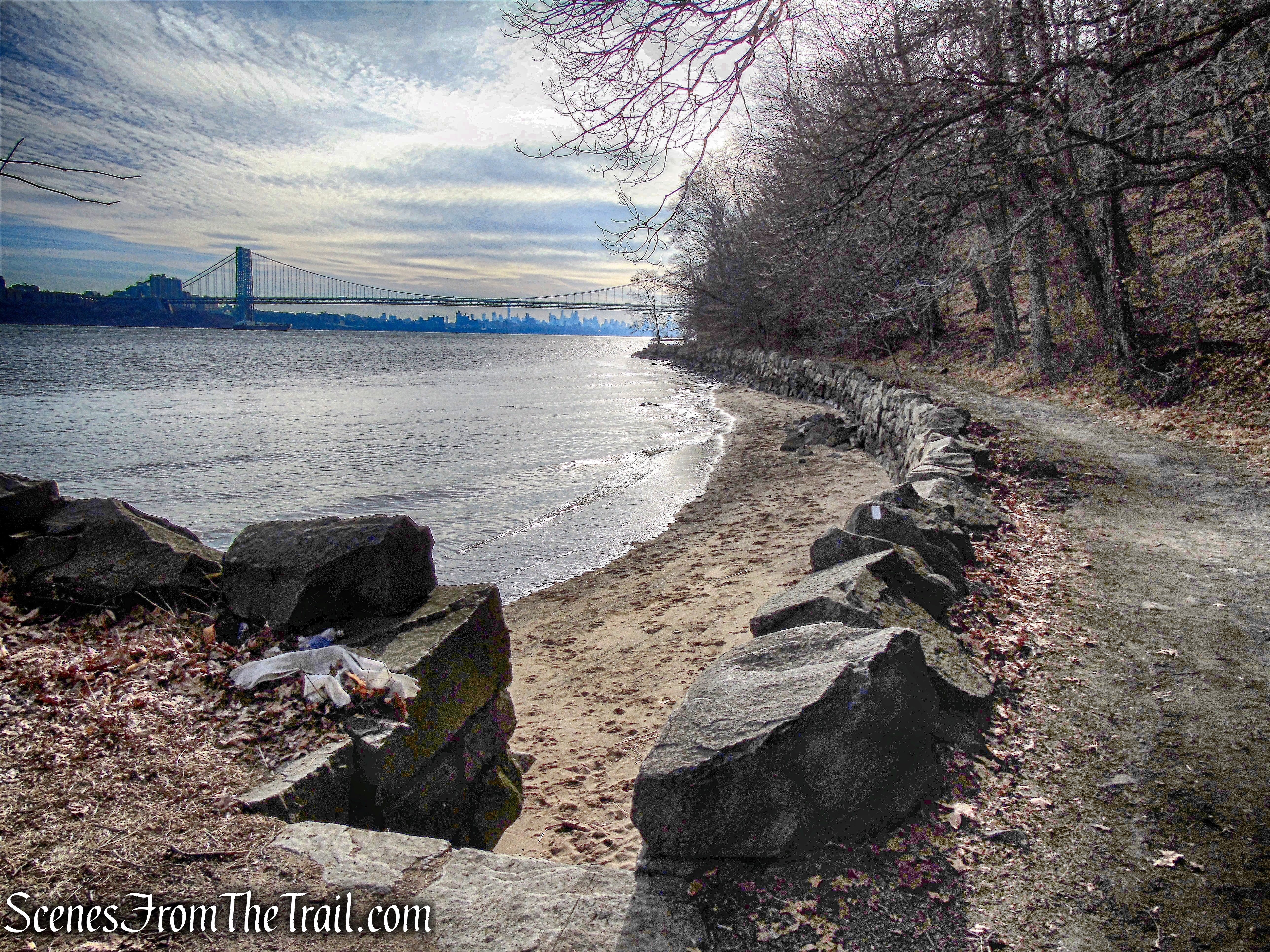
Shore Trail
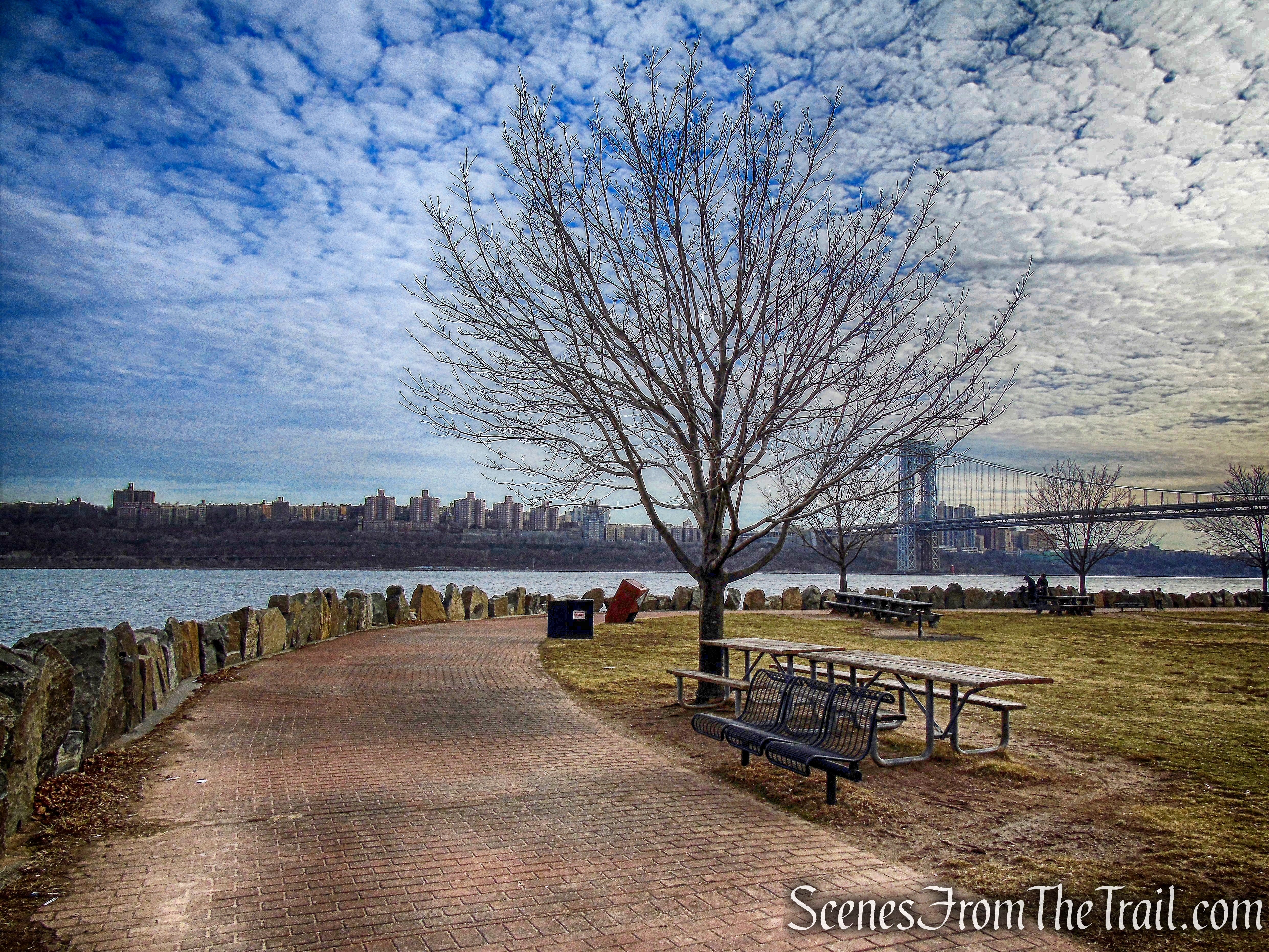
In warm weather, this trail sees a lot of foot traffic, but on this day there were few people along the trail. Walking south, we had a constant view of the GW Bridge. The land mass at the bottom is the Ross Dock Picnic Area.
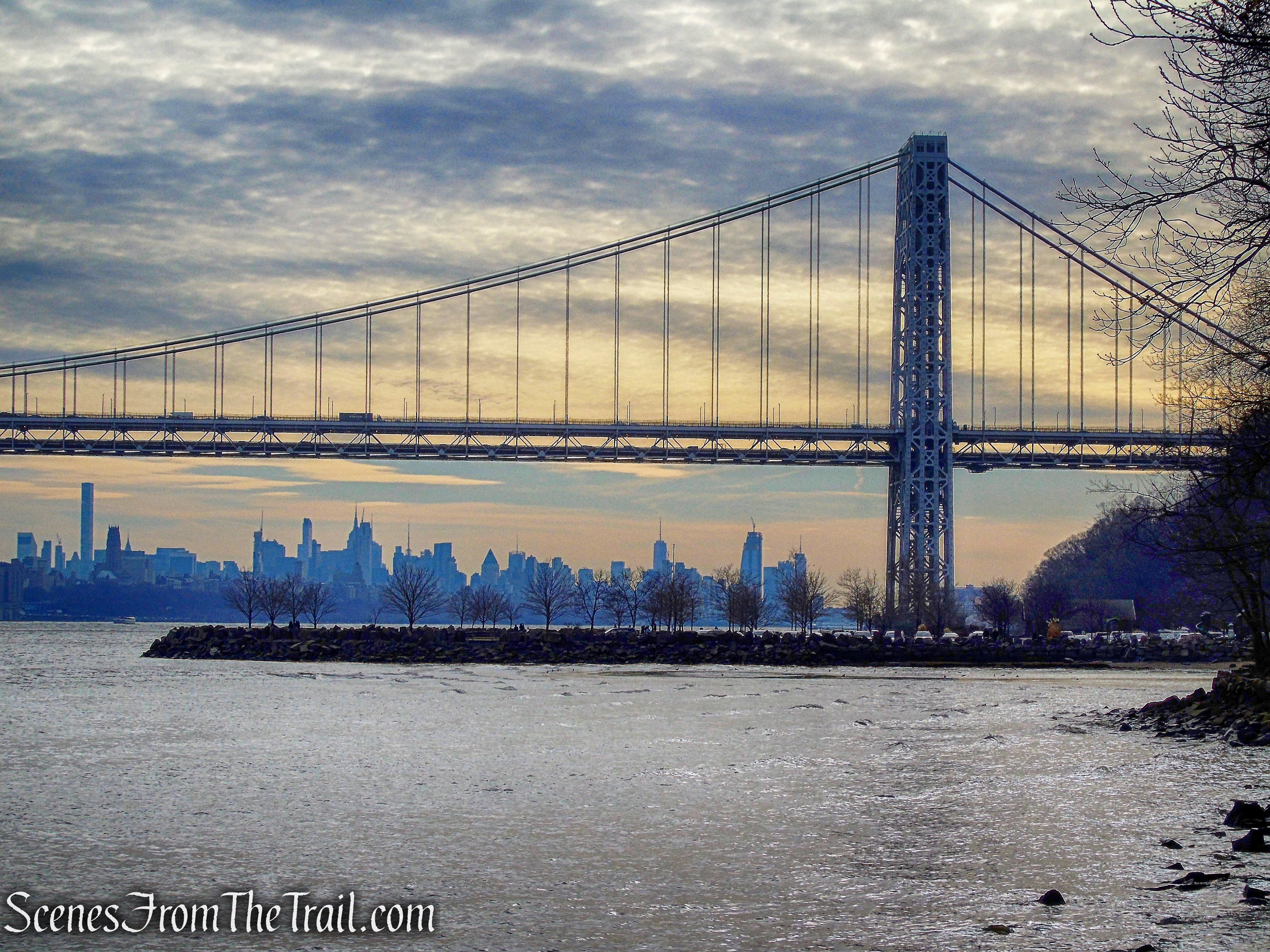
GW Bridge – Shore Trail
We arrived at the Ross Dock Picnic Area and there were plenty of people out and about, enjoying the day. During the early 1900’s, Ross Dock was a summer camp for families from New York City.
Ross Dock Picnic Area
Much of the present-day picnic area was built on sunken barges and other landfill from the quarry days.
Ross Dock Picnic Area
The Shore Trail has various access points and is a great place to take a walk by the Hudson River.
Shore Trail
Carpenter’s Grove, just south of the main Ross Dock picnic area, is a picnic grove that is set aside for the use of groups by permit.
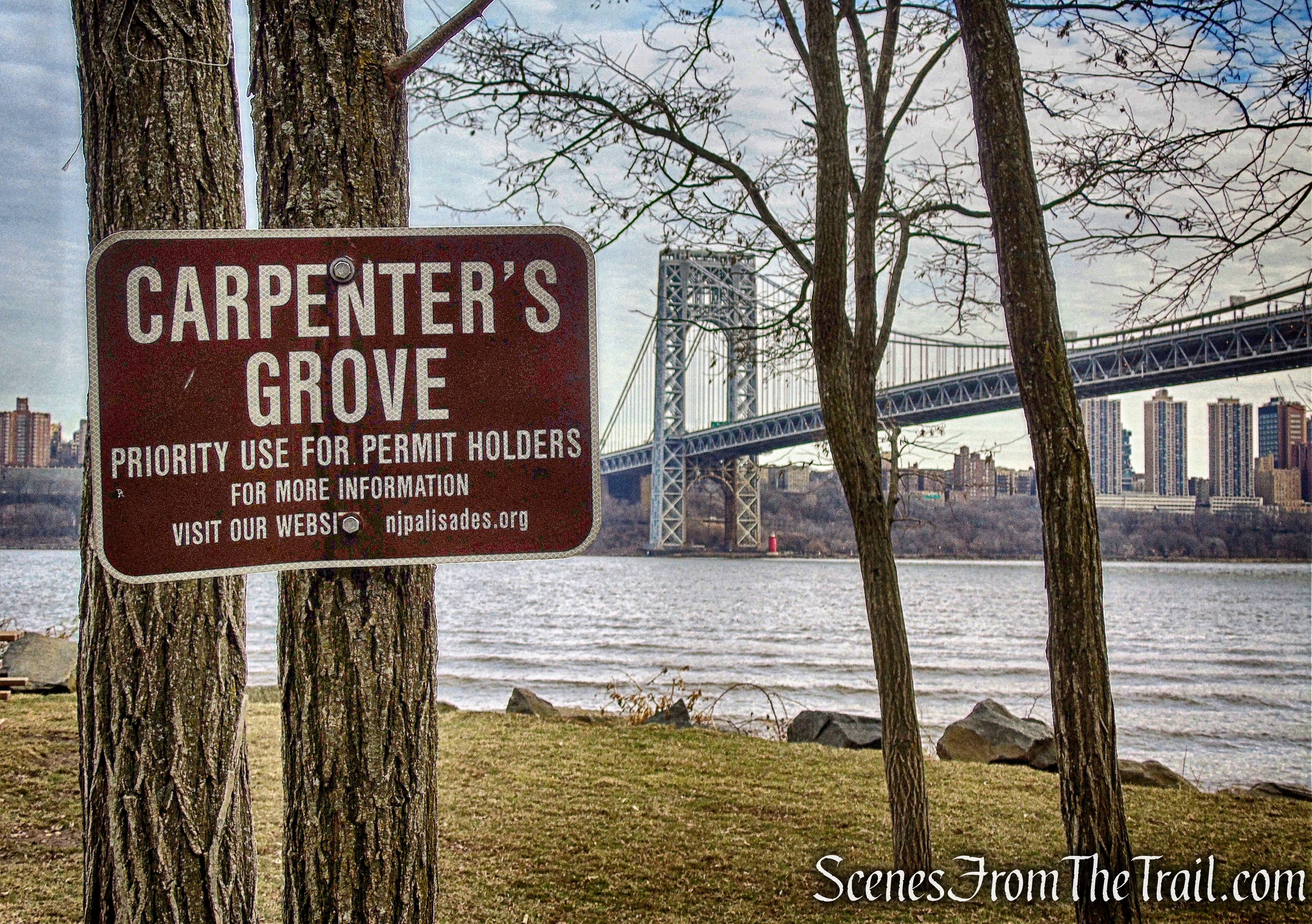
Carpenter’s Grove
The Shore Trail passes beneath the GW Bridge.
Shore Trail
A river level view of the Little Red Lighthouse.
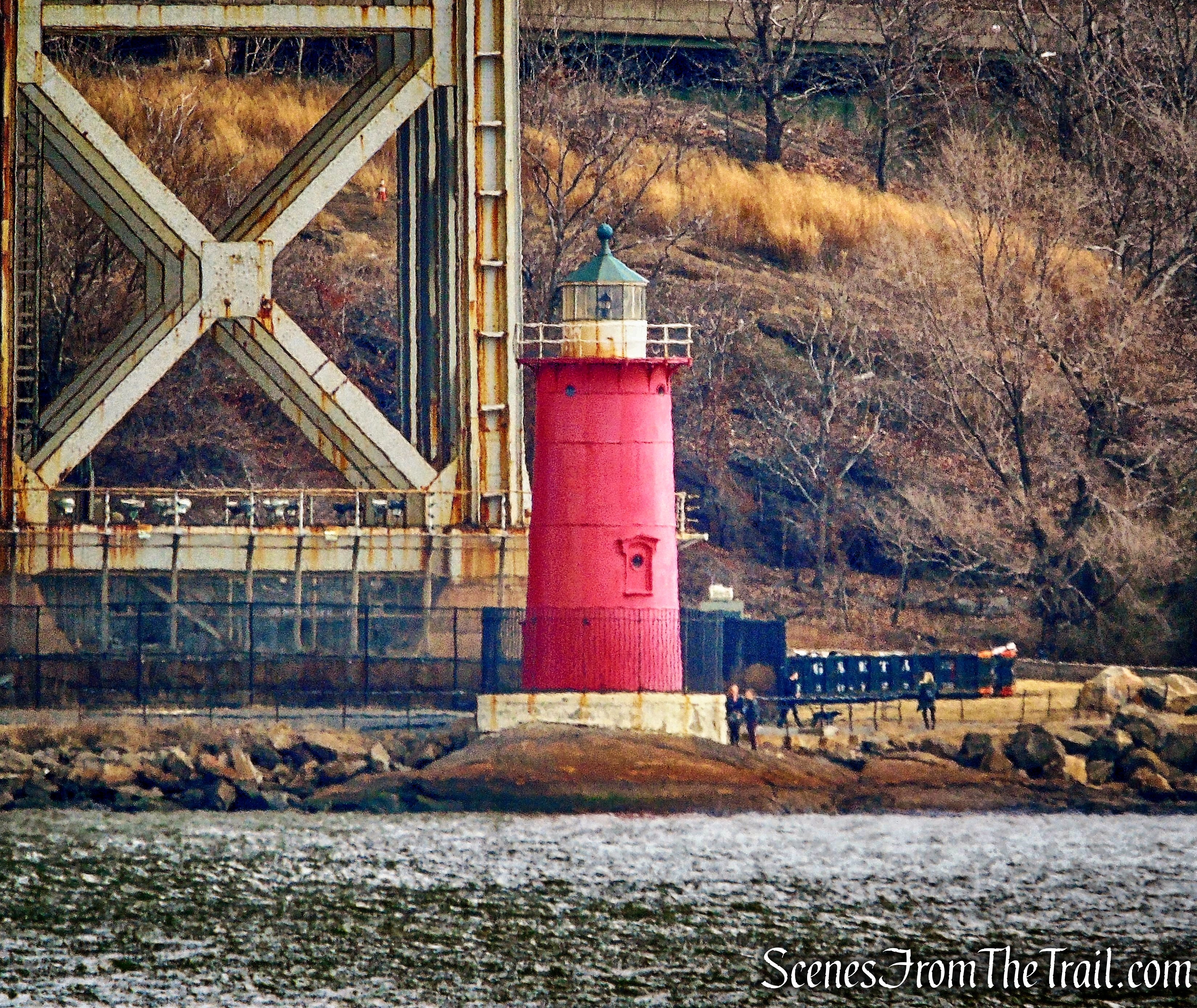
Little Red Lighthouse
The Shore Trail then arrives at another nice sitting area, then climbs a series of stone steps.
stone steps – Shore Trail
The trail then emerges on Henry Hudson Drive where we took a short break from climbing all those steps.
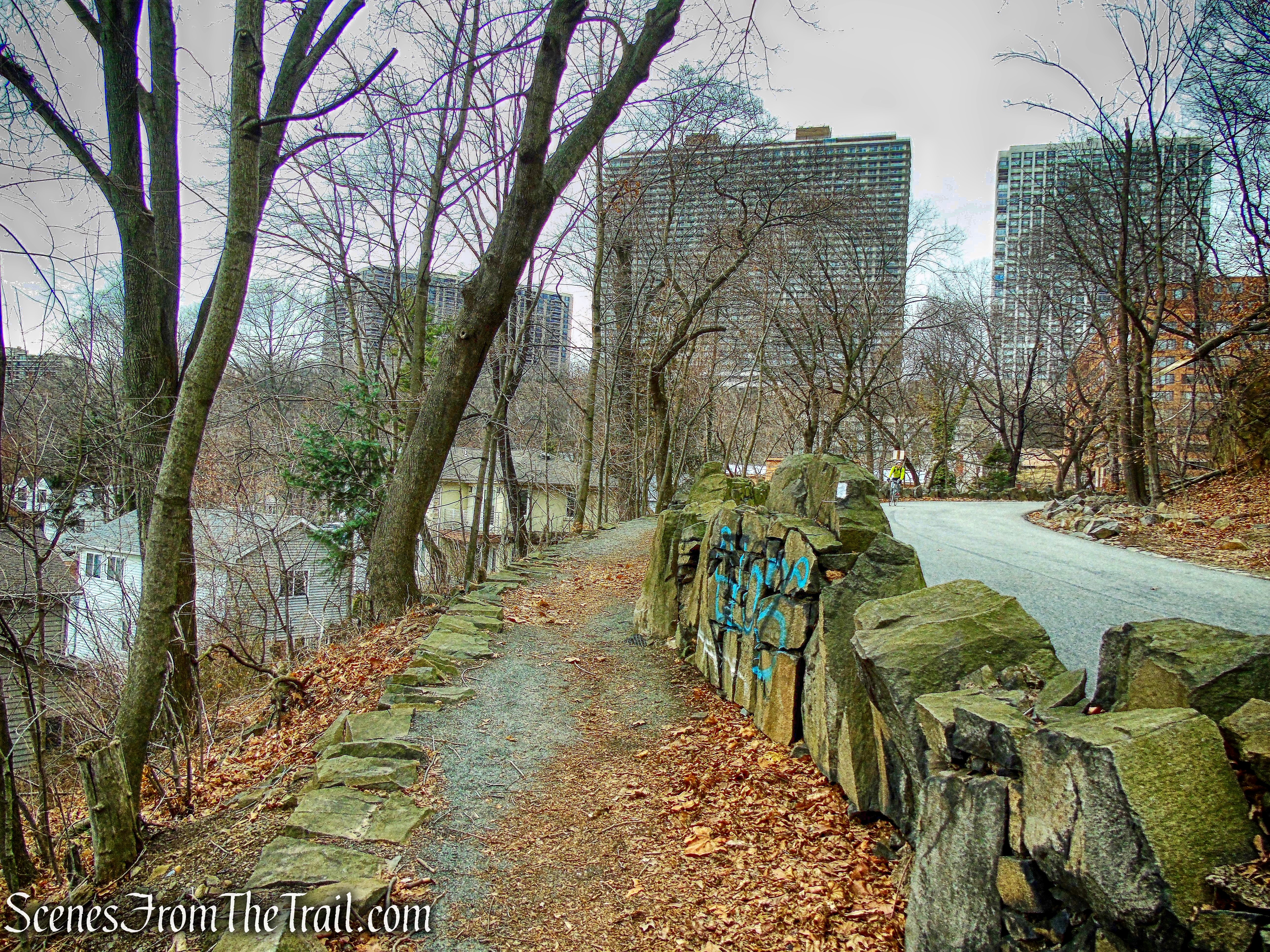
Shore Trail
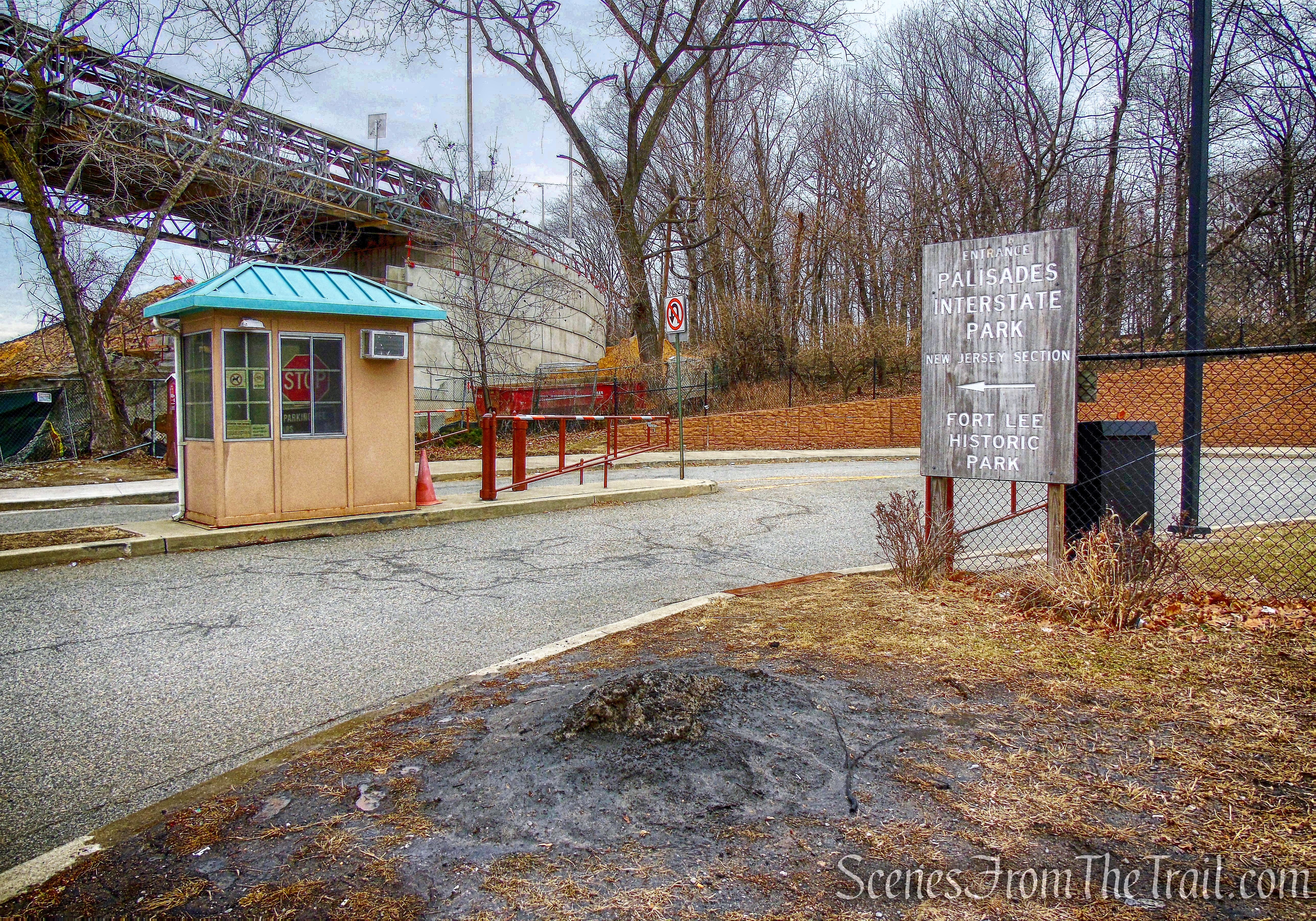
We followed the white blazes which turned right onto Hudson Terrace, now heading north, back to the entrance of Fort Lee Historic Park.
Hudson Terrace – Shore Trail
Across the street from the park there is an interesting stone arch. If I wasn’t so tired, I would have crossed the street to check it out, but there was a lot of traffic and I wasn’t in the mood to dodge cars at this point.
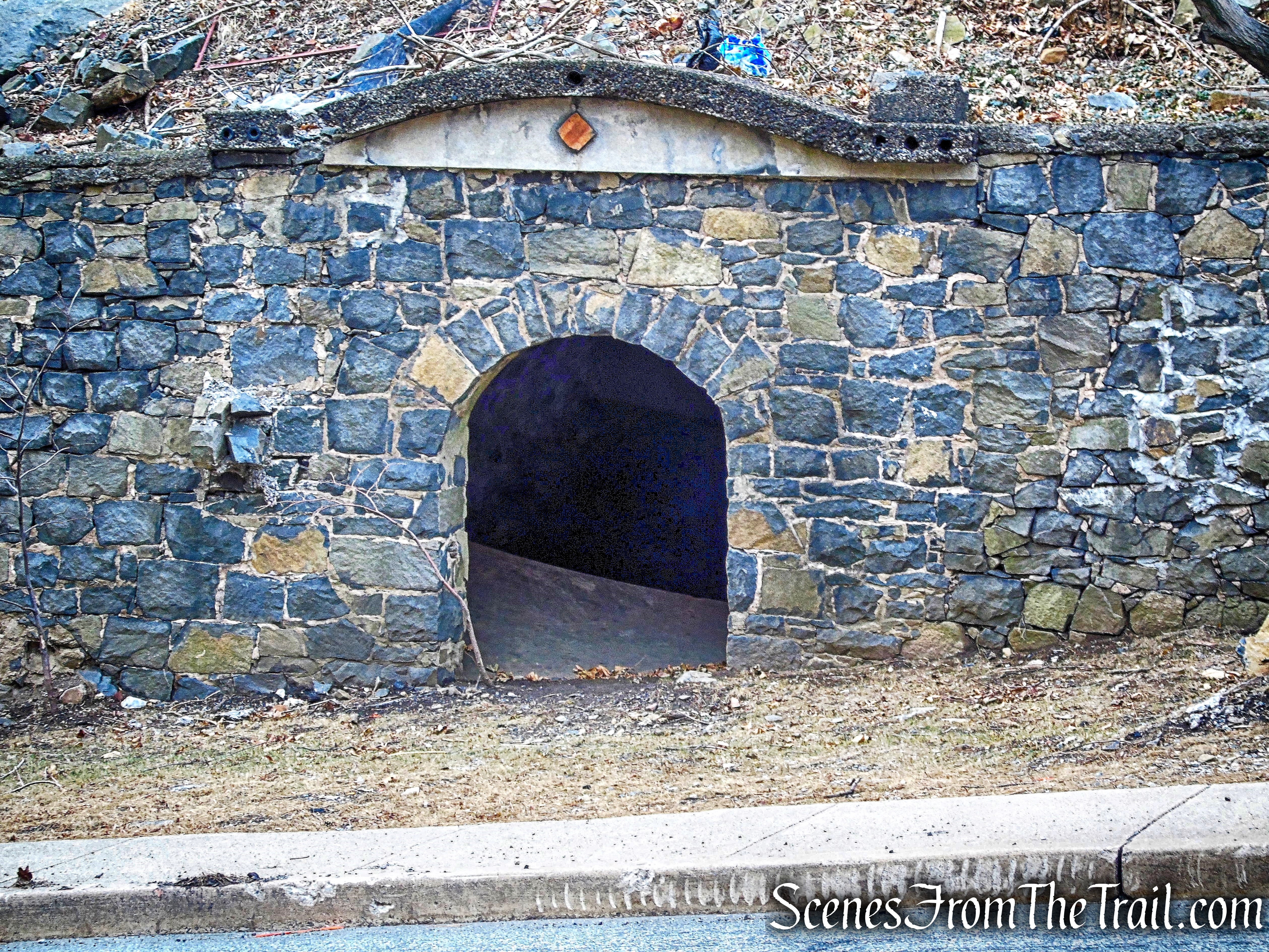
stone arch
The Shore Trail then reaches the entrance to the park, and turns right.
Hudson Terrace – Shore Trail
Entering the park, we began to retrace our steps back on the paved walkway.
Fort Lee Historic Park – Shore Trail
We then reached the terminus of the Shore Trail and back to the parking area, where our hike began.
terminus of the Shore Trail
Another terrific hike with lots to see. There is only one noteworthy descent and ascent on the entire hike. For the majority of the route it was mostly level with plenty of views along the way. A great hike atop the cliffs and a nice return walk along the Hudson.
Pros: Historical features, scenic views, Hudson River, lighthouse, Long Path.
Cons: Road walk.
Take a hike!
Dyckman Hill Loop from Fort Lee Historic Park
Sources:
New York-New Jersey Trail Conference
