September 17, 2022 – Stony Point, NY
Re-hiked April 17, 2026
Difficulty: Easy – Moderate
Length: Approximately 2.7 miles
Max elevation: 1,289 ft. – total elevation gain approximately 494 ft.
Route type: Circuit
Buy Maps (Paper & Avenza): Harriman-Bear Mountain Trails Map #119
Free Bear Mountain Summit Trail Map: Bear Mountain Hikes, NY
Free Bear Mountain Summit Avenza Map: Bear Mountain Hikes, NY
Free Web Map: Bear Mountain State Park Trail Map 2019
Free Avenza App Map: Bear Mountain State Park Trail Map 2019
Trailhead parking: Perkins Memorial Drive, Stony Point, NY 10980
Paved parking lot – bathrooms on site
Park Overview:
The 5,205-acre Bear Mountain State Park is situated in rugged mountains rising from the west bank of the Hudson River. The Perkins Memorial Tower at the summit of Bear Mountain gives visitors spectacular views of the park, the Hudson Highlands and the rolling hills of Harriman State Park. A scenic drive to the top of the mountain, along Perkins Memorial Drive, is a very popular destination in the park for tourists and sightseers. Perkins Memorial Drive and Tower are open from April through late November, weather permitting.
The park includes Bear Mountain as well as Dunderberg Mountain and West Mountain. Fort Montgomery is adjacent to the north edge of the park while Iona Island Bird Sanctuary is on the eastern edge on the Hudson River. Bear Mountain State Park is a separate entity from the adjacent Harriman State Park which runs along the western edge of the park, but are managed as a single unit.
Bear Mountain State Park is 45 miles north of New York City in the Hudson Highlands. One of the most visited parks in the Northeast, Bear Mountain hosts more than 3 million annual visitors. Bear Mountain is accessible by car and bus and is a popular day use park. It’s sometimes too popular; the state occasionally shuts the park down to control crowds during the warmer months.
History:
During the American Revolution, when control of the Hudson River was viewed by the British as essential to dominating the American territories, the area that was to become the park saw several significant military engagements. In 1777 British troops routed Patriots at Fort Montgomery. Anthony Wayne’s attack of the British fort at Stony Point moved colonial troops to the west of Bear Mountain.
In 1908, the State of New York announced plans to relocate Sing Sing Prison to Bear Mountain. Work was begun in the area near Highland Lake (renamed Hessian Lake) and in January 1909, the state purchased the 740-acre Bear Mountain tract. Conservationists inspired by the work of the Palisades Interstate Park Commission lobbied successfully for the creation of the Highlands of the Hudson Forest Preserve, stopping the prison from being built.
Mary Averell Harriman, whose husband, Union Pacific Railroad president E. H. Harriman died in September of that year, offered the state another 10,000 acres and one million dollars toward the creation of a state park. George W. Perkins, with whom she had been working, raised another $1.5 million from a dozen wealthy contributors including John D. Rockefeller and J.P. Morgan.
Bear Mountain-Harriman State Park became a reality the following year when the prison was demolished and a dock built for steamboat excursion traffic. The park opened in June 1913. Steamboats alone brought more than 22,000 passengers to the park that year. Camping at Hessian Lake (and later at Lake Stahahe) was immensely popular; the average stay was eight days and was a favorite for Boy Scouts. By 1914 it was estimated that more than a million people a year were coming to the park.
In the 1930’s the federal government under Franklin D. Roosevelt was developing plans to preserve the environment as part of the Depression-era public works programs; the Civil Works Administration and the Works Progress Administration spent five years on projects at the park. Pump houses, reservoirs, sewer systems, vacation lodges, bathrooms, homes for park staff, storage buildings and an administration building were all created through these programs. Both the Perkins Memorial Drive and Perkins Memorial Tower were built by the Civilian Conservation Corps (CCC) between 1932 and 1934. The winding, steep drive was dynamited out of Bear Mountain by 1,500 NYS Temporary Relief Workers. Work began on November 21, 1932 and the drive and tower opened on October 31, 1934. President and Mrs. Roosevelt were among the first visitors.
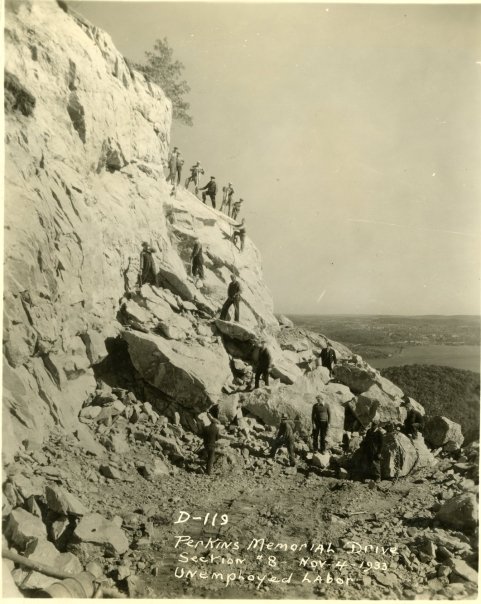
Perkins Memorial Drive 1933 – Palisades Parks Conservancy
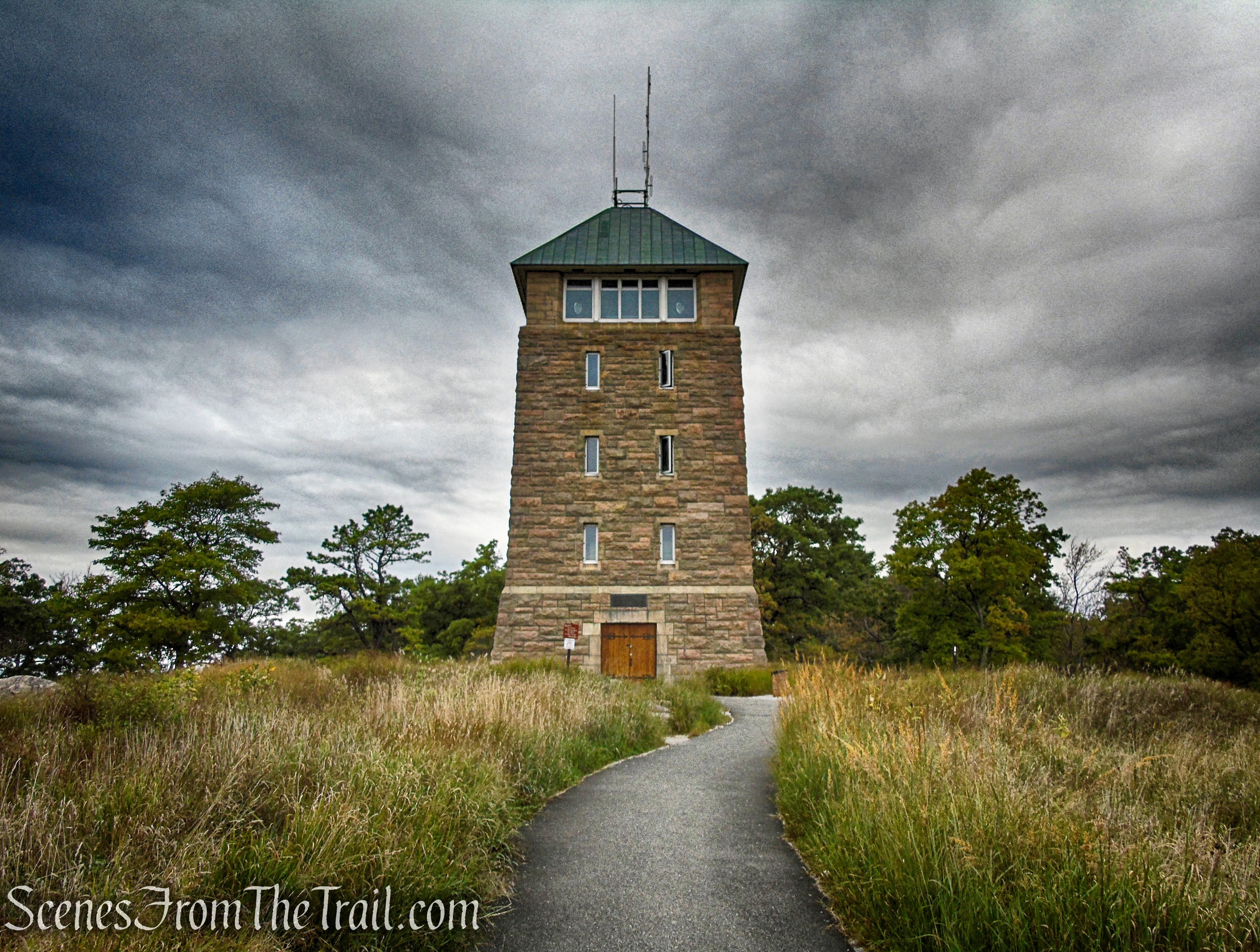
Perkins Memorial Tower was built with funds provided by the Perkins family. The tower is 65 feet high and 30’x30′ at the base. It was constructed of native stone from a quarry at the base of Bear Mountain.
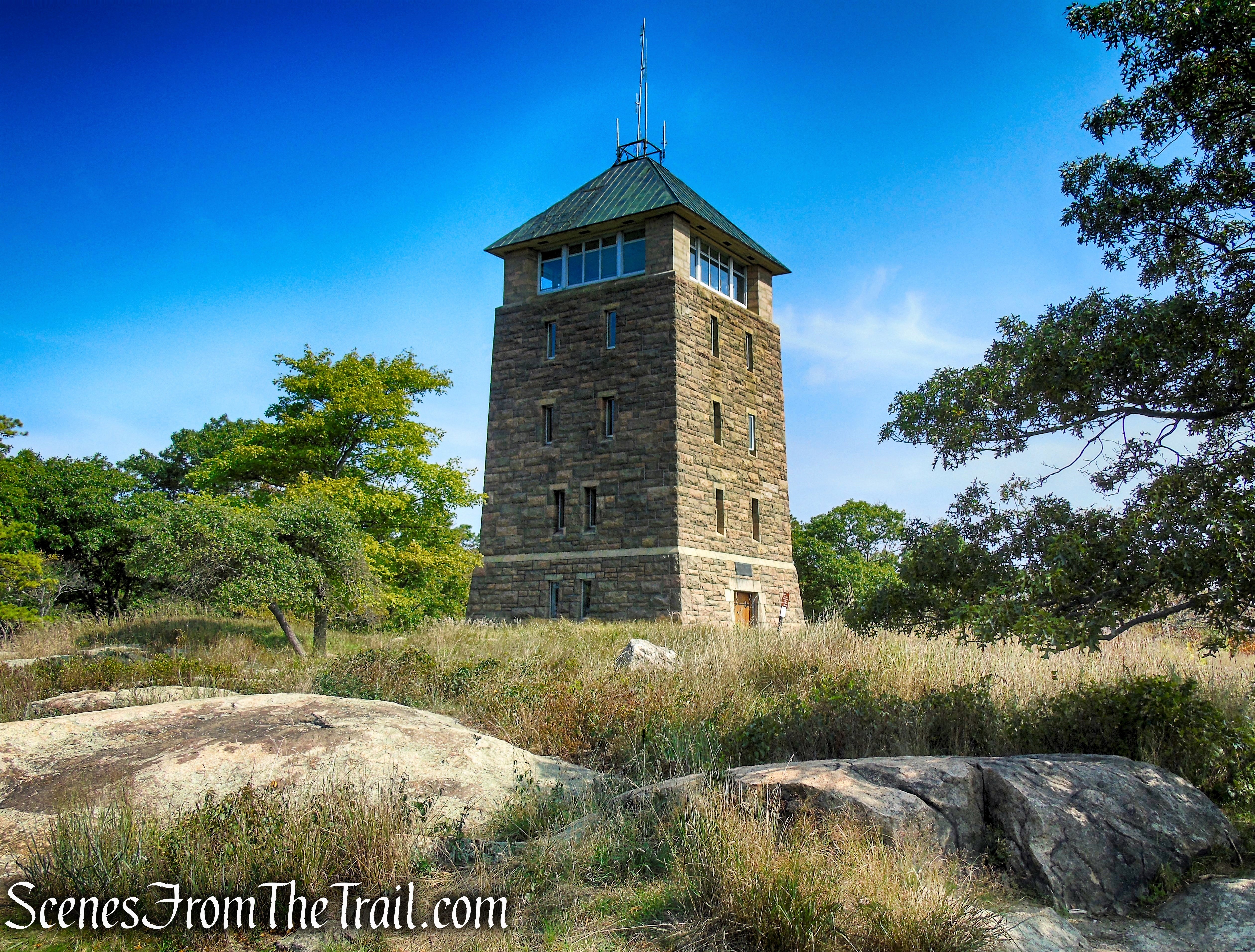
Perkins Memorial Tower – Bear Mountain
Appalachian Trail~
It was in Bear Mountain State Park back in 1923 when the very first section of the Appalachian Trail was built and blazed. It officially opened on October 7, 1923 and served as a pattern for the other sections of the trail developed independently by local and regional organizations and later by the federal government. The Appalachian Trail has been re-routed numerous times on Bear Mountain since its founding in 1923 due to erosion caused from 100,000+ hikers a year.
In the fall of 2018, the New York-New Jersey Trail Conference completed the Bear Mountain Trails Project, the most ambitious rehabilitation of the Appalachian Trail (AT) ever conducted. Of the entire 2,200 miles of the AT, the section that runs through Bear Mountain State Park is the oldest and most heavily used. Over 90 years ago, it was Trail Conference volunteers who blazed this original portion of the AT and opened it to the public. By 2004, the Bear Mountain trail had become an eroded, 10-foot-wide scar.
Work on the trail included hardening the tread with 1,300 granite steps, each of which weighed between 500 and 800 pounds and needed to be moved from the bottom of Bear Mountain to the summit. The project also included constructing the first ADA-compliant section of the AT.
The first section of the Appalachian Trail relocation was opened on June 5th, 2010 (National Trails Day) and consisted of roughly 700 steps. A second section including an A.T. loop and nearly 1/2 mile of fully accessible trail on the top of Bear Mountain was officially opened on June 6th, 2011 (National Trails Day).
Trails Overview:
There are over 50 official trails covering over 235 miles, featuring a wide range of difficulties and elevation changes.
The Appalachian Trail passes through old-growth forest on its way to Perkins Memorial Tower atop Bear Mountain, with scenic overlooks and spectacular views of the Hudson River and Dunderberg, Bald, and West mountains along the way. The tower can also be reached by car, and a portion of the path at the summit is wheelchair accessible.
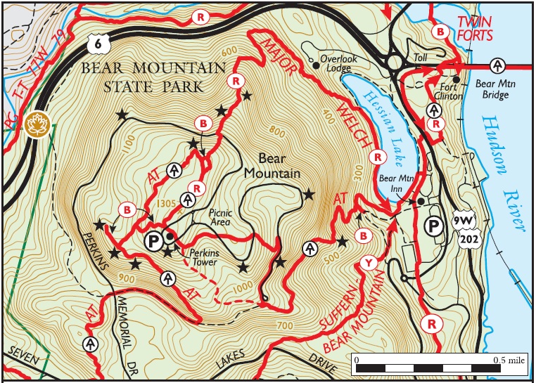
Bear Mountain Summit Trails
Hike Overview:
I have been at the summit of Bear Mountain more times than I can count. I have always driven to the top to enjoy the views from Perkins Tower and the viewpoint just off the parking lot where the crowds seem to gather. I had never bothered to explore the trails around the summit until last year. Dealing with some health issues, I wanted to get outdoors and enjoy some Hudson Valley views without the physical exertion required on a hike. Walking around on the summit led me to the western side of the mountain where the AT passes through as well as a couple of blue connector trails. I have since returned several times to explore a little more and decided to do a short loop hike utilizing the AT and the abandoned section of Perkins Memorial Drive to link it together.
This hike descends stone steps down to an abandoned section of Perkins Memorial Drive then climbs more stone steps as it regains the elevation lost on the way down. Along the way there are numerous views and little foot traffic. This hike is perfect for the casual hiker or those not seeking a deep woods experience. Depending on the time of day or season, you will encounter hordes of people around the vicinity of Perkins Tower. The farther you move away from that area, the less people you will encounter. We arrived at the summit around 8:30am on a Saturday Morning in late September and there were a few cars already there. By the time we returned to the parking area, around 11:15am, there were many cars, motorcycles, bikes and people milling around enjoying the scenery. My advice is to get there early before the crowds.
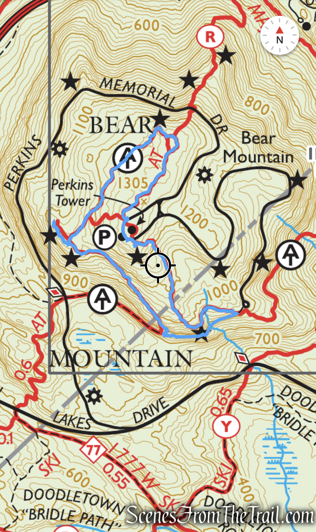
Bear Mountain Summit Loop
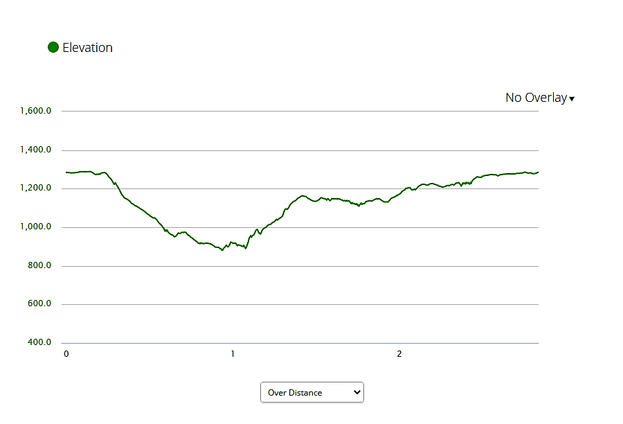
elevation profile – Bear Mountain Summit Loop
The Hike:
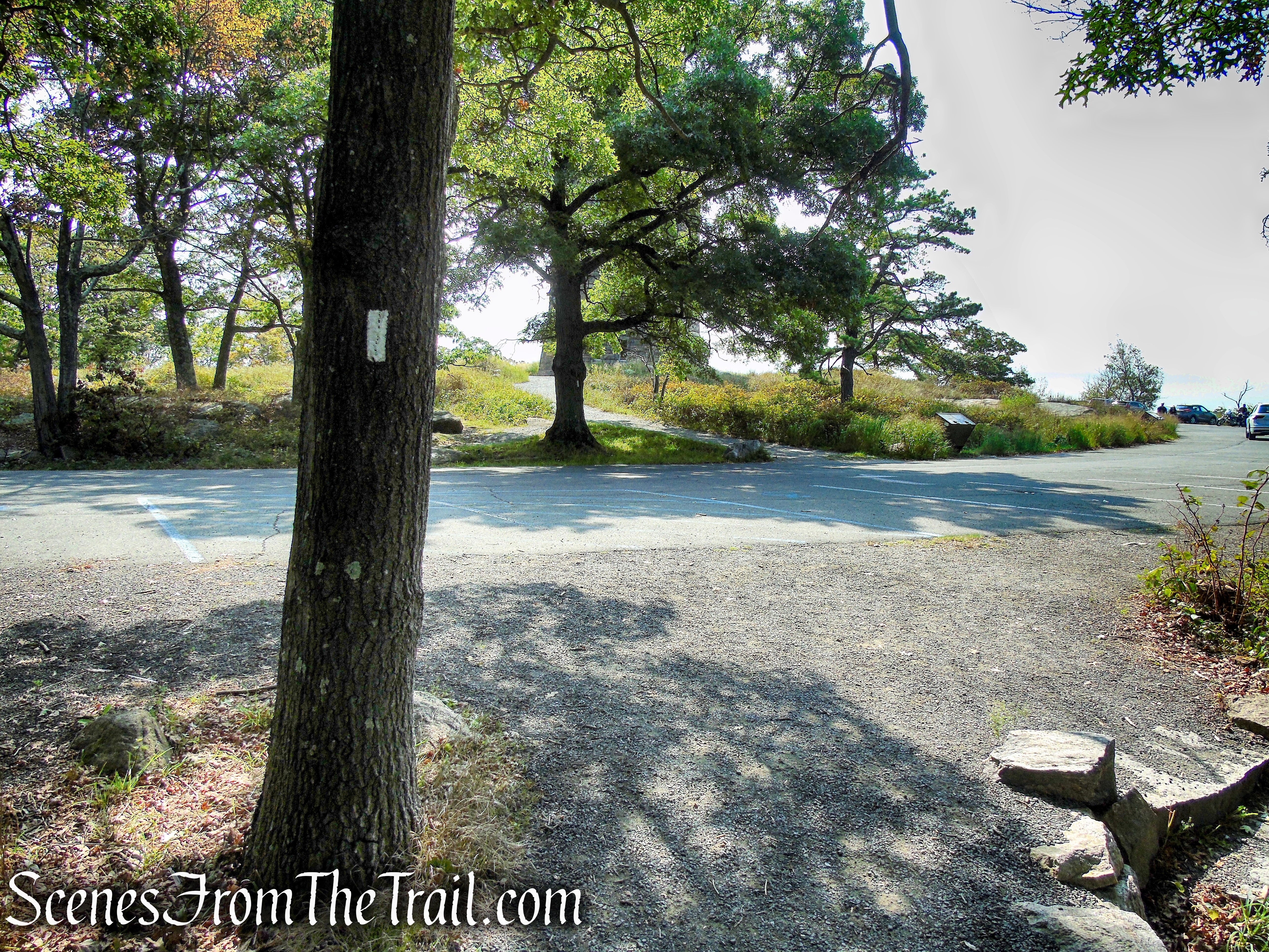
Across the paved loop road, with Perkins Memorial Tower on your left, there is a kiosk with a map and information on the northwest side of the summit. Just to the right of the kiosk is a fork. The right fork, blazed with the 2″x6″ white blazes of the Appalachian Trail (AT) and the red-ring-on-white blazes of the Major Welch Trail, will be your return route, but for now, continue ahead through the parking lot and if the tower is open, you may want to go inside to check it out.
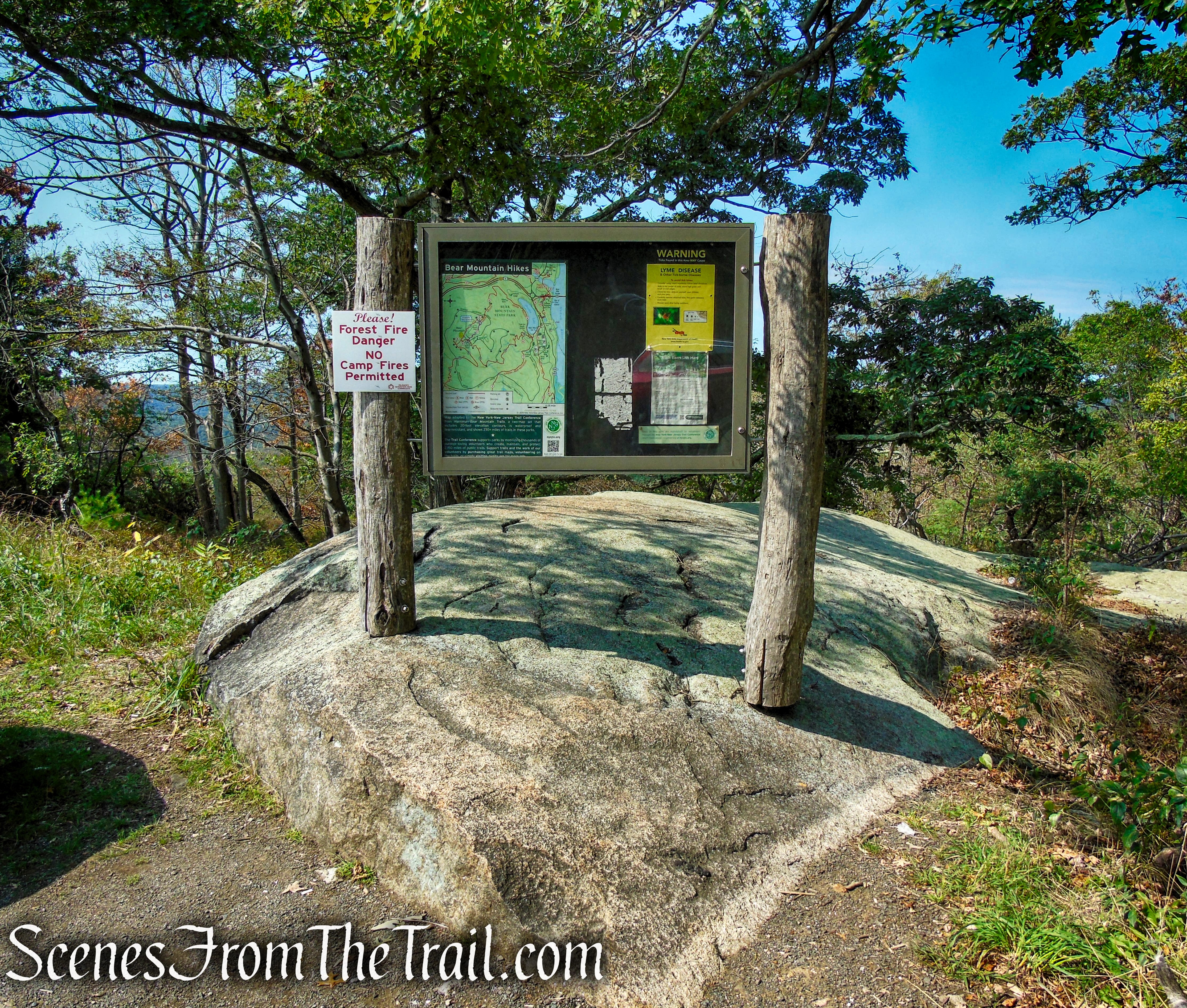
kiosk – Bear Mountain summit
A.T. Trailhead – Bear Mountain summit
Bear Mountain summit

Bear Mountain summit
Situated 1,305 feet above the Hudson River, the 360 degree panoramic views from Perkins Tower are spectacular. On a clear day, four states and the Manhattan skyline can be seen from the tower. The observation floor has interpretive displays that describe the distant scenery. Perkins Memorial Tower was built by the Civilian Conservation Corps (CCC) between 1932 and 1934. The tower was closed when we arrived at approximately 8:30am on a Saturday in September.
Perkins Memorial Tower – Bear Mountain State Park
The tower was built to honor the memory of George W. Perkins (1862-1920), the first President of the Palisades Interstate Park Commission. The tower served as a fire lookout station until the 1950’s. It is now open to the public.

Perkins Memorial Tower – Bear Mountain State Park
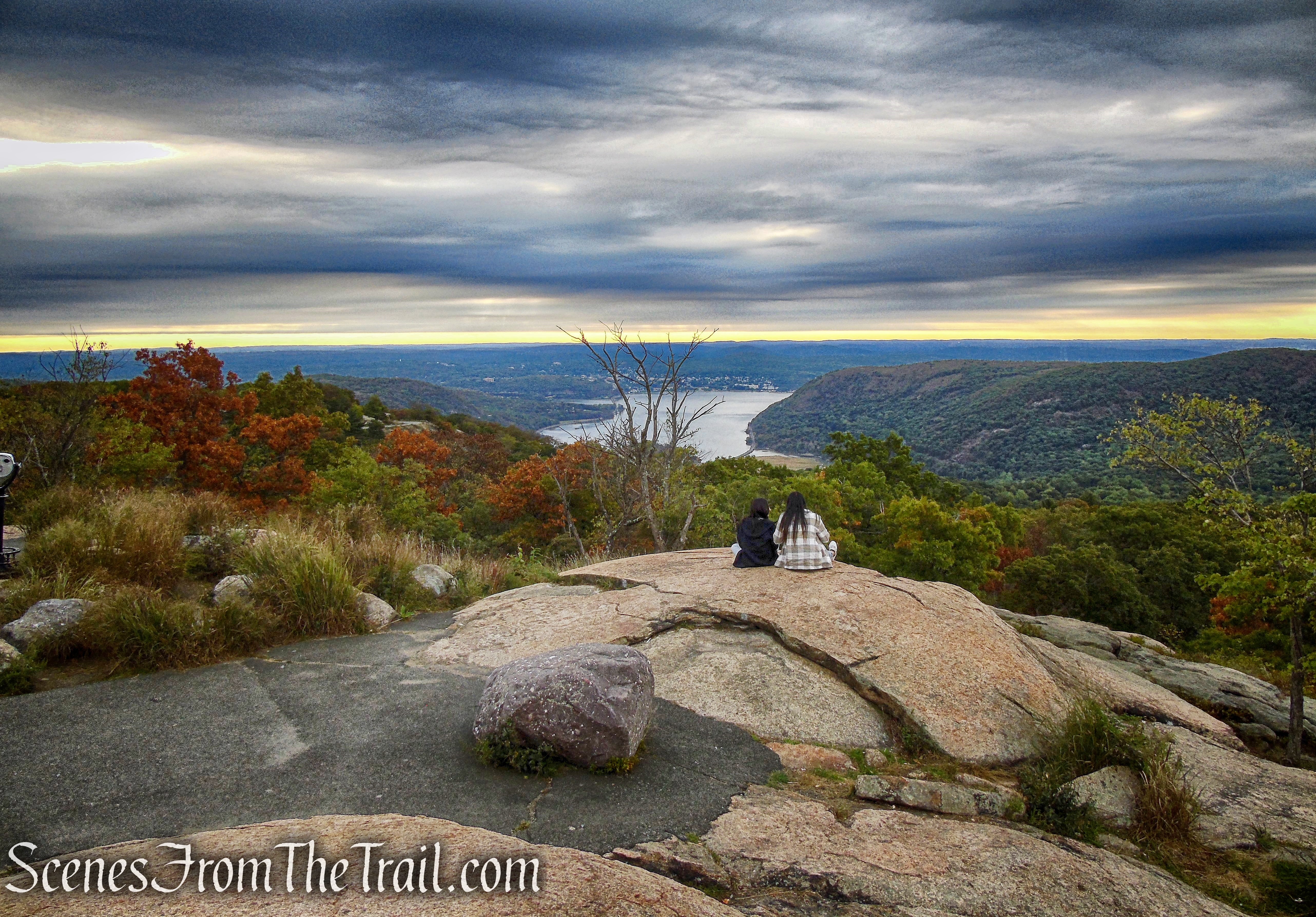
Continue past the tower and proceed ahead to a broad south-facing viewpoint, with Dunderberg Mountain jutting into the Hudson River to the left. Rustic benches have been placed in this area for visitors to rest and enjoy the views. Note the Manhattan skyline visible in the distance.
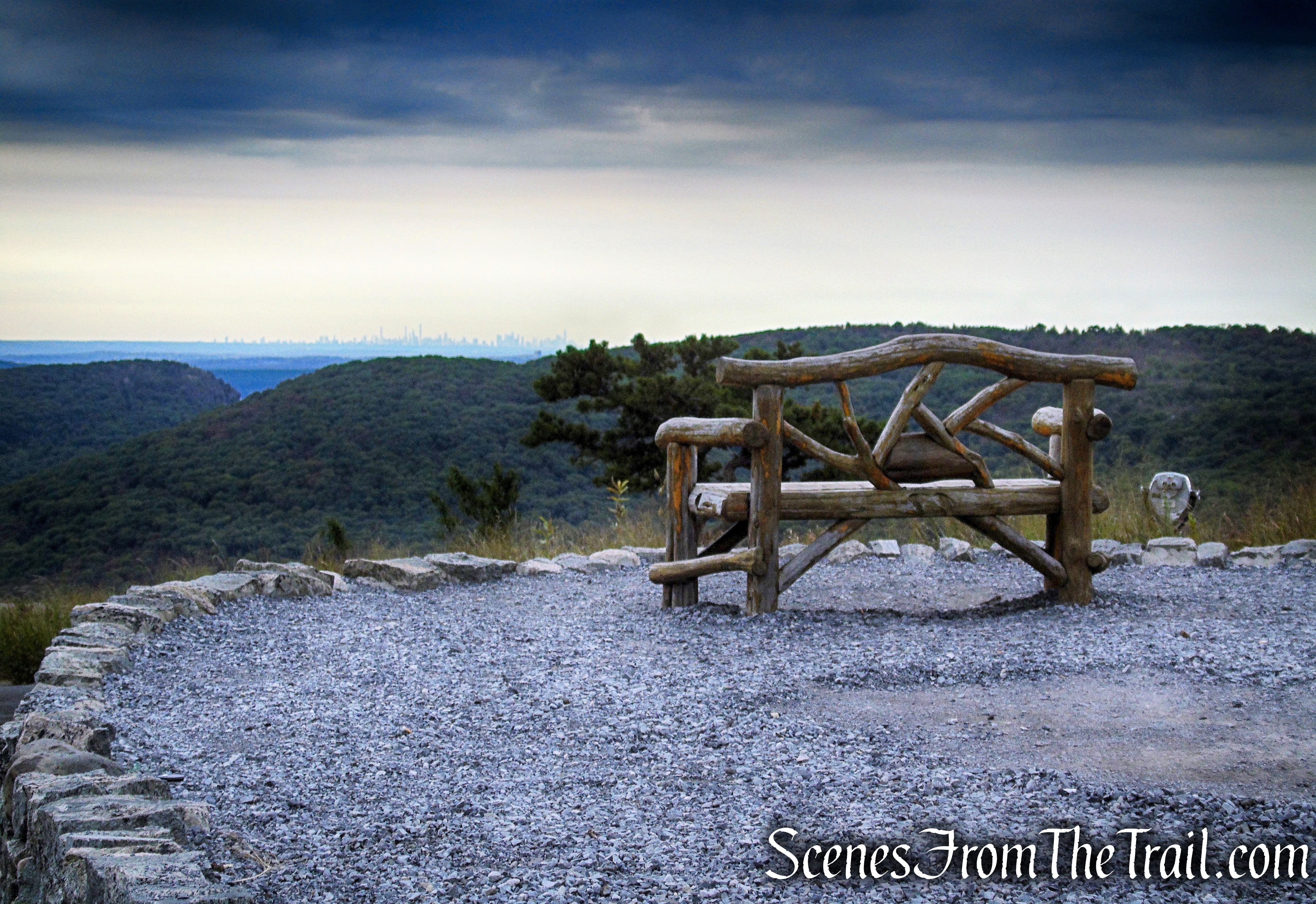
rustic bench – Bear Mountain summit
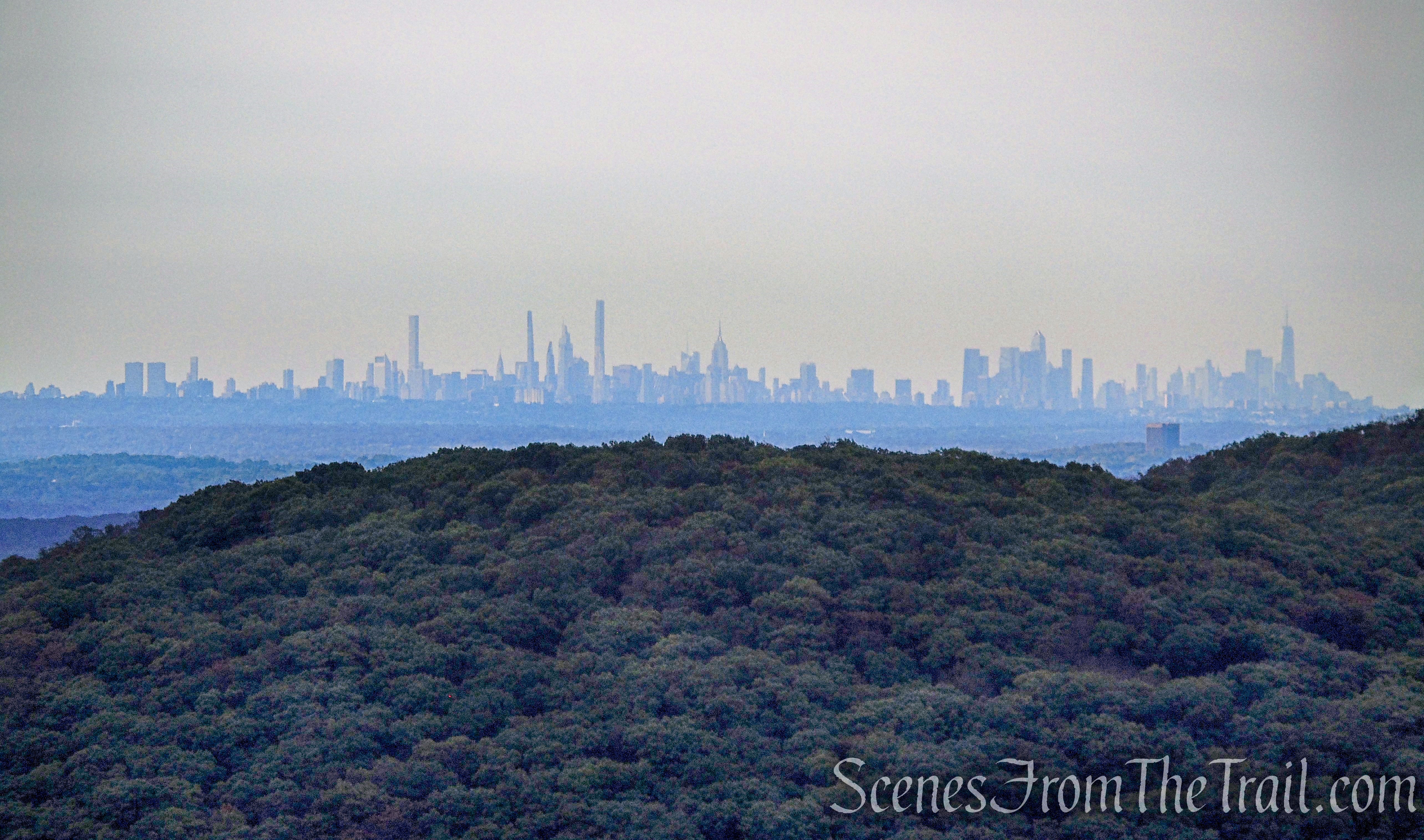
NYC skyline – Bear Mountain summit
Looking south over the Hudson River from Bear Mountain at 8:30am.
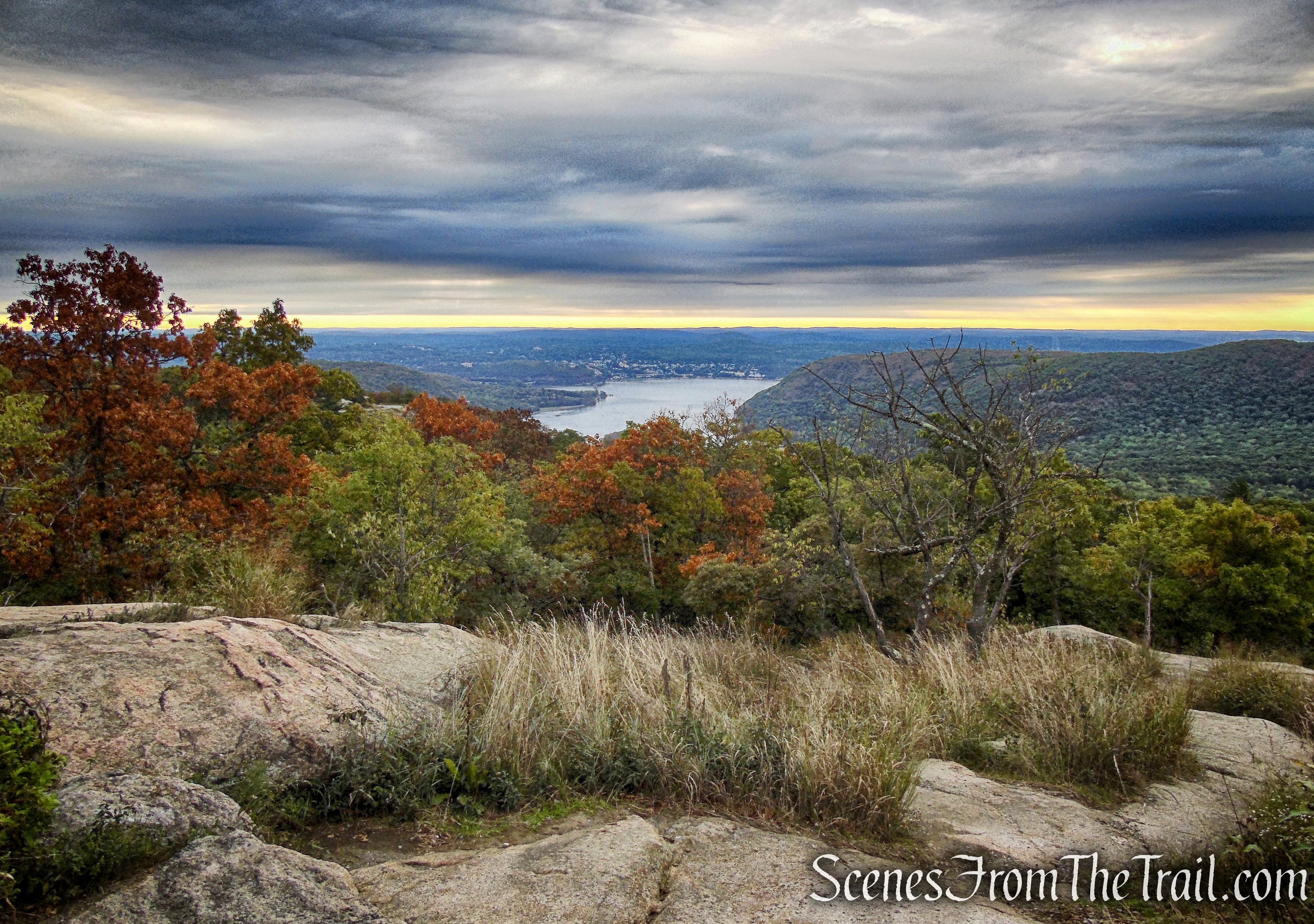
Hudson River view – Bear Mountain summit
Hudson River view – Bear Mountain summit
rustic bench – Bear Mountain summit
After enjoying the view, head back towards the tower, but bear right at a fork in the path. Directly ahead, on a rock, you’ll notice a plaque placed to commemorate the service of Joseph Bartha as Trails Chairman of the New York-New Jersey Trail Conference from 1940 to 1955.
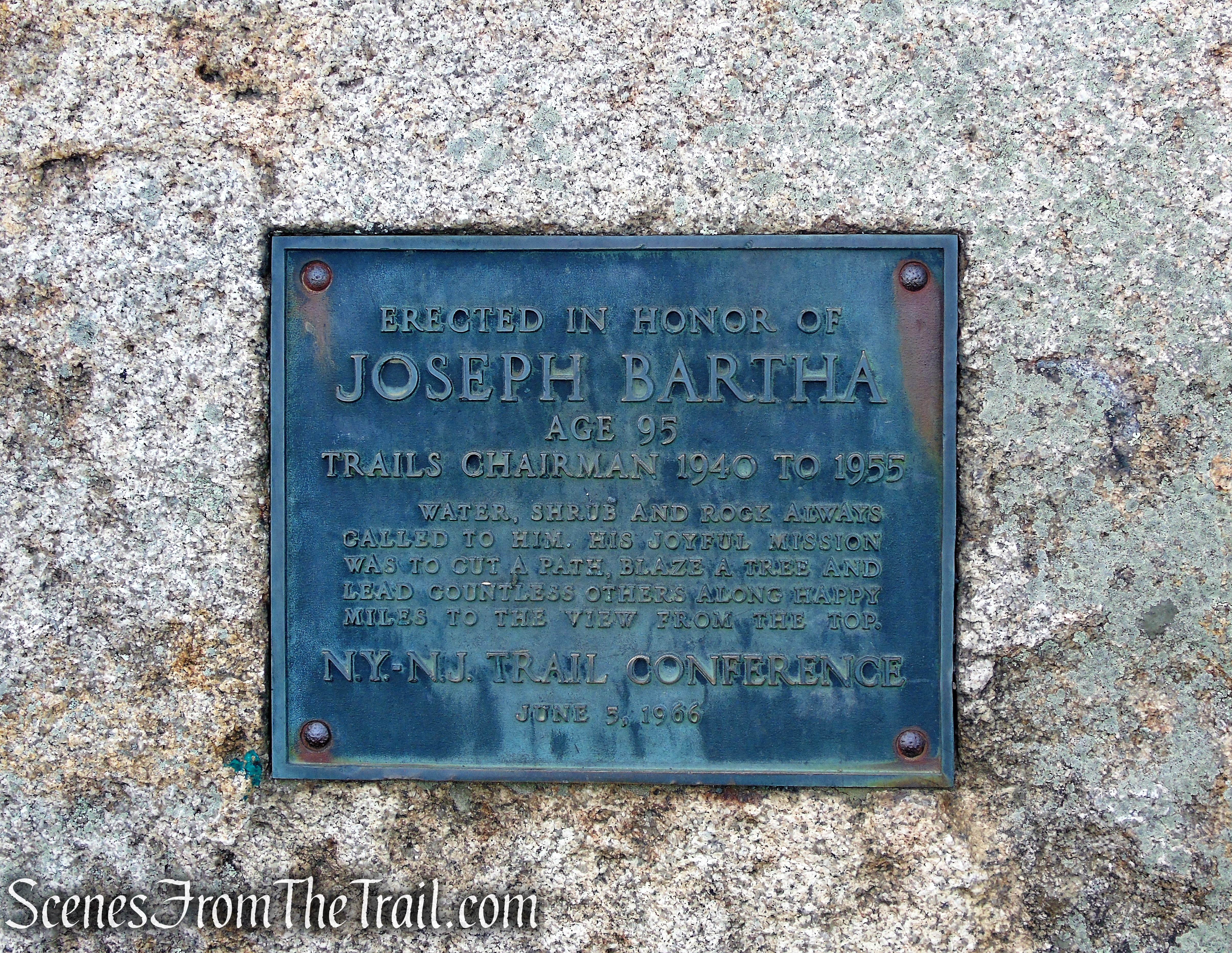
Joseph Bartha Plaque – Bear Mountain Summit
Bear right at the plaque and descend along the white-blazed Appalachian Trail. You now are following a spectacular trail section, opened in stages between 2010 and 2018, that was built over a 13-year period by professional trail builders and AmeriCorps trail crews, along with Trail Conference volunteers.
Appalachian Trail – Bear Mountain Summit
Appalachian Trail – Bear Mountain Summit

Appalachian Trail – Bear Mountain Summit
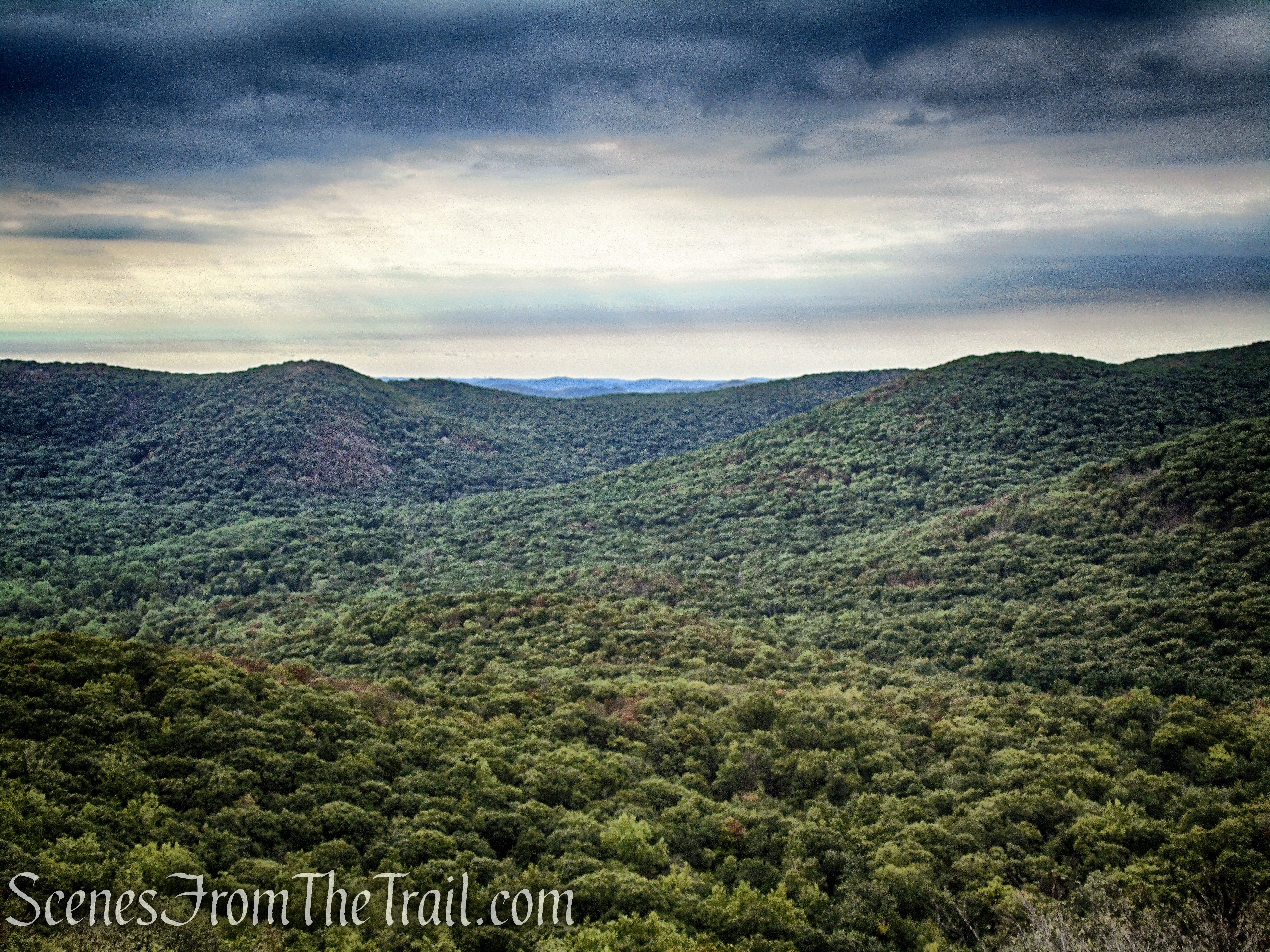
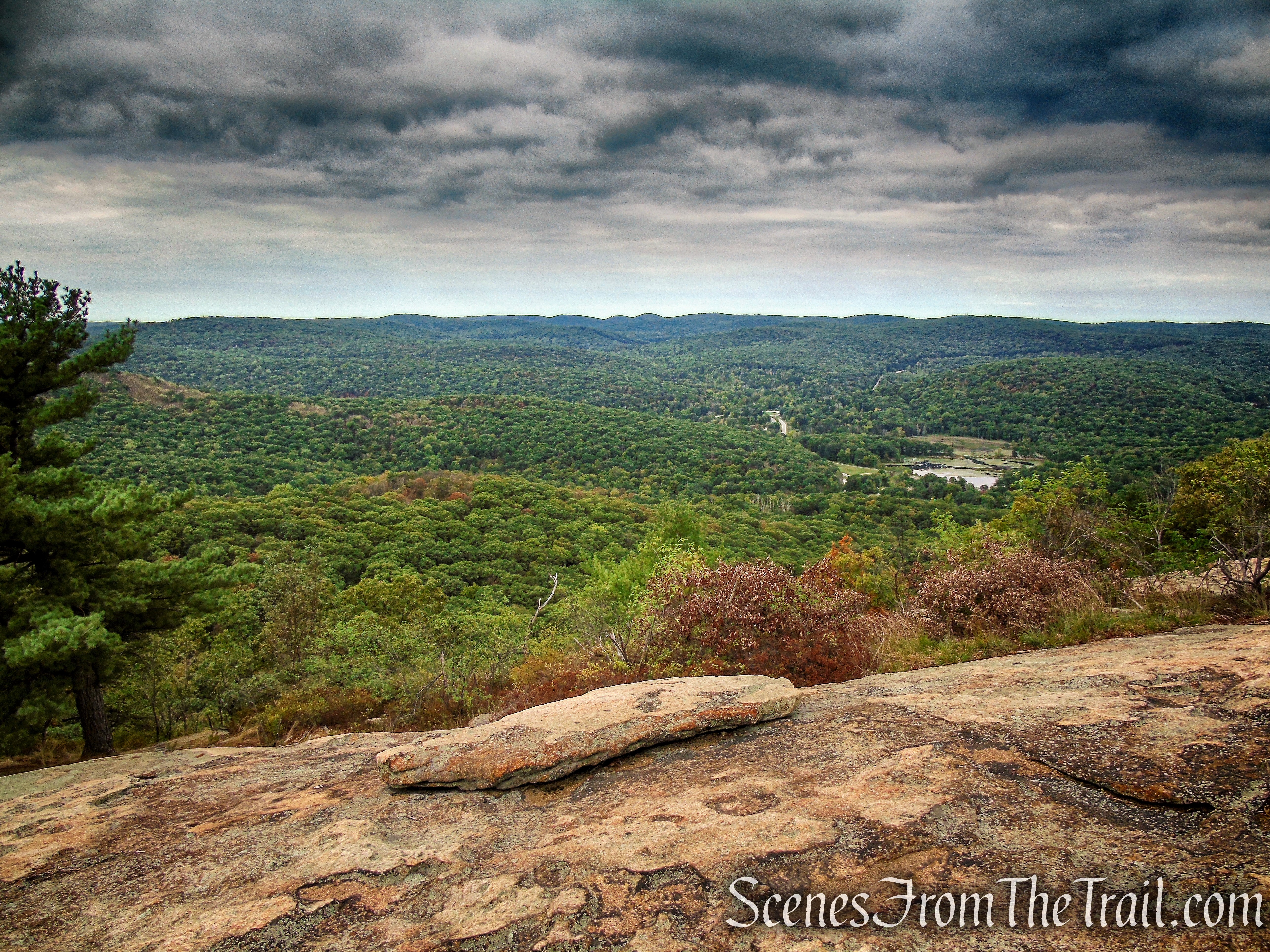
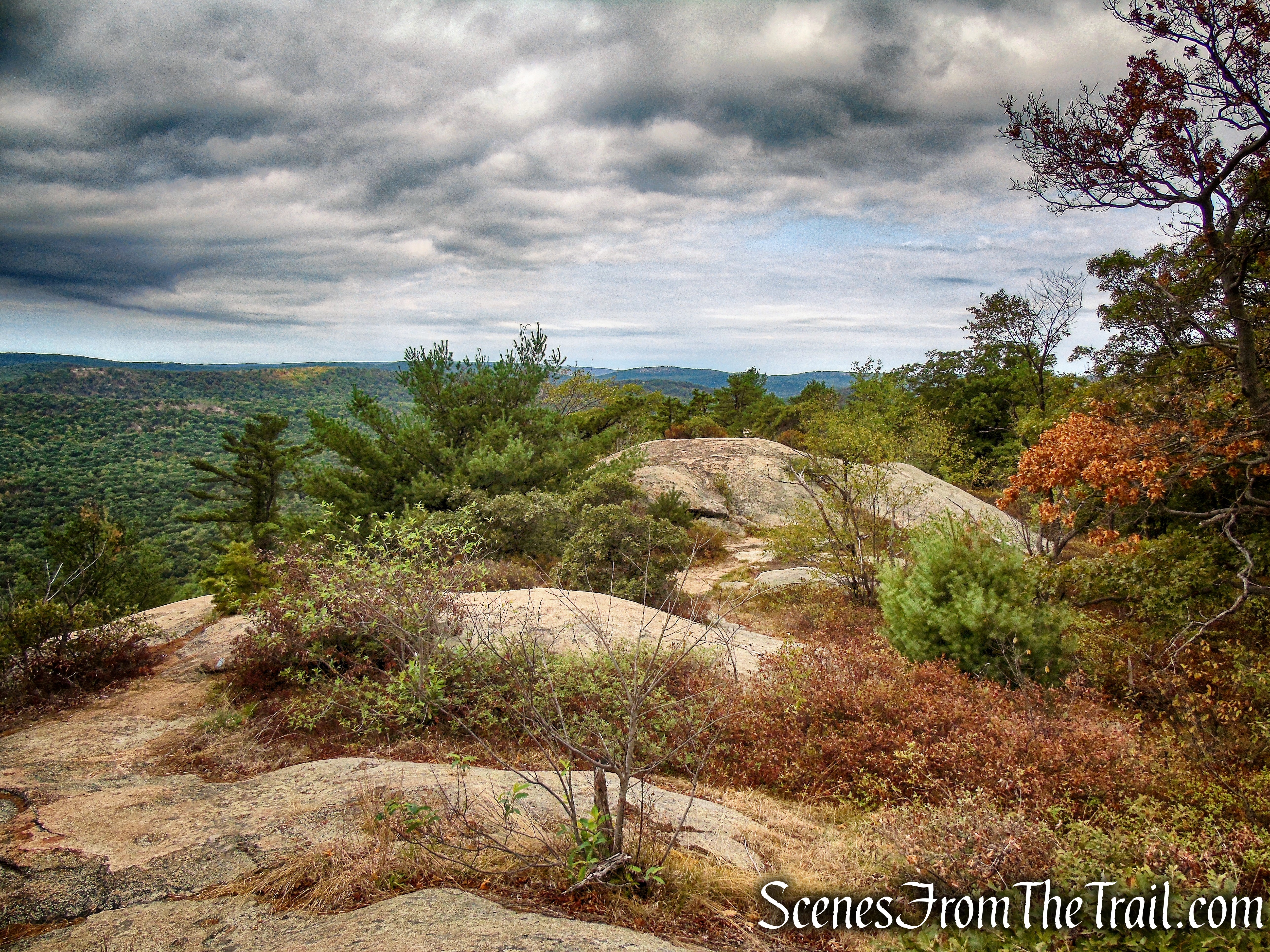
In about half a mile, after having descended nearly 400 stone steps, you’ll reach a viewpoint on the right over Dunderberg Mountain to the southeast. Here, the trail bears left and levels off. It then climbs a little and crosses a stream channeled between two rock slabs.
Appalachian Trail – Bear Mountain Summit
Appalachian Trail – Bear Mountain Summit
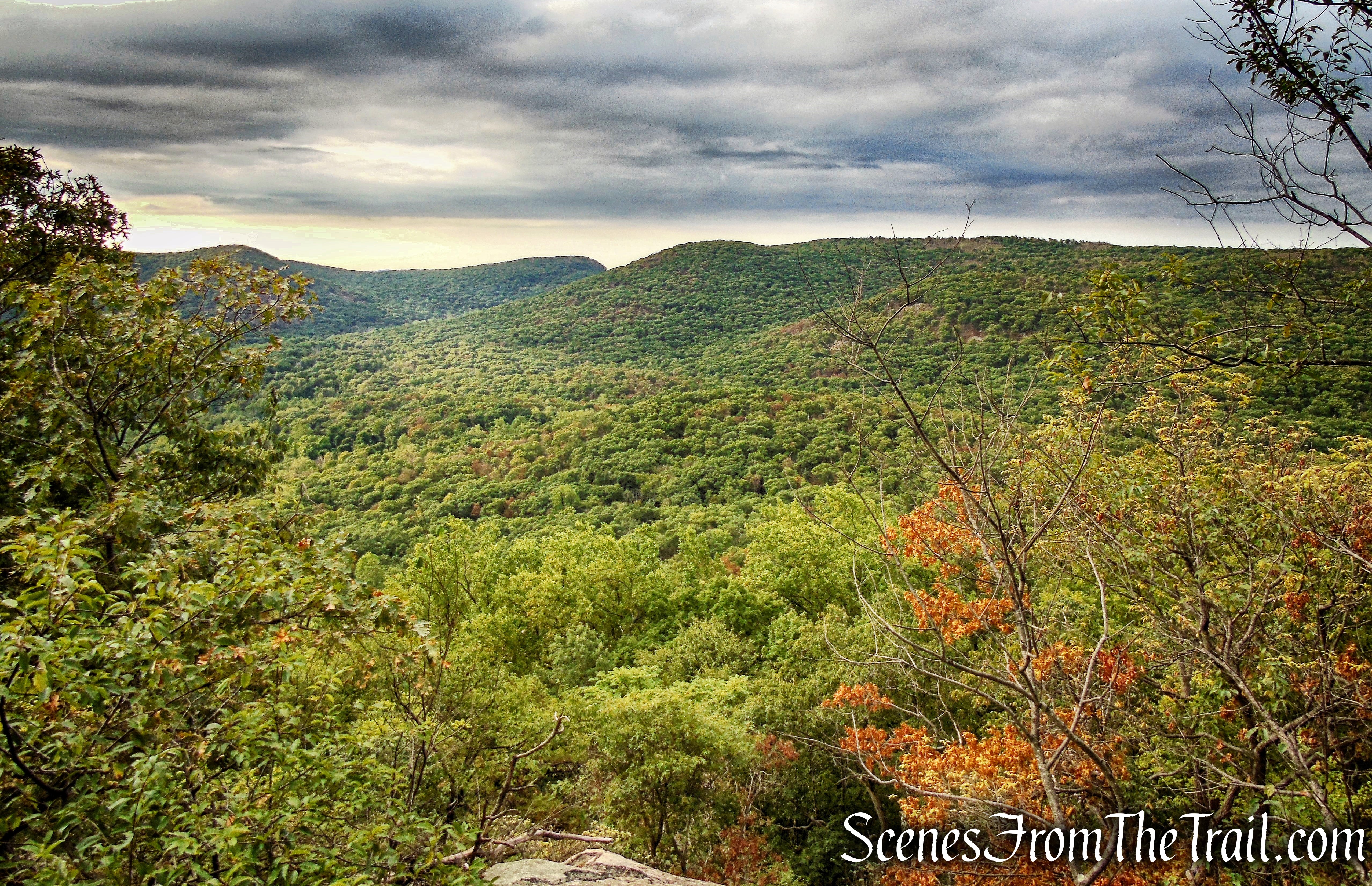
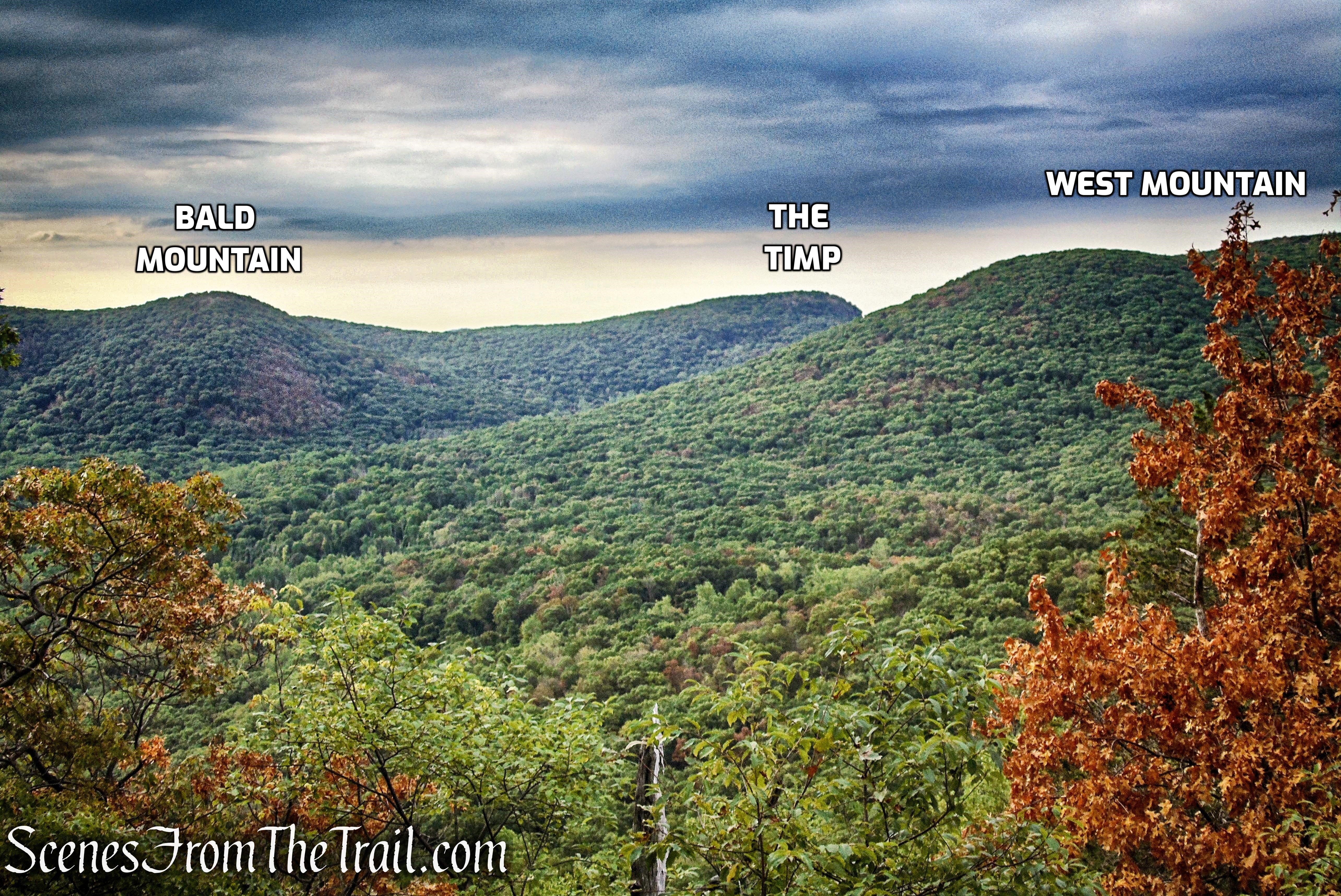
The peak on the left, rising just above the leaves is Bald Mountain. The peak just left of the notch (left of center) is The Timp and West Mountain is the long ridge on the right.
view south – Appalachian Trail
view south – Appalachian Trail
Appalachian Trail – Bear Mountain
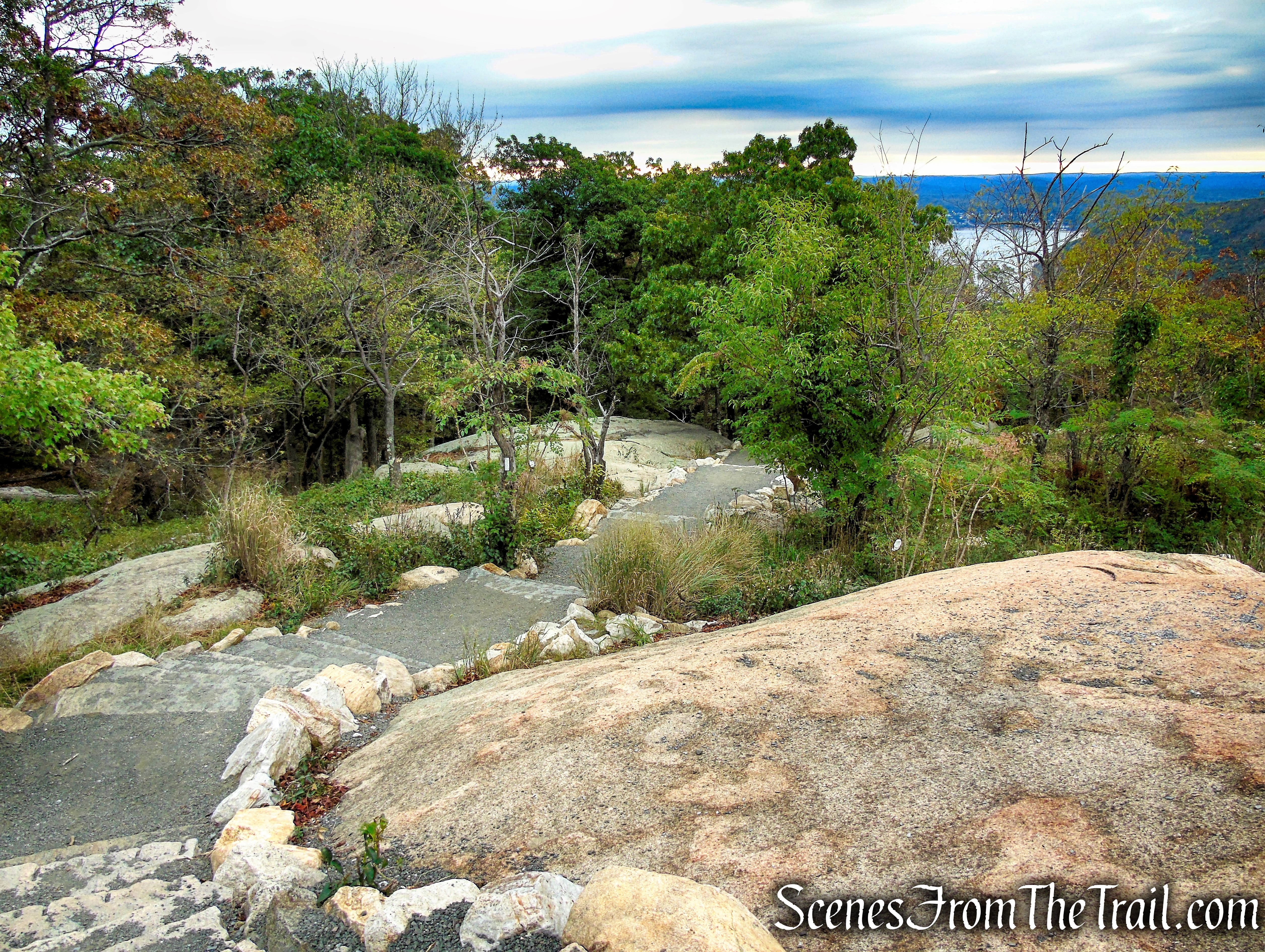
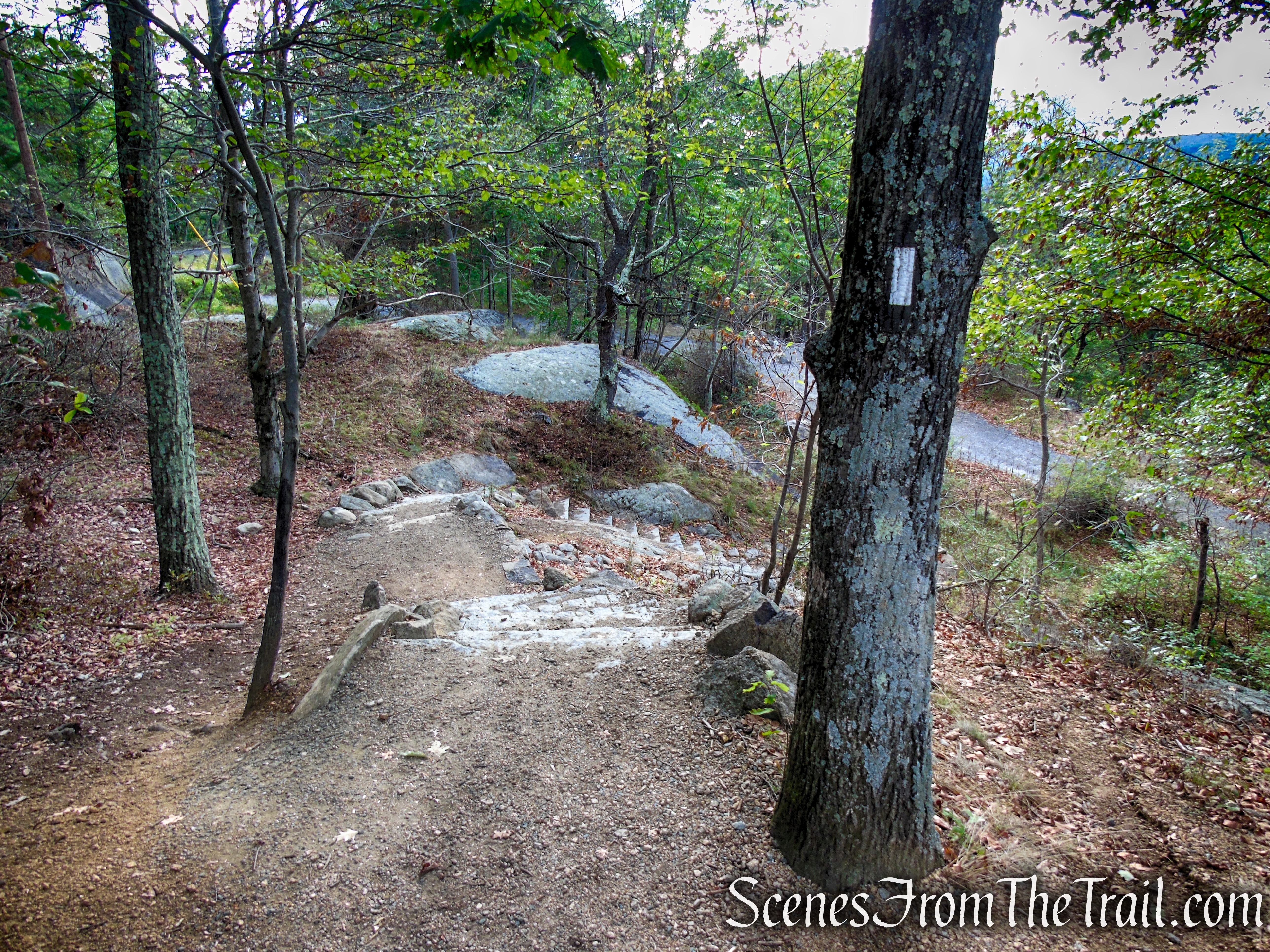
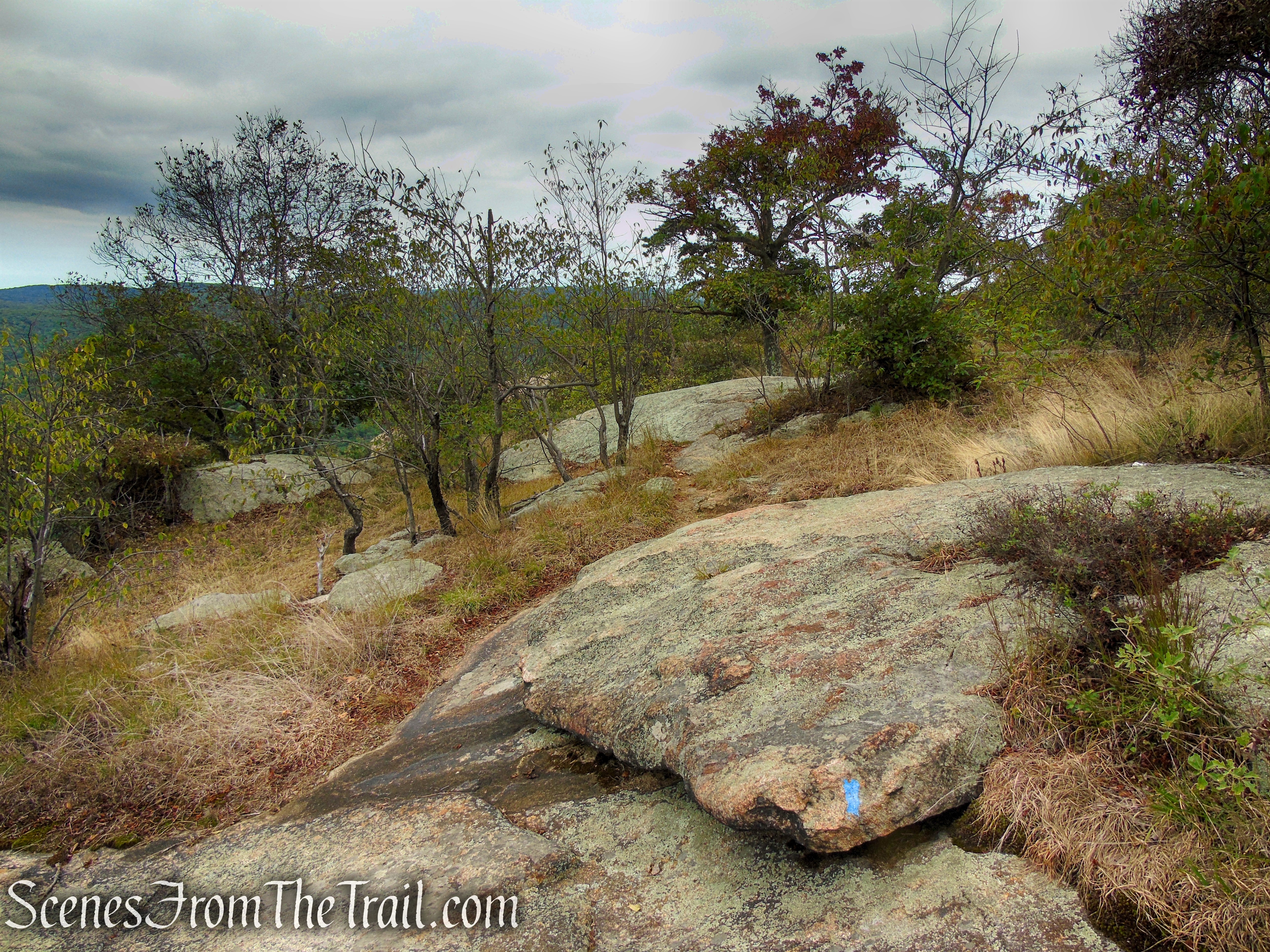
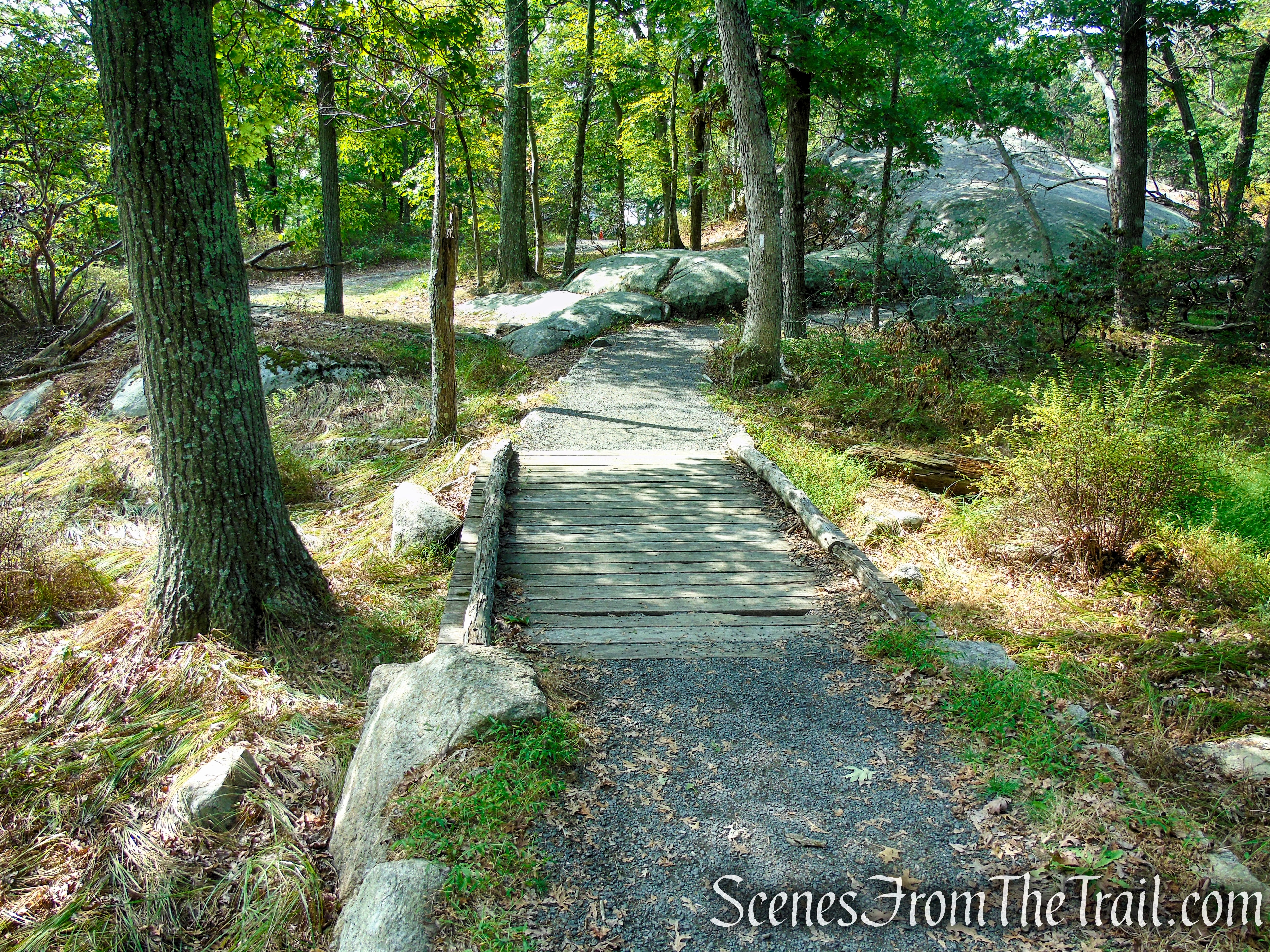
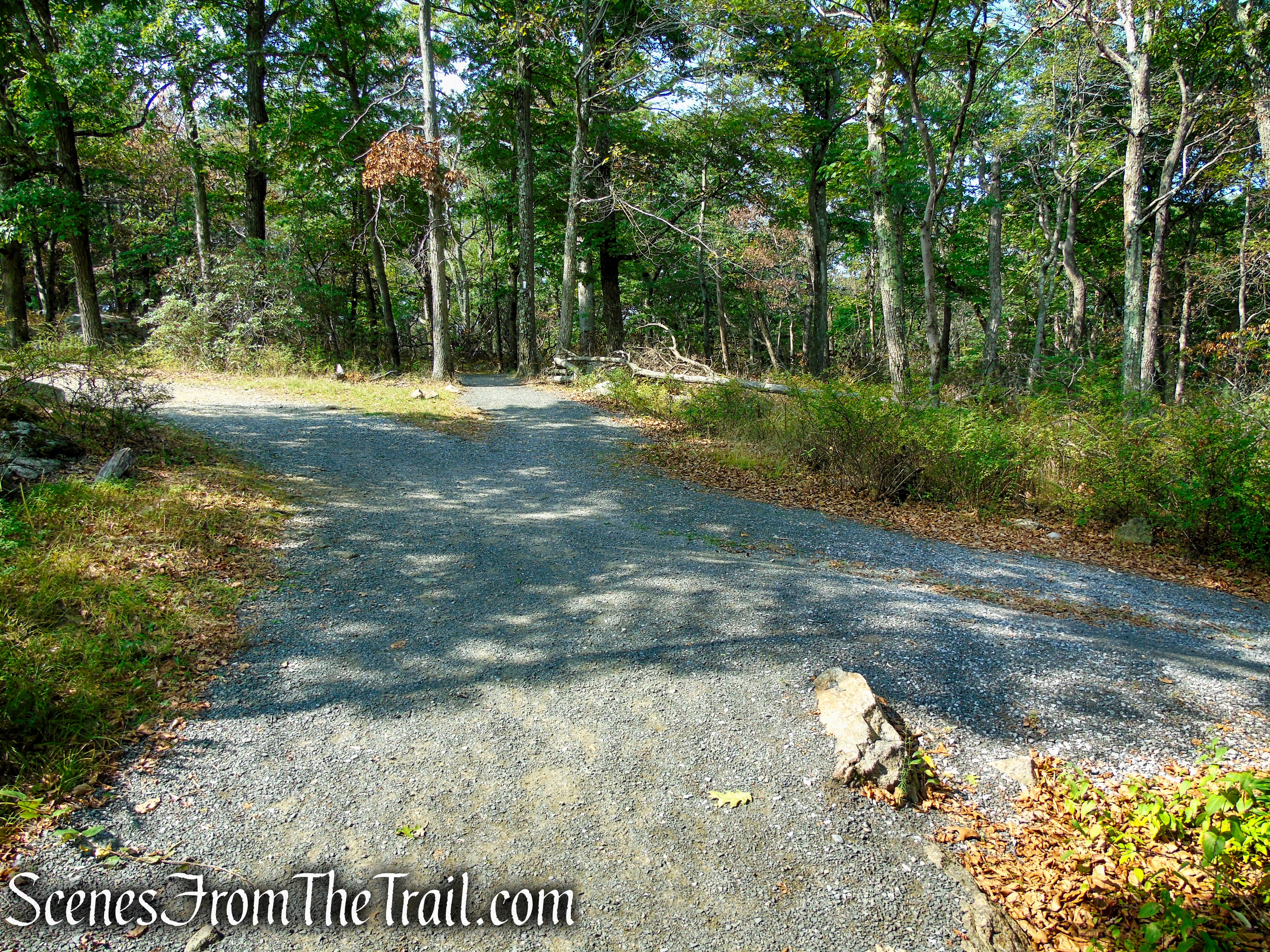
A short distance beyond, the trail descends several long flights of stone steps and crosses an abandoned section of the Perkins Memorial Drive. Here you should turn right, leaving the Appalachian Trail and head in a westerly direction along the asphalt road. You may notice some blue blazes along the way. This section of paved road connects two different sections of the AT.
Appalachian Trail – Bear Mountain
Turn right at the junction
abandoned Perkins Drive – Bear Mountain
The road passes below the tall cliffs that you were just on moments earlier, then runs alongside a stone retaining wall. In about 0.3-mile, the paved road reaches a junction with the other side of the Appalachian Trail. Turn right at the junction as the AT climbs steeply up the mountain on stone steps.
abandoned Perkins Drive – Bear Mountain
abandoned Perkins Drive – Bear Mountain
Appalachian Trail – Bear Mountain
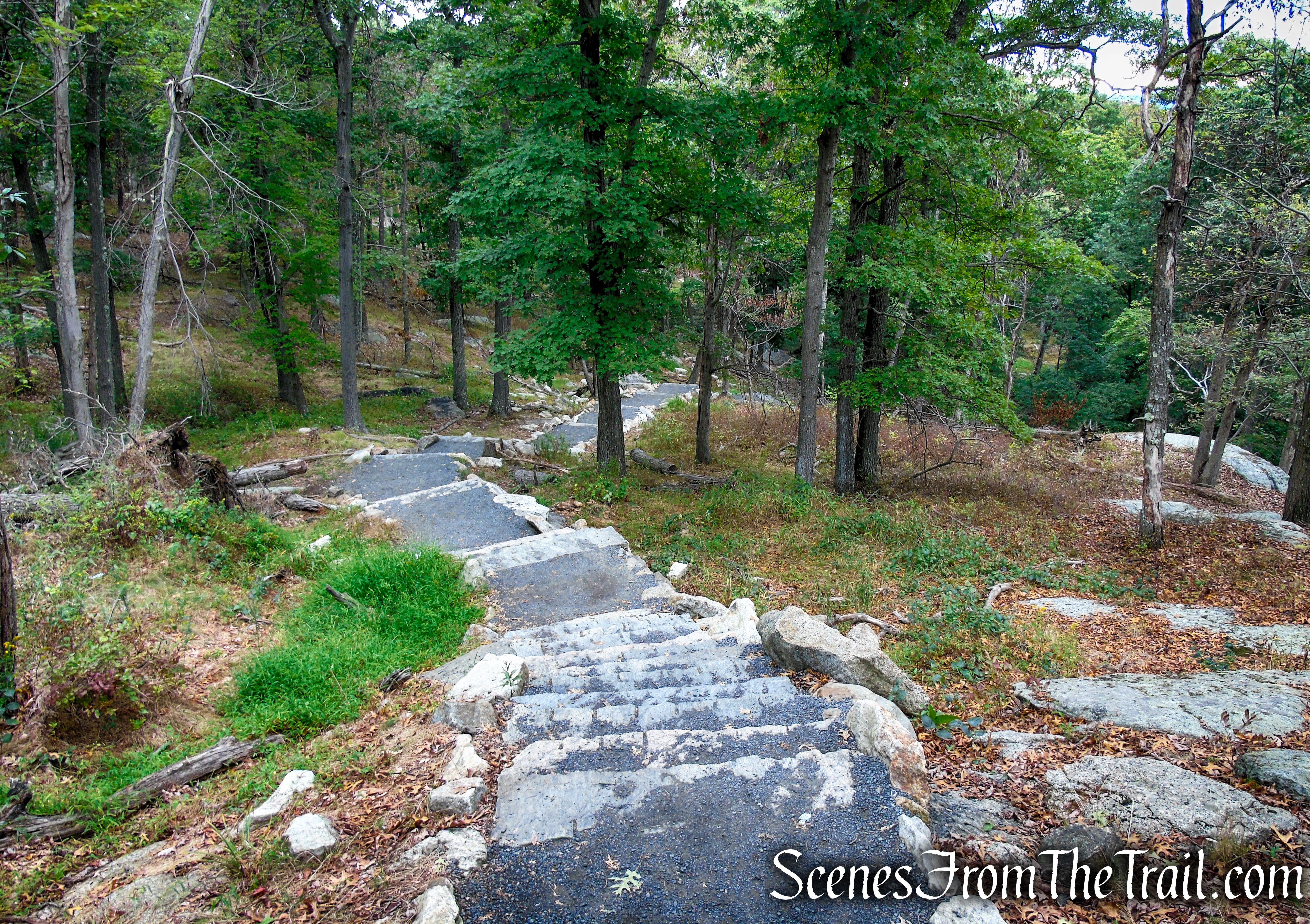
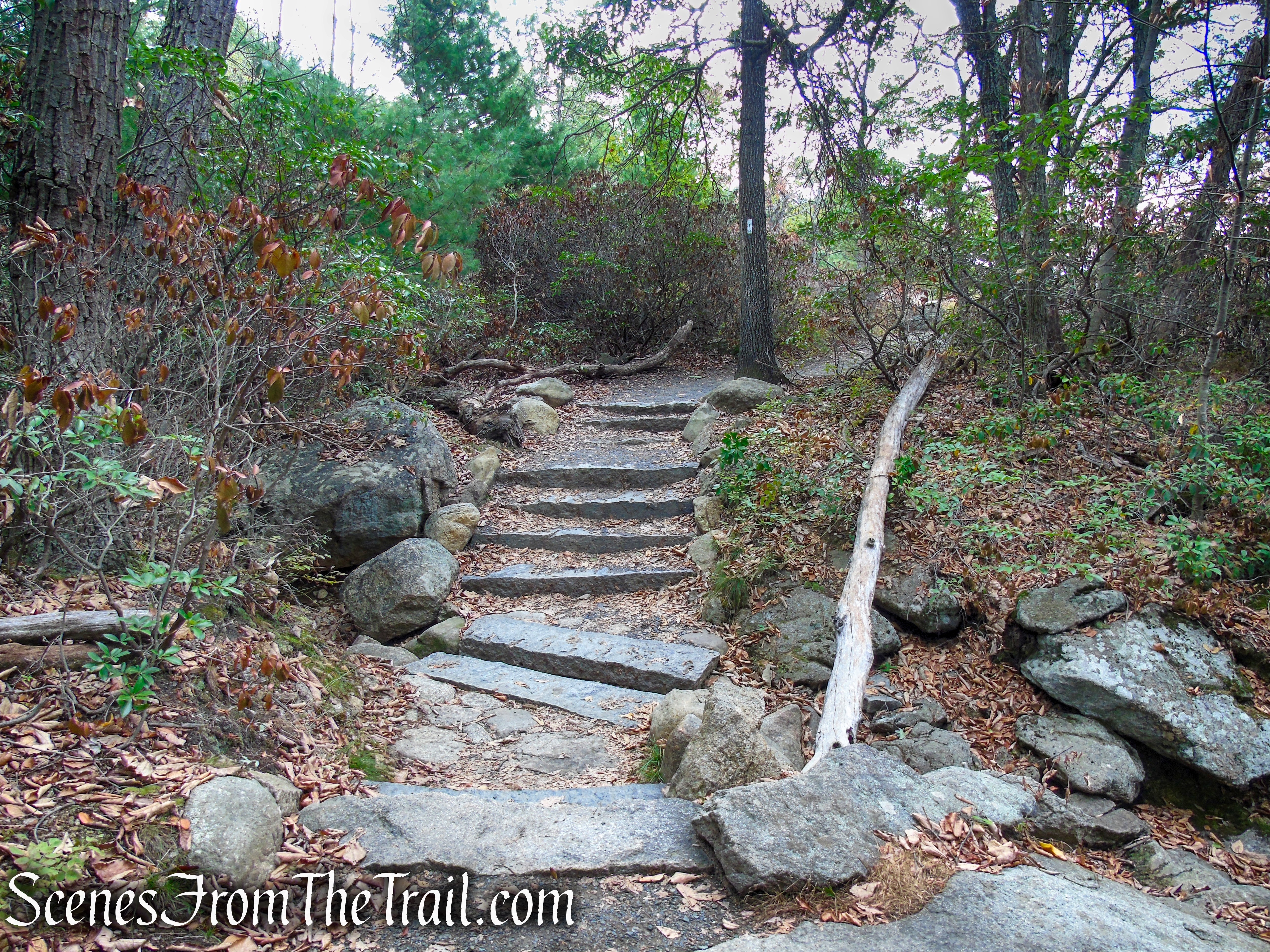
Follow the white blazes as they climb the stone steps along the southwest slope of Bear Mountain. This section of trail is quite impressive. The way the stone steps snake their way up the mountain is nothing short of spectacular. The workers that built this section were craftsmen and artists.
Appalachian Trail – Bear Mountain

Appalachian Trail – Bear Mountain
Appalachian Trail – Bear Mountain
Appalachian Trail – Bear Mountain
Appalachian Trail – Bear Mountain

Appalachian Trail – Bear Mountain
Appalachian Trail – Bear Mountain
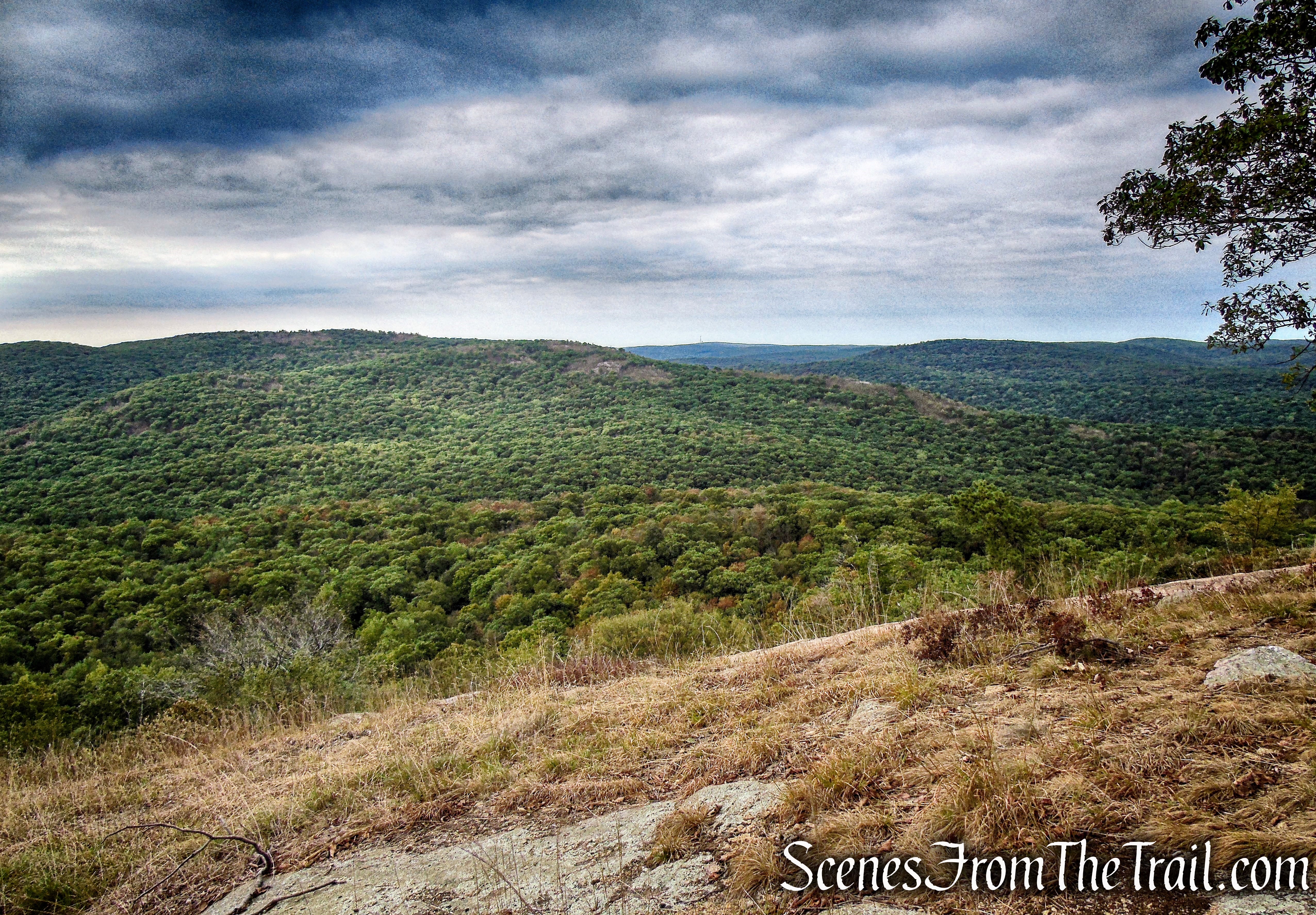
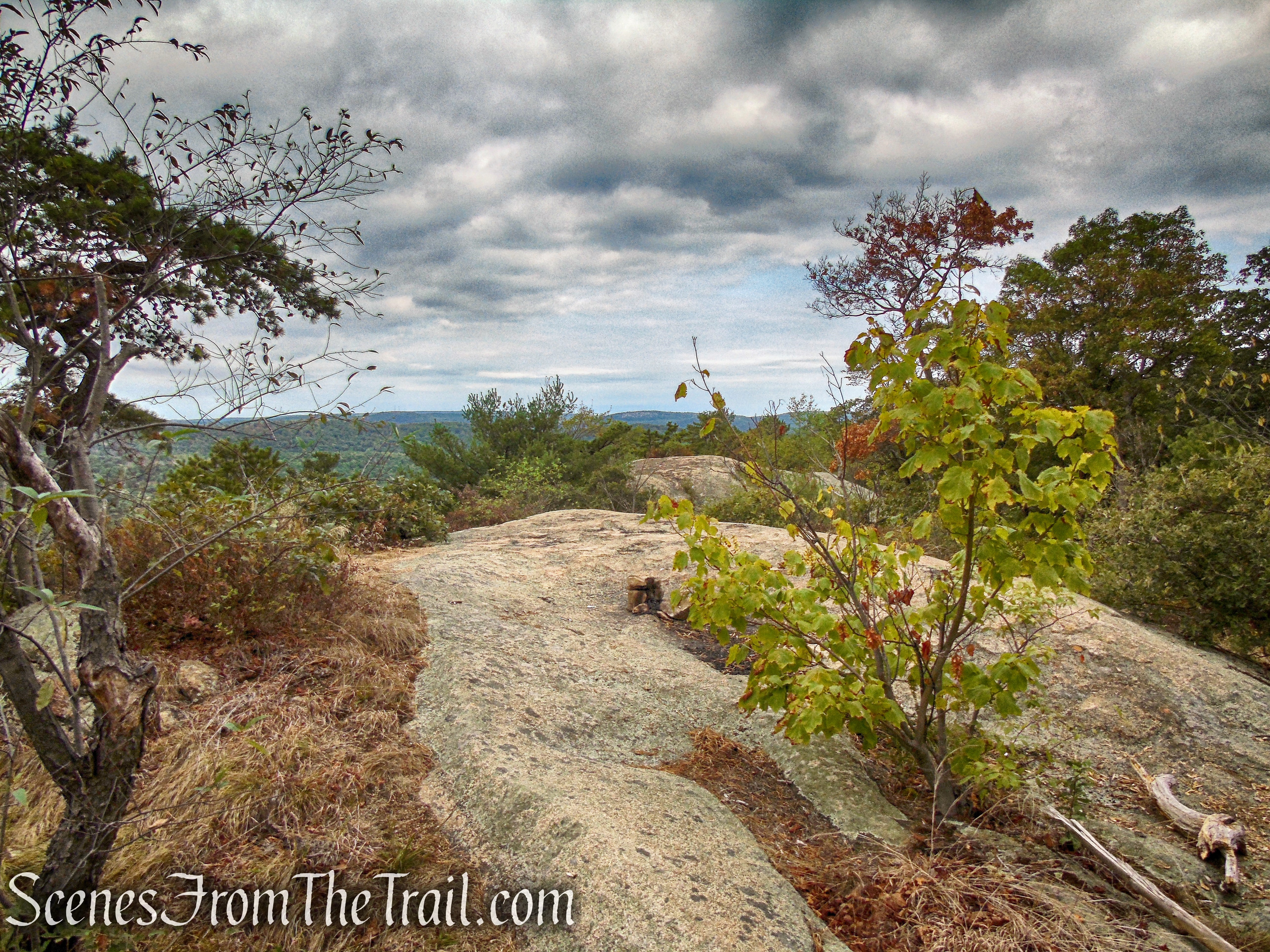
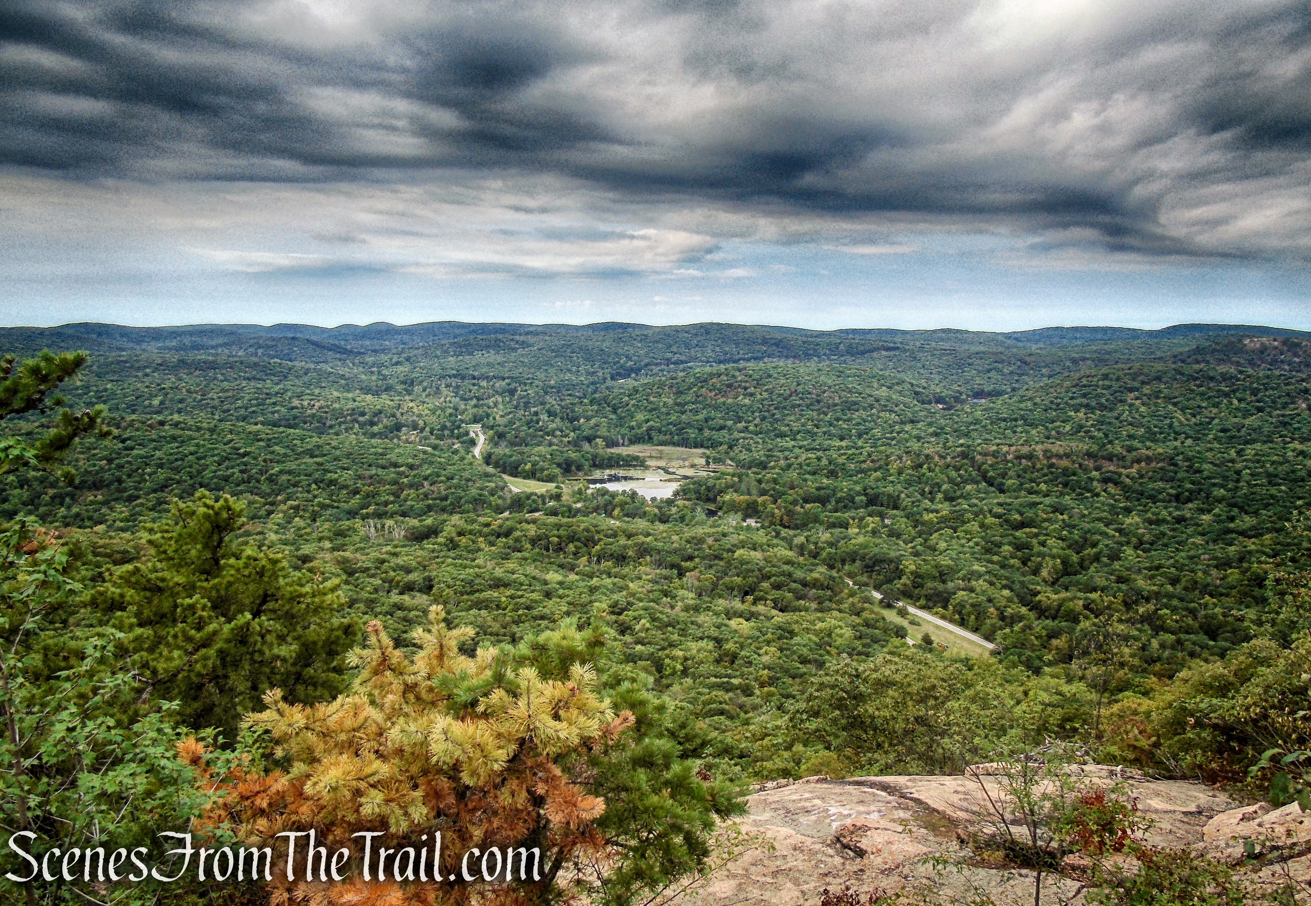
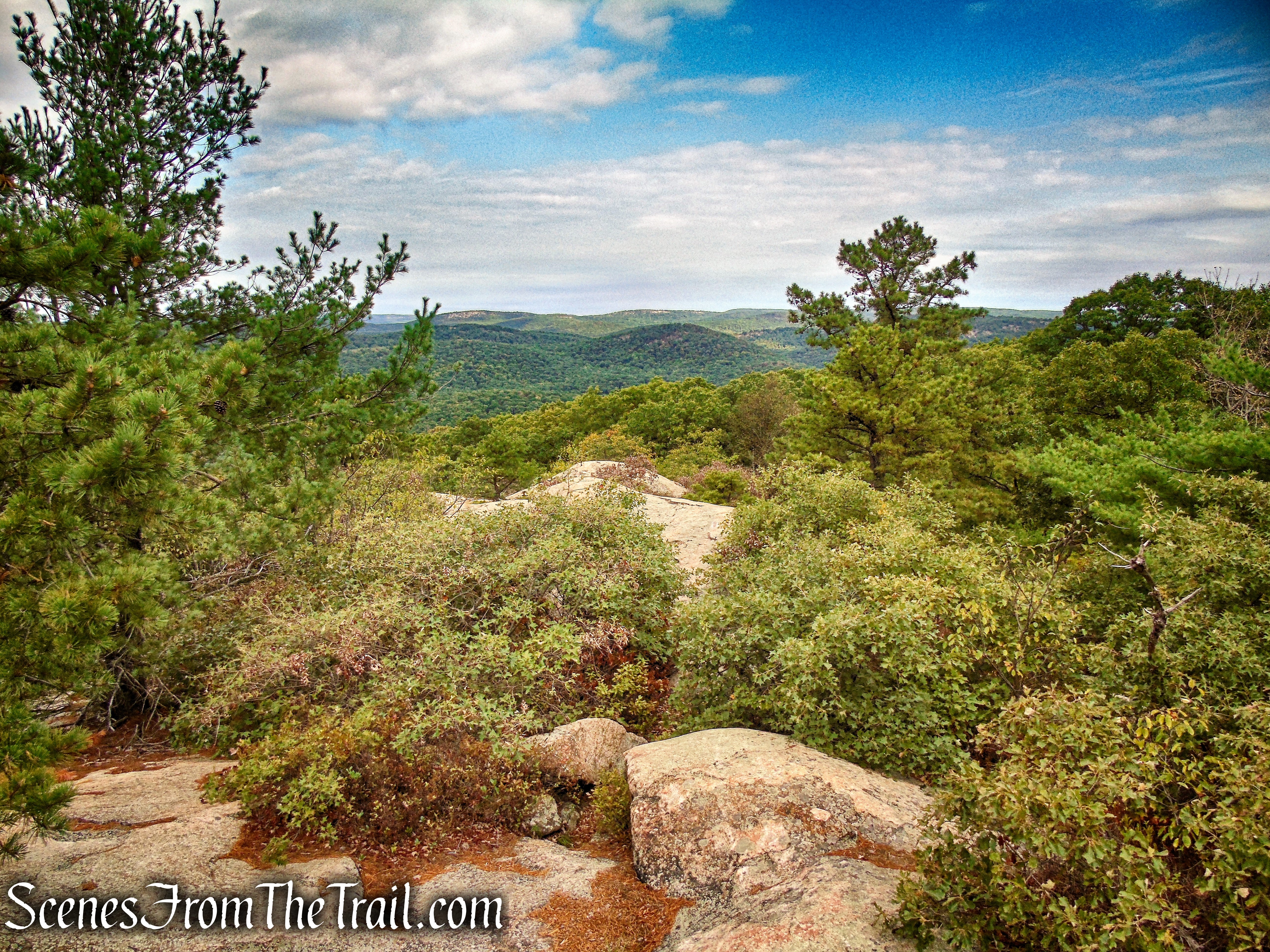
As the trail climbs the southwestern slope of Bear Mountain, it passes several rock ledges with open views to the southwest over the rolling hills of Harriman State Park.
Appalachian Trail – Bear Mountain

Appalachian Trail – Bear Mountain

Appalachian Trail – Bear Mountain
Appalachian Trail – Bear Mountain

Appalachian Trail – Bear Mountain
Appalachian Trail – Bear Mountain
Appalachian Trail – Bear Mountain
The AT climbs more stone steps and passes massive boulders that form a rock wall.
Appalachian Trail – Bear Mountain
Appalachian Trail – Bear Mountain
Appalachian Trail – Bear Mountain

Appalachian Trail – Bear Mountain

Appalachian Trail – Bear Mountain
Appalachian Trail – Bear Mountain
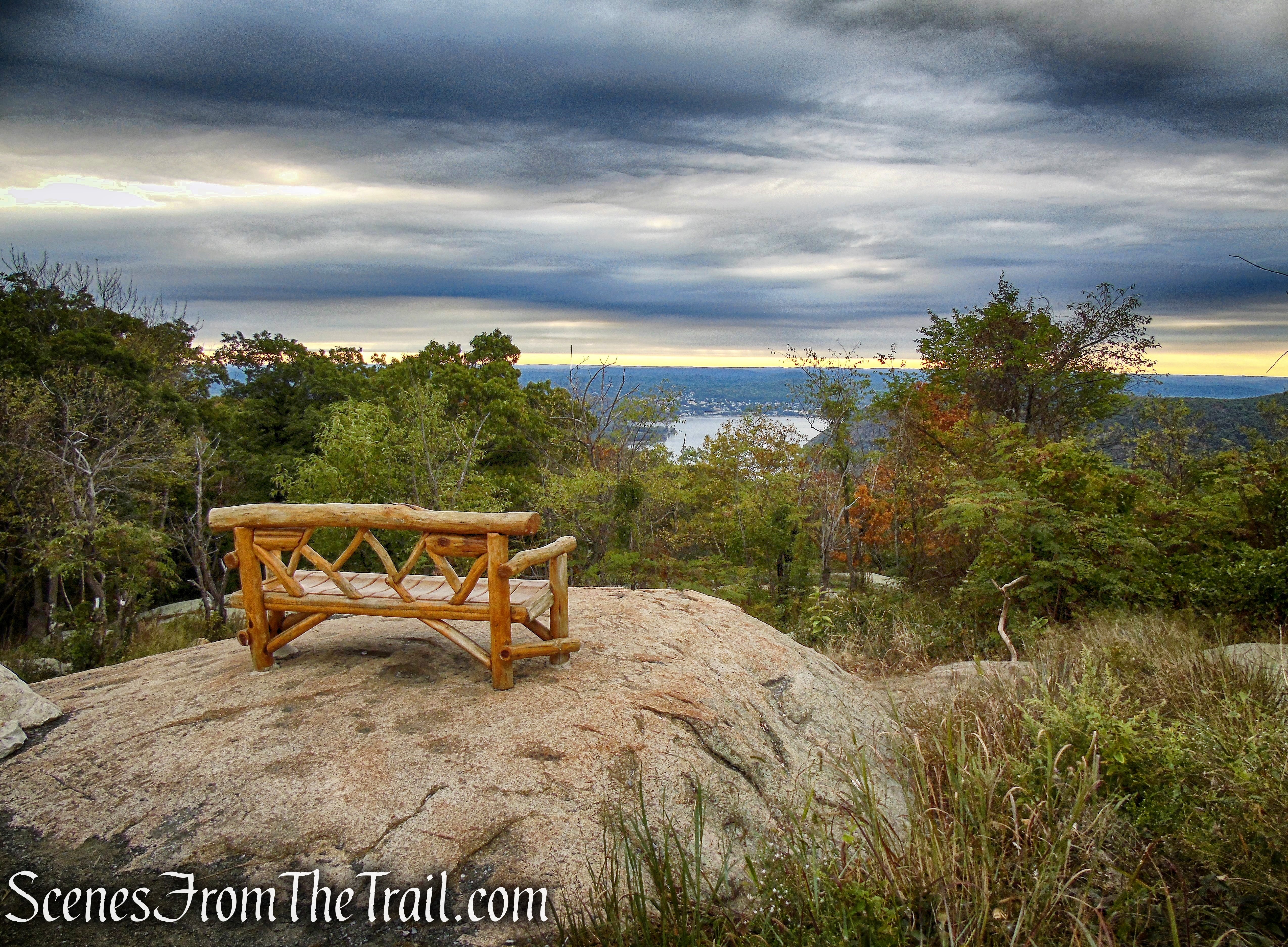
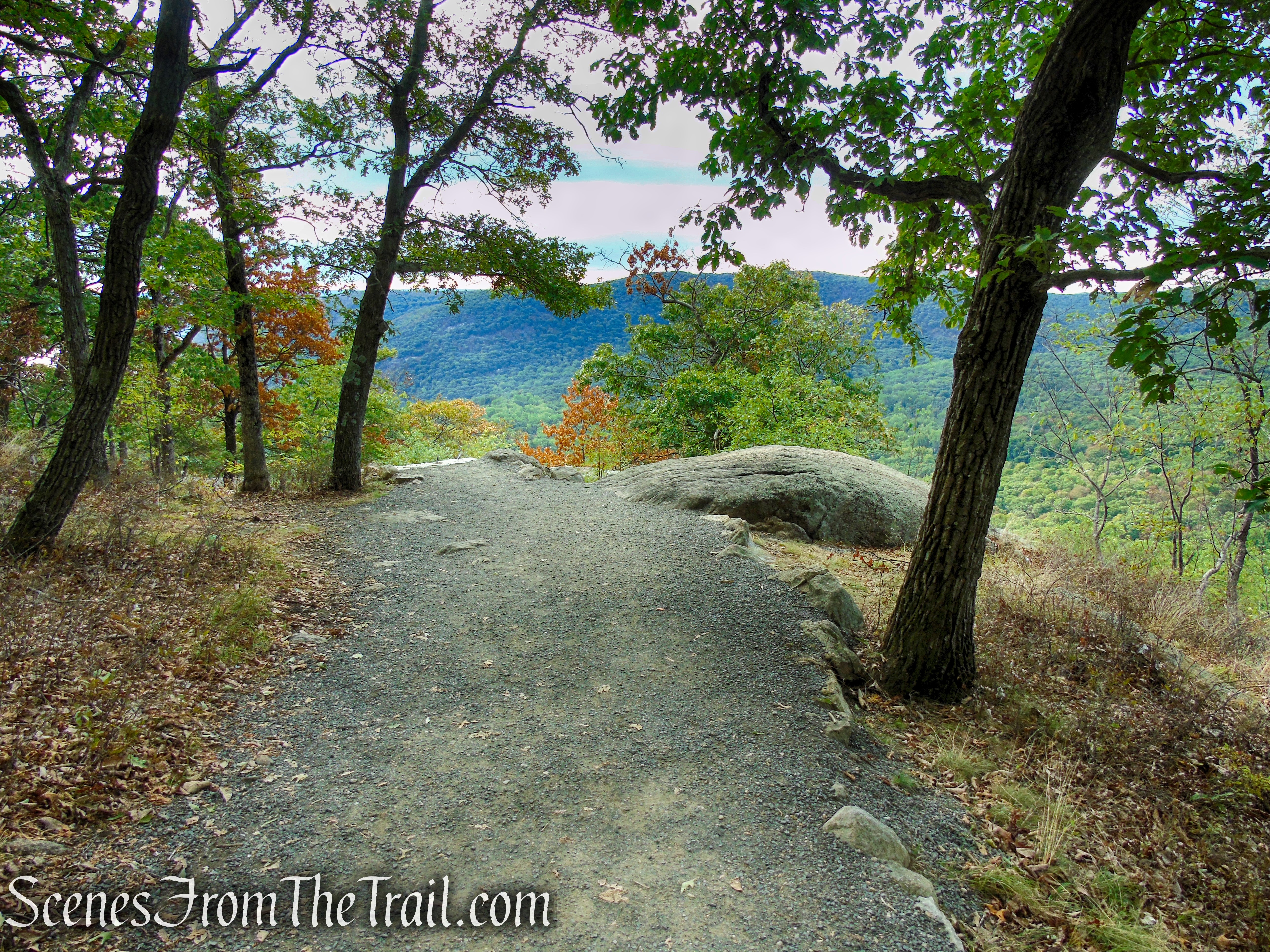
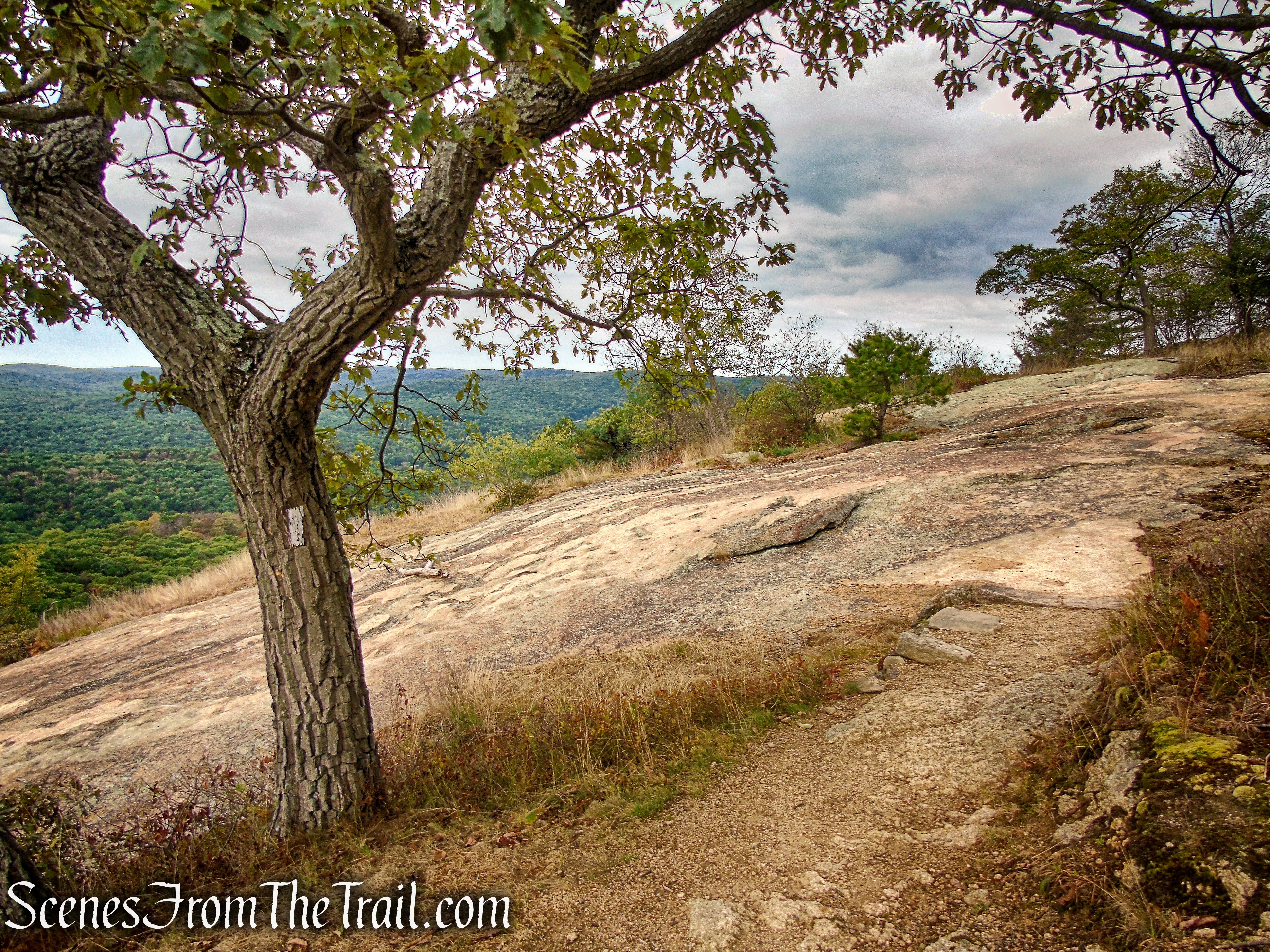
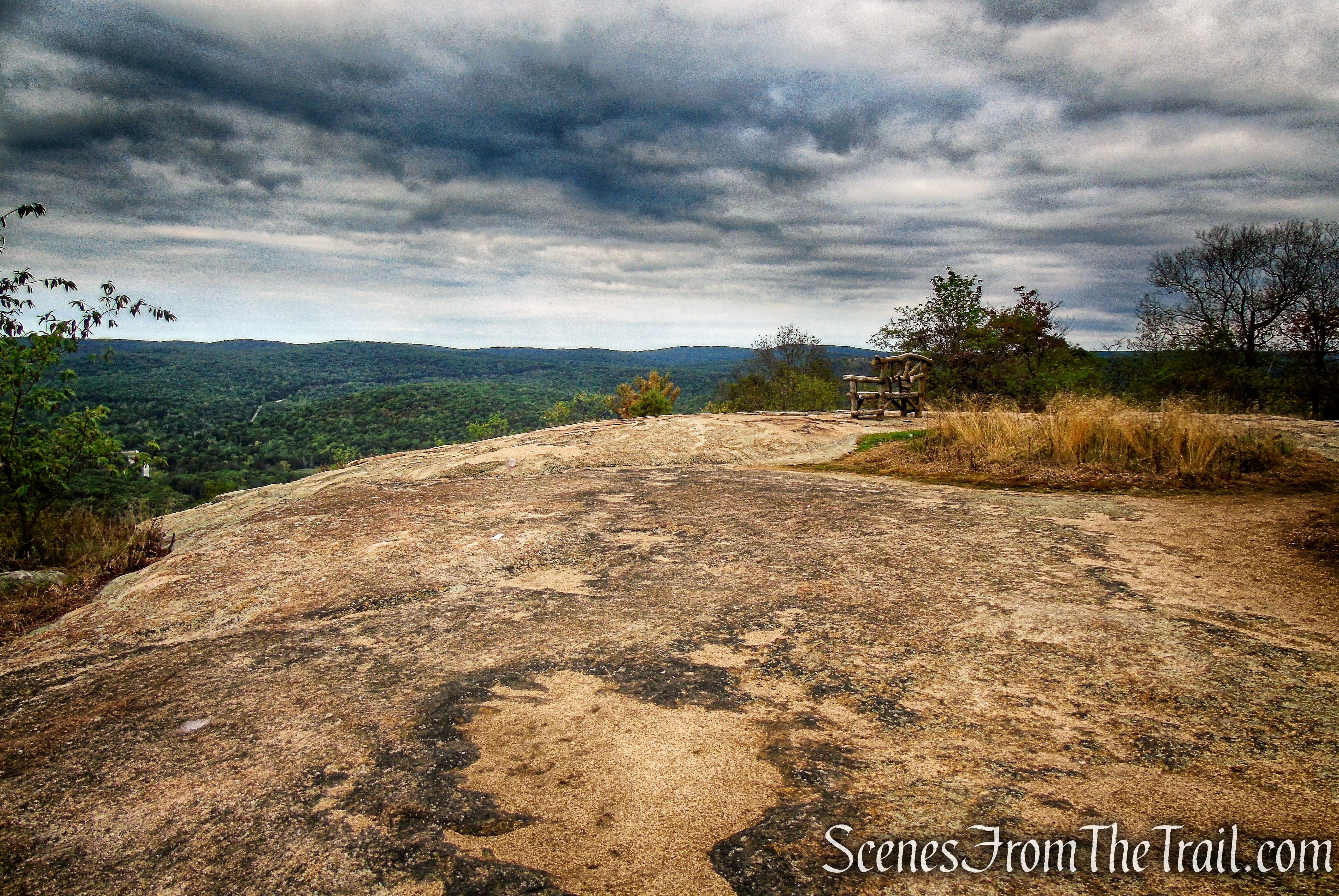
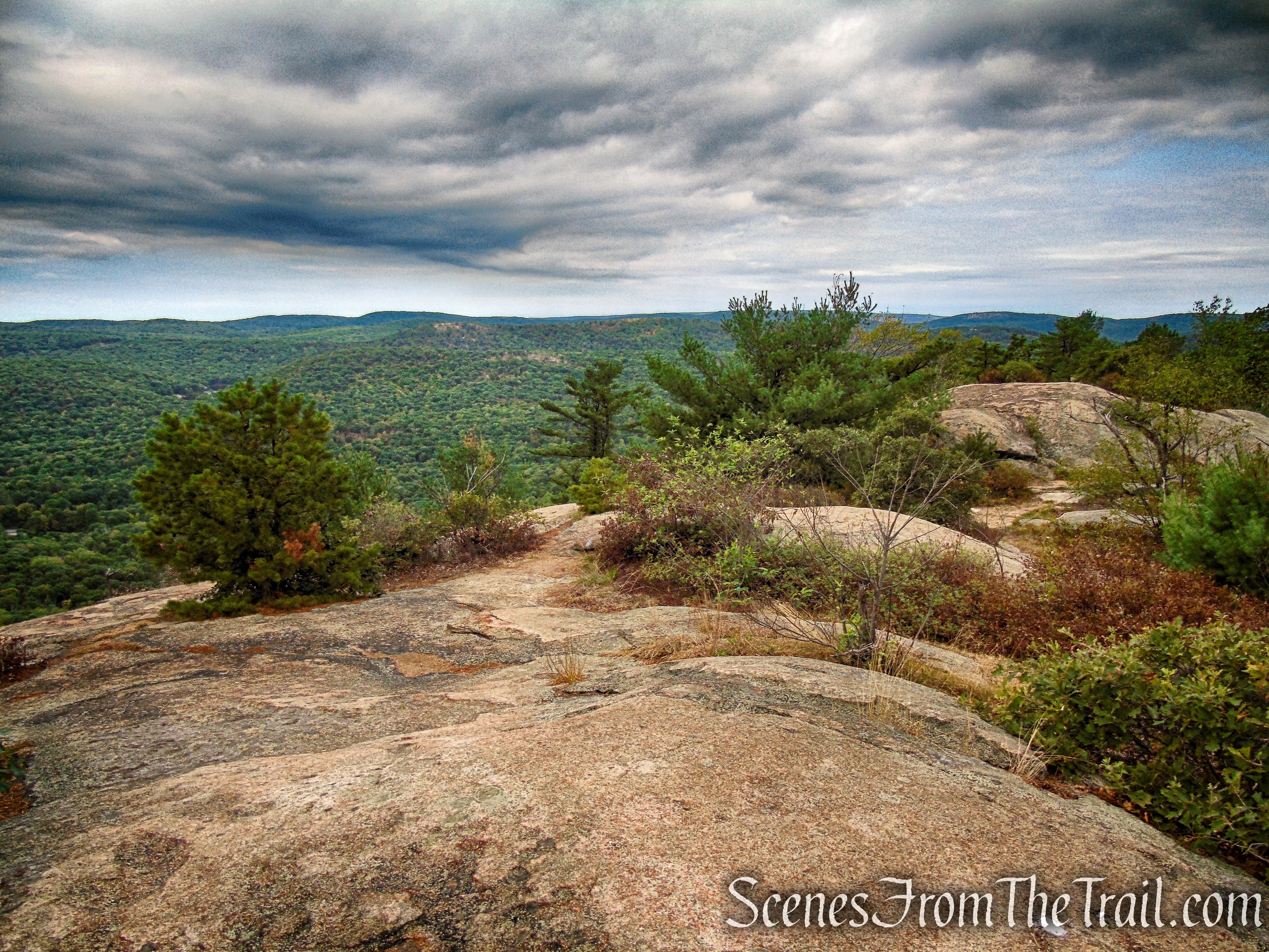
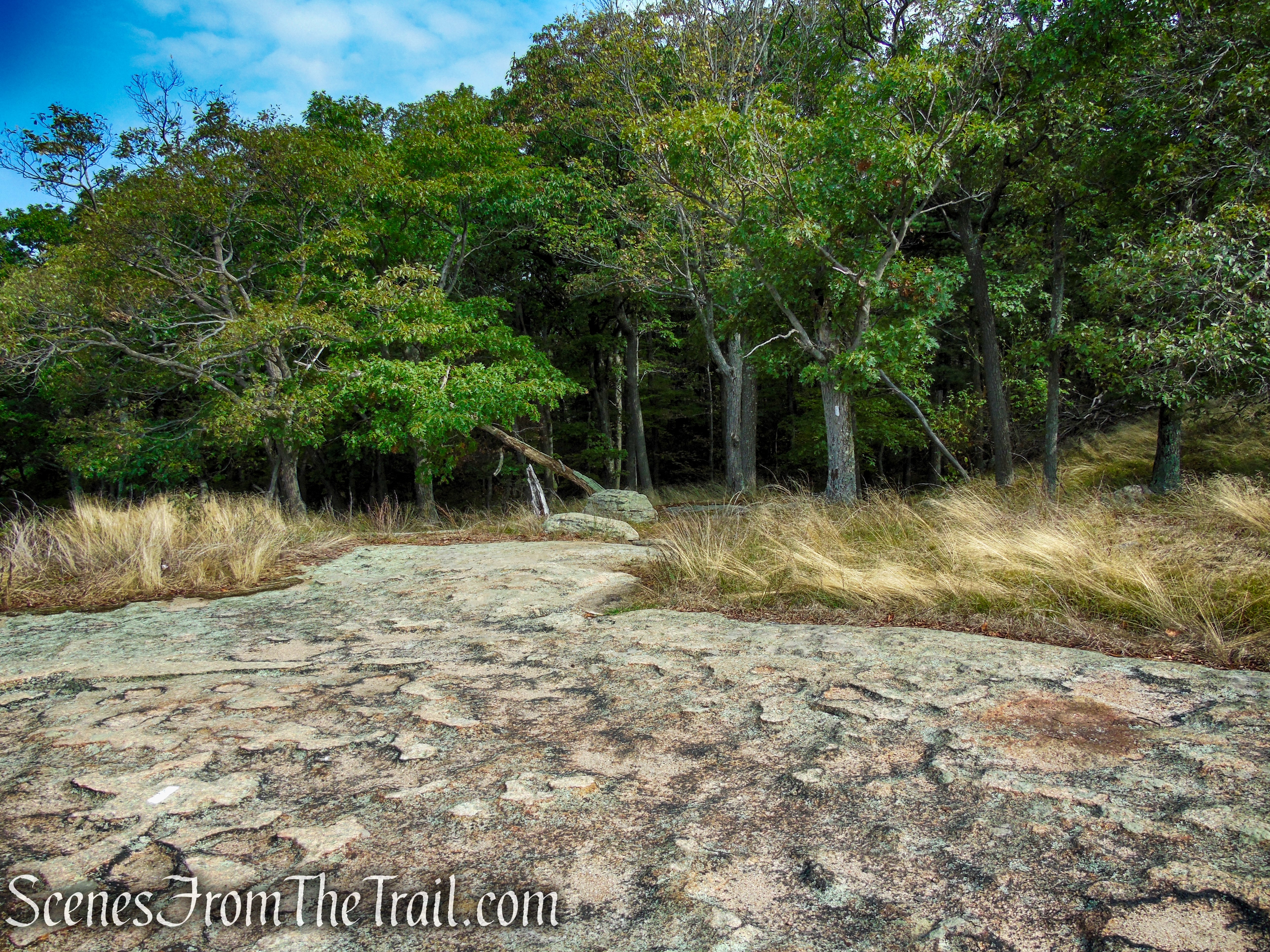
The AT descends stone steps, passes through an open area and soon reaches the western summit of Bear Mountain with wide-ranging views. A short distance later the A.T. emerges on a flat pockmarked rock surface with a rustic bench right in the center.
Appalachian Trail – Bear Mountain
Appalachian Trail – Bear Mountain
Appalachian Trail – Bear Mountain
Appalachian Trail – Bear Mountain
Appalachian Trail – Bear Mountain
Appalachian Trail – Bear Mountain
Appalachian Trail – Bear Mountain

Appalachian Trail – Bear Mountain
Appalachian Trail – Bear Mountain
This makes for an excellent place to take a break and enjoy the view. The bulk of the elevation gain for this hike is done once you reach this spot.

Appalachian Trail – Bear Mountain
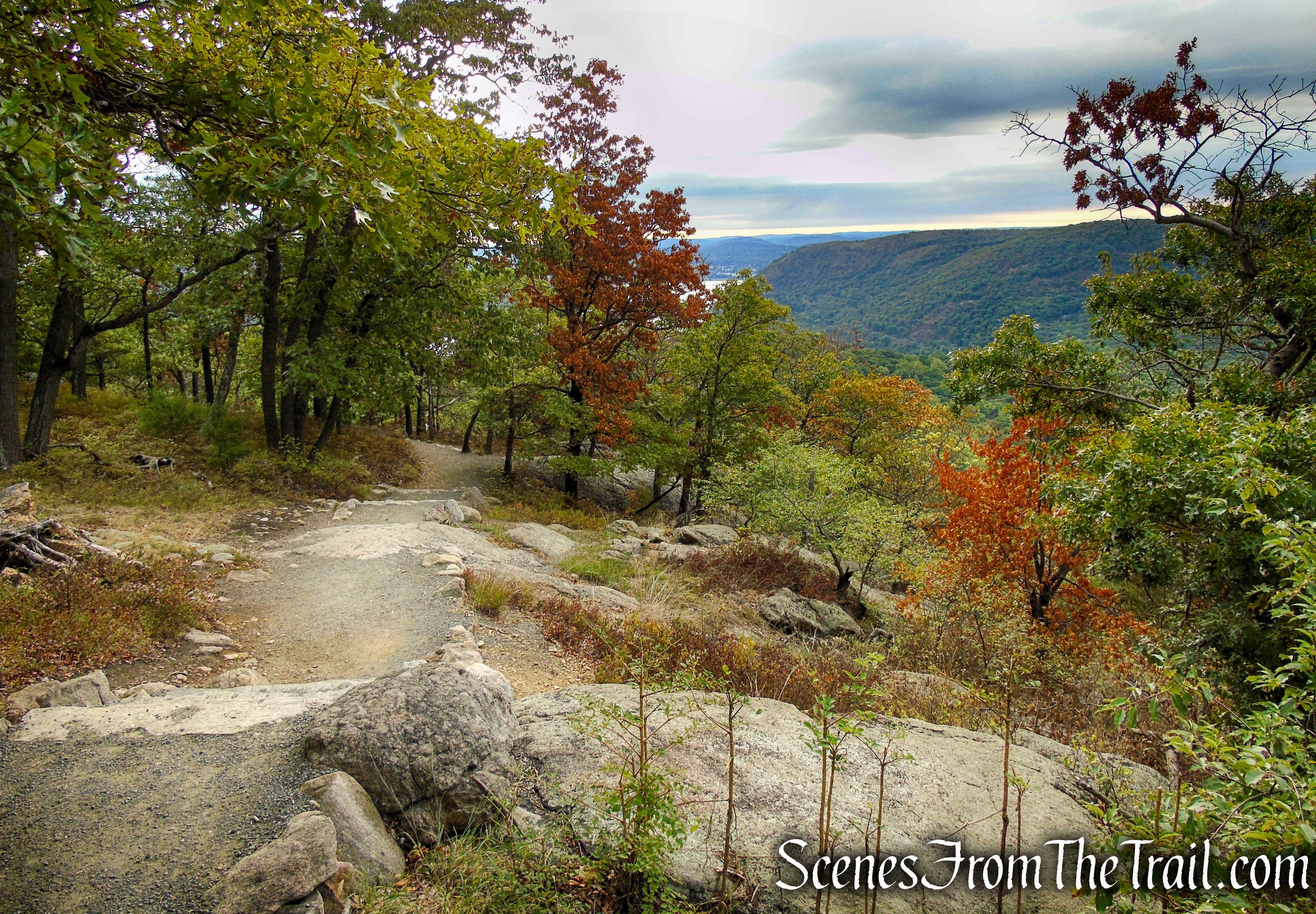
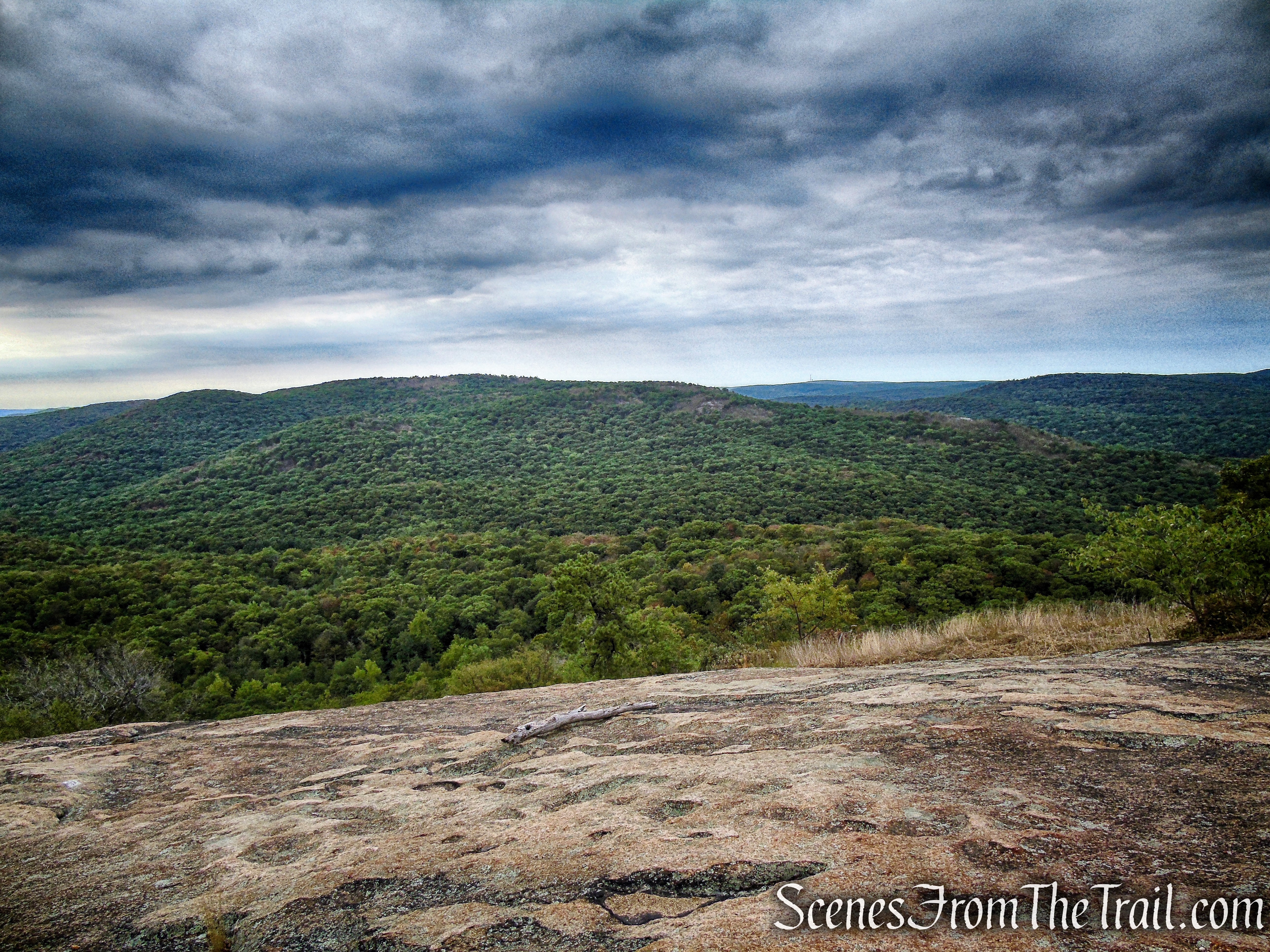
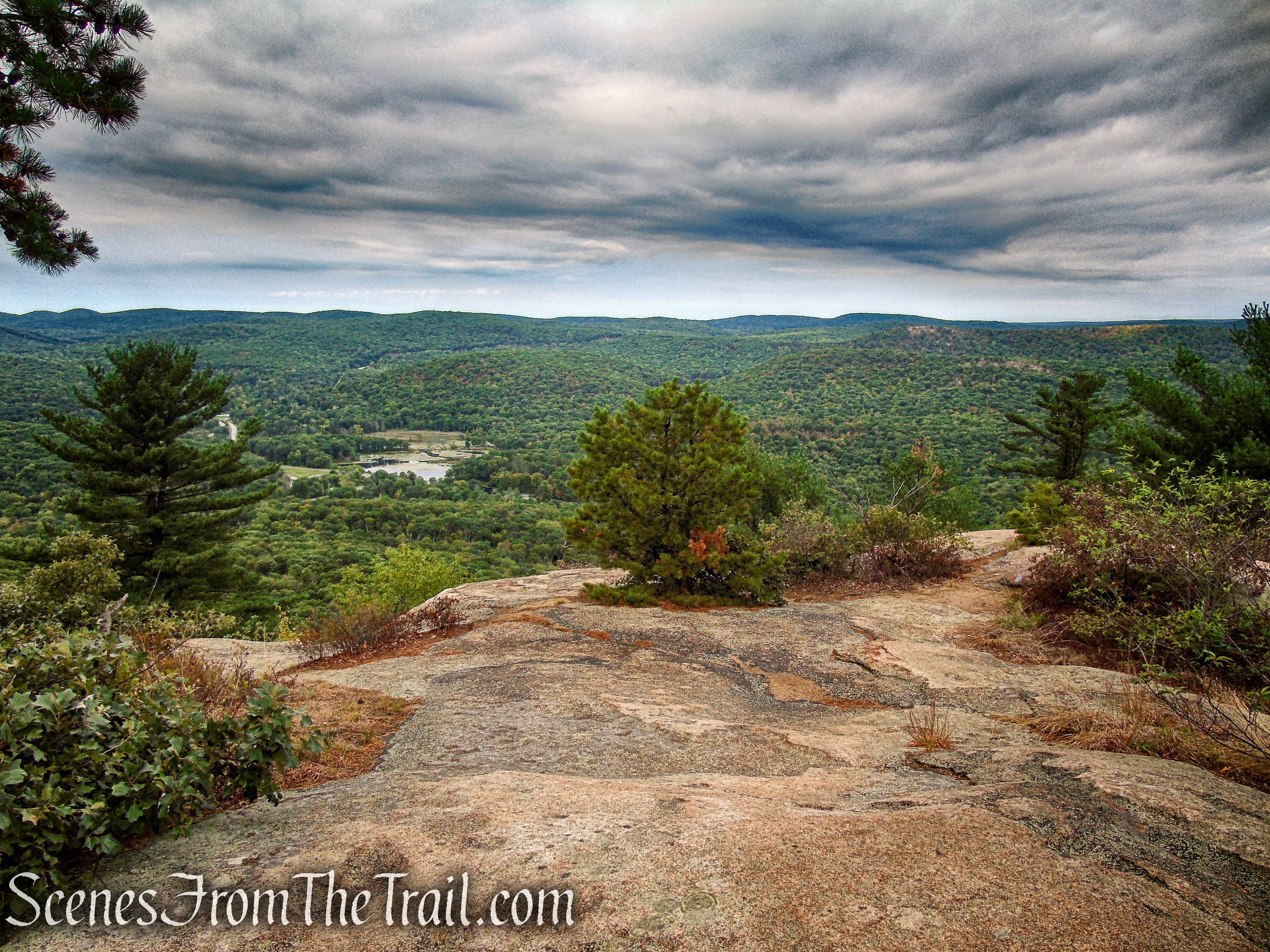
When you are ready to continue, just a few feet from the bench is the start of another blue-blazed trail at a south-facing viewpoint over West Mountain. Follow the blue blazes along this short, but picturesque spur trail. You will return back to the bench when you are done.
Appalachian Trail – Bear Mountain
Blue Spur Trail – Bear Mountain
Turn right and follow the blue-blazed side trail, which soon emerges on another rock outcrop, with excellent views to the west (Queensboro Lake may be seen below). This side trail follows a former route of the Major Welch Trail and was blazed by volunteers as a side trail to the A.T. to preserve the magnificent views.
Blue Spur Trail – Bear Mountain
Blue Spur Trail – Bear Mountain
Blue Spur Trail – Bear Mountain
Blue Spur Trail – Bear Mountain
Blue Spur Trail – Bear Mountain
Blue Spur Trail – Bear Mountain
Blue Spur Trail – Bear Mountain
Blue Spur Trail – Bear Mountain
In 500 feet, the side trail ends at a triple blaze. It looks like you could go a little farther, but we did not go much farther past the end of the trail.
Blue Spur Trail – Bear Mountain
Blue Spur Trail – Bear Mountain
Blue Spur Trail – Bear Mountain
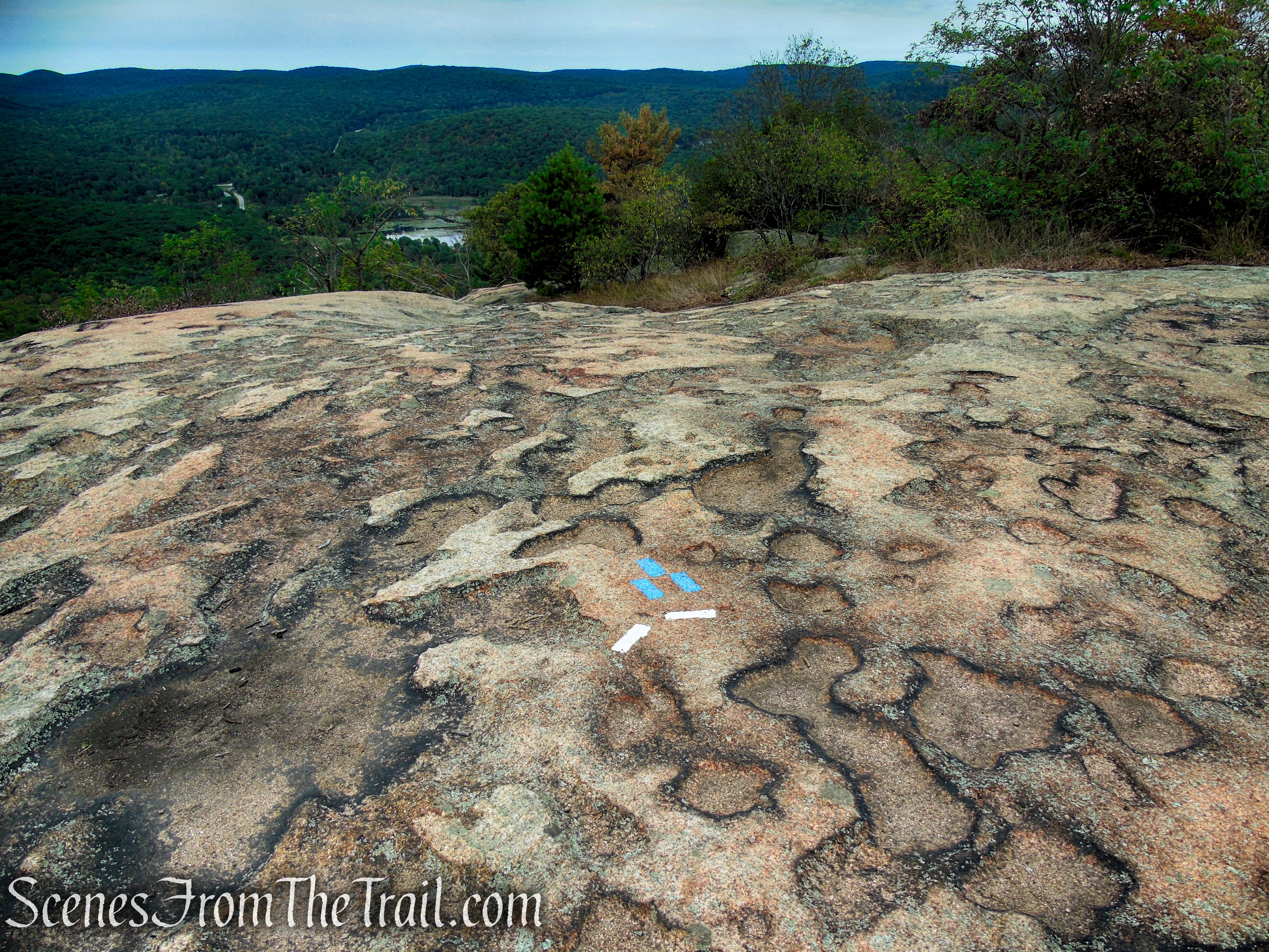
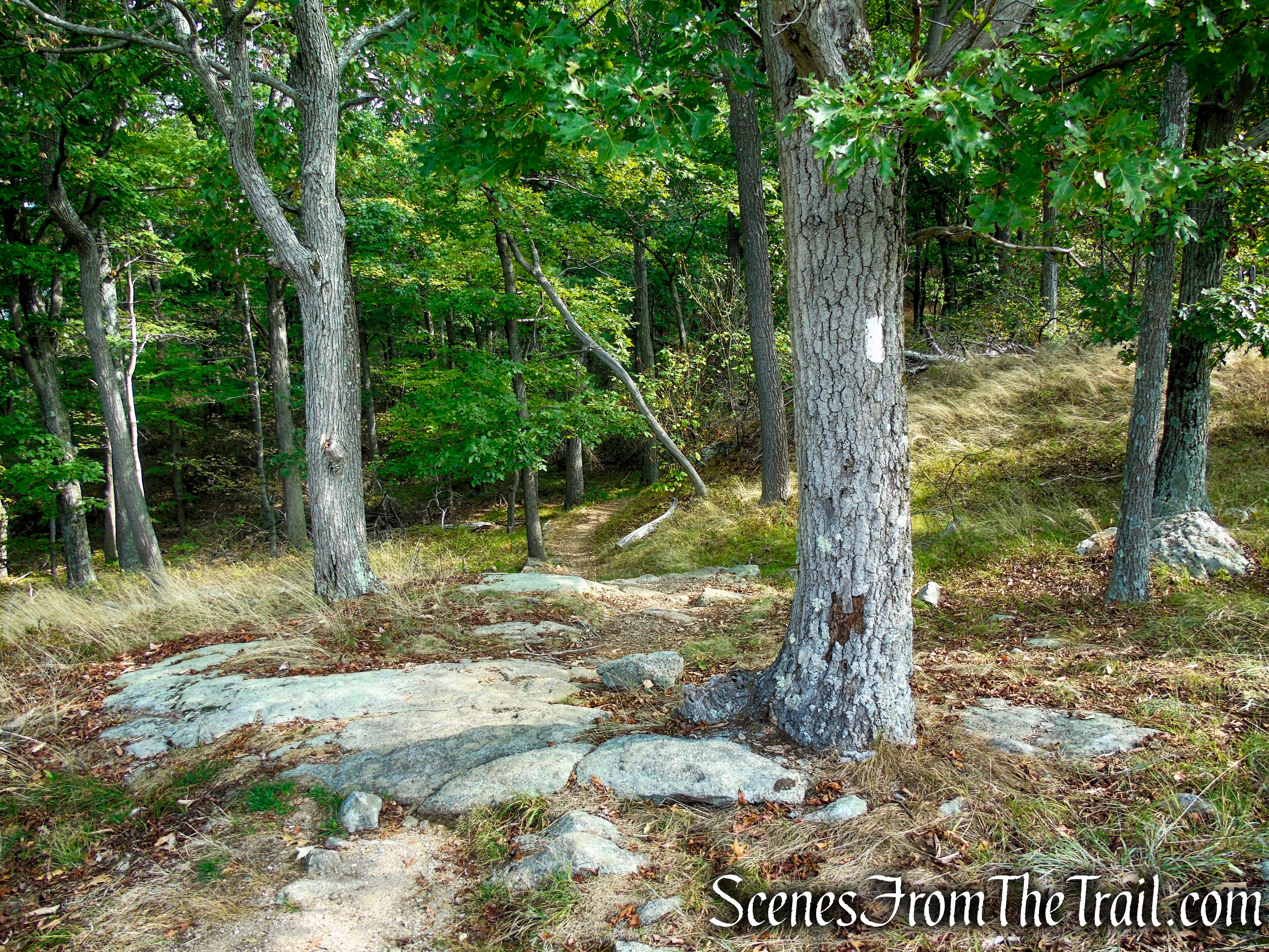
Retrace your steps to the A.T., then turn left and proceed along the A.T. as it heads northeast on a relatively level grade. When the AT reaches a junction with yet another blue-blazed trail, continue ahead following the white blazes. The Blue Trail can be used as a bailout option if one chooses. It ends at the parking area where the hike began. It is also a beautiful section of trail.

Blue Spur Trail – Bear Mountain
Appalachian Trail – Bear Mountain
Appalachian Trail – Bear Mountain
Appalachian Trail – Bear Mountain
Appalachian Trail – Bear Mountain
Appalachian Trail – Bear Mountain
This section of the A.T. features more stone steps, most of which were shaped on-site from native rock. Soon, you’ll pass two huge boulders to the right, with stone steps curving down from the end of the first boulder.
Appalachian Trail – Bear Mountain
Appalachian Trail – Bear Mountain
Appalachian Trail – Bear Mountain
Appalachian Trail – Bear Mountain
Appalachian Trail – Bear Mountain
Appalachian Trail – Bear Mountain
Appalachian Trail – Bear Mountain
As the trail reaches the northernmost section of the summit, you can see the damage from a brush fire that occurred in mid August of 2022.
Appalachian Trail – Bear Mountain
Appalachian Trail – Bear Mountain
After ascending stone steps, you’ll reach a spectacular north-facing viewpoint over the Hudson River and the hills of the West Point Military Reservation, with Brooks Lake visible directly below. Ahead, you will see a stone pillar that once marked the boundary between the park and West Point.

Appalachian Trail – Bear Mountain

Appalachian Trail – Bear Mountain
After ascending more stone steps, there is a bench and a viewing platform. This makes for a nice spot to take a break.
Appalachian Trail – Bear Mountain

Appalachian Trail – Bear Mountain
Appalachian Trail – Bear Mountain
The last third of a mile has been designed to be ADA compliant, thus permitting all users to enjoy a beautiful section of the A.T. Even this trail section has been skillfully designed to blend in with the surroundings.
Appalachian Trail – Bear Mountain
ADA Compliant Appalachian Trail – Bear Mountain
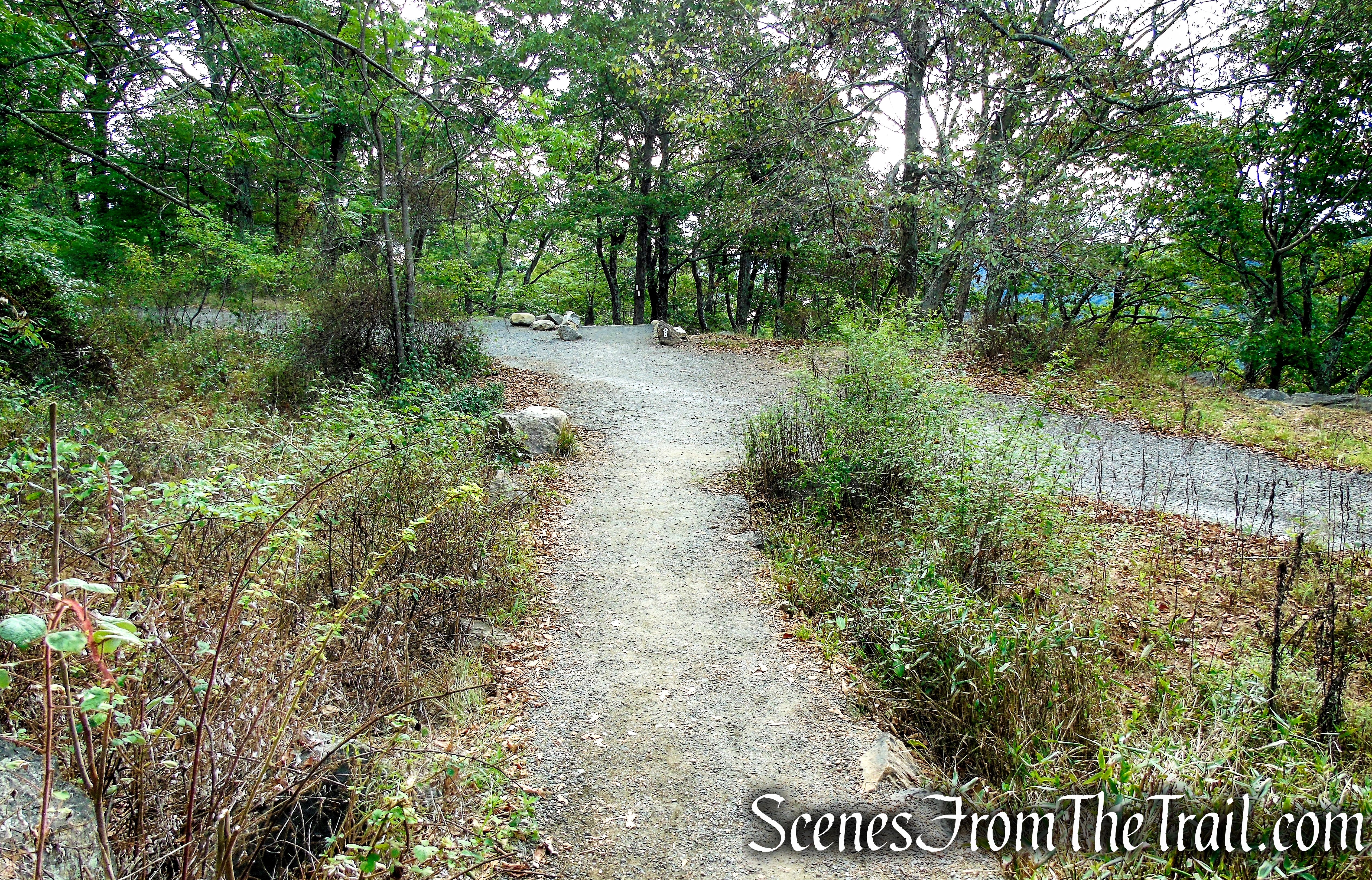
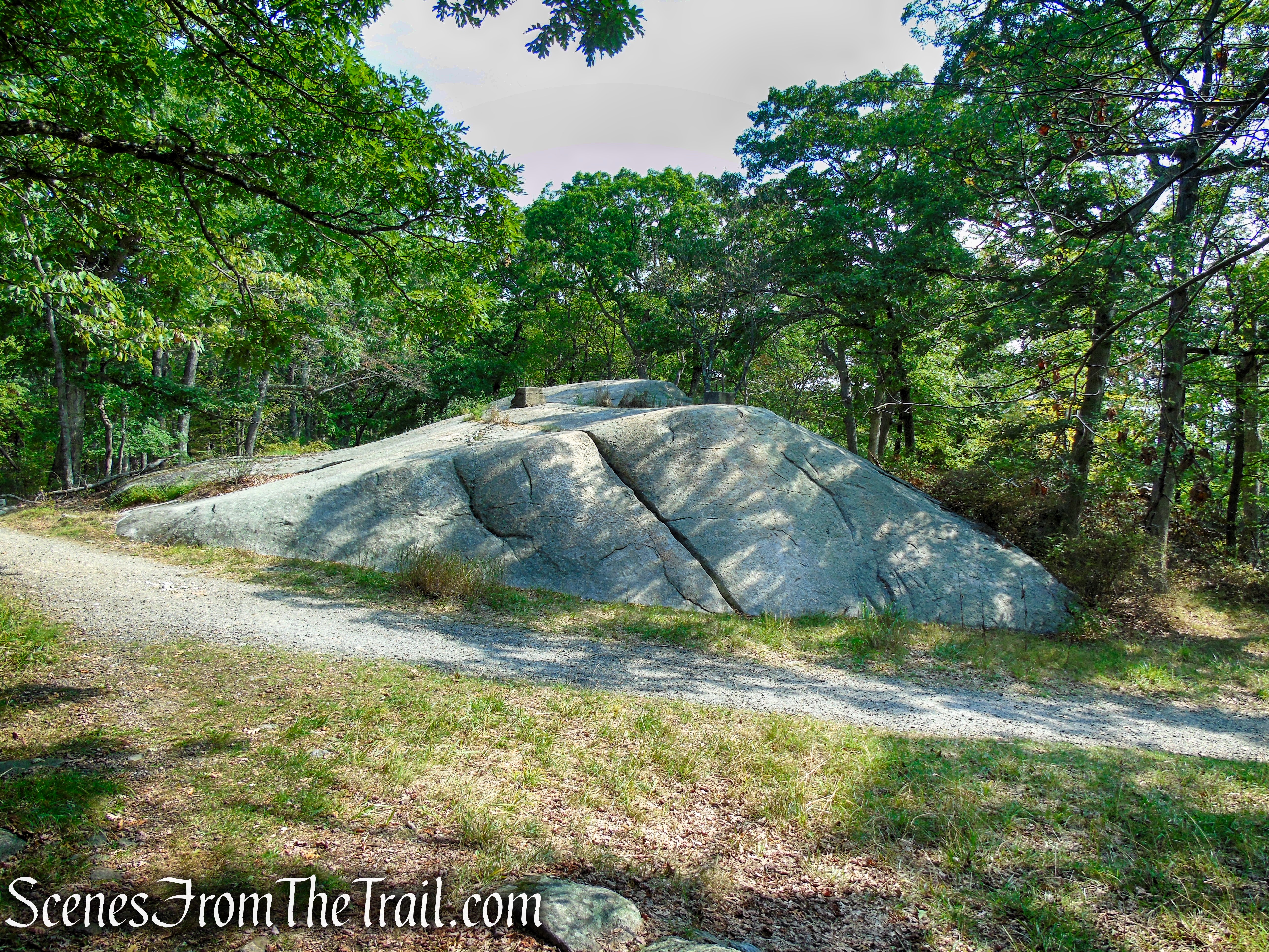
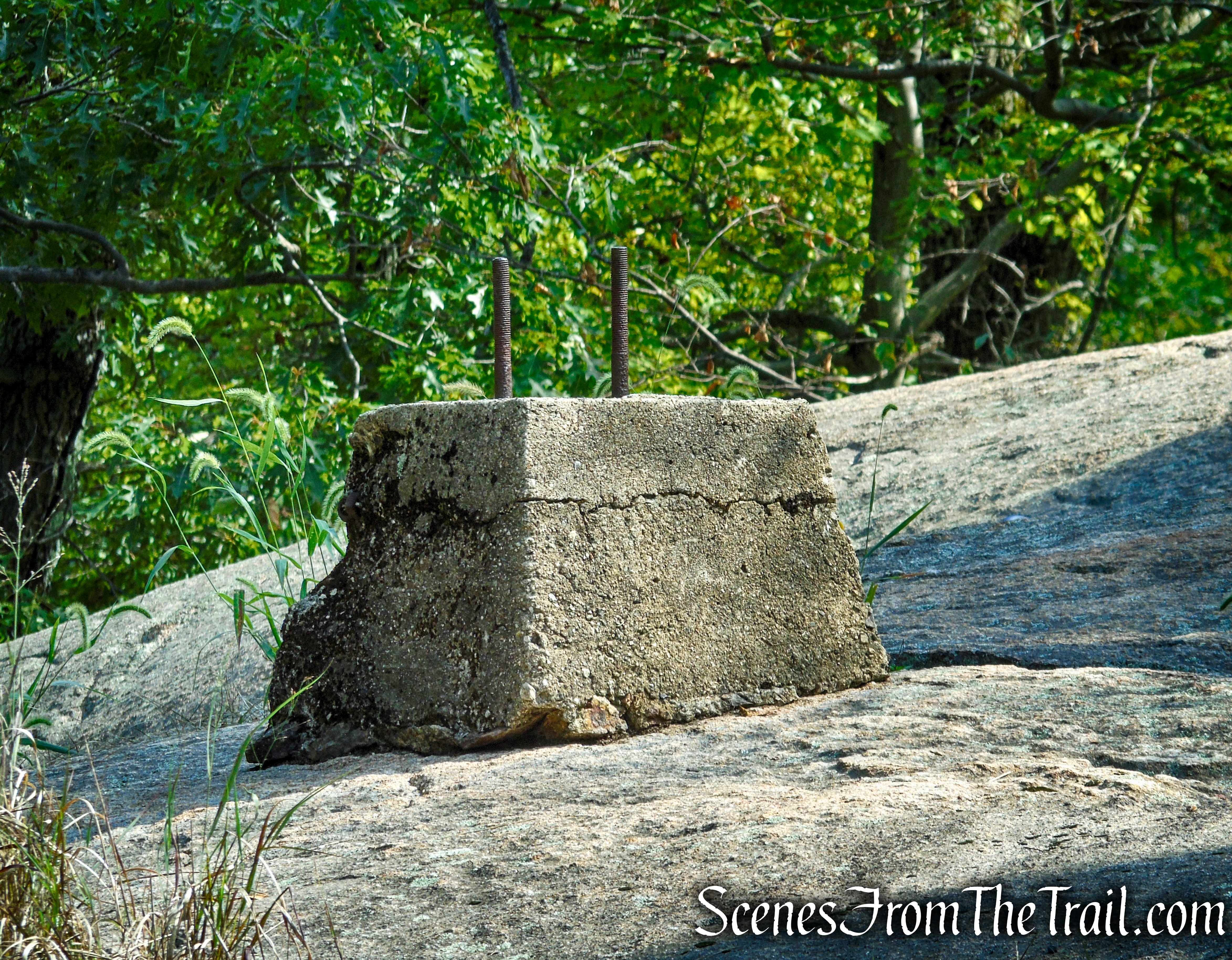
Continue following the white blazes along the well-graded gravel path which soon runs jointly with the Major Welch Trail, which comes in from the left. In a short distance, you’ll cross a gravel service road and pass a massive boulder on the left. Atop the boulder are the concrete foundations of a former fire tower (replaced in 1934 by the Perkins Memorial Tower).

ADA Compliant Appalachian Trail – Bear Mountain
ADA Compliant Appalachian Trail – Bear Mountain
ADA Compliant Appalachian Trail – Bear Mountain
ADA Compliant Appalachian Trail – Bear Mountain
ADA Compliant Appalachian Trail – Bear Mountain
Just beyond, the Appalachian Trail reaches the paved loop road around the summit, near Perkins Memorial Tower, where the hike began.
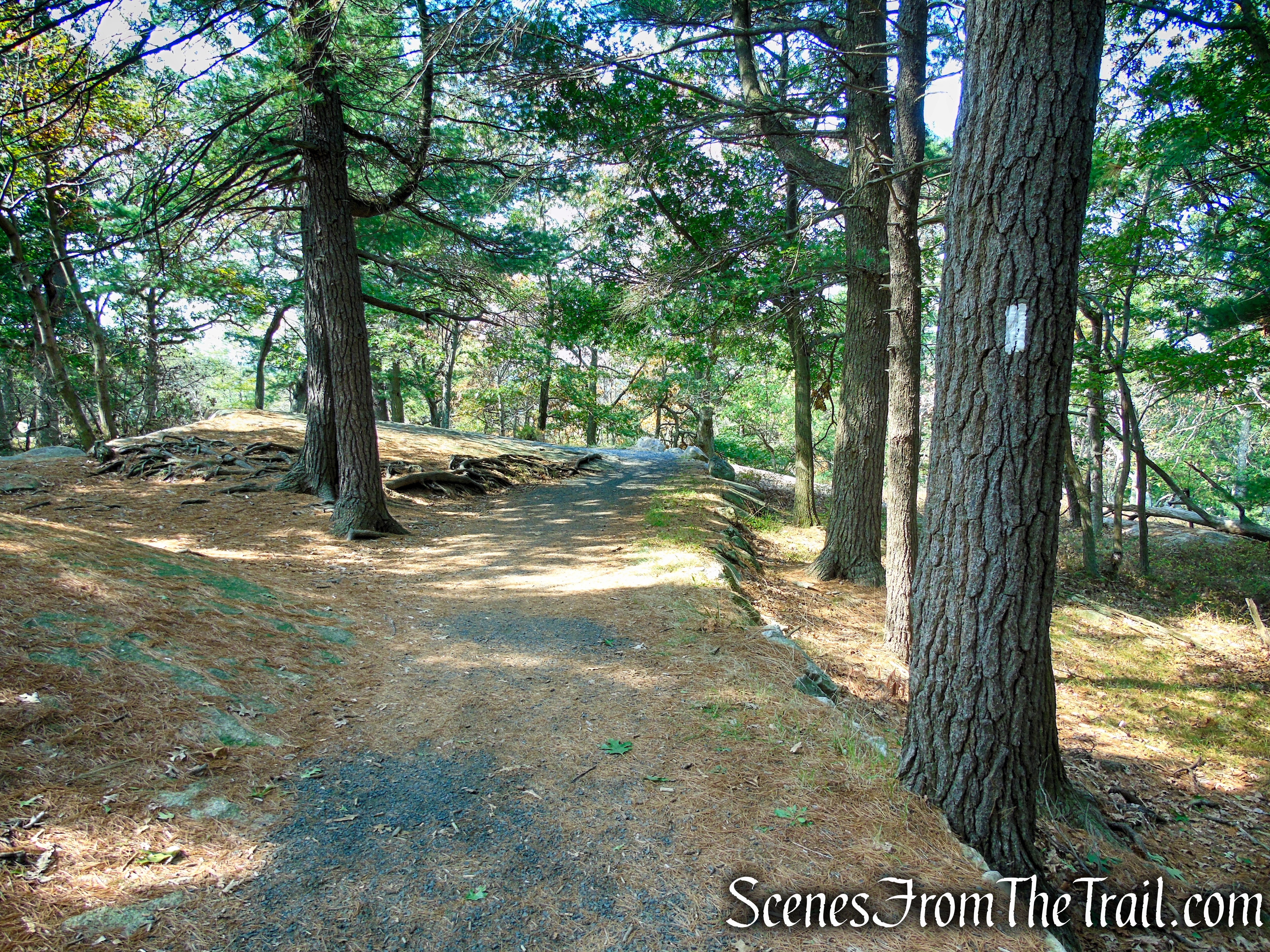
ADA Compliant Appalachian Trail – Bear Mountain
ADA Compliant Appalachian Trail – Bear Mountain
Review:
A splendid hike, short but very sweet. I highly recommend this hike. It has so much to offer. Views galore, massive boulders and erratics, and the stone steps are a masterpiece. My advice is to get there early before the crowds come. By 11:15am when we were done, there were quite a few people in the area around Perkins Tower. Not as many as I have seen in days past, but enough that we didn’t stay too long after the hike. Still, a really scenic hike that is doable by most.
Pros:
Views galore, Appalachian Trail, well marked trails, scenic landscape, full and portable restrooms, paved parking lot.
Cons:
The area around Perkins Memorial Tower can get really crowded on nice days.
Take a hike!

Bear Mountain Summit Loop
Sources:
- New York-New Jersey Trail Conference
- Bear Mountain State Park
- Bear Mountain Trails Project
- A brush fire damaged 5 acres at Bear Mountain
- Palisades Parks Conservancy
- Perkins Memorial Drive and Tower
- Perkins Memorial Drive and Tower Announcement
- Perkins Memorial Drive and Tower: An Analysis of Past, Present, and Future Development
- Perkins Memorial Drive and Tower pamphlet – 1934
- Perkins Highway to Top of Bear Mt. Being Built

Avoid the stone steps. Take the escalator which is coming soon.
LikeLike