May 16, 2020 – Cross River, NY
Difficulty: Moderate
Length: Approximately 5 miles
Max elevation: 605 ft. – total elevation gain: approximately 566 ft.
Route type: Circuit
Maps: Westchester Trails Map – Ward Pound Ridge Reservation Trail Map
Trailhead parking: Meadows Parking Lot – Cross River, NY 10518
Park Overview:
Ward Pound Ridge Reservation’s 4,700-acres, makes it the largest park in Westchester County. The hilly terrain is a mix of second-growth hardwood forest, hemlock, laurel, bold rock outcroppings, steep ravines, wetlands, and open meadows. With its varied terrain and landscapes, ranging from deep hollows to ridges 800 feet high, the park provides a variety of activities in all seasons. Brown, Rainbow and Brook trout inhabit the Cross River and Waccabuc River, which flow through the park. There are areas for picnicking, lean-to camping, fishing and cross-country skiing. It is managed by the Westchester County Department of Parks, Recreation and Conservation.
Ward Pound Ridge Reservation
History:
The name Pound Ridge (originally spelled “Poundridge”) is credited to the Indians who originally lived in the area. They had a local pound in which they kept game on the hoof until they needed it for food. The Indians built an enclosure of saplings driven into the ground and drove their game into the pound.
Originally part of Cortlandt Manor, the reservation was settled by farmers from Connecticut. The low stone walls that crisscross the forest floor indicate that more than thirty farms once existed within the park’s boundaries.
In 1925 Westchester County purchased over 4,000 acres of land in northern Pound Ridge and adjacent Lewisboro to create the Pound Ridge Reservation. The park was renamed the Ward-Pound Ridge Reservation in 1938 after the park planner and longtime Republican county leader William L. Ward. From 1933 to 1940 the Reservation was host to a Civilian Conservation Corp camp known variously as Camp SP-9, Camp No. 24 and Camp Merkel after the parks superintendent for Westchester County. The camp had about 200 enrollees at any one time. Workers improved roads and built bridges, planted trees and constructed shelters, picnic areas, walls, latrines and a museum.
Trails Overview:
There are 42 miles of wooded trails, mostly on the old farm roads that bisect the property. This gives hikers many options for either short strolls or longer and more rugged hikes.
North of Reservation Road, the Brown Trail offers a pleasant 3.8-mile walk along the Cross River. It is accessible from the picnic areas along Reservation Road.
The trails and junctions are well marked and easy to follow.
Hike Overview:
This hike loops around the northern section of the park and parallels the scenic Cross River upon returning. It is done clockwise and although there are many turns and junctions, it’s an easy hike to follow. All the junctions in this area of the park are marked with numbered signs. The links supplied above for the trail maps have the corresponding junction numbers as well.

Northern Loop – Ward Pound Ridge Reservation
Helpful Hint: My advice is to print out the trail map (always carry a paper map) and download the Avenza Maps app (FREE). You can then download the free Ward Pound Ridge Reservation Trails Map through the app or purchase the NY-NJ Trail Conference Map for Avenza (more detailed), which can be purchased as a set or just a single map. This will tell you exactly where you are on the trail and you can record your track and mileage. I have found that this is a great resource when hiking on unfamiliar trails and helps avoids wrong turns and missing points of interest.
The Hike:
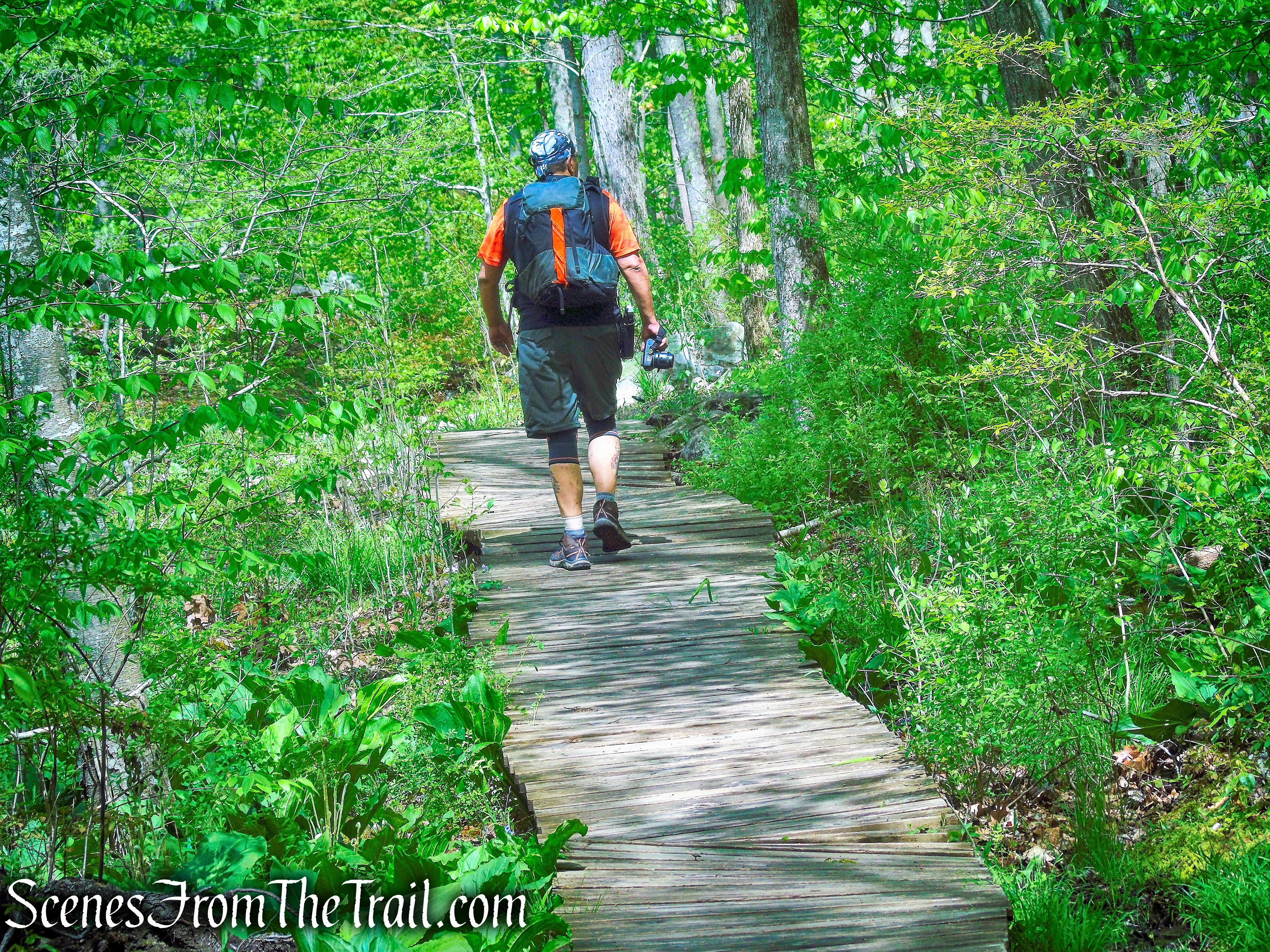
From the kiosk at the northwest corner of the parking area, proceed north on a wide path, following the Fox Hill Trail, marked with “FH” blazes. After crossing a wet area on a boardwalk and a stream on a bridge, the trail continues between stone walls. When the “FH” blazes turn right, continue ahead and cross a bridge over the Cross River. Just beyond, you’ll reach junction 1, where you turn left onto the Brown Trail.

Fox Hill Trail – Ward Pound Ridge Reservation
Fox Hill Trail – Ward Pound Ridge Reservation
Fox Hill Trail – Ward Pound Ridge Reservation
Fox Hill Trail – Ward Pound Ridge Reservation
bridge over the Cross River
bridge over the Cross River
Cross River – Ward Pound Ridge Reservation
Brown Trail – Ward Pound Ridge Reservation
Brown Trail – Ward Pound Ridge Reservation
At junction 46, turn right and follow the Brown Trail uphill on a wide woods road. The trail levels off, then resumes its climb. When you reach the top of the climb at junction 45, bear right to continue along the Brown Trail, which now descends. After traversing a relatively level section, the trail climbs steadily.
Brown Trail – Ward Pound Ridge Reservation
Brown Trail – Ward Pound Ridge Reservation
Brown Trail – Ward Pound Ridge Reservation
Brown Trail – Ward Pound Ridge Reservation
Brown Trail – Ward Pound Ridge Reservation
bear right at junction 45
Brown Trail – Ward Pound Ridge Reservation
Brown Trail – Ward Pound Ridge Reservation
Continue ahead at junction 44, where another road joins from the left. Just ahead, at junction 5 (marked by a cairn on a stump), turn left, leaving the Brown Trail, and follow the Deer Hollow Trail, marked with “DH” blazes. This trail follows along the hillside, with Deer Hollow below on the right.

Brown Trail – Ward Pound Ridge Reservation

turn left at junction 5
Deer Hollow Trail – Ward Pound Ridge Reservation

Deer Hollow Trail – Ward Pound Ridge Reservation
In a quarter mile, the Deer Hollow Trail begins to descend, passing a trail register on the right (please sign) and a blue trail on the left that leads into the Lewisboro Town Park. At the base of the descent, it crosses an intermittent stream, then climbs again, passing a yellow trail on the left. From the crest of the rise, the trail descends steeply, then more gradually. It soon begins to parallel a stream on the right and passes the start of another blue trail on the left.

Deer Hollow Trail – Ward Pound Ridge Reservation
Deer Hollow Trail – Ward Pound Ridge Reservation
Deer Hollow Trail – Ward Pound Ridge Reservation
Deer Hollow Trail – Ward Pound Ridge Reservation
Deer Hollow Trail – Ward Pound Ridge Reservation
Deer Hollow Trail – Ward Pound Ridge Reservation
Deer Hollow Trail – Ward Pound Ridge Reservation
Deer Hollow Trail – Ward Pound Ridge Reservation

Deer Hollow Trail – Ward Pound Ridge Reservation
After passing a fenced-off horse farm, with Route 35 visible in the distance, the trail crosses a stream, goes through a gap in a stone wall, and passes a wetland on the left. At junction 40, a white-blazed trail comes in from the right, but you should continue ahead on the Deer Hollow Trail.
Deer Hollow Trail – Ward Pound Ridge Reservation
Deer Hollow Trail – Ward Pound Ridge Reservation
Deer Hollow Trail – Ward Pound Ridge Reservation
Deer Hollow Trail – Ward Pound Ridge Reservation
Deer Hollow Trail – Ward Pound Ridge Reservation
The trail now follows a relatively level route, with some minor ups and downs. It passes rock outcrops to the right, continues to parallel the wetland on the left, and goes through an area with thick barberry bushes. After paralleling a stone wall for some distance, it climbs a little, then makes a short, steep descent. You are now about a quarter mile from Route 124, which may be heard and seen through the trees.
Deer Hollow Trail – Ward Pound Ridge Reservation

Deer Hollow Trail – Ward Pound Ridge Reservation
Deer Hollow Trail – Ward Pound Ridge Reservation
Soon, the trail begins to climb, passing more rock outcrops on the right. When it reaches a point where the road ahead is badly eroded, the trail bears right and continues on a footpath. It turns sharply right, rejoins the road, and soon bends left to reach junction 8.
Deer Hollow Trail – Ward Pound Ridge Reservation

Deer Hollow Trail – Ward Pound Ridge Reservation

Deer Hollow Trail – Ward Pound Ridge Reservation

Deer Hollow Trail – Ward Pound Ridge Reservation
Deer Hollow Trail – Ward Pound Ridge Reservation
Deer Hollow Trail – Ward Pound Ridge Reservation
Deer Hollow Trail – Ward Pound Ridge Reservation

Deer Hollow Trail – Ward Pound Ridge Reservation

Deer Hollow Trail – Ward Pound Ridge Reservation

Deer Hollow Trail – Ward Pound Ridge Reservation
Deer Hollow Trail – Ward Pound Ridge Reservation

Deer Hollow Trail – Ward Pound Ridge Reservation
Deer Hollow Trail – Ward Pound Ridge Reservation
Deer Hollow Trail – Ward Pound Ridge Reservation

Deer Hollow Trail – Ward Pound Ridge Reservation

Deer Hollow Trail – Ward Pound Ridge Reservation

Deer Hollow Trail – Ward Pound Ridge Reservation
Here, you should turn right onto a white-blazed trail and follow it for a third of a mile to junction 7, passing large rock formations on both sides of the trail.

turn right at junction 8
turn right at junction 8

White Trail – Ward Pound Ridge Reservation

White Trail – Ward Pound Ridge Reservation
White Trail – Ward Pound Ridge Reservation
White Trail – Ward Pound Ridge Reservation
White Trail – Ward Pound Ridge Reservation
Turn left at junction 7 onto the Brown Trail, which soon descends – first steeply, then more gradually. At junction 3, turn right, briefly rejoining the Deer Hollow Trail, but when the two trails diverge (at a sign for junction marker 42), bear left to stay on the Brown Trail, which descends to cross a wet area on a wide boardwalk.

turn left at junction 7
Brown Trail – Ward Pound Ridge Reservation
Brown Trail – Ward Pound Ridge Reservation
Brown Trail – Ward Pound Ridge Reservation

turn right at junction 3
turn right at junction 3
turn right at junction 3
take left fork to remain on Brown Trail

take left fork to remain on Brown Trail

Brown Trail – Ward Pound Ridge Reservation
For the next three-quarters of a mile, the Brown Trail follows a woods road along the Cross River, below on the left (to avoid several wet sections, it detours slightly to the right). This is a particularly scenic section, with the trail paralleling the cascading stream. Most of the way, the trail is elevated above the stream, but it dips down in places to approach the stream.
Brown Trail – Ward Pound Ridge Reservation
Brown Trail – Ward Pound Ridge Reservation

Brown Trail – Ward Pound Ridge Reservation

Cross River – Ward Pound Ridge Reservation

Brown Trail – Ward Pound Ridge Reservation

Brown Trail – Ward Pound Ridge Reservation

Cross River – Ward Pound Ridge Reservation
Cross River – Ward Pound Ridge Reservation
Brown Trail – Ward Pound Ridge Reservation
Brown Trail – Ward Pound Ridge Reservation
Brown Trail – Ward Pound Ridge Reservation
Brown Trail – Ward Pound Ridge Reservation

Cross River – Ward Pound Ridge Reservation
Brown Trail – Ward Pound Ridge Reservation

Cross River – Ward Pound Ridge Reservation
When you reach junction 2, turn left, cross the bridge over the river, then immediately turn right to proceed west on the Fox Hill Trail, which continues to parallel the stream. After passing high above the stream, below on the right, the trail goes by a playground and picnic area on the left. A short distance beyond, the Fox Hill Trail reaches another bridge over the river. Turn left (do not cross the bridge) and retrace your steps on the Fox Hill Trail back to the parking area.
turn left and cross the bridge over the river

cross the bridge over the river
Cross River – Ward Pound Ridge Reservation
Fox Hill Trail – Ward Pound Ridge Reservation
Fox Hill Trail – Ward Pound Ridge Reservation

Fox Hill Trail – Ward Pound Ridge Reservation
Fox Hill Trail – Ward Pound Ridge Reservation
turn left to remain on Fox Hill Trail
Meadows Parking Lot – Ward Pound Ridge Reservation
Review:
This is a really good hike through scenic woods with interesting rock formations. With many of the popular trails being overcrowded as of late, this is a good spot to avoid the masses. we began the hike about 8:30 am on a Saturday morning and only encountered the occasional jogger until we were walking along the Cross River, near the end of the hike, at about 11:30 am. There are no hilltop views on this hike, but if you are looking for a relaxing walk in the woods, this is worth doing.
Pros:
Cross River, rock formations, well marked trails.
Cons:
Some road noise can be heard on Deer Hollow Trail.
Take a hike!
Northern Loop – Ward Pound Ridge Reservation
Sources:
- New York-New Jersey Trail Conference
- Westchester County Department of Parks
- Lewisboro Parks and Recreation
- History of Pound Ridge
.

Great detail. Thank you,Ed
LikeLiked by 1 person