May 10, 2020 – New Rochelle, NY
Difficulty: Easy
Length: Approximately 2.5 miles
Max elevation: 163 ft. – total elevation gain: approximately 100 ft.
Route type: Lollipop Loop
Map: Larchmont Reservoir Trail Map
Trailhead parking: Pinebrook Tennis Center – 1-99 Albert Leonard Place, New Rochelle, NY 10804
Overview:
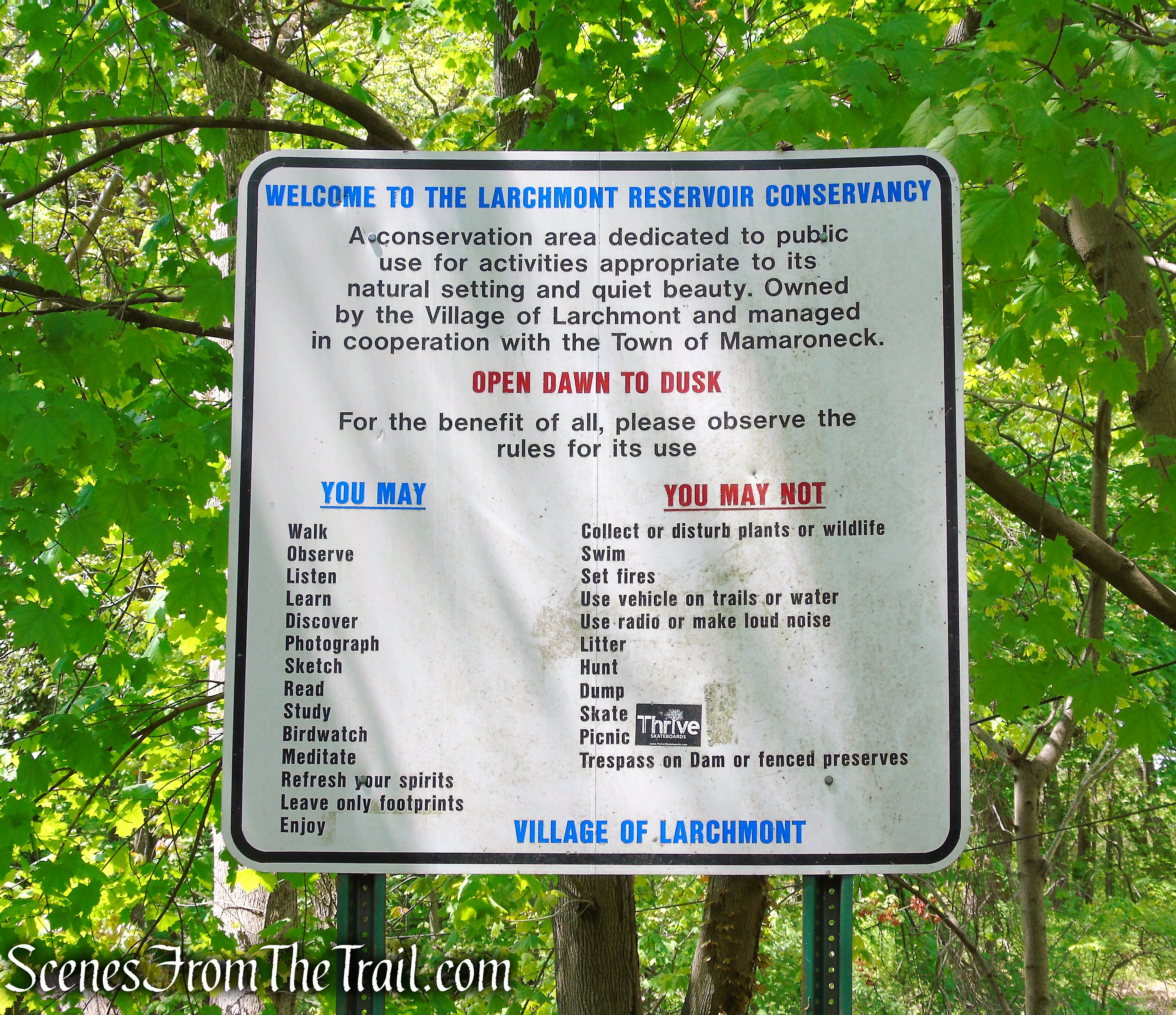
The Larchmont Reservoir (James G. Johnson, Jr. Conservancy) is a 60-acre wildlife sanctuary and nature study area with lakeside trails and quiet woodland paths. The entire Conservancy is owned by the Village of Larchmont although 12.76 acres lies within the Town of Mamaroneck and the rest within the City of New Rochelle. The property is maintained and managed by the Town of Mamaroneck under Village of Larchmont supervision and in cooperation with the City of New Rochelle. The property is open daily from dawn to dusk.
Larchmont Reservoir
The Mamaroneck Environmental Resource Center, located adjacent to the Reservoir, houses the Sheldrake Environmental Center and the Monroe summer camp. The Sheldrake Environmental Center offers nature programs for adults and children throughout the year.
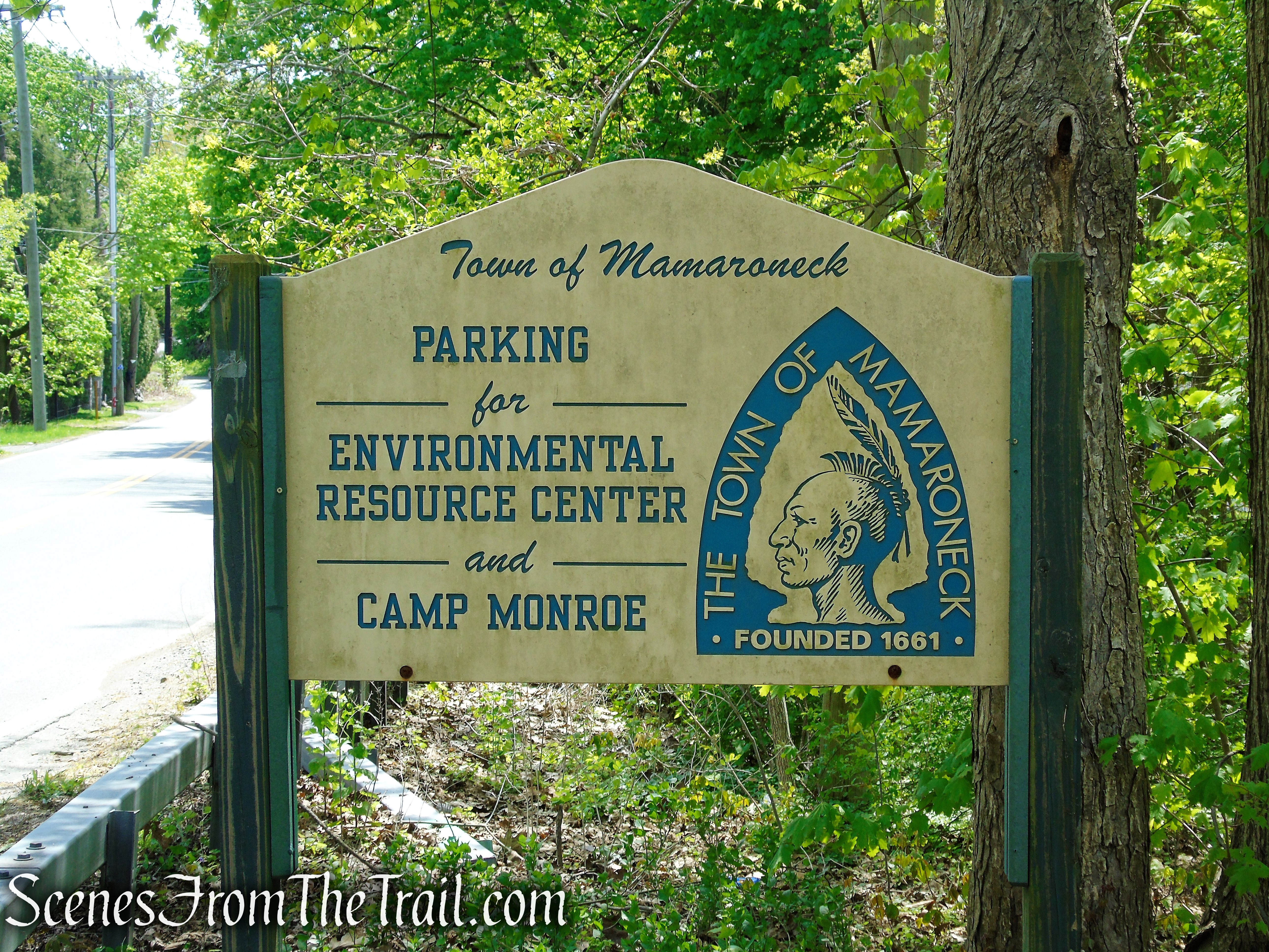
Mamaroneck Environmental Resource Center
There are several parking areas that can be used to access the trails at the reservoir.
- Sheldrake Environmental Center – 685 Weaver St, Larchmont, NY 10538
- 99-83 Dennis Drive, New Rochelle, NY 10804 – At the end of cul-de-sac
- Pinebrook Tennis Center – 1-99 Albert Leonard Place, New Rochelle, NY 10804
My recommendation is to park at the Pinebrook Tennis Center which has a larger parking lot than the others.
History:
Larchmont Reservoir is actually two bodies of water that are separated by a dam and spillway. The upper reservoir is known as Sheldrake Lake and the lower reservoir as Goodliffe Pond.
It is believed that traces of post-Revolutionary building sites remain on the Mamaroneck side of the Larchmont Reservoir property. Three quarry sites have also been identified at the Reservoir property. In addition, the Reservoir was the site of a saw mill, grist mill and ice-harvesting business.
The reservoir was created in the 18th century to harness water power for mills along the Sheldrake River. A saw mill and a grist mill were built in the 1750’s and by 1800, a cotton mill was operating there as well. In 1876, John T. Goodliffe constructed a dam to create a pond for his ice business. In the 1880’s, the Larchmont Water Company purchased the the pond for use as a water source.
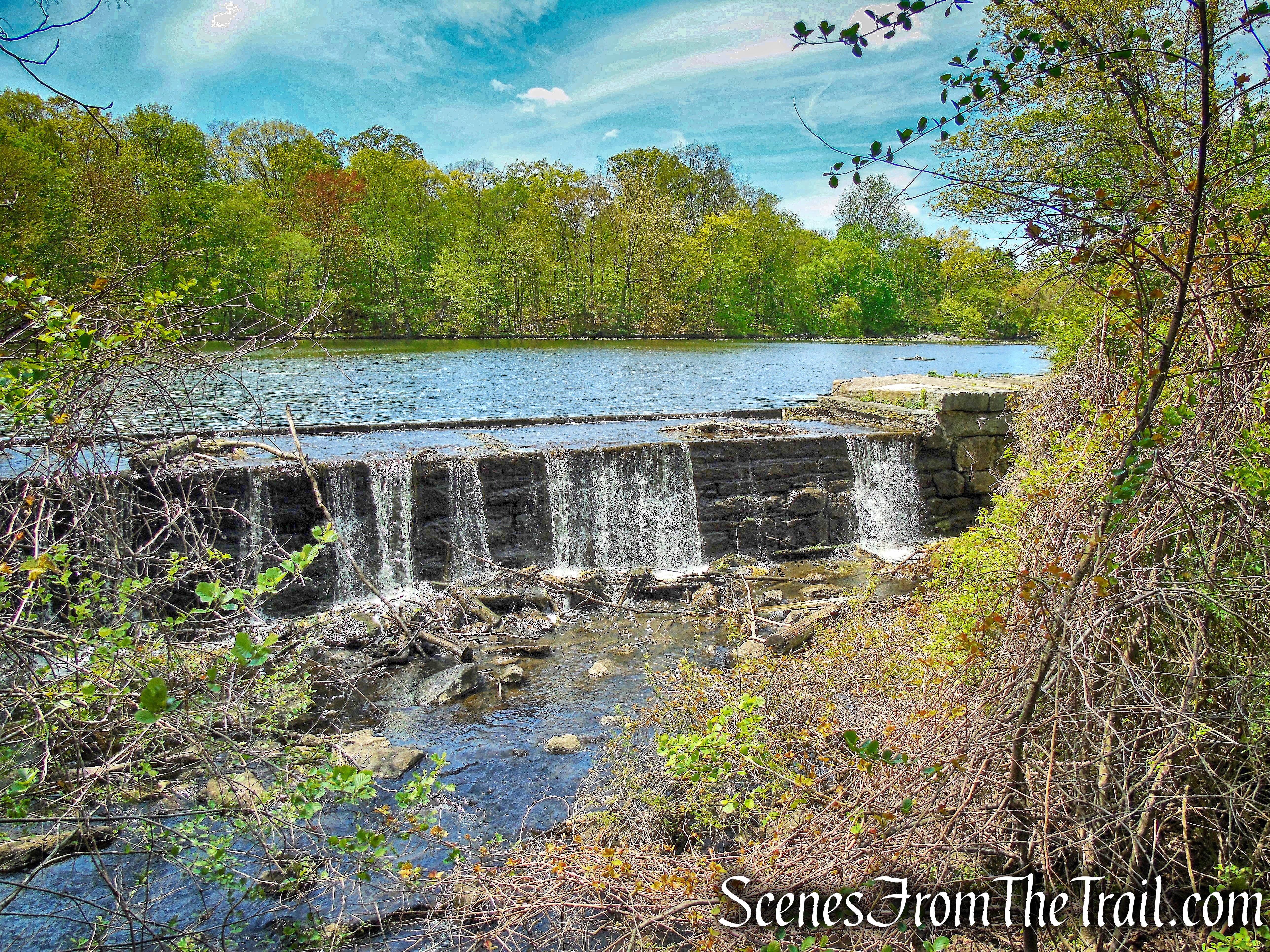
Goodliffe Pond dam – Larchmont Reservoir
Flood control of the Sheldrake River and the increased demand for drinking water resulted in construction of a dam to create what is now Sheldrake Lake. The original dam was completed in 1903 and in 1934, the original masonry dam was capped with concrete to raise the crest an additional 5 feet.

Sheldrake Lake dam – Larchmont Reservoir
The reservoir ceased being the source of Larchmont’s drinking water in 1975, when the village discovered that it was less expensive to connect to New York City’s Aqueduct system (a blend of the Catskill and Delaware watersheds). It was then maintained as a conservation area and flood control facility. Even though the reservoir was closed to the public, walkers and birders continued to use the site. Since the the property is physically removed from the village, Larchmont wanted to sell it.

Larchmont Reservoir
James G. Johnson Jr. (1915 – 2011) an environmental activist and namesake of the James G. Johnson Conservancy at the Larchmont Reservoir, served as president of Friends of the Reservoir Inc., a conservation group that led the efforts to preserve the Larchmont Reservoir. In October 1984, this property was dedicated in perpetuity by the Village of Larchmont for specified public purposes including conservation, nature study, wildlife preserve, flood control, standby water supply, and environmental and historical education.

James G. Johnson Conservancy at the Larchmont Reservoir
In 1993, the National Institute for Urban Wildlife certified the Larchmont Reservoir as an “Urban Wildlife Sanctuary.”
Beginning in the early 1980’s, Friends of the Reservoir, a local nonprofit organization, exercised a stewardship role in the Conservancy, helping to develop and maintain its walking trails and buildings in cooperation with the Town of Mamaroneck and the Village of Larchmont, and producing, together with the L.I.F.E. Center, educational events and entertainments there. These functions were taken over in 2001 by the newly formed Sheldrake Environmental Center, created by a merger between the L.I.F.E. Center and Friends of the Reservoir.
Hike & Trails Overview:
Co-aligned trails are the name of the game at Larchmont Reservoir. The Colonial Greenway (blue with white stars) is co-aligned with three different trails as it goes through the park. This 15-mile unpaved trail loop system links numerous open spaces and spans five municipalities, utilizing the Hutchinson River Pathway and the Leatherstocking Trail, as well as existing trail systems within the County and local parks and nature preserves.
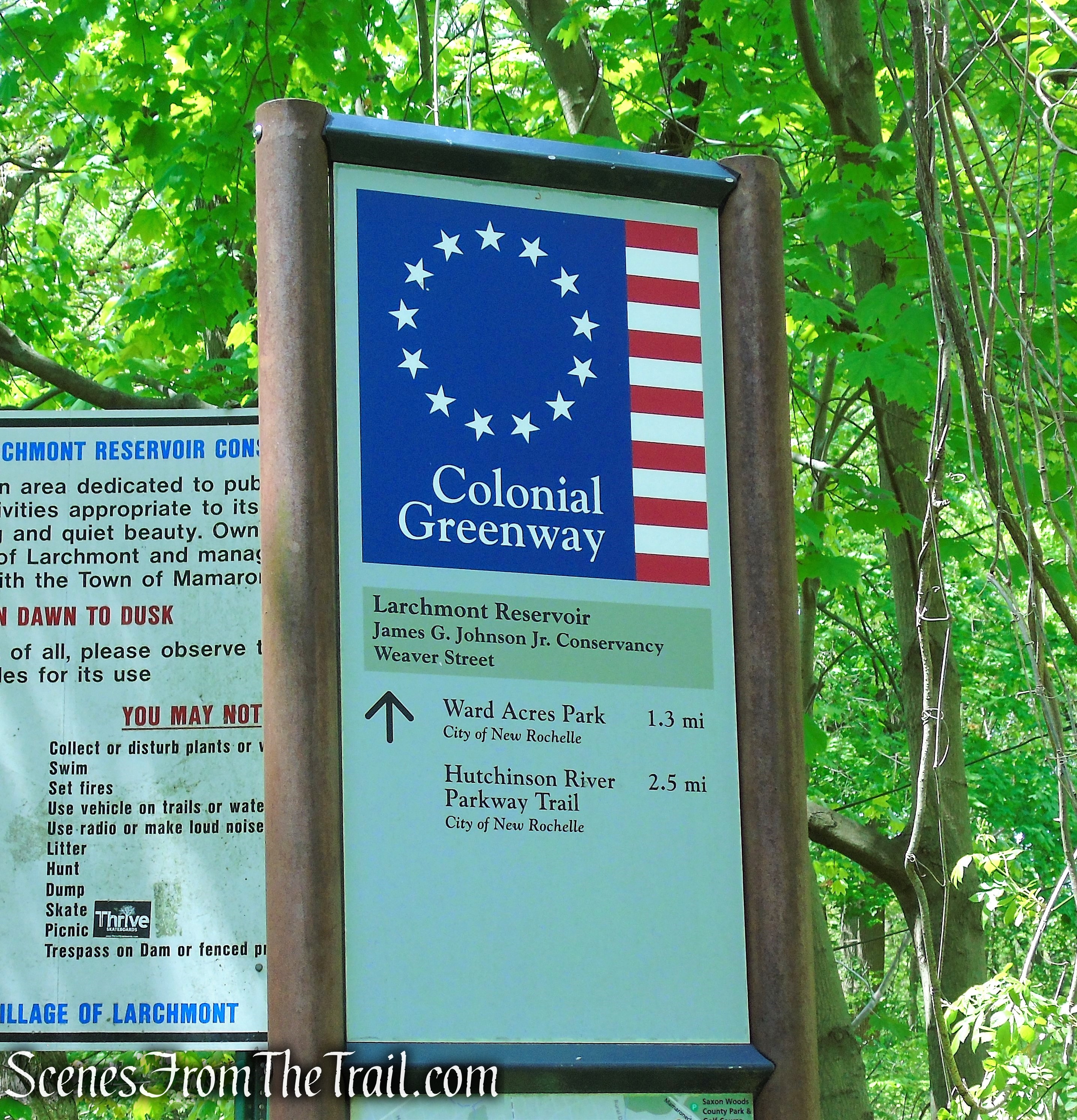
Colonial Greenway – Larchmont Reservoir
Although the numerous blazed trails and unmarked paths that bisect the property can be daunting, it’s really not very difficult to find your way around. Rule of thumb is to stay on the trails that are close to the shoreline of the lake and pond, and you can’t go wrong. After all, even though the woods are scenic, the real views are along the water.
Please note: A loop around the entire property (approximately 2.35 miles) can be done utilizing the streets from Dennis Drive to the Pinebrook Tennis Center (see inset on map).
This 2.5 mile hike begins at the Pinebrook Tennis Center (far left on the map) and winds its way through the woods, following the contour of Sheldrake Lake. When the trail reaches the southern end of the Sheldrake Lake dam, we turned right and followed the trail around Goodliffe Pond to the northern end of the Sheldrake Lake dam. From there we walked along the eastern side of the lake to its northern point, crossing a long wooden boardwalk. Where the Colonial Greenway Trail makes a sharp left uphill to Dennis Drive, we turned around and made our way back.
Larchmont Reservoir Trail Map
The Hike:
From the east end of the Pinebrook Tennis Center, proceed past the kiosk for the James G. Johnson, Jr. Conservancy. Follow the sign that reads “Upper Trail.” Proceed past the tennis courts that are on the right, and towards the woods. Climb the steps and follow the red-triangle-on-white blazes.

Pinebrook Tennis Center

Pinebrook Tennis Center Trailhead
Upper Trail – Larchmont Reservoir
Pay careful attention to the blazes at the start of the hike as there is a myriad of unmarked trails in this area. The trail heads northeast at first, turns right, heading in a southerly direction and soon descends.
Upper Trail – Larchmont Reservoir
A Scarlet Tanager spotted along the Upper Trail.

Upper Trail – Larchmont Reservoir
An unmarked footpath on the left affords views of Sheldrake Lake and the dam.

Upper Trail – Larchmont Reservoir

Upper Trail – Larchmont Reservoir
Upper Trail – Larchmont Reservoir
The trail ascends slightly then descends again to the southern end of Sheldrake Lake.

Upper Trail – Larchmont Reservoir
Upper Trail – Larchmont Reservoir

southern end of Sheldrake Lake
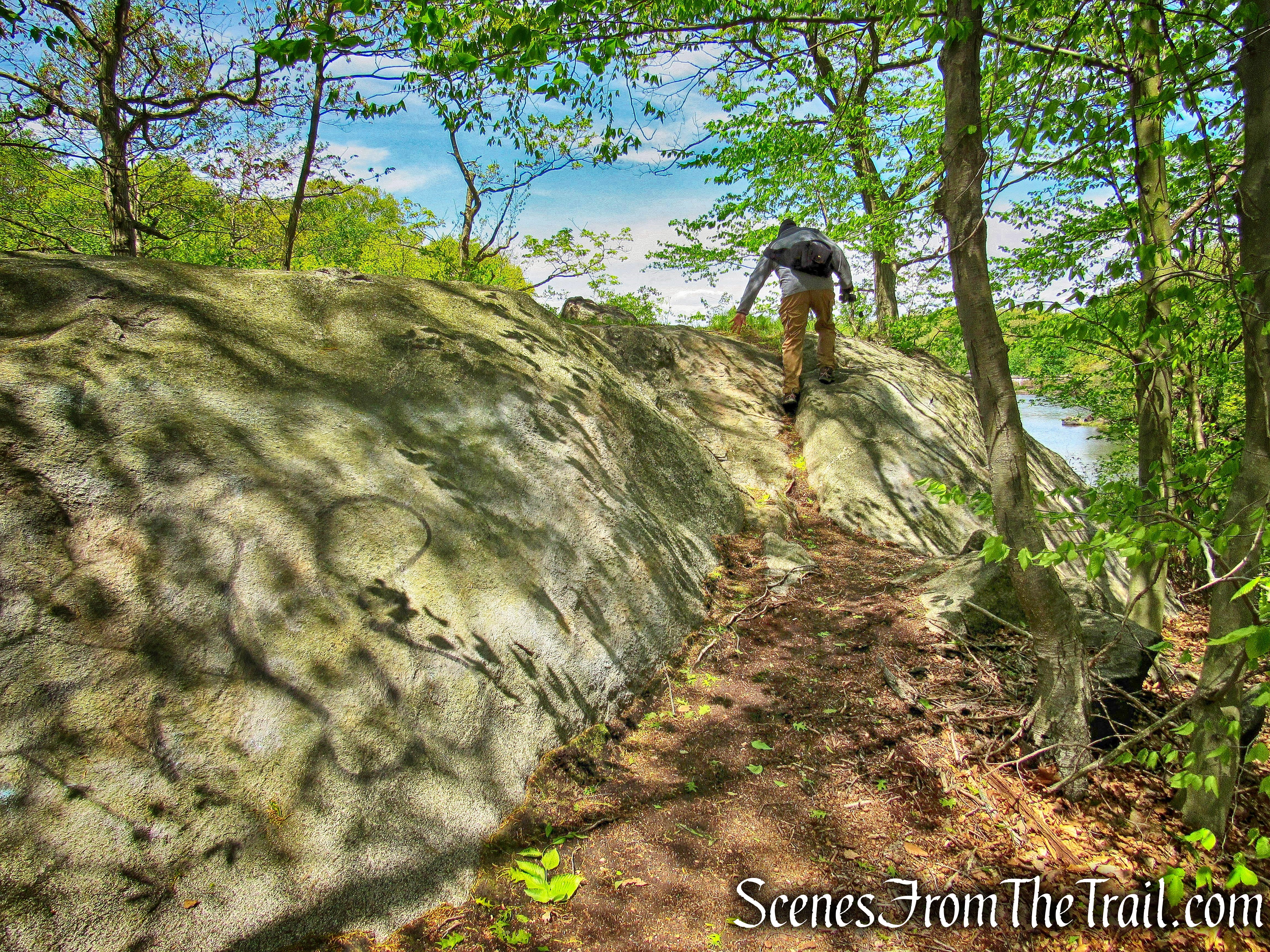
Follow the trail through a mass of jumbled boulders and rock slabs. At times you may have to use both your hands and feet to navigate this section of trail.

Upper Trail – Larchmont Reservoir

Upper Trail – Larchmont Reservoir
Upper Trail – Larchmont Reservoir

Upper Trail – Larchmont Reservoir
Upper Trail – Larchmont Reservoir

Upper Trail – Larchmont Reservoir
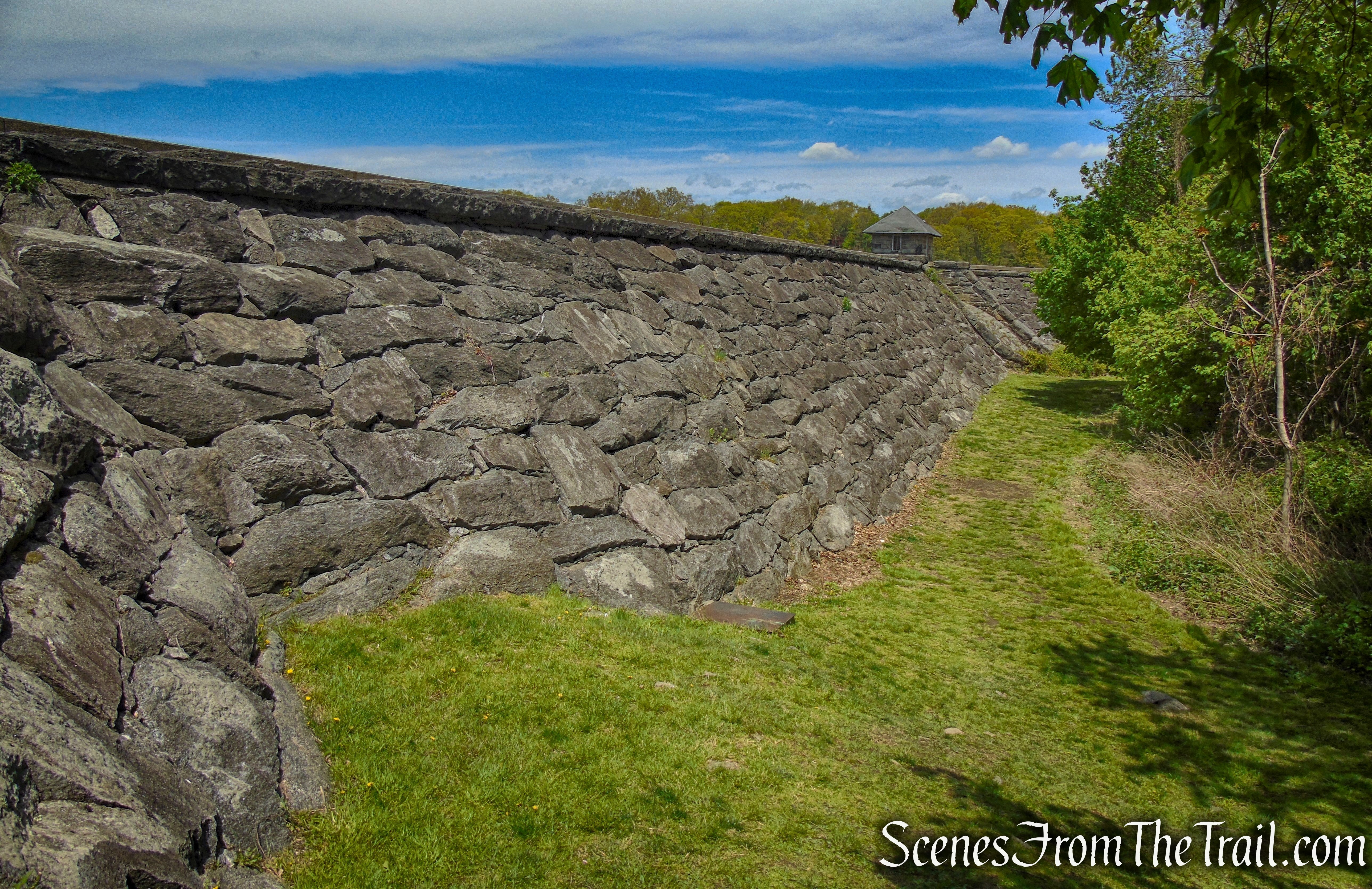
In about 0.5 mile, the Upper Trail comes to the southern end of the Sheldrake Lake Dam.
Upper Trail – Larchmont Reservoir
The dam was designed by George B. Burbank and Louis L. Tribus in 1897. In 1900, expert stonemasons from Italy began construction on the Dam and spillway (Larchmont Water Company Dam #2), which was completed by 1903. In 1924, Hazen and Wipple, Civil Engineers from New York City, designed flashboards for the existing structure.
turn right to remain on Upper Trail
In 1934, the original masonry dam was capped with a concrete structure and rock fill was placed behind the existing stone masonry to raise the crest an additional 5 feet. This work was designed by Fuller and Everett, Civil Engineers, 22 East 40th Street, New York City. The top width is 10 ft wide; 6 ft of this width is composed of the reinforcing rock fill while the upstream 4 feet Is made up of the concrete cap which Is placed above the original masonry structure..
Sheldrake Lake Dam – Larchmont Reservoir
The original portion of the dam is a masonry structure of cut and hand laid stone. The present length of the dam is approximately 1,000 feet and 30 feet tall.

turn right to remain on Upper Trail
The splllway is an ogee stone masonry structure.

Sheldrake Lake Dam – Larchmont Reservoir
Turn right at the southern end of the dam and follow the Upper Trail as it soon joins the Colonial Greenway and Cliff Emanuelson Trail. The three co-aligned trails run along the western side of Goodliffe Pond.
Colonial Greenway – Larchmont Reservoir
Follow the trail as it circles Goodliffe Pond, taking time to view the wildlife.
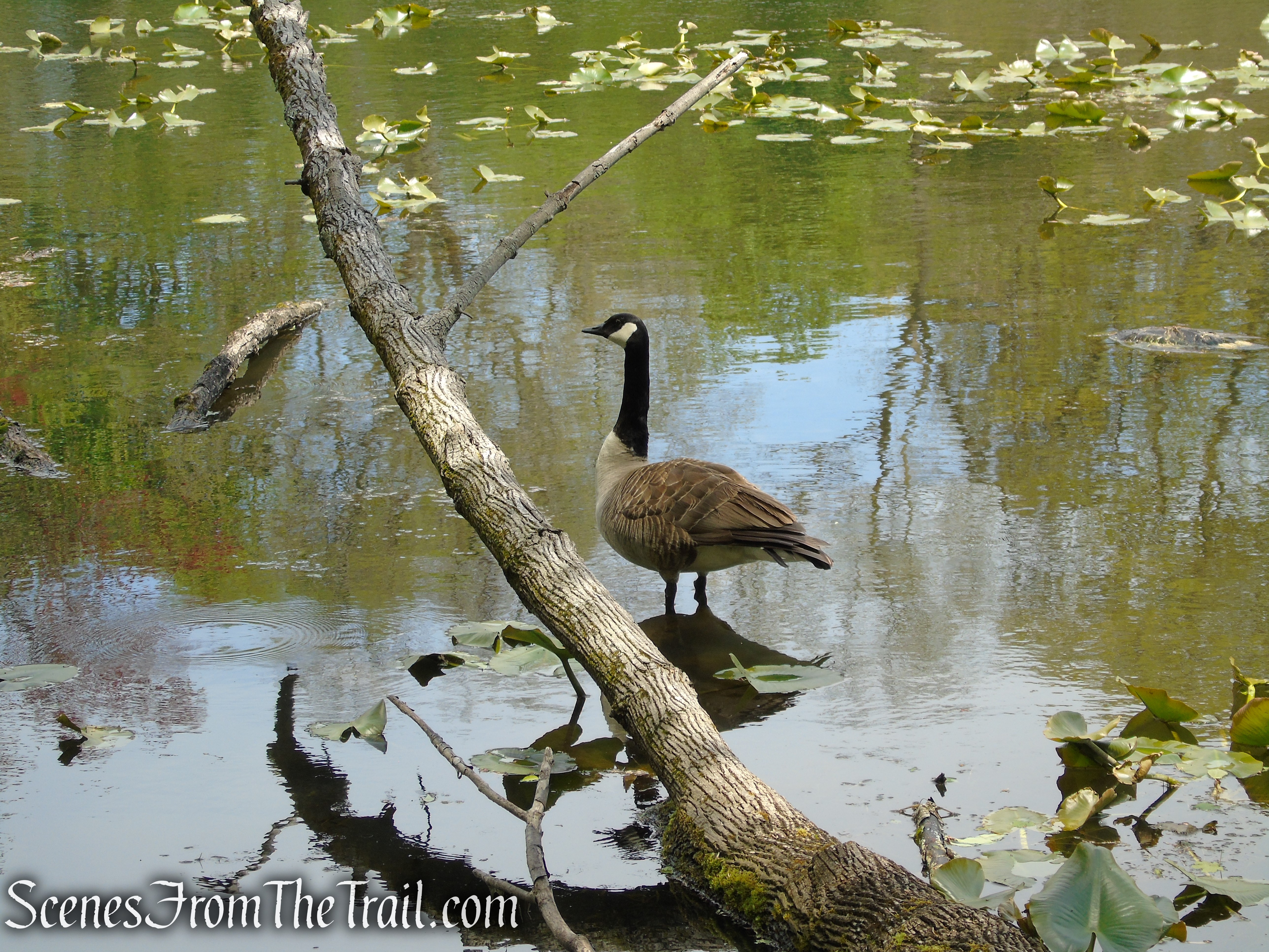
Goodliffe Pond – Larchmont Reservoir
Goodliffe Pond – Larchmont Reservoir

Goodliffe Pond – Larchmont Reservoir

Colonial Greenway – Goodliffe Pond
Colonial Greenway – Goodliffe Pond

Colonial Greenway – Goodliffe Pond
Goodliffe Pond – Larchmont Reservoir
The stone gatehouse (pumping station or pumphouse) at the edge of Goodliffe Pond is now used as a bird blind.
Goodliffe Pond – Larchmont Reservoir
Goodliffe Pond – Larchmont Reservoir

Goodliffe Pond – Larchmont Reservoir
Goodliffe Pond – Larchmont Reservoir
Goodliffe Pond – Larchmont Reservoir
As the Colonial Greenway and Upper Trail leave to the right (they go to the parking area on Weaver St.), continue ahead and cross the wooden footbridge which spans the Sheldrake River as it falls from the Goodliffe Pond Dam.

Leddy Trail – Larchmont Reservoir
Goodliffe Pond dam – Larchmont Reservoir
Continue on the footpath, now on the east side of Goodliffe Pond and head towards the Sheldrake Lake Dam.
Leddy Trail – Larchmont Reservoir
Goodliffe Pond – Larchmont Reservoir

Leddy Trail – Larchmont Reservoir
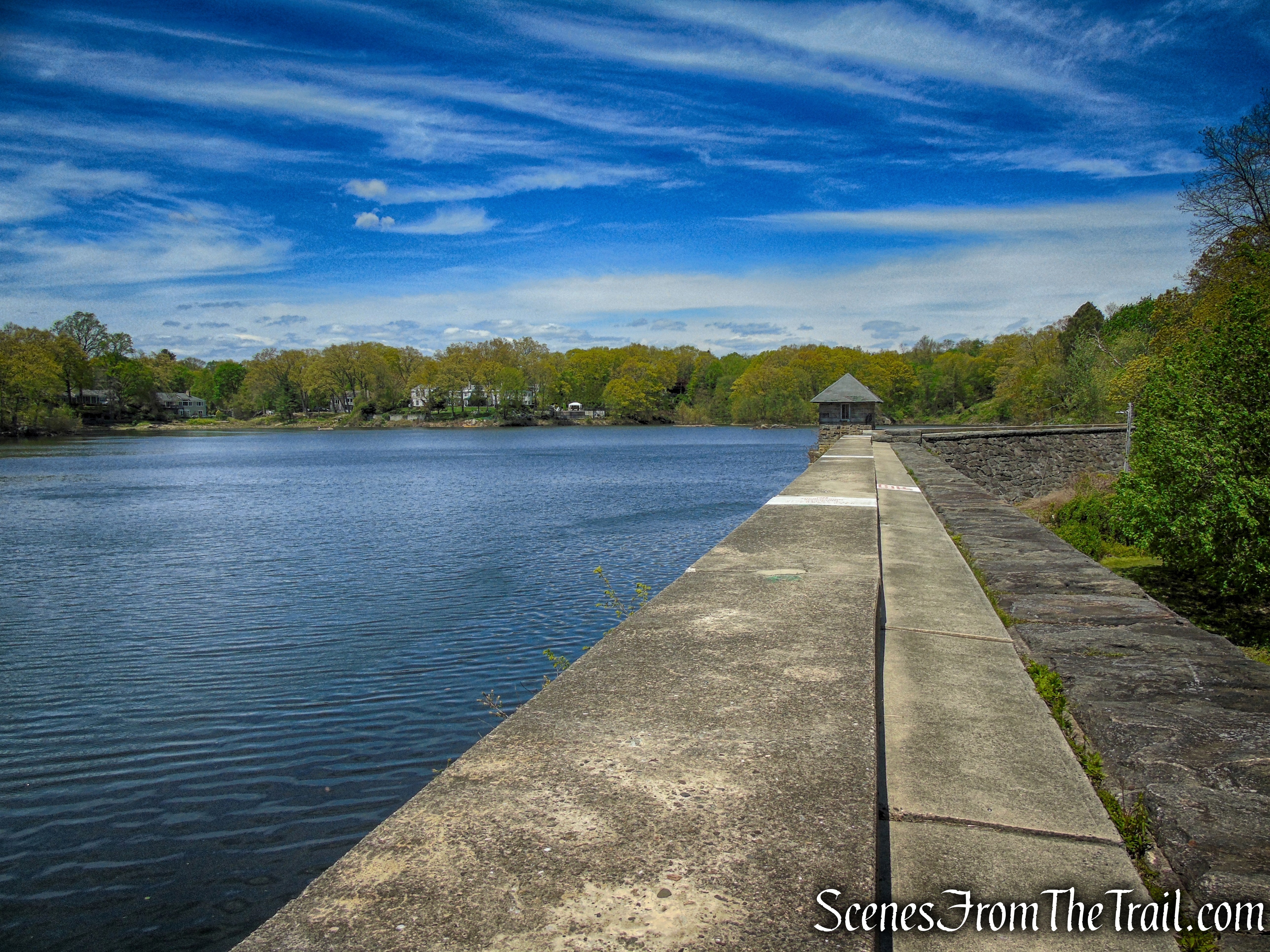
Turn right on a footpath along the dam, the route of the Colonial Greenway (also the Cliff Emanuelson Trail) and head northeast along the lake.
turn right at the north end of the dam
Take a look back across the dam.
Sheldrake Lake dam – Larchmont Reservoir
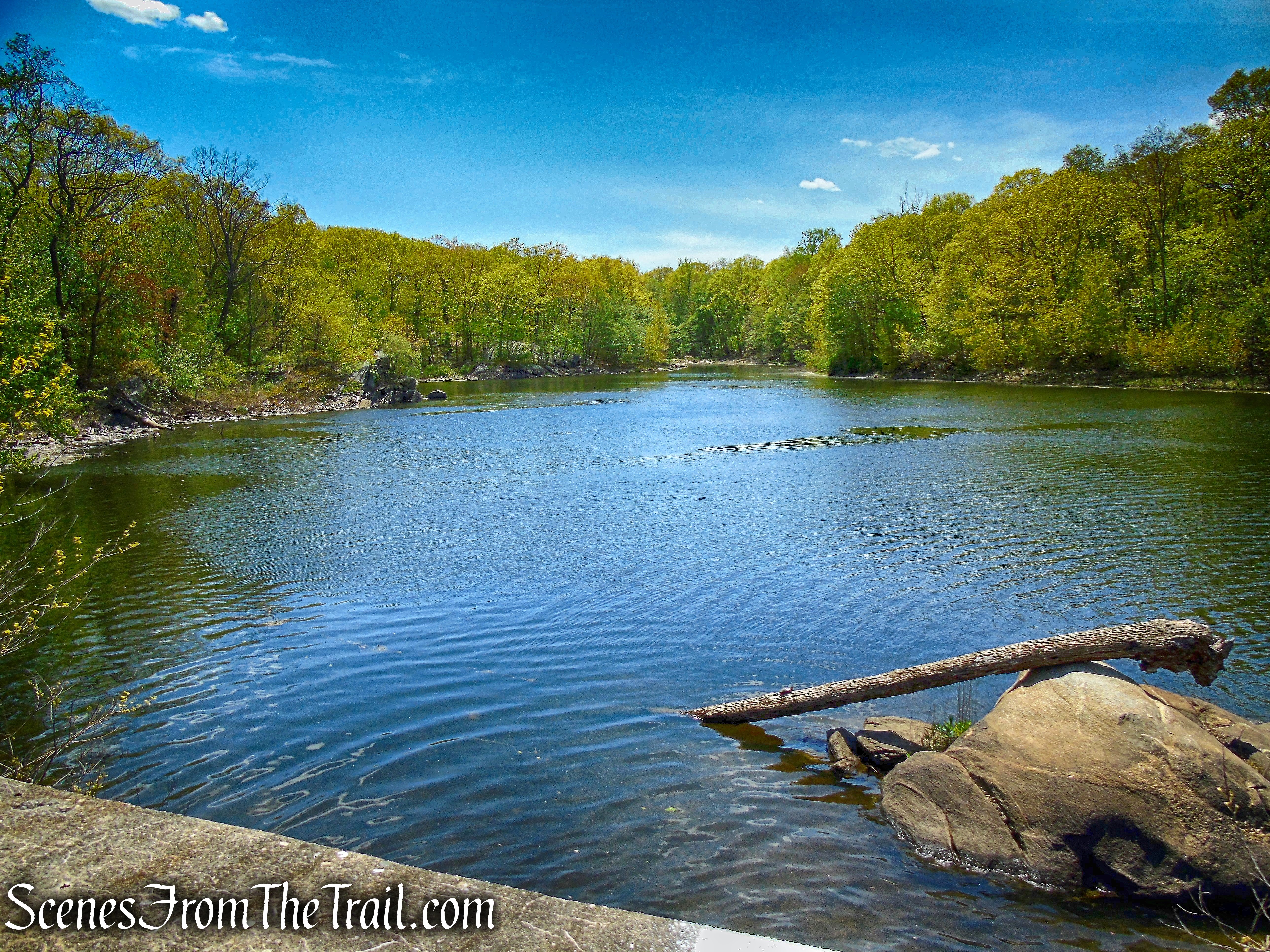
Follow the mostly level footpath along the eastern side of the lake, a short distance to a rock outcrop that looks out over Sheldrake Lake.
Colonial Greenway – Larchmont Reservoir

Colonial Greenway – Larchmont Reservoir
Sheldrake Lake – Larchmont Reservoir
Sheldrake Lake – Larchmont Reservoir
To the west, a stone arch bridge that carries Pinebrook Blvd over the Sheldrake River.

Sheldrake Lake – Larchmont Reservoir

Sheldrake Lake – Larchmont Reservoir
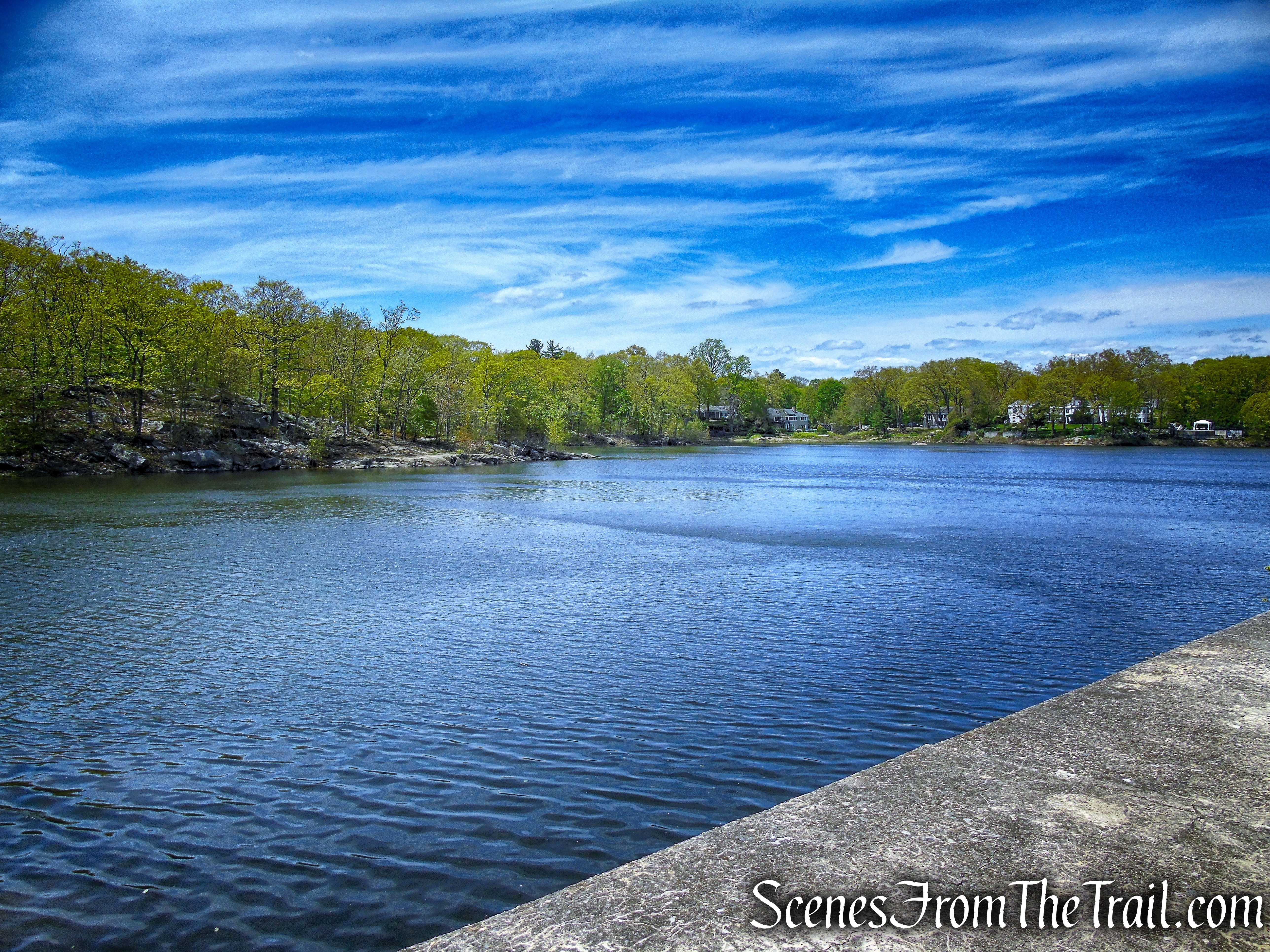
Continue heading north on the Colonial Greenway with views of the lake through the trees. As the trail rounds the northern end of the lake, views open up over the entire lake.
Colonial Greenway – Larchmont Reservoir
Sheldrake Lake – Larchmont Reservoir
Sheldrake Lake – Larchmont Reservoir
Sheldrake Lake – Larchmont Reservoir
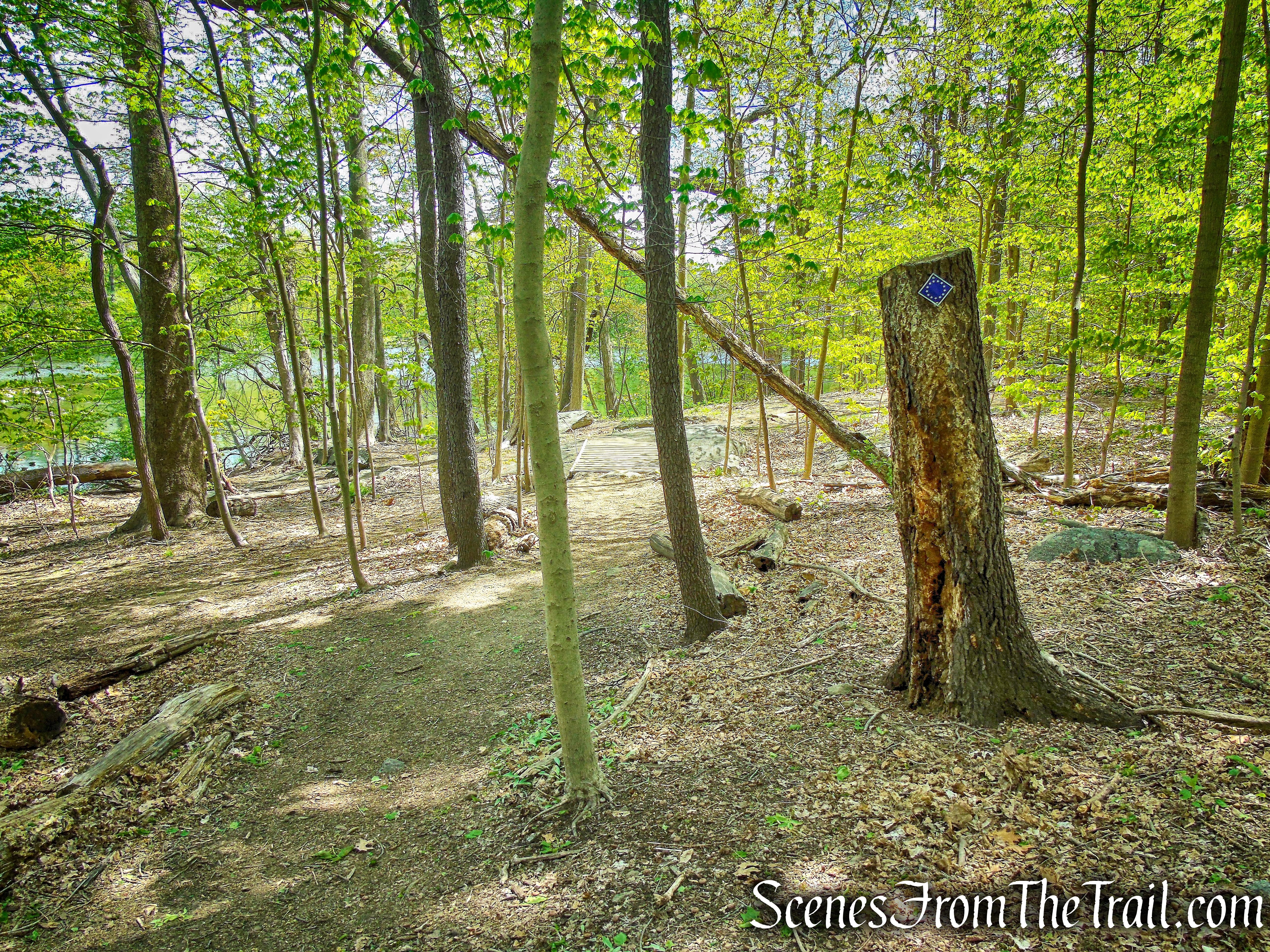
Follow the Colonial Greenway as it veers away from the lake, enters the woods and crosses a long wooden boardwalk. At the end of the boardwalk, the Colonial Greenway turn sharp left, climbs the hill to the Dennis Drive cul-de-sac parking area.
Colonial Greenway – Larchmont Reservoir
Continue ahead on another boardwalk (Cliff Emanuelson Trail) just ahead that curves to the right. This boardwalk loops around and rejoins the Colonial Greenway near Sheldrake Lake. Now retrace your steps along the lake and when you get to the dam, continue straight along the grassy area at the base of the dam, soon connecting with the Upper Trail. Retrace your steps on the Upper Trail, passing by the southern end of Sheldrake Lake, past the tennis courts and back to the parking area, where the hike began.
Cliff Emanuelson Trail – Larchmont Reservoir
Sheldrake Lake Dam – Larchmont Reservoir
Sheldrake Lake – Larchmont Reservoir
Sheldrake Lake – Larchmont Reservoir
Review:
I was really impressed by this place. I was expecting a leisurely walk around the reservoir on paved paths with benches, but some of the area is surprisingly rugged. The Upper Trail is a must do if visiting. The jumbled boulders and giant rock slabs that must have been strewn about while constructing the reservoir, makes for an interesting hike. The area around Goodliffe Pond is also very picturesque and a good spot to linger and check out the wildlife. The Sheldrake Lake Dam is quite impressive and walking alongside the lake makes for a pleasant day outdoors.
Pros:
Picturesque setting, Upper Trail, Goodliffe Pond, Sheldrake Lake Dam, lots of bird activity and quite a few Chipmunks.
Cons:
None.
Take a hike!
Larchmont Reservoir
Sources:
- Larchmont Reservoir
- Sheldrake Environmental Center
- Colonial Greenway
- NYSDEC – National Dam Safety Program – Larchmont Water Company Dam #2
- Walkable Westchester: A Walking Guide to Westchester County, NY – by Jane and Walt Daniels
