March 24, 2019 – New Haven, Connecticut
Difficulty: Easy – Moderate
Length: Approximately 3.2 miles
Max elevation: 365 ft.– total elevation gain approximately 461 ft.
Route type: Circuit
Map: East Rock Park Map
Trailhead parking: Eli Whitney Museum – 915 Whitney Ave, Hamden, CT 06517
Park Overview:
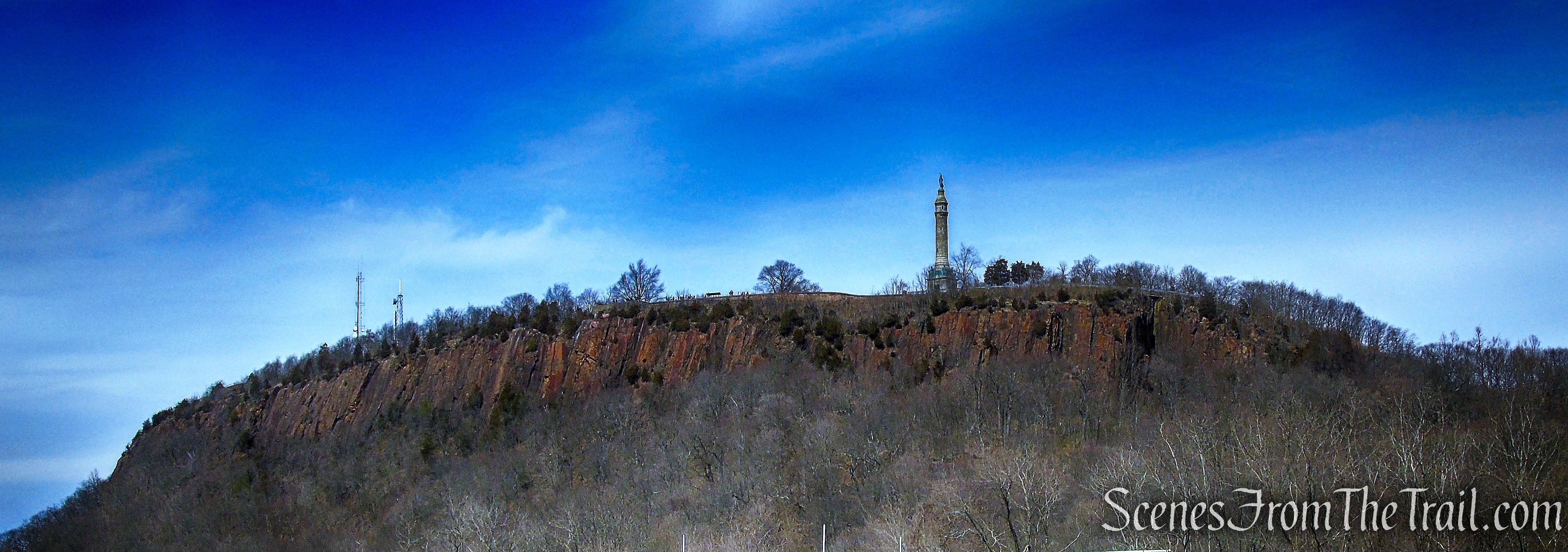
East Rock was formed about 200 million years ago as the continents were in the process of moving away from each other. Molten rock from deep in the earth surged through stress cracks formed in the sandstone bedrock of the New Haven area. The molten rock cooled to form dolerite, also know as basalt or traprock. Dolerite is much more resistant to erosion than the surrounding sandstone. As glacial action and the forces of weathering eroded away the softer sandstone, East Rock (and other traprock ridges such as West Rock) became more prominent. The summit of East Rock Park now rises more than 350 feet above the floor of the Mill River valley at its base.
East Rock Park
The 425-acre park is located on the New Haven / Hamden border. The park is roughly bounded by Livingston Street, Davis Street, State Street and the Mill River. It is administered by the New Haven Department of Parks, Recreation and Trees.
There are more than 10 miles of trails at East Rock Park, including an 800-foot self-guided nature trail constructed and maintained in part by students of Wilbur Cross High School in New Haven. The 365-foot summit, home to the Soldiers and Sailors Monument, affords views of neighboring downtown and Long Island Sound. The Giant Steps Trail to the summit provides a solid workout, with a convenient handrail.
The park surrounds and includes the mountainous ridge named East Rock and was developed with naturalistic landscaping. The park’s layout is the work of Donald Grant Mitchell and the Olmsted Brothers.
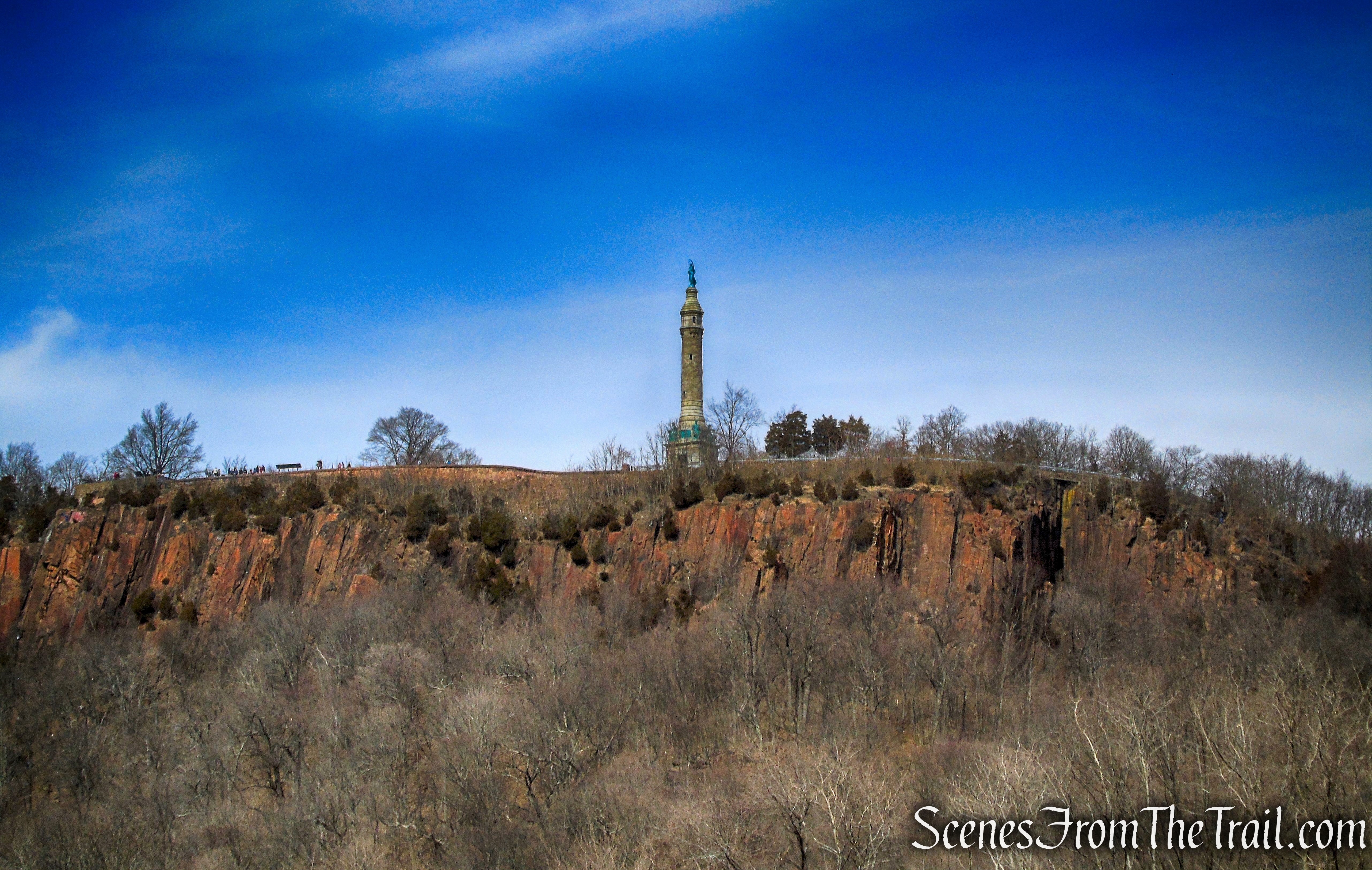
Soldiers and Sailors Monument – summit of East Rock
Trails Overview:
With about 12 miles of trails, paved park roads and gated fire roads available, any number of loop hikes can be done, ranging from an easy walk to more moderate and slightly challenging hikes.
The marked trails often parallel and cross paved park roads at various points, making getting lost a tough task.
The Giant Steps Trail provides a spectacular 285-foot climb to the Summit. It starts at the English Drive gate along the north side of Rice Field. The Giant Steps Trail is designated with yellow trail markers.
Please note: Some of the trails traveled on this hike are poorly marked and there are a number of unmarked footpaths that branch off the main trails that lead to the edge of the cliffs at various points throughout the park. There is loose gravel with steep drop-offs at most of these “dead ends.” Proper footwear and extreme caution should be exercised in these areas.
Hike Overview:
East Rock Park has numerous access points and parking areas that surround it. While doing research for this hike, I discovered that there is a covered bridge and a dam with a waterfall at the Eli Whitney Museum and wanted to begin the hike there. I called the museum to inquire about parking and was told that I could park in their lot while hiking in East Rock Park.
This is a great place to begin and end a hike. The museum grounds are on the western banks of the Mill River with plenty of benches to sit on at the conclusion of the hike. The waterfall and covered bridge add to its charm.
This hike begins and ends at the Eli Whitney Museum. It crosses the Mill River on the covered bridge then heads south along the river. Upon reaching Rice Field, we turned left and began heading in a northerly direction, climbing to the summit of East Rock via the Giant Steps Trail. We then continued north along the escarpment of East Rock, descending and climbing Whitney Peak. From there we descended towards the west, returning to the parking area.
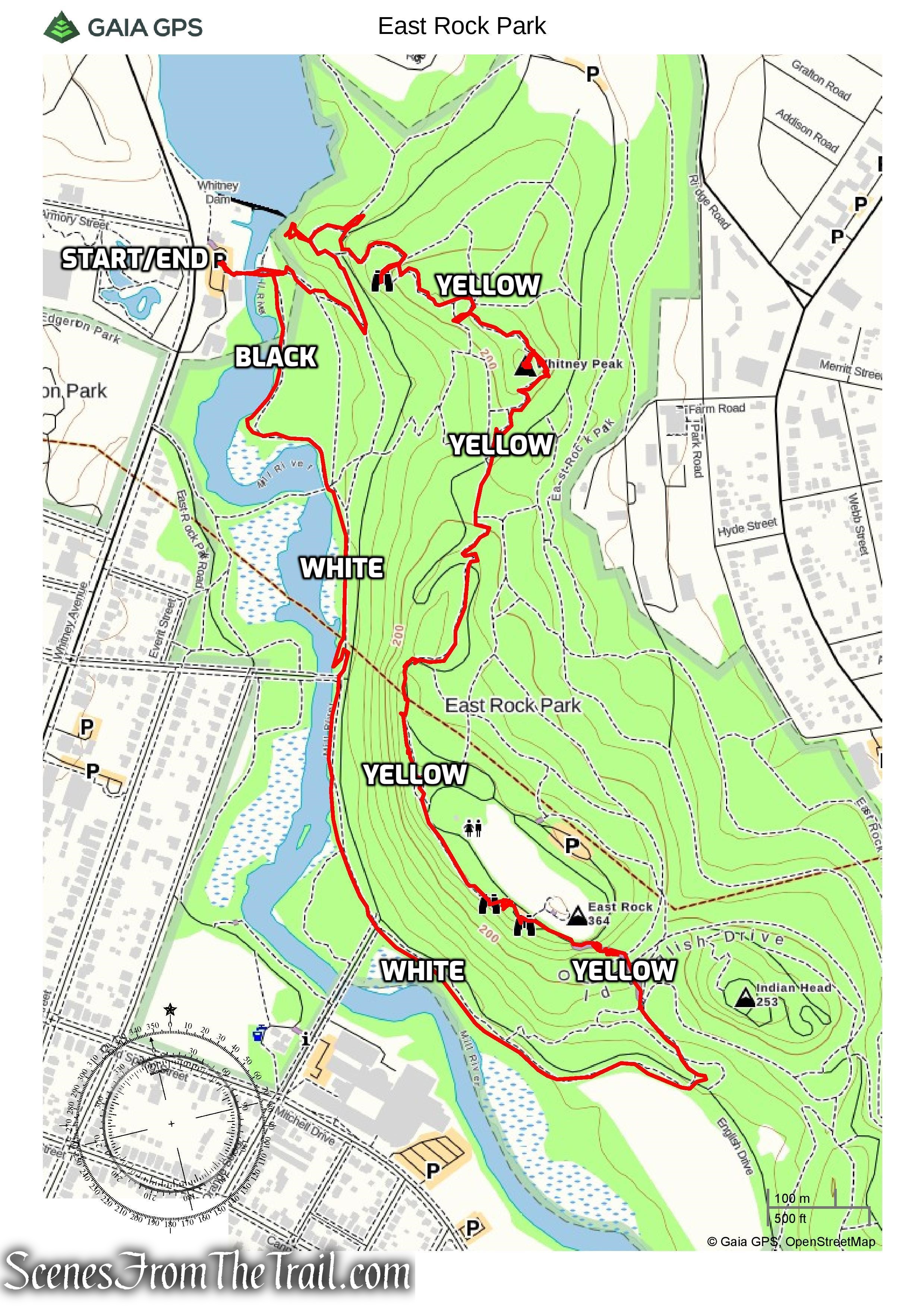
East Rock Park Loop
The Hike:
The Lake Whitney dam and waterfall is adjacent to the parking lot and the first place we checked out. A dam existed at a nearby site as early as 1798 and provided water to power a grist mill. The dam has undergone several periods of improvement and modification. Major changes around 1917 lengthened the spillway and adjusted its elevation to 33 feet.
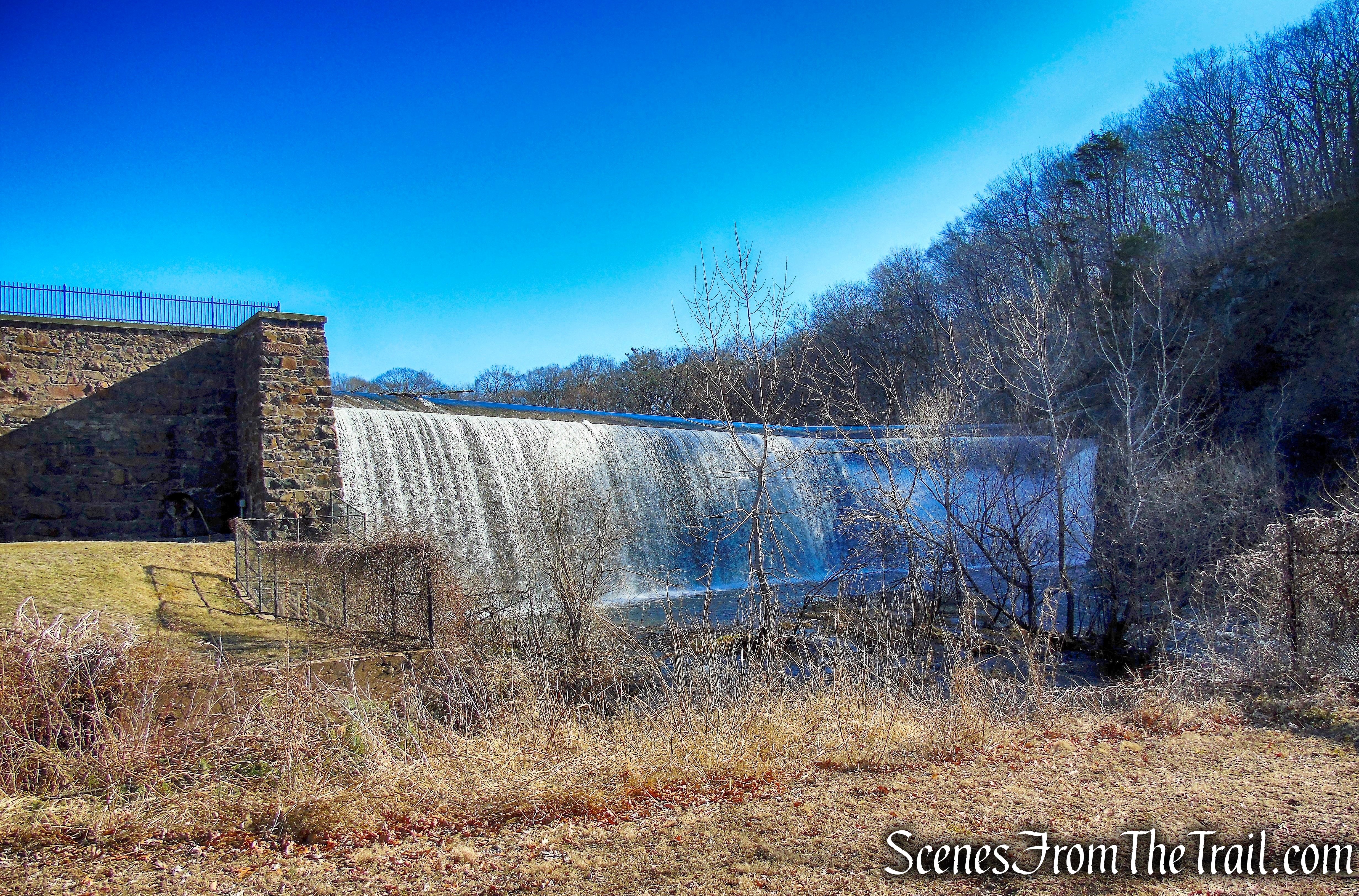
Lake Whitney dam and waterfall
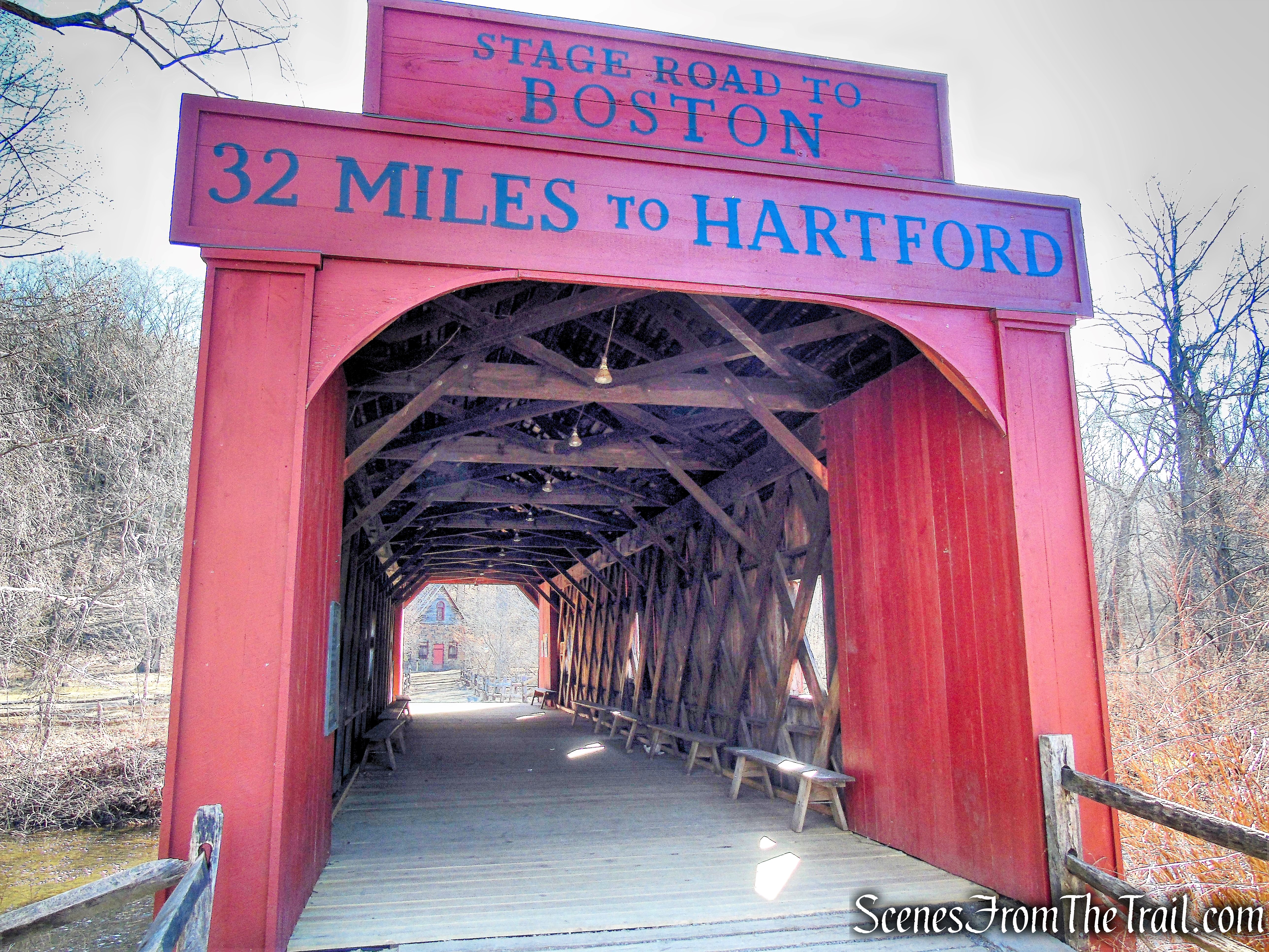
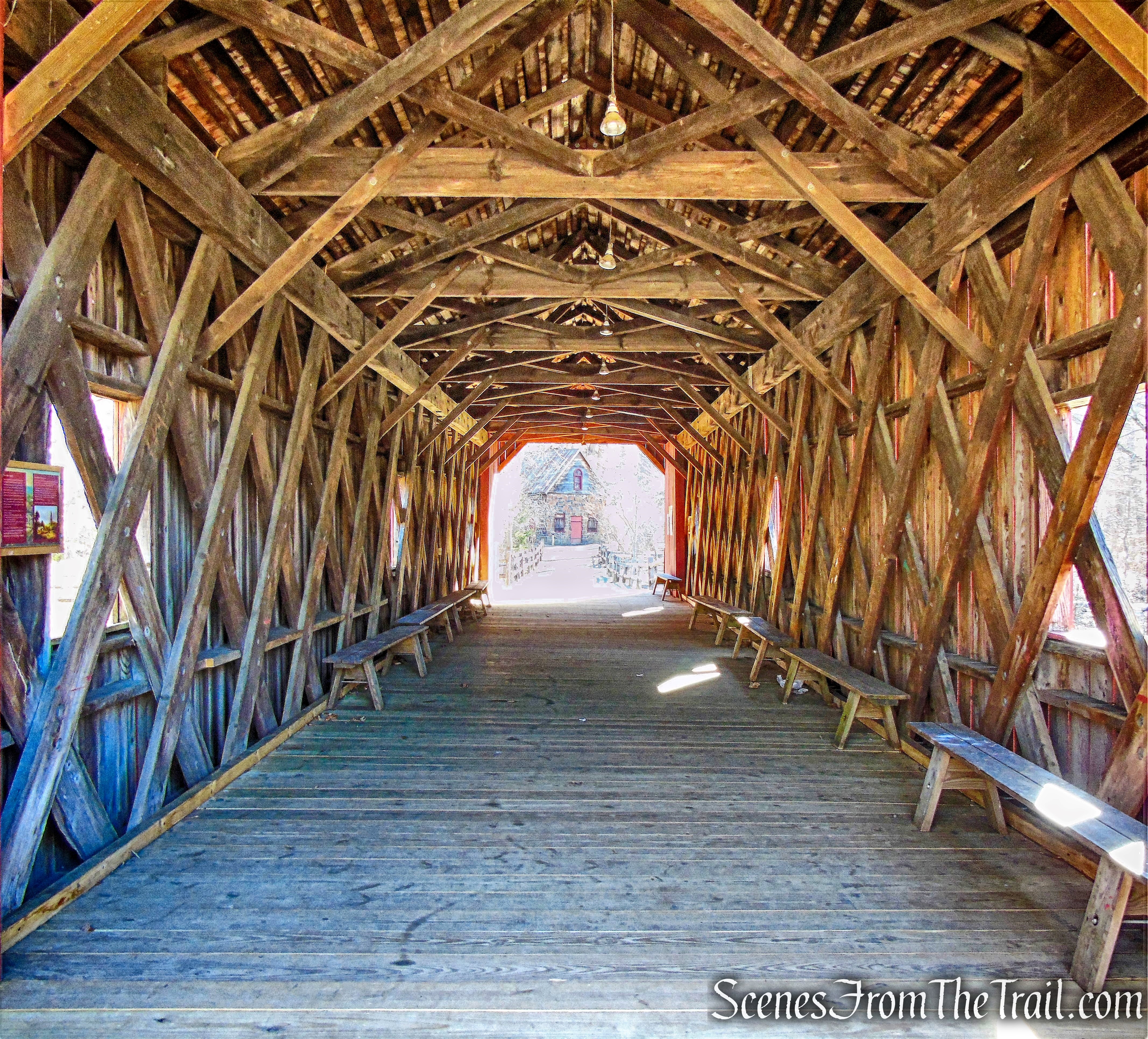
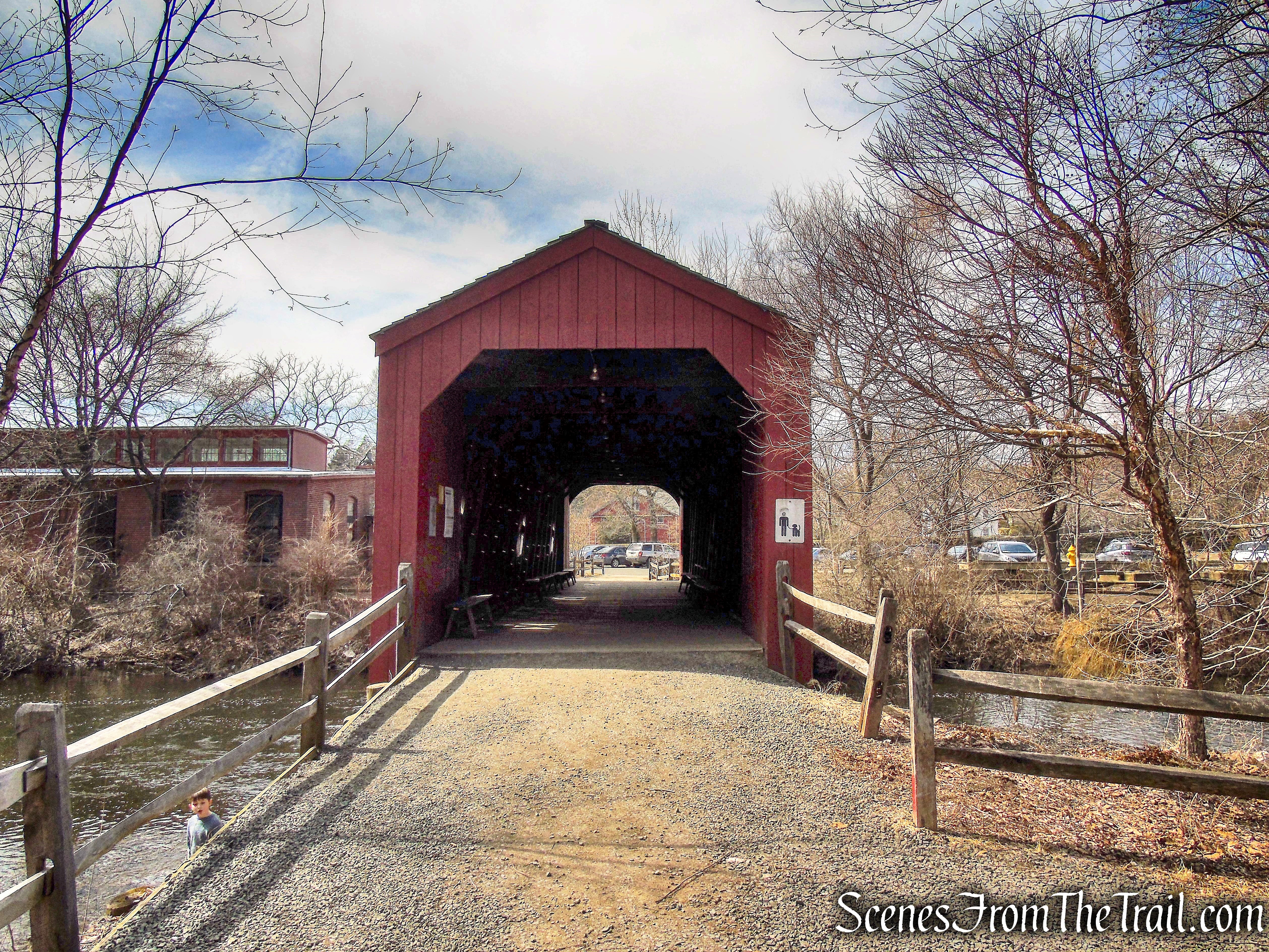
From the parking area, we walked through the covered bridge which spans the Mill River.
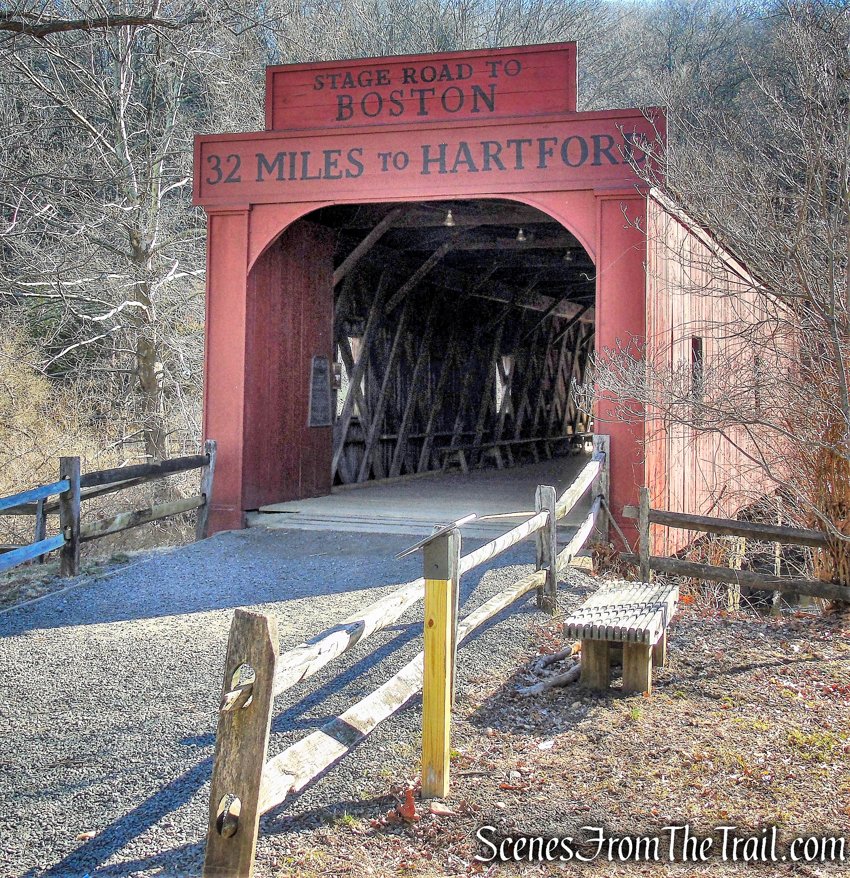
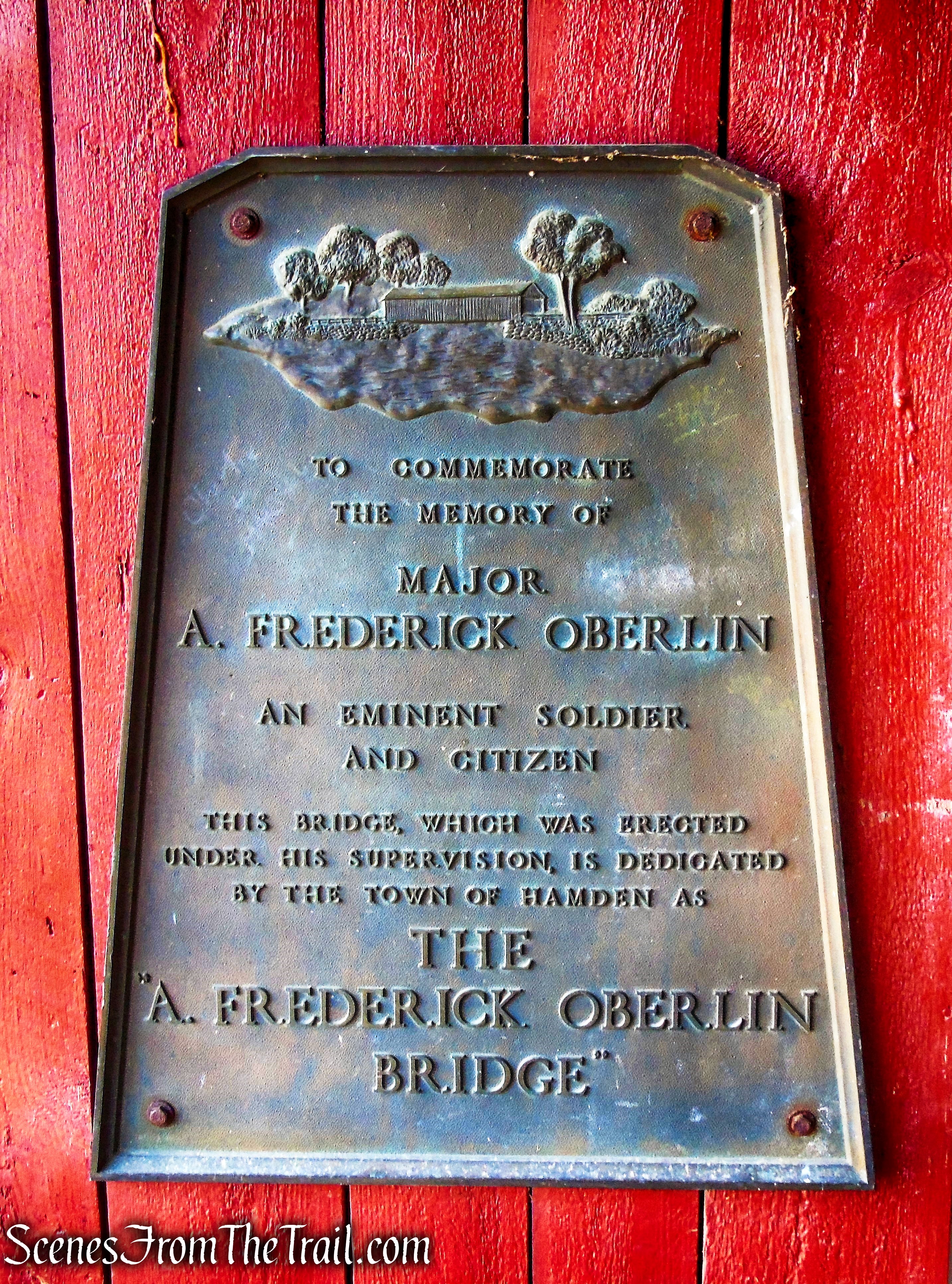
A. Frederick Oberlin Bridge
The original bridge, located a distance north of the Whitney Site, was destroyed in flooding around the turn of the 20th century. In 1979, students from Eli Whitney Vocational-Technical High School reconstructed the bridge at its current site.
A. Frederick Oberlin Bridge
The 72 ft. bridge is named for Adam Frederick Oberlin (June 25, 1891 – July 10, 1938), a prominent citizen of Hamden, Connecticut who served with distinction in the United States Military during the First World War. He was awarded the Silver Star in 1918.
A. Frederick Oberlin Bridge
A. Frederick Oberlin Bridge
The Black Trail (unblazed) begins on the right just after crossing the bridge, but we walked a short distance ahead to check out the coal storage shed.
A. Frederick Oberlin Bridge
Black Trail
This coal storage shed is the original building and dates back to 1803.
coal storage shed
We then began heading south on the Black Trail. It is shown and listed on the map as the Black Trail, but it is unmarked and easy to follow.
Black Trail
Black Trail
The trail runs along the Mill River, sometimes across berms that divide the river from a swamp to the east.
Black Trail
Black Trail
Black Trail
The Black Trail reaches a pedestrian bridge over the Mill River, joins the White Trail briefly then turns right and crosses the bridge. We continued straight and began following the white blazes south along the east side of the river.
Black Trail
White Trail
The White Trail soon comes to a junction with a another gravel path that leads towards the river. We stayed left and continued on the White Trail as it ascends towards East Rock Road and then crosses it.
stay left on White Trail
White Trail crosses East Rock Road
White Trail crosses East Rock Road
The White Trail continues along the edge of the Mill River and in a short distance crosses Orange Road. The trail then starts to veer away from the river and ascends gradually.
White Trail
White Trail crosses Orange Road
White Trail
White Trail
The White Trail passes by several sets of stone steps that lead to the paved park road which runs parallel to the trail. Soon the White Trail reaches Rice Field and turns left, climbing stone steps and crosses English Drive.
White Trail approaches Rice Field
White Trail turns left and climbs stone steps
White Trail crosses English Drive
After crossing English Drive, the White Trail starts heading in a northerly direction. It soon reaches stone steps and joins the start of the Yellow Trail. A short distance later the White Trail turns right on a dirt road as the Yellow Trail climbs another set of stone steps. This is the start of the Giant Steps Trail.
White Trail joins the start of the Yellow Trail
Bear left on Yellow Trail
Now following the Yellow blazes, we began ascending towards the summit of East Rock on several sets of stone steps.
Giant Steps Trail – Yellow Trail
Giant Steps Trail – Yellow Trail
Giant Steps Trail – Yellow Trail
The Giant Steps Trail (yellow blazes) crosses the paved English Drive twice as it climbs East Rock. It then comes to the base of the cliff and the steepest part of the climb.
Giant Steps Trail – Yellow Trail
The uneven stone steps climb almost straight up the side of the cliff. There are railings along the way for assistance, but the lower thinner railings are a little shaky. The bigger railings higher up are pretty solid and stable.
Giant Steps Trail – Yellow Trail
Giant Steps Trail – Yellow Trail
As the Giant Steps Trail nears the summit, views start to open up and the Long Island Sound can be seen on a clear day.
view south from Giant Steps Trail – Yellow Trail

Giant Steps Trail – Yellow Trail
To the southeast, Indian Head, a smaller peak in the park, is visible.
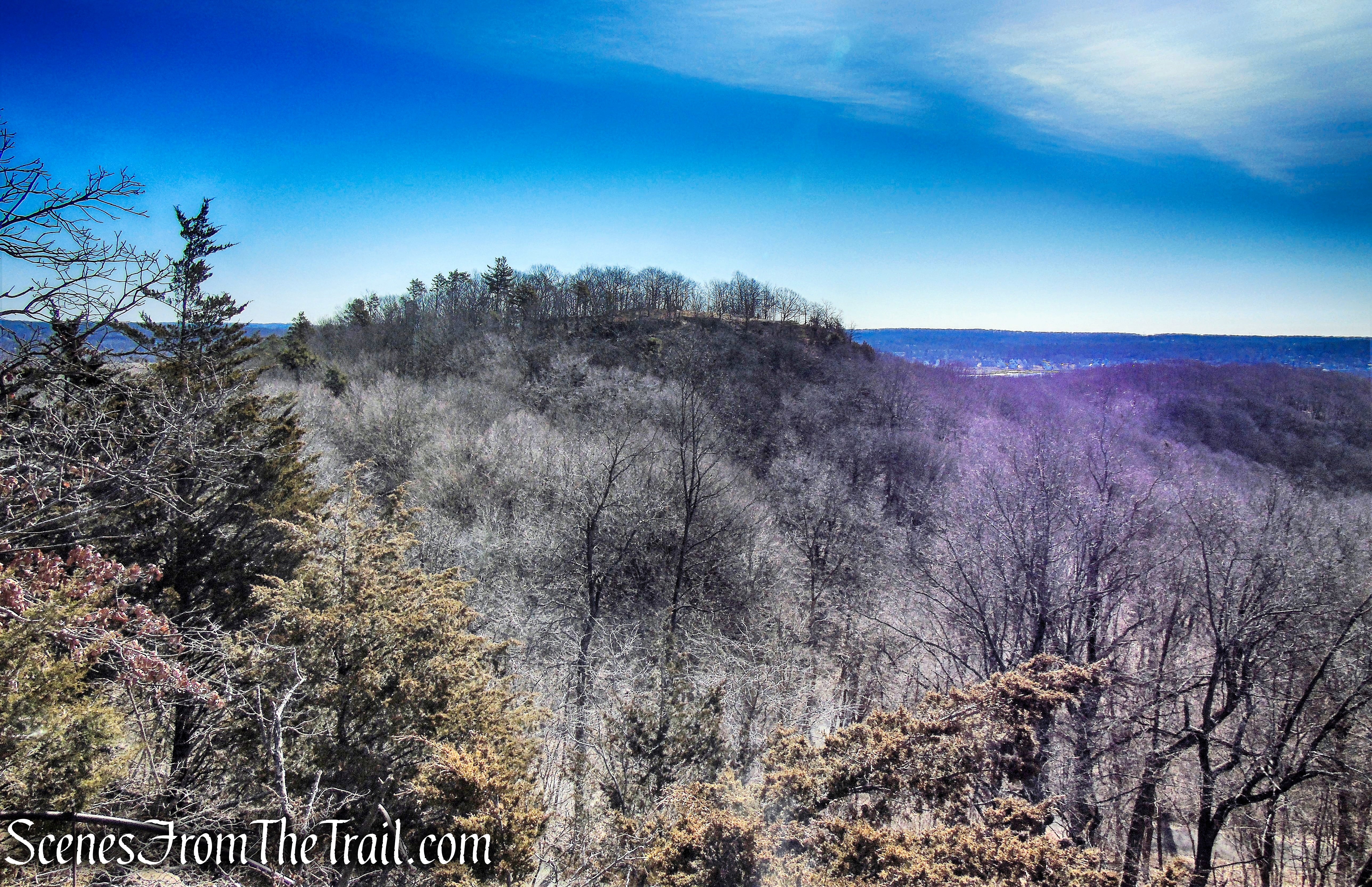
Indian Head as viewed from Giant Steps Trail
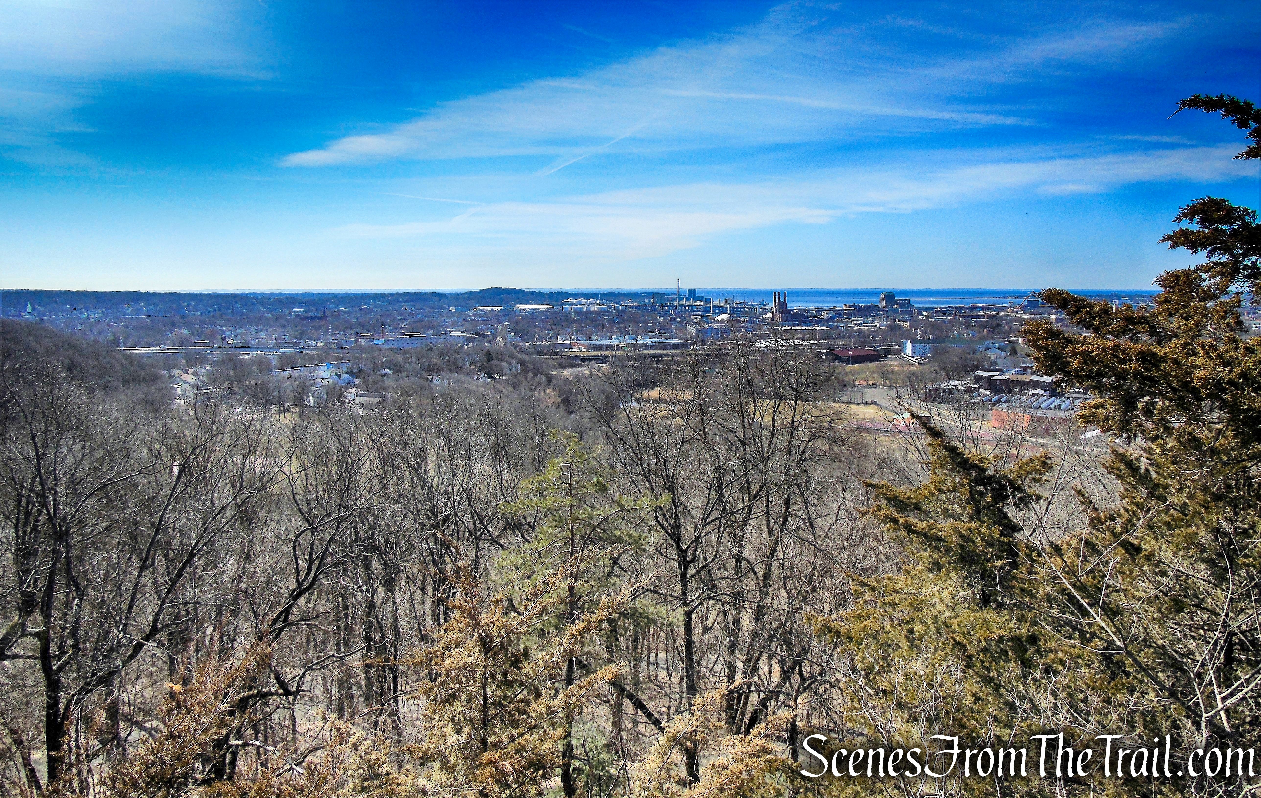
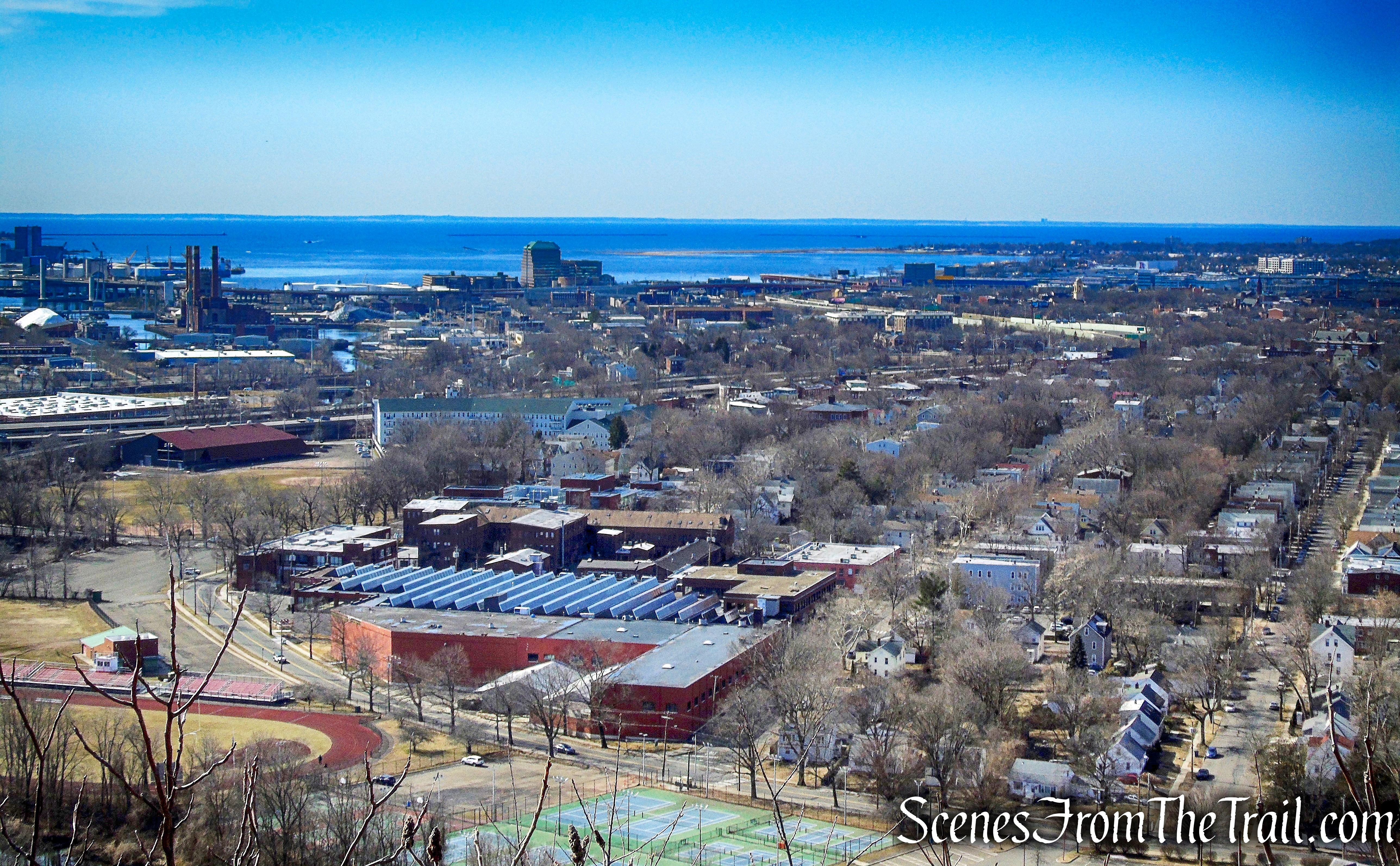
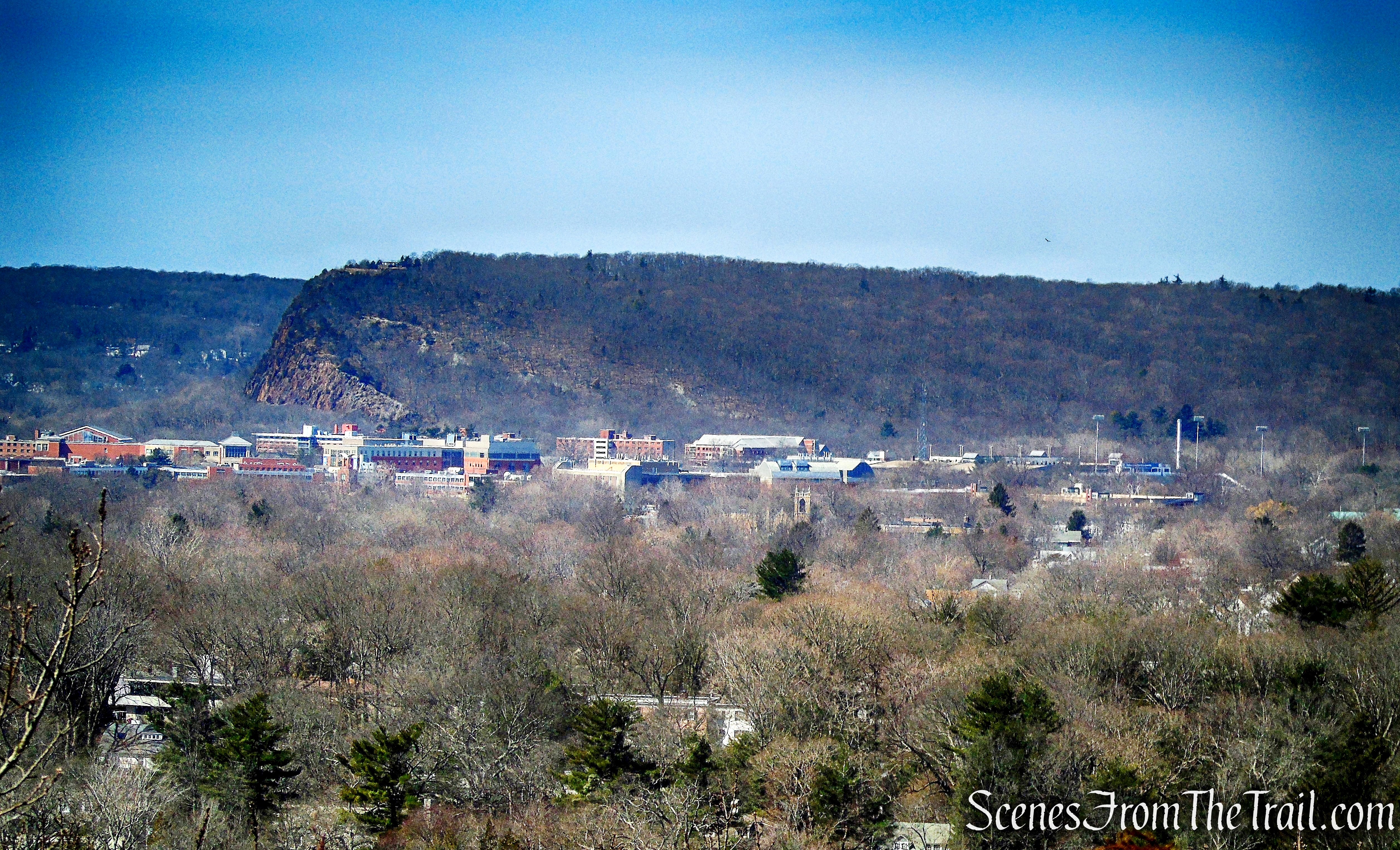
Looking southwest, the city of New Haven and beyond can be seen.
view southwest from Giant Steps Trail
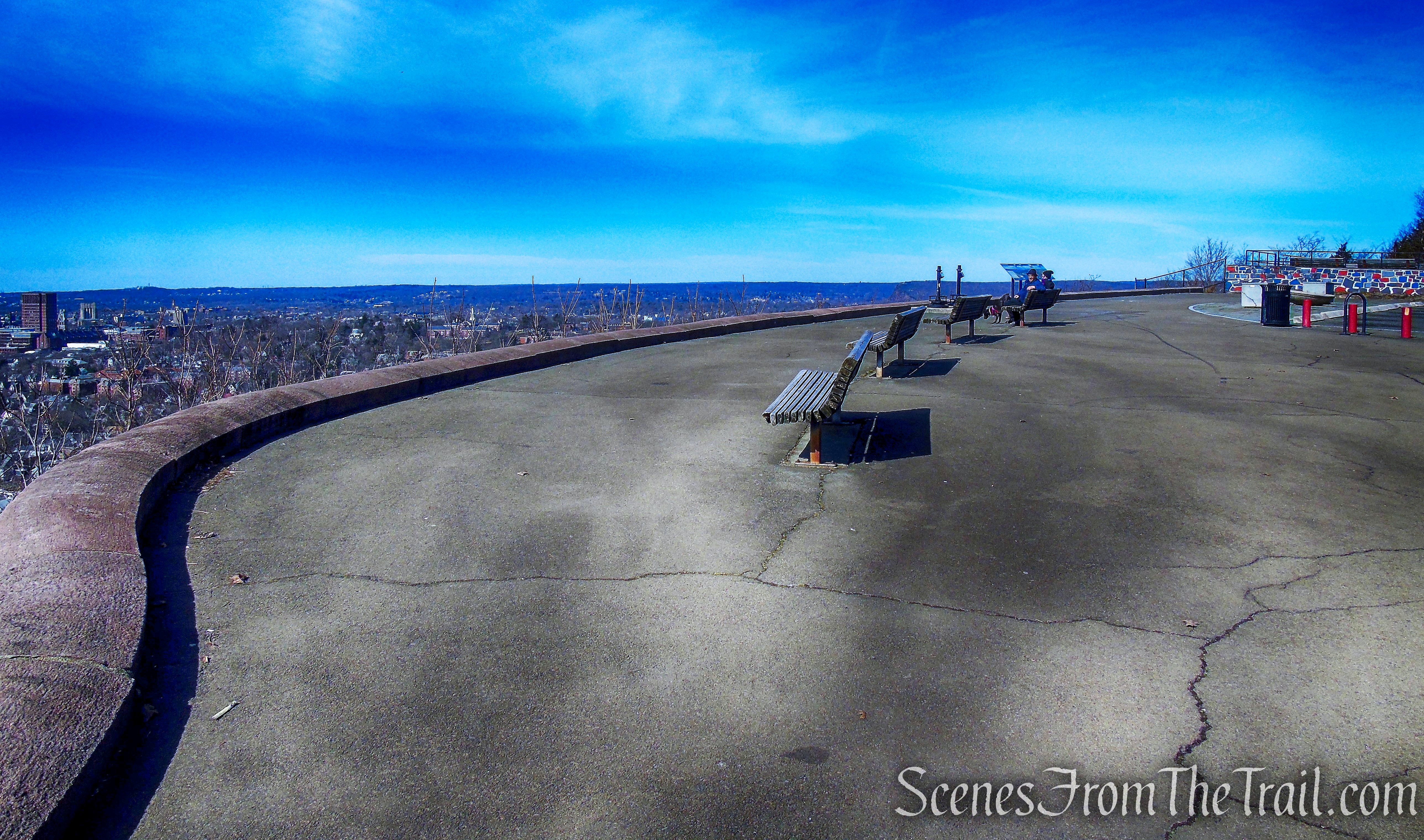
After a short, but steep climb, the trail reaches the summit and follows the paved park road north. There are benches and picnic tables all around and this makes for a perfect spot to sit and enjoy the expansive views.
East Rock summit
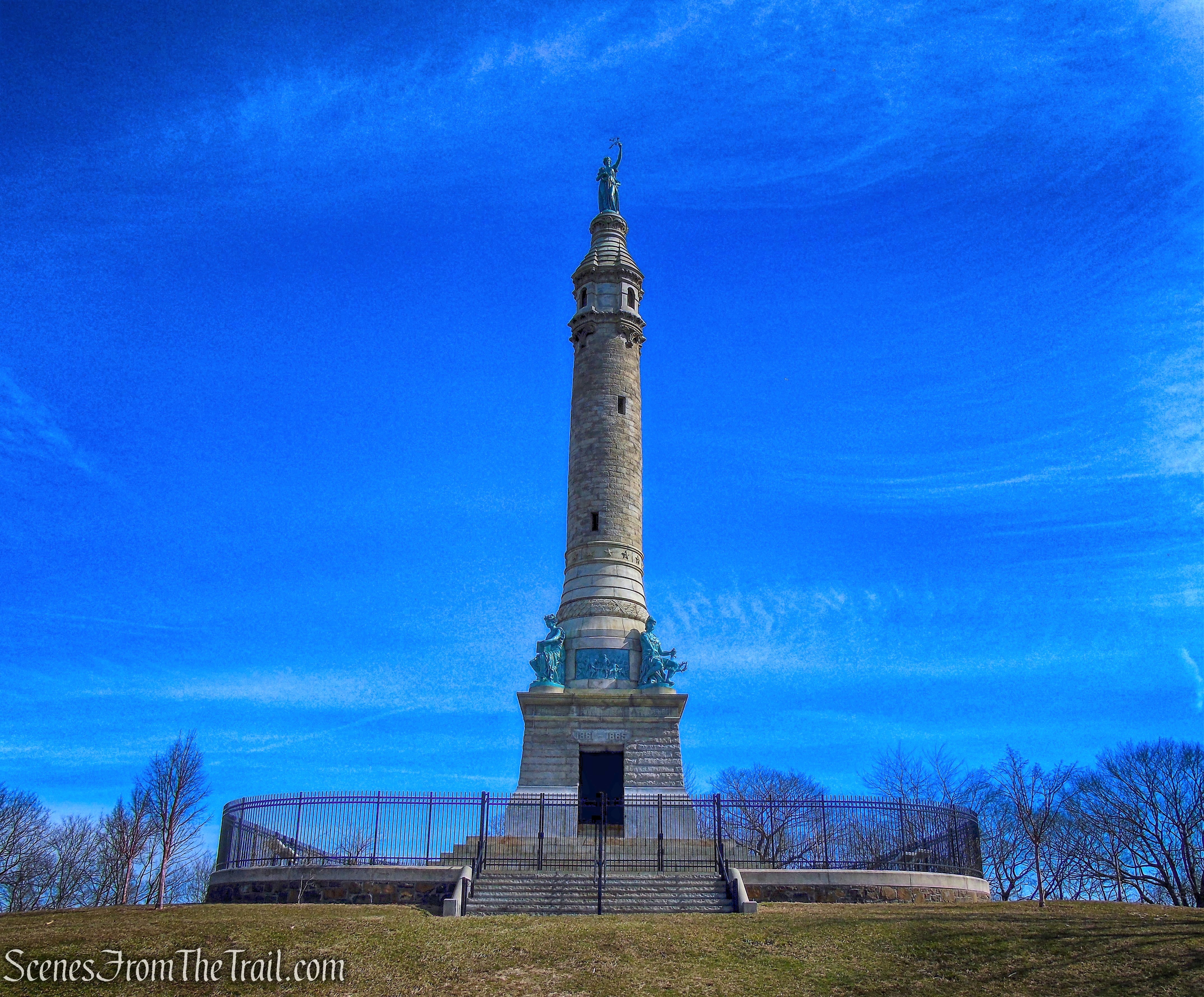
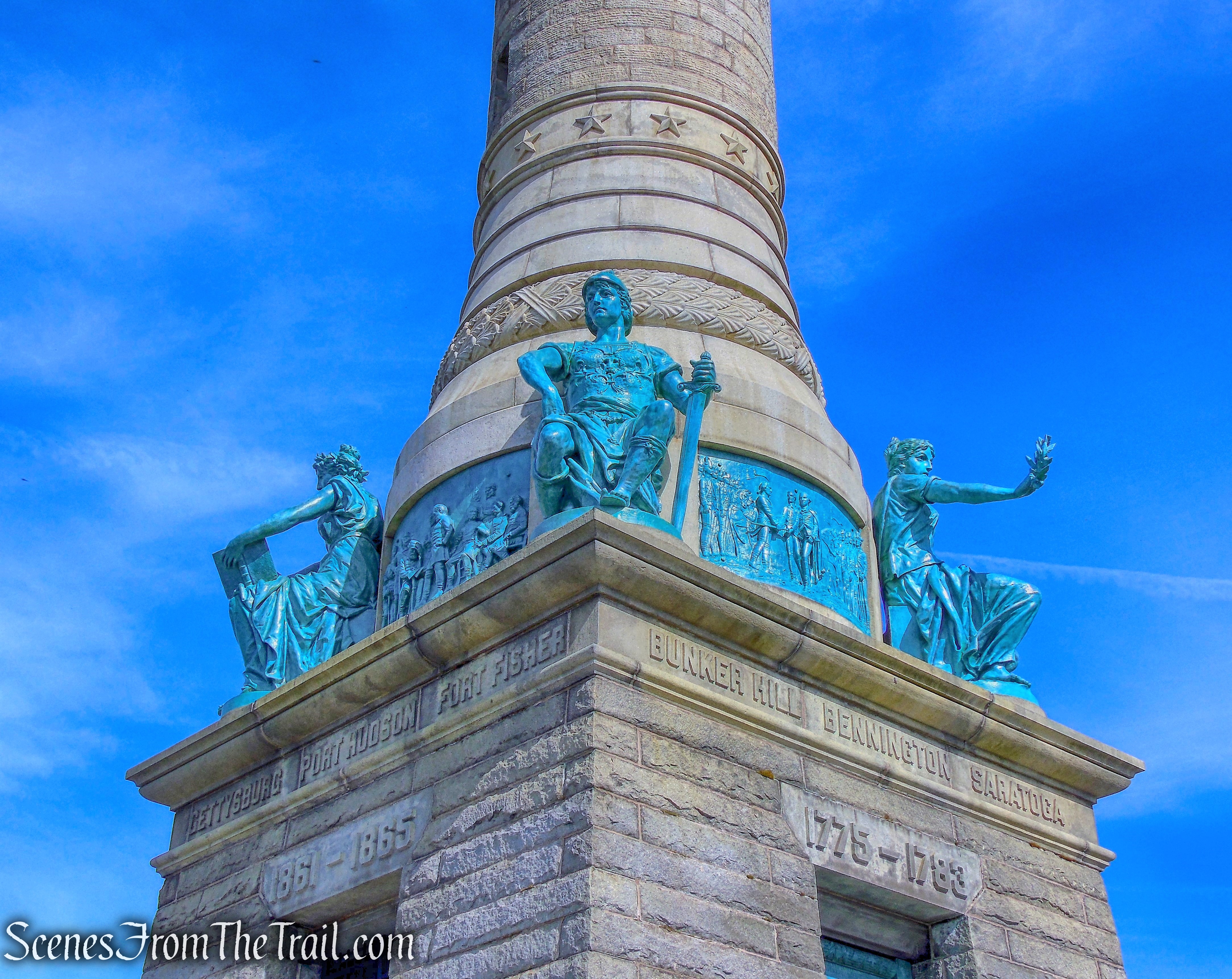
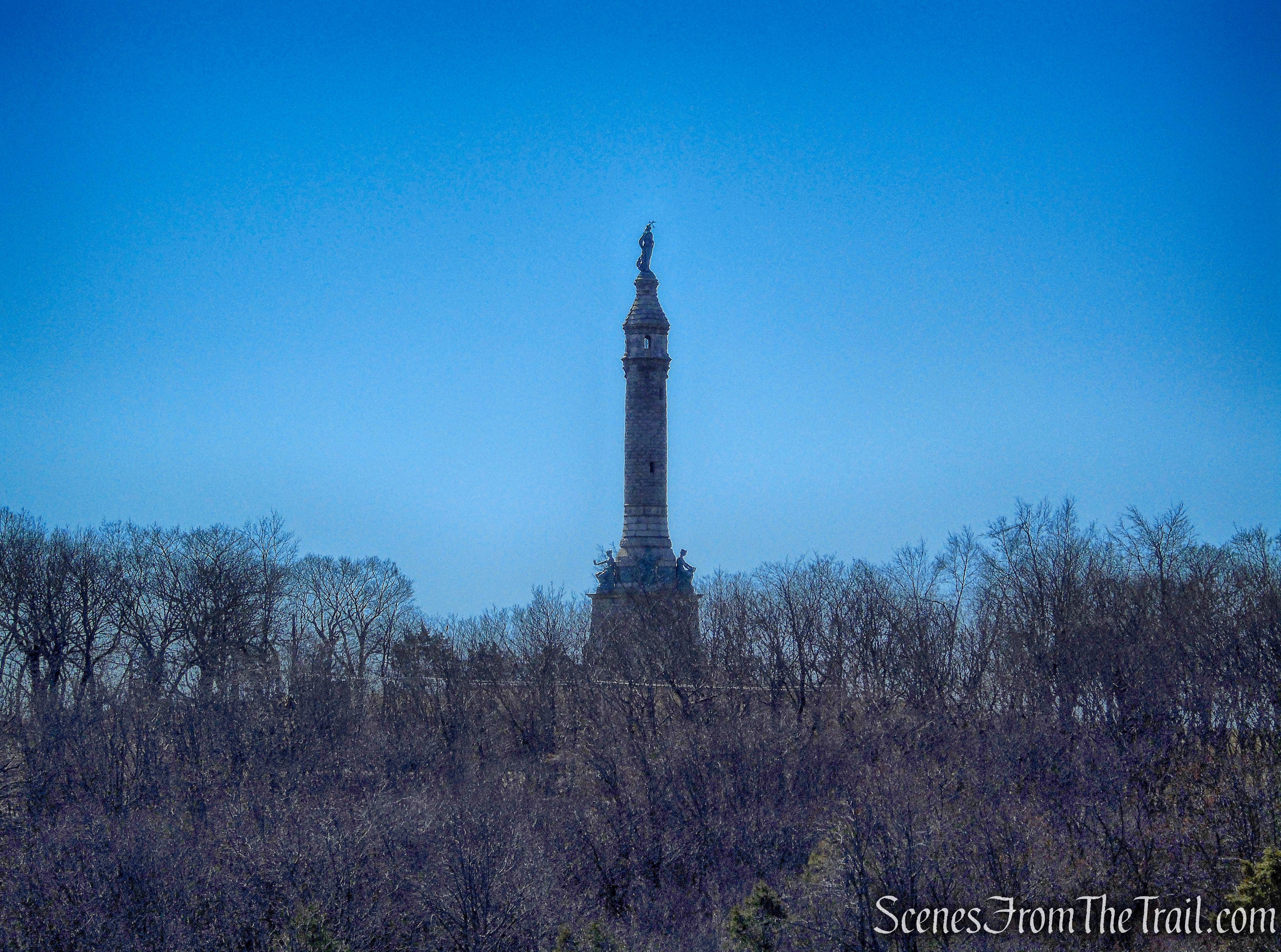
The 110-foot tall Soldiers’ and Sailors’ Monument high above New Haven, is visible for miles on a clear day. The monument, at the summit of East Rock Park, was dedicated in 1887 to honor soldiers and sailors who fought in the American Revolution, the War of 1812, the Mexican-American War and the Civil War.
Soldiers & Sailors Monument – East Rock Park
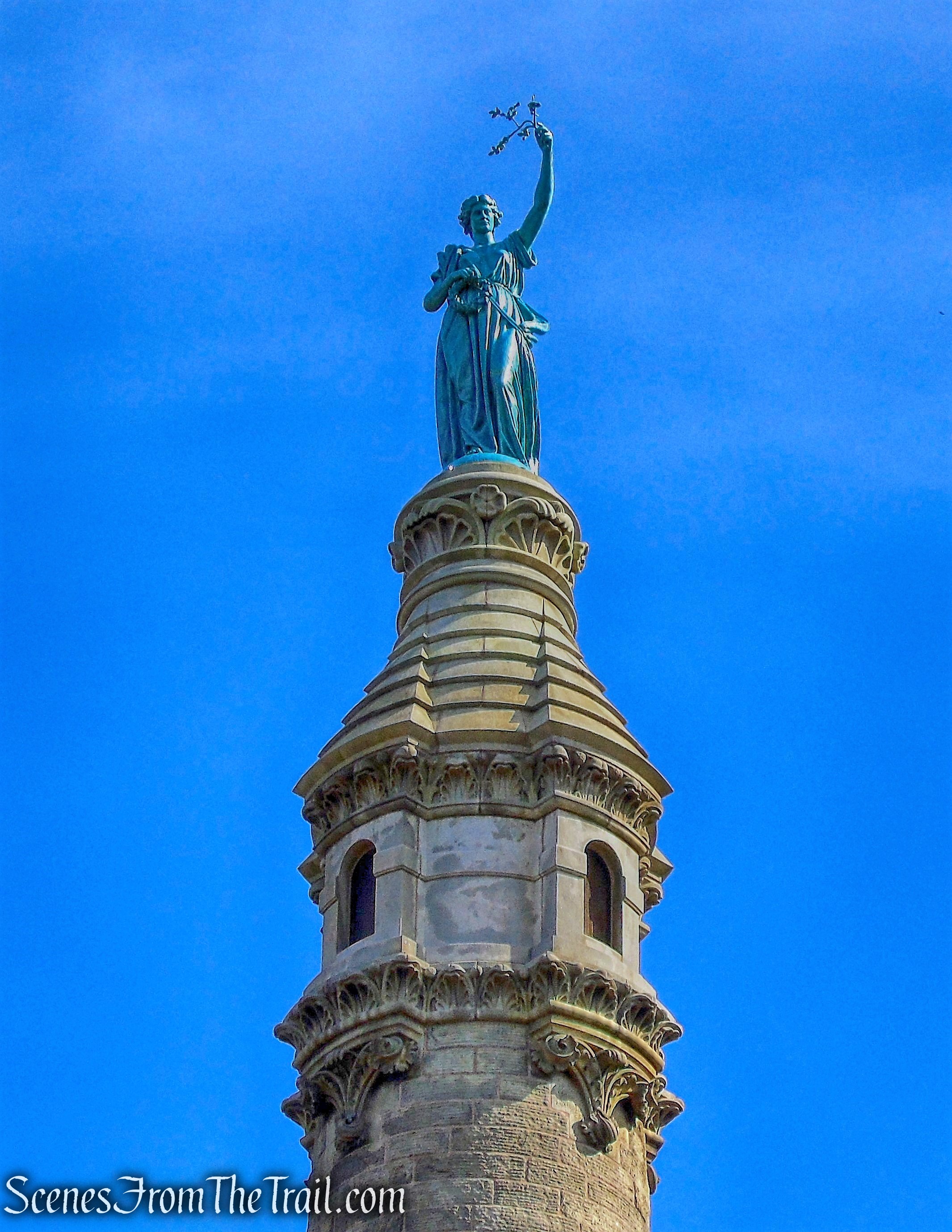
The monument is topped by an 11-foot tall statue known as the Angel of Peace, which faces downtown New Haven and holds an olive branch in an outstretched left arm. The statue, originally installed in March 1887, was restored in 2006 and returned to the top of the monument.
Soldiers & Sailors Monument – East Rock Park
The monument features a round granite column rising from a square base with allegorical bronze statues on all four corners, and bas relief sculptures depicting scenes from the highlighted wars.
Soldiers & Sailors Monument – East Rock Park
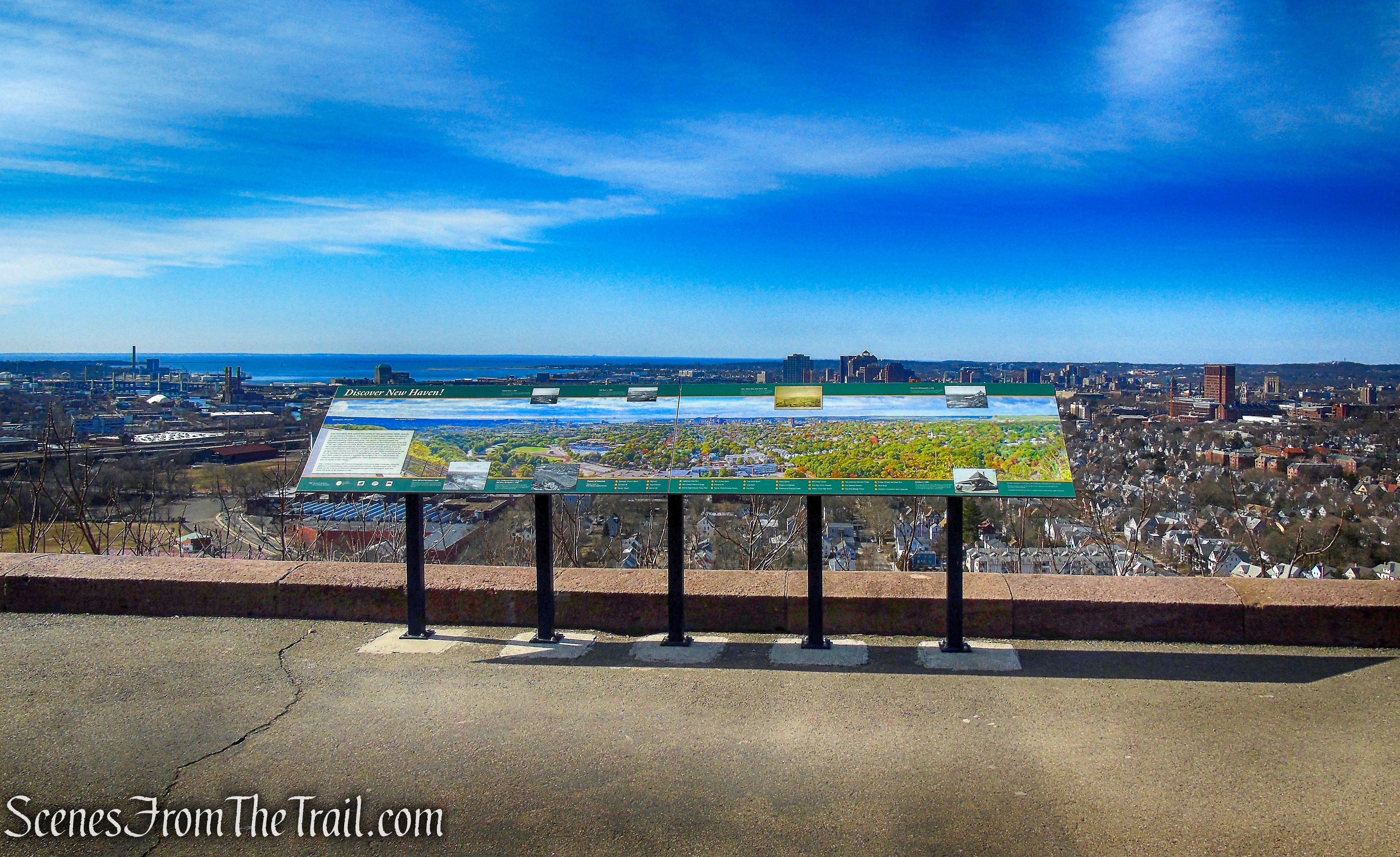
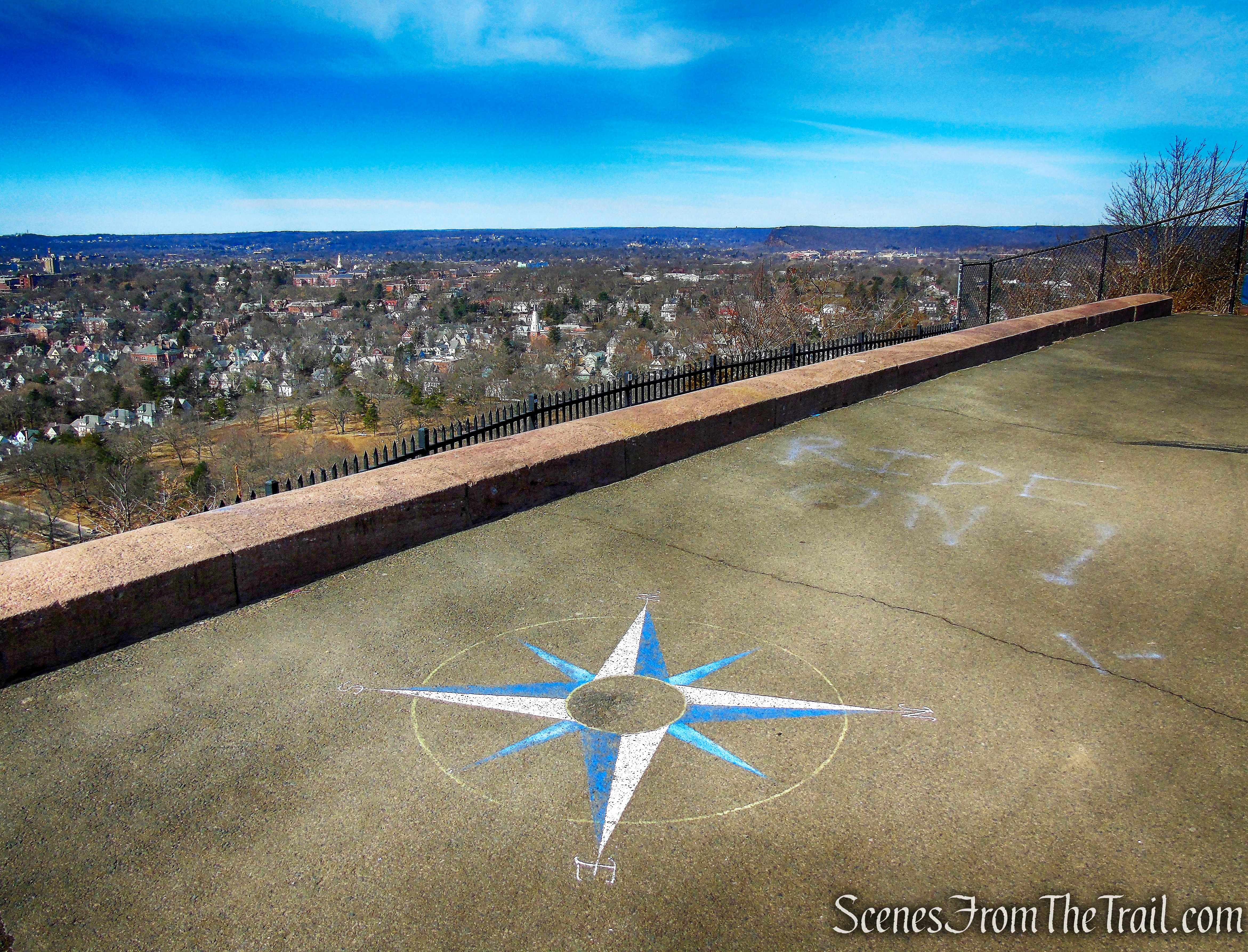
There are informational signs that detail the view below.
East Rock summit
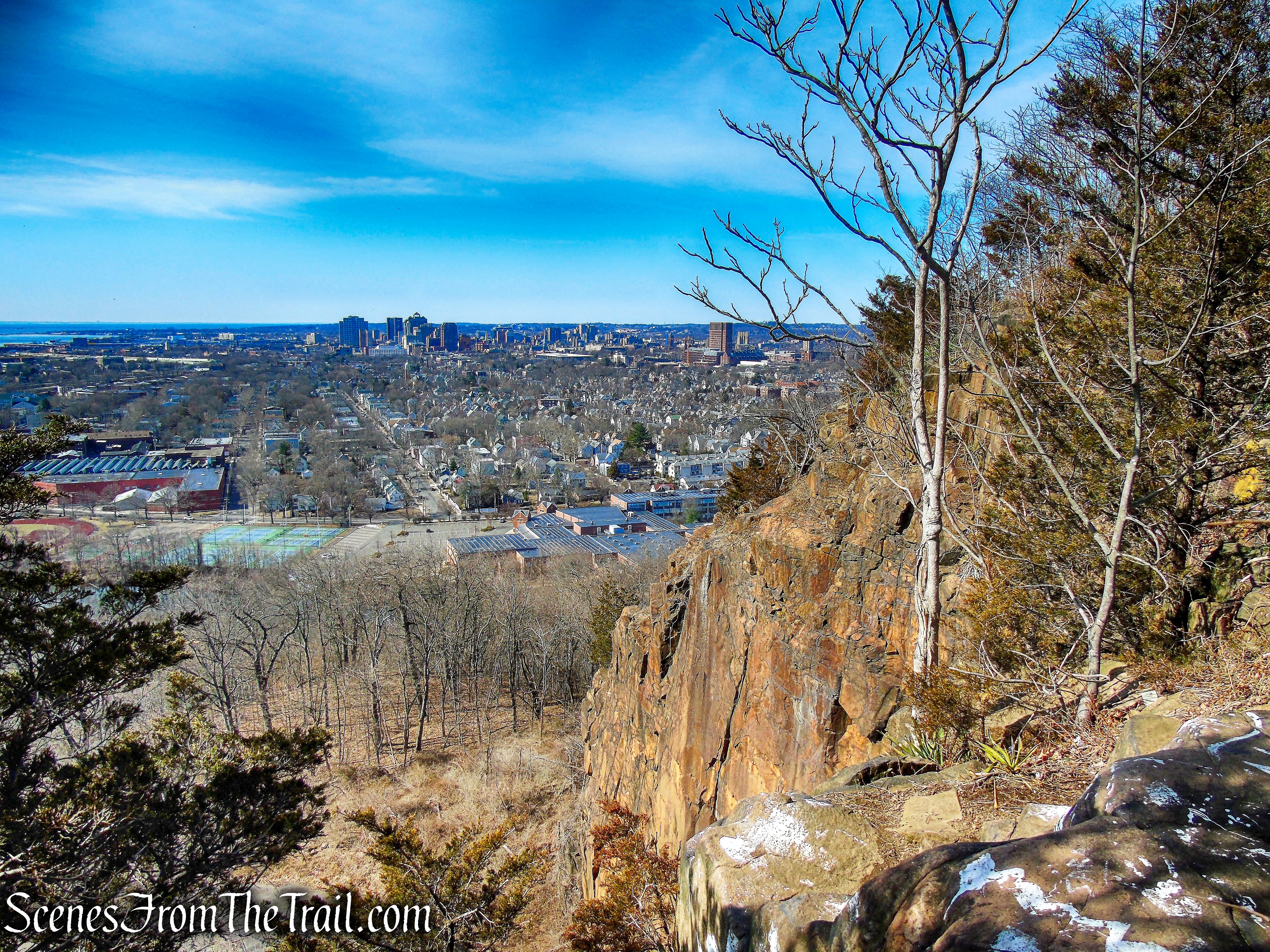
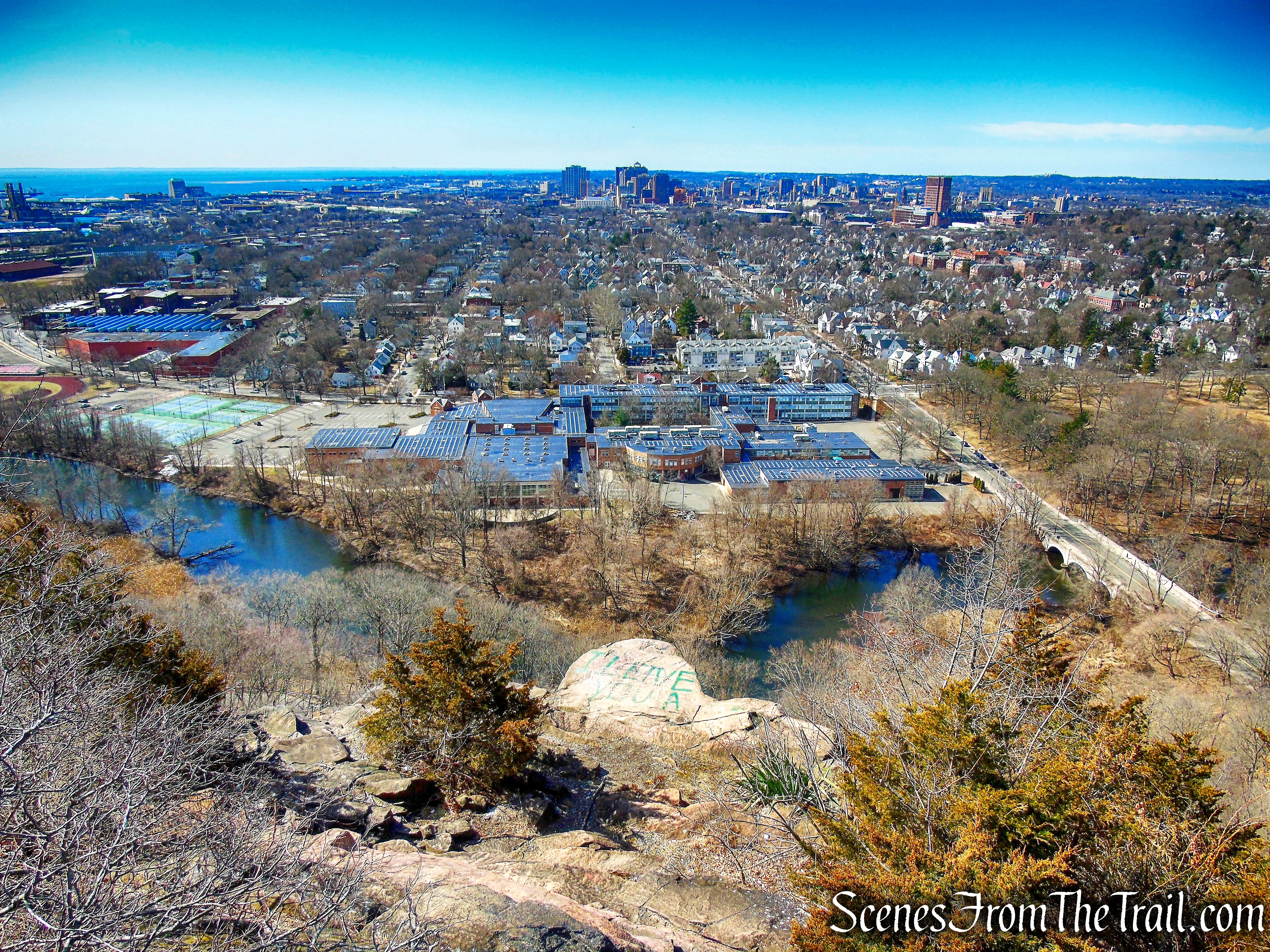
Looking southwest, Wilbur Cross High School is visible below, with the city of New Haven around it. Looking across the Long Island Sound, Long Island can be seen in the distance.
view southwest from East Rock summit
West Rock Ridge State Park is visible to the west.
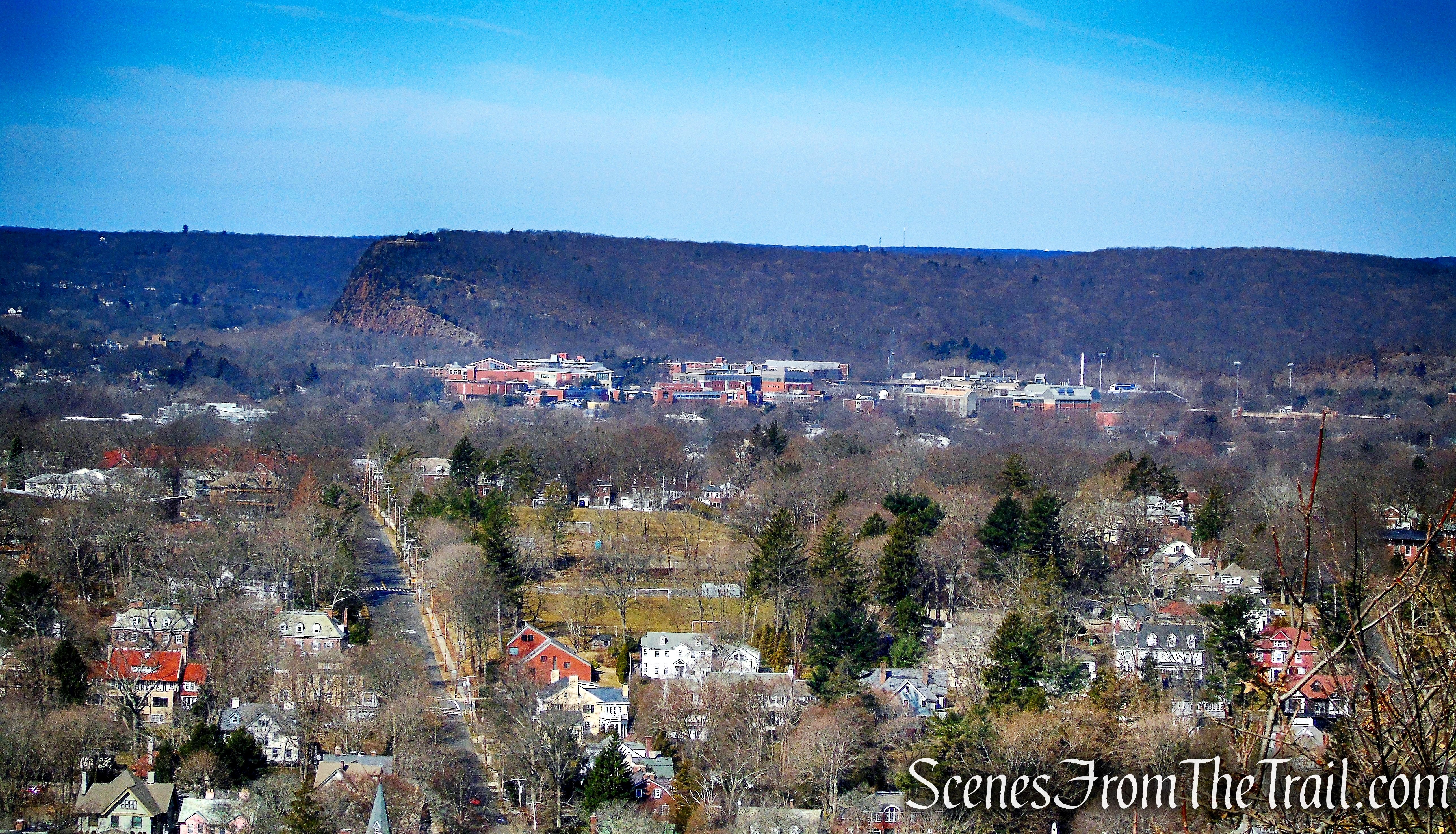
view west from East Rock summit
East Rock summit
Looking southwest over the city of New Haven.
view southwest from East Rock summit
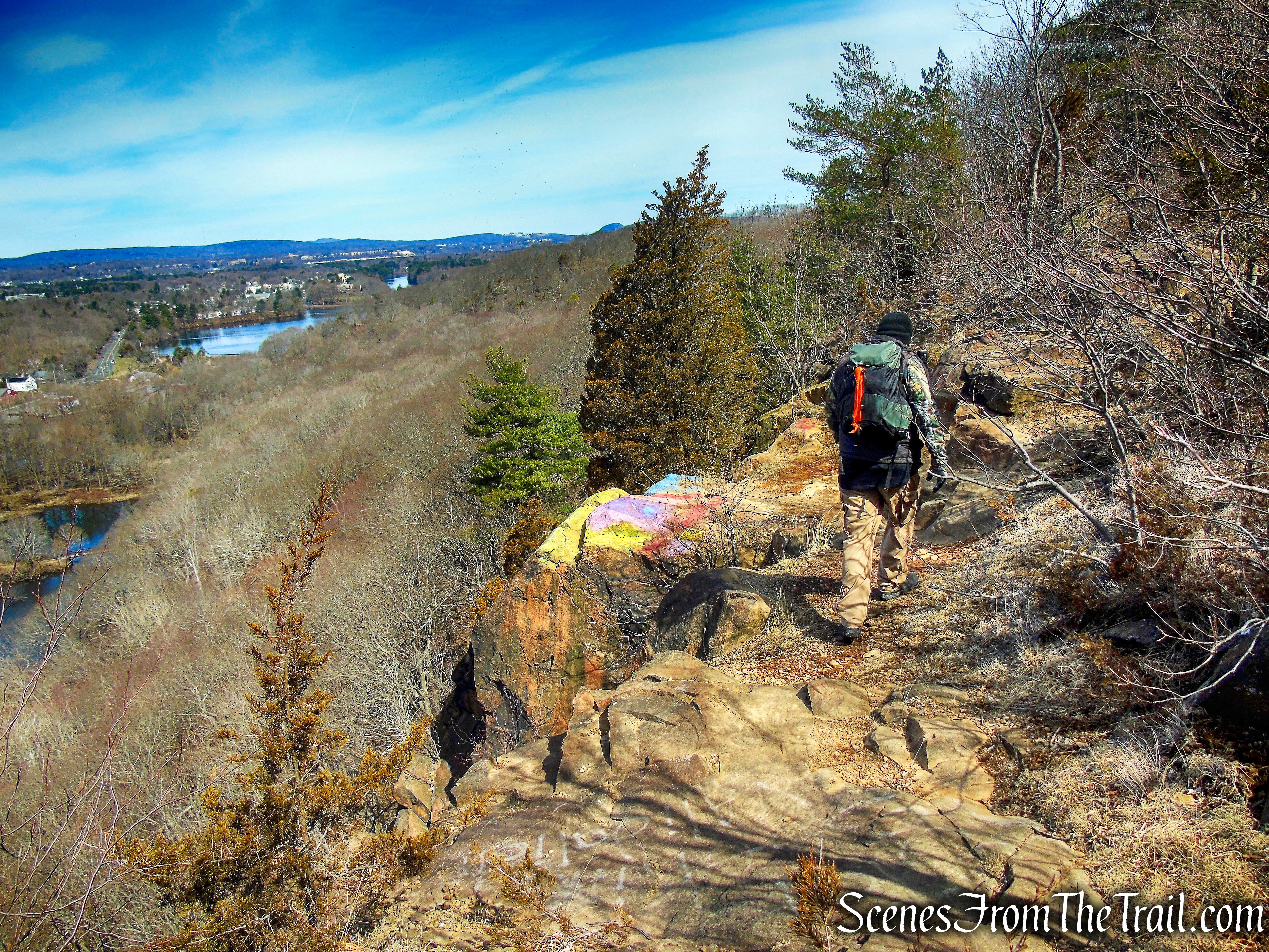
The Yellow Trail leaves the paved park road and runs north along the escarpment, with constant views along the way. Soon the trail passes by the English Shelter.
Yellow Trail – East Rock Park
Looking down Orange St. from Yellow Trail – East Rock Park
The English Shelter is a locally unique Modernist design using an abstract geometry of the triangle in steel and stone, to integrate structure and site. The picnic shelter’s design made a radical departure from traditional rustic park architecture, modeled on stone and log structures erected during the 1930’s. Architects Robert and Jean Coolidge were trained at Harvard in the 1940’s.
English Shelter – East Rock Park
Continuing north along the escarpment, I saw two Peregrine Falcons dancing near the cliffs. One of them landed and I was able to capture this image.

Peregrine Falcon – East Rock Park
view northwest from Yellow Trail – East Rock Park
The Yellow Trail joins the park road then leaves the road just before the stone retaining wall. I would suggest to follow the park road until it meets back up with the yellow Trail a little further down.
Yellow Trail – East Rock Park
We followed the yellow blazes that lead between the retaining wall and the cliff. There is a lot of loose gravel and sand in this area and the footing is hazardous.
Yellow Trail – East Rock Park
Yellow Trail – East Rock Park
The Yellow Trail veers away from the cliff’s edge and starts to descend.
Yellow Trail – East Rock Park
The Yellow Trail crosses a paved park road then parallels it. It is then joined by the White Trail, crosses the paved road again, then the White Trail leaves to the left near the base of Whitney Peak as the Yellow Trail turns right.
Yellow Trail – East Rock Park
The Yellow Trail climbs steeply around the eastern slope of Whitney Peak on a rocky footpath.
Yellow Trail – East Rock Park
Yellow Trail – East Rock Park
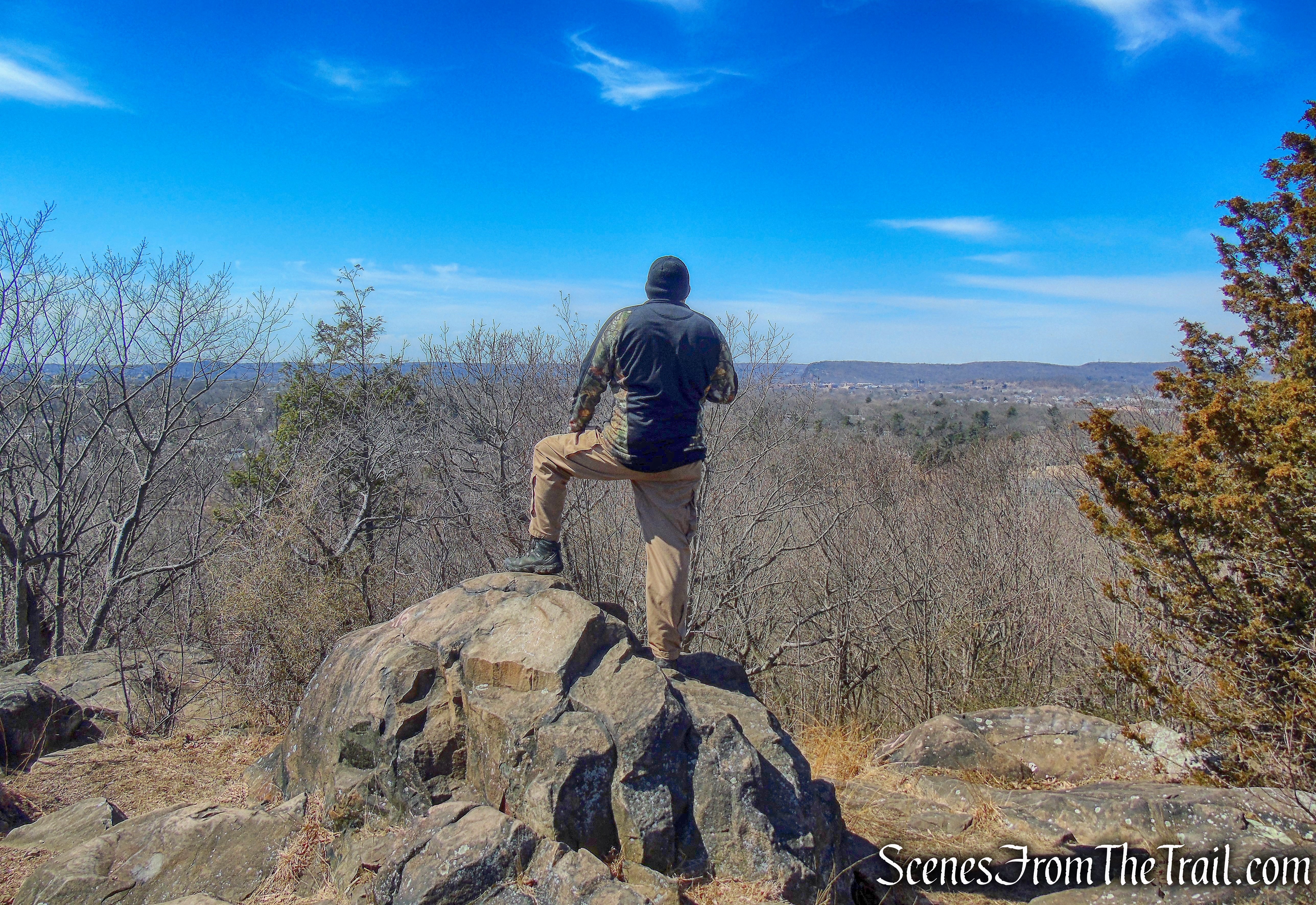
The trail levels off and comes to an open rock ledge with views to the southeast.
viewpoint at Whitney Peak – Yellow Trail – East Rock Park
To the right (south), the Soldiers & Sailors Monument can be seen high atop East Rock.
viewpoint at Whitney Peak – Yellow Trail – East Rock Park
The trail then heads northwest as it approaches the summit. A short unmarked trail leads to the actual summit of Whitney Peak.
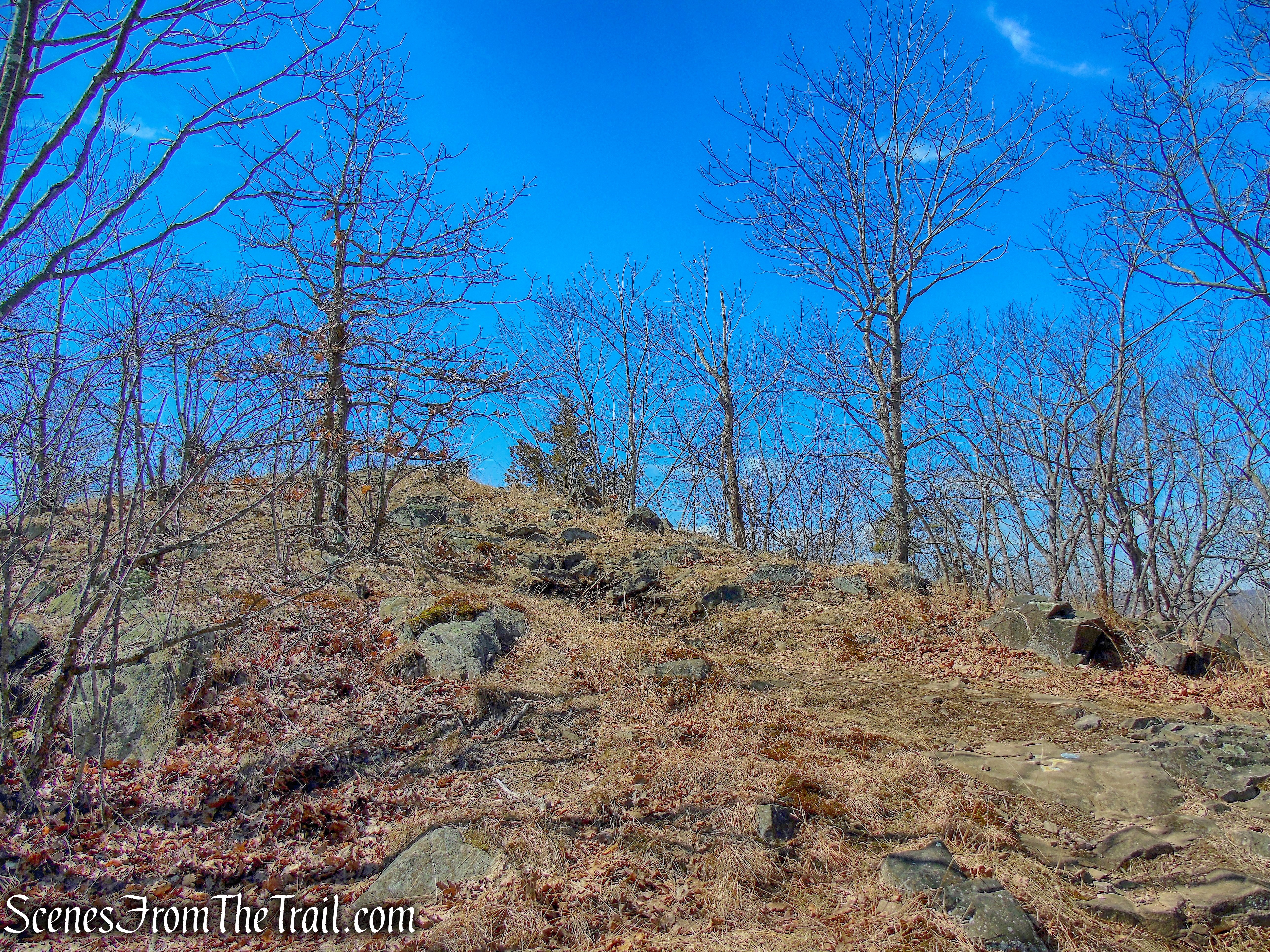
approaching Whitney Peak summit – Yellow Trail – East Rock Park
There are seasonal views at the summit, mostly through the trees.
Whitney Peak summit – East Rock Park
Looking west, West Rock Ridge State Park is visible in the distance.
view west from Whitney Peak summit – East Rock Park
Descending the summit, we turned left on the Yellow Trail and began heading downhill. When the Yellow Trail splits, we stayed left and continued heading northwest until this leg of the Yellow Trail ends at Farnam Drive, right in front of Whitney Circle.
Yellow Trail – East Rock Park
We walked around the circle and took an unmarked footpath to the edge of a cliff to catch a glimpse of Lake Whitney, the dam and waterfall.
Lake Whitney
We then walked back up to Whitney Circle and followed the guardrail to the right. We turned right on the Blue Trail and continued downhill. The Blue Trail heads southeast and ends at a T-intersection with the White Trail.
Blue Trail – East Rock Park
After taking a sharp right on the White Trail, we followed the wide path downhill until we reached the coal storage shed and turned left. We then crossed the Mill River on the covered bridge, back to the parking area, where the hike began.
White Trail – East Rock Park
Black Trail – East Rock Park
Review:
A great hike with many points of interest. For a city park that is located in an urban setting, at times I felt like I was in the deep woods. East Rock summit is reachable by car so it does attract crowds. The trails we hiked were almost deserted, but the paved park roads had plenty of walkers as the day wore on. Some trails could be better blazed in some areas and there are numerous unmarked spur trails that lead to steep drop offs. There were some large blowdowns along the Mill River that we had to climb over. These could seem as a negative, but I prefer a more primitive trail and it made the hike more interesting. The views are expansive and there are many. There are so many things to see in this park that it is worth the visit. I plan on going back and explore some more of it.
Pros: Scenic views, covered bridge, waterfall, Mill River, Giant Steps Trail, East Rock summit, Yellow Trail.
Cons: Some trails poorly marked or not blazed at all, crowds at East Rock summit.
Take a hike!
East Rock Park Loop
Sources:
- East Rock Park
- A. Frederick Oberlin Bridge
- Mill River: Water Power and Water Supply
- Lifestream for a Region: History of the Regional Water Authority
- Excerpt from New Haven Outdoors: a Guide to the City’s Parks, ©1990 – PDF
- Eli Whitney Museum and Workshop
- Soldiers & Sailors Monument
