January 12, 2019 – Sparkill, NY
Difficulty: Easy
Length: Approximately 4.4 miles
Max elevation: 218 ft. – total elevation gain 409 ft.
Route type: Circuit
Map: Hudson Palisades Trails Map #109 – Tallman Mountain State Park Map
Trailhead parking: Rockland Road, Sparkill, NY 10976
Overview:
The southernmost component of the Palisades Interstate Park system in New York State, 706-acre Tallman Mountain State Park stretches along the Hudson River from the hamlet of Palisades to the Village of Piermont.
Tallman Mountain State Park comprises wooded country on the easterly slope of the Palisades uplands overlooking the Hudson River and the 1,000-acre Piermont Marsh, which lies between the river and the slope. The marsh is part of the Hudson River National Estuarine Research Reserve. The park operates as a day-use area, offering a running track, tennis courts, ball field, cross country skiing, a walking trail, hiking and picnic areas. Fees may apply.

Tallman Mountain State Park
History:
The cliff area was once threatened with quarrying. In 1923 the Standard Oil Company planned to take 540 acres to make an oil tank “farm.” The project was never completed because of strong public opposition. There are still many oil-seepage ditches with earthen berms. When the land was acquired by the park, the ditches became woodland ponds.
Below is an aerial photograph (circa 1920) which show the tanks. Image courtesy of the Nyack Library.
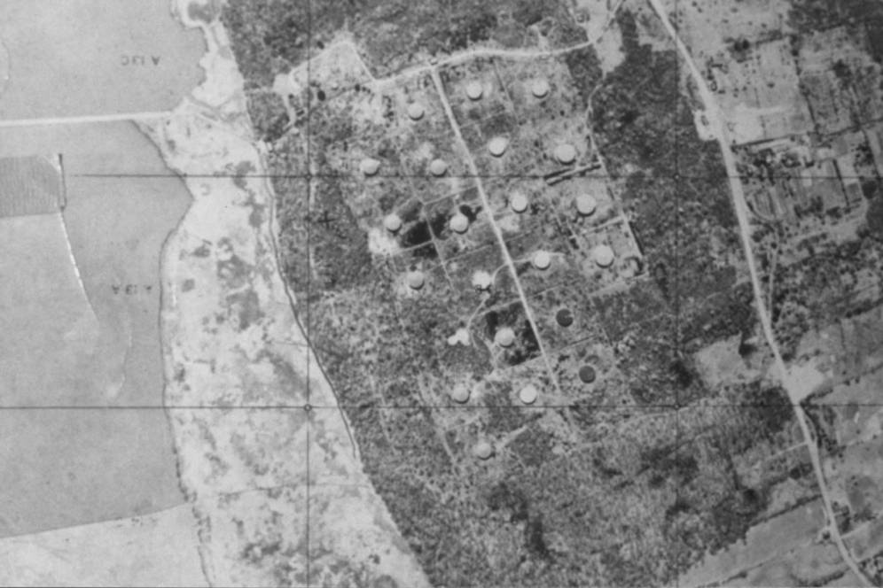
Tallman Mountain State Park – Nyack Library
Tallman Mountain State Park was formed in 1928 after the Palisades Interstate Park Commission moved to condemn the 164-acre property of the Standard Trap Rock Company in an effort to preserve a portion of the Hudson River Palisades. Park facilities were improved in 1933 by Temporary Emergency Relief Administration workers, who constructed a swimming pool, recreation fields, and picnic areas. Some 550 men commuted daily from Yonkers to work on the construction. The park was so popular that it soon became overcrowded. In 1942 the Commission acquired 542 additional acres, the money donated by three of the Commissioners, Laurance S. Rockefeller, George W. Perkins, and W. Averell Harriman.
Trails:
Two north-south trails extend the length of the park, the Long Path and the Tallman Bike Path. These two trails may be combined to make loop hikes from 2.5 to 5 miles. There are also some paved path roads, walkways and unmarked footpaths that branch off the main trails as well.

Tallman Mountain State Park
The Hike:
I scheduled this hike to coincide with the controlled demolition of the East Anchor of the Tappan Zee Bridge. Some of the best views of the Tappan Zee Bridge can be had from the Piermont Pier and Tallman Mountain. Unfortunately the demolition was postponed, but I decided to proceed with the hike anyway.
From the South Picnic parking area, we began following the orange blazes of the Interpretive Trail.
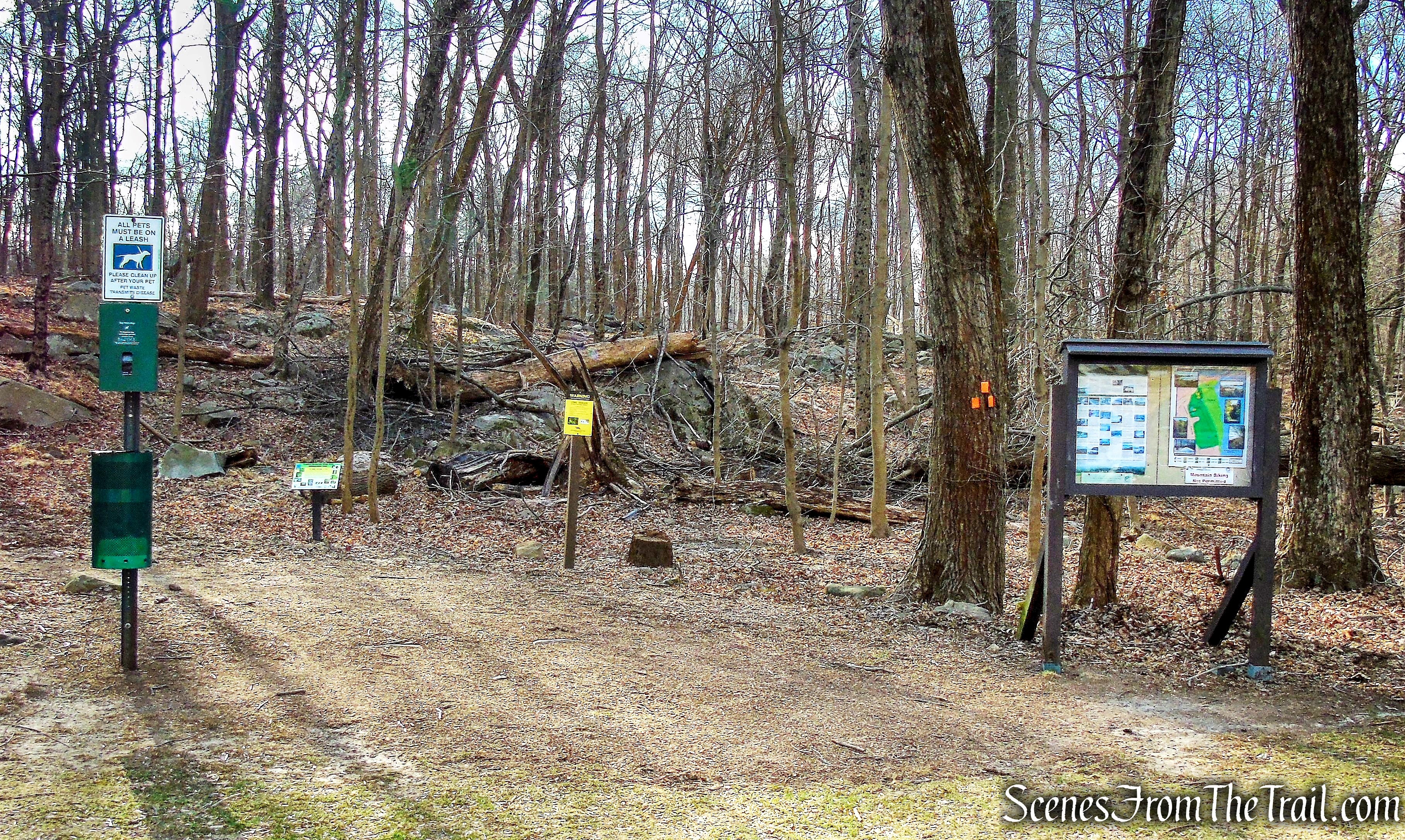
Start of Interpretive Trail
Interpretive Trail
The trail heads east through the tree lined forest.
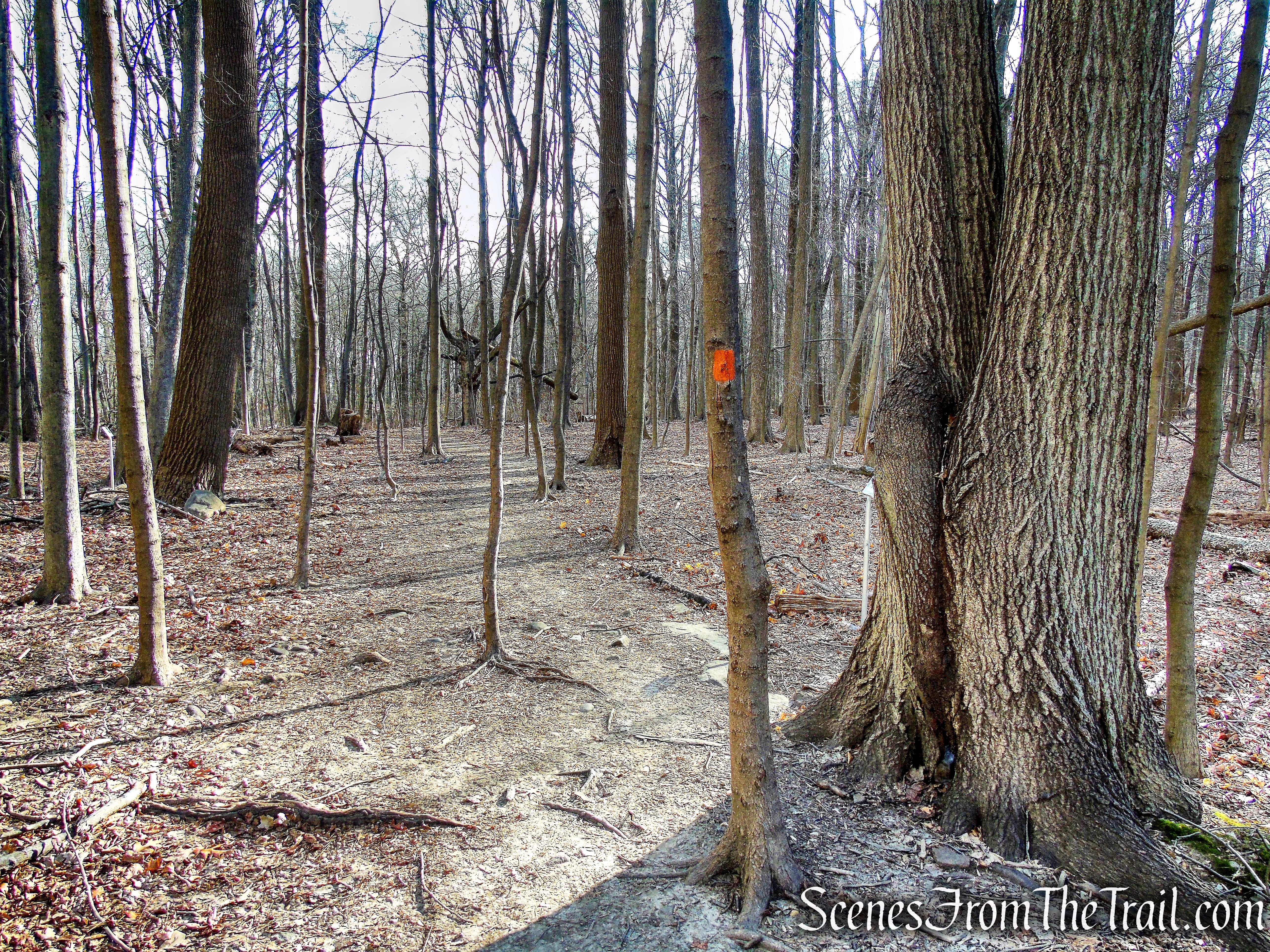
Interpretive Trail
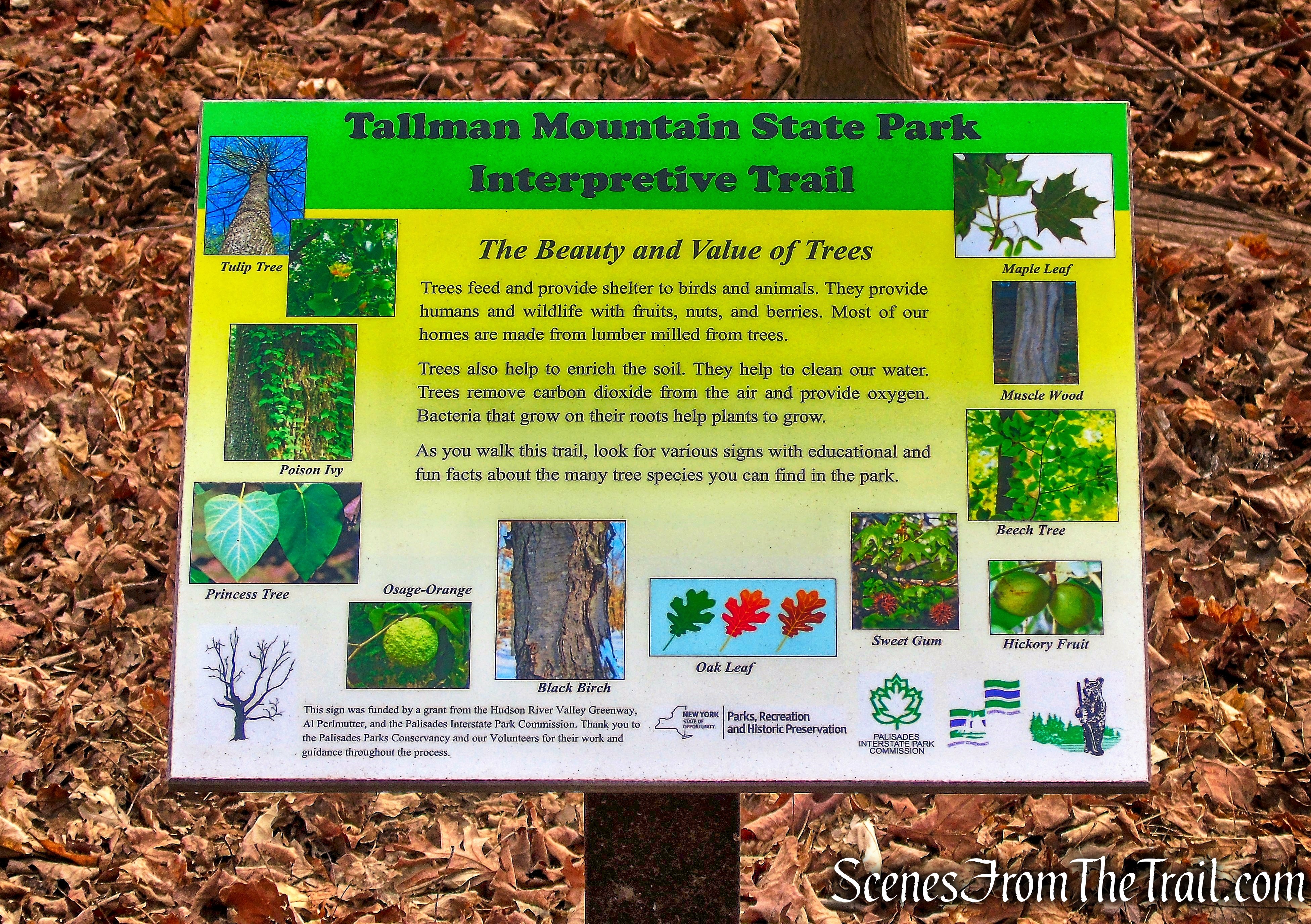
Along the way there are interpretive signs with detailed information on the different species of the native trees.
Interpretive Trail
Interpretive Trail
In about 400 yards, the Interpretive Trail crosses the Tallman Bike Path. In another 250 feet, the orange-blazed trail ends at a T-intersection with the aqua-blazed Long Path.
terminus of Interpretive Trail
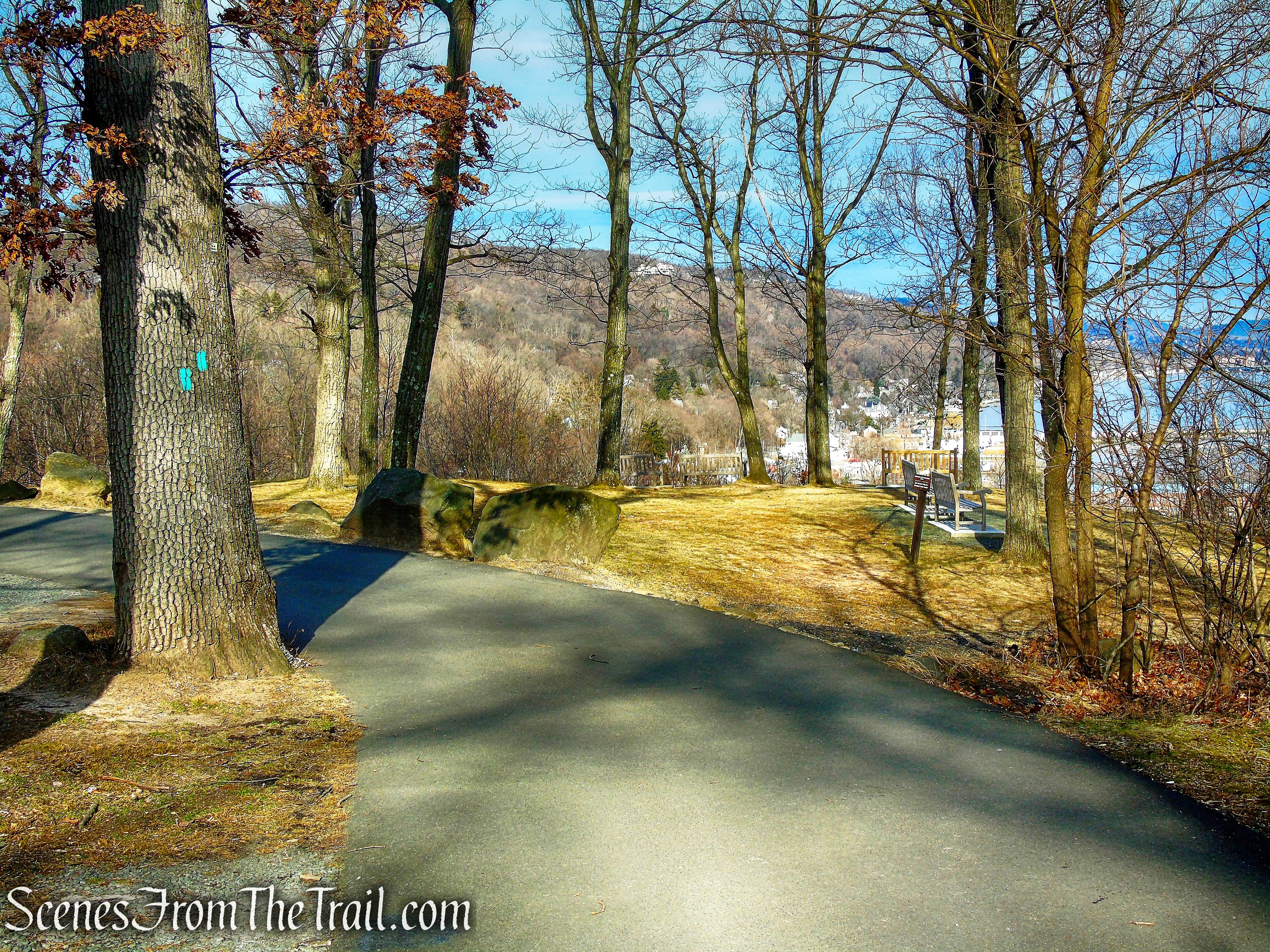
We turned left on the Long Path which heads north. The Long Path bears right at a fork and descends to reach the south end of a picnic area. With a gated road visible on the left, the Long Path bears right again and soon passes a stone comfort station on the left (closed in the winter) and a large group of picnic tables. Just beyond, it bears right at a fork, descends a slope, and briefly continues ahead along a stone-lined road. The trail bears right, leaving the road, and continues to descend more steeply on a footpath and stone steps. At the bottom of the steps, the trail turns sharply right and descends on a switchback.
Long Path
The Long Path turns right at the base of the descent and crosses a stream on a wooden bridge.
Long Path
Just ahead, the park swimming pool is visible below on the right, with the Piermont Marsh and the Hudson River beyond. A bench has been placed here for visitors to pause to enjoy the view.

Long Path
We continued to follow the Long Path as it turns sharply left and climbs a paved path to a traffic circle.
Long Path
The marked trail bears right and crosses the park road that leads down to the river.
Long Path
On the other side of the road, it goes up wooden steps and continues to climb rather steeply to the North Picnic Area.
Long Path
Long Path
At the top, it turns right and follows the paved park road that runs close to the edge of the escarpment.
Long Path
There are picnic tables and benches along the way to take a break and enjoy the partial views through the trees.
Long Path
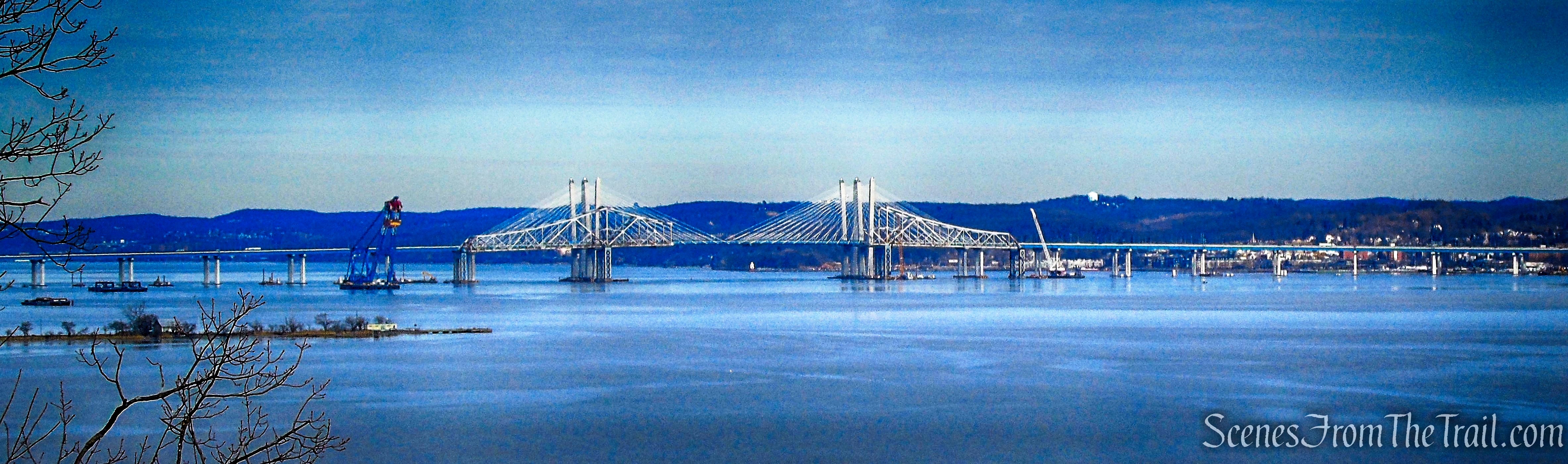
After passing a stone picnic shelter on the left, the Long Path reaches a viewpoint over the Hudson River from an open area on the right. The mile-long Piermont Pier (built by the Erie Railroad in 1838 as a terminus for its trains from the west) juts into the river to the north, with the Tappan Zee Bridge beyond. Piermont Marsh is directly below, and the villages of Irvington and Dobbs Ferry may be seen across the river.
Long Path
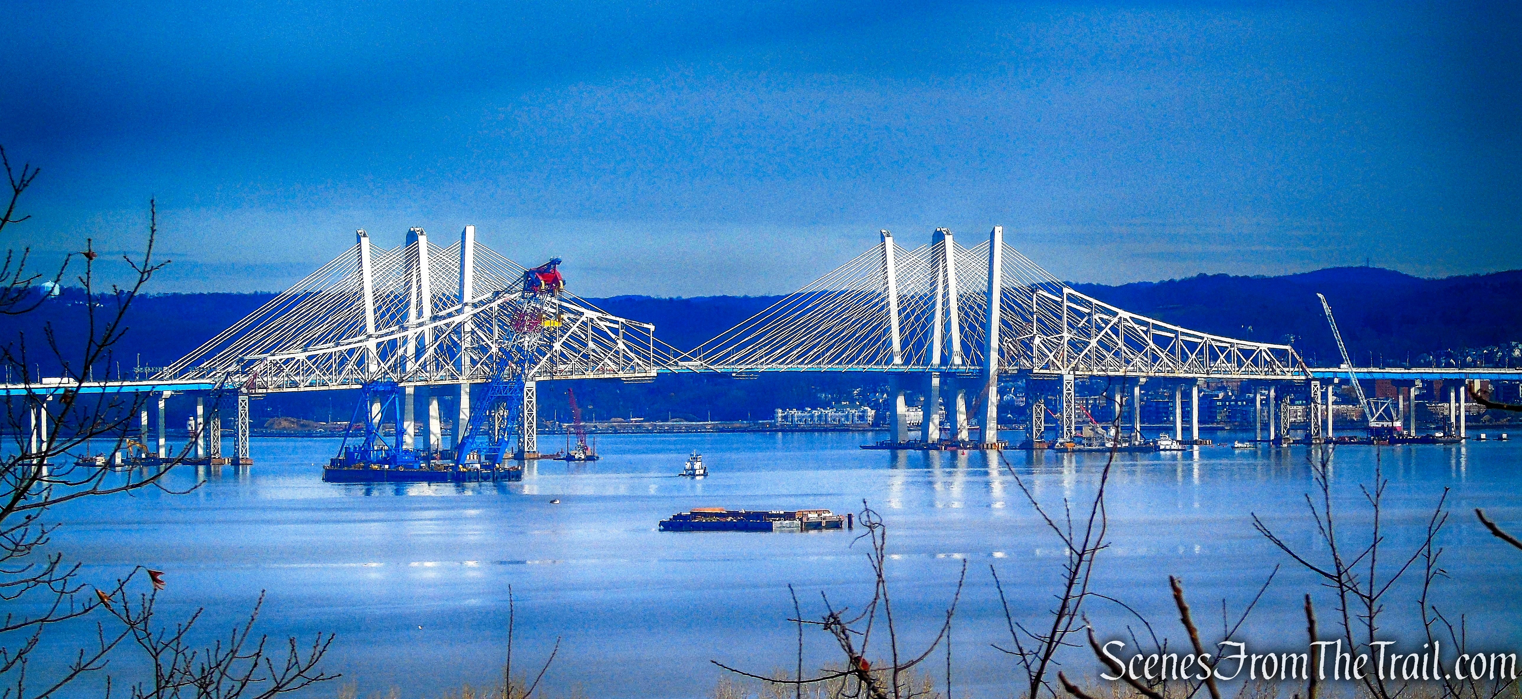
Tappan Zee Bridge
We continued ahead along the paved road. In another 200 feet, as the road bends to the left, we followed the aqua blazes which leave the road and continue ahead to a panoramic viewpoint.
Long Path
This one looks north along the Hudson, with the village of Piermont directly below and Hook Mountain jutting into the river in the distance. Benches have been placed here to encourage you to pause and enjoy the view.
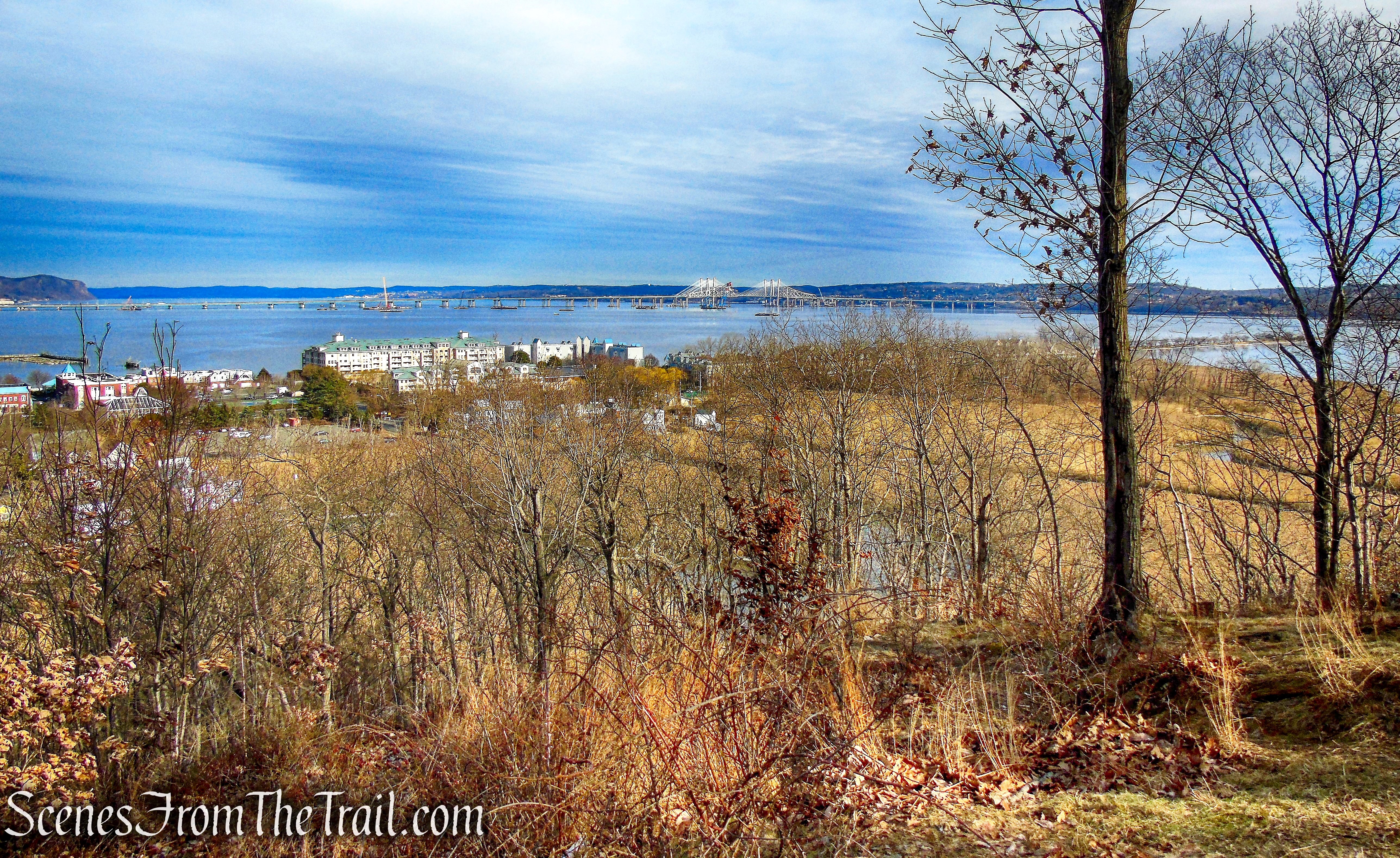
Long Path
Tappan Zee Bridge
Hook Mountain
The Long Path now bears right and steeply descends to the river level on rough, uneven rock steps. Caution should be exercised here if it is wet or covered with leaves.
Long Path
Long Path
Long Path
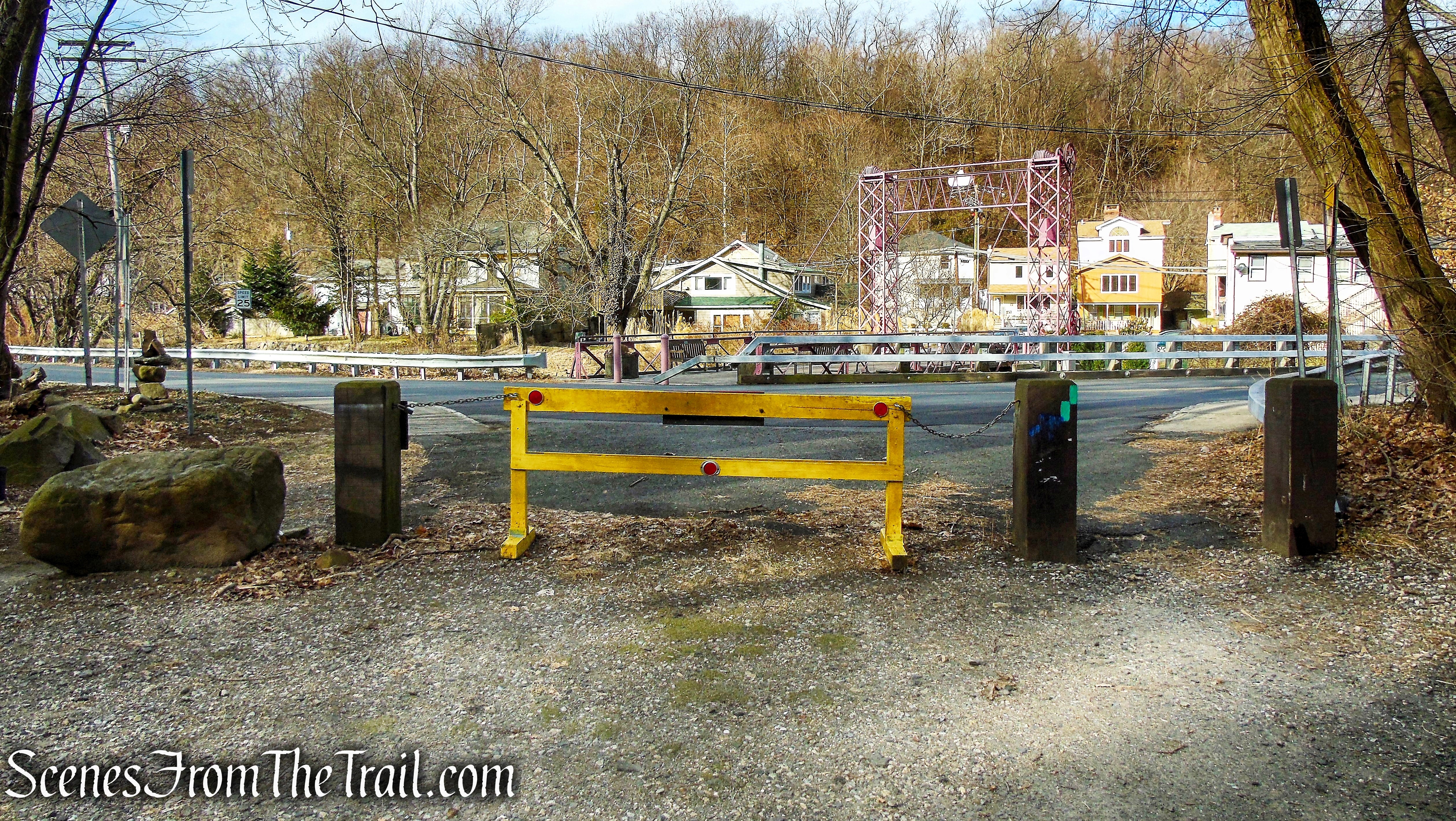
At the base of the descent, the Long Path reaches a gravel road, the route of the Tallman Bike Path. I turned left here to make a little detour.
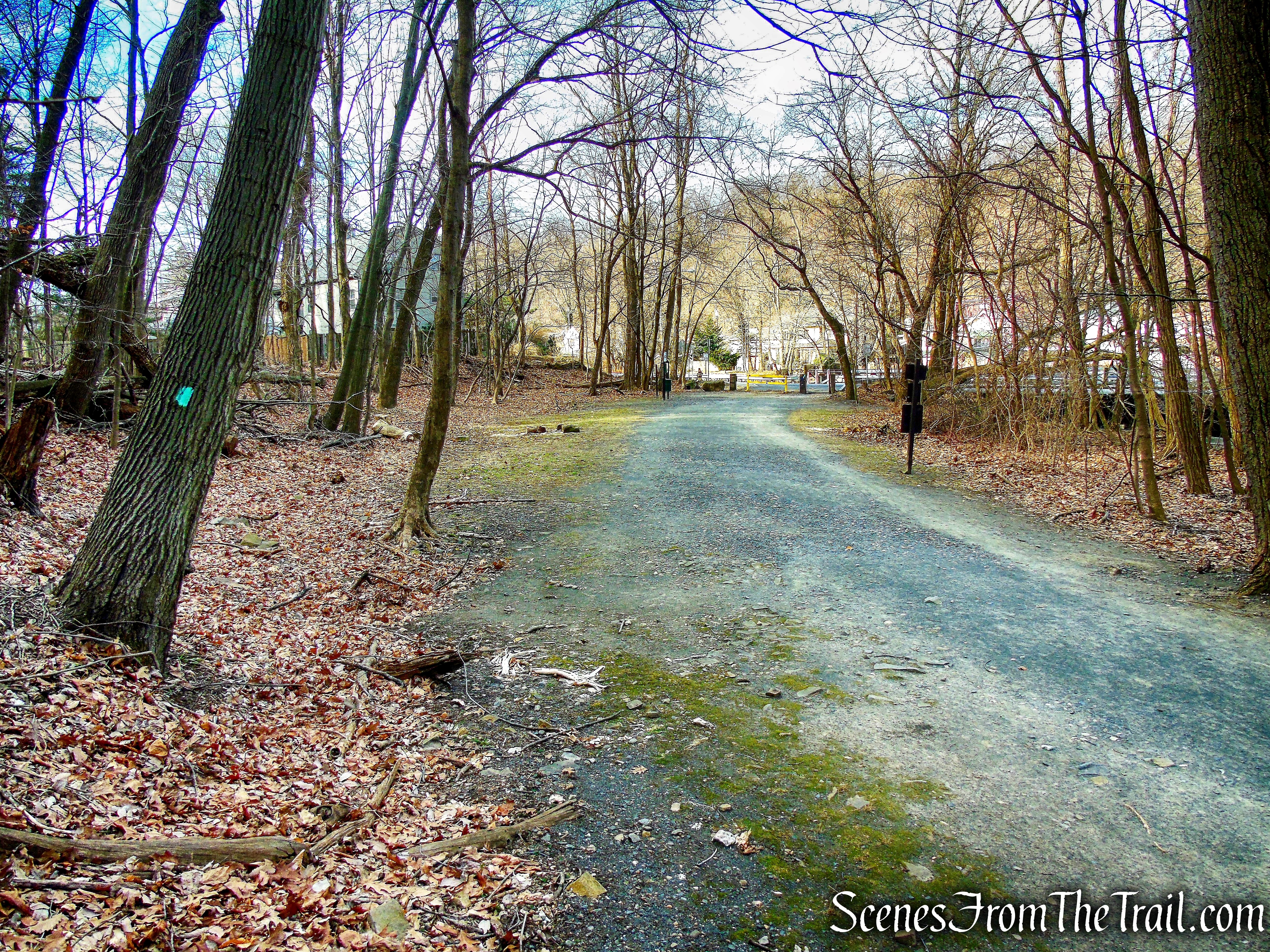
Long Path
I followed the Long Path to the gate on Ferdon Avenue to get a look at the historic Sparkill Creek Drawbridge.
Long Path
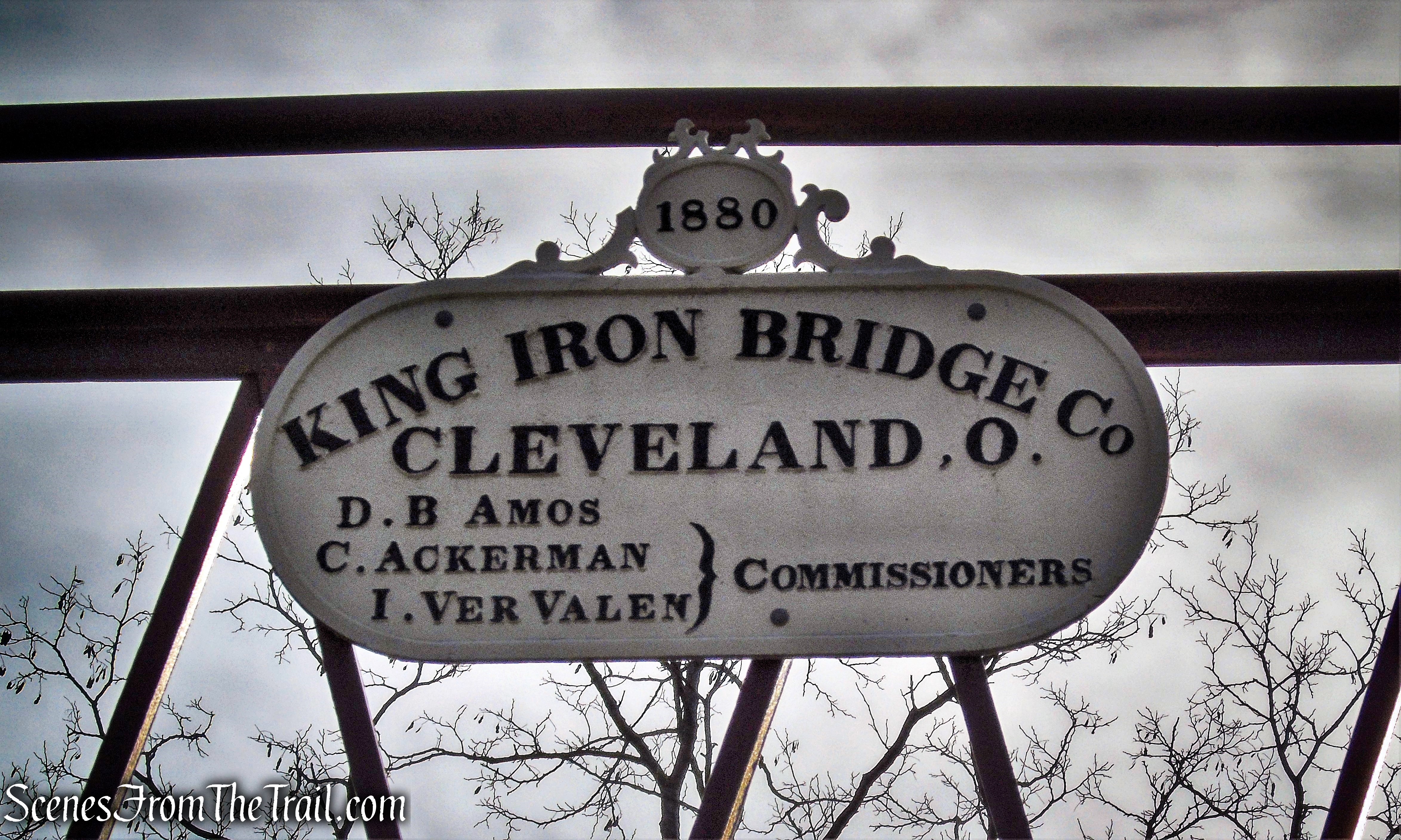
The Sparkill Creek Drawbridge is a historic Pratt Pony Truss drawbridge located at Piermont in Rockland County, New York.
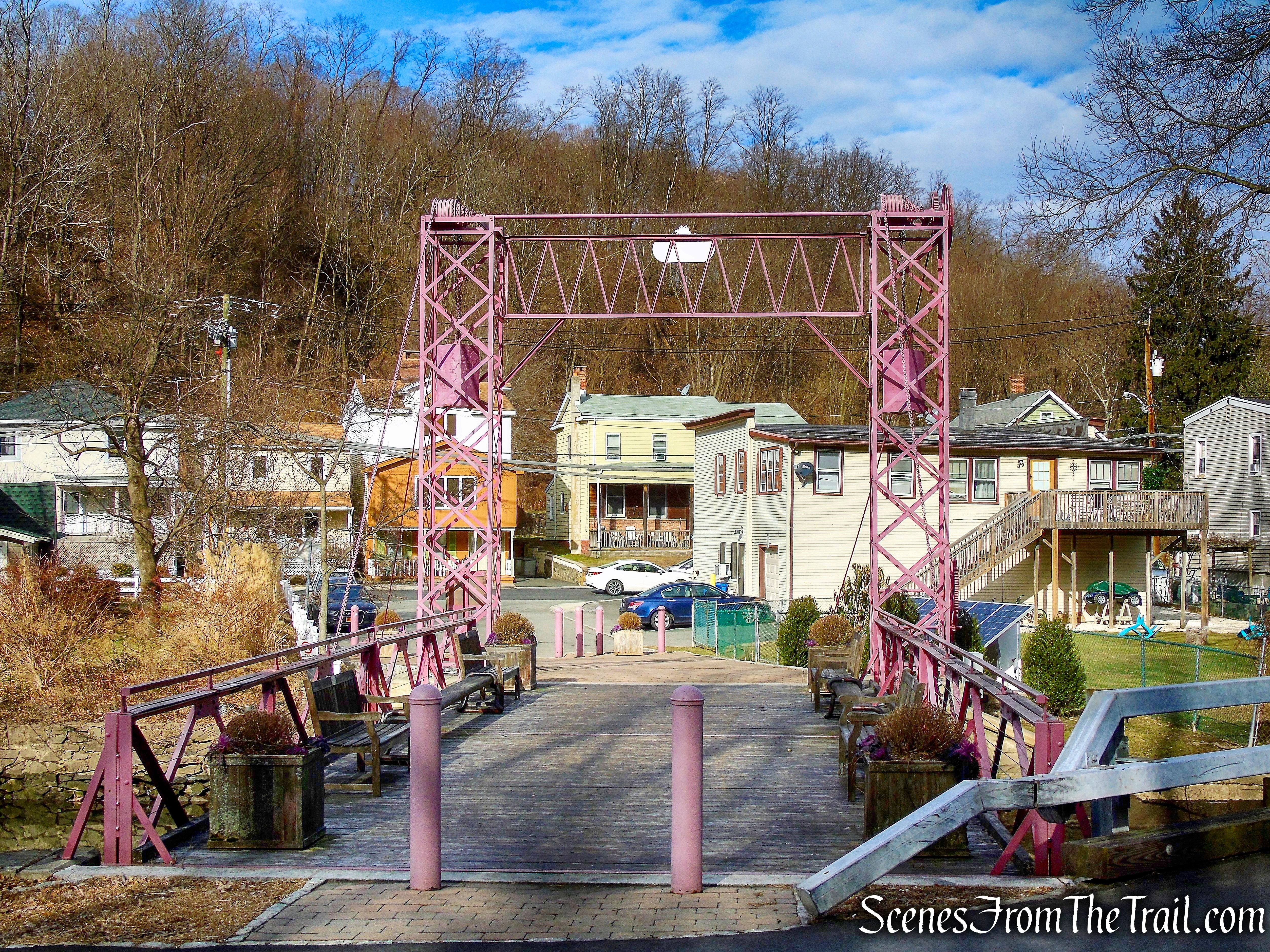
Sparkill Creek Drawbridge
It was built in 1880 by the King Iron Bridge Company of Cleveland, Ohio, and is a single-leaf movable metal bridge.
Sparkill Creek Drawbridge
Chains can lift the bridge when an operator turns a crank, helped by counterweights. It spans Sparkill Creek, a tributary of the Hudson River.
Sparkill Creek Drawbridge
The bridge was listed on the National Register of Historic Places in 1985 and documented by the Historic American Engineering Record in 1994. A complete dismantling and restoration for $900,000 was completed in 2009 and the bridge now serves as solely a pedestrian bridge. The Rockland County Highway Department was responsible for this historic restoration.
Sparkill Creek Drawbridge
After checking out the bridge, I retraced my steps and rejoined my hike mates on the gravel road. Passing the spot where the Long Path meets the gravel road, we began heading south. This unmarked gravel road which curves to the right and begins to parallel the reeds of the Piermont Marsh, is the Tallman Bike Path.
Tallman Bike Path
When the gravel road ends at a barrier of wooden posts, we veered right and continued uphill on the paved park road.
Tallman Bike Path
paved park road
looking east from paved park road
When we reached the traffic circle, we turned left at the end of the guardrail and then immediately veered right onto an unmarked footpath that leads into the woods.
unmarked footpath
We followed this unmarked path which heads south, parallel to the park road. After crossing an open area, it joins a moss-covered paved path that comes in from the left and soon ends at a park road that leads to the South Picnic Area.
unmarked footpath
moss-covered paved path
We turned left onto this paved road, then veered right at the fork, following the green “Bike Route” sign.
bear right at the fork, following the green “Bike Route” sign
Heading south on the paved bike path, we spotted a water tank just up the hill on the right.
Tallman Bike Path
I bushwacked up the hill to check it out, a worthwhile detour.
water tower
I then bushwacked south from the water tower and rejoined my fellow hikers on the bike path.
Tallman Bike Path
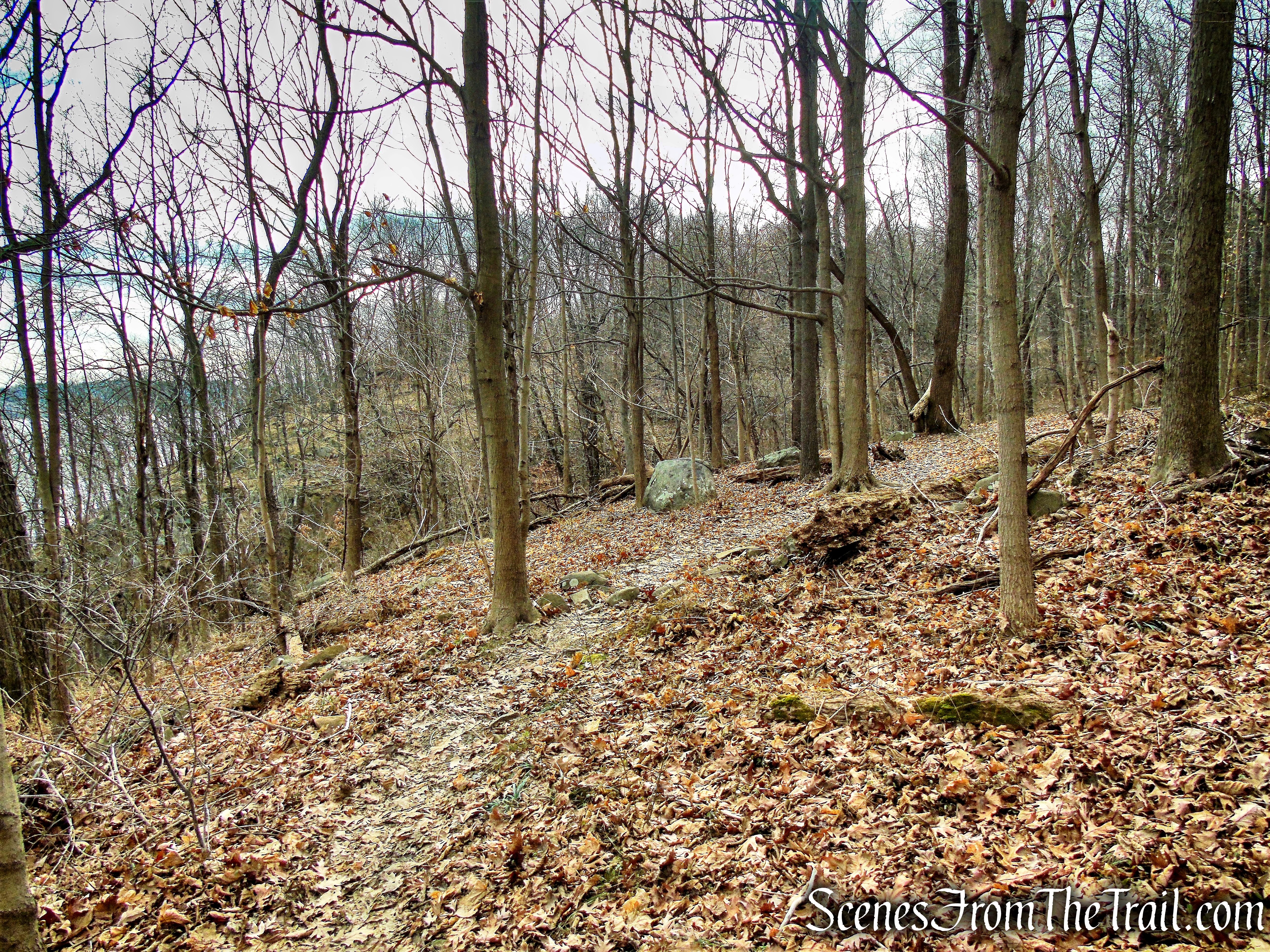
The pavement ends at the top of the hill, but we followed the gravel road as it heads south, parallel to the Hudson River, which is sometimes visible through the trees on the left. From the point at which the paving of the Bike Path ends (near the top of the hill), we continued ahead on the Bike Path for 0.3 mile, watching carefully for the Long Path crossing. When we reached the spot where the Long Path crosses the Bike Path, we turned left onto the aqua-blazed trail.
turn left on Long Path
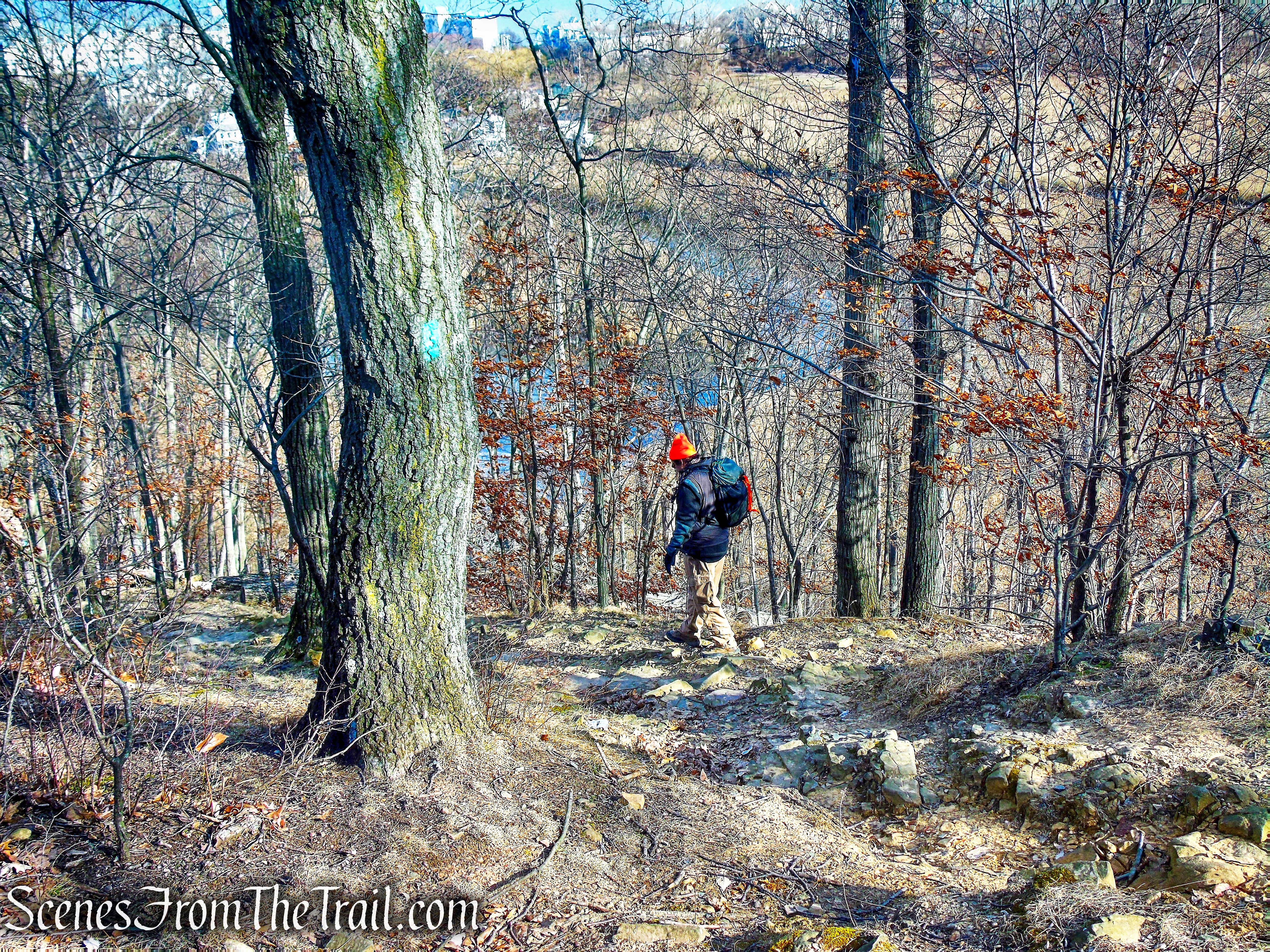
We continued on the Long Path for about 300 feet until we came close to the cliff edge and noticed an unmarked footpath that comes in from the right.
Long Path
We turned right onto this footpath and headed south, with views of the Hudson River to the left through the trees.
unmarked footpath
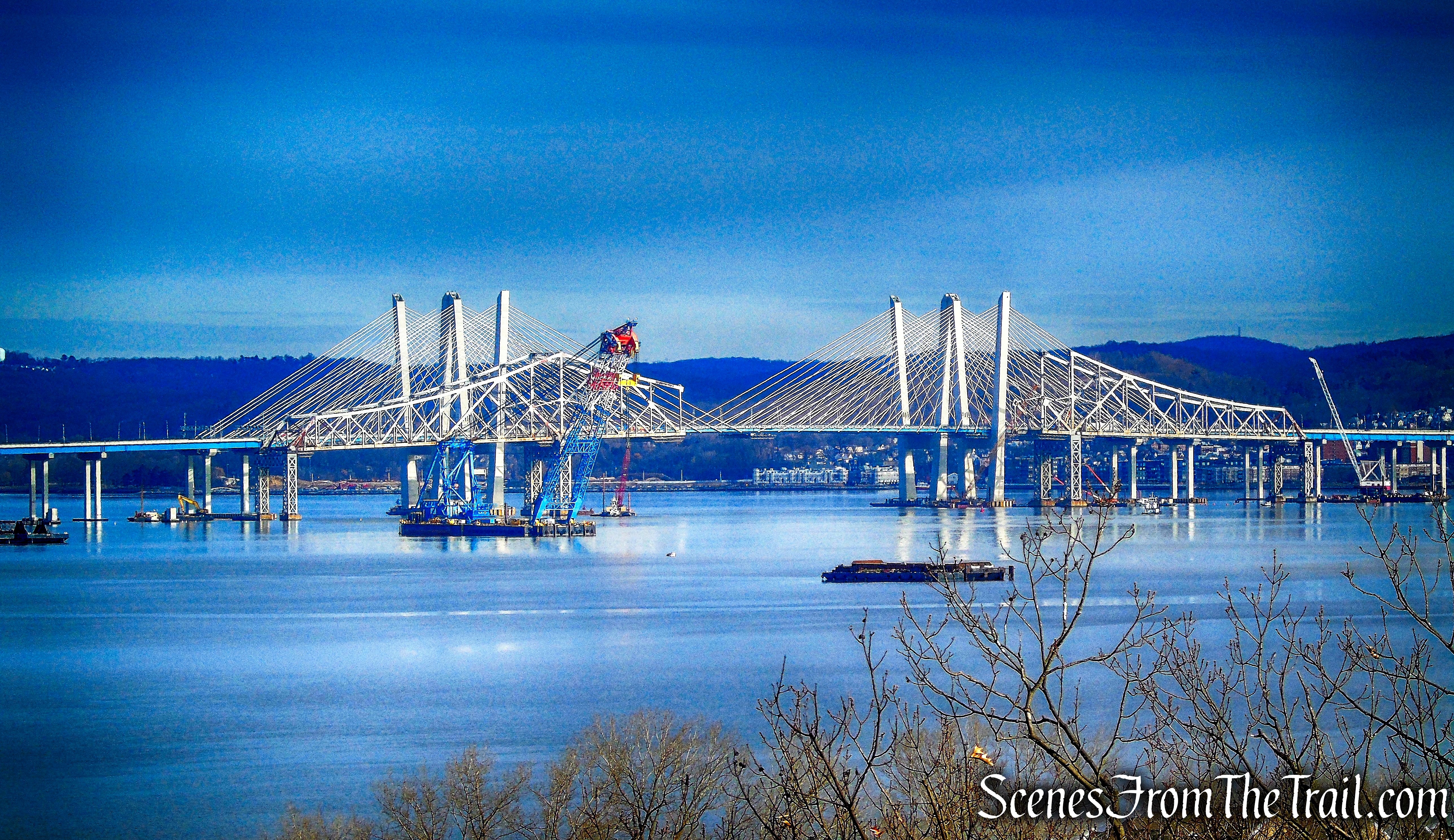
In about half a mile, we reached an open rock ledge on the left that affords spectacular views over the river, the Piermont Marsh below, and the Tappan Zee Bridge to the north.
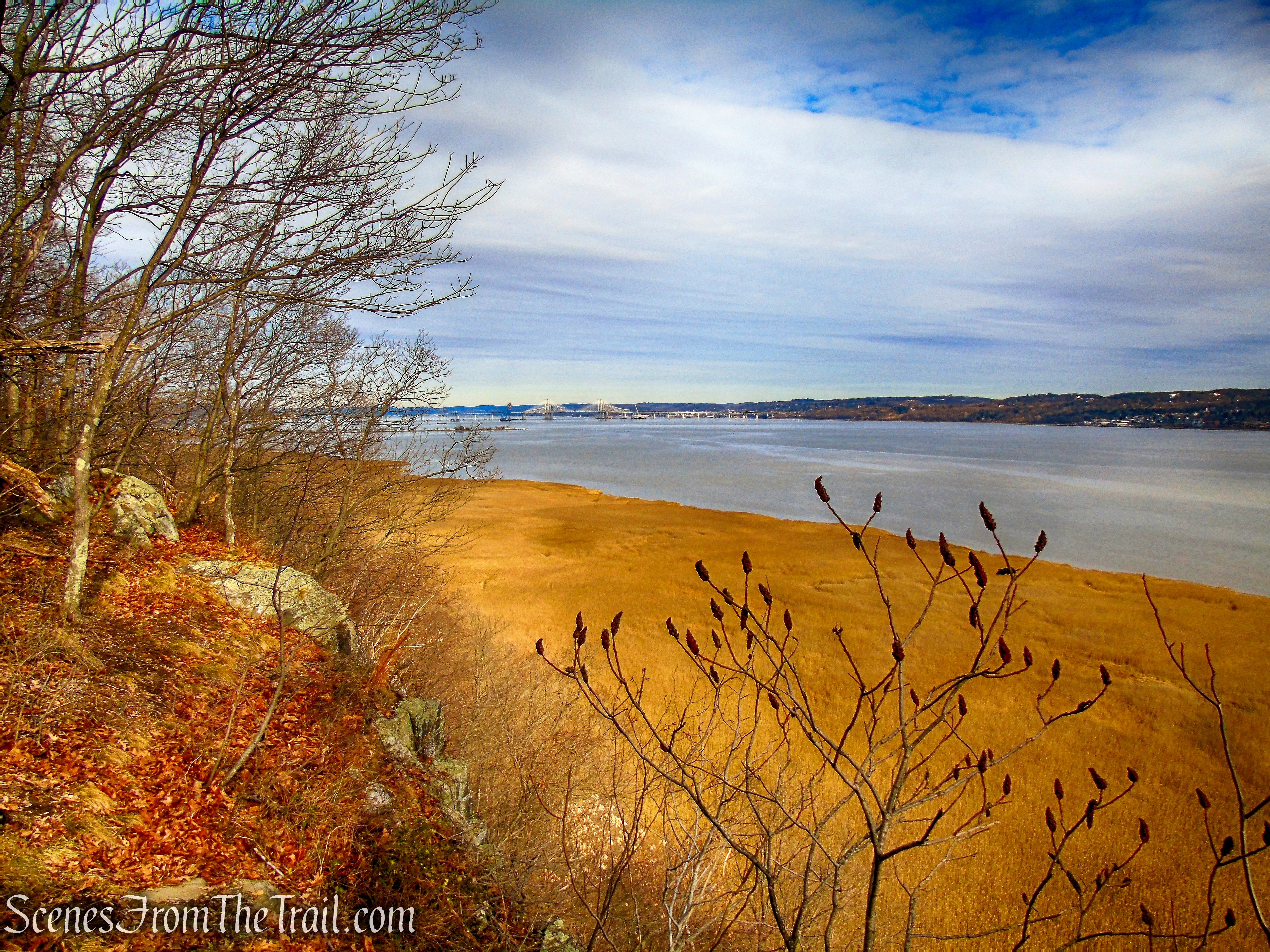
view from open rock ledge
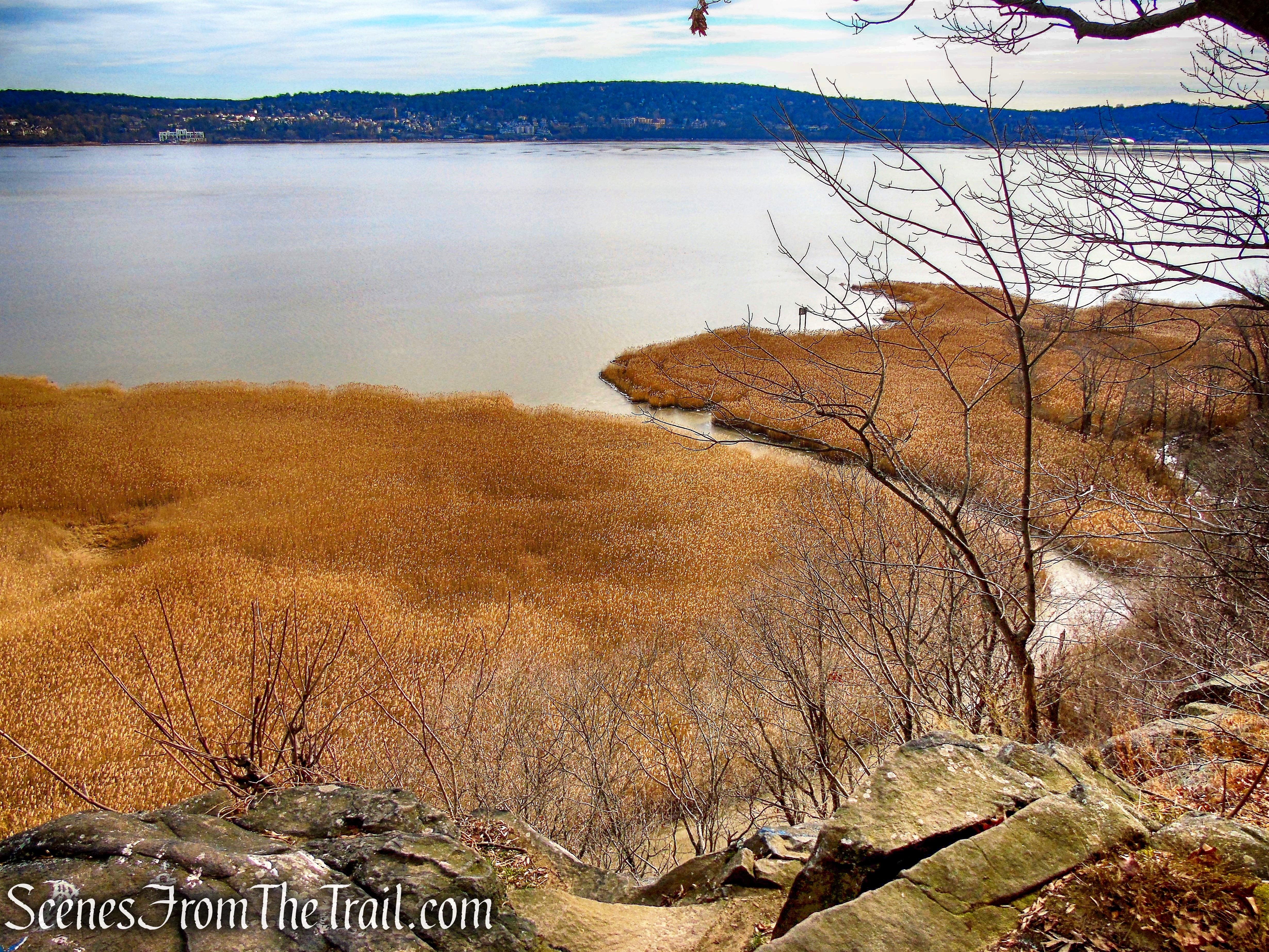
view from open rock ledge
view from open rock ledge
After taking in the view, we continued south along the unmarked trail. In about 500 feet, just before reaching a deep ravine, the trail turns right and begins to head west.
unmarked footpath
Just beyond, we were supposed to bear right at a fork (this turn can easily be missed, as the left fork is more distinct). We overshot this turn and ended up at stream crossing with some brick columns along the edge of the stream. We backtracked a short distance and with the help of the Avenza app, found the trail we were looking for.
unmarked footpath
Once on the trail it became more discernible and easier to follow. The unmarked trail soon ends at the gravel road followed by the Bike Path.

turn right on Tallman Bike Path
We turned right onto the Tallman Bike Path and began heading north.
Tallman Bike Path
Tallman Bike Path
After about 0.8 mile on the bike path, we reached the spot where the orange-blazed Interpretive Trail crosses the road.
turn left on Orange Trail
Here we turned left and began following the orange blazes as they lead west, now retracing our steps.
Interpretive Trail
Interpretive Trail
We followed the orange blazes back to the parking area where the hike began.
Interpretive Trail
Upon returning to the vehicle and enjoying some hot chocolate and a Raspberry Turnover, I decided to take a walk and take a look at the stone handiwork of the TERA workers. (This distance is not included in the length of the hike).
Tallman Mountain State Park
I was intrigued by the stonework just beyond.
Tallman Mountain State Park
Tallman Mountain State Park
I was surprised and impressed when I discovered that they were stone bleachers.
Tallman Mountain State Park
A stone water fountain nearby.
Tallman Mountain State Park
A double-sided stone comfort station with terraces.
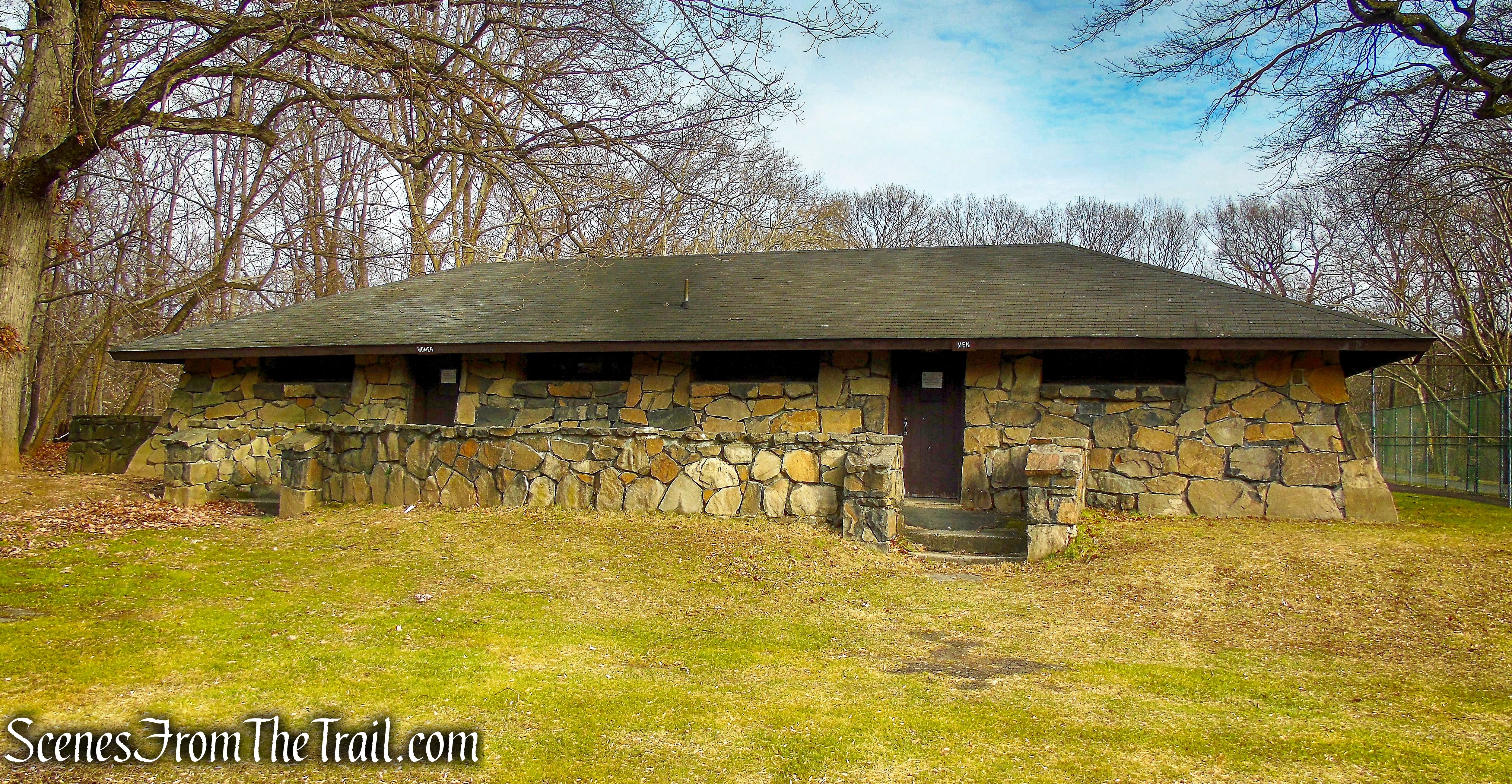
Tallman Mountain State Park
There is a miniature golf course and tennis courts in this area as well.
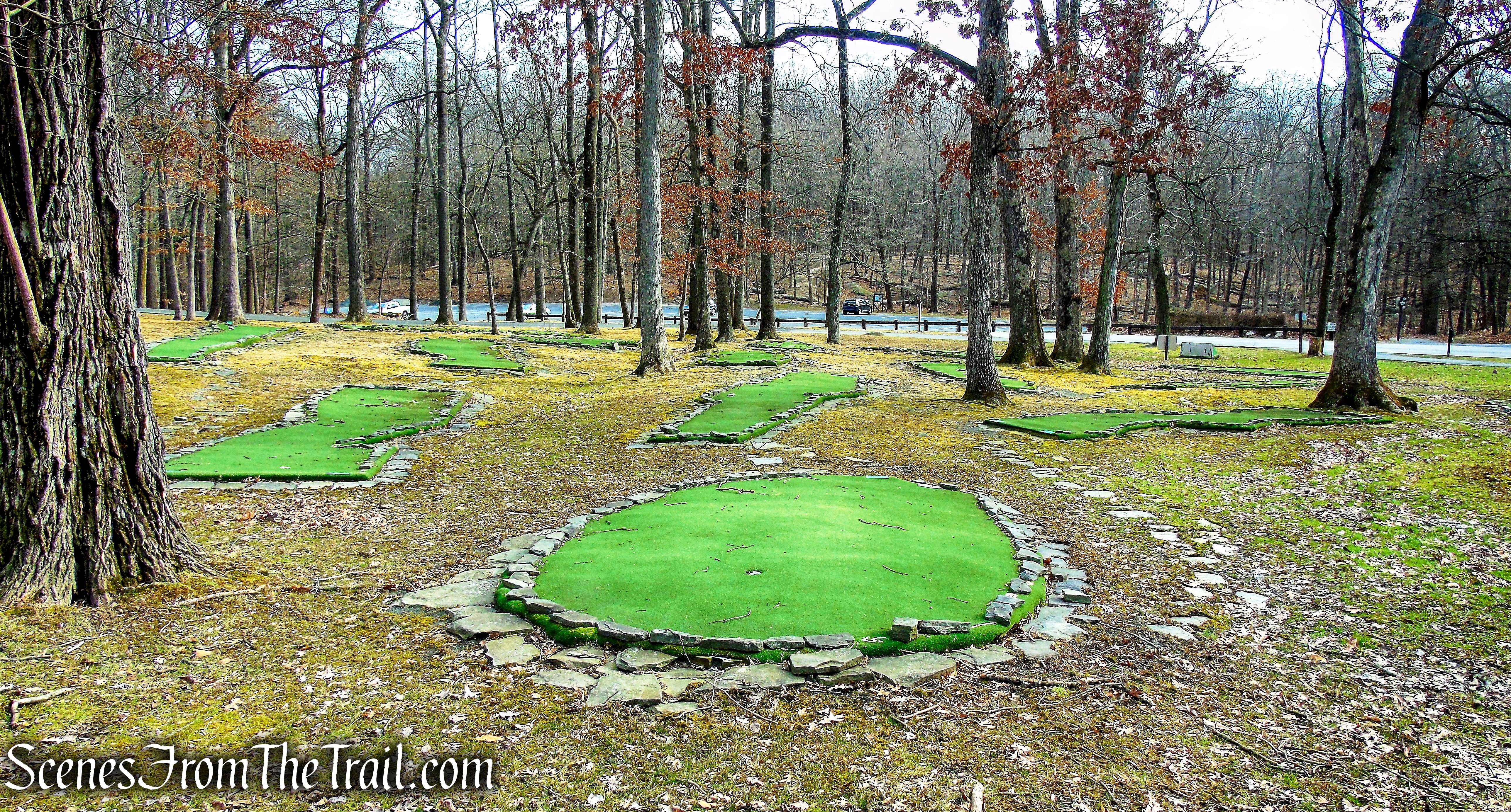
Tallman Mountain State Park
Review:
This is a really nice hike, but most likely better done in the colder months as this park gets crowded in the summer. We saw several pairs of hikers/walkers on our visit, but were mostly alone for the duration. With the leaves being off the trees, we had almost constant views of the Hudson River throughout the hike. The history of the park and the stonework of the Temporary Emergency Relief Administration workers during the Great Depression, makes this park worth visiting.
Pros: Scenic views, historical features, Long Path.
Cons: Gets crowded during the summer months.
Take a hike!
Tallman Mountain State Park
Sources:

Great photos and back ground story. Thanks for sharing. I always wondered why there was that grid type area. Namaste!
LikeLike