September 8, 2018 – Tomkins Cove, NY
Difficulty: Strenuous
Length: approximately 6.3 miles
Max elevation: 1,080 ft.– total elevation gain approximately 1,463 ft.
Route type: circuit
Map: Harriman-Bear Mountain Trails Map #119
Trailhead parking: North Liberty Drive – Tomkins Cove, NY 10986
Another hike to The Timp, from an alternate starting point can be found here:
The Timp is a cliff at the west end of the Dunderberg Mountain massif. Although part of the Dunderberg Mountain formation along with Bald Mountain (Bockberg), the three summits are however, separately named by the USGS. The 1,080-foot summit of The Timp sits near the border of Bear Mountain State Park and Harriman State Park. With its sparsely wooded summit and rock ledges, it offers great views of the surrounding area.
Below: The Timp (left of center) as viewed from West Mountain Shelter.
The Timp (left of center) as viewed from West Mountain Shelter
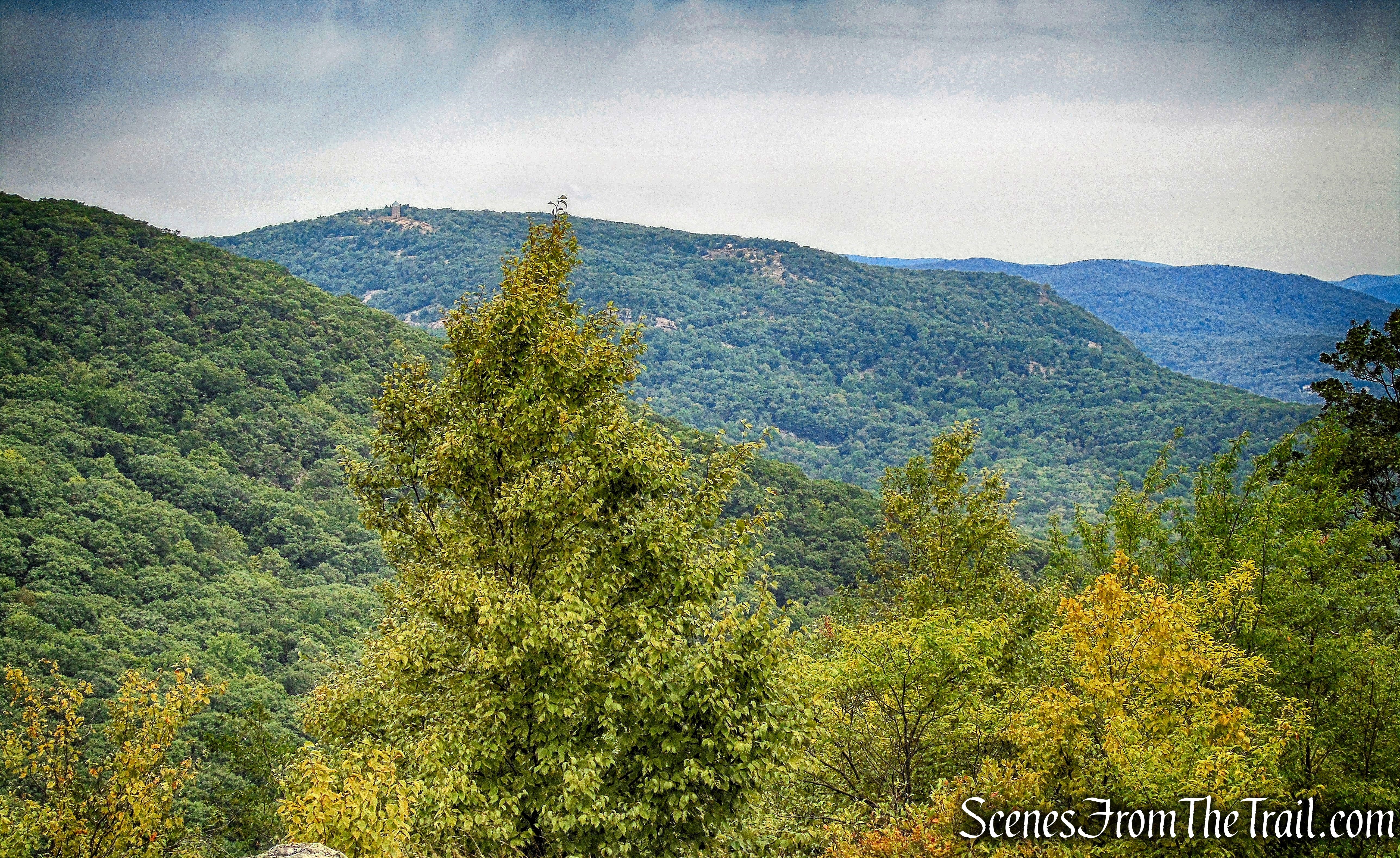
The Timp on the left and West Mountain on the right, as viewed from Bald Mountain.
The Timp on the left and West Mountain on the right, as viewed from Bald Mountain
The trail system in Harriman and Bear Mountain State Parks make any number of loop hikes possible, varying in length. Since I had already been to the summit of The Timp, I wanted to include sections of trails that I had never hiked before. I mapped out several different alternatives that varied in length and elevation gain. I wanted to keep my options open and the route that would be taken would be determined by how much energy we had after reaching the summit. As it turned out, we did the longer of the three hikes I had mapped out.
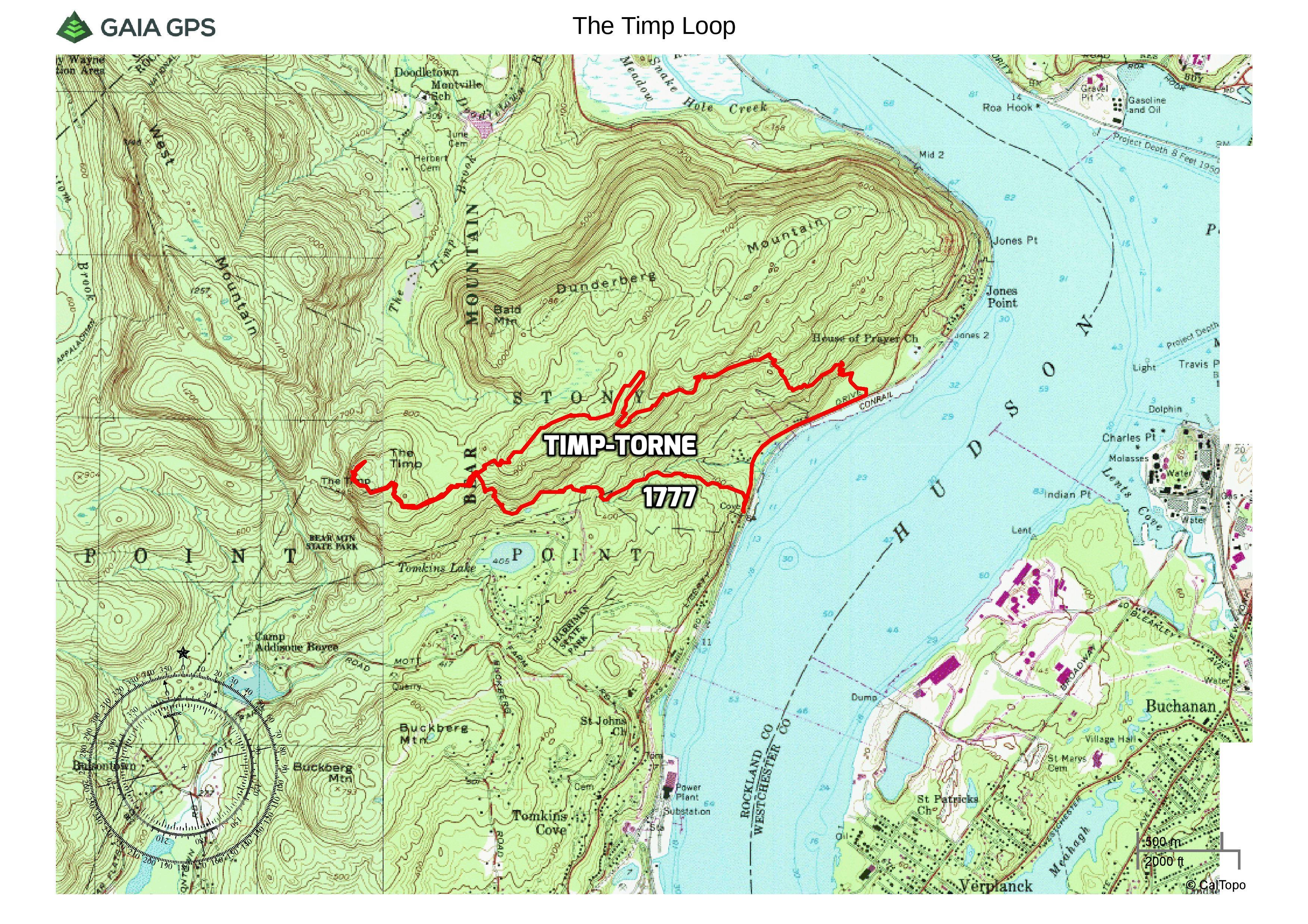
The Timp Loop via 1777 Trail
There is a small parking area along North Liberty Drive (US 9W/US 202). There were no other cars there when we arrived shortly before 9 am or when we returned in the afternoon. The parking area is about 200 feet south of the trailhead. From the parking area, we crossed the road and proceeded north along the road.
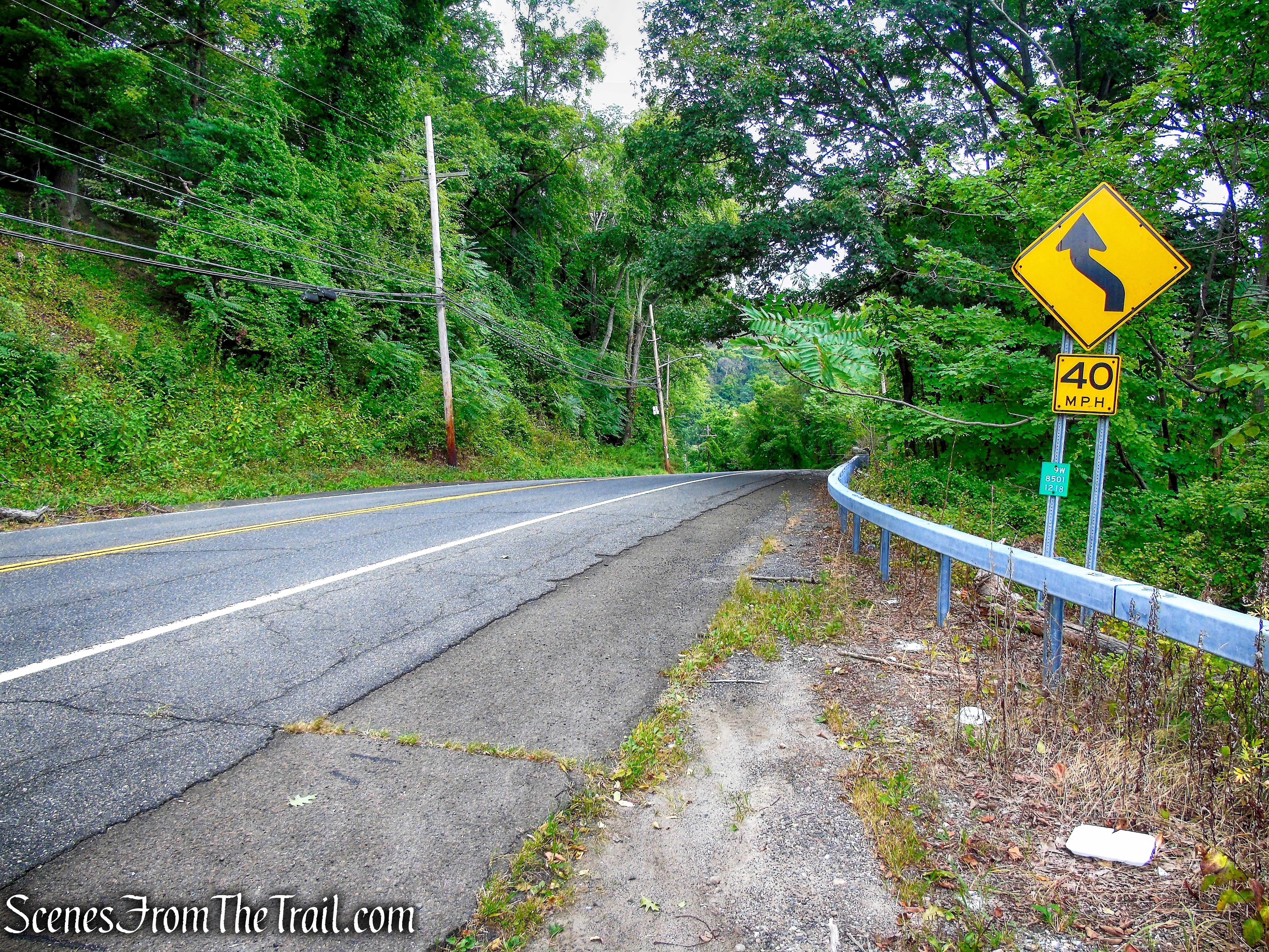
North Liberty Drive parking area
The trail is located across from the stone wall, by the telephone pole, with the white transformer box attached.
heading north along North Liberty
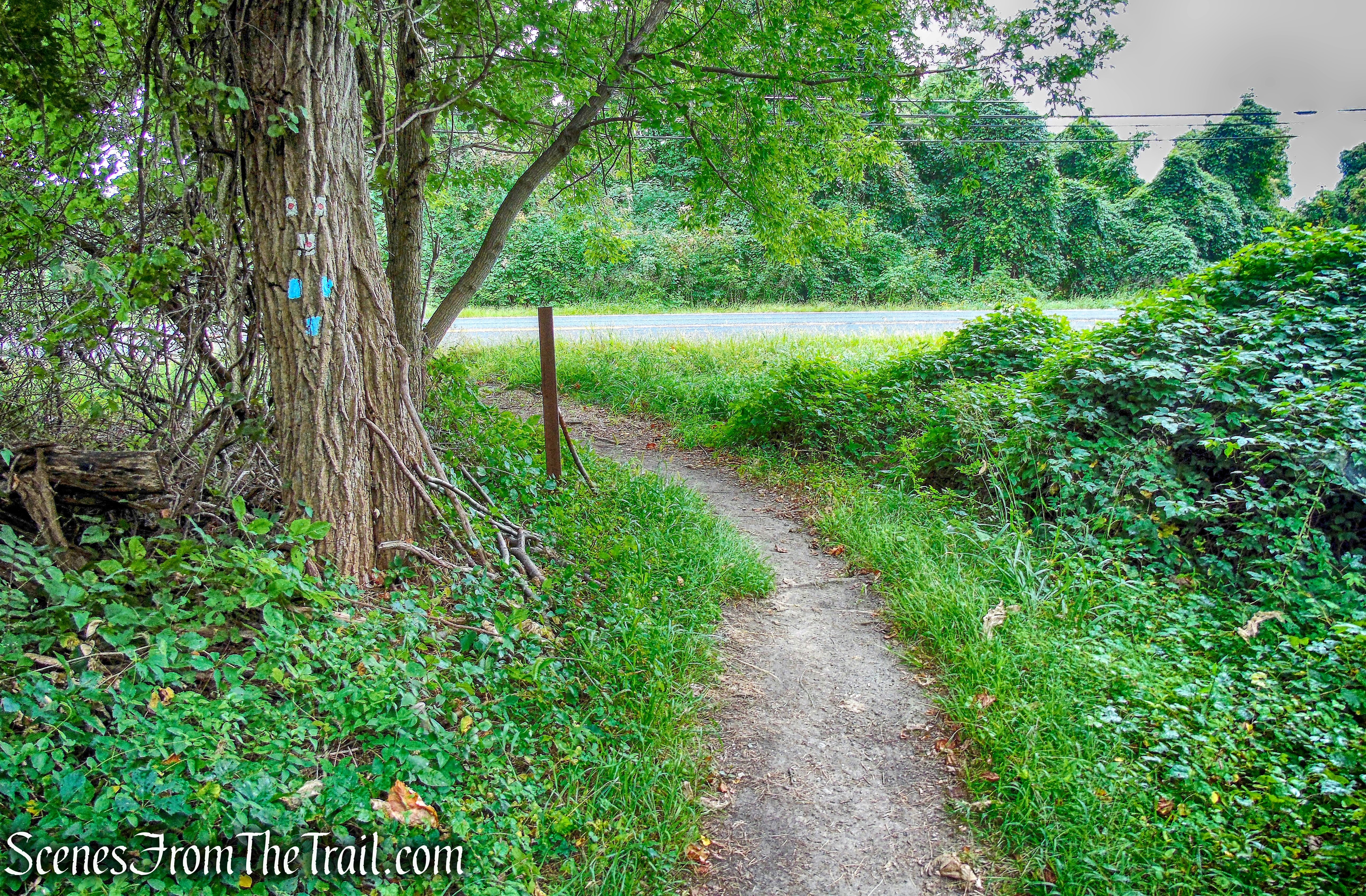
In about 200 feet, we came to a telephone pole marked with three white circular blazes with a red “1777.” This is the start of the 1777 Trail.
1777 Trail
The 1777 Trail marks the route taken by British troops under Sir Henry Clinton on October 6, 1777 from Stony Point, to attack the American forces at Fort Clinton and Fort Montgomery. To avoid private property, the present-day trail starts from Route 9W.
1777 Trail
At first, the trail follows an old road known as the Jones Trail, which was built about 1890 to take workmen up to the various levels of the Dunderberg Spiral Railway.
1777 Trail
In 300 feet, it crosses the lowest grade of the railway. Then, at 0.4 mile, the trail crosses a stream on a wooden footbridge, built in 1987 as an Eagle Scout project and rebuilt in 2004, also as an Eagle Scout project.
1777 Trail
At 0.65 mile, the trail has been rerouted to the left to avoid an eroded section of the original road. Then, in 150 feet, the 1777 Trail turns left, while the Jones Trail continues straight ahead (on the old road to the right).
1777 Trail
Now the 1777 Trail runs close to the Park boundary, with homes visible to the left. At 1.1 miles, after passing a small wet area to the left, the 1777 Trail turns right and goes steeply up an old road to a saddle on the ridge between The Timp (on the left) and Dunderberg Mountain (on the right).
1777 Trail
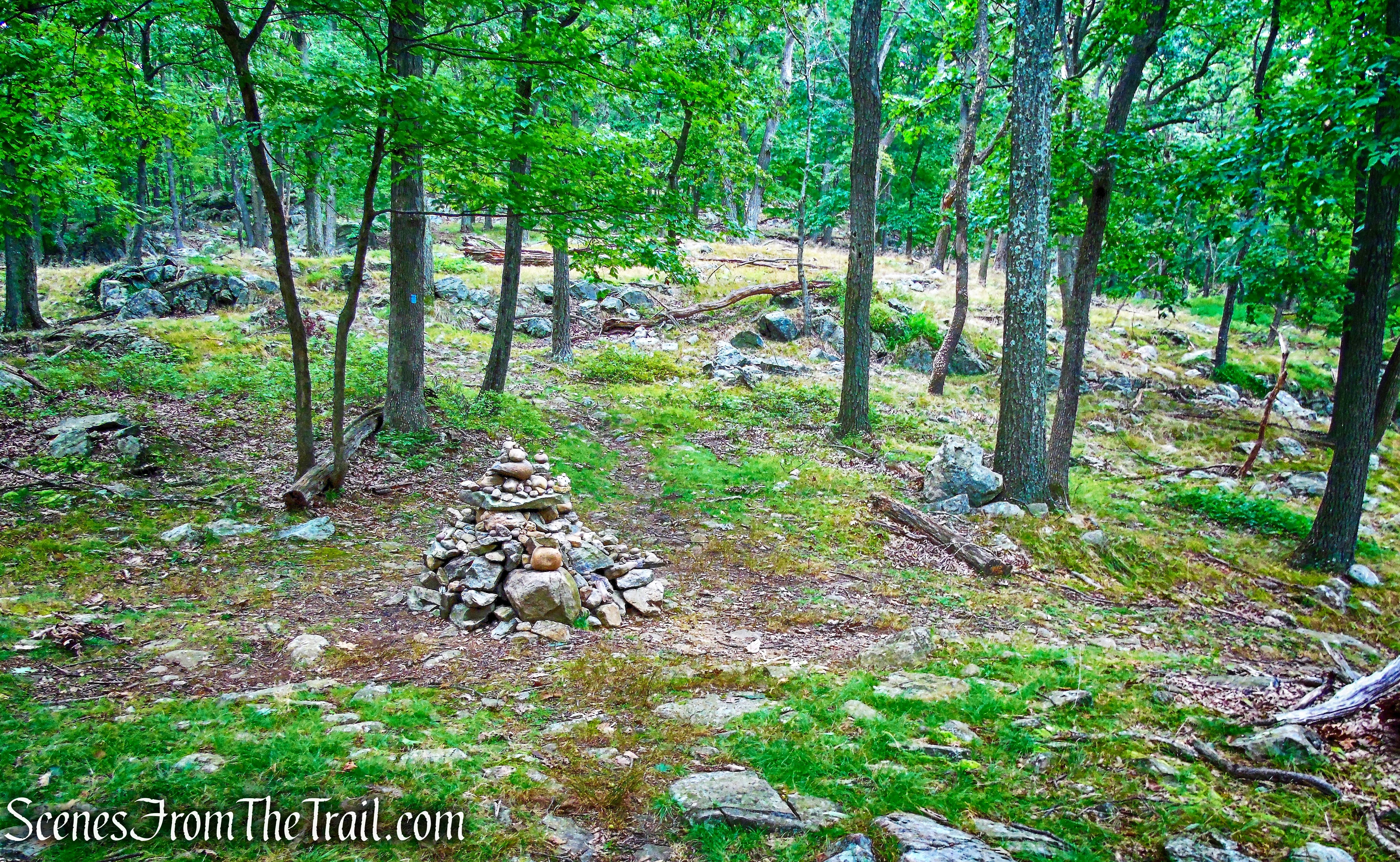
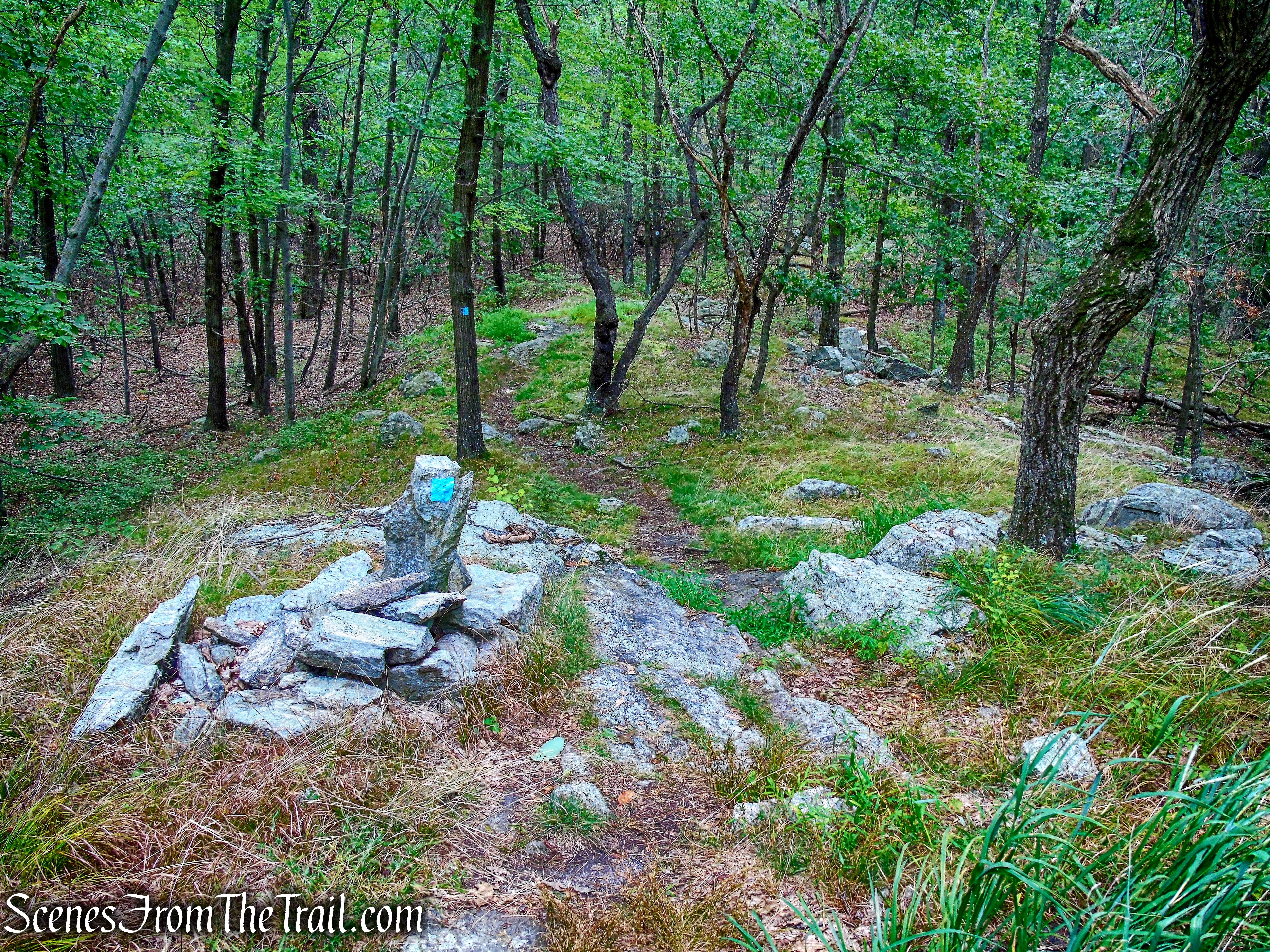
At 1.35 miles, the 1777 Trail reaches a junction with the blue-blazed Timp-Torne Trail, marked with a large cairn.

junction with the Timp-Torne Trail
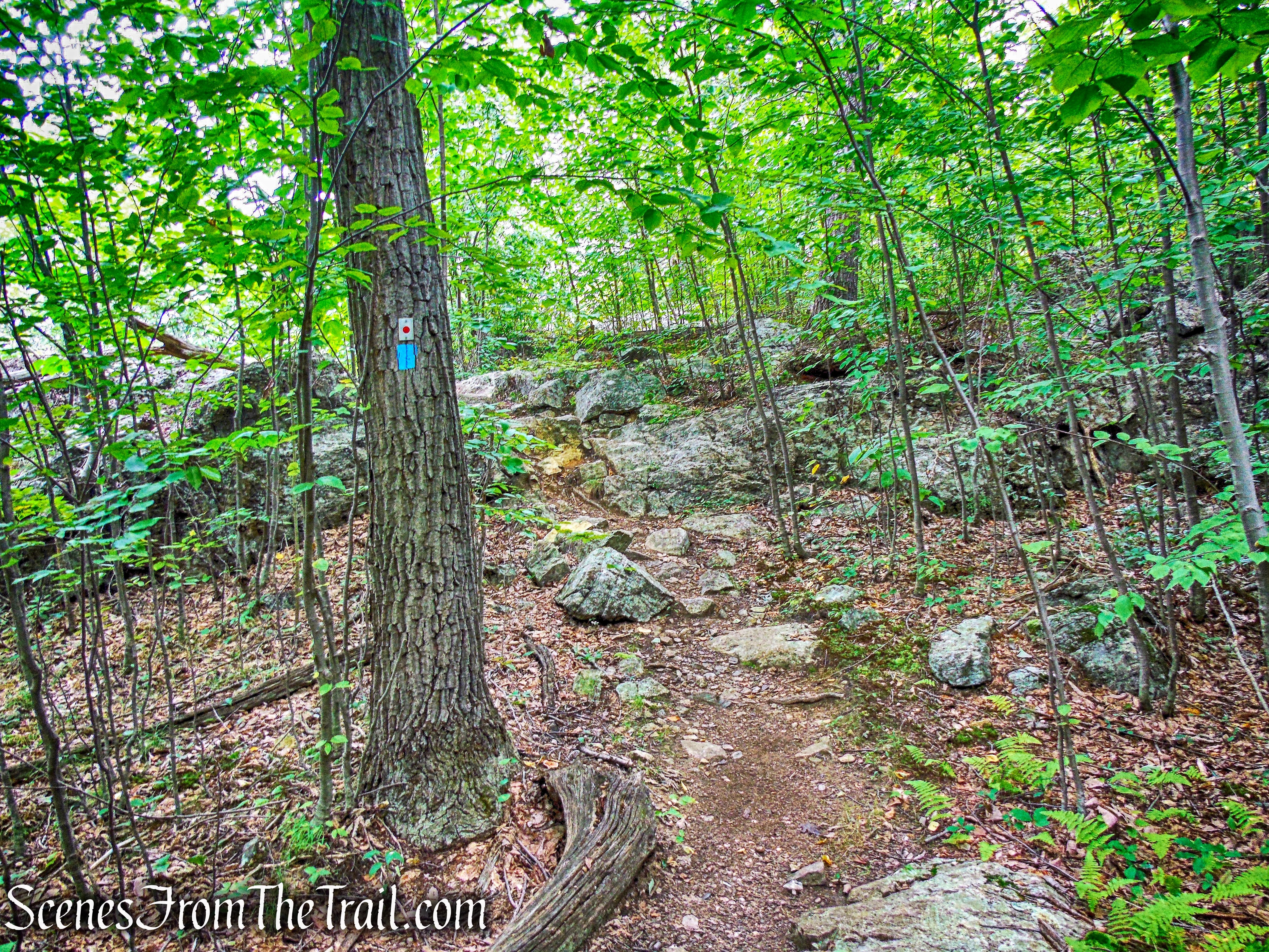
We turned left at the junction and began heading southwest on the blue-blazed Timp-Torne Trail.
Timp-Torne Trail
The Timp-Torne Trail (T-T) was the second trail built by the new Palisades Interstate Park Trail Conference, in the winter of 1921. The 11.2 mile long trail starts on the access road that leads from Route 9W to the Fort Montgomery State Historic Site, 0.2 mile north, of the north end of the Popolopen Viaduct, and ends at Route 9W, just south of Jones Point.
Timp-Torne Trail
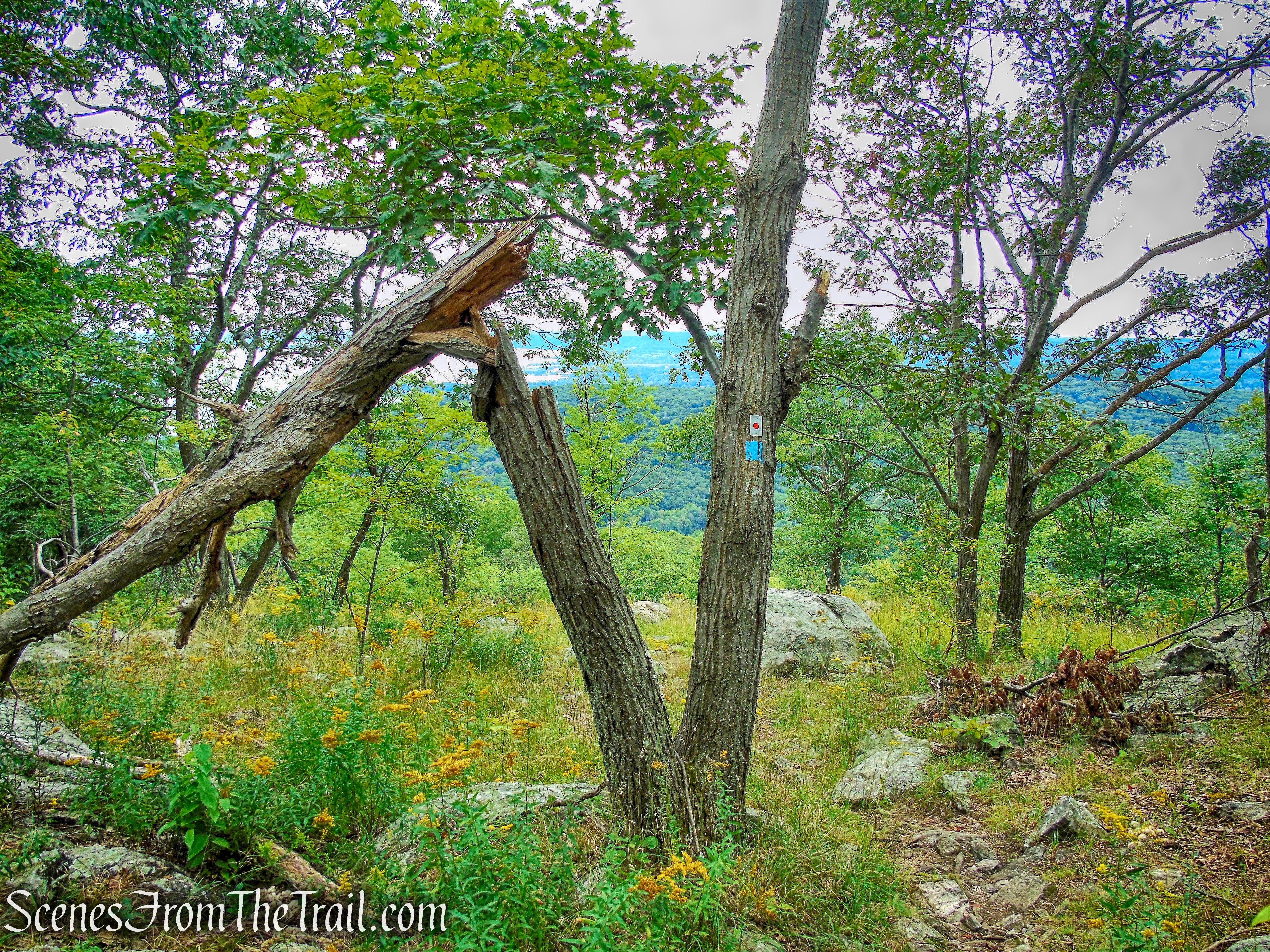
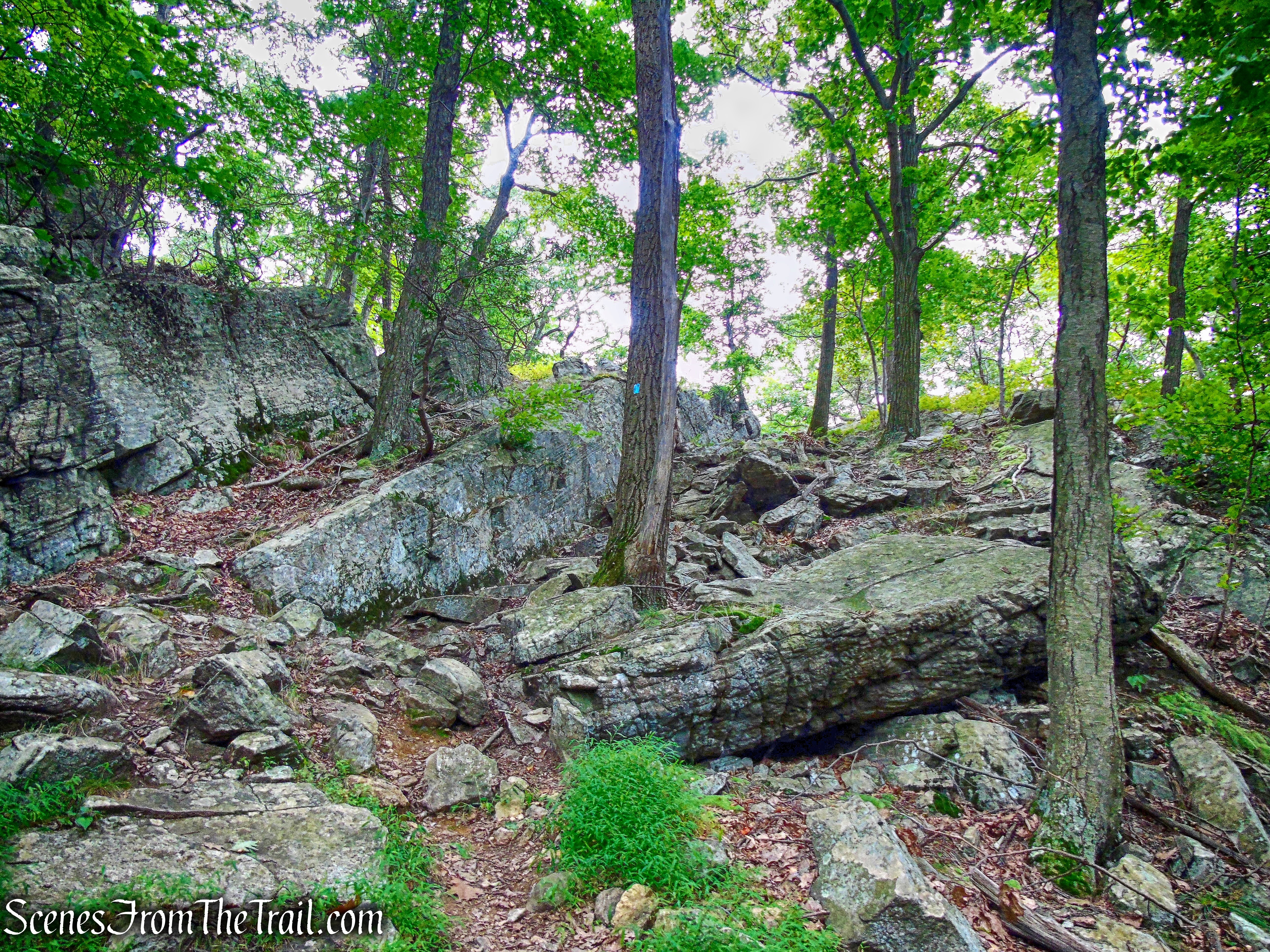
The trail ascends gradually through the woods, filled with some interesting rock formations.
rock formation – Timp-Torne Trail
rock formation – Timp-Torne Trail
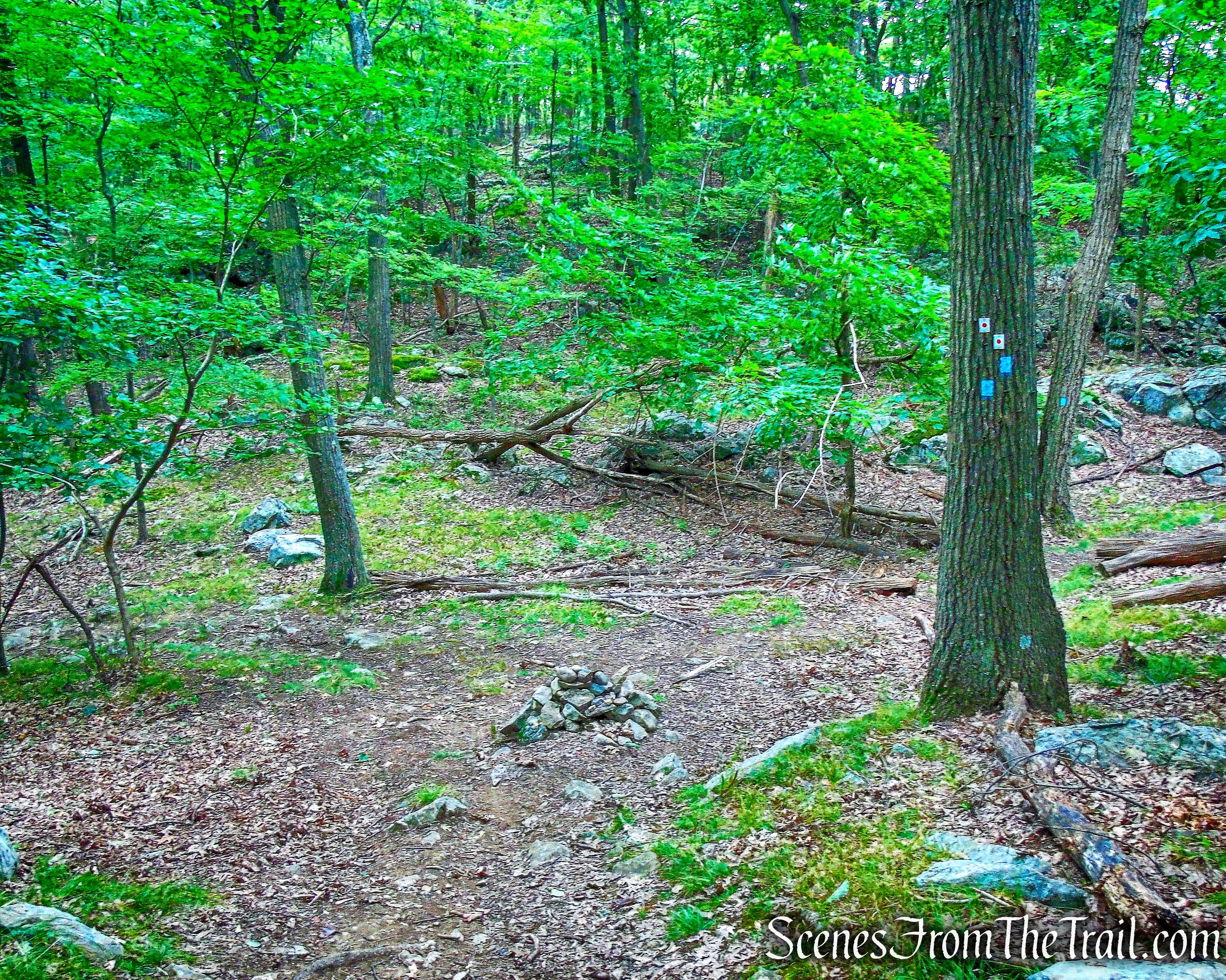
After just under 0.5 mile from the junction with the 1777 Trail, we came to another junction. Here the red-dot-on-white-blazed Ramapo-Dunderberg Trail (R-D) comes in from the right and joins the Timp-Torne Trail. The junction is marked by a small cairn.
junction with Ramapo-Dunderberg Trail
We turned left, now following the joint T-T/R-D Trails.
joint T-T/R-D Trails
The trail continues its ascent, and as it approaches the summit of The Timp, comes out on an open area filled with yellow wildflowers.
joint T-T/R-D Trails
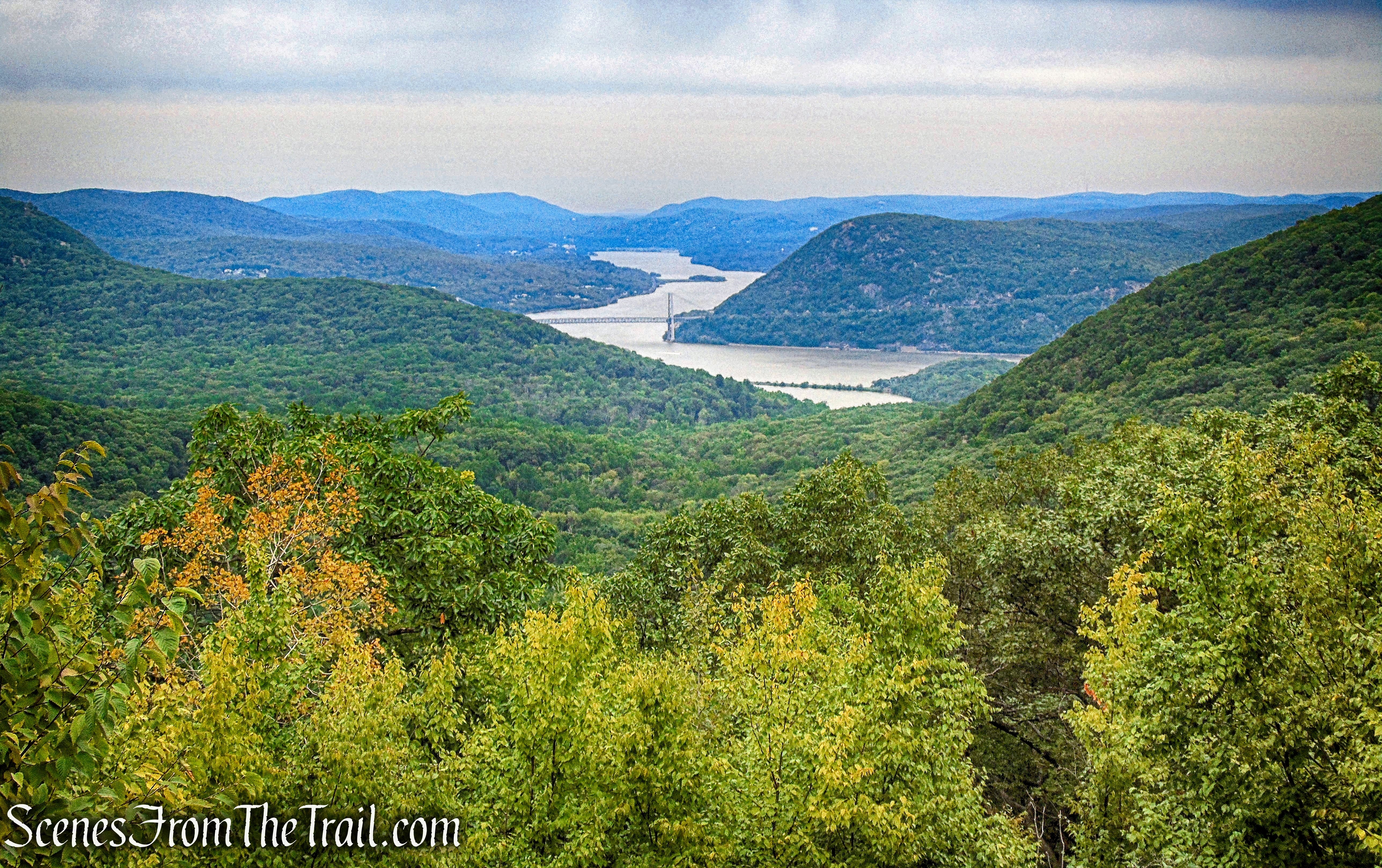
From this spot, there are views to the south of the Hudson River.
view south from joint T-T/R-D Trails
A short distance beyond, the trail reaches the summit of The Timp. We had now hiked approximately 2 miles with almost 1,000 feet of elevation gain. We stopped here to enjoy the expansive views of the surrounding area.

The Timp summit
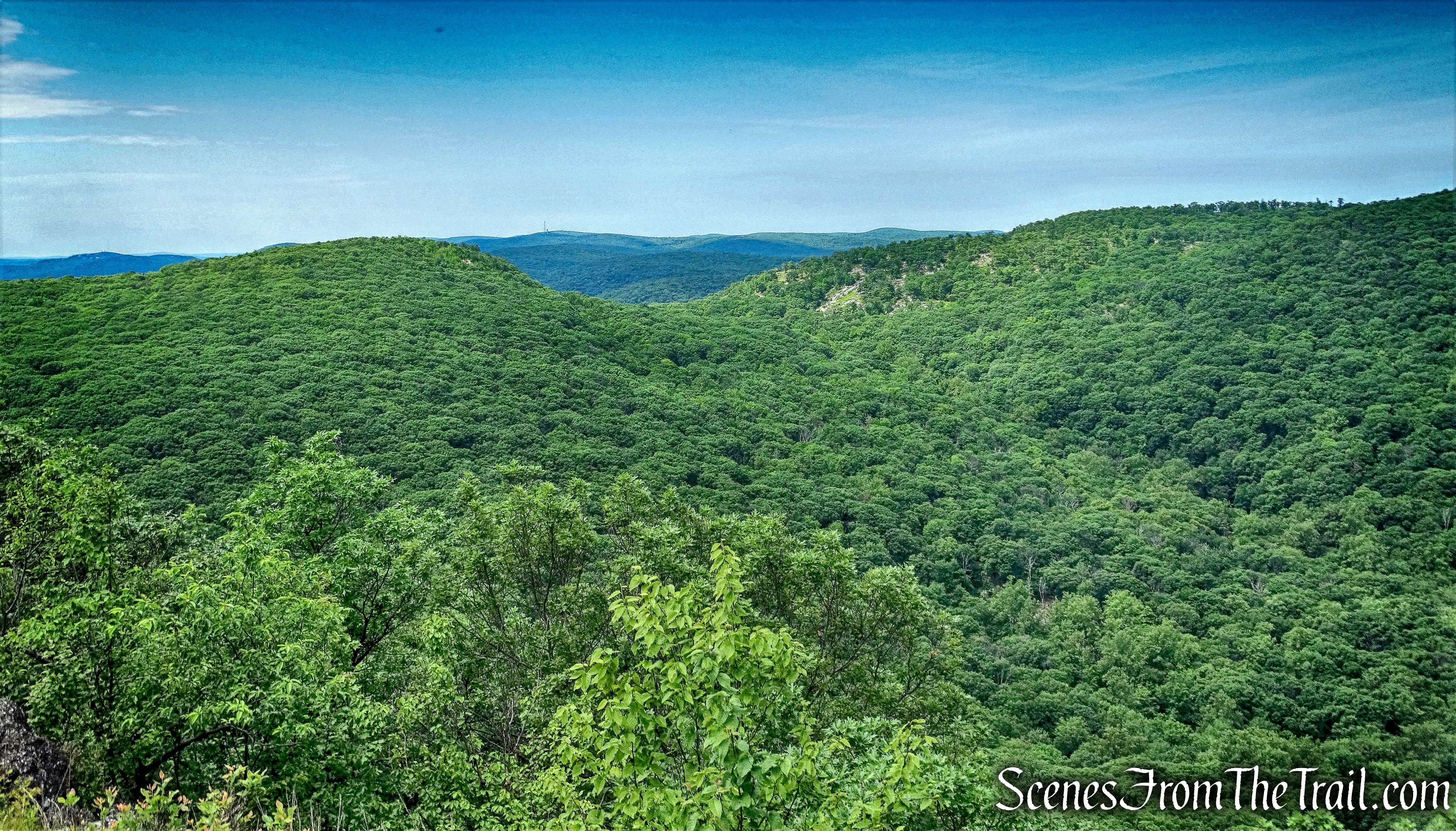
Looking northwest towards West Mountain.
view of West Mountain from the summit of The Timp
Looking north towards Bear Mountain.
view of Bear Mountain from the summit of The Timp
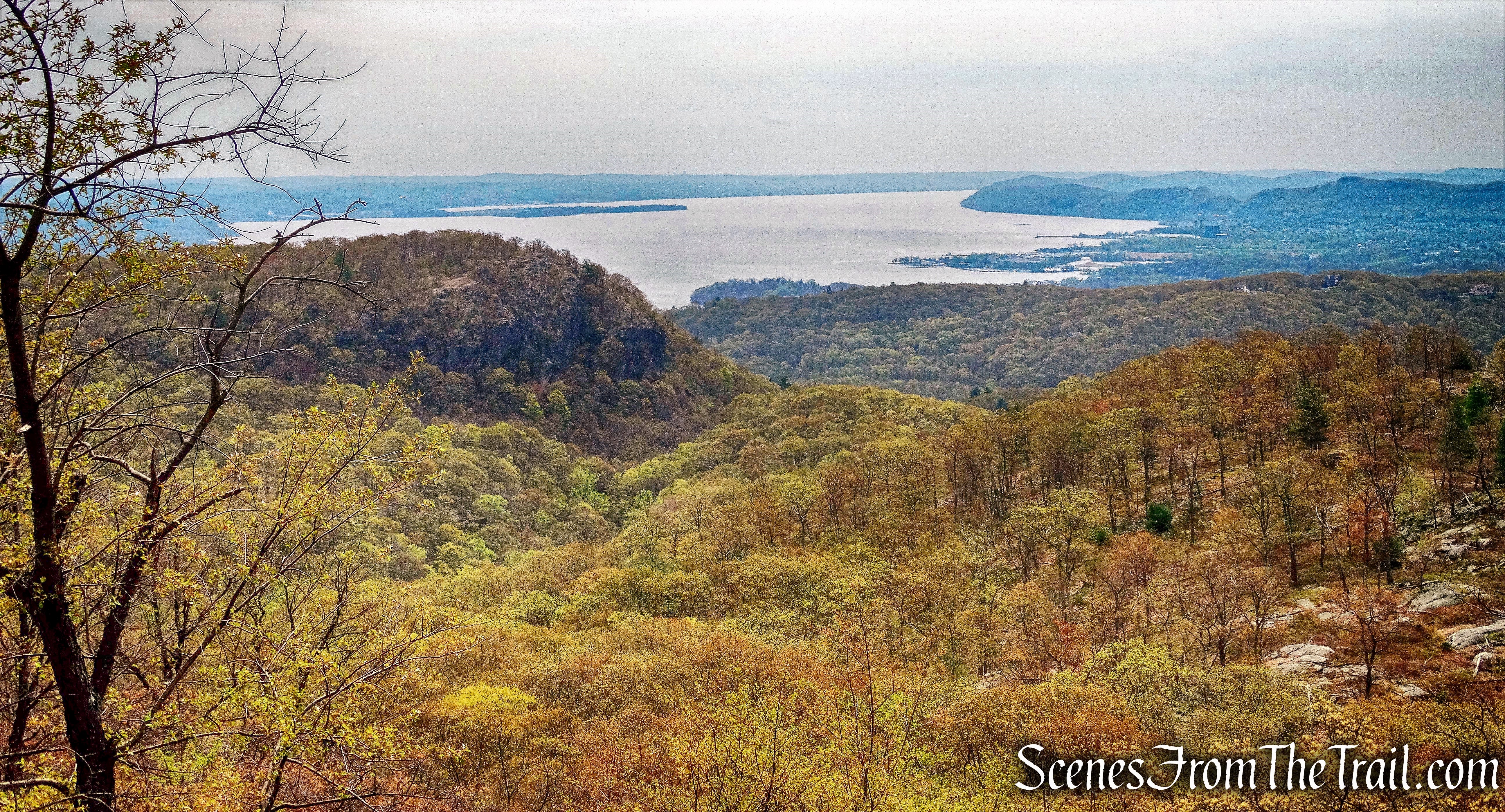
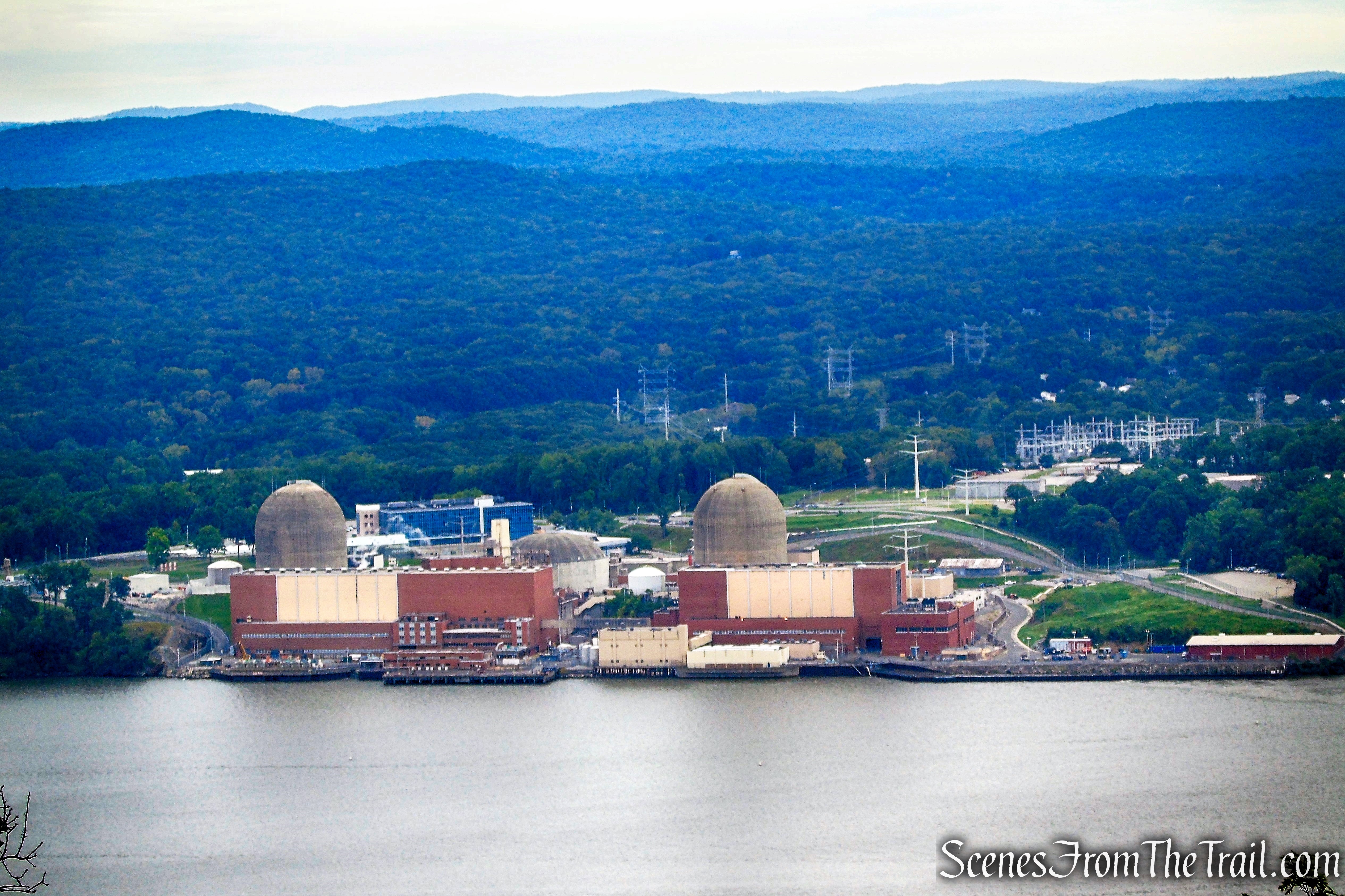
Looking southeast, Buckberg Mountain can be seen along with the Hudson River through the trees.
view of Buckberg Mountain from the summit of The Timp
On a clear day, the Manhattan skyline is visible to the south.

view of Manhattan skyline from the summit of The Timp
We had the summit all to ourselves for a little while until a group of about 20 hikers loudly approached and stopped for lunch. Up to this point, we had not encountered anyone else along the trails. We decided to find a quieter spot and moved on. We continued on the joint T-T/R-D Trails, which enters the woods and curves to the north.
joint T-T/R-D Trails
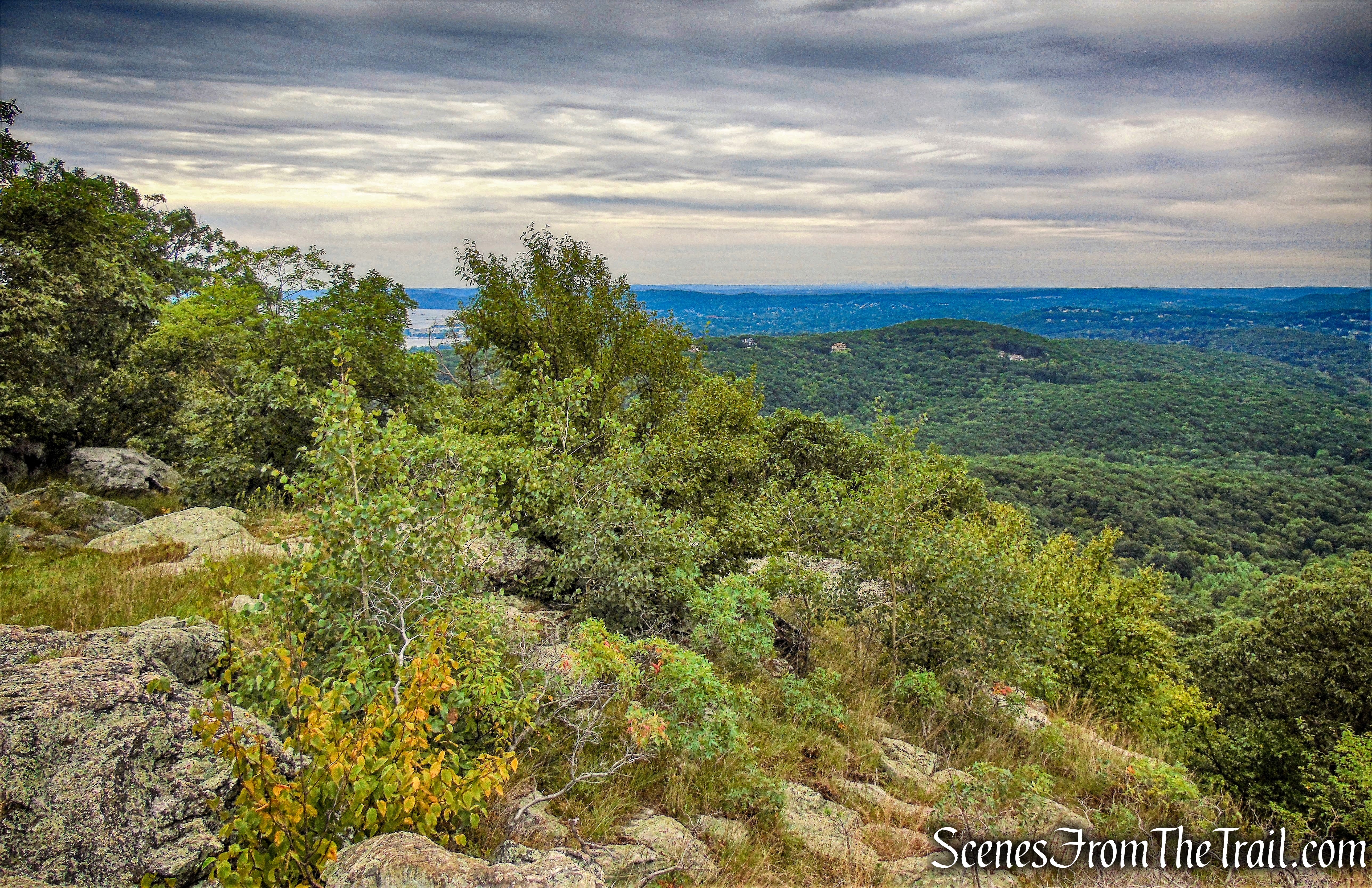
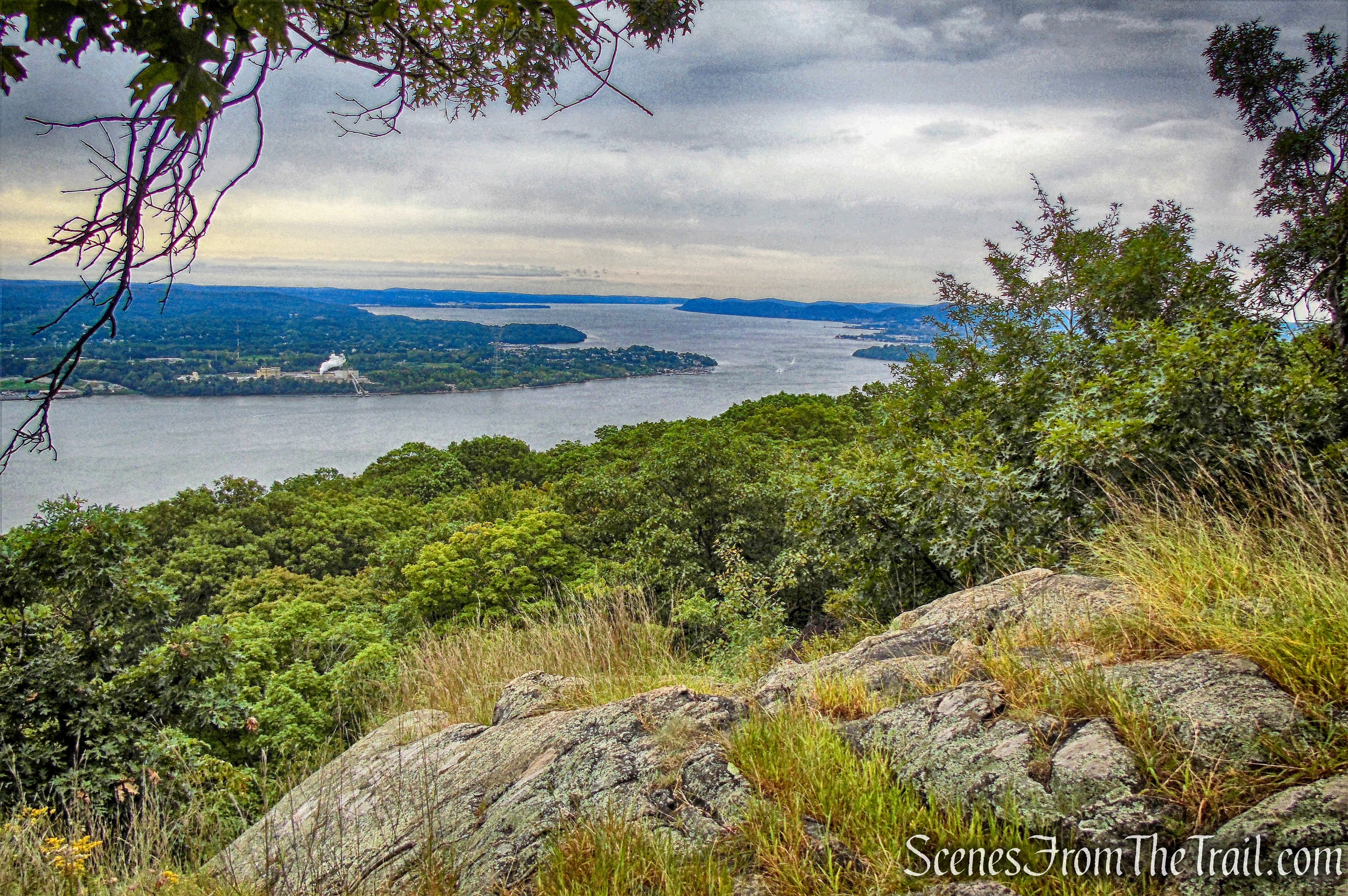
Approximately 500 feet from the summit, the trail reaches an open rock area with fantastic views to the north.
view north from The Timp
Looking north, the Hudson River, Bear Mountain Bridge, Anthony’s Nose and the surrounding hills can be seen. We stopped here to admire the view for a while.
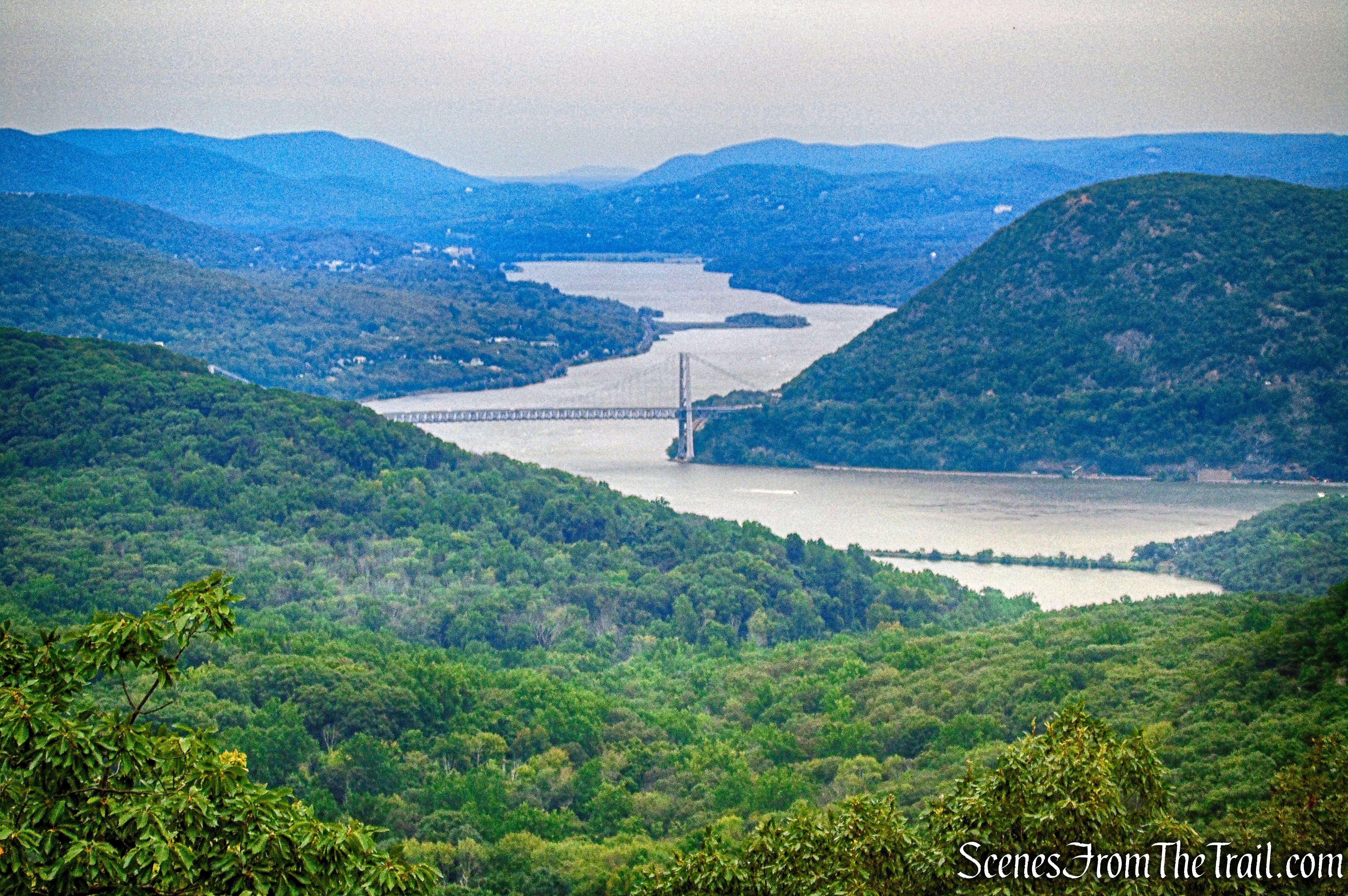
view north from The Timp
After a short while, a couple of hikers stopped to check out the view. We had enjoyed this spot long enough and decided to resume our hike. From here we began retracing our steps, passing the summit, where the loud hikers were still, well, loud.
joint T-T/R-D Trails
When we reached the junction where the Ramapo-Dunderberg Trail (R-D) leaves to the left, we turned right and continued retracing our steps on the blue-blazed Timp-Torne Trail.
junction with Ramapo-Dunderberg Trail
In another 1/2 mile, we arrived at the junction with the 1777 Trail. We continued straight on the blue-blazed Timp Torne Trail, no longer retracing our steps. For a shorter and less strenuous out and back hike, turning right on the 1777 Trail would have taken us back the way we came.
junction with the 1777 Trail
This section of the Timp-Torne Trail, although very scenic, has a lot of ups and downs, which tacked on some extra elevation gain.
Timp-Torne Trail
Timp-Torne Trail
Now zig-zagging downhill, the Timp-Torne Trail provides a number of good views along the way.
Indian Point from Timp-Torne Trail
view south of Hudson River from Timp-Torne Trail
The Timp-Torne Trail then crosses the Jones Trail and a little brook. The trail turns right at the opposite end of the uncompleted Dunderberg Spiral Railway upper tunnel. For a shorter hike and much less of a road walk at the end, turning right onto the Jones Trail leads back to the 1777 Trail and back down to 9W, where we began the hike. Doing that would have bypassed the two tunnels of the railway, which I was intent on seeing. A shorter hike that includes just the railway, can be viewed HERE.
Timp-Torne Trail
The trail follows the descending grade of the railway through a rock cut.
Timp-Torne Trail
The T-T Trail then follows a work road up to the other end of the tunnel.
Timp-Torne Trail
The Dunderberg Spiral Railway was a project started in 1890 and abandoned, unfinished, in 1891. The plan was to have the railcars pulled up the mountain on a cable incline by a stationary steam engine, with the downhill journey being made by gravity.
Dunderberg Spiral Railway upper tunnel
The unfinished tunnel, intended for use by the descending trains, has been excavated for about 75 feet, and is often filled with water.
Dunderberg Spiral Railway upper tunnel
The trail continues its descent on the graded section of the railway.

Timp-Torne Trail
The trail turns sharply right, leaving the graded section of the railway and again joining the Ramapo-Dunderberg Trail. It descends steeply downhill and reaches the lower railway tunnel.
Dunderberg Spiral Railway lower tunnel
This 50 ft. long stone-arch tunnel was designed to allow the ascending trains to pass over the route of the descending trains.
Dunderberg Spiral Railway lower tunnel
The width of the grade and the height of the tunnel and underpass, show that this was to be standard railroad gauge with normal-sized cars, not narrow gauge or cars of an amusement-ride type. The open passenger cars would have been similar to open streetcars of the day, wooden bodies with benches across the width, possibly roll-down canvas for the sides in case of rain, and a solid roof.
Dunderberg Spiral Railway lower tunnel
After passing the lower railway tunnel, The trail descends on steps built into the hillside and ends at Route 9W, just south of Jones Point.
terminus of joint T-T/R-D Trails
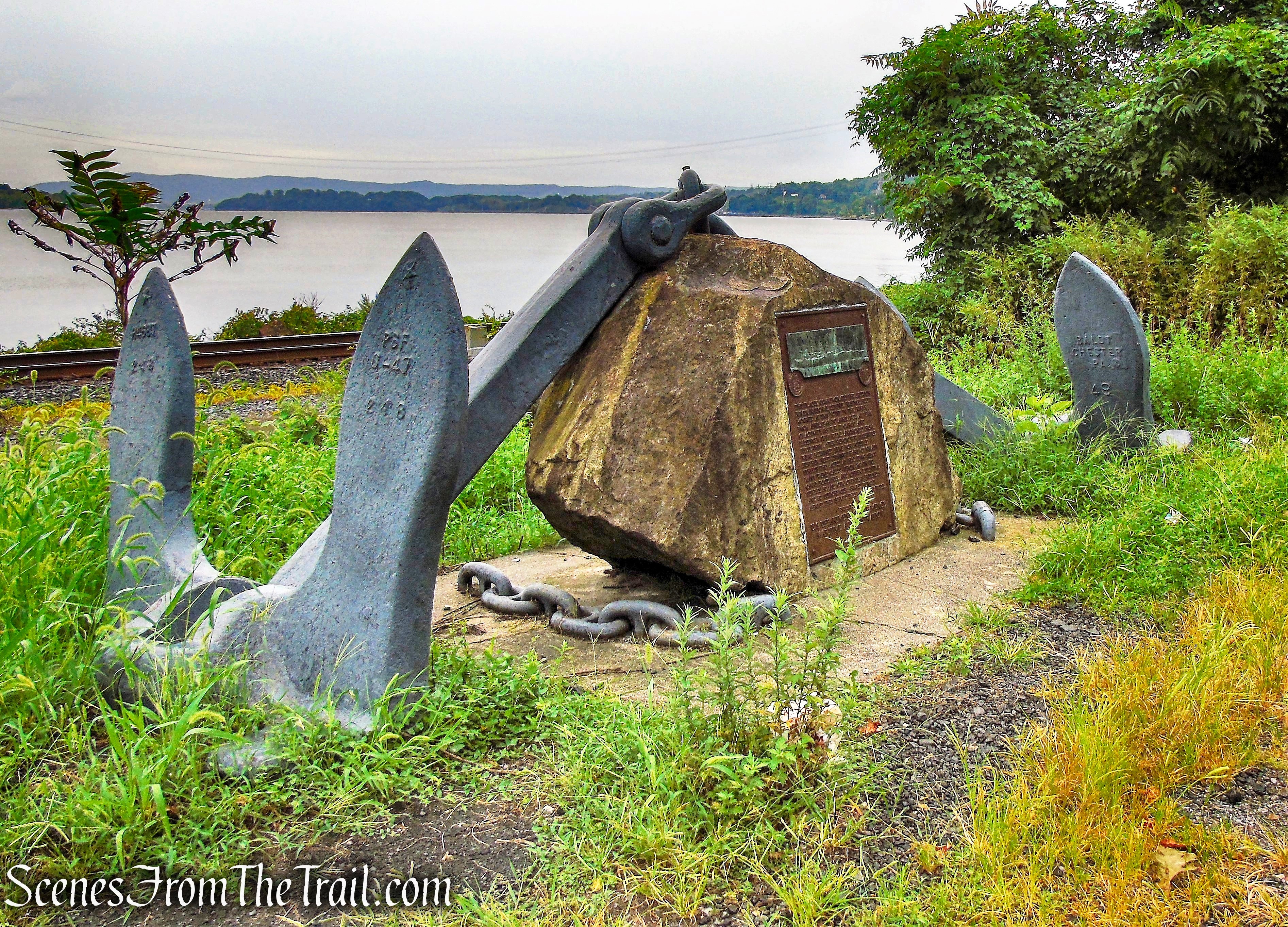
From there we crossed the road and began heading south along 9W. This was my least favorite part of the hike. The highlight was walking past the Hudson River Reserve Fleet Memorial.
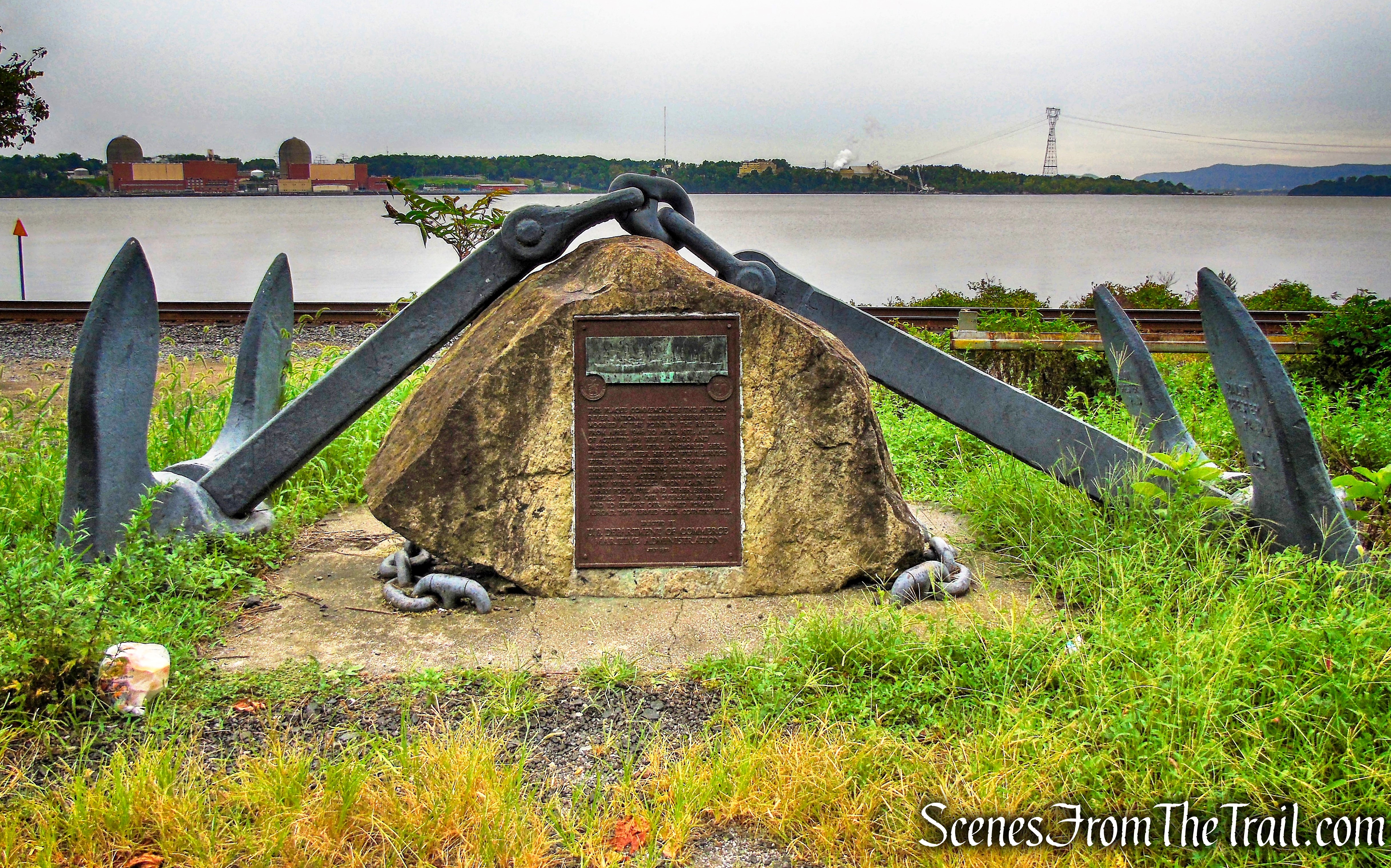
Hudson River Reserve Fleet Memorial
This memorial commemorates the Hudson River National Defense Reserve fleet moored at this point in the river from April 1946 to April 1971. At peak of activity, 189 WW II cargo and passenger ships were anchored here. These ships after heroic WW II service were retained here for possible further need. During years of grain surplus they acted as floating silos. Many were called upon again to carry food, fuel and other essential supplies to aid our overseas friends and to support our armed forces abroad.
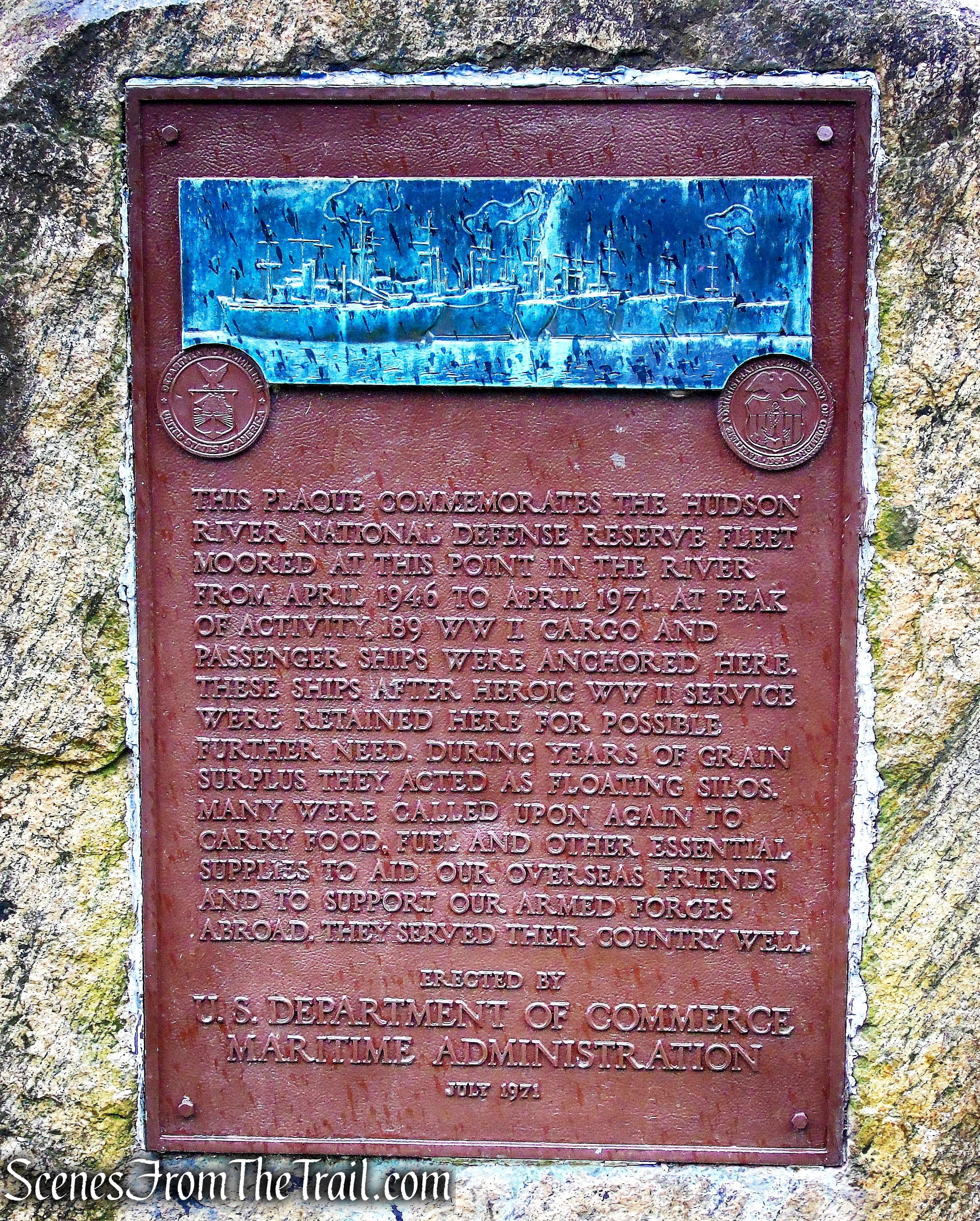
Hudson River Reserve Fleet Memorial
The Hudson River National Defense Fleet established by an act of Congress in 1946, was first located off Tarrytown, one of eight anchorages in the United States to provide a sizable group of merchant ships to support the military effort at the outset of any war. On April 30, 1946, the Hudson River fleet was moved further north to Jones Point (at one time known as Caldwell’s Landing) at the foot of Dunderberg Mountain. Here the anchorage remained until the last two ships were towed away on July 8, 1971, to be sold for scrap to Spain.
Hudson River Reserve Fleet Memorial
Below is a vintage photograph of the Hudson River Reserve Fleet moored at Caldwell’s Landing (Jones Point).
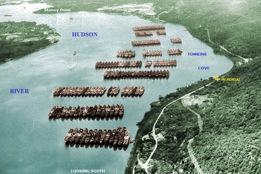
Hudson River Reserve Fleet
After our roadside history lesson, we continued our 0.7 mile road walk along Route 9W back to the parking area, where our hike began. Despite the road walk, this was another great hike in Bear Mountain State Park. It offered up a little bit of everything, making it a worthwhile day on the trails.
Pros: Well marked trails, scenic views, historical features, tunnels, lesser traveled trails.
Cons: Road walk.
Take a hike!
The Timp Loop via 1777 Trail
Sources:
- New York-New Jersey Trail Conference
- Hudson River Reserve Fleet
- History of the Dunderberg Spiral Railway
- Myles, William J.. Harriman Trails: A Guide and History – Kindle Edition
