June 11, 2016 – Jones Point, NY
Difficulty: moderate – strenuous
Length: approximately 4 miles
Route type: circuit
Dunderberg Spiral Railway was an incline railroad that was supposed to take visitors up to the top of the mountain. Construction began in 1890 and ceased about a year later. It has been reported that about a million dollars was spent on the project before funds dried up. Needless to say, it was never completed. I decided to go have a look.
I followed the same hike as described here by the The New York-New Jersey Trail Conference. They are a great resource for information on hiking. On this hike I used the Harriman-Bear Mountain Trails Map set. Since this hike incorporates unmarked roads and trails having a map of the area is essential.
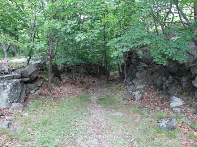
From the parking area I walked south along the road until I saw the trailhead on the right.

Timp-Torne (blue) and Ramapo-Dunderberg (red-dot-on-white) trails
From there I proceeded into the woods following the well blazed trail.


Almost immediately I came upon the first tunnel. It was just off the trail to the left.


I explored the tunnel for a bit and took some photographs. It seemed to be a busy spot as I saw a few groups of hikers coming along as I was about to leave. I continued up the trail which now steepened.


After a relatively short, but steep climb I reached a clearing where there were partially obstructed views of Indian Point. From here the trail split. The Timp-Torne (blue) went left and that is the route I took. It climbed steadily and for some reason it was wearing me down. I had to take a few minutes to catch my breath and gather myself. It was not that hot, but I seemed to be dehydrated. After drinking some fluids, I continued on. There was no way I was going to quit. I continued following the blue blazed Timp-Torne trail.


Soon I reached a graded section of the railway which was much more pleasant to walk.

graded section of the railway
After a short walk along the graded section I could see the second tunnel come into view. It looked more like a cave than a tunnel. It is about 75 feet deep and quite dark. A headlamp or a flashlight comes in handy here. I explored inside and took numerous photographs. It was quite impressive to say the least.


It was time to move on, so I continued following the graded section of the railway which was the only easy hiking I would do on this day.


It was a scenic walk throughout this hike, with interesting rock cuts and views along the way.
rock cut
After crossing a mostly dried up stream I turned right onto the Jones trail. It is unblazed and from what I read many hikers miss this turn and end up getting lost. I paid careful attention and made the proper turn. After a rocky walk uphill, the trail was filled with Mountain Laurel.

Mountain Laurel
After reaching an intersection with the Ramapo-Dunderberg (red-dot-on-white) trail, I turned right and continued up the mountain and took a well deserved break on a rock outcrop with limited views.

rock outcrop with limited views
My break was cut short as it began to rain and I decided to get moving. The rain helped to cool me off, but it did keep me from capturing more images of the hike.
After a short while I reached the best viewpoint of this hike. I was still feeling a little weak and tired so I mostly rested and missed out on some good shots.

best view
The rest of the hike was a lot of ups and downs filled with loose rocks. I had to keep my eyes to the ground to make sure I stepped in the right place or risk twisting an ankle. Some more views along the way were to be had.


After descending steeply I reached a stone abutment which had something to do with the railway.

stone abutment
Continuing down the extremely rocky trail, I turned around and took a look back. It was pretty steep, but I hadn’t really noticed because my eyes were glued to the ground in front of me.

rocky trail
Despite not feeling well throughout most of this hike, I enjoyed it. Although it was rough going for most of the way, it was a very scenic hike. Now it was time to go. I had to rest up because in two days I was taking a road trip to Pennsylvania.
Stay tuned……..

happy trails
