March 31, 2018 – East Haddam, Connecticut
Difficulty: Easy
Length: Approximately 2.5 miles
Max elevation: 213 ft.– total elevation gain approximately 138 ft.
Route type: Circuit
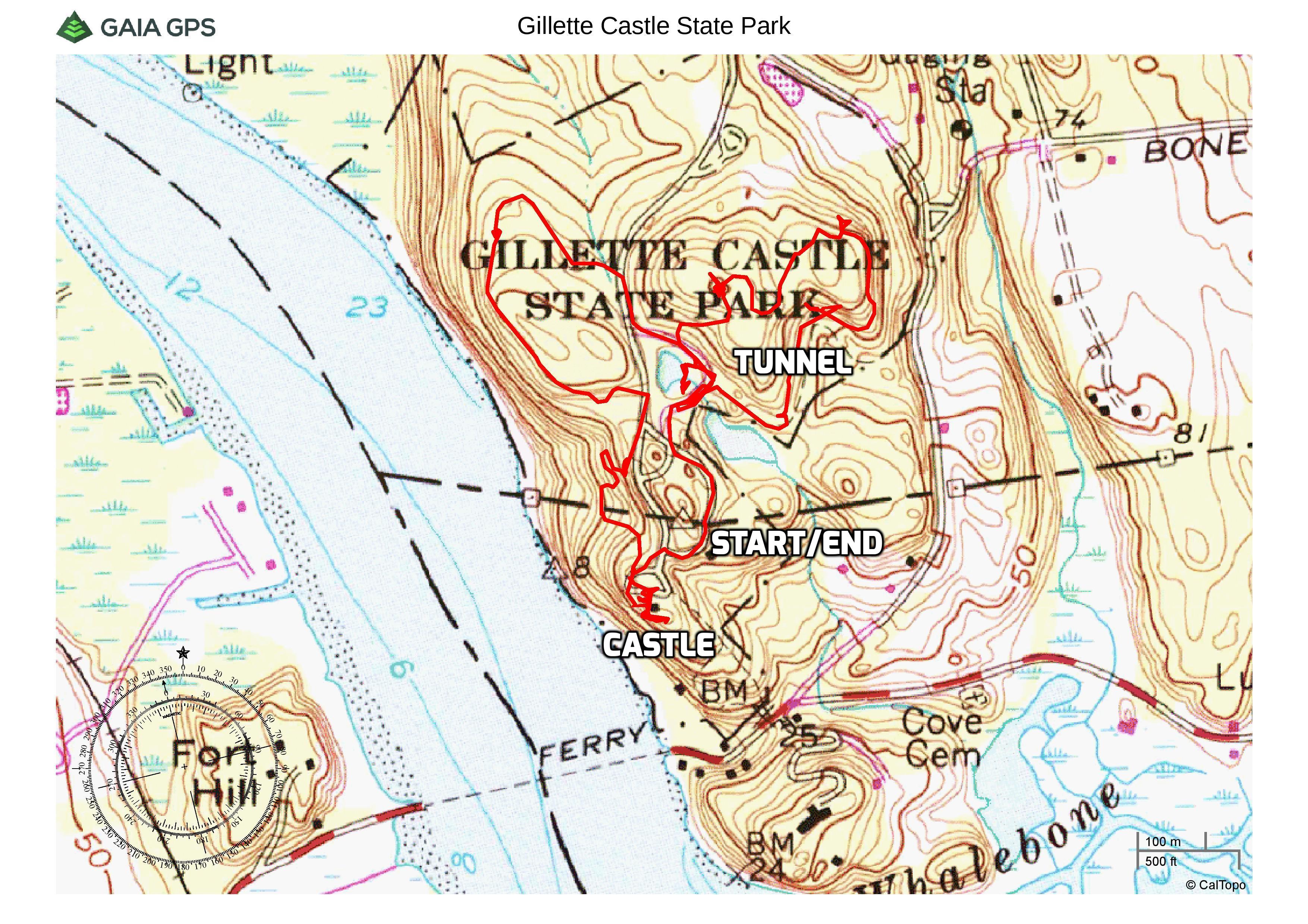
Map: Gillette Castle State Park Hiking Map
Trailhead parking: 67 River Rd, East Haddam, Connecticut 06423
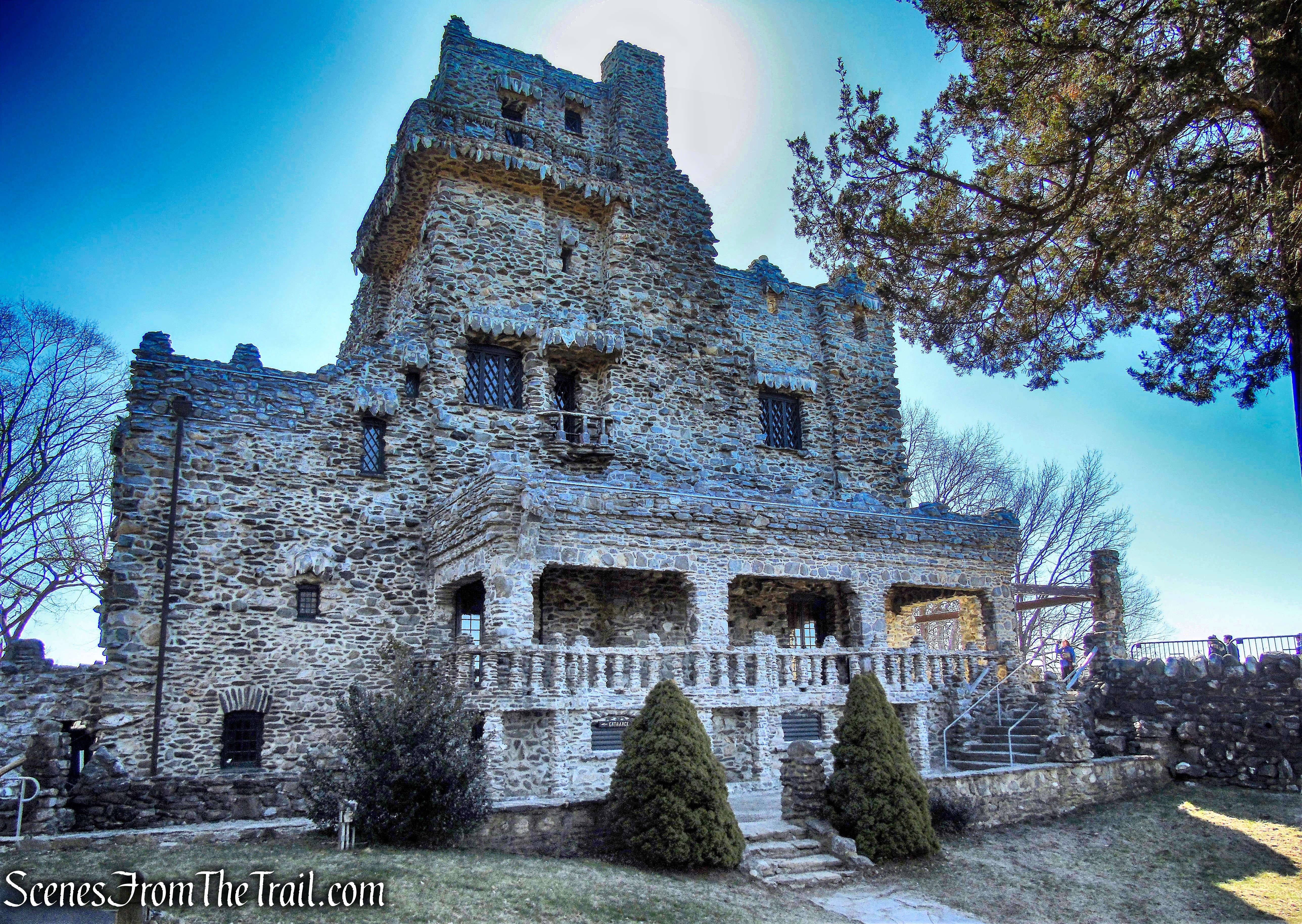
Atop the most southerly hill in a chain known as the Seven Sisters, William Hooker Gillette, noted actor, director, and playwright, he is most famous for his portrayal on stage of Sherlock Holmes, built this one hundred and eighty-four acre estate, the Seventh Sister. The focal point of his effort was a twenty four room mansion reminiscent of a medieval castle.
Gillette Castle
Purchased by the State of Connecticut in 1943 from the executors of Mr. Gillette’s will, Gillette Castle and the adjoining property with its fine woodlands, trails, and vistas are now administered for the enjoyment of present and future generations.
Connecticut River
The trails often follow, over trestle and through tunnel on the actor’s three mile long narrow gauge railroad. Gillette’s own walking paths were constructed with near-vertical steps, stone-arch bridges, and wooded trestles spanning up to forty feet. Other outdoor attractions include a vegetable cellar, the railroad station (Grand Central), and Gillette’s goldfish pond.
stone-arch bridge – Gillette Castle State Park
I have visited Gillette Castle State Park several times in the past, but had never hiked the trails. Warm weather for the weekend was in the forecast and after all the snow storms, I wanted to take advantage of it. While researching places to hike where we can also barbecue, I happened to find out that there is a trail on the property which passes through a train tunnel. That was enough for me to plan a nice leisurely hike and then relaxing with the first post hike barbecue of the season. We mostly walked the narrow gauge railroad bed and tried to hit all the points of interest before settling in for an afternoon of grillin’ and chillin’.
The trails are not blazed and the map is difficult to decipher at times, but we were able to manage our way through. Hopefully this description of the hike will help others find their way.
Gillette Castle State Park
Check out the Google Earth Fly-Through video of the hike below.
After an almost two hour drive from Westchester County, NY, we parked in the main lot by the visitor center. The visitor center and castle are open seven days a week beginning Memorial Day Weekend through Labor Day, but the grounds are open year round. This place does get crowded during the season, but a worthwhile place to visit during the off season as well. We headed towards the castle along the paved walkway.
Gillette Castle State Park
Just to the right is a vegetable cellar built into the side of the hill.
vegetable cellar – Gillette Castle State Park
Walking along the park road, it immediately becomes evident the amount of labor involved in the stonework throughout the property.
Gillette Castle State Park
Since it was still somewhat early, there were only a few people around as we walked towards the castle.
Gillette Castle State Park
A beautiful stone arch provides entry to the woodlands and trails of the park.
stone arch – Gillette Castle State Park
Just to the right of the stone arch is a remnant of the track from his railroad.
tracks – Gillette Castle State Park
Across from the main entrance to the castle is “Grand Central Station,” the depot for Mr. Gillette’s narrow gauge railroad. It is now used as a picnic pavilion.
Grand Central Station – Gillette Castle State Park
Grand Central Station – Gillette Castle State Park

Grand Central Station – Gillette Castle State Park
Below is an image of Mr. Gillette posing with his train in Grand Central Station.
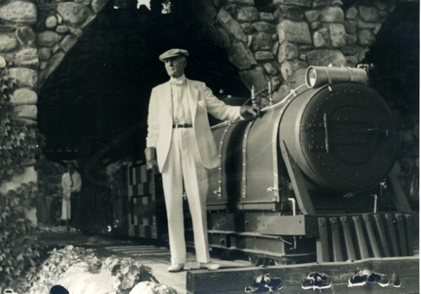
William Gillette – image courtesy of Harriet Beecher Stowe Center and Connecticut State Library
Built of local fieldstone supported by a steel framework, it took twenty men five years (1914-1919), to complete the main structure.
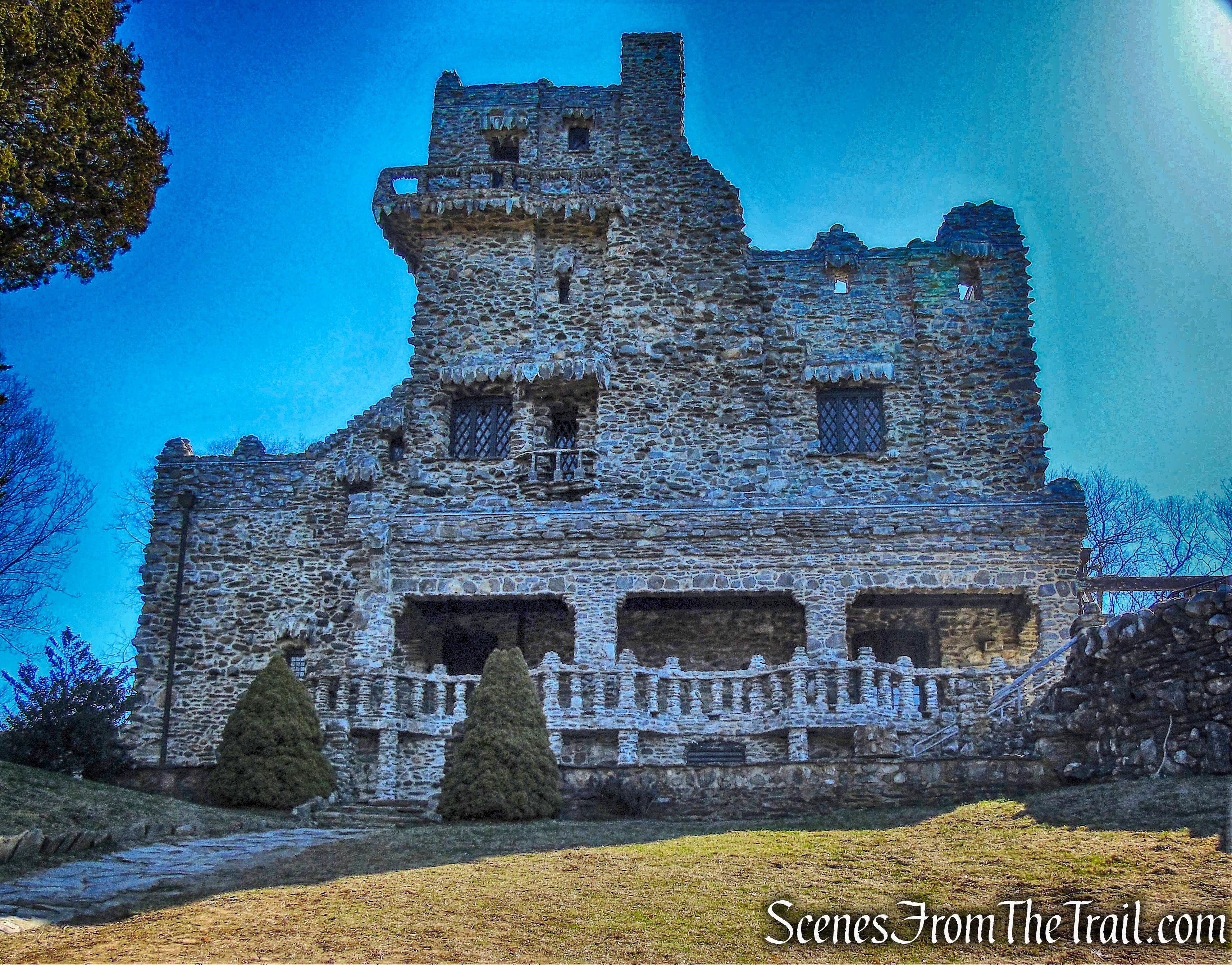
Gillette Castle
Gillette was perturbed about the future of his estate, and in his will, he specifically charged executors of his will, “To see to it that the property did not fall into the hands of some blithering saphead who has no conception of where he is or with what surrounded.” The estate was eventually sold to the state for a public park for $5,000.
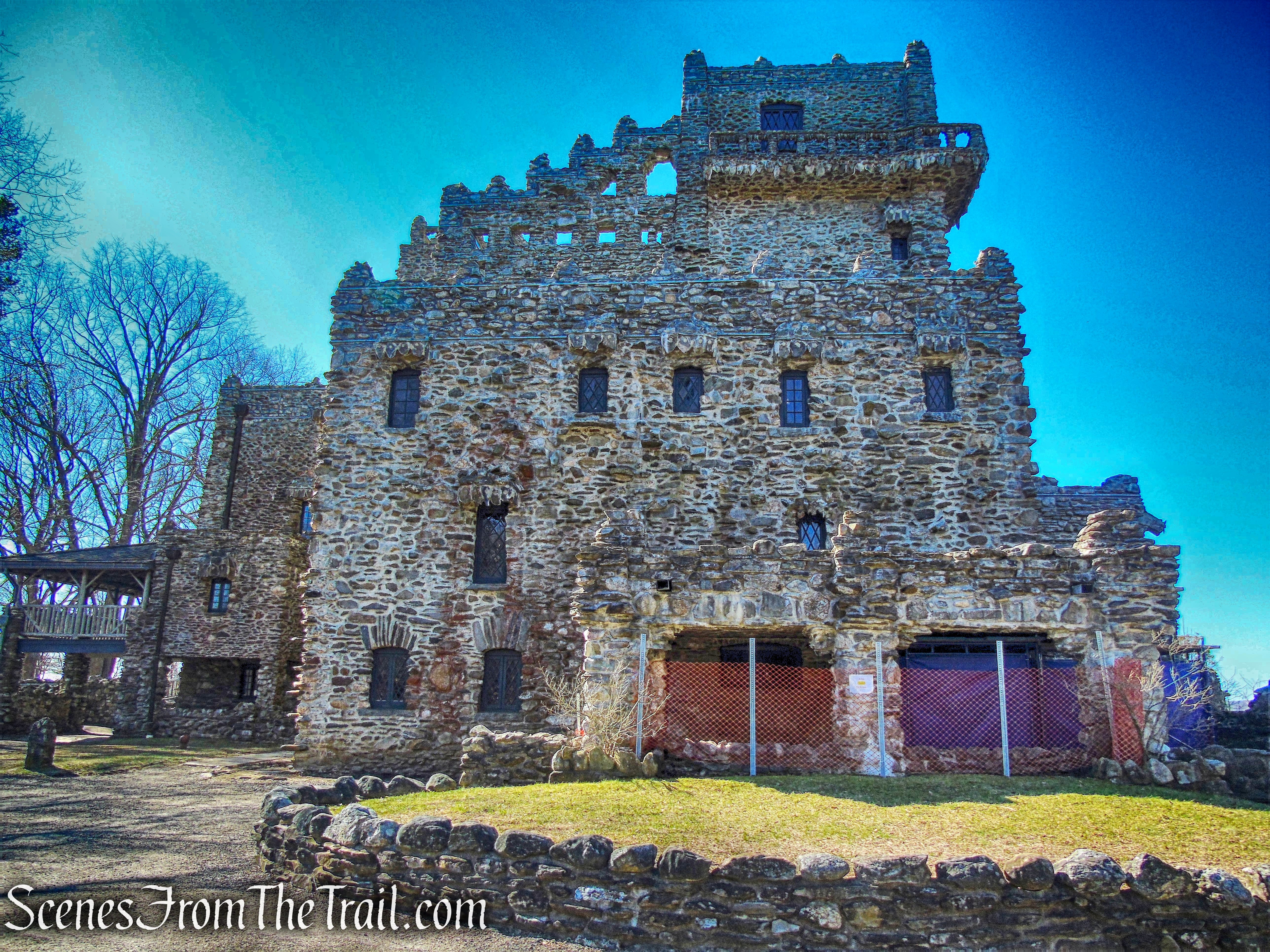
Gillette Castle
The castle has 24 rooms, with puzzle locks, secret doors, and even hidden mirrors that allowed Gillette to spy on his guests (including Albert Einstein and Calvin Coolidge) in order to time dramatic entrances for their amusement. The estate, now called Gillette Castle, is owned and maintained by Connecticut’s Department of Energy and Environmental Protection (DEEP).
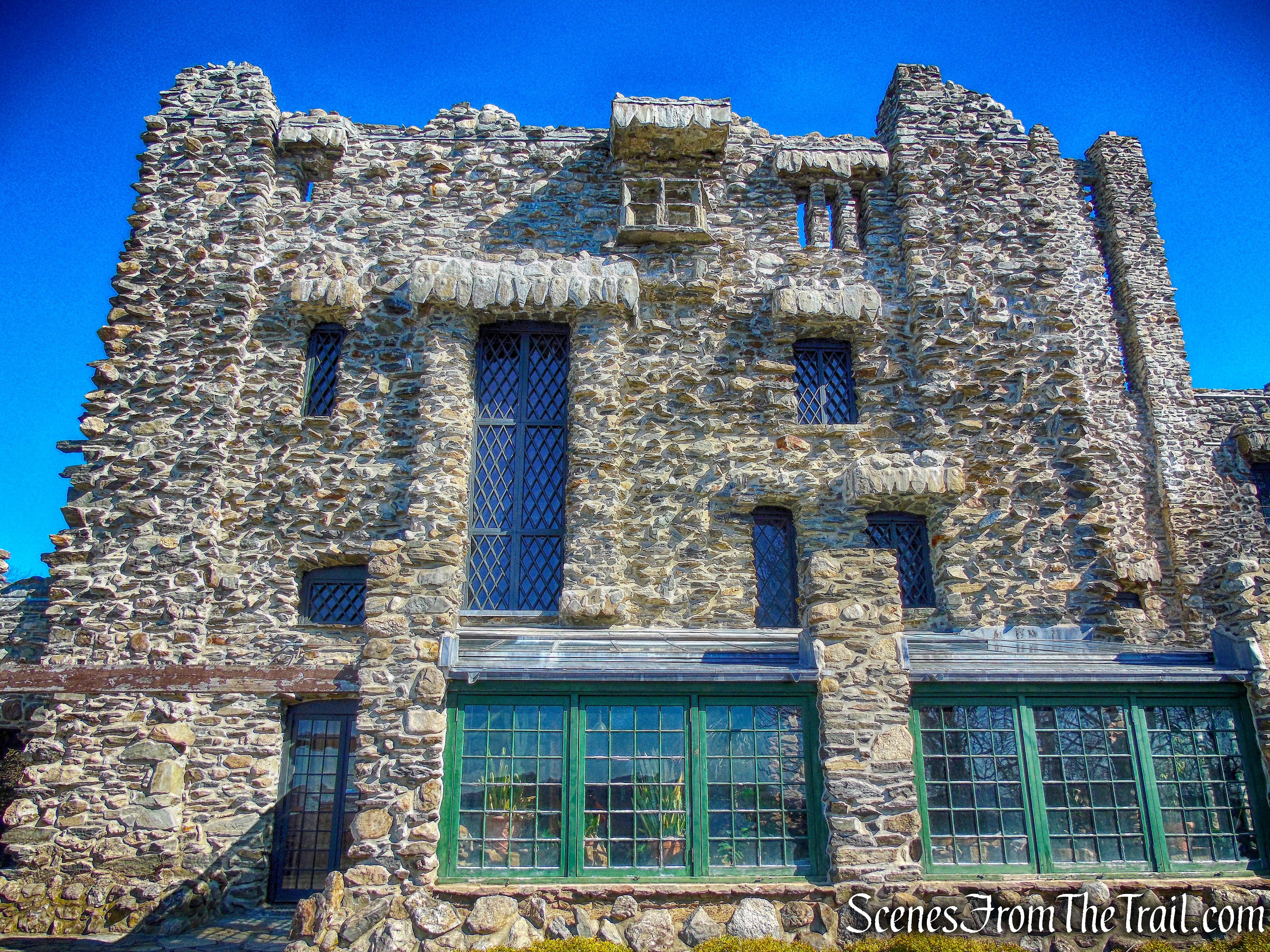
Gillette Castle
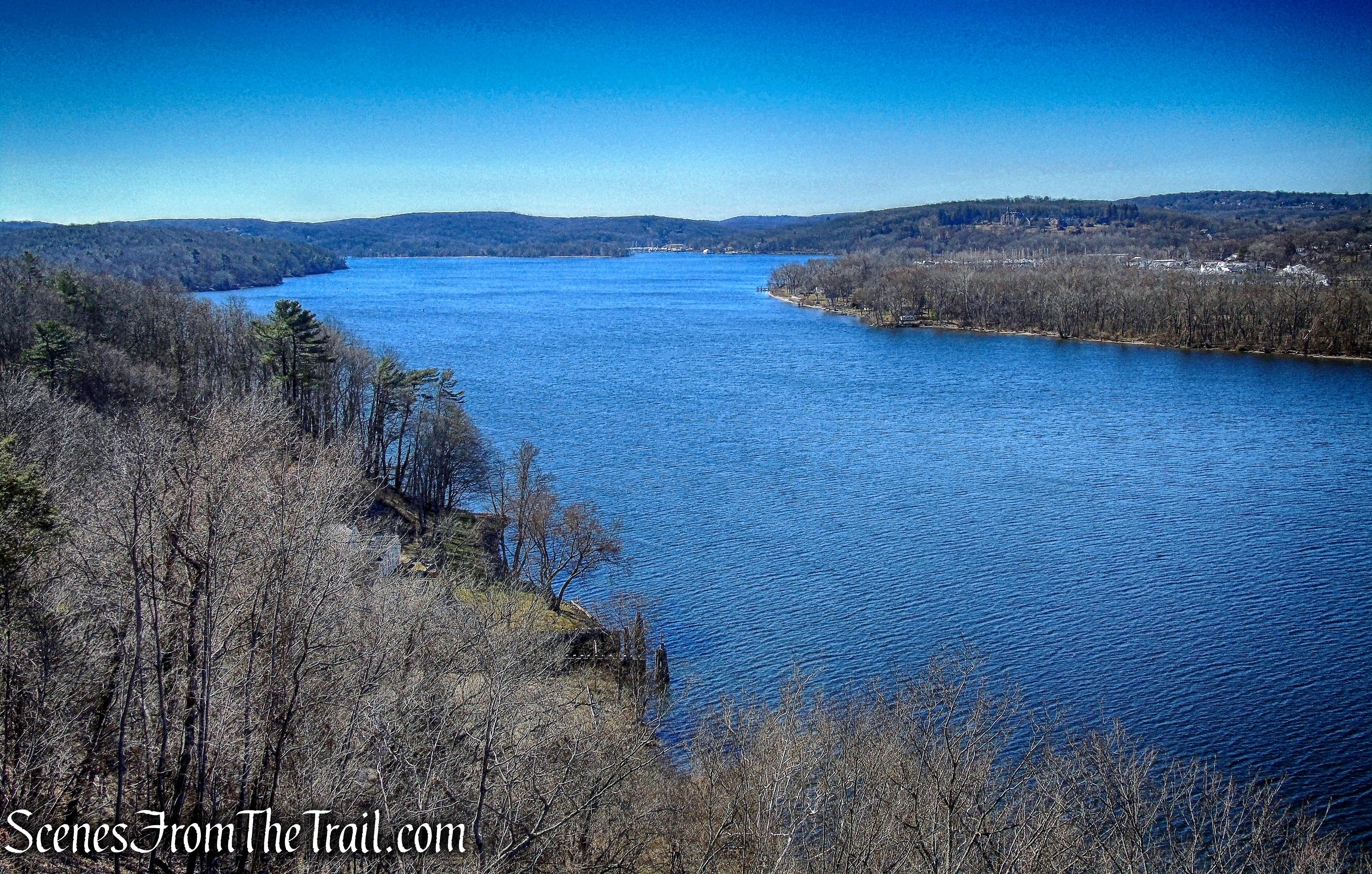
From the terrace, a spectacular view of the Connecticut River as it flows south into the Long Island Sound.

view of the Connecticut River – Gillette Castle
Once our sightseeing was concluded, we proceeded through the stone arch to get started on our hike.
stone arch – Gillette Castle State Park
My intention for this hike was to walk a good portion if not all of the railbed of Mr. Gillette’s narrow gauge railroad. I also wanted to check out as many points of interest as possible. On our way to find the railbed, I saw what appears to be a covered bridge of sorts just down the hill. We walked towards it then across it.
covered bridge – Gillette Castle State Park
covered bridge – Gillette Castle State Park
After crossing the bridge, we made our way back up the hillside to a trail that runs north to south along some shale-like Hebron rock formations.
Gillette Castle State Park
The trail comes to a junction where one trail makes a sharp right. We followed that trail uphill to a small bridge that the old railbed travels on.
Gillette Castle State Park
Now on the railbed of Mr. Gillette’s beloved railroad, we began following it to see where it took us.
Gillette Castle State Park
The trail continues over another longer wooden bridge that closely parallels the entrance road.
Gillette Castle State Park
At the end of the bridge there is what remains of an old stone water tower.
Gillette Castle State Park
The trail turns sharply left then turns right, sandwiched between some rock formations and the steep hillside.
Gillette Castle State Park
The trail then arrives at the 125th Street Station.
125th Street Station – Gillette Castle State Park
There were a few markers along the railbed signifying “Seventh Sister Railroad.”
Seven Sisters Railroad – Gillette Castle State Park
This is a nice touch along the trail, with the Connecticut River just below.
125th Street Station – Gillette Castle State Park
We stayed on the railbed, which travels north, then begins to curve to the east then heads southeast, crossing two small wooden bridges along the way.
wooden bridge – Gillette Castle
The trail reaches the park entrance road, just across from Mr. Gillette’s goldfish pond. There is a small parking area there, along with some picnic tables near the edge of the pond. That is where we ended up grilling at the conclusion of our hike. We crossed over and began walking through the parking area.
goldfish pond parking area – Gillette Castle
There is a kiosk at the far end of the parking area and several ways to go from there.
goldfish pond parking area – Gillette Castle
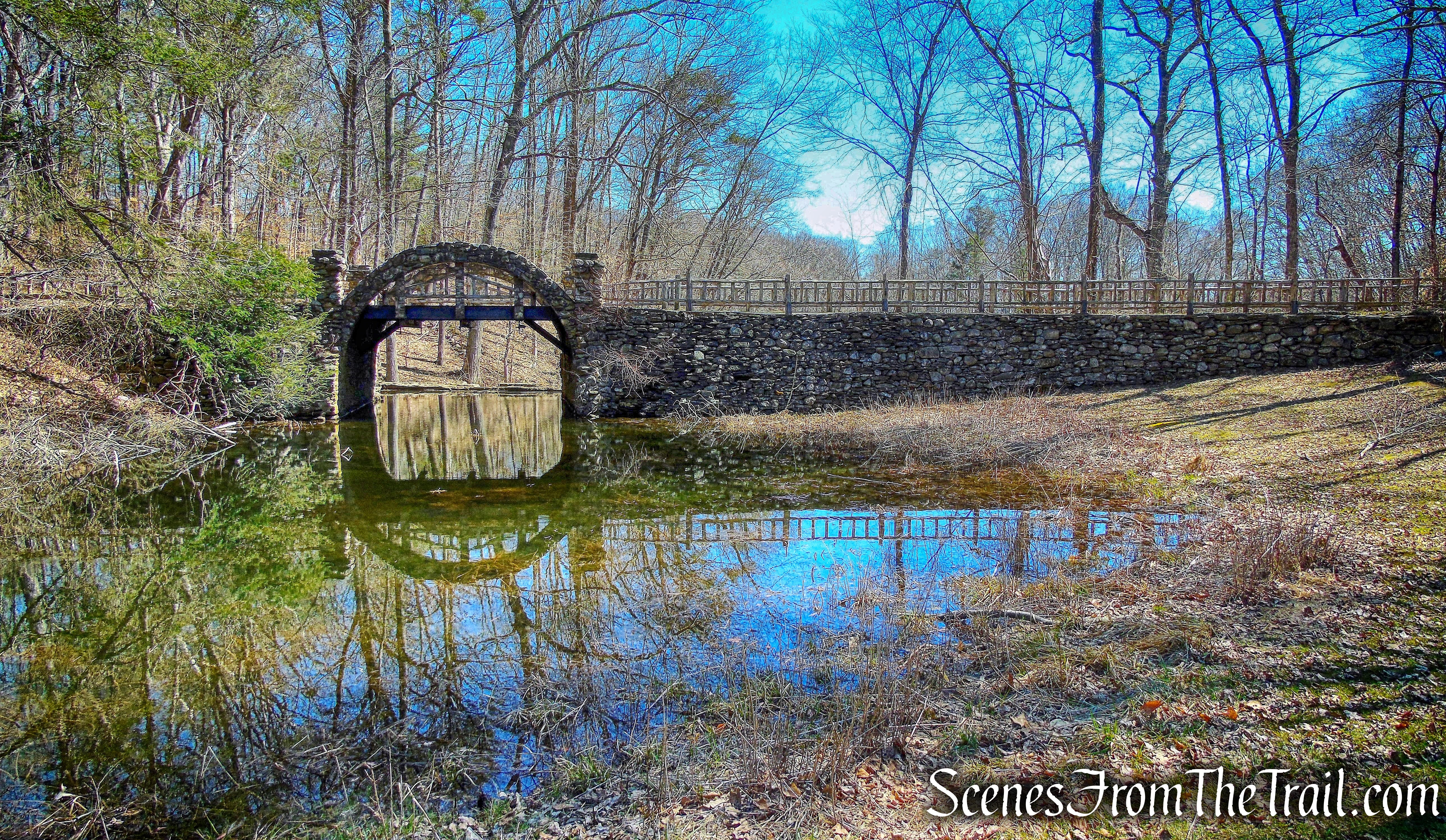
I consulted the map trying to figure out which way to go to get to the tunnel. One of the few things labeled on the map is the tunnel. There are five trails which are closely aligned in this area, so we stopped momentarily on the stone arch bridge to figure things out.
stone arch bridge – Gillette Castle
The trail we took is directly behind the kiosk when walking from the entrance to the parking area. The trail just to the left of it has a gate across it and a sign that reads “bridge closed.” I knew beforehand that there is a train trestle that is part of the railroad trail and surmised that the sign referred to that. We took the wide woods road that heads southeast.
wide woods road – Gillette Castle
In a short distance, the trestle comes into view on the left.
trestle – Gillette Castle State Park
The 40 ft. wooden trestle carried the tracks over rough terrain.
trestle – Gillette Castle State Park
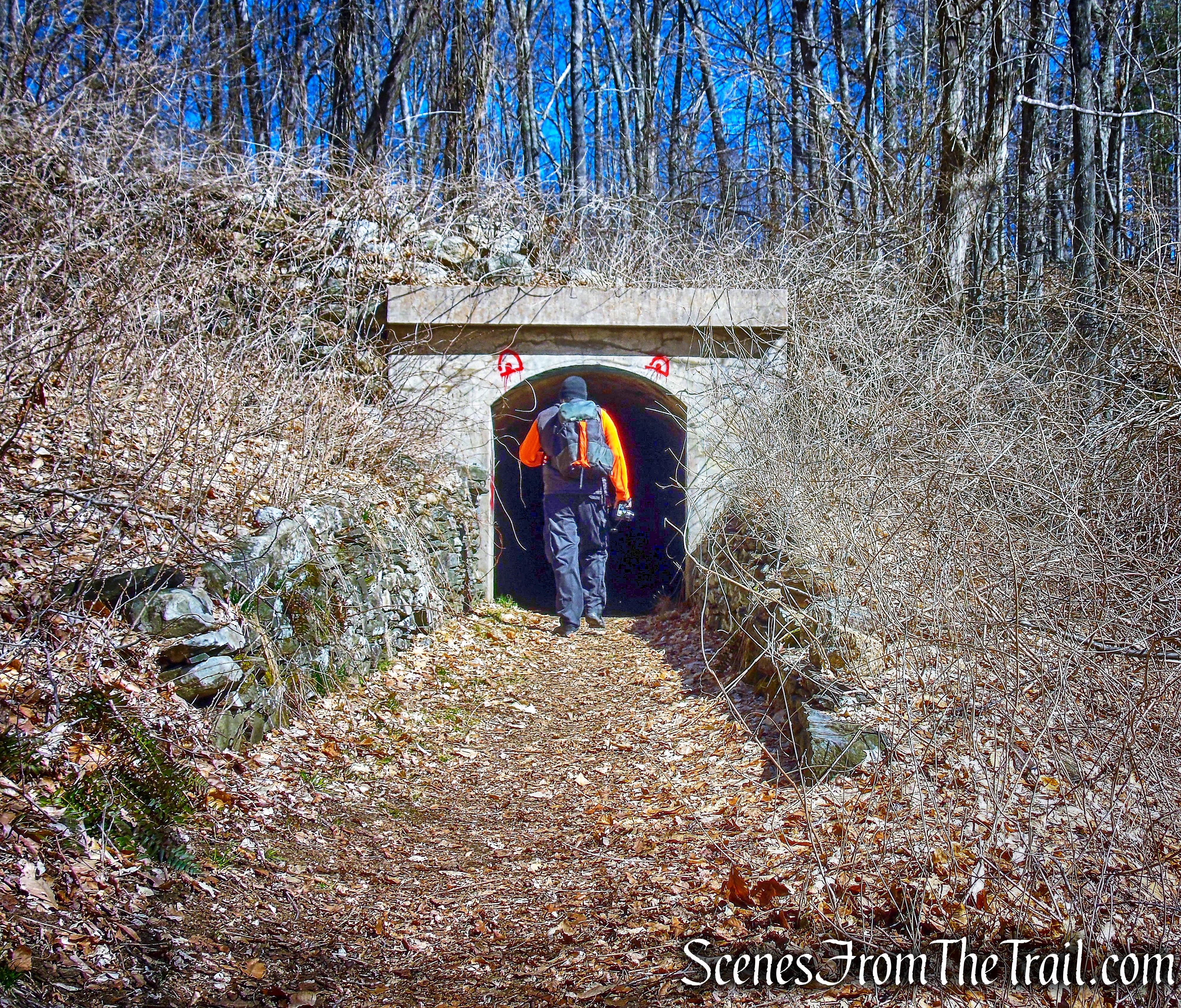
Just after passing the trestle, we walked up the hill to reach the same level as the railbed. That’s when the tunnel came into view and we made a beeline towards it. The tracks of the railroad were removed long ago and scenic walking trails were created in their place.
train tunnel – Gillette Castle State Park
The 30th President of the United States, Calvin Coolidge Jr.; Albert Einstein; famed actress Helen Hayes and Yukio Ozaki, a mayor of Tokyo that brought the famed cherry trees to Washington, D.C., they all took a ride on the “Seventh Sister Short-line.”
train tunnel – Gillette Castle State Park
Mr. Gillette’s 3-mile narrow-gauge railroad operated around his 184-acre estate in the 1920’s and 1930’s.
train tunnel – Gillette Castle State Park
The 75-foot-long, slightly curved tunnel cuts through the hillside.
train tunnel – Gillette Castle State Park
The other side of the tunnel offers a different look.
train tunnel – Gillette Castle State Park
Mr. Gillette’s railroad, which he called the “Connecticut Nutmeg,” often whisked terrified guests from “Grand Central Station” along the winding 3-mile corridor of his wooded estate.
railbed – Gillette Castle State Park
The railbed comes to an abrupt end at a point where there seemed to be a bridge that is no longer there except for a couple of support beams.
railbed – Gillette Castle State Park
We climbed a few feet up the hill and jumped on a footpath that parallels the railbed. A little further down the trail, looking down at the railbed, is the roundabout. The place where the train would turn around and head back towards the tunnel. The roundabout is an interesting area to explore, with its huge stone walls.
roundabout – Gillette Castle State Park
roundabout – Gillette Castle State Park
Now heading west on the footpath, we came upon a stealth campsite and decided to take a break.
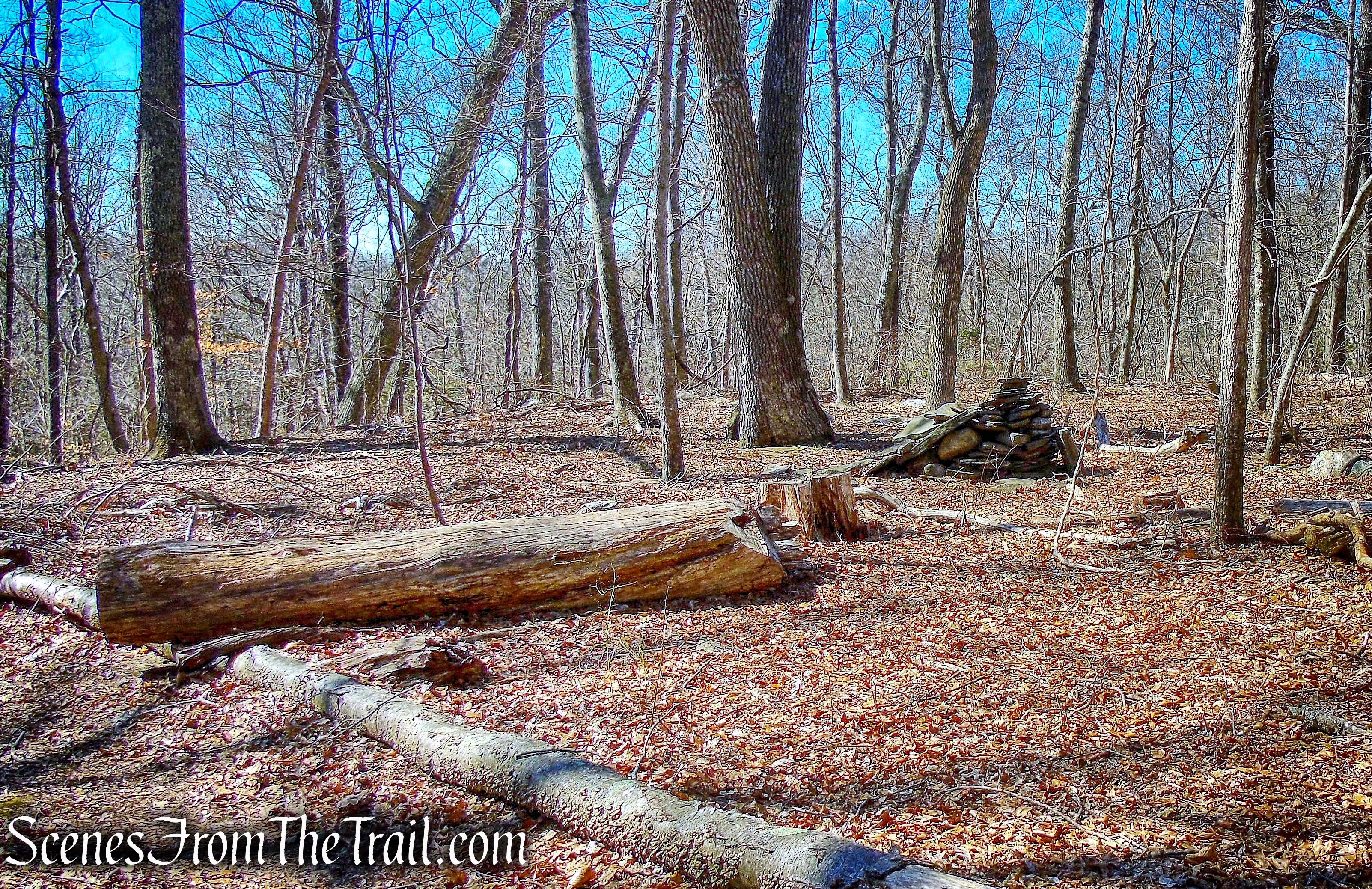
stealth campsite – Gillette Castle State Park
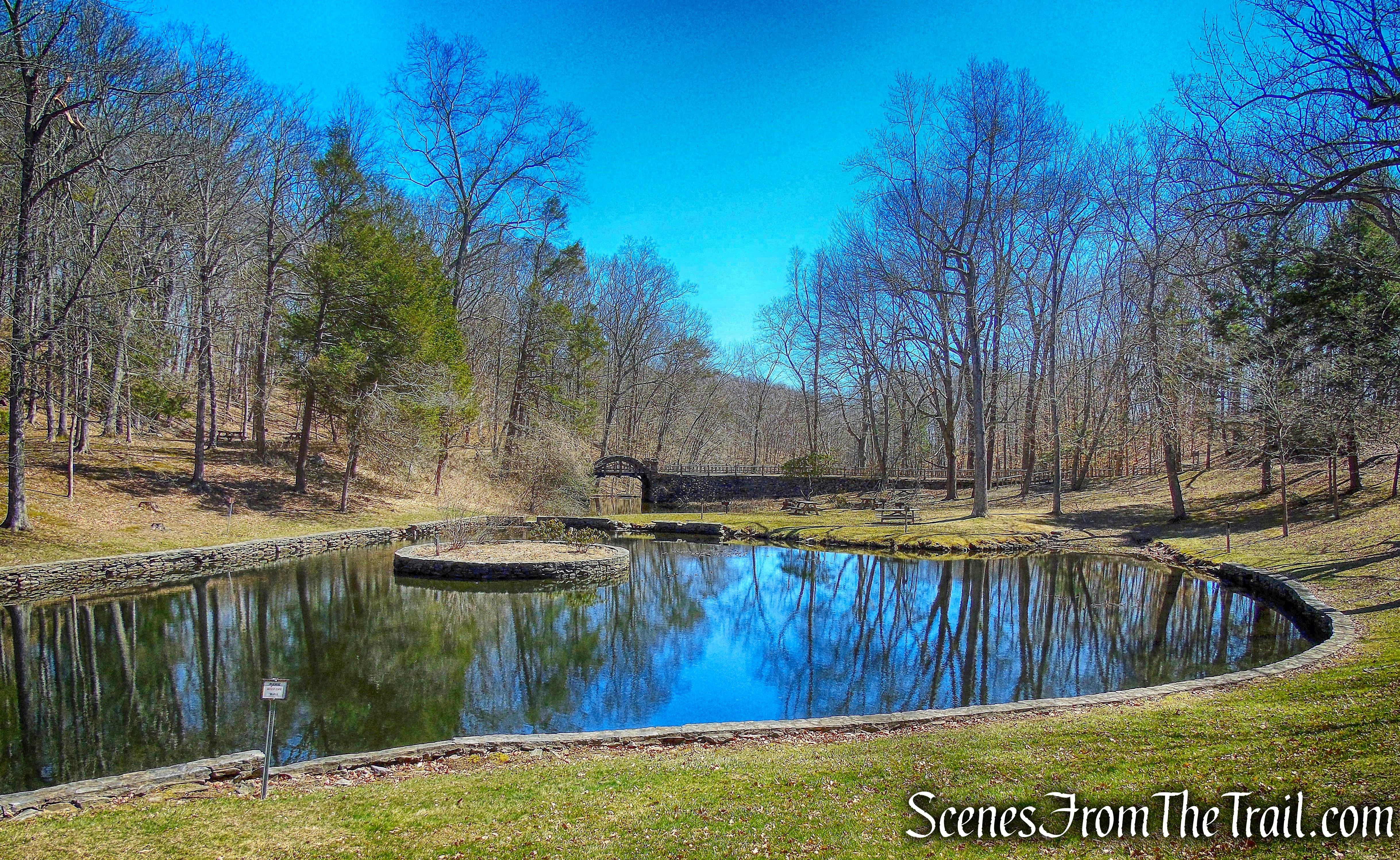
The trail we were on led us back to Mr. Gillette’s goldfish pond, where my colleagues stayed and saved a couple of tables for us. I headed back to the parking lot, crossing over the stone arch bridge.

stone arch bridge – Gillette Castle State Park
The view from the bridge, looking out at the goldfish pond.
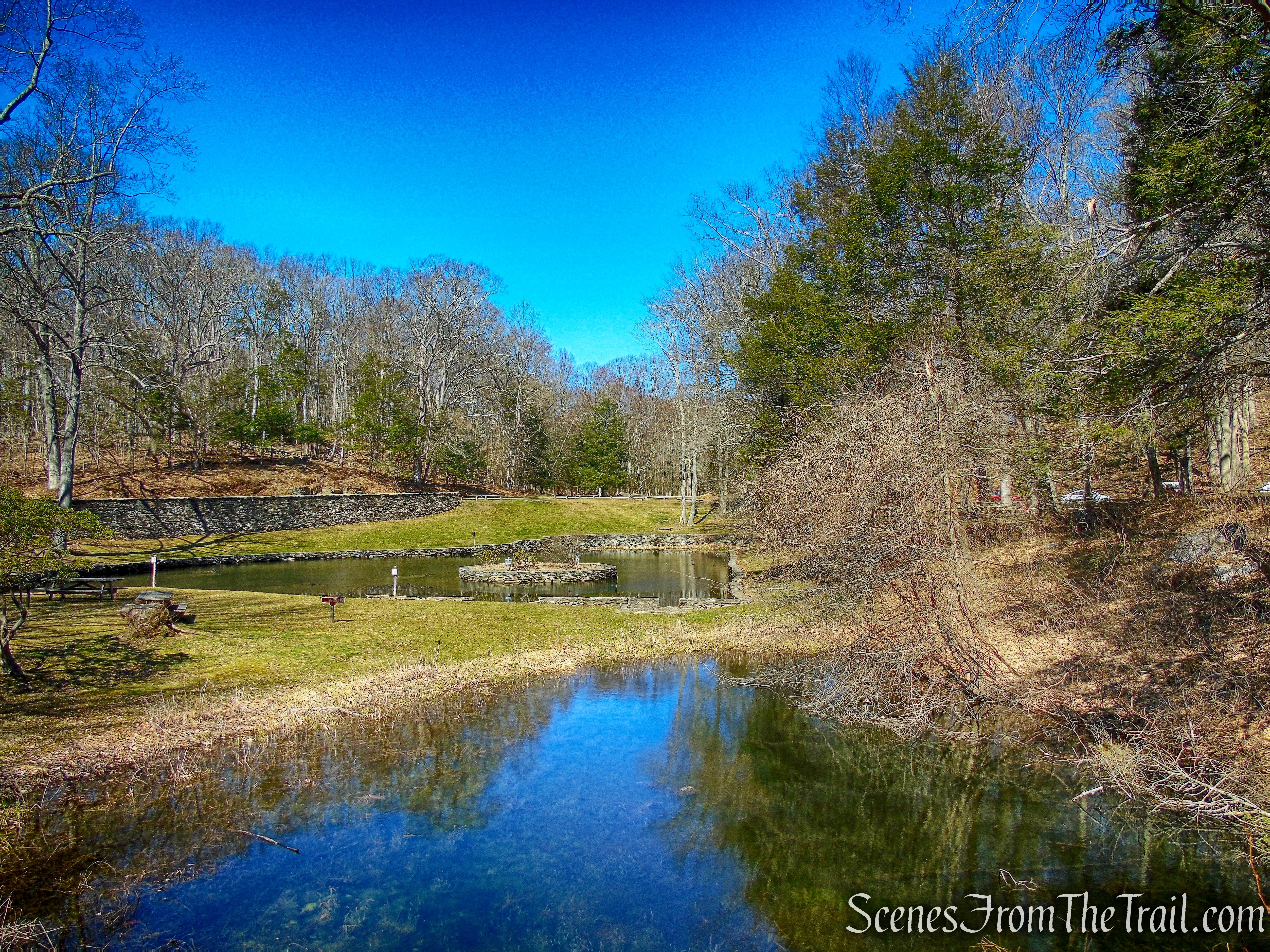
goldfish pond – Gillette Castle State Park
After walking a short distance to the parking lot, I drove back to the parking area by the goldfish pond. We relaxed by the pond and grilled up some marinated Skirt Steak. That steak was delicious and the main reason why we kept the hike short. After enjoying some good eats, I took a walk around the pond to capture some images.
goldfish pond – Gillette Castle State Park
stone-arch bridge – Gillette Castle State Park
After a nice afternoon in the sun, it was time to head out. I wasn’t thrilled about the two hour drive, but it was totally worth it. We practically had the whole park to ourselves. This is a gorgeous place to spend a day and I would definitely visit again, just not during peak season. This is a great place to bring the kids or anyone as an introduction to hiking. The trails are easy to walk and it has enough points of interest to keep anyone engaged. And it has a castle and a tunnel!!
Pros: Gillette Castle, train tunnel, Connecticut River views, picnic tables and grills.
Cons: Two hour drive from Westchester County, big crowds in summer, map could be better detailed, trails not blazed.
Take a hike!
Gillette Castle State Park
Sources:

Just as I vaguely remember from my 1992 visit. I yearn to return and enjoy this park again. Awesome in a word.
LikeLiked by 1 person