March 24, 2018 – Dover Plains, NY
Difficulty: Moderate
Length: Approximately 4.2 miles
Max elevation: 841 ft.– total elevation gain approximately 770 ft.
Route type: Lollipop Loop
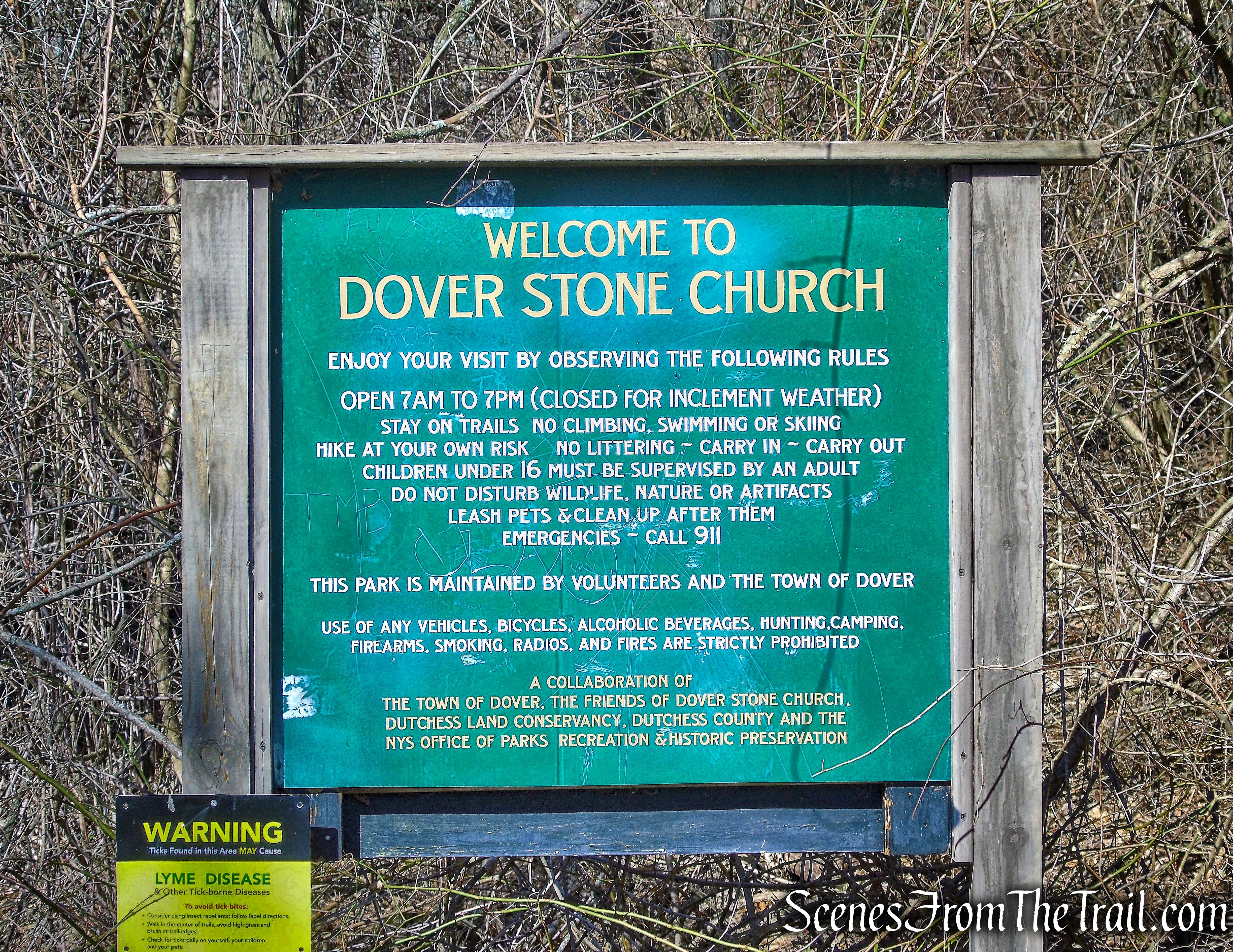
Trailhead parking: There is no public parking on property on or near the right-of-way off Route 22. Parking there may be subject to towing. Parking is allowable at Dover Elementary School (When School is NOT in Session) 9 School St, Dover Plains, NY 12522 or Freshco 22 Plaza (When School is IN Session) 3156 NY-22, Dover Plains, NY 12522.
There is an updated write-up from May, 2023 here: Dover Stone Church Preserve
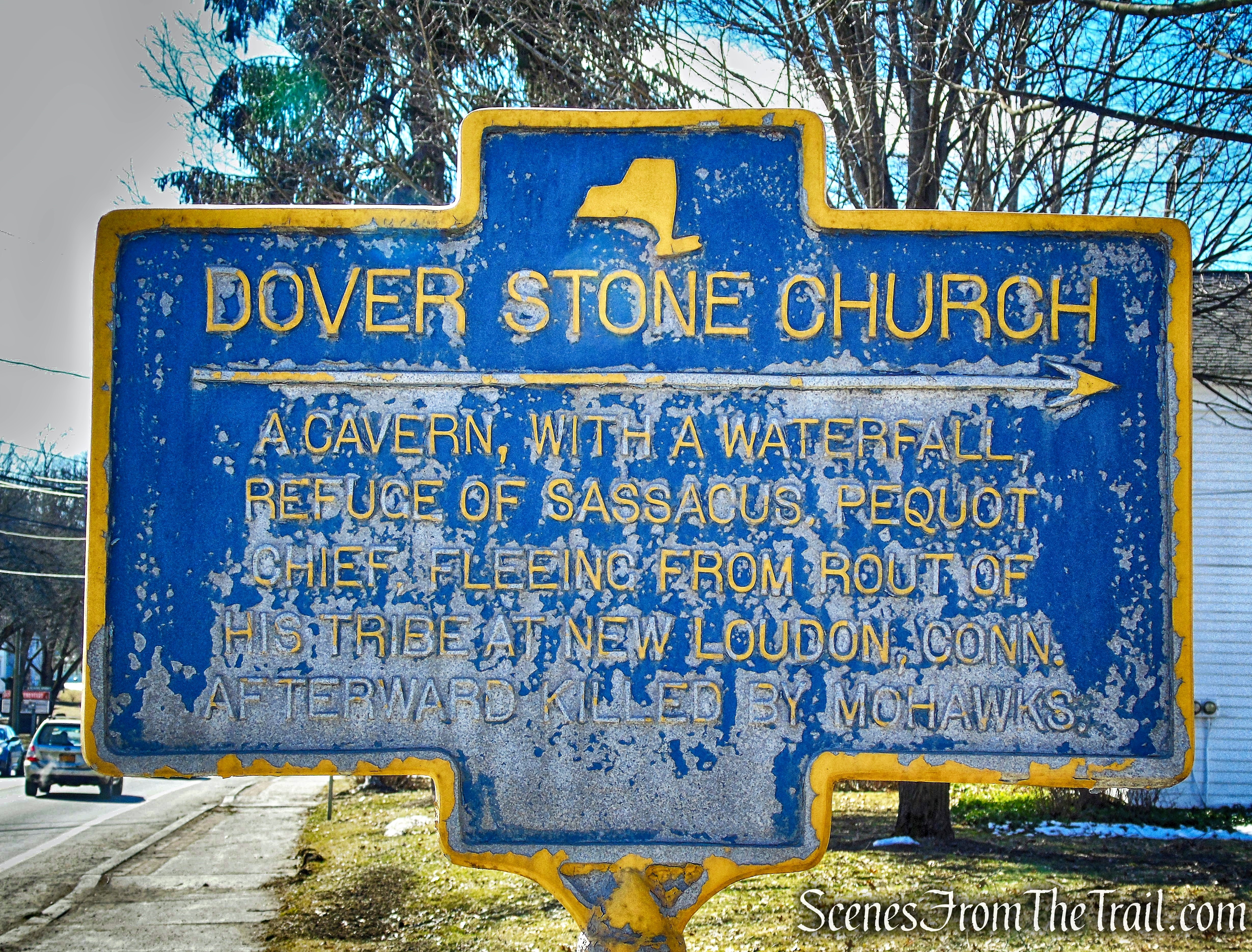
The “Stone Church” is an ancient cavern on the Stone Church Brook in Dover Plains, hewn by time in the formation similar to a church’s cathedral stained glass window. According to local legend, the site was a refuge for Pequot Sachem Sassacus and his warriors as they fled from the English Army in the 1600’s. In the 1800’s and early 1900’s, the Stone Church was a popular local attraction for New York City dwellers to visit and enjoy the recuperative fresh air and beauty of upstate New York. It was placed on the National Register of Historic Places in 2014.
Dover Stone Church
A distinctive geological feature in eastern Dutchess County, it was a celebrated and much-visited tourist destination in New York State by the middle decades of the nineteenth century. The site was highlighted as a remarkable natural curiosity in published accounts as early as the 1830’s.
Dover Stone Church
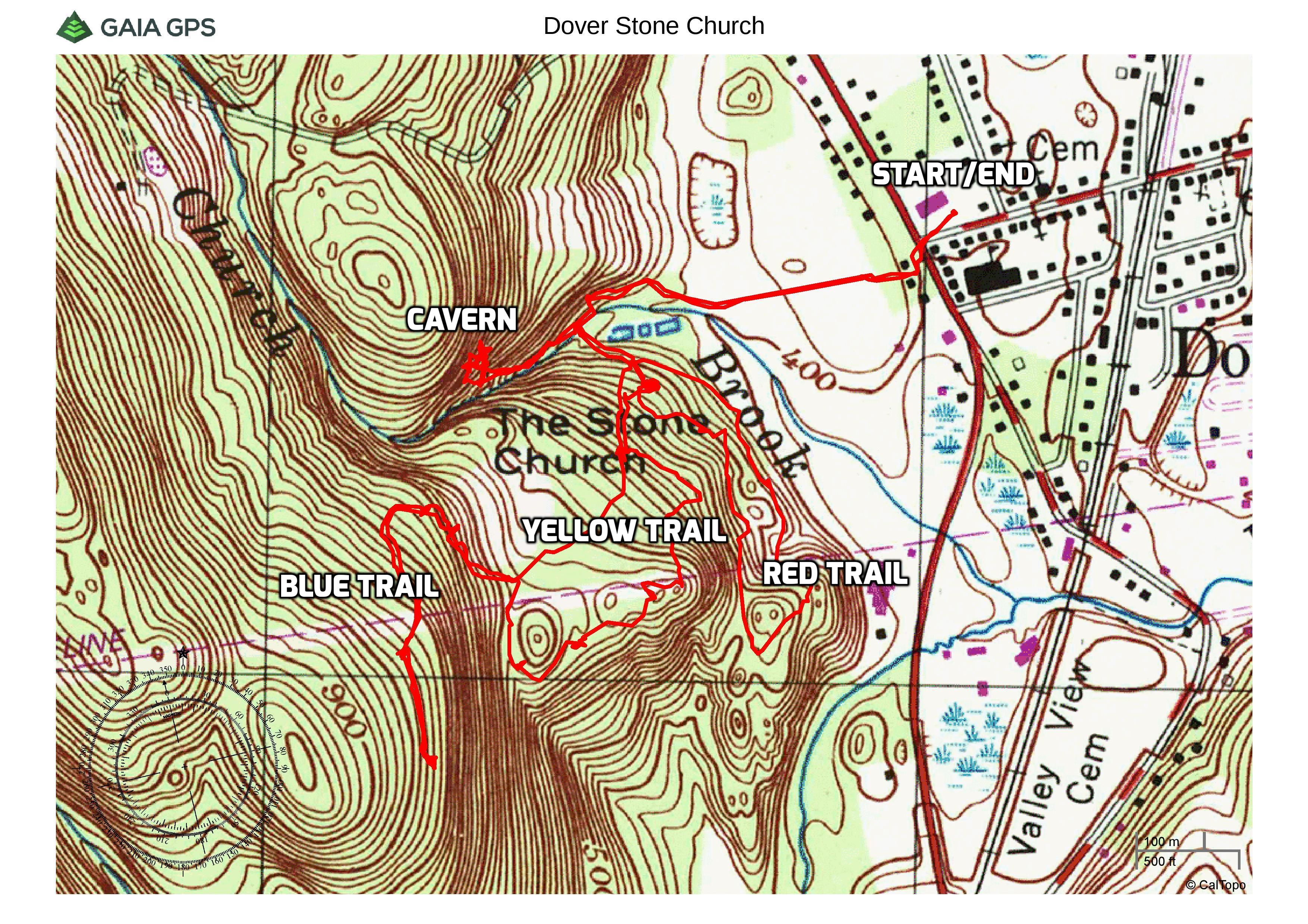
In 2015 three new trails were added. The hike to and from the “Stone Church” is about 1.2 miles round-trip from the parking area. The stone path along the brook to the cavern is delightful enough on its own, but it makes for a really short hike, especially when travelling just over an hour to get there. I wanted to traverse all of the marked trails on this visit and I am glad that I did. While there will always be plenty of people down near the brook, we only encountered a man and his dog while we hiked the other three trails.
Dover Stone Church
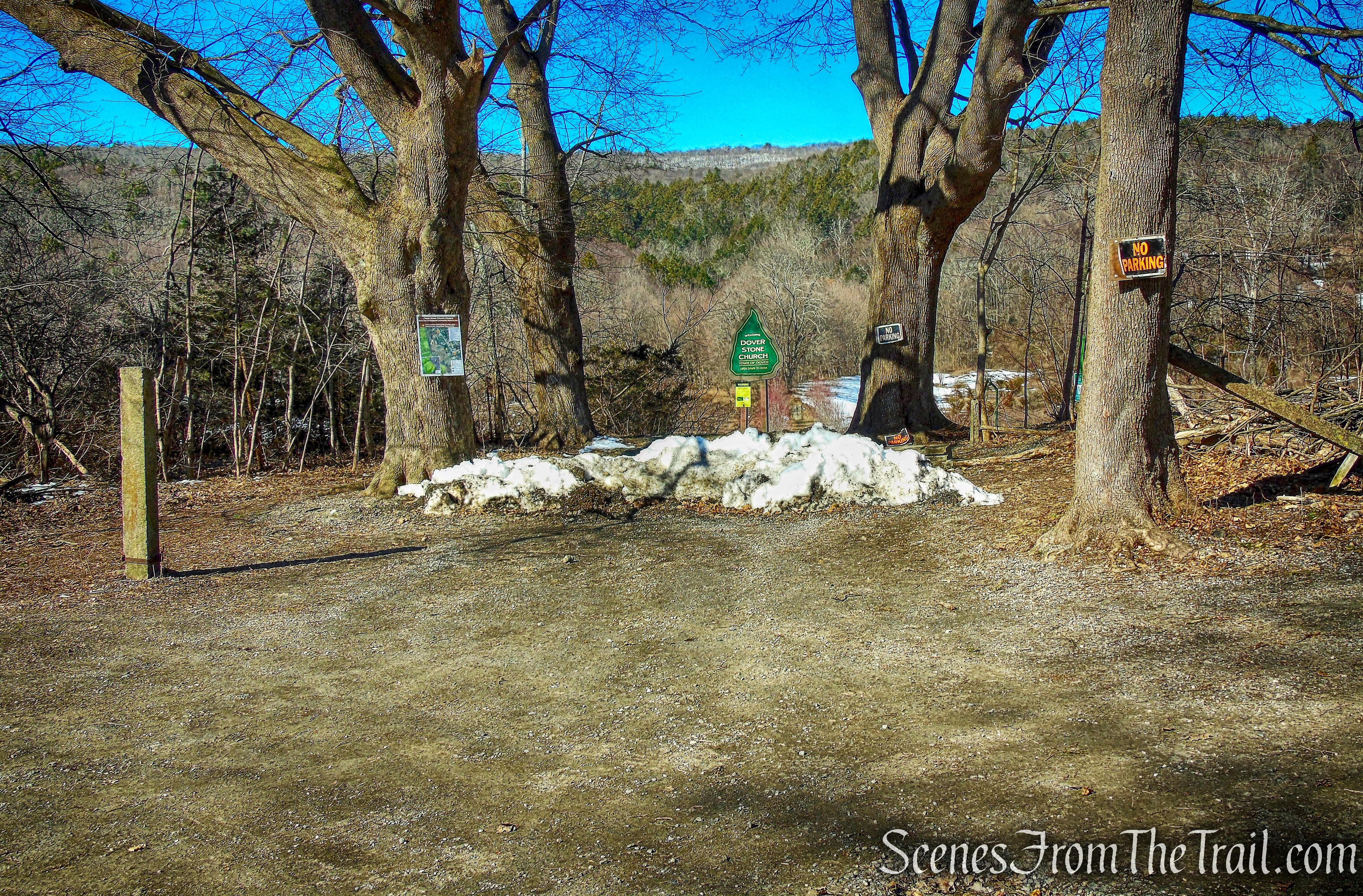
Although it was a Saturday, we parked in the Freshco 22 Plaza, which is where I have always parked when I visit Dover Stone Church. I always park in the far corner of the lot, away from the business entrances and have never had any issues. We walked out to the traffic light on the corner of Route 22 and Mill Street and crossed the road. Turning left on the other side, we walked south a short distance until we came to the right-of-way, marked by the blue and gold historic marker. The entrance to Stone Church begins with a gravel driveway through private property. We proceeded to walk up the to the back of the driveway.
Dover Stone Church
To the right of the sign, there are granite steps and railings. They were installed to create passage along a man-made valley.
Dover Stone Church
granite steps and railings – Dover Stone Church
In 2010, the Town of Dover improved the right-of-way entrance with restoration of maple trees that lined the entrance for centuries.
maple trees – Dover Stone Church
This section is especially pretty during the fall season. The image below is from October 2014.
maple trees – Dover Stone Church – October 19, 2014
At the end of the row of maple trees, there is another set of granite steps.
granite steps – Dover Stone Church
The path continues west alongside Stone Church Brook, passes through two fence posts and approaches a large kiosk.
large kiosk – Dover Stone Church
The kiosk has a lot of good information about this place, including a historical timeline, features of Stone Church and the ravine habitat.
large kiosk – Dover Stone Church
Turning left at the kiosk takes us past another sign and on a wide path that heads back towards the brook.
Dover Stone Church
I found there to be an inordinate amount of signs here, but I guess that too many is better than not enough.
Dover Stone Church
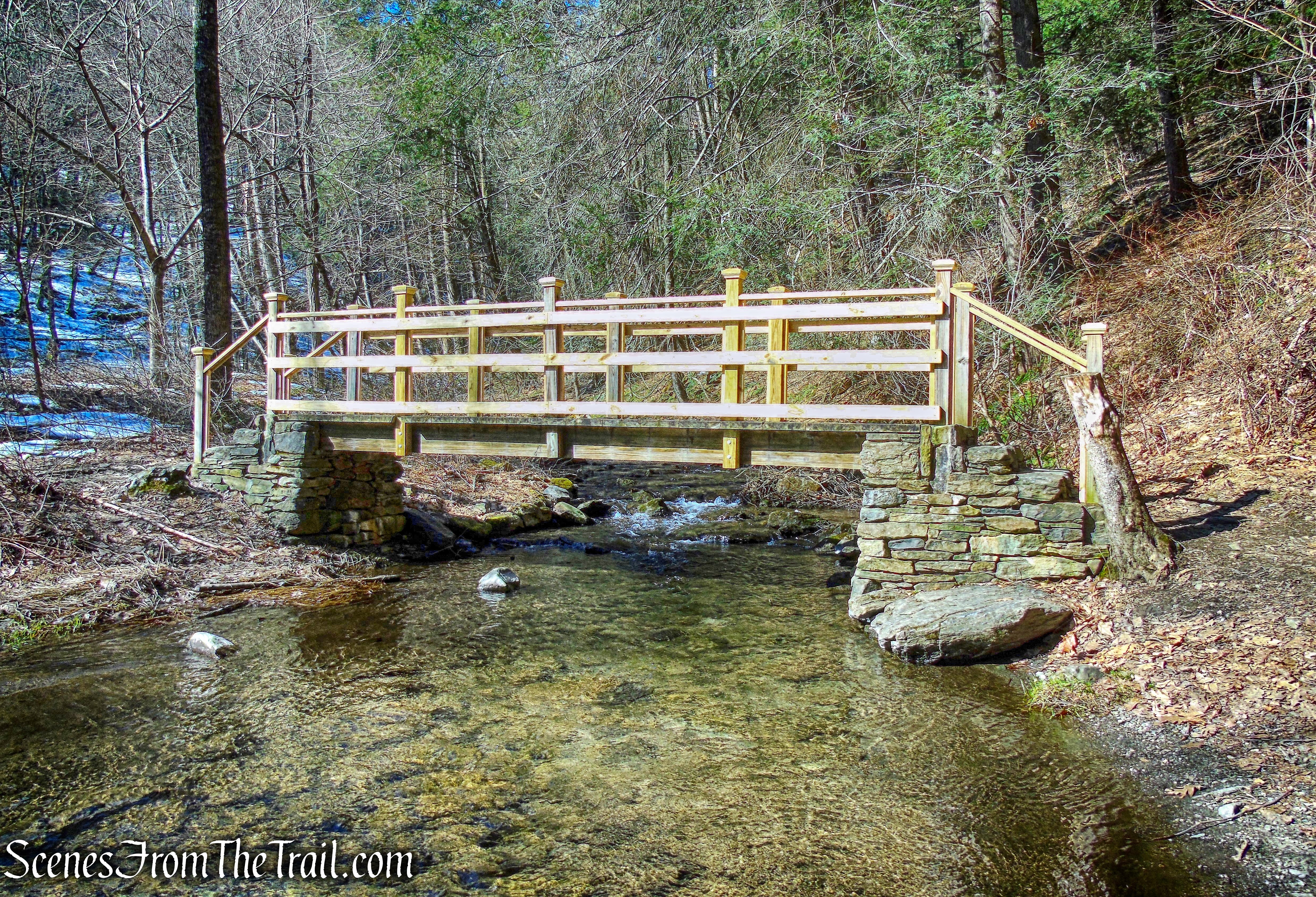
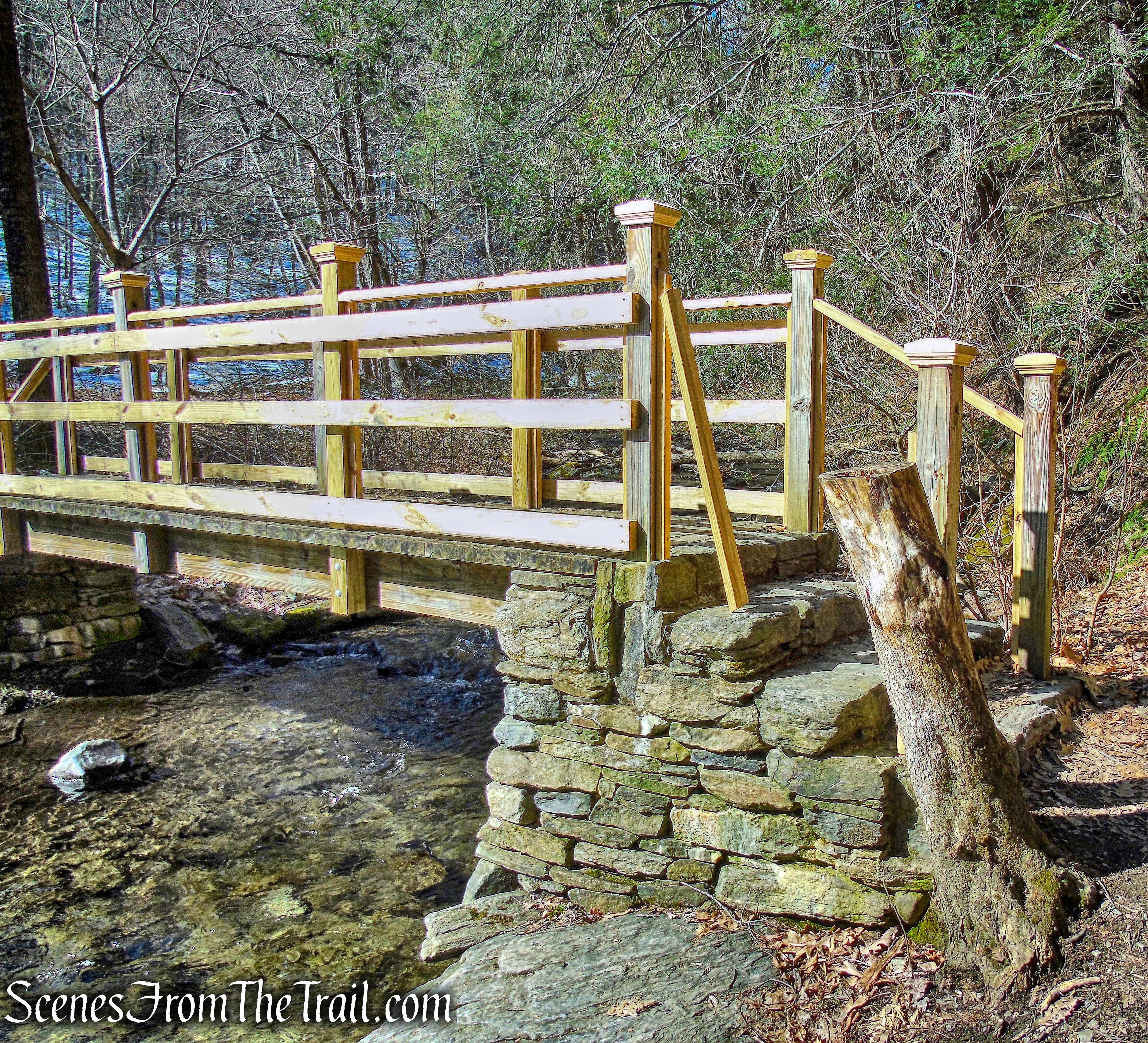
In a short distance, the path arrives at a wooden footbridge that spans Stone Church Brook. This bridge has been recently upgraded with better railings installed.
wooden footbridge – Dover Stone Church
The old bridge had only three posts on each side and a rope top rail.
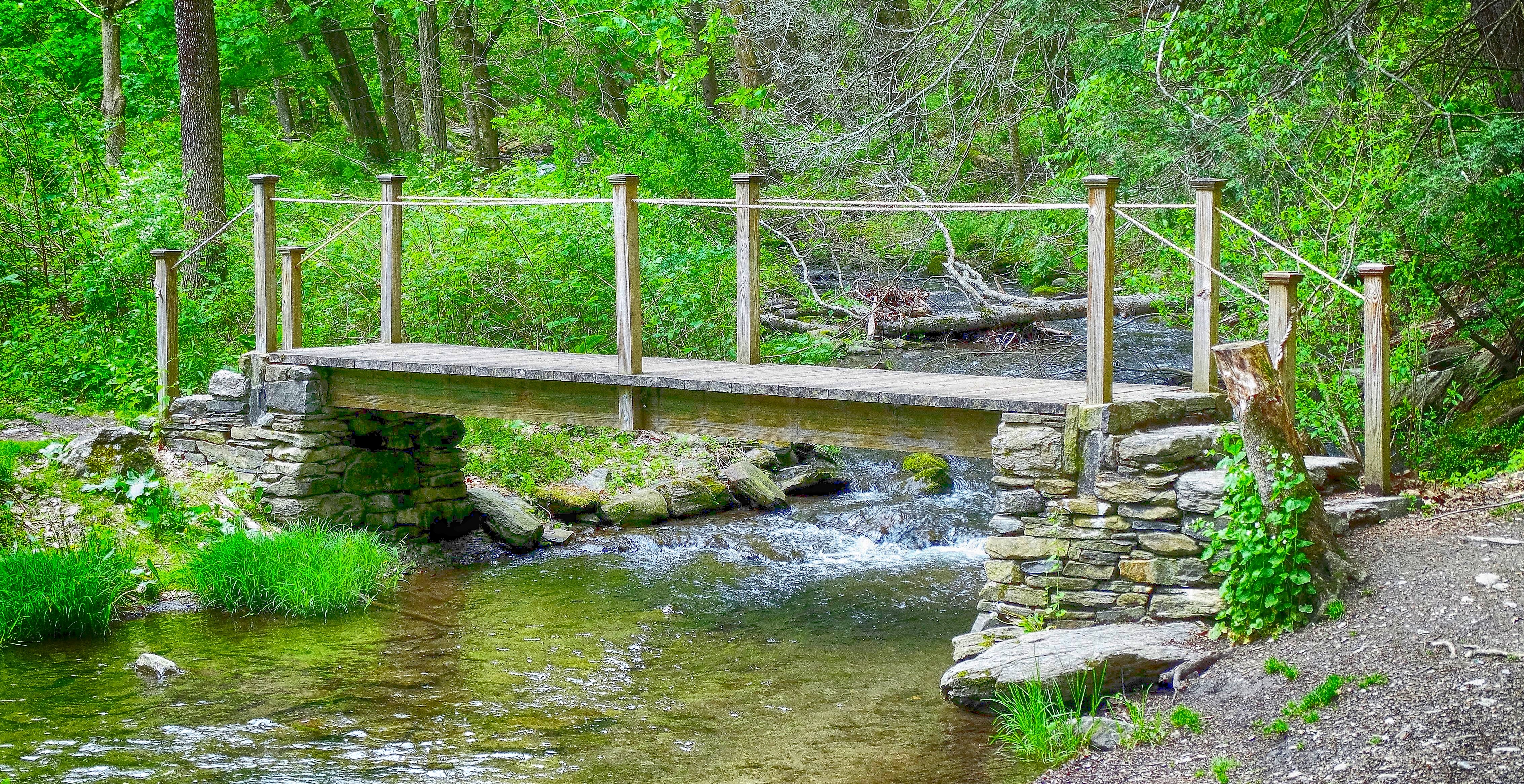
wooden footbridge – Dover Stone Church – May 14, 2016
I applaud their efforts for upgrading the bridge for safety reasons, but a little more care should have been taken, in my opinion. Since I have trust issues, I always check railings anywhere I go by giving them a shake and seeing what kind of hardware is employed. As I took a step up onto the bridge, I grabbed the left hand rail and gave it a little shake. As it turns out, it was never screwed in place. When I examined the rest of the railing, I noticed that only one screw was used in most places where several should have been. I removed the loose hand rail, fearing that someone unsuspectingly would fall and crack their skull, but on my way out, I saw that someone put it back unsecured. I removed it once again. This bridge sees a lot of foot traffic and I wouldn’t want anyone to take a tumble.
wooden footbridge – Dover Stone Church
After crossing the footbridge, to the left there is a small meadow with three spring-fed ponds. We turned right and stopped at the bench with the sign next to it. Sign, sign, everywhere a sign! We put on our microspikes here, anticipating the icy trail alongside the brook that leads to the cavern.
Dover Stone Church
The three newer trails all start to the left, but the Stone Church Cave Trail begins on the right. It travels southwest along the edge of the brook.
Stone Church Cave Trail
Stepping stones have been placed in strategic places to avoid having to getting wet.
Stone Church Cave Trail
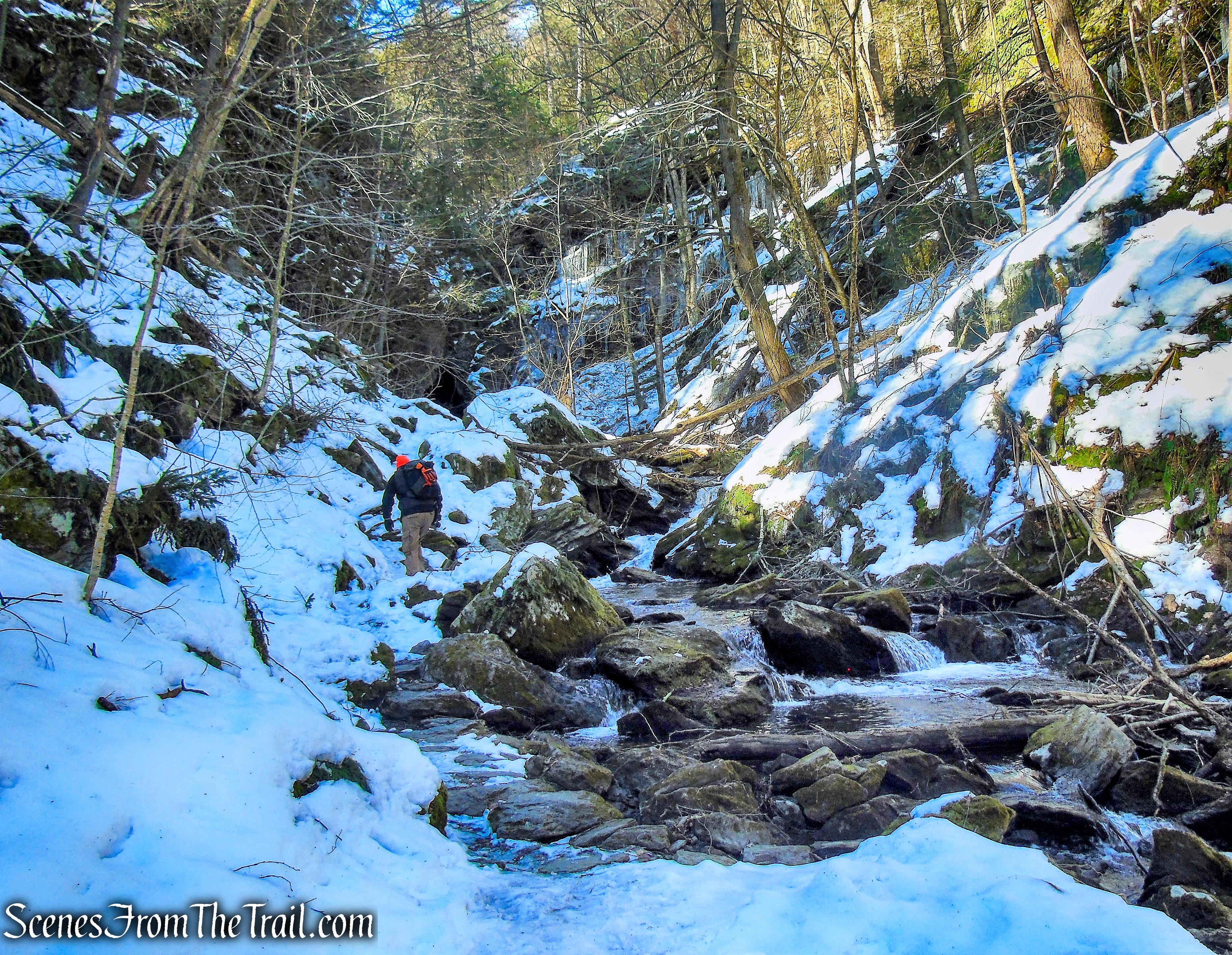
The trail continues up the picturesque gorge, giving you the feeling of being in the deep woods.
picturesque gorge – Dover Stone Church
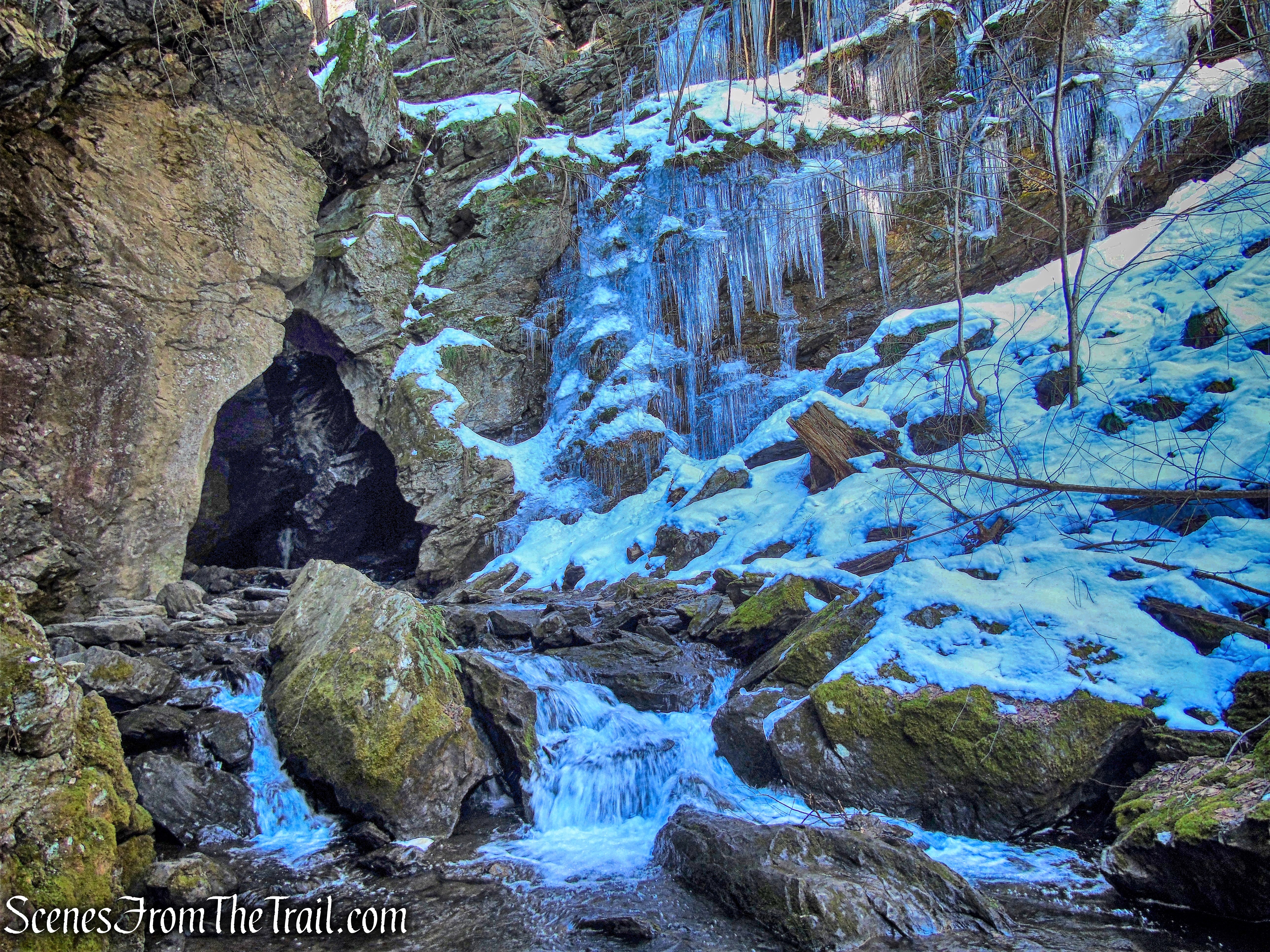
In no time at all, the opening of the cavern comes into view.
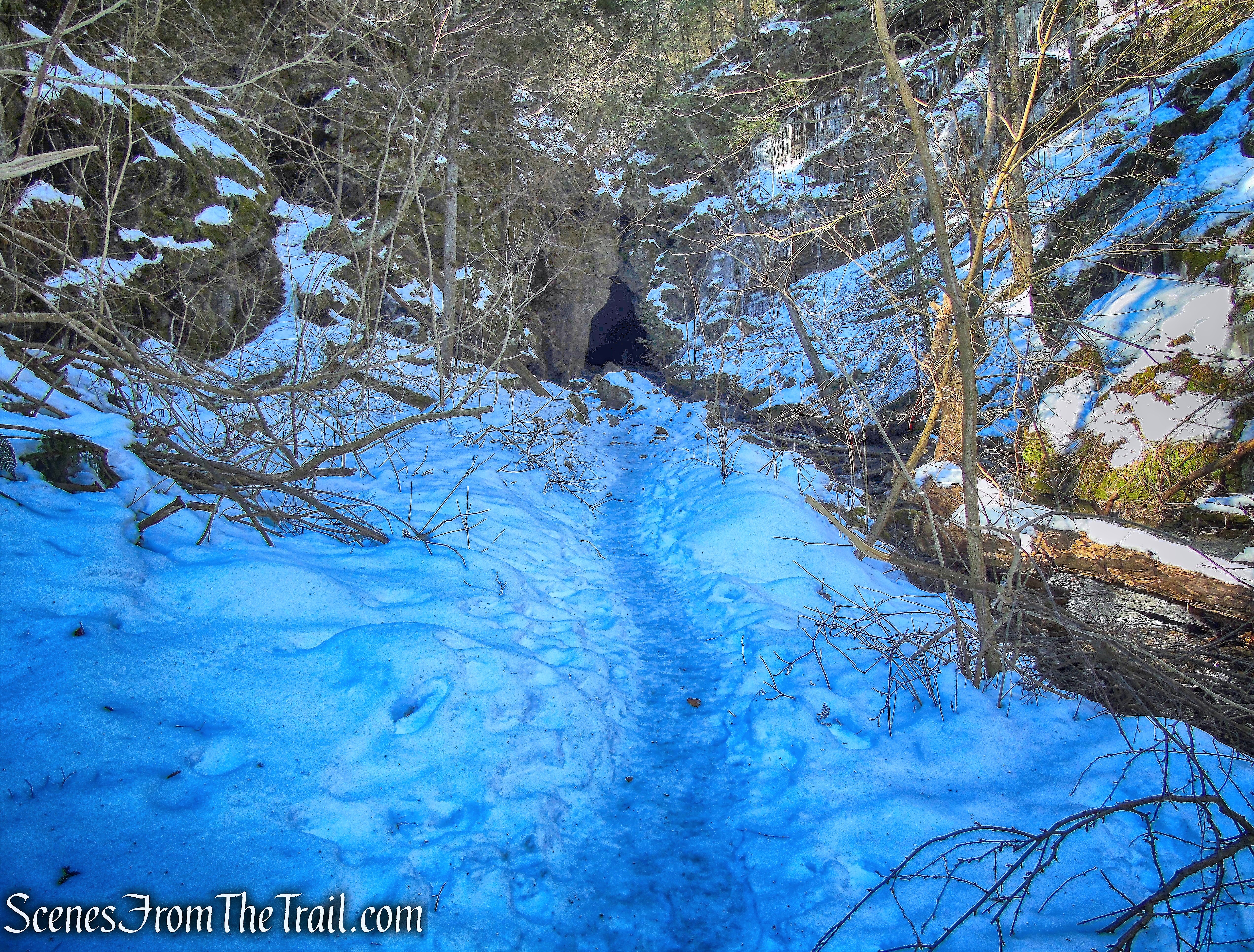
Dover Stone Church Trail
This place is very popular year round, even in winter. We were lucky this trip as there was no one around when we arrived. Large metamorphic rocks converge to form the entrance in the shape of a church’s cathedral window.
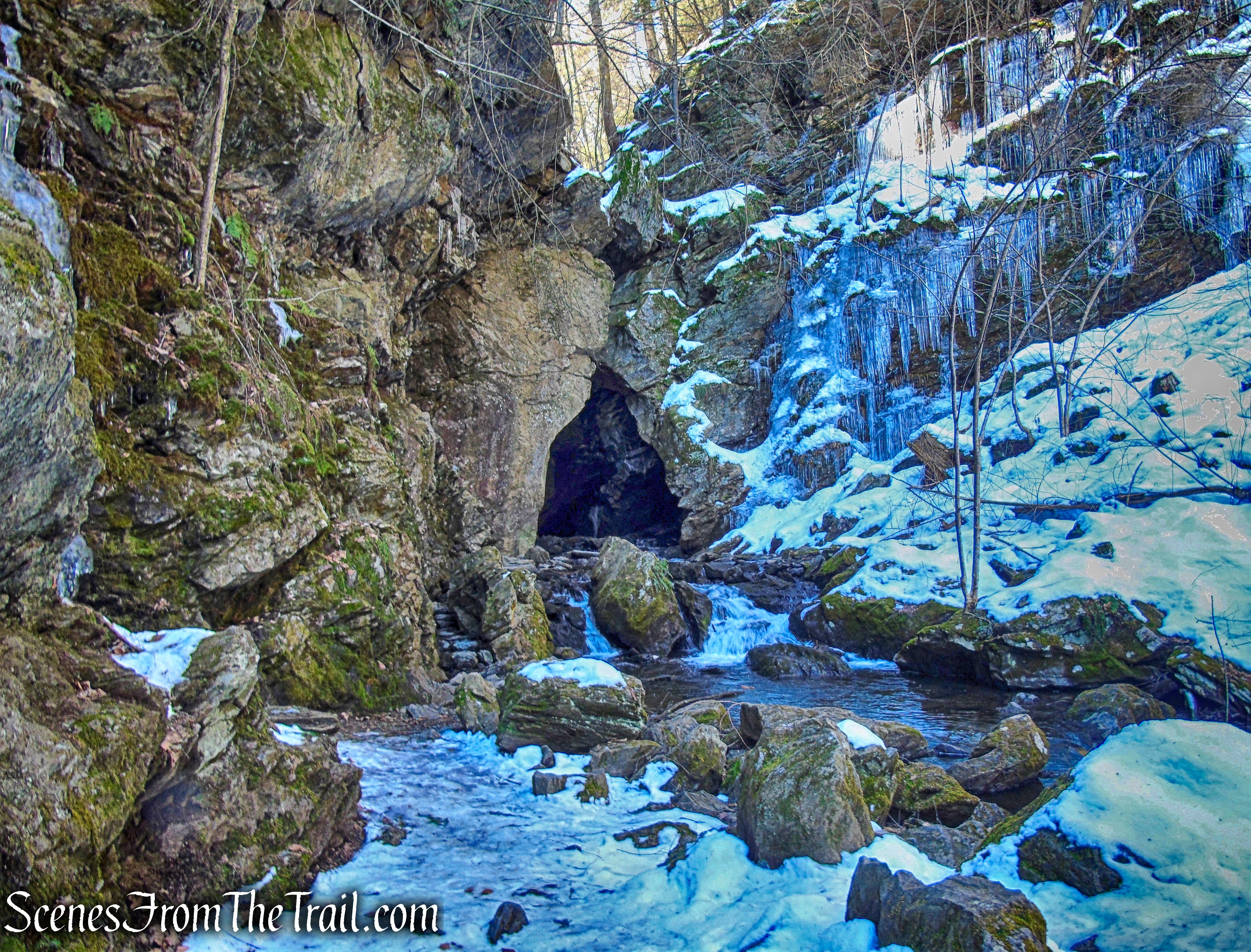
Dover Stone Church
With its natural beauty and unique geological formation, it is no wonder that people flock here. The gothic (pointed arch) formation of the stones gave rise to the moniker, “Stone Church.”
Dover Stone Church
The Stone Church Brook, a tributary of the Ten Mile River, flows through and out the cavern entrance.
Dover Stone Church
Inside the cavern, there is a waterfall cascading into a pool of water.
Dover Stone Church
The cavern can be entered, but caution should be taken on the wet and slippery rocks. The view from the inside, looking out.
Dover Stone Church
We stayed here for a little while, enjoying this glorious spot. It’s not often that one can visit here without encountering strangers, so we took advantage of it. I never get tired of this view.
Dover Stone Church
We retraced our steps along the brook, making our way back to the bench where we put on our spikes.
Dover Stone Church
Walking southeast past the sign, the three newer trails begin to climb the hillside.
start of the 3 newer trails – Dover Stone Church
The three trails are co-aligned at the start, as they climb the hill and pass through a fence. The three trails then come to a woods road with another sign. We turned right to begin on the blue-blazed Lookout Point Trail. Whichever way one chooses to go, all three trails return to this point.
Turn right at the sign for the Lookout Point Trail
The beauty of this place is that one can opt to just hike to the cavern or extend the hike by doing one, two or all three of the newer trails. At this point, I wasn’t sure how many trails we would do, but my goal was to do them all. Immediately we came to a large blowdown blocking the trail, but that is to be expected along most any trail after all the storms recently.
blowdown – Lookout Point Trail
The blue and yellow trails are co-aligned for about 0.3 mile from the sign as they ascend steadily on the woods road.
Lookout Point Trail
The co-aligned trail continues climbing and then levels off briefly, goes through a stone wall and skirts a meadow.
Lookout Point Trail
The two trails then reach a junction where they split and the blue-blazed Lookout Point Trail goes to the right, still following the woods road.
junction – Lookout Point Trail
After turning right to continue following the blue blazes, we encountered a couple of blowdowns which were easy to get over.
blowdowns – Lookout Point Trail
The Lookout Point Trail continues its ascent, now heading northwest. It veers left, leaves the woods road and continues on a footpath. A blue marker can be seen to the left on a tree in the distance along the trail.
Lookout Point Trail
After leaving the woods road, the trail now curves towards the left and begins heading south. This trail is by no means difficult, but it is more challenging than the red or the yellow trails. It was in this area that the blazes on the trees were few and far between, making the trail a little difficult to follow. There were footprints in the snow, but I am a little wary of following a previous hiker’s path through the snow because that person could have been off the trail or lost. Turning around, I saw that the trail was marked well in the opposite direction, so I turned around several times to check the blazes and stay on the trail.
Lookout Point Trail
The trail then leads to some slanted rock slabs dotted with dwarf pines, which I believe is Lookout Point. I didn’t see three blazes which is normally used to mark the end or beginning of a trail, but I didn’t see any more blazes beyond there. Nevertheless, this was a good place to stop and enjoy the best hilltop view of the entire hike. Looking southeast towards Connecticut, the Litchfield Hills are visible in the distance.
Lookout Point
We took a lengthy break here enjoying the sunny day. The view, looking a little more northeast.
Lookout Point
We retraced our steps on the blue-blazed Lookout Point Trail to the junction with the yellow-blazed Upper Loop Trail. Here we had to look into the woods for yellow blazes because the sign isn’t pointing in the right direction. With no leaves on the trees it was relatively easy to spot, but one more yellow blaze closer to the junction would be helpful.
junction with the yellow-blazed Upper Loop Trail
The Upper Loop Trail heads south into the woods towards a large rock formation.
Upper Loop Trail
The trail passes just to the right of the rock formation which is massive.
rock formation – Upper Loop Trail
rock formation – Upper Loop Trail
The Upper Loop Trail then wraps around the rock formation and begins to climb.
Upper Loop Trail
The trail proceeds to the other side of the rock formation where it extends outward at an angle, creating a natural stone shelter.
natural stone shelter – Upper Loop Trail
The trail continues its ascent……
Upper Loop Trail
with limited views through the trees.
Upper Loop Trail
The trail climbs some more…..
Upper Loop Trail
with more limited views.
Upper Loop Trail
After a few ups and downs, the Upper Loop Trail begins a steady descent.
Upper Loop Trail
As the trail continues to descend, it rejoins the blue-blazed Lookout Point Trail. Just before reaching the sign where all three trails meet, there is a clearing with a large glacial erratic. We jumped off the trail and headed towards it to take a break.
glacial erratic – Upper Loop Trail
We sat down and relaxed for a bit while contemplating our next move. I wanted to hike the red-blazed Lower Loop trail in order to complete all the marked trails on the property. After a little debate and dissension, we embarked on the final remaining trail. It’s listed as 1 mile long on the map, but I think it’s just a little shorter. I did not realize it until we were ready to continue that we were sitting on the Lower Loop Trail and it passes between the two rock formations.
rock formation – Lower Loop Trail
I borrowed a hiking pole for the last descent on the Upper Loop Trail and leaned it on a rock while we rested. It wasn’t until we were almost halfway done with the Lower Loop Trail that we realized that I had left it behind. I decided to keep moving because the trail would lead us right back to that same spot. Luckily it was still there when we completed the loop.
We continued to the sign where the three trails meet and turned right on the woods road which descends as it heads southeast.
Lower Loop Trail
The trail continues to descend then turns right and leaves the woods road onto a footpath.
Lower Loop Trail
At the top of the rise, the trail levels off and there are limited viewpoints through the trees. To be honest, from the moment we realized that I had left the hiking pole back by that rock, we raced through this trail and really didn’t get to enjoy it.
Lower Loop Trail
The trail then descends and we were keeping up a good pace. We finally made it back to the rock and the hiking pole was still there. We sat there for a few minutes trying to catch our breath then headed out by retracing our steps past the sign where all three trails meet, through the fence, down the hill, over the footbridge, across the field, up the stairs and across Route 22 to the parking area where our hike began.
Dover Stone Church
This was a really good hike that got the blood pumping without being overly strenuous. I’m glad that we did all of the marked trails, but if I had to rate the three newer trails in order of enjoyment, I would pick the Upper Loop as the best because of the rock formations. The Lower Loop would be second with the Lookout Point Trail last. Don’t get me wrong, they are all worth hiking, but if I didn’t have enough time to hike all three, that would be my choice.
Pros: “Stone Church,” gorgeous gorge, rock formations, scenic views, little foot traffic above the gorge.
Cons: Crowds nearly year round to visit Stone Church, a few more blazes could be added in certain spots.
Now get out there and take a hike!
Dover Stone Church
Source: Dover Stone Church
