October 14, 2017 – Shandaken, NY
Difficulty: Moderate – Strenuous
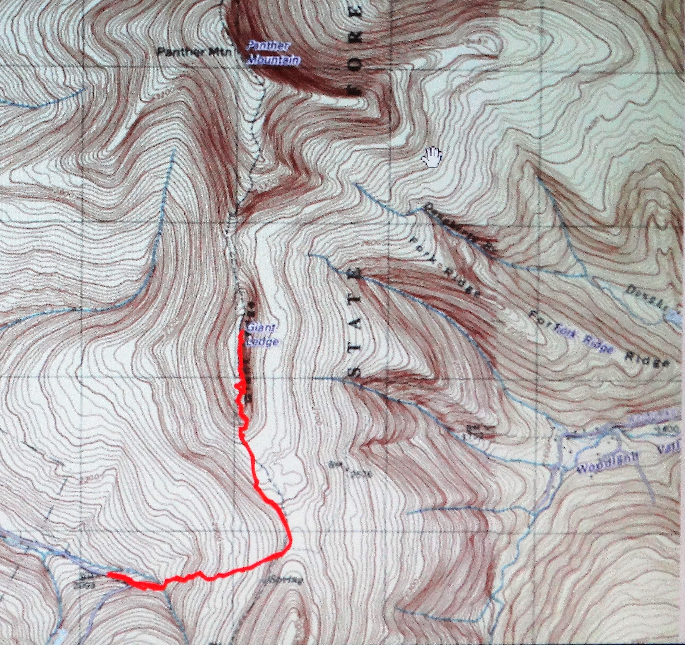
Length: Approximately 4 miles
Max elevation: 3,213 ft.– total elevation gain approximately 1218 ft.
Route type: Out and back
Trailhead parking: Oliverea Road – Big Indian, NY 12410
Giant Ledge is located in the 47,500 acres Slide Mountain Wilderness Area. The largest and most popular wilderness area in the Catskill Forest Preserve. Extensive foot trails provide access to the remote interior, often climbing over lofty peaks with spectacular views.

Slide Mountain Wilderness
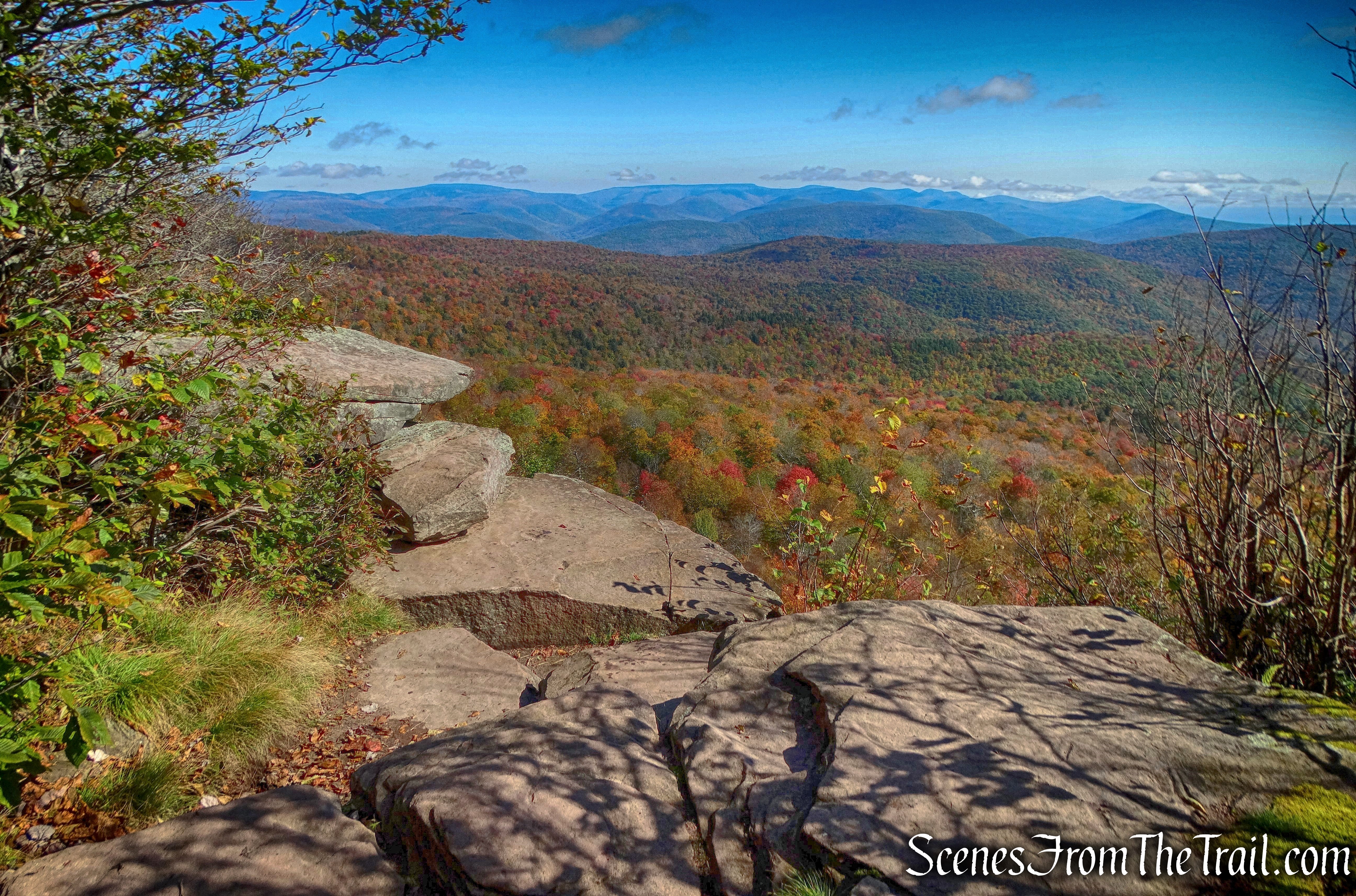
Giant Ledge is unique in the Catskills. The west side of the ridge has the typical smooth rounded shape caused by glacial action and years of erosion. The east side provides panoramic views of the northern and southern Catskills, as well as the Esopus Valley and
forest canopy below. The viewpoints sit atop a sheer cliff dropping to the forest floor 180 feet below.
Giant Ledge
“Giant Ledge” refers to multiple separate rocky lookouts on the mountain, not just one spot. It is a very popular hiking destination and offers some of the best views in the Catskills. There are quite a few spur trails that run from east to west, leading to additional viewpoints and there are some isolated outlooks along the ridge as well. If you are seeking solitude, you won’t find it here unless you visit on a weekday……possibly.
Giant Ledge
A new feature that I have added is the Google Earth Fly-Through video. It follows the path that we hiked and it gives you a good idea of the terrain, layout, amount of parking etc. Check it out, it’s pretty cool.
View the Google Earth Fly-Through video of the hike below.
The parking area fills up quickly on the weekends, so it’s a good idea to arrive early and beat the crowds.
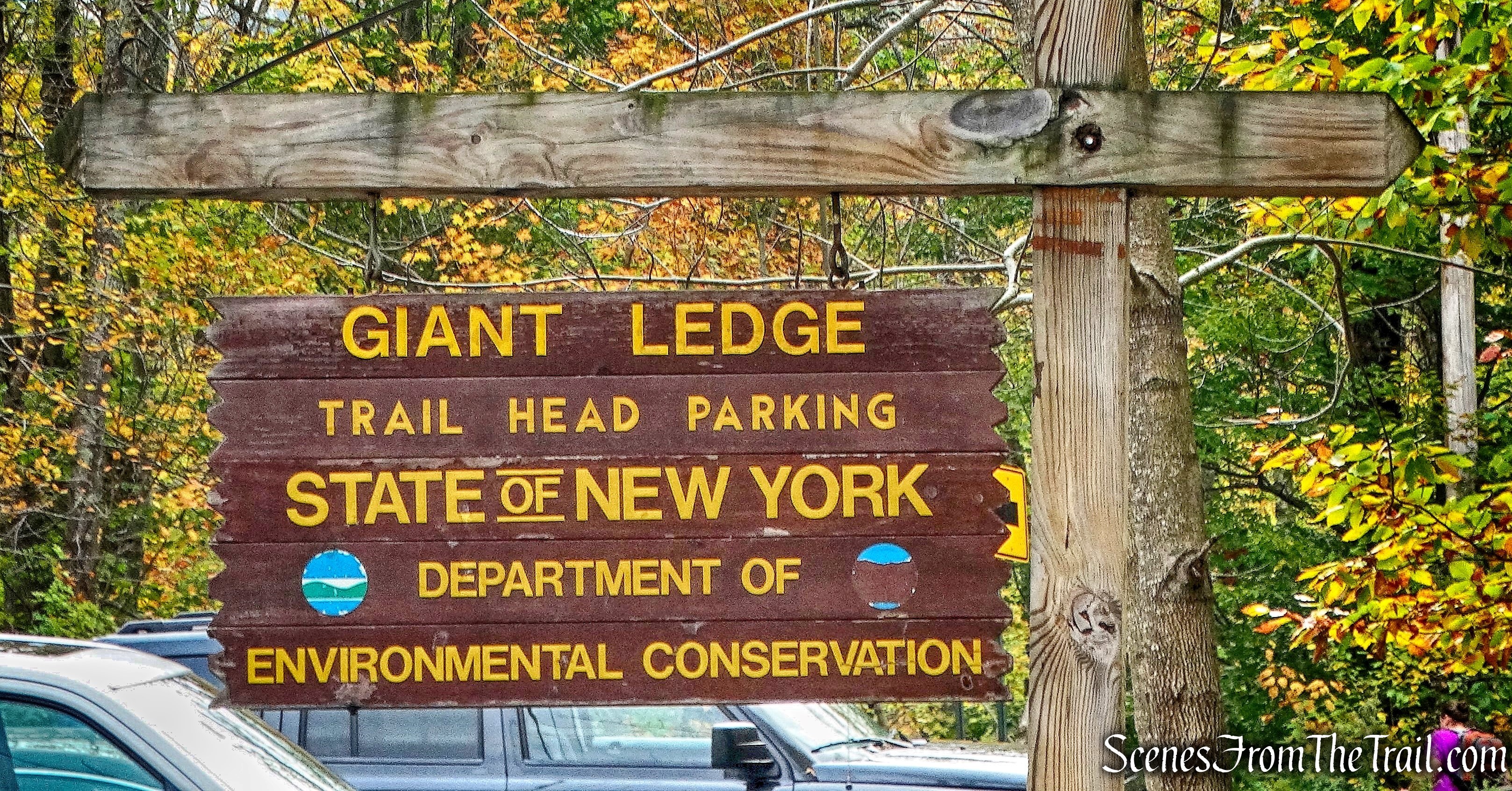
Giant Ledge – trailhead parking
After a two hour drive, we arrived at the trailhead at approximately 9:45 am. The parking area was already full and there were cars parked on both sides of CR 47 (Oliverea Road).
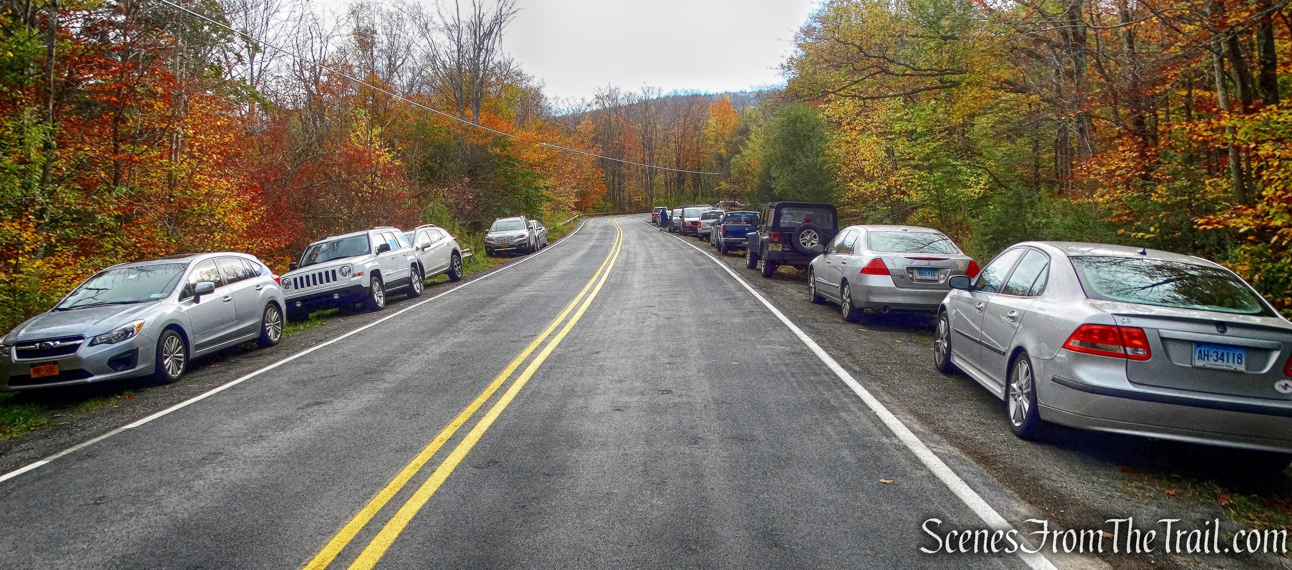
CR 47 – Oliverea Road
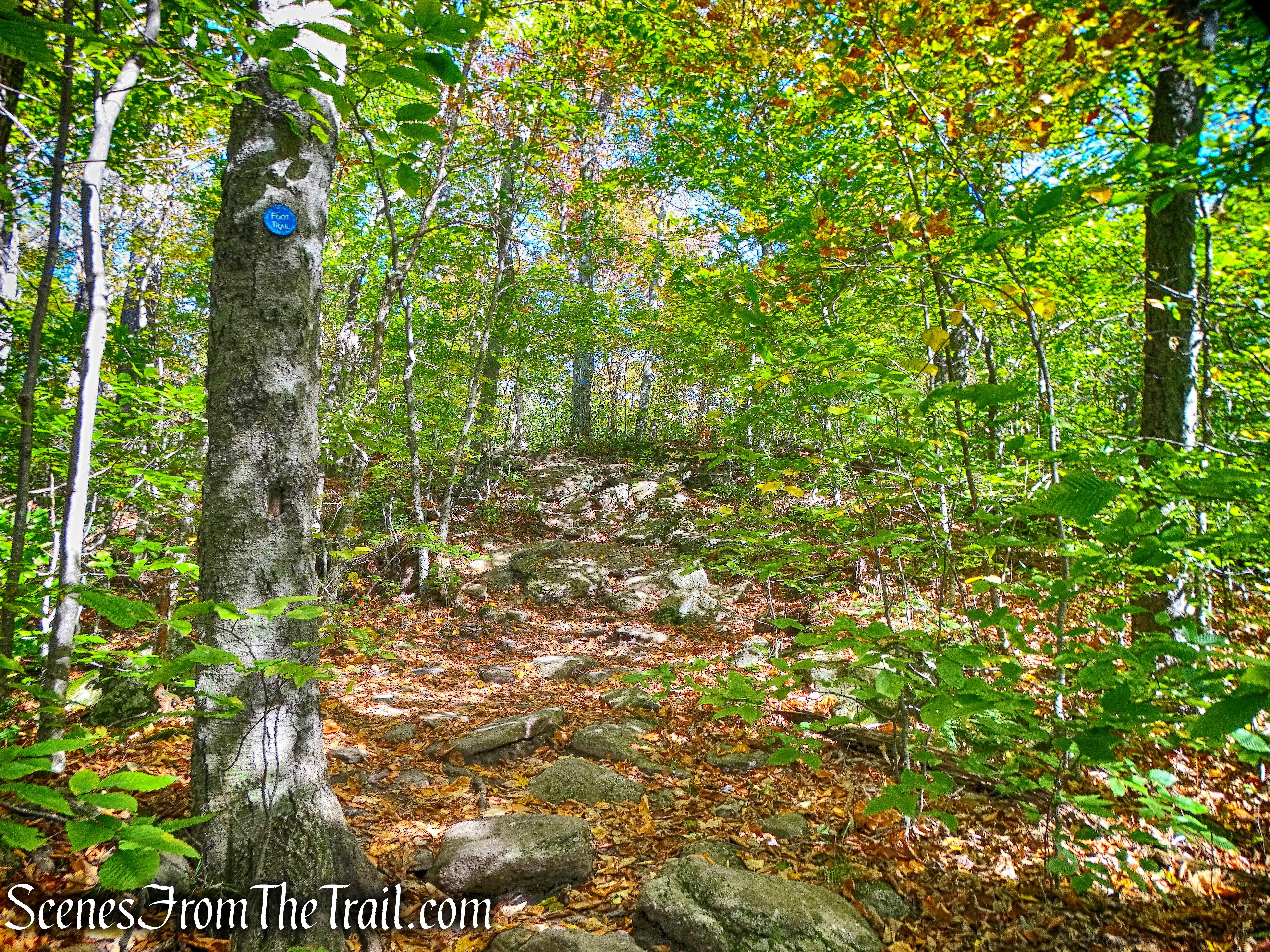
The hike starts off along the yellow-blazed Phoenicia-East Branch Trail, across the road from the parking area, at the hairpin turn.
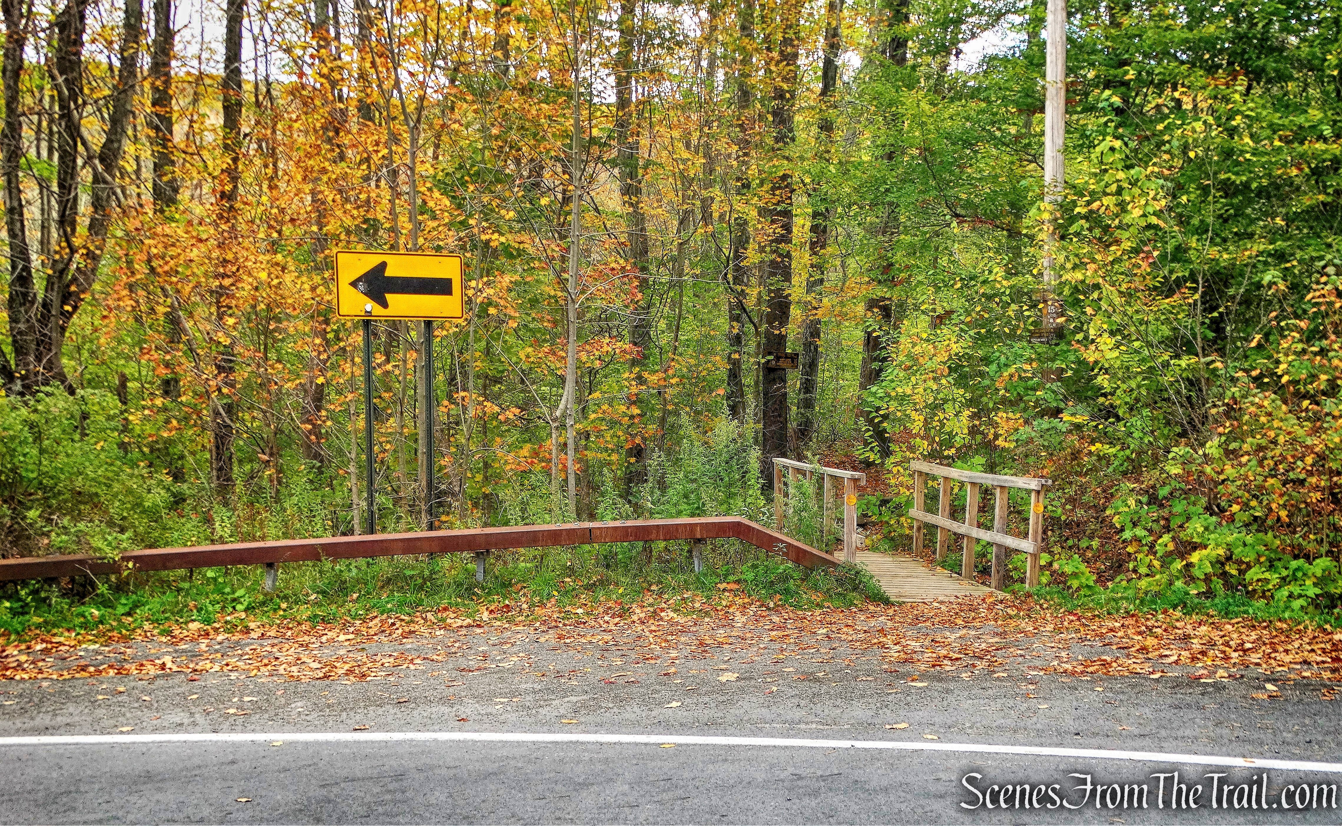
Giant Ledge Trailhead
The wooden footbridge marks the beginning of the hike. For approximately the first 0.7 miles we would be following the yellow blazes.
yellow-blazed Phoenicia-East Branch Trail
The trail is well marked and easy to follow, with signs pointing hikers in the right direction at trail junctions.
Phoenicia-East Branch Trail – Giant Ledge
A short distance from the start of the hike, is the trail register. It’s a good idea to sign in whenever there is a trail register. It’s for your safety, should anything go wrong and it also helps to calculate the amount of usage a trail gets, which helps with funding.

trail register – Giant Ledge
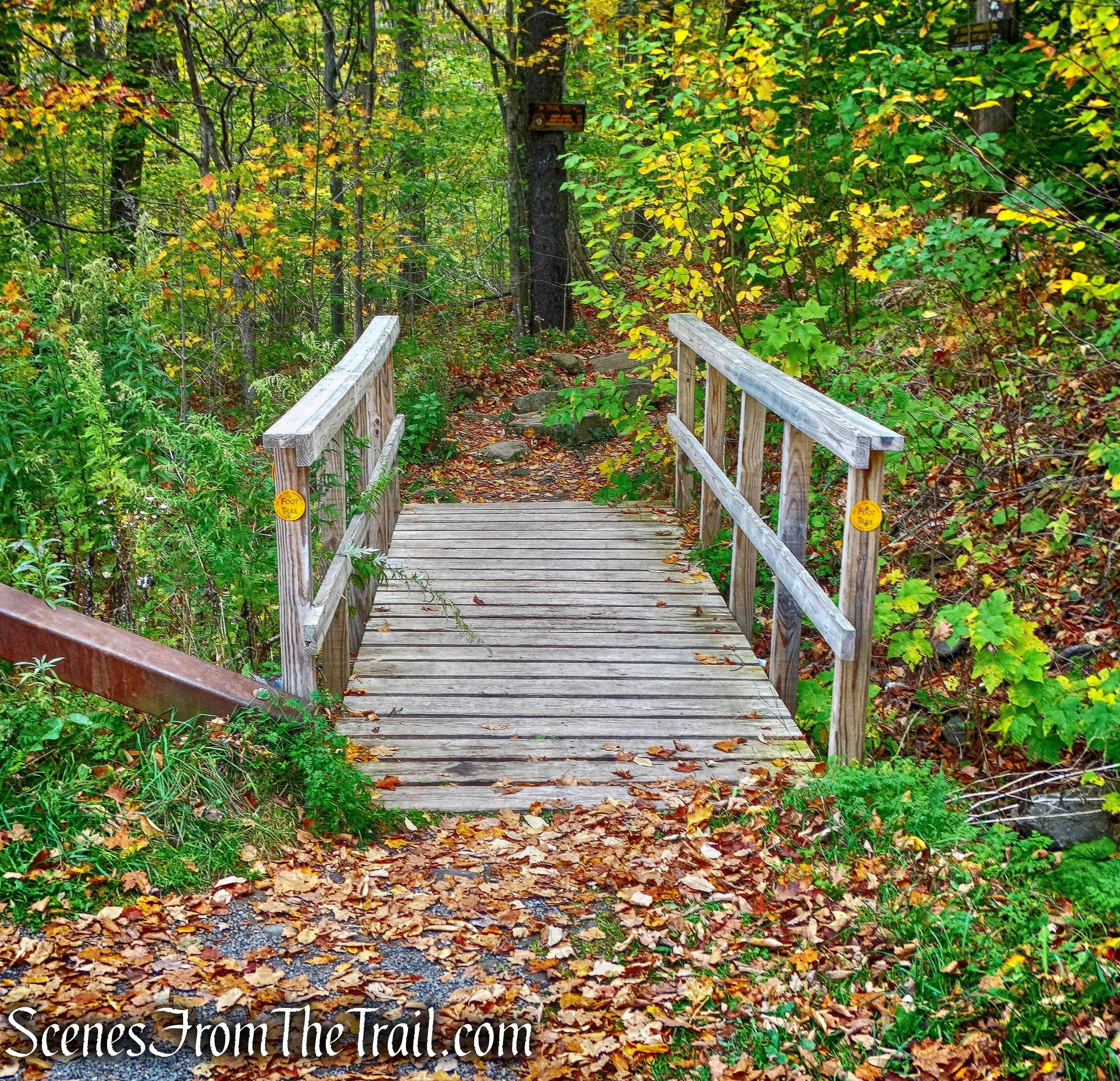
The trail then crosses another wooden footbridge over a seasonal stream. It was dry on the day we visited.
wooden footbridge – Phoenicia-East Branch Trail
The Phoenicia-East Branch Trail now begins to climb, first gradually, then more steeply.
Phoenicia-East Branch Trail
In some of the steeper sections, there are uneven stone steps, which are generally used to gain a lot of elevation in a short distance.
stone steps – Phoenicia-East Branch Trail
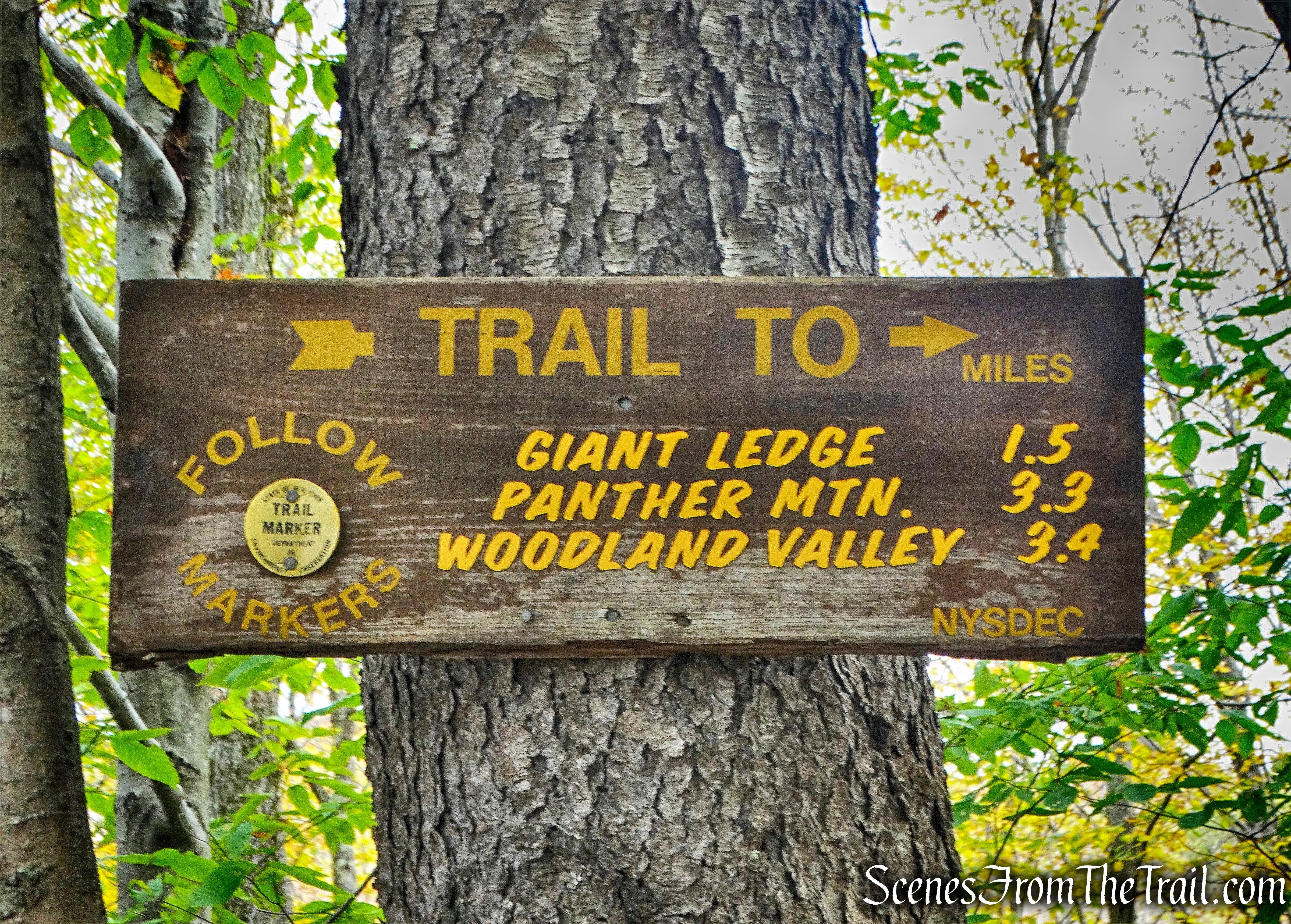
After about 0.75 miles from the trailhead, the yellow-blazed Phoenicia-East Branch Trail arrives at a junction with the blue-blazed Giant Ledge-Panther Mountain-Fox Hollow Trail. An elevation gain of approximately 621 feet from the start of the hike.
junction – Giant Ledge-Panther Mountain-Fox Hollow Trail
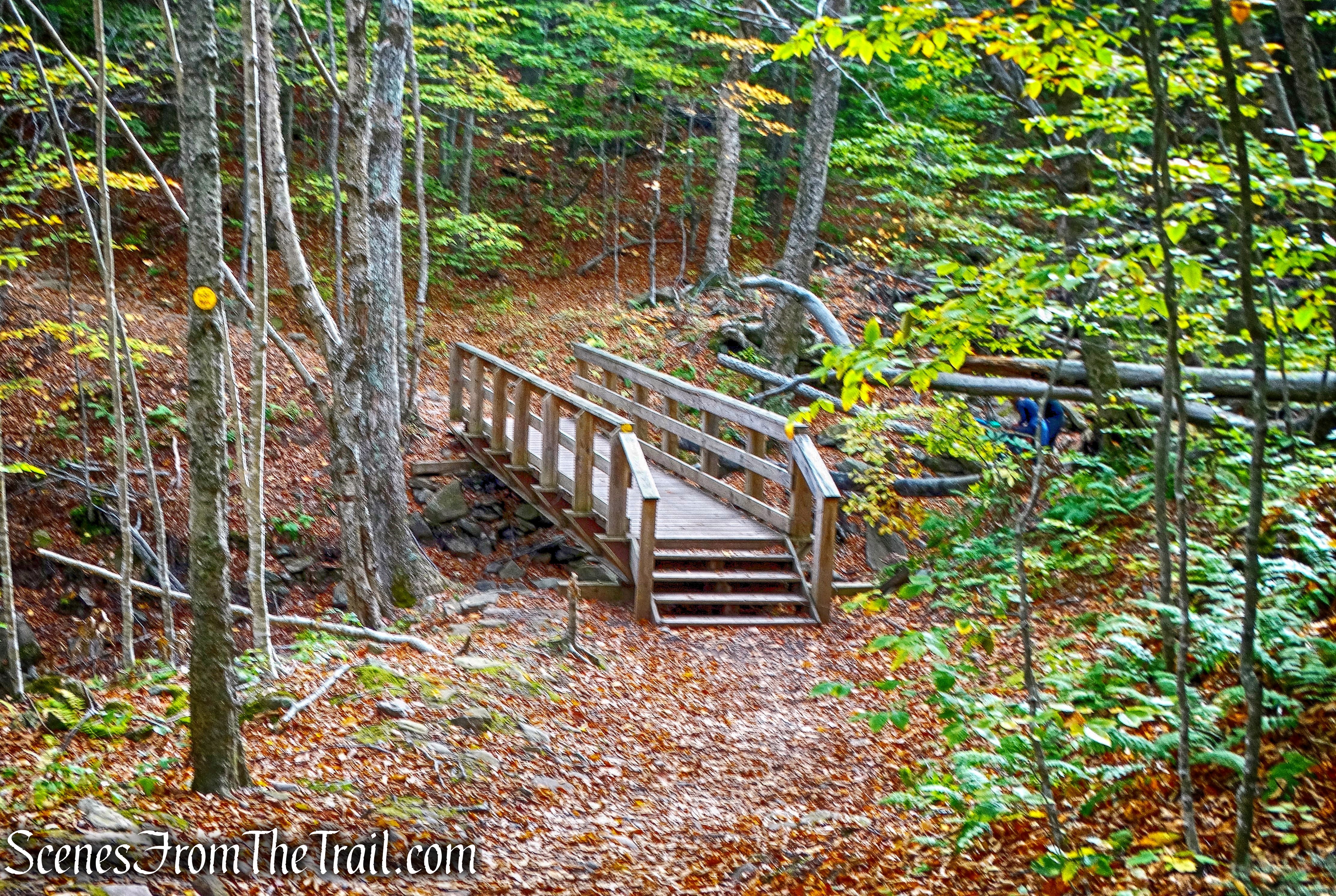
After turning left, now following the blue blazes, the trail remains relatively level for the next 0.5 miles.
Giant Ledge-Panther Mountain-Fox Hollow Trail
The trail then steepens as it nears the ridge.
Giant Ledge-Panther Mountain-Fox Hollow Trail
The trail climbs over rocks as it gains another 400 feet of elevation from the trail junction.
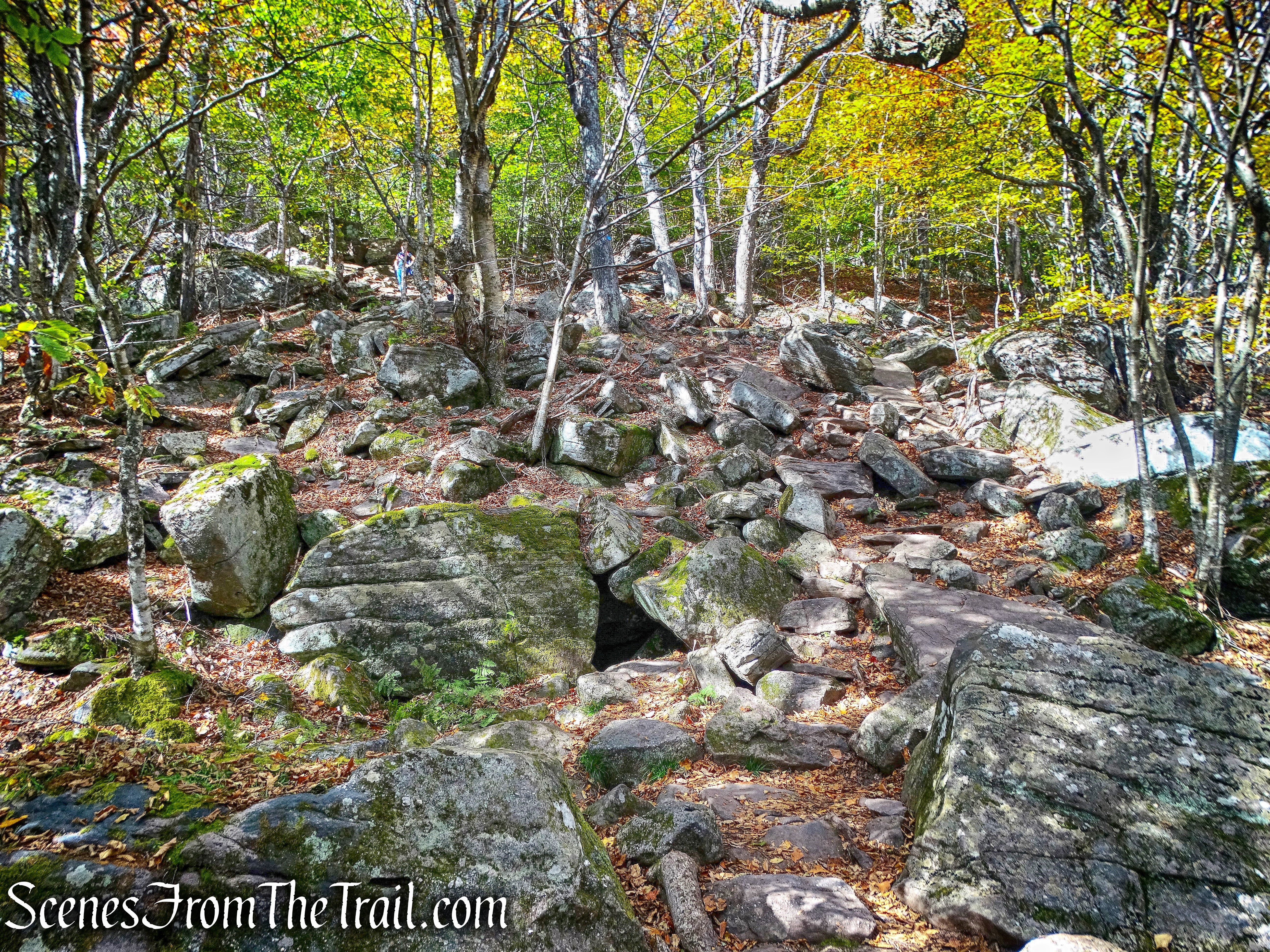
Giant Ledge-Panther Mountain-Fox Hollow Trail
After about 1.5 miles from the start, there is a short spur trail to the right, that leads to the first ledge and a magnificent view.
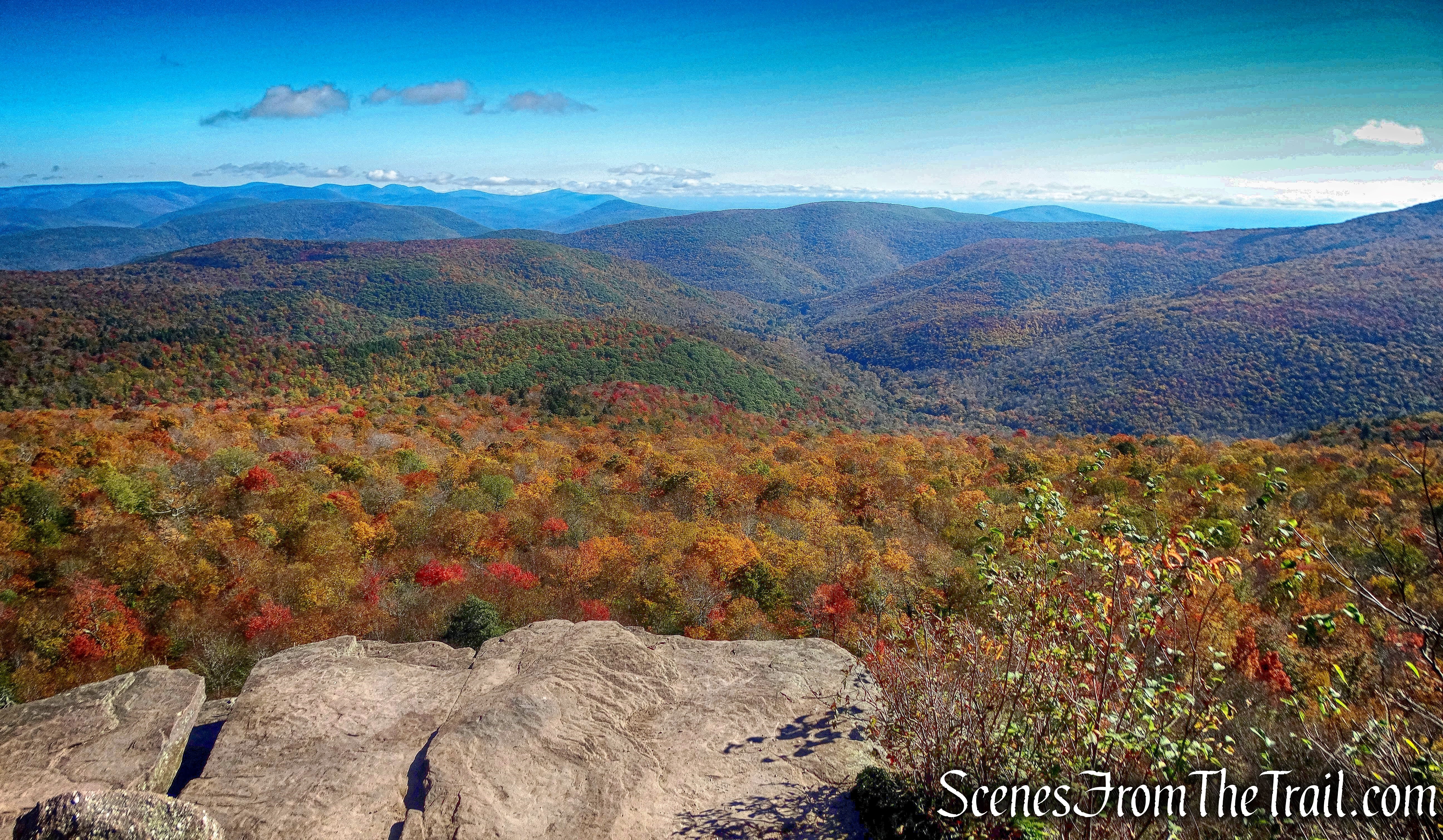
view from Giant Ledge
The views are basically the same from the eastern facing ledges. The image below is from another ledge. After some time up there moving from ledge to ledge, we retraced our steps down the mountain and back to the vehicle.
Giant Ledge
The ridge where Giant Ledge is located, spans about 0.4 miles. On a busy Saturday in October, it felt like being in a park. People coming and going and the ledges crowded at times. This is a great hike, but much too busy for my liking. This is definitely a Monday or Tuesday hike. On another hiking blog this hike is rated as moderate, I have to disagree. Level of difficulty is subjective, but this is more than a moderate hike. The rocky terrain, steep ascents and descents and the total elevation gain is above any moderate hike. Even though it’s only 1.5 miles to the first ledge, it’s no walk in the park. I saw many unprepared hikers (sightseers?) on the trail. No water, inappropriate footwear, little kids in tow, you name it. Perhaps people see the short distance of the hike and figure it’s a piece of cake. I saw a few people standing very close to the edge taking selfies with their foot inches from the edge. Giant Ledge is a great hike, just not on a weekend.
Pros: Fantastic views, well marked and maintained trails.
Cons: Way too crowded.
Take a virtual hike with additional images added below.
Take a hike!

Giant Ledge
