October 7, 2017 – Town of Deerpark, NY
Difficulty: Easy
Length: Approximately 2.1 miles
Max elevation: 591 ft.– total elevation gain approximately 157 ft.
Route type: Out and back
Map: Upper Delaware River Valley Map
Trailhead parking: 668-716 NY-97 – Sparrow Bush, NY 12780
PLEASE NOTE: TRAIL IS CLOSED FROM 12/1 – 4/1
The Mongaup River Trail is a one mile long linear trail that parallels the Mongaup River. The trail begins at New York State Route 97, where the Mongaup River flows into the Delaware River. Large Eastern Hemlocks trees tower overhead and shade this steep ravine landscape. The trail is relatively flat, with minimal elevation gain. At the trails terminus, there is an old cemetery, with tombstones dating back to the 1800’s.
Mongaup River Trail
The Mongaup River Trail is one of six trails featured in the “Take a Hike!” brochure, which gives names, locations, descriptions, and difficulty levels of trails in the Upper Delaware River Valley. It also provides a checklist to keep track of the trails you’ve hiked which can be turned in upon completion for a “Take a Hike!” patch.
Mongaup River Trail
The previous weekend, we did three of the hikes on the list, the Bouchoux Trail, Damascus Forest Trail and the Cobey Pond Trail. We were now going to complete the final three hikes to earn our Take a Hike! patch. Having already done the Tusten Mountain Trail and the Minisink Battleground Park Trails earlier in the day, we were ready to do the Mongaup River Trail. This is the last of six hikes that are on the list.
The trailhead was a little difficult to find. I first pulled in the parking lot of the Mongaup Valley Wildlife Management Area, which is just up the road. After reading everything on their kiosk and not seeing “Mongaup River Trail” written anywhere, I deduced that I was in the wrong place. I then I drove by it and didn’t even see it. The GPS location that I had was slightly off. The trailhead is located just southeast of County Road 31 and the Mongaup River on Route 97. Look for a small pull off with a kiosk.
Mongaup River Trail
There are no signs indicating that this is the Mongaup River Trail, but I asked a woman that was in the parking area and she indicated that I was indeed in the right place. The trail begins just to the left of the kiosk, by the rock at the far left of the image above. The unmarked trail skirts the edge of the Mongaup River, on an old woods road.
Mongaup River Trail
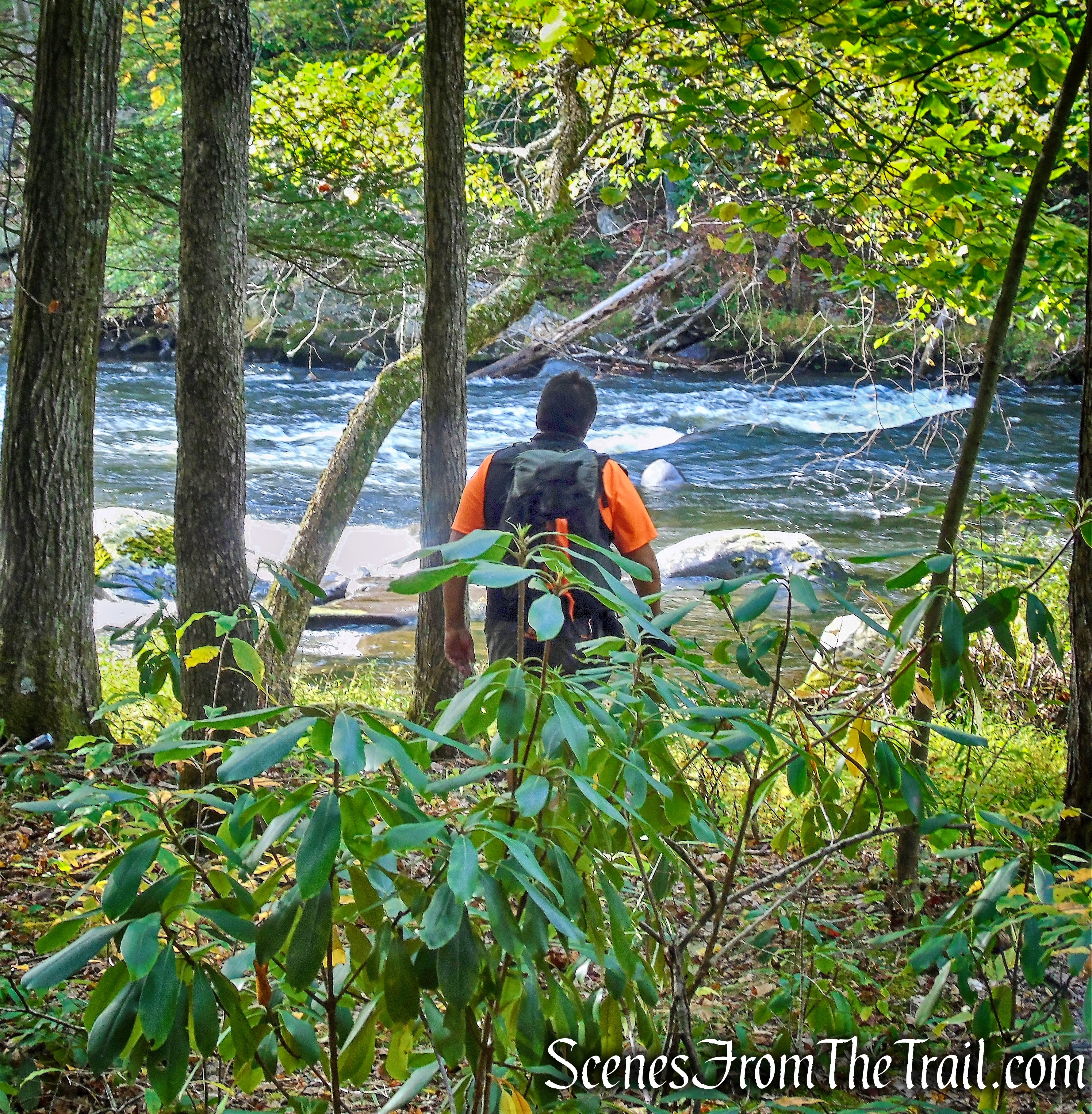
There are numerous short spur trails that lead to the rivers edge.
Mongaup River Trail
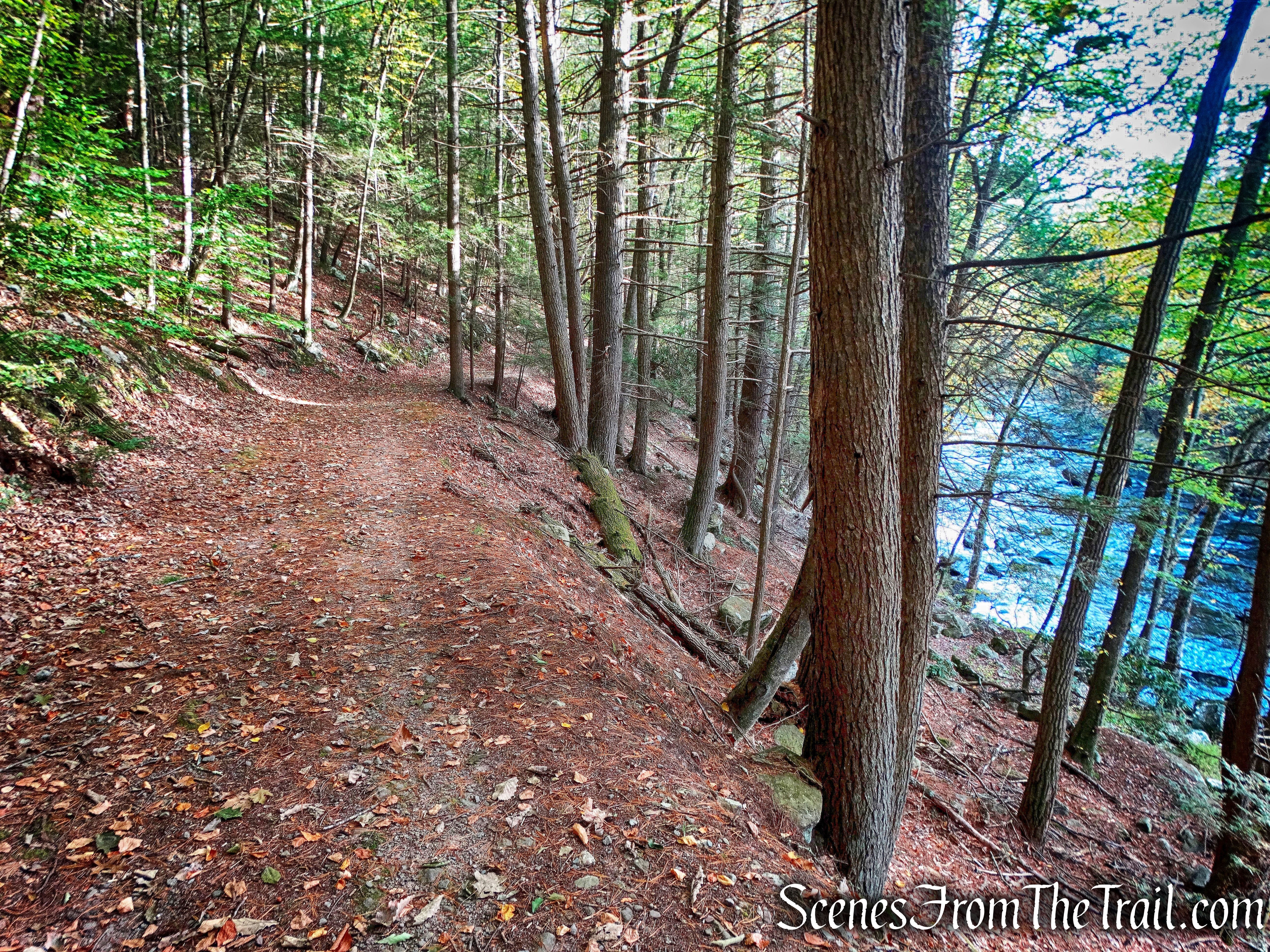
The woods road begins to rise gradually.
Mongaup River Trail
This is a very quiet area and this trail doesn’t seem to get much foot traffic.
Mongaup River Trail
The trail descends back to river level.
Mongaup River
Then at the end of the trail is the Knight Cemetery, surrounded by a stone wall.
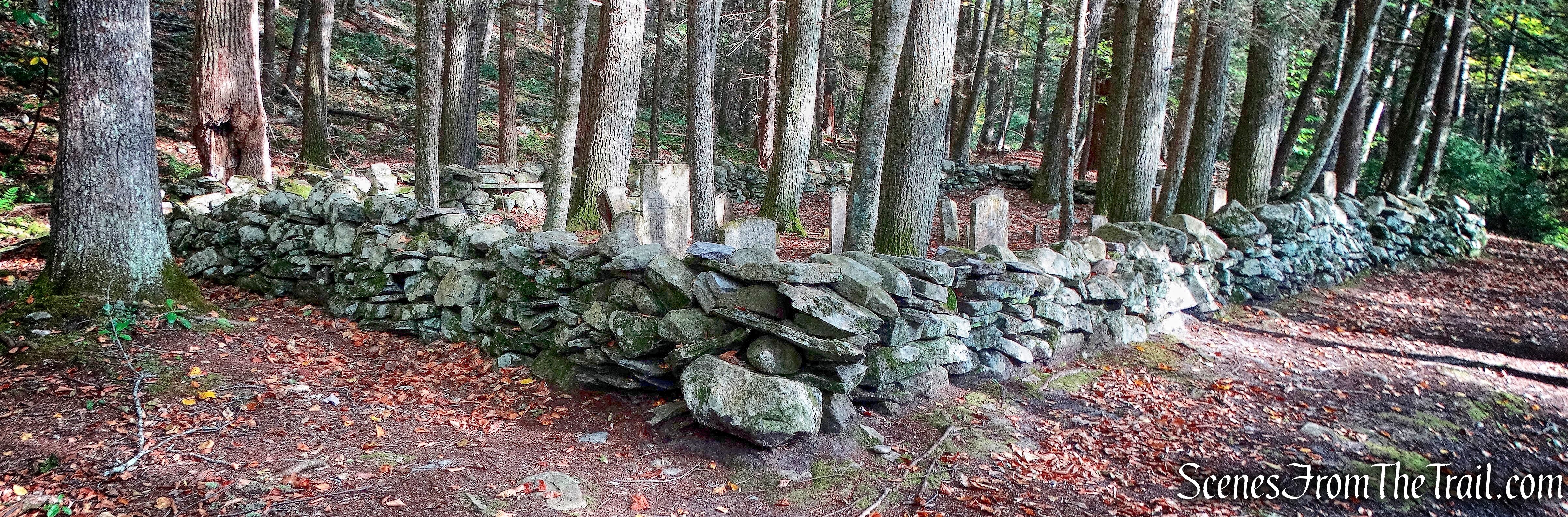
Knight Cemetery – Mongaup River Trail
One tombstone reads: Samuel Knight, Died 1816, Aged 60 Years.
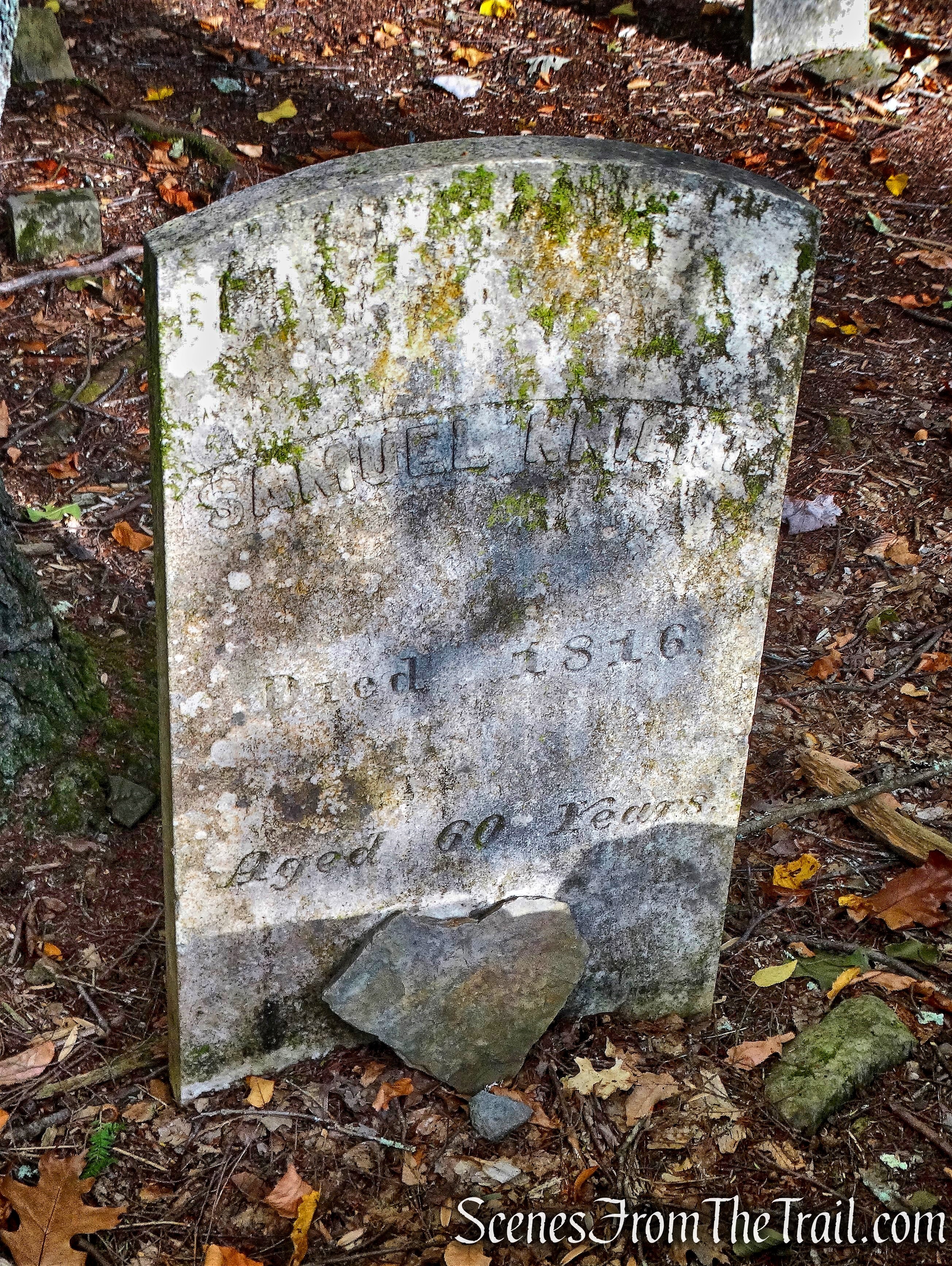
Samuel Knight, Died 1816, Aged 60 Years
The Knight family settled near the mouth of the Mongaup River and were one of the pioneers of that section. This land was the frontier of early America.
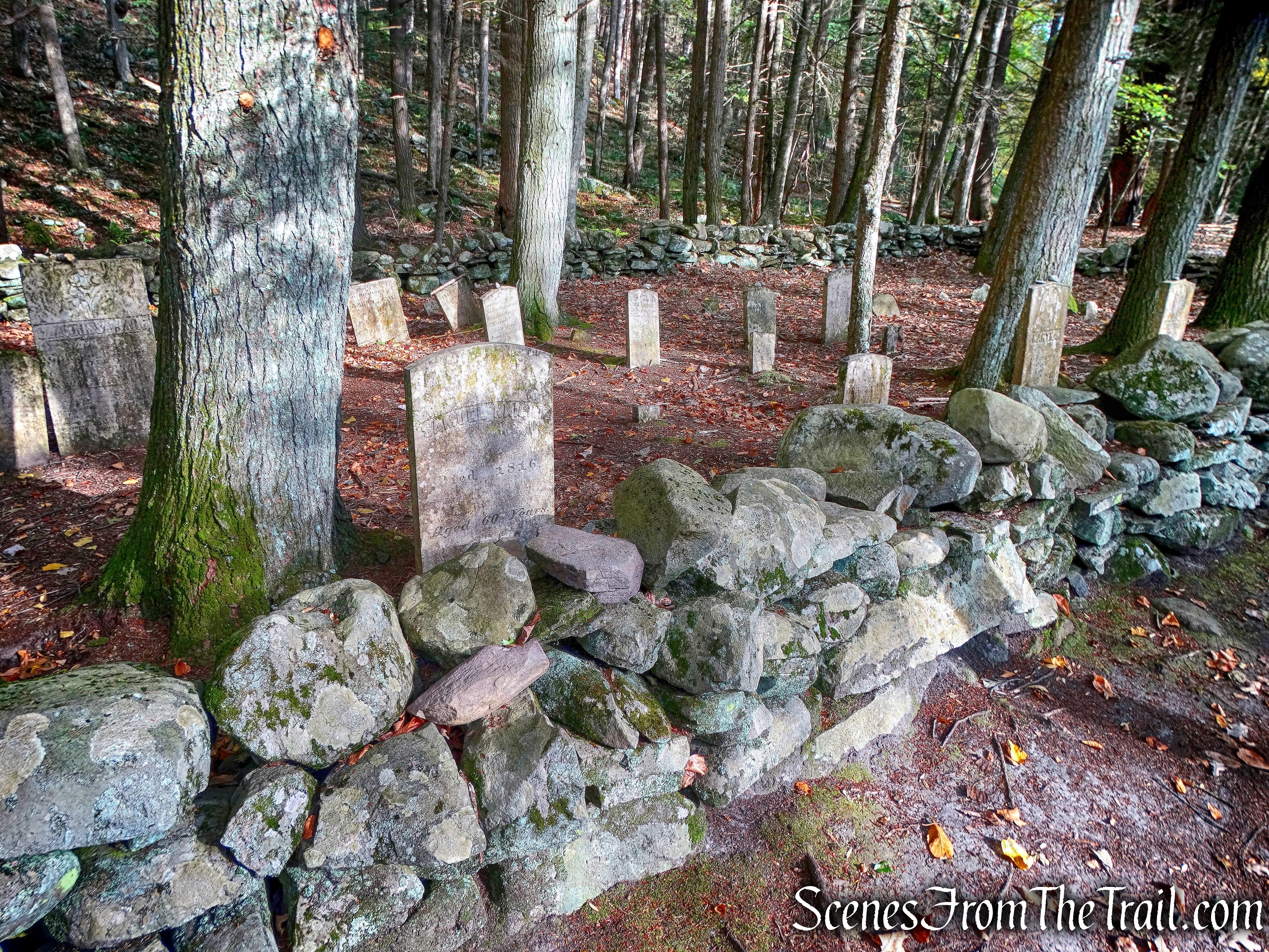
Knight Cemetery – Mongaup River Trail
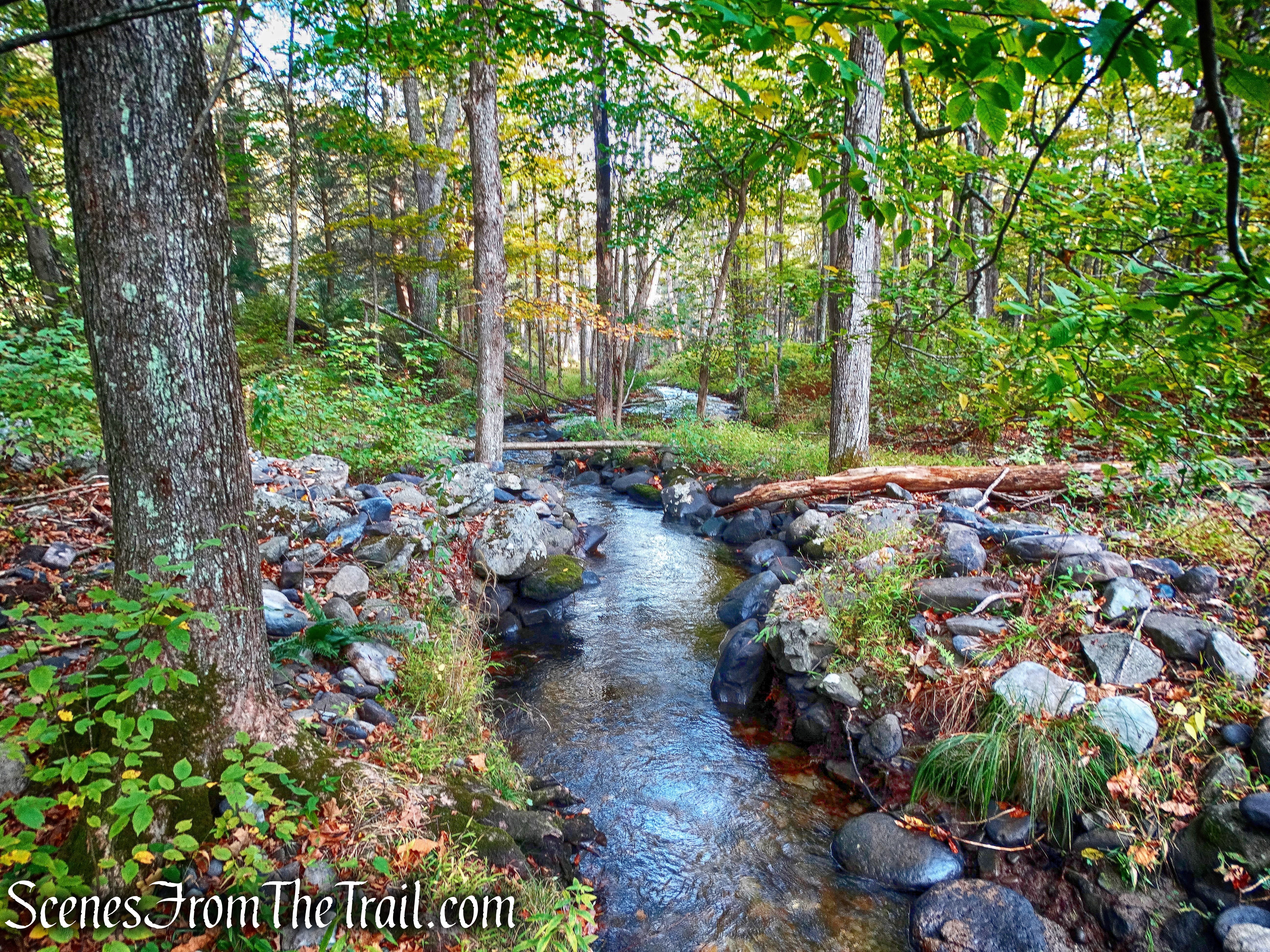
From the cemetery, we retraced our steps back the way we came, stopping occasionally to enjoy the scenery.
Mongaup River
It’s an easy walk along this tranquil woods road, back to the parking area.
Mongaup River Trail
This was a nice, short hike and a good way to end the day. With all six hikes now done, the forms were mailed in and now we await our patches. Stay tuned……
Pros: Mongaup River, quiet and scenic area, historic cemetery, earn a patch.
Cons: A sign with the name of the trail would be nice.
Mongaup River Trail

thanks for the memories. dave and kevin lordville ny and frostproof florida
we own parts of bouchoux trail areas and were instrumental in the signage , the NYT and getting the party place eliminated and keeping the parking lot clean and mowed . sorry if you think too many signs, but if one remembers what this looked like, even the ledges , it was terrible with broken glass and garbage all over. we are working on the ATV issues causing the gravely terrain of the path
LikeLiked by 1 person
I am heading there now, seriously. I am glad I checked your website first. Thank you for posting this information, and all the other great hikes you post.
LikeLiked by 1 person