October 1, 2017 – Hancock, NY
Difficulty: Moderate
Length: Approximately 3.2 miles
Max elevation: 1,388 ft.– total elevation gain approximately 649 ft.
Route type: Out and back
Map: Upper Delaware River Valley Maps
Trailhead parking: Bouchoux Brook Rd, Hancock, NY 13783
The Upper Delaware Scenic and Recreational River stretches along approximately 73.4 miles of the Delaware River from Hancock, New York, to Sparrowbush, New York. Most of the land in this unit of the National Park System is privately owned, the federal government owns only approximately 30 acres. Within the park are the remains of the Delaware and Hudson Canal. More than 14,000 acres within the watershed of the Upper Delaware Scenic and Recreational River are protected by conservation easements enacted by willing private property owners and held by the Delaware Highlands Conservancy land trust.
Known officially as “Bouchoux Trail” or “Jensen’s Ledges,” The Ledges, as the locals call it, is a short but steep hike on a rocky woods road, leading to panoramic views of the Upper Delaware River Valley. The National Park Service rates this hike as difficult, but it’s just a steep walk up a rocky woods road.
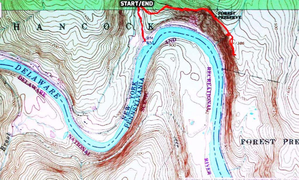
Bouchoux Trail – Jensen’s Ledges
View the Google Earth Fly-Through video of the hike below.
Having received a patch for completing the Tupper Lake Triad challenge, I decided to check to see if any hikes near me were offering patches. I stumbled onto the Upper Delaware’s Take a Hike! campaign. Although not exactly close by, I decided I would complete the six hikes on the list to earn my free patch. Since they are short hikes, we did three on each day and they were completed in two consecutive weekends. We did this hike first because it was the furthest north. We figured that we work from north to south, which would make the ride home a little shorter.
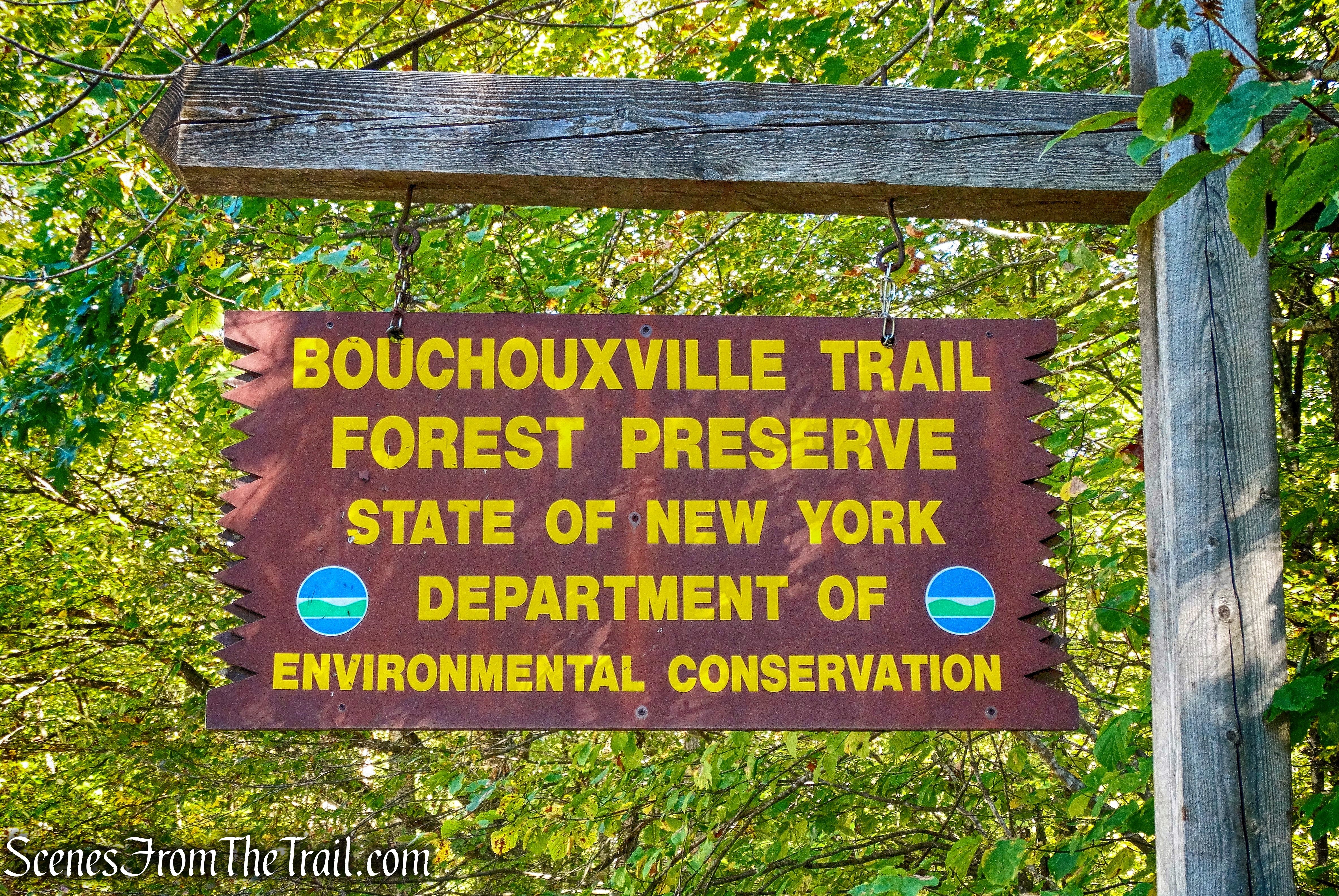
Bouchoux Trail Forest Preserve
We got a late start on this Sunday morning and didn’t arrive at the trailhead until about 10:45 am after a two hour drive from Westchester County. We geared up and began our hike on the Bouchoux Trail.
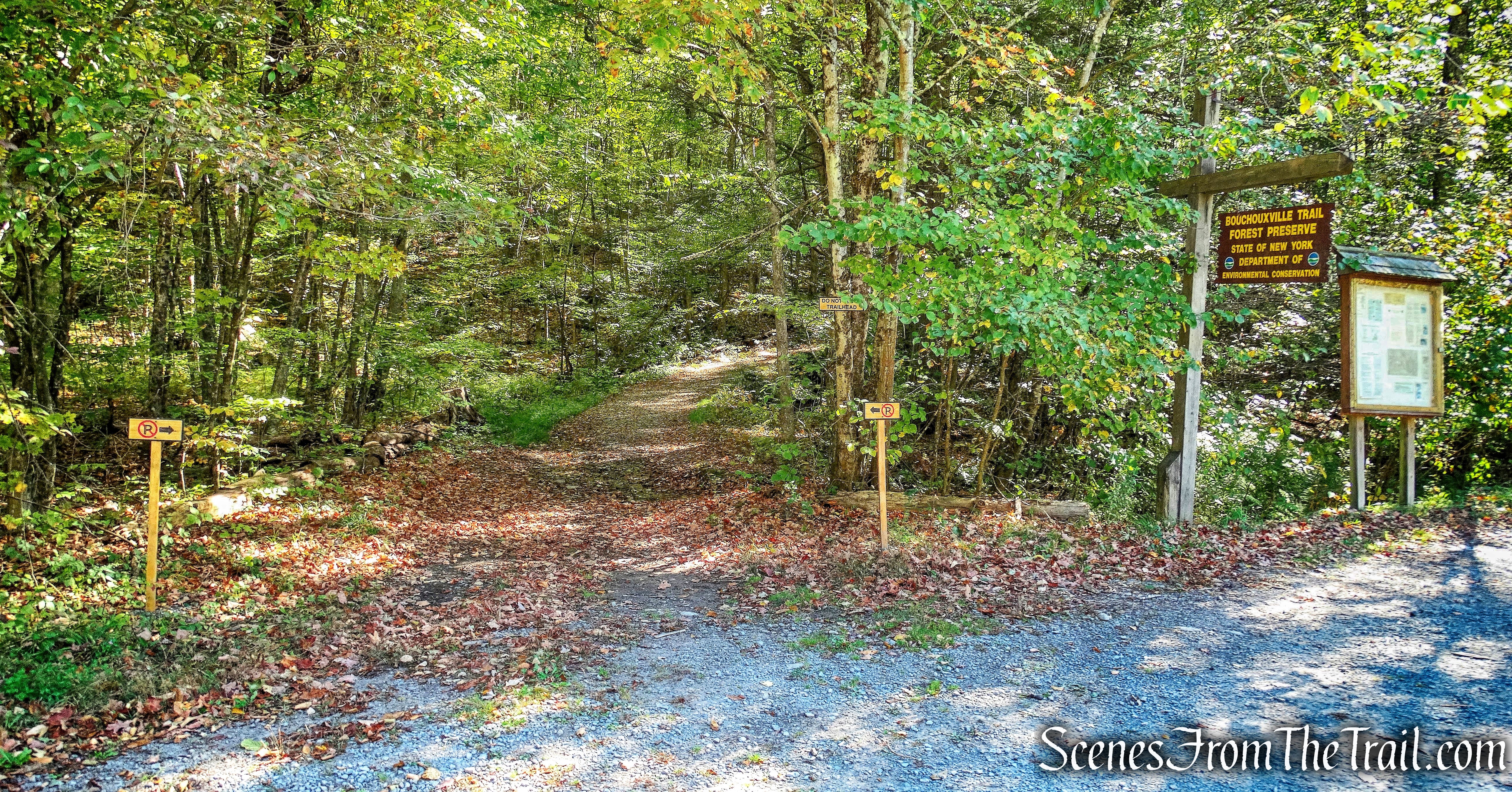
Bouchoux Trail
A short distance up the road is the trail register and we signed in.
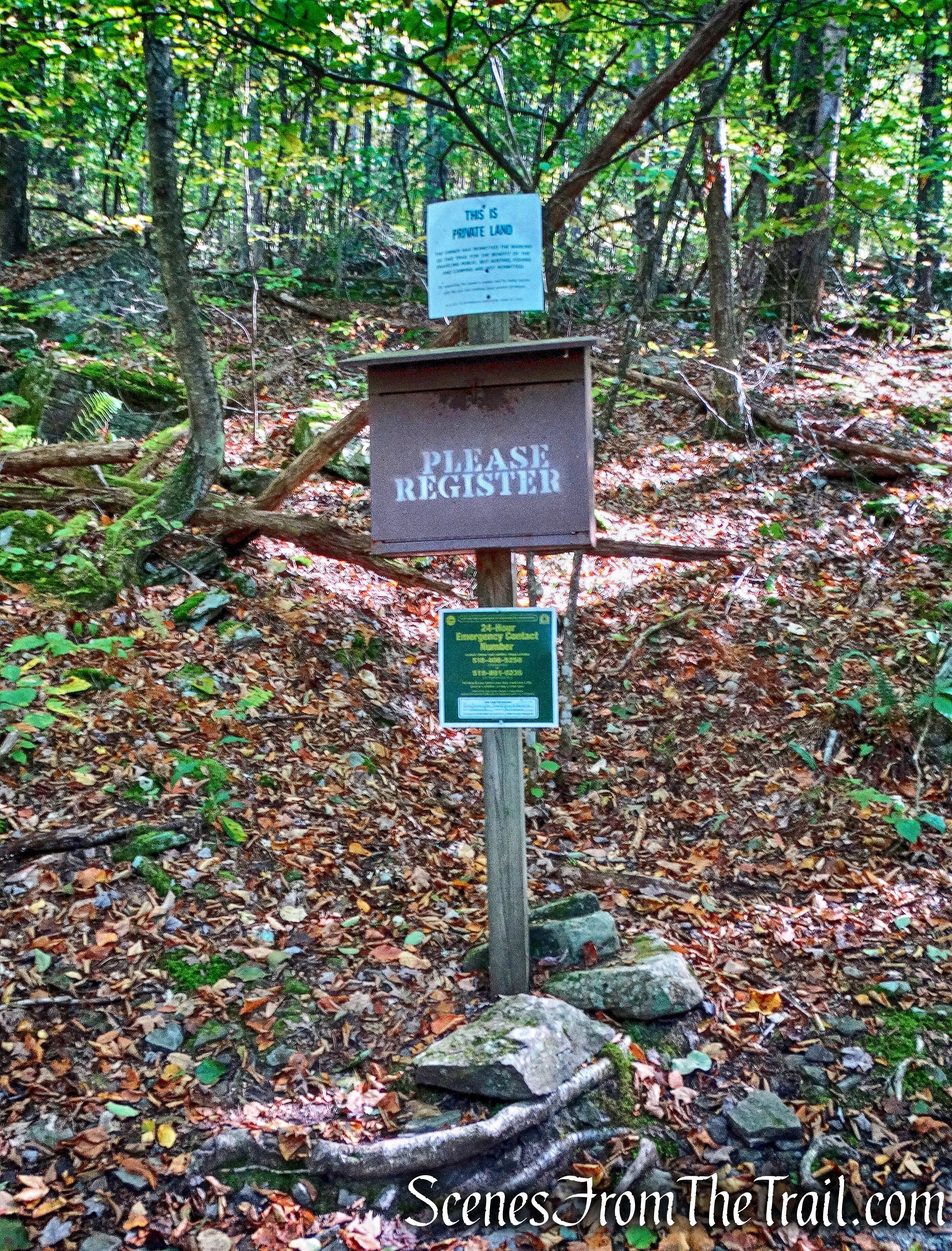
trail register
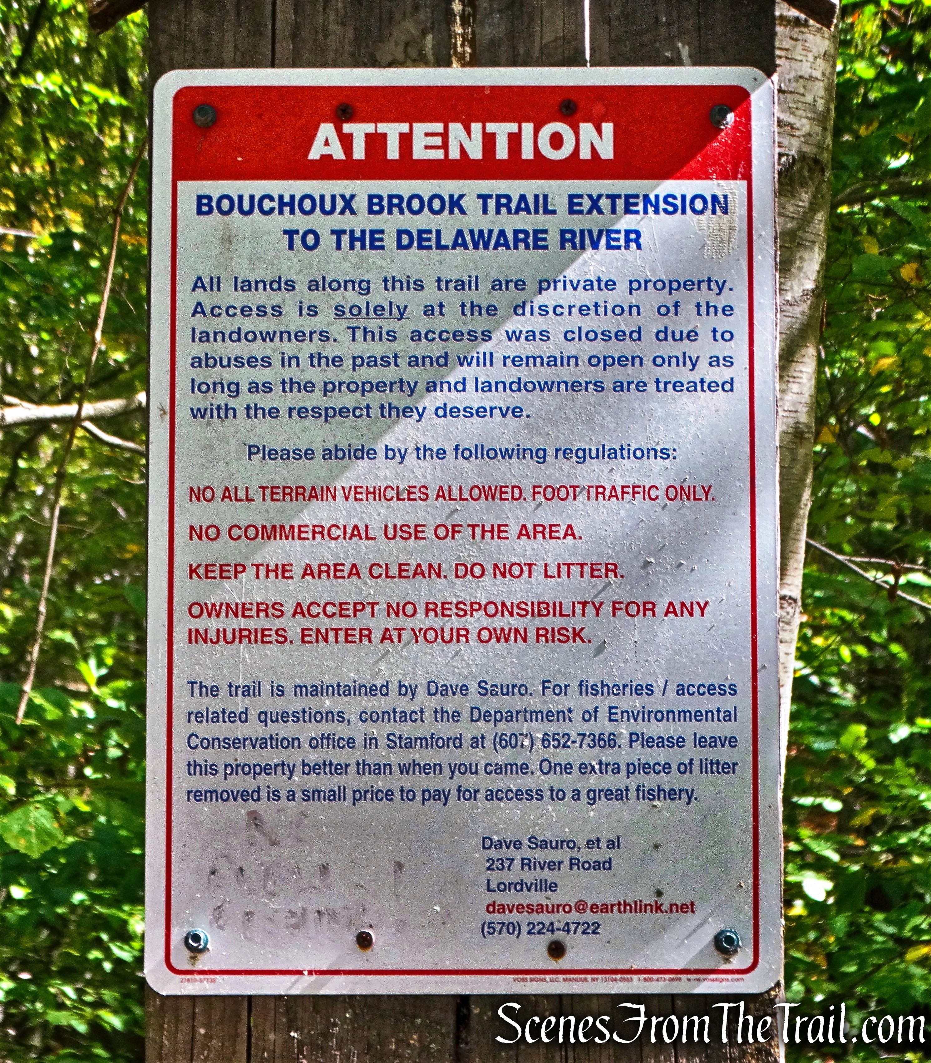
In a partnership with private landowners, this trail has been made available for public use. There are numerous “No Trespassing” and “Private Property” signs throughout the hike. Failure to adhere to these warnings may result in the trails being closed to the public and/or criminal prosecution.
Private Land sign
The trail is marked with red blazes, almost all of which are faded and barely visible. The trail is easy to follow and although there are a few side trails along the way, they are posted with ‘Private Property” signs to let you know that you are in the wrong place.
faded red blaze – Bouchoux Trail
The Bouchoux Trail ascends steeply on a very rocky woods road. It’s, what is referred to as an “ankle breaker trail.” This road leads to a now-abandoned Bluestone quarry.
Bouchoux Trail
The woods road climbs steeply to the shoulder of Bouchoux Hill, passing some interesting rock formations along the way.
rock formation – Bouchoux Trail
Just before a stream crossing, there is a short spur trail on the right that leads to a ledge. From there, Bouchoux Hill Falls can be viewed as it tumbles down over the cliff into the Delaware River. It was nothing more than a trickle on the day we visited. Back out to the main trail, we crossed the stream that feeds Bouchoux Hill Falls.
stream crossing – Bouchoux Trail
Upon crossing the stream, one can see where it drops off the cliff to create the waterfall.
stream crossing – Bouchoux Trail
Right after the stream crossing, the Bouchoux Trail continues ahead. We took a side trail that leads to a large pile of Bluestone. Quarrying of Bluestone was once a large industry in the area.
Bluestone quarry
Creative hikers have built some stone furniture here, so we took a break here to enjoy the fruits of their labor.
Bluestone chair
I’m in the front row!
I’m in the front row!
The view from the Bluestone chair wasn’t too shabby. There are steep drop-offs here with loose stones underfoot, extra care should be taken here not to lose your footing.
View from the Bluestone chair
Large decorative cairns lead the way over the Bluestone.
Bluestone cairns
Just past the cairns there is a nice chaise lounge that looks out towards the Delaware River.
stone chaise lounge
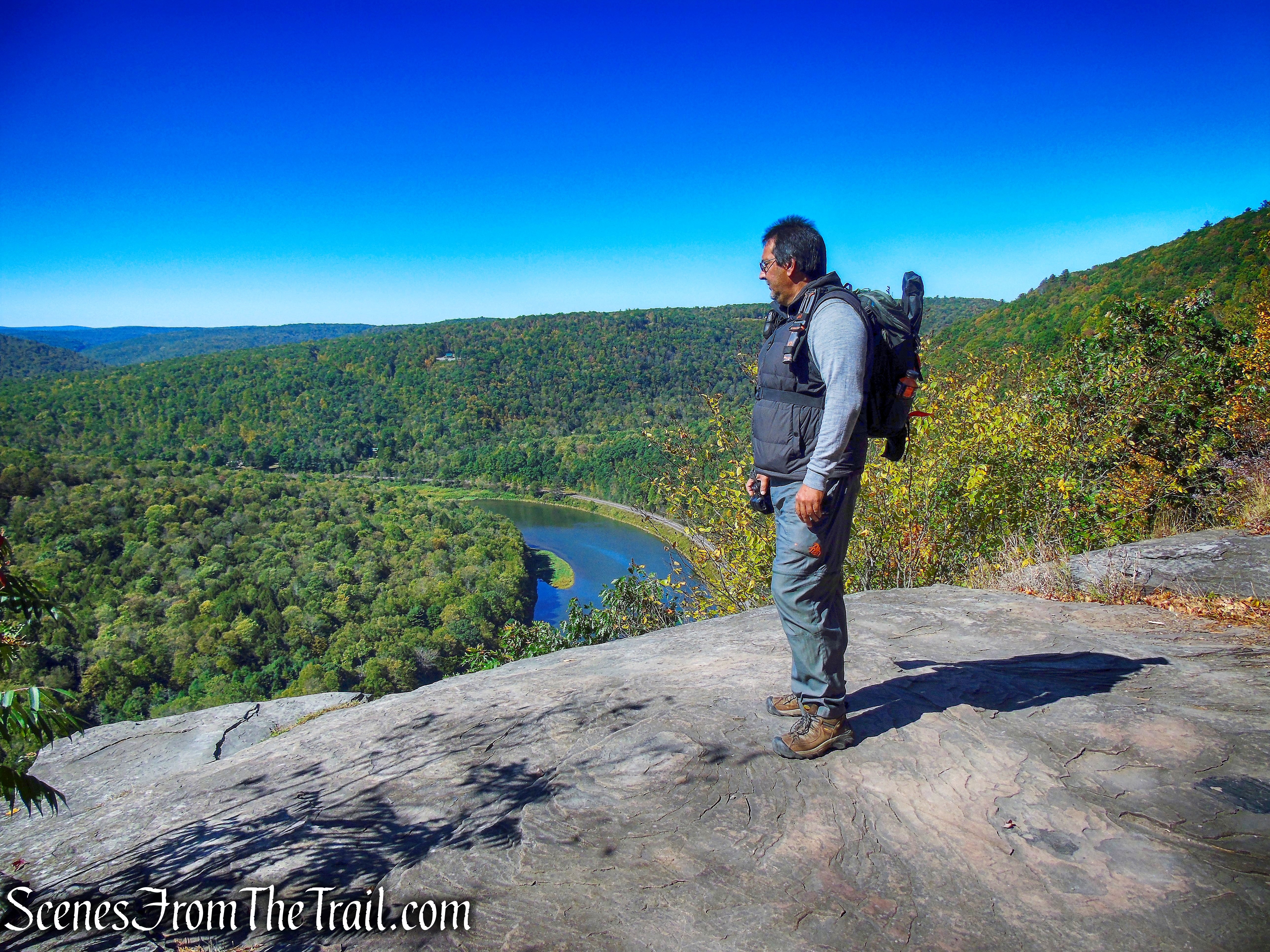
We walked back onto the main trail and in a short distance, we arrived at Jensen’s Ledges.
Jensen’s Ledges
The view from here makes it worth the trek up that ankle breaker trail.
Jensen’s Ledges
We stayed at this spot for quite some time enjoying the view. This is a popular spot and we were not alone up there, but still a great spot.
Jensen’s Ledges
We made our way back down the woods road to the parking area, where our hike began.
Bouchoux Trail
While sitting on a rock, relaxing and having a snack, I saw what looked like a trailhead at the southern end of the parking area.
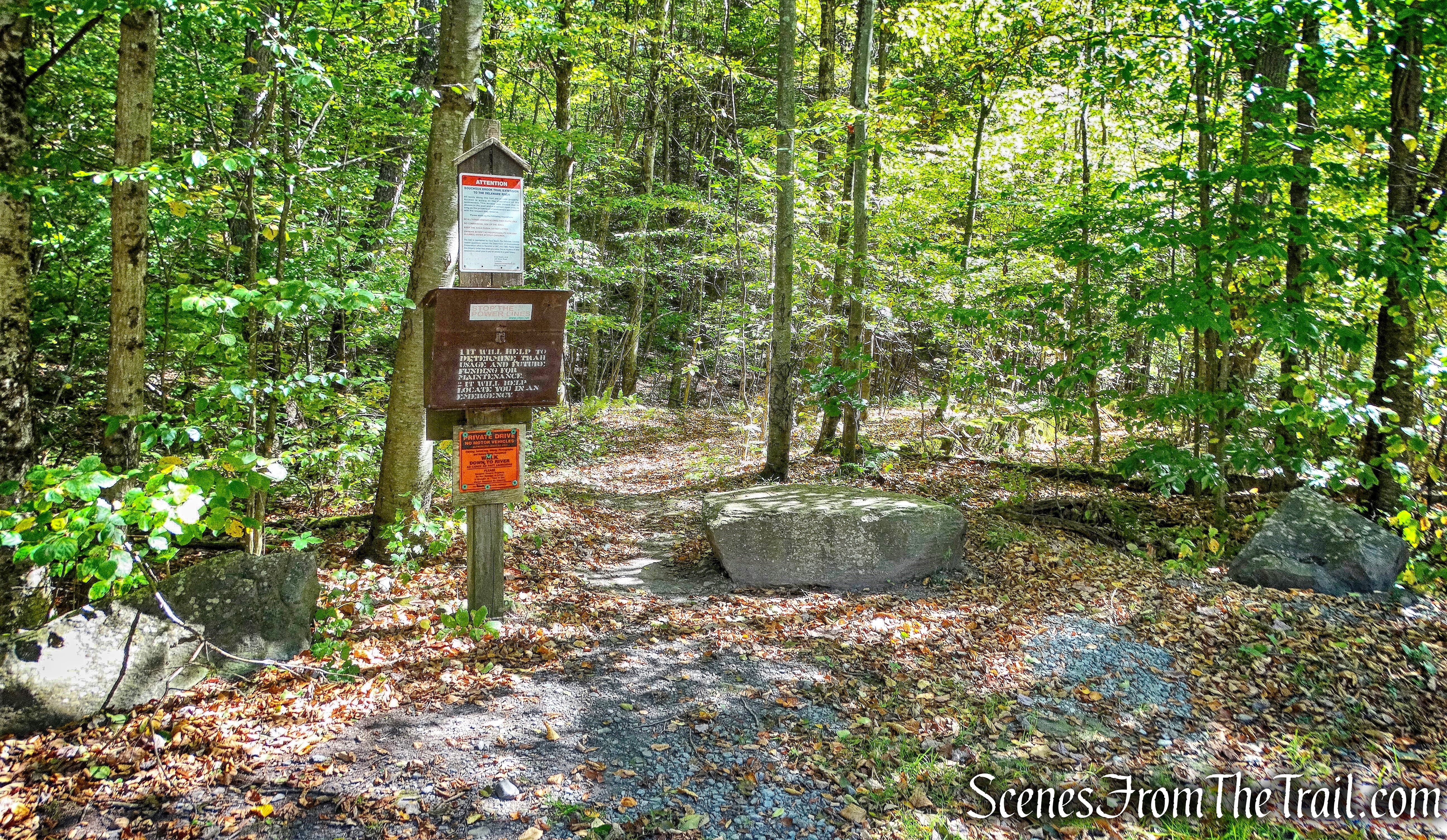
Bouchoux Brook Trail Extension
Getting a closer look at the sign, I read that it is the Bouchoux Brook Trail Extension. I don’t know where the Bouchoux Brook Trail is, but since we were already there, I figured we would walk this trail to the Delaware River.
Bouchoux Brook Trail Extension
Almost immediately upon entering the trail, there are remnants of a large multi-room structure.
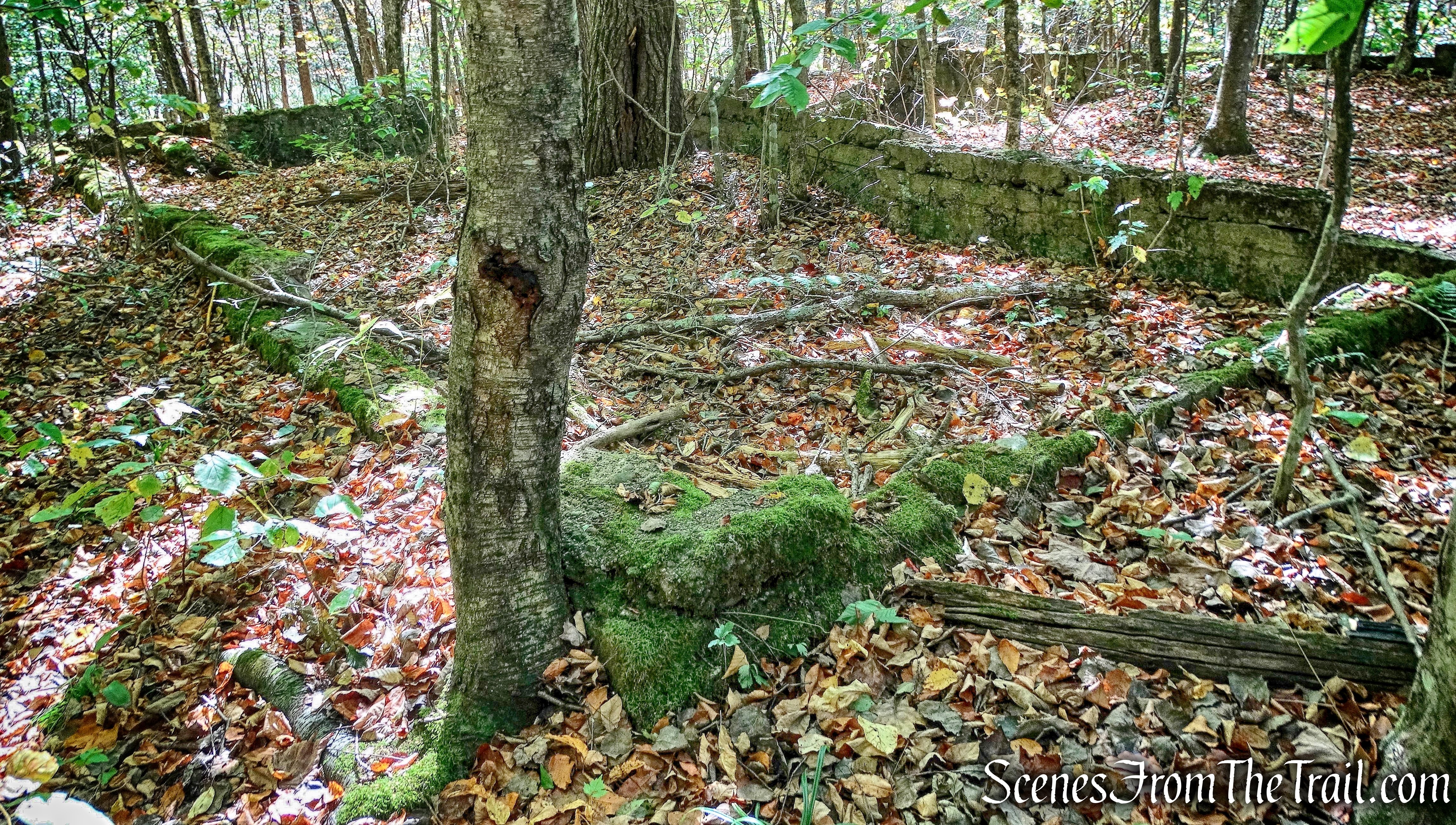
ruins – Bouchoux Brook Trail Extension
The ruins of an old wooden bridge that used to span Bouchoux Brook is visible from the trail.
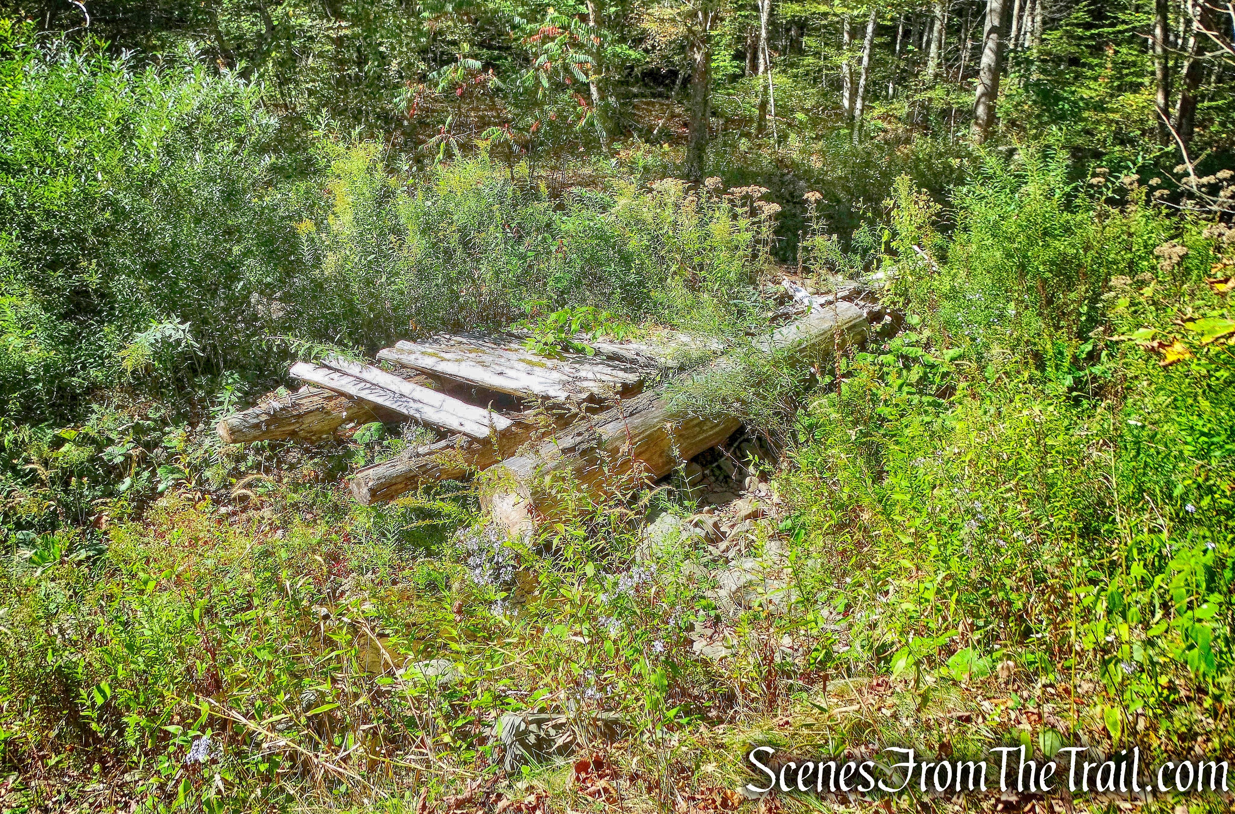
wooden bridge ruins – Bouchoux Brook Trail Extension
The trail passes by a picnic table and a grill…….
picnic table and a grill – Bouchoux Brook Trail Extension
and plenty of signs on either side of the trail to keep you on your toes.
warning sign – Bouchoux Brook Trail Extension
These signs are intended to keep hikers from straying off the trail.
warning sign – Bouchoux Brook Trail Extension
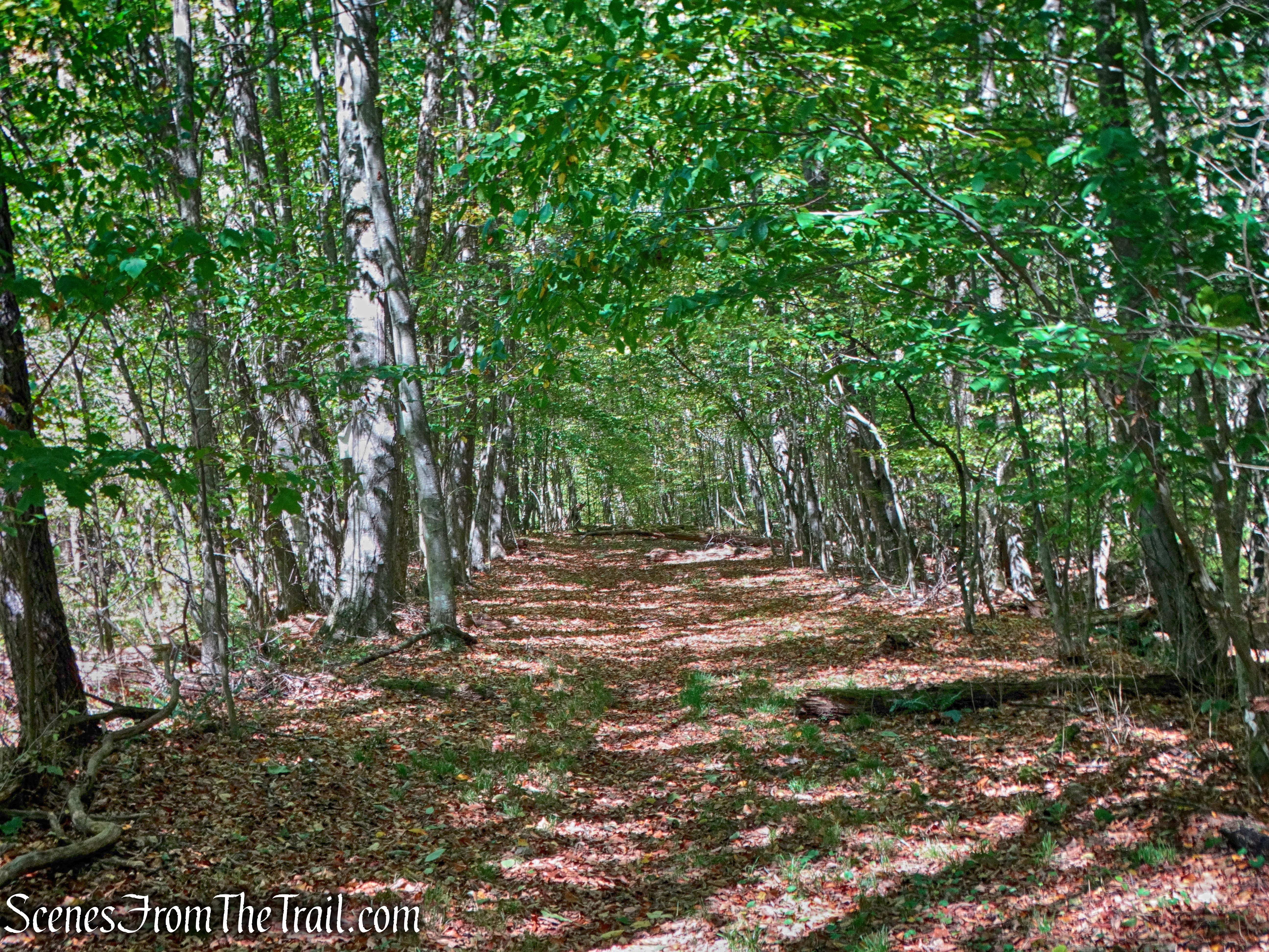
The wide woods road heads south through private lands.
Bouchoux Brook Trail Extension
The Bouchoux Brook Trail Extension leads to the railroad tracks, which is active. I was able to capture this image of Bouchoux Hill from the tracks.
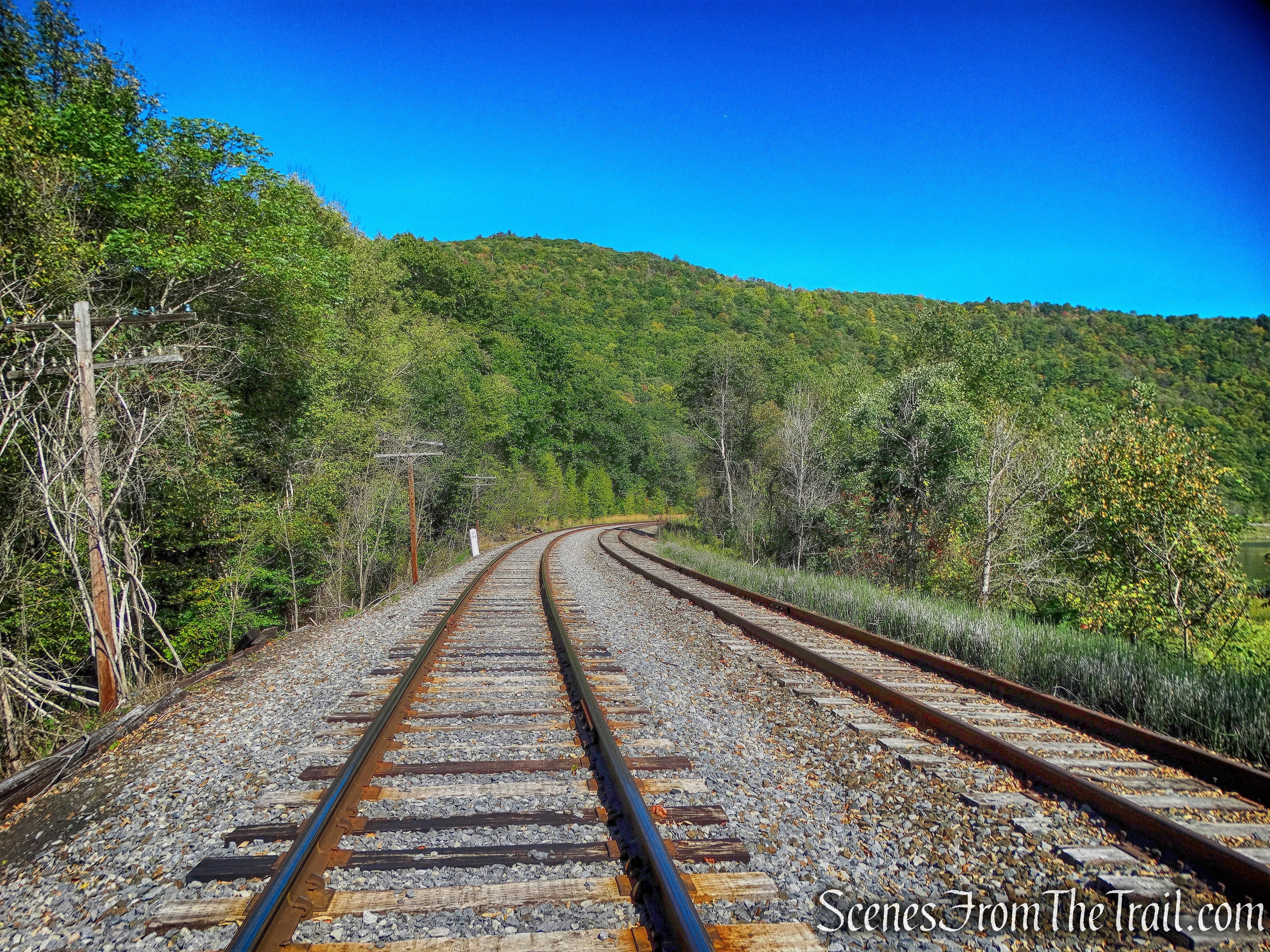
Bouchoux Hill as viewed from the tracks.
There wasn’t much to see unless you walk up or down the tracks. We had two other hikes to do, so I returned to the trail and we retraced our steps on the Bouchoux Brook Trail Extension back to the parking area.
Bouchoux Brook Trail Extension
What a great hike in such a picturesque area. I had never heard of this place before, but I am glad that we found our way here. Hike one of six now in the books towards a free patch. Now we were off to hike the Damascus Forest Trail, so stay tuned.
Pros: Great views, beautiful area, waterfall (when active), stone furniture, Delaware River.
Cons: Ankle breaker trail, sign, signs, everywhere there’s signs.
Bouchoux Trail – Jensen’s Ledges

Thanks for posting this. We were looking for a hike in this area. We visit my sister nearby often but have never hiked here. I wasn’t sure I could do it since I had knee surgery a couple of years ago, but it wasn’t overly challenging. We are in our early 60’s and were probably the oldest people on the trail that day. Saw some kids on the trail too. Beautiful views of the main stem of the Delaware river. We missed the trail to the bluestone quarry and the chairs (we’ll have to go back). We had a hard time finding the next trail to the ledge. We suspected we went too far so we backtracked and took a trail marked private property because we suspected that was it and we were right. We missed it at first because we were respecting the property owners rights, but other people were up there. Not sure why that sign was there. Better signage would definitely be helpful. Reading your post and seeing your pictures helped to familiarize ourselves with the trail before we got there.
LikeLiked by 1 person
this is our front yard. the lower trail to the river is our property. 35 years of living in lordville and each time we visit the ledges we are always trilled as each visit is different
LikeLike
Great blog! Very handy for the hikes I’m looking at.
All trails has this hike at 5.8 miles Out and Back, but you have it as 3. Are you excluding the Extension from the regular hike? I am trying to figure out why you say 3, the NPS says 3, and All trails has 6.
LikeLike
The distance I recorded includes the extension which is also ‘out and back.” The primary trail continues past Jensen’s Ledges to another trailhead. That is possibly why All Trails has it listed as 5.8 miles. Remember, All Trails is user generated data, and as such may not always be accurate. If you do just the primary trail from the trailhead to the ledges, it’s about 2.1 miles out and back.
LikeLike
Thats a good idea and thank you for clarifying. That makes a difference in my hime planning since we know All Trails is not always accurate.
LikeLike
yes, very good explanation. as one who has hiked from bouchouxville to long eddy ,many many times you nailed it on the head…sometimes I would walk along the river on way back home to lordville. also having 2 trailheads ( one in long eddy not properly designated ) makes it difficult to figure out what trail books have this listed. One thing DEC has done is to do the trailhead signage about 10 years ago along with topo map and you are here star.
LikeLike