October 7, 2017 – Town of Highland, NY
Difficulty: Easy
Length: Approximately 1 mile
Max elevation: 1,142 ft.– total elevation gain approximately 130 ft.
Route type: Circuit
Map: Upper Delaware River Valley Map
Trailhead parking: Barryville, NY 12719
Minisink Battleground Park, which is listed on the National Register of Historic Places, is dedicated to the brave men who fought and died at the “Battle of Minisink,” the Upper Delaware’s only major Revolutionary War skirmish.
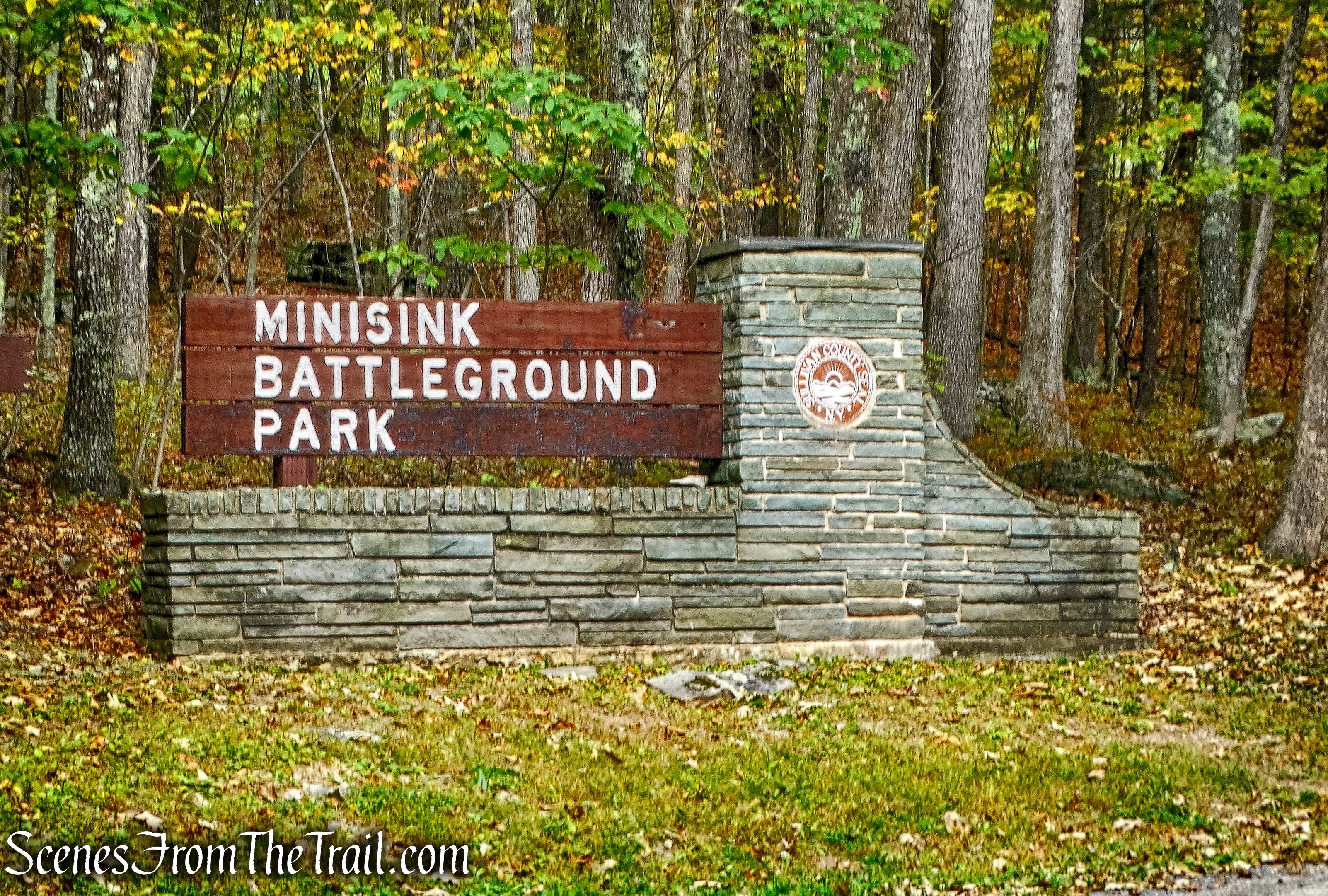
Minisink Battleground Park
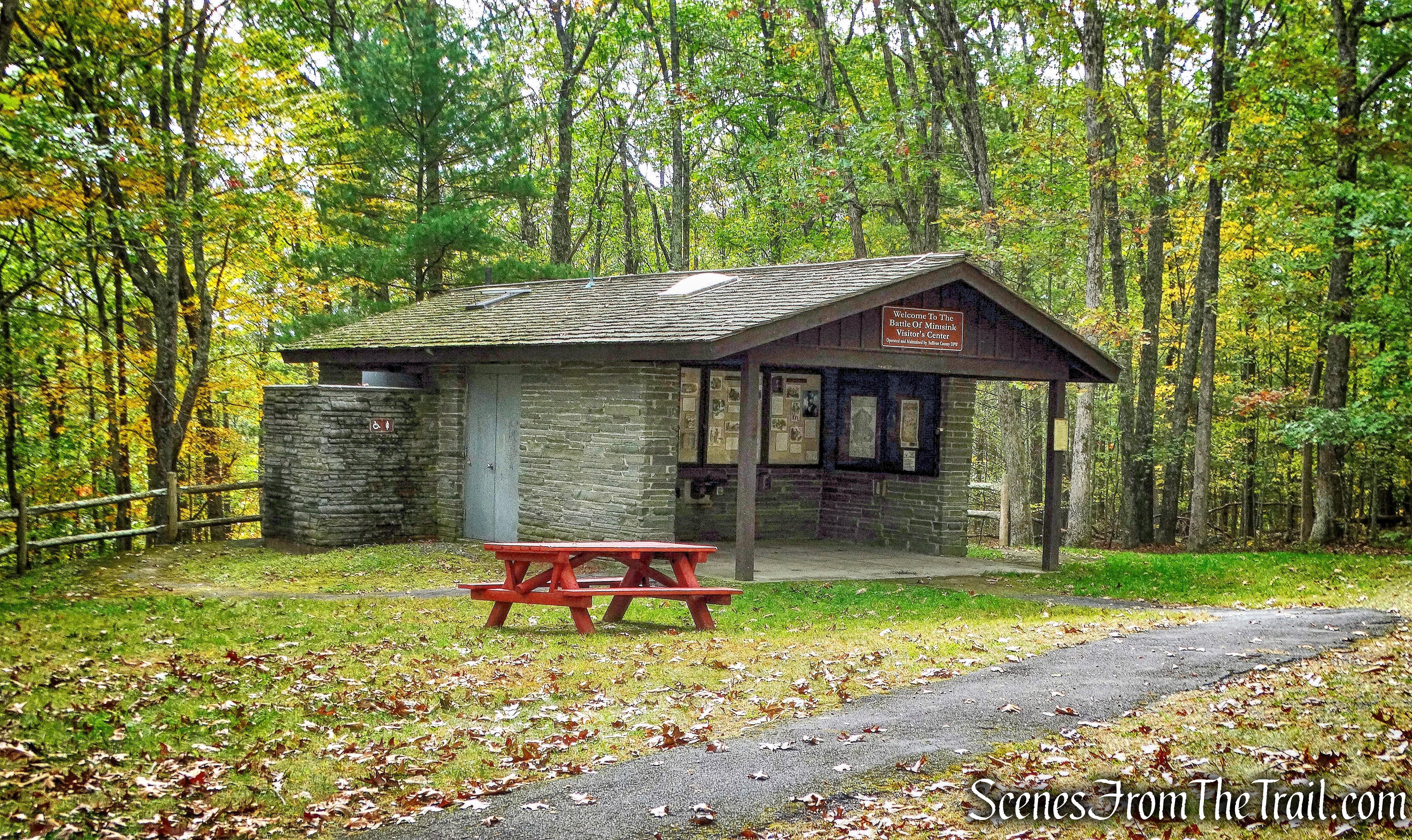
Included in the park’s 57 acres, are picnic areas, a group picnic pavilion (fee required), restroom facilities, an Interpretive Center and walking trails.
Minisink Battleground Park
Trails run throughout the park with informational signage that explain the historical significance of the places along the trail. The Minisink Battleground Park Trails is one of six trails featured in the “Take a Hike!” brochure, which gives names, locations, descriptions, and difficulty levels of trails in the Upper Delaware River Valley. It also provides a checklist to keep track of the trails you’ve hiked which can be turned in upon completion for a “Take a Hike!” patch.
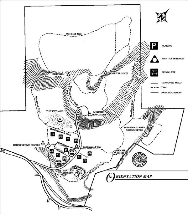
Orientation Map – Minisink Battleground Park
The previous weekend, we did three of the hikes on the list, the Bouchoux Trail, Damascus Forest Trail and the Cobey Pond Trail. We were now going to complete the final three hikes to earn our Take a Hike! patch. Having already done the Tusten Mountain Trail this morning, we were ready to do the Minisink Battleground Park Trails. Although, the brochure lists the trails as: from ¼ – ½ miles, we decided to extend the distance to further explore the park.
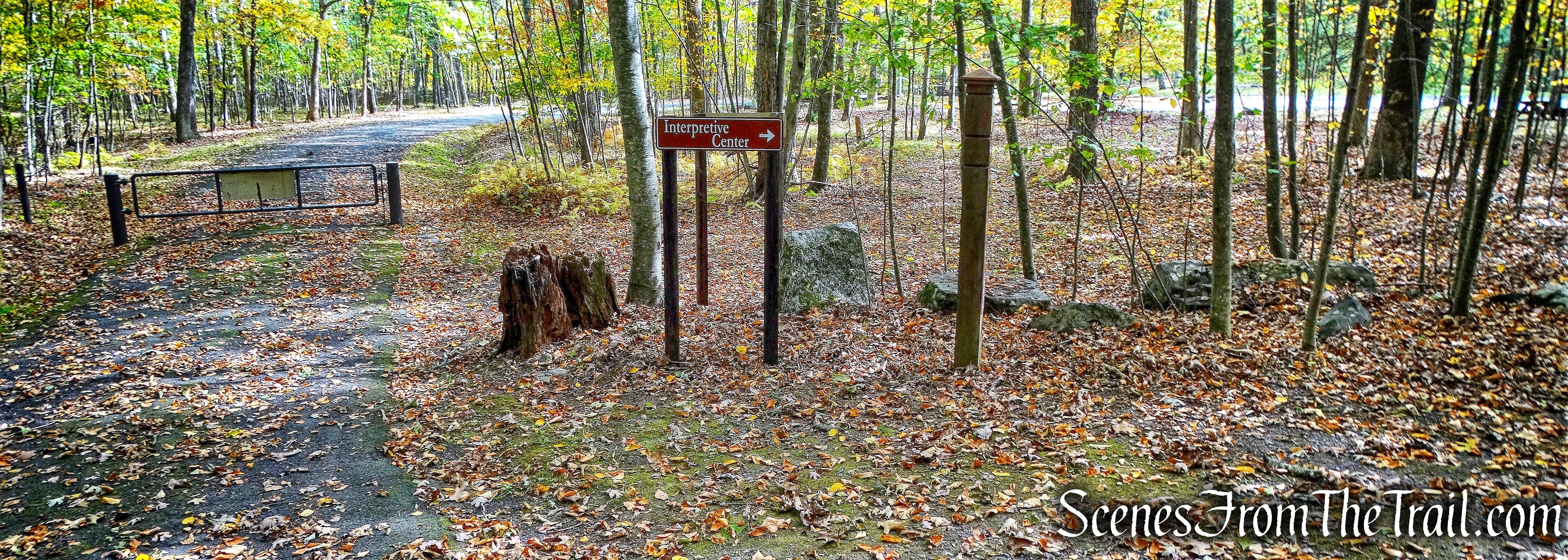
The large parking lot was empty when we arrived and a motorcycle was parked there when we returned. We began our hike by heading back to the entrance, where we picked up the Battleground Trail. Next to the sign is a stone monument to commemorate the Bicentennial that contains a time capsule, to be opened in 2026.
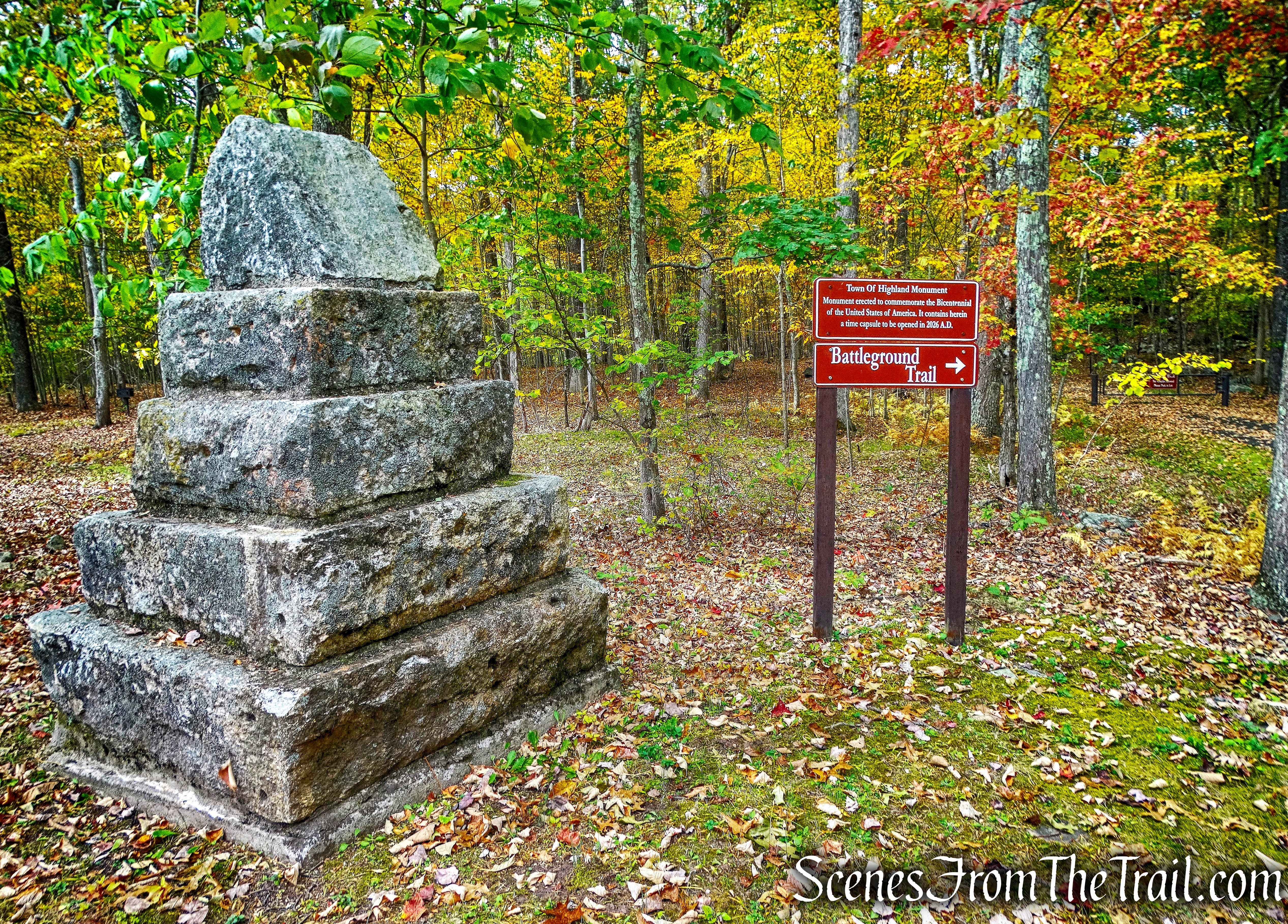
Bicentennial Monument – Minisink Battleground Park
The trail is directly across the road from this sign, but since it is a loop, there is also another entry to the trail just a few feet up the entrance road as well. Apparently, the trail is meant to be done clockwise, because the wooden posts along the trail only have the trail name on one side. The junctions are marked with signs, but the trails can be a little confusing. Nevertheless, it’s a small park and we just wandered around trying to see as many points of interest as possible.
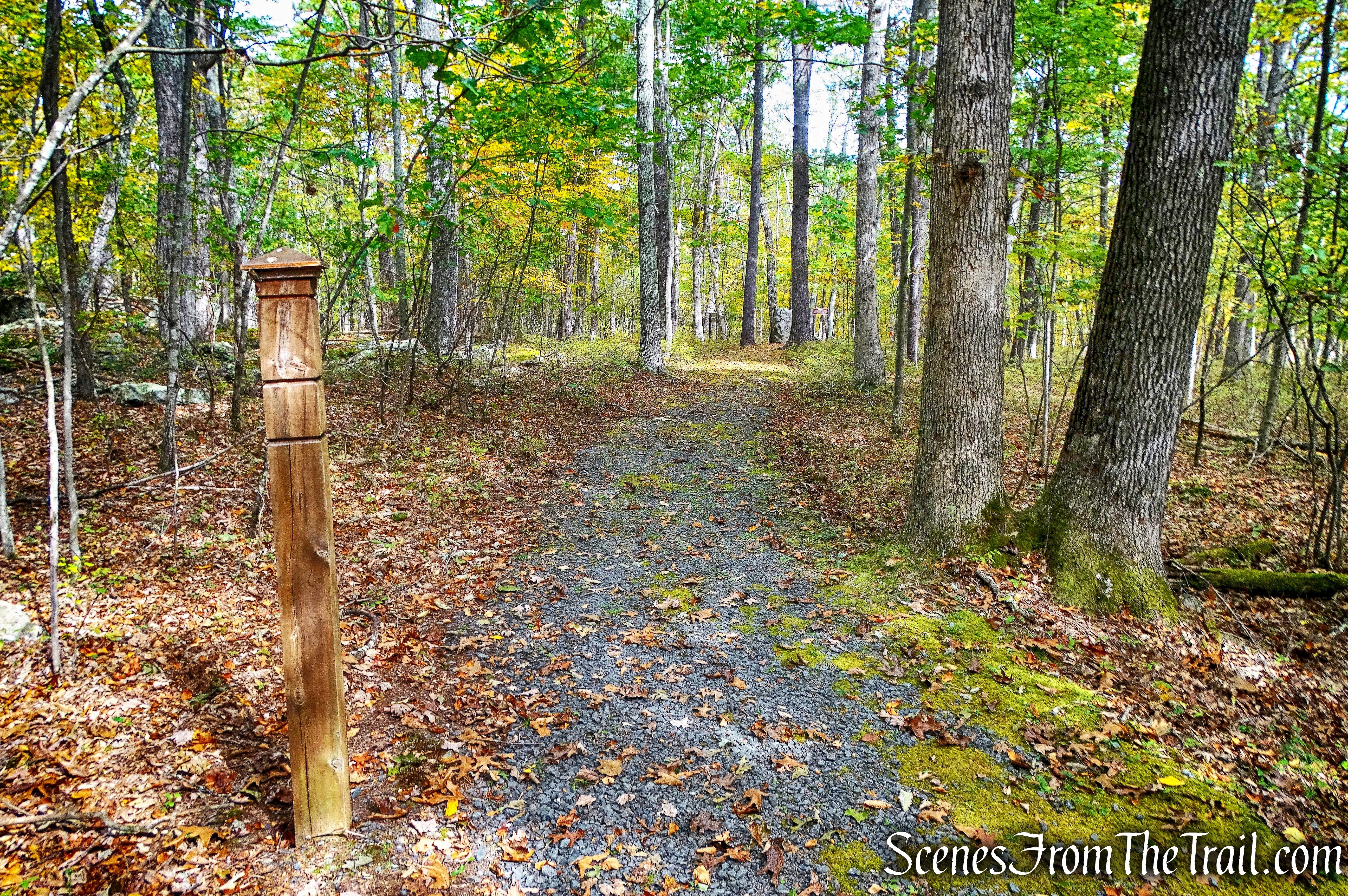
Battleground Trail
In a short distance, we came to a junction where Indian Rock is located.
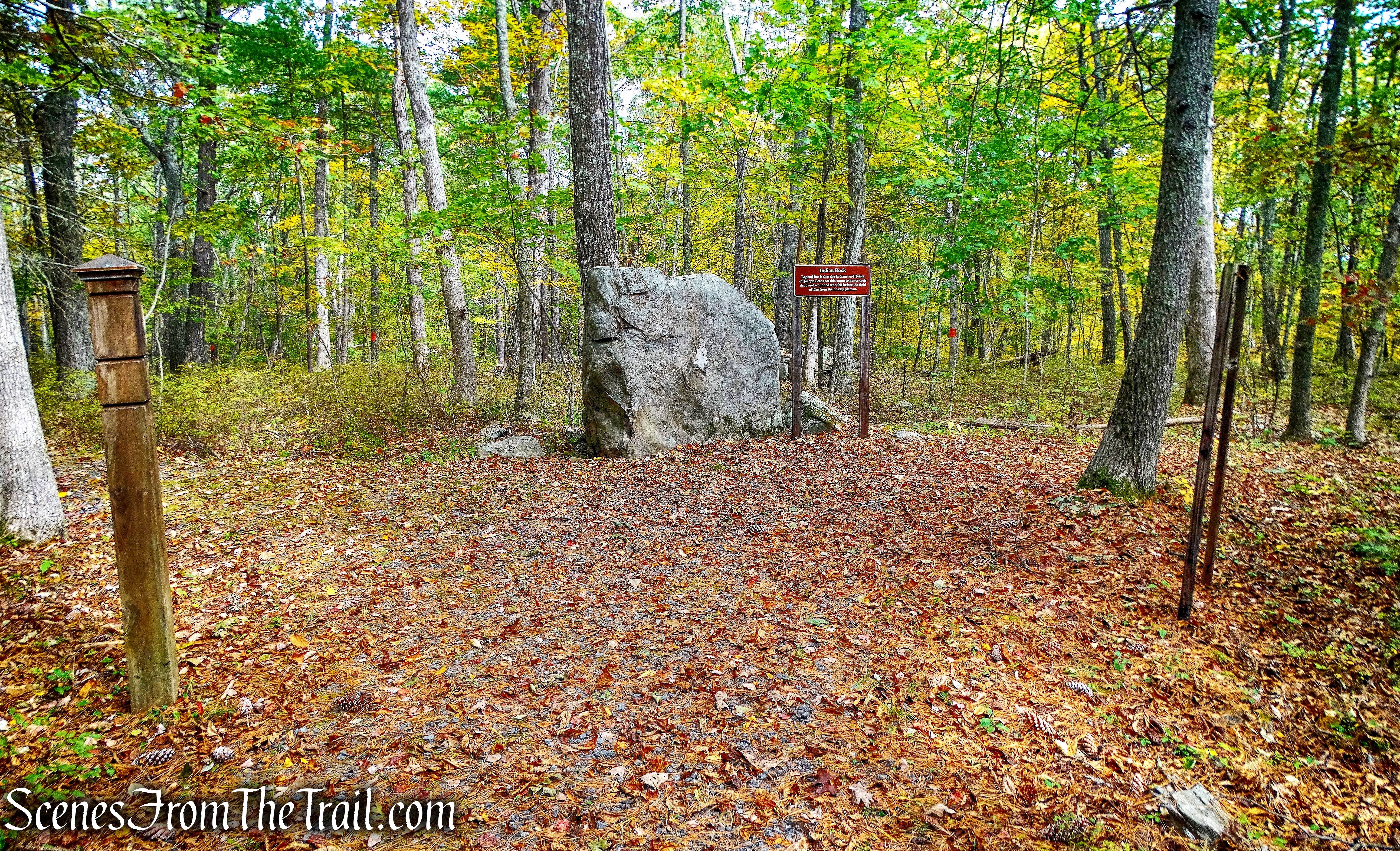
Indian Rock – Minisink Battleground Park
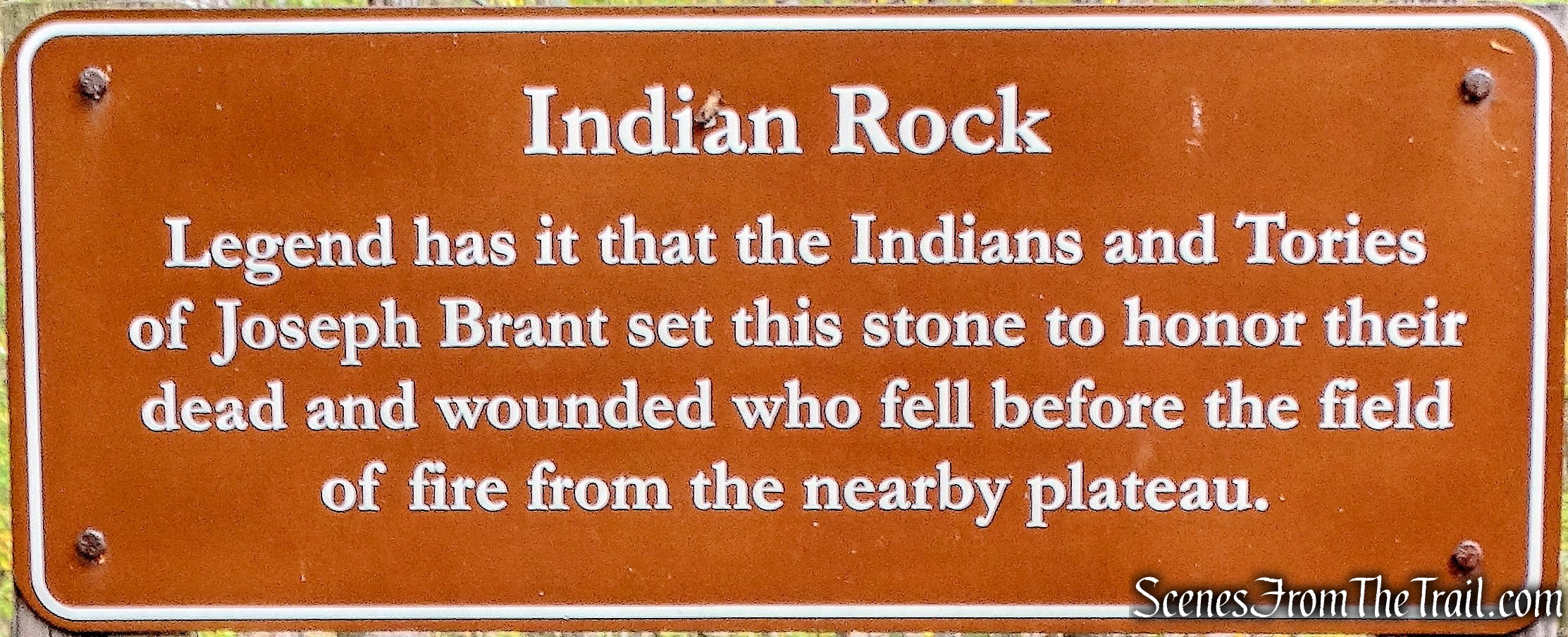
Indian Rock – Minisink Battleground Park
Continuing on the Battleground Trail, we came to a fork and veered right.
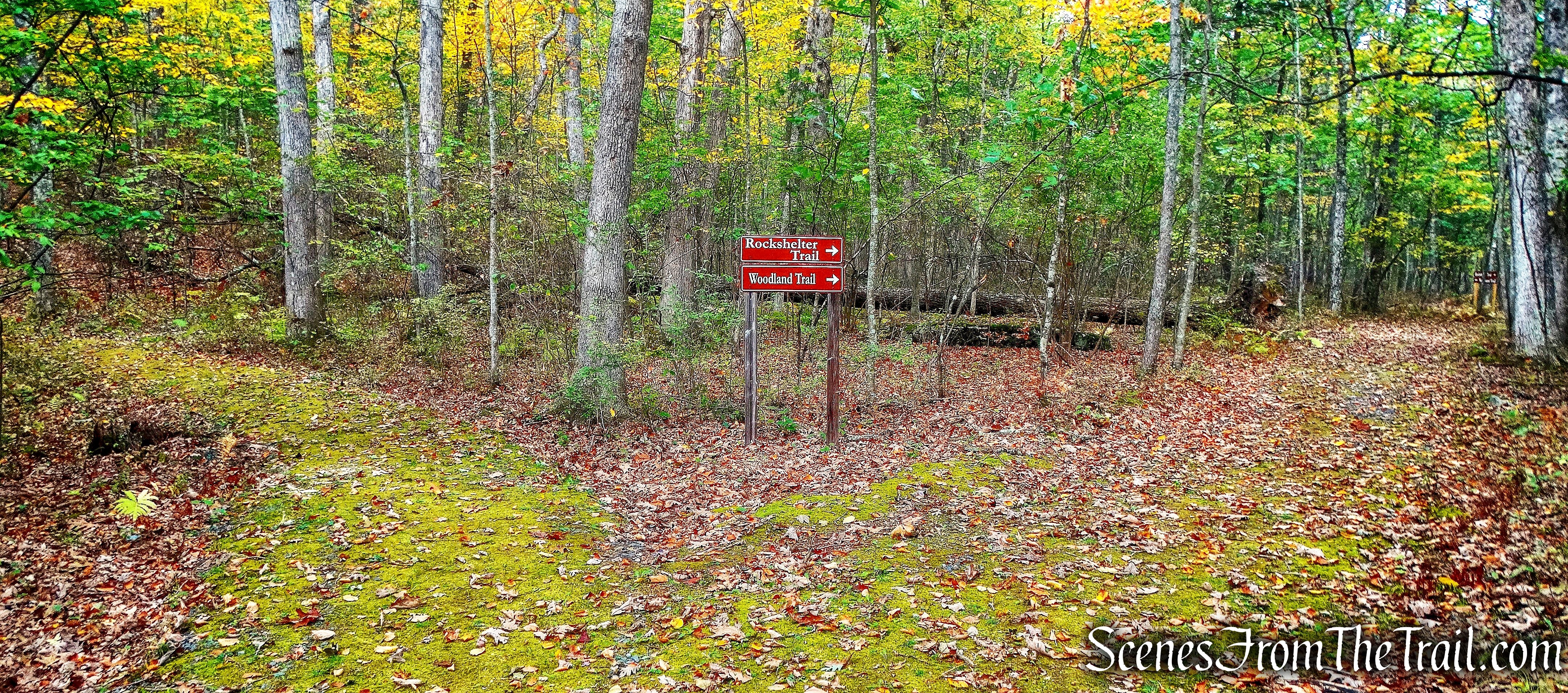
junction – Minisink Battleground Park
The Rockshelter trail sounded interesting so we headed that way. At the next fork, the Rockshelter Trail goes off to the right and we headed in that direction.
Turn right on Rockshelter Trail
Along the left side of the trail, on the hillside, there are some natural rock shelters.
rock shelters
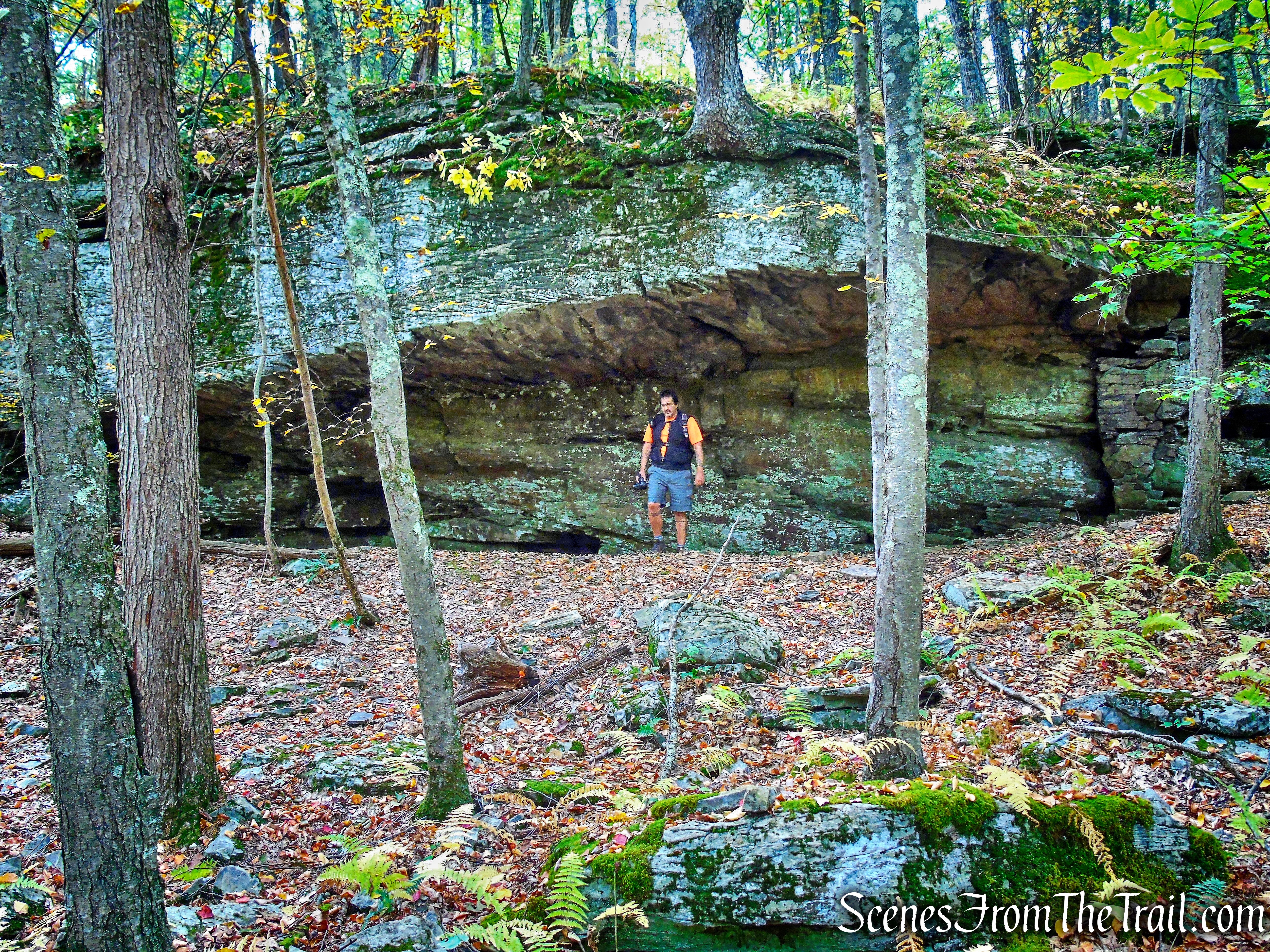
The rock formations in this area are amazing. A little further down the trail is the massive Minisink Spring Rockshelter, which is quite impressive.
Minisink Spring Rockshelter
Minisink Spring Rockshelter
Minisink Spring Rockshelter
This place has some of the coolest rock formations that I have seen.
rock formation
The Rockshelter Trail loops back around and returns to the fork. We reconnected with the Battleground Trail and wandered through the forest.
Battleground Trail
Through the trees, I spotted The Minisink Battle Monument, so we left the trail and bushwacked towards it. The Minisink Battle Monument was erected on the site of the militia’s “last stand” and was dedicated in 1879 on the centennial of the battle. It is built of native bluestone and is capped by a rounded glacial boulder.
The Minisink Battle Monument
We then rejoined the Battleground Trail and headed to Hospital Rock.
Battleground Trail
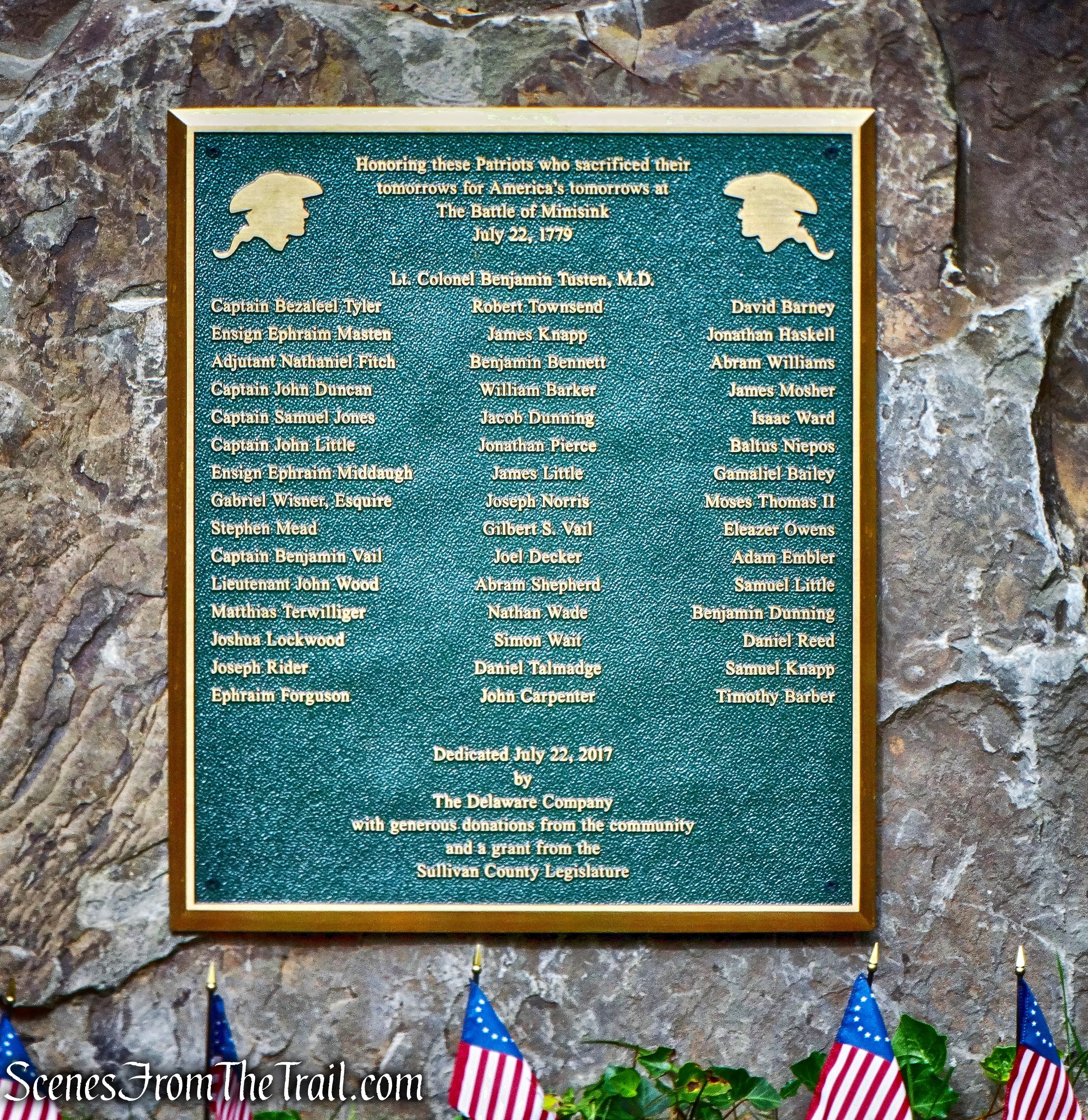
Hospital Rock is the most historically significant location on the battleground. Once the enemy broke the American’s defensive square late in the afternoon, it was here in the shadow of this rock that Lt. Col. Benjamin Tusten, a physician, and seventeen wounded militiamen under his care were trapped and killed by Brant’s raiders. Probably fewer than a dozen of the forty-five men who made a protracted “last stand” on the hilltop escaped.
Hospital Rock
We retraced our steps back briefly on the Battleground Trail, followed the trail as it turned right and continued ahead to Sentinel Rock.
Heading towards Sentinel Rock
Tradition has long held that this is the location where the final push by the British, led by Colonel Joseph Brant, into the heart of the militia’s defensive square that it had held for most of the day began. It was believed that a sentinel standing guard here was killed.
Sentinel Rock
We then continued on the Battleground Trail, walked downhill and back to the parking area, where our hike began.
Battleground Trail back to the parking area
Today the Minisink Battleground Park is hallowed ground where so many patriots fell in defense of an ideal – liberty. They were passionate men who perished here, a long distance from their farms, their families and friends. Because of their sacrifice and that of thousands of other patriots during the American War for Independence, our nation was born.
Minisink Battleground Park
This was a short one mile hike, but it was packed with interesting features. There are two additional trails that traverse the park, the Woodland Trail and the Old Quarry Trail. We did not walk them, but in hindsight, I wish that we had. Now we are off to our last hike of the day and the 6th and final hike in order to earn a patch. Off to the Mongaup River Trail, catch ya later.
Pros: Historical features, rock formations, quiet area, hallowed ground, earn a patch.
Cons: Trails could be better marked.
Minisink Spring Rockshelter – Minisink Battleground Park
