October 15, 2017 – Pine Bush, NY
Difficulty: easy
Length: Approximately 1.5 miles
Route type: out and back
Fees: $5.00 per person day use (Bear Hill only)
Map: Posted at information booth
Stone Church address: 280 Henry Road, Cragsmoor, NY 12420
Trailhead parking for Bear Hill: 258-260 Hartshorn Rd, Pine Bush, NY 12566
Construction began on The Stone Church in Cragsmoor, NY in 1895 and two years later in 1897, the 900-pound bell in the tower was raised. The chapel, built of stone from the mountain, was designed by Frederick S. Dellenbaugh, an architect and prominent Cragsmoor resident. Cragsmoor is the only residential community on the Shawangunk Ridge and is a hamlet of roughly four square miles.
The Stone Church
Bear Hill Nature Preserve is in the same Shawangunk Ridge as Sam’s Point. At an elevation of 1,950 feet, it provides spectacular views. It is a 50 acre privately owned park. This is a short easy hike with some of the best views anywhere. It is managed by the Cragsmoor Association.
Bear Hill Nature Preserve
The Stone Church and Bear Hill are within a mile of each other and if visiting one, it only makes sense to visit the other. On a Sunday afternoon, there was no one around when we visited the Stone Church, which is located atop the Shawangunk Ridge at an elevation of almost 2,000 feet above sea level.
The Stone Church
Behind the church there is a stone archway with sweeping views of the surrounding countryside.
stone archway – Stone Church
On a clear day, the views stretch for 50 miles.
view from stone archway – Stone Church
The chapel is available for weddings and other events, the funds from which are used exclusively for the restoration of the building and the grounds. The Stone Church is operated by Friends of the Stone Church.
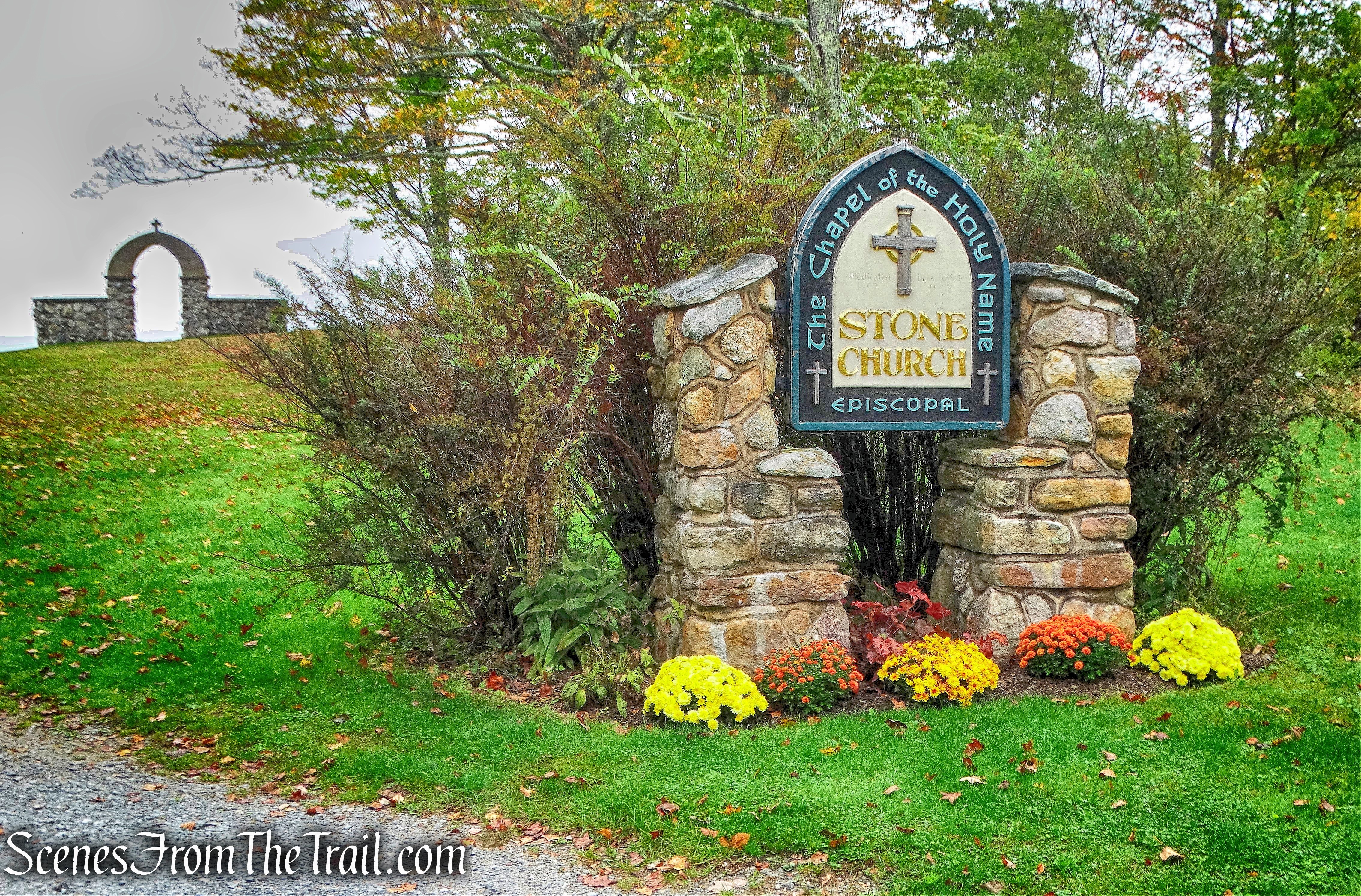
The Stone Church
Less than a mile away, in Pine Bush, NY, is the Bear Hill Nature Preserve. A great place for an easy walk that leads to some of the best views. The main trails are not marked, but well defined. On previous visits, no map was available, but now they have a map on the wall of the booth where you pay.
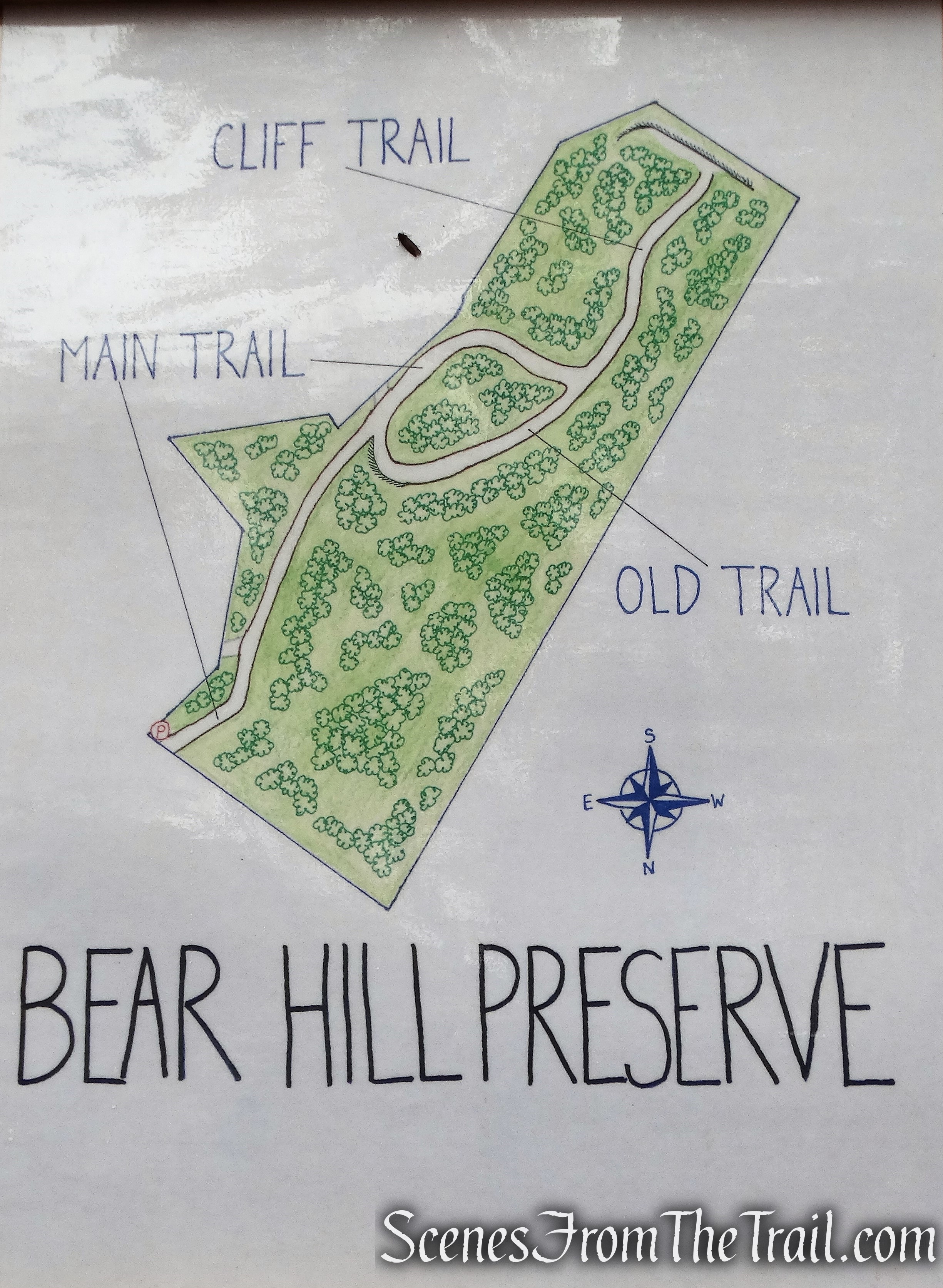
Bear Hill Nature Preserve map
The walk begins along the Main Trail, on a wide crushed stone road.
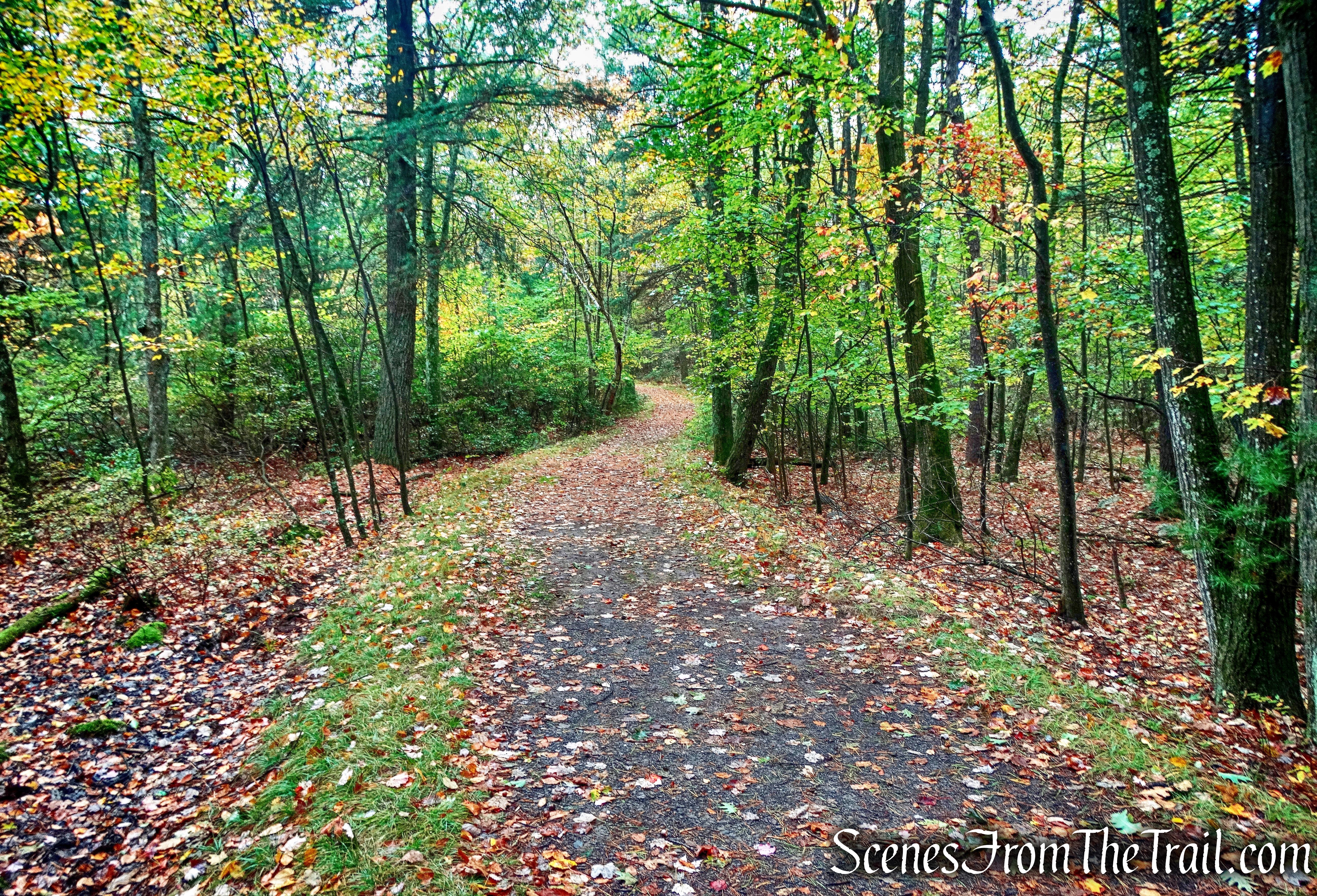
Main Trail – Bear Hill Nature Preserve
Along the way, there is a junction with the Old Trail, that goes off to the right. That makes a good return route. Staying on the Main Trail brings you to the views.
junction with the Old Trail
The Main Trail ends at a T-intersection with the Cliff Trail and the Old Trail.
Main Trail terminus – Bear Hill Nature Preserve
The views are the reason you are here, so you want to turn left on the Cliff Trail.
Left on Cliff Trail – Bear Hill Nature Preserve
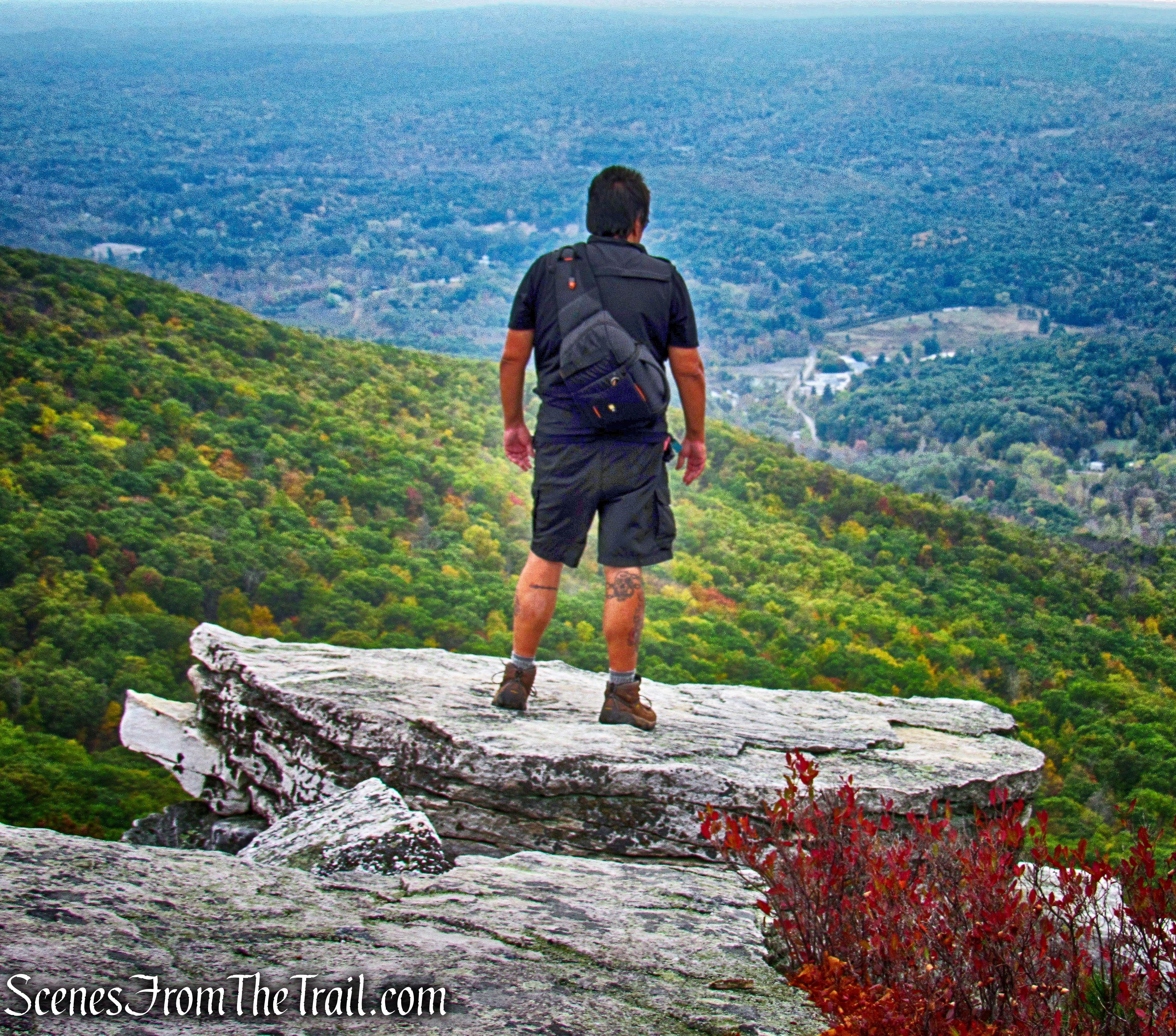
In a short distance, the trail comes out at the top of the cliffs.
Cliff Trail – Bear Hill Nature Preserve
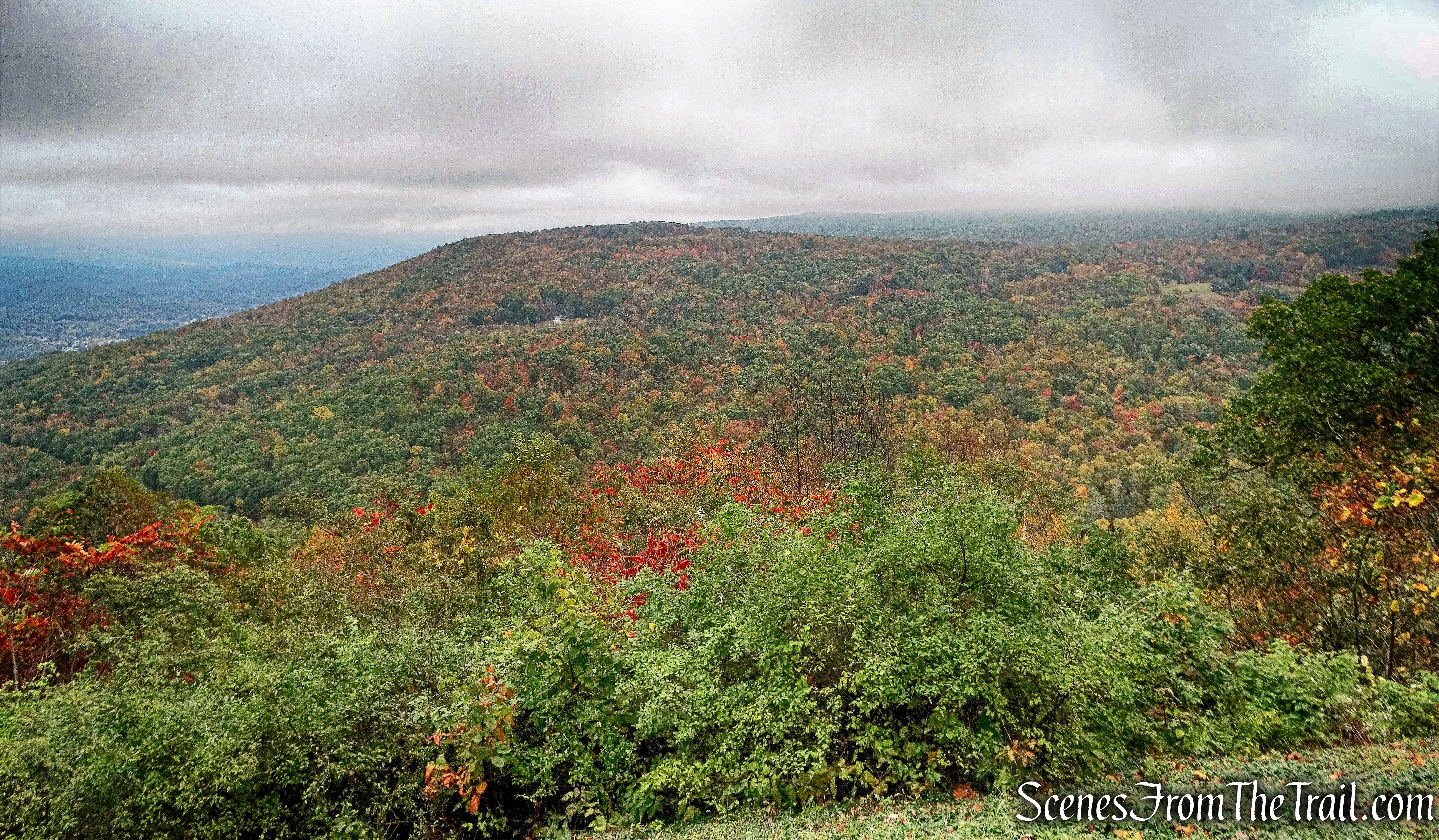
Even on a cloudy and overcast day, the views are still phenomenal.
Bear Hill Nature Preserve
The view southwest from the top of the sheer white cliffs, dotted with boulders.
Bear Hill Nature Preserve
Not as much color as my last visit, almost a year ago, but still quite scenic.
Bear Hill Nature Preserve
There are numerous trails that criss-cross the property and you can venture to many a rock outcrop if you dare.
Bear Hill Nature Preserve
There are also many deep crevasses in the rock formations that can be explored.
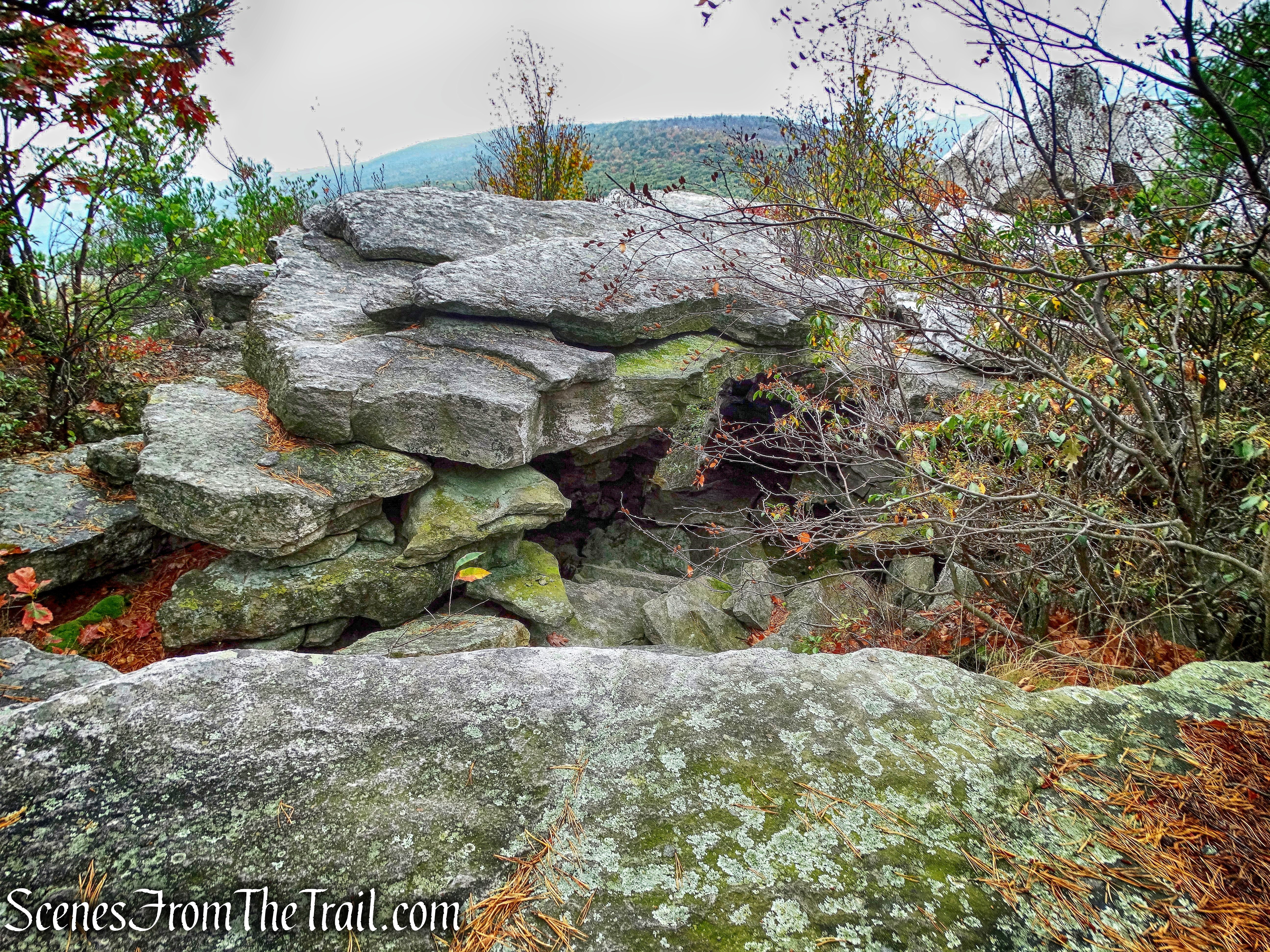
crevasse – Bear Hill Nature Preserve
With the ease of access to these cliffs, it does get crowded on a nice day, but there are plenty of places where one can escape to.

crevasse – Bear Hill Nature Preserve
Next time you are out taking a drive in the country, consider these two scenic spots and you’ll be rewarded with some of nature’s beauty.
Pros; Sweeping views, sheer white cliffs, Stone Church, The Gunks.
Cons: Can get crowded.
Take a virtual hike with additional images added below.
Take a hike!
Bear Hill Nature Preserve

Your photos are exquisite of Bear Hill Preserve and the Stone Church. Thank you…
When we get to the cliff, what area are we overlooking? Is it Ellenville?
LikeLike
The south-facing views are over the Shawangunk Ridge State Forest, Roosa Gap State Forest and beyond.
LikeLike