April 2, 2017 – Mahwah, New Jersey
Difficulty: moderate – strenuous
Length: approximately 5 miles
Route type: circuit
Map: Ramapo Reservation Trail Map (2016 updated newly blazed trails)
Trailhead parking: 608 Ramapo Valley Rd Oakland, NJ 07436
Ramapo Valley County Reservation is Bergen County’s largest park and is located on the edge of the Highlands Region. It was designated a Wilderness Area in 1972 with 741 acres of open space. The reservation now boasts over 4,000 acres of permanent open space. Several trails connect with bordering Ringwood State Park to the north and the Ramapo Mountain State Forest to the south. It’s a great place for a midday walk, a morning trail run, or a weekend hike with the family. It does get crowded the closer you are to the parking area.
The past month or so I have been I have been battling Bronchitis and have been relegated to easier hikes as I recovered. Now feeling better it was time to do a more rigorous one. Trying to stay away from snow covered trails, we decided on Ramapo Valley County Reservation. During the summer of 2016, volunteers of the NY/NJ Trail Conference, in cooperation with the Bergen County Department of Parks, created a new network of loop trails in the core area of the Reservation, making trails easier to follow. The project involved re-blazing 6 miles of existing trails and constructing 1.2 miles of new trails.
We arrived at the parking area at about 9:30am on a beautiful Sunday morning. It was sunny and the temperature reached 60 degrees. A perfect day to spend in the woods. The parking lot had a good number of cars when we arrived, but was completely full when we got back about 2:30pm, with people waiting for others to leave so they could park.
We began our hike at the southwest corner of the parking area and picked up the Yellow-blazed Vista Loop Trail.
Yellow-blazed Vista Loop Trail
We walked down a few steps and proceeded straight towards the steel truss bridge which spans the Ramapo River.
steel truss bridge
Ramapo River
We continued straight after crossing the bridge, walking on a wide dirt road. Since it was relatively early, there weren’t too many people around. On our return, this road was packed.
Yellow-blazed Vista Loop Trail
We walked along the shore of Scarlet Oak Pond, which was on our right. We stopped here briefly to capture a few images.
Scarlet Oak Pond
Once past the pond, there is a tree with four Yellow blazes, indicating the start of the loop. We turned right, heading north along the western shore of Scarlet Oak Pond for about 500 feet. The Yellow-blazed Vista Loop Trail now turns left and crosses a wooden footbridge.
wooden footbridge
The trail now begins to climb on a moderately steep grade.
Yellow-blazed Vista Loop Trail
We stopped once or twice to catch or breath then arrived at Hawk Rock, which would provide us with our first view of the day.
Hawk Rock
Looking down to the right, we could see Scarlet Oak Pond, which we had just walked by minutes earlier.
View from Hawk Rock
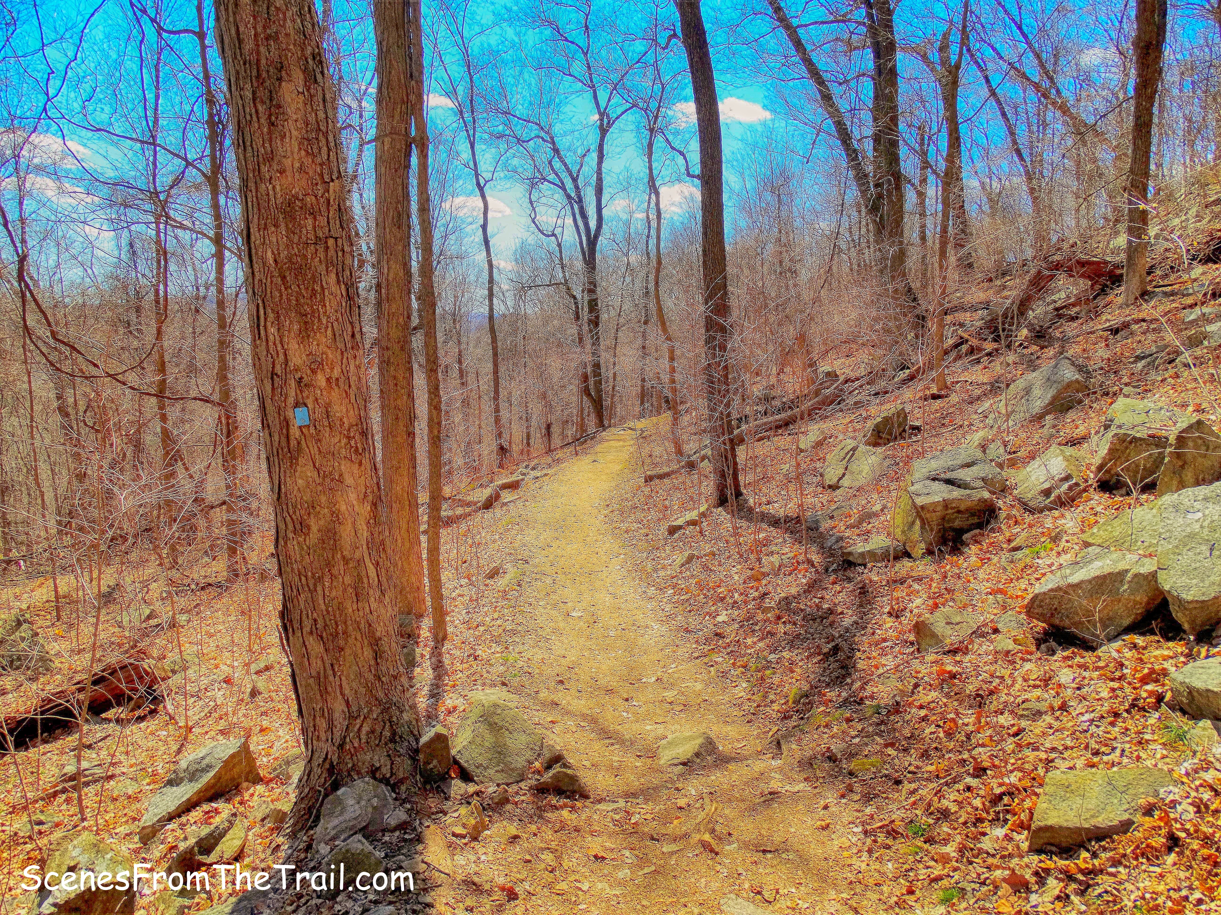
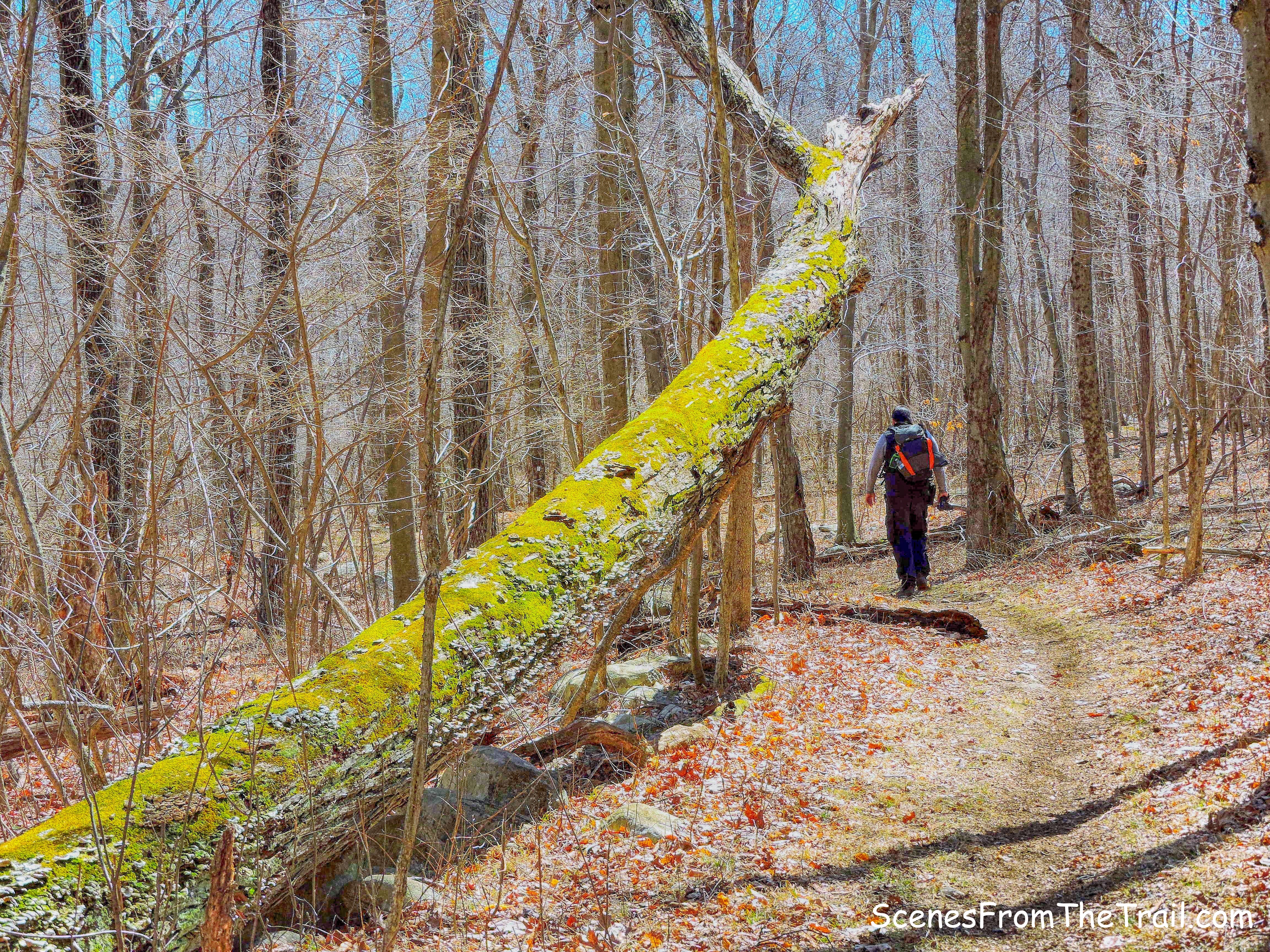
The Vista Loop Trail now becomes steep and rocky as we continued our ascent.
Vista Loop Trail
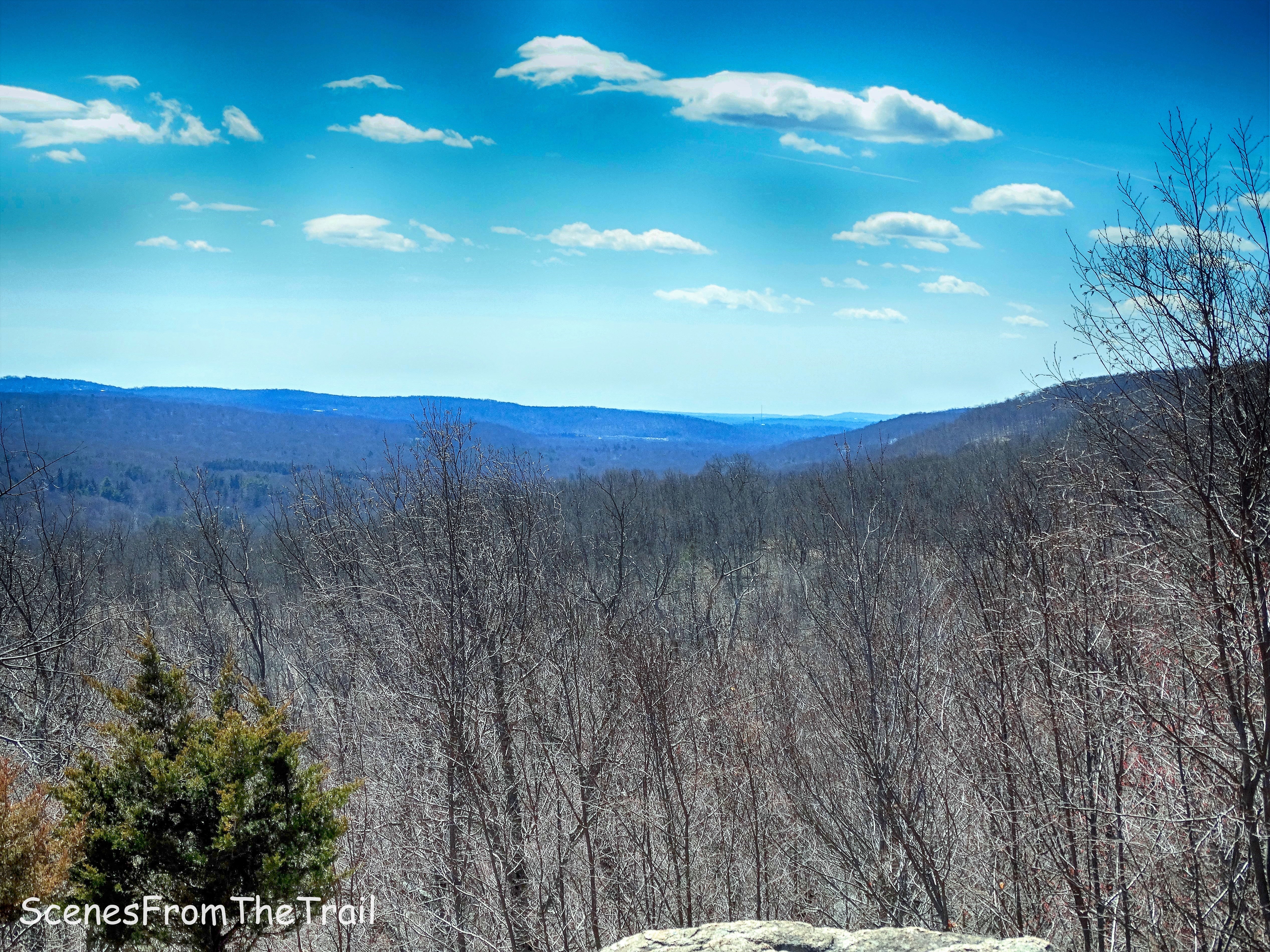
After leveling off, the trail arrives at Cactus Ledge, which offers a similar viewpoint as Hawk Rock, but from a higher elevation. The NYC skyline is also visible from here.

view from Cactus Ledge
At this spot there are some Prickly Pear Cactus, the only native American cactus that grows east of the Rocky Mountains. So now we know how this scenic vista got its name.
Prickly Pear Cactus
As we resumed our hike, the Vista Loop Trail becomes a little wider and much less steep.
Vista Loop Trail
It then comes to a junction and the triple-green-on-white blaze marks the start of the Halifax Trail.
start of the Halifax Trail
The Halifax Trail gradually descends through the woods and crosses a wide gas pipeline cut. When we got to the pipeline cut, we had to stop and look for blazes. None were visible, but a footpath just off to the right, caught my eye. Once we started walking on the footpath, the blazes became noticeable.
Halifax Trail
At the base of the descent, the Halifax Trail turns left onto a woods road which passes through Havemeyer Hollow. We had now hiked about two miles.
Halifax Trail – Havemeyer Hollow
The trail was swampy in some spots so we walked along the edge of the road/trail.
Halifax Trail – Havemeyer Hollow
There are several abandoned cars along this trail, but they were so far gone that there was not much left of them. We did not encounter any other hikers along this stretch of trail.
abandoned car
In about 1/4 mile, we reached a junction with the purple-blazed Havemeyer Trail. This was the way we were going, but first we took a short side trip. We wanted to check out a set of ruins just ahead on the Halifax Trail, but we had to cross Havemeyer Brook to proceed on the Halifax Trail.
Havemeyer Brook – Halifax Trail
The brook was running strong and we didn’t want to get wet. This seemed to be the place to cross, but it is also the widest point in this area. We walked up and down a few feet, but it was knee deep in some areas. Luckily, my hiking partners had trekking poles, so I borrowed one and we rock hopped across Havemeyer Brook. There was another car a few feet past the brook crossing that was mangled beyond recognition.
abandoned car
A few feet past the mangled car, there is a stone wall and just beyond, is the Halifax ruins.
Halifax ruins
They weren’t that impressive and not really worth the side trip, but it is listed on the map, so here we were. I even walked up the trail a bit just to make sure that this was indeed the ruins we were looking for………they were.
Halifax ruins
We then retraced our steps back to the brook and crossed back over. We didn’t get wet so in hindsight it was kind of fun.
Havemeyer Brook – Halifax Trail
We then turned right and began a steep climb up the Purple-blazed Havemeyer Trail. This was probably the hardest part of the hike, in part due to dirt bikes creating a rut in the trail along some of the steepest sections.
purple-blazed Havemeyer Trail
We kept a pretty steady pace up, only stopping briefly to catch our breath. A pair of hikers passed us on their way down, but we did not see anyone else on this trail.
purple-blazed Havemeyer Trail
At the top of the hill, the White Trail comes in from the right and joins the Havemeyer Trail. The purple and white blazes run jointly for about 500 feet on a mostly level route, passing more stone walls on the right.
joint Havemeyer Trail and White Trail
When the purple blazes depart to the right, we continued straight ahead on the White Trail, which soon begins to climb very gently.
Havemeyer Trail and White Trail junction
Walking along the White Trail, we could hear dirt bikes/ATVs motoring through the woods. We didn’t encounter any, but they weren’t too far away. No other hikers on this trail but us.
White Trail
After a steep climb, it was enjoyable just strolling through the woods knowing that it was all downhill from here.
White Trail
We came to the route of the same gas pipeline that we crossed earlier, picking up the White Trail on the other side.
White Trail
The White Trail ends at a t-intersection with the Yellow-blazed Vista Loop Trail, which comes in from the left. We veered slightly right and were now following the yellow blazes.
White Trail terminus
In about 500 feet, the Blue-blazed Ridge Loop Trail joins from the right. We now followed both the blue and yellow blazes as they led us downhill.
Yellow-blazed Vista Loop Trail/Blue-blazed Ridge Loop Trail
In about another 500 feet, the trails split and we turned right and followed the Yellow-blazes up the hill. I saw a unmarked footpath to the left and we took it to a rock outcrop that is known as the Ridge Overlook.
view from Ridge Overlook
When we got to the overlook, there was one guy sitting enjoying the view. In a few minutes about 20 people came pouring out onto the rock outcrop and we headed out.
view from Ridge Overlook
Another nice view of New York City can be had from here on a clear day.
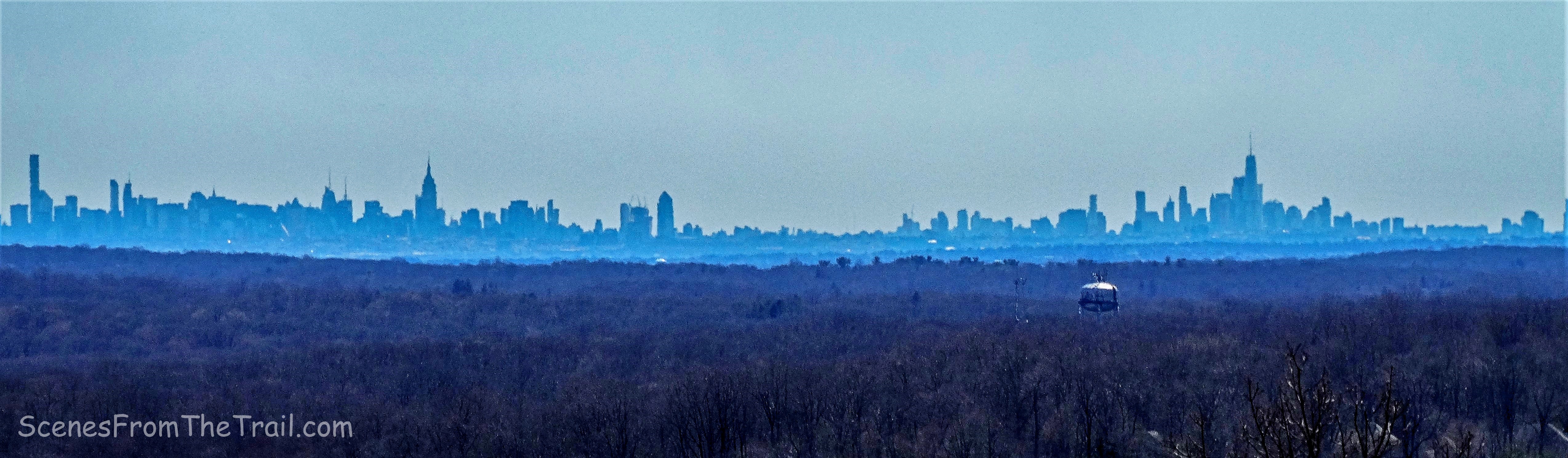
view from Ridge Overlook
We retraced our steps back to the Blue-blazed Ridge Loop Trail and turned right heading down the hill.
Blue-blazed Ridge Loop Trail
We spotted a small Garter Snake slithering close to the trail.
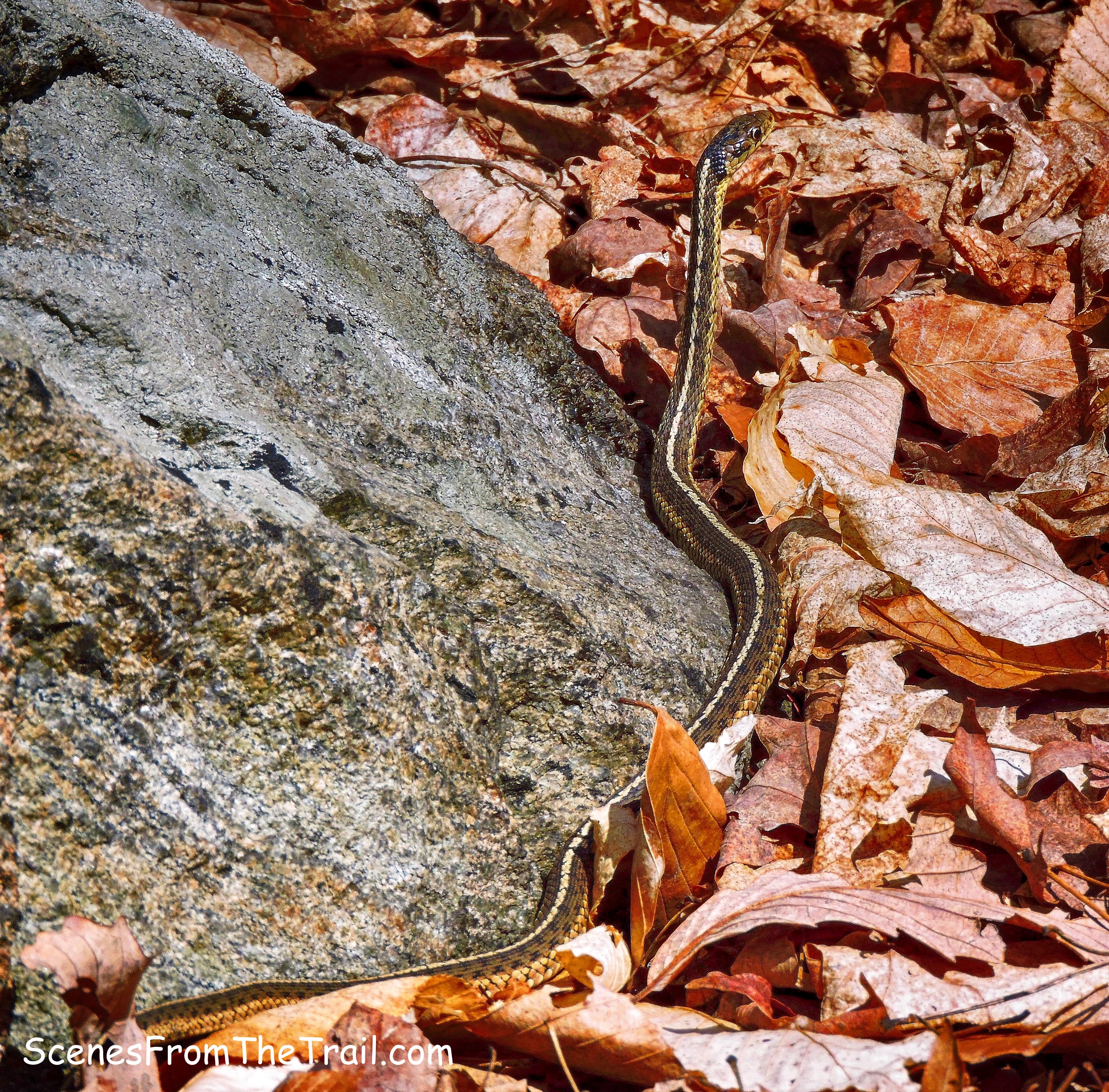
Garter Snake
At the base of the descent, the Ridge Loop Trail reaches a wide woods road, with blue blazes going in both directions. We turned right and followed the Ridge Loop Trail uphill for about 650 feet and crossed a bridge over a stream with some nice cascades.
bridge over a stream
Almost immediately after crossing the bridge, we turned left onto the Yellow-blazed Vista Loop Trail. Now on a footpath in the woods, we walked along the stream which had numerous cascades.
Yellow-blazed Vista Loop Trail
Since we were walking downstream, we had to keep looking over our shoulder to view the cascades.
cascade
The trail then turns left and crosses the stream on a wooden footbridge.
wooden footbridge
Right after crossing the bridge, we turned right onto the Green-dot-on-Orange-blazed River Trail which runs close to the Ramapo River. As we neared the river two hikers that were coming from the opposite direction told us the trail was flooded. We then turned around and returned to the Yellow-blazed Vista Loop Trail and turned right. We followed the trail back to the parking area. Along this stretch of the trail, it was jam packed with people. I wanted to relax by Scarlet Oak Pond and decompress a little while before driving, but there were people at every turn. When we got back to the parking lot, people were waiting for spots. Not wanting to get right in the car and start driving, we stood around enjoying a beverage after a rigorous hike. At least six people asked me if I was leaving so they could take my spot. I was feeling tired, but no worse for wear.
I hope that you enjoyed the hike and please don’t forget to follow my blog. See you next time, now get out there and take a hike!
Pros: Scenic vistas, streams, cascades, ruins, well marked trails.
Cons: Way too many people the closer you get to the parking area.
Take a hike!
