March 25, 2017 – Alpine, New Jersey
Difficulty: moderate
Length: approximately 5.5 miles (includes off trail exploration)
Route type: circuit
Map: Hudson Palisades Trails Map – Free maps
Trailhead parking: Henry Hudson Drive, Closter, NJ 07624
An updated version of this hike which begins and ends at the Alpine Boat Basin can be viewed HERE.
Overlooking the Hudson River in Bergen County, NJ, Palisades Interstate Park is about 12 miles long, a half-mile wide, and encompasses 2,500 acres of wild Hudson River shorefront, uplands, and cliffs. There are over 30 miles of trails that range from easy to strenuous. The two main trails within the park are the Long Path, which runs along the top of the cliffs and the Shore Trail which runs along the banks of the Hudson River. Five short trails link the Long Path and the Shore Trail, ranging in classification from moderate to steep.
With snow still covering some of the trails in Harriman and the surrounding area, I decided it was better to head a little further south where the trails would have little or no snow. I had done this hike before, but in warmer weather when the vegetation covered much of the area I wanted to explore. I figured now was a good time to pay a return visit.
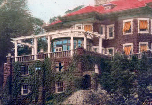
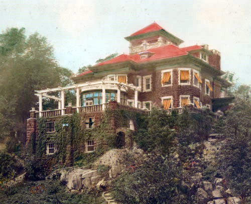
George A. Zabriskie made a name for himself in the flour business, working for Pillsbury flour mills. The fifteen-room manor house called “Cliff Dale” that was built for Zabriskie at Alpine in 1911 was constructed of native stone on a 25-acre estate high atop the cliffs of the Palisades. His was just one of many mansions that used to line “Millionaire’s Row.” Today all that remains of those stately mansions are some foundations, with the exception of Cliff Dale. The two-story ruins of the foundation and the surrounding terraced gardens along with the pool make for an interesting off trail exploration. Below is an image of Cliff Dale, courtesy of of the Palisades Interstate Park Commission.
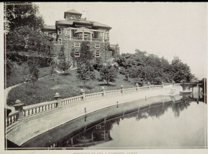
Image courtesy of the Palisades Interstate Park Commission
With the history lesson out of the way, it’s time to get on with our hike. From the parking area, we headed south past the park headquarters towards Henry Hudson Drive.
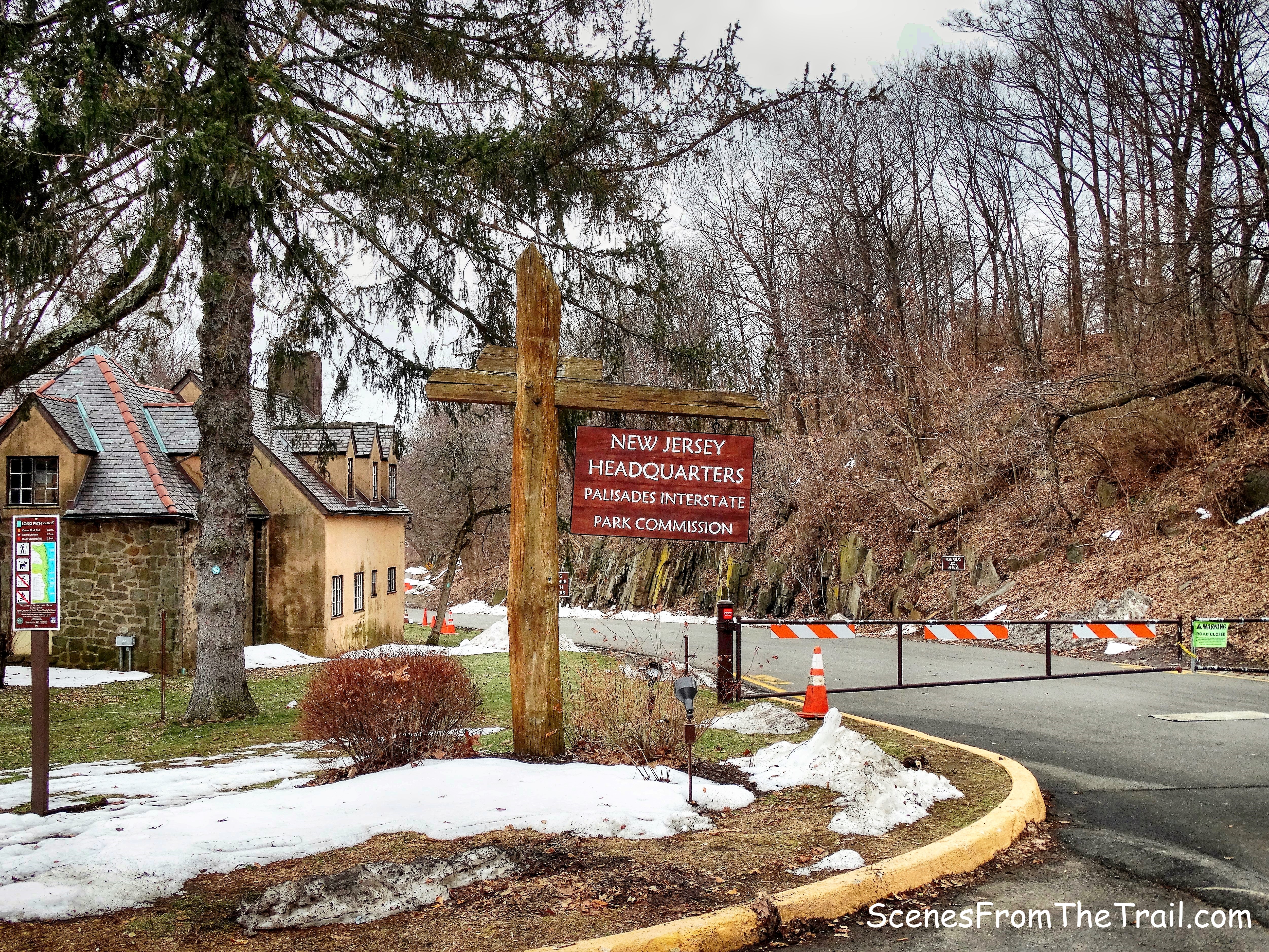
Palisades Interstate Park Commission
We walked down the road and veered left onto a footpath just before the blocked off section of Henry Hudson Drive.
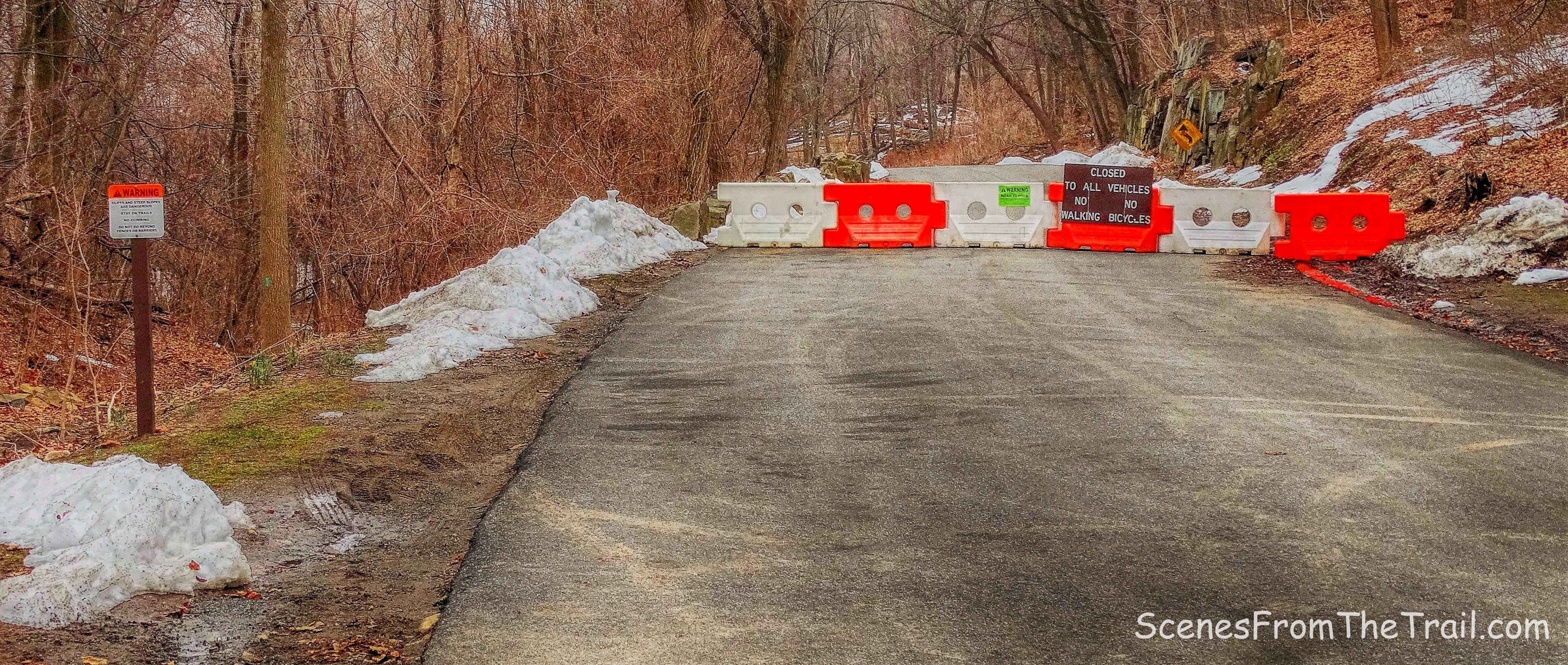
blocked off section of Henry Hudson Drive
For the first part of the hike, we would be following the Aqua blazes of the Long Path.
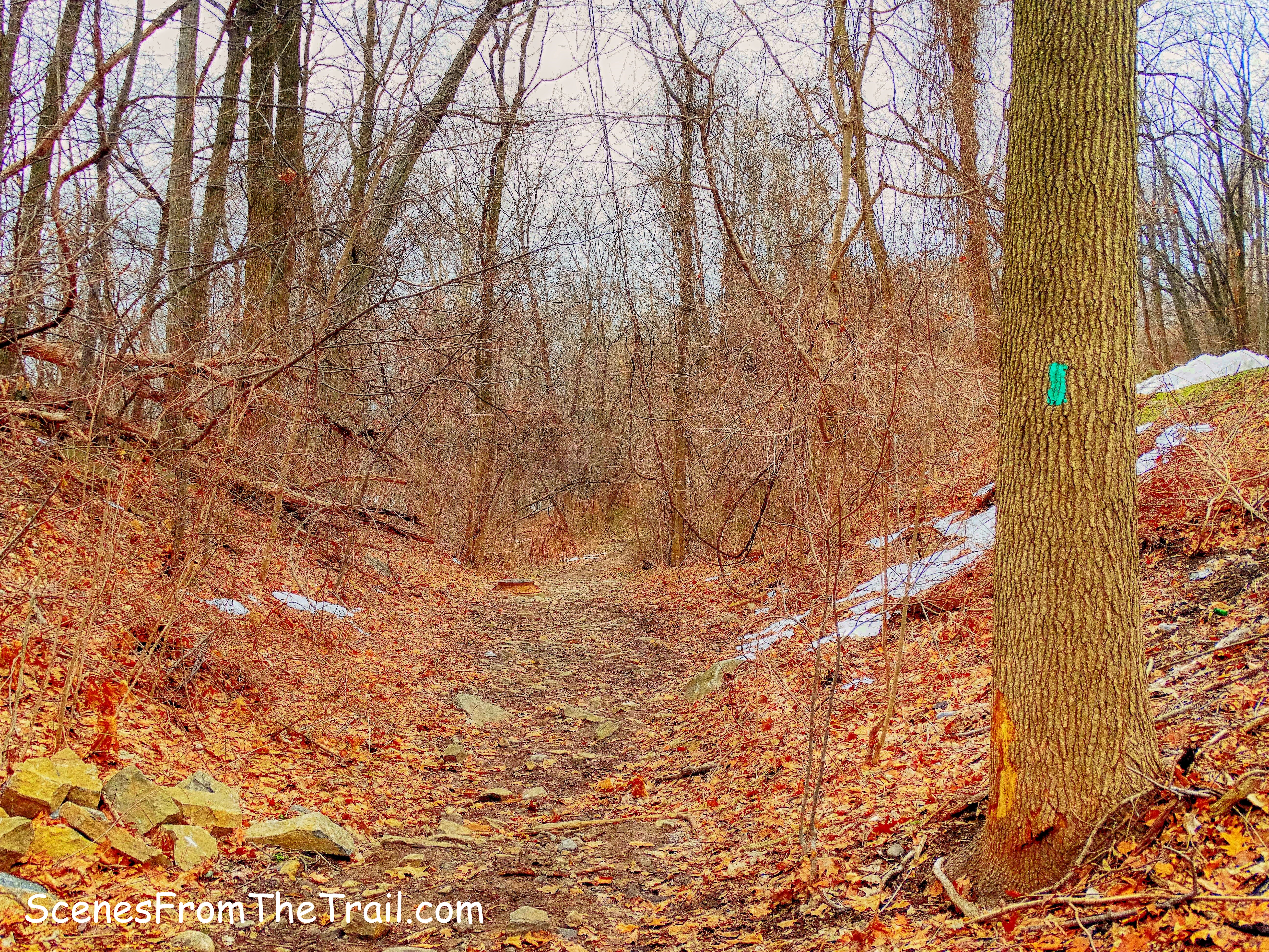
Long Path
After a brief walk downhill, we turned right and walked through a stone tunnel that passes beneath Henry Hudson Drive. We were now following both the Aqua blazes of the Long Path and the Orange blazes of the Closter Dock Trail.
Long Path and Closter Dock Trail
Through the tunnel and up some stairs we went.
Long Path and Closter Dock Trail
After climbing the stairs we were now walking near the Palisades Interstate Parkway. In a short distance the two trails split, but we stayed left to continue on the Long Path.
Long Path and Closter Dock Trail
The trail now led away from the parkway and brought us closer to the cliffs and our first views of the day. Visibility was not optimal, but still a nice view.
view north
Down below us was the Alpine Boat Basin, which we would walk by on our return route. Yonkers is visible just across the Hudson River.
Alpine Boat Basin – Hudson River
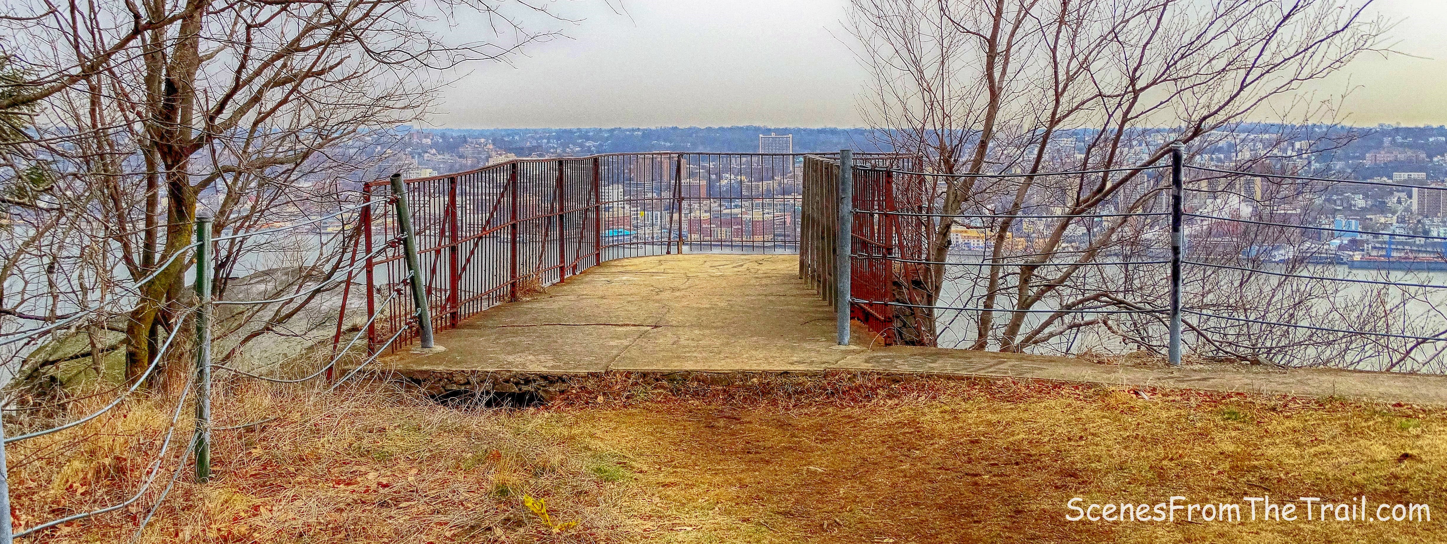
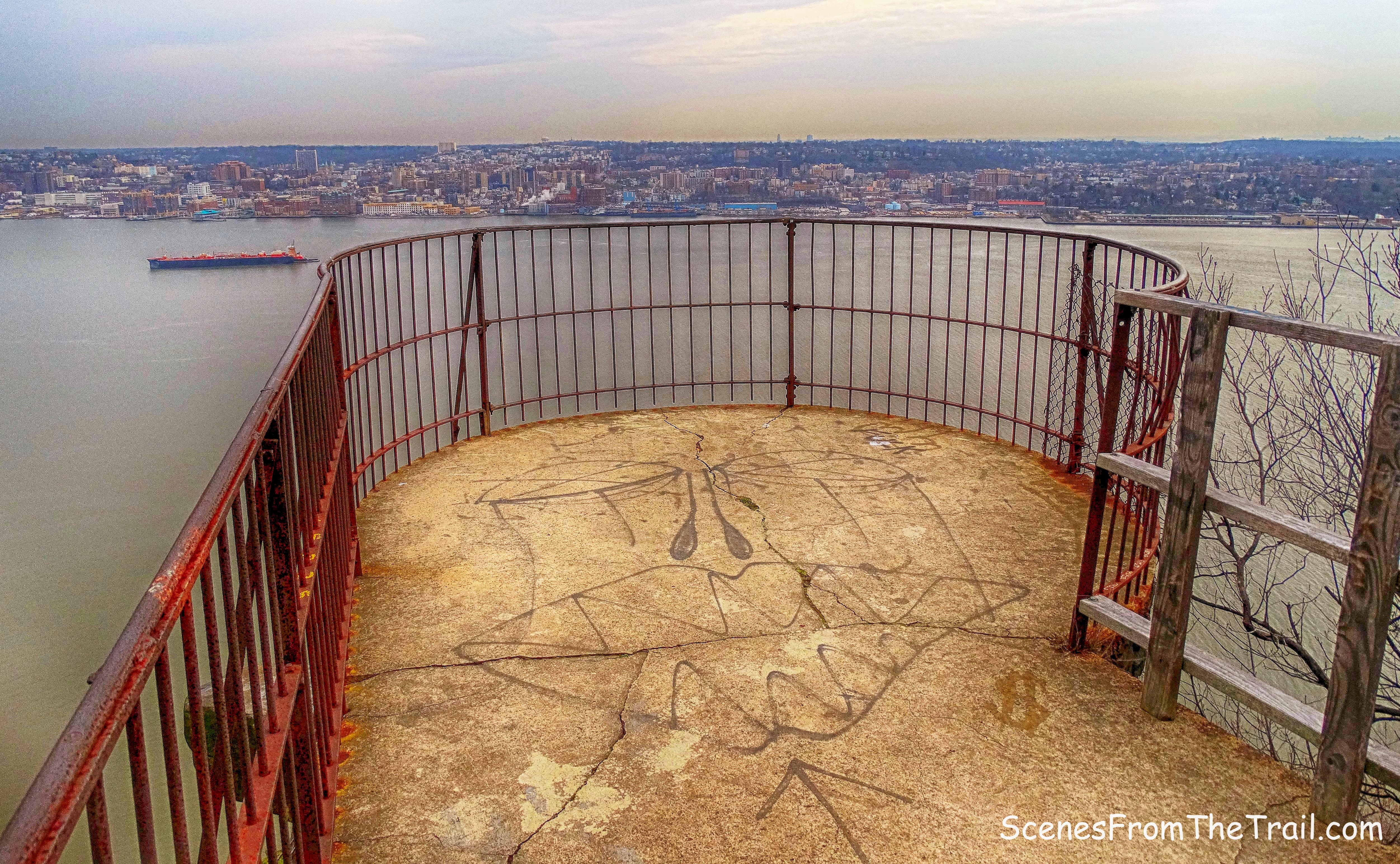
There are numerous spur trails that lead to the edge of the cliffs from the Long Path and we ventured down most of them. At times we also just walked along the edge of the cliffs with the Long Path to our right. A little further down the trail, we saw a stone lookout that was built on the edge of the cliff.

stone lookout
stone lookout
Right nearby there are some foundation ruins of what used to be a pretty big house. This was “Millionaire’s Row” and I am quite sure that the estates that rested on these cliffs were impressive. It’s a shame that they were all torn down for the construction of the Palisades Interstate Parkway.
ruins
We continued walking off trail along the edge of the cliff and came to the terraced gardens of Cliff Dale. We had now traveled about a mile from the start of the hike.
terraced gardens
terraced gardens
Through the trees the numerous levels of Mr. Zabriskie’s garden are visible.
terraced gardens
A walkway right alongside the Long Path leads down to the garden.
walkway
As you travel down the walkway these stairs lead further down to the different terraces.
stairs
A little further south, there are concrete columns laying on the ground.
concrete columns
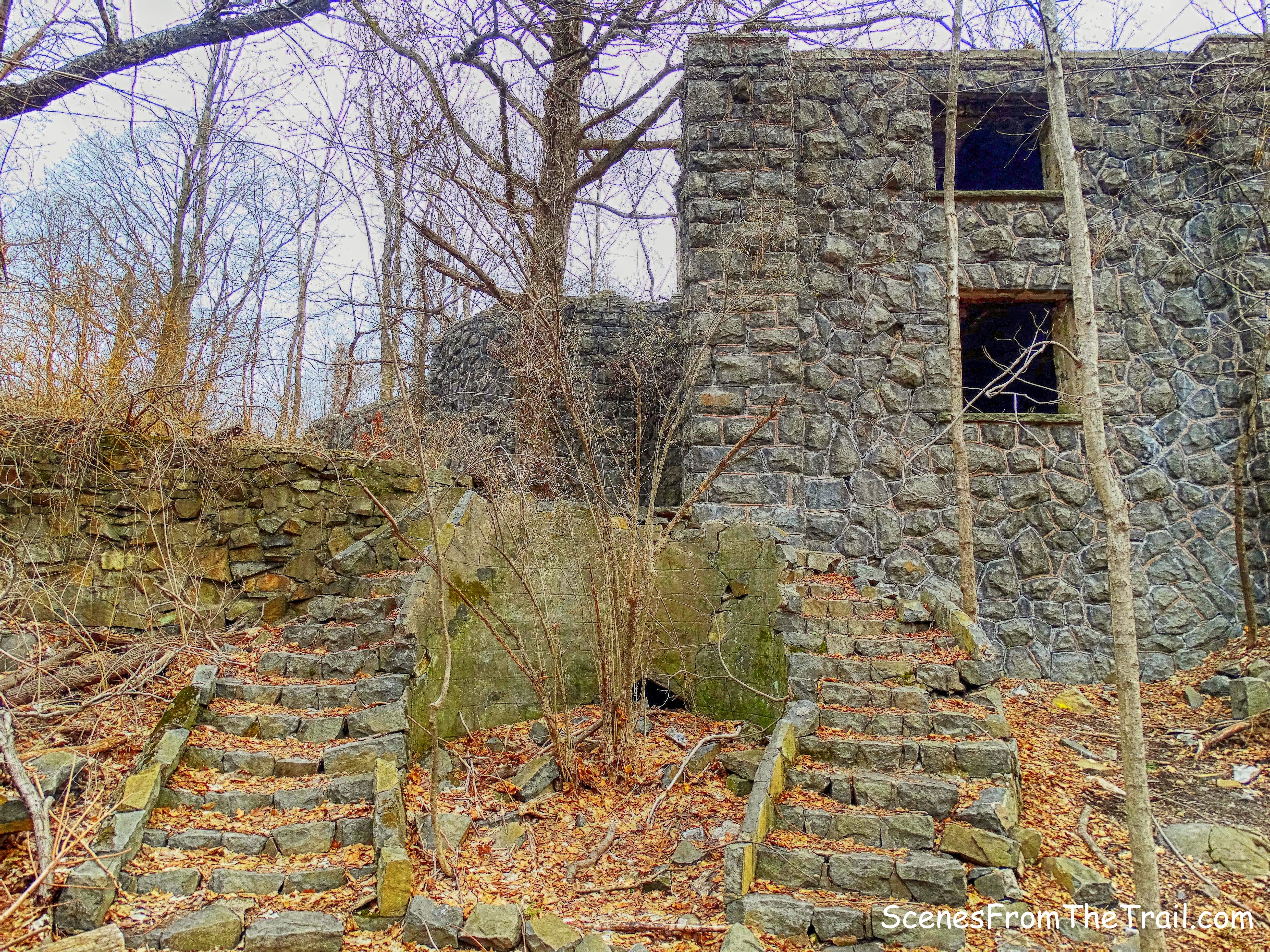
Just past the columns, we came to what is left of the house. We walked along the eastern side of the house and I saw what used to be a window and a doorway that was sealed up.
window and an doorway
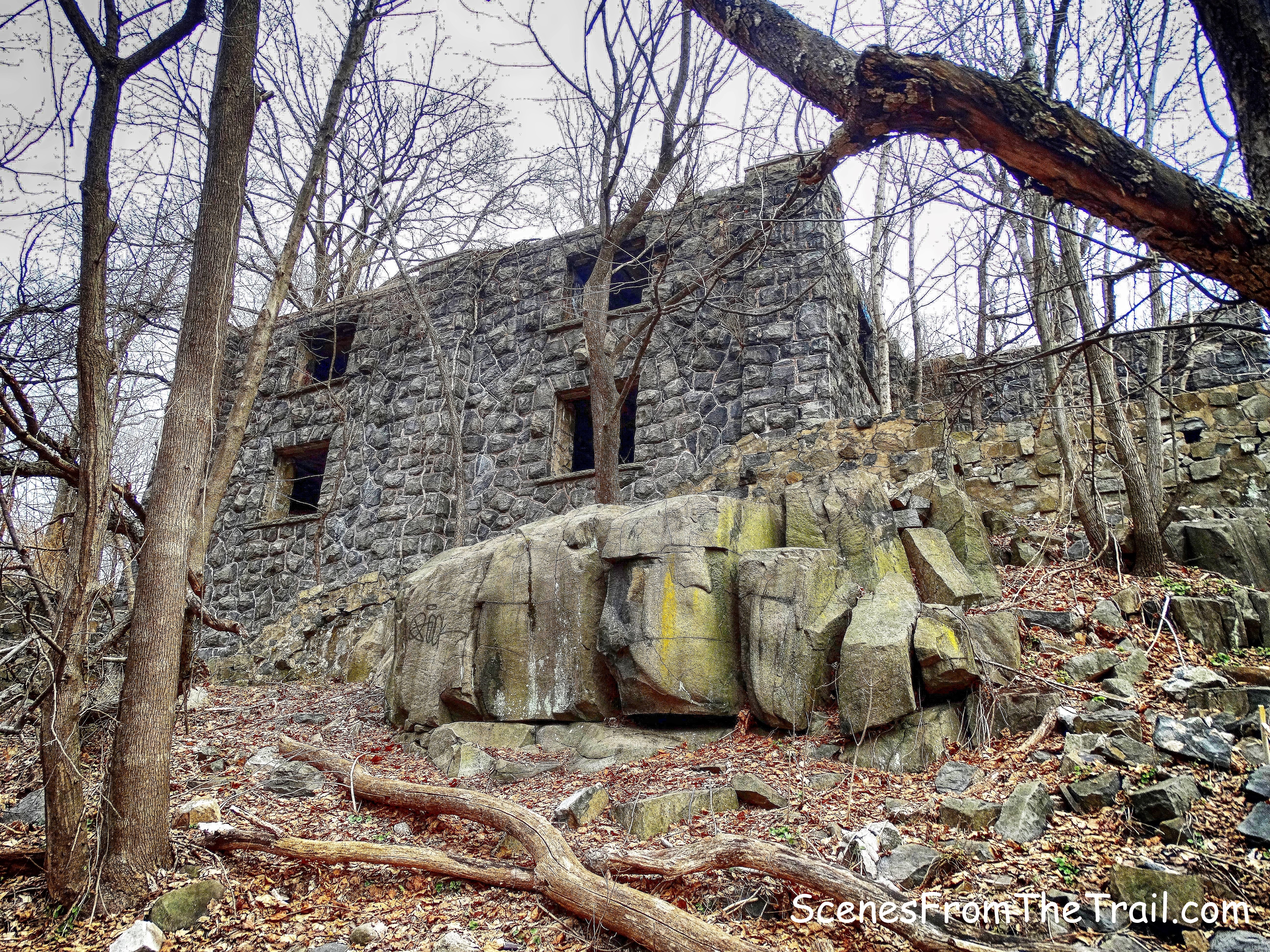
This was, I believe, the garage and also the foundation of the house. Just above the garage is where the patio once was.
Zabriskie Ruins
A look inside the garage.
garage
According to the Palisades Interstate Park website, the property was purchased by John D. Rockefeller Jr. in 1930, along with much of the surrounding area, in an attempt to halt over-development of the cliffs spurred by the newly built George Washington Bridge.
stairs leading to the Long Path
The room above the garage.
room above the garage
On the side of the house, the year of construction is clearly visible.
1911
The top of the garage, where the patio was located. Note the tiles mostly still intact. The hole on the patio is from where a column once stood.
patio
An old photograph shows the patio and the columns that once supported the pergola.
Courtesy of the Palisades Interstate Park Commission
The curved double staircase was a nice touch.
curved double staircase
The two images below were captured from similar angles and provide a glimpse of what it looked like then and the reality of now.
then – courtesy of the Palisades Interstate Park Commission
now
As we walked further down the embankment and got closer to the cliff, we came to what once was a pool or pond. Below is an image of the pond in its former splendor.
pond – courtesy of the Palisades Interstate Park Commission
Doesn’t quite look the same today.
pond
Standing in what used to be the pond are some of the small columns that were part of the railing that bordered the pond. Scroll up to the top of the page and use the first image of Cliff Dale as a reference.
pond
When we were done exploring, we sat near the edge of the cliff and relaxed a bit. Imagining how it must have been to live up here in such wonderful surroundings. Once we were done daydreaming, we headed back to the Long Path and continued heading south.
the Long Path
About a 1/2 mile from Cliff Dale, we arrived at the Alpine Lookout. It is a pull-off overlook in Alpine, about 3 miles north of Parkway Exit 1, opposite Yonkers and accessible from the northbound Parkway only. The Long Path follows a paved walkway along an iron railing on the edge of the cliff.
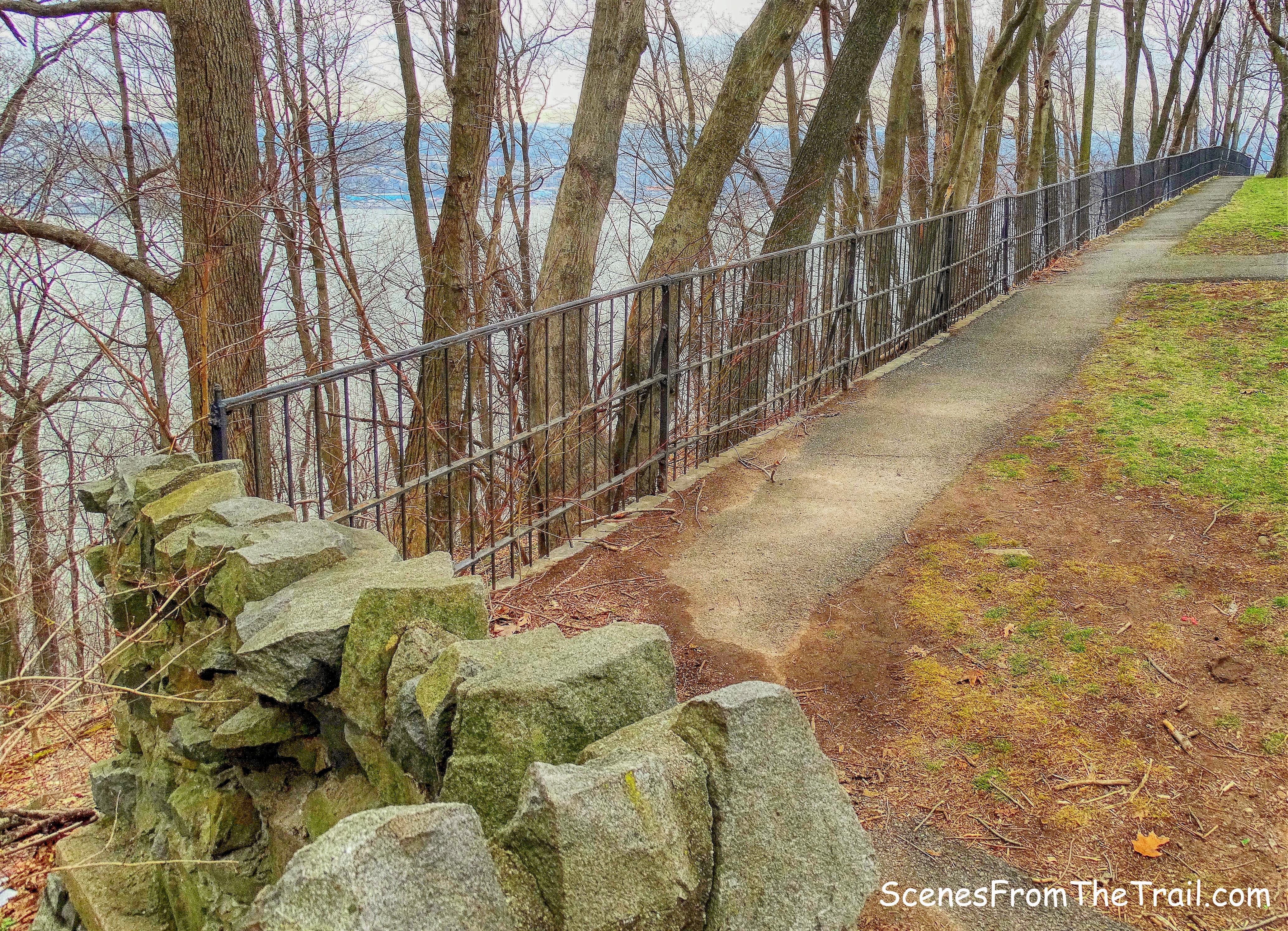
Alpine Lookout
Manuel Rionda a Sugar Baron who owned sugarcane plantations in Cuba, built the sprawling “Rio Vista,” the largest of the Palisades estates. The manor house was where Alpine Lookout is today.
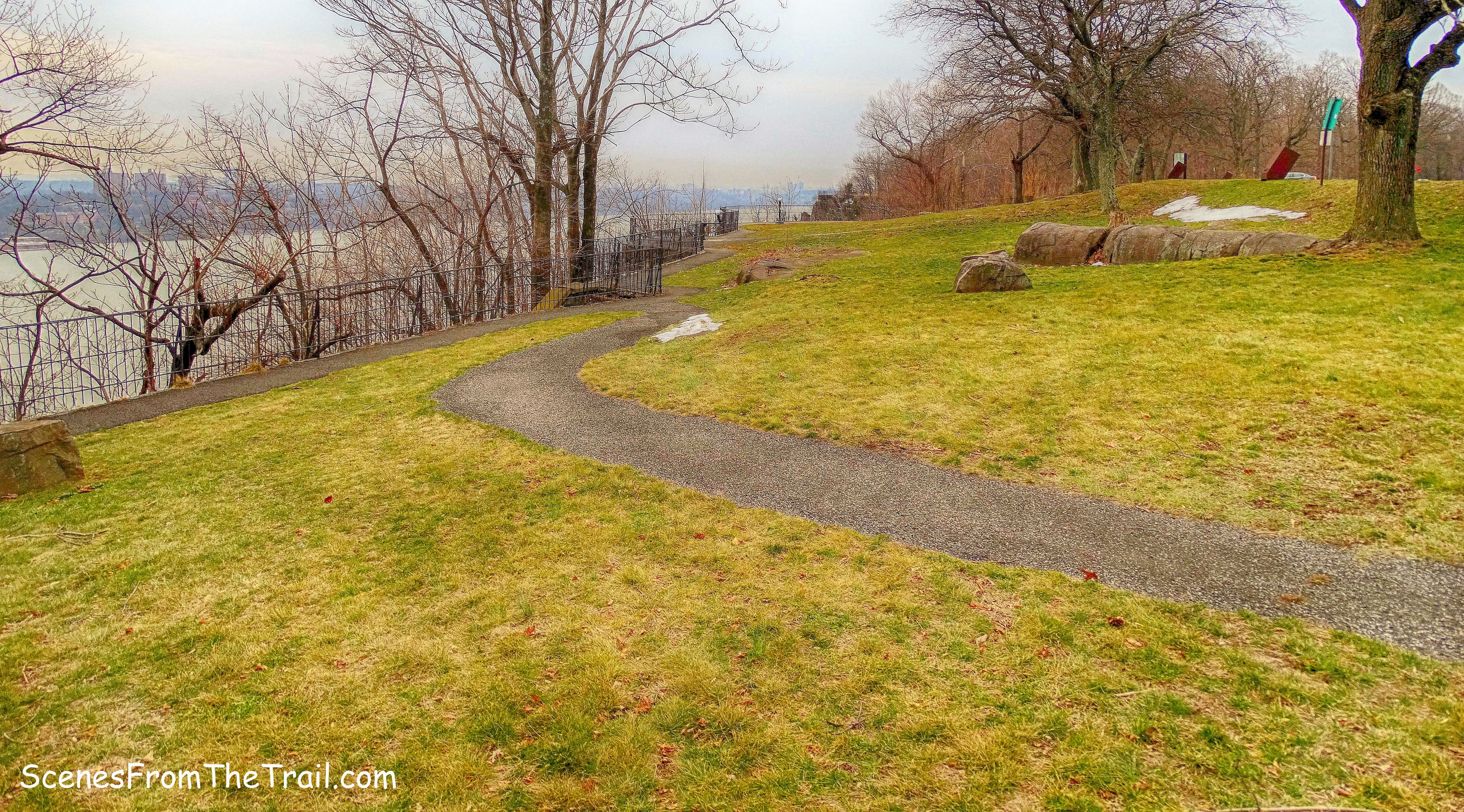
Alpine Lookout
The wrought iron fencing still along the cliff edge is from Rio Vista.
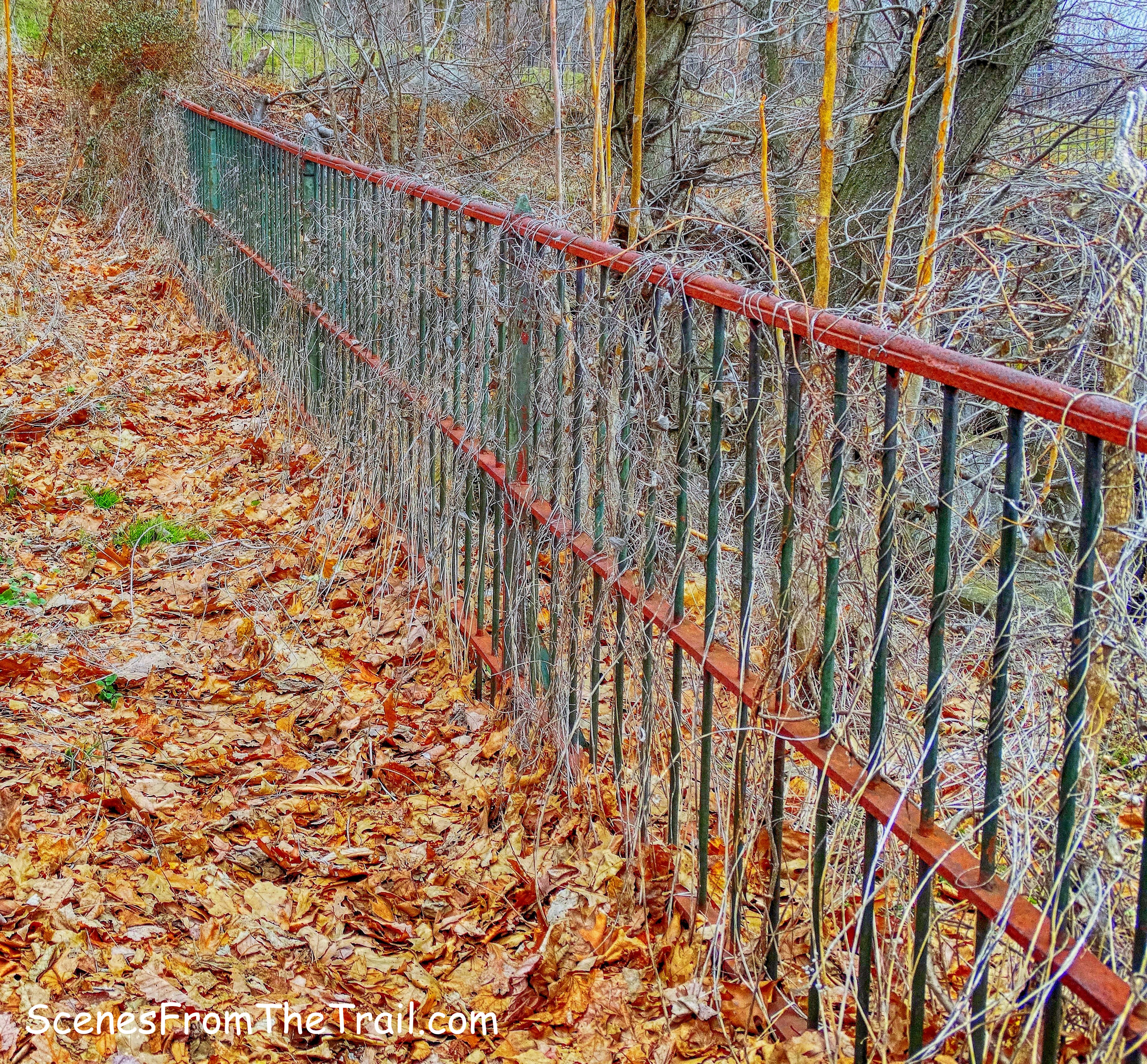
wrought iron fencing
A view of a barge parked in the middle of the Hudson River with Yonkers in the background.
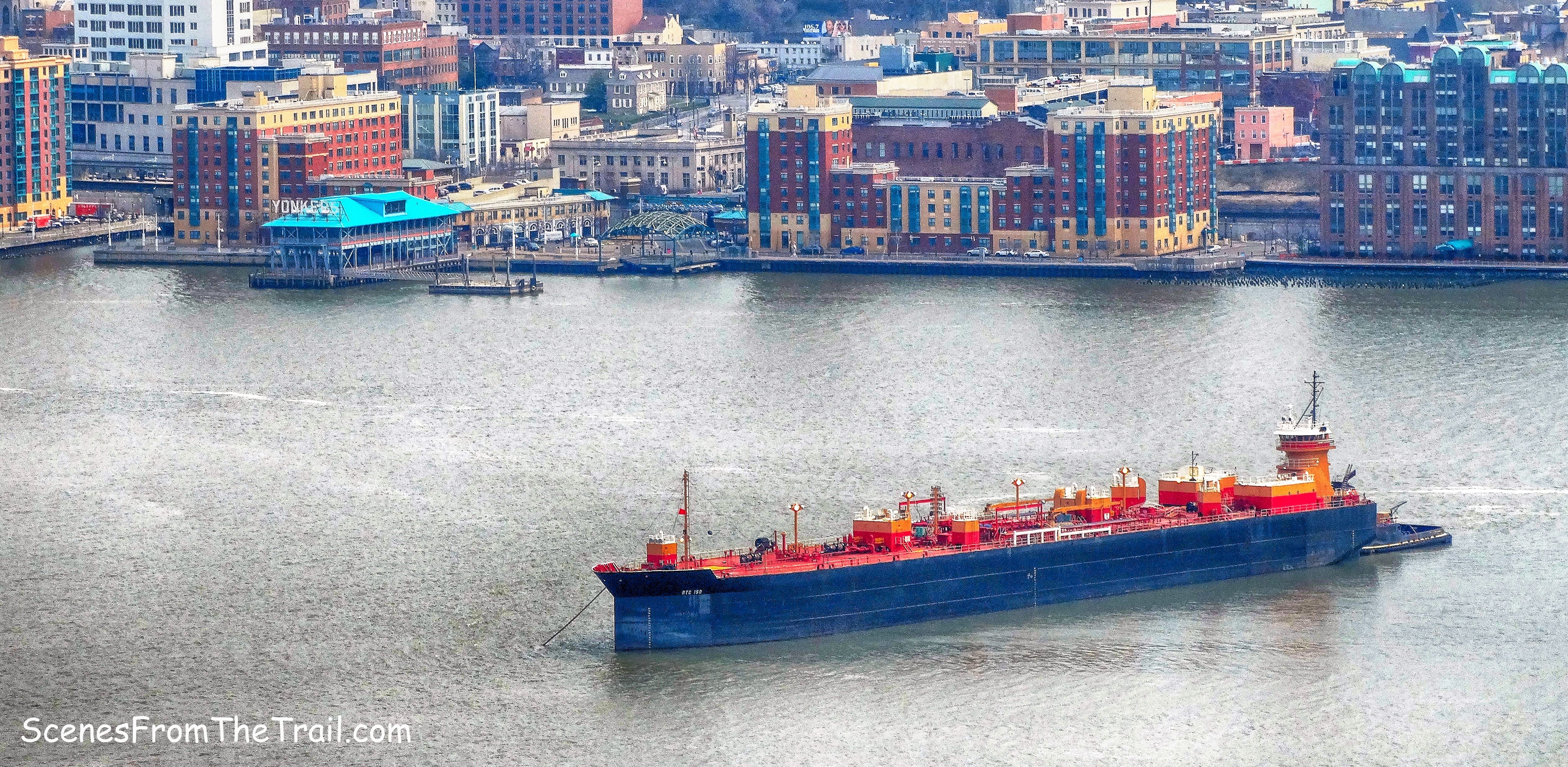
view of Yonkers from Alpine Lookout
We walked along the railing and back into the woods where the Long Path reaches a parapet that juts out over the cliff, with views up and down the Hudson River.
parapet
I wouldn’t trust the railings as they felt a little shaky.
parapet
Looking north up the Hudson River from the parapet.
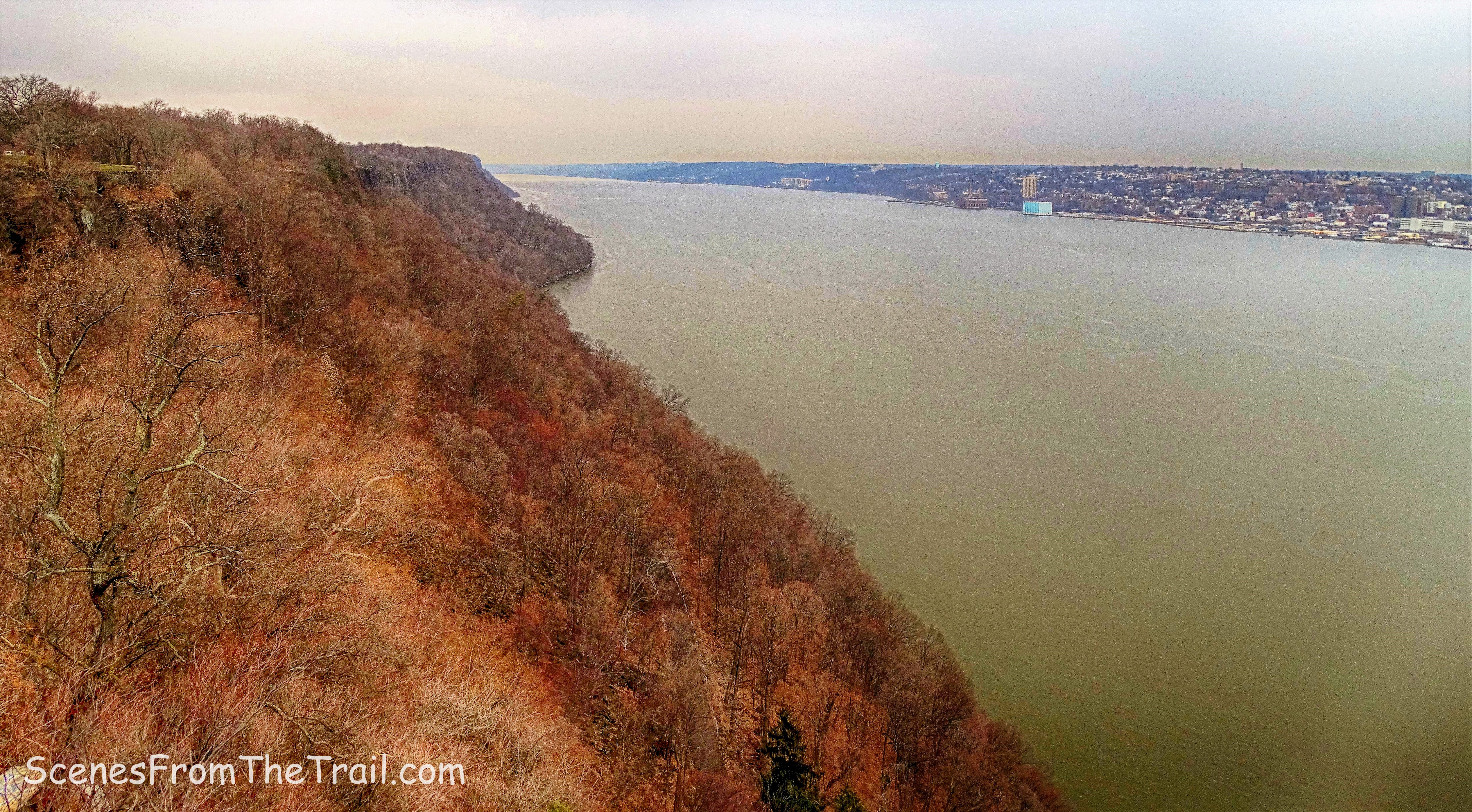
view north from the parapet
Still following the Aqua-blazed Long Path, we walked by another foundation. This one was a little different due to the coloring of the stones.
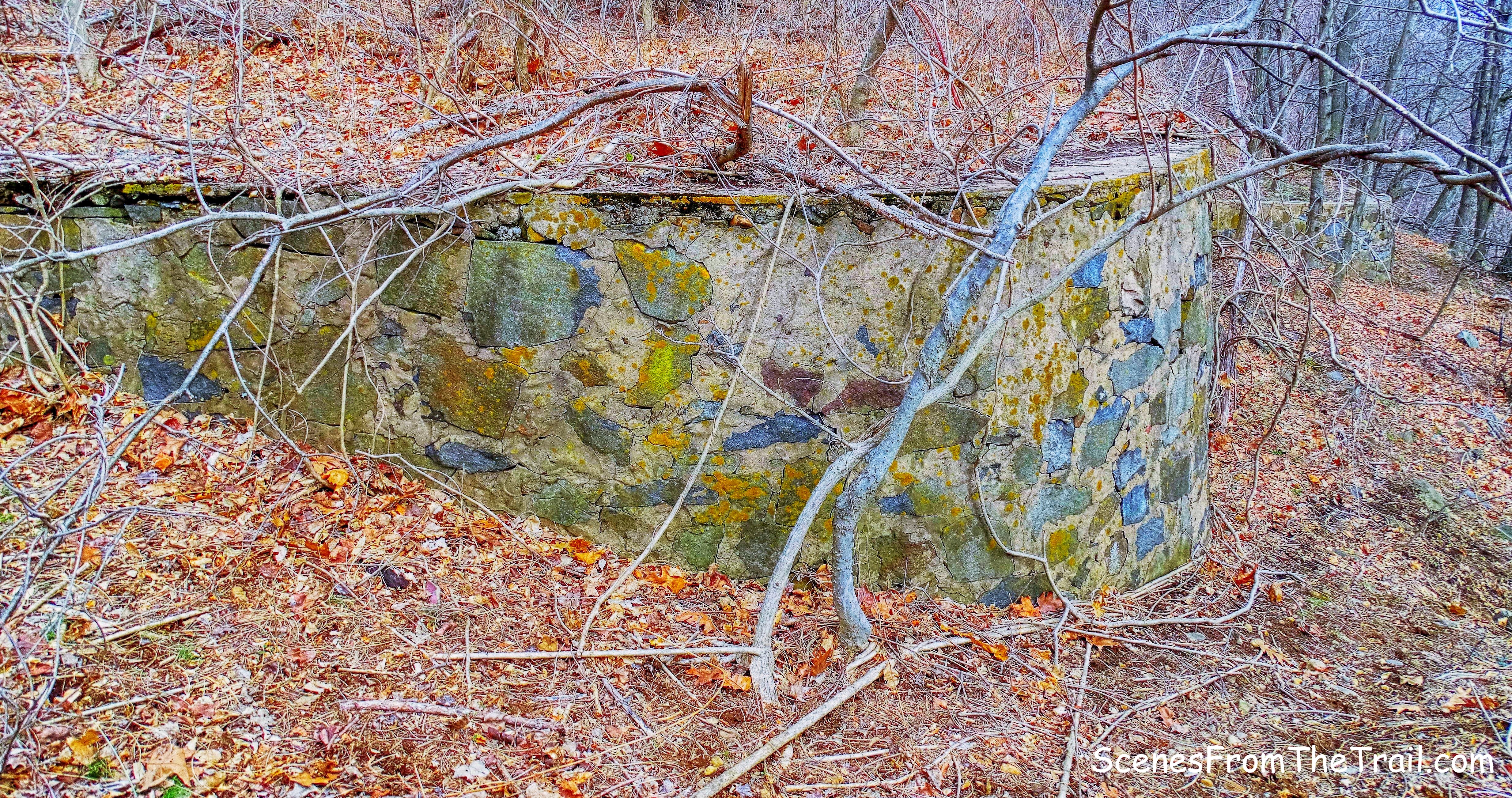
foundation
As the trail began to run closer to the Palisades Interstate Parkway, we came to a junction with the Red-blazed Huyler’s Landing Trail. We turned left and began to descend towards the river. At this point we had now traveled a little over 2 miles.
Huyler’s Landing Trail
Of the five trails that run from the cliffs to the river, the easiest is the red-blazed Huyler’s Landing Trail, an old wagon route that gradually descends 400 feet from the Long Path to the Shore Trail.
Huyler’s Landing Trail
When the trail emerges on Henry Hudson Drive, we turned left and walked on the paved road about 300 feet. We then turned right at a chain and continued our descent towards the river.
Huyler’s Landing Trail
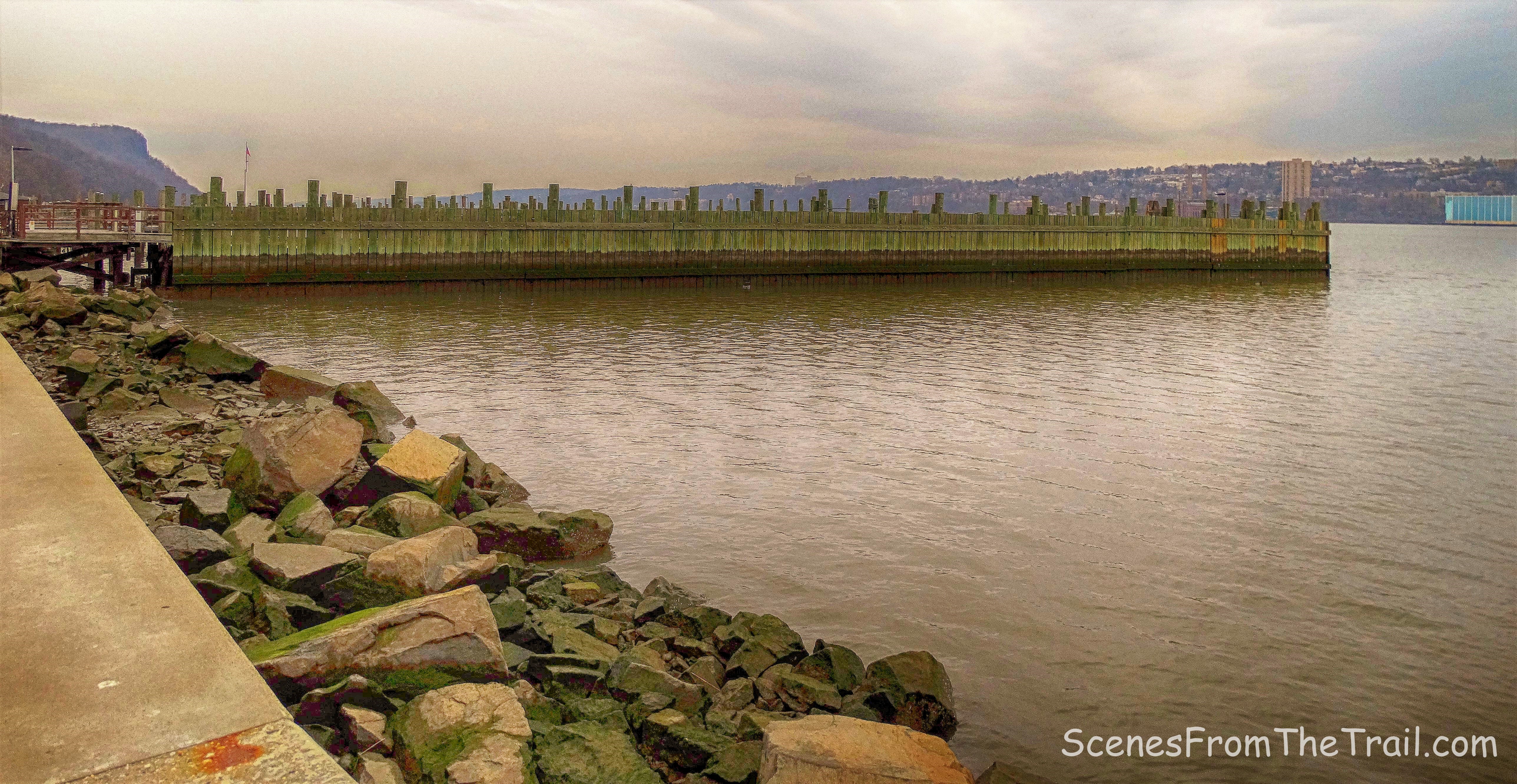
Upon reaching the river, we arrived at Huyler’s Landing. In November of 1776, British and Hessian troops led by General Cornwallis crossed the Hudson River from New York City, causing the American troops to abandon their encampment at Fort Lee and begin a retreat across New Jersey. It is believed that they disembarked here at Huyler’s Landing, which was then called “Lower Closter Landing” or “the New Dock.”
Huyler’s Landing
We sat on a log here and took a short rest as we enjoyed a hydration break along with the view.
view north from Huyler’s Landing
We then proceeded to head north along the Shore Trail with the river to our right as it hugs the shoreline.
Shore Trail
In about a 1/2 mile, the Shore Trail ascends and begins to veer away from the river.
Shore Trail
The trail then led us back near the water and we decided to stop. I had read that a squadron of French fighter jets were supposed to fly from Stewart Airport in New Windsor, down the Hudson River, just south of the Statue of Liberty and then back up the Hudson River. I had read that it would happen at noon which was ten minutes away. This was a good vantage point to watch and/or capture some images as they flew by, otherwise, we would be blocked by tree cover along the trail. It didn’t take long because after a few minutes we heard the roar of the engines as they came into view.
French Alpha Jets
The Glenwood Power Plant is also visible just across the river in Yonkers.
Glenwood Power Plant
We then resumed our hike, still following the White blazes of the Shore Trail. A few minutes later, the jets came roaring back up the river. That was pretty cool, I had no idea that the jets would be doing a flyover until after I had planned the hike. I am glad I got to see them. Further along the trail there is a plaque attached to a boulder in memory of John Jordan, the first Superintendent of the Park, who died here in 1915.
in memory of John Jordan
We then arrived at the Alpine Picnic Area & Boat Basin. In the early part of the twentieth century, the Palisades Interstate Park Commission operated a bathing beach here, and the stone picnic pavilion, built in 1934 by the Civil Works Administration, used to have lockers on the lower floor. Most bathers came on the Yonkers Ferry, which landed at the south end of Alpine Boat Basin. The ferry service was discontinued in 1957, after the completion of the Tappan Zee Bridge. There were many interesting sights in this area, including a stone tunnel that runs under Henry Hudson Drive which has been sealed up on the other side.
stone tunnel
A stone water fountain in the foreground with the booth where the entrance fee is collected, behind it.
stone water fountain
The boat basin.
Alpine Boat Basin
A row of dilapidated garages sits on the left at the base of the cliffs.
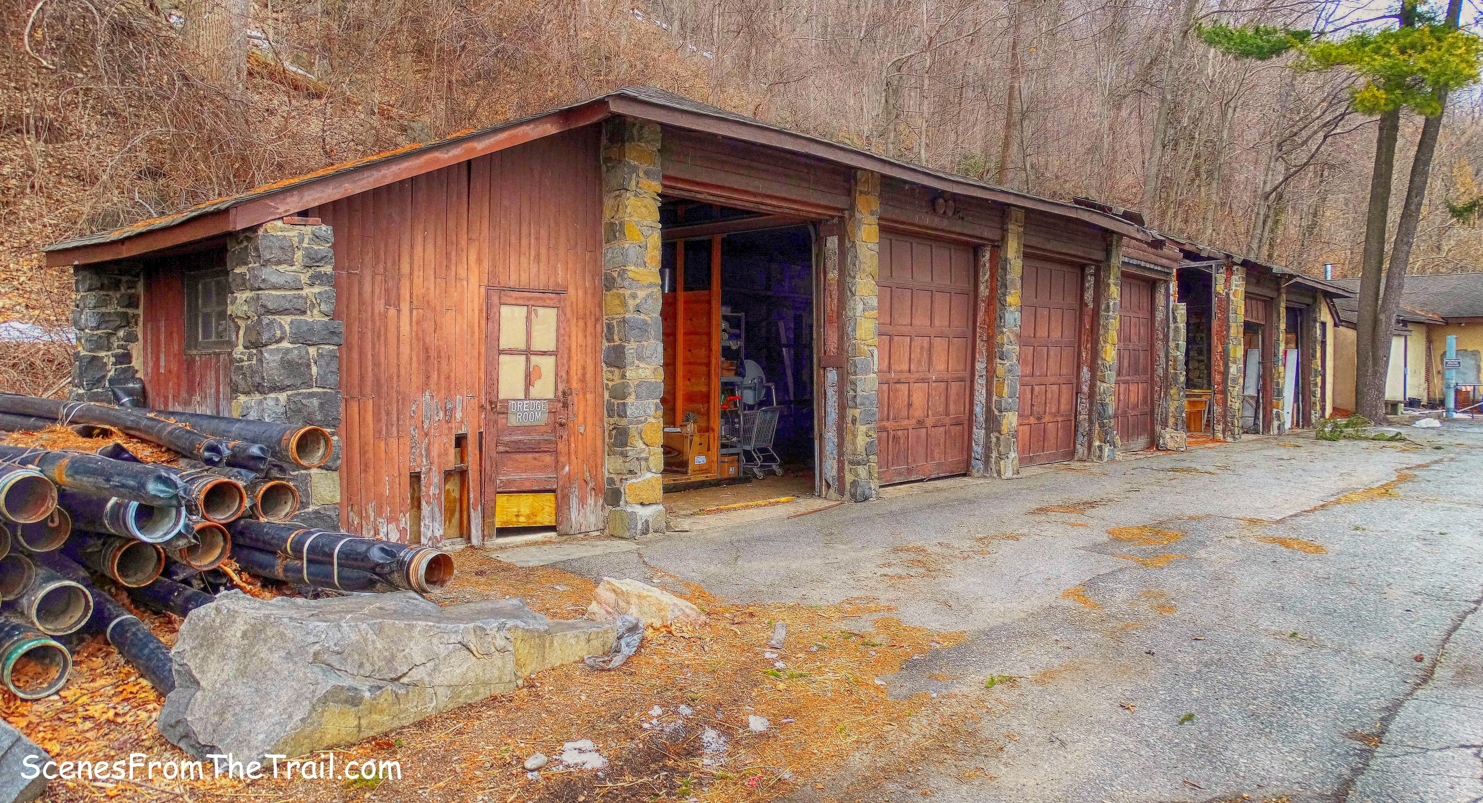
dilapidated garages
Kearney House is a 19th-century tavern and homestead that serves as a history museum. Of the dozen or more houses that once stood at the Landing, only the Kearney House remains.
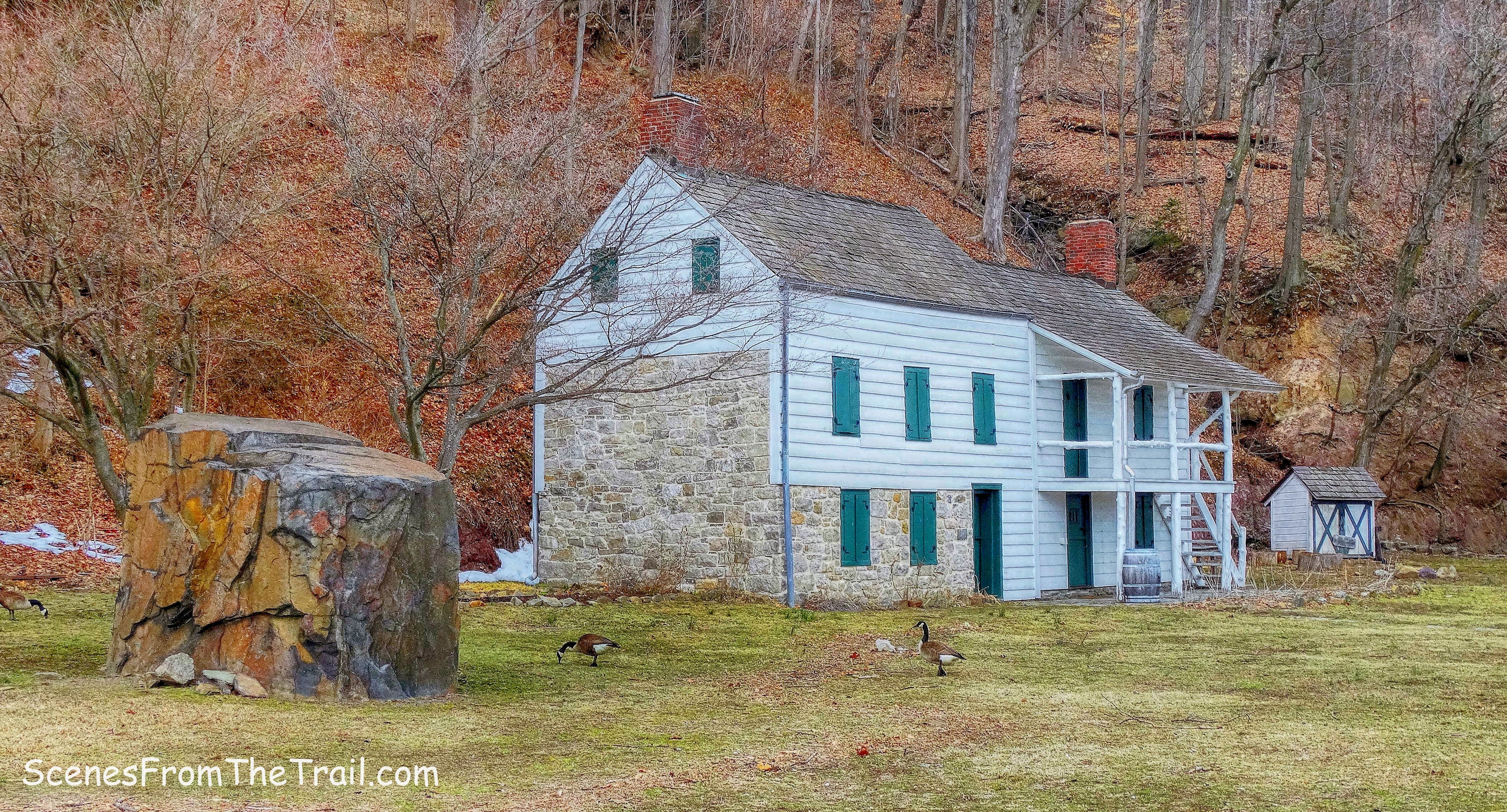
Kearney House
The concession stand.
concession stand
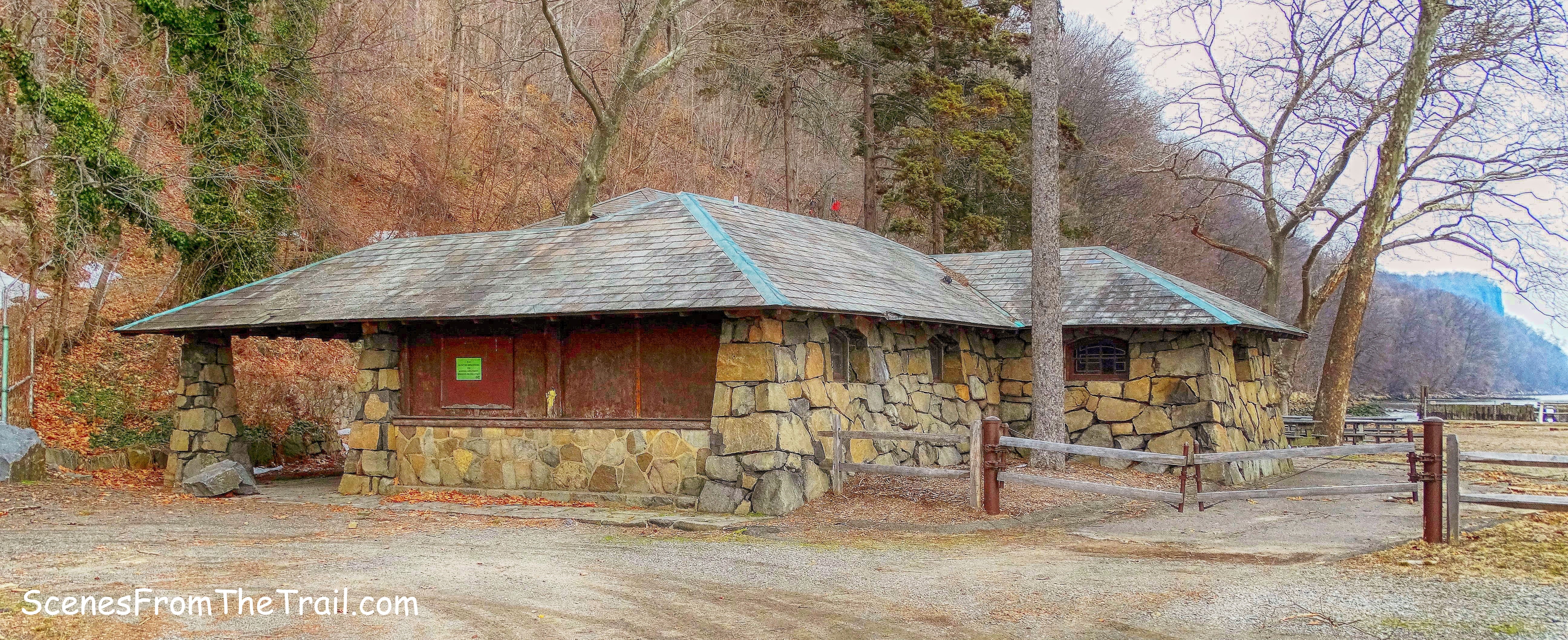
The Alpine bathhouse, now called Alpine Pavilion, “rustic in design and veneered with great boulders” — with “architectural features of unusual beauty and utility” — still stands, even if the beach it was built to service is closed. On most weekends in the warm weather it is the site of parties and picnics, family get-togethers, barn dances, even the occasional wedding. It is also a monument of sorts — to the men who wrested it from the hard winter. We rested here for a few minutes before we made our way back up the mountain.
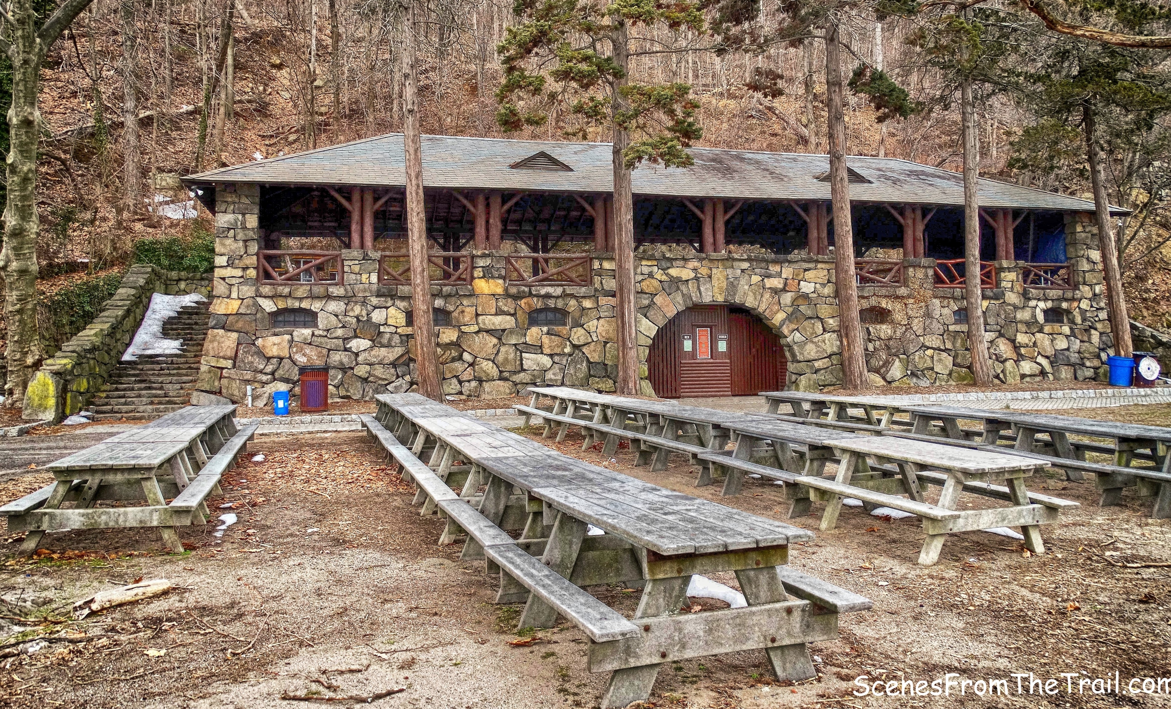
Alpine Pavilion
The plaque which is entitled “Old Alpine Trail,” states that the trail you are about to use to climb the Palisades was used by British troops in 1776 during the American Revolution. The information on this plaque from 1928 is no longer considered to be historically accurate.
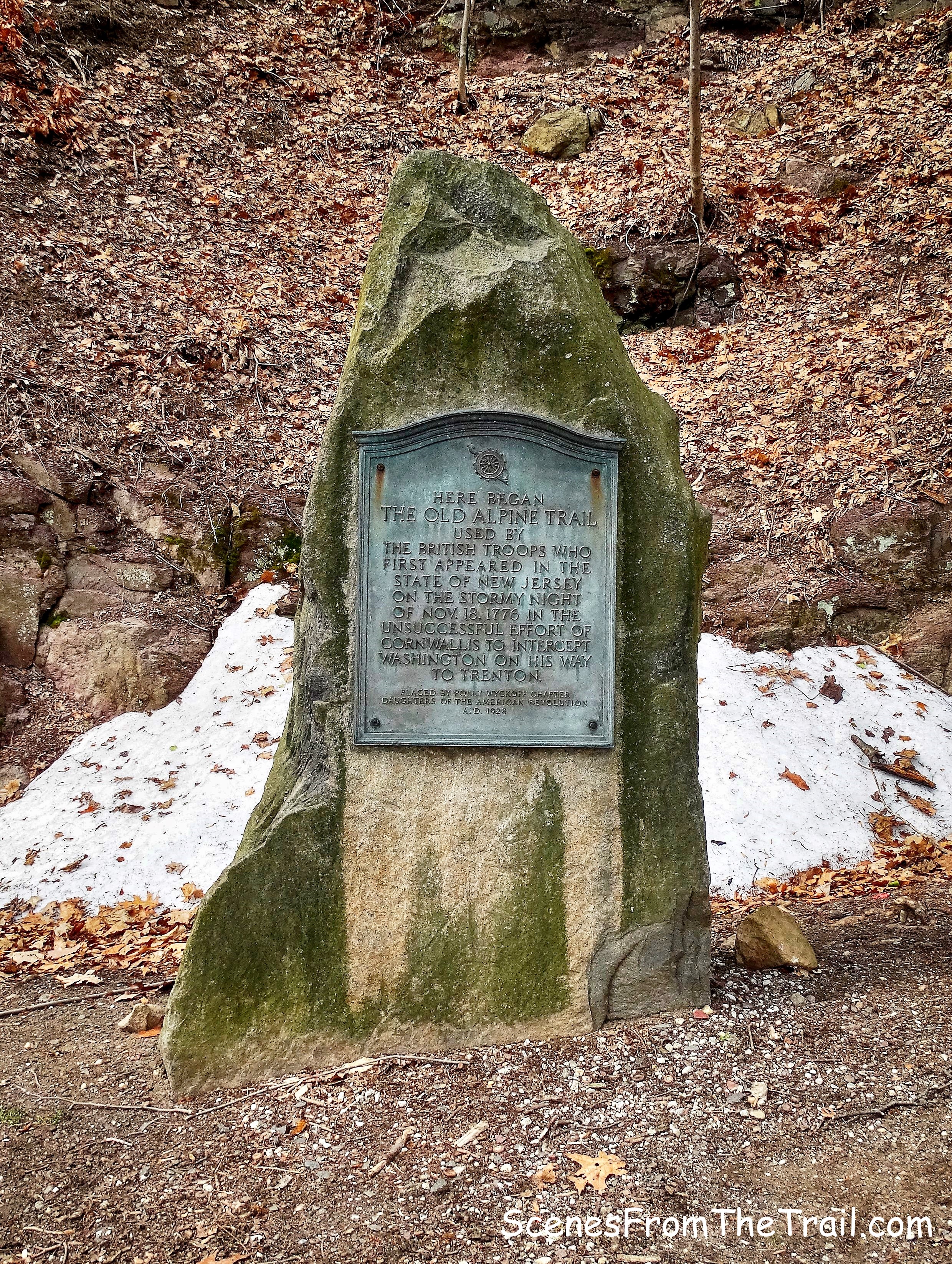
Old Alpine Trail plaque
This informational sign which sits a few feet away, corrects the information on the plaque.
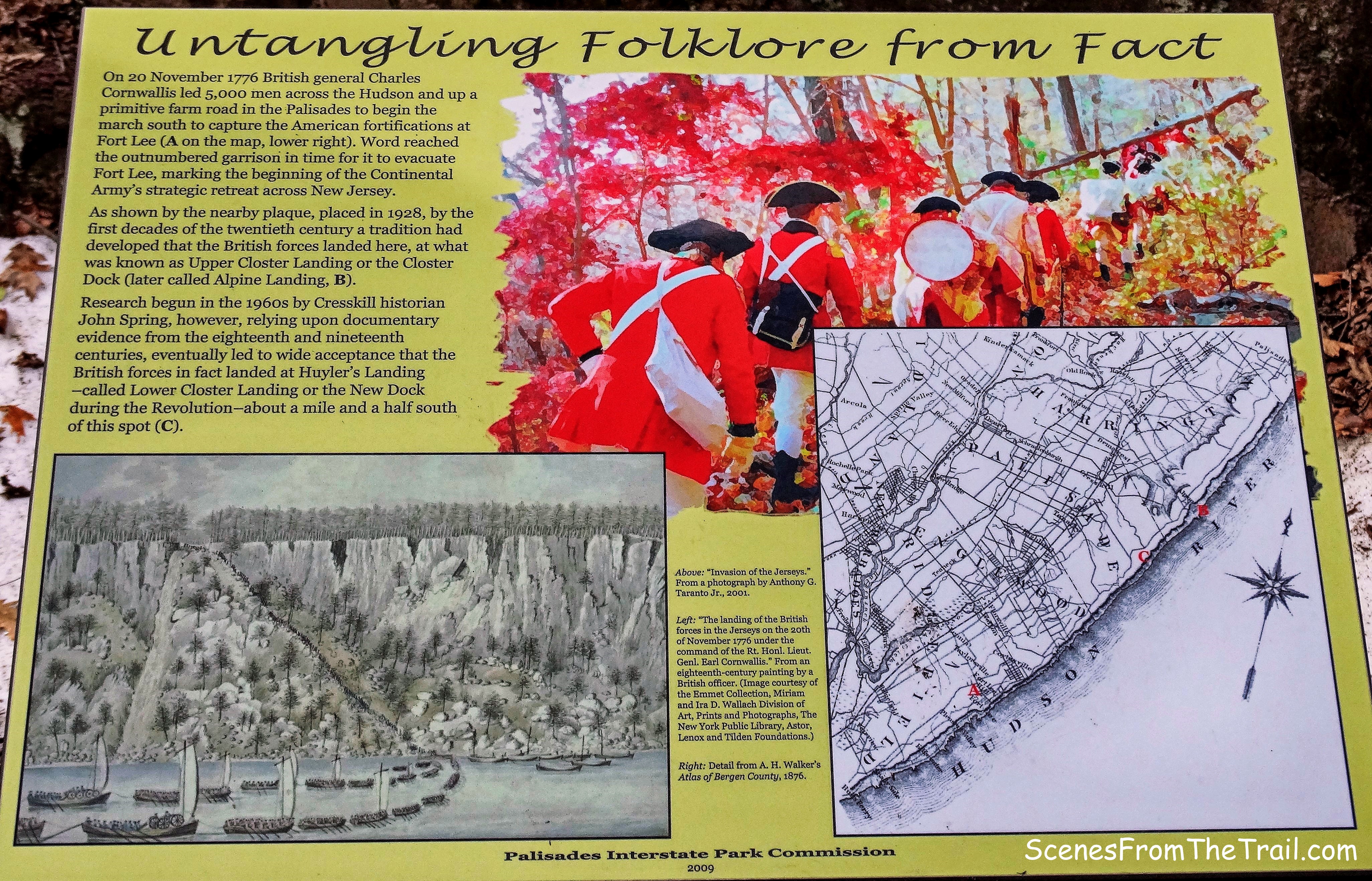
informational sign
We then continued on the Shore Trail which led us up the hill on a stone-paved road.
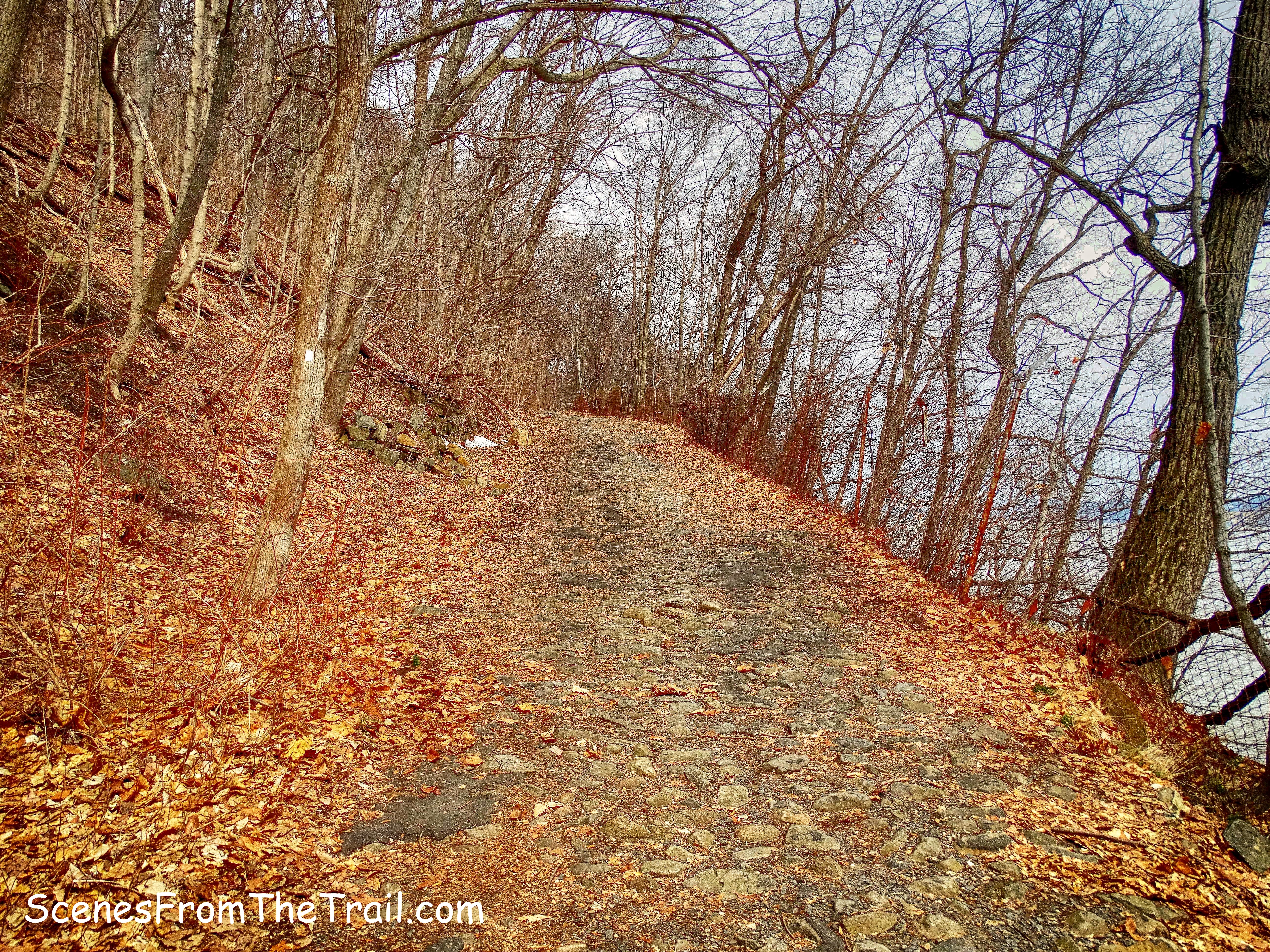
Shore Trail
We then arrived at a junction with the Closter Dock Trail where we turned left and began a 460 feet ascent to the top of the cliffs. The orange-blazed Closter Dock Trail is an old wagon route, though a bit steep.
Closter Dock Trail
It was steep, although it was a wide mostly smooth road which was easier to navigate than some of the other trails that lead up to the top of the cliffs.
Closter Dock Trail
As we were huffing and puffing up the hill, I noticed a stone structure just off the trail. I did not know what it was, but was informed by Eric Nelsen, the Historical Interpreter of the park of its origin after contacting him via email. It was a trash incinerator built by the park in 1934, in operation for about 25 years. Trucks would dump garbage from the picnic area and it would be burned there. The “chute” on the hillside is the chimney.
trash incinerator
There are a nice set of stone steps at the same location as well.
stone steps
I also saw “1840” engraved on a boulder nearby. It looked like it was done with some sort of a punch and hammer.
1840
We then retraced our steps back to the Closter Dock Trail and resumed our climb uphill.
Closter Dock Trail
When the orange-blazed Closter Dock Trail turns left through the stone tunnel, the one we walked through at the beginning of the hike, we continued straight. That led us back to the parking area where we began our hike.
stone tunnel
This hike was packed with history and had plenty to see. When I did this hike previously, I missed some of it due to the amount of vegetation on the ground and not knowing it was there. I am glad that I chose to do it again. One of my favorite hikes thus far. I hope that you enjoyed my interpretation of this hike and please don’t forget to follow my blog. Now get out there and take a hike!
Pros: Clifftop views, river views, historical features, ruins, Hudson River, Long Path, well blazed trails.
Cons: Couldn’t think of any.
Take a hike!

This writeup is fantastic. I had run into some of these ruins before but didn’t find much information in my quick google searching. I went out to the trails again last Saturday, explored some of these ruins again, and then when I googled this morning your post came up… and it’s just so amazing to see photos of what that house looked like before it was demolished! So, built in 1911, purchased in 1930 and presumably demolished soon after. Sort of short lived for such a grand residence. Fascinating to explore.
LikeLiked by 1 person
This is awesome!!!
LikeLike
Great review.
We played throughout the area when we were kids never realizing the history of the area. Often riding the ferry to Yonkers & back for 15 cents as I recall. I also worked for the park collecting money for parking, spending many weekends at the tool booth.
I took a walk through the area last time I was in Alpine & not a lot has changed.
LikeLike
Very impressive: your hike and the information. Thank you very much. I was searching as I knew some information but you added much to what I have read before. It is greatly appreciated. I hope to get to return to the area.
LikeLiked by 1 person