November 12, 2022 – New Windsor, NY
Difficulty: Easy – Moderate
Length: Approximately 2 miles
Max elevation: 705 ft.– total elevation gain approximately 450 ft.
Route type: Lollipop Loop
Free map: Snake Hill Trail Map 2022 – Scenic Hudson
Trailhead parking: San Giacomo Park, 402 Union Ave, New Windsor, NY 12553
Large paved parking lot – Restrooms on site
Park Closes At Dusk
San Giacomo Park and Snake Hill are Carry-in/Carry-out areas
Details on a hike to Snake Hill via a different route:
Overview:
Snake Hill rises 700 feet above the Hudson River and is the highest elevation along Newburgh’s boundary with the Town of New Windsor. Snake Hill is the dominant feature of the landscape surrounding Newburgh and New Windsor.
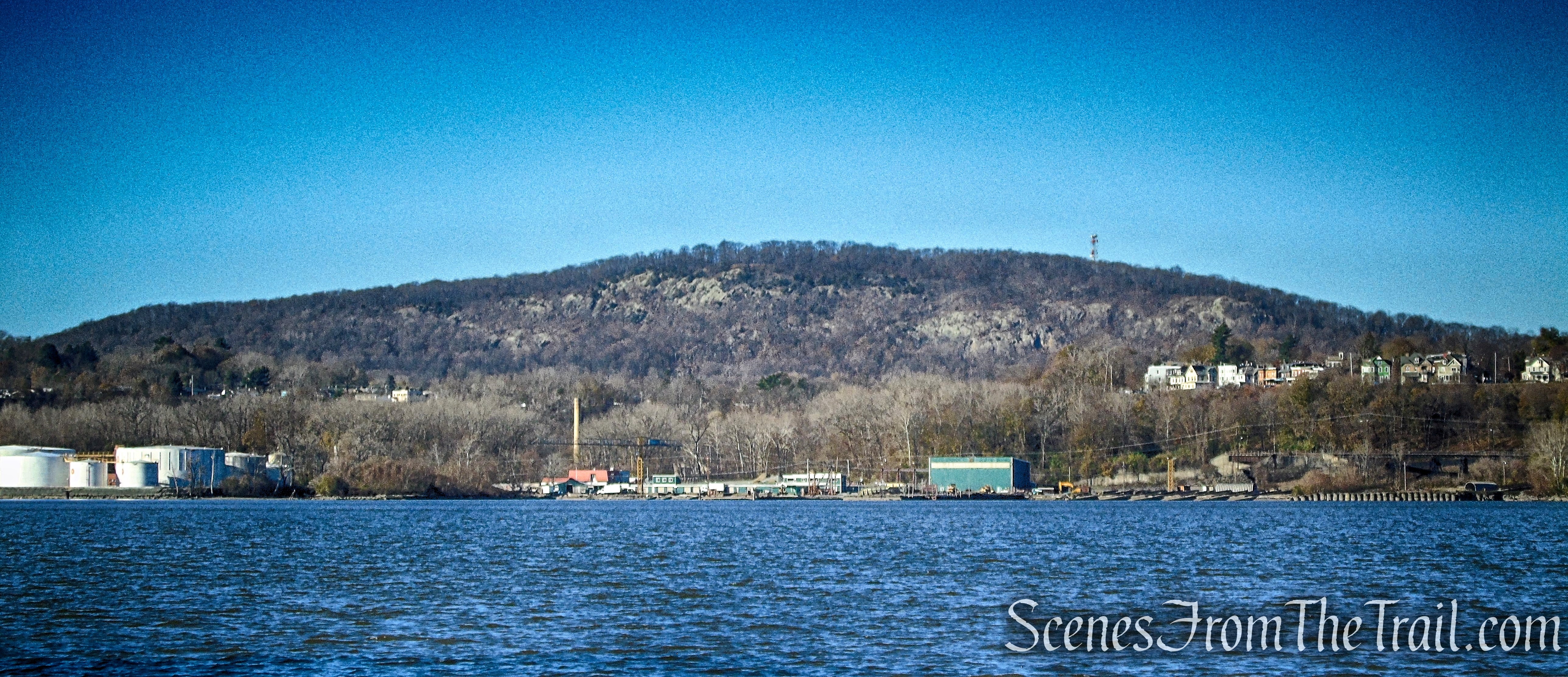
Snake Hill as viewed from Denning’s Point – 2022
Snake Hill as viewed from Mount Beacon – 2016
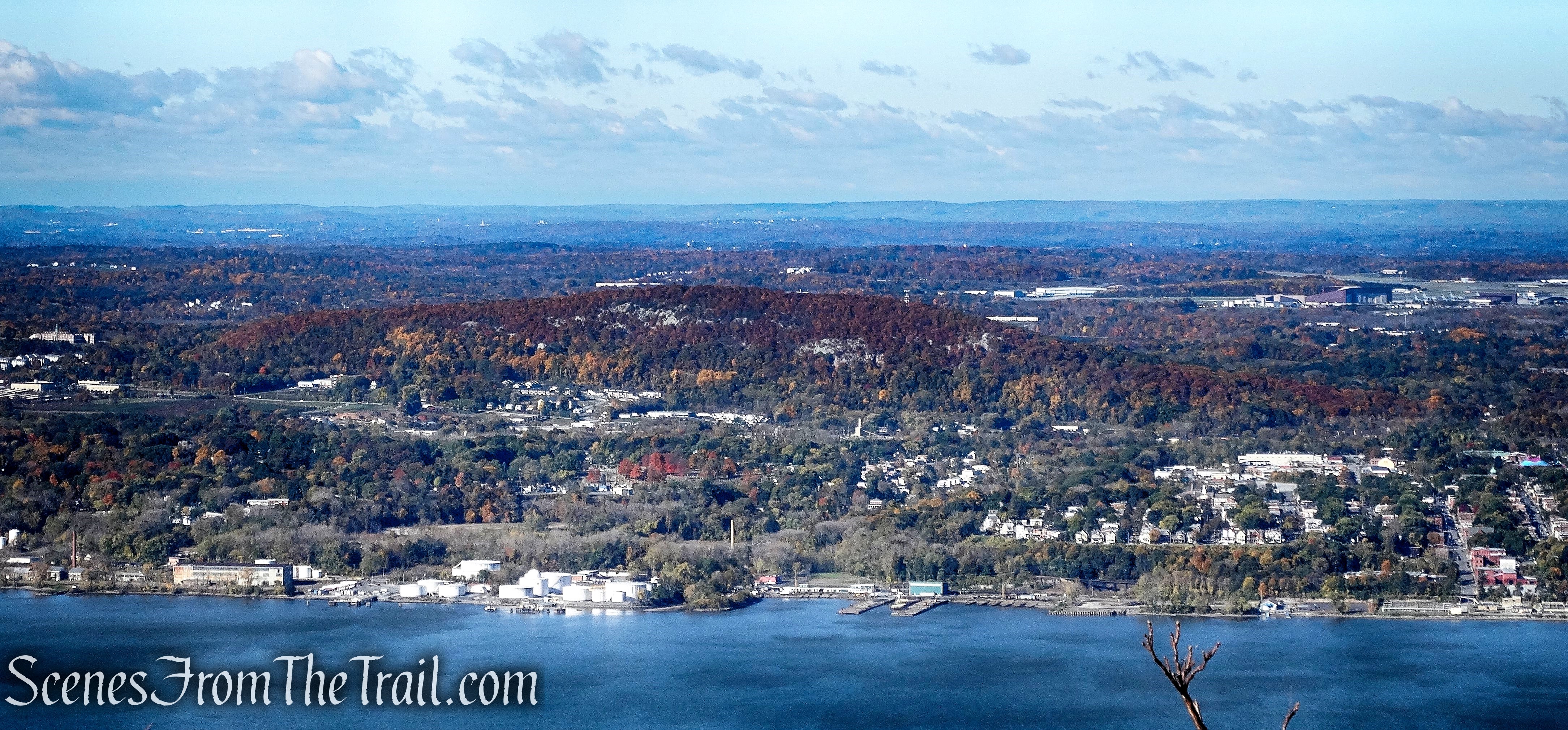
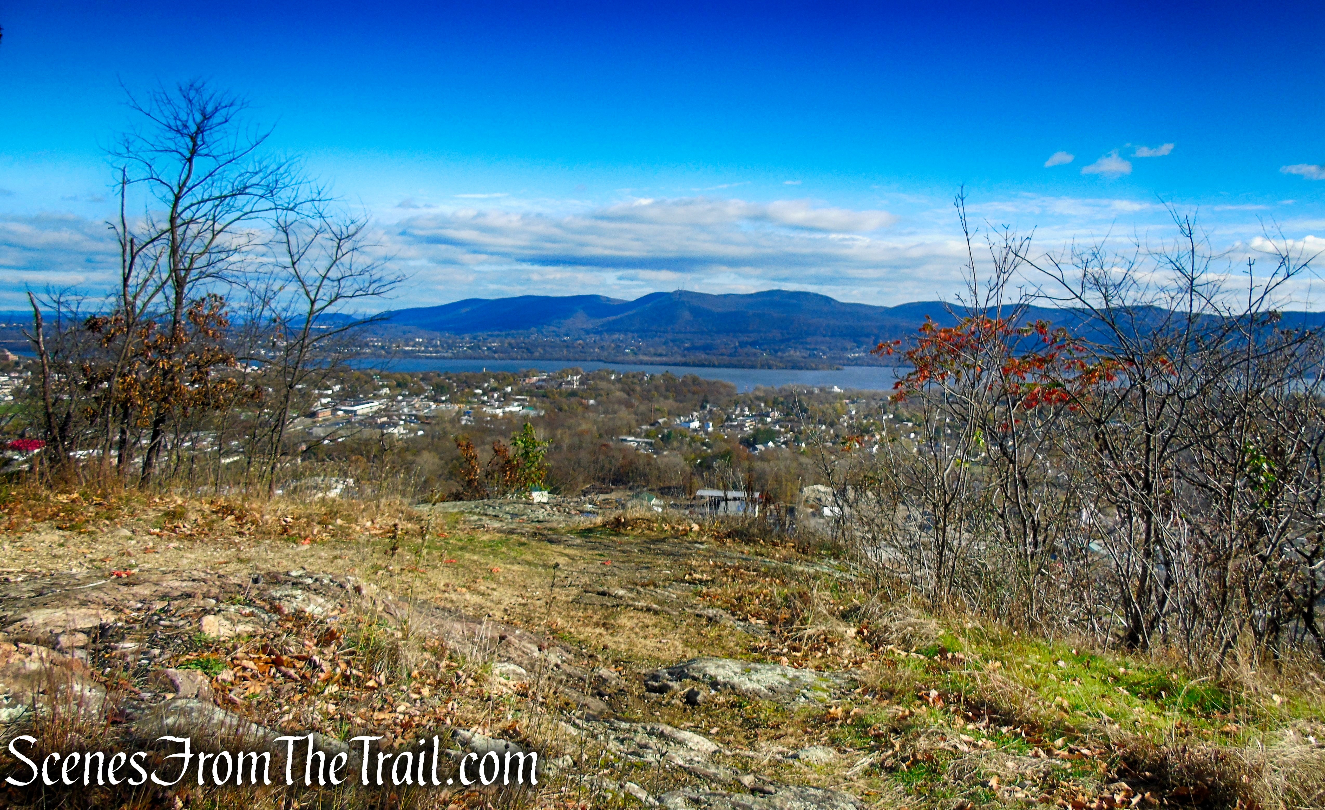
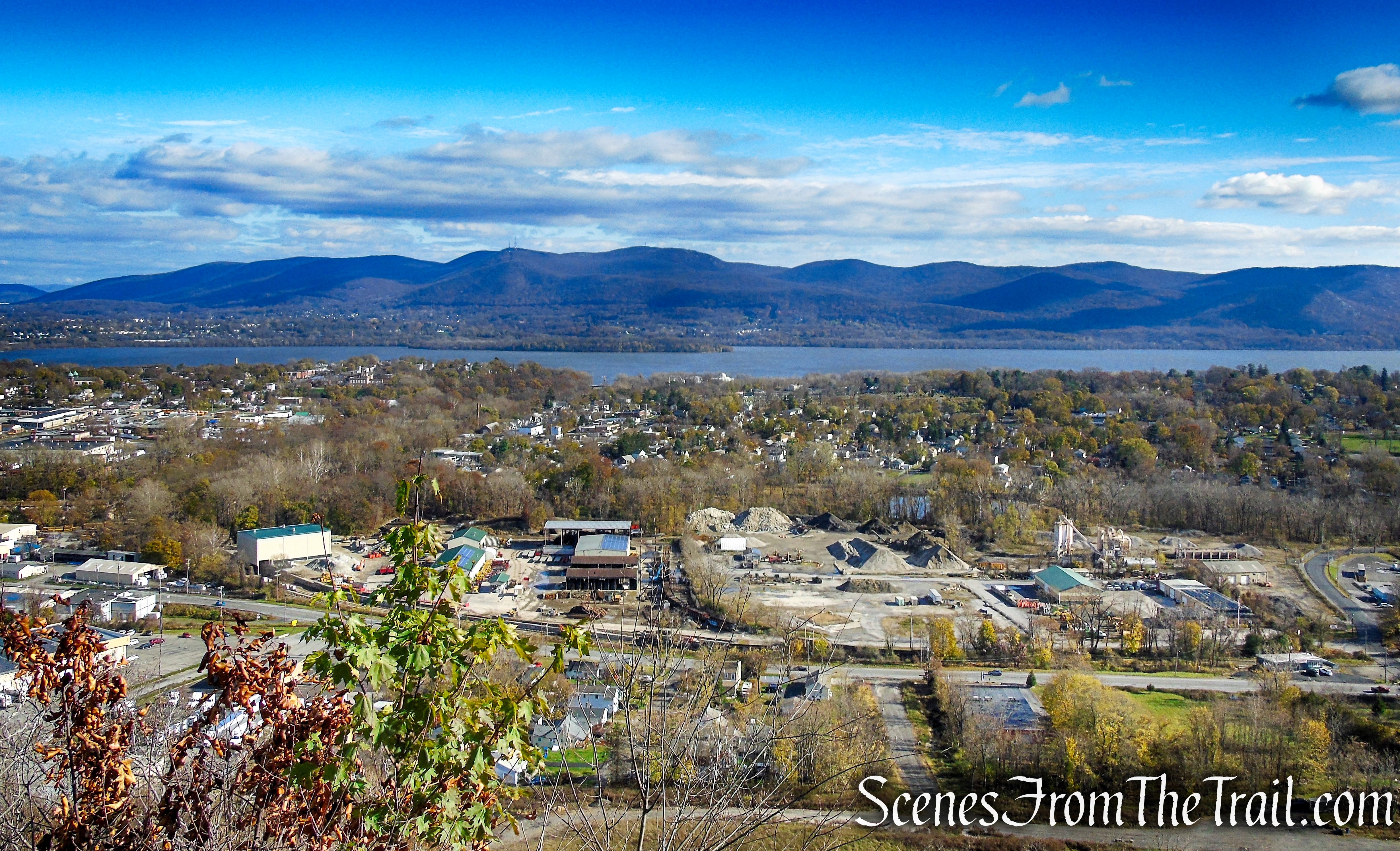
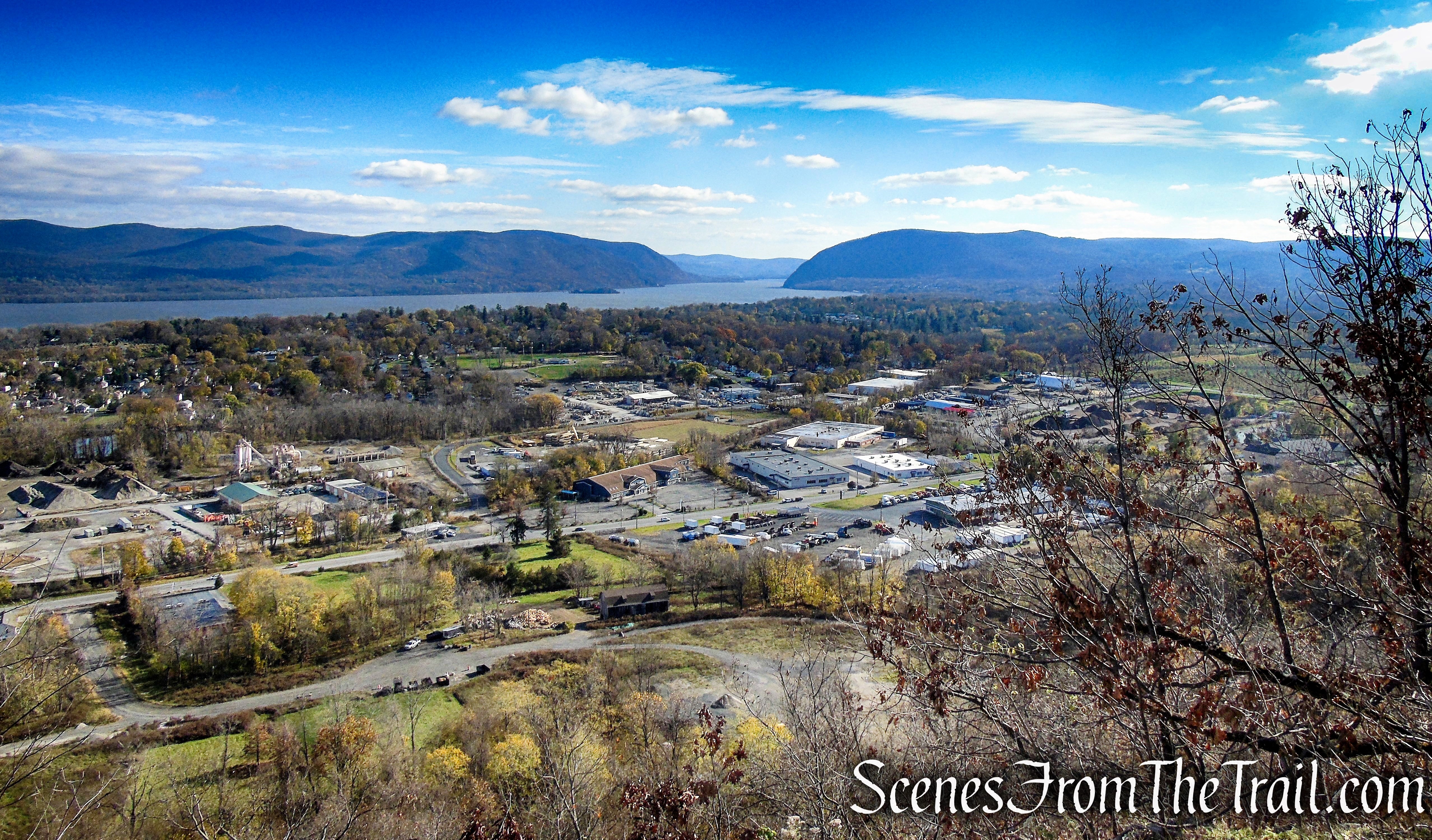
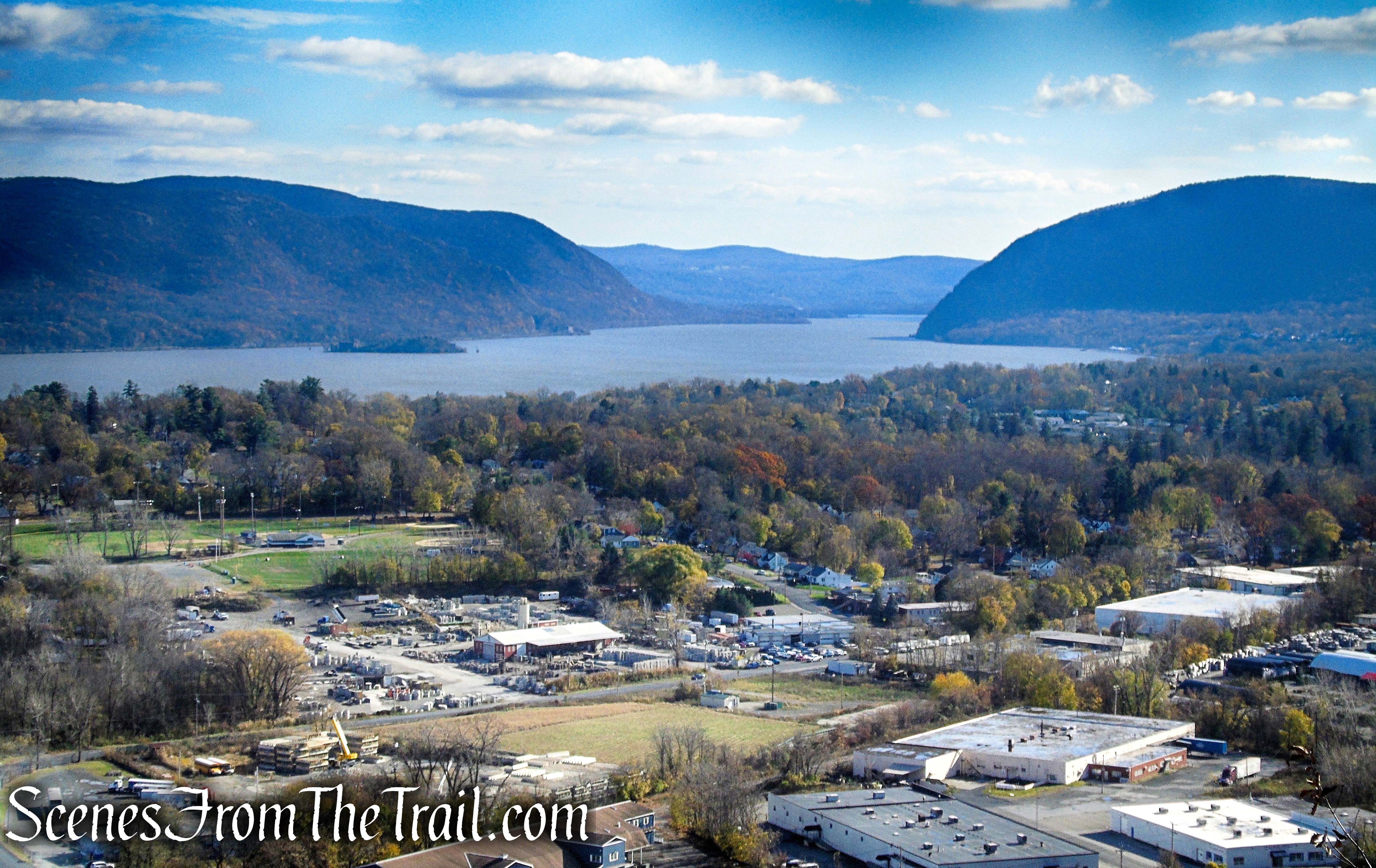
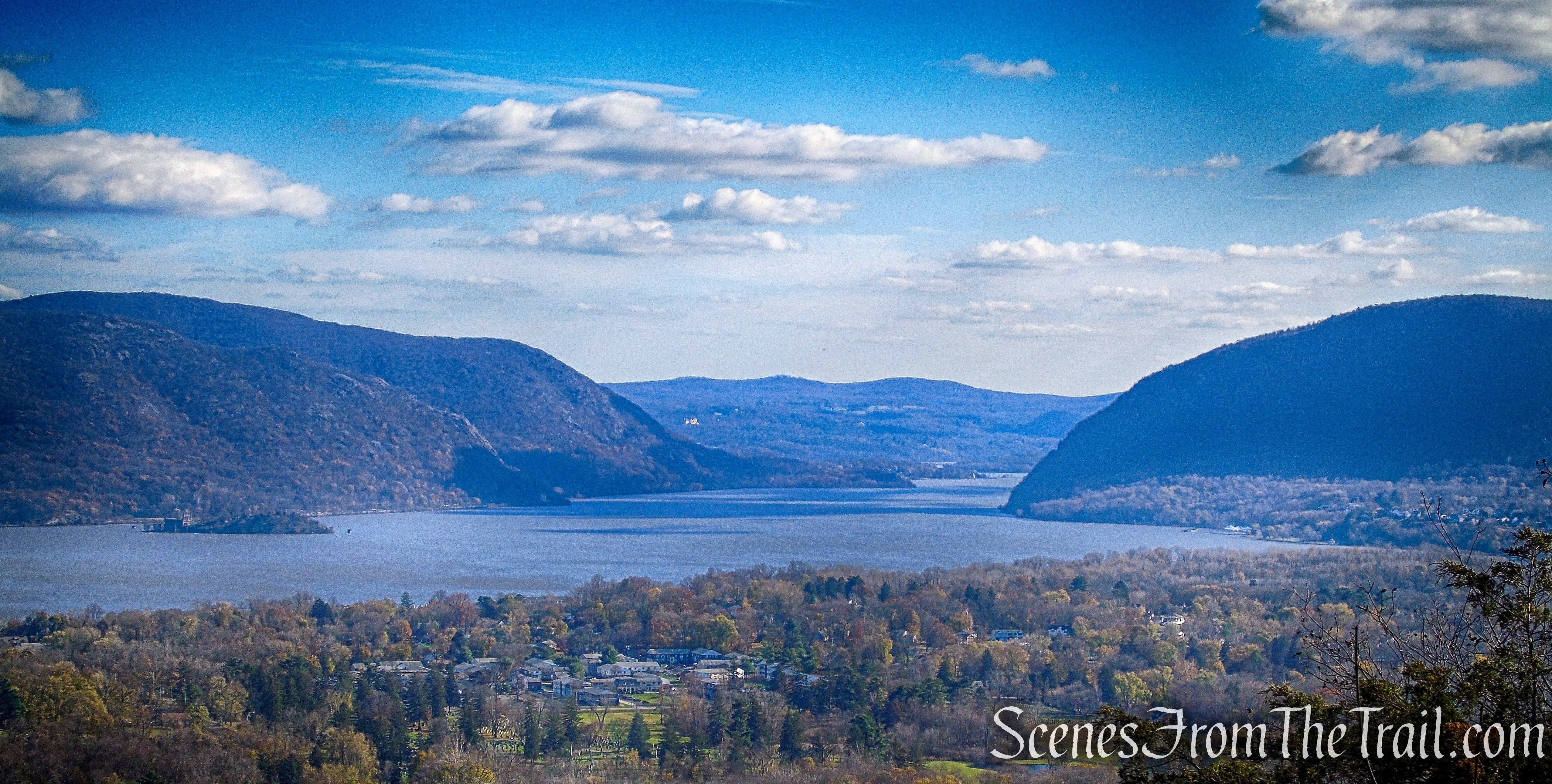
Snake Hill is a local landmark that offers sweeping views of the Hudson River and surrounding landscape from its summit. The Hill straddles the City of Newburgh/Town of New Windsor. It drops off precipitously to the east, giving unobstructed views of the Hudson River, the East Hudson Highlands, the cities of Newburgh and New Windsor, Pollepel Island to the southeast, and Storm King Mountain to the south.

View from Snake Hill
San Giacomo Park is a 9-acre Town Park that has the following amenities: Dog Park (Membership Required For Dog Park), Basketball Courts, Tennis Courts, Playground, and Restrooms. Park Closes At Dusk.

San Giacomo Park
History:
Once named Muchattoes Hill (Much-Hattoos, Much-Hattoes), which loosely translated means bad or evil small hill. In local nomenclature the hill has long been known as Snake Hill from the abundance of rattlesnakes that inhabited it, though few have been seen there in recent years.
At the summit of Snake Hill there is a rock outcrop referred to as “Spy Rock.” According to the Historical Society of Newburgh Bay and the Highlands, “Legends say local Indians and then colonial militia used the high point to watch activity on the Hudson.”

Blue Trail benches – Snake Hill
During the American Revolution, patriots kept a signal fire in readiness atop Snake Hill to warn surrounding communities of a British invasion upriver.
Although the land didn’t face any threat of development, Scenic Hudson felt it was worth permanently protecting and the opportunity to do so arose. Scenic Hudson paid $1.06 million for 95 acres, comprising the bulk of Snake Hill, in 2004.
The trails were built from 2017-2018 (finished in spring of 2018) by Scenic Hudson and volunteers. Scenic Hudson maintains the trails, again with volunteer help.
Thanks to Reed Sparling, Writer and Scenic Hudson Historian for providing the information on its history.
Trails Overview:
There are three marked trails on the map and a paved road that cuts through the center of the property. There are also some unmarked “social” trails as well. The official trails are well marked and relatively easy to follow, although they can use an extra blaze or two at a couple of turns.
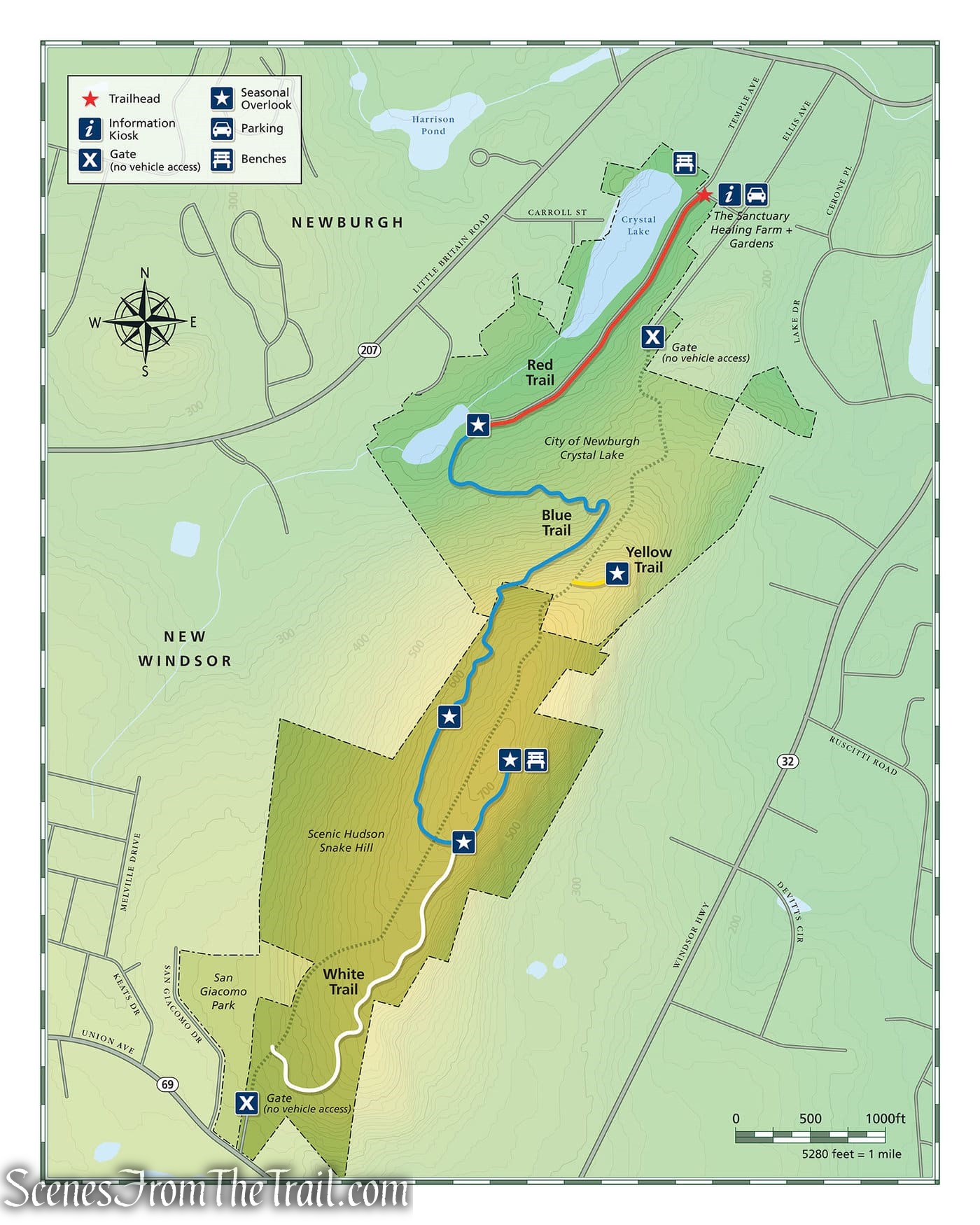
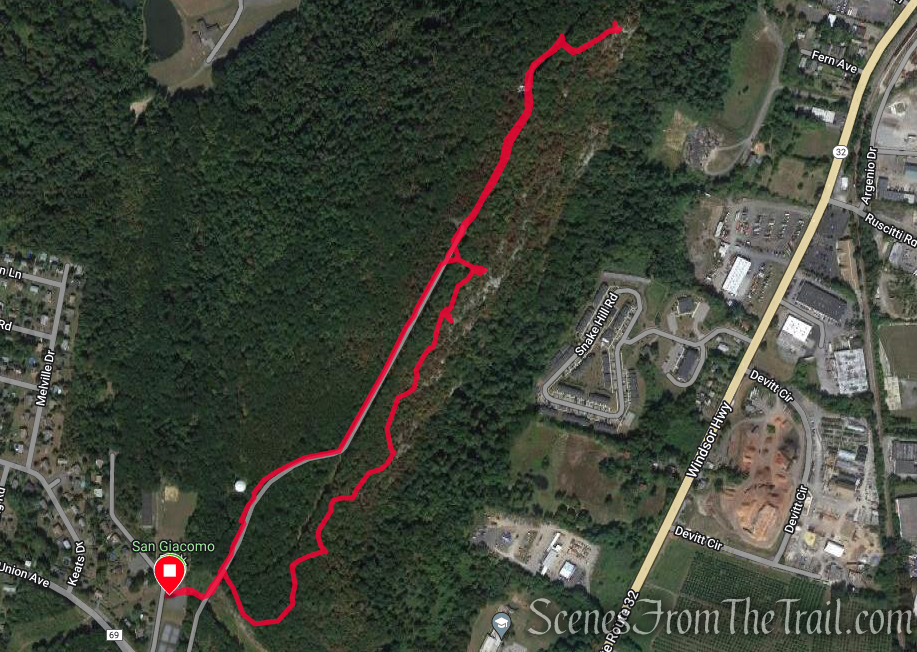
Snake Hill Trail Map – 2022
The trails are marked with Scenic Hudson round plastic discs in various colors.
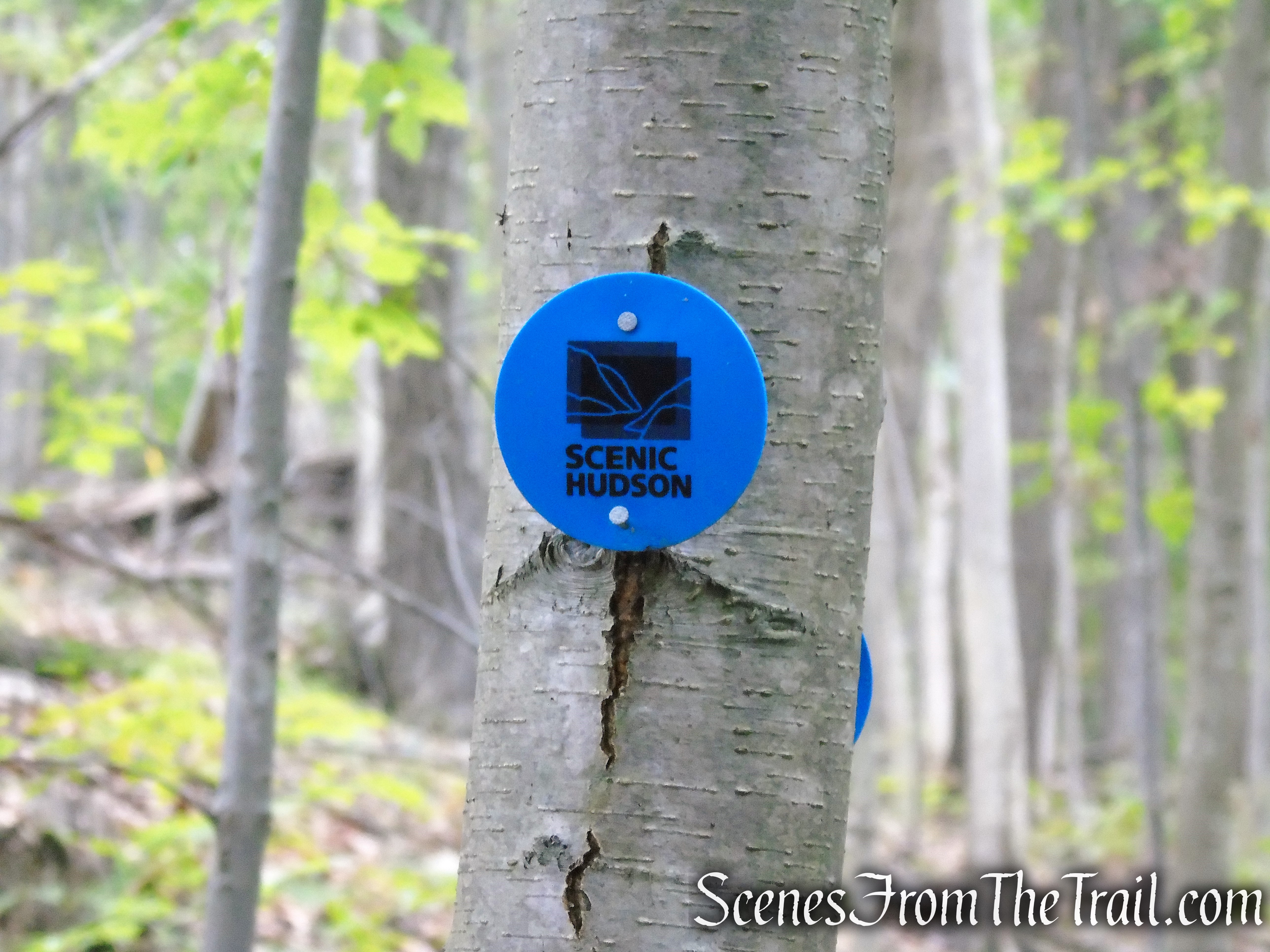
Snake Hill – Scenic Hudson
The Yellow Trail, travels through the City of Newburgh property and is marked with painted rectangular blazes. The Scenic Hudson trail map only shows the spur that leads to the view which doesn’t have many blazes.
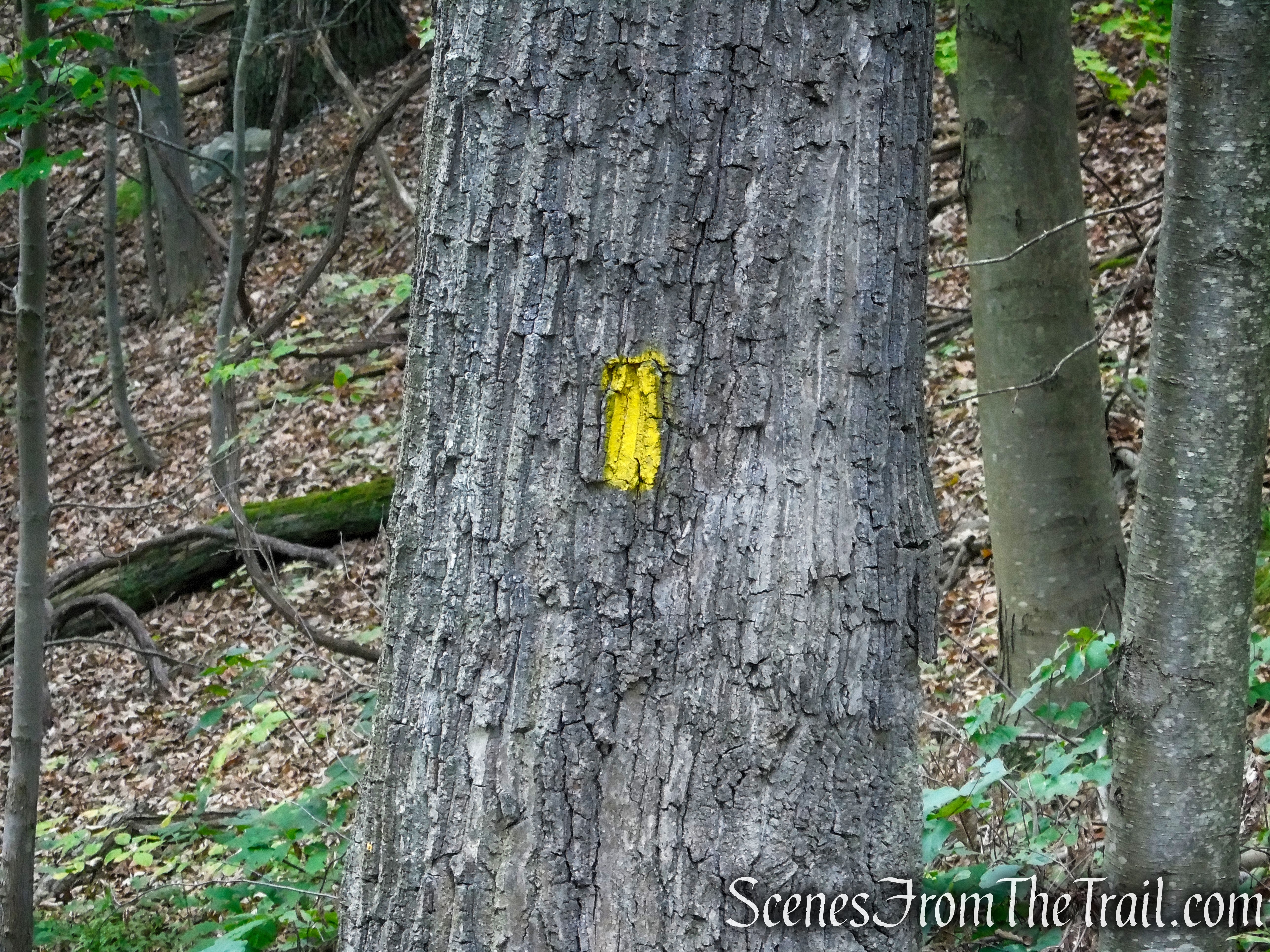
Yellow Trail – Snake Hill
Hike Overview:
I first hiked Snake Hill in early September, 2022. I enjoyed the view so much that I came back two more times since then. Snake Hill has some of the best views anywhere up and down the Hudson River. Normally I am an early morning hiker to secure a parking spot and avoid the crowds. But this hike is better done after midday. Midday you ask? Yes, because as fabulous as the views are, on a sunny day, the sun is right in your face as you try to photograph and/or enjoy the views. Since it was raining all through the night and into the morning of this hike, I decided it was a good time to return. When the rain ended it became a little hazy, but still these views have to be experienced to truly appreciate them.
This is a short Lollipop Loop with the stick being at the far end. It can be combined with some of the other trails for a slightly longer hike. We utilized the paved road for our return route after stopping at the bench view for a second time.
Snake Hill from San Giacomo Park
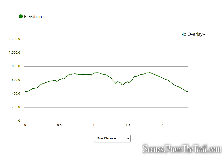
elevation profile – Snake Hill from San Giacomo Park
The Hike:
This hike begins near the northeast area of the parking lot. Follow an unmarked footpath past the gate and turn left on the paved road. In about 180 feet, turn right on the White Trail, which is marked with three white blazes and a sign. You will be following the White Trail for the next 1/2 mile or so.
San Giacomo Park trailhead
Turn left after the gate

Asphalt Road – San Giacomo Park

White Trail – Snake Hill
White Trail – Snake Hill
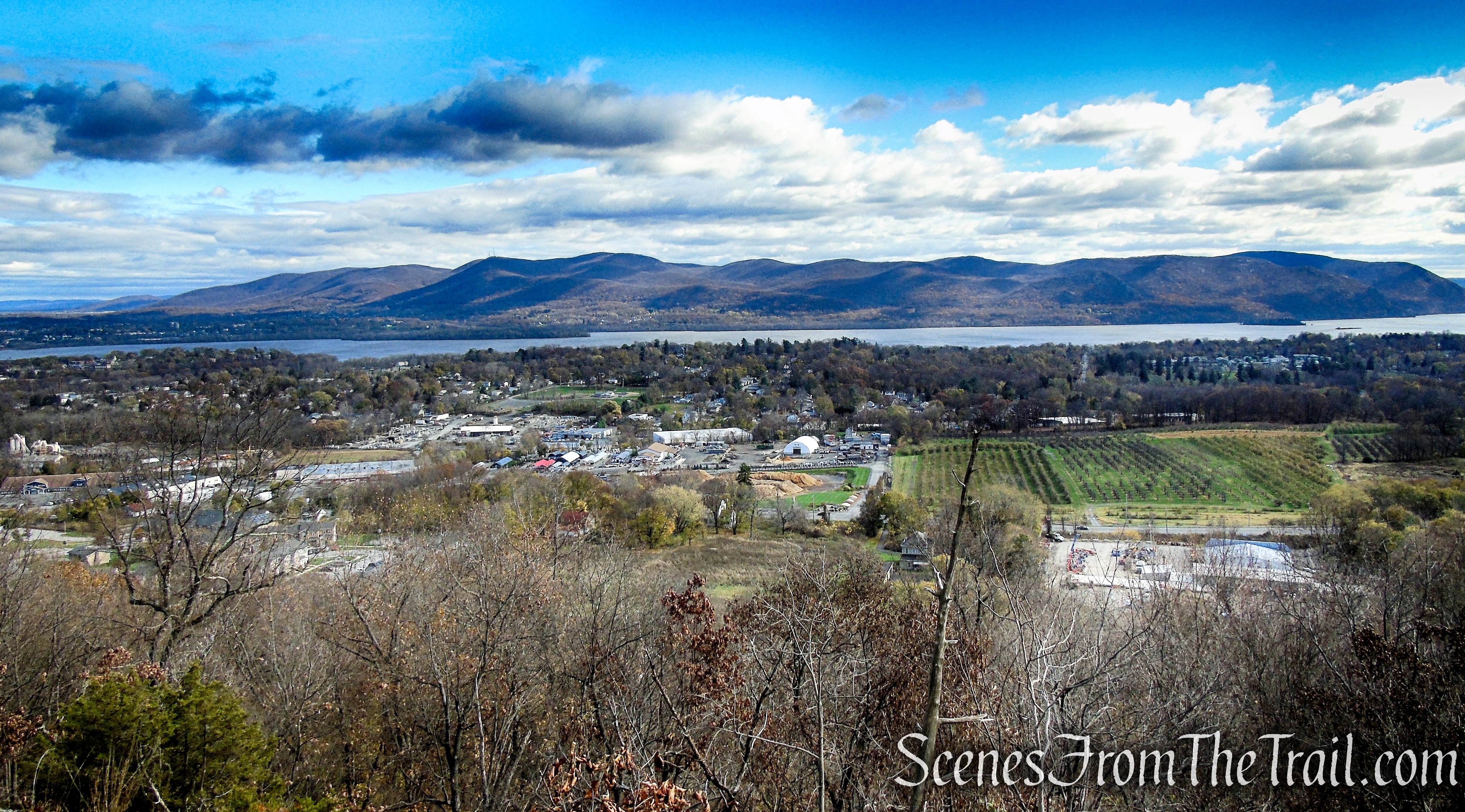
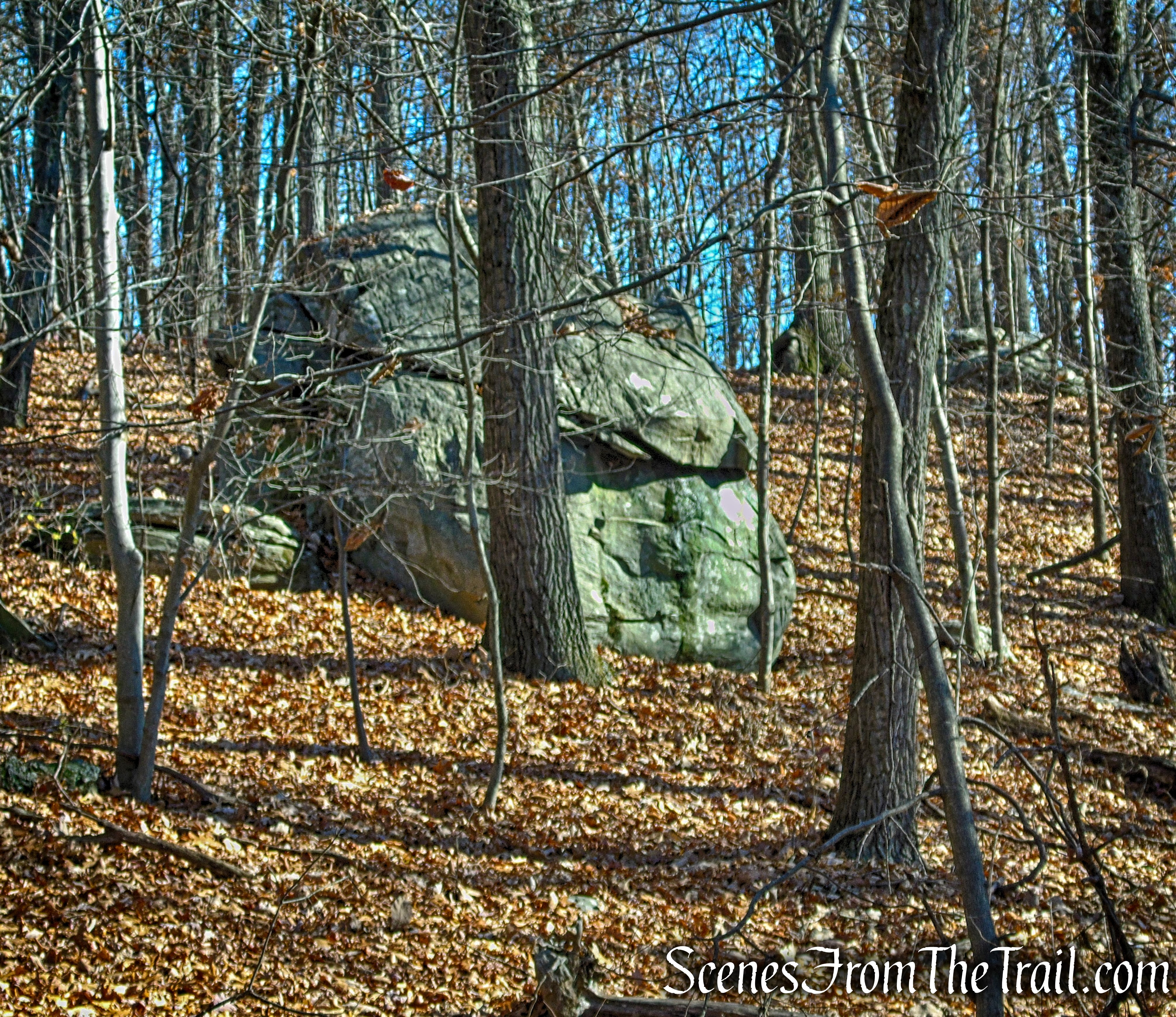
The White Trail climbs gradually through the woods passing some interesting looking boulders that are scattered about. In about 0.4 mile, the White Trail reaches a slanted rock outcrop with wide ranging views over the Hudson River.
White Trail – Snake Hill
White Trail – Snake Hill
White Trail – Snake Hill
White Trail – Snake Hill
White Trail – Snake Hill
White Trail – Snake Hill
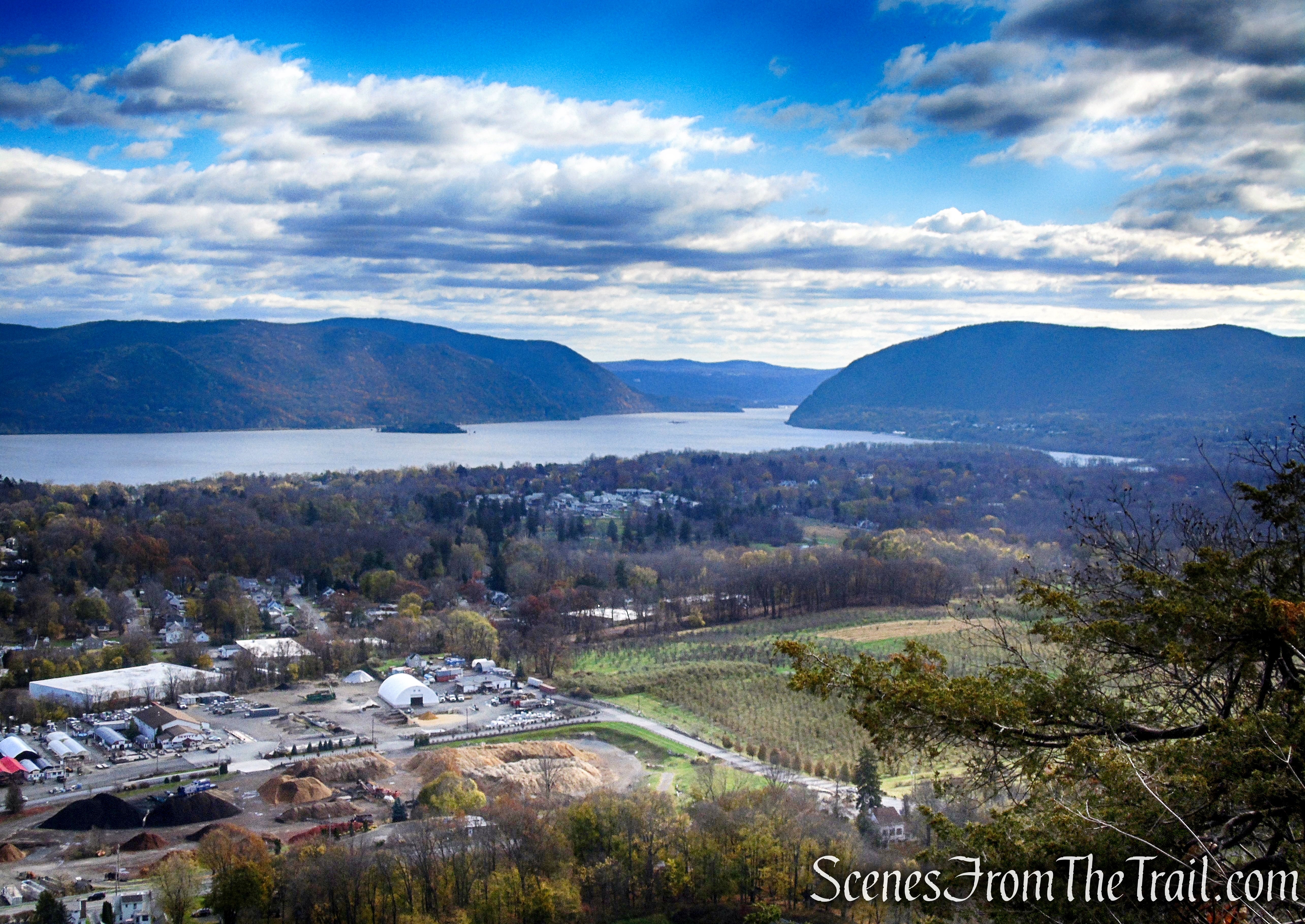
Storm King Mountain and Butter Hill is visible to the right. Across the Hudson River, a good stretch of the East Hudson Highlands can be seen with Pollepel Island and Bannerman’s Castle near its shore.

White Trail – Snake Hill
White Trail – Snake Hill
White Trail – Snake Hill
There were plenty of vultures and several hawks circling high above on this day. The communications towers visible to the left are on North Beacon Mountain.
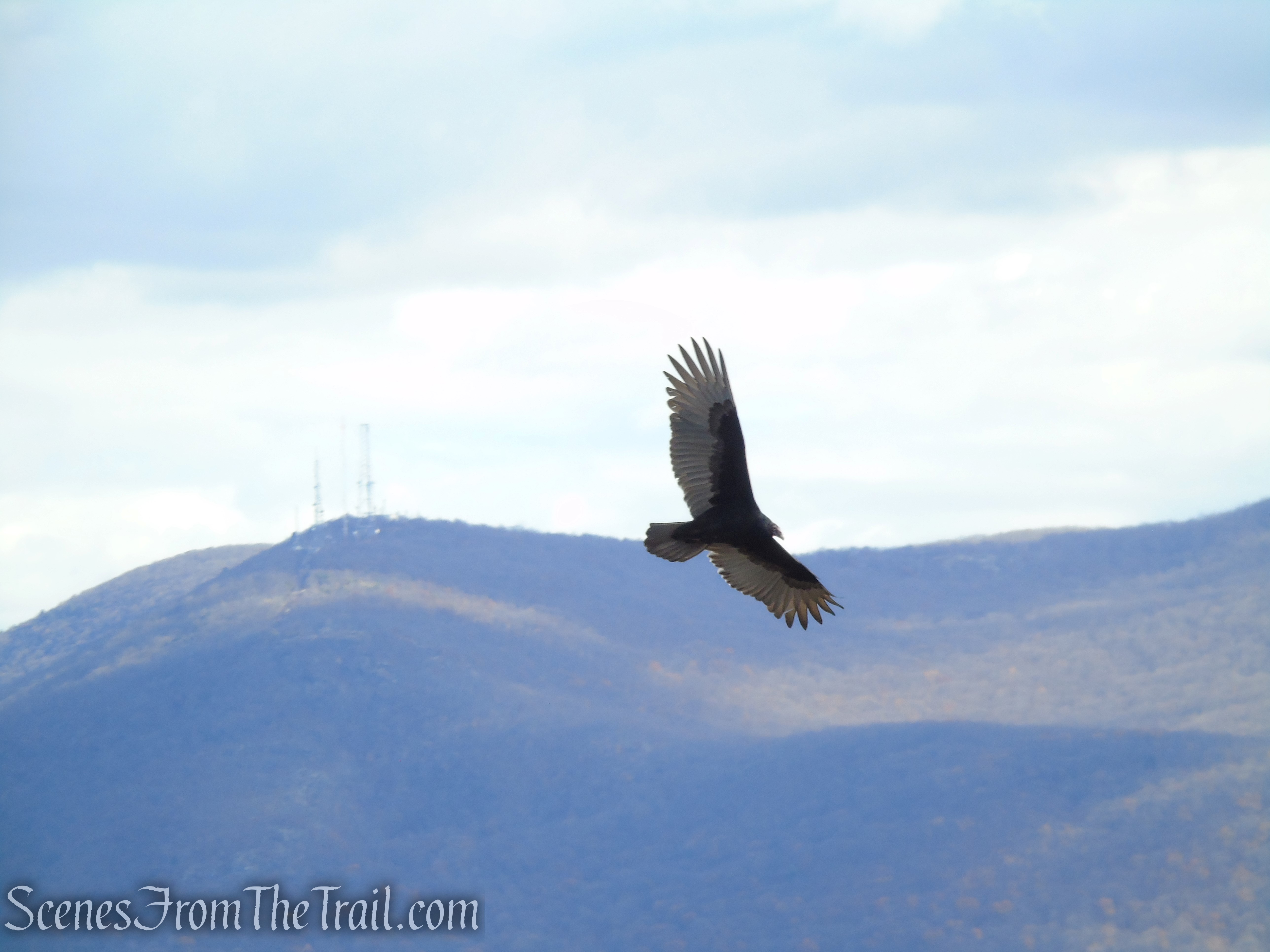
Turkey Vulture – Snake Hill
North Beacon Mountain just right of center and the Mount Beacon Fire Tower can be seen on the high point on the far right.
White Trail – Snake Hill
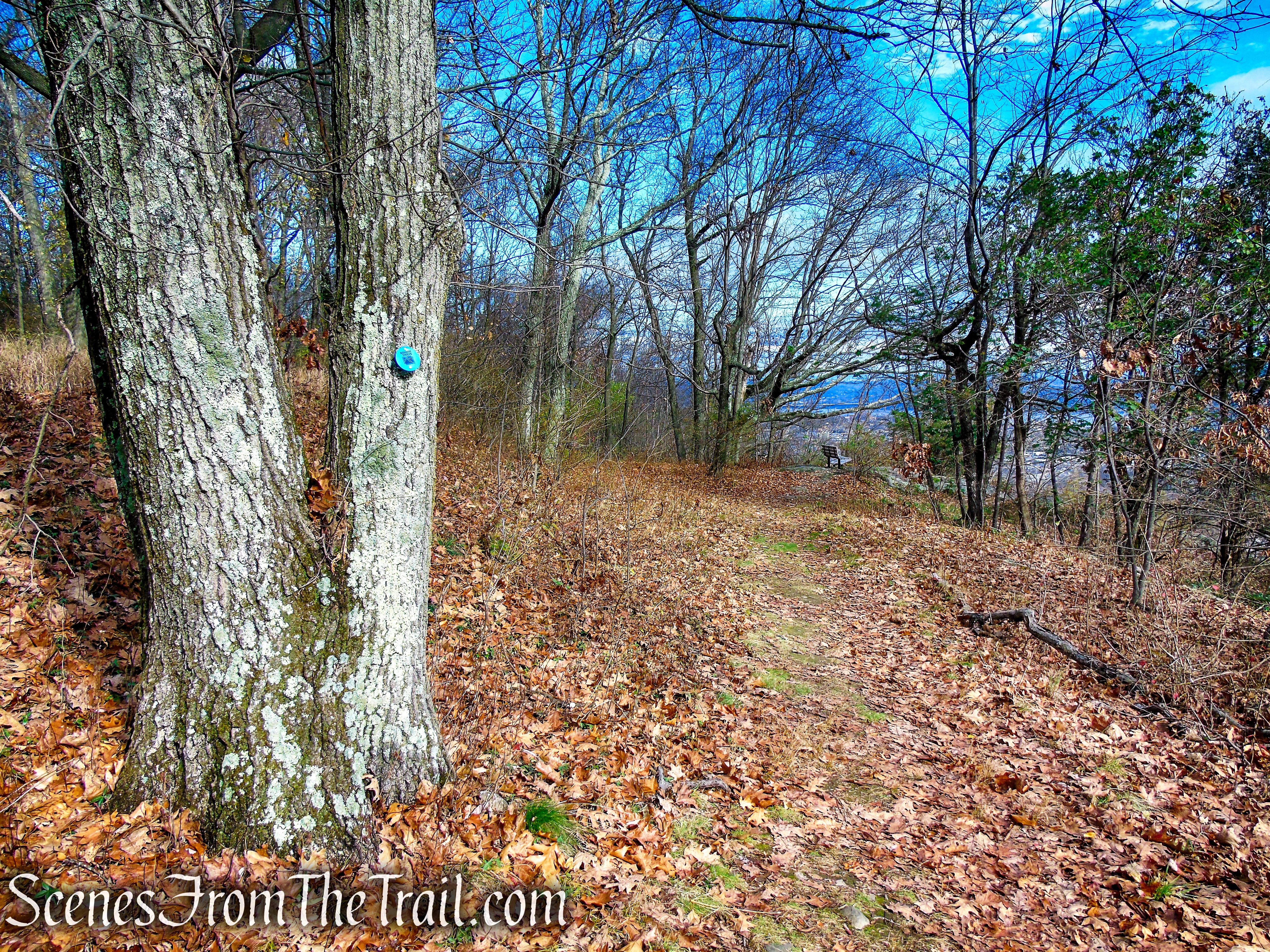
The White Trail climbs rather steeply, and soon ends at a junction with the Blue Trail, which comes in from the left. Proceed ahead on the Blue Trail, passing a rock outcrop just off the trail with similar views as those on the White Trail.
White Trail – Snake Hill
White Trail – Snake Hill
Blue Trail – Snake Hill
Blue Trail – Snake Hill
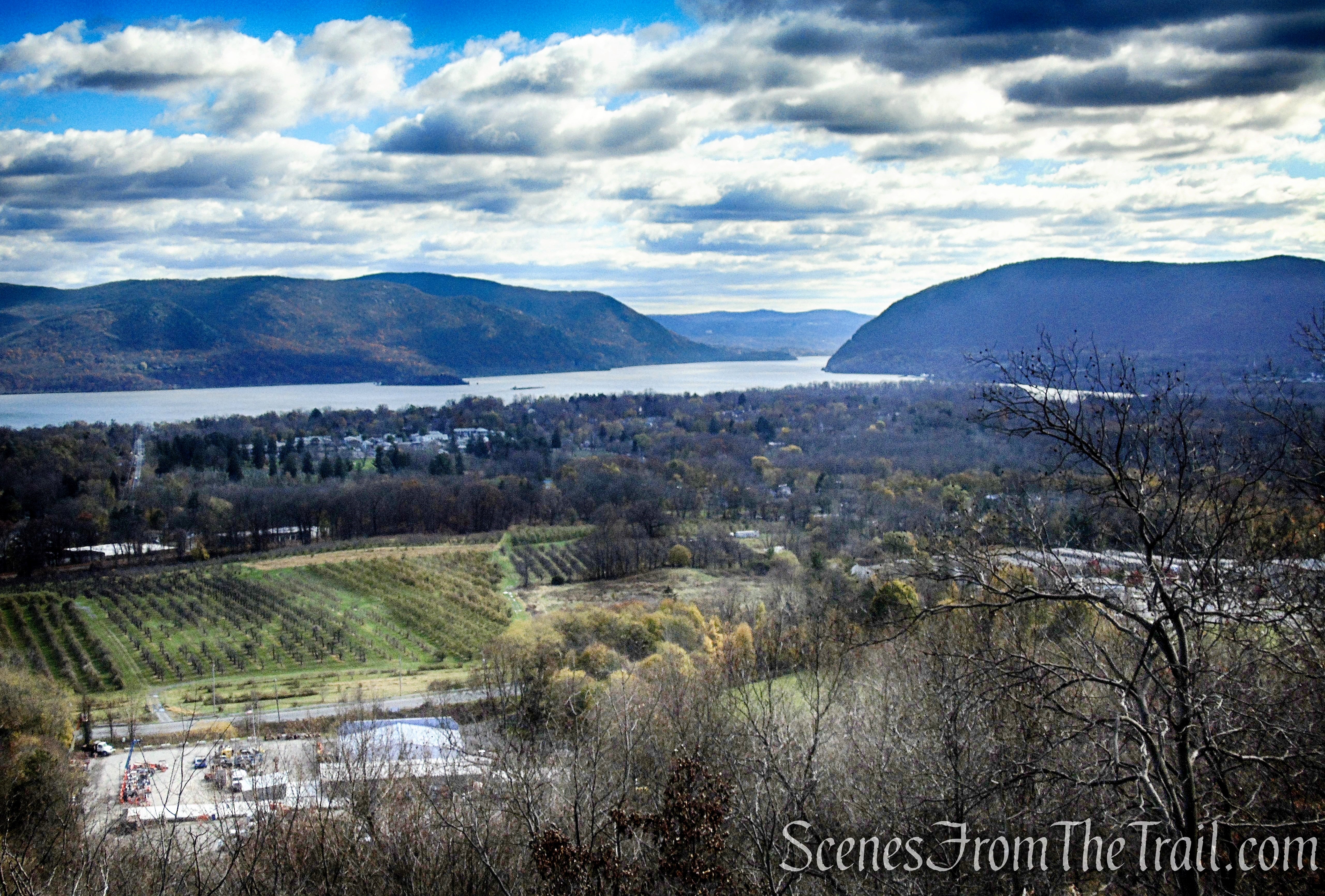
In a short distance, the Blue Trail ends at a large rock outcrop fitted with two benches. This makes for a great spot to relax and enjoy the glorious views.
Blue Trail – Snake Hill
Known as “Spy Rock,” Legend has it that local Indians and then colonial militia used this high point to watch for activity on the Hudson. During the American Revolution, patriots kept a signal fire in readiness at this spot to warn surrounding communities of British troops’ movements.
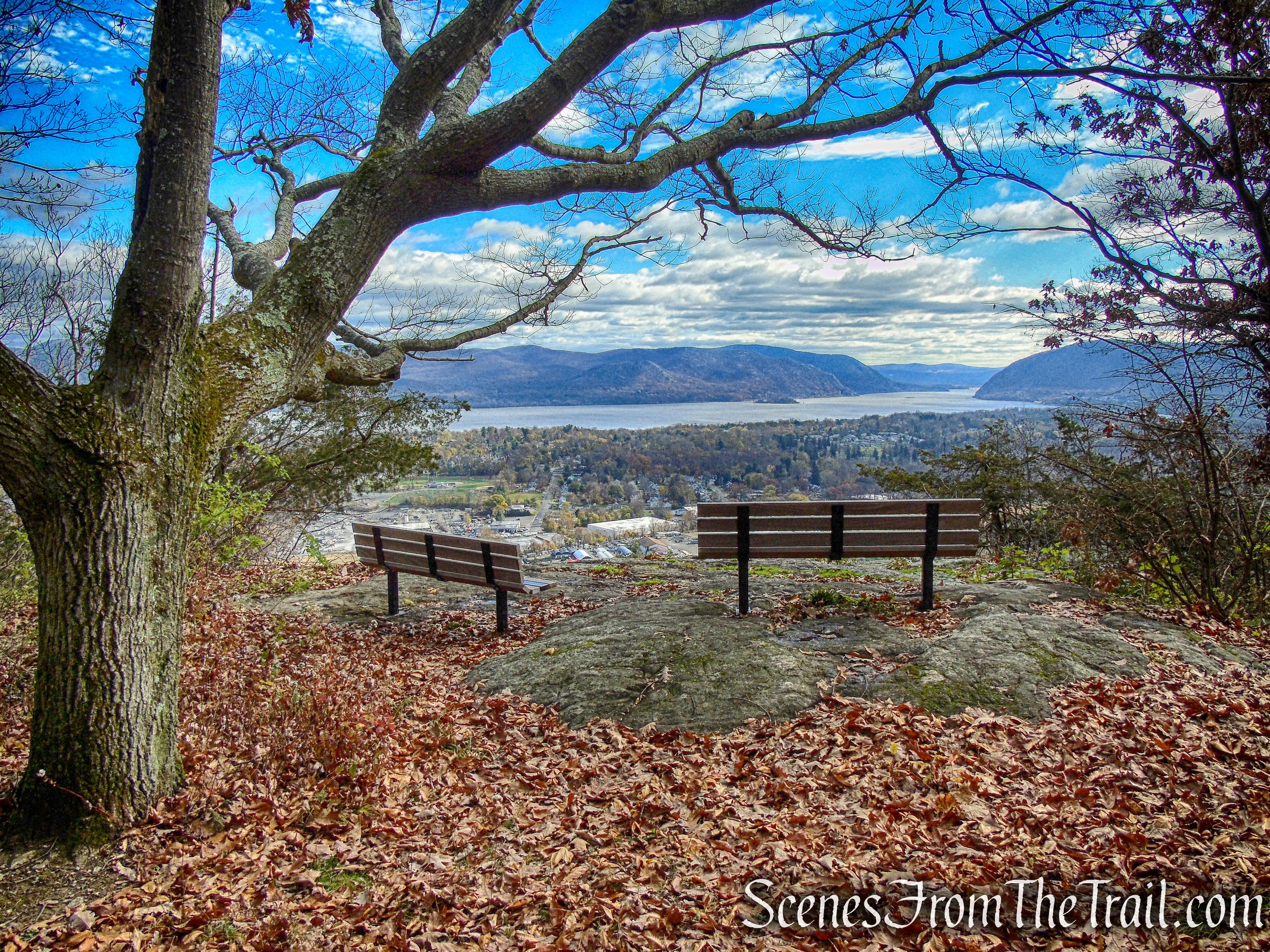
Blue Trail – Snake Hill
A good chunk of the Hudson River Highlands can be viewed from this very spot.
View from Snake Hill

Blue Trail – Snake Hill
Blue Trail – Snake Hill

Blue Trail – Snake Hill
Blue Trail – Snake Hill
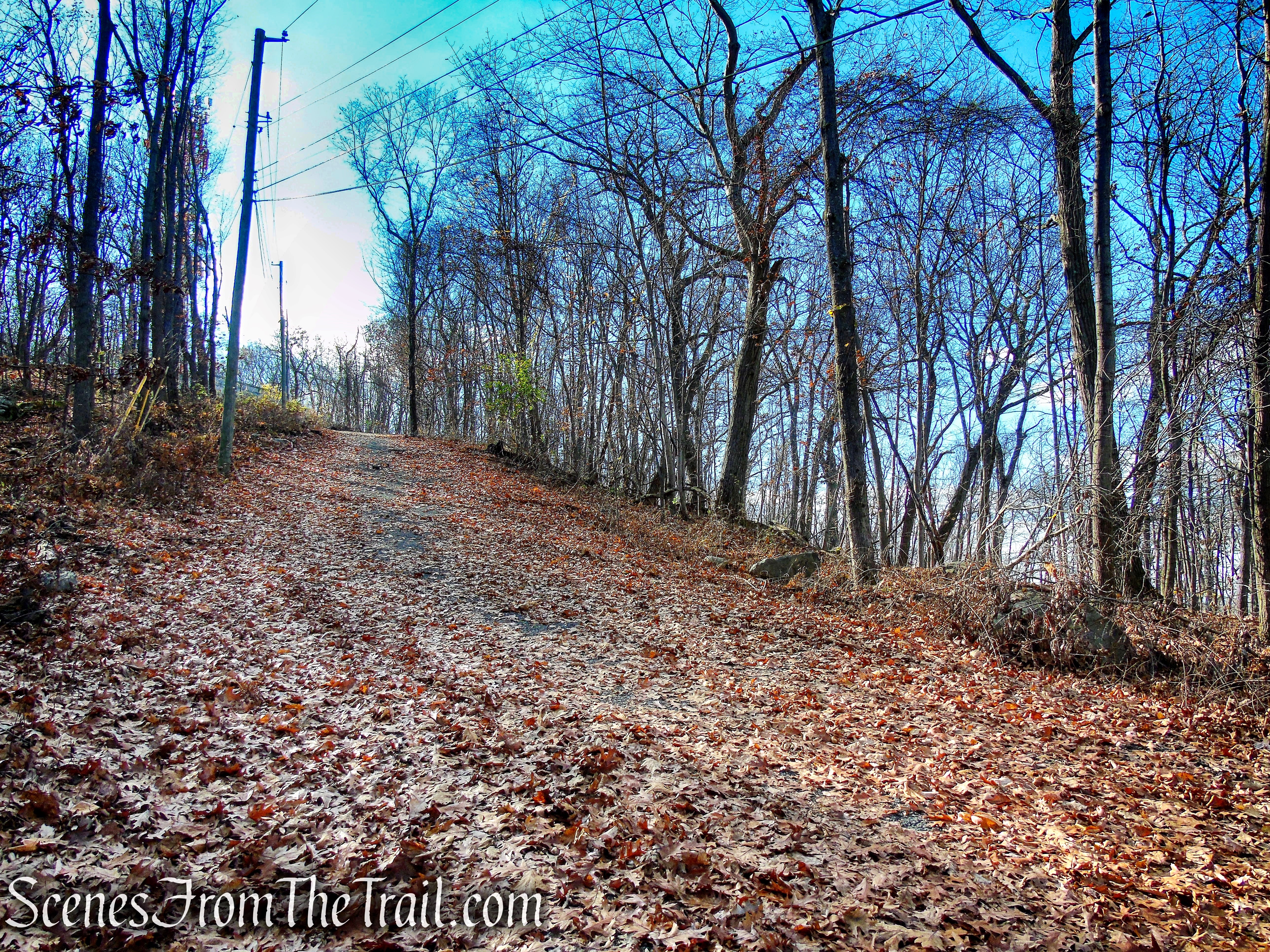
When you are ready to continue, follow the unmarked footpath directly behind the benches out to the paved access road and turn right. Follow the asphalt road as it heads northeast along the summit ridge, soon passing a communications tower on the left.
Unmarked footpath – Snake Hill summit

Turn right on the paved road
Paved access road – Snake Hill
Communication tower – Snake Hill
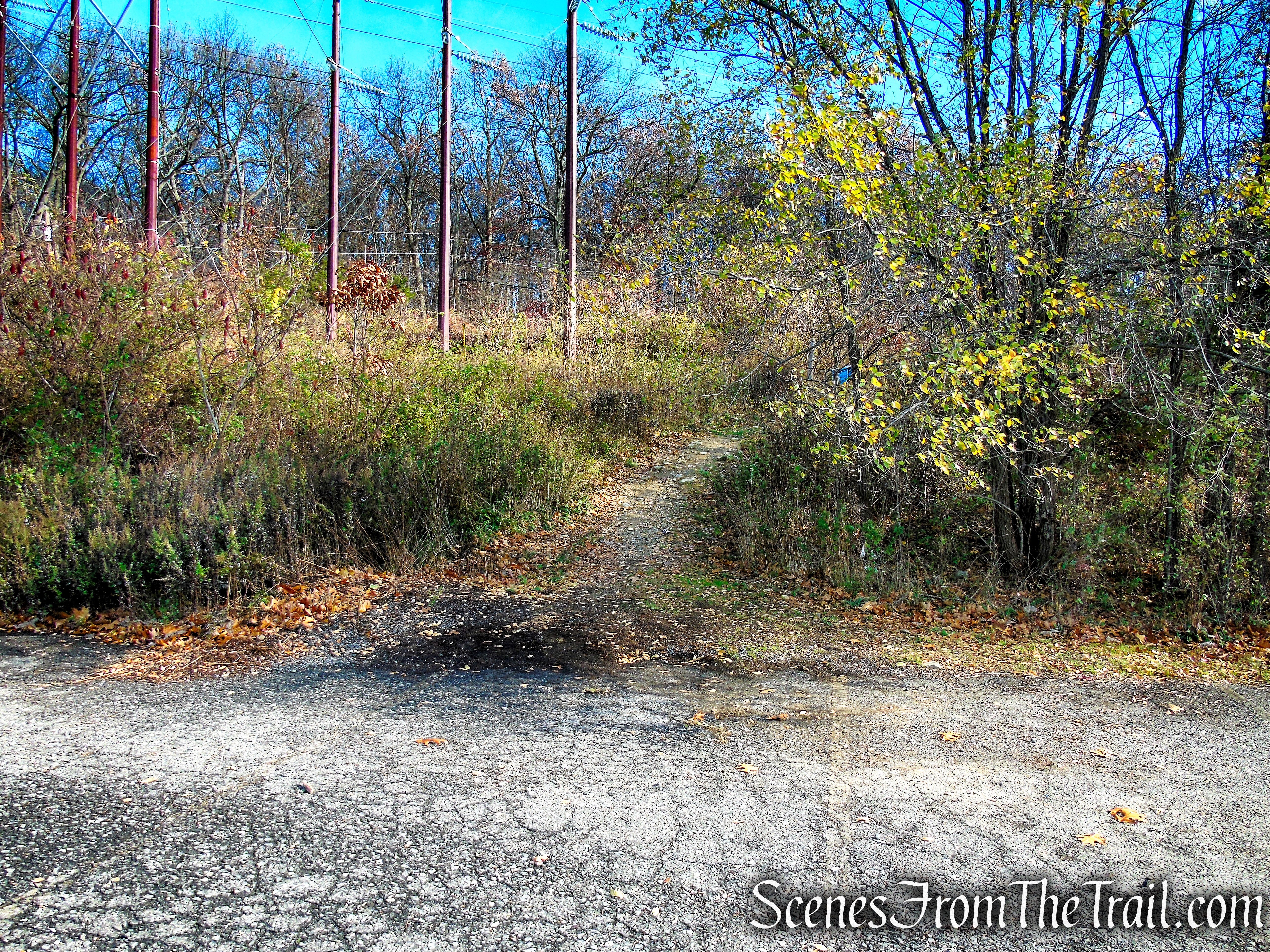
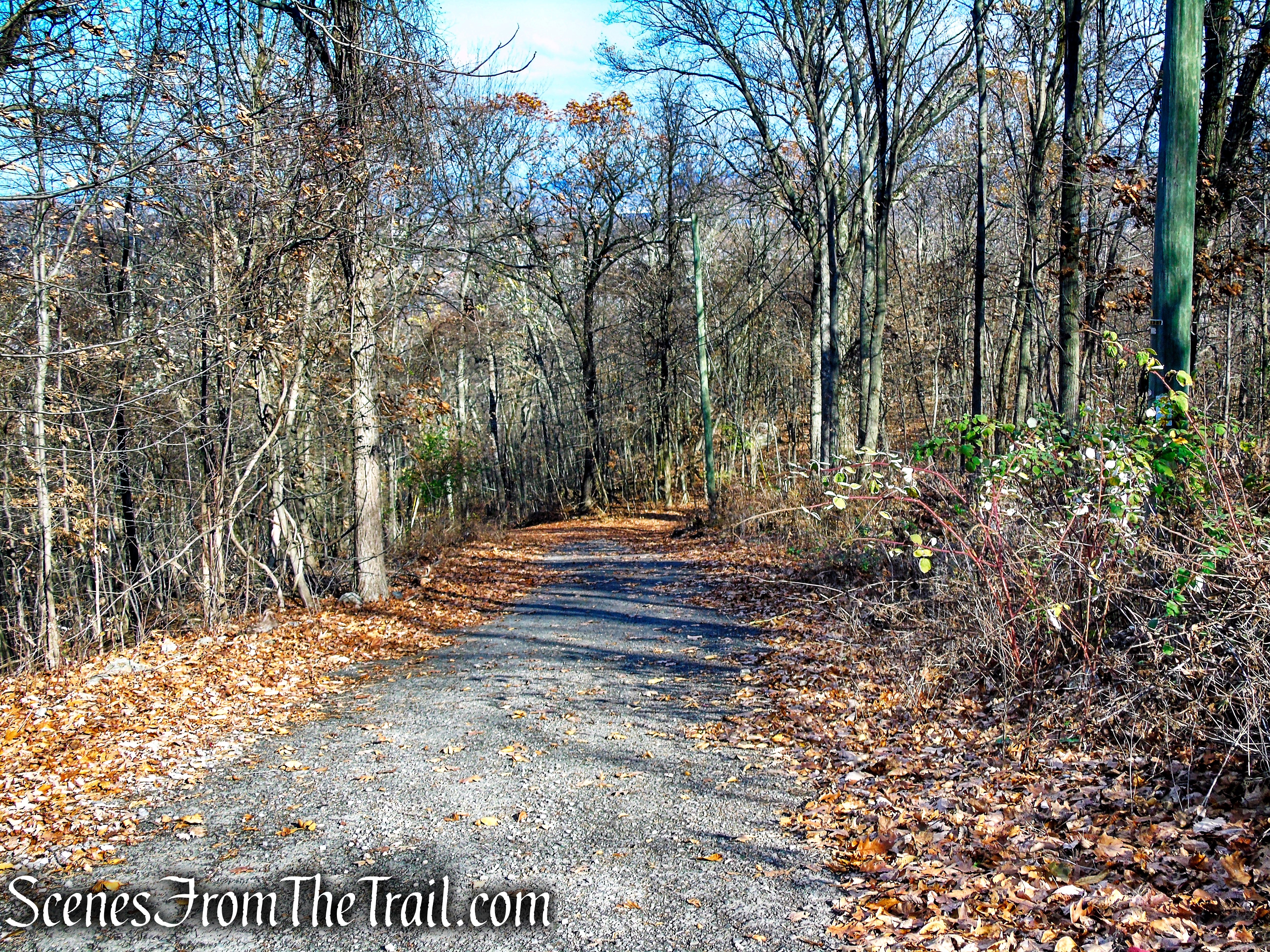
Once you pass the tower, the road is no longer paved until you get to the next tower.

Unpaved road – Snake Hill
I have no idea what the purpose of this contraption is. It’s a small locker strung up on this pole using insulated electrical wires. By the way it is rigged up, it appears that it could be raised and lowered. If anyone knows what this is used for, please comment below. It was here the last two times that I hiked this area.
Unpaved road – Snake Hill
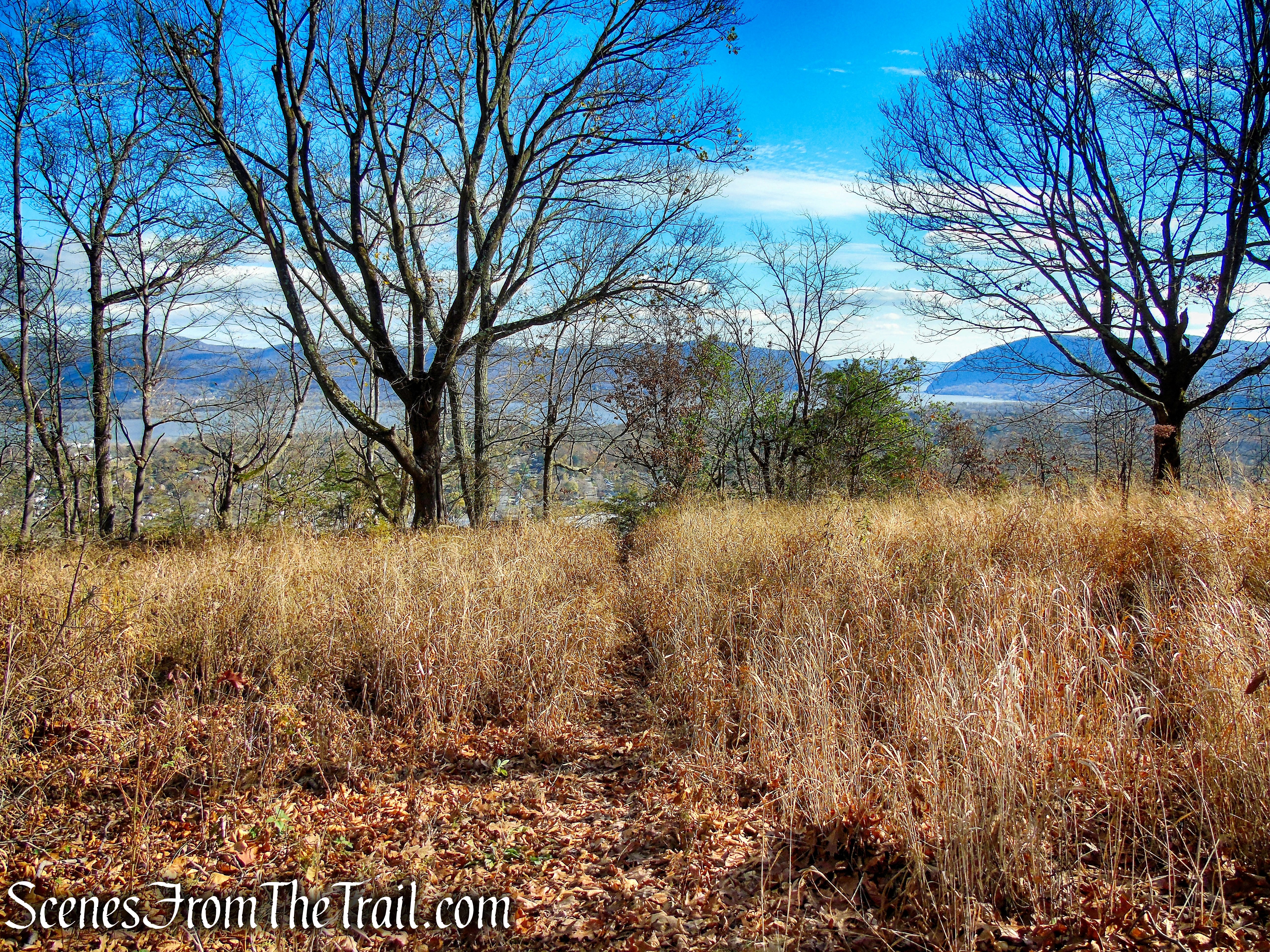
Soon, the road comes to a gate with another communications tower just beyond on the left. You are now leaving Scenic Hudson property and entering property owned by the City of Newburgh. Proceed downhill on the paved road past the gate for about 400 feet. After passing telephone pole #38, turn right on a woods road that heads uphill briefly then turns left. This is the route of the Yellow Trail even though you may not see any blazes. The trail dead ends in about 360 feet at another lovely viewpoint.

Unpaved road – Snake Hill

Unpaved road – Snake Hill
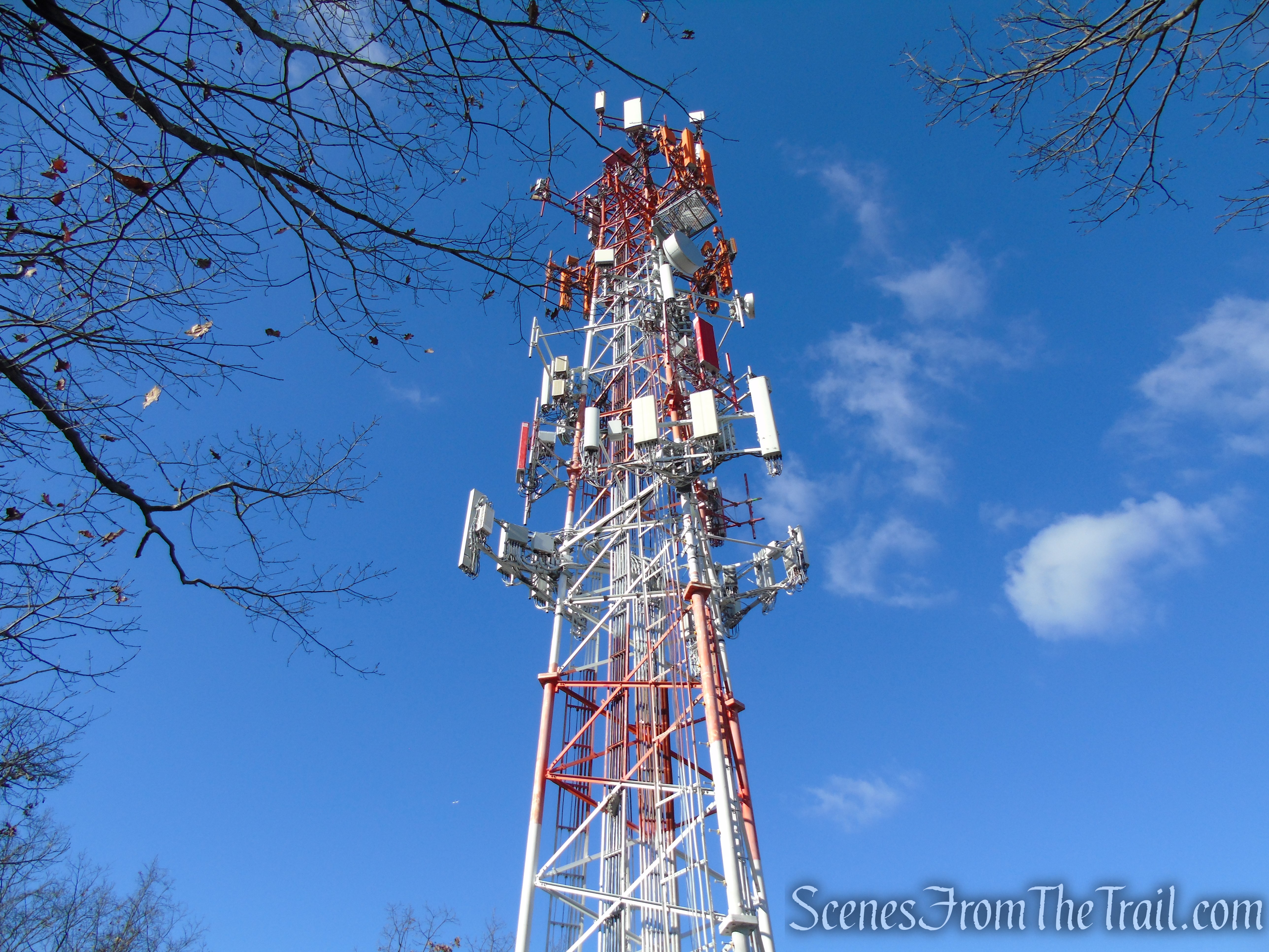
Communications tower – Snake Hill
Paved access road – Snake Hill
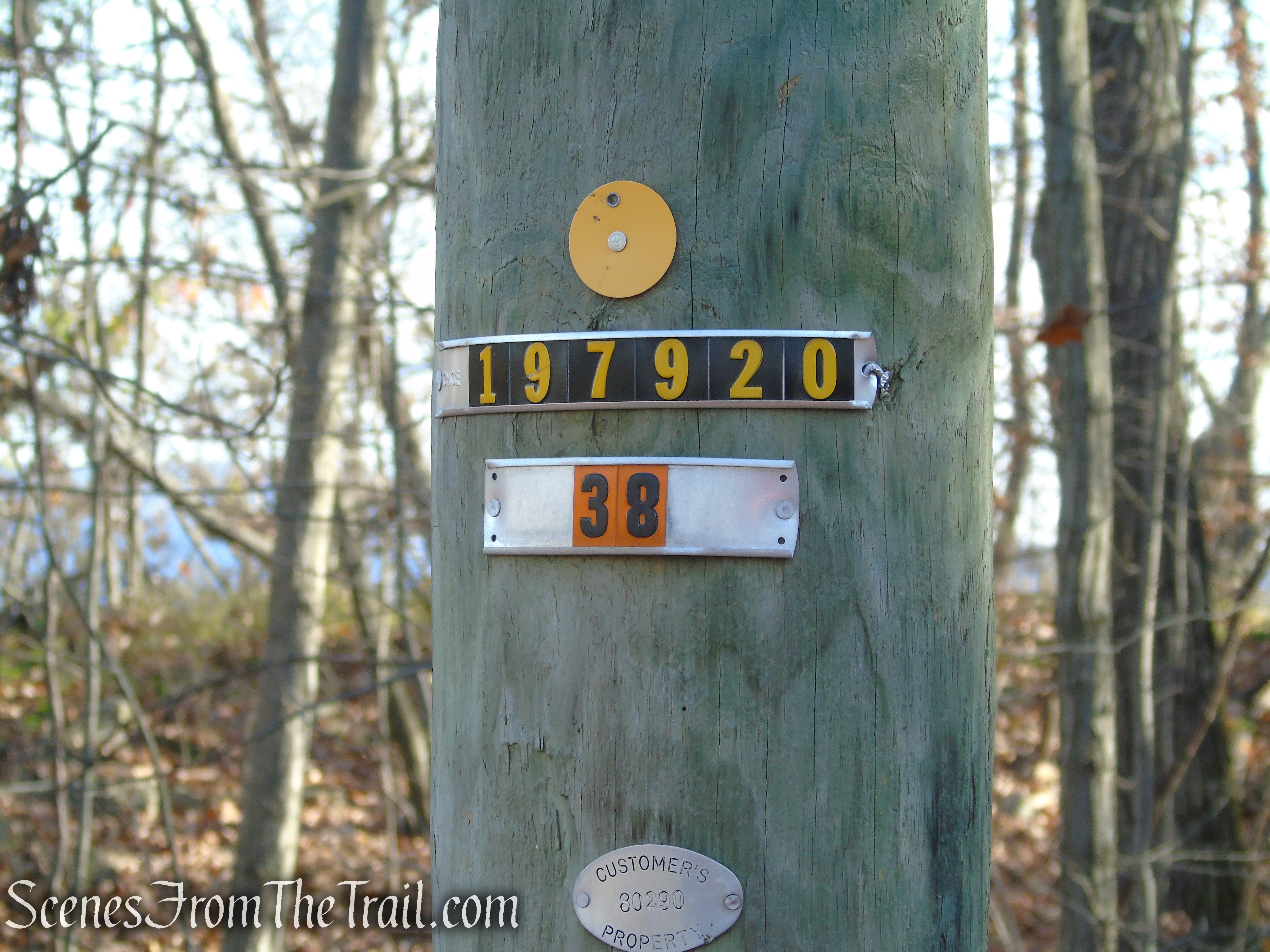
Telephone pole 38 – paved access road – Snake Hill
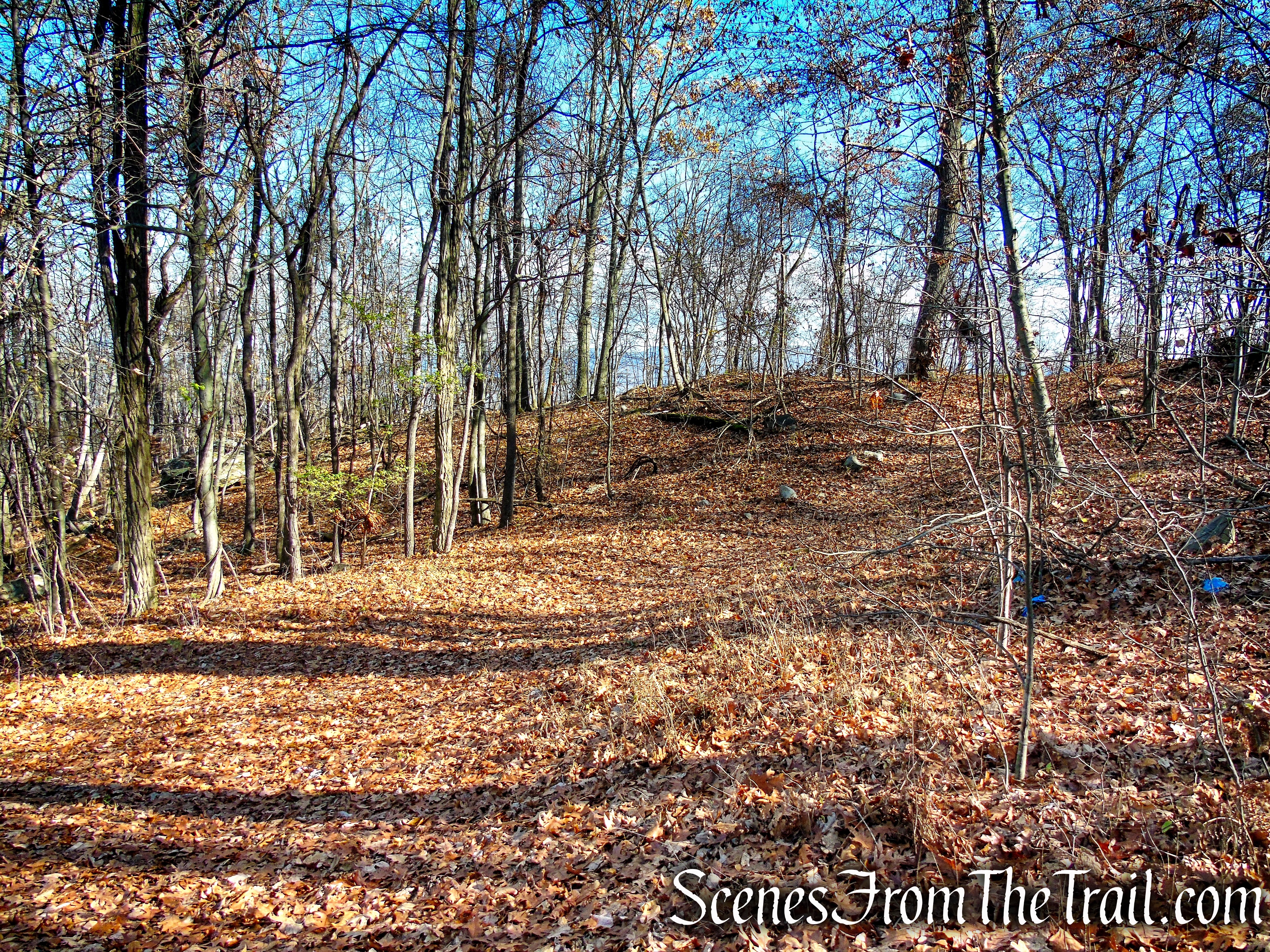
Yellow Trail – Snake Hill

Yellow Trail – Snake Hill
Yellow Trail – Snake Hill
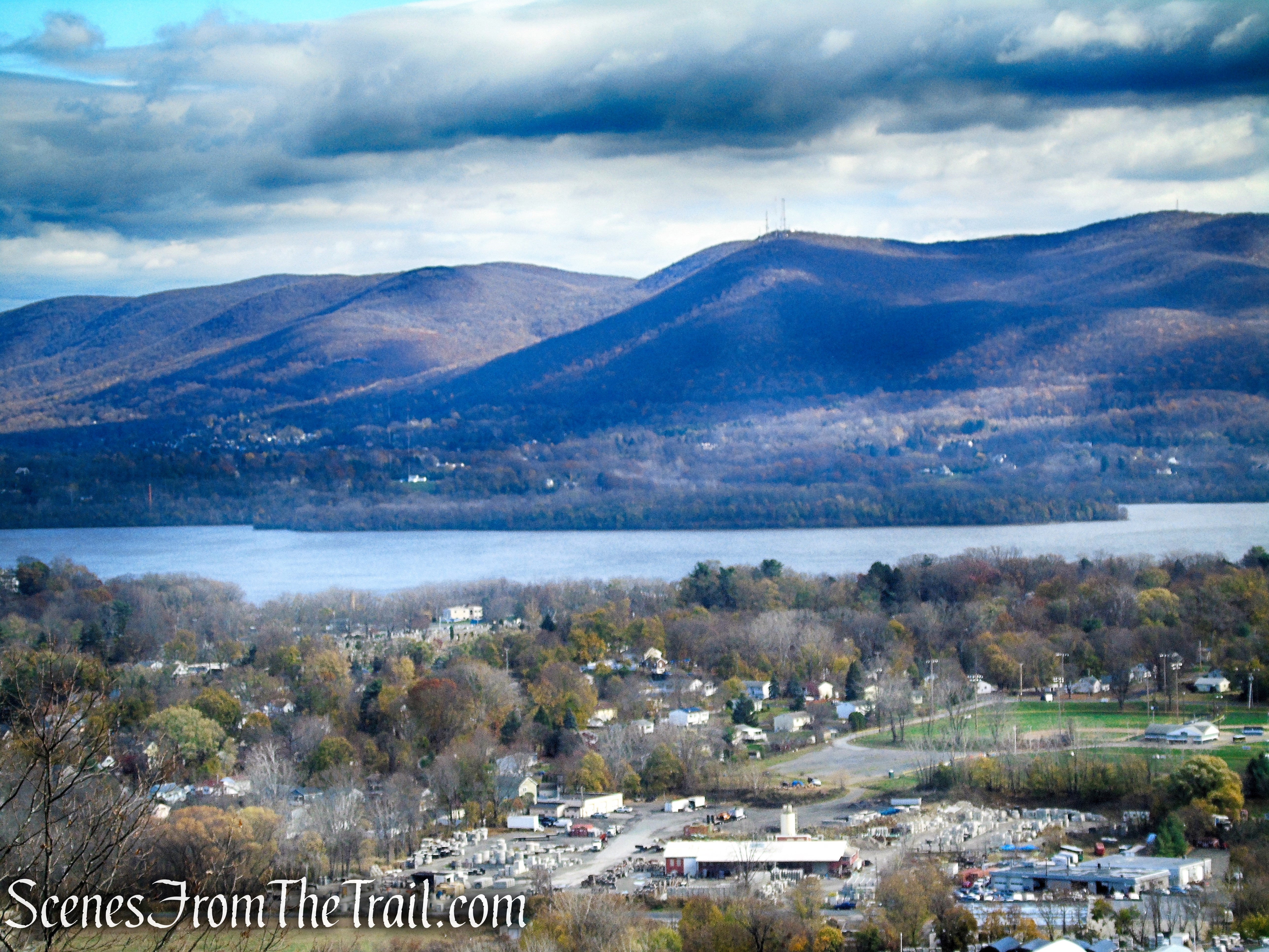
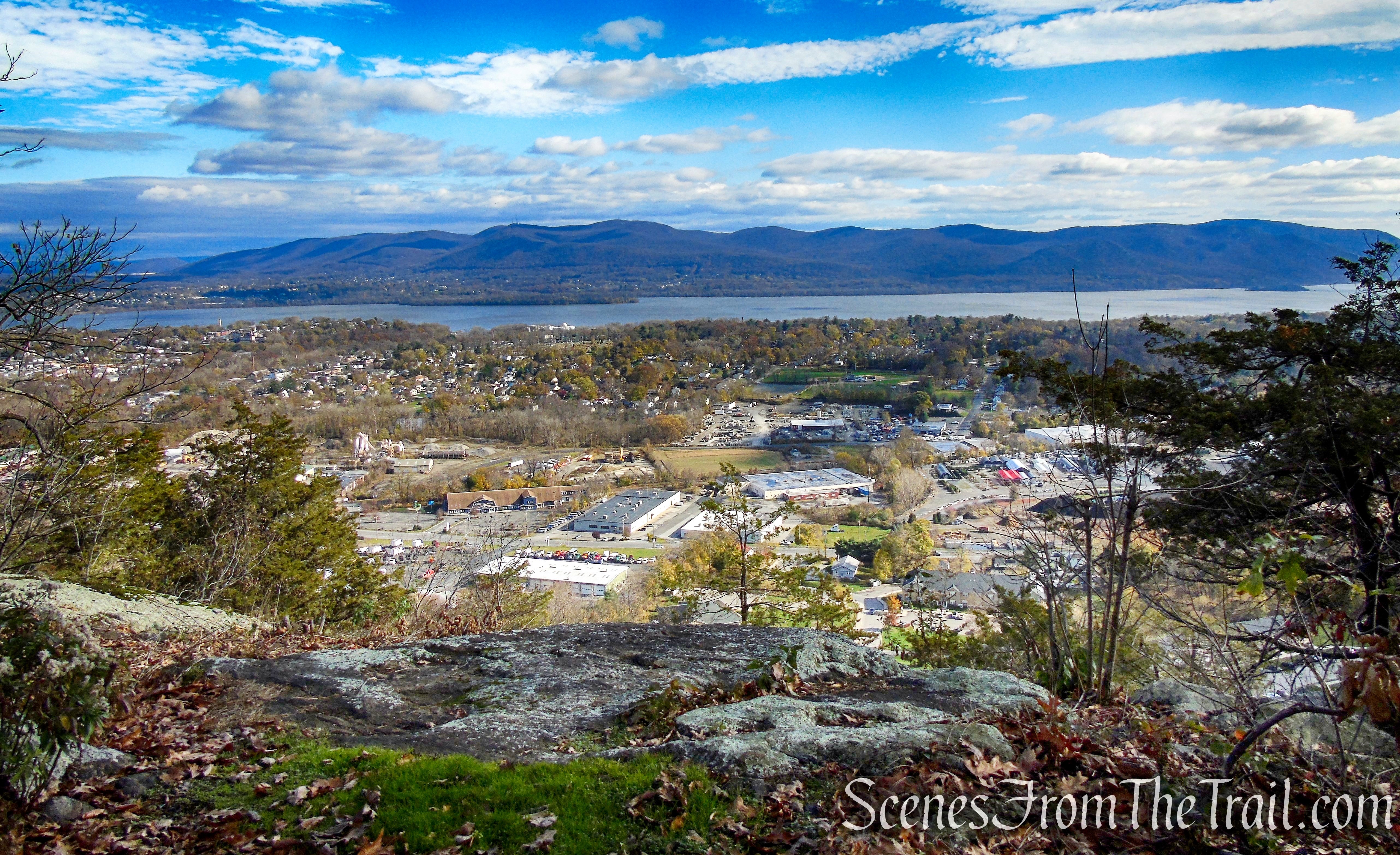
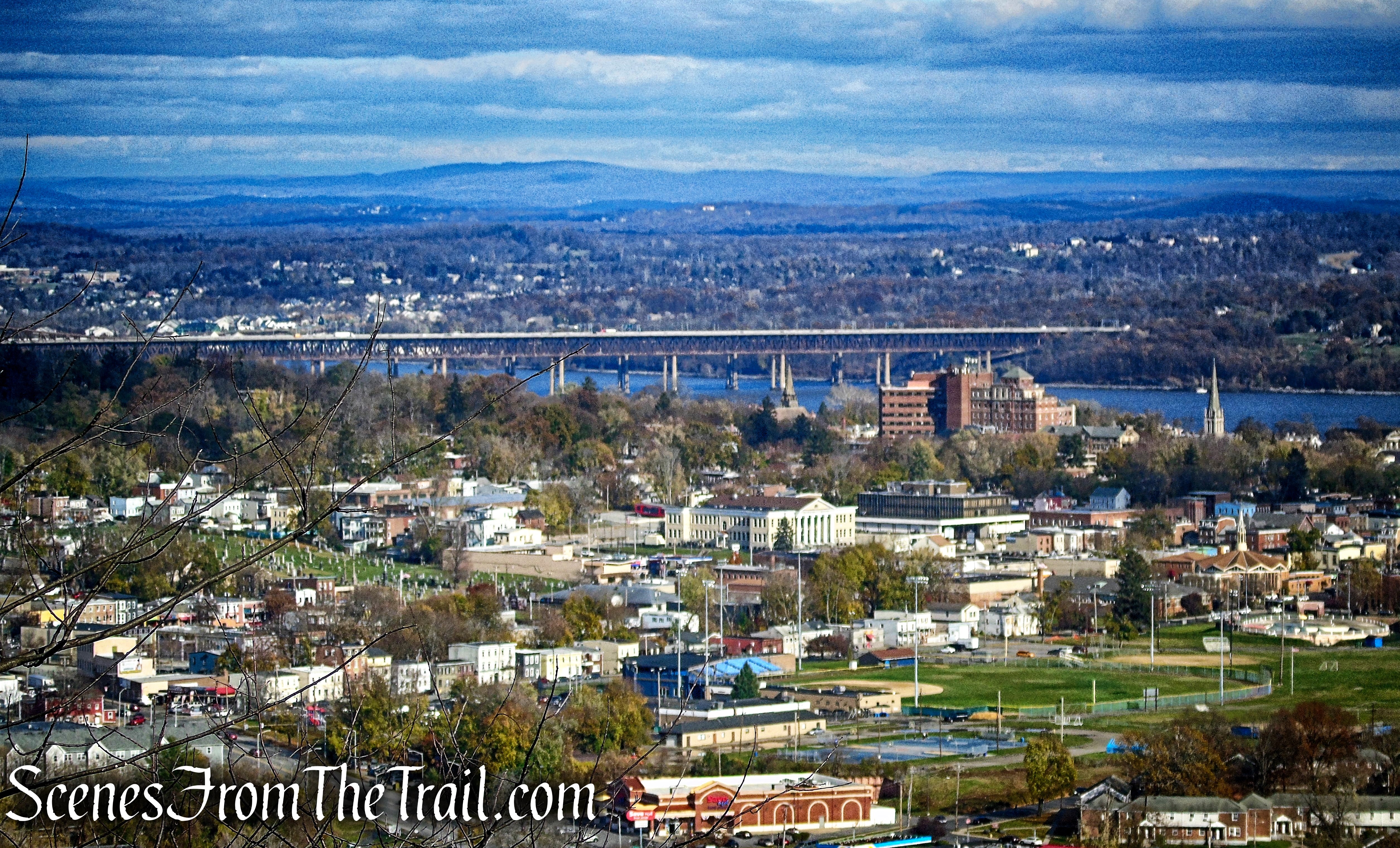
Here the panorama is more extensive, with views north as well as south. The Beacon waterfront and the East Hudson Highlands can be seen across the river. The historic architecture of Newburgh is visible down below to the north with the Newburgh-Beacon Bridge just beyond.
Yellow Trail – Snake Hill
Yellow Trail – Snake Hill
Yellow Trail – Snake Hill
Yellow Trail – Snake Hill

Yellow Trail – Snake Hill
When you are done enjoying the view, retrace your steps on the Yellow Trail back to the paved road and turn left. Continue retracing your steps past the two communications towers and continue downhill on the paved road. We stopped at the viewpoint with the benches one more time then returned to the paved road, following it downhill all the way to San Giacomo Park, where the hike began.

Yellow Trail – Snake Hill
Turn left on paved access road
Unmarked footpath – Snake Hill summit

Blue Trail benches – Snake Hill
Blue Trail benches view – Snake Hill
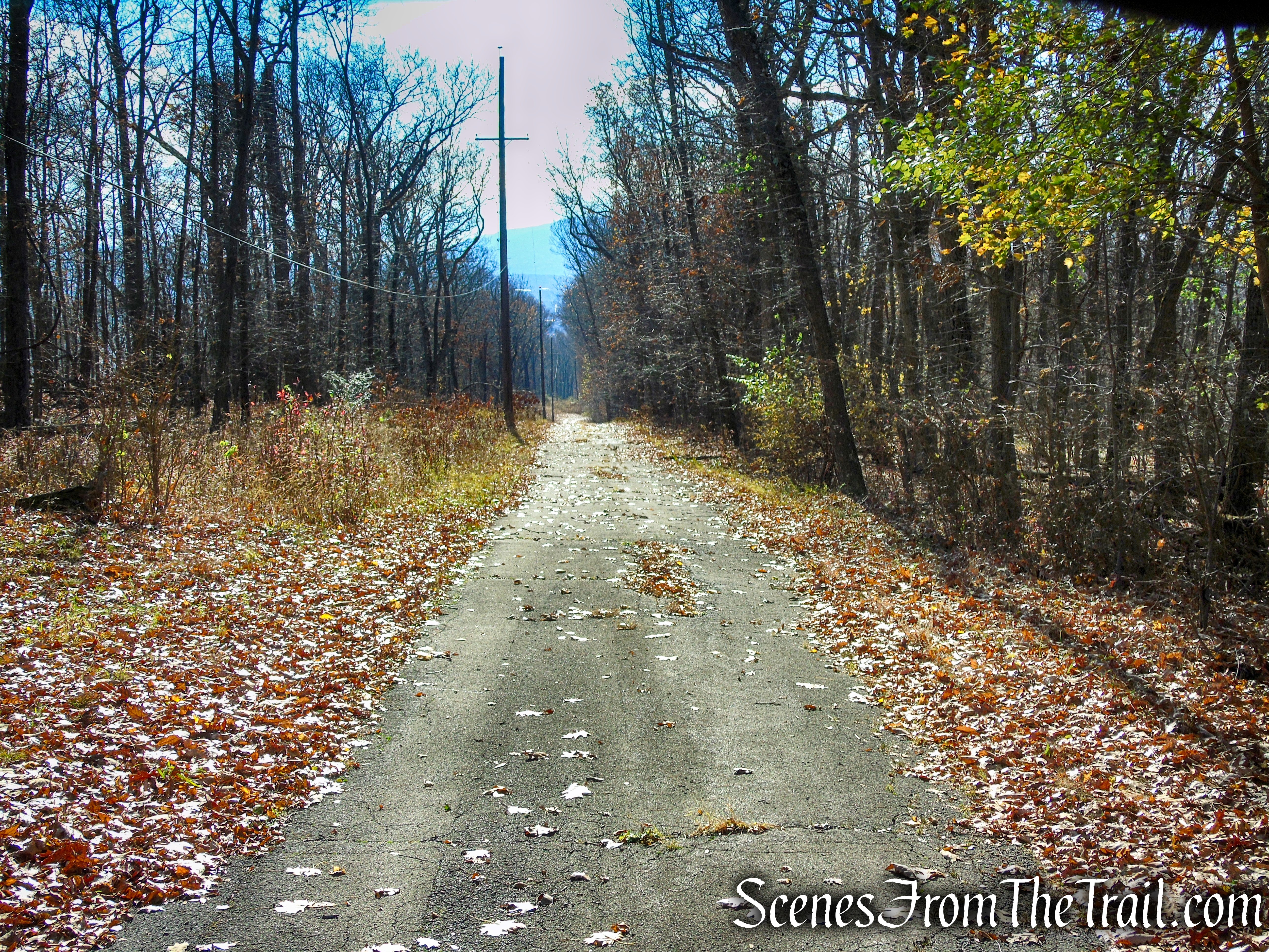
Paved access road – Snake Hill
Angry boulder – Snake Hill
Review:
This is one of my favorite views, so much so that I have hiked it three times in two months. We saw two people at the first viewpoint on the White Trail and no one thereafter. I am surprised that each time that I have hiked Snake Hill, I haven’t seen more than a couple of people. This is a great spot for a relatively easy hike and those benches are great. I highly recommend this hike to those that enjoy Hudson Valley views.
Pros:
Outstanding views, well marked trails, no litter (let’s keep it that way!), not much foot traffic, large paved parking lot that feels safe to leave your vehicle.
Cons:
None.
Take a hike!

Snake Hill from San Giacomo Park
Sources:

I hiked this and dont know what the box is either, hopefully someone does.
LikeLike