October 22, 2022 – Wurtsboro, NY
Difficulty: Easy
Length: Approximately 2 miles
Max elevation: 810 ft.– total elevation gain approximately 150 ft.
Route type: Out and back
Free map: Shawangunk Ridge Trail Map – 2016
Buy Map (Paper & Avenza): Shawangunk Trails Map 106B – 2019
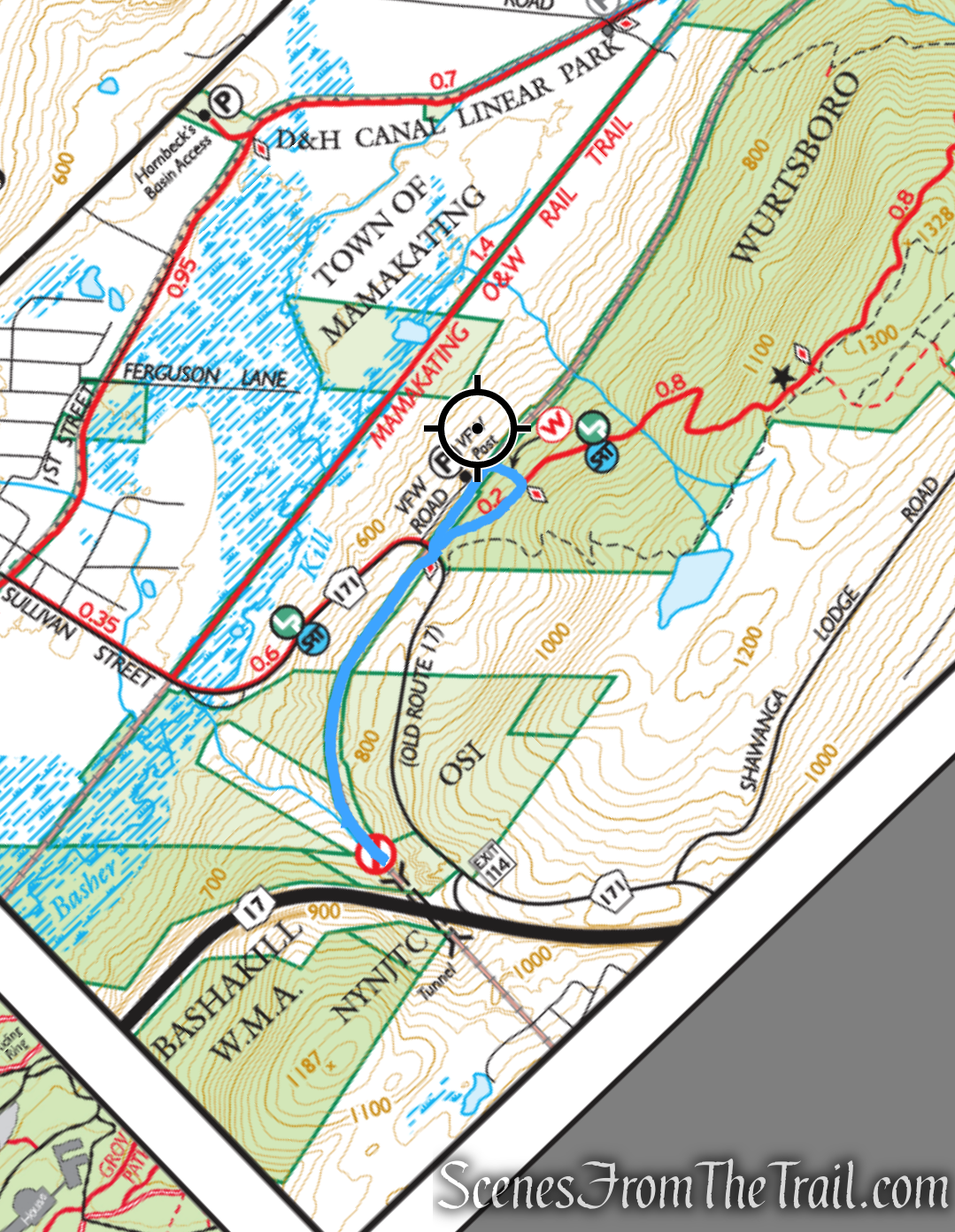
Trailhead parking: 26 VFW Road, Wurtsboro, NY 12790
Dirt parking area for about 10 cars – No restrooms on site
Please Note: It is not safe to enter this tunnel because it has not been maintained since the 1950’s, it is flooded and there is the danger of falling debris along with other hazards when exploring abandoned places. It is also rumored that people have drowned in the tunnel.
Overview:
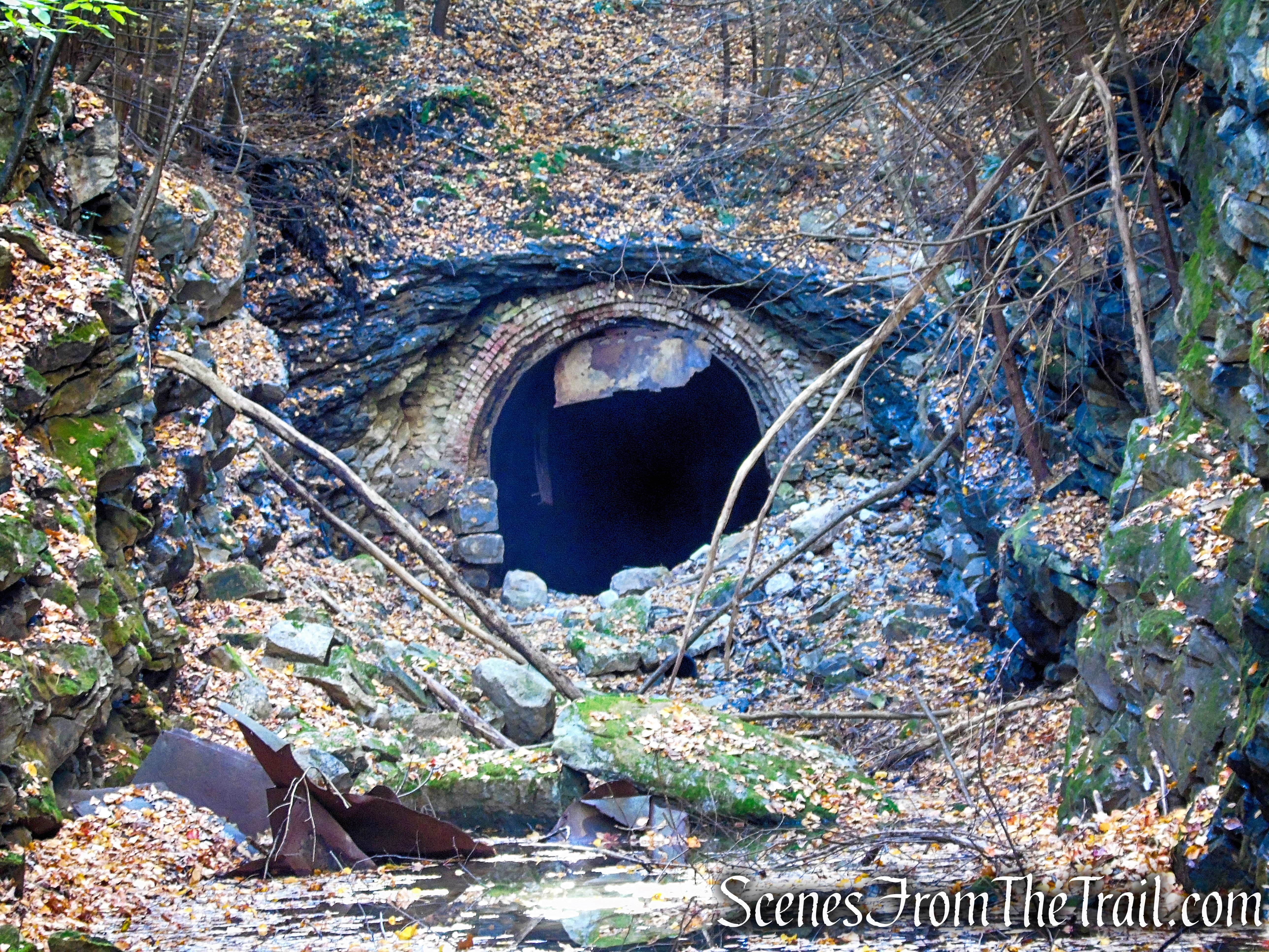
The High View Tunnel, also known as the Shawangunk Tunnel or the Bloomingburg Tunnel, was completed in 1871 through the Shawangunk Mountains by the New York and Oswego Midland Railroad (NY&OM), predecessor of the New York, Ontario & Western Railway (NYO&W or O&W). At 3,855-foot in length, High View is the longest among the four tunnels on the O&W.
High View Tunnel
Although the tunnel is located on property owned by the New York-New Jersey Trail Conference, the High View Tunnel is adjacent to Wurtsboro Ridge State Forest where there is trailhead parking for the Long Path/SRT on VFW Road. Since the the hike begins and ends in Wurtsboro Ridge State Forest, I named it as part of the state forest in order to make it easier to identify its location.
History:
The New York, Ontario & Western Railway (O&W, NYO&W) was a regional railroad that connected Oswego, New York to Weehawken Terminal in New Jersey. At the end of the 19th century, the O&W Railway was the best way for New York City passengers to make their way to the Catskill Mountains. It is the first notable railroad in America to have its mainline entirely abandoned.
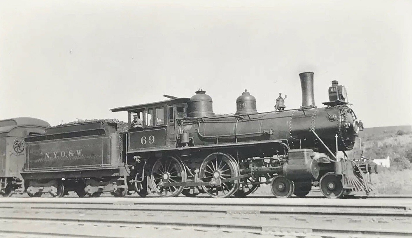
New York, Ontario and Western Railroad
In 1868, the New York and Oswego Midland Railroad (Midland), predecessor to the O&W, began building its mainline from Weehawken, New Jersey to Oswego, New York. The route selected would pass through the Shawangunk Ridge via a tunnel between Wurtsboro on the west and Bloomingburg on the east. Construction began in 1868 at both ends of the tunnel. Three years later, Midland completed the High View Tunnel after excavating through 3855 feet of Shawangunk Grit. When the workers finally met in the middle, to everyone’s delight they were only a few feet apart.
The High View Tunnel operated from 1871 until 1957 but not without its problems, mainly water and falling rock. While Shawangunk Grit is impervious to water, the open seams running through the grit are perfect waterways. Once abandoned, the tunnel continued to take on water with no one taking steps to dewater the tunnel. Meanwhile, NYS Route 17 was built over the High View Tunnel and, at one point, future plans called for a ramp directly over the North Portal. Those plans have since been scrapped.
In 1980, possibly in response to rumors of a drowning in the High View Tunnel, an attempt was made to seal the North Portal. Despite efforts, the portal wasn’t completely sealed and the resulting large debris pile in the front of the North Portal allowed even more water to collect in the tunnel (the crest of the tunnel is near the South Portal which is private property). An early 1970’s view of the masonry North Portal shows already some deterioration had taken place. This gives a good indication that perhaps as much as twenty feet was collapsed and excavated in the attempt to shut off access.
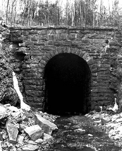
High View Tunnel – 1970’s
The New York Department of Transportation grew concerned that the higher water levels (estimated at 13 feet in some places) could weaken the tunnel, posing a threat to Route 17 (I-86). The DOT cleared the debris from the North Portal in 2006, thereby reducing the water level to about 3 feet nearest the North Portal.
Hike Overview:
I visited the High View Tunnel in 2016 and decided to pay it a return visit. Not much has changed since then, but the abandoned railbed seems to have taken on more water or at least it appeared that way. On this visit, we couldn’t get as close to the tunnel as last time due to the amount of water near the entrance of the north portal of the tunnel. So much water that Gaia GPS has it listed as “High View Tunnel Outflow Stream” on its online maps. Although I had on waterproof boots, the water was much deeper than the top of my boots. Also the ground was muddy enough in places to suck the boots right off your feet if you stepped in the wrong spot.
High View Tunnel
The hike begins at VFW Post 4947 which is the former Mamakating Depot for O&W Main Line and is on the same grade as the High View Tunnel. Long before O&W trains stopped running in 1957, the company had closed the Mamakating Depot. The building was in disrepair when VFW Post 4947 purchased it for their base of operations.
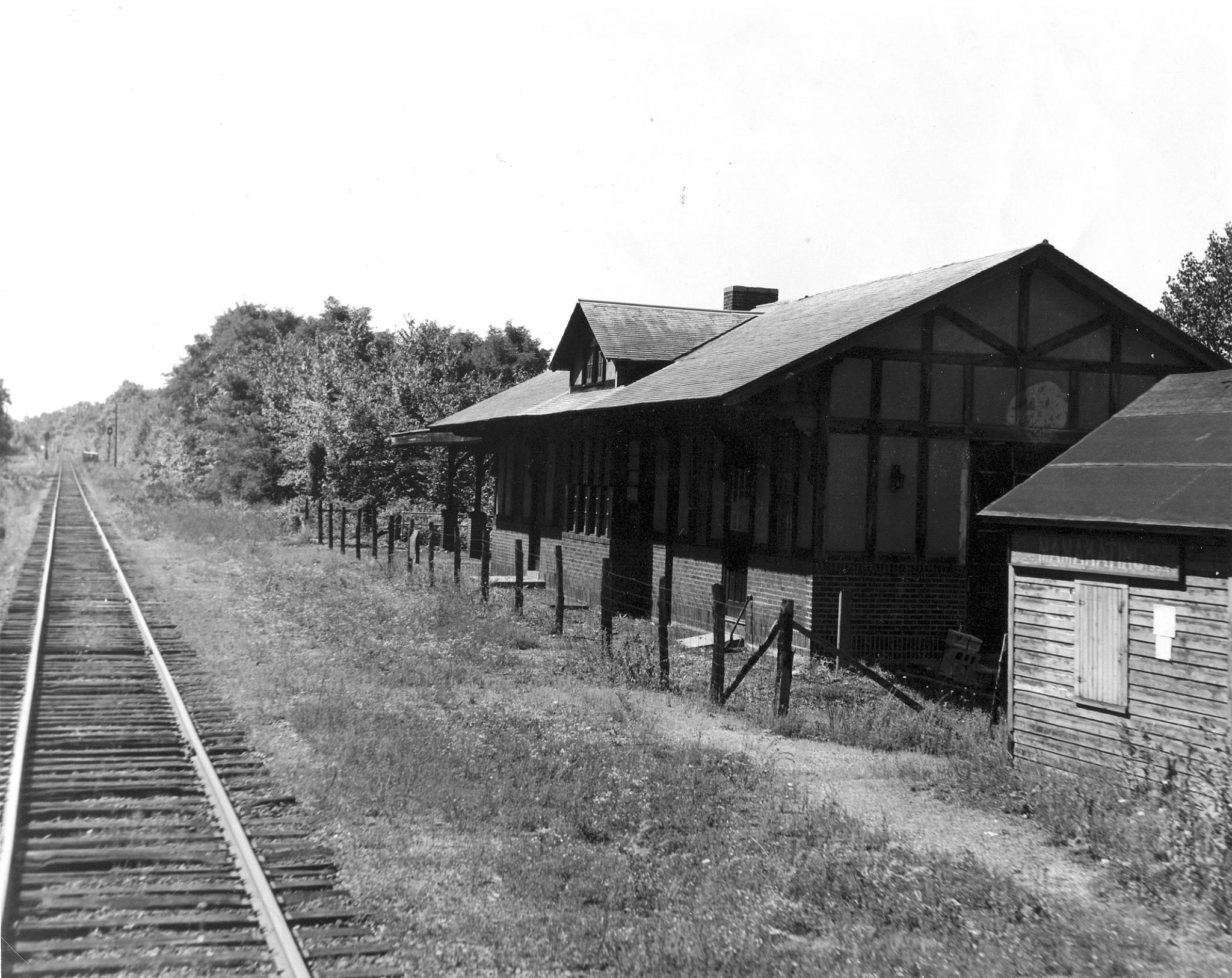
Mamakating Depot
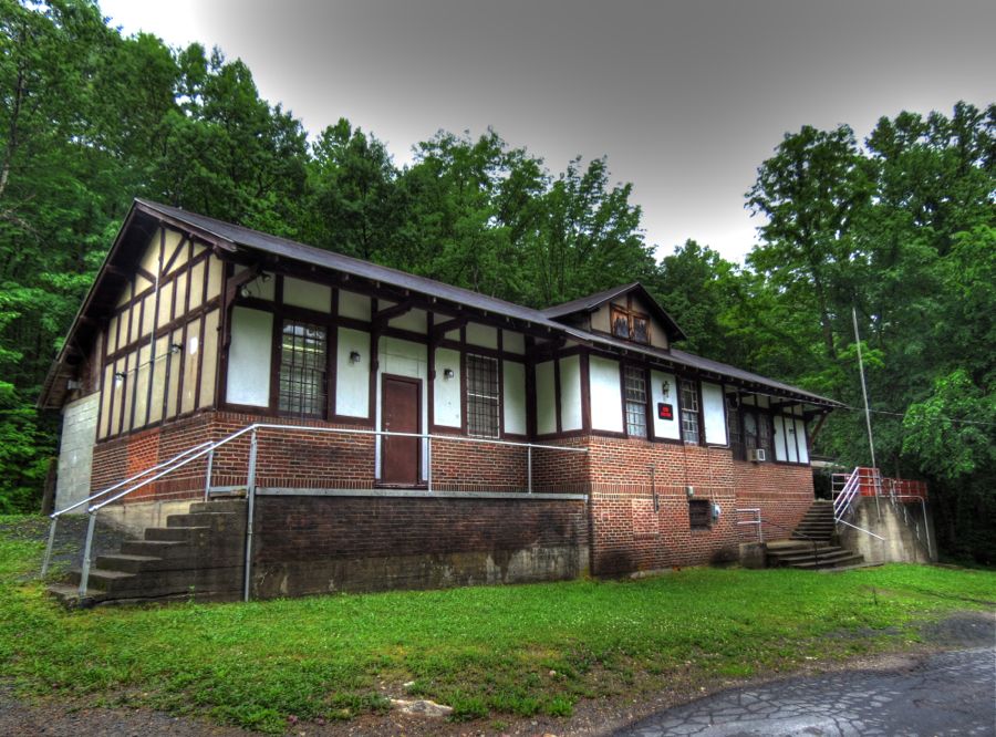
VFW Post 4947
There is parking along the left side of the building as you drive in. DO NOT block the gate or the entrance road. There is a scrap yard near the entrance to VFW Road that has several barking dogs of various sizes. We heard them barking as we began the hike, and as we were returning to the parking area, two medium sized dogs approached us barking, but retreated once I yelled at them. Just a heads up to be vigilant if you decide to visit.
This is a relatively easy and straightforward out and back hike. If you so choose, you can walk back down VFW Road, bypassing the trail and cross the road to reach the abandoned railbed. I chose to use the SRT/Long Path south to reach the road and a short section of the railbed between the VFW and the road to return to the parking area, to eliminate the road walk.
High View Tunnel
As you can see from the elevation graph, it’s a relatively level hike.
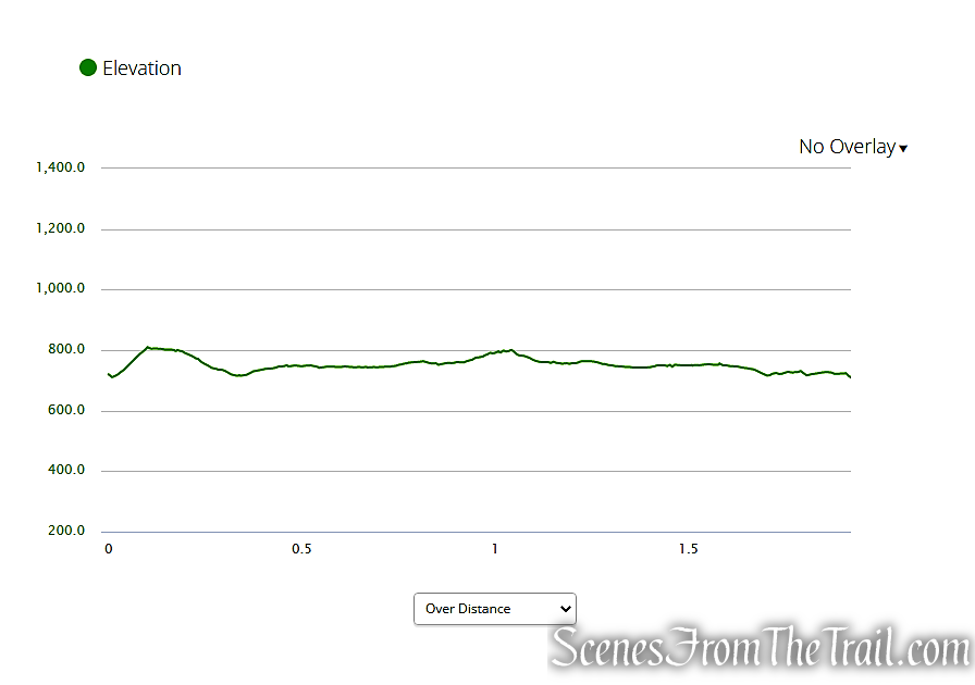
elevation profile – High View Tunnel
The Hike:
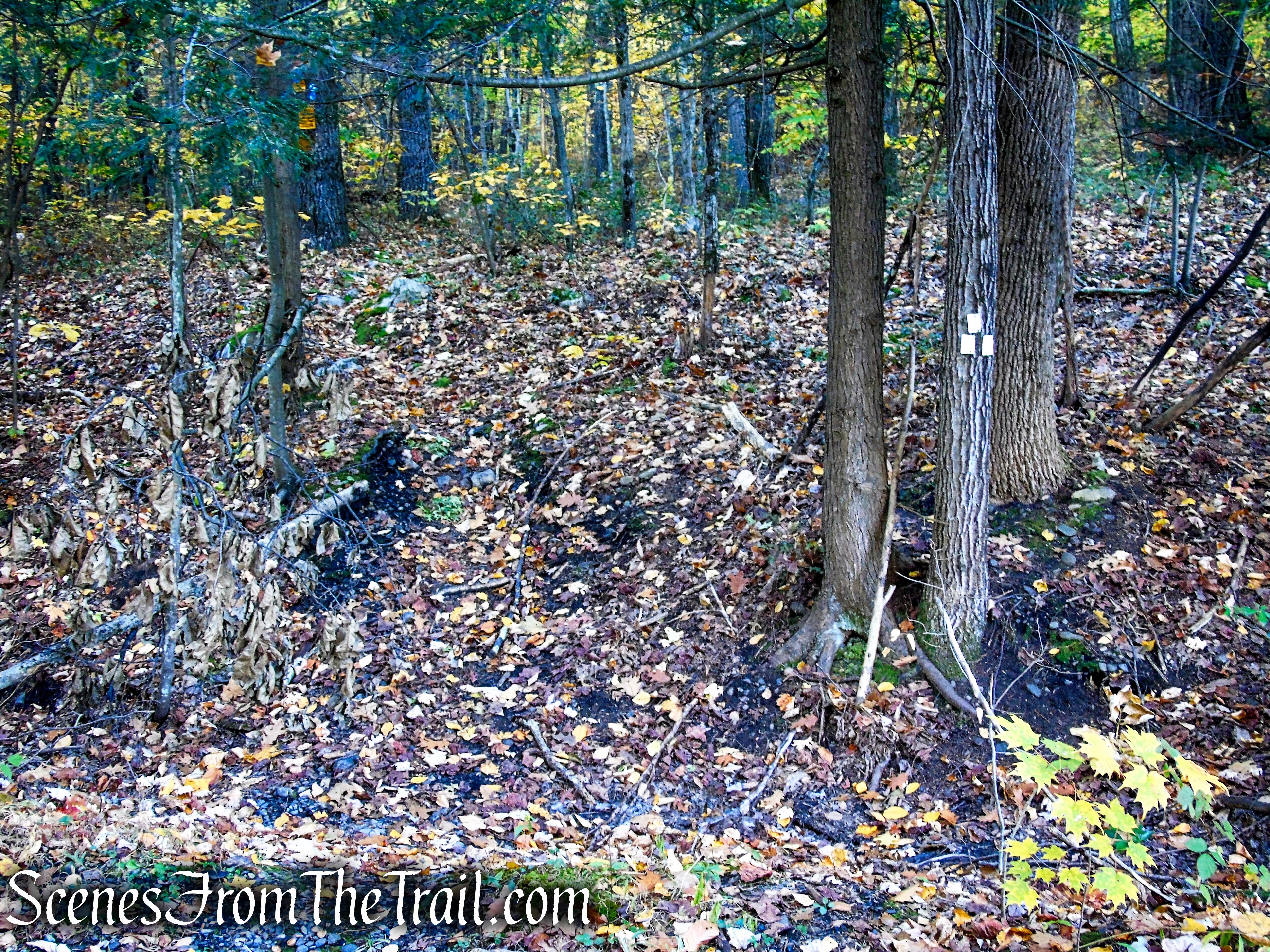
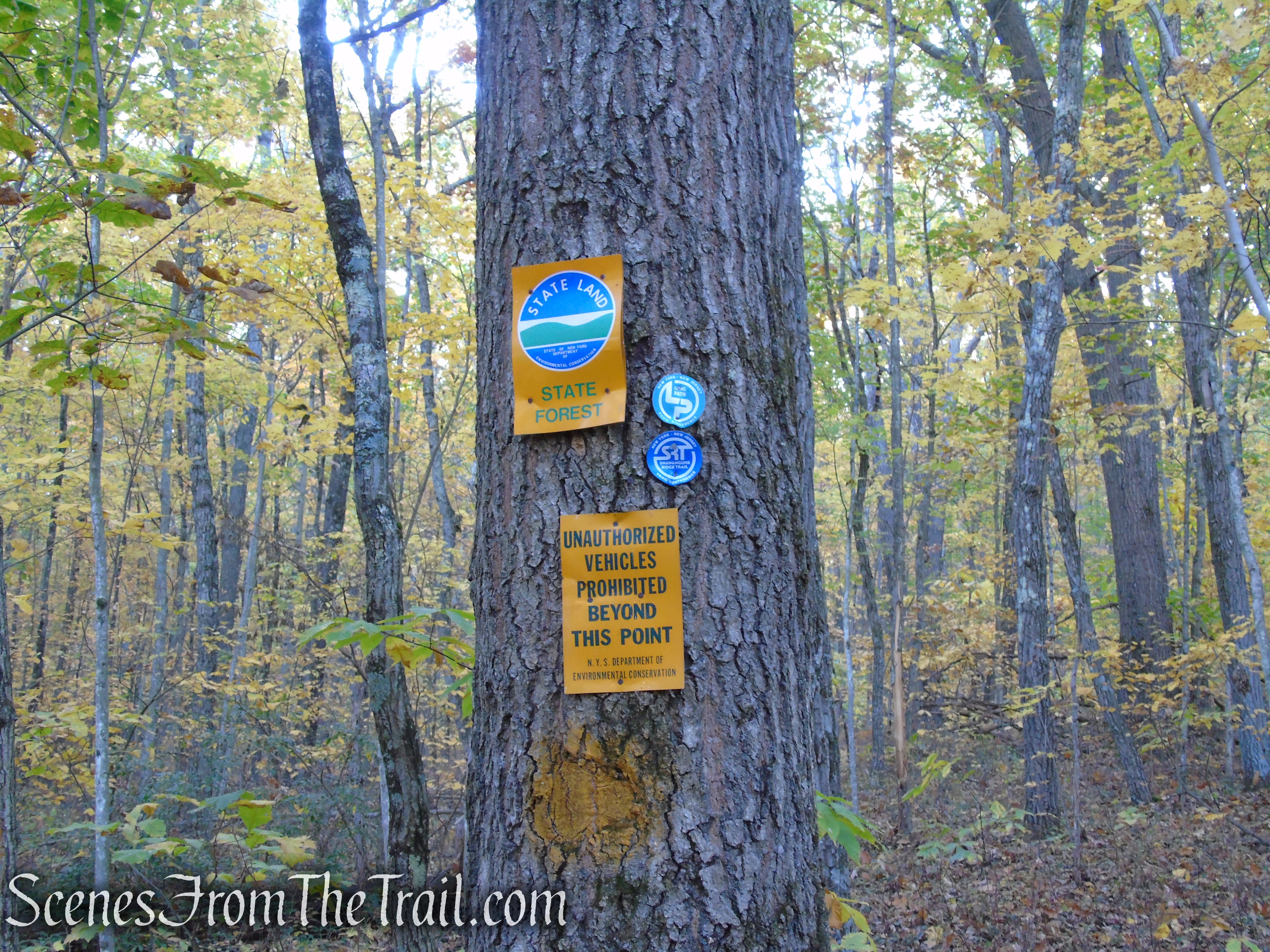
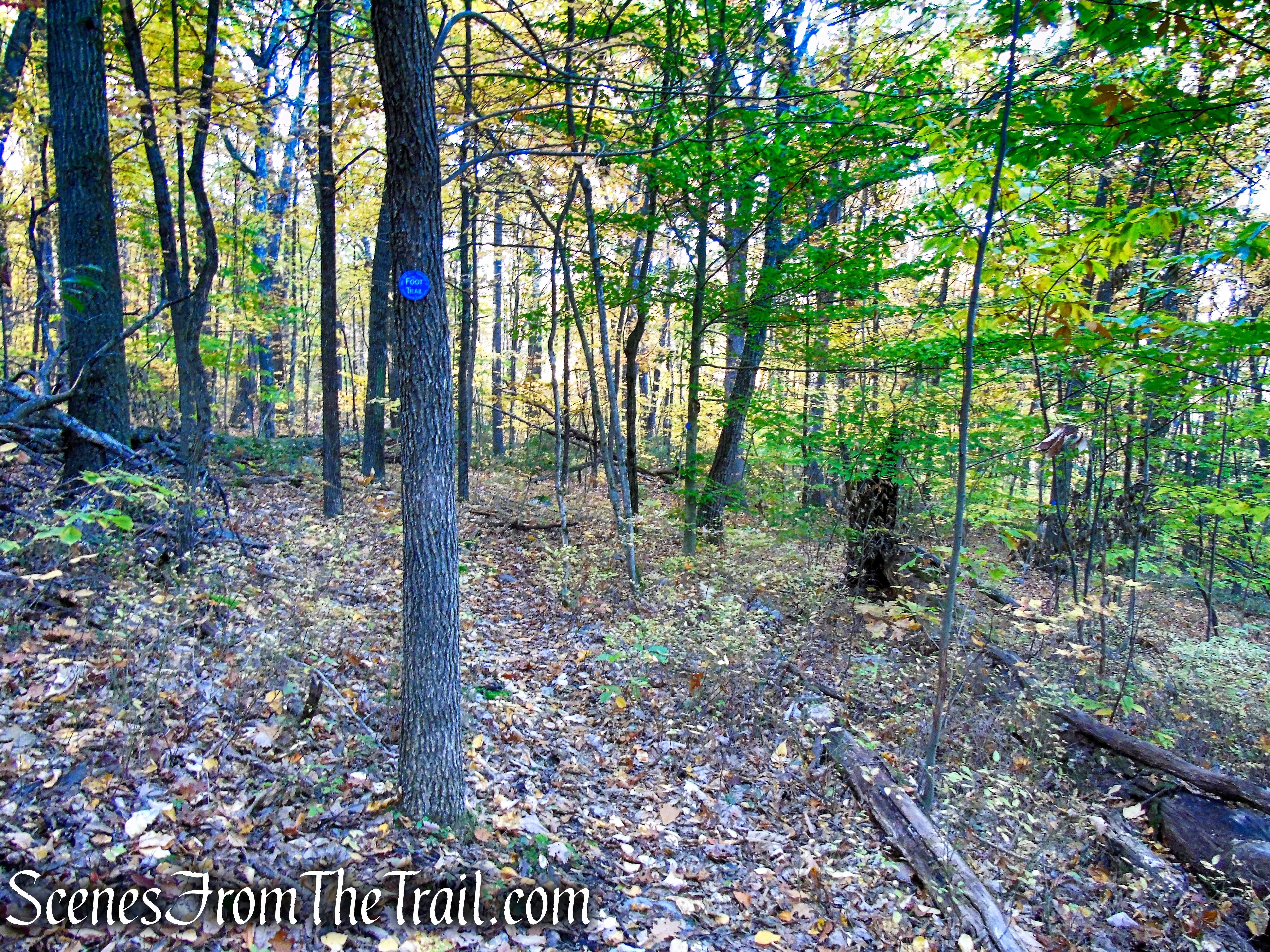
Walk to the back of the parking area towards the gate. beyond the gate is the continuation of the abandoned railbed heading north. To the right of that concrete block are three white blazes on a tree. That is the start of the Connector Trail that leads to the co-aligned Long Path/SRT. The White Trail climbs for about 400 feet until its terminus at a T-intersection with the Shawangunk Ridge Trail (SRT). Turn right at the junction and follow the SRT south as it weaves its way through the woods.
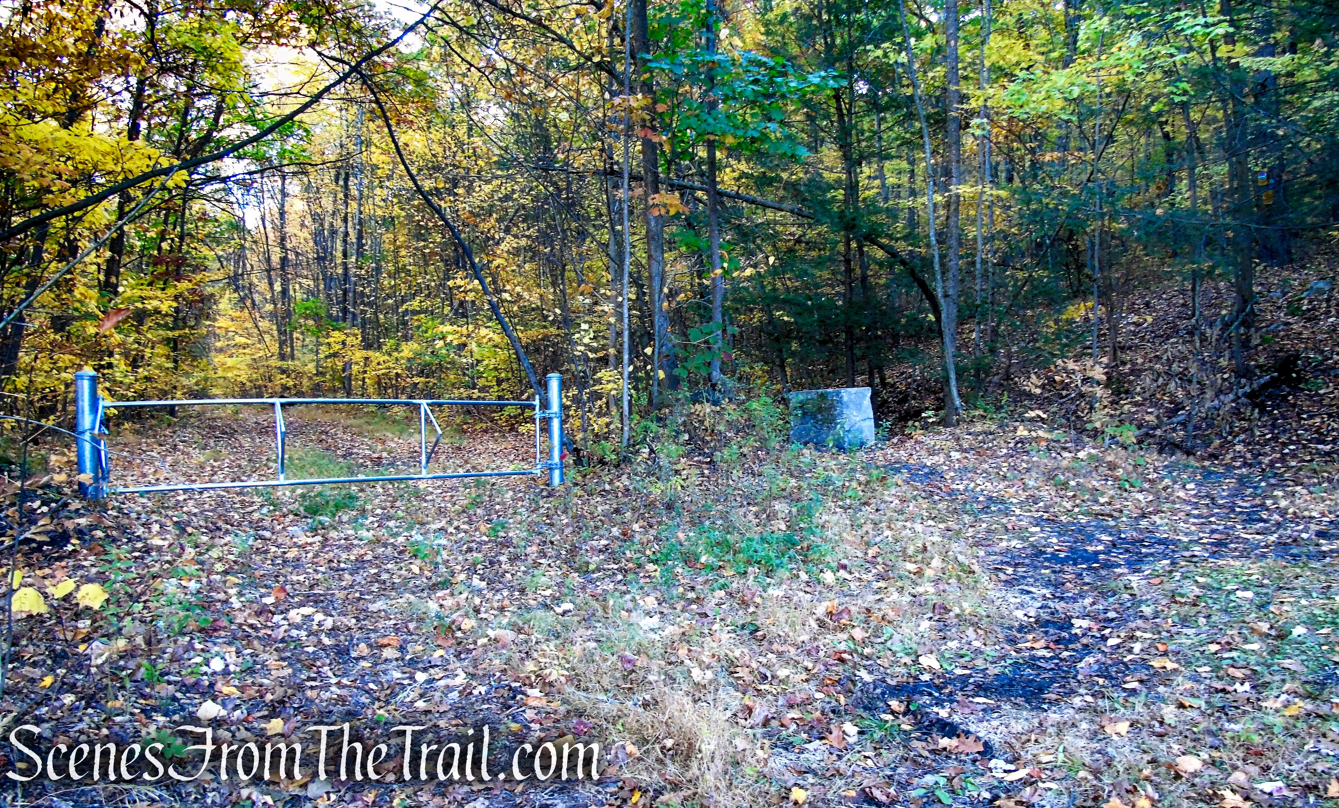
VFW Road trailhead parking
White Connector Trail – Wurtsboro Ridge State Forest
White Connector Trail – Wurtsboro Ridge State Forest
Long Path/SRT – Wurtsboro Ridge State Forest
Long Path/SRT – Wurtsboro Ridge State Forest
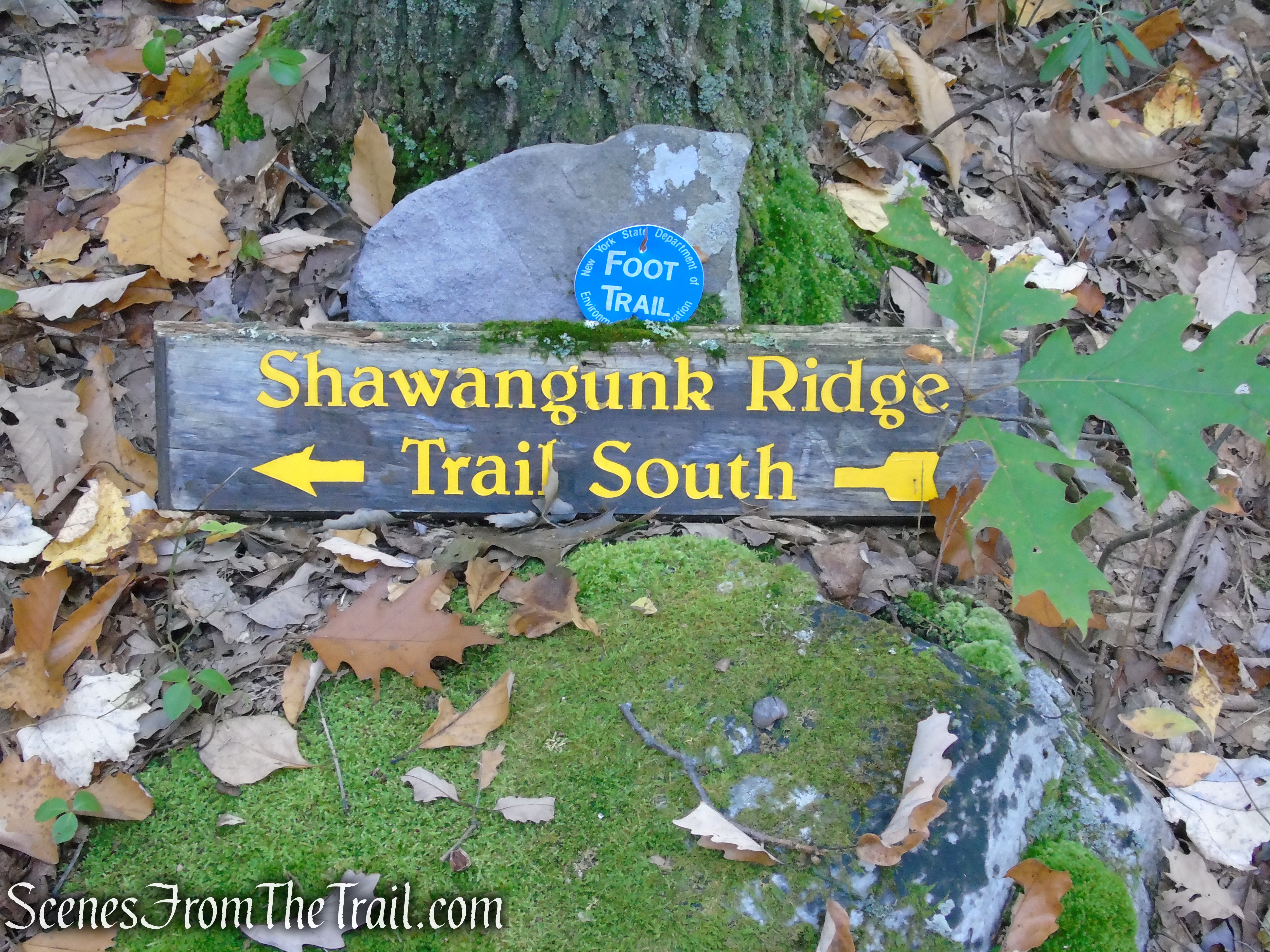
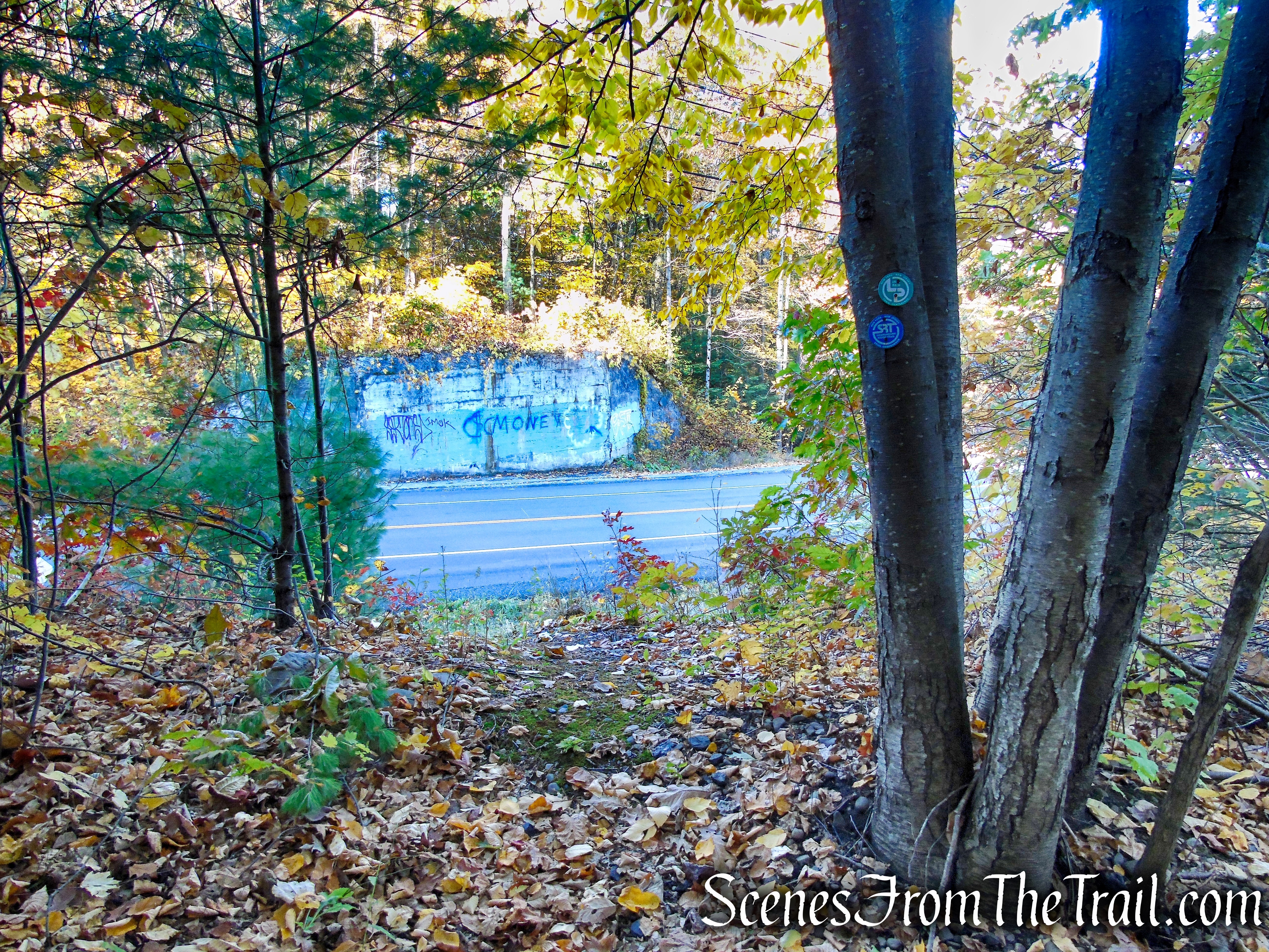
In about 350 yards, the SRT reaches Sullivan County Route 171 (Mamakating Road). Here the Long Path/SRT turns right and begins a road walk, but you should carefully cross the road. This is a hairpin curve where cars speed by with a limited sight distance so be alert when crossing here.
Long Path/SRT – Wurtsboro Ridge State Forest
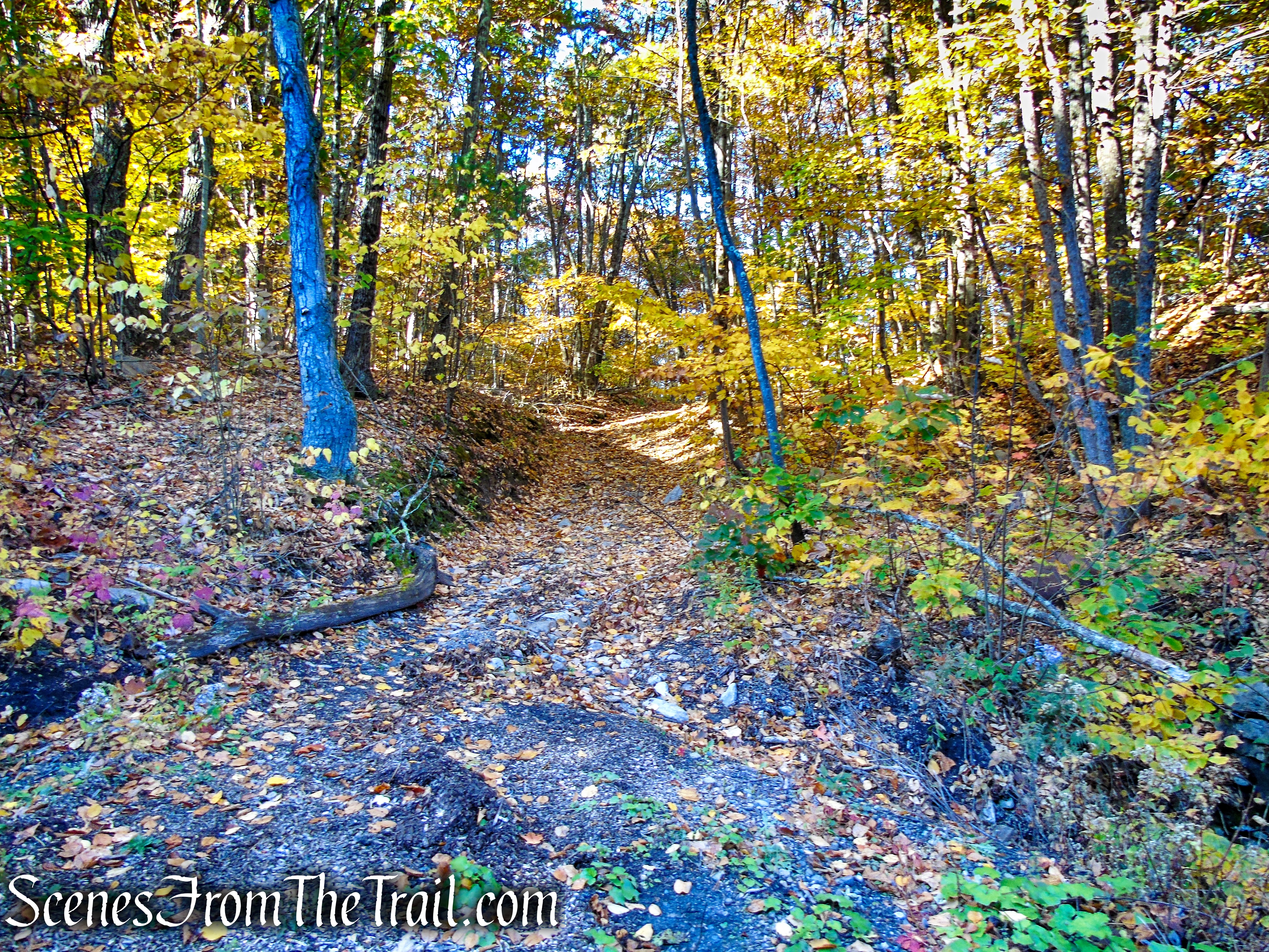
Directly across the road is a bridge abutment that supported the railroad bridge. To the left of the abutment is an access road that leads to the abandoned railbed. Follow the road up the hill and turn left, heading south.
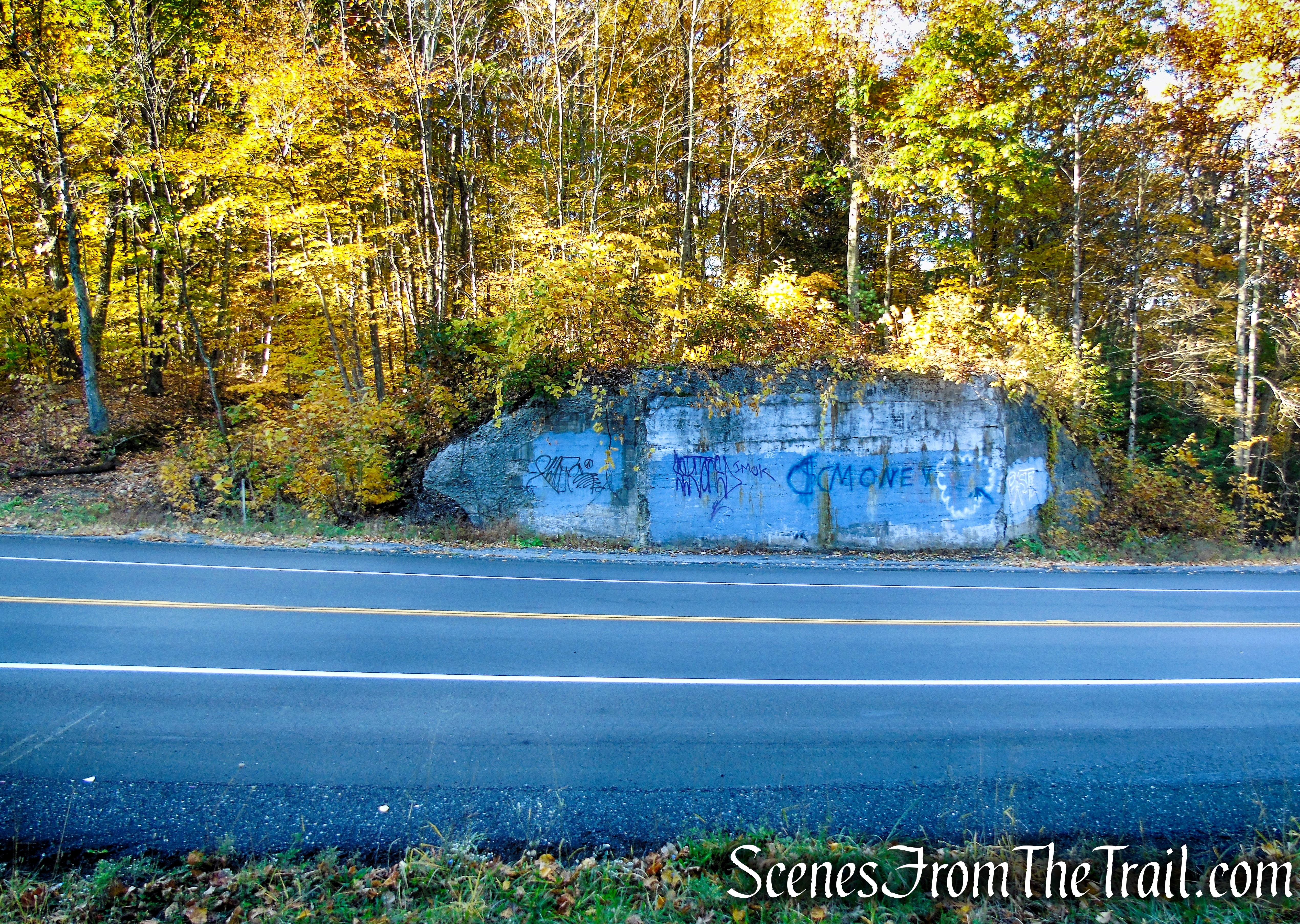
Sullivan County Route 171 – Mamakating Road
Access Road to abandoned railbed

Abandoned railbed – High View Tunnel
Once on the railbed, it’s about a 0.7-mile, mostly flat walk to the north portal of the High View Tunnel.
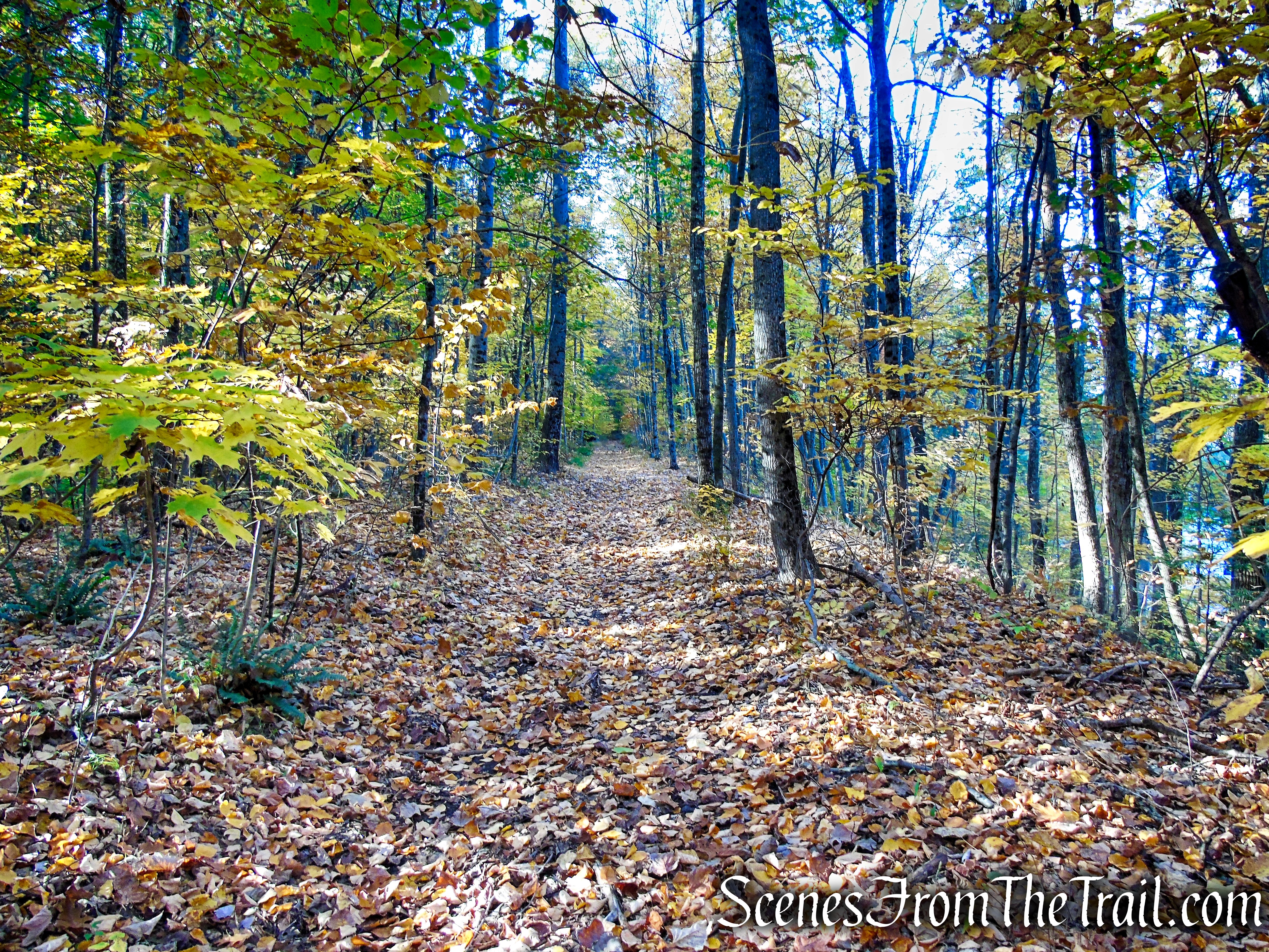
Abandoned railbed – High View Tunnel
In another 350 yards or so, on the left, there is a concrete telephone booth. The C.F. Massey Company, based in Chicago, manufactured these enclosures for any number of purposes, such as telephone booths, outhouses, watch shanties, and oil storage sheds.
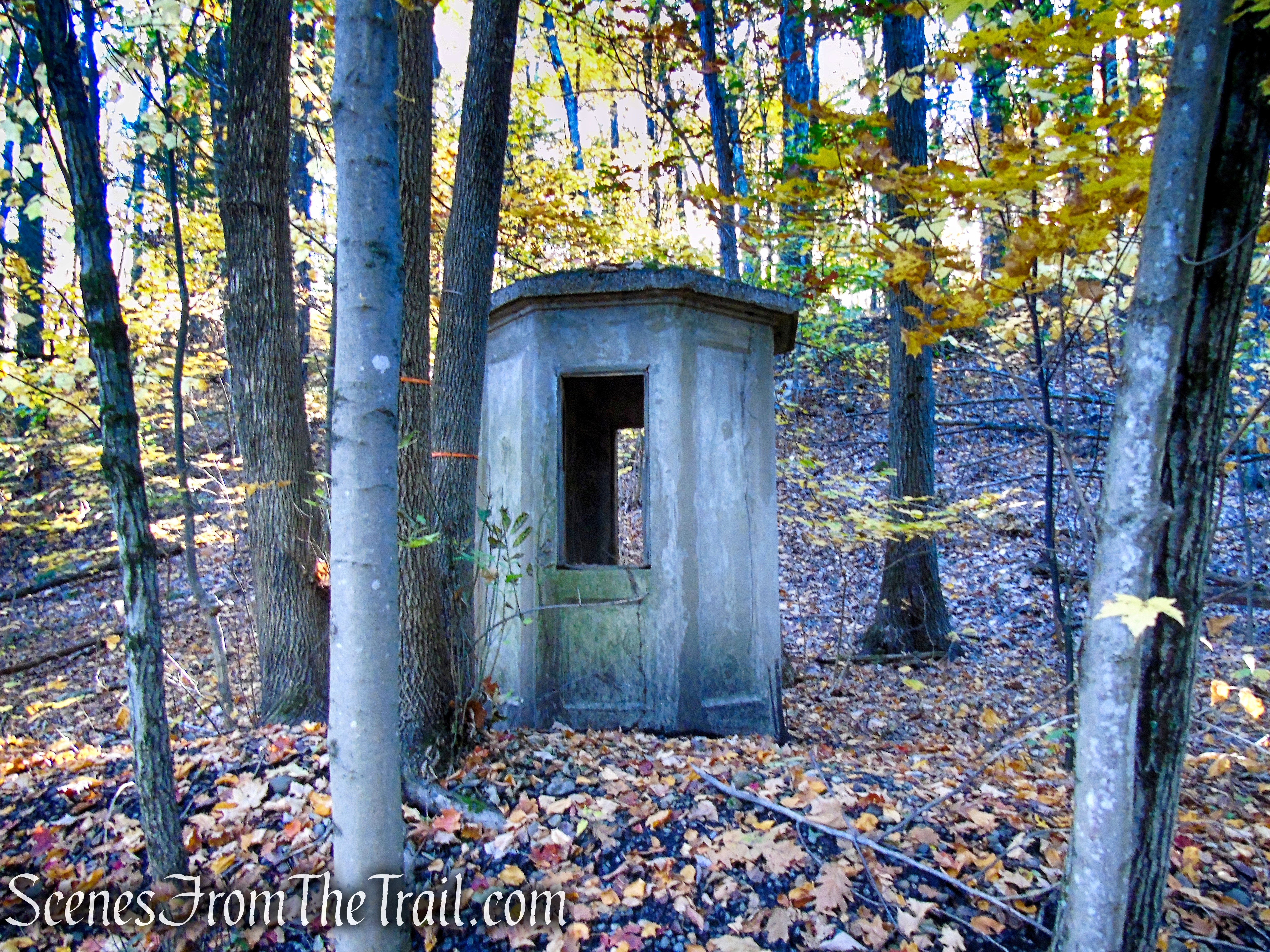
Abandoned railbed – concrete telephone booth

Abandoned railbed – High View Tunnel
Abandoned railbed – High View Tunnel
Not far from the concrete telephone booth, there are still some concrete footings that supported the signal towers.
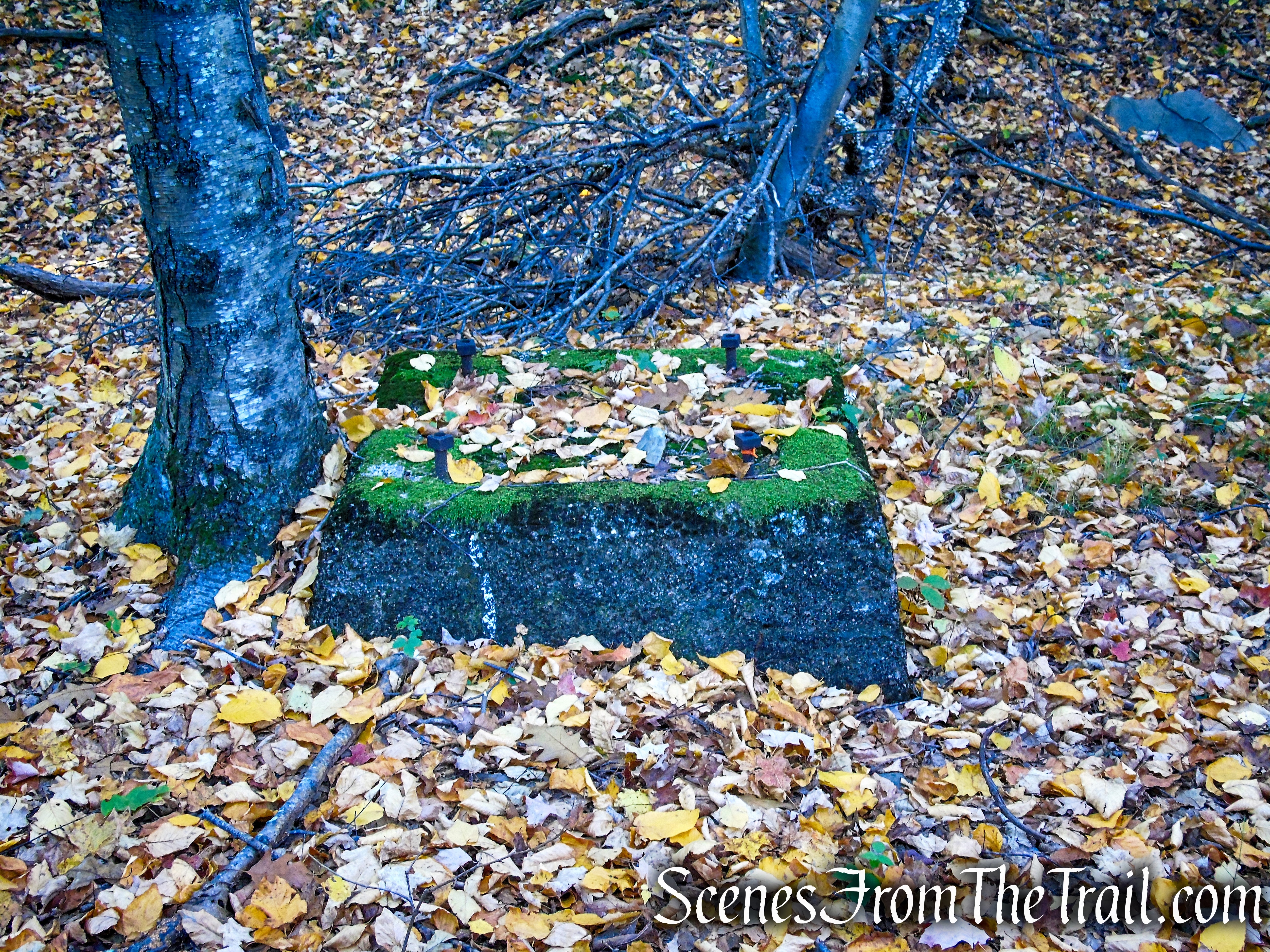
Abandoned railbed – concrete footing
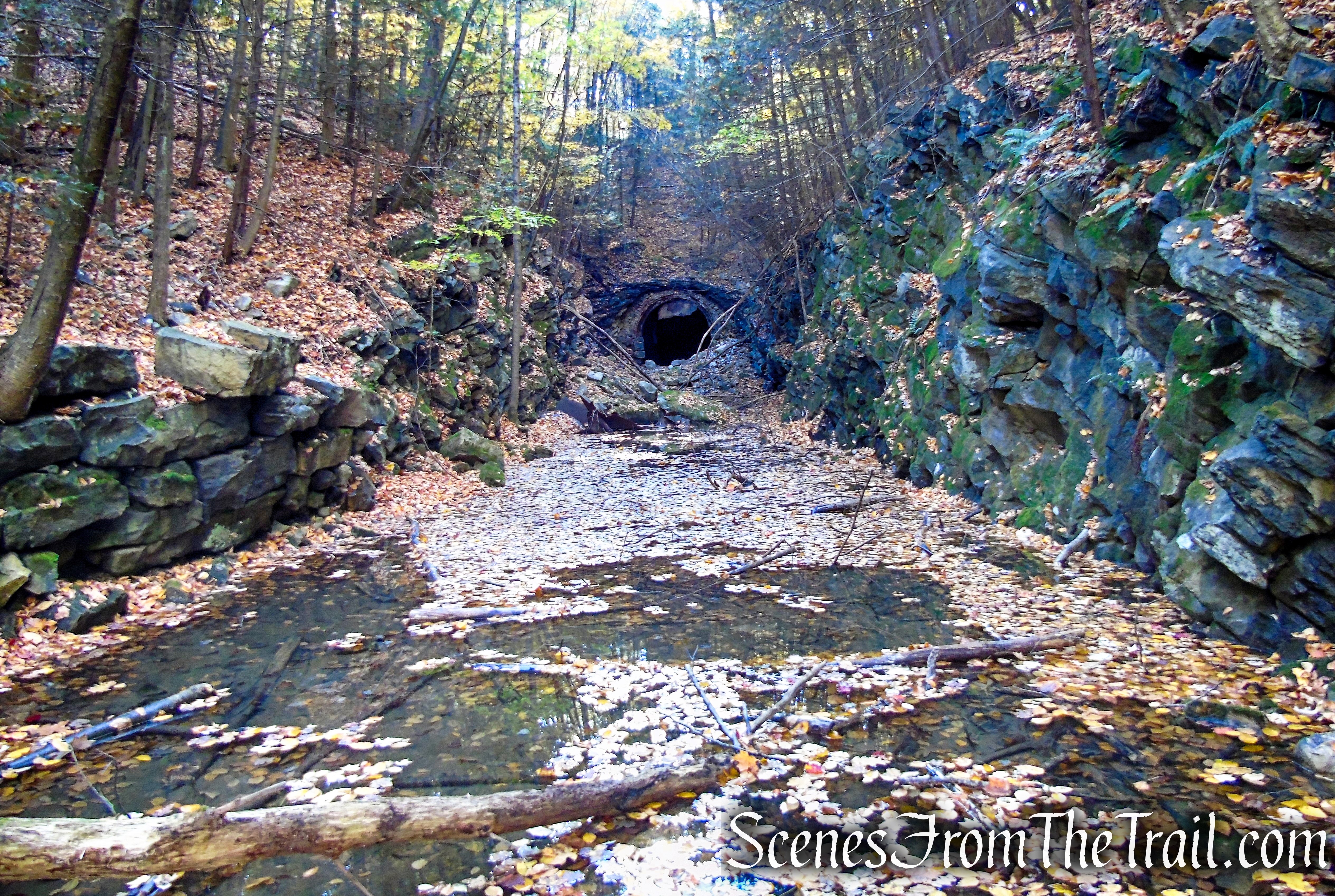
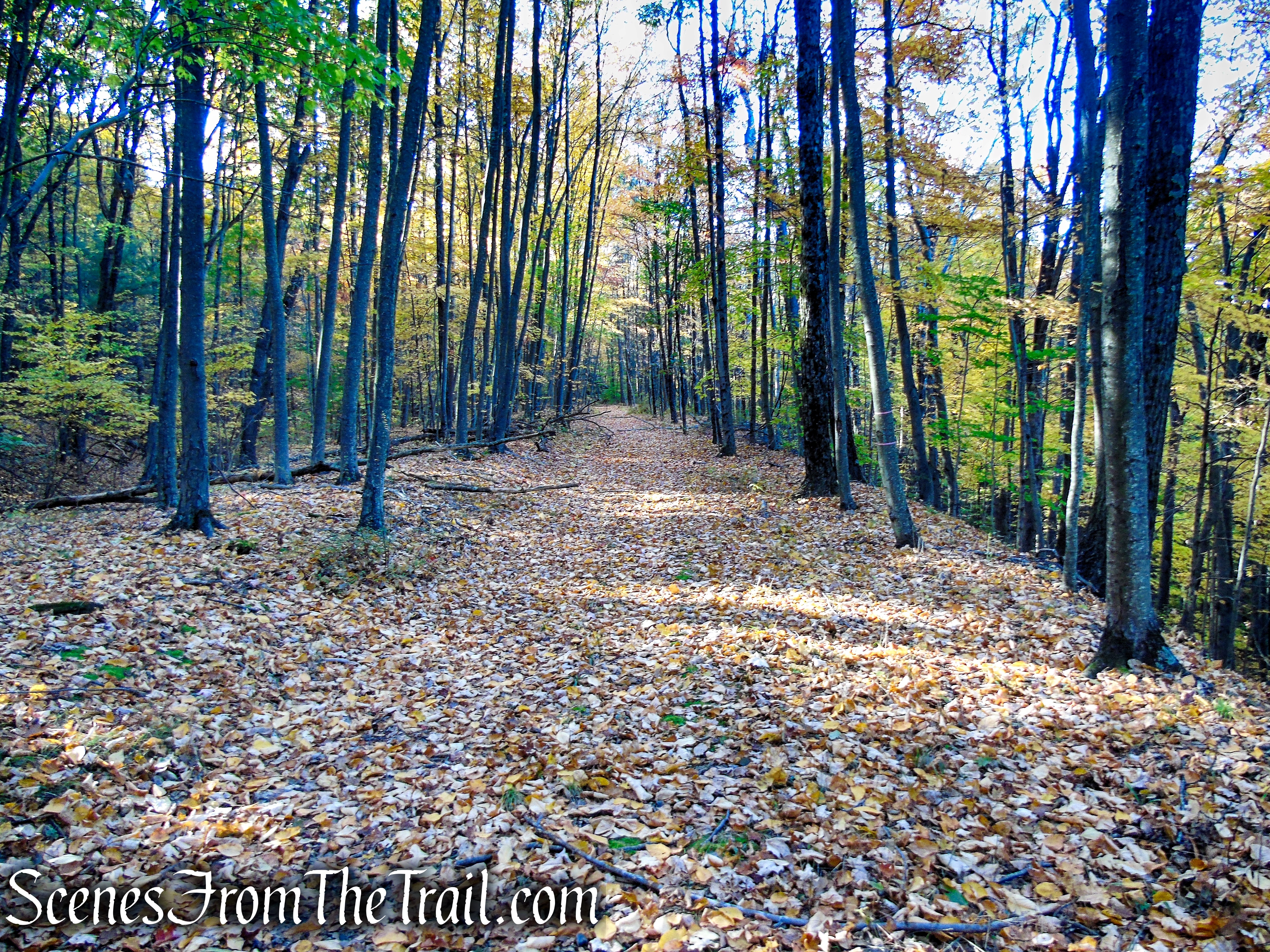
A short distance later, as the railbed approaches a rock cut, there are some leaning trees and caution is advised when walking underneath them.
Abandoned railbed – High View Tunnel
Abandoned railbed – High View Tunnel
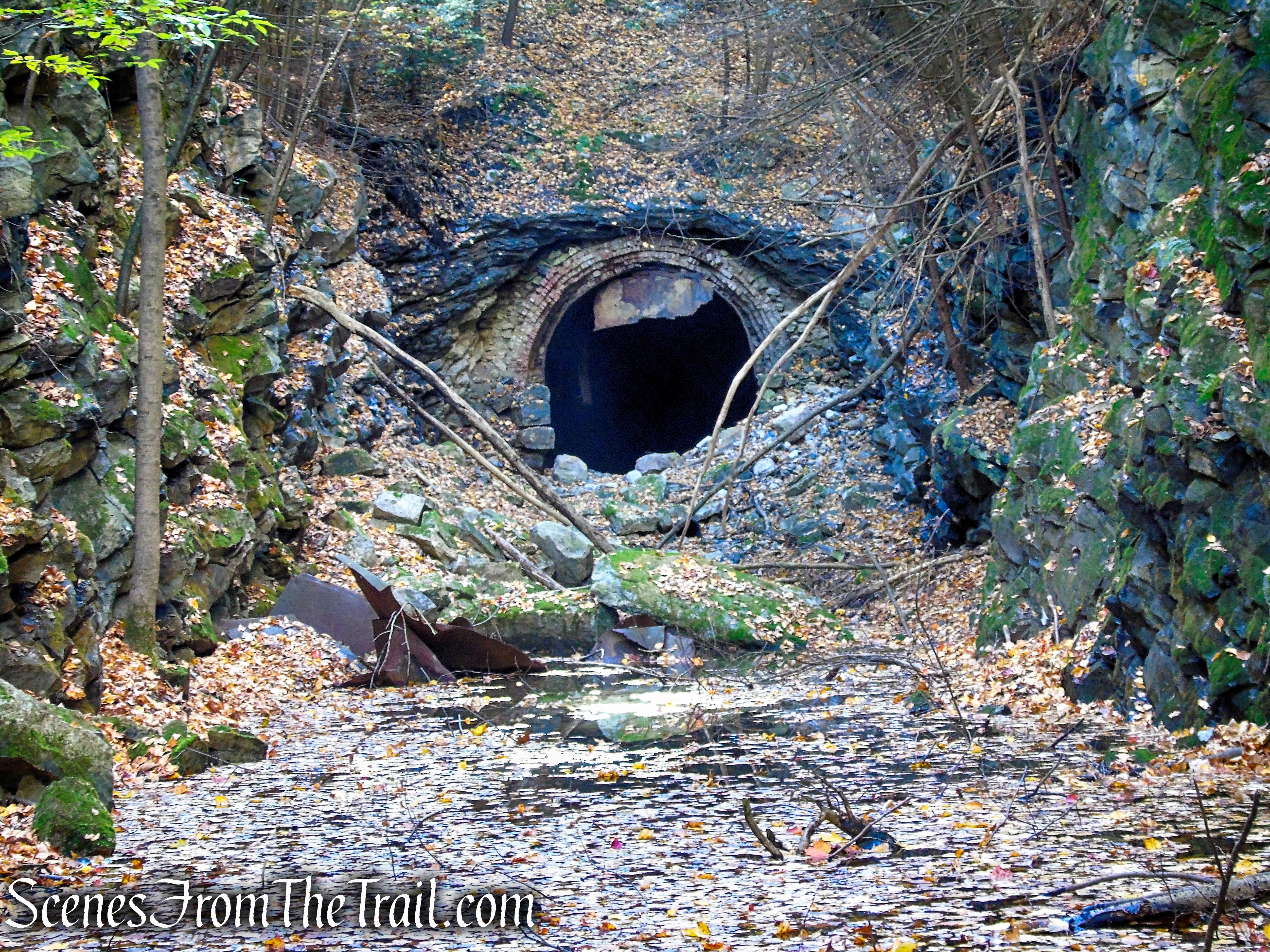
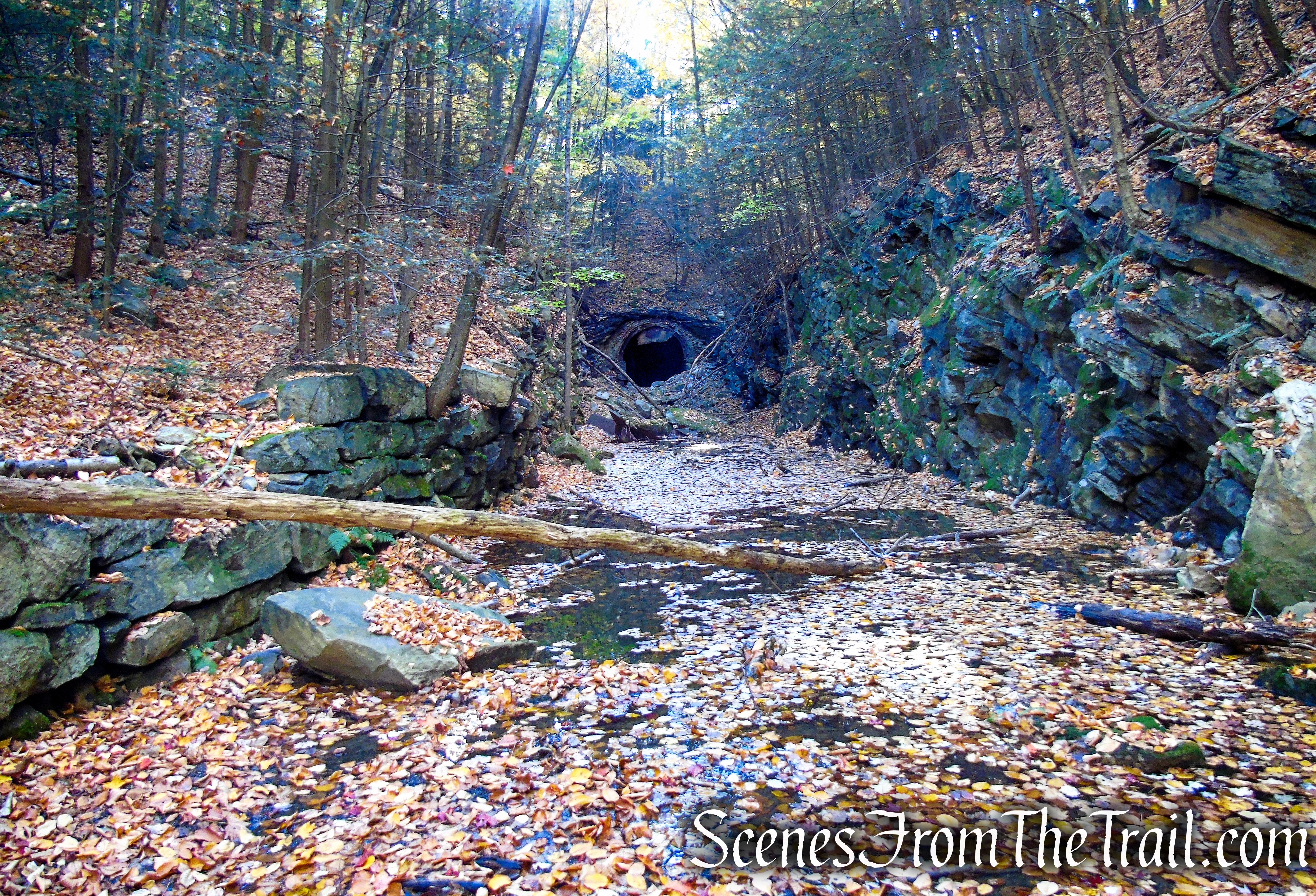
After passing through the rock cut, you will arrive at the High View Tunnel Outflow Stream. This stream flows out of the north portal and courses downhill to your right. Do your best to keep your feet dry in this area.
High View Tunnel Outflow Stream
On the right side of the railbed is an old explosives magazine, used for the “day storage” of explosives. The robust stone walls, inward opening steel door, and flimsy wood roof were designed to contain any accidental blast and direct it skyward. It was used during the tunnel’s construction, and possibly in later years to help clear the frequent cave-ins that occurred.

Abandoned railbed – explosives magazine
The water gets deeper and the grip of the mud gets stronger as you near the tunnel.
Abandoned railbed – High View Tunnel
This is about as far as we got on this day. I didn’t want to risk losing a boot or getting water over the top of my boots.
Abandoned railbed – High View Tunnel
The image below is from 2016. It was taken from about the same spot as the image above. Notice the row of rocks in the foreground lined across the railbed. These same rocks are now underwater in the image above in 2022.
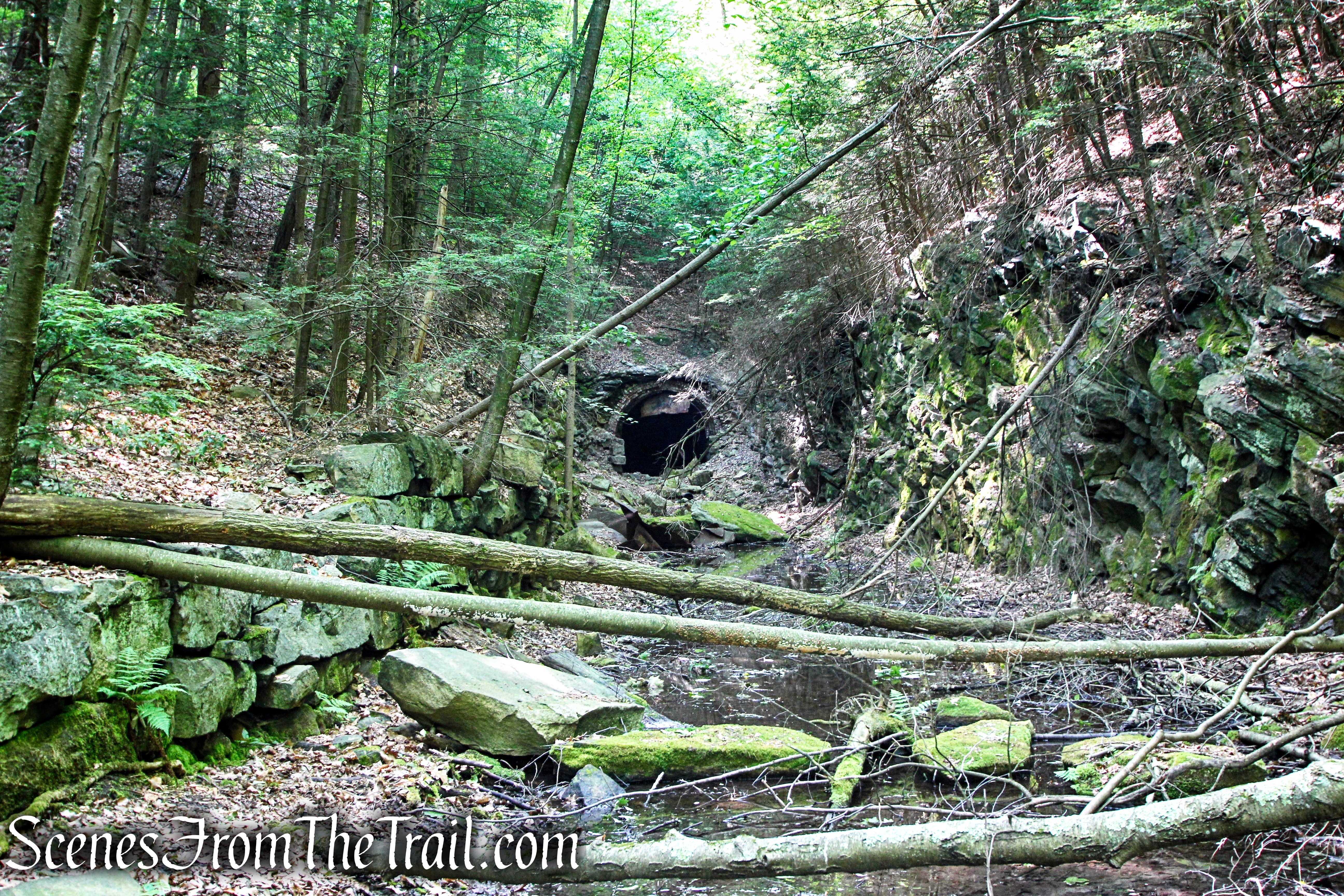
Abandoned railbed – High View Tunnel
High View Tunnel
High View Tunnel
Since we didn’t get as close as I would have liked, I included an image from 2016 of the interior of the tunnel.
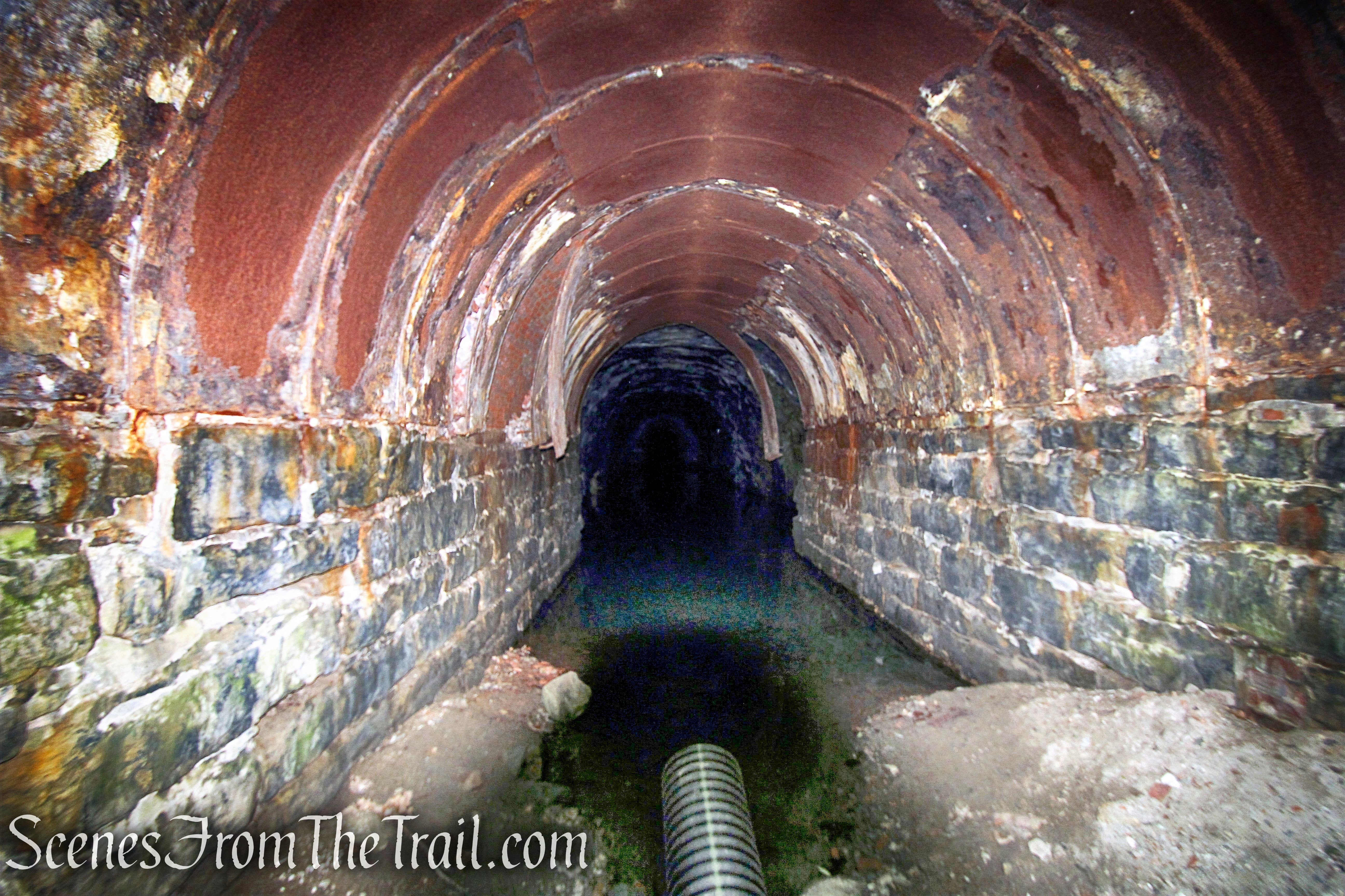
High View Tunnel – 2016
From here it’s just a matter of retracing your steps back to CR 171 (Mamakating Road) and carefully crossing the road. Instead of taking the Long Path/SRT, we found the abandoned railbed on the north side of the road and followed that back past the VFW, to the parking area, where the hike began.
Access Road to abandoned railbed
Abandoned railbed on north side of CR 171 (Mamakating Road)
Abandoned railbed on north side of CR 171 (Mamakating Road)
VFW Post 4947
Review:
A short hike, but it could be made longer by taking the abandoned railbed north from the VFW or for a more challenging hike, you can take the SRT/Long Path north in Wurtsboro Ridge State Forest. The tunnel itself makes for a good point of interest as well as the remnants of the railroad that once passed through here.
Pros:
High View Tunnel, railroad ruins, secluded area.
Cons:
A lot of water near the north portal of the tunnel.
Take a hike!

High View Tunnel – Wurtsboro Ridge State Forest
Sources:
- Another Visit to High View Tunnel, on a Fall Afternoon
- Wurtsboro Ridge State Forest
- The Mamakating Depot
- Ontario & Western Railway Historical Society, Inc.
- Edward M. Maier Memorial VFW Post 4947
- Mrs. Harriet R. Morrison – FIRST WOMAN TO INSPECT TUNNEL

Scrap yard is a private residence. Former train depot is VFW.
Judy Gumaer Testa
Assistant Mamakating Historian
LikeLiked by 1 person
This is a very interesting but short hike.I walked thru the tunnel,end to end, in the 1970s.There was water in it back then also.
LikeLike
Thank you so much for the great directions! My son and I made it all the way into the tunnel today. Great hike in the woods. Thank you again
LikeLiked by 1 person