May 8, 2022 – Woodbury, Connecticut
Difficulty: Moderate
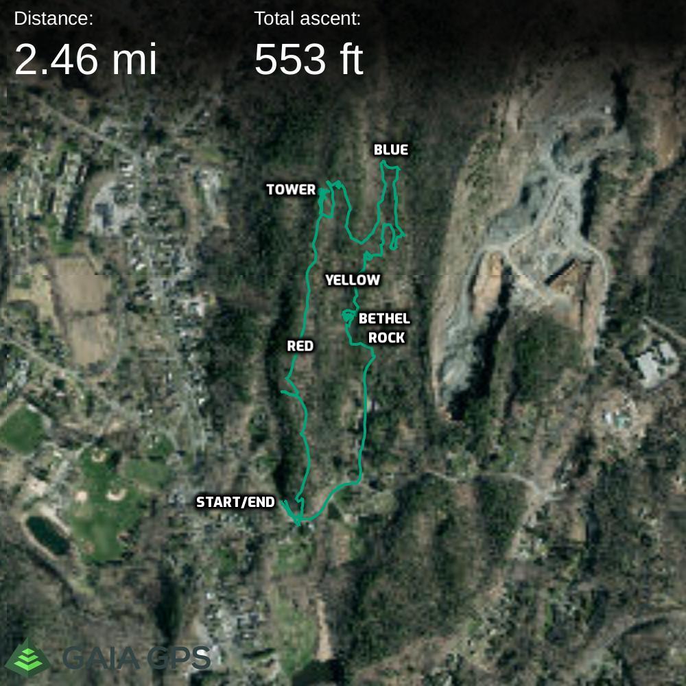
Length: Approximately 2.5 miles
Max elevation: 587 ft.– total elevation gain approximately 553 ft.
Route type: Circuit
Maps: Orenaug Park Trail Map
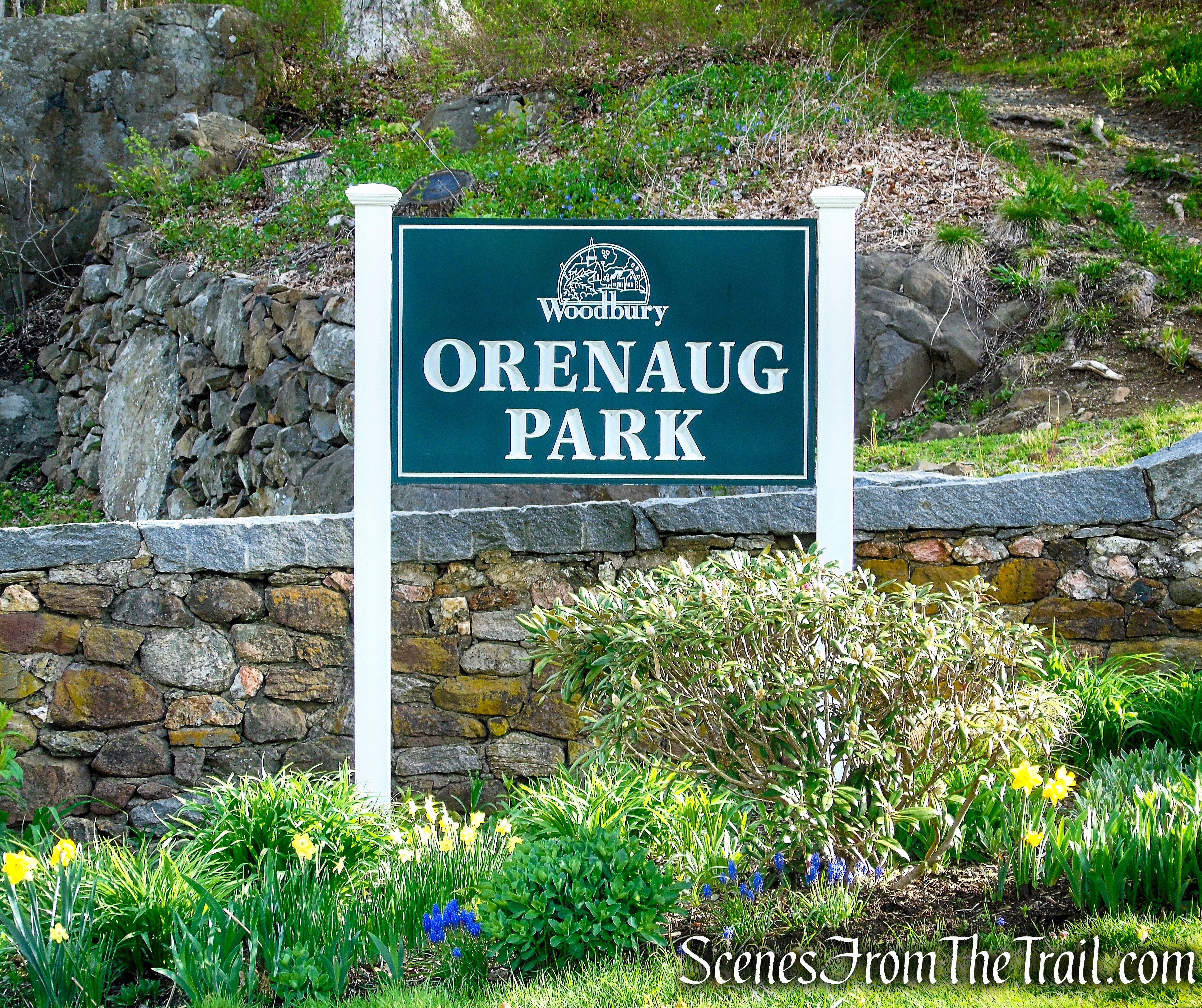
Trailhead parking: Across the street from 30 Park Road, Woodbury, CT 06798
No toilets on site – No entrance or parking fees
Roadside parking for about 10 cars
Park Overview:
Orenaug Park is a striking cluster of trap rock cliffs, with blazed trails and a steel observation tower, from which six surrounding towns can be seen. On the east side of the Park is a natural stone amphitheater, known as Bethel Rock, where, according to tradition, the first religious services were held.
The 78.45-acre town park is located on a basalt (trap rock) ridge overlooking the Pomperaug River Valley in Woodbury, Connecticut that is used for passive recreation. The tract is comprised of rock walls that rise 140 feet into the air, flanked by stately old pines and ravines with sloping hillsides that are carpeted with ferns and mosses.
Orenaug Park is owned and managed by the Town of Woodbury and is open year-round from dawn to dusk.
Orenaug Park
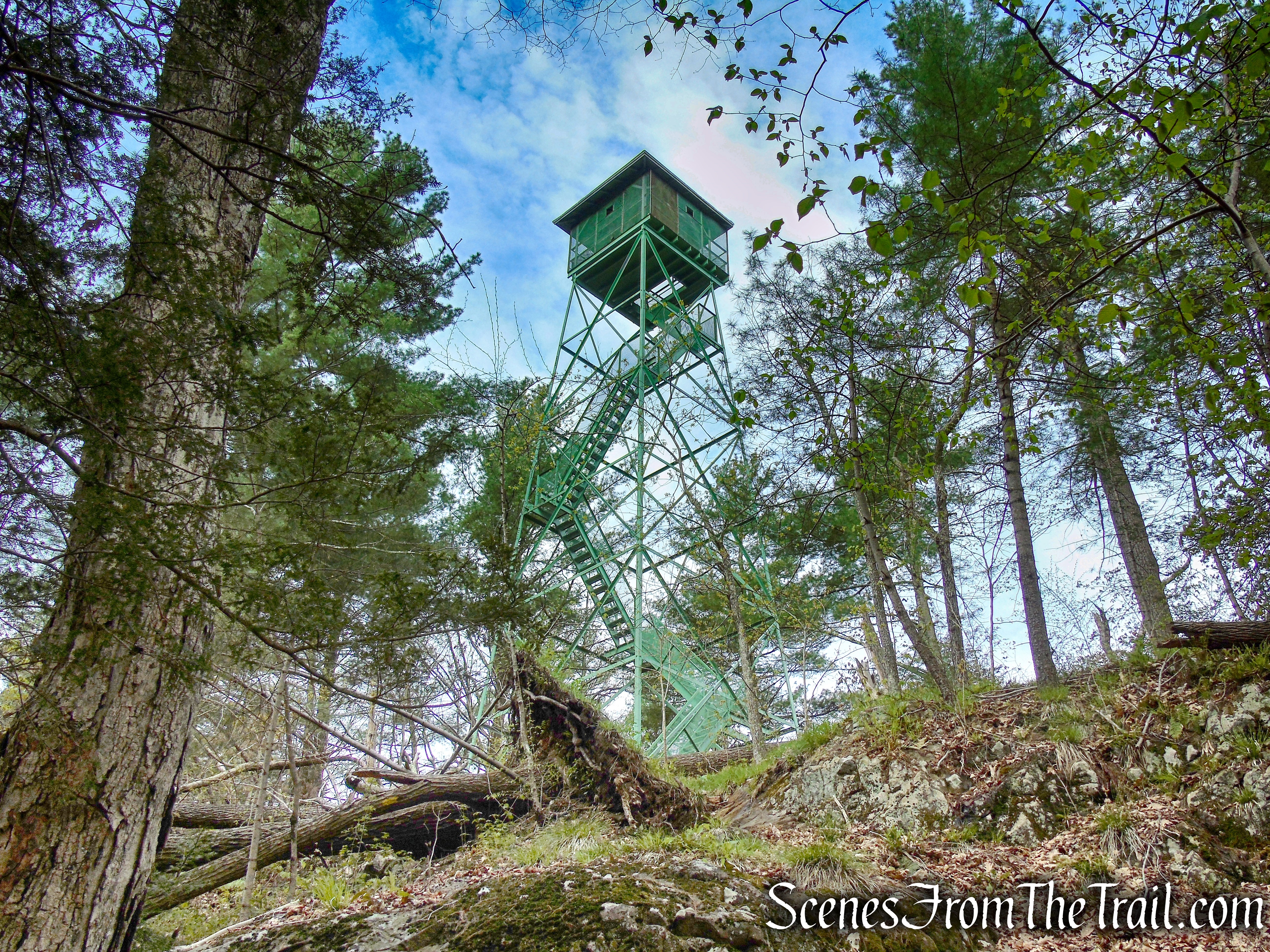
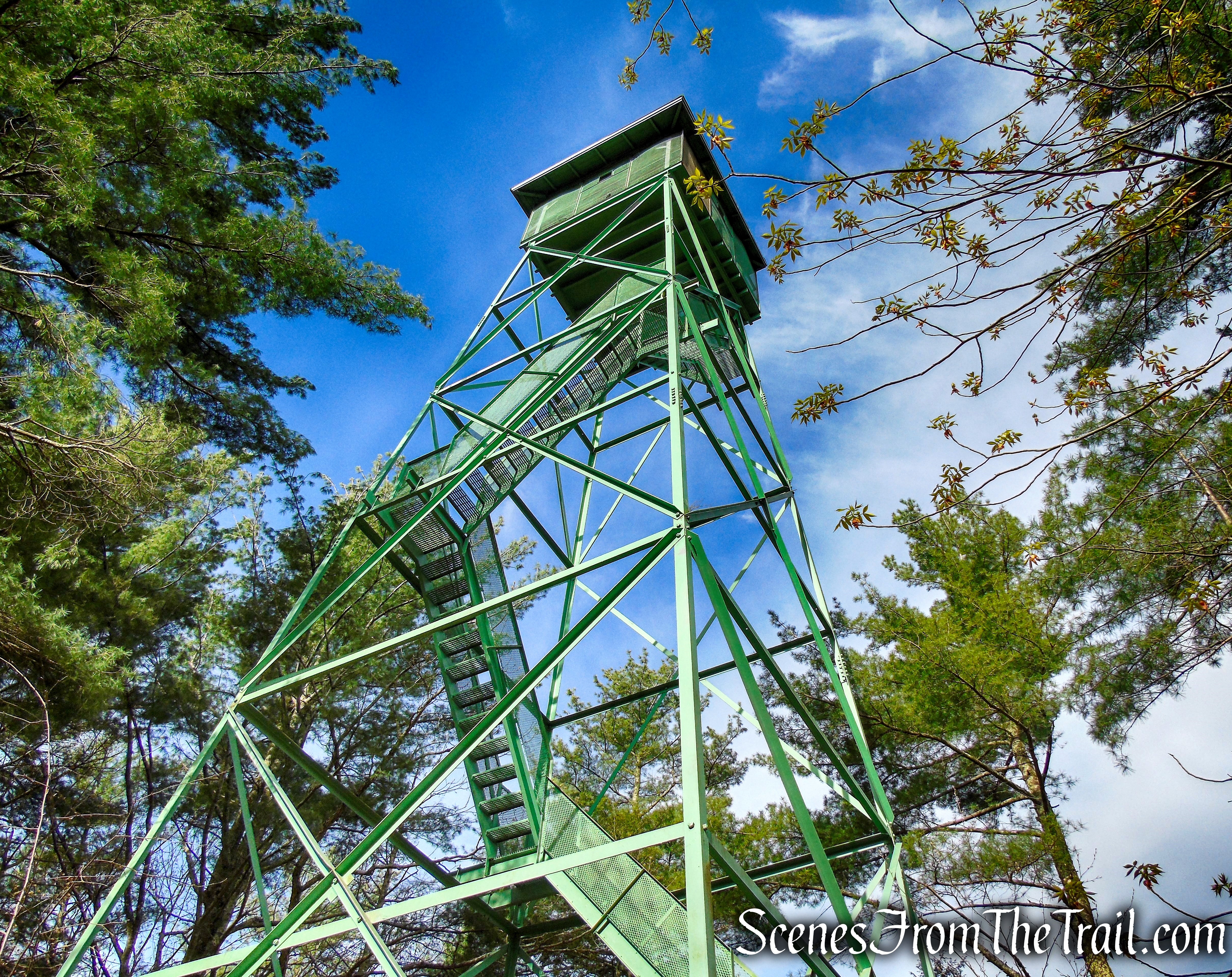
The centerpiece of the park, a 67′ 4″ steel observation tower, at an elevation of 520 feet above sea level, offers 360° views of Woodbury and the Pomperaug River Valley.
Orenaug Park Observation Tower
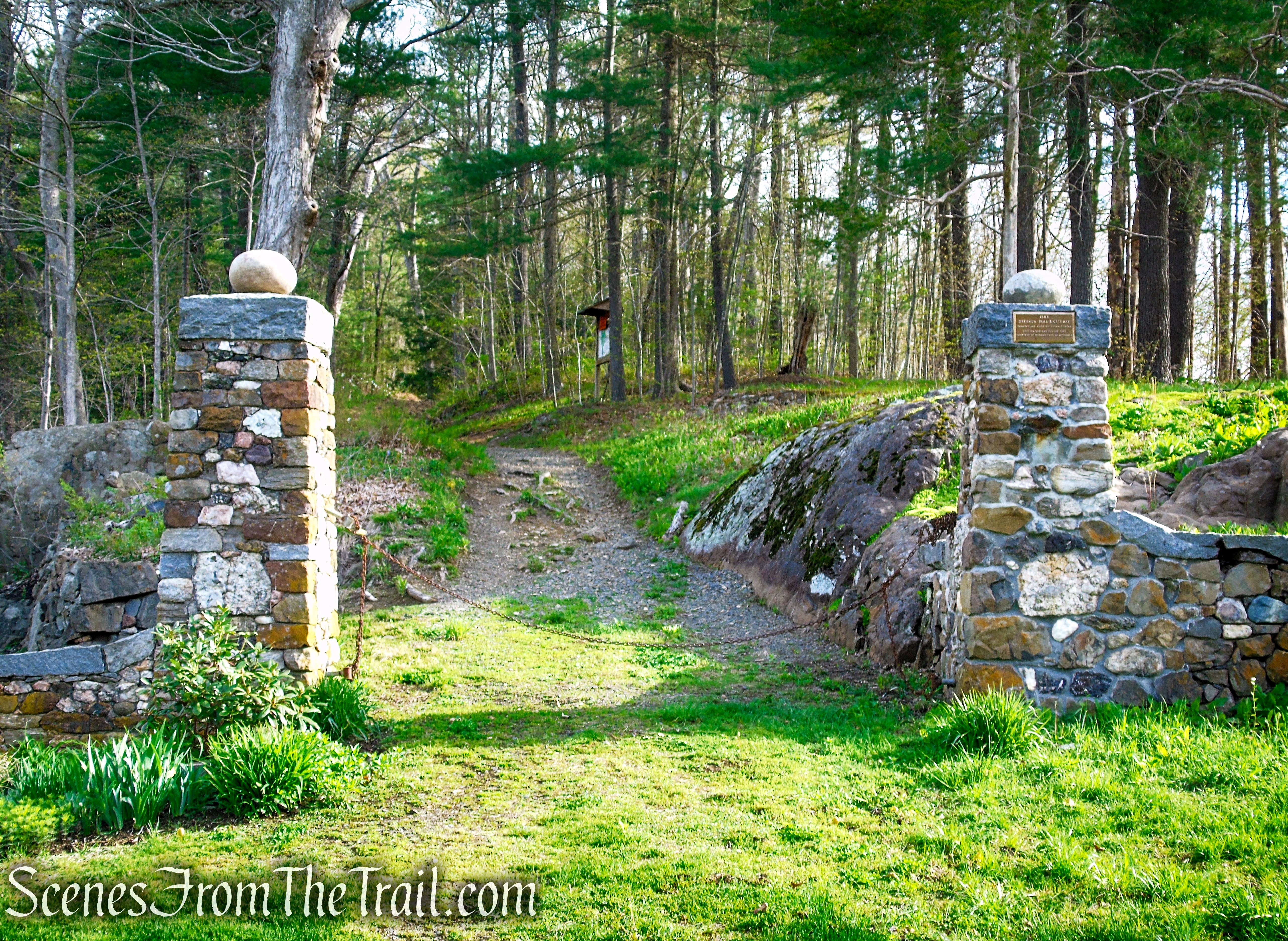
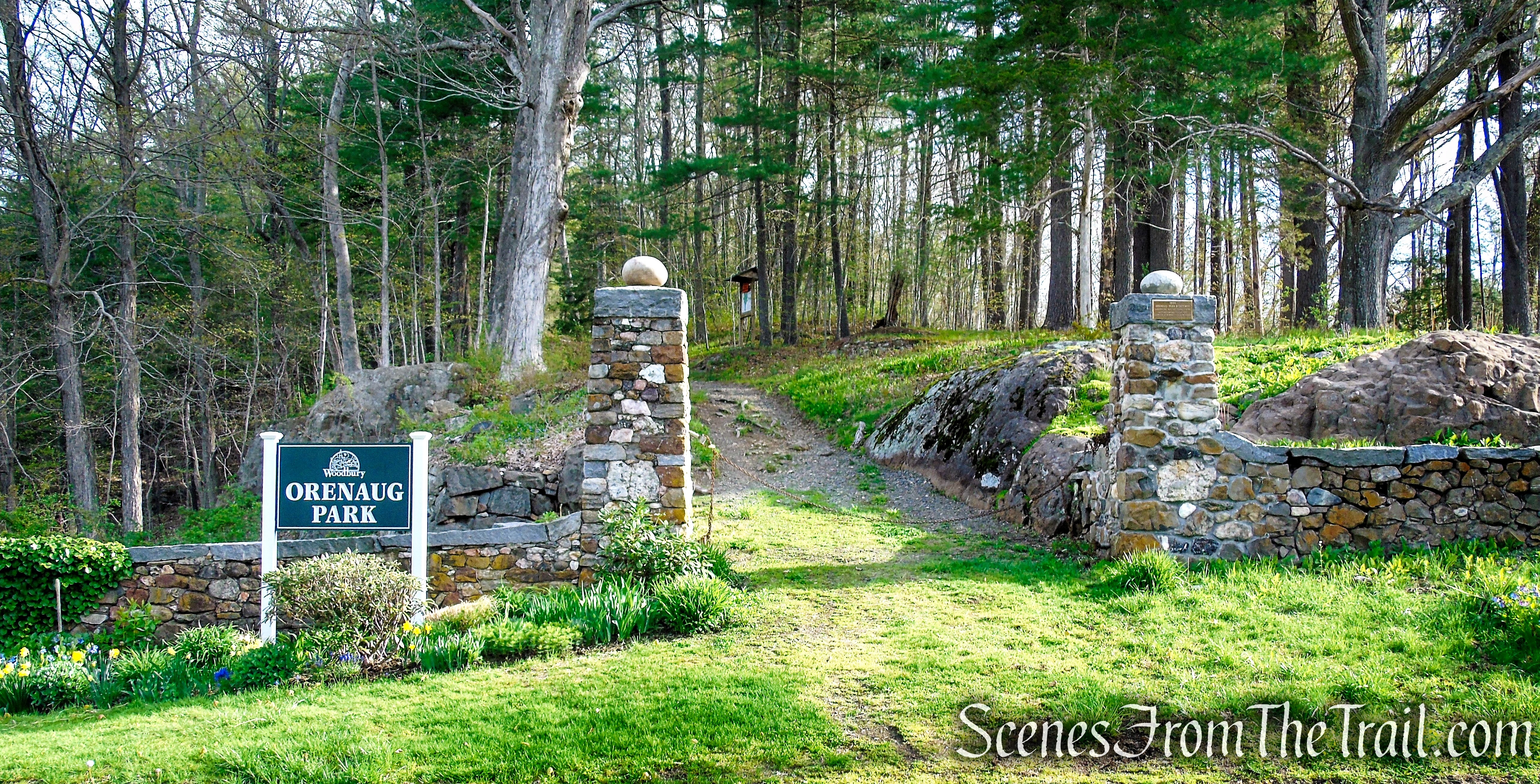
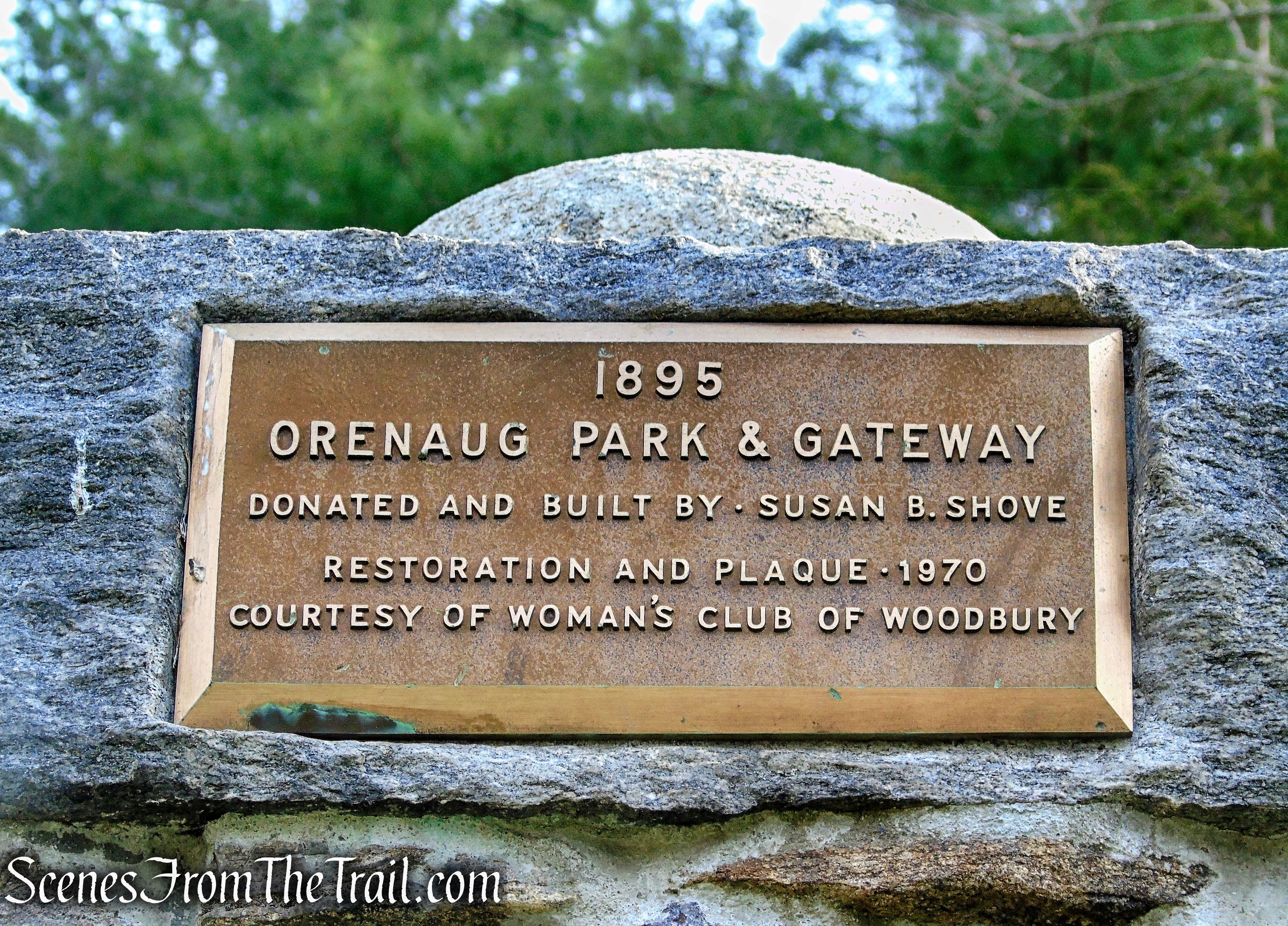
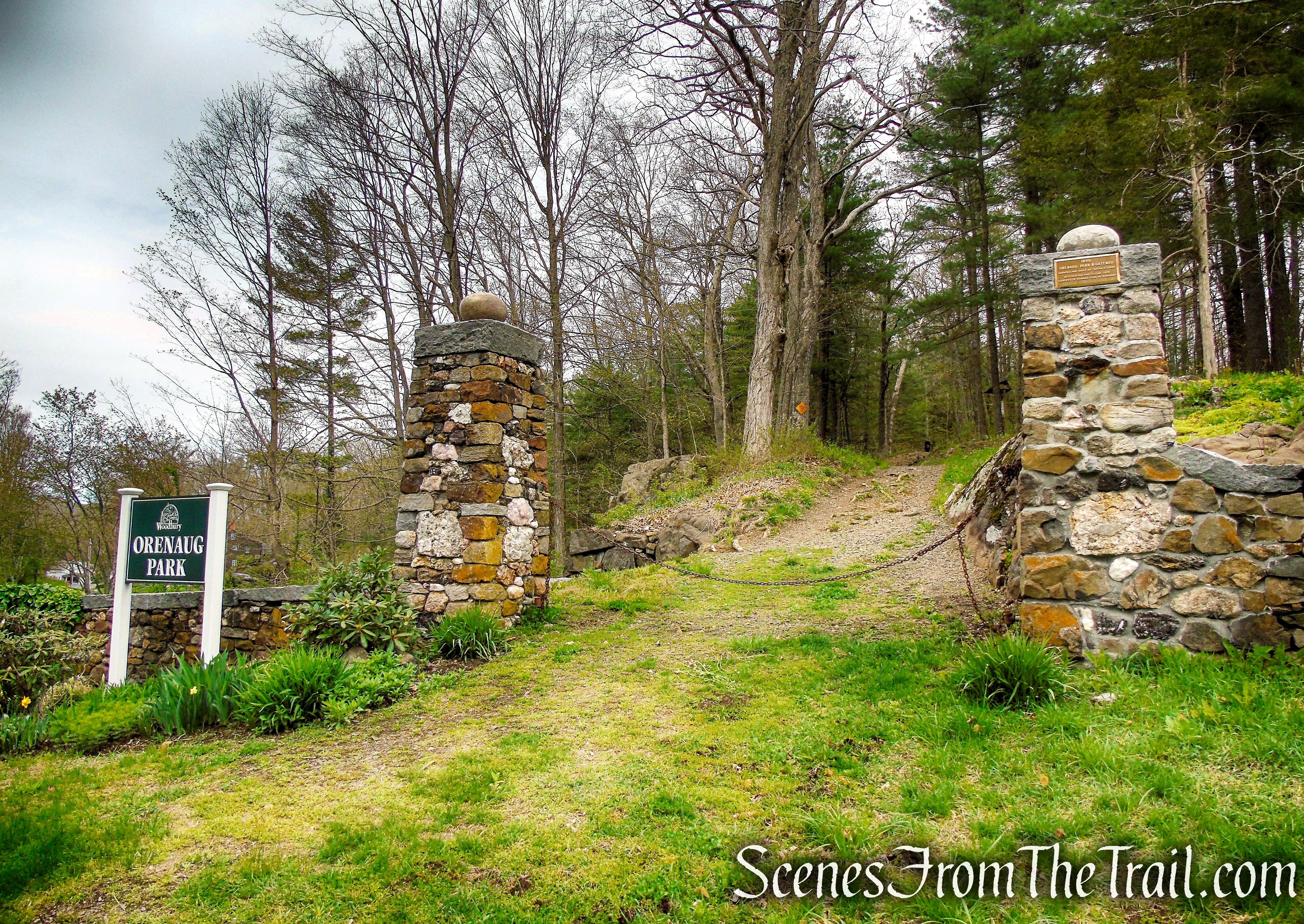
At the Park Road entrance, the two pillars are constructed of colorful stones from all 50 states. The 127-year-old stone pillars, received a major restoration in 2020. Longtime Woodbury resident Chris Swainbank began the volunteer project back in August of 2020 and spent more than 60 hours fixing up the pillars and the 180-foot stone wall that runs along Park Road.
Orenaug Park
History:
In 1892, Susan B. Shove conveyed land to the Town of Woodbury, to be used as a park. Orenaug Park has been owned and maintained by the Town for the benefit and use by the public since that time.
Orenaug Park started as a combination of several pieces of land put together over the course of several years by Susan Shove, with the help of William Cothren. What began as 11 acres, grew to an area of over 60 acres when the land was officially presented by Mrs. Shove to the Town of Woodbury for use as a park in 1892. It has since grown to almost 80 acres.
The name Orenaug comes from the Pootatuck, the Native American tribe which resided in this area before being settled by colonists from Stratford, CT in the 1670’s, meaning “sunny place.”
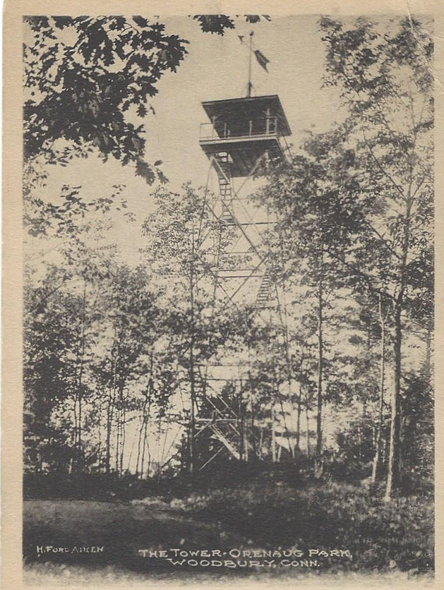
This is the original wooden observation tower built by William Cothren on his land in what is now Orenaug Park. This Tower, which was built before 1859, collapsed in a heavy windstorm in 1901, as the current tower was being constructed.
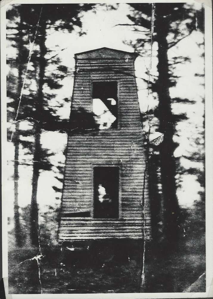
Orenaug Tower 1898
Built in 1901, the 67-foot 4-inch Orenaug Tower looms over Orenaug Park’s hilly landscape. The tower was commissioned by Susan B. Shove as an observation tower so residents could view the town landscape, which was much more visible in the 1900’s when the town was significantly deforested.
This is a postcard of the Orenaug Park Observation Tower. This tower was built in 1901 to replace the wooden tower built by William Cothren. This tower still stands today, and provides 360° views of Woodbury and several surrounding towns.
Orenaug Park Observation Tower
The tower began to show signs of rust and wear, and in 2018 the town refurbished the Orenaug Park Observation Tower and gave it a fresh coat of paint.
Orenaug Park Observation Tower
Today several hiking trails wind through the hilly park as well as a rock-climbing area for experienced climbers. The park can be accessed from three locations, all leading to the hiking trails, Bethel Rock and an observation tower from which up to six surrounding towns can be seen.
Side Note: I reached out to the Woodbury Historical Society for more information, but they did not know any of the history of the park. I also reached out by phone and email to the Recreation Department and the local library. They both promised to call me back, but neither did.
Trails Overview:
Orenaug Park has three access points/trailheads. The main entrance is on Park Road, flanked by two stone columns with stones that have been cultivated from all 50 states. The red-blazed Fire Trail begins there. The second access point is from the back of the Woodbury Senior Community Center, which utlizes the orange-blazed Tower Trail. The third is on Park Lane, which is the trailhead for the yellow-blazed Bethel Rock Trail.
There are almost 2 miles of well marked trails in Orenaug Park as well as some unmarked footpaths that travel through the rugged trap rock hills.
There are substantial blowdowns throughout the park that have to be navigated around/under. In some cases the trail has been rerouted around the larger blowdowns, when possible.
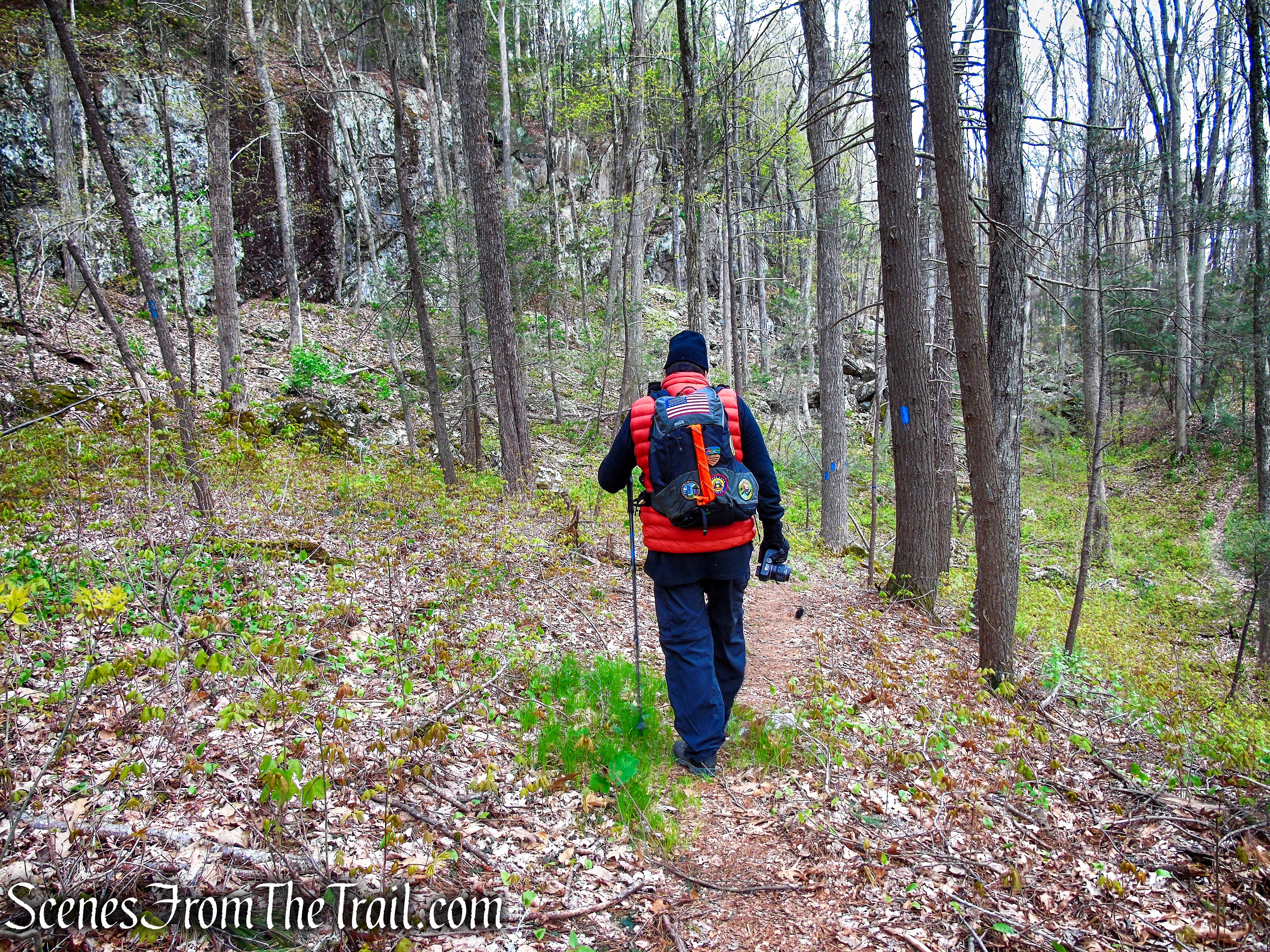
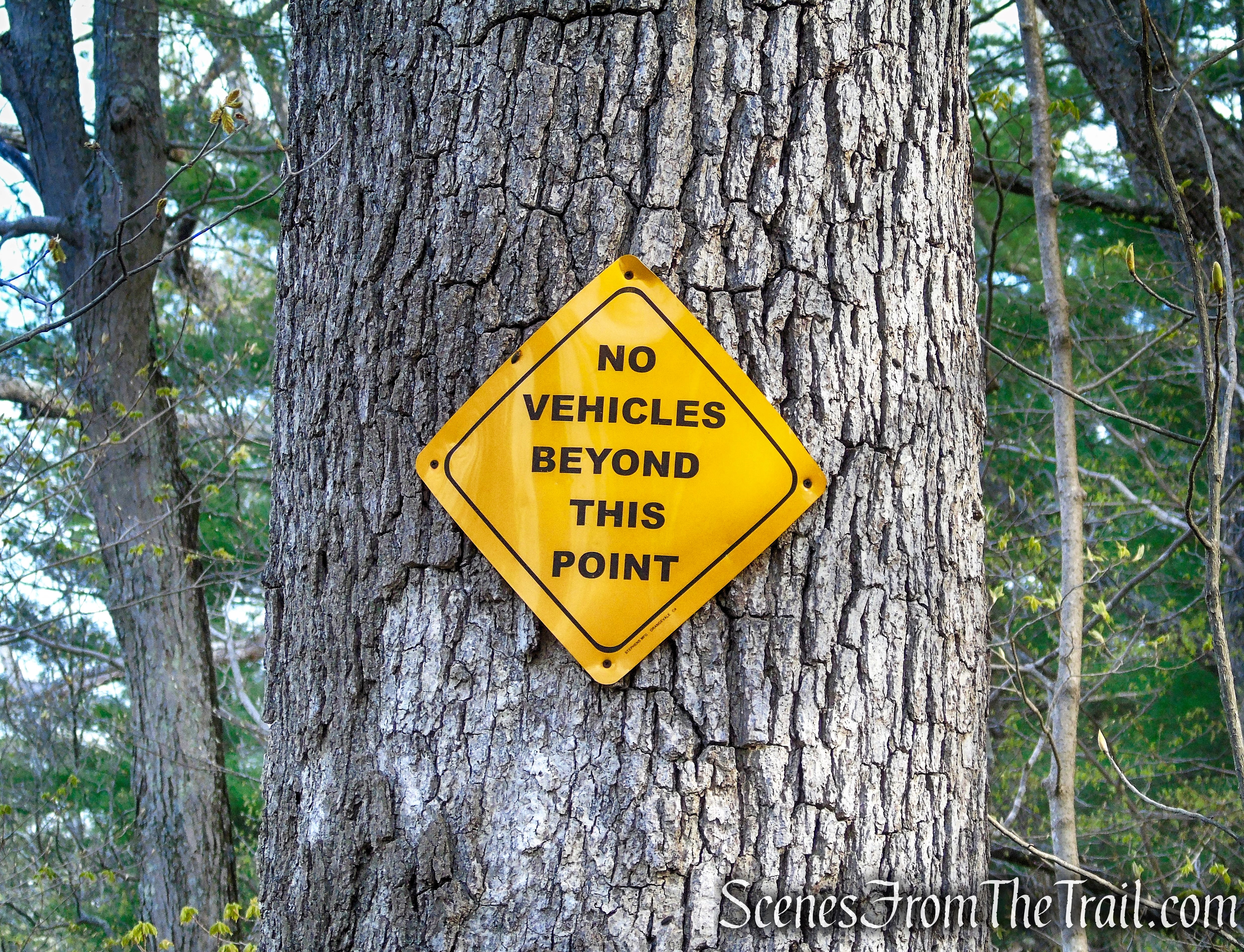
Fire Trail (red blazes – 0.55-mile) ~ is the main entrance and begins on Park Road between the two stone pillars. It follows an old woods road north up to the steel observation tower, where it ends.
Tower Trail (orange blazes – 0.40-mile) ~ begins behind the Woodbury Senior Community Center and connects to the Fire Trail, just below the tower. We did not hike this trail so I don’t have any insight on it.
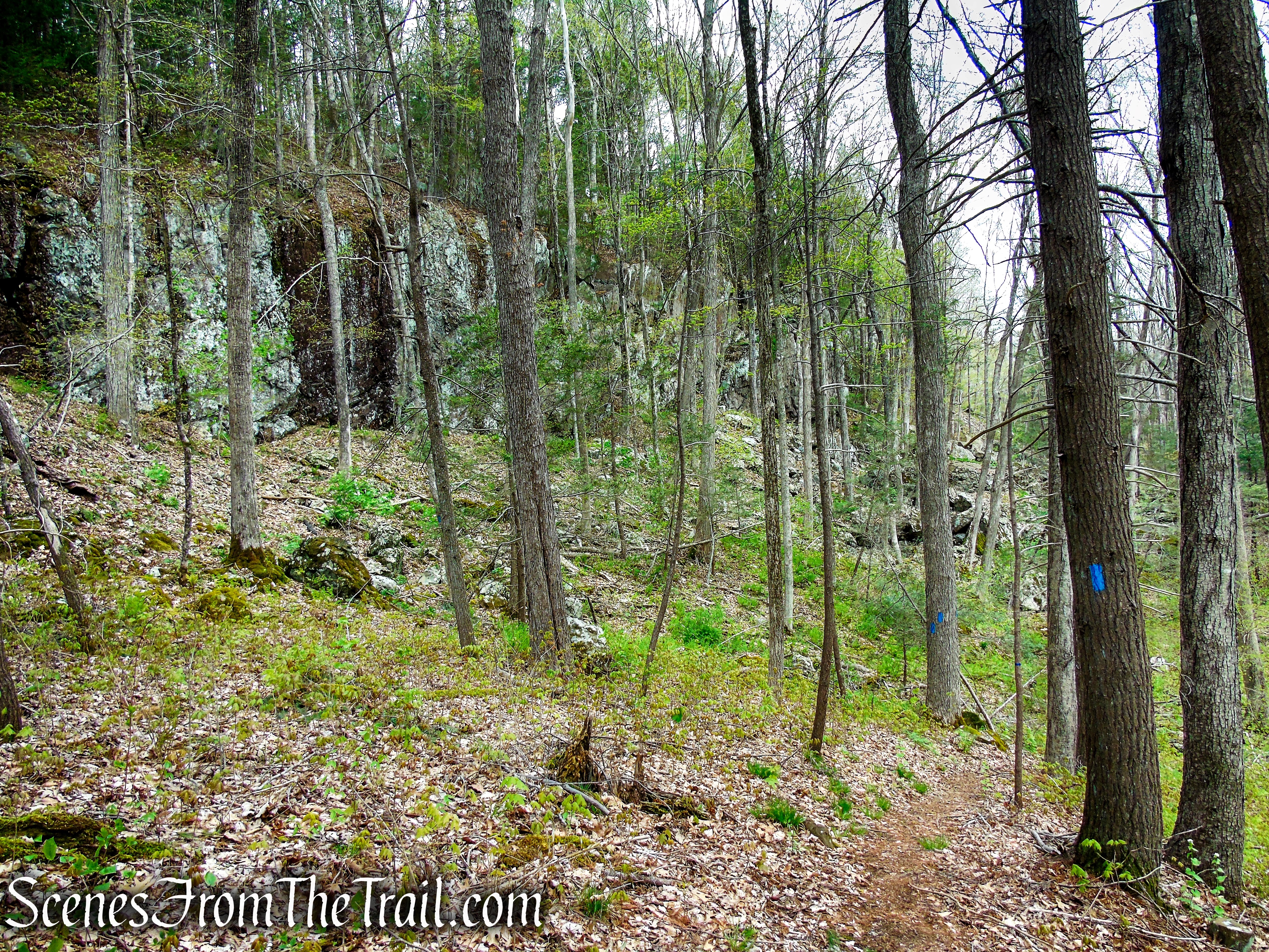
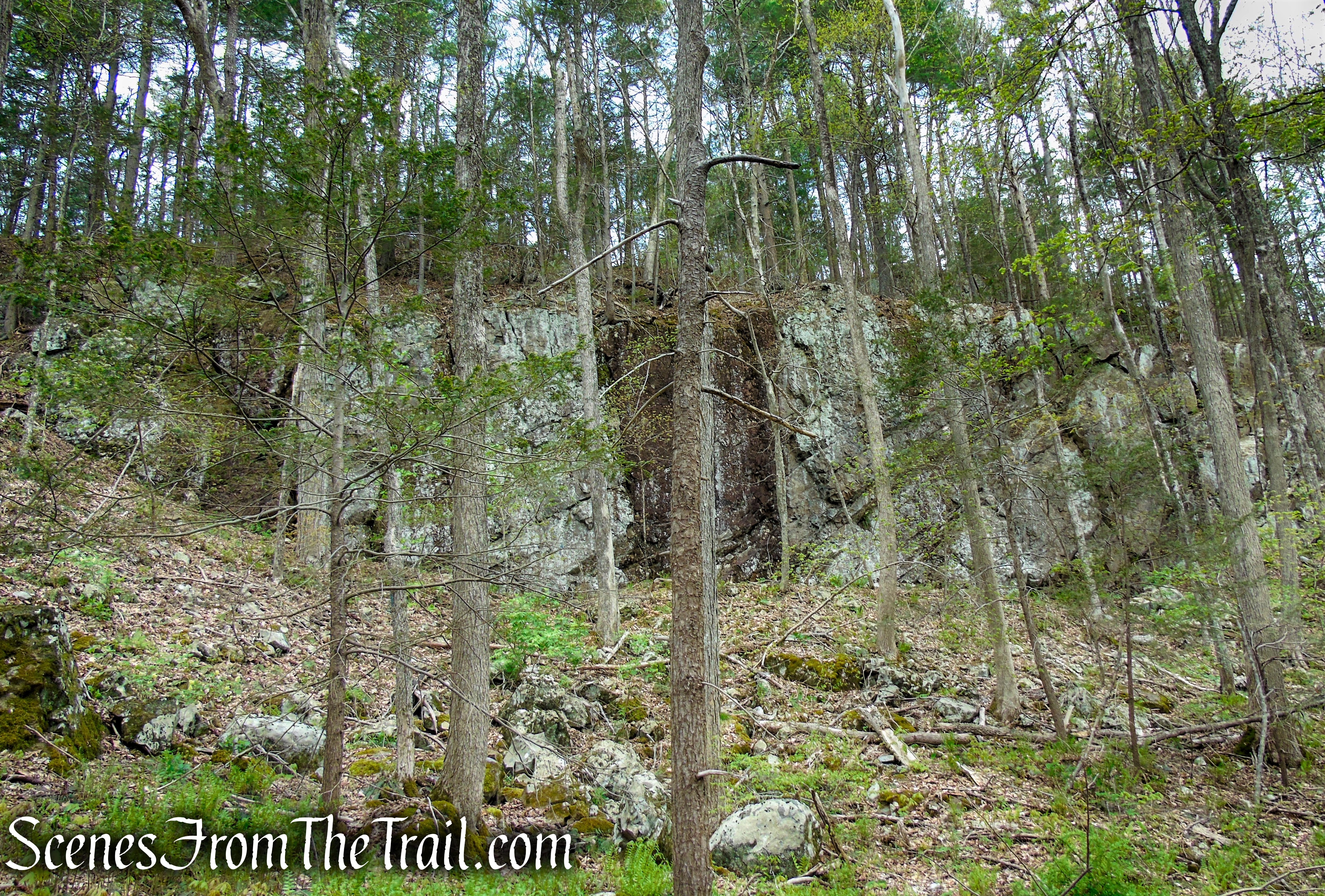
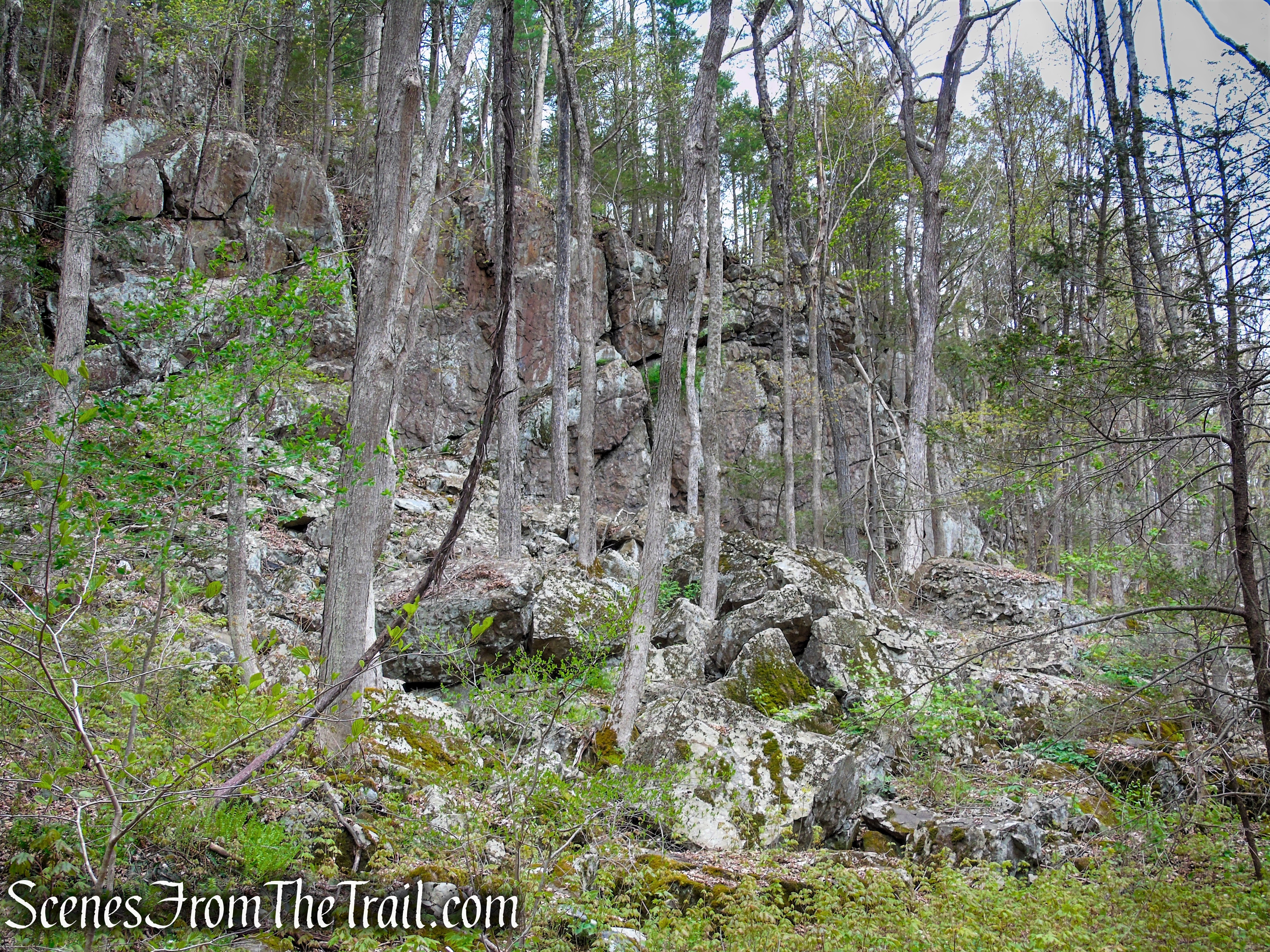
Loop Trail (blue blazes – 0.43-mile) ~ begins and ends at the Yellow Trail. It descends into the valley, surrounded by high rock walls. A beautiful area to hike and should not be skipped. We spotted a Black Bear on a cliff above watching us, as we stood in the ravine.
Bethel Rock Trail (yellow blazes – 0.50-mile) ~ begins near the observation tower at a junction with the Fire Trail (red blazes) and winds its way through the forest with some minor ups and downs. It passes by the historic Bethel Rock and concludes at Park Lane (a gravel road).
There are plans for additional trails to be cut and marked.
Hike Overview:
Being a fan of observation towers, hiking Orenaug Park is a no brainer. Although the tower was the attraction, the rest of the park is worth exploring as well. The high rock walls that loom over the small valleys in the park, dominate the landscape and give the area a prehistoric feeling. Hiking through this boulder strewn territory is like being transported back in time.
Loop Trail – Orenaug Park
The hike was done clockwise beginning and ending at the pond.
Orenaug Park
The elevation profile of the hike is below.
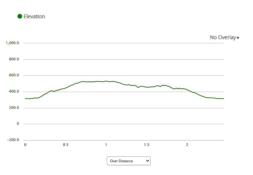
elevation profile – Orenaug Park
We didn’t encounter any other hikers during our time spent on the trails, but did spot a Black Bear eye-balling us from a cliff while on the Loop Trail. It ran off when I pointed it out to my friend.
Since this is a short hike, it could be done in conjunction with Nonnewaug Falls. It is a short 12 minute drive (6.7 miles) from Orenaug Park to the Nonnewaug Falls trailhead.
The Hike:
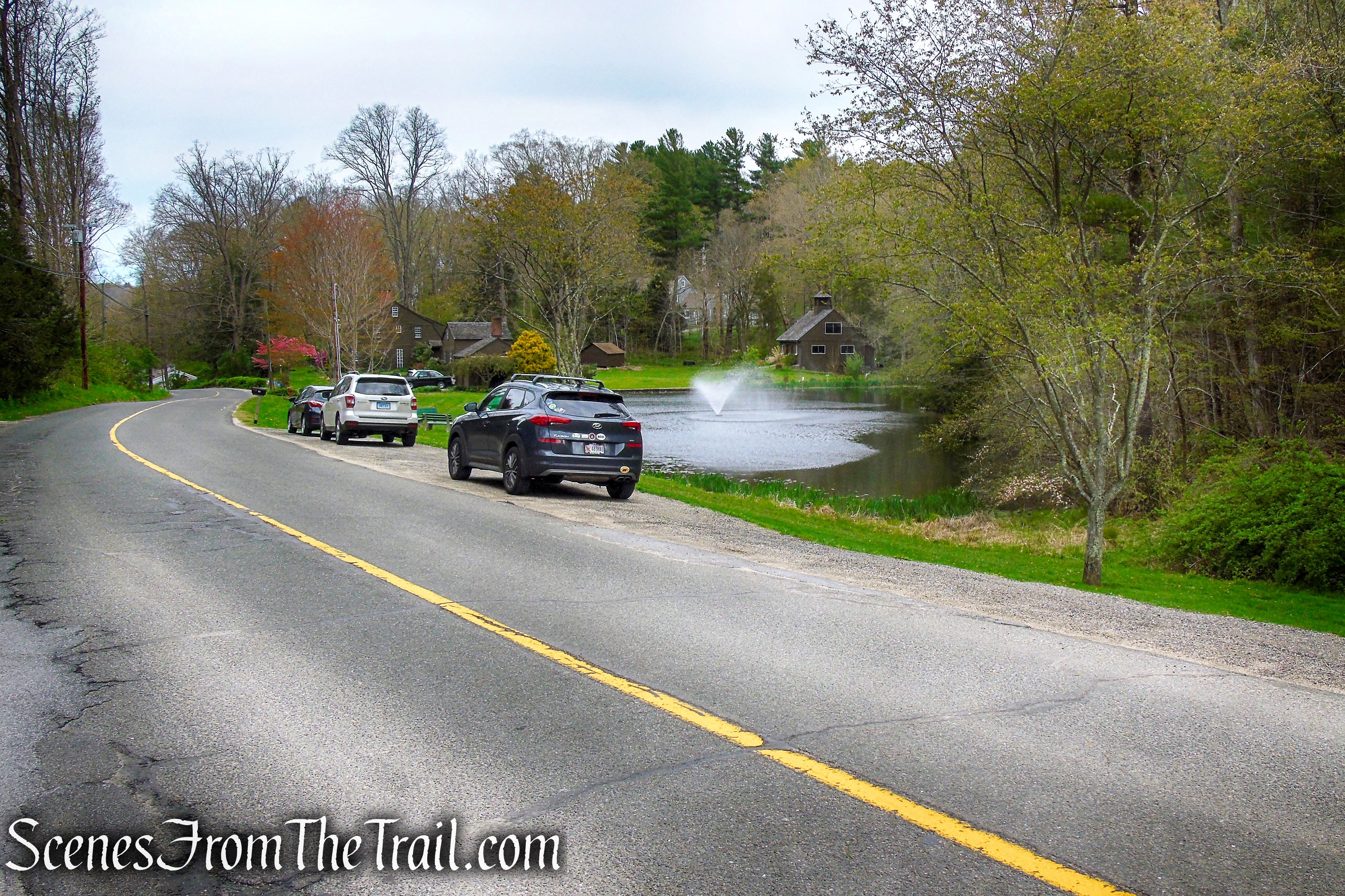
We parked alongside Crystal Lake (aka Silver Lake, Webb’s Pond) which has roadside parking for about 10 cars if everyone parks correctly. This is an official parking area for Orenaug Park and is just about 150 feet west from the the main entrance on Park Road. The small lake is public property even though it appears to be part of a residence.
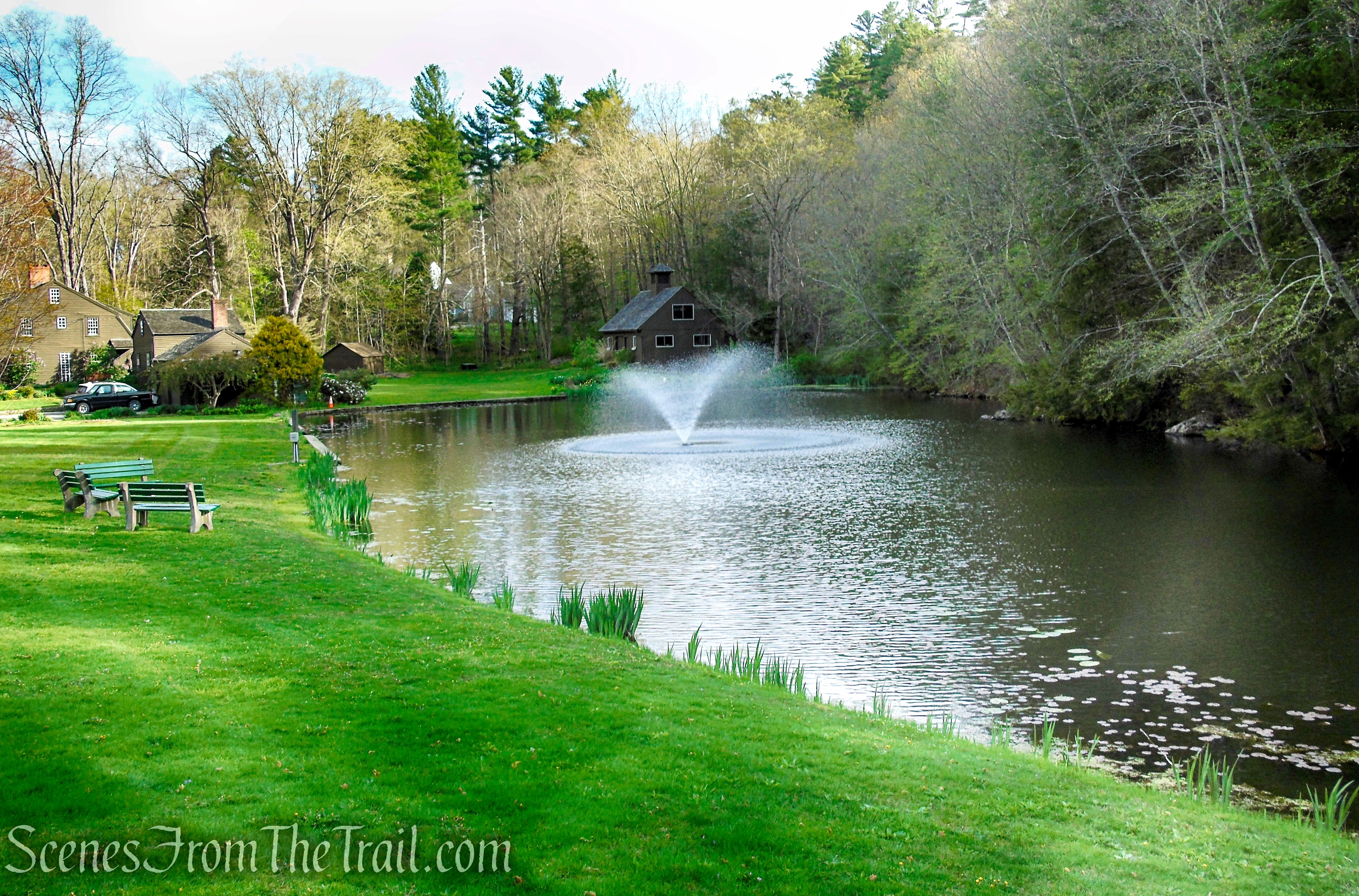
Crystal Lake near the entrance to Orenaug Park
The hike starts on the red-blazed Fire Trail, which begins at the two stone pillars. The two stone pillars at the fire trail entrance are made of 50 stones, each one being from a different state. This gateway was donated and built by Susan B. Shove in 1895.
Park Road entrance – Orenaug Park
Park Road entrance – Orenaug Park
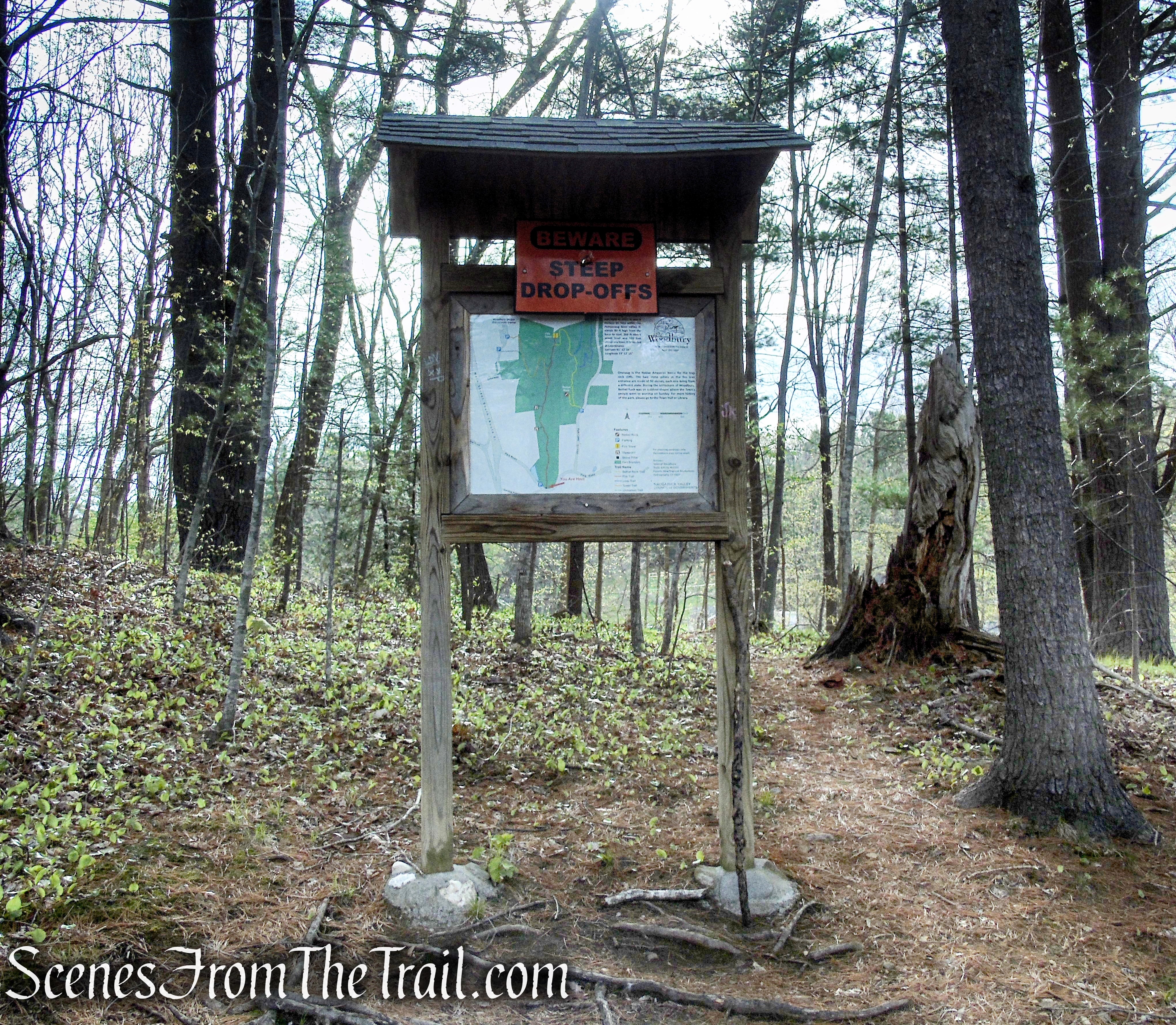
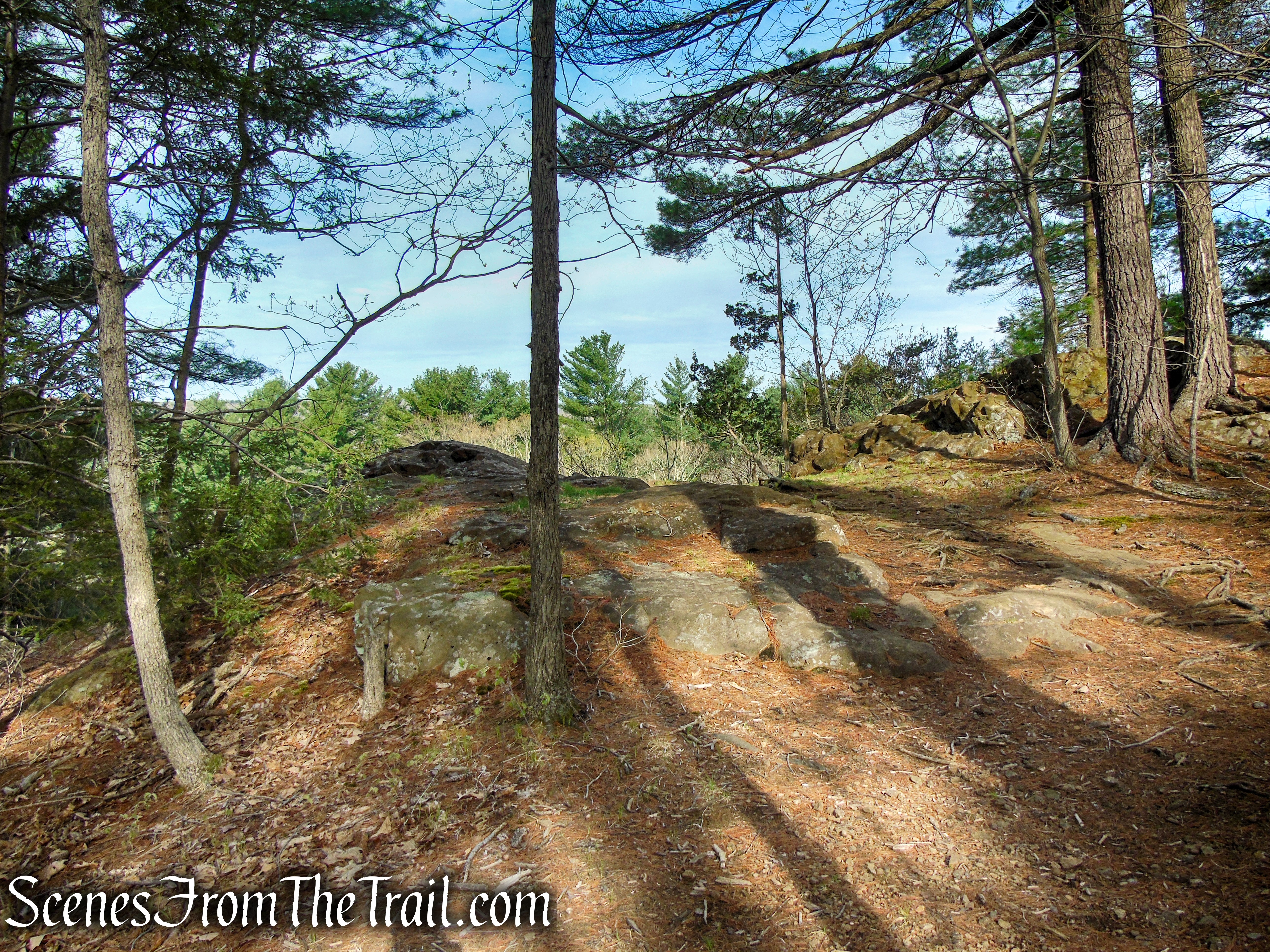
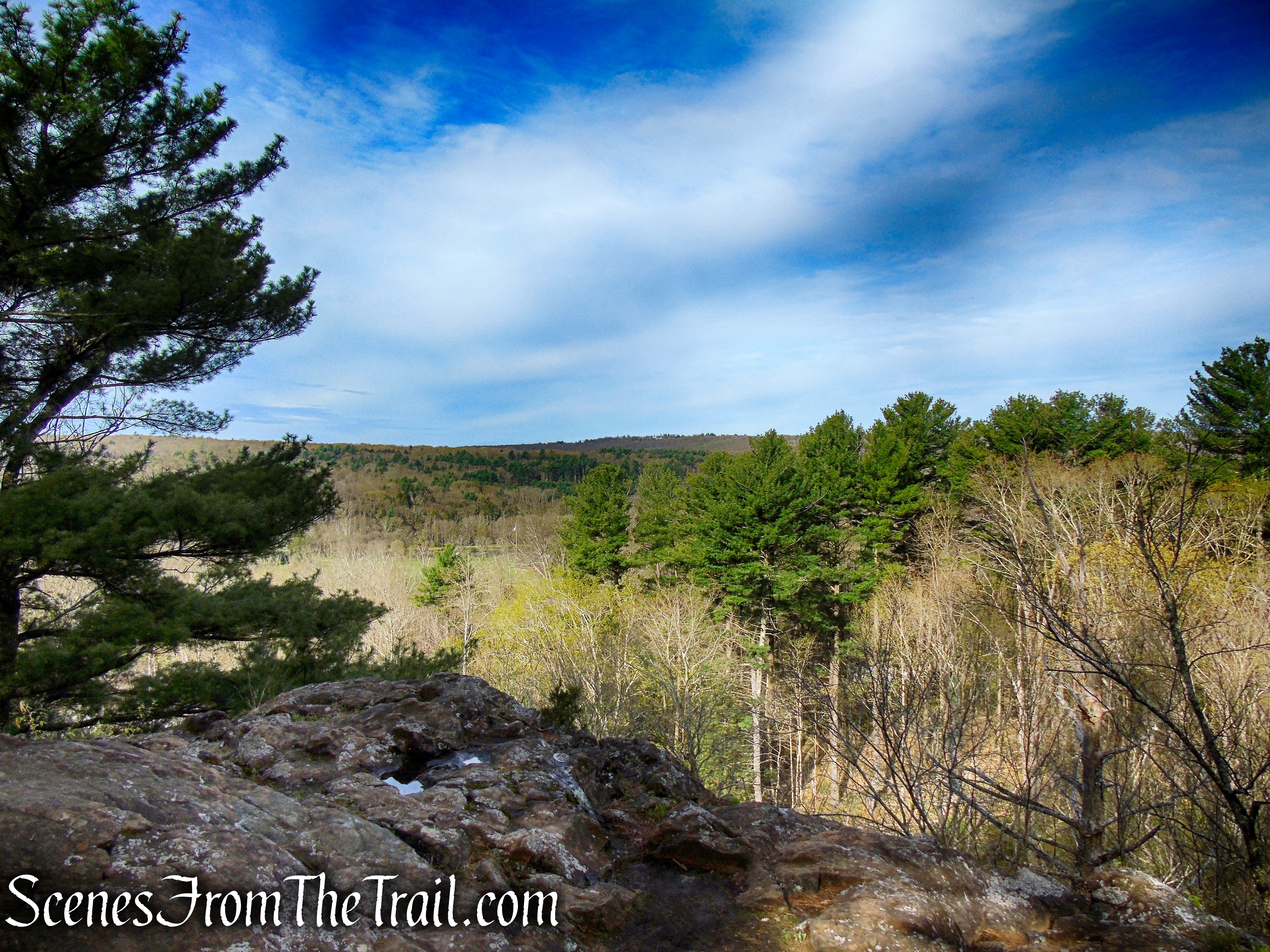
The Fire Trail begins heading uphill on a woods road, past a kiosk with a trail map on it. At first the trail climbs gradually, steepens then moderates again. In about 300 feet, the Fire Trail passes an unmarked trail on the left that leads to a rock outcrop with west-facing views of Woodbury and the surrounding area.
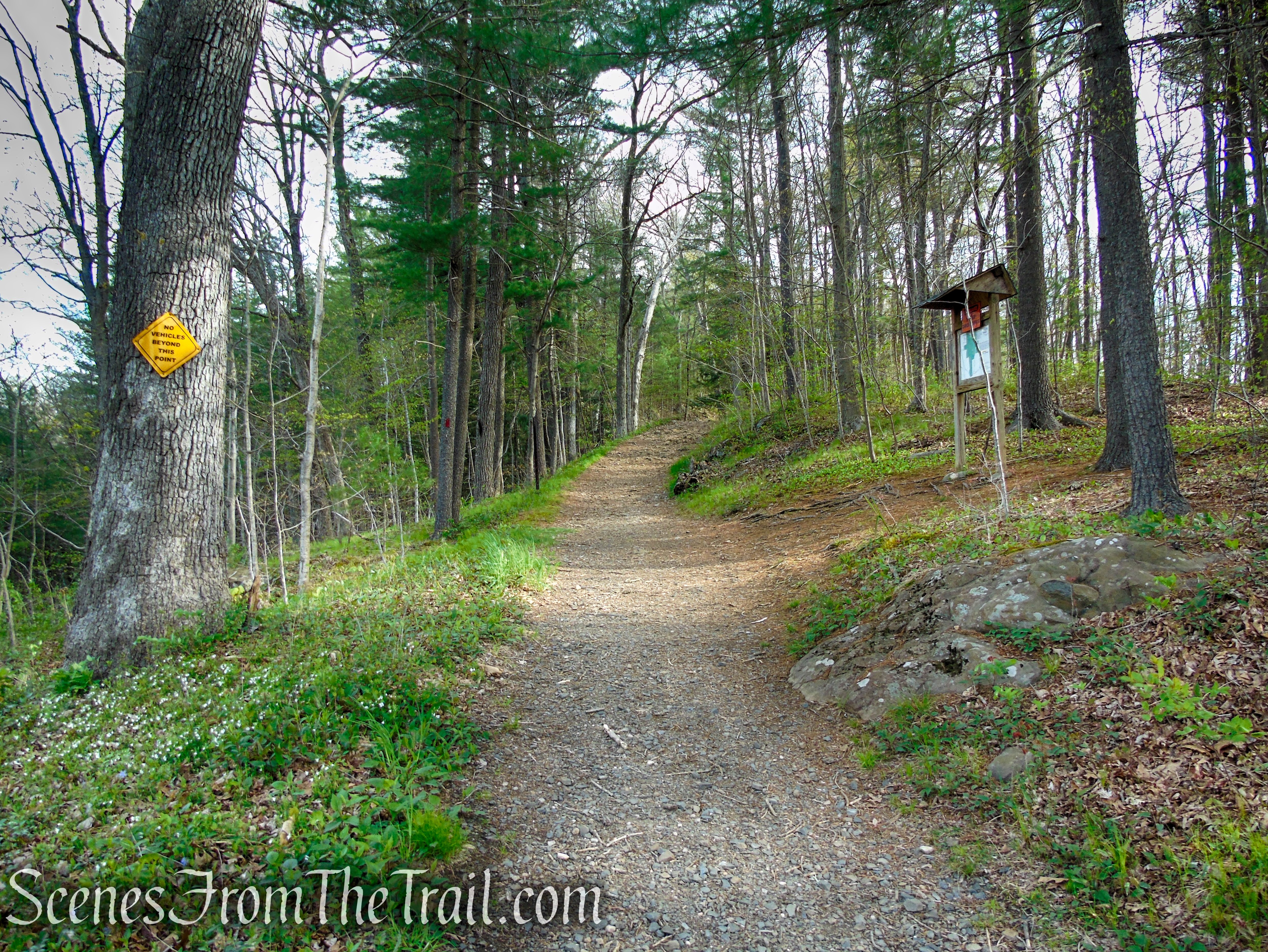
Fire Trail – Orenaug Park
Fire Trail – Orenaug Park
Fire Trail – Orenaug Park
Fire Trail – Orenaug Park
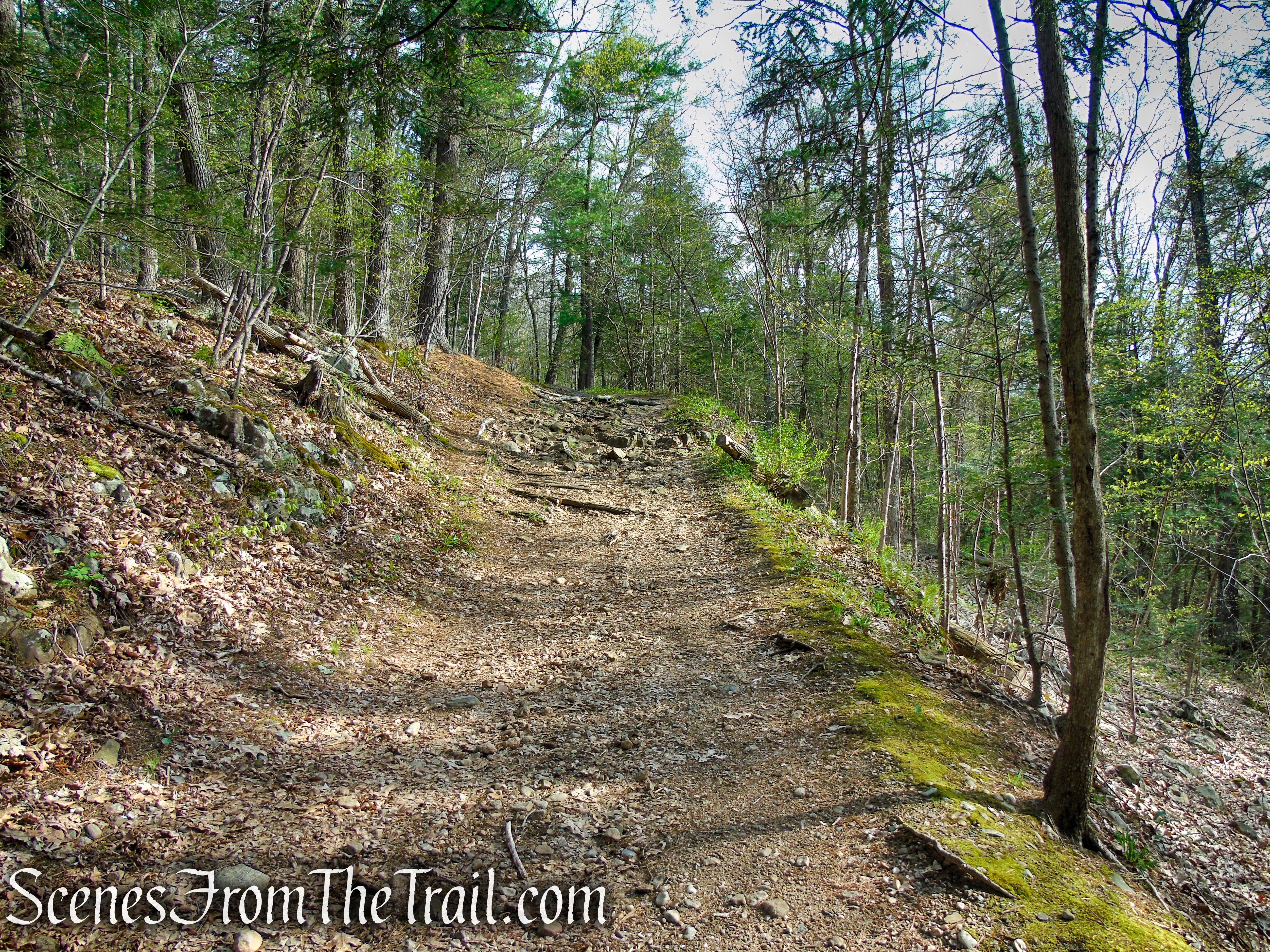
Fire Trail – Orenaug Park
Fire Trail – Orenaug Park
Fire Trail – Orenaug Park
Fire Trail – Orenaug Park
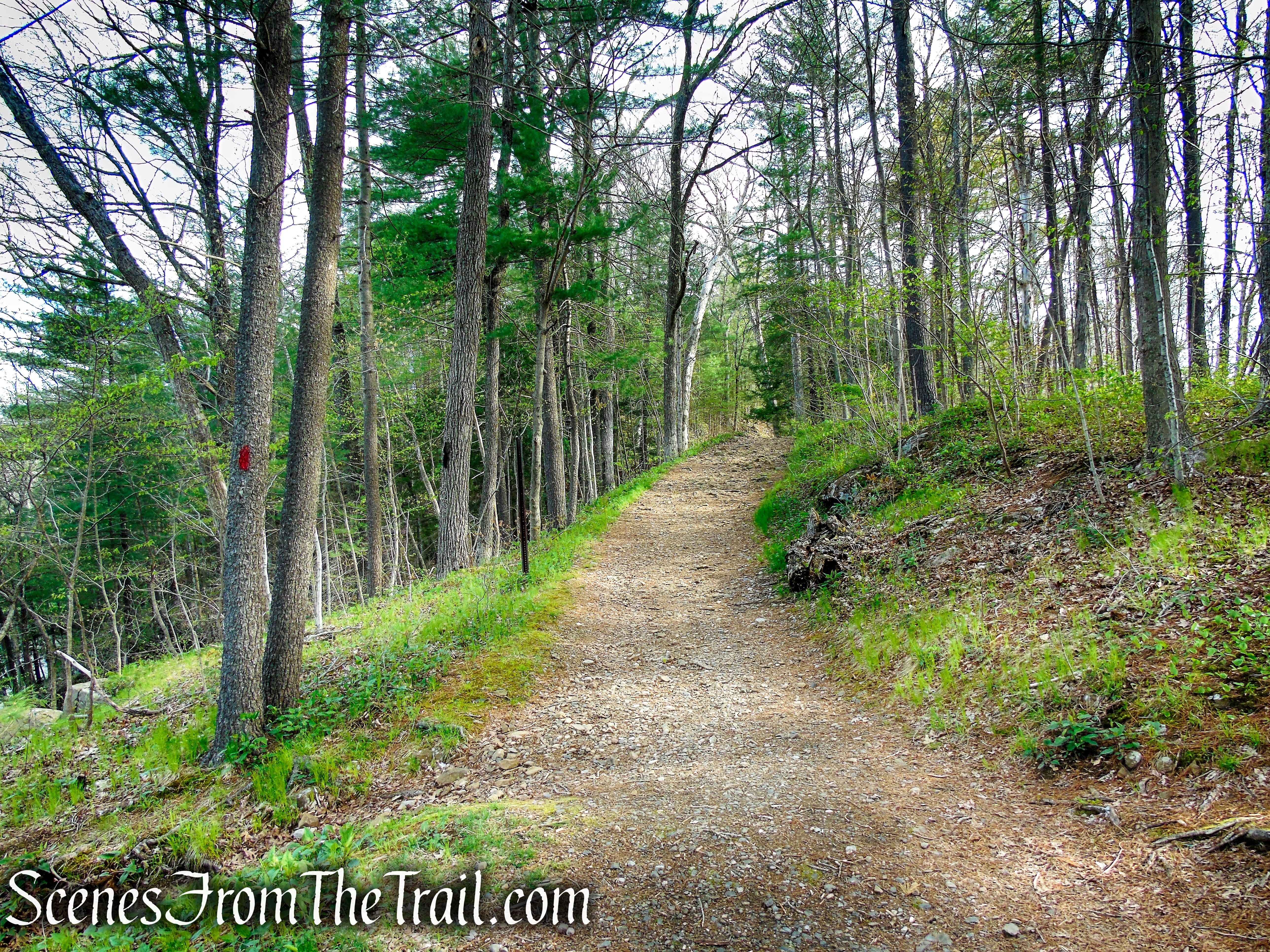
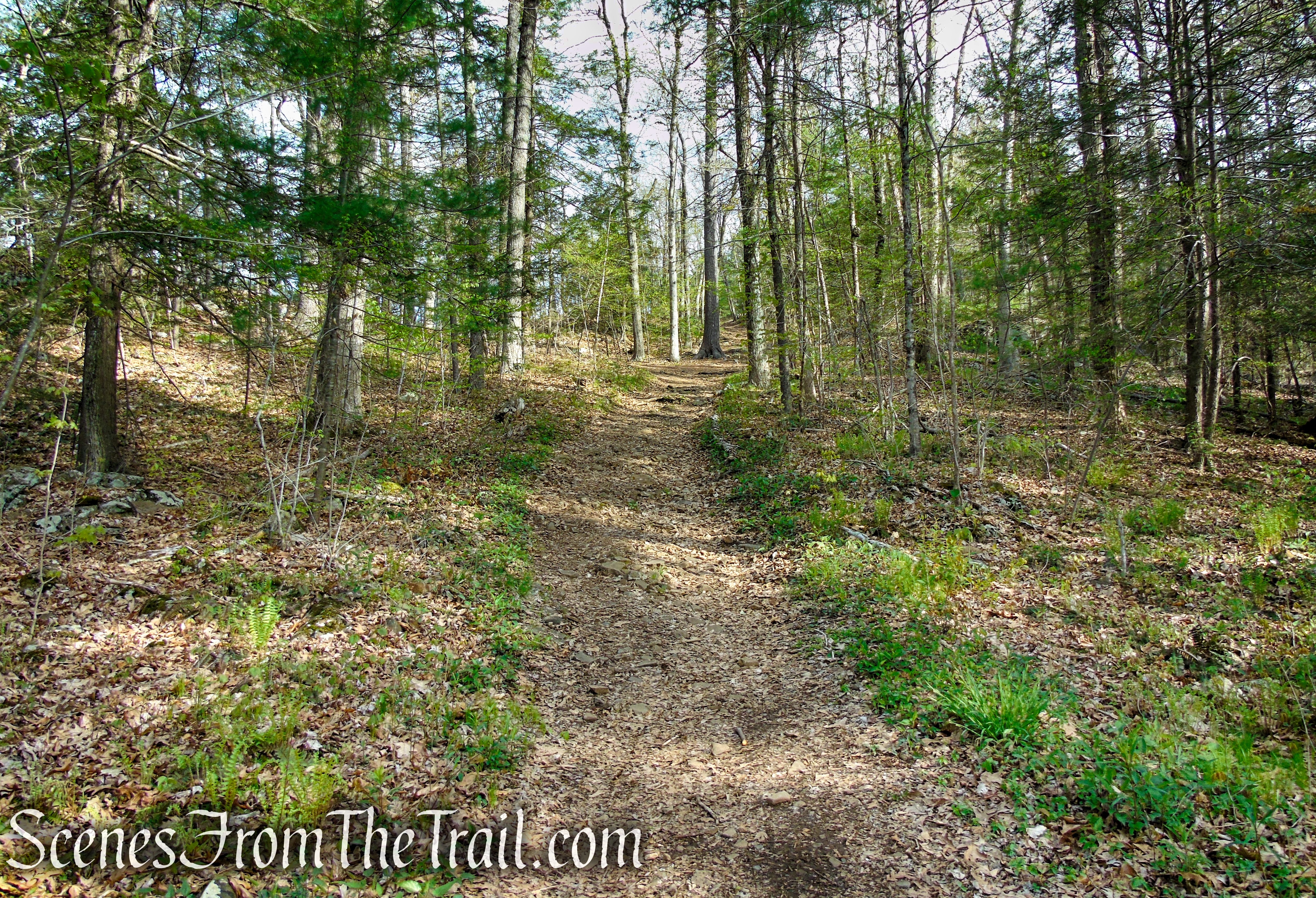
The Fire Trail continues heading north, uphill on the woods road, passing another side trail with similar views as the first and then about a 1/2-mile from the start of the hike, the Fire Trail reaches a junction with the orange-blazed Tower Trail, which begins on the left.
Fire Trail – Orenaug Park
bear right to remain on Fire Trail
bear right to remain on Fire Trail
Bear right to remain on the red-blazed Fire Trail and in about 260 yards, you’ll pass a junction with the yellow-blazed Bethel Rock Trail which begins on the right. In another 200 feet, the Fire Trail ends at the Orenaug Park Observation Tower.
Fire Trail – Orenaug Park
Orenaug Park Observation Tower
Orenaug Park Observation Tower
In 2018 the Orenaug Park Observation Tower got a fresh coat of paint. Previously, the tower had a metallic look, but now is a light green color. The $26,000 project to paint and repair the structure was completed in the summer of 2018 by Jim Casale of JNC Contracting Associates of Bethel. The contractor used scaffolding to paint and repair the hardest to reach areas.
Orenaug Park Observation Tower
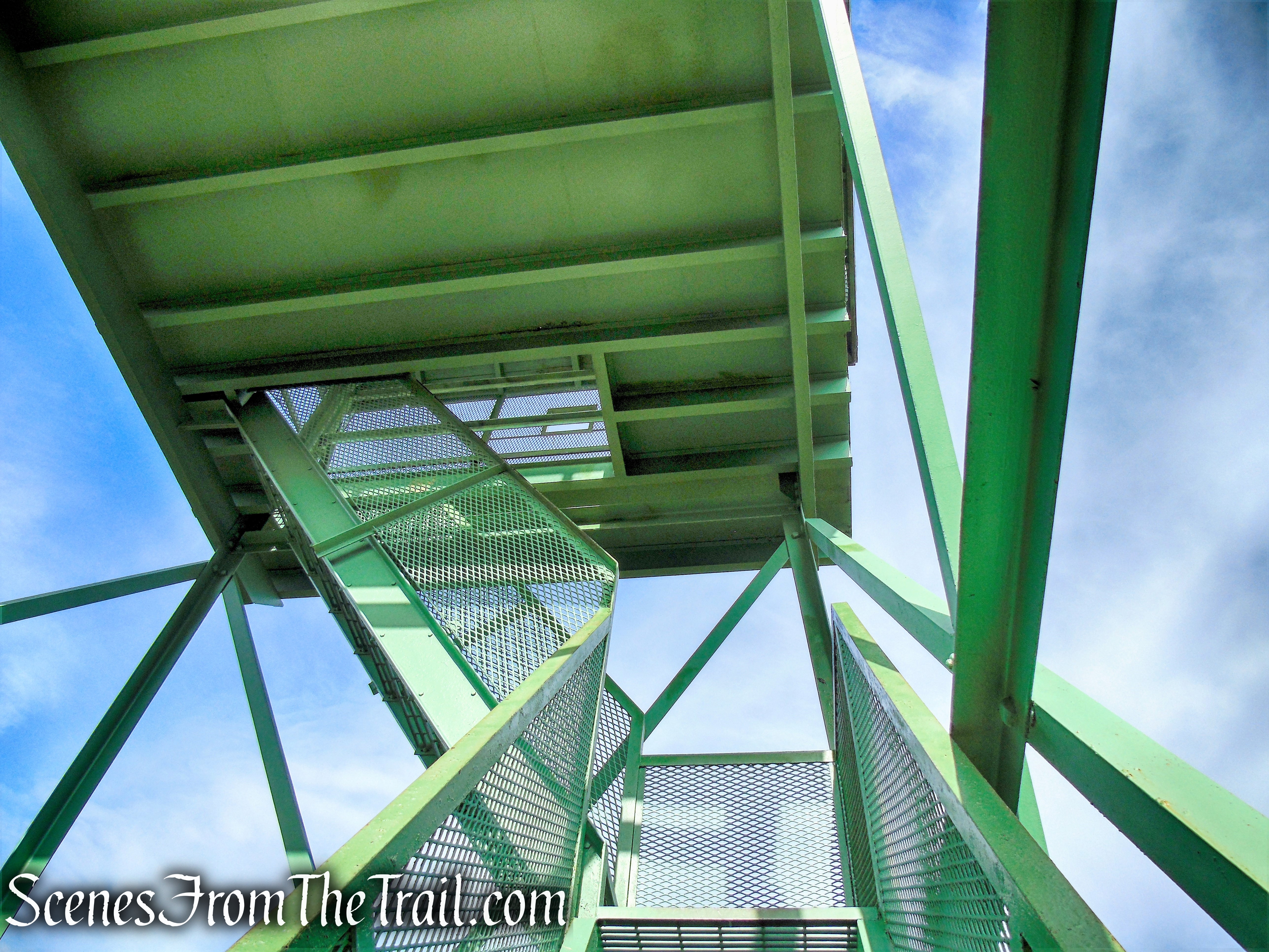
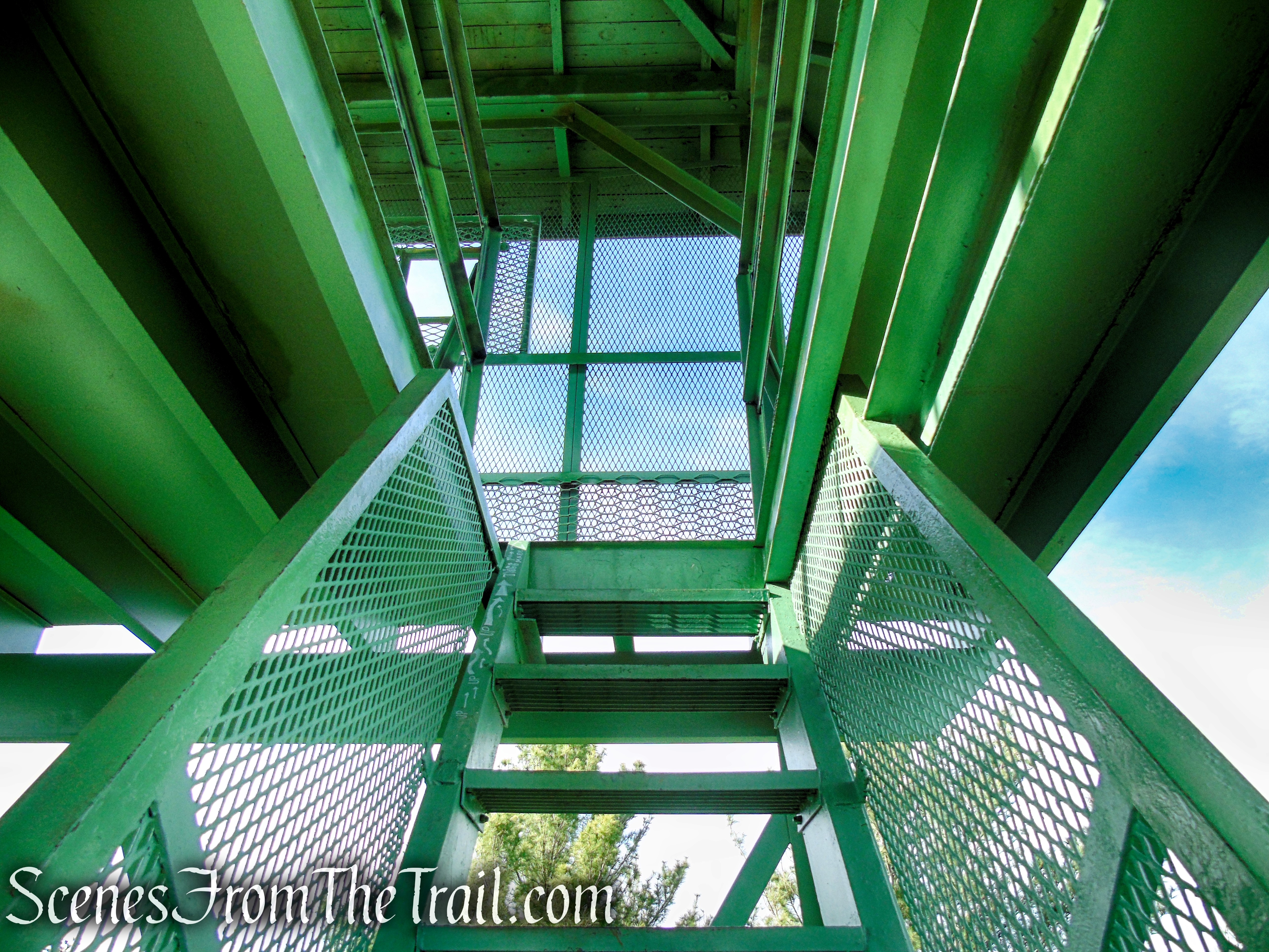
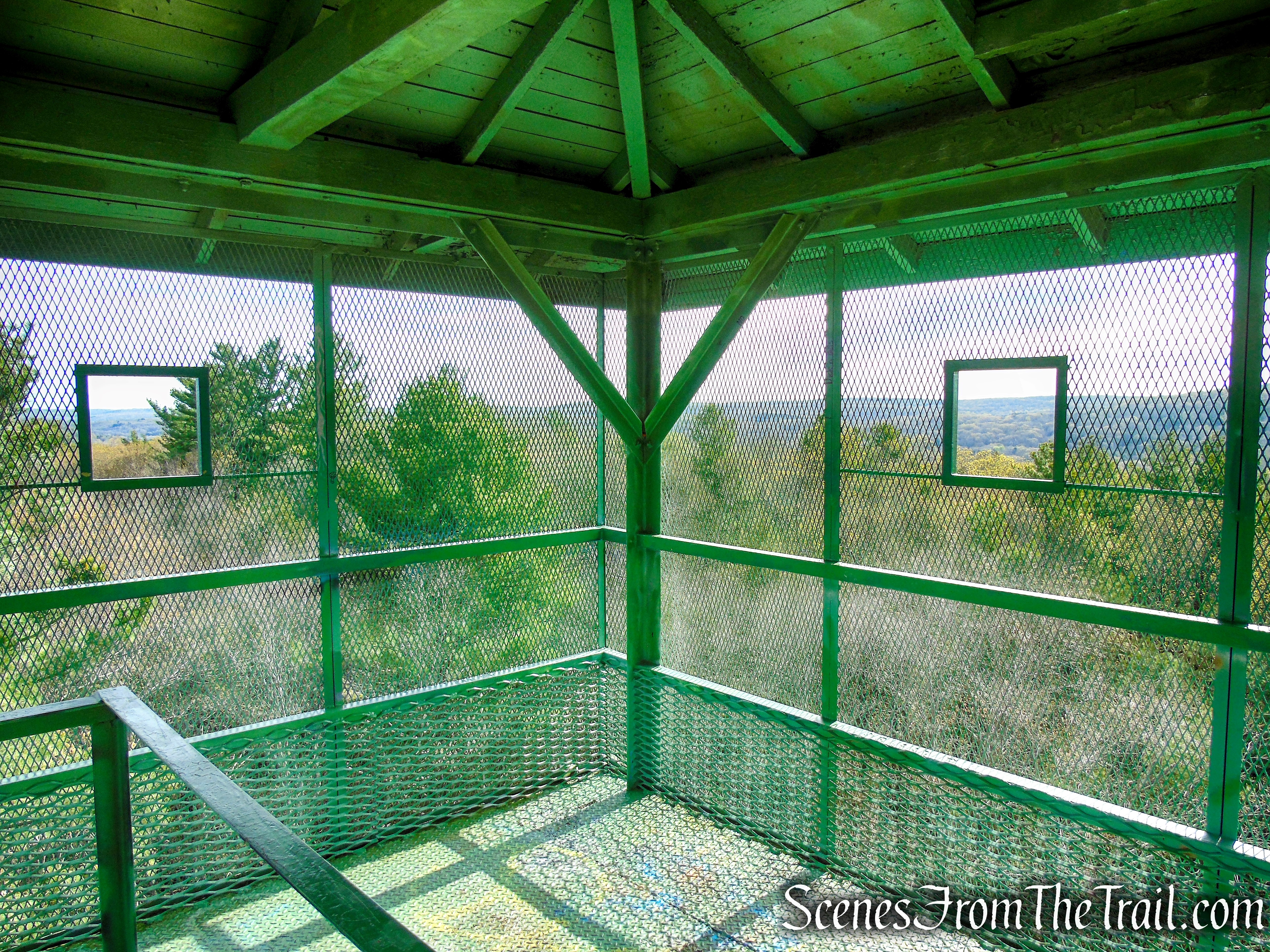
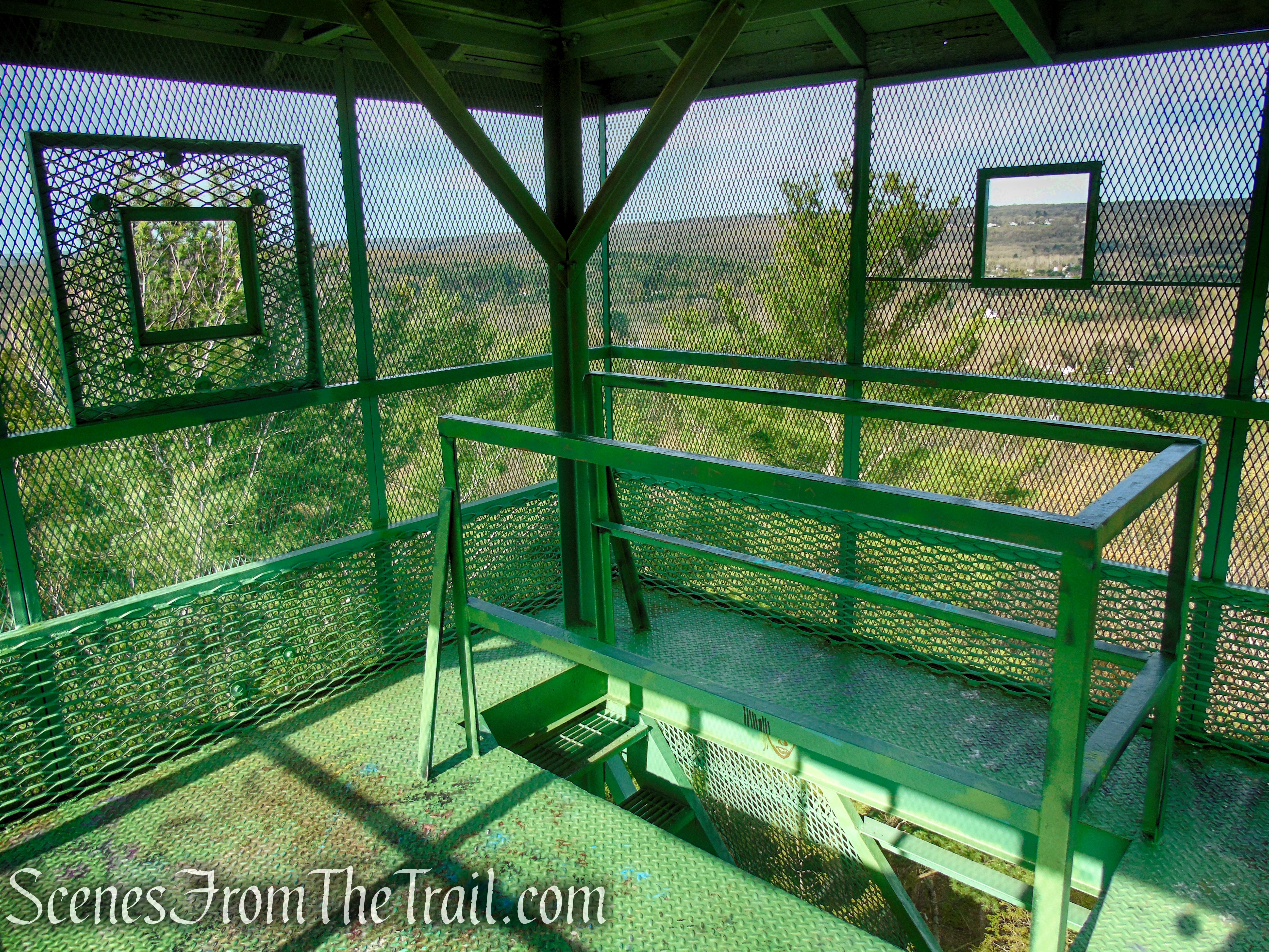
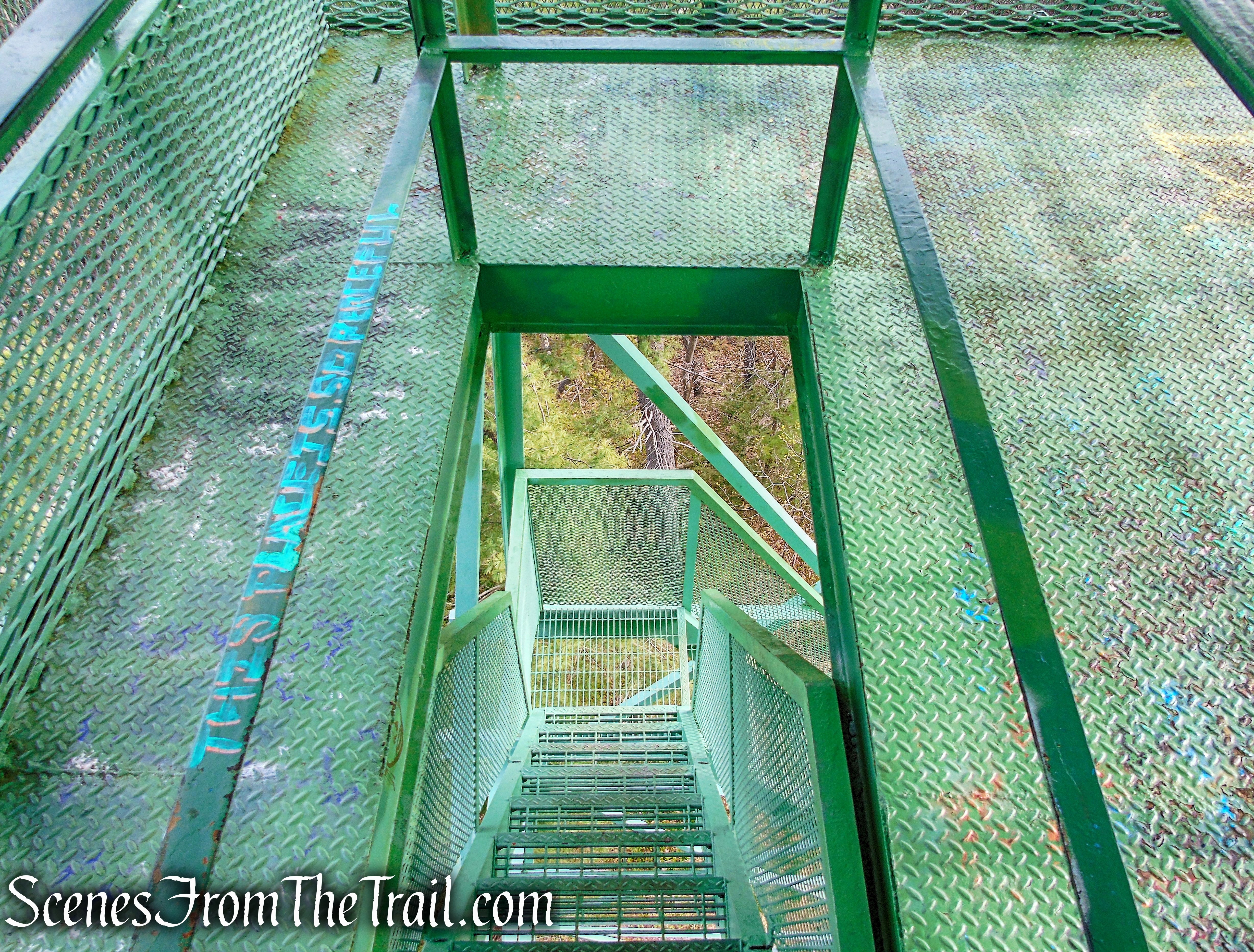
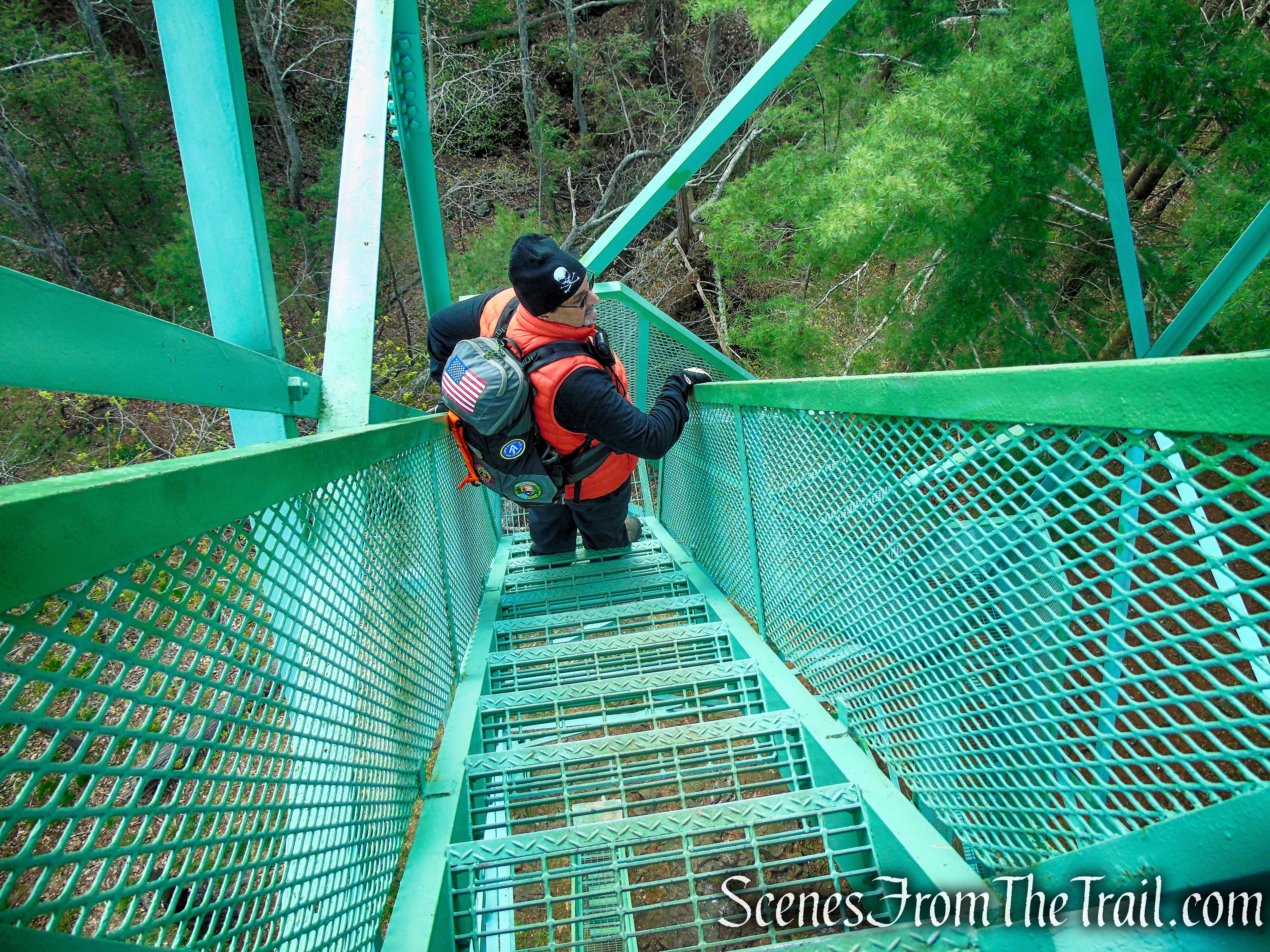
You may want to ascend the observation tower’s 70 steps on the open grid stairway, protected by sturdy wire mesh, to the enclosed deck for 360° views of the Pomperaug River Valley. There is no view from the base of the tower.
Orenaug Park Observation Tower
Orenaug Park Observation Tower
Orenaug Park Observation Tower
Orenaug Park Observation Tower
Unlike some of the other old fire towers that I have climbed, this one did not have any shake to it, but the floor of the cab does ripple underfoot.
Orenaug Park Observation Tower
Orenaug Park Observation Tower
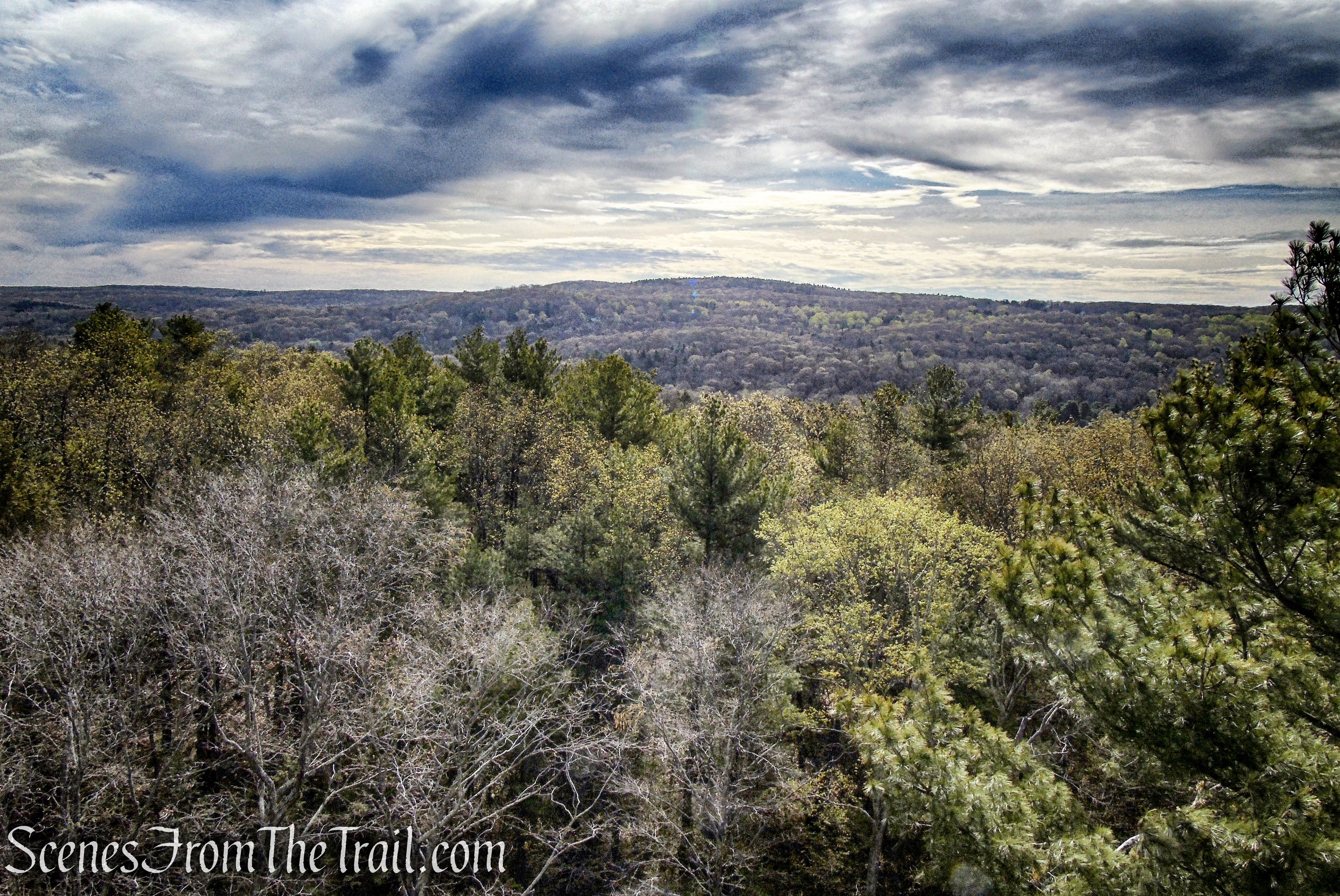
view northeast from Orenaug Park Observation Tower
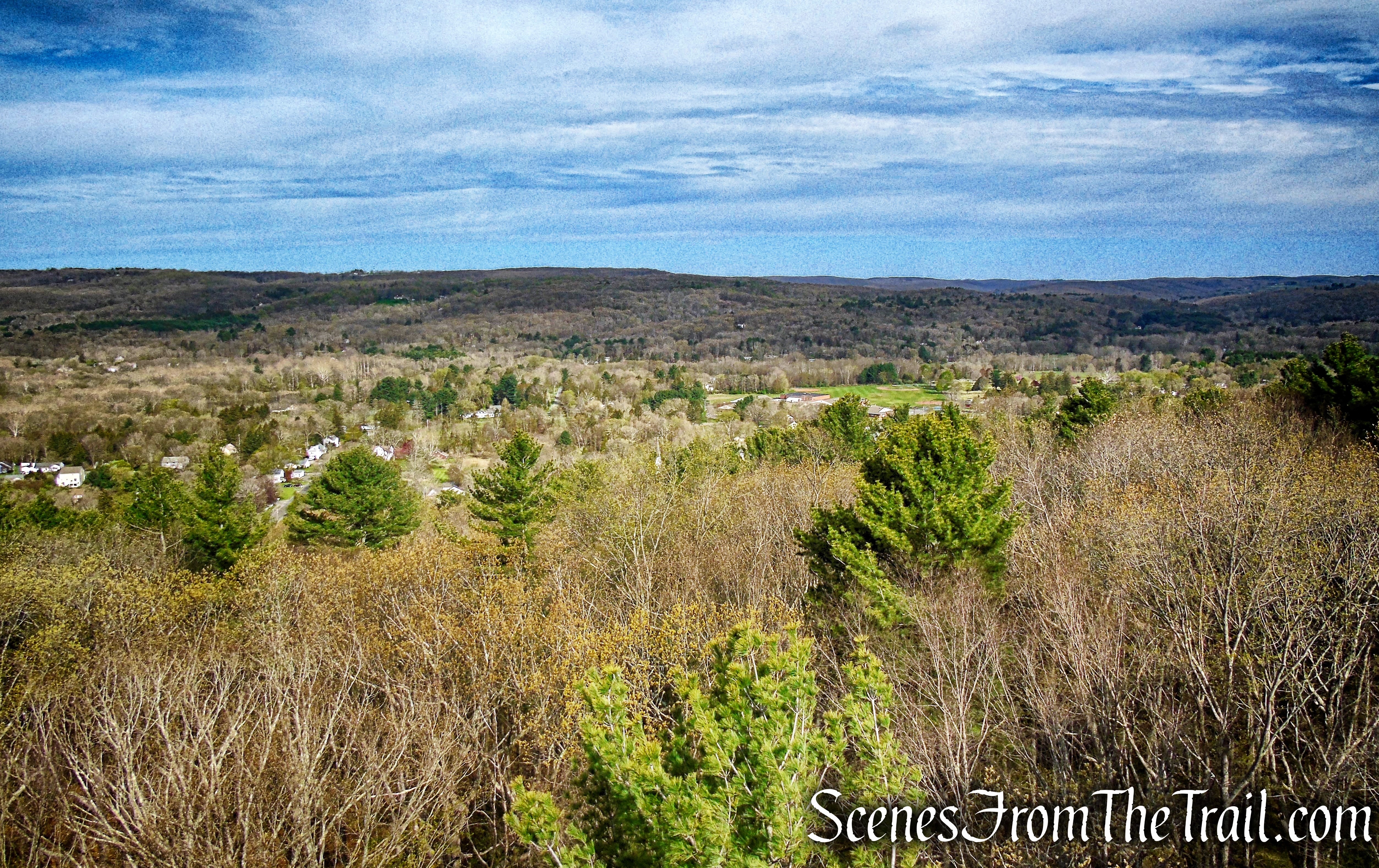
view southwest from Orenaug Park Observation Tower
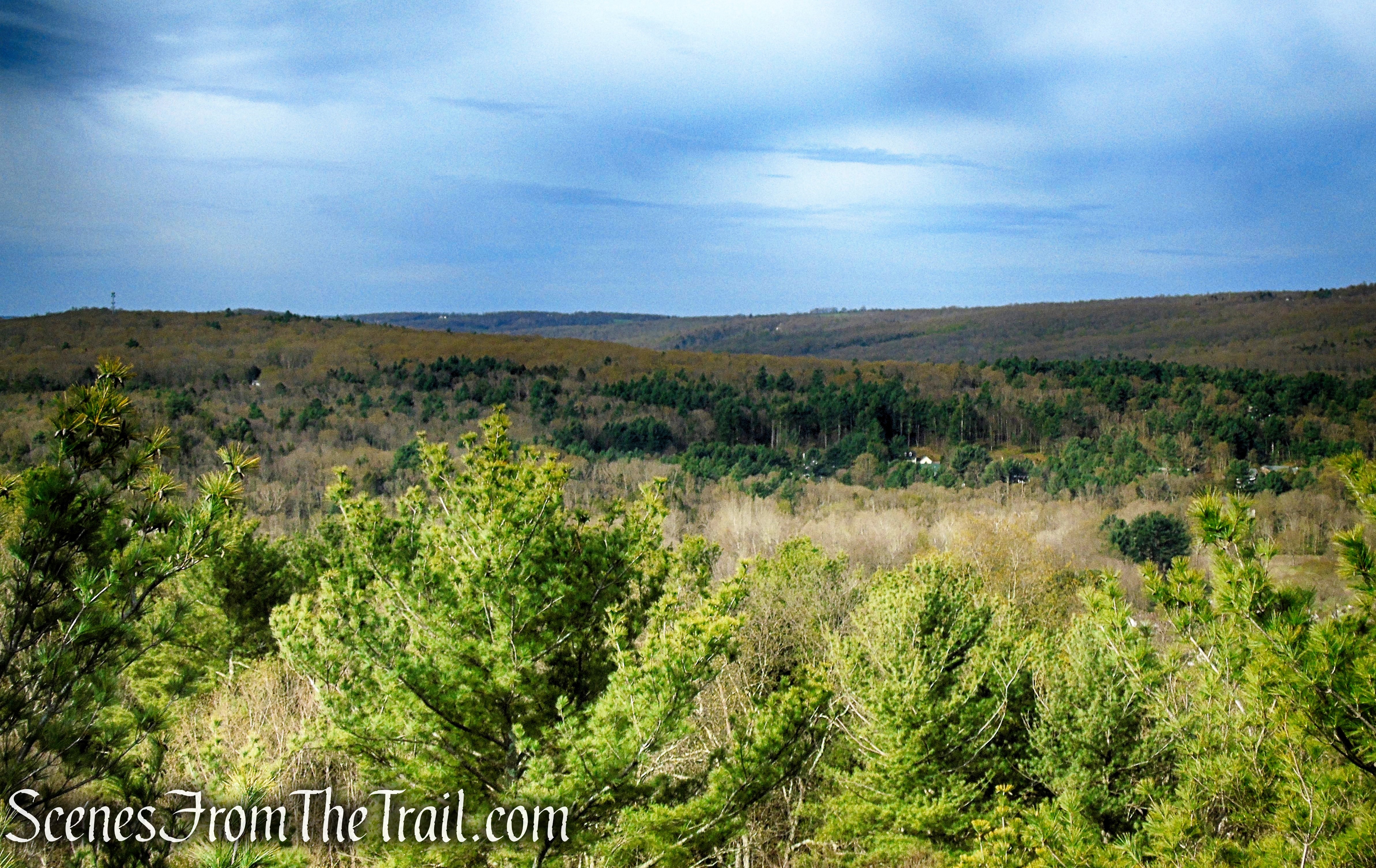
view west from Orenaug Park Observation Tower
When you are done enjoying the views, carefully descend the steps back to flat ground and retrace your steps for about 200 feet along the red-blazed Fire Trail to the junction with the yellow-blazed Bethel Rock Trail, which you passed on the way up.
Orenaug Park Observation Tower

Orenaug Park Observation Tower
Turn left on the Bethel Rock Trail and follow the yellow blazes as they descend slightly and turn left, soon passing through an interesting looking area lined with rock walls. The trail passes below the the base of the tower, turns right then climbs the hillside.
Bethel Rock Trail – Orenaug Park
Bethel Rock Trail – Orenaug Park
Bethel Rock Trail – Orenaug Park
Bethel Rock Trail – Orenaug Park
Bethel Rock Trail – Orenaug Park
Bethel Rock Trail – Orenaug Park
Soon the trail levels off somewhat and in about 350 yards, comes to a junction with the blue-blazed Loop Trail.
Bethel Rock Trail – Orenaug Park
Bethel Rock Trail – Orenaug Park
turn left on Loop Trail
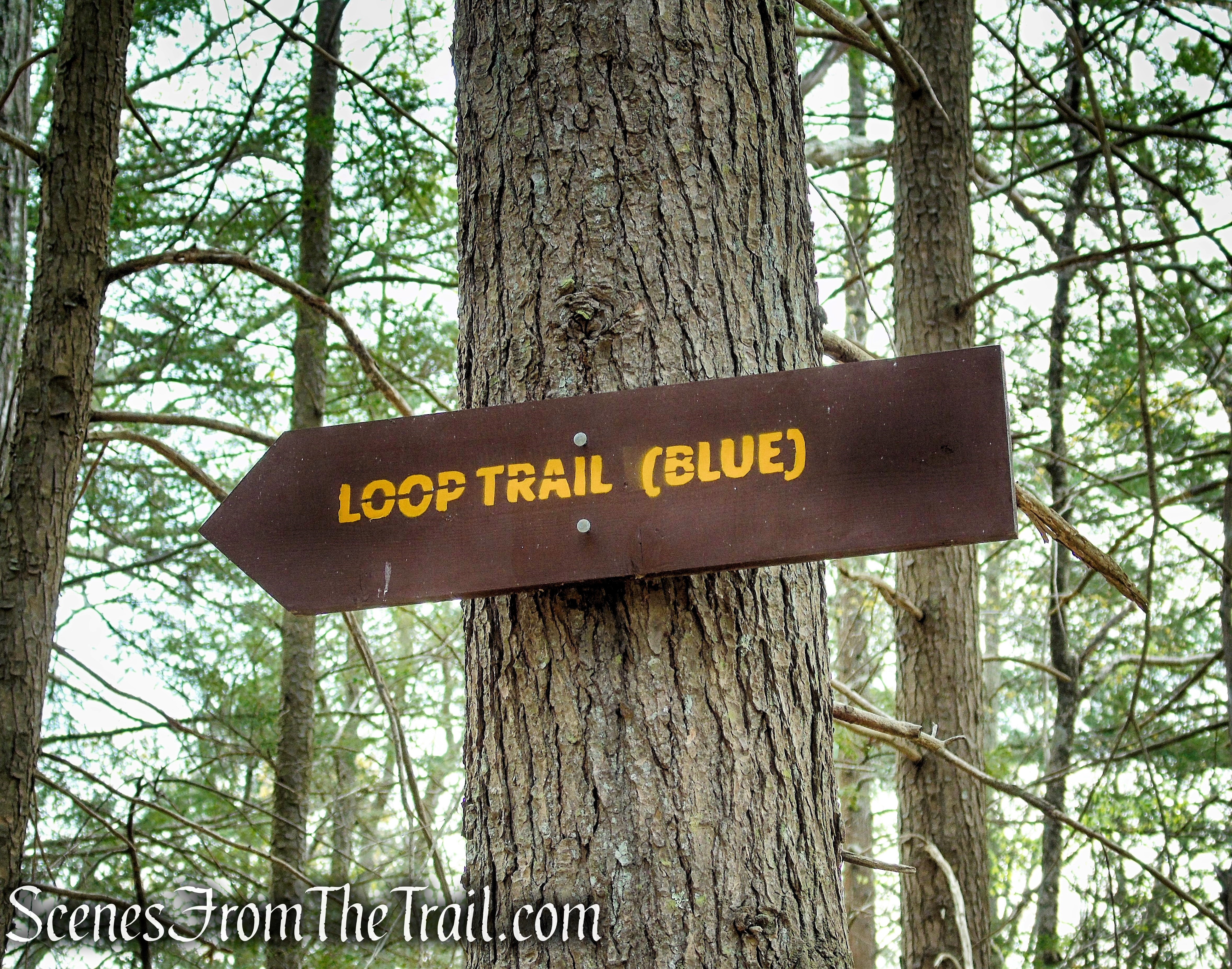
turn left on Loop Trail
Turn left on the blue blazed trail and follow it as it descends into the valley with high rock walls on the left. At the base of the descent, the trail turns sharp right. It was in this area that I looked up to the top of the cliffs and saw a Black Bear watching me. When I pointed the bear out to my hiking partner, it ran off. It then stopped, turned around and looked at me again. When I pointed to it again, it ran off once again. As luck would have it the trail took us right by where the bear was standing watching us. We were on high alert after that, but we did not see the bear again. My estimation is that the bear was 1-2 years old and about 150 pounds.
Loop Trail – Orenaug Park
Loop Trail – Orenaug Park
Loop Trail – Orenaug Park
After a short, but steep climb, the trail soon comes to a junction with the yellow-blazed Bethel Rock Trail. Turn left and follow the yellow blazes as they head southwest, gradually downhill.
Loop Trail – Orenaug Park
Loop Trail – Orenaug Park
Loop Trail – Orenaug Park
Loop Trail – Orenaug Park
Loop Trail – Orenaug Park
Loop Trail – Orenaug Park
Bethel Rock Trail – Orenaug Park
In about 500 feet, the Bethel Rock Trail reaches Bethel Rock. You may want to take a little time to explore this area.
Bethel Rock – Orenaug Park
Bethel Rock – Orenaug Park
Bethel Rock – Orenaug Park
Originally, we were going to retrace our steps, but due to the bear sighting, we decided to make a loop out of it using two residential streets. The Bethel Rock Trail continues in a southerly direction until its terminus on Park Lane, an unpaved road.
Bethel Rock Trail – Orenaug Park
Bethel Rock Trail – Orenaug Park
Bethel Rock Trail – Orenaug Park
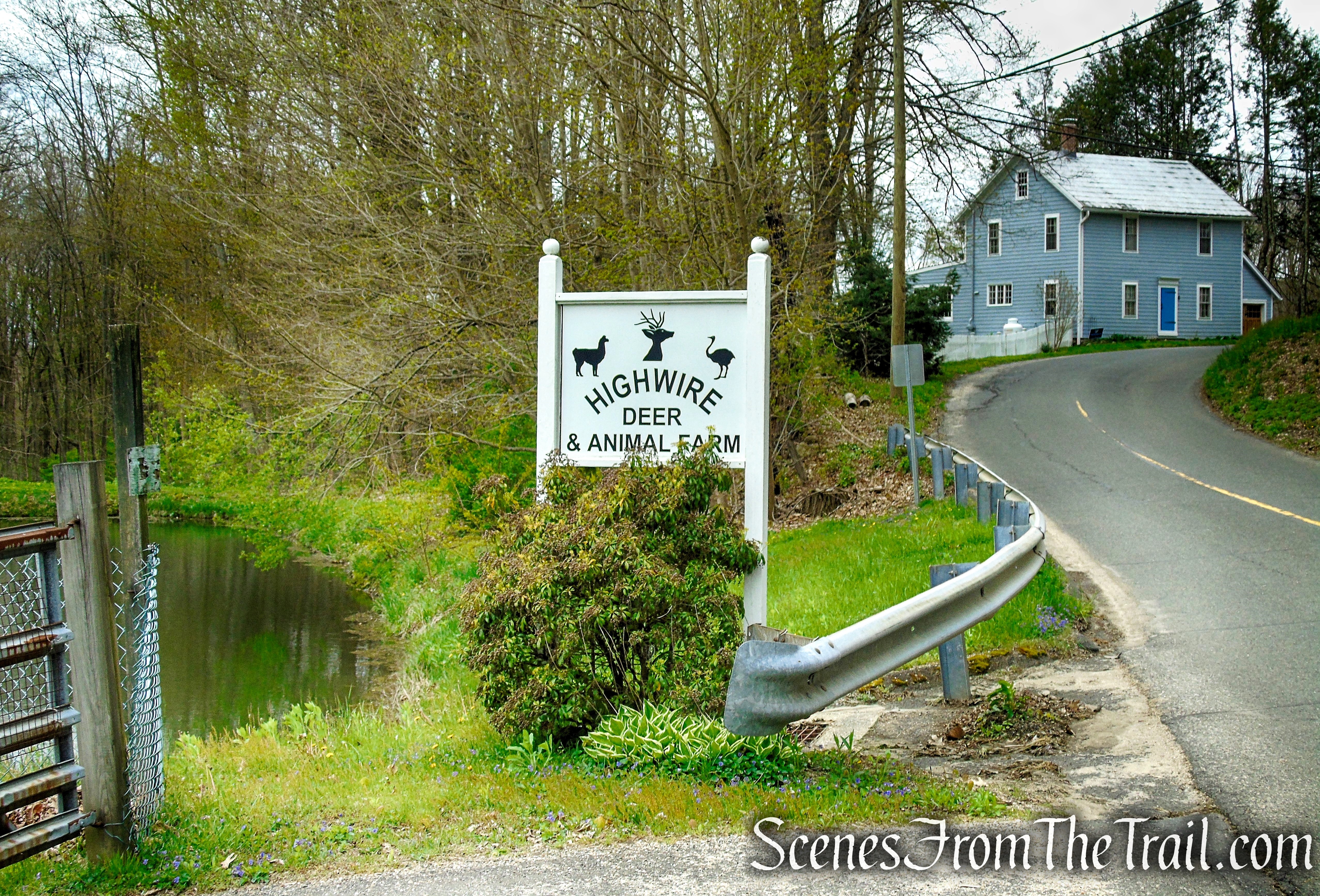
Turn right on Park Lane and follow it for about 1100 feet, to its terminus at Park Road. Turn right on Park Road and follow it for about 315 yards, passing an animal farm and returning to the parking area, where the hike began.
Park Lane – Woodbury
Park Lane – Woodbury
Alpaca along Park Road.
Park Road – Woodbury
Alpaca along Park Road.

Park Road – Woodbury
Park Road – Woodbury
Park Road – Woodbury
Park Road – Woodbury
Side Note:
Woodbury which means “dwelling place in the woods,” is a beautiful town that is full of history and worth checking out. There are many historic buildings, some dating back to the 1700’s. Woodbury is often referred to as Connecticut’s “Antique Capital,” with over 30 dealers offering virtually all categories, periods and styles of antiques, related accessories, gifts and bench made reproductions from every corner of the world.
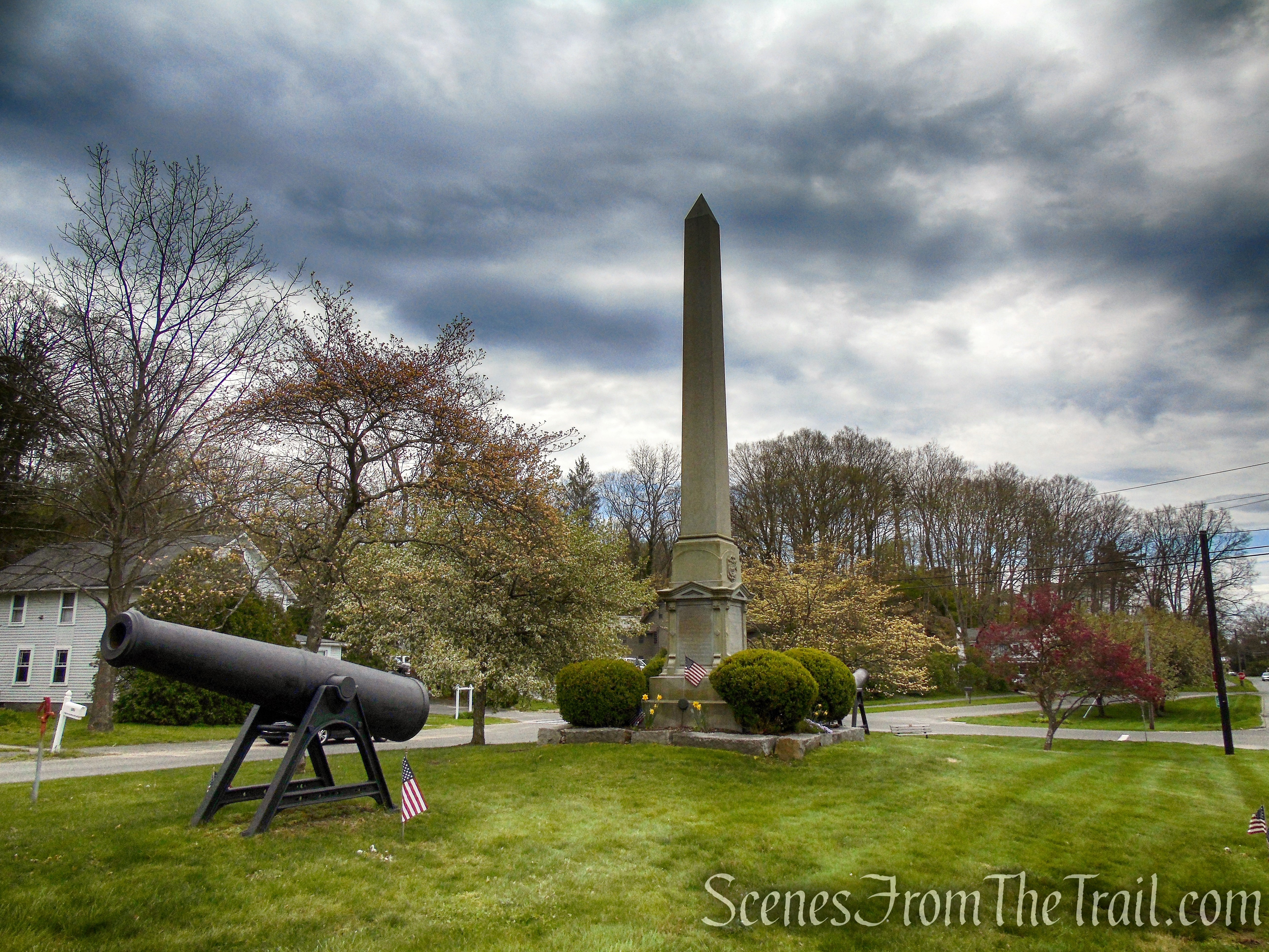
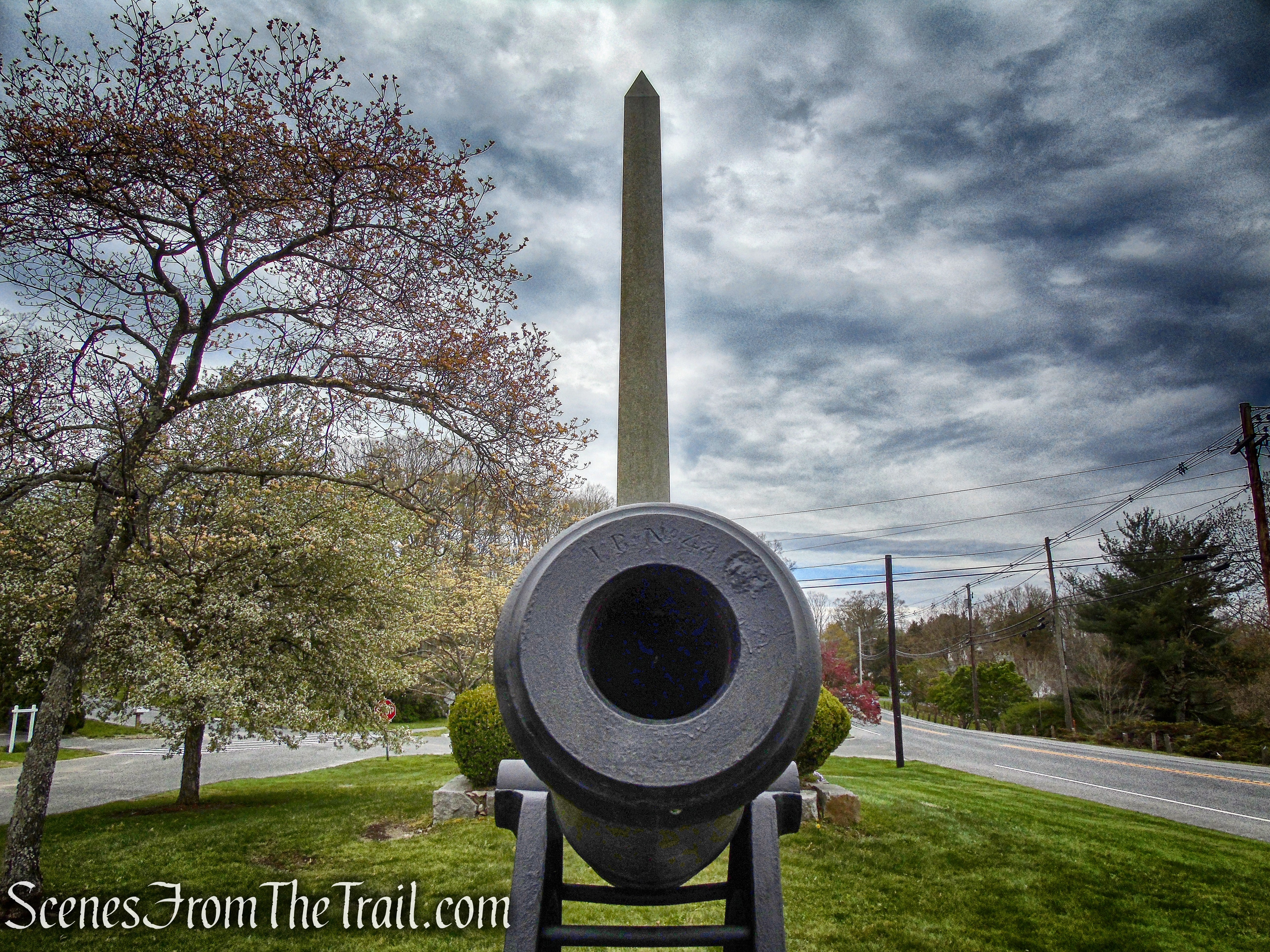
A picturesque, New England setting, with a “tree lined” Main Street, it is worth taking a stroll around if you have the time. We stopped at the Soldiers’ Monument, just down the road from where we parked.
An 1871 obelisk and two cannons on Woodbury’s South Green honor the sacrifice of local residents killed in the Civil War.
Soldiers’ Monument – Woodbury
The town’s contribution to the Civil War was 264, of whom 56 did not survive the war. In grateful memory, the Soldier’s Monument was dedicated September 26, 1871.
Soldiers’ Monument – Woodbury
Review:
A great hike in a small tract of land. The observation tower is worth the trip on its own. The blue-blazed Loop Trail should not be missed as it is very scenic with its unusual rock formations. Bethel Rock is also worth checking out. The bear sighting was cool although it made us change our route. We didn’t see any other hikers during our time there. Worth a visit if you are in the area or even to make a special trip there. We drove 70 minutes (65 miles) to do this hike. Worth every mile and minute.
Pros:
Orenaug Park Observation Tower, Bethel Rock, well marked trails, interesting rock formations, Black Bear sighting, hidden gem.
Cons:
No loops unless you use public roads.
Take a hike!
Orenaug Park
Sources:

We goin’ there soon! Thanx for tour! We’re tower fans also! Regards, Mike from Simsbury, Ct
LikeLiked by 1 person