April 24, 2022 – Hamden, Connecticut
Difficulty: Easy – Moderate
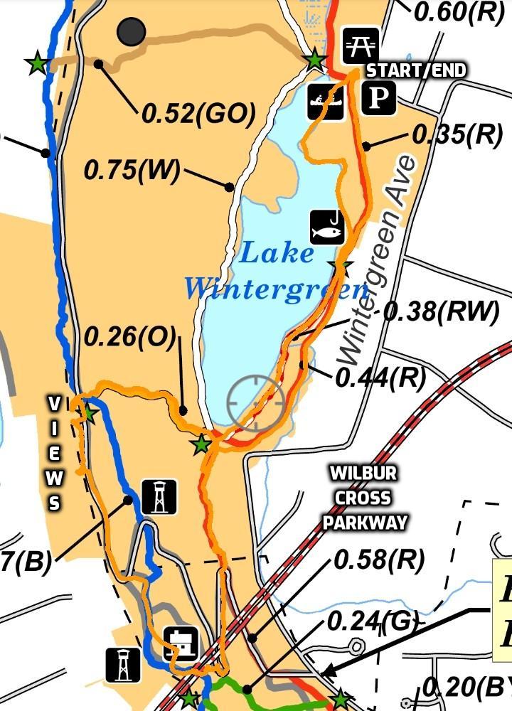
Length: Approximately 3.8 miles
Max elevation: 441 ft.– total elevation gain approximately 408 ft.
Route type: Circuit
Maps: West Rock Ridge State Park Trail Map – West Rock Ridge State Park Avenza Map
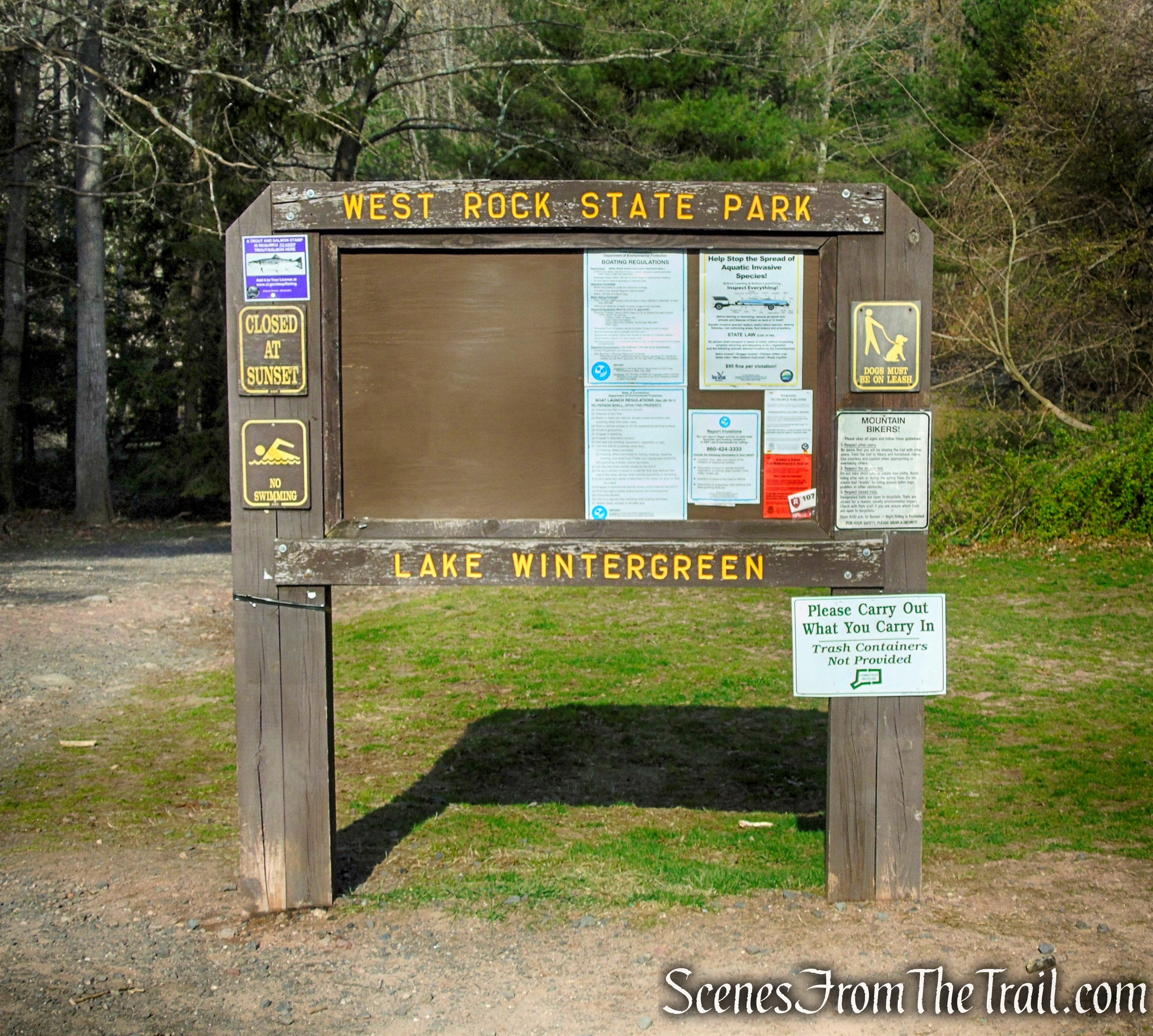
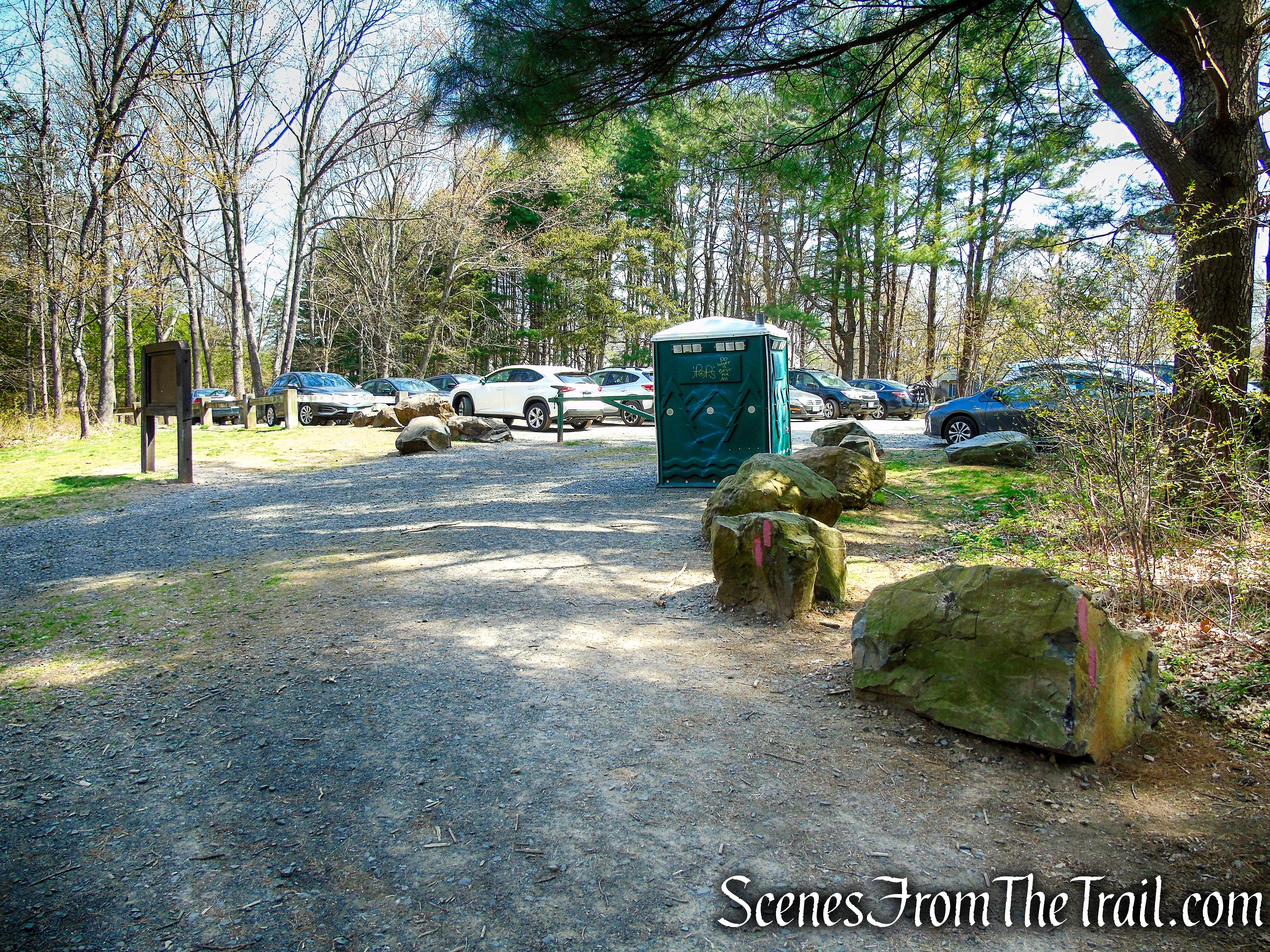
Trailhead parking: Lake Wintergreen Parking Area
Composting toilets on site – No entrance or parking fees
Approximately 30 parking spaces at the Lake Wintergreen trailhead.
Park Overview:
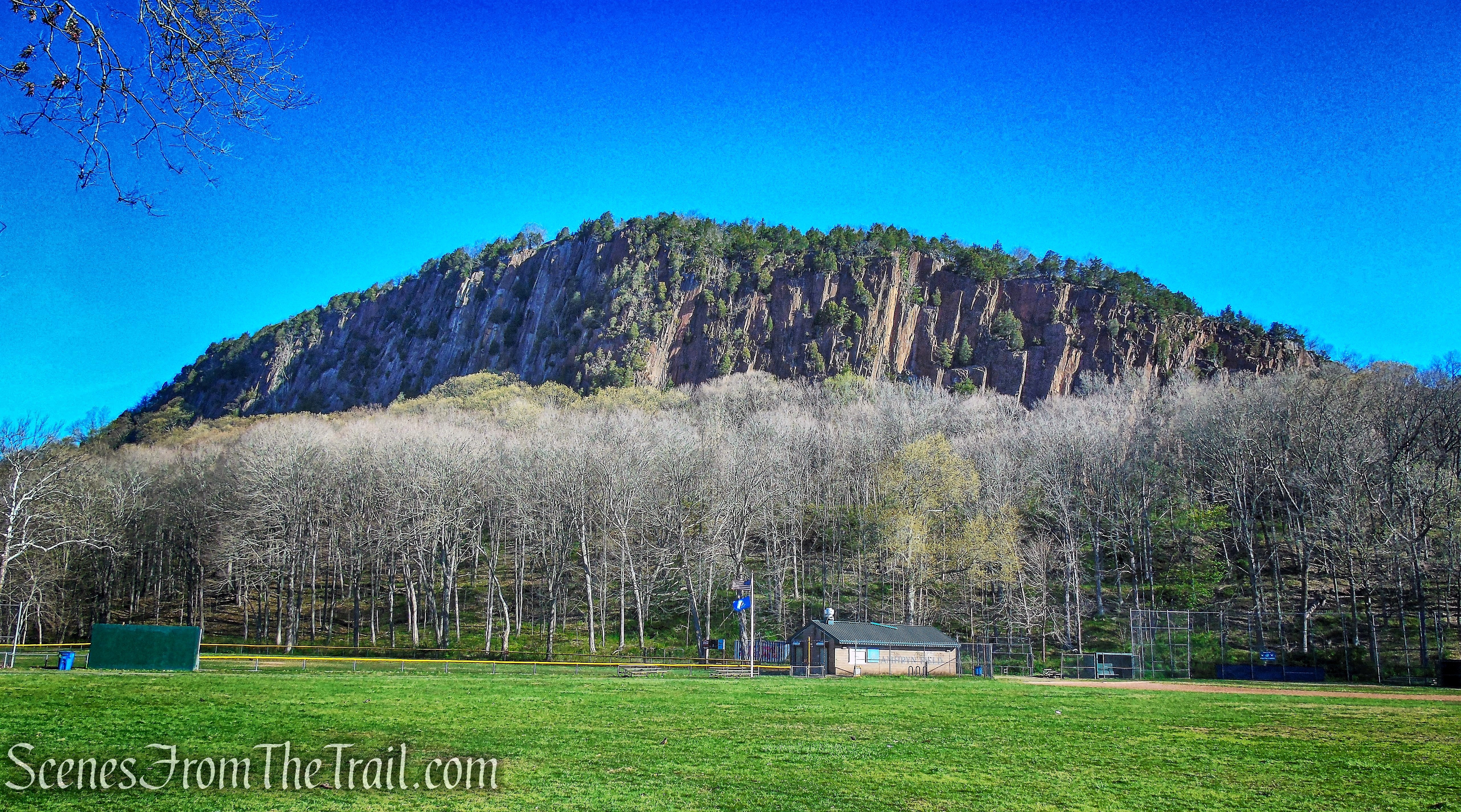
Rising up to 627 feet above mean sea level, West Rock Ridge is one of the most prominent features of the New Haven region. West Rock affords visitors a spectacular view; it is estimated that one can see approximately 200 square miles from various locations on the ridge with excellent views of New Haven Harbor and Long Island Sound.
West Rock Ridge
West Rock Ridge State Park is located in parts of New Haven, Hamden, and Woodbridge, Connecticut. The state park is named for the 400 to 700 ft. trap rock West Rock Ridge, which is part of the Metacomet Ridge extending from Long Island Sound to the Vermont border. The park’s 7 miles of open west-facing cliffs offer vistas encompassing Metropolitan New Haven and suburban towns to the west. The park includes Judges Cave, a colonial era historic site; Lake Wintergreen; and the 7-mile long Regicides Trail, part of the Connecticut Forest and Park Association’s Blue Trail system. The park is part of a larger area of protected open space including state, municipal, and non-profit owned land.
Lake Wintergreen – West Rock Ridge State Park
The park is open for walk-in access from 8 am to sunset.
The drive to the summit is open for vehicles on weekends and holidays from Memorial Day weekend until the last weekend in October from 8 a.m. – 6:00 p.m.
There is a composting toilet by the Lake Wintergreen parking lot, which is the only restroom facility available in the park.
History:
The park began as a city park in 1826, when Elijah Thompson donated 50 acres to the City of New Haven. In 1927, Governor Simeon Baldwin donated over $100,000 to the New Haven Park Commission, leading to acquisition of a large portion of the ridge and construction of Baldwin Drive in the 1930’s. Baldwin Drive (once known as Baldwin Parkway) was built along the ridge by the Works Progress Administration (WPA) in the 1930’s.
In 1962, the State of Connecticut endorsed the need for open spaces preservation. In 1975, the State legislature unanimously created West Rock Ridge State Park and established the boundaries of the larger Conservation Area.
New Haven’s city park, which had grown to more than 600 acres, was transferred to the State in 1982, and the State has continued to acquire parcels within the West Rock Ridge Conservation Area over the years, for a total now of over 1700 acres.
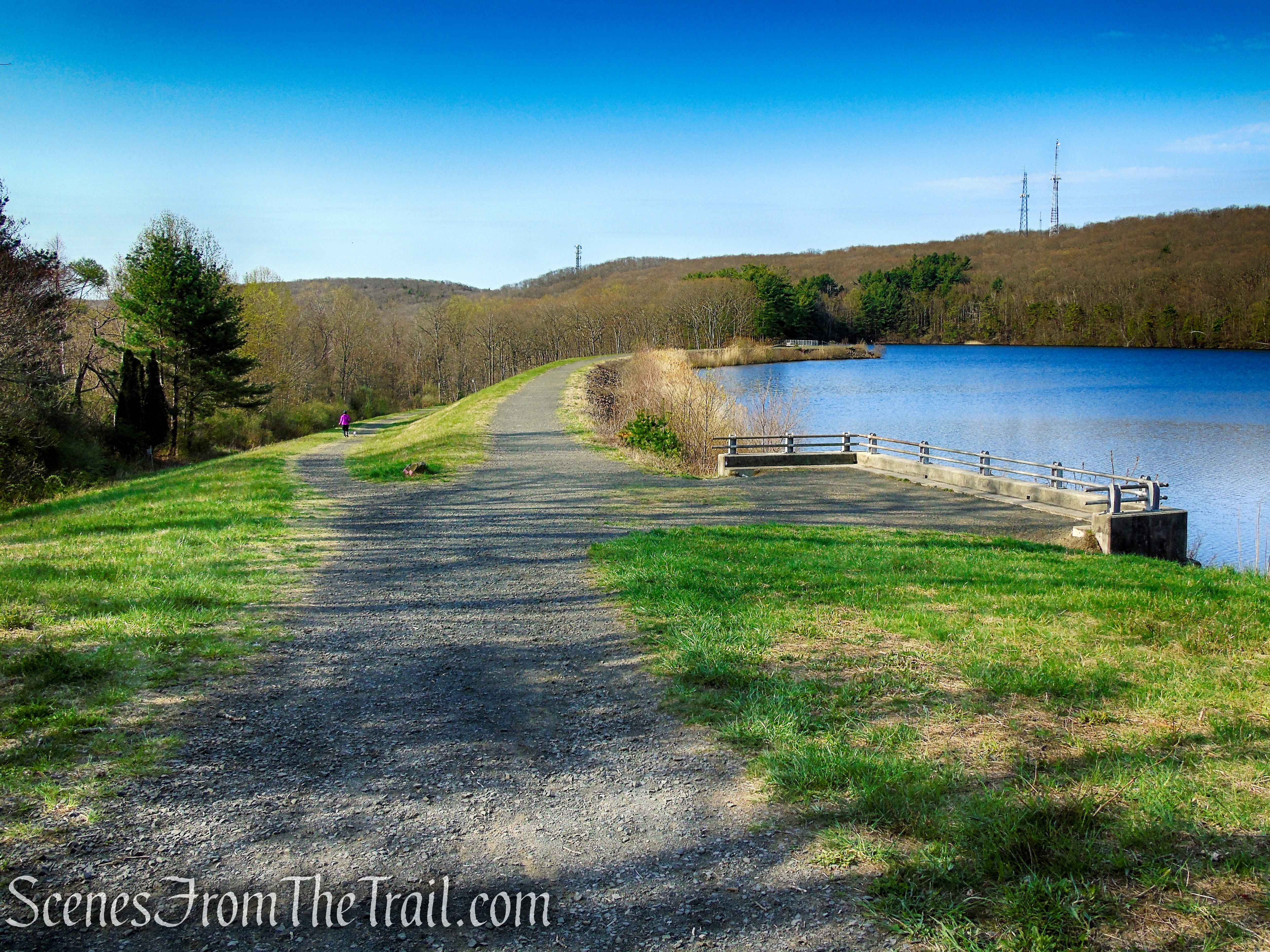
Between 1863 and 1978 Lake Wintergreen provided water for the City of New Haven. The lake was created when an earthen dam was built by Fair Haven Water Co. to flood the bedrock basin. After they had used the water supply for 13 years, the Fair Haven Water Co. was bought out by the New Haven Water Company, which soon bought additional land in the watershed. In 1978 the lake was taken out of the water supply system because strict new Federal standards would have required construction of a filtration plant.
Red Trail – West Rock Ridge State Park
Trails Overview:
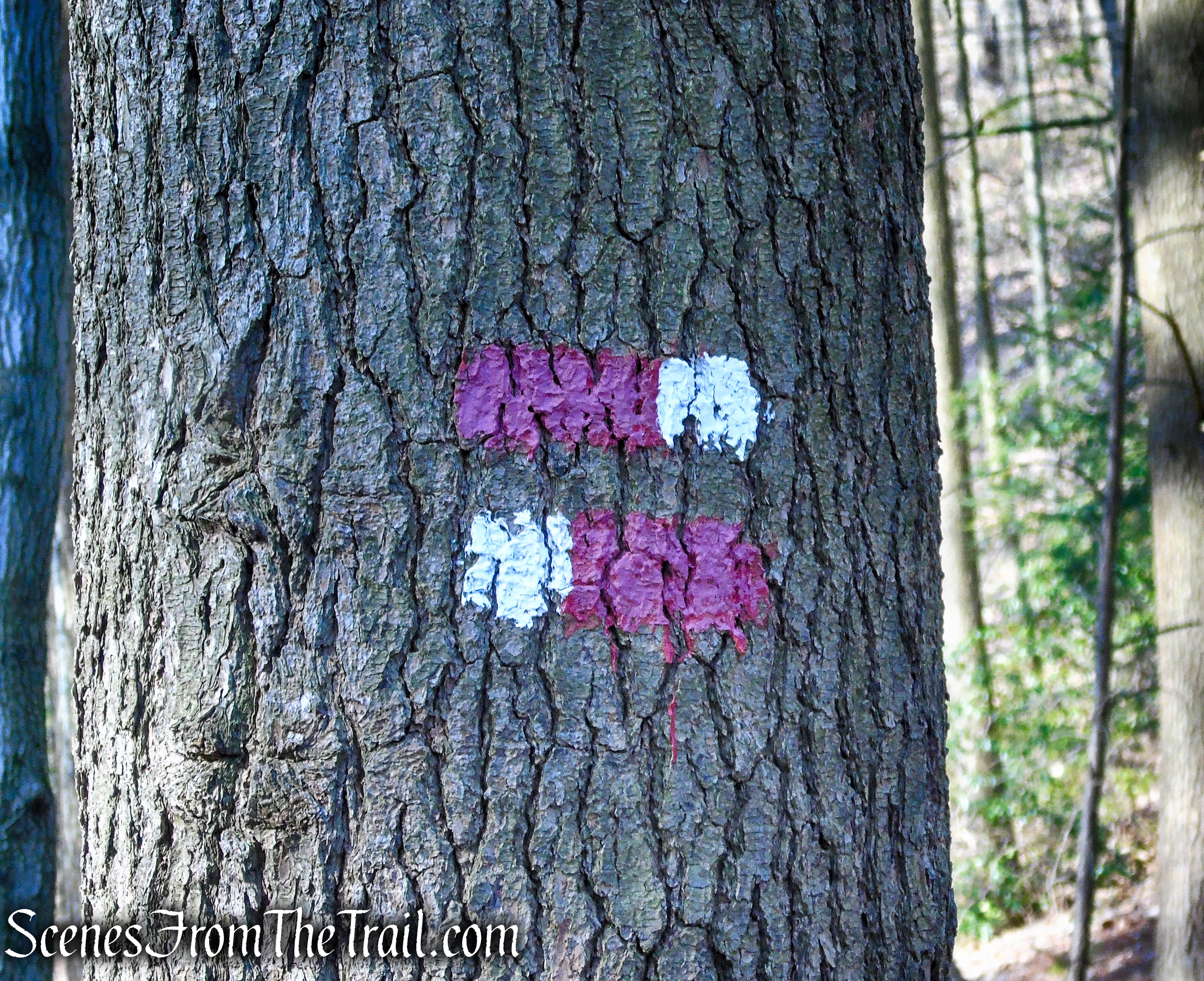
There are more than 25 miles of marked trails in and near West Rock Ridge State Park, all of which are marked with painted blazes. If two blazes are stacked to resemble an equal sign, then this symbol indicates the end of the trail. There is no special marker to indicate the start of a trail.
Red/White Trail – West Rock Ridge State Park
The Green, Red, Red-White, Yellow and White blazed trails are designated as multi-use. Riding horses and mountain bikes on these trails is encouraged. All other trails are footpaths for hiking activity only.
Trails used on this hike:
The Red Trail (6.75 miles) runs roughly parallel to the Regicides Trail (Blue Trail) with several connecting trails cutting between the two. This allows hikers to make a variety of loops within the park. The trail has some rolling ups and downs in the middle and a steep downhill (or uphill) at the southern end and a similar climb or descent on the north end where the trail climbs up to meet the Regicides Trail (Blue Trail) at the ridgeline.
The blue-blazed Regicides Trail extends 6.8 miles northerly from the South Overlook of West Rock to its terminus at the Quinnipiac Trail on the west slope of York Mountain. Along the way, the Regicides Trail intersects with a series of different colored trails that climb the ridge. With these numerous trail options, hikers can easily customize the length of their hike. The Regicides Trail also crosses Baldwin Drive six times.
The Regicides Trail is considered one of Connecticut’s most spectacular cliff walks. Along the western side of the ridge, hikers are rewarded with extended views of reservoirs and forests in Woodbridge and Bethany. On the eastern side, the trail has a dramatic perspective down the length of West Rock Ridge, including Farm Brook Reservoir and the forested slopes of the state park.
The Red-White Trail is a short connector trail along the eastern shore of Lake Wintergreen, near the southern end of the lake by the Lake Wintergreen spillway. It is rocky and has a lot of exposed roots.
The Orange Trail is 0.3 mile long and starts at the southern end of Lake Wintergreen, near the intersection of the Red and White Trails, and ends at the junction of the Regicides Trail and Baldwin Drive. The trail is a steady climb from the lake up to the ridge, gaining about 200 feet of elevation. It is mostly rocky with a few wet areas.
A combination of park roads and an unmarked trails were also used.
Hike Overview:
This hike was a last minute change of plans which meant not that much research was done on the area. I did not know that the park roads were closed to motor vehicles until Memorial Day weekend. That meant that we had to park at the Lake Wintergreen parking lot. Although there are numerous approved parking areas near connecting trails just outside the park, I was unaware of some of their locations. Some of the parking locations along Wintergreen Avenue seemed a little desolate and quite frankly gave the impression of not being a safe spot to leave a vehicle unattended.
The hike that I had mapped out got scrapped and I made one up on the fly. Several points of interest from the original plan were not included, but it still turned out to be a good hike.
Using a combination of blazed and unmarked trails, along with park roads, we made our way along the lake and up to the ridge to enjoy some views. We ran into a few people, but mostly near the lake. Lake Wintergreen, the South Overlook, and Judges Cave, are the three most heavily-used areas at West Rock.
The hike begins at the northern end of Lake Wintergreen, heads south then climbs the Orange Trail up to the ridge for some west-facing views. Then south on the Regicides Trail past a ventilator shaft over the Heroes Tunnel and returns on the Red Trail.
Konolds Pond Overlook from Lake Wintergreen
This hike is rated easy-moderate with only one steep ascent on the Orange Trail. The rest of the hike is relatively easy.
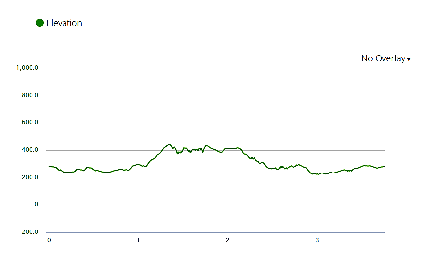
elevation profile – Konolds Pond Overlook from Lake Wintergreen
The Hike
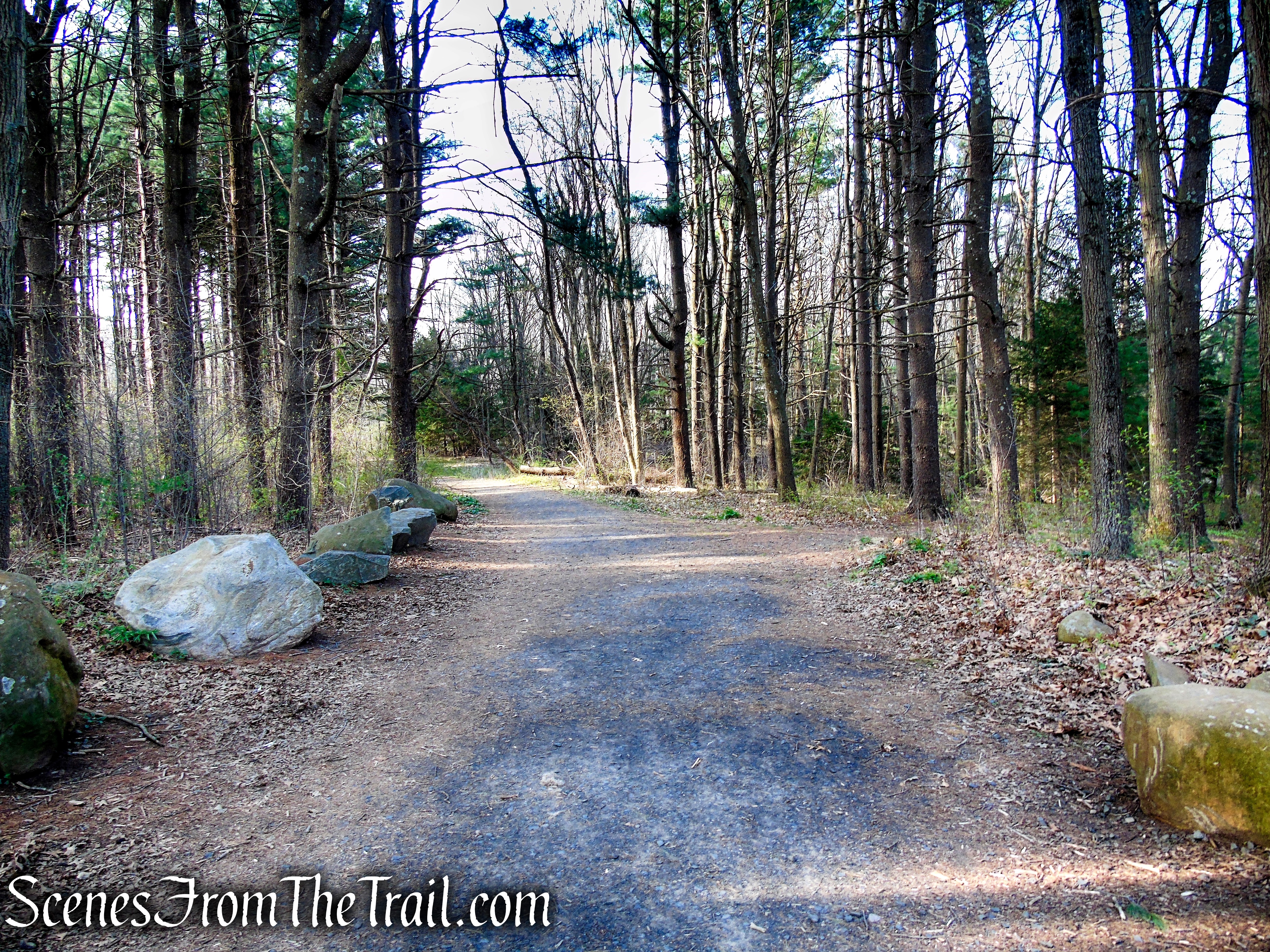
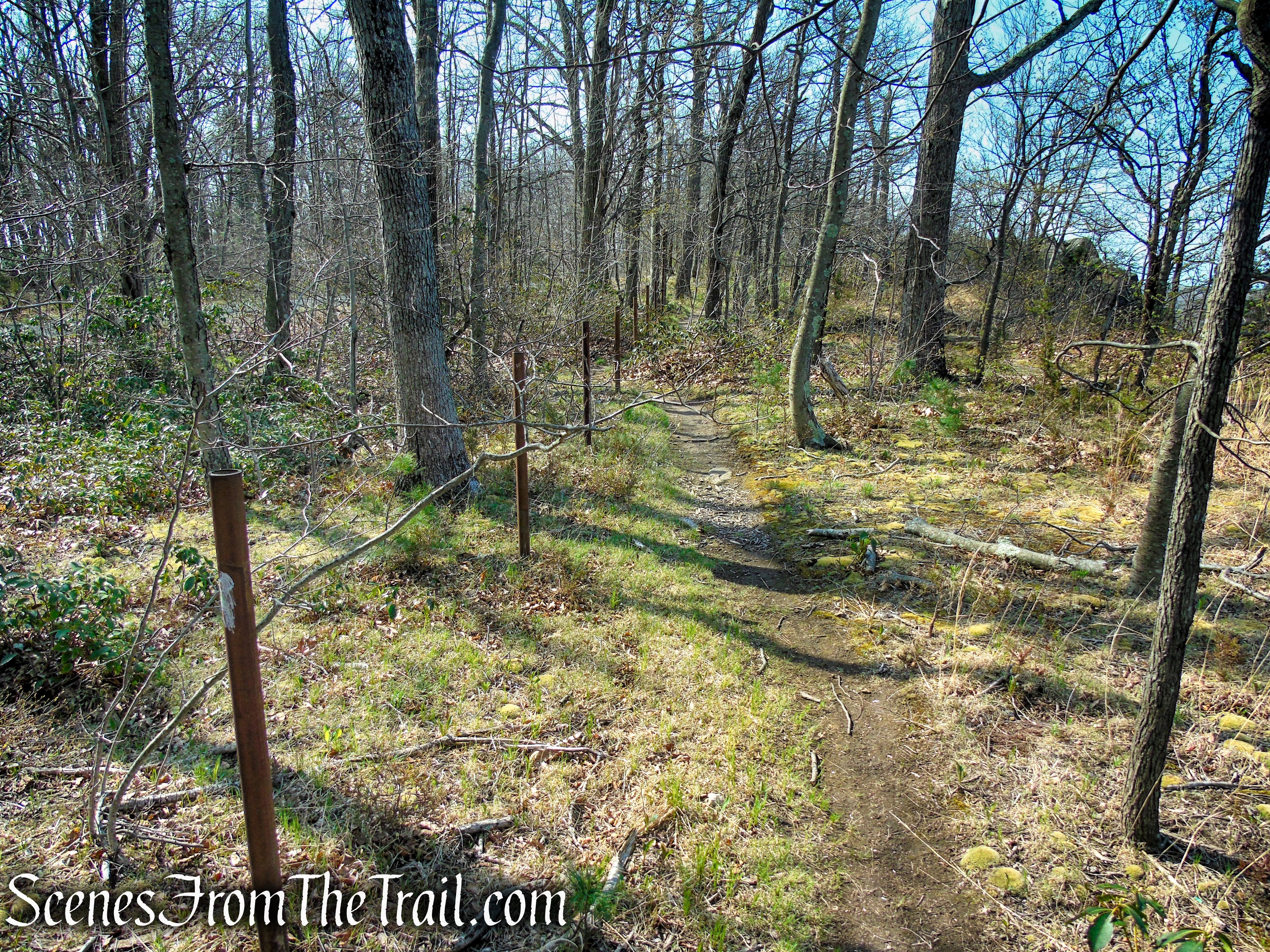
We walked towards the sign and turned left on the wide gravel road. That is the Red Trail. Almost immediately we turned right on an unmarked footpath and headed towards Lake Wintergreen. We walked on a wide footpath, which follows the contour of the scenic lake. In about 1/2-mile, the unmarked trail meets up with the Red Trail, where we turned right.
Lake Wintergreen – West Rock Ridge State Park
Red Trail – West Rock Ridge State Park
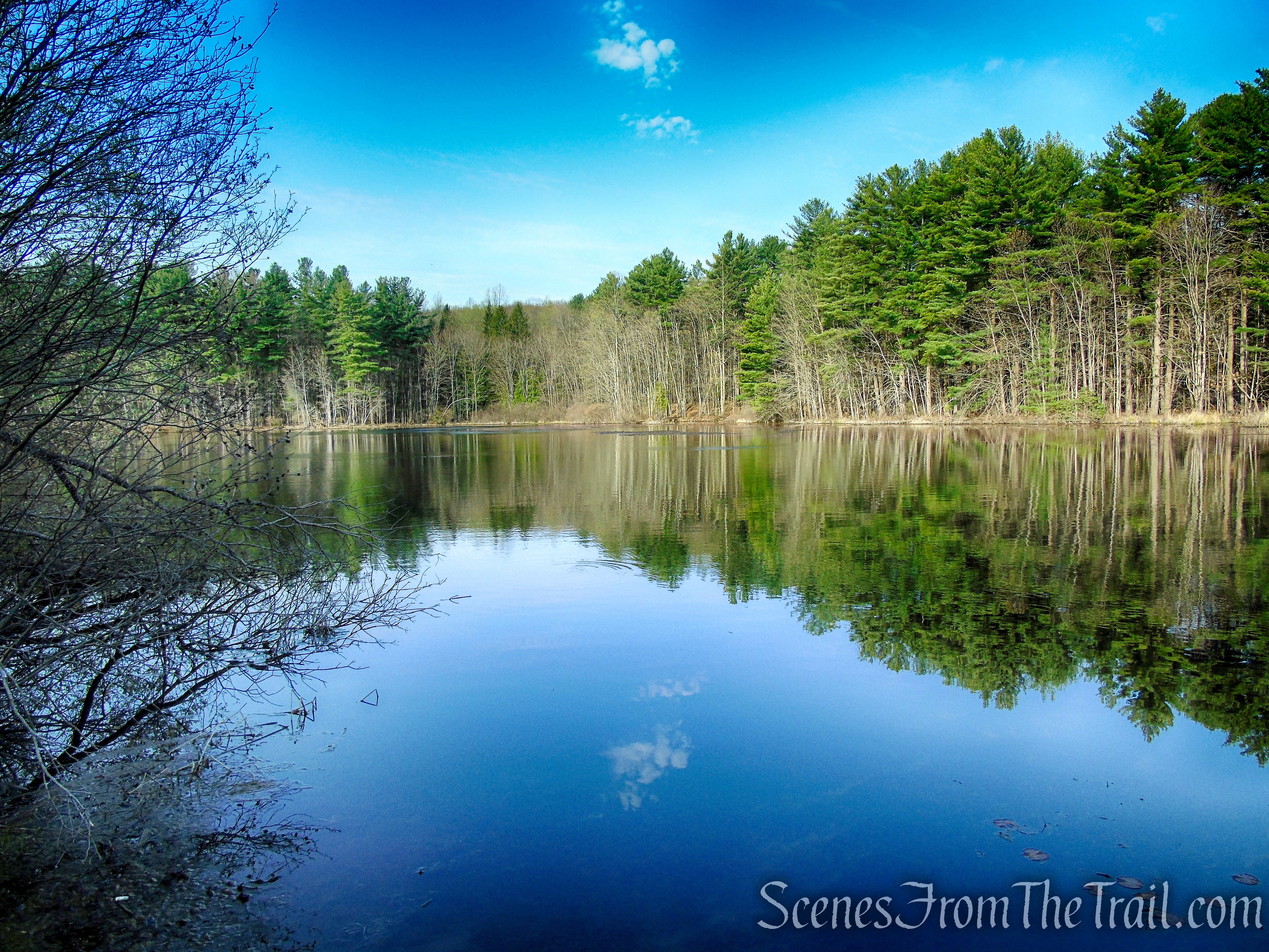
Lake Wintergreen – West Rock Ridge State Park
unmarked trail along Lake Wintergreen
Lake Wintergreen – West Rock Ridge State Park
unmarked trail along Lake Wintergreen
unmarked trail along Lake Wintergreen
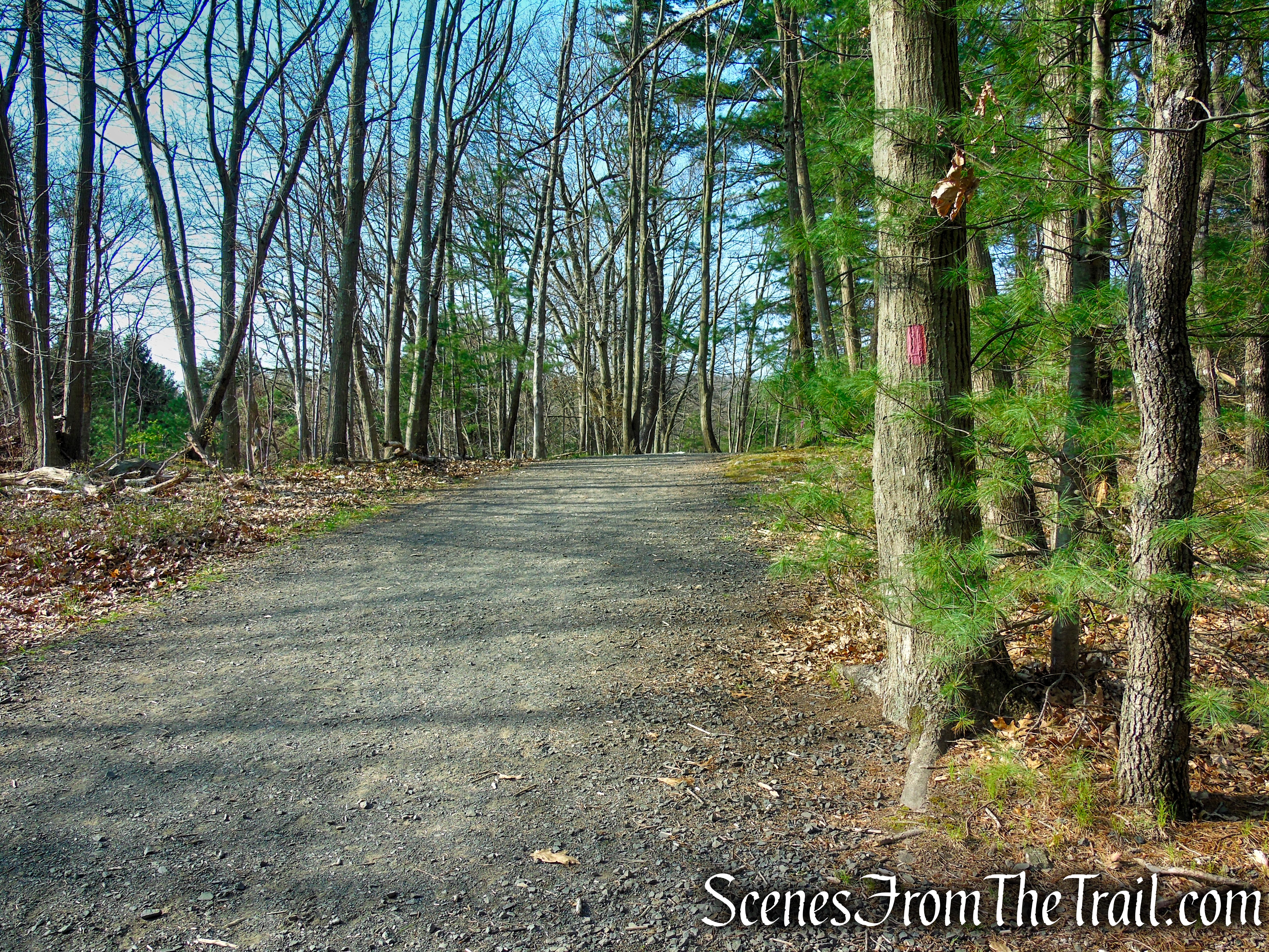
Red Trail – West Rock Ridge State Park
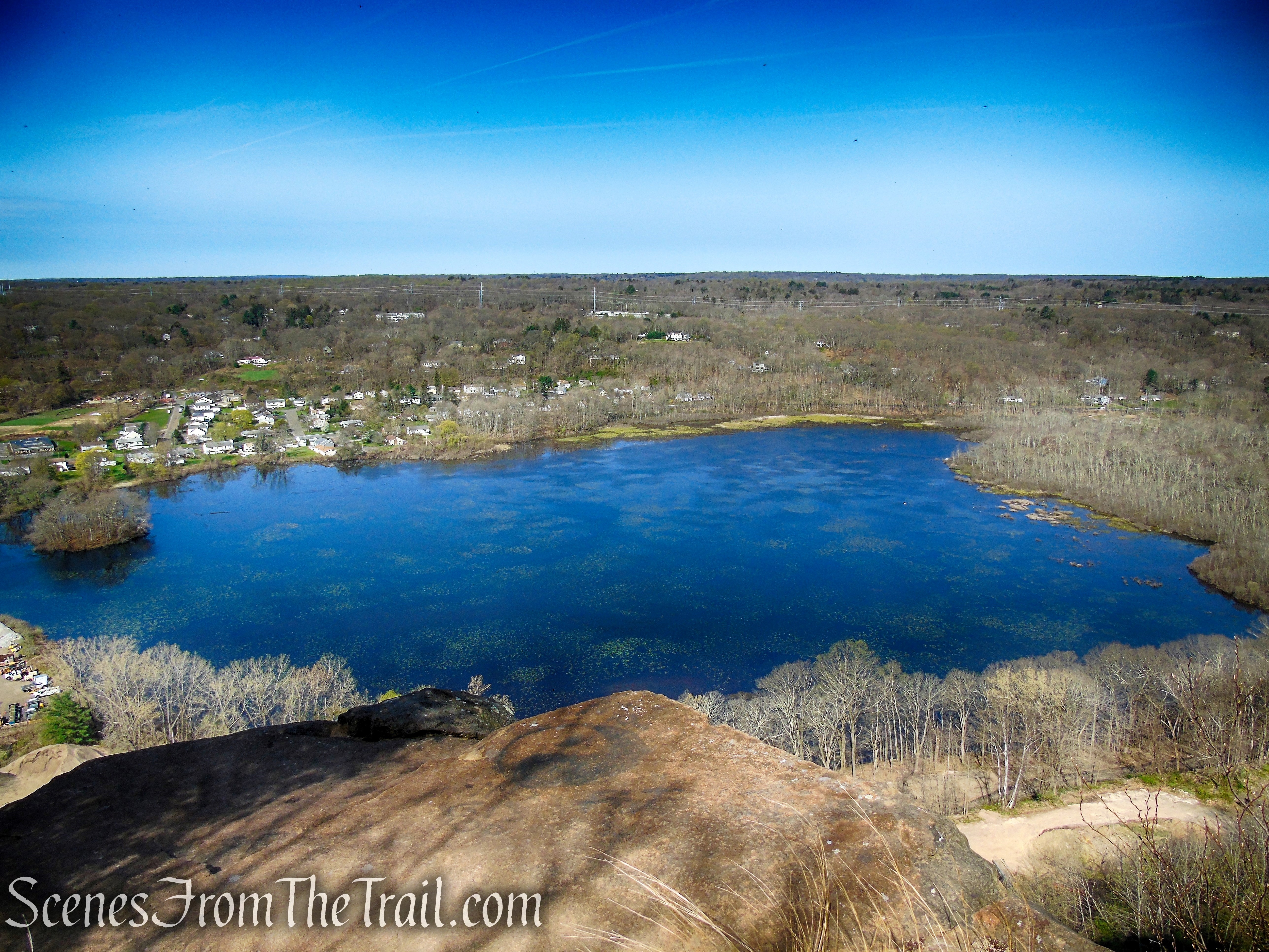
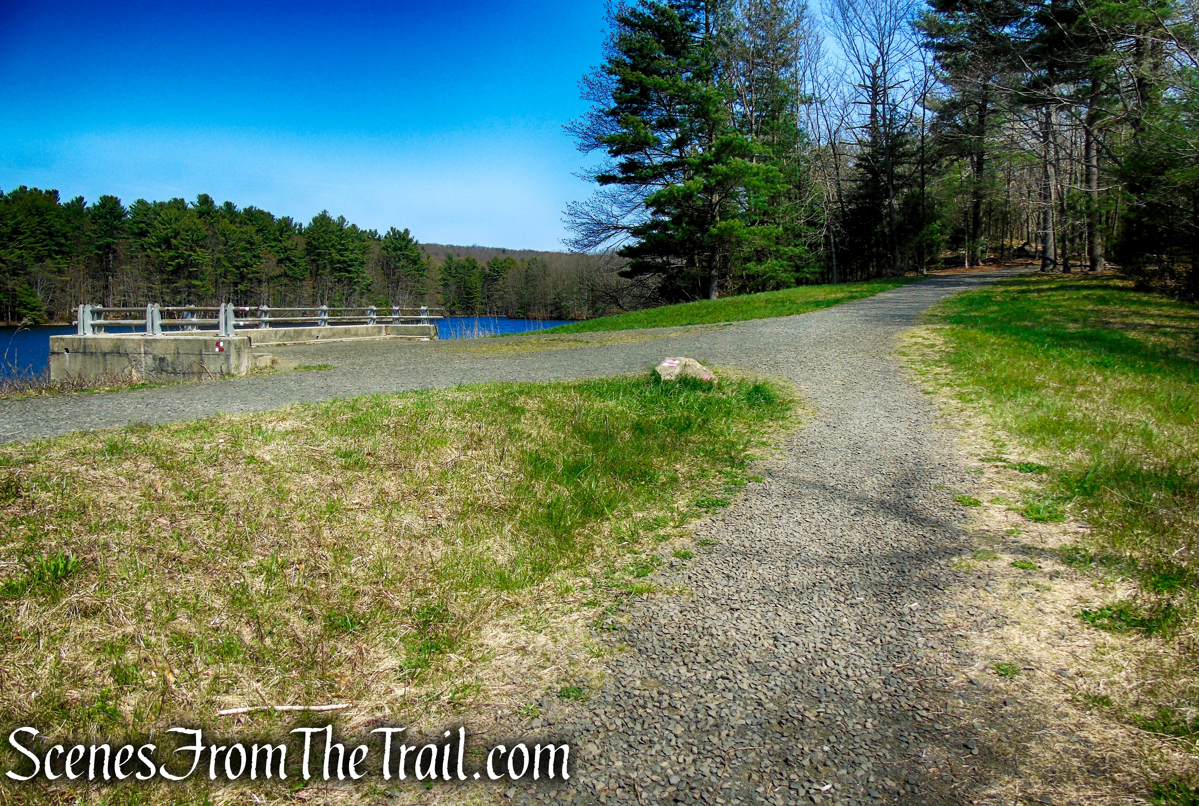
In a short distance, the Red Trail veers left at a junction with the Red/White Trail which runs across the top of the earthen dam. From this area you can get some of the finer views of Lake Wintergreen. The Red Trail will be your return route, for now continue straight on the Red/White Trail.
Red Trail – West Rock Ridge State Park
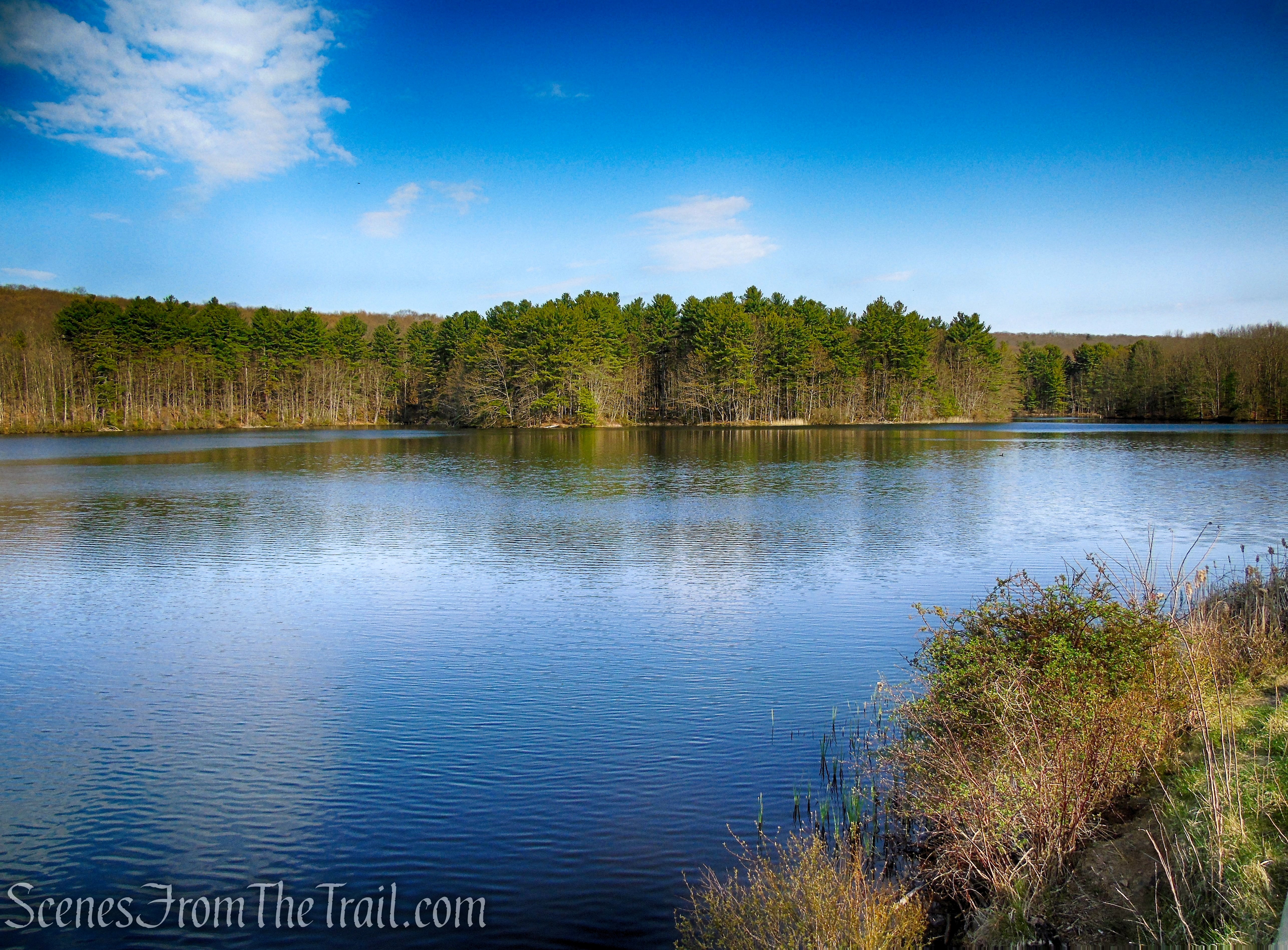
Lake Wintergreen is a 44-acre artificially impounded body of water. It has a shoreline of approximately 1.6 miles and sits at an elevation of about 239 feet above sea level.
Lake Wintergreen – West Rock Ridge State Park
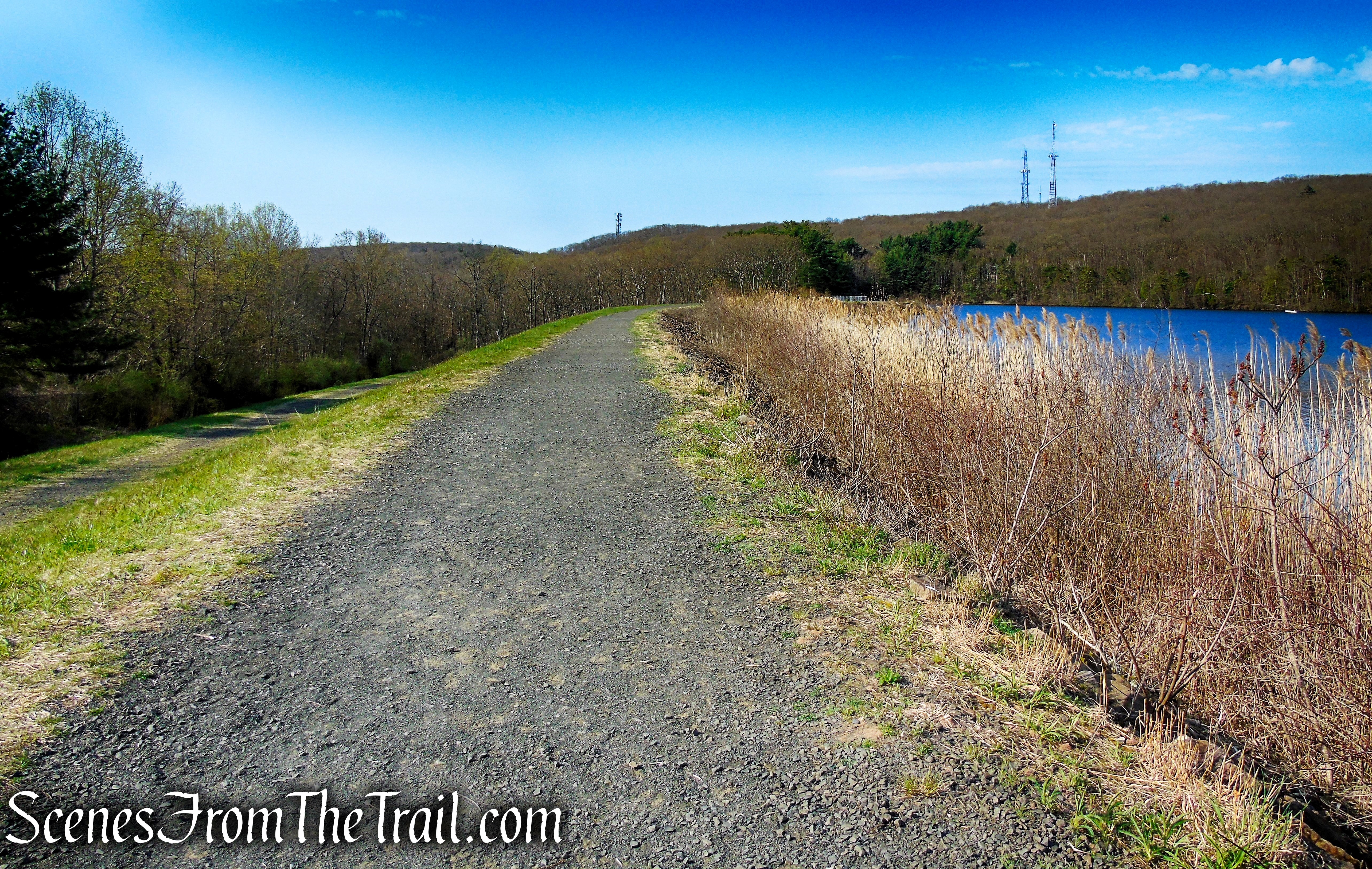
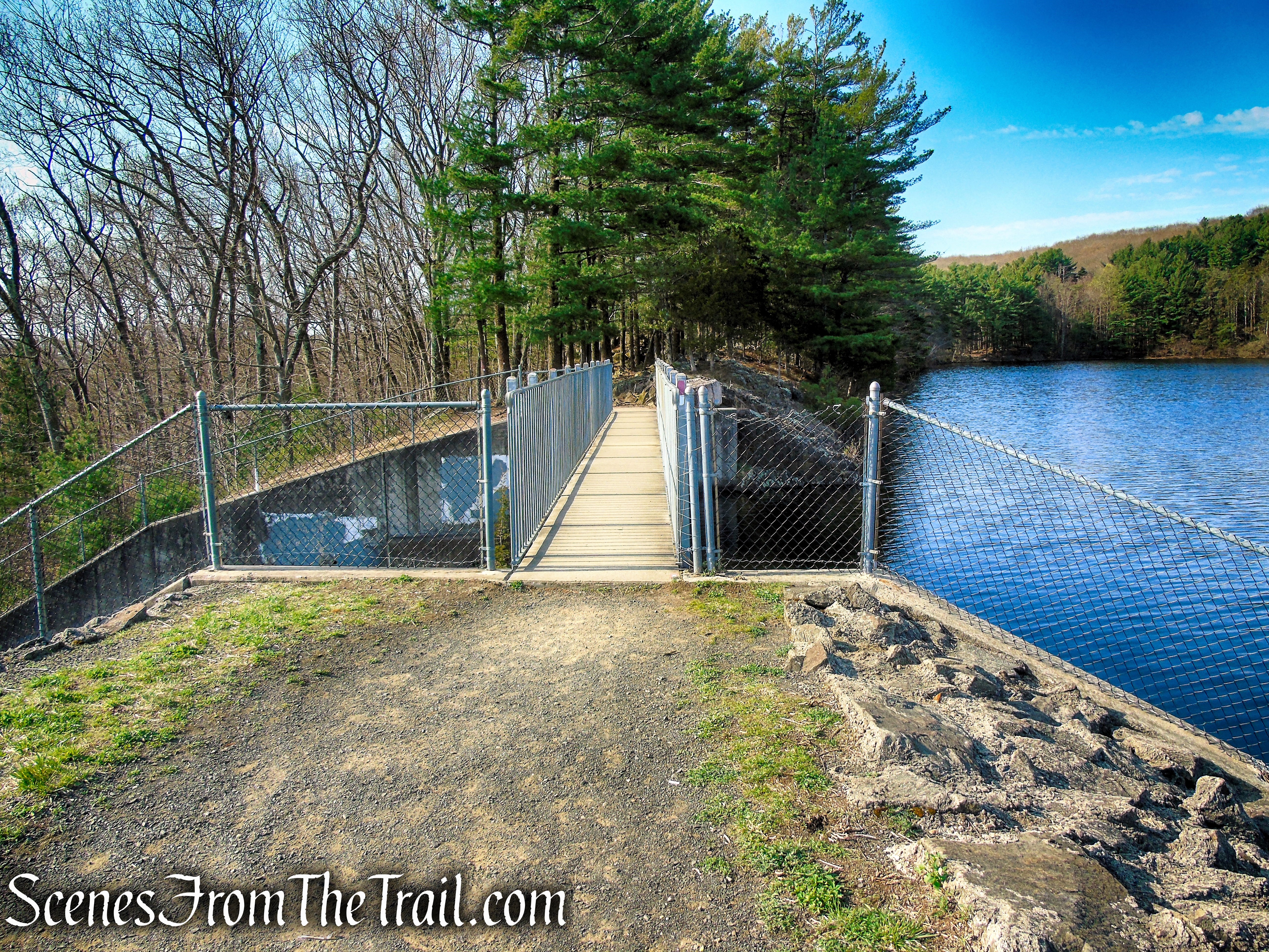
The Red/White Trail continues south on the earthen dam and soon crosses a footbridge over the Lake Wintergreen Dam Spillway.
Red/White Trail – West Rock Ridge State Park
Red/White Trail – West Rock Ridge State Park
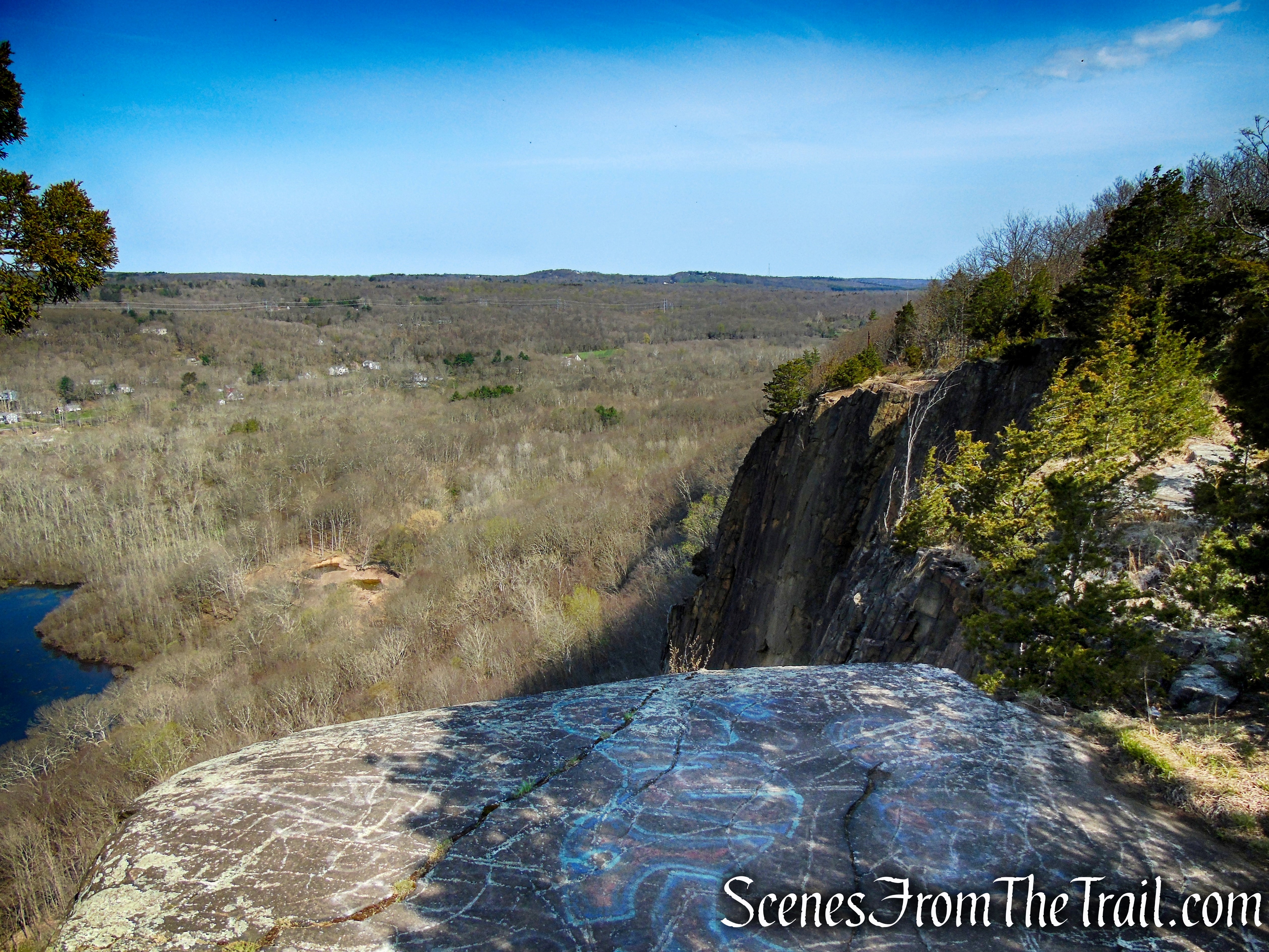
After crossing the footbridge, the Red/White Trail travels along a a natural rock ridge with steep drop-offs on each side. This section of the trail is covered with roots and is quite rocky. Exercise caution in this area, especially when the trail comes close to the edge. Please note: this section can be bypassed by veering left on the Red Trail by the earthen dam.
Red/White Trail – West Rock Ridge State Park
Red/White Trail – West Rock Ridge State Park
Red/White Trail – West Rock Ridge State Park
Red/White Trail – West Rock Ridge State Park
Red/White Trail – West Rock Ridge State Park
View of Lake Wintergreen from the southern end of the Red/White Trail.
Lake Wintergreen – West Rock Ridge State Park
In about 0.4 mile, the Red/White Trail ends at a junction with the Red Trail which comes in from the left. Turn right briefly joining the Red Trail. When the Red Trail turns left, continue ahead on the White Trail which begins at the southern end of the lake.
terminus of Red/White Trail
White Trail – West Rock Ridge State Park
In about 200 feet, turn left on the Orange Trail. The Orange Trail climbs steeply on several switchbacks, gaining about 200 feet of elevation in less than 0.3 mile.
Orange Trail – West Rock Ridge State Park
At the top of the rise, the Orange Trail is joined by the blue-blazed Regicides Trail, which comes in from the left. Both trails cross Baldwin Drive.
Orange Trail – West Rock Ridge State Park
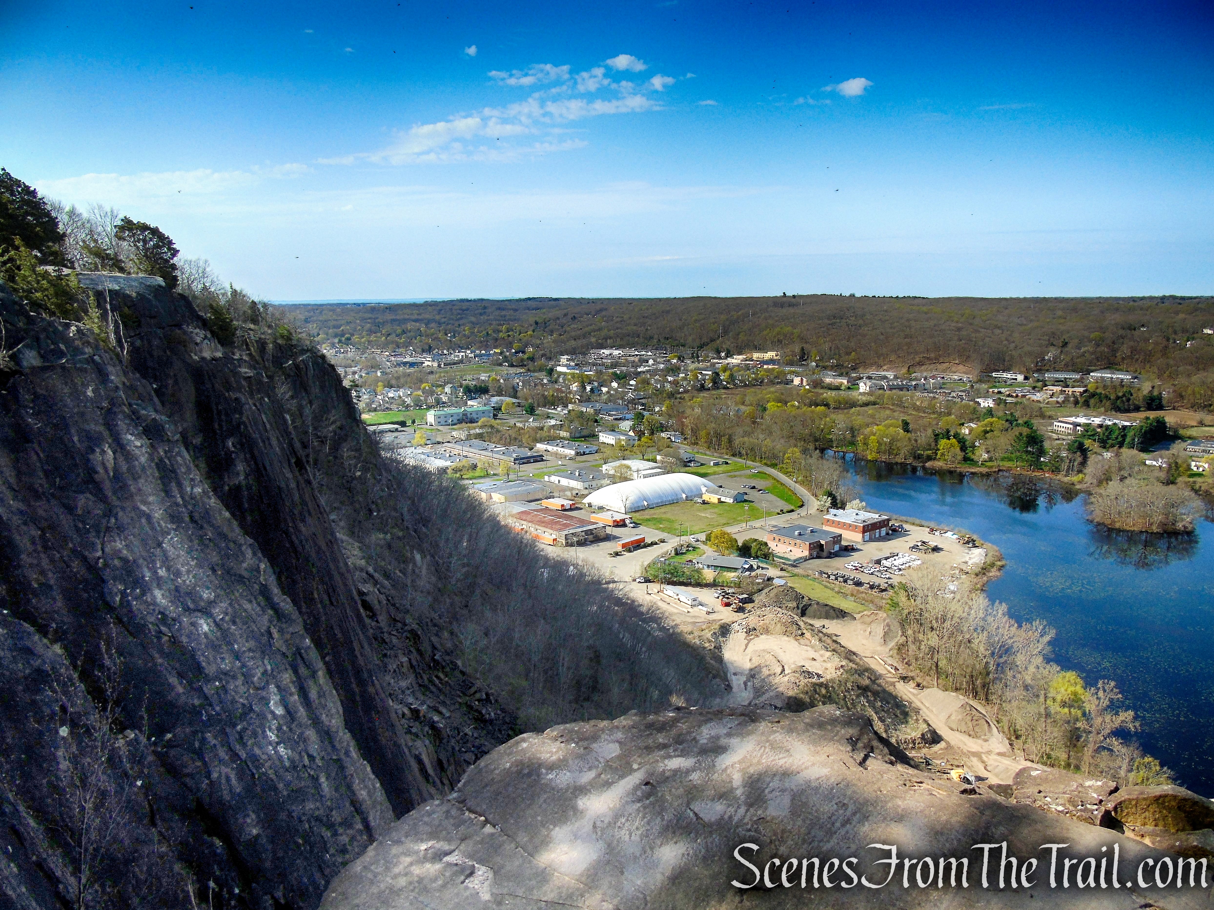
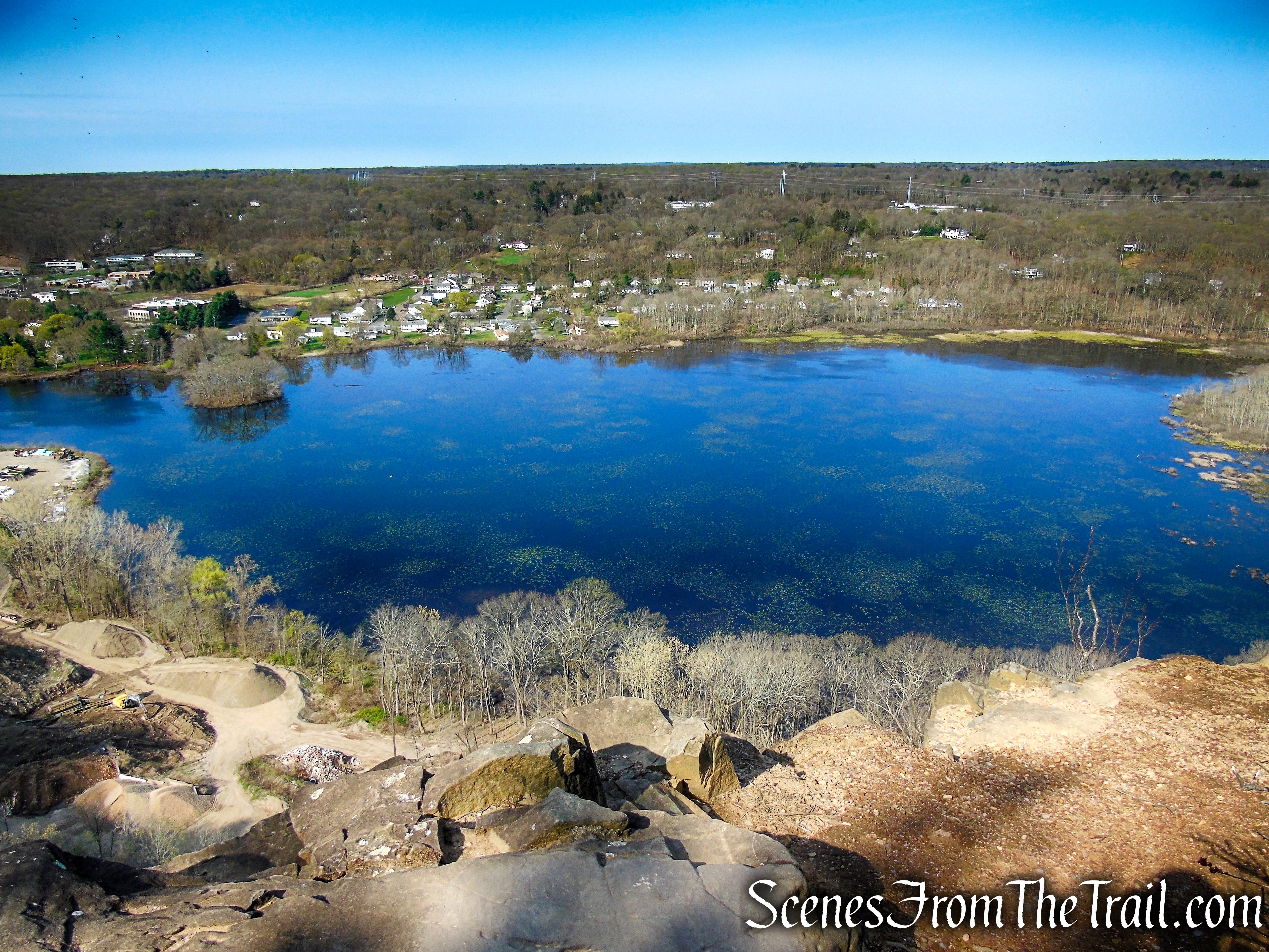
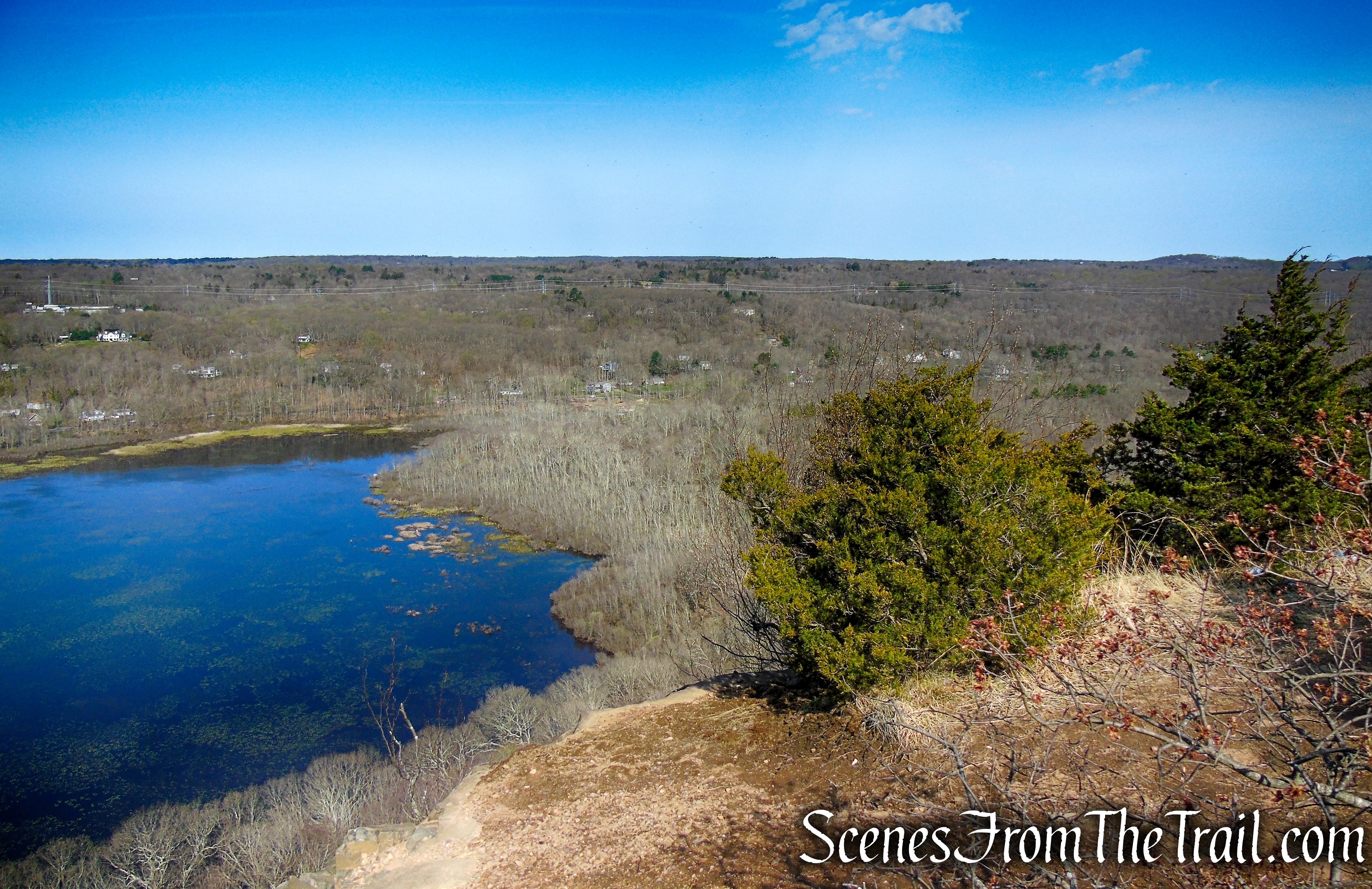
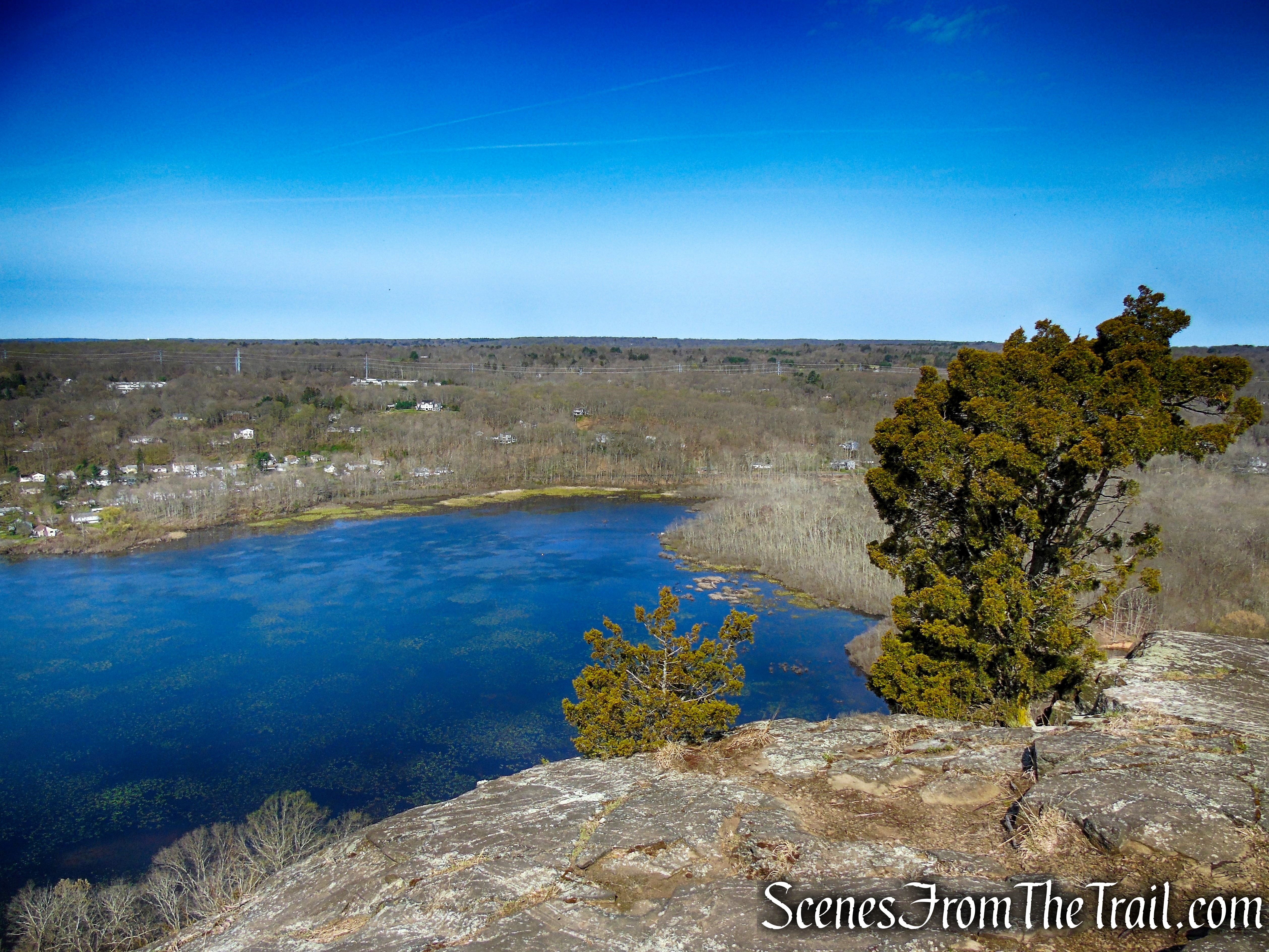
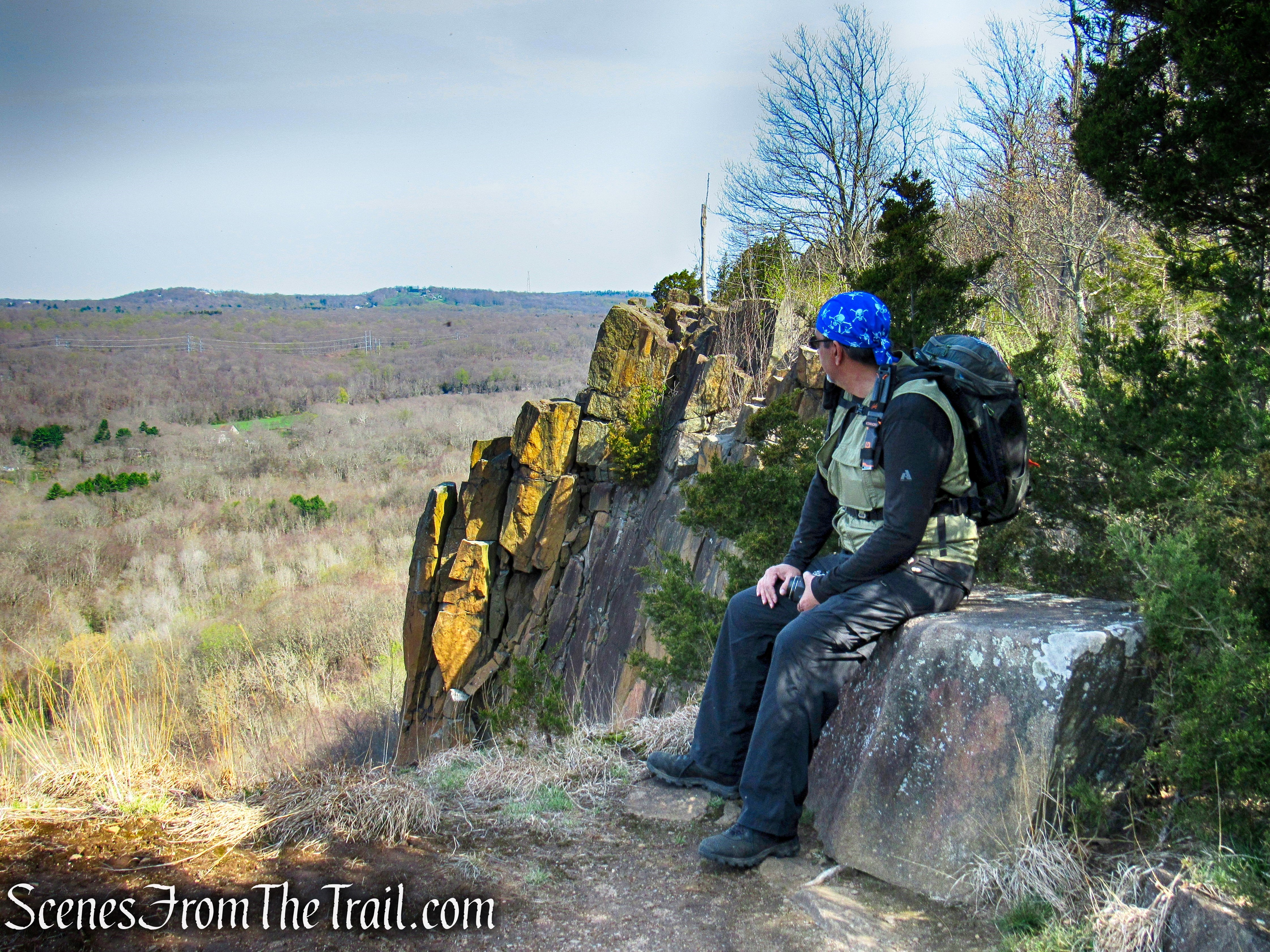
The Orange Trail ends where the Regicides Trail turns sharply right and continues north. Walk a few feet past the tree to Konold’s Pond Overlook, a west-facing view of the West River Valley and Konold’s Pond.
terminus of Orange Trail
The ridge was quarried here, so the cliffs are steep and uneven with about a 300-foot drop. Be mindful of your footing at the overlook, staying a respectful distance from the edge and enjoy the views.
Konolds Pond Overlook – West Rock Ridge State Park
Looking southwest.
Konolds Pond Overlook – West Rock Ridge State Park
In 1911, the Pond Lily Company purchased twenty-six acres of land from William J. Konold. At the southern border of this parcel, they built an earthen berm and a cement spillway, creating Konold’s Pond. This project was done as a backup water source for their dyeing operation.
Konolds Pond Overlook – West Rock Ridge State Park
Looking northwest.
Konolds Pond Overlook – West Rock Ridge State Park
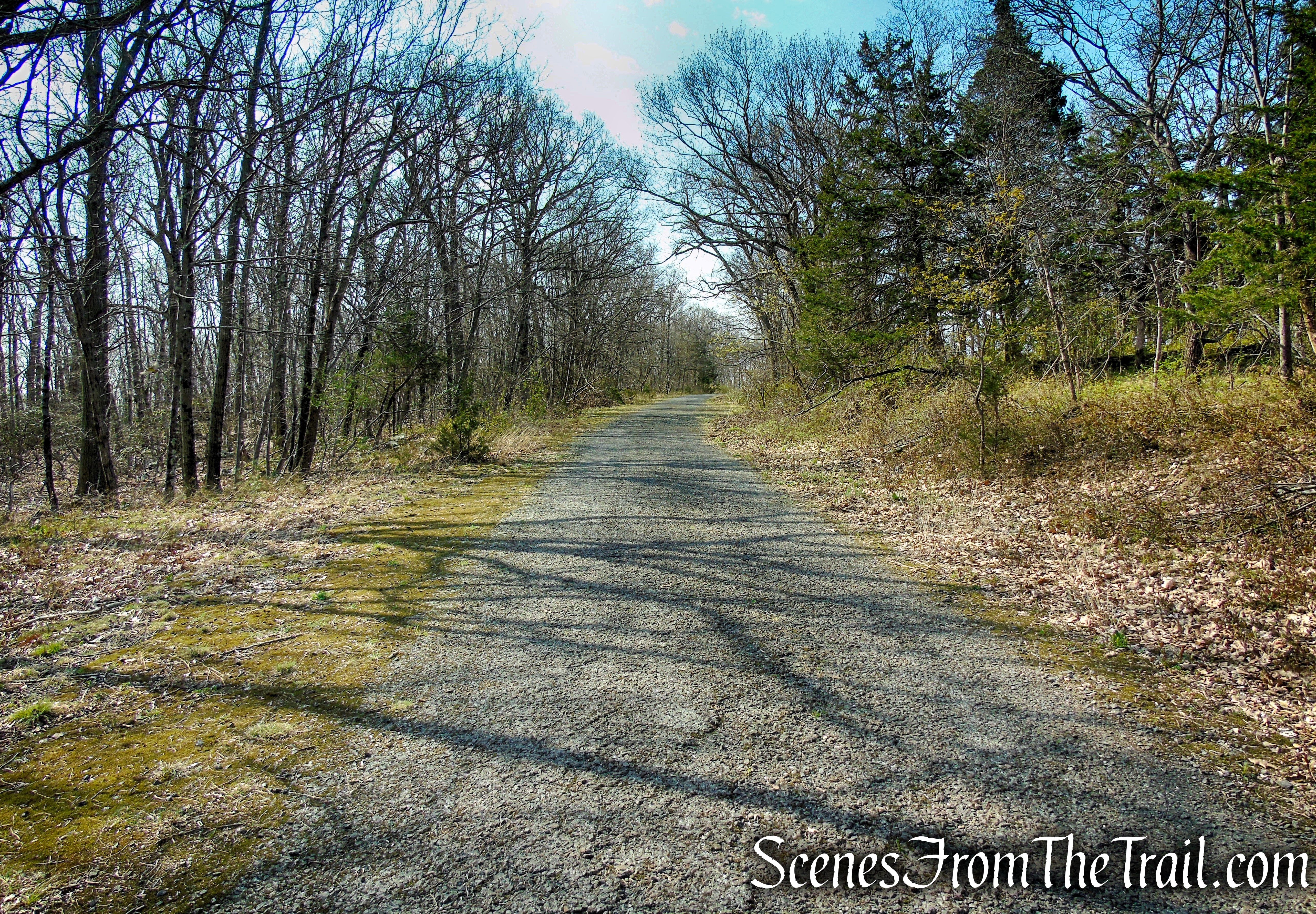
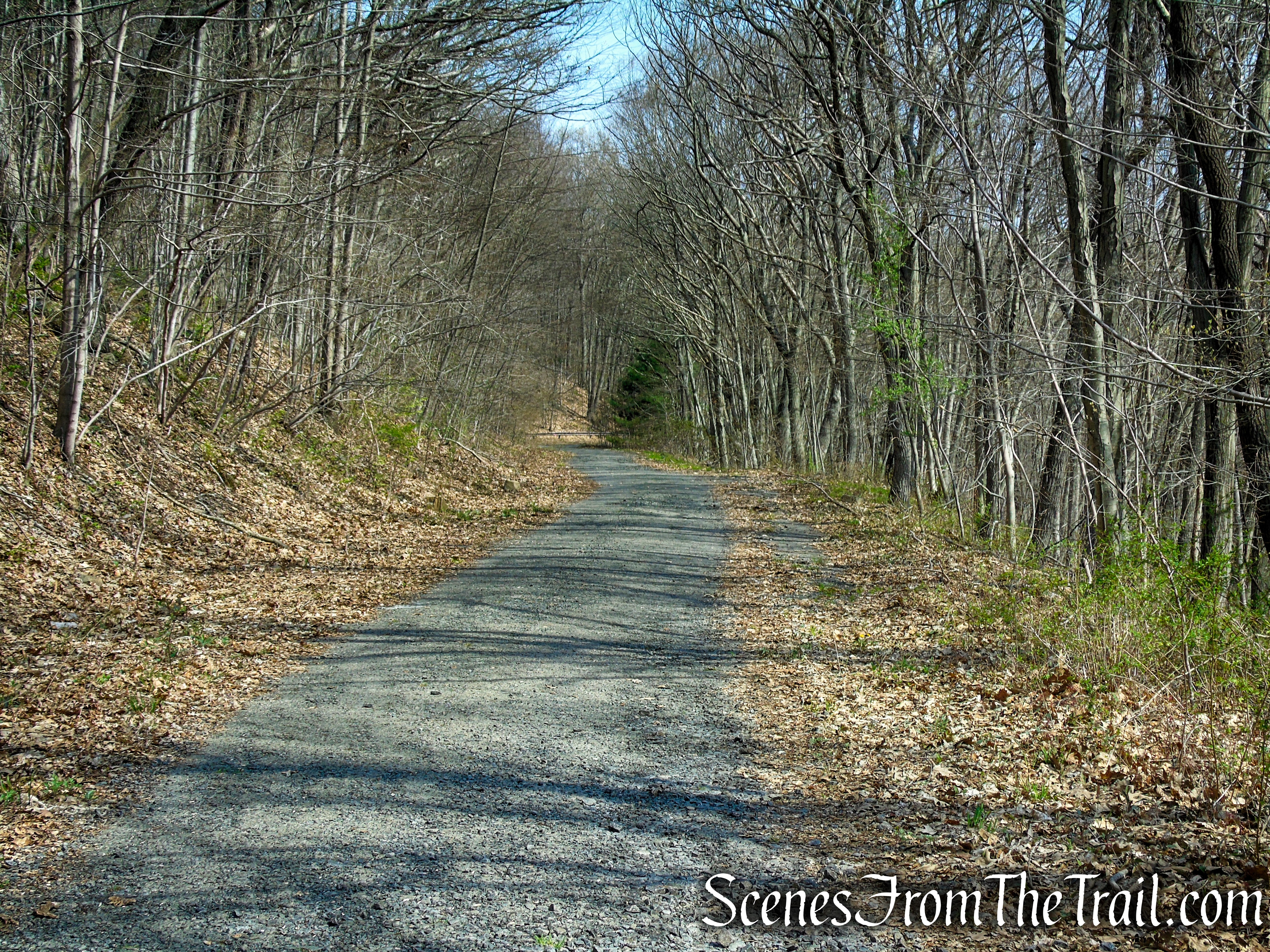
When you are ready to continue, retrace your steps to Baldwin Drive and turn right. Baldwin Drive is a paved park road currently closed to motor vehicles, except for maintenance. It was named for New Haven native Simeon E. Baldwin, governor of Connecticut from 1911 to 1915.
Baldwin Drive – West Rock Ridge State Park
There is an unmarked trail between Baldwin Drive and the edge of the cliffs that provides more views from various rock outcrops.
rock outcrop near Baldwin Drive
rock outcrop near Baldwin Drive
unmarked trail along Baldwin Drive
rock outcrop near Baldwin Drive
rock outcrop near Baldwin Drive
Baldwin Drive continues south, not far from the edge of the cliffs. As Baldwin Drive makes a sharp left, continue ahead on a gravel road that connects Baldwin Drive to a tall antenna on the ridge. Soon you’ll pass an old airway beacon.
Baldwin Drive – West Rock Ridge State Park
Baldwin Drive – West Rock Ridge State Park
Airway beacons in the US were constructed by the Post Office and the Department of Commerce between 1923 and 1933. Approximately 1,500 airway beacons were constructed to guide pilots from city to city, covering 18,000 miles. Today, most of the beacons have been removed.
Airway Beacon – West Rock Ridge State Park
A short distance later after reaching a fenced off building, we turned right into the woods and jumped back on the blue-blazed Regicides Trail which descends steeply.
Regicides Trail – West Rock Ridge State Park
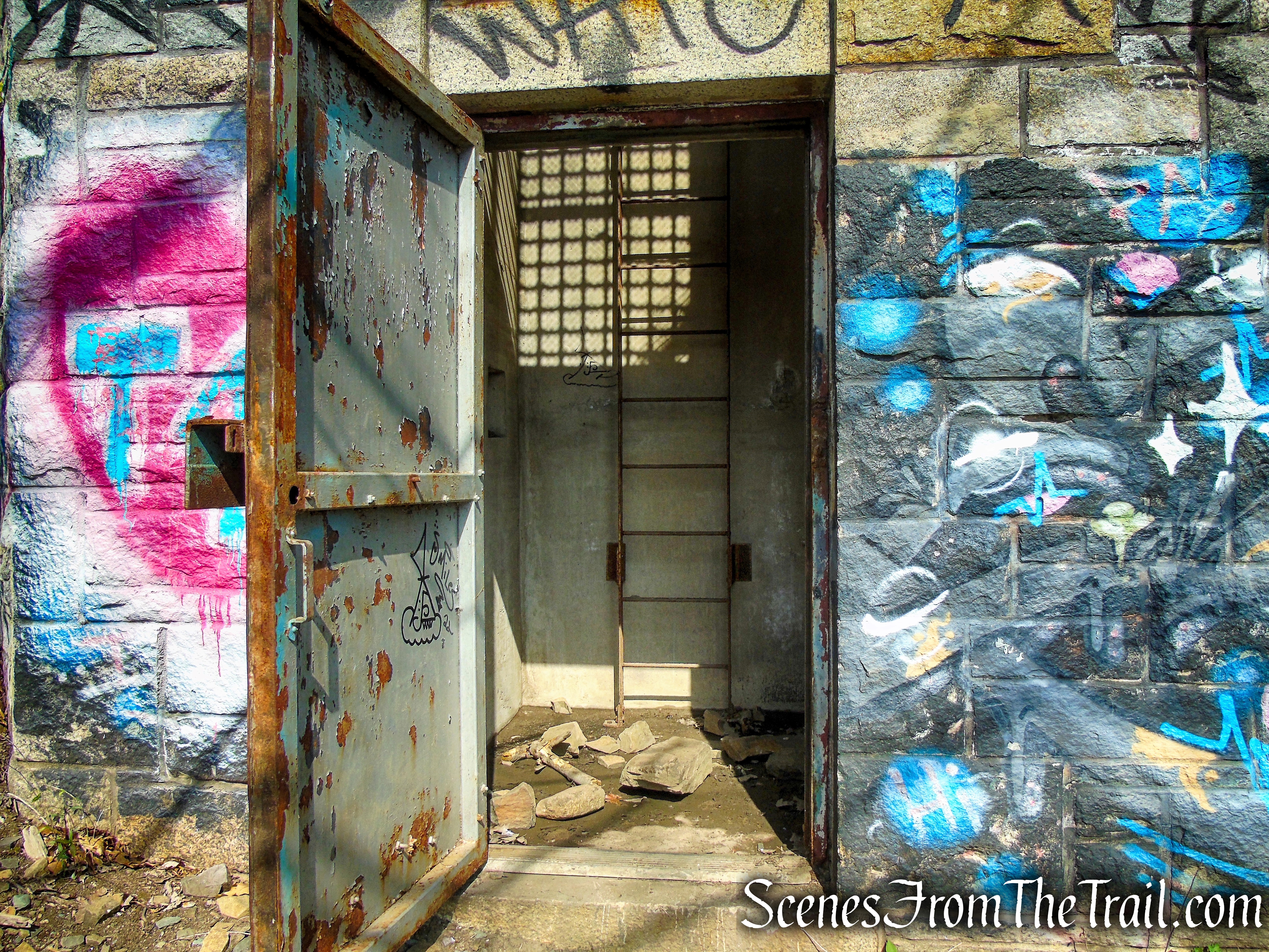
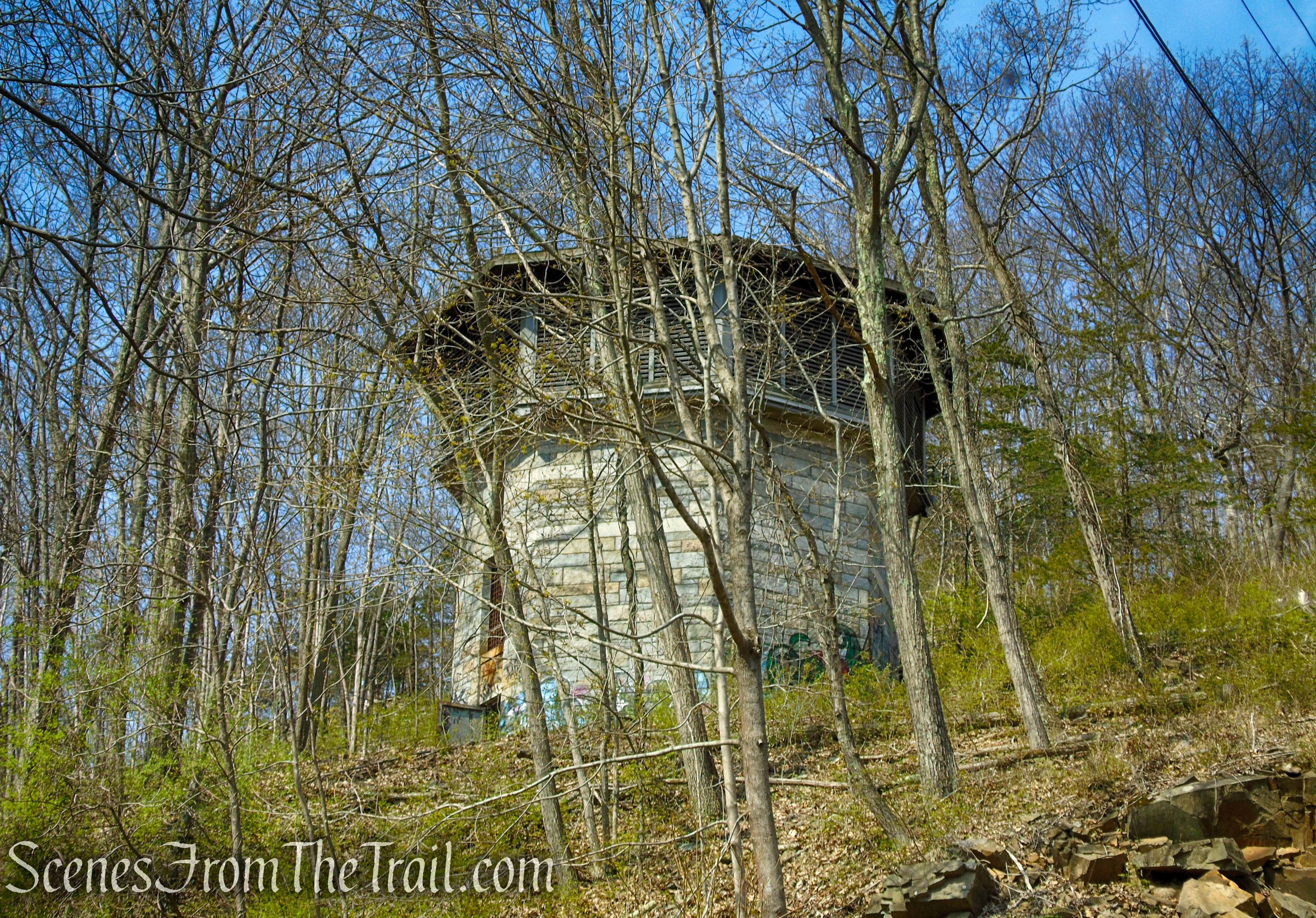
As the trail descends, the ventilation shaft for the Heroes Tunnel (formerly West Rock Tunnel) is visible through the trees on the left.
Regicides Trail – West Rock Ridge State Park
The large stone building covers a concrete ventilation shaft marking the 1,200-ft. tunnel’s midpoint. There is a control room at the base of the shaft. The fans in the shaft would draw exhaust fumes from the tunnels below and blow it up into the shaft and out of one of the four ducts. The sounds of cars can be heard whispering below. If you have ever driven on the Wilbur Cross Parkway (Connecticut Route 15) between Exits 59 and 60, then you have literally driven under the park.
ventilator shaft – West Rock Ridge State Park
ventilator shaft – West Rock Ridge State Park
Shut the door on the way out.
ventilator shaft – West Rock Ridge State Park
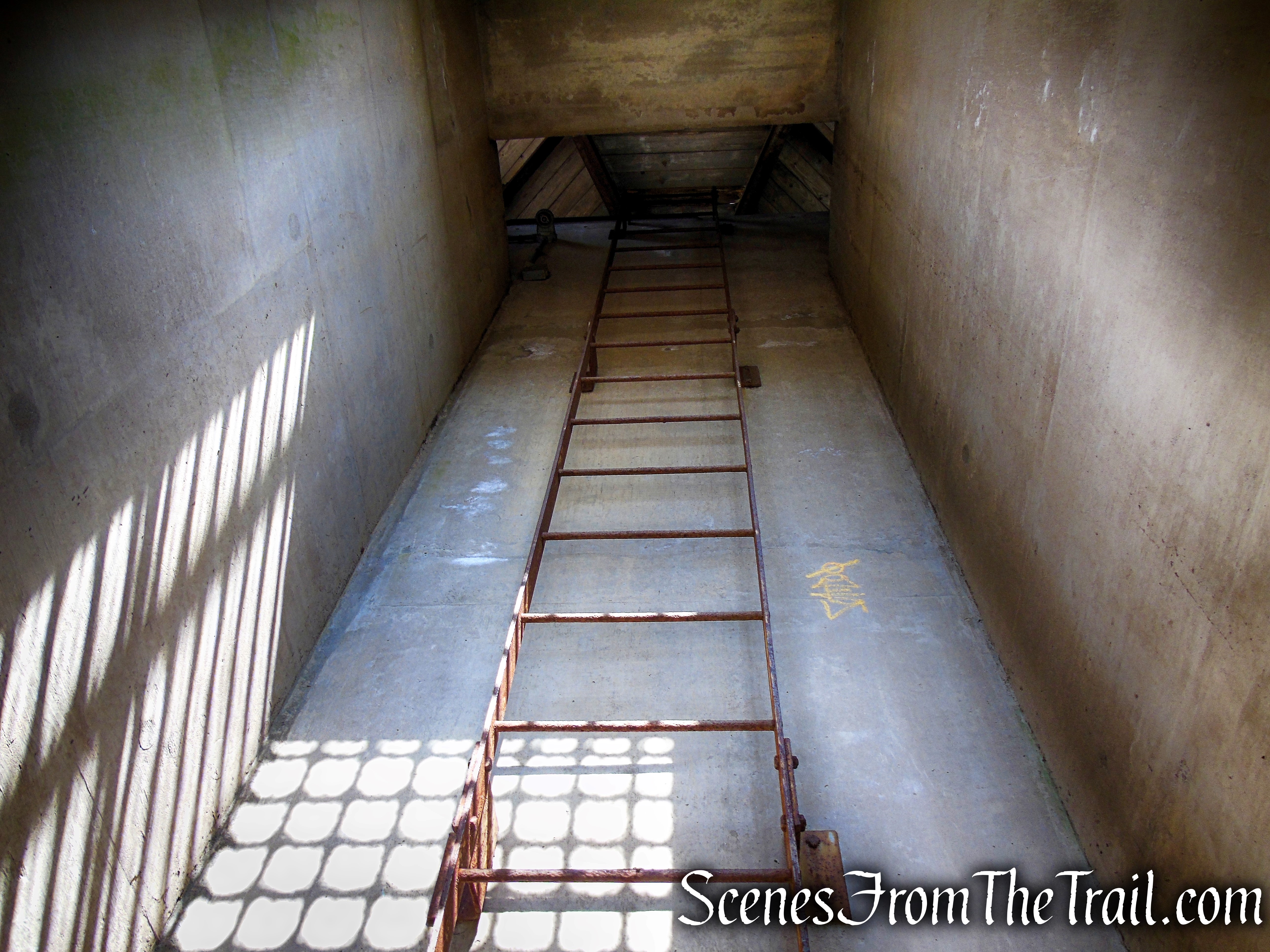
ventilator shaft – West Rock Ridge State Park
A short footpath leads downhill from the ventilator shaft to Baldwin Drive. Turn left and follow Baldwin Drive down to the hairpin turn and proceed past the guard rail at the turn, joining the Red Trail that comes in from the right.
ventilator shaft – West Rock Ridge State Park
Baldwin Drive – West Rock Ridge State Park
Baldwin Drive – West Rock Ridge State Park
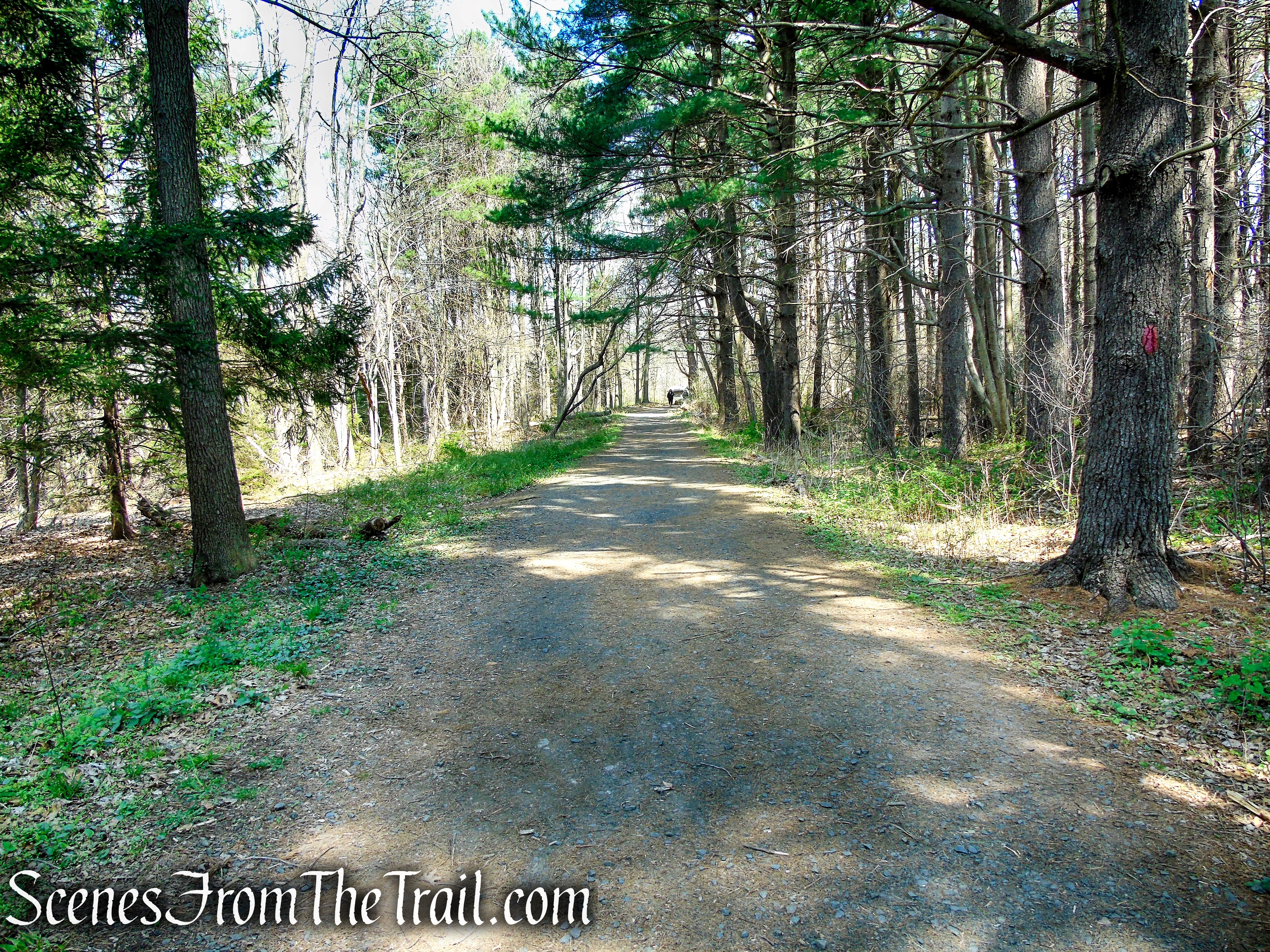
Follow the red blazes north as the trail climbs slightly, levels off then descends along a narrow section of trail under tall evergreen trees. The trail soon widens to a woods road as it nears Lake Wintergreen.
Red Trail – West Rock Ridge State Park
At the junction where the White Trail turns left and the Red/White Trail begins straight ahead, turn right to stay on the Red Trail as it descends around a curve. At the base of the descent, the trail passes the stone ruins of an old pump house dating from when Lake Wintergreen was water company property.
Red Trail – West Rock Ridge State Park
Red Trail – West Rock Ridge State Park
After crossing the Lake Wintergreen Dam Spillway, the trail climbs alongside the earthen dam and soon levels off at the junction with the Red/White Trail. The Red Trail is now a flat, wide woods road with a solid gravel surface. Follow the Red Trail a short distance north, back to the Lake Wintergreen parking area, where the hike began.
Red Trail – West Rock Ridge State Park
Red Trail – West Rock Ridge State Park
Lake Wintergreen parking area
Review:
A very nice hike with lots to see. The views of the lake are quite nice as well as from Konold’s Pond Overlook. The trails are well marked and easy to follow. Download the Avenza Maps app along with a park map and you won’t go astray. If you visit the park when the park roads are closed, the farther away you get from Lake Wintergreen, the less people you will run into. All in all a nice place to spend some time outdoors. I look forward to a return visit.
Pros:
Beautifully maintained park and trails, not much foot traffic.
Cons:
Some road noise can be heard near and around the tunnel.
Take a hike!
Konolds Pond Overlook from Lake Wintergreen – West Rock Ridge State Park
Sources:
- West Rock Ridge State Park
- West Rock Trails website
- Wintergreen Brook 1
- Wintergreen Brook 2
- Regicides Trail
- West Rock Ridge Park Association
