November 17, 2019 – Kinnelon, NJ
Difficulty: Moderate
Length: Approximately 4.5 miles
Max elevation: 1,058 ft.– total elevation gain approximately 636 ft.
Route type: Circuit
Map: Morris County Highlands Trails Map #125 – 2022 – Silas Condict County Park Trail Map (2022)
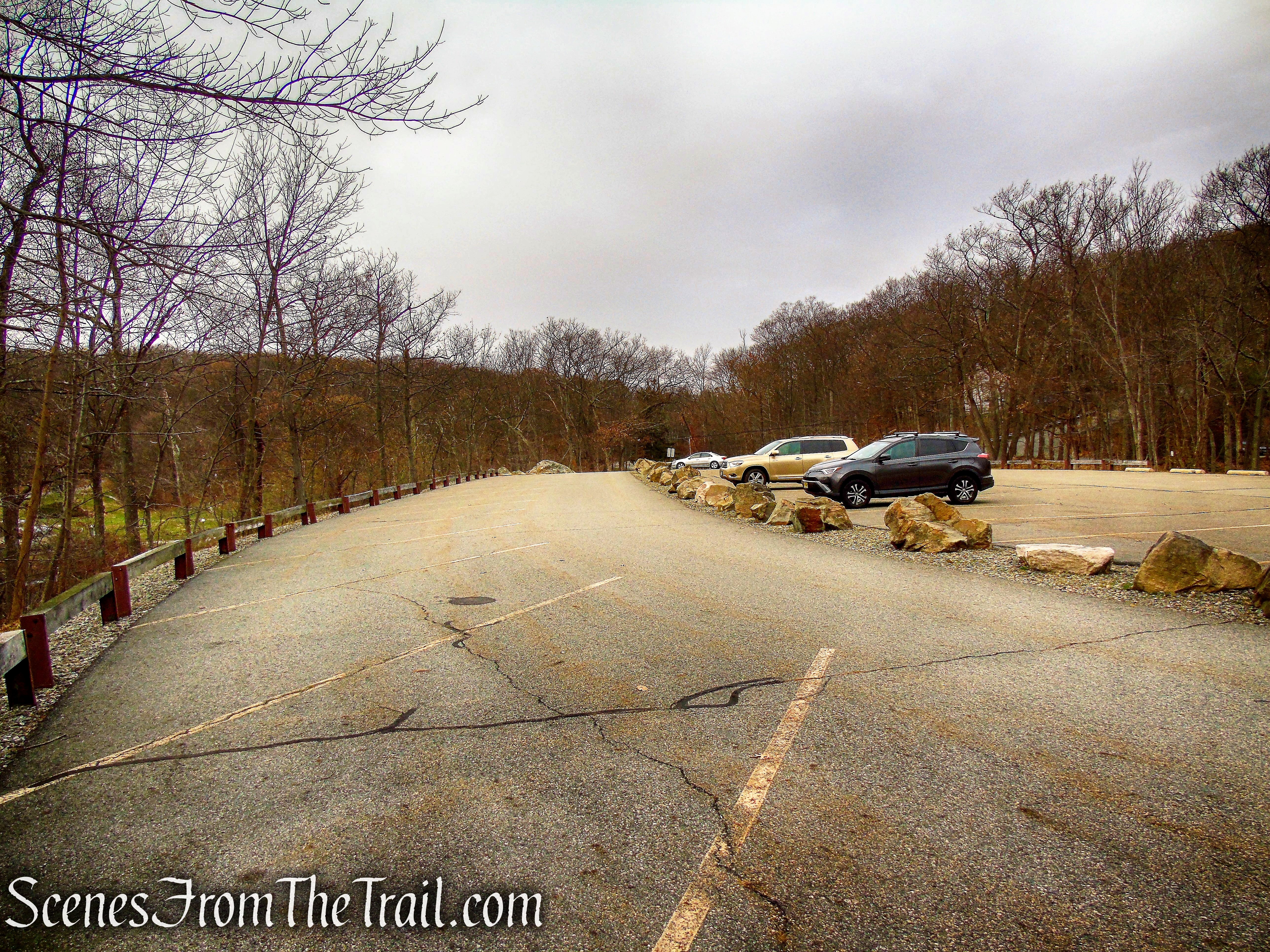
Trailhead parking: 100 Kinnelon Road, Kinnelon, NJ 07405
Park Overview:
Silas Condict County Park is a general purpose park comprised of 1,513 acres with 12 miles of trails and woods roads. These trails meander through the Park, connecting several scenic overlooks. Digital trail maps are available online. Silas Condict County Park is open daily Sunrise to Sunset throughout the year. Located in Kinnelon, NJ, the park is managed by the Morris County Parks Department.
Silas Condict County Park
This park offers seasonal recreational opportunities, including hiking, fishing, horseback riding, paddle boating, cross-country skiing, and sledding. There are reservable picnic sites with grills, tents, and a shelter, and an athletic field to complement your outing. What makes this park so appealing is the picturesque seven-acre lake partially lined with weeping cherry trees.

Canty Lake – Silas Condict County Park
On any day, you can hike, jog, or take a leisurely walk along the trails that connect to several scenic overlooks. Fishing is enjoyed by many along the Canty Lake, and with advanced reservations, paddle boats are available for rental to compliment reservations from Memorial Day through Labor Day. Enjoy hosting a special event at the renowned site, The Casino.

The Casino – Silas Condict County Park
History:
In June 1963, the Morris County Park Commission acquired its first parcel of land that would become Silas Condict County Park. The Park was dedicated in September 1964.
The Park was named for the Revolutionary War Patriot, Silas Condict, a farmer, surveyor, and politician who lived in Morris County. Silas Condict’s political career began in 1775 when the Freeholders elected him as a delegate to the Provincial Legislature. He was a member of the committee that drafted New Jersey’s first Constitution and was appointed President of the Committee of Safety. Silas Condict also served as a member of the Continental Congress, and was appointed Deputy Surveyor of the lands of the Eastern Division of New Jersey. He was elected to the New Jersey House of Assembly and served as its speaker in 1792-94 and again in 1797.
The original acres of the Park were occupied by various families throughout the 1800’s to the mid-1900’s. In 1926, during Prohibition, John Canty Sr. purchased the property and built a much larger dam, creating the present day seven-acre lake. Canty razed a barn and constructed the stone speakeasy in 1933, which is now The Casino. The property was known as Canty Farm. It was learned from a local man present at the time of the speakeasy that “the Casino was constructed as a private club for the use and entertainment of all the selected bootleggers, racketeers, beer barons, and special friends.” The speakeasy closed in 1938, five years after the repeal of prohibition.
Hike Overview:
The trails in the park go to three different unnamed peaks, 883 feet, 990 feet and the other at 1058 feet. These hills are a part of the Ramapo Mountains. The Free Map (dated 2011 and shown below), only denotes the White Trail as blazed and does not show the Yellow Trail, which runs below the the southwest section of the White Trail. The Red and Blue Trails are shown as unmarked woods roads although they are now well blazed. The Jersey Highlands Trails Map (2016) shows all the blazed trails, but the Yellow Trail is shown as Blue on the map.
The Blue and Red Trails are woods roads and the White and Yellow Trails are footpaths. The Blue Trail has a nice viewpoint that is worth checking out. The map shows a viewpoint just off the Red Trail, from a large rock formation, but it is blocked by trees. We did not hike the Yellow Trail because if doing a loop, one would have to retrace steps on either White or Yellow to complete the loop.
The White Trail is the best trail in the park and the most enjoyable with all the ups and downs and several views. If only doing one trail, the White Trail is the one that you should hike.

Silas Condict County Park
The Hike:
The Blue Trail:
From the northernmost parking area, look for three blazes on a tree. This is the start of the Blue Trail. Follow the blue blazes as they head gradually uphill on a gravel road. Soon the grade steepens and after approximately 0.3 mile, the Blue Trail reaches a northwest-facing overlook with a bench.
Blue Trail – Silas Condict County Park

Blue Trail – Silas Condict County Park
Blue Trail – Silas Condict County Park

Blue Trail – Silas Condict County Park

Blue Trail – Silas Condict County Park
Blue Trail Overlook – Silas Condict County Park

Blue Trail Overlook – Silas Condict County Park
Blue Trail Overlook – Silas Condict County Park
Retrace your steps on the Blue Trail and turn right when you reach the parking area.

Blue Trail – Silas Condict County Park
The Red Trail:
Look for three red blazes on a tree. That marks the start of the Red Trail. The Red Trail ascends gradually on another gravel road with several benches along the way. Follow the red blazes as they head northwest then curves to the south. At the top of the rise there is a bench on the left. A few feet past the bench there is an unmarked footpath that leads to a rock formation that is marked with a star on the map. Although there is no view, that rock formation is the summit of the hill at 990 feet.
Red Trail – Silas Condict County Park
Red Trail – Silas Condict County Park

Red Trail – Silas Condict County Park

rock outcrop above Red Trail – Silas Condict County Park
The trail now descends gradually on the gravel road, passing more benches along the way. After about 0.6 miles, the Red Trail ends at the edge of a softball field. Turn right and head towards the lake. You’ll see another gravel road, which leads to the White Trail or you can walk along the southwest edge of the lake towards the recently completed new dam for views of the lake.

Red Trail – Silas Condict County Park

terminus of Red Trail – Silas Condict County Park
Canty Lake – Silas Condict County Park

Canty Lake – Silas Condict County Park

Canty Lake – Silas Condict County Park
The stone building across the lake was renovated in the fall of 1993 and named “The Casino.” The extensive work included the interior of the casino to preserve the murals that are rich with local history.
The Casino – Silas Condict County Park
Canty Lake – Silas Condict County Park
In 2017, a $1.1 million dam replacement project was completed and the spillway widened on Canty Lake. A new benefit as part of the dam replacement, is pedestrian access to the dam side of the lake for fishing and hiking. Previously the dam could not be crossed or used for recreational purposes.

Canty Lake Dam – Silas Condict County Park
The new dam now provides a broad viewpoint over Canty Lake.
Canty Lake – Silas Condict County Park
From the dam, proceed northwest on a gravel road through an open gate in a chain-link fence across the road. Look on the left for three white blazes on a tree with a kiosk nearby.
Silas Condict County Park
The White Trail:
You’ll notice a triple-white blaze on a tree to the left, along with a kiosk. This marks the start of the White Trail, which will be your route for the next 2.5 miles.

White Trail – Silas Condict County Park
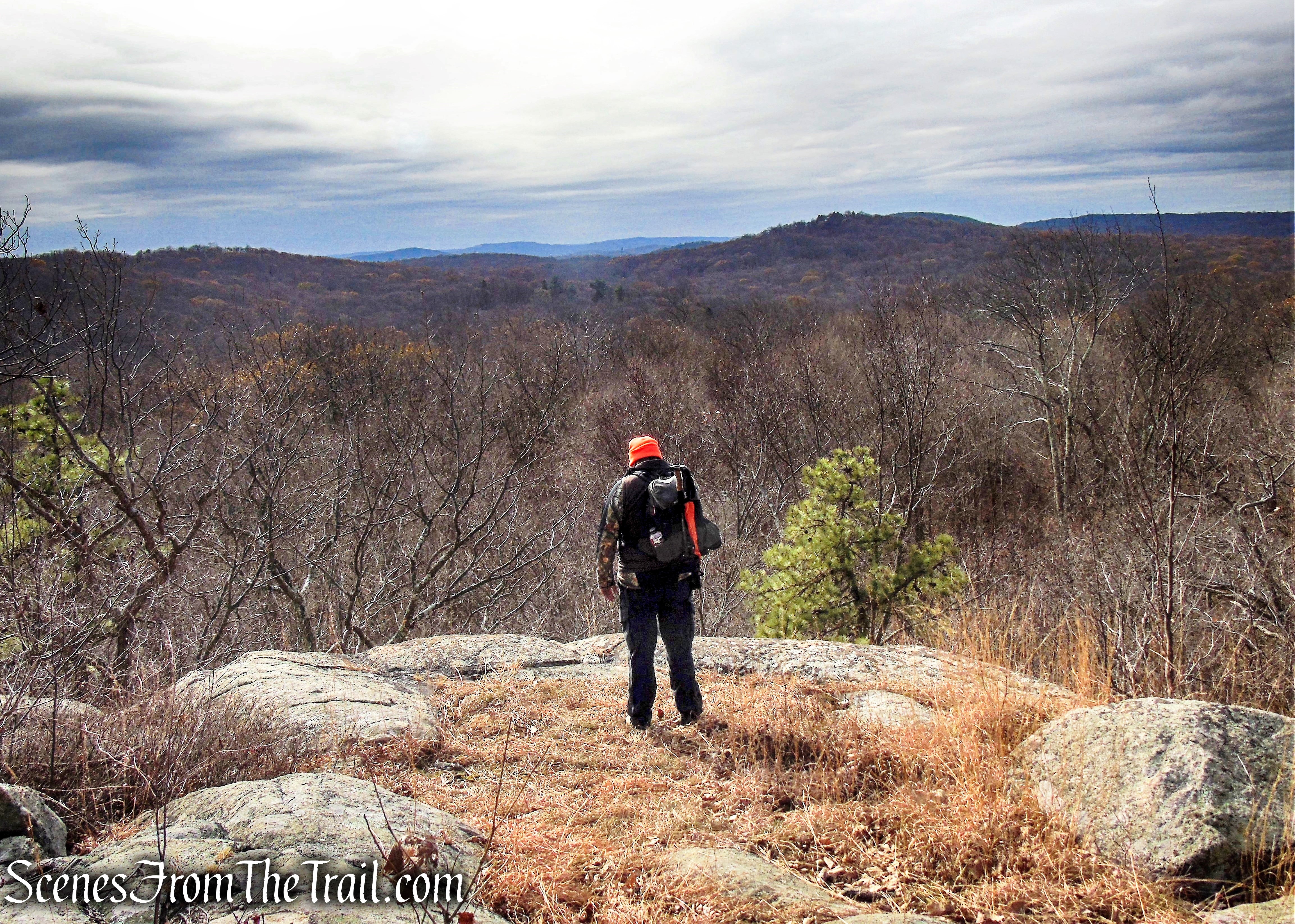
Follow the White Trail into the woods as it climbs to the edge of an escarpment, descends a little, then resumes a steady climb. Be alert for a sharp turn to the right. Just ahead, the trail switches back to the left and begins a steeper climb. At the crest of the rise, the trail comes out on a rock outcrop, with a panoramic east-facing view. A wooden bench has been placed here to permit you to rest and enjoy the view.

White Trail – Silas Condict County Park

White Trail – Silas Condict County Park
White Trail – Silas Condict County Park
White Trail – Silas Condict County Park

White Trail – Silas Condict County Park

White Trail – Silas Condict County Park
White Trail – Silas Condict County Park
White Trail – Silas Condict County Park
Just ahead, the trail begins a steady descent, passing interesting rock outcrops on the way down. At the base of the descent, the Yellow Trail begins on the right. The White Trail climbs again, first gradually, then more steeply through mountain laurel thickets. At the top, the trail turns sharply left. Here, a rock outcrop just ahead on the ridge, with pitch pines and mountain laurel, offers a broad view to the west.

White Trail – Silas Condict County Park

White Trail – Silas Condict County Park
White Trail – Silas Condict County Park

White Trail – Silas Condict County Park
White Trail – Silas Condict County Park

White Trail – Silas Condict County Park
White Trail – Silas Condict County Park

White Trail – Silas Condict County Park
White Trail – Silas Condict County Park
White Trail – Silas Condict County Park
After taking in the view, backtrack for about 25 feet, turn right and continue through dense mountain laurel thickets. The trail soon climbs back to the ridge and heads south, with several short but steep ups-and-downs, and limited views to the west through the trees. Towards the end of the ridge, the trail descends a little, then comes out onto a broad southwest-facing viewpoint from a rock ledge to the right of the trail.

White Trail – Silas Condict County Park
White Trail – Silas Condict County Park

White Trail – Silas Condict County Park
White Trail – Silas Condict County Park

White Trail – Silas Condict County Park
White Trail – Silas Condict County Park

White Trail – Silas Condict County Park

Scenic Overlook – White Trail – Silas Condict County Park
Scenic Overlook – White Trail – Silas Condict County Park
The trail levels off, then climbs to pass a balanced boulder on the right. It descends a rocky slope, turns right, and continues to descend. After passing a fractured rock outcrop on the right, the trail begins a short ascent. At the top of the climb, it turns right and goes through a tunnel under massive boulders. It now climbs past a huge rock outcrop and again starts to descend.
White Trail – Silas Condict County Park
White Trail – Silas Condict County Park

White Trail – Silas Condict County Park
White Trail – Silas Condict County Park

White Trail – Silas Condict County Park
White Trail – Silas Condict County Park
White Trail – Silas Condict County Park
Cave Tunnel – White Trail – Silas Condict County Park
Cave Tunnel – White Trail – Silas Condict County Park
White Trail – Silas Condict County Park

White Trail – Silas Condict County Park

White Trail – Silas Condict County Park
At a limited seasonal viewpoint to the east (with the Kakeout Reservoir visible in the distance during leaf-off season), the trail turns left, passes a huge overhanging boulder on the right and levels off. It soon reaches a kiosk that marks the terminus of the Yellow Trail, which comes in from the right. Just ahead, the trail begins a gradual descent. After crossing a small stream, it makes a short climb. The trail passes a massive rock outcrop on the left, then descends more steeply. It goes over another rise and descends to cross a tributary stream on a wooden bridge.

White Trail – Silas Condict County Park

White Trail – Silas Condict County Park

White Trail – Silas Condict County Park

White Trail – Silas Condict County Park
White Trail – Silas Condict County Park
White Trail – Silas Condict County Park
White Trail – Silas Condict County Park

White Trail – Silas Condict County Park

White Trail – Silas Condict County Park
White Trail – Silas Condict County Park
After crossing the main stream on another wooden bridge, the trail steeply climbs around a cliff, turns left onto a gravel road, and continues to climb rather steeply, passing a wooden bench along the way. It reaches an open area at the crest of the rise, where it bears left, leaving the gravel road, and continues on a footpath. Soon, you’ll pass rock outcrops on the left that offer a west-facing view overlooking the ridge that you followed at the start of the hike.

White Trail – Silas Condict County Park

White Trail – Silas Condict County Park
White Trail – Silas Condict County Park
White Trail – Silas Condict County Park
White Trail – Silas Condict County Park
White Trail – Silas Condict County Park

White Trail – Silas Condict County Park
The trail now descends, twice briefly joining dead-end branches of the gravel road that it followed up the rise. It continues on a footpath to end at the second parking area of Silas Condict County Park. Turn left to return to the third parking area, where the hike began.
White Trail – Silas Condict County Park
White Trail – Silas Condict County Park
White Trail – Silas Condict County Park
White Trail – Silas Condict County Park

White Trail – Silas Condict County Park
Silas Condict County Park

Canty Lake – Silas Condict County Park

Canty Lake – Silas Condict County Park
Review:
The highlight of this hike is the White Trail. It is surprisingly rugged, with numerous ups and downs and its interesting rock formations. The views are nice, but the rocky footpath will pique your interest. We encountered several pairs of hikers going in the opposite direction while on the White Trail, but mostly it was very quiet. The Blue Trail is worth the walk up to the view, but the Red Trail is more of a connector to the lake and/or White Trail or just to lengthen the hike.
Pros:
White Trail, rock formations, Cave Tunnel, Canty Lake, scenic landscape, quiet area.
Cons:
Trail map needs updating.
Take a hike!
Silas Condict County Park
Sources:
