August 26, 2019 – Meriden, Connecticut
Difficulty: Easy – Moderate
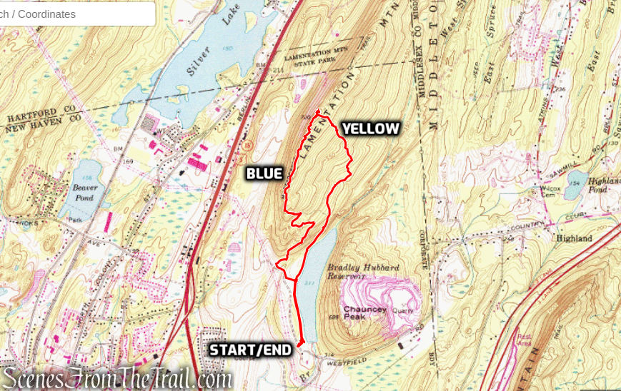
Length: Approximately 3.5 miles
Max elevation: 720 ft.– total elevation gain approximately 474 ft.
Route type: Circuit
Maps: Neither map is up to date – Giuffrida Park – Giuffrida Park & Suggested Hikes
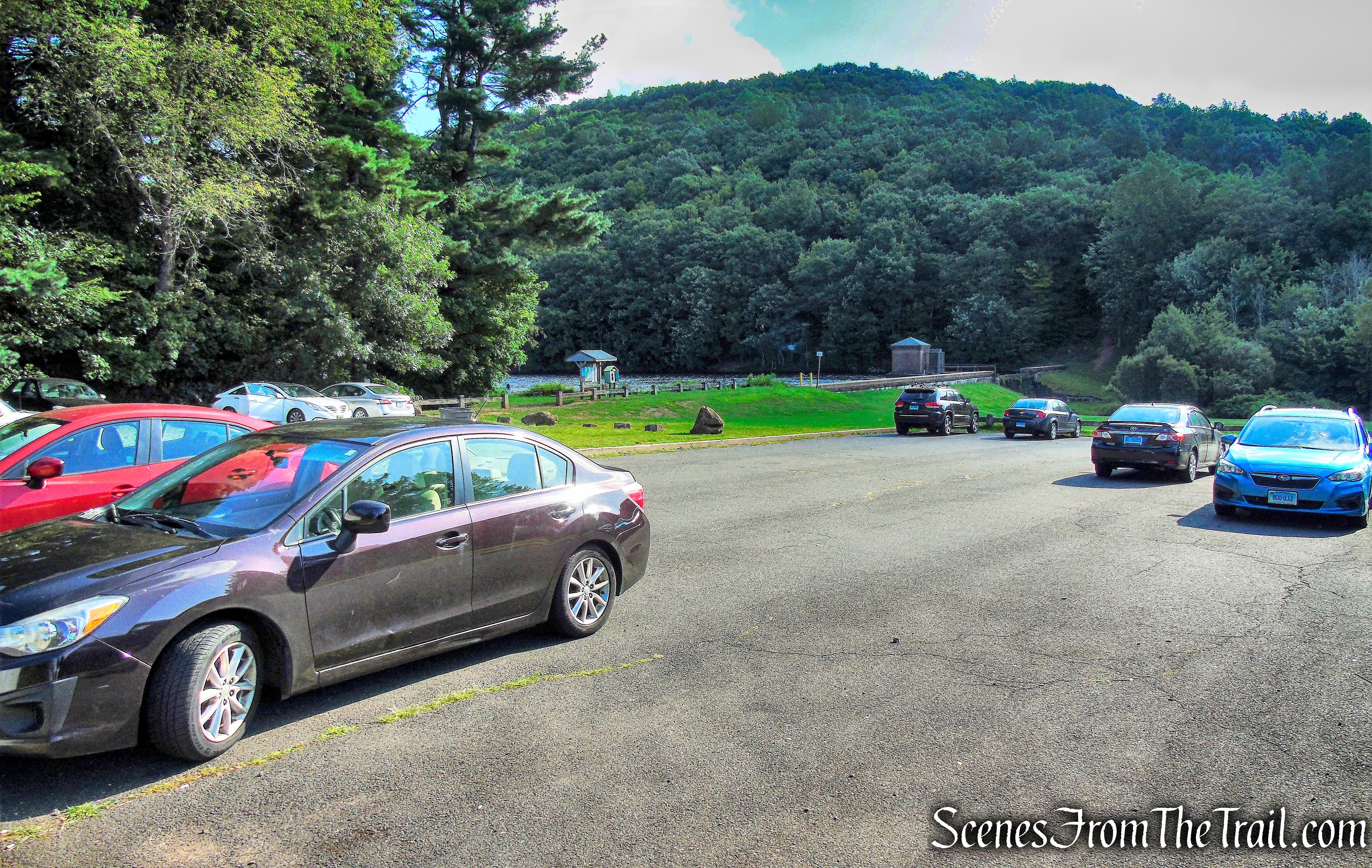
Trailhead parking: Doctor Francis Giuffrida Park – 800 Westfield Rd, Meriden, CT 06450
Overview:
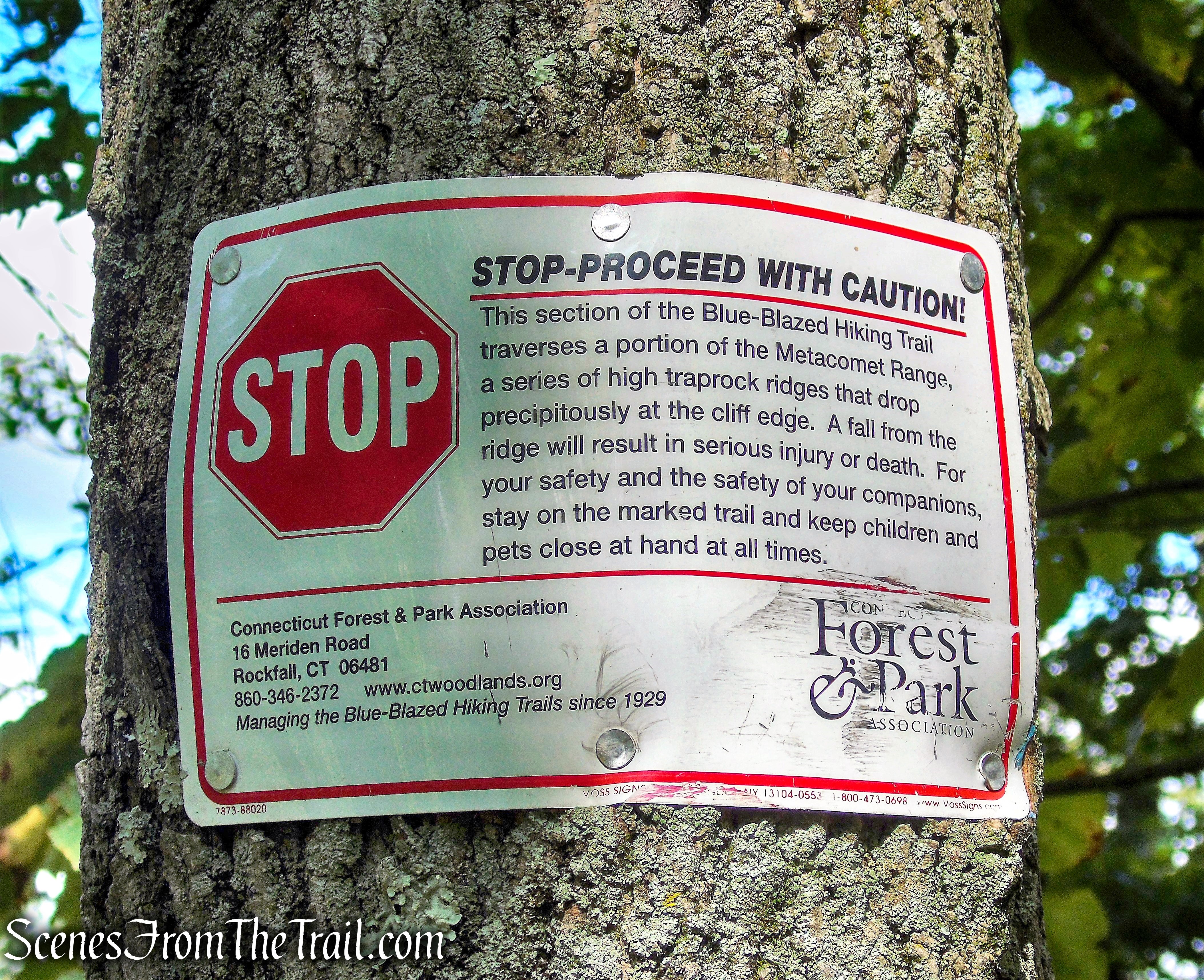
Lamentation Mountain, or Mount Lamentation, at an elevation of 720 feet, is a traprock mountain located 2.5 miles north of Meriden, Connecticut. It is part of the narrow, linear Metacomet Ridge that extends from Long Island Sound near New Haven, Connecticut, north through the Connecticut River Valley of Massachusetts to the Vermont border. Lamentation Mountain is known for its scenic vistas, extensive cliff faces, unique microclimate ecosystems, and rare plant communities. It rises steeply 550 feet above the city of Meriden to the south with west-facing cliffs of 200 feet or more. The cliff line, described by the Connecticut Forest and Park Association as “perhaps the most scenic traprock ridge walk in the state” is a prominent landscape feature visible for miles. The mountain is traversed by the 50-mile Mattabesett Trail.
The Berlin Land Trust and the Meriden land Trust are active in the conservation of Lamentation Mountain and its viewshed.
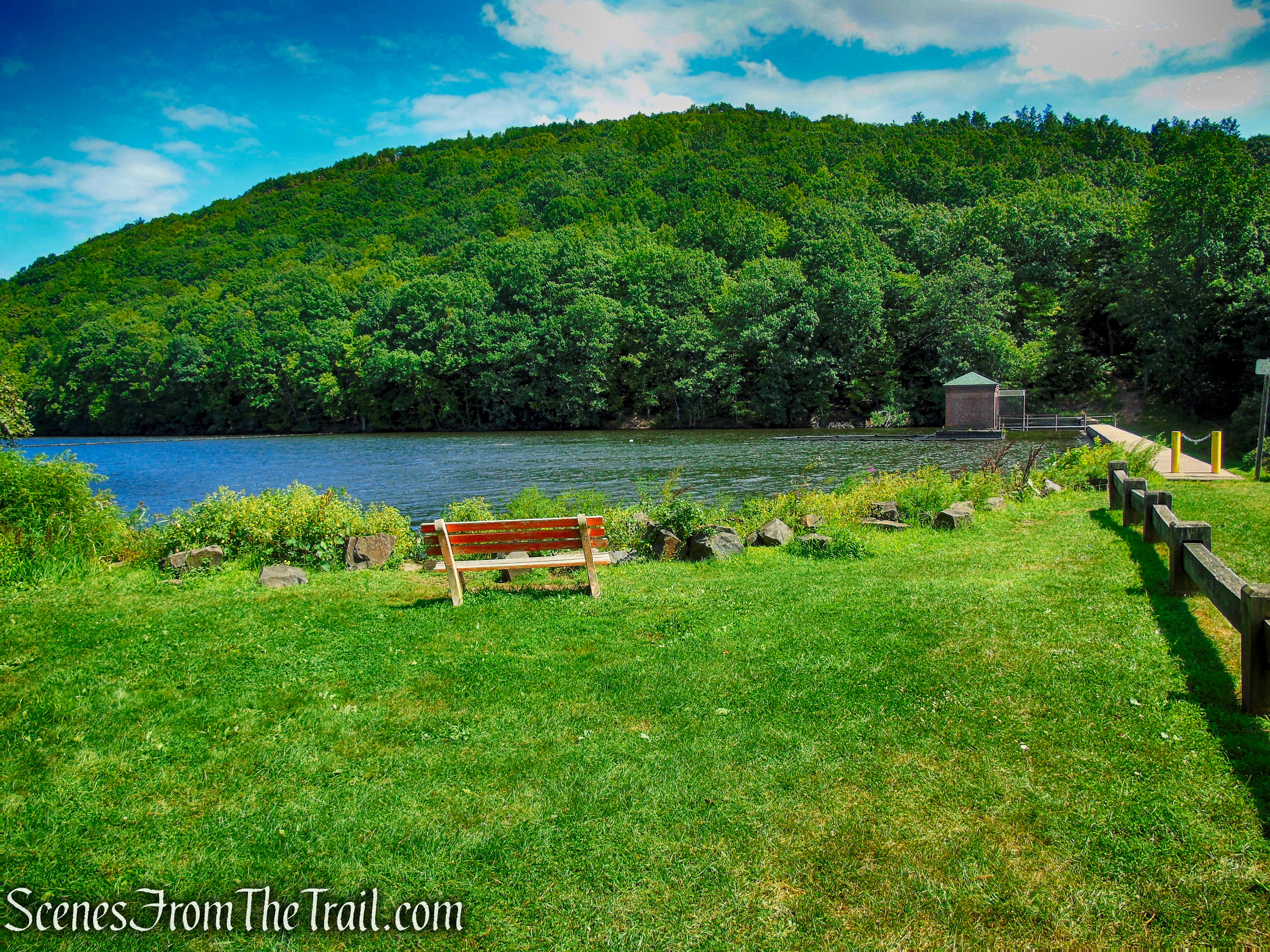
Giuffrida Park is located in Meriden’s northeast corner, with two entrances off of Westfield Road. Substantial parking is available within Giuffrida Park and at a commuter lot on Country Club Road, on the west side of I-91 (Exit 20). It consists of the former Bradley-Hubbard Reservoir, now known as Crescent Lake and the nearly 600-acres surrounding it.
History:
Mount Lamentation was named in 1636 when a member of Wethersfield Colony became lost and was found by a search party three days later on this ridge, twelve miles from home. There is some controversy whether the Lamentation refers to his behavior or that of those looking for him. Also known from a legend in the 1700’s when a Native American Girl committed suicide by jumping off the Mountaintop from the loss of her love. In 1735 a group of local men leased land on the western edge of this mountain in an attempt to find gold, as quartz formations there seemed promising. None was ever found.
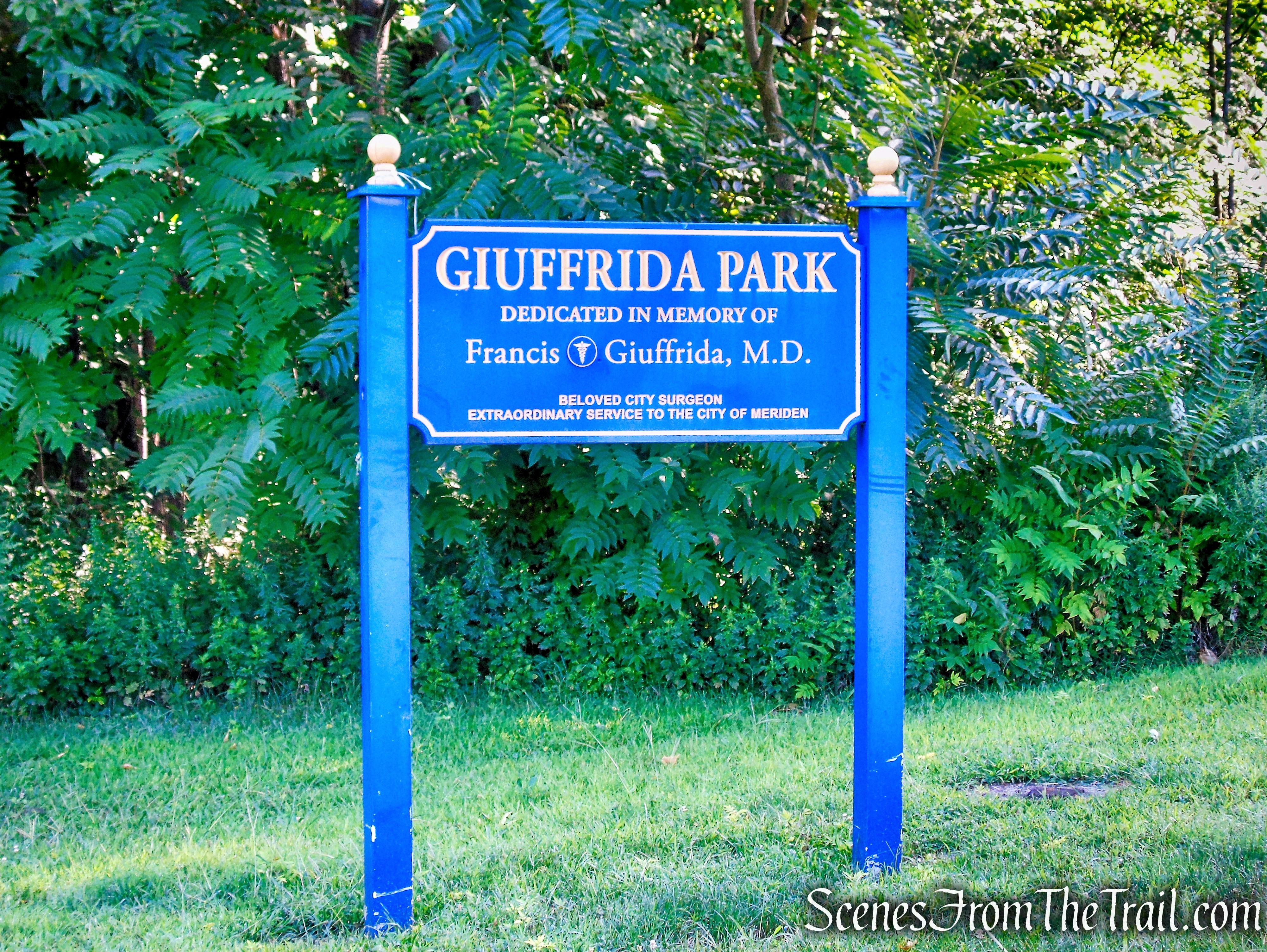
Giuffrida Park was originally part of an area farmed in the late 1600’s and early 1700’s by Jonathan Gilbert and later Captain Andrew Belcher. This farm, the first European settlement in this region, became known as the “Meriden Farm” – from which the whole area eventually took its name. It was acquired by the city in 1965 and subsequently named for Dr. Francis Giuffrida, a beloved city surgeon who died in 1966 at the age of 56. Dr. Giuffrida was on active duty with the U.S. Navy and Marine Corps from 1941 to 1946, serving in both the Atlantic and Pacific theaters of war. He was awarded the bronze star and held the rank of Captain. Today, the Park contains 598 acres for passive recreation.
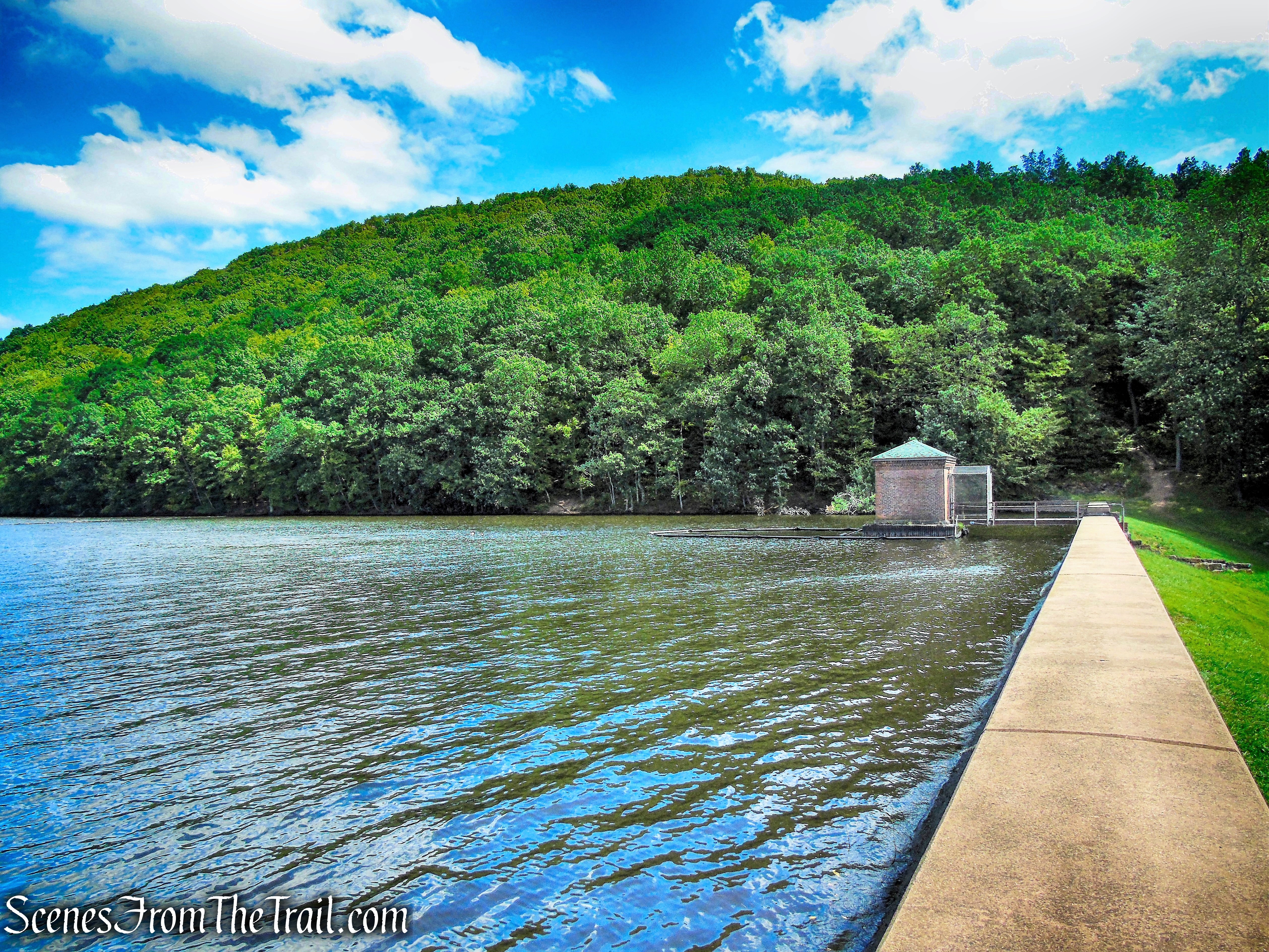
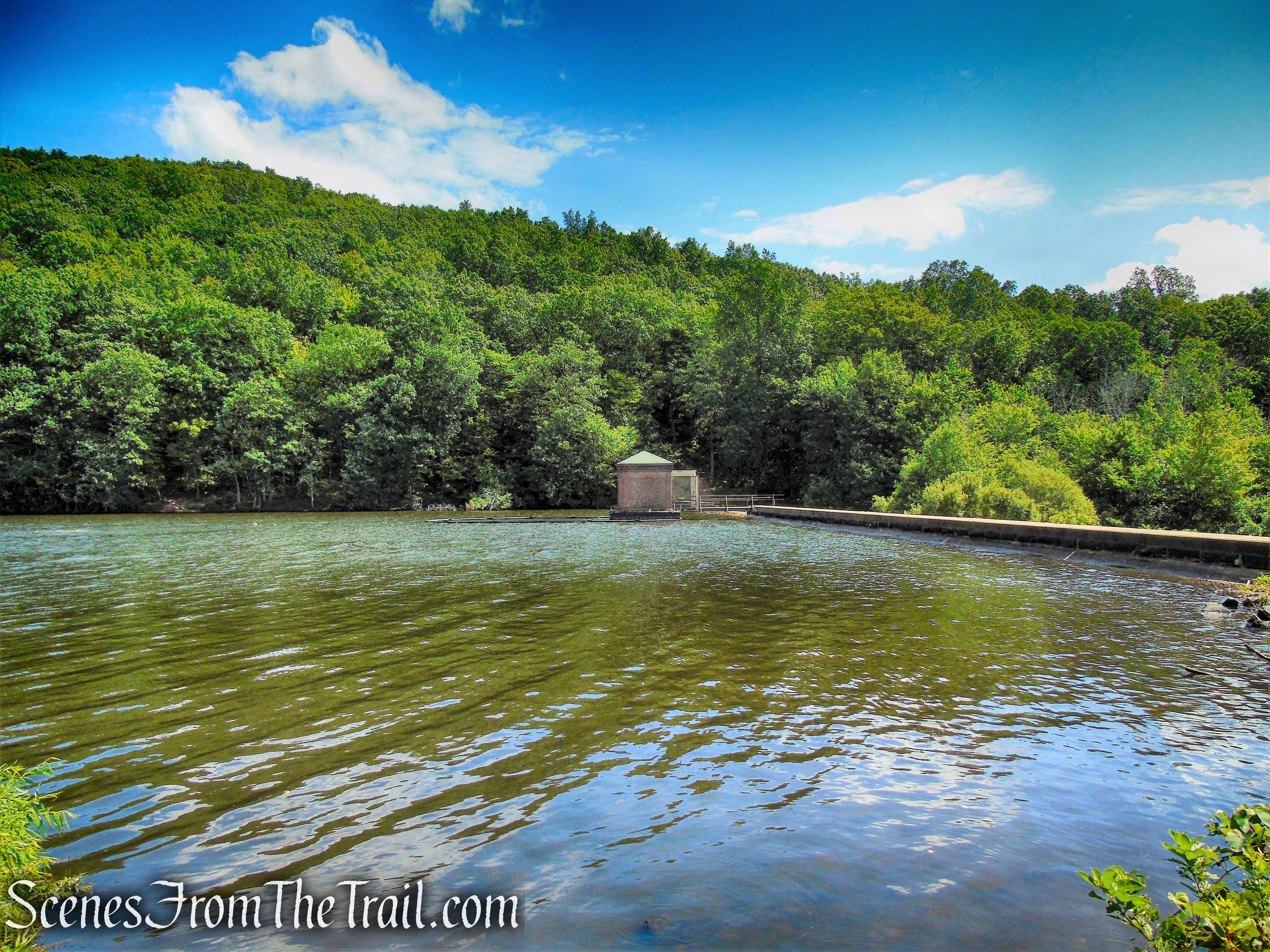
The reservoir, Crescent Lake (formerly called Bradley Hubbard Reservoir), lies nestled in the gap between Mount Lamentation and Chauncey Peak. It was built by the Bradley and Hubbard Manufacturing Company for its use in the late 1800’s. The dam was raised three feet in 1927. Then International Silver acquired the property for use as a reliable source of water for its manufacturing processes. When International Silver relocated, it gave the city of Meriden special permission to connect into their now unused reservoir. The reservoir remains a backup water source today.
Trails Overview:
Total trails distance is approx. 24.8 miles
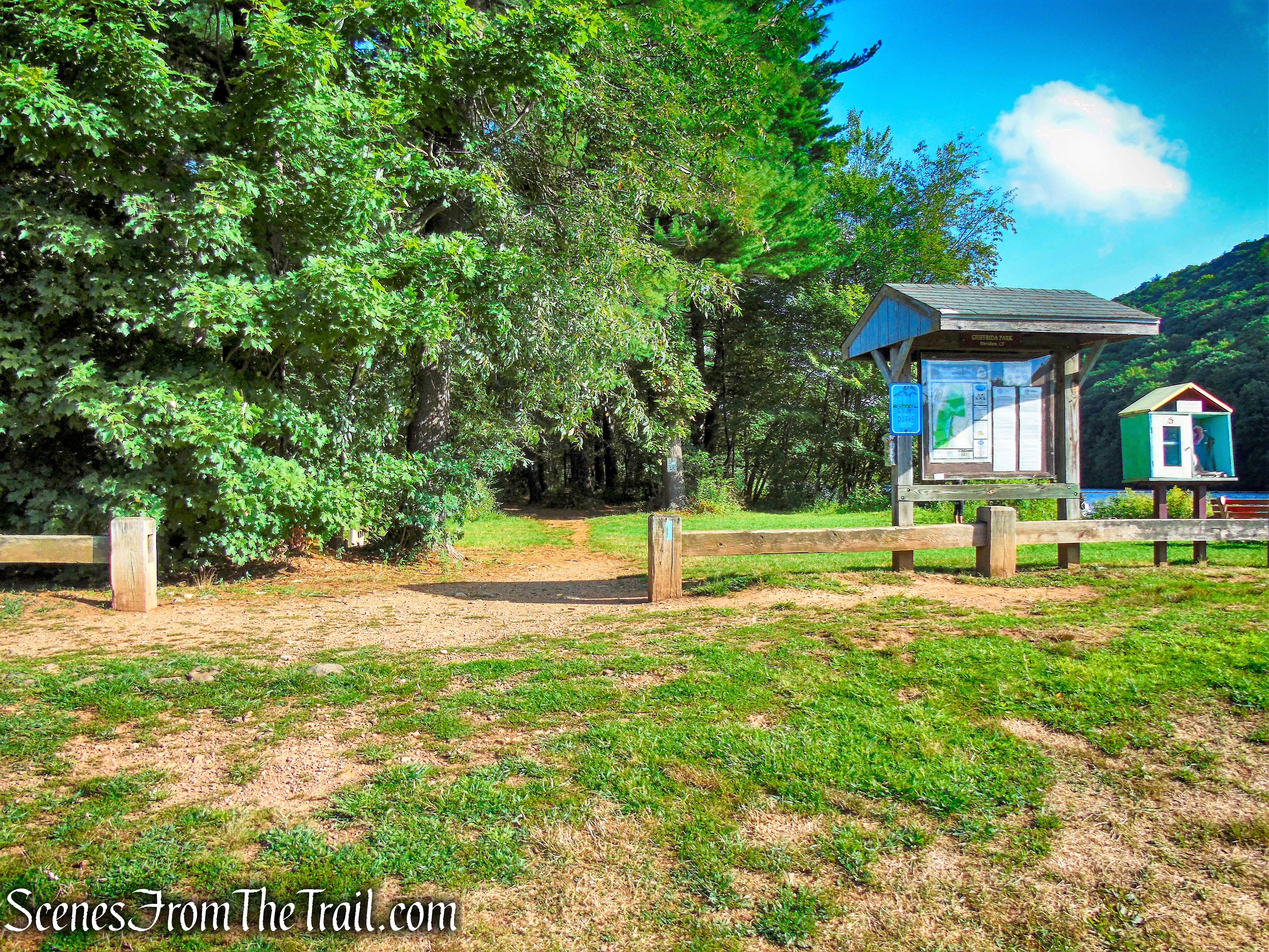
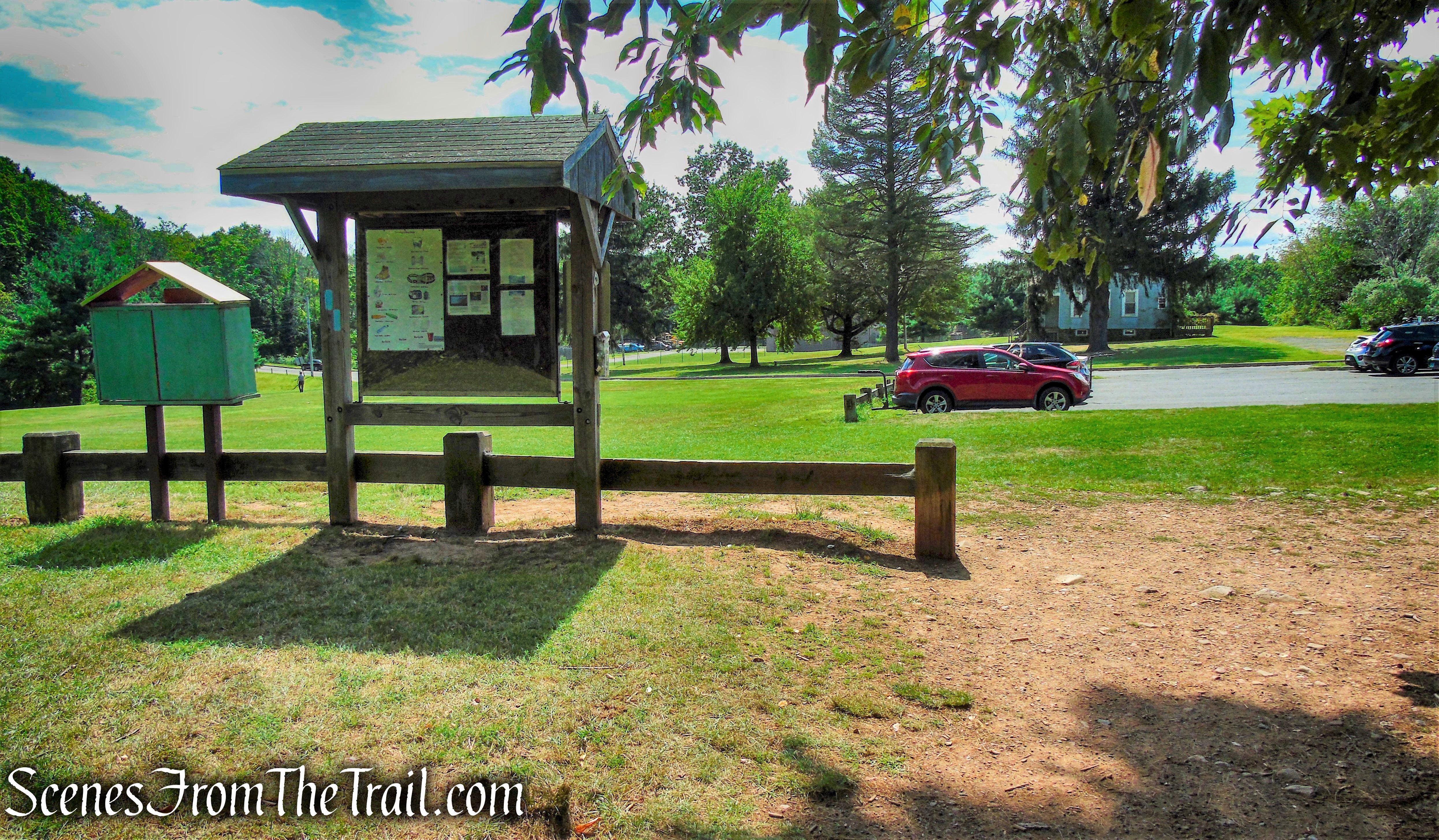
Please Note: Some of the trails have been rerouted and the outdated maps do not reflect the current alignment of the trails. The kiosk at Giuffrida Park has a more up to date map and I would recommend that anyone hiking the area, take a photograph of it to take along on the hike.
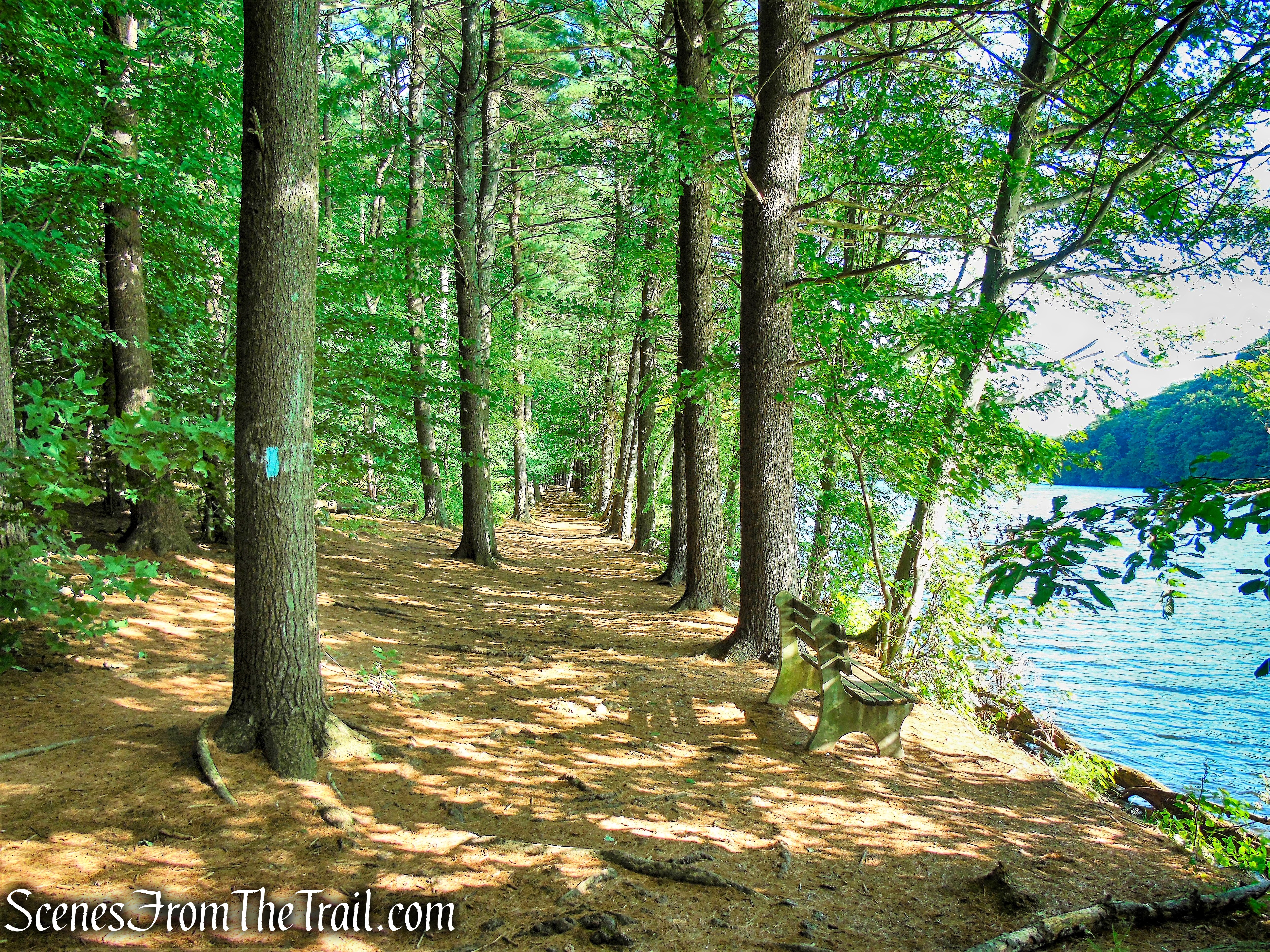
From the parking lot, the blue-blazed Mattabesett Trail is coaligned with the White Trail and follows the shoreline of Crescent Lake (Bradley Hubbard Reservoir). It soon ascends and runs along the ridge of Mount Lamentation, with numerous views from open rock ledges to the south, west and north. Leaving Meriden, the trail descends to Spruce Brook Road in Berlin.

In addition to the blue-blazed Mattabesett Trail, both the red and yellow-blazed trails ascend to the ridgeline of Mount Lamentation. The Yellow Trail ascends from the white-blazed trail to a poorly marked intersection with the Mattabesett Trail near one of the best overlooks. The Red Trail turns sharply away from the blue trail as it passes a deep canal cut through stone, passes by an old shelter, and intersects the blue-blazed trail at the ridgeline.
With the vast network of trails, any number of loop hikes can be done, ranging from 1 – 7 miles round trip.
The Hike:
This lollipop loop was done in a counterclockwise fashion, beginning at the southern end of Crescent Lake.
From the parking area, head towards the kiosk near the lake to snap a pic of the map before you proceed.
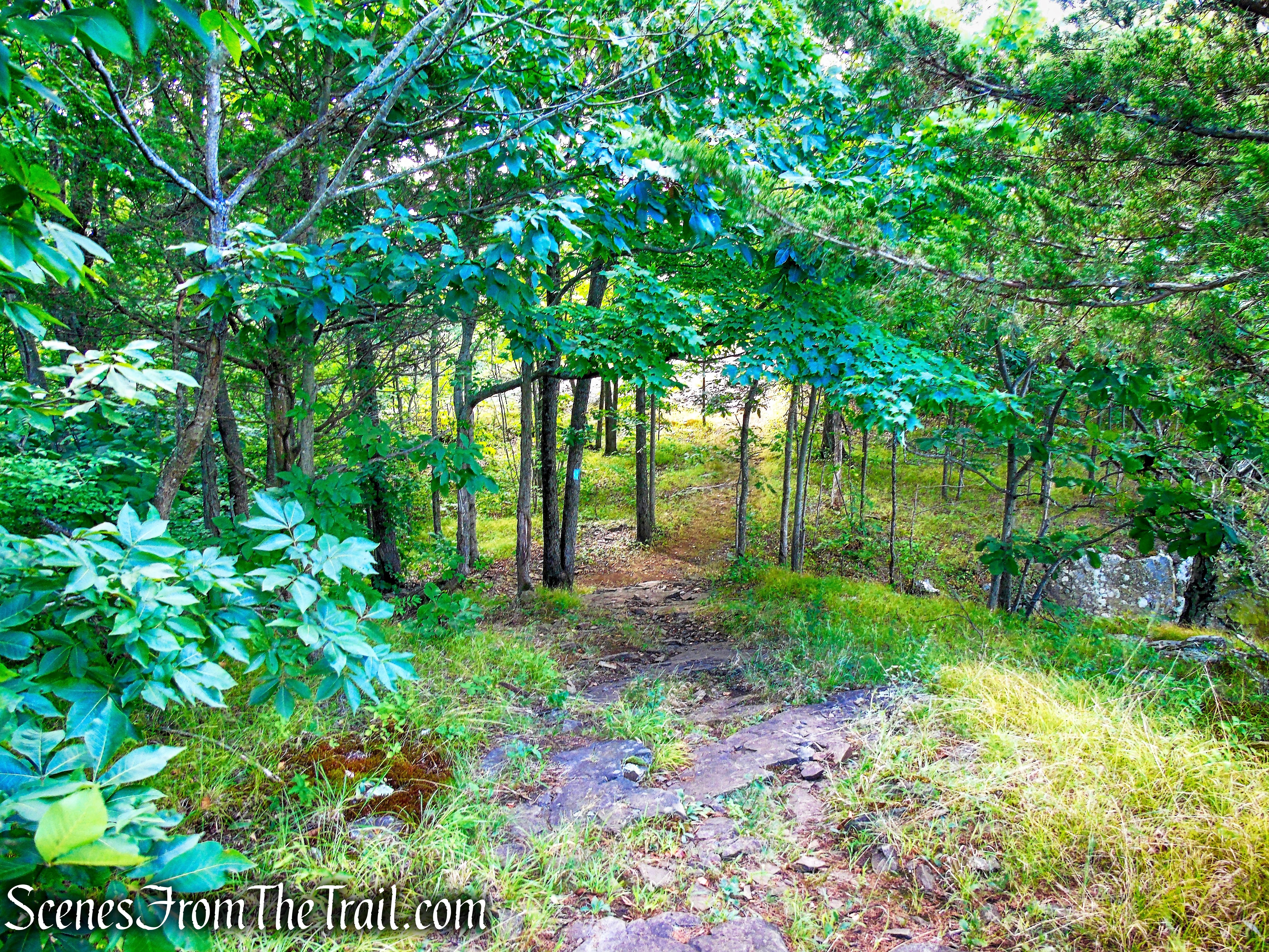
Just to the left of the kiosk, look for a blue blaze painted on a post at a break in the wooden barrier. Follow the blue-blazed Mattabesett Trail north as it runs along the western shore of Crescent Lake. Here the Mattabesett Trail is coaligned with the white-blazed Crescent Lake Loop Trail, although there are not any white blazes visible just yet. In just under 600 yards, the blue-blazed Mattabesett Trail leaves to the left. This will be your return route, but for now follow the white blazes as they continue along the shoreline.
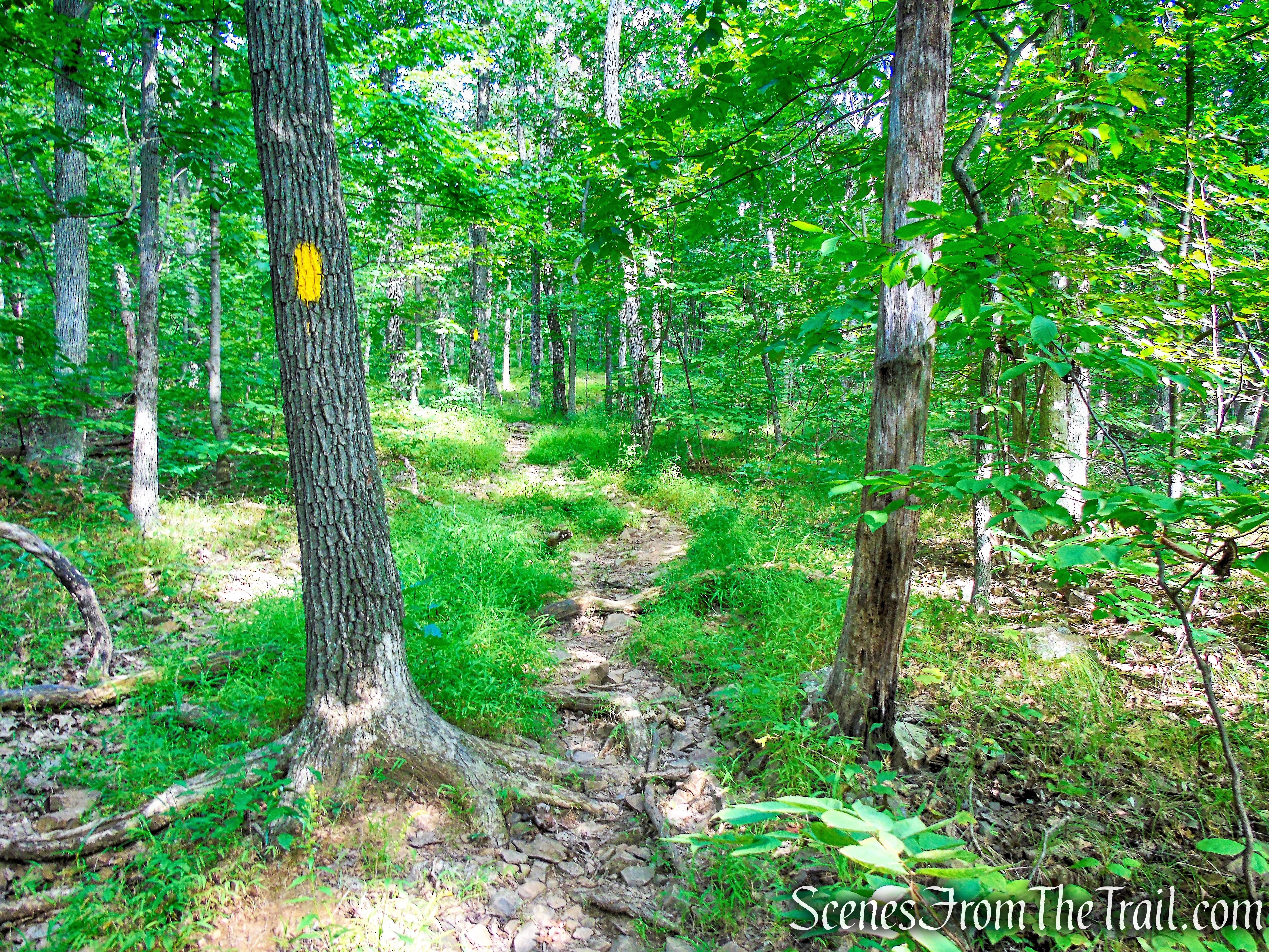
In a short distance, the White Trail turns left and joins a woods road. The unmarked path (the route we took) joins up with the woods road (White Trail) a short distance later. Soon the White Trail comes to a junction with the Yellow Trail which begins on the left. Turn left, leaving the White Trail and begin following the yellow blazes as it begins to climb on a rocky woods road.
In about 800 feet, the Red Trail joins in from the left.
The blazes can be a bit confusing here, but just continue ahead on the woods road, following the yellow blazes.
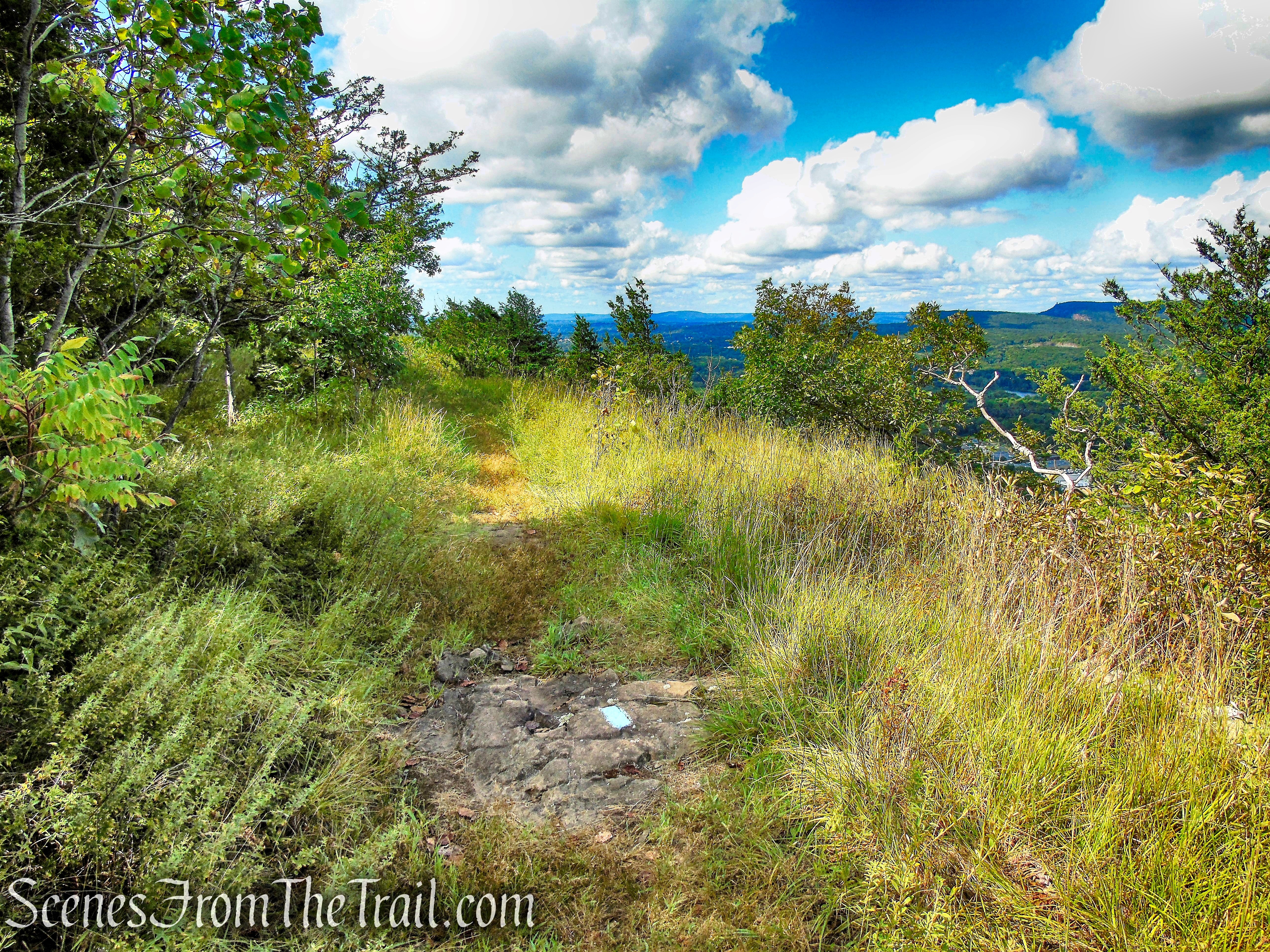
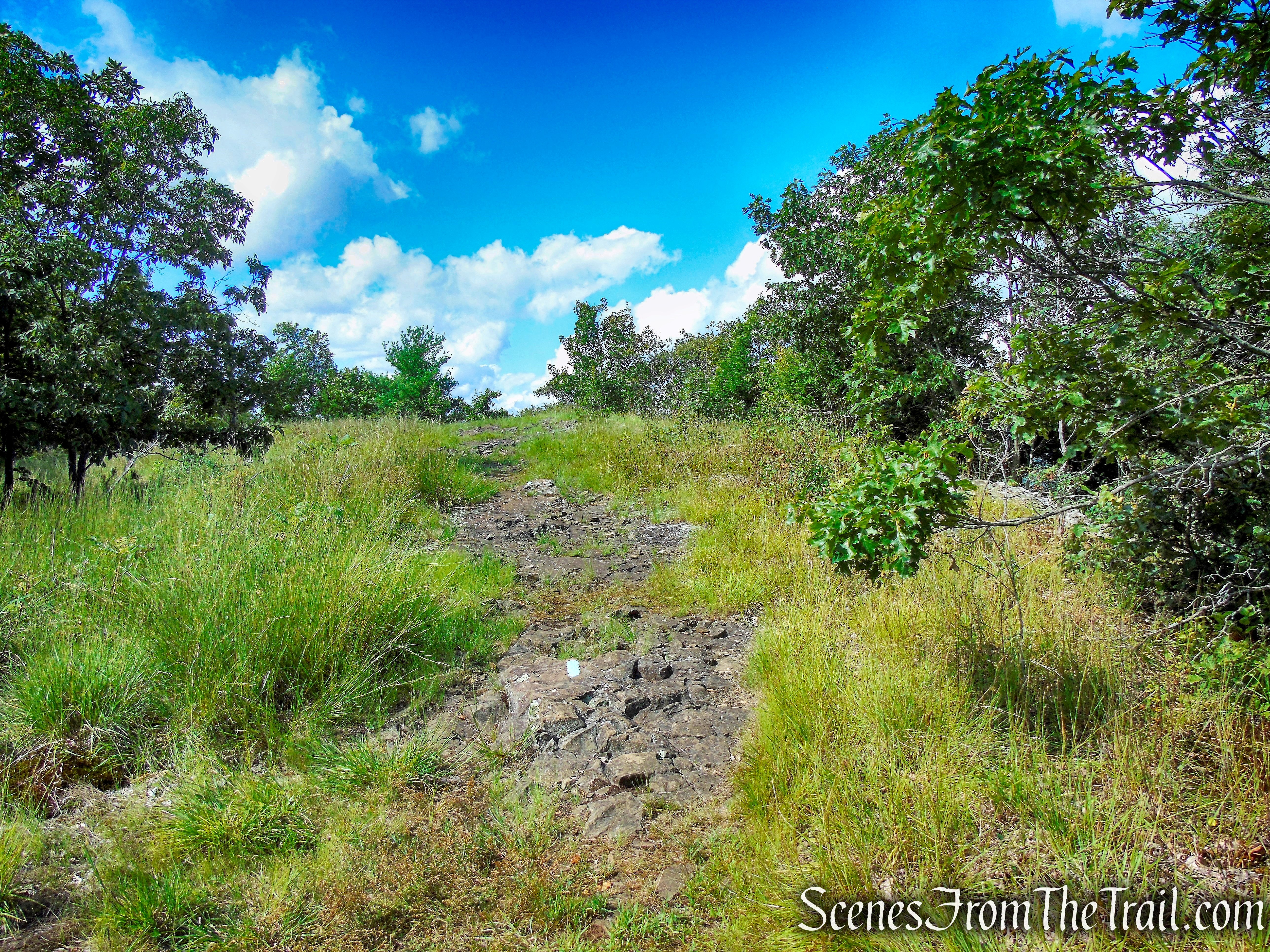
In a short distance, the Red Trail leaves to the right, but you should bear left and continue to follow the yellow blazes. The Yellow Trail now climbs the mountain on switchbacks on a very moderate grade. In another 0.7 mile, the Yellow Trail reaches the 720 ft. summit of Mount Lamentation.
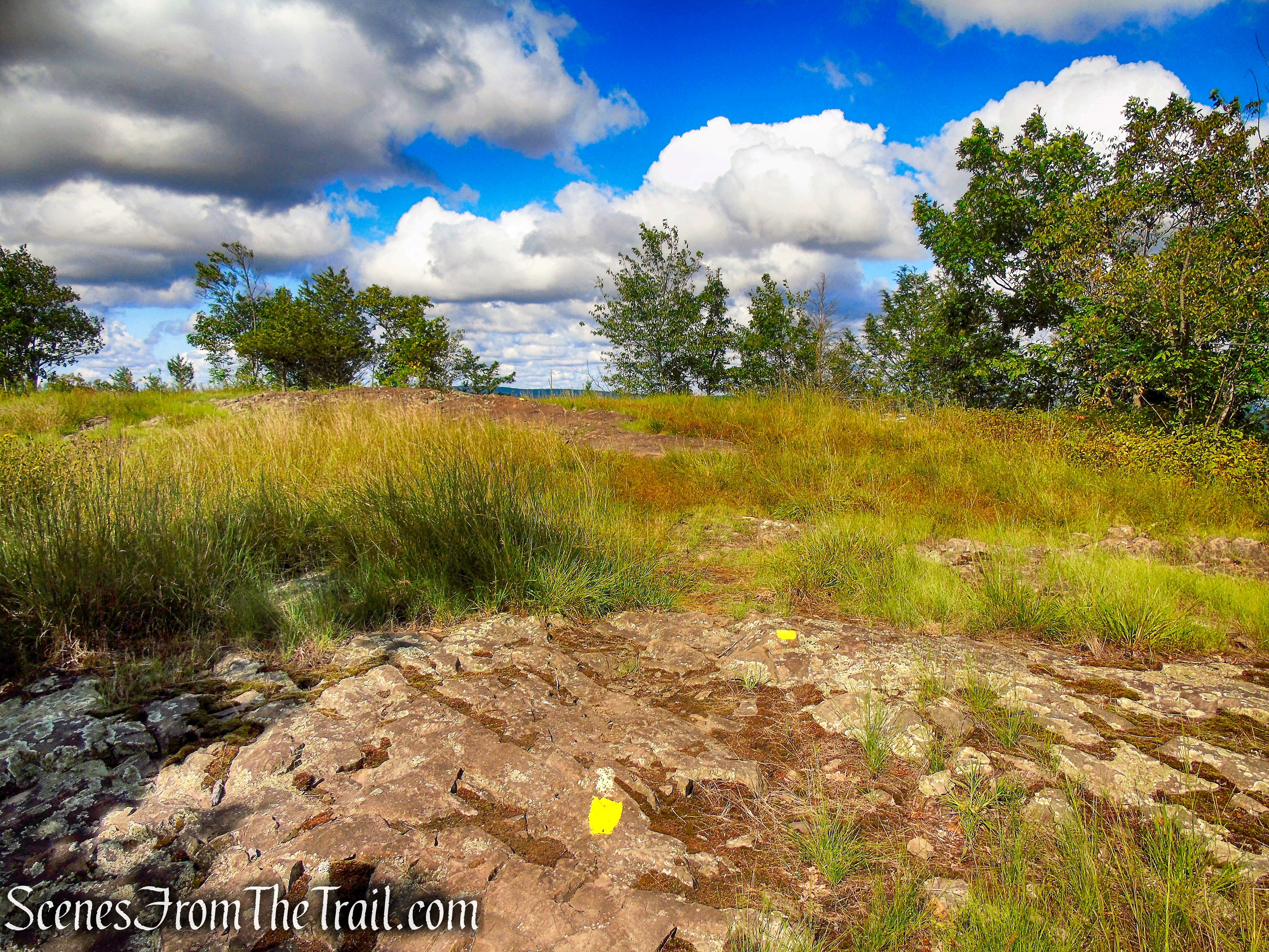
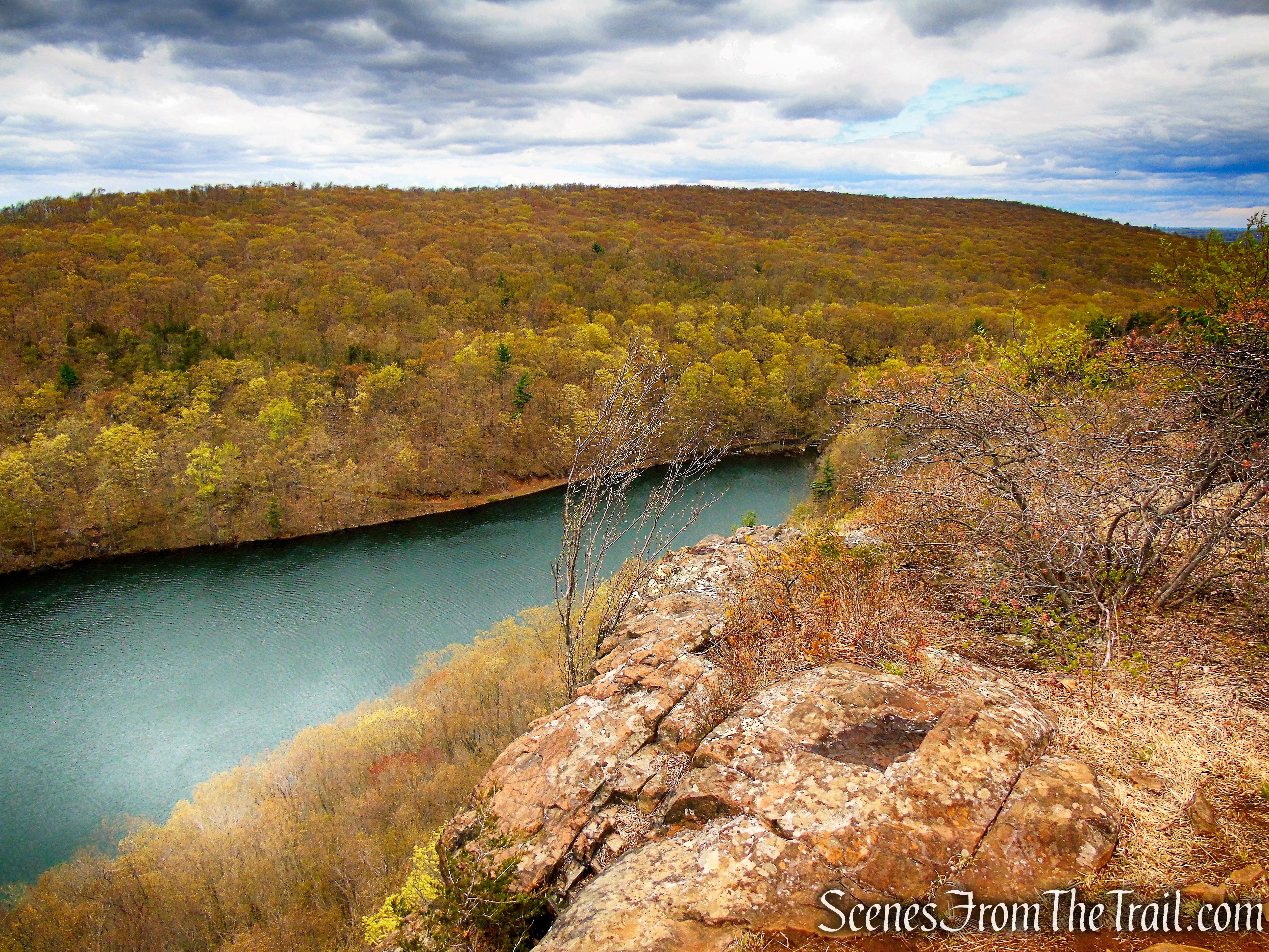
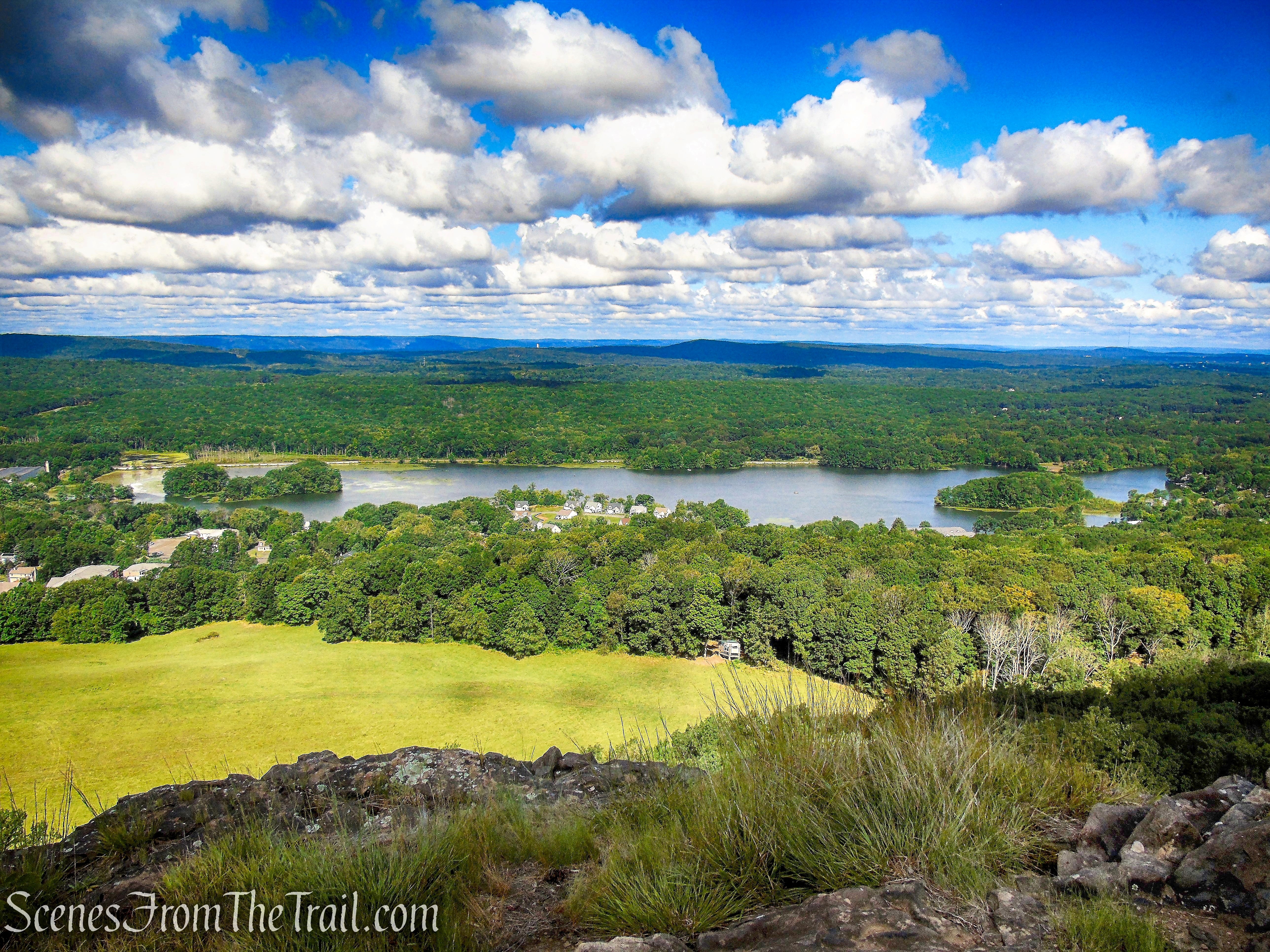
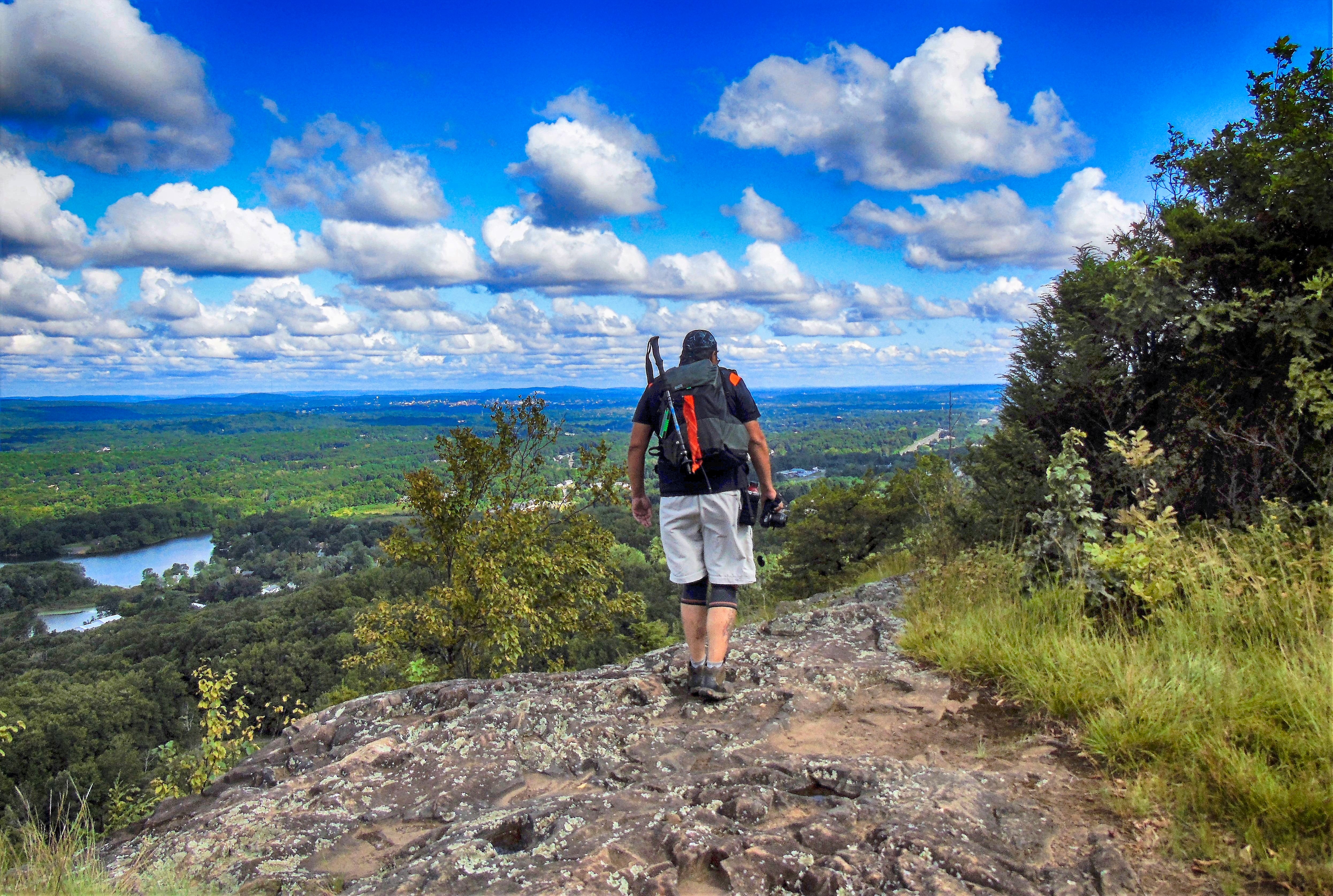
Continue straight ahead towards the edge of the cliffs. The Yellow Trail ends here and this is where the blue-blazed Mattabesett Trail crosses. Straight ahead there are panoramic views to the south, west and north.
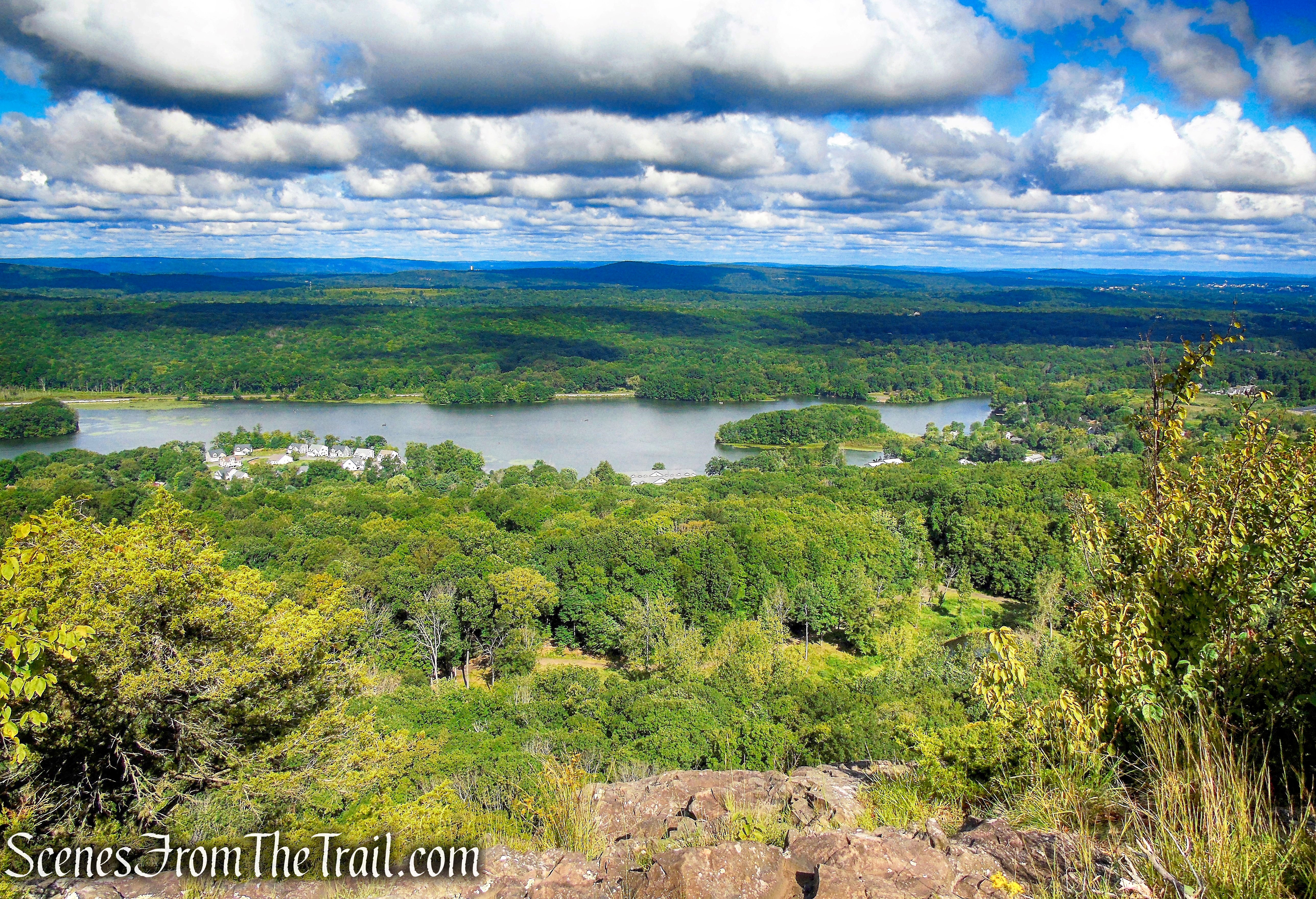
Right below is Silver Lake in the town of Berlin and to the southwest, South Mountain and Castle Craig atop of East Peak can be seen in the distance.
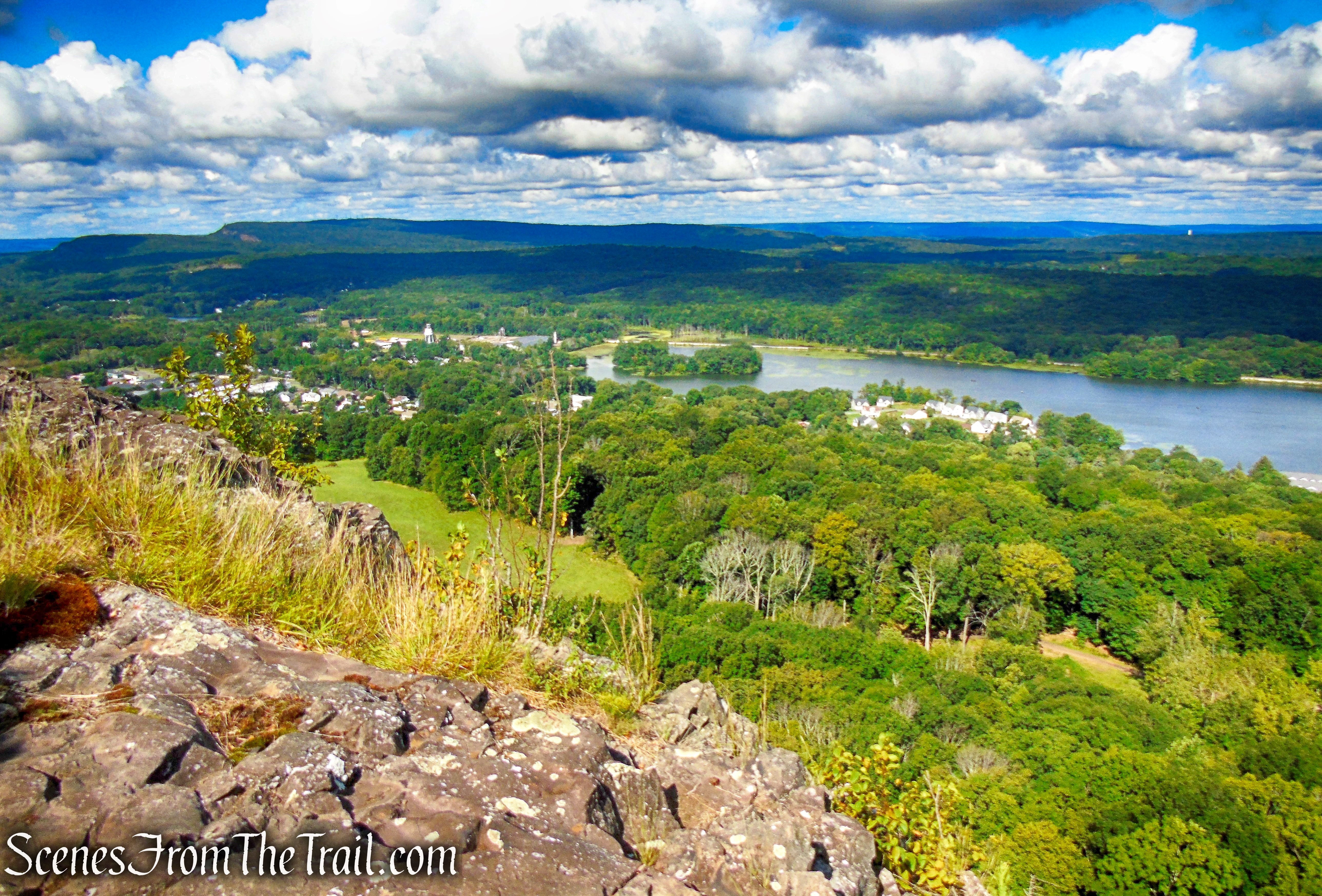
A short distance to the north, there is a larger rock outcrop with similar views, but with better places to sit. This is a good spot to take a break and enjoy the views.
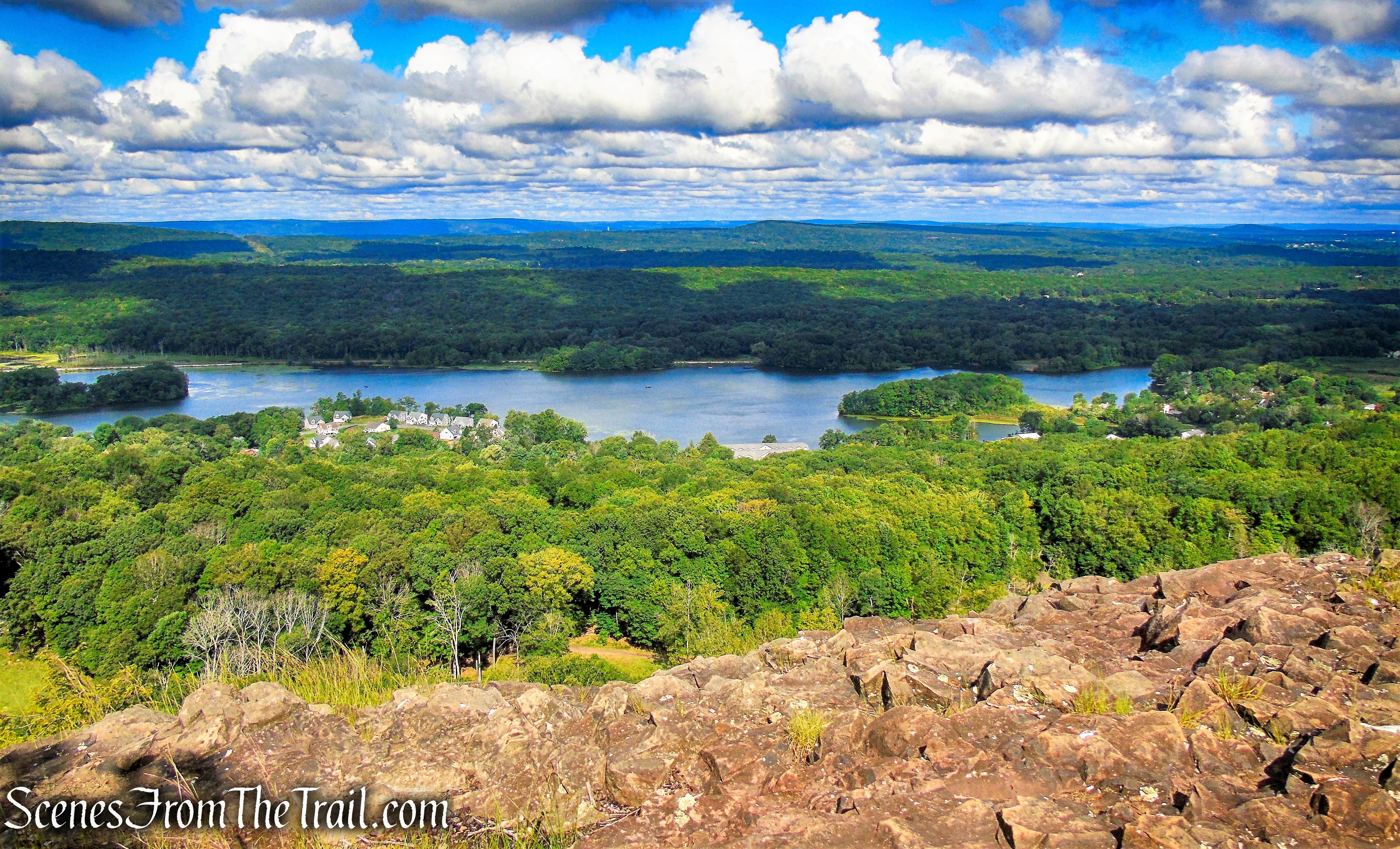
When you are ready to continue, retrace your steps back to the junction with the Yellow Trail and continue south along the edge of the cliffs, now following the blue blazes, passing several rock outcrops with more views.
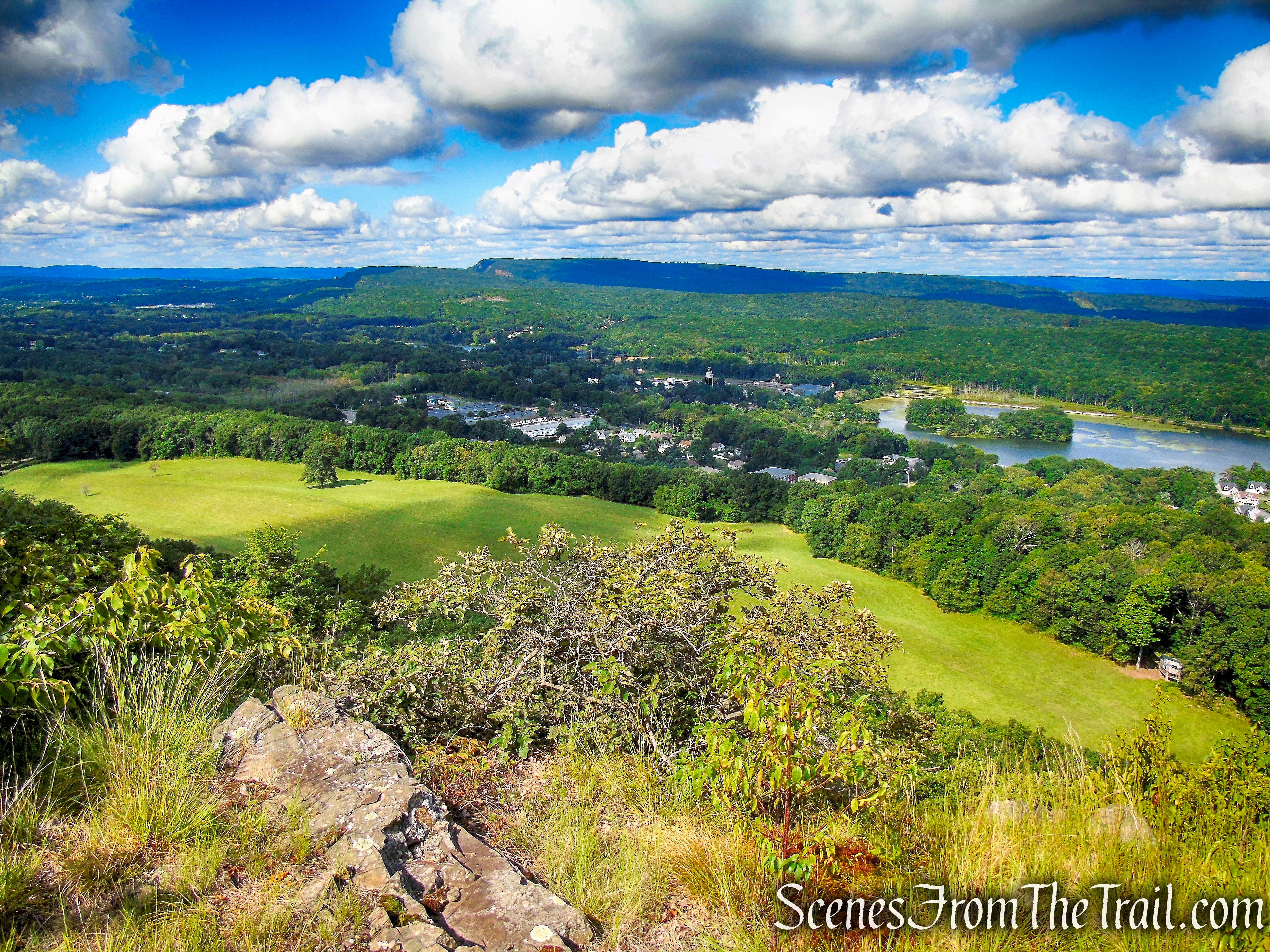
The Mattabesett Trail veers slightly away from the edge of the cliffs, descends into the forest then climbs slightly and comes out on open rock and approaches another viewpoint.
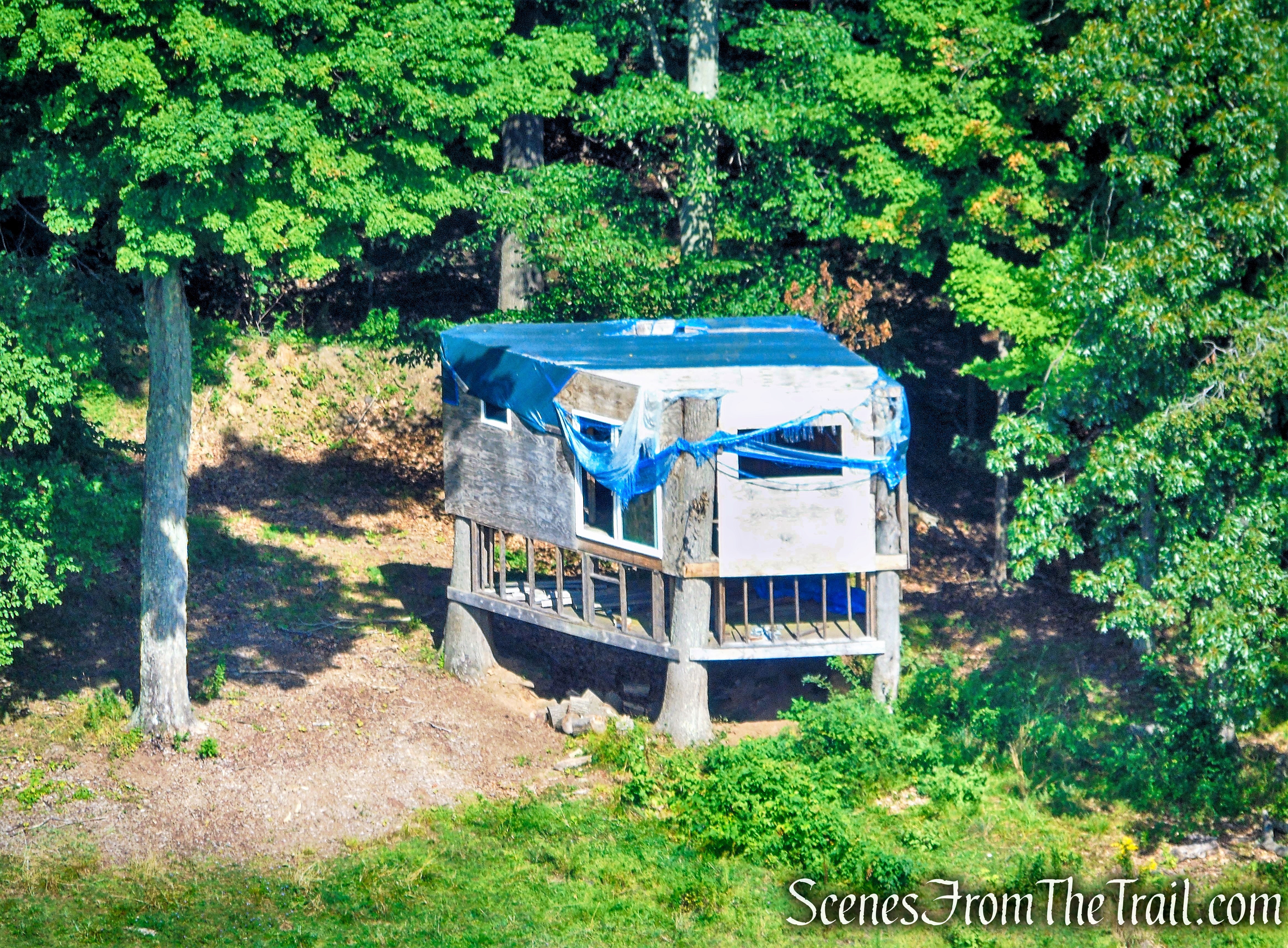
In the field below there is an interesting looking tree house. Note how they used the existing trees for the corner posts.
The Mattabesett Trail again veers slightly away from the edge of the cliffs, enters the forest then returns to the escarpment and approaches another viewpoint. As the trail heads south along the ridge, the views are more to the southwest and Castle Craig can be better viewed as it sits high atop East Peak.
The Mattabesett Trail descends and soon comes to a junction with the Red Trail, on the left. One can take the Red Trail, which leads to an old shelter and connects with the Blue Trail a little farther down, but doing so would bypass several more overlooks.
The Mattabesett Trail descends, then climbs again and comes to a south facing viewpoint. The trail then begins a steady descent, this time more steeply. After passing the intersection where the Blue and Red Trails “kiss,” the Blue Trail continues its descent and soon emerges on a gravel road in a powerlines cut and turns left. The trail follows the gravel road for several hundred feet then turns left, leaving the gravel road and entering the woods.
The Mattabesett Trail soon comes out of the woods, crosses over a woods road and heads towards Crescent Lake. Across the lake is Chauncey Peak and its magnificent cliffs.
Turn right and follow the blue blazes for about 600 yards back to the parking lot, where the hike began.
Review:
This was a wonderful hike with almost constant views from the ridge. The ascent up to the ridgeline is relatively tame and doable by most. The trails are well blazed and for the most part, easy to follow. Giuffrida Park and the surrounding area is a very scenic spot to spend a warm sunny day. The day we visited was perfect hiking weather, yet we only encountered several people on the trails. I have read that there have been issues with ATVs and dirt bikes tearing up the trails. We encountered a group of dirt bikes at the summit, but when they saw me, they moved on. All in all, a lovely day on the trails. This hike can be combined with Chauncey Peak or they can be done separately.
Pros: Scenic landscape, gorgeous views, ridge walk, well marked trails.
Cons: Need an updated map for the public, dirt bikes at the summit.
Take a hike!

Thank you for your detailed description of the hike!!! I followed it today and hiked to Lamentation for the first time. I’ve been going to Giuffrida for about 10 years now and never took the hike up to Lamentation – dont know why it took me so long!
LikeLiked by 1 person