August 31, 2019 – Meriden, Connecticut
Difficulty: Moderate – strenuous
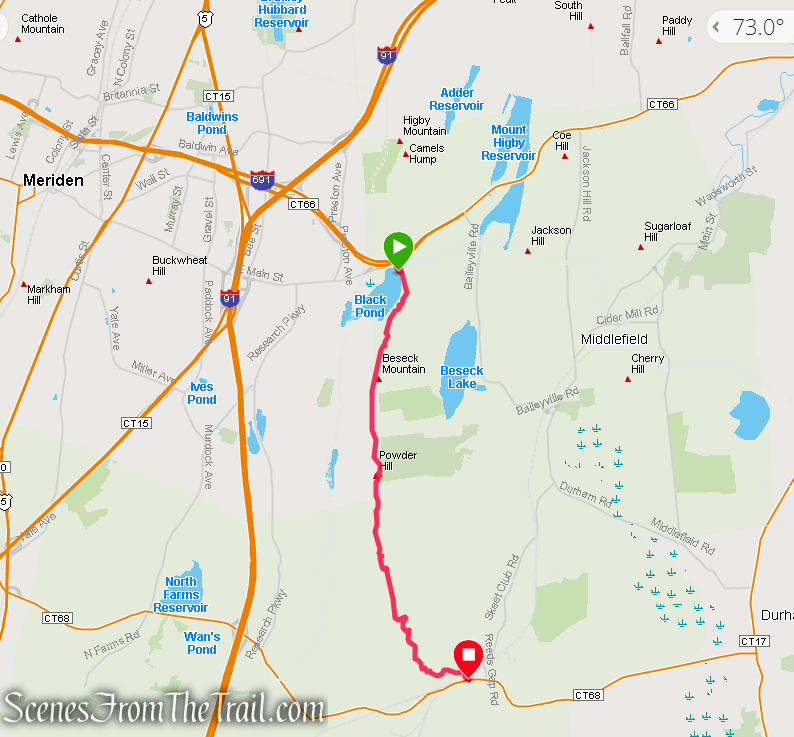
Length: Approximately 5 miles
Max elevation: 840 ft.– total elevation gain approximately 1137 ft.
Route type: Point-to-Point
Maps: Mount Higby – Beseck Mountain Trail Map
Trailhead parking: Black Pond State Wildlife Area – Mattabeseck Road, Meriden, CT 06450
Overview:
Beseck Mountain (sometimes spelled Besek), also known as Black Mountain, est. 840 feet, is a traprock mountain ridge located 4.75 miles southeast of Meriden, Connecticut. It is part of the narrow, linear Metacomet Ridge that extends from Long Island Sound near New Haven, Connecticut, north through the Connecticut River Valley of Massachusetts to the Vermont border. Besek Mountain is known for its 3-mile long line of open cliffs, unique microclimate ecosystems, and rare plant communities. The mountain is traversed by the 51-mile Mattabesett Trail, and is home to the Powder Ridge Ski Area. The Metacomet Ridge continues north from Besek Mountain as Higby Mountain and south as Trimountain.
The Wallingford Land Trust and the Middlesex Land Trust are active conservation partners in the area.
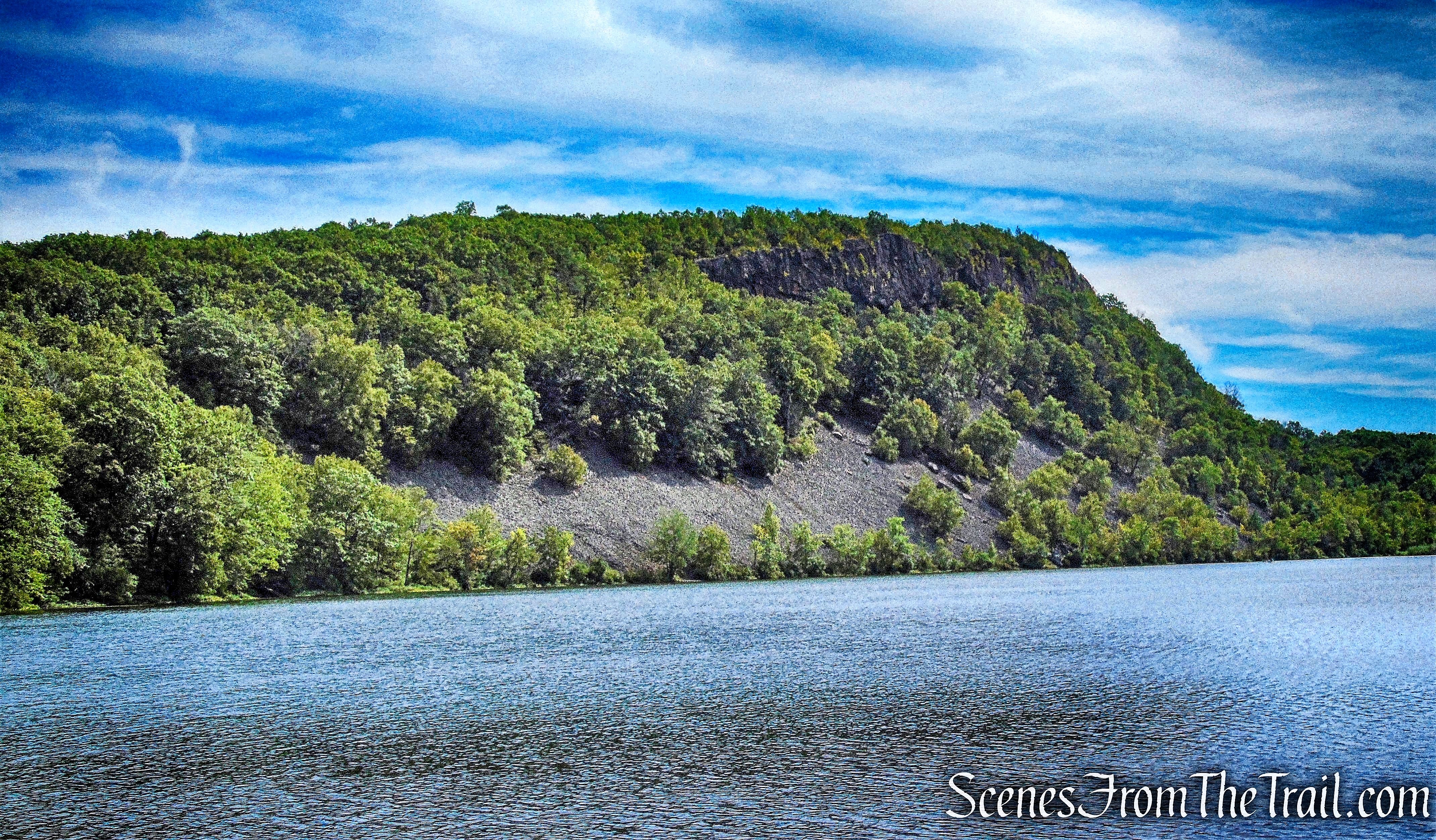
Besek Mountain as viewed from Black Pond State Wildlife Area
The Mattabesett Trail is a large, blue-blazed, U-shaped (51-mile), hiking trail that runs through the central parts of Connecticut; it is part of the New England National Scenic Trail. This section of the path features metamorphic rock, panoramic views atop Besek Mountain, Black Pond views and dense forests. Along the Besek Mountain ridge there are vistas displaying the Quinnipiac Valley. The trail runs through a ski resort and there are several suburbs and smaller towns observable from the trail. The forest is full of maple, hemlock, sycamore, beech, oak and birch trees. Be apprised that dogs must be kept on a leash while on the trail. Also, know that you can hike this as a one-way if you would like.
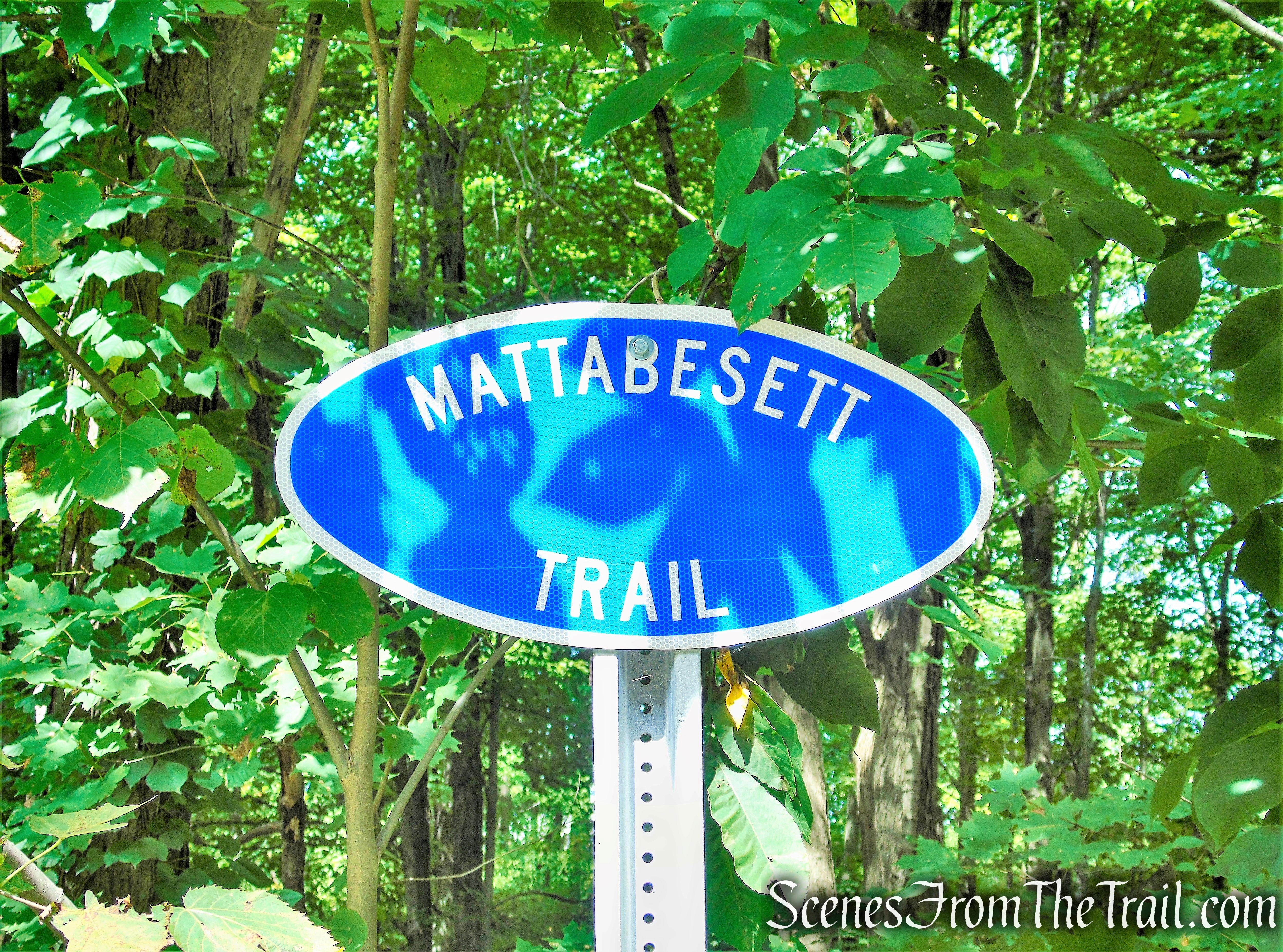
Mattabesett Trail
The New England National Scenic Trail (NET) is a National Scenic Trail in southern New England, which includes most of the three single trails Metacomet-Monadnock Trail, Mattabesett Trail and Metacomet Trail. The 215-mile route extends through 41 communities from Guilford, Connecticut at Long Island Sound over the Metacomet Ridge, through the highlands of the Pioneer Valley of Massachusetts, to the New Hampshire state border.
The trail is administered by the National Park Service, and managed by two non-profit and member-volunteer based organizations: the Connecticut Forest and Park Association in Connecticut, and the Appalachian Mountain Club in Massachusetts. The trail is maintained by the volunteers of these organizations.
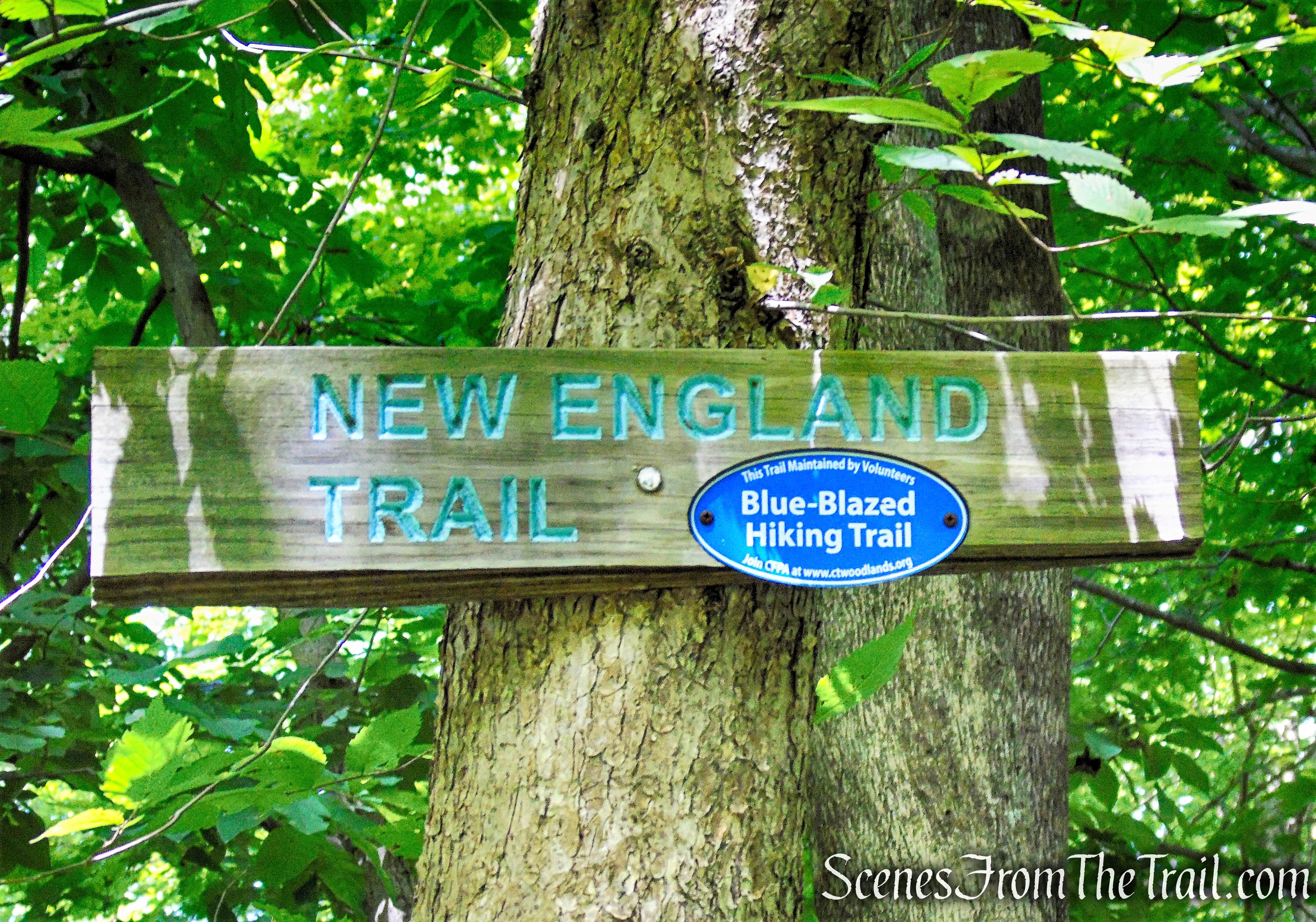
Mattabesett Trail – New England National Scenic Trail
Hike Overview:
Since this is a point-to-point hike, it is best to spot vehicles at both the start and the end of the hike. This hike was done from north to south, but can be done in reverse as well.
A trailhead for the Mattabesett Trail on Besek Mountain is located just west of the junction of Connecticut Route 68 and Connecticut Route 157 in Reeds Gap between Trimountain and Besek Mountain, 3 miles west of Durham center. Black Pond can be accessed via a small parking lot off East Main Street in Meriden, 1.2 miles east of Connecticut Route 15.
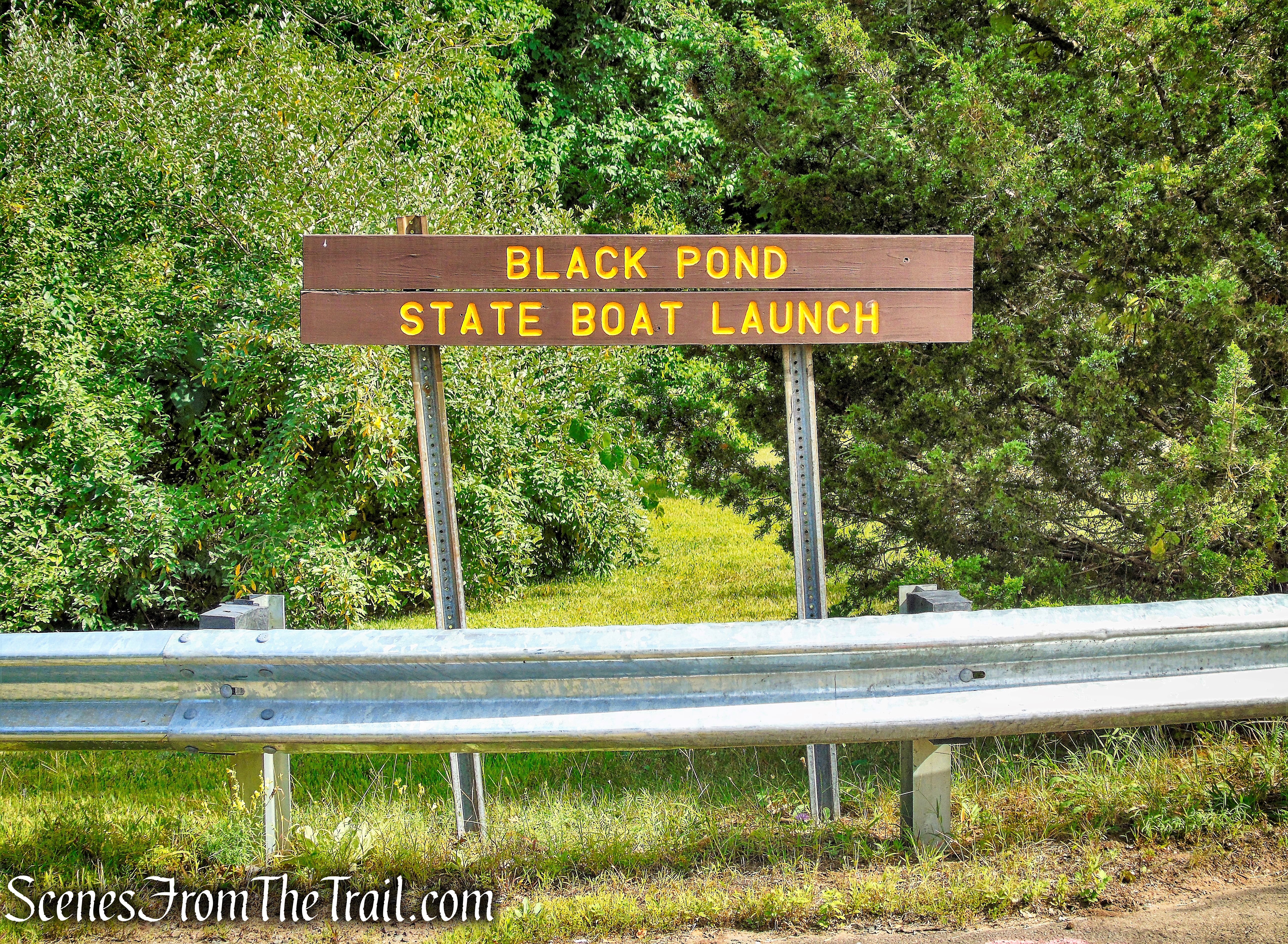
Black Pond State Wildlife Area
For a true “section hike,” the mountain may also be accessed via the parking area for Higby Mountain on Connecticut Route 66, just east of Black Pond.
This hike covers only the blue-blazed Mattabesett Trail, although there are a number of side trails, both blazed and unmarked that branch off the main trail, that one could explore.
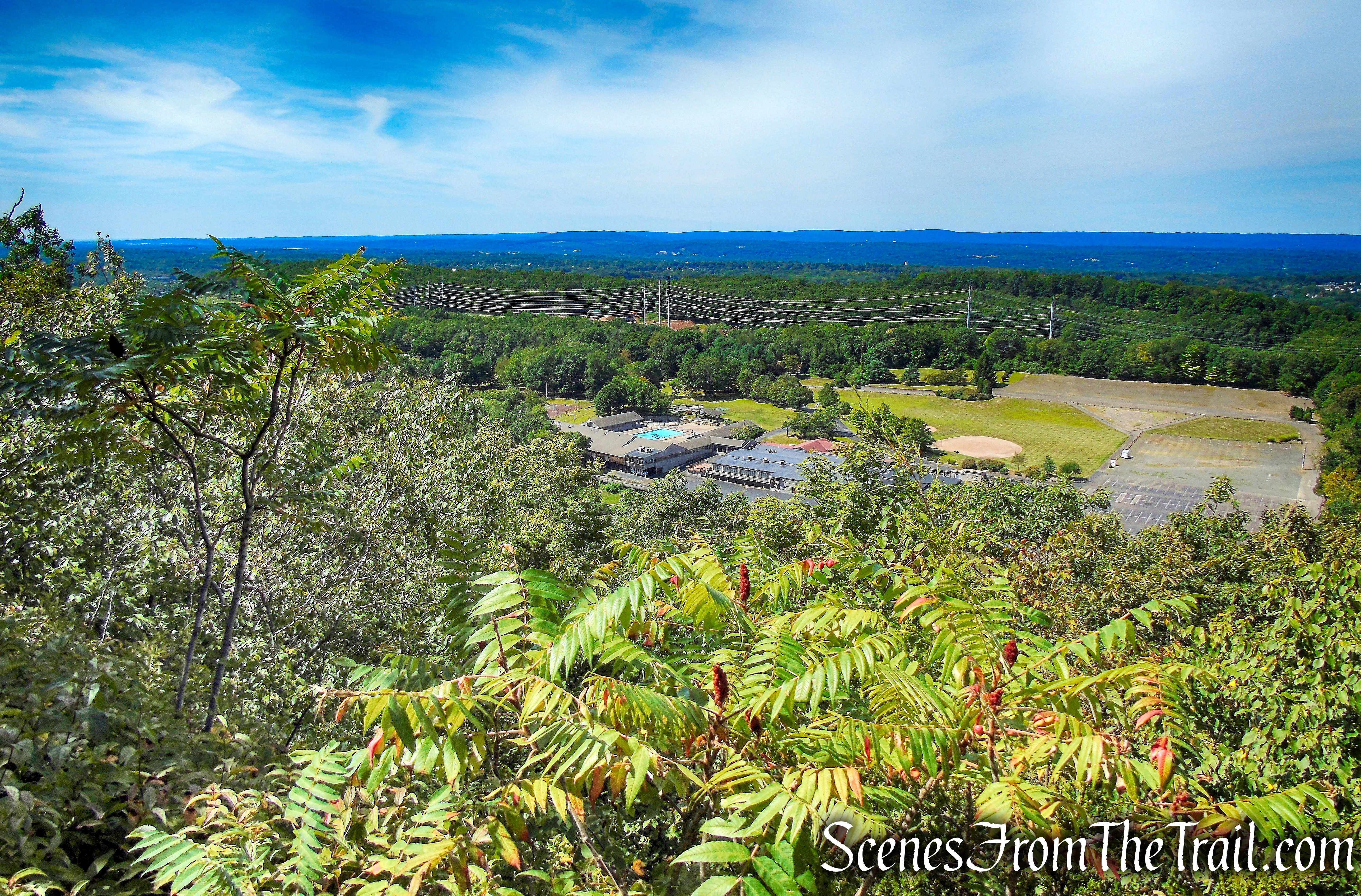
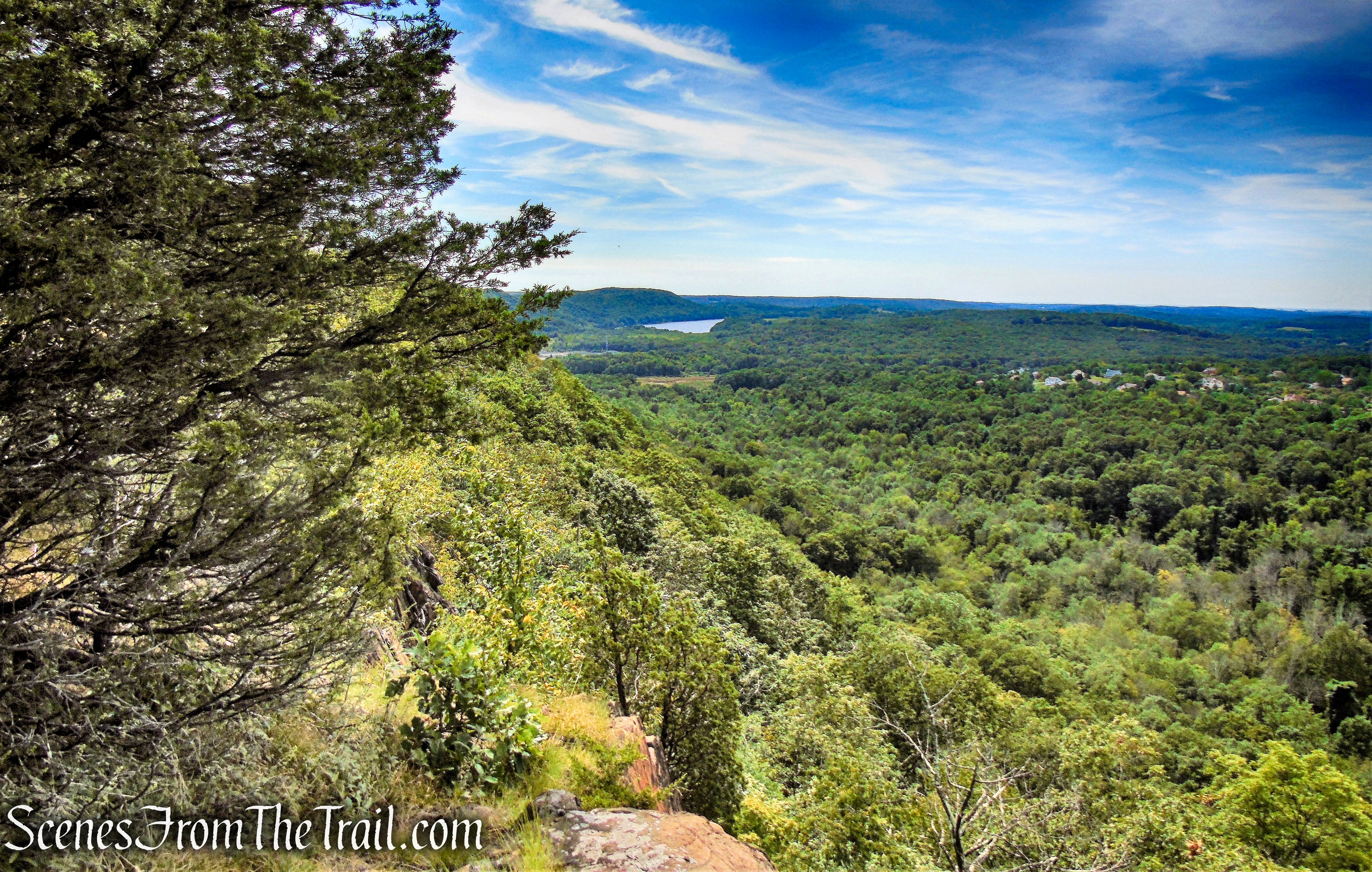
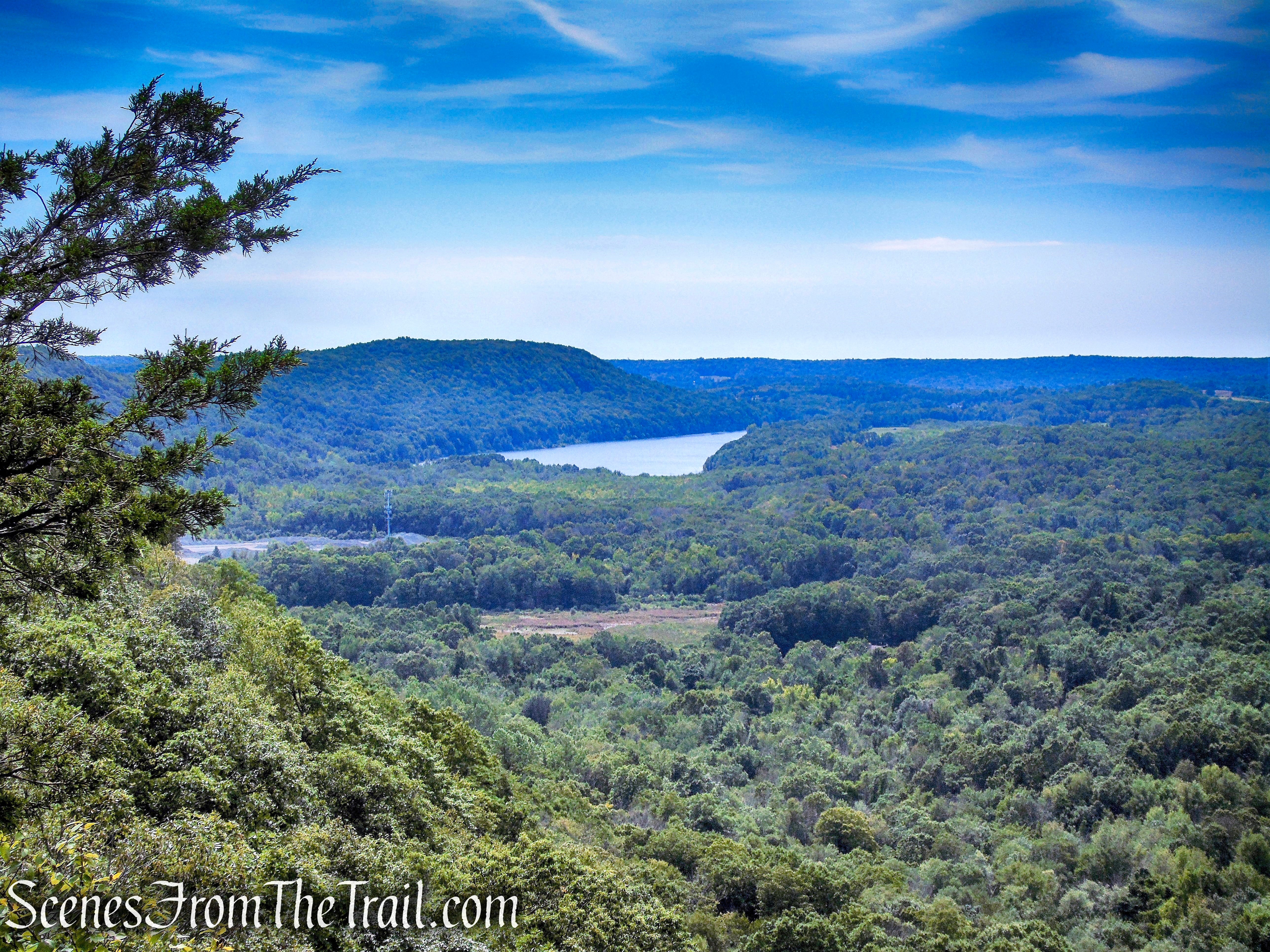
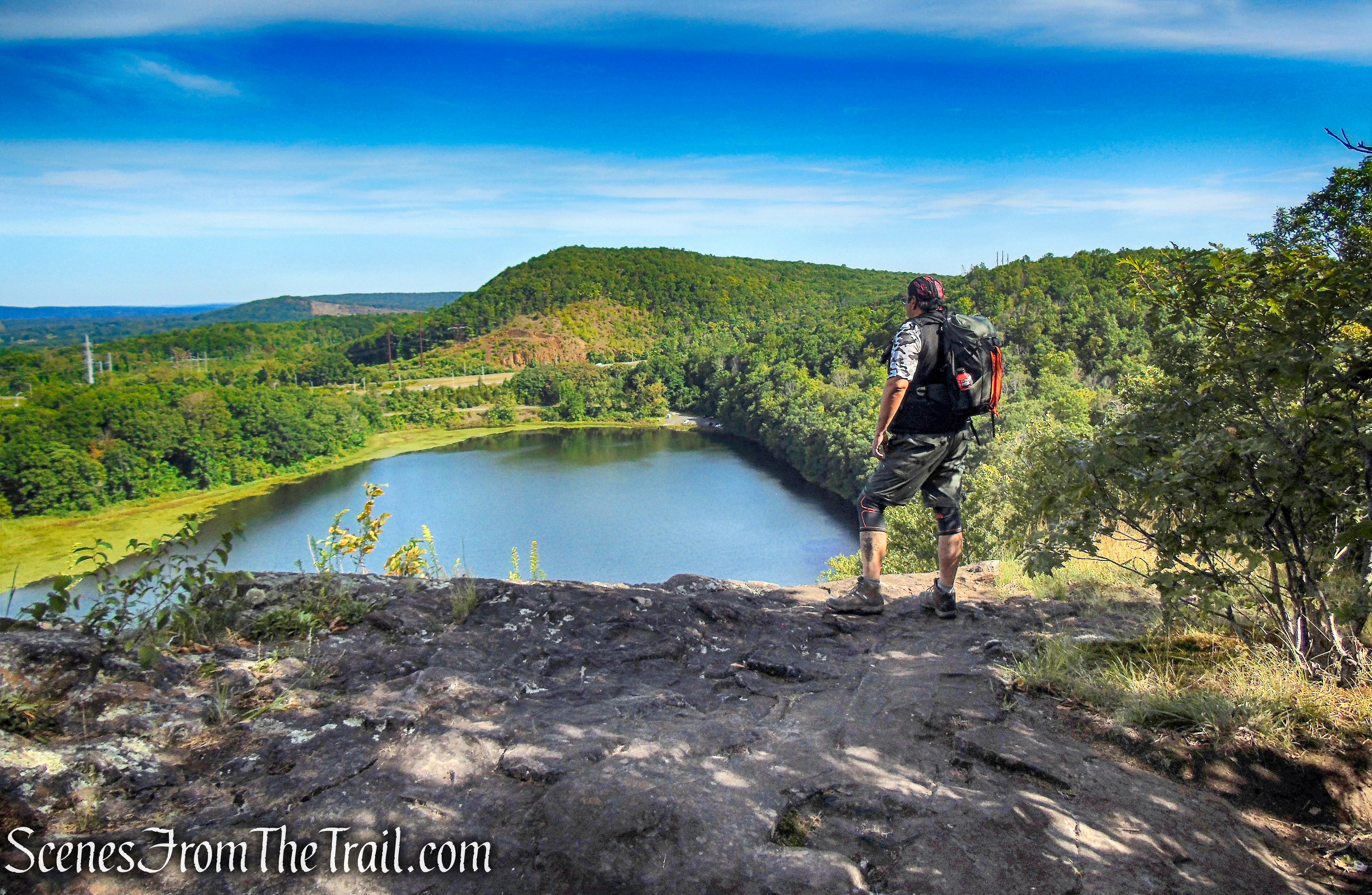
On this stretch of trail enjoy ridge-walking with beautiful views. The climbs are moderately difficult, but once the ridge is reached the walking is relatively easy. The cliffs are dangerous in wet conditions, be sure to watch your footing. Views stretch to Talcott Mountain and Meriden to the northwest and Long Island Sound to the south. Black Pond sits at the base of the cliffs. While hiking you will also pass under the chair lifts at the Powder Ridge Ski Area.
Please Note: Beseck Mountain offers spectacular views of Meriden, including The Hanging Hills, Lamentation Mountain, and Chauncey Peak. These trap rock ridges are extremely steep, and care should be taken.
Mattabesett Trail – Besek Mountain
The Hike:
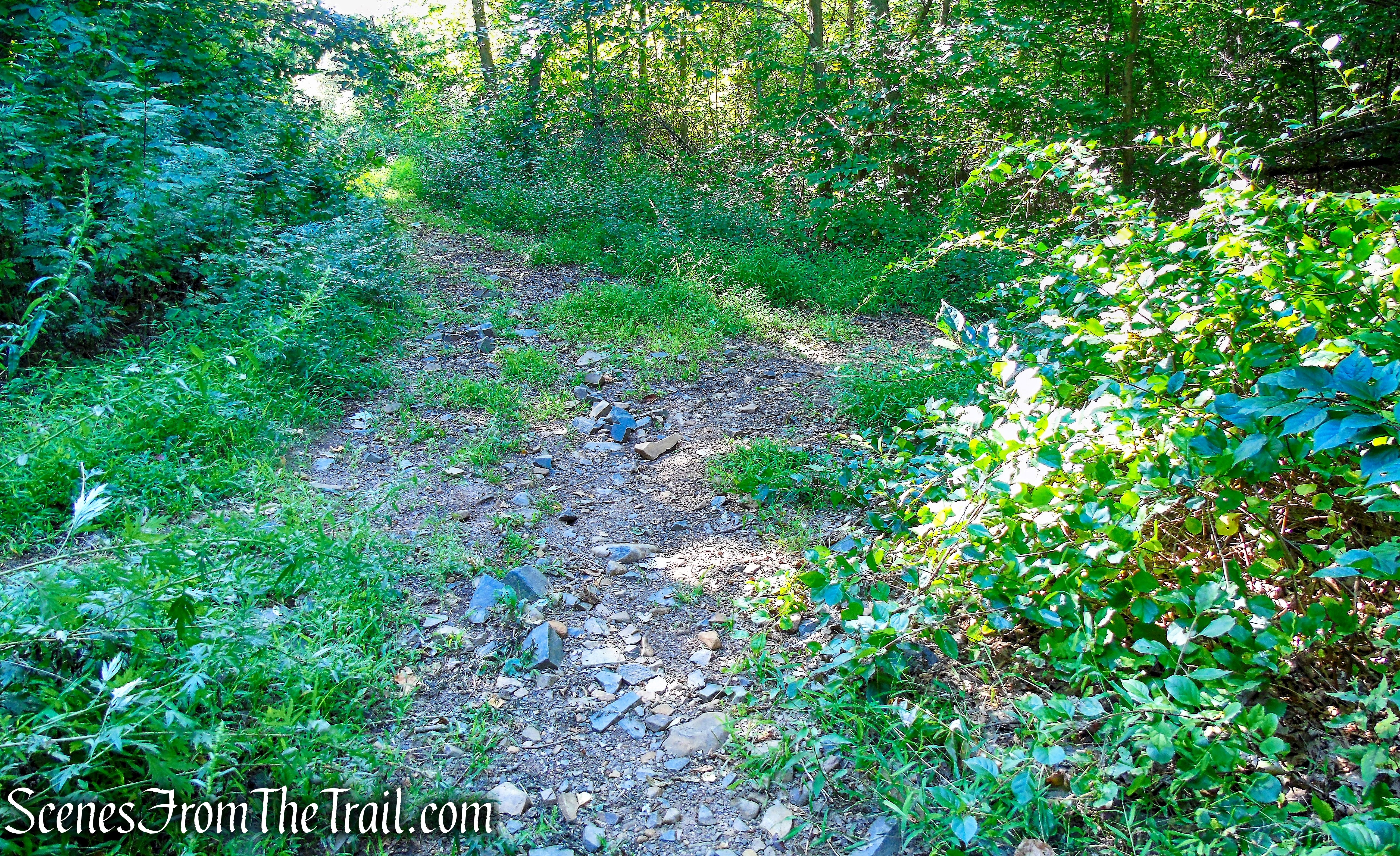
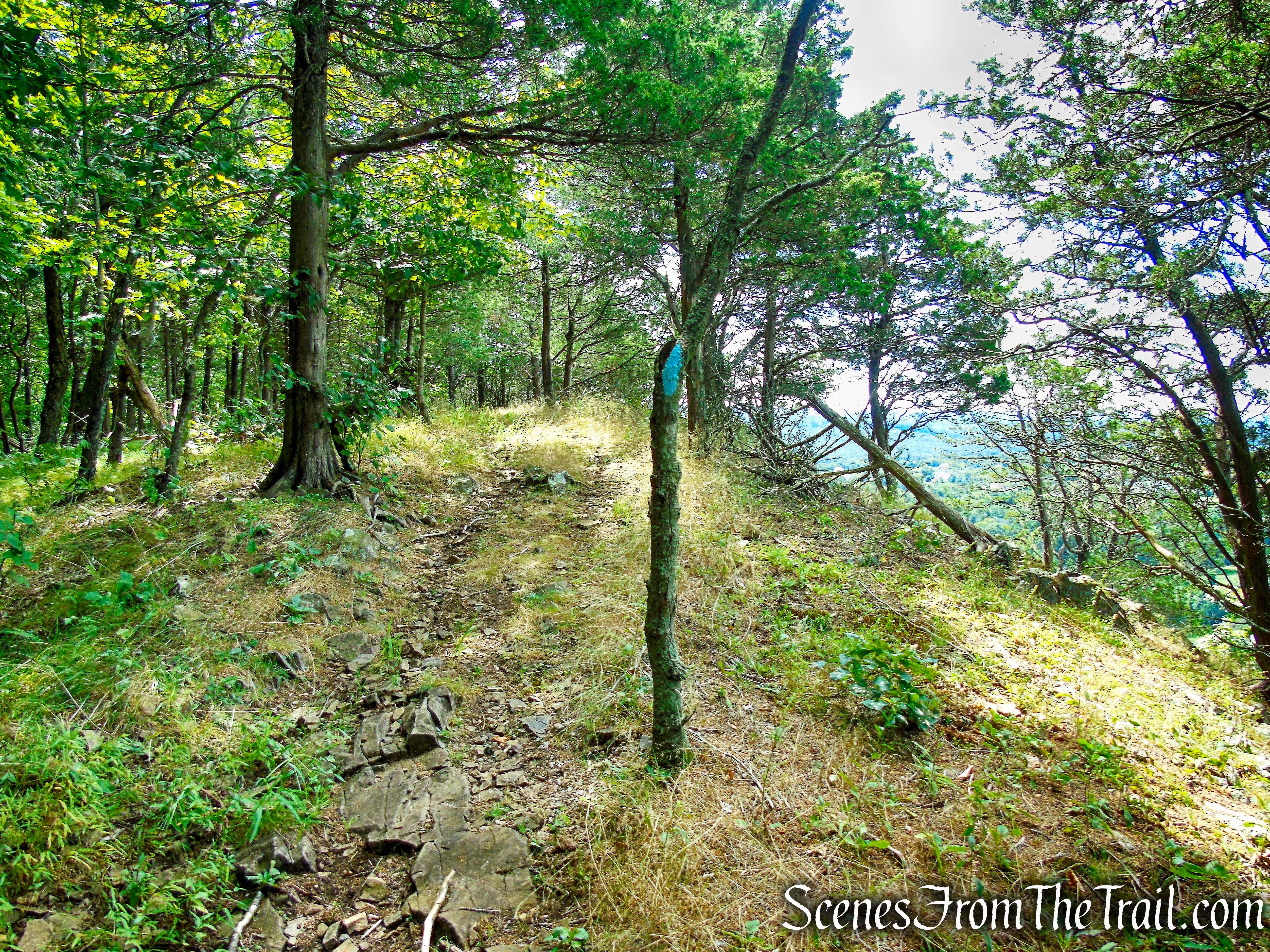
From the parking area of the Black Pond State Wildlife Area, head back towards the entrance road. In about 250 feet, turn sharp right and proceed uphill on a rocky woods road and around a metal gate. This unmarked road is shown on the trail map as the Black Pond Trail. The road heads southwest as it begins to ascend Besek Mountain, with Black Pond visible through the trees below on the right. In another 450 yards, the woods road comes to a four-way intersection with the blue-blazed Mattabesett Trail, which comes in from the left. Turn right and begin following the blue blazes as they lead uphill. You will be following the blue blazes for the remainder of the hike.
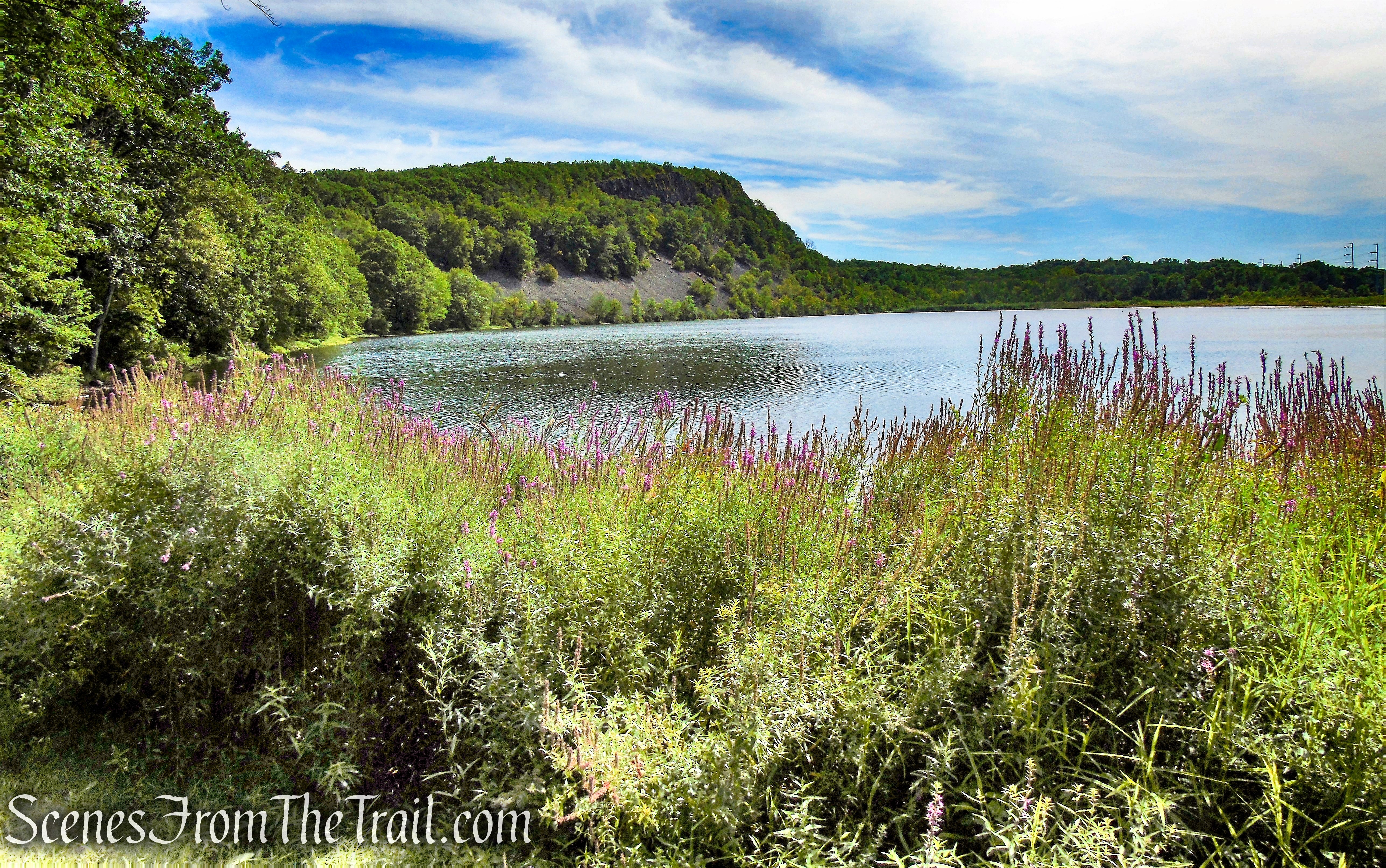
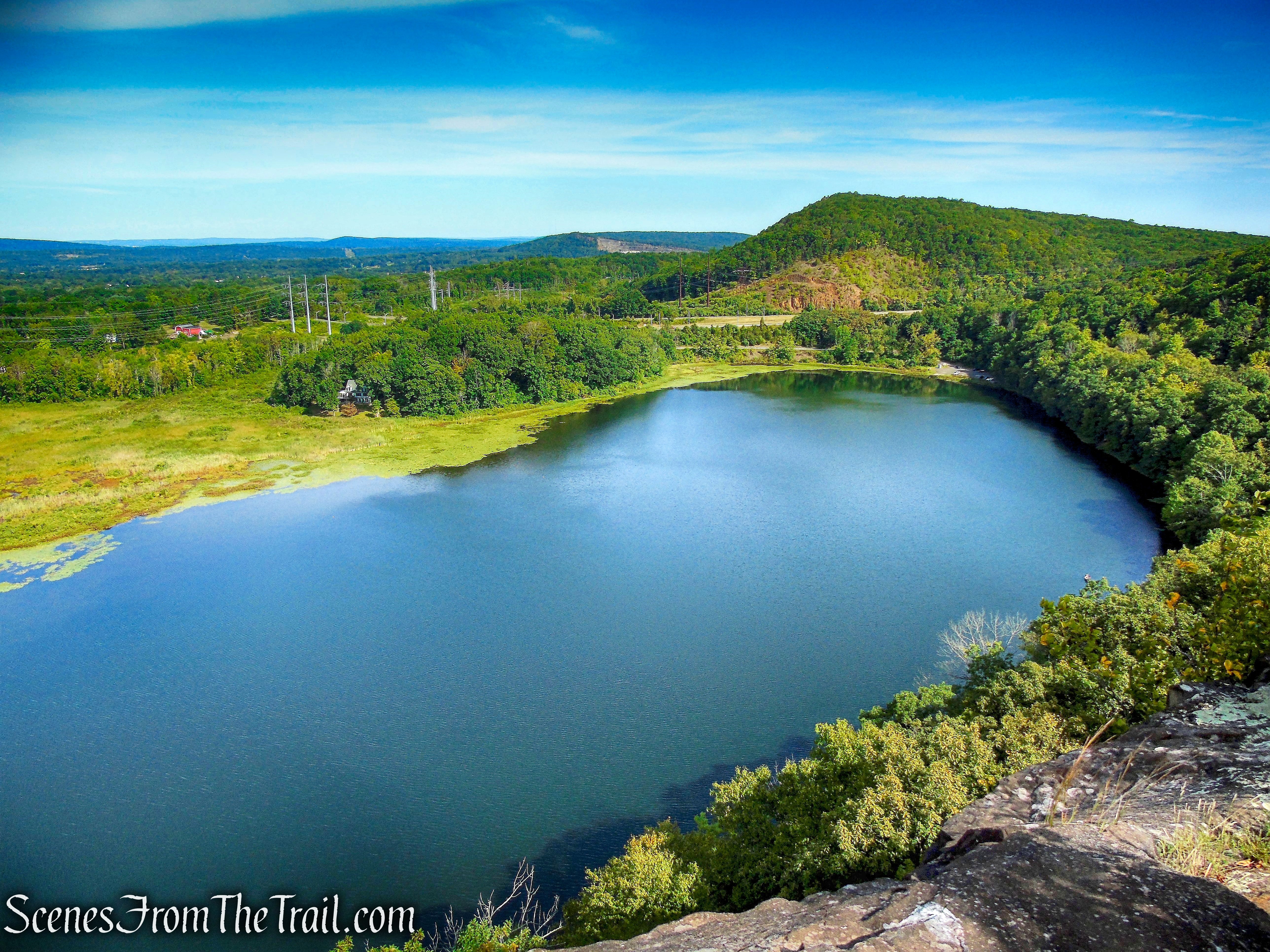
Black Pond looking towards Besek Mountain
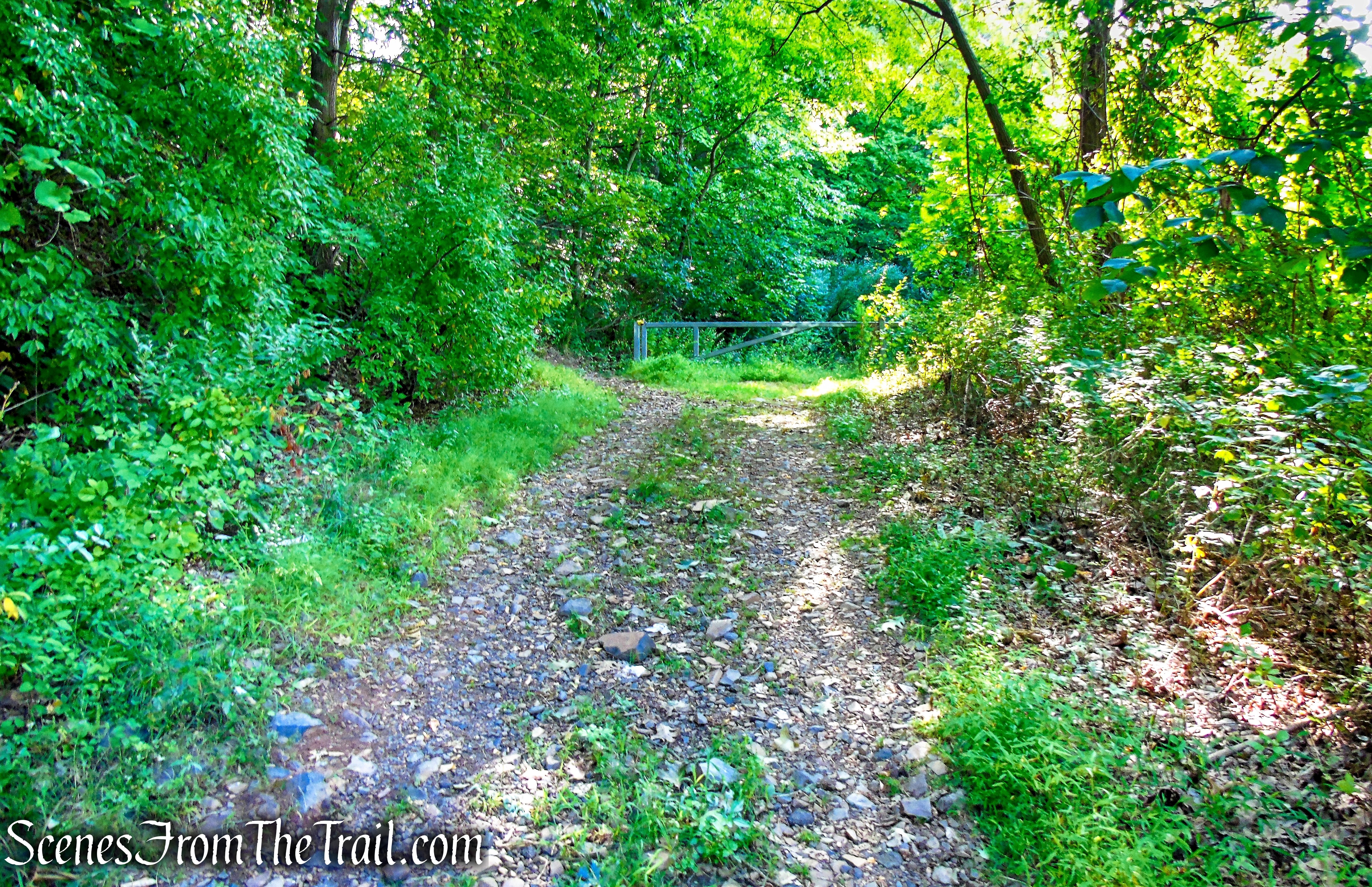
Black Pond Trail – Black Pond State Wildlife Area
turn right on Mattabesett Trail – Besek Mountain
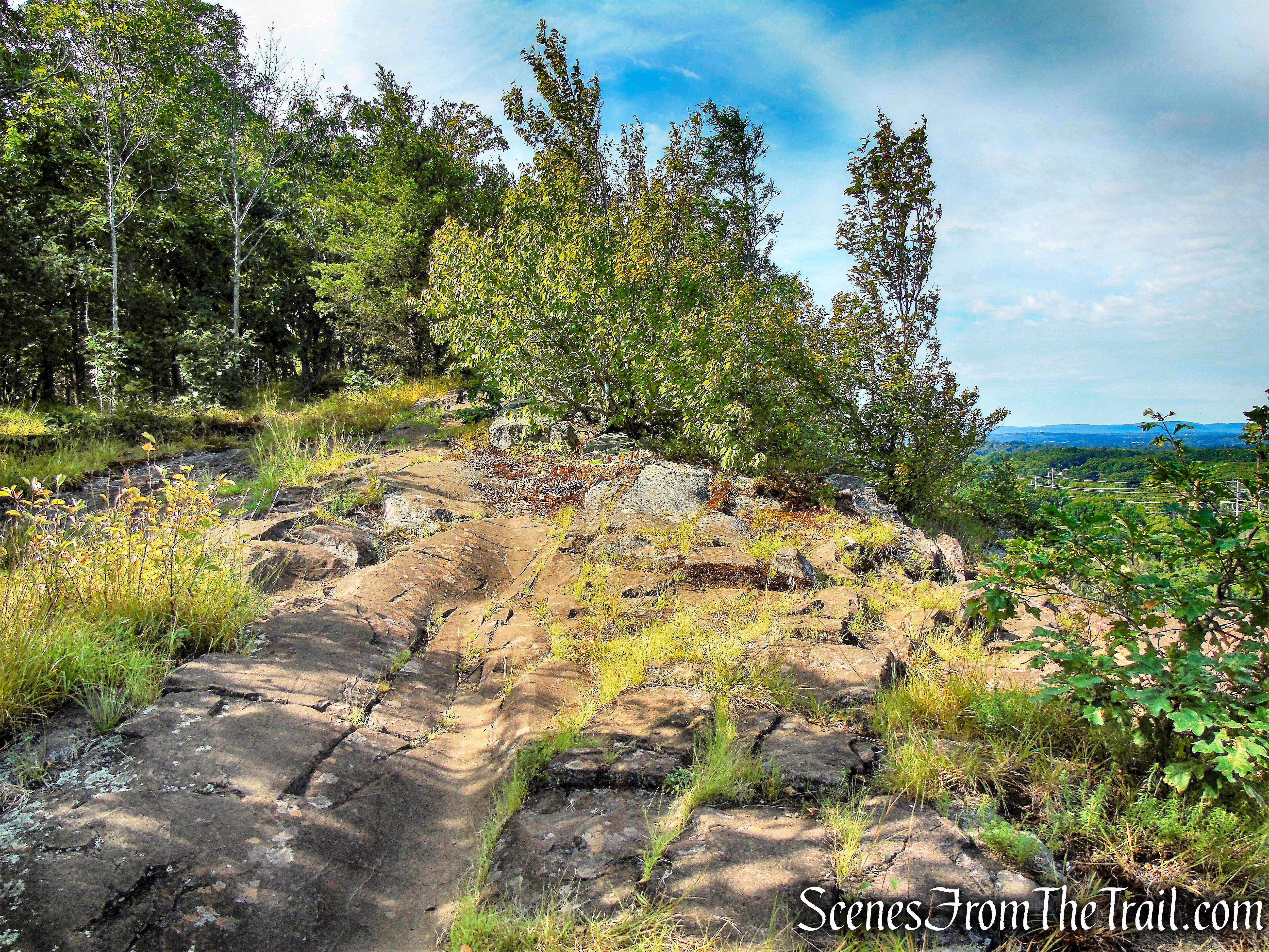
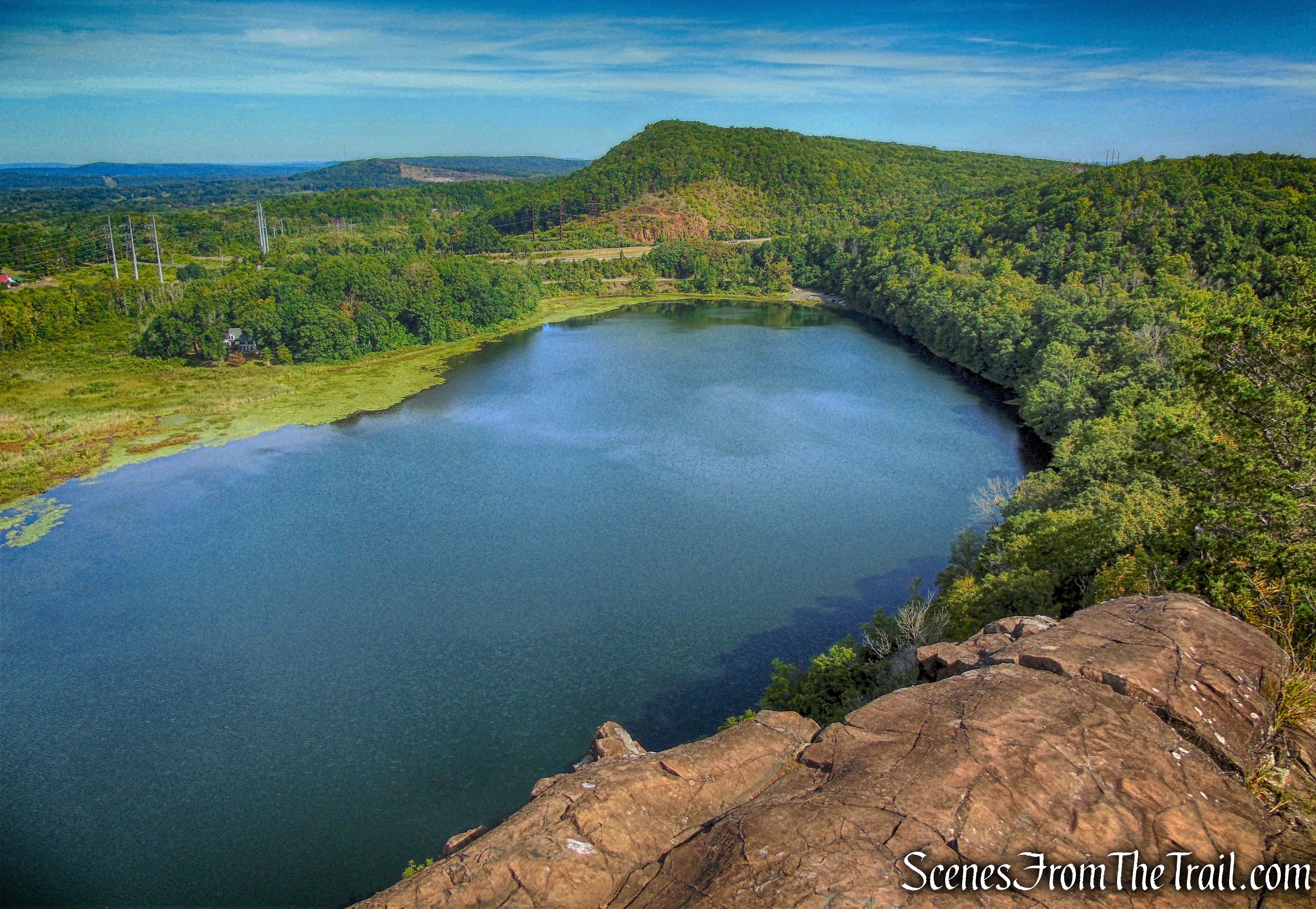
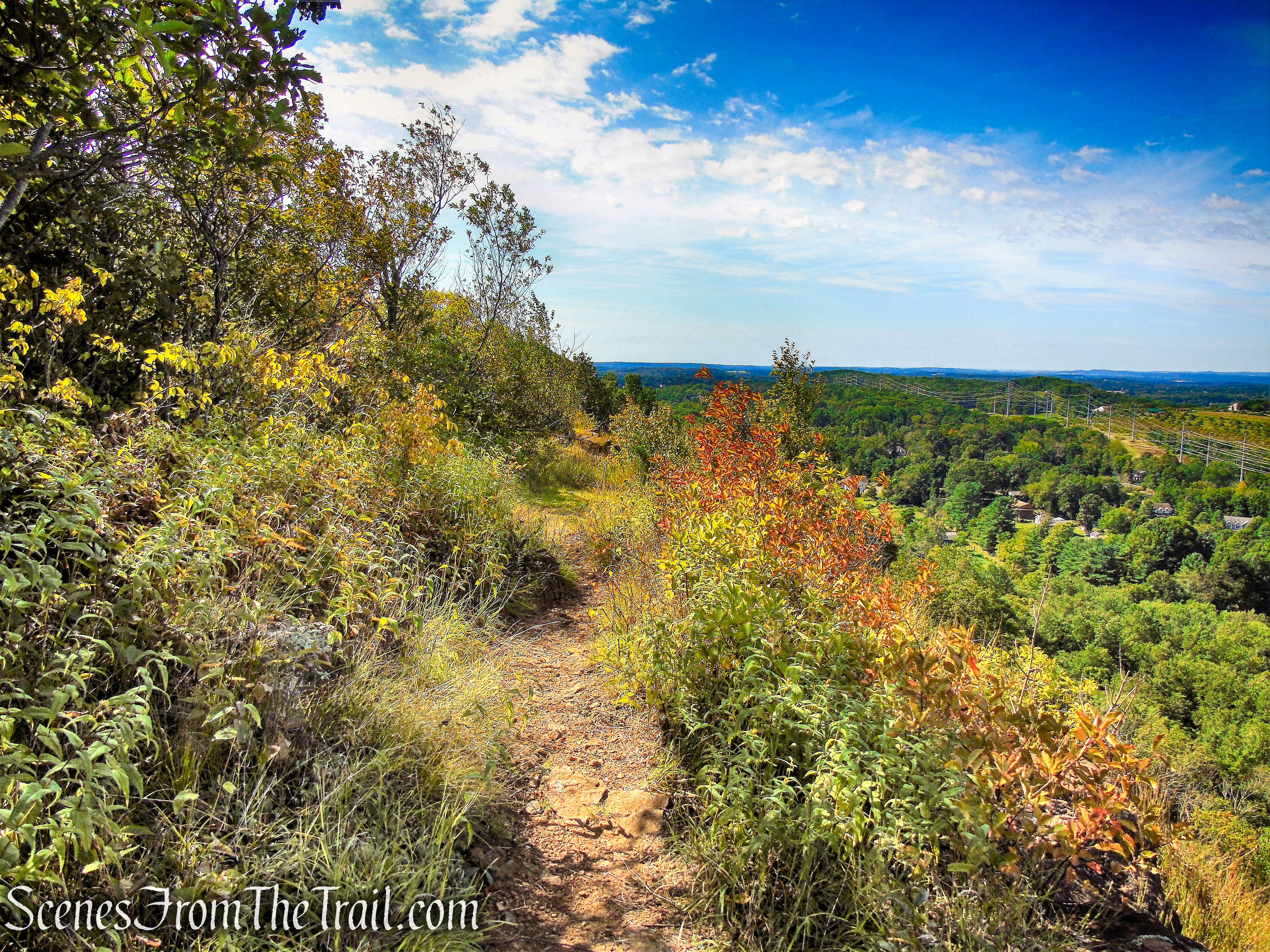
The Mattabesett Trail heads in a southerly direction as it climbs the ridge on a wide footpath. In another 400 yards, the trail comes to an open rock ledge with views north of Black Pond with Mount Higby just beyond. You have just traveled about 1/2 mile and gained about 230 feet in elevation. You may want to take a moment to enjoy the view.
Mattabesett Trail – Besek Mountain
Mattabesett Trail – Besek Mountain
Mattabesett Trail – Besek Mountain
Mattabesett Trail – Besek Mountain
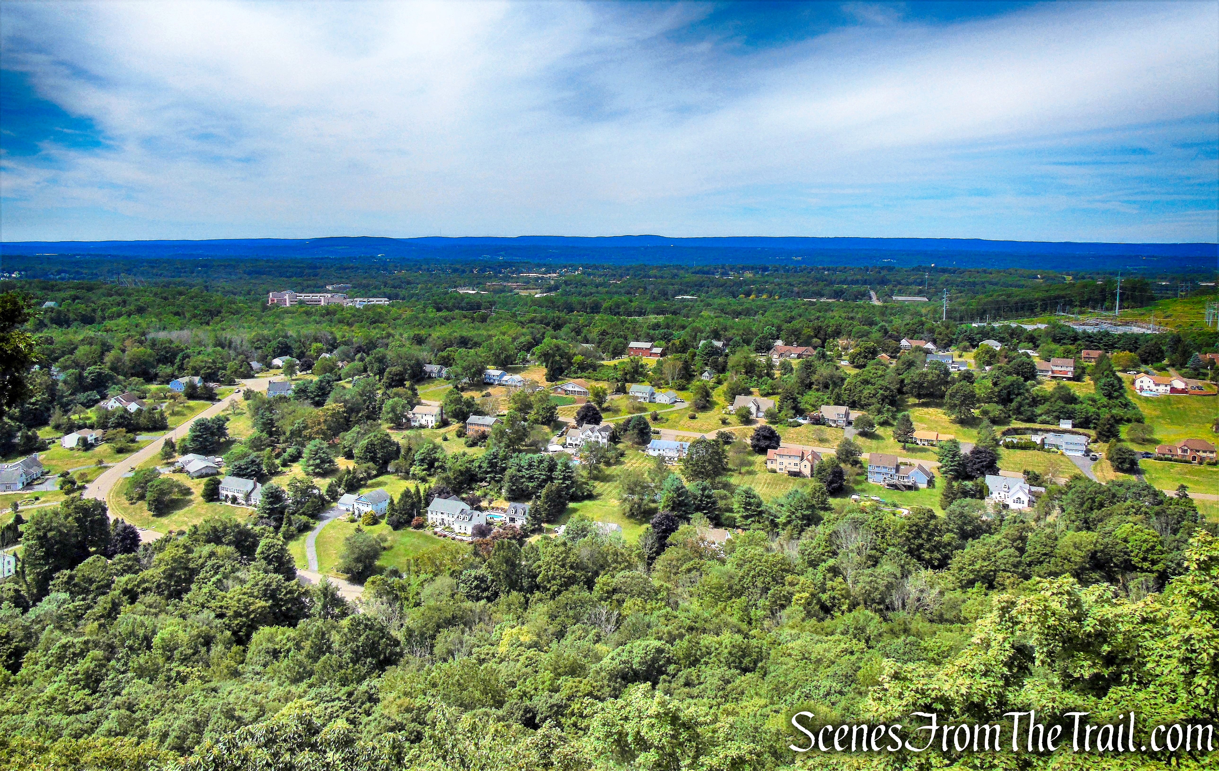
When you are ready to proceed, head south along the ridge, following the blue blazes. In a short distance, the trail climbs to a similar viewpoint from another rock ledge. As the Mattabesett Trail continues along the ridge, there are multiple viewpoints of Black Pond with Mount Higby just beyond, and views to the west, of the city of Meriden and the Hanging Hills.
Mattabesett Trail – Besek Mountain
Mattabesett Trail – Besek Mountain

Mattabesett Trail – Besek Mountain
Mattabesett Trail – Besek Mountain
Mattabesett Trail – Besek Mountain
Mattabesett Trail – Besek Mountain
Mattabesett Trail – Besek Mountain
Mattabesett Trail – Besek Mountain
Mattabesett Trail – Besek Mountain
The trail meanders along the ridge, at times in close proximity to the cliff’s edge. Along these sections that are extremely close to the edge, there is a path that parallels the main trail about 10 feet away. After reaching a highpoint, the trail leads away from the cliffs and ducks into the forest. It soon makes a sharp right turn and descends steeply. At the base of the descent there is a massive rock ledge to the left of the trail. The trail now levels off and soon approaches the edge of the cliffs.
Mattabesett Trail – Besek Mountain
Mattabesett Trail – Besek Mountain
Mattabesett Trail – Besek Mountain
Mattabesett Trail – Besek Mountain
Mattabesett Trail – Besek Mountain
Mattabesett Trail – Besek Mountain
Mattabesett Trail – Besek Mountain
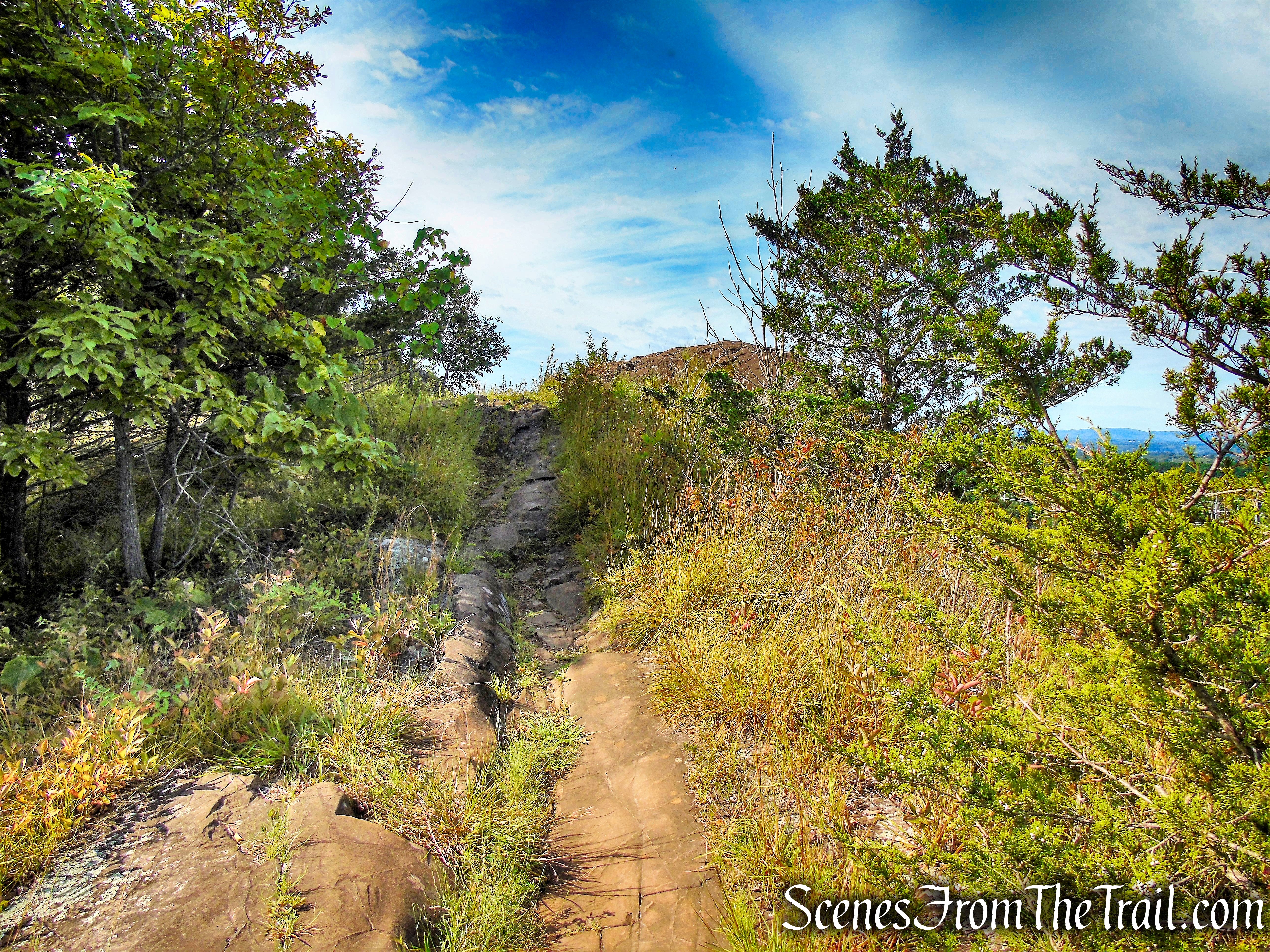
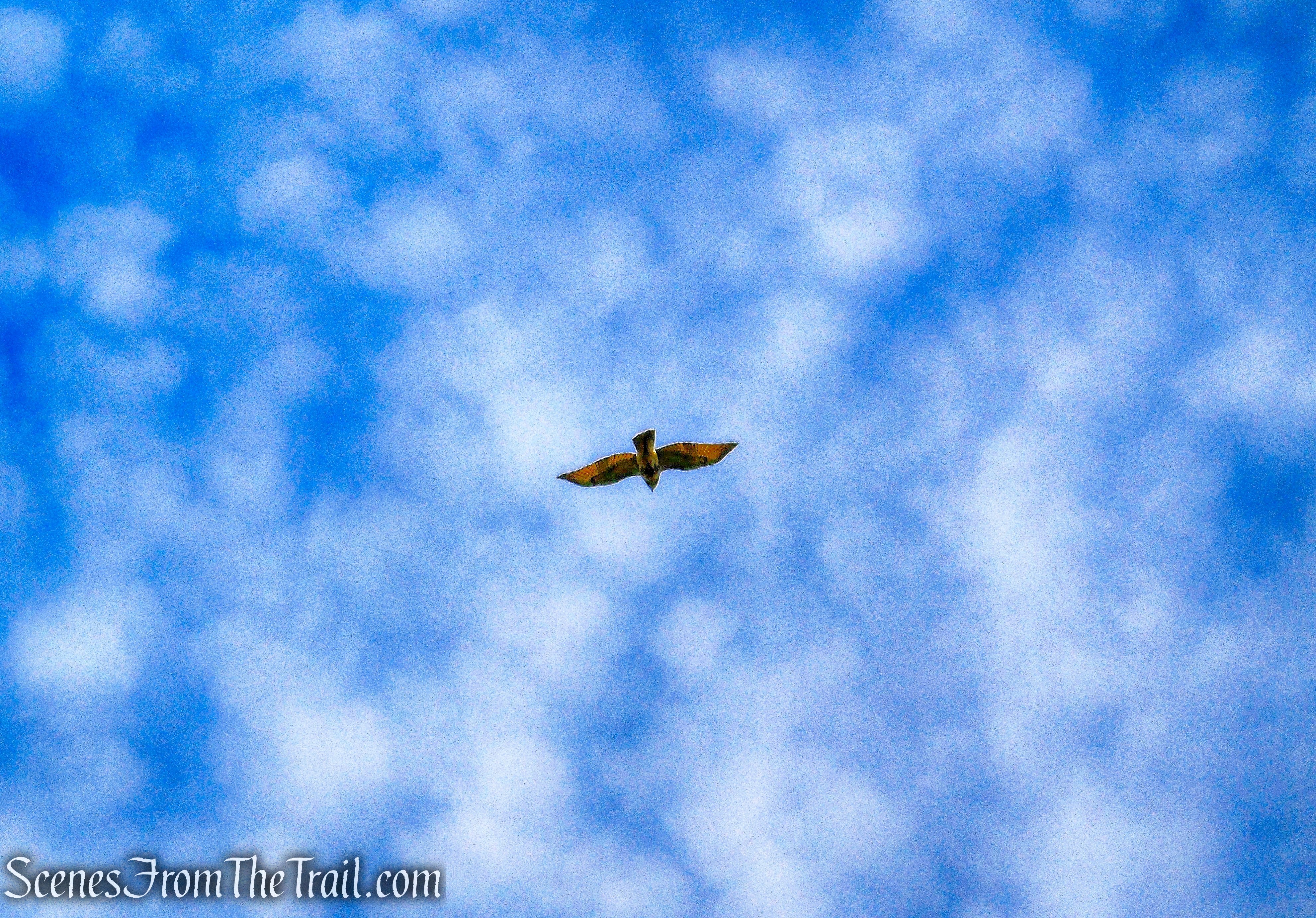
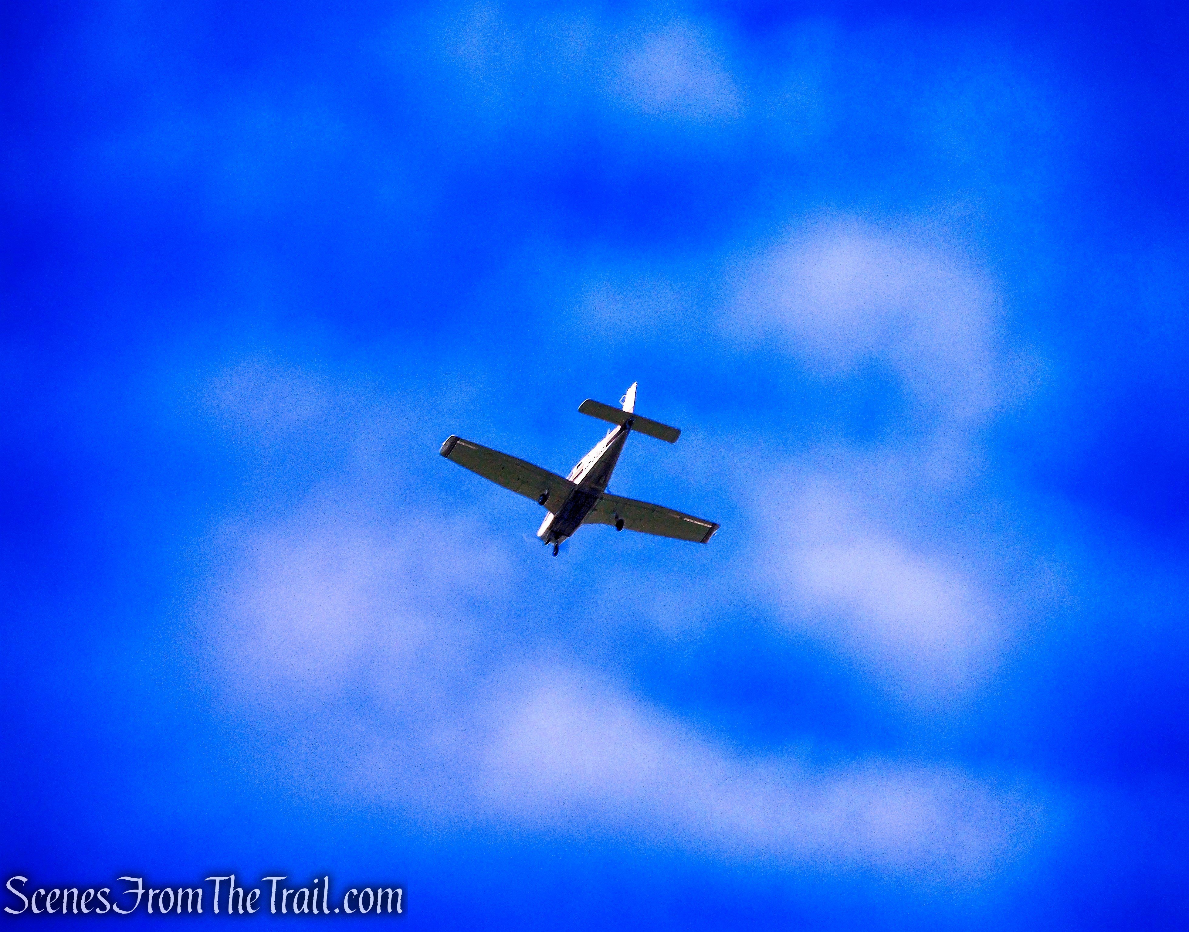
The trail travels over undulating terrain as it comes precariously close to the edge and there is a lot of loose rock and dirt in this area. Great care should be exercised along this section to avoid tripping or losing one’s footing. Soon the trail comes to an open area which makes for a good spot to take another break and perhaps spot some hawks or small planes flying overhead.
Mattabesett Trail – Besek Mountain
Mattabesett Trail – Besek Mountain
Mattabesett Trail – Besek Mountain
Mattabesett Trail – Besek Mountain
Mattabesett Trail – Besek Mountain
Mattabesett Trail – Besek Mountain
Mattabesett Trail – Besek Mountain
Mattabesett Trail – Besek Mountain
Mattabesett Trail – Besek Mountain
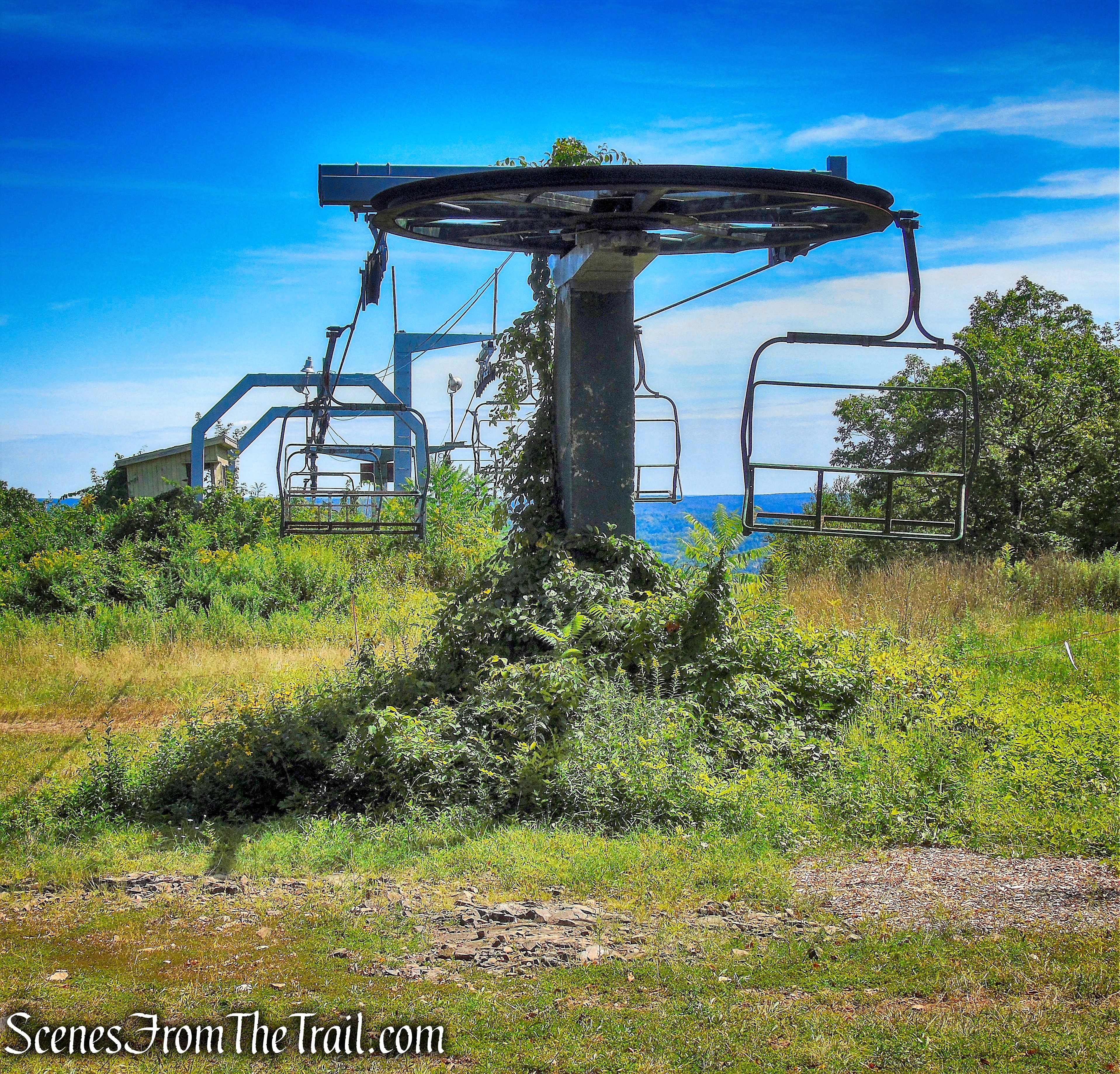
The Mattabesett Trail then veers away from the cliffs and soon joins a woods road. In another 0.5 mile, the trail reaches the Powder Ridge Ski Area. Powder Ridge was for many years one of the most popular ski areas south of Massachusetts. After a multi-year closure, Powder Ridge reopened in 2013 as the Powder Ridge Mountain Park & Resort.
Mattabesett Trail – Besek Mountain
Powder Ridge – Mattabesett Trail – Besek Mountain
Powder Ridge – Mattabesett Trail – Besek Mountain
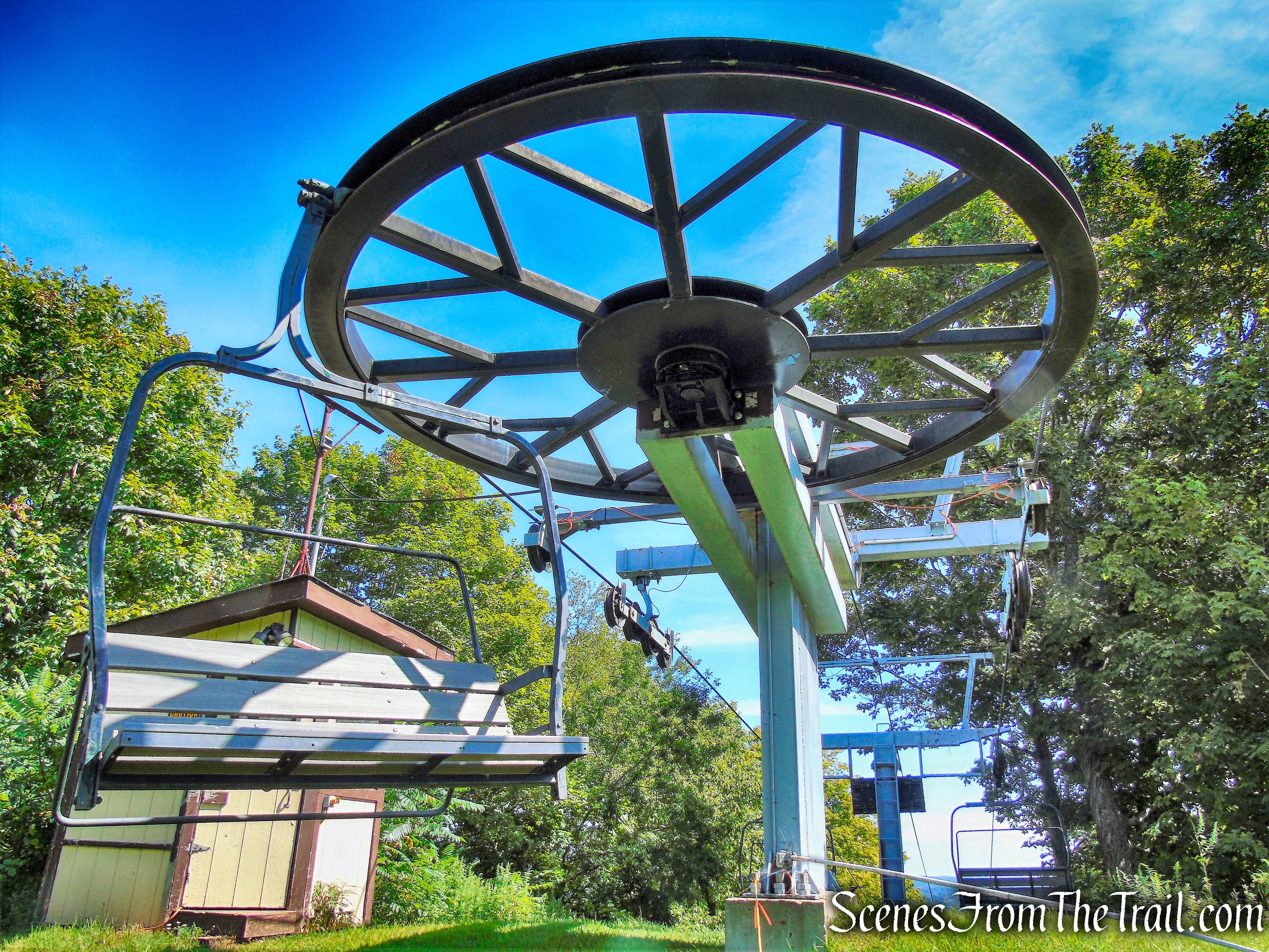
The trail continues under the chairlifts and passes by a gazebo that overlooks the ski slope. This is a good spot for lunch and also a good turnaround point if you are doing an out-and-back hike. You have now traveled approximately 2.5 miles from the start of the hike.
Powder Ridge – Mattabesett Trail – Besek Mountain
In 1970, the ski area made headlines as the venue for the Powder Ridge Rock Festival. A three day event one year after Woodstock, many popular artists of the era, including Fleetwood Mac, James Taylor, Joe Cocker, Van Morrison, Jethro Tull, Janis Joplin, John Sebastian, Chuck Berry, and possibly Led Zeppelin were expected to play. Connecticut newspapers projected crowds of up to 50,000 to attend the July 31-August 2, 1970 festival. After local opposition, the event was halted on July 27, 1970, just days before the projected start. Due to the short notice, up to 30,000 concert-goers showed up and proceeded to trash the area and cause drug-related legal issues that would plague the courts for months to come.
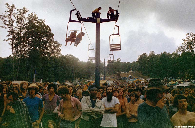
The cancelled Powder Ridge Rock Festival – image courtesy of New England History
Powder Ridge – Mattabesett Trail – Besek Mountain
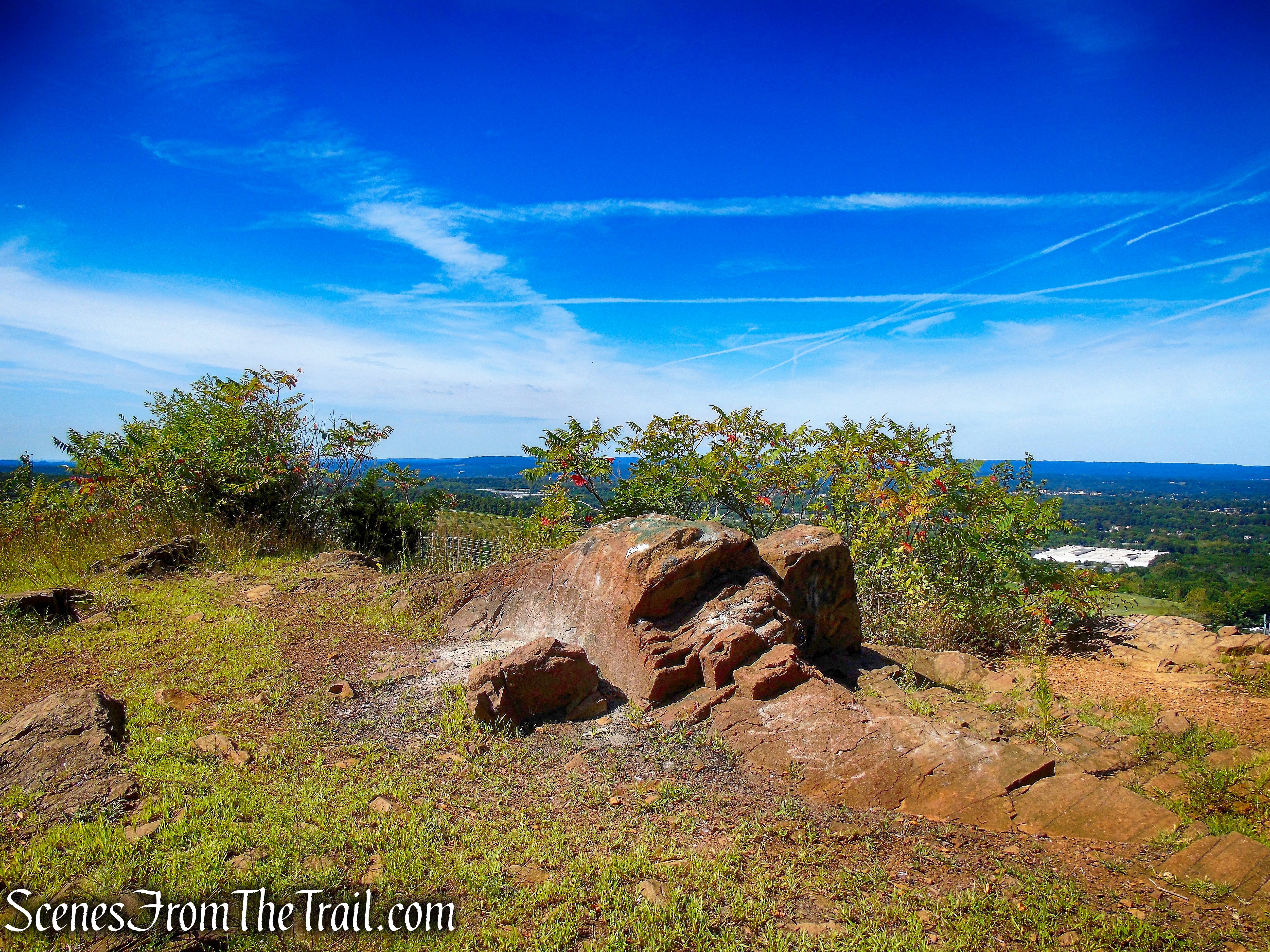
The Mattabesett Trail continues south past the ski area with a west-facing viewpoint, just to the right of the trail. The trail then enters the woods and travels on a gravel road. A short distance later, the trail passes over the true summit of Besek Mountain. The trail soon leaves the road and travels on a footpath with many ups and downs, passing a campsite, then climbs to pass underneath some powerlines.
Powder Ridge – Mattabesett Trail – Besek Mountain
Powder Ridge – Mattabesett Trail – Besek Mountain
Mattabesett Trail – Besek Mountain
Mattabesett Trail – Besek Mountain
Mattabesett Trail – Besek Mountain
Mattabesett Trail – Besek Mountain
There are views through the trees of the town of Wallingford. There are also several spots where Pistapaug Pond in Wallingford can be seen off in the distance. Compared to the views earlier in the hike, these are somewhat of a letdown.
Mattabesett Trail – Besek Mountain
Mattabesett Trail – Besek Mountain
Mattabesett Trail – Besek Mountain
Mattabesett Trail – Besek Mountain
Mattabesett Trail – Besek Mountain
Mattabesett Trail – Besek Mountain
The trail leaves the ridgeline as it continues to weave through the woods with numerous ups and downs. After several miles of ridge walking, the trail turns east and heads down to Reed’s Gap and Route 68. The Mattabesett Trail then joins a woods road as it descends gradually. The trail then crosses train tracks as it nears the trailhead on Connecticut Route 68.
Mattabesett Trail – Besek Mountain
Mattabesett Trail – Besek Mountain
Mattabesett Trail – Besek Mountain
Mattabesett Trail – Besek Mountain
This is an active rail line and care should be taken when crossing.
Mattabesett Trail – Besek Mountain
As the Mattabesett Trail reaches the road, you have now traveled about 5 miles. The blue blazes turn left and continue along the road before crossing Route 68 and ascending Tri-Mountain.
Mattabesett Trail – Connecticut Route 68
Back at Black Pond to retrieve the vehicle, we spotted a Great Blue Heron relaxing in the pond.
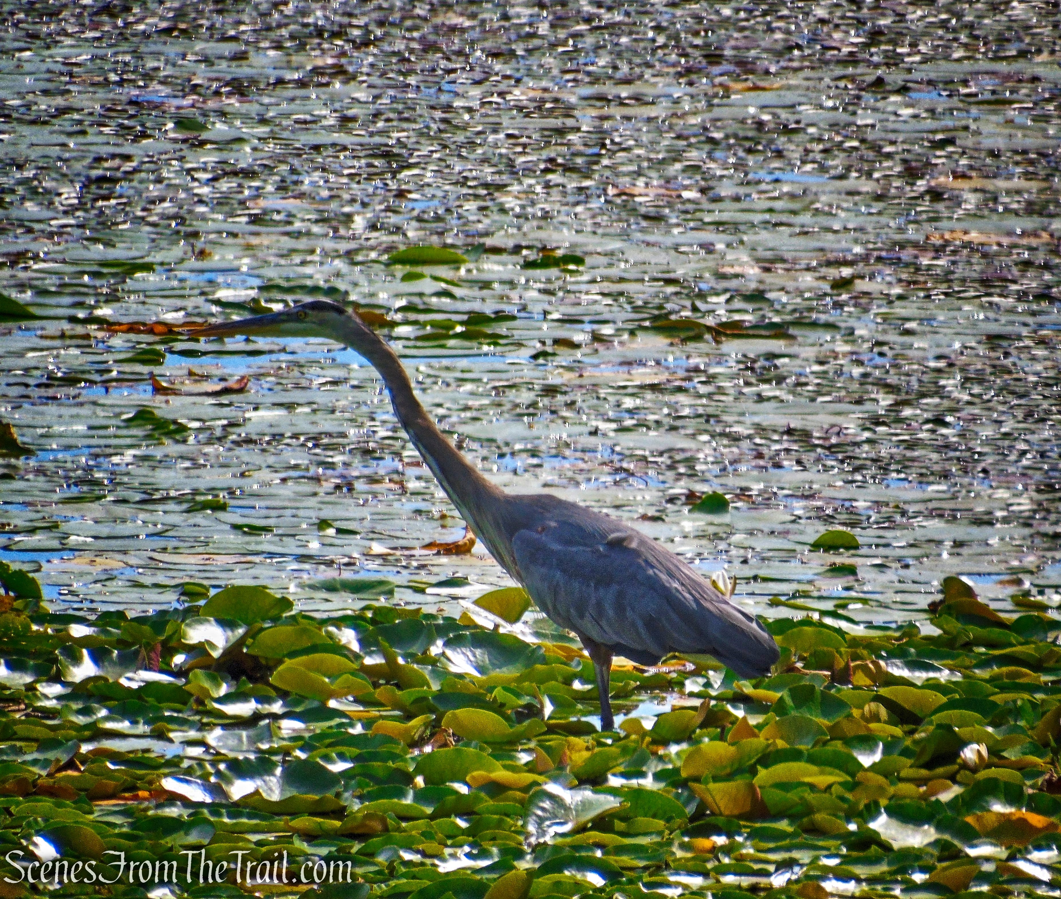
Great Blue Heron – Black Pond State Wildlife Area
Review:
This was a great hike with outstanding views and not many people on the trail. The ridge walk is the highlight of the hike. The best views are before the Powder Ridge Ski Area and if doing an out and back, a good place to turn around. From that point on, going south, the views don’t compare with those of the northern section. In retrospect, I would have turned around at the ski area, but I wanted to reach the true summit and was hoping for more southern views. In my opinion, from Powder Ridge to Route 68, felt redundant and drawn-out.
Pros: Outstanding views, Mattabesett Trail is well blazed and maintained, lesser traveled area.
Cons: Point-to-point hike means two vehicles or a cab ride back to the start.
Take a hike!
Mattabesett Trail – Besek Mountain
Sources:

I did this south to north, and agree with most of what you wrote. I found there was audible traffic from I-91 at times, which detracted Forman otherwise wonderful hike.
LikeLiked by 1 person
Great hike!
LikeLike