April 27, 2019 – Meriden, Connecticut
Difficulty: Easy – Moderate
Length: Approximately 3 miles
Max elevation: 688 ft.– total elevation gain approximately 410 ft.
Route type: Circuit
Maps: Neither map is up to date – Giuffrida Park – Giuffrida Park & Suggested Hikes
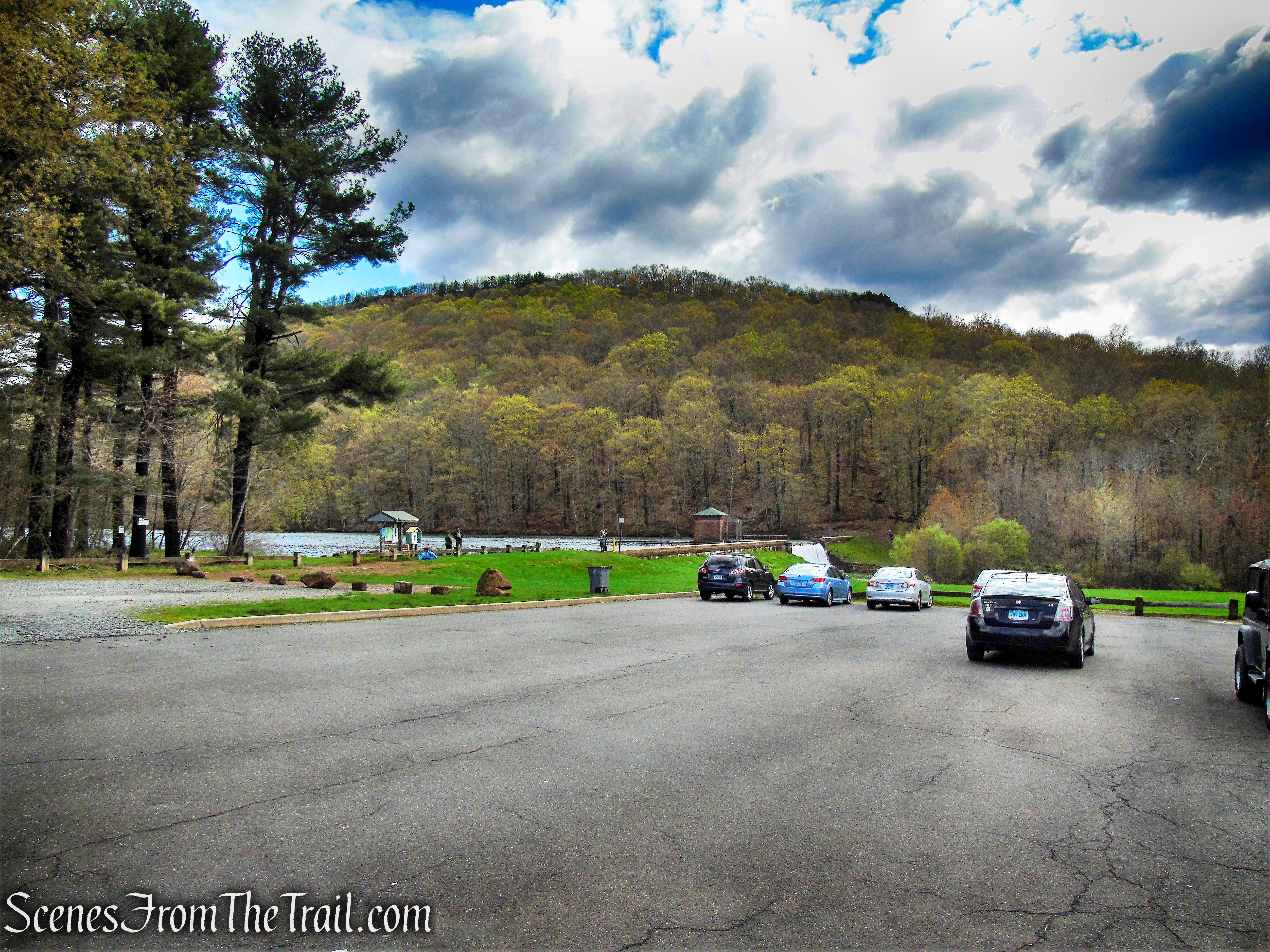
Trailhead parking: Doctor Francis Giuffrida Park – 800 Westfield Rd, Meriden, CT 06450
Park Overview:
Giuffrida Park is located in Meriden’s northeast corner. It consists of the former Bradley-Hubbard Reservoir, now known as Crescent Lake and the nearly 600-acres surrounding it. It was acquired by the city in 1965 and subsequently named for Dr. Francis Giuffrida, a beloved city surgeon who died in 1966 at the age of 56. Dr. Giuffrida was on active duty with the U.S. Navy and Marine Corps from 1941 to 1946, serving in both the Atlantic and Pacific theaters of war. He was awarded the bronze star and held the rank of Captain.
Chauncey Peak rises to an elevation of 688 feet and is a traprock mountain that is part of the narrow, linear Metacomet Ridge that extends from Long Island Sound near New Haven, Connecticut, north through the Connecticut River Valley of Massachusetts to the Vermont border. Chauncey Peak is known for its scenic vistas, vertical cliff faces overlooking Crescent Lake, unique microclimate ecosystems, and rare plant communities. It rises steeply 400 feet above the city of Meriden to the south with west-facing cliffs that plunge into Crescent Lake 300 feet below. The mountain is traversed by the 50-mile blue-blazed Mattabesett Trail, a New England National Scenic Trail.
Giuffrida Park offers everything from a peaceful reservoir to a beautiful wetland meadow to stunning views from Lamentation Mountain and Chauncey Peak. These trap rock ridges are extremely steep, and care should be taken. In addition to trails that climb to ridgelines, there are other trails that follow relatively level terrain.
Total trails distance is approx. 24.8 miles
Doctor Francis Giuffrida Park
Hike Overview:
The Meriden Land Trust provides a guide with a map and description of this hike (their hike description has not been updated since the trail reroute) and others. This hike, which is 3 miles with an elevation gain of approximately 410 feet, they have classified in their brochure as “moderate.” This trail was recently (in 2017) rerouted to make the initial ascent more gradual. The first 0.2-mile stretch used to be quite steep and required a little scrambling. Other than the initial climb and the descent at the north end of the mountain, which requires some care, the rest of the hike is relatively easy.
Please note: Some sections of the trail along the ridge come close to the edge of the cliffs and caution should be exercised along this area as there is loose rock and gravel, causing unstable footing. During wet periods, the rocks may be slick and care should be taken as well.
This hike was done counter clockwise, starting from the parking area.
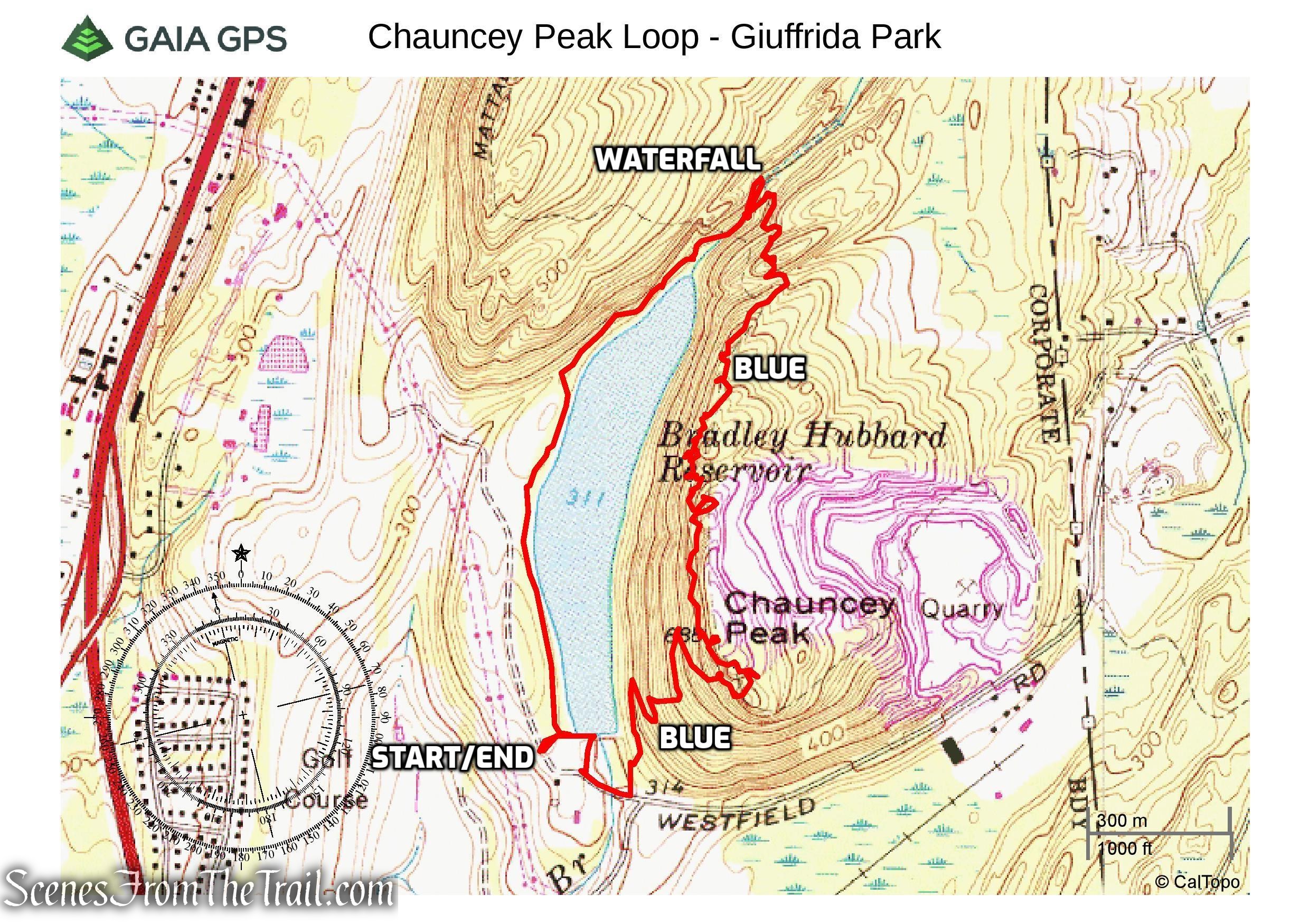
Chauncey Peak Loop – Giuffrida Park
The Hike:
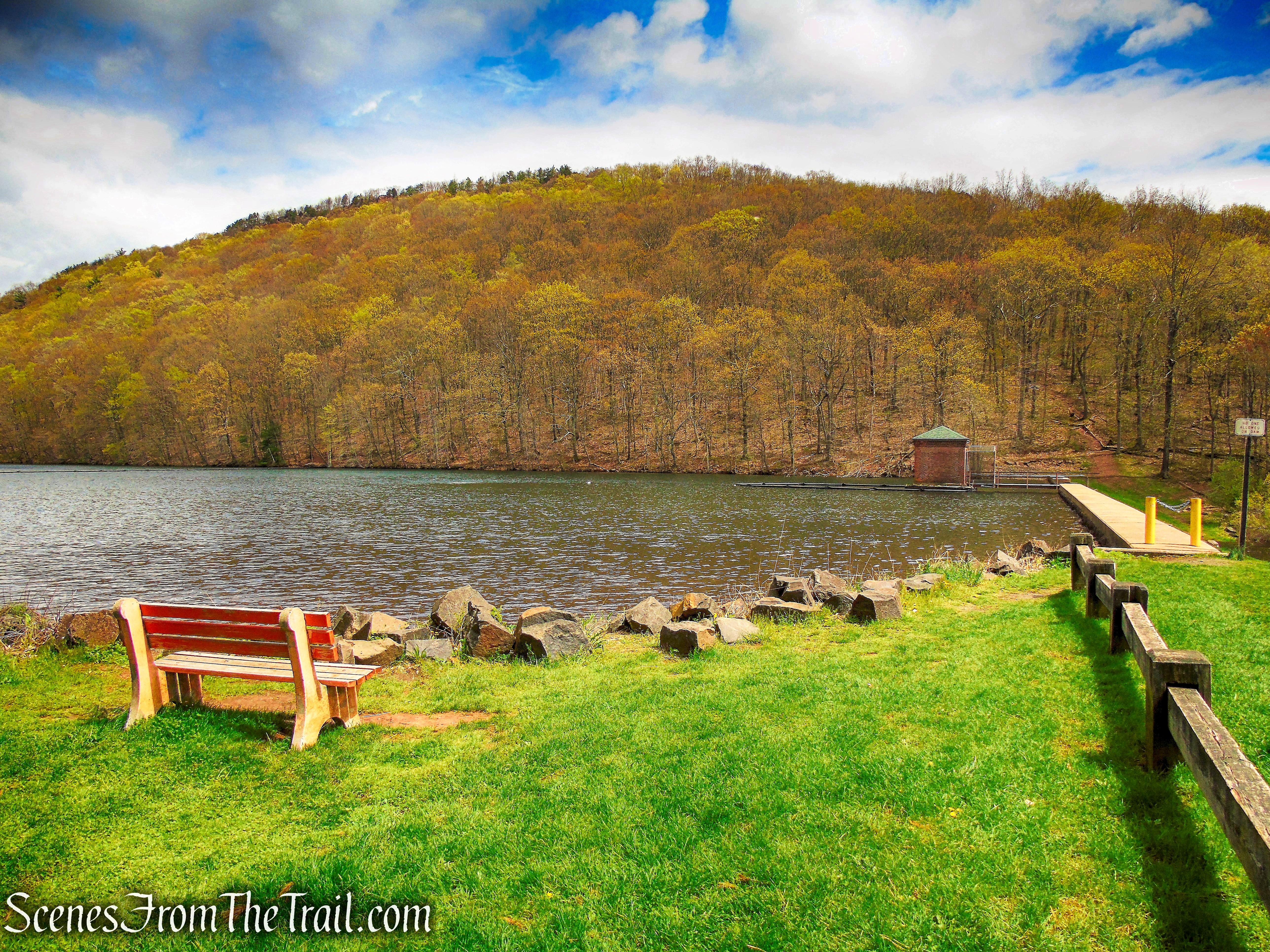
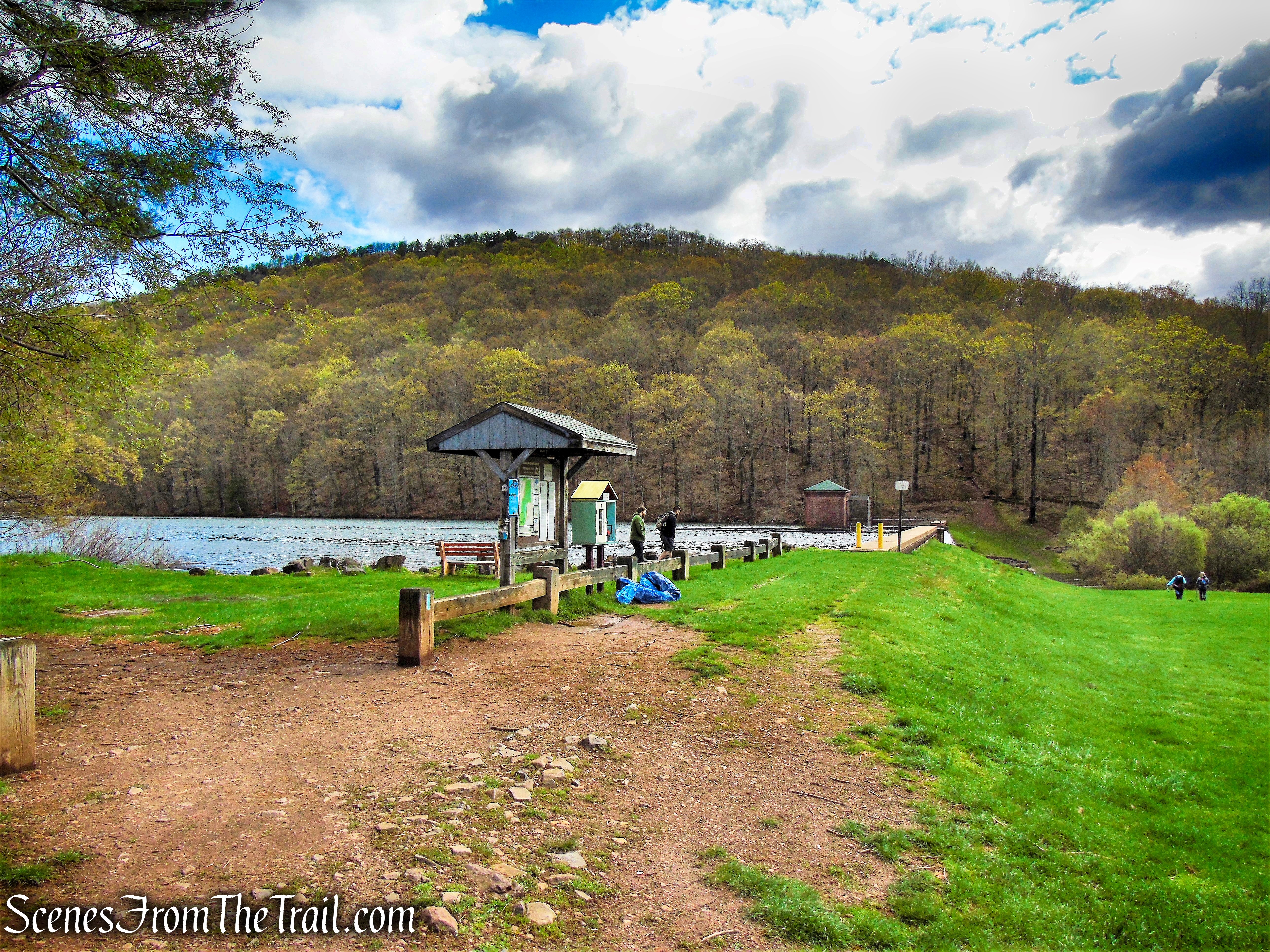
From the parking area, head towards the kiosk near the edge of the lake, with Chauncey Peak visible just across the lake.
Giuffrida Park
The blue blazed Mattabesett Trail comes in from the left and heads east along the base of the dam. To the left is your return route, for now continue towards Chauncey Peak through the grass field that descends slightly. You will be following the blue blazes for the first 1.7 miles of the hike, not including the short side trails that lead to several viewpoints.
Giuffrida Park
Crescent Lake – Giuffrida Park
The trail crosses North Branch Harbor Brook at the base of the spillway. There are rocks to hop across, but in times of high water or if you don’t want to risk getting wet, this section can be bypassed. You can walk out onto the park entrance road and once the road crosses over the brook, there is a trail to the left that will lead you in the same direction.
Mattabesett Trail – Giuffrida Park
This is the bypass trail, if this is the chosen route, look for a right turn with blue blazes that lead uphill. If you continue straight, you will end up at the brook crossing that you avoided.
Mattabesett Trail – Giuffrida Park
The Mattabesett Trail climbs steeply on switchbacks, with several shortcut trails, marked with blue blazes (probably the old route) that take a more direct and steeper route up Chauncey Peak.
Mattabesett Trail – Chauncey Peak
As the Mattabesett Trail ascends the mountain the path becomes more rocky.
Mattabesett Trail – Chauncey Peak
Mattabesett Trail – Chauncey Peak
Mattabesett Trail – Chauncey Peak
Mattabesett Trail – Chauncey Peak
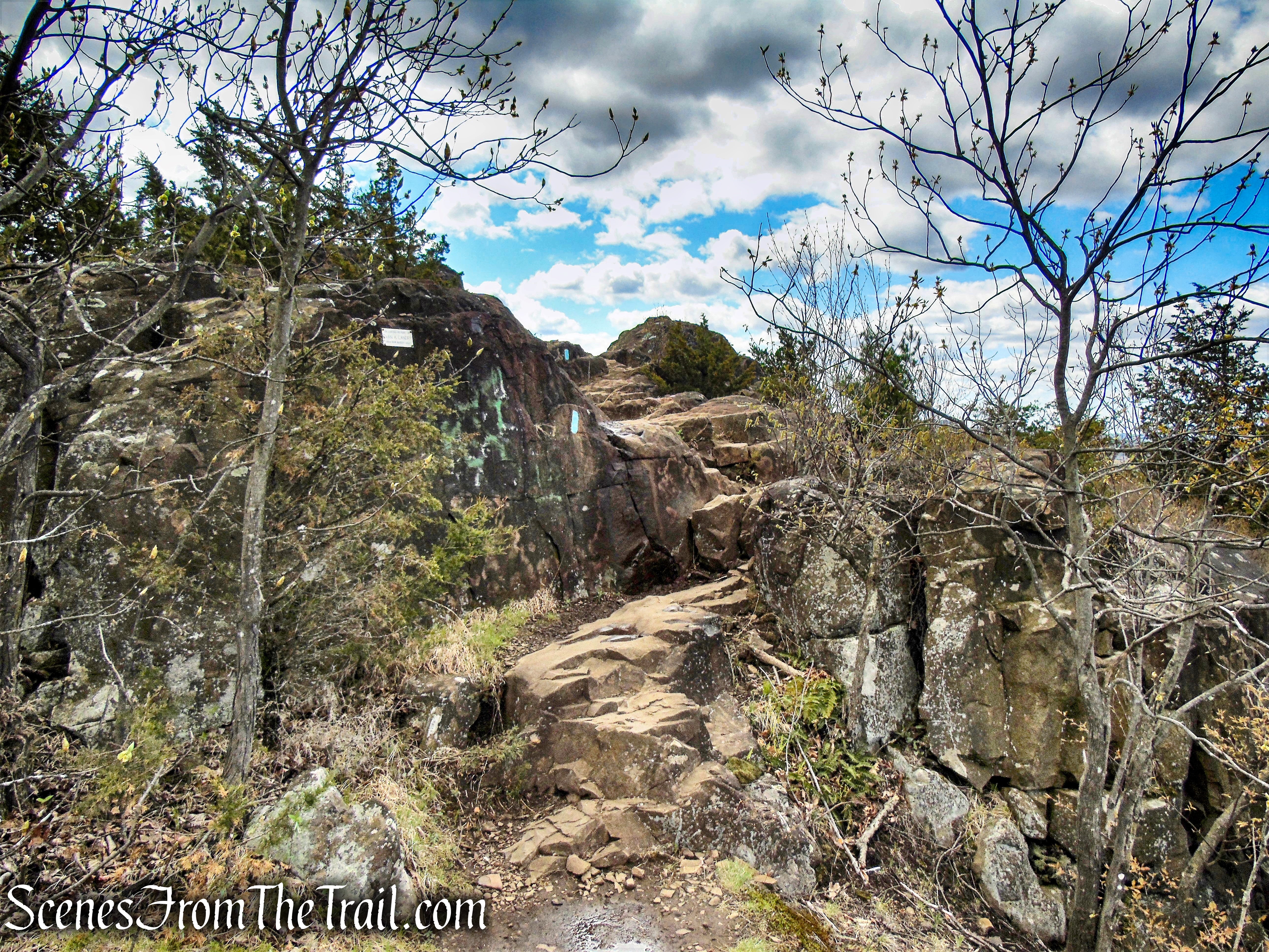
In many spots along the trail, stone steps have been constructed around the turns.
Mattabesett Trail – Chauncey Peak
rock formation alongside Mattabesett Trail – Chauncey Peak
As the trail nears the top, it enters a ravine. A blue-and-red-blazed connector trail begins to the left, but you should turn right and continue following the blue-blazed Mattabesett Trail which continues to climb to the south and soon reaches a limited viewpoint.
Mattabesett Trail – Chauncey Peak
Mattabesett Trail – Chauncey Peak
In a short distance, as the trail climbs some more, it comes out to a panoramic viewpoint to the east, south and west from an open rock ledge.
Mattabesett Trail – Chauncey Peak
Mattabesett Trail – Chauncey Peak
You have gained about 350 of elevation in the first 0.7 mile of the hike. This is a good spot to take a break and enjoy the view.
Mattabesett Trail – Chauncey Peak
Looking west, South Mountain, East Peak and West Peak can be seen in the distance.
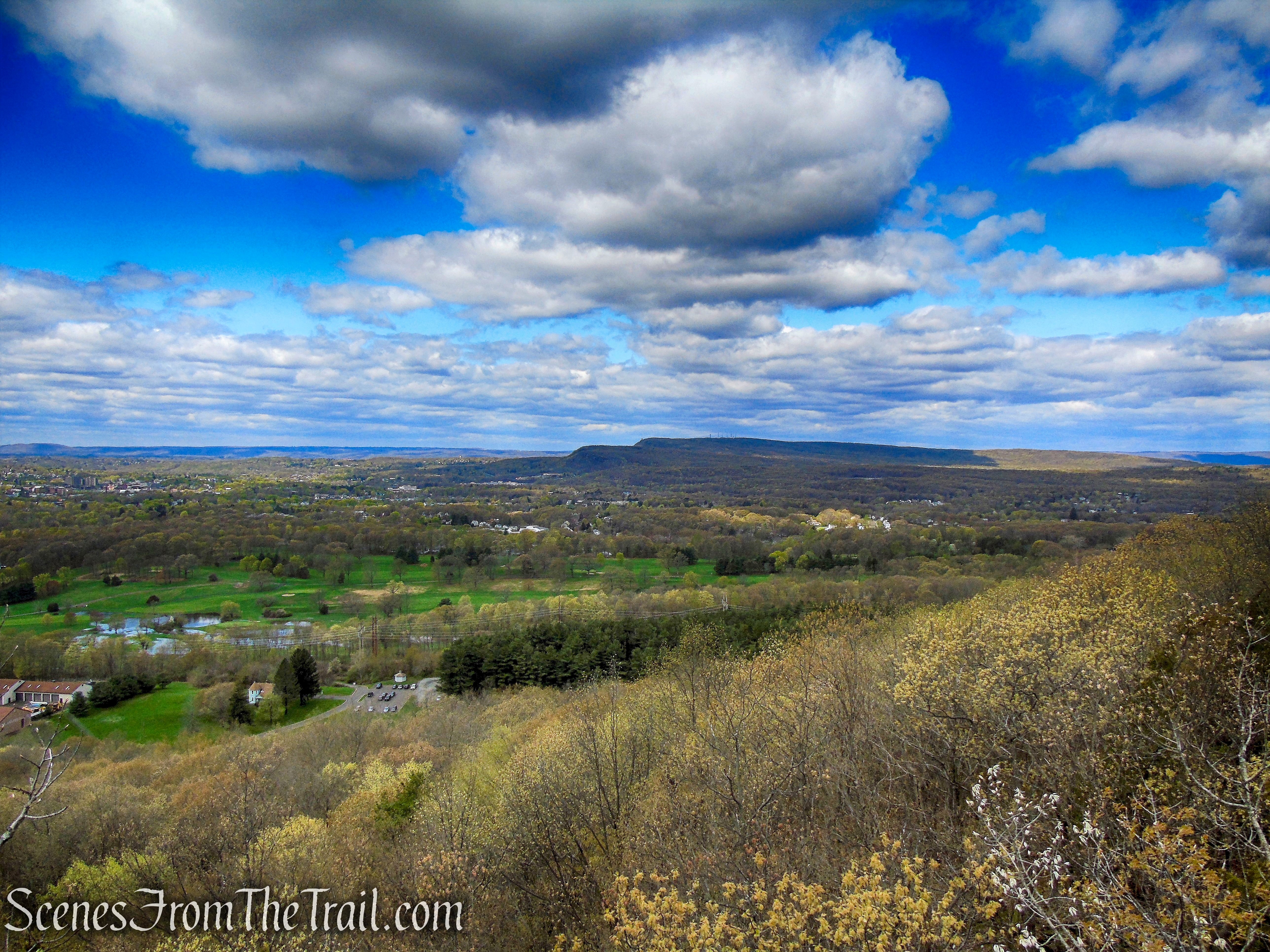
view west from Mattabesett Trail – Chauncey Peak
view west from Mattabesett Trail – Chauncey Peak
The trail turns left, leaves the rock ledge and enters the woods.

view southeast from Mattabesett Trail – Chauncey Peak
Mattabesett Trail – Chauncey Peak
As the trail turns left, there is a gravel path to the right, that leads to an east facing viewpoint over the quarry.
Mattabesett Trail – Chauncey Peak
quarry – Chauncey Peak
The blue blazes continue to climb as the trail heads north, with side trails that lead to the edge of the quarry.
Mattabesett Trail – Chauncey Peak
Much of the east side of the mountain has been subject to quarrying. As of 2007, the quarry was .5 mile wide, roughly 3/4 the width of the entire mountain.
quarry – Chauncey Peak
Soon the Mattabesett Trail reaches the summit of Chauncey Peak.
Mattabesett Trail – Chauncey Peak
A short spur trail leads to a southwest facing viewpoint.
Mattabesett Trail – Chauncey Peak
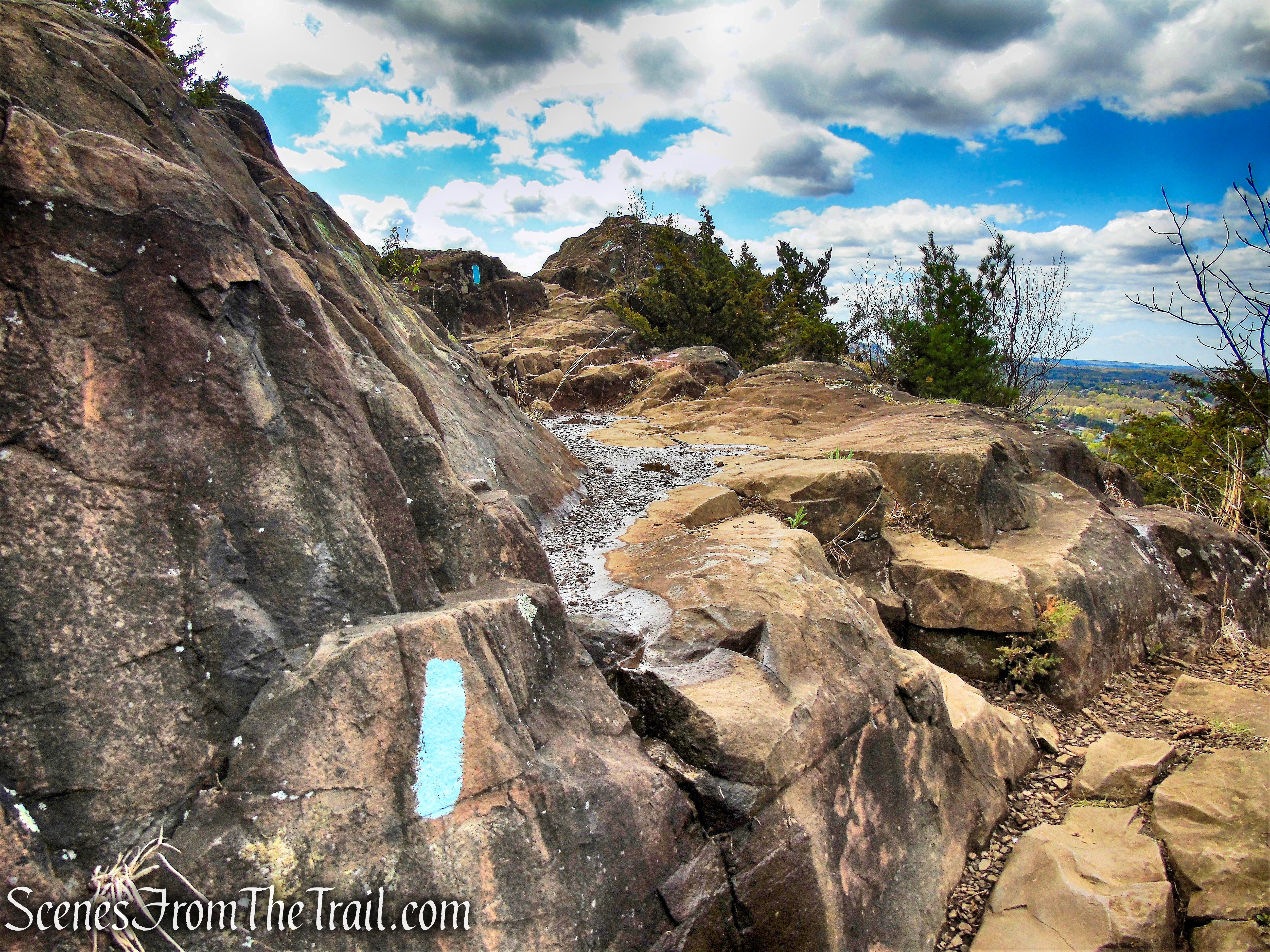
The trail now levels off somewhat as it heads north along the ridge.
Mattabesett Trail – Chauncey Peak
Soon the trail begins to run close to the edge of the cliffs and views appear.
Mattabesett Trail – Chauncey Peak
Looking southwest with Crescent Lake below, the parking area is visible at the southwest end of the lake. To the right is South Mountain and East Peak in the distance.
Crescent Lake from Mattabesett Trail – Chauncey Peak
Looking west.
Crescent Lake from Mattabesett Trail – Chauncey Peak
The trail then veers away from the cliffs and reenters the woods.
Mattabesett Trail – Chauncey Peak
As the trail turns left, another short spur trail leads to a viewpoint overlooking the quarry.
Mattabesett Trail – Chauncey Peak
Looking southeast.
quarry – Chauncey Peak
Looking east over the quarry.
quarry – Chauncey Peak
The Mattabesett Trail now begins to descend through the woods.
Mattabesett Trail – Chauncey Peak
Mattabesett Trail – Chauncey Peak
The trail soon returns to the edge of the cliffs with more views.
Mattabesett Trail – Chauncey Peak
Crescent Lake from Mattabesett Trail – Chauncey Peak
Looking northwest.
Mattabesett Trail – Chauncey Peak
The blue blazes continue along the edge of the cliffs with more views.
Mattabesett Trail – Chauncey Peak
Mattabesett Trail – Chauncey Peak
Mattabesett Trail – Chauncey Peak
The trail leaves the cliff’s edge, but soon returns to even more views.
Mattabesett Trail – Chauncey Peak
Mattabesett Trail – Chauncey Peak
view west from Mattabesett Trail – Chauncey Peak
The Mattabesett Trail soon descends and then climbs again.
Mattabesett Trail – Chauncey Peak
Mattabesett Trail – Chauncey Peak
The trail then bends to the west and descends on switchbacks along the northwest slope of Chauncey Peak.
Mattabesett Trail – Chauncey Peak
At the base of the descent, the trail turns right and crosses North Branch Harbor Brook on a wooden footbridge.
Mattabesett Trail – Chauncey Peak
After crossing the bridge, the blue blazes turn right onto a gravel road and head north along the brook.
Mattabesett Trail – Chauncey Peak
Right after the Mattabesett Trail passes a junction with a red-blazed trail on the left and the blue blazes turn left and begin to climb Lamentation Mountain, there is a seasonal waterfall that is worth checking out.
waterfall alongside Mattabesett Trail – Giuffrida Park
After viewing the waterfall, retrace your steps back to the footbridge and continue past it on the gravel road. Do not recross the bridge.
Mattabesett Trail – Giuffrida Park
This gravel road is listed on the trail map as the Black Trail, but it doesn’t seem to be blazed.
Black Trail – Giuffrida Park
In a short distance, the Black Trail ends at a T-intersection with the White Trail at the northern end of Crescent Lake.
Black Trail – Giuffrida Park
To the left is the ridge that you have just been walking.
Chauncey Peak and Crescent Lake – Giuffrida Park
The White Trail (no blazes) heads south along the western shore of Crescent Lake.
White Trail – Giuffrida Park
Soon the trail comes to a fork. Take the left fork to remain on the White Trail.
veer left on White Trail – Giuffrida Park
The White Trail returns to the water’s edge with more views of Chauncey Peak.
Chauncey Peak – Giuffrida Park
The White Trail continues south along Crescent Lake and may be wet after periods of heavy rain.

White Trail – Giuffrida Park
Soon the blue-blazed Mattabesett Trail comes in from the right and joins the White Trail as they continue south.
Mattabesett Trail – Giuffrida Park
Mattabesett Trail – Giuffrida Park
A short distance later, the trail reaches the parking area, where the hike began.
Mattabesett Trail – Giuffrida Park
Review:
This is a great short hike that is doable by most people. After the initial steep ascent, the hike becomes easy. There are numerous views in all directions from the many rock outcrops and open ledges. On the day we visited, it was extremely windy in the low 50’s, with possible rain in the forecast. That may have kept fair weather hikers away. This seems to be a popular spot with locals, but we only ran into a handful of people along the ridge, going in the opposite direction. Most of the foot traffic we encountered was along the lake as we neared the parking area.
The 2 trail maps that have been provided have not been updated since the trail reroutes in 2017.
Pros: Great views, traprock ridge, Crescent Lake, Mattabesett Trail.
Cons: Trails can get crowded during nice weather, needs an updated trail map.
Take a hike!
Chauncey Peak Loop – Giuffrida Park
Sources:

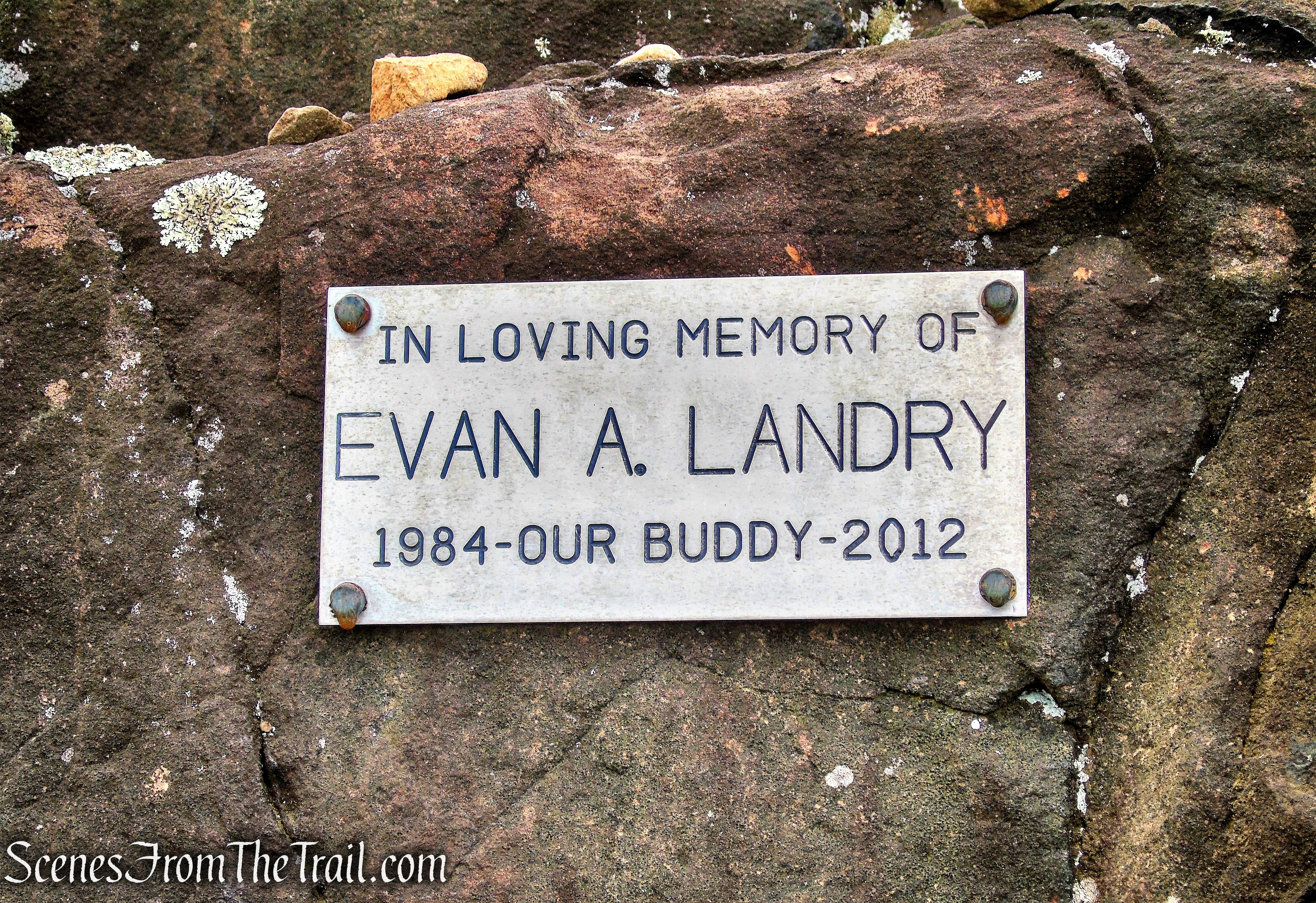
This website explains who was Evan A. Landry, as seen in the plaque on the rock: https://www.ealgolftournament.com
LikeLiked by 1 person