January 1, 2019 – Montrose, NY
Difficulty: Easy
Map: George’s Island Park Map (outdated)
Trailhead parking: Dutch St, Montrose, NY 10548
Admission and Fees: County Park Pass is not required for admission
Fee: $5 with Park Pass, $10 without Park Pass — weekends only in May and September until Sunday, Oct. 1. Daily 5/27 through Labor Day.
Overview:
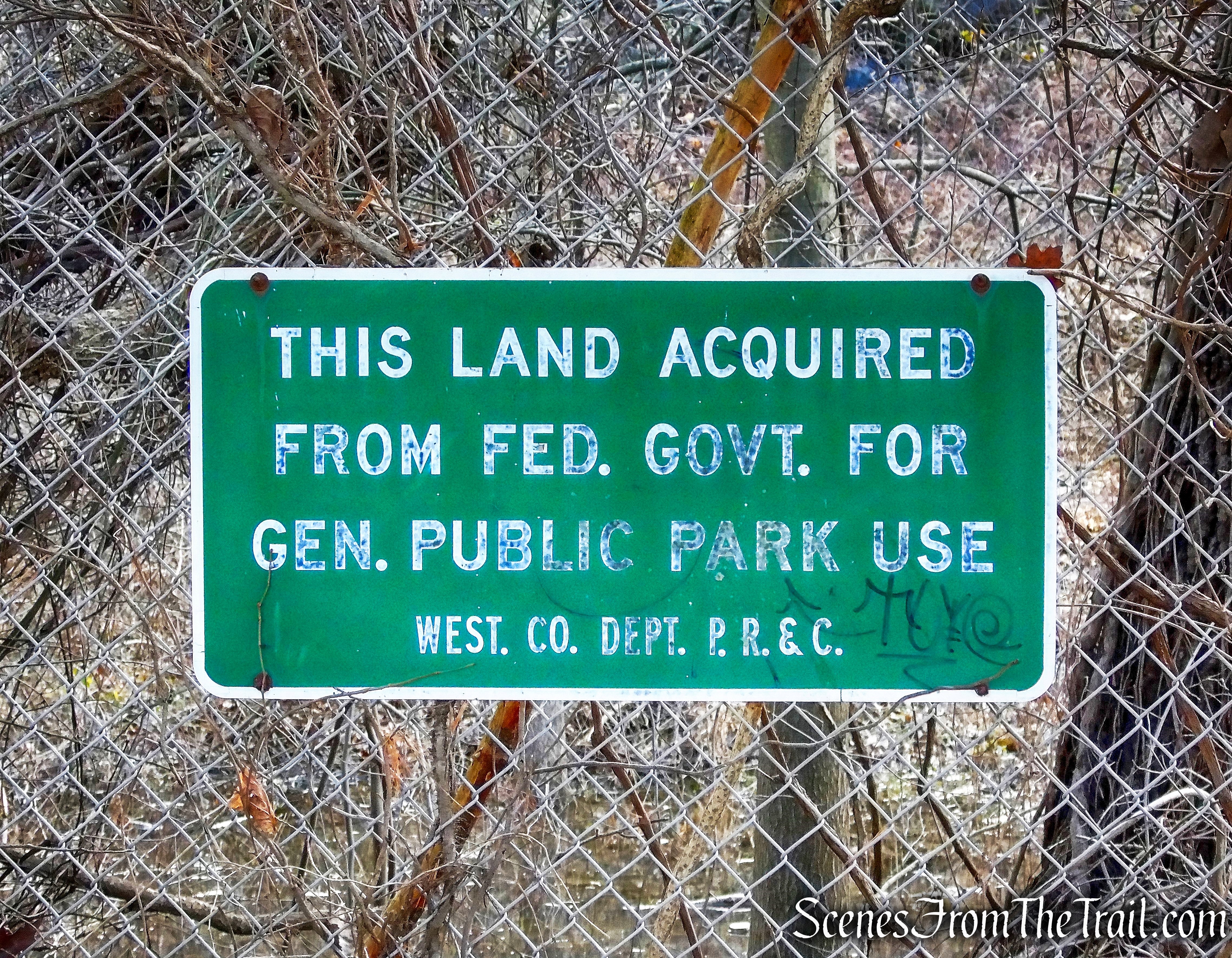
George’s Island Park in Montrose is a 208-acre riverside park offering a freshwater pond, nature study, picnic spots, tidal wetlands, fishing, baseball and wooded trails linked to the Hudson River Greenway, and boat access to the Hudson River for sailing and more. In winter, this is a favorite spot for watching eagles on the Hudson. A trail network links the park to the Hudson River Greenway and Montrose Point State Forest, making longer hikes possible. George’s Island, acquired by the County in 1966, has been the site of archeological finds dating back to the time of early Native American settlements. A lesser used section of the park can be entered from Montrose Point Road.
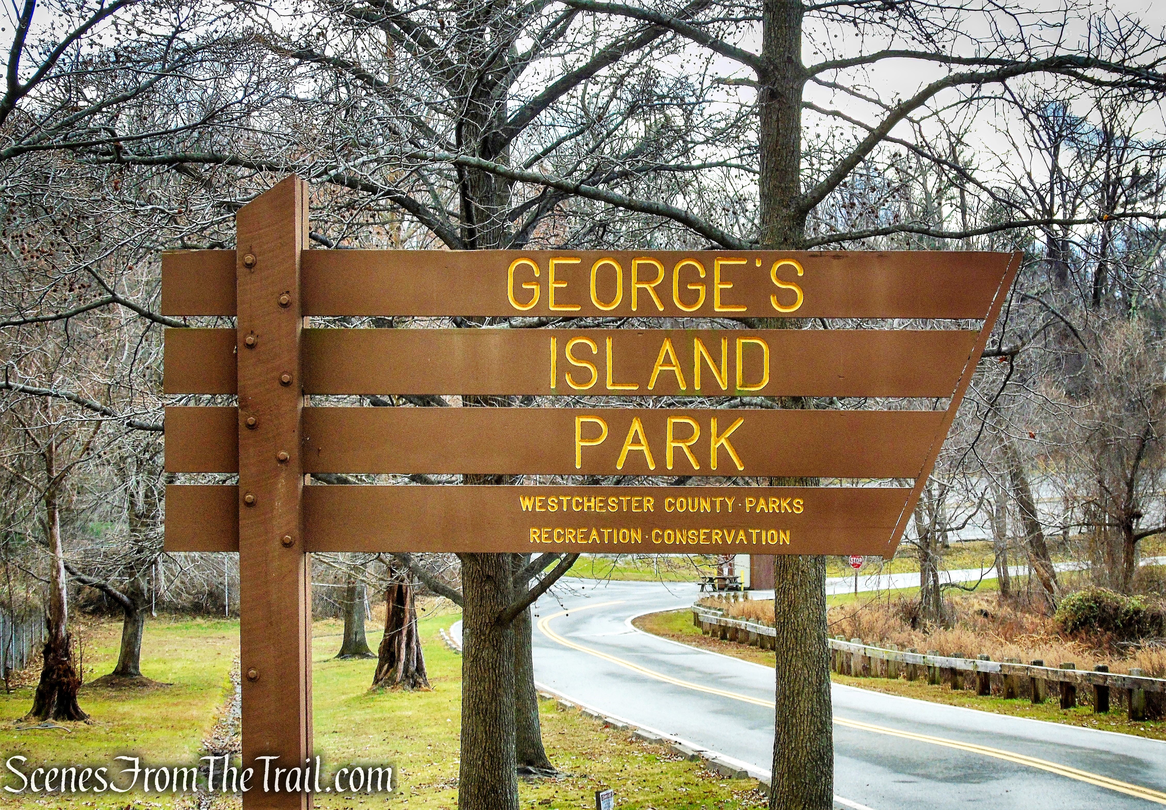
George’s Island Park
The Gormley Brick Company once occupied this site. Their bricks were used in the construction of the Sing Sing Correctional Facility in Ossining, N.Y., as well as the buildings at Graymoor and the Roman Catholic institution in Garrison, N.Y. The last shipment of Gormley bricks was sent to New York City by boat on April 13, 1938. On George’s Island there were three leased brickyards, employing 130 men. The shoreline of George’s Island is still sprinkled with bricks.
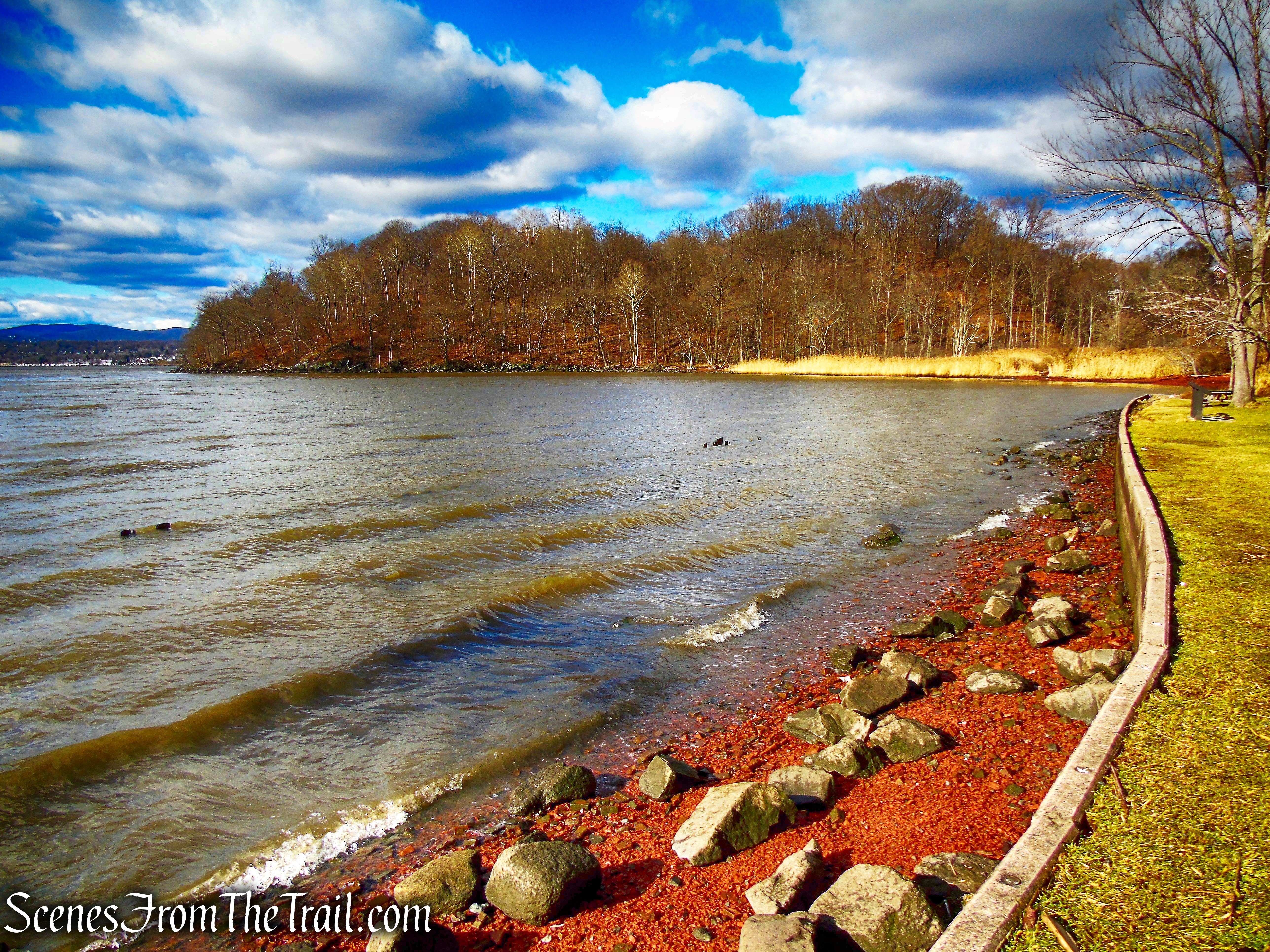
Shasta’s Cove – George’s Island Park
The Trails:
There are approximately 5 miles of blazed and unmarked trails over a variety of terrain. The trail map is from 1993, but it’s helpful to bring one along. I have hiked all of the trails at different times and have wandered throughout most of the property. I will describe the trails below as they appear on the map.
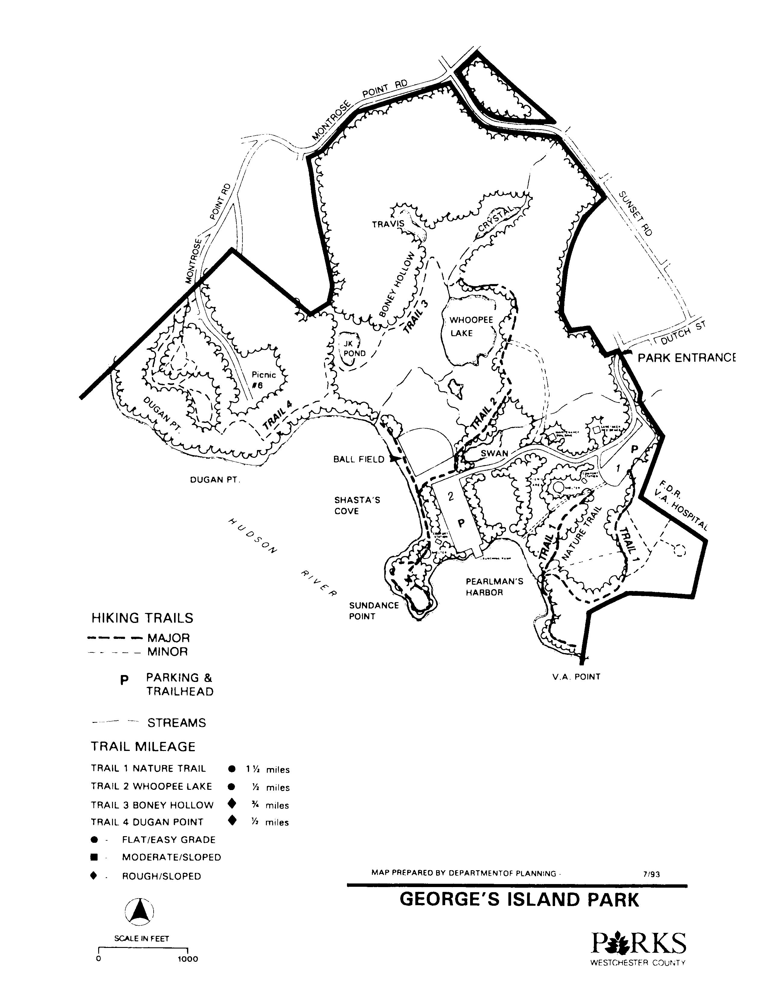
George’s Island Park Trail Map
Trail 1:
The trailhead is located at the southwestern end of Parking Lot 1, which is located on the left almost immediately after entering the park from Dutch Street. There is a large green sign just to the left of the start of the trail.
Trail 1 – George’s Island Park
The trail begins at a break in the fence and heads south through the woods.
Trail 1 – George’s Island Park
The trail travels through a section of the park that is shown on the map as V.A. Point.
Trail 1 – George’s Island Park
The trail comes to a fork with an unmarked woods road, turns right and descends towards the river.
Trail 1 – George’s Island Park
A large rock outcrop just ahead leads to obstructed views of the Hudson River.
Trail 1 – George’s Island Park
The trail then descends on a switchback and passes alongside the previous rock outcrop as it heads south.
Trail 1 – George’s Island Park
Trail 1 – George’s Island Park
The trail descends to near river level and crosses a wooden footbridge.
Trail 1 – George’s Island Park
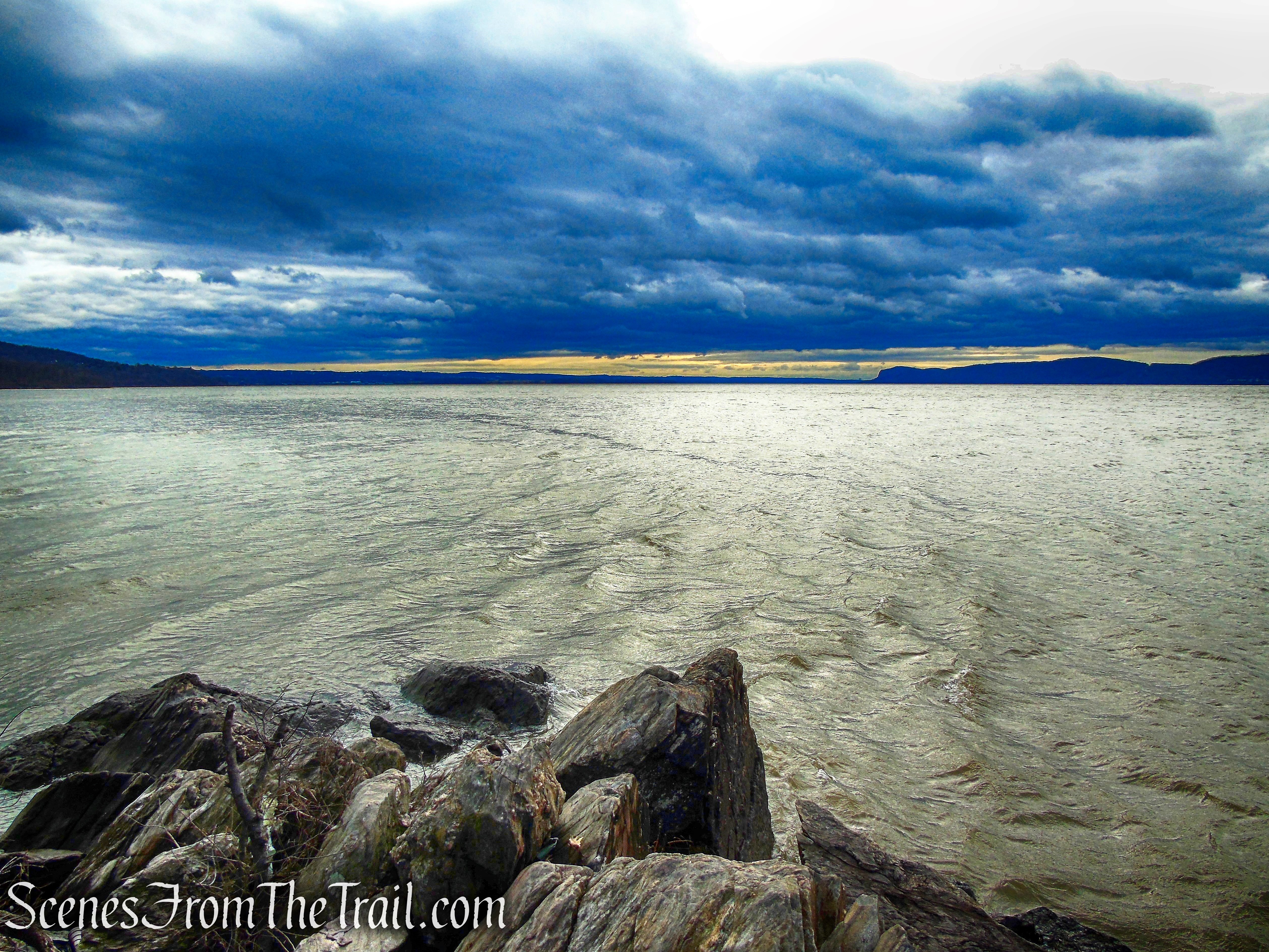
At the end of the point, there are south-facing views of the Hudson River.
Trail 1 – George’s Island Park
Hook Mountain is visible in the distance, with the Tappan Zee Bridge just beyond, to the left.
Trail 1 – George’s Island Park
The trail ends at a gate that enters the V.A. Hospital property. From here you have to retrace your steps.
Trail 1 – George’s Island Park
Unmarked Side Trail off of Trail 1:
The unmarked woods road that forks from Trail 1 has several side trails.
Unmarked Side Trail off of Trail 1 – George’s Island Park
One such trail leads a short distance to partial views of the river.
Unmarked Side Trail off of Trail 1 – George’s Island Park
A USCG Survey marker is located on a rock slab.
Unmarked Side Trail off of Trail 1 – George’s Island Park
A few feet away there is another survey marker.
Unmarked Side Trail off of Trail 1 – George’s Island Park
Back on the woods road heading east, the road forks. The left fork leads towards a neighborhood and the right fork heads towards the V.A. Hospital grounds, which is government property. Around this area I spotted a coyote which saw me and ran off. From here you have to retrace your steps back to the trailhead.
Unmarked Side Trail off of Trail 1 – George’s Island Park
Trail 2:
This trail starts near the river at Parking Area 2. Heading south along the river, the trail passes a large picnic pavilion.
Trail 2 – George’s Island Park
The trail travels close to the river with small rock outcrops offering some views. Looking north one can see across Shasta’s Cove to Dugan Point, a favorite gathering place for wintering Bald Eagles.
Trail 2 – George’s Island Park
Looking west, the Stony Point Lighthouse is visible across the river.
Trail 2 – George’s Island Park
The trail continues south along the river.
Trail 2 – George’s Island Park
This narrow piece of land jutting out into the Hudson River is shown on the map as Sundance Point.
Trail 2 – George’s Island Park
Expansive south-facing views at the end of the point.
Trail 2 – George’s Island Park
The trail loops around Sundance Point and heads back towards the parking area. Looking east across Pearlman’s Harbor to V.A. Point.
Trail 2 – George’s Island Park
From the parking area, the trail heads past a ballfield and a marshy area. Just off trail in the woods, there is what appears to be the remnants of an old mining steam engine.
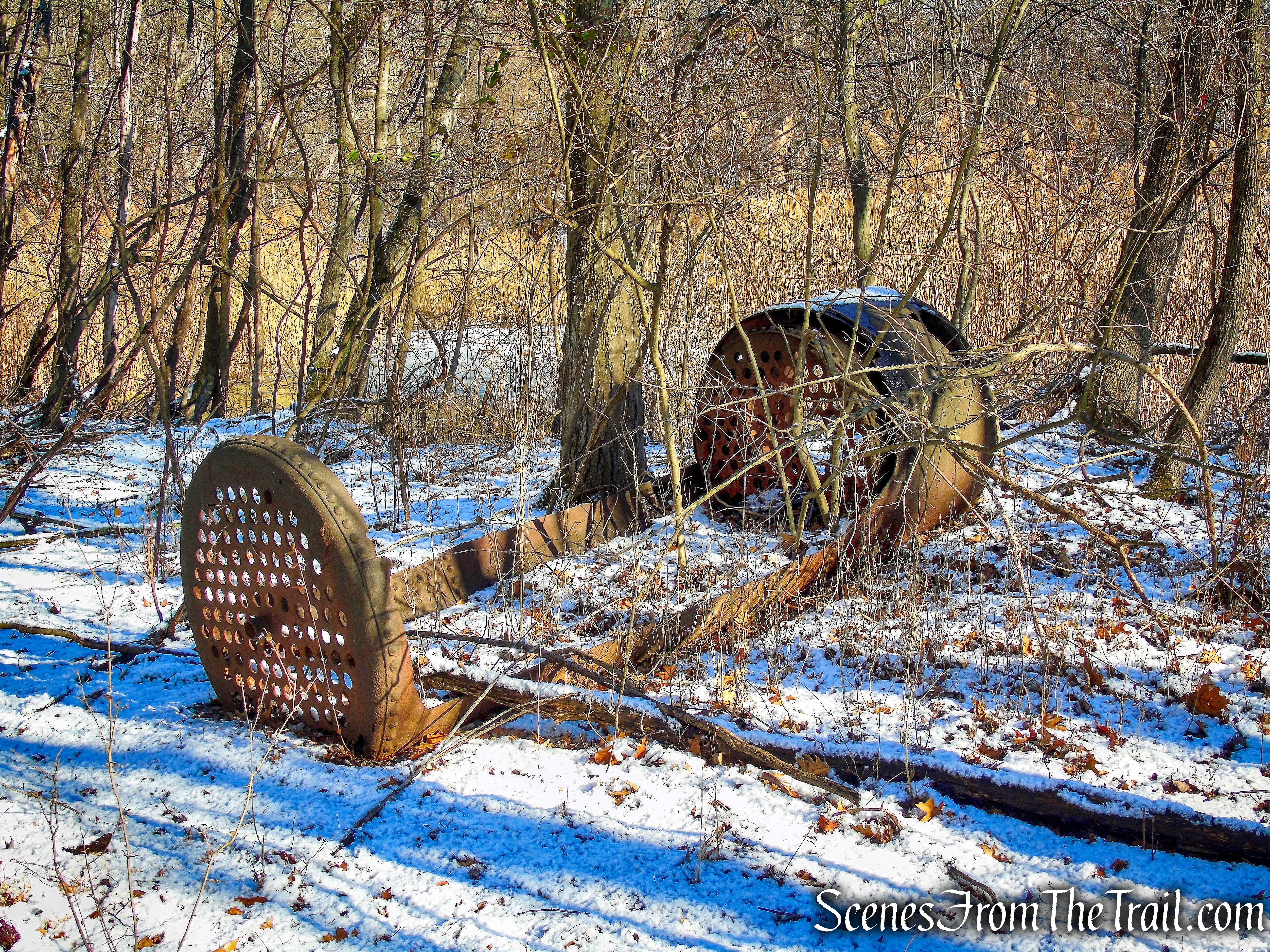
Trail 2 – George’s Island Park
This trail ends at the northern edge of Whoopee Lake, a very scenic spot to take a break. The Blue Trail and Trail 3 begin here as well.
Trail 2 – George’s Island Park
Blue Trail:
This trail heads northeast through the woods.
Blue Trail – George’s Island Park
This is a scenic and quiet area that doesn’t seem to get much foot traffic.
Blue Trail – George’s Island Park
Blue Trail – George’s Island Park
There are several large blowdowns in this area, but are easy to get around.
Blue Trail – George’s Island Park
The Blue Trail crosses a wooden footbridge and ends at Sunset Road.
Blue Trail – George’s Island Park
Trail 4:
Trail 4 can be hiked as a continuation of Trail 3 or entered from Montrose Point Road. Montrose Point Road dead ends at the rear entrance driveway into George’s Island Park. Three white blazes on a tree signify the start of the White Trail. A lesser used section of the park, this area is the most interesting to explore.
White Trail – George’s Island Park
The White Trail ascends gradually on a paved road.
White Trail – George’s Island Park
There are a lot of blowdowns throughout this section of the park.
White Trail – George’s Island Park
Just past the fire hydrant, there is an unmarked footpath.

White Trail – George’s Island Park
There are remnants of brick structures and foundations in this area, but most are overgrown and hard to see.
brick ruins – George’s Island Park
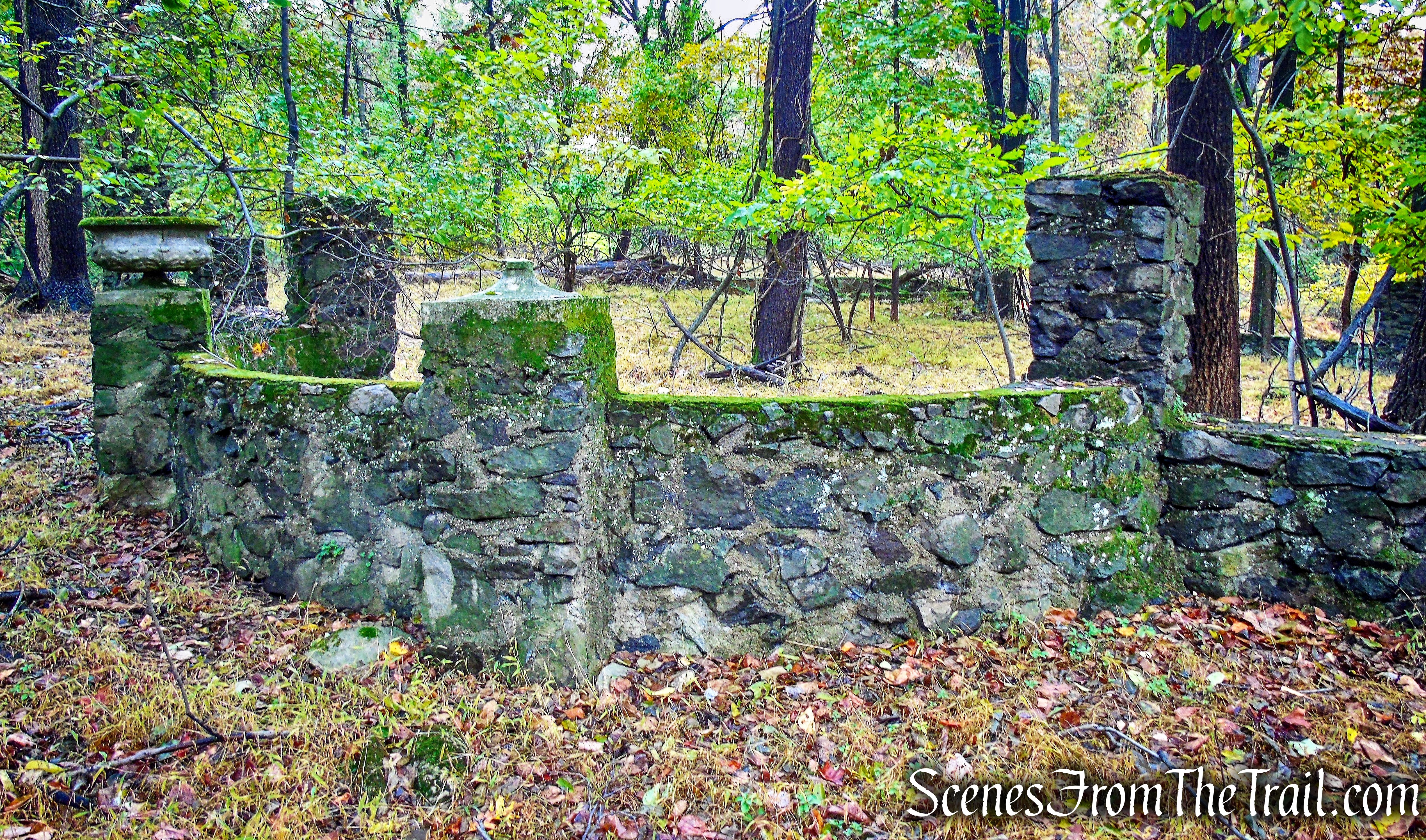
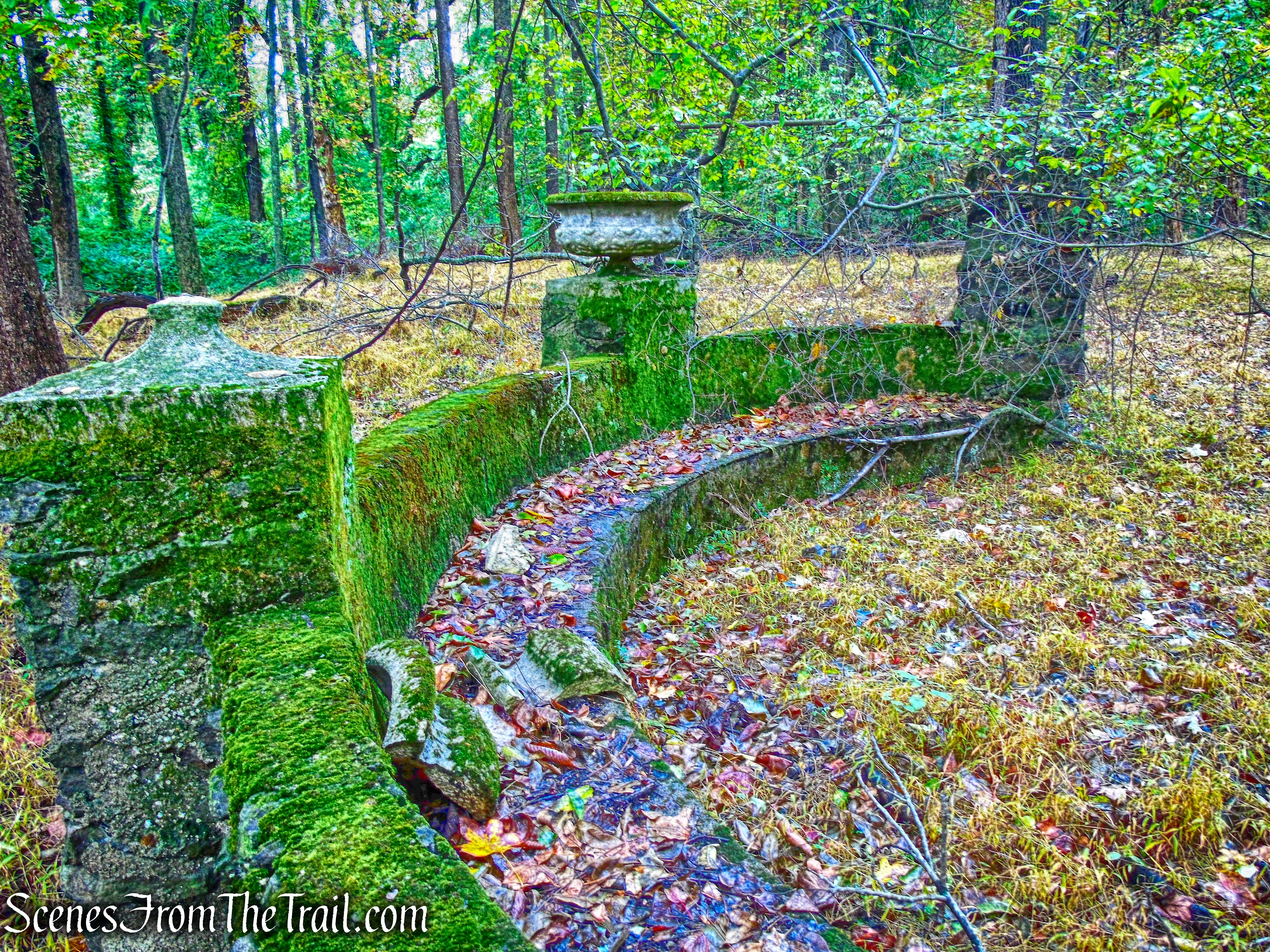
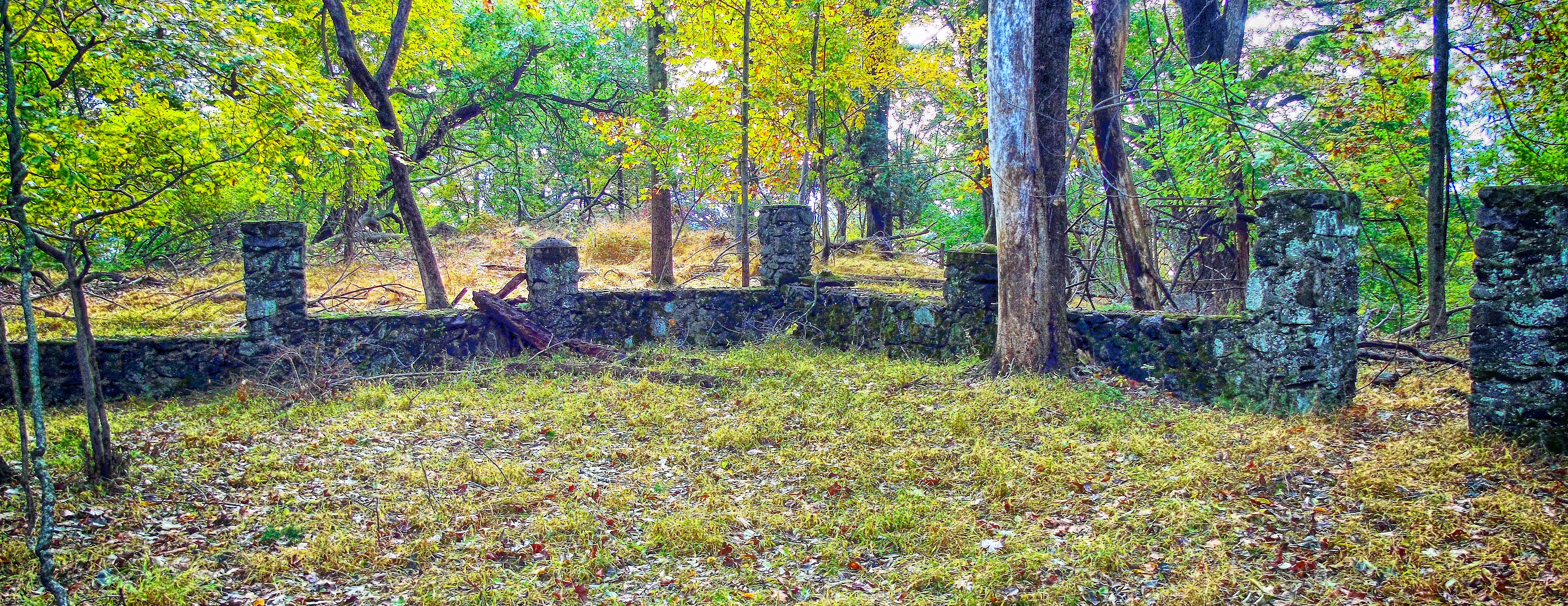
Back out on the White Trail, a short distance later, extensive stone ruins come into view just to the right of the trail.
ruins – George’s Island Park
At first glance, George’s Island Park appears to be a picnic park and boat launch, but off to the side is a network of wooded trails with interesting features.
ruins – George’s Island Park
The information on this estate is very scant and somewhat contradictory. Some old maps that I have viewed put the estate just a bit north, on what is now the Kolping-On-Hudson property on the other side of Montrose Point Rd. Based on the design, these ruins could be from the same estate and possibly a large terrace or patio-like structure.
ruins – George’s Island Park
The information that I have gathered, if true, give these stone ruins a very historic past.
ruins – George’s Island Park
The Seward Estate which was located on Montrose Point, was built and owned by Frederick W. Seward, son of William Seward, Secretary of State under Abraham Lincoln. Frederick was seriously injured, along with several other people, during an assassination attempt on his father’s life on the evening of April 14, 1865 in Washington D.C., at the same time Lincoln was being shot in Ford’s Theater. It was part of a plot to assassinate several government leaders in an attempt to destroy the government. Frederick suffered a fractured skull after being beaten with a pistol that misfired. Both Sewards survived the vicious attack, but it is said that Frederick lived out his life with a silver plate in his skull.
ruins – George’s Island Park
The handsome Seward Estate covered about 30 acres. A stately mansion with a beautiful Victorian garden and various outbuildings, it commanded a magnificent view of the Hudson River. The grounds of the estate were dotted by little ponds that had been made by excavating clay for the brickyards which flourished along the Hudson during that period.
ruins – George’s Island Park
ruins – George’s Island Park
Frederick had talked of living somewhere on the Hudson River and by 1870 he was ensconced in a pretentious Italianate villa that he called “Montrose.”
ruins – George’s Island Park
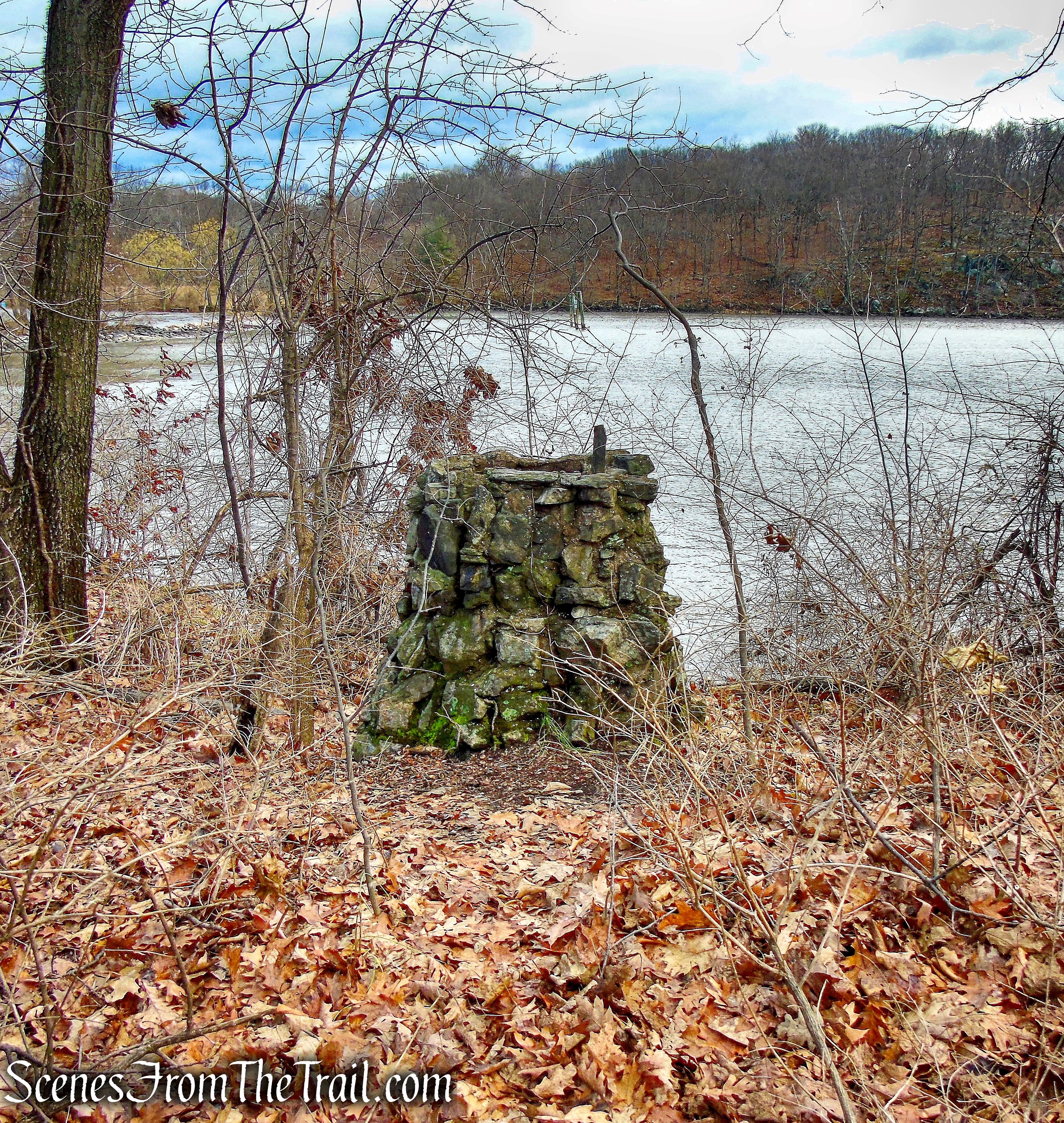
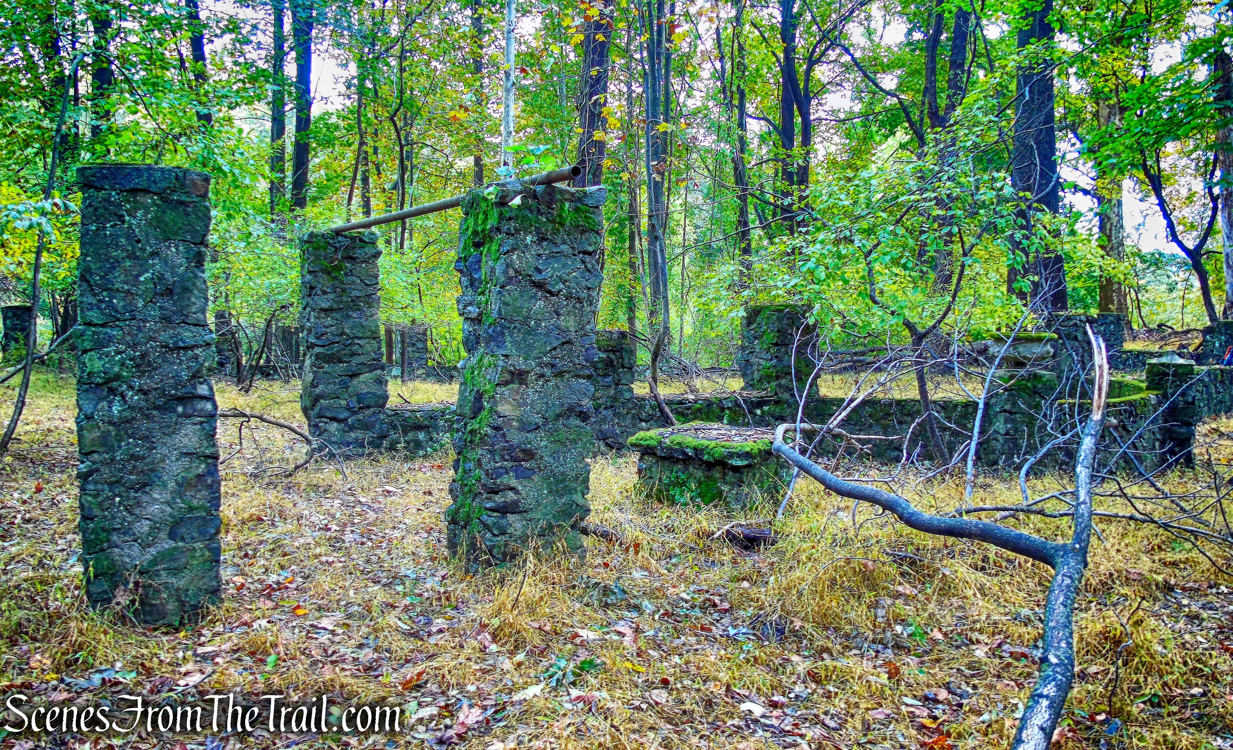
Away from the main ruins, there are several of these short stone columns scattered about.
ruins – George’s Island Park
ruins – George’s Island Park
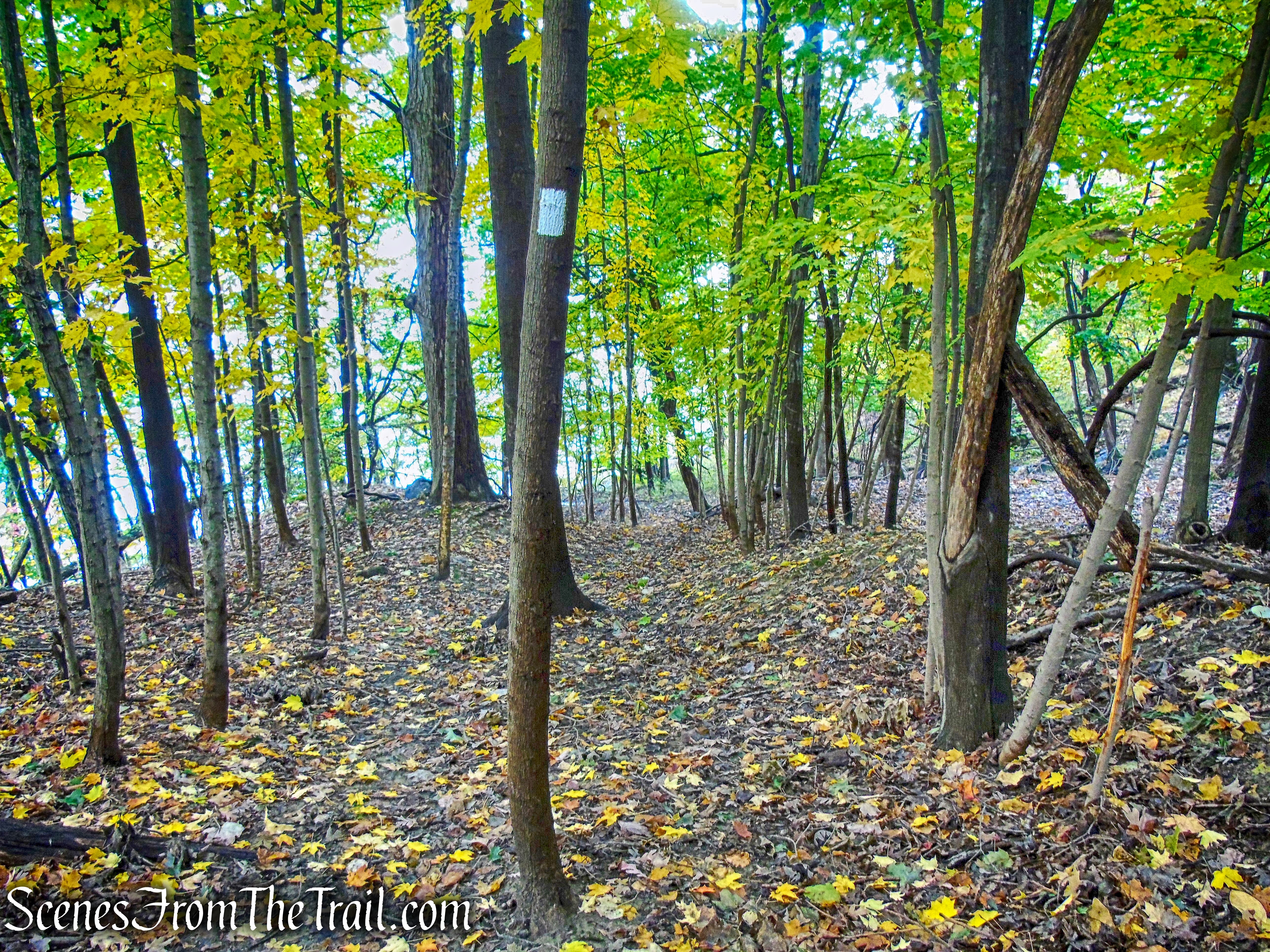
The White Trail continues south through Dugan Point.
White Trail – George’s Island Park
Off trail, there are several foundations and a cinder block structure on the hill.
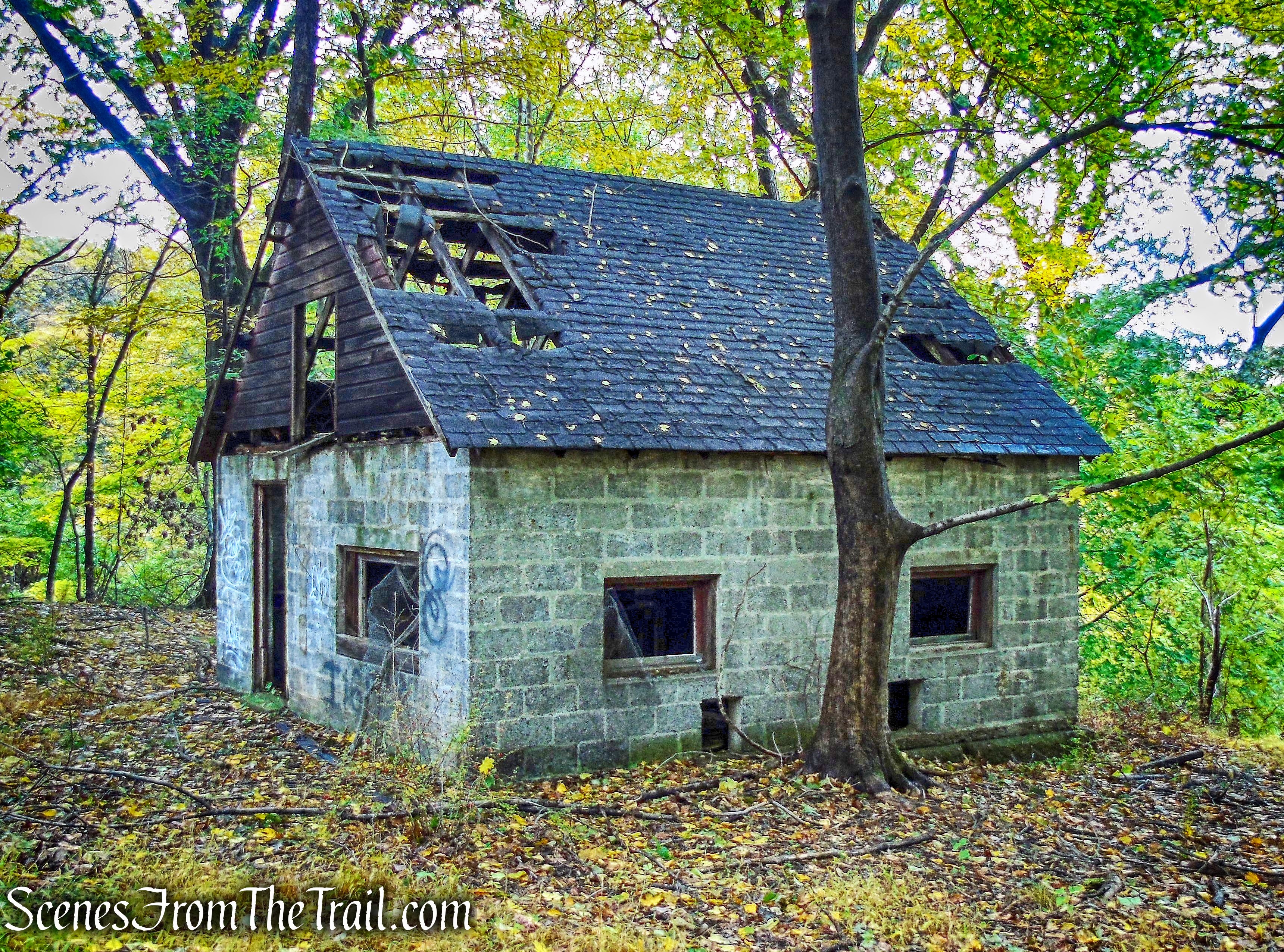
ruins – George’s Island Park
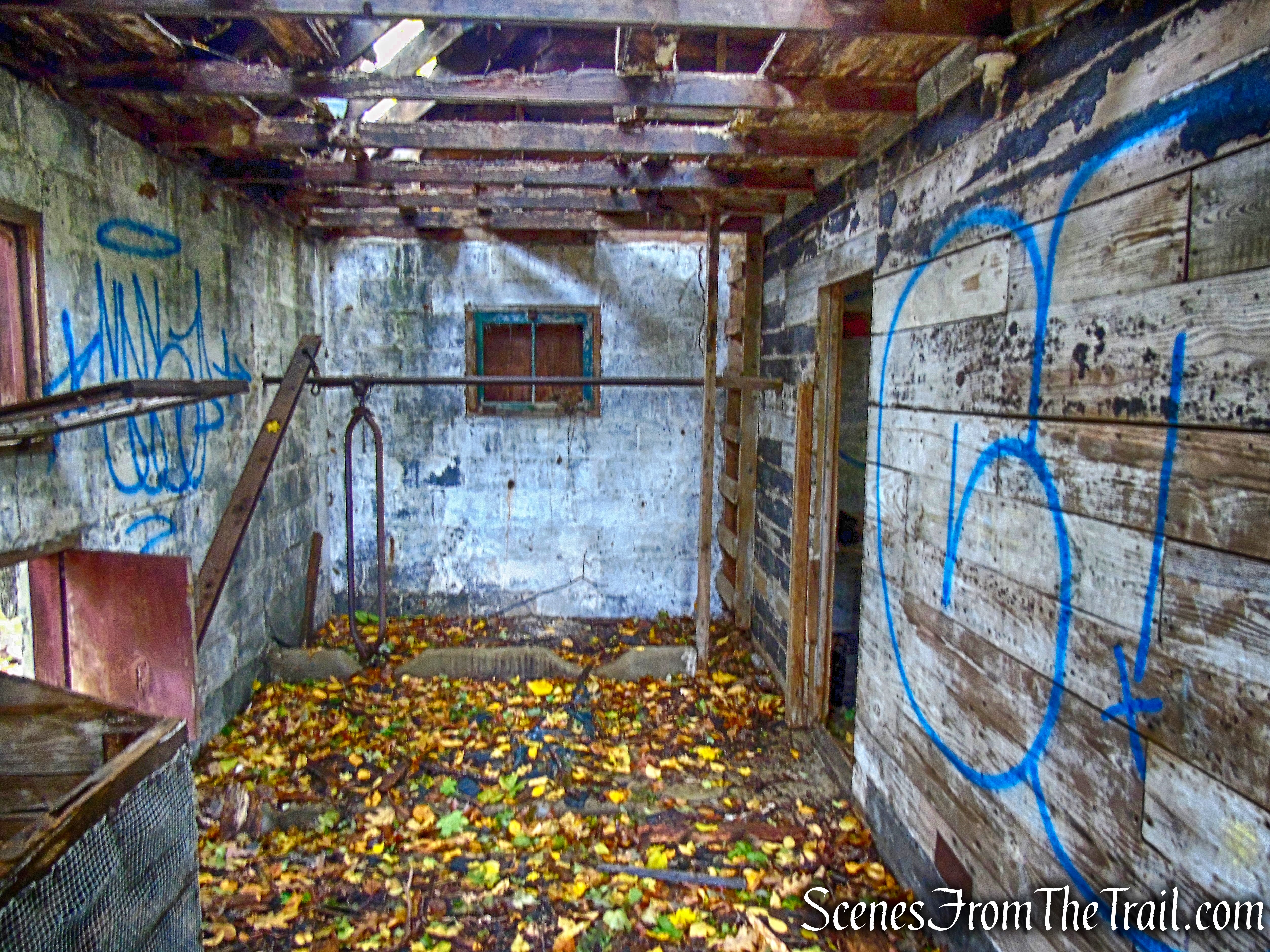
ruins – George’s Island Park
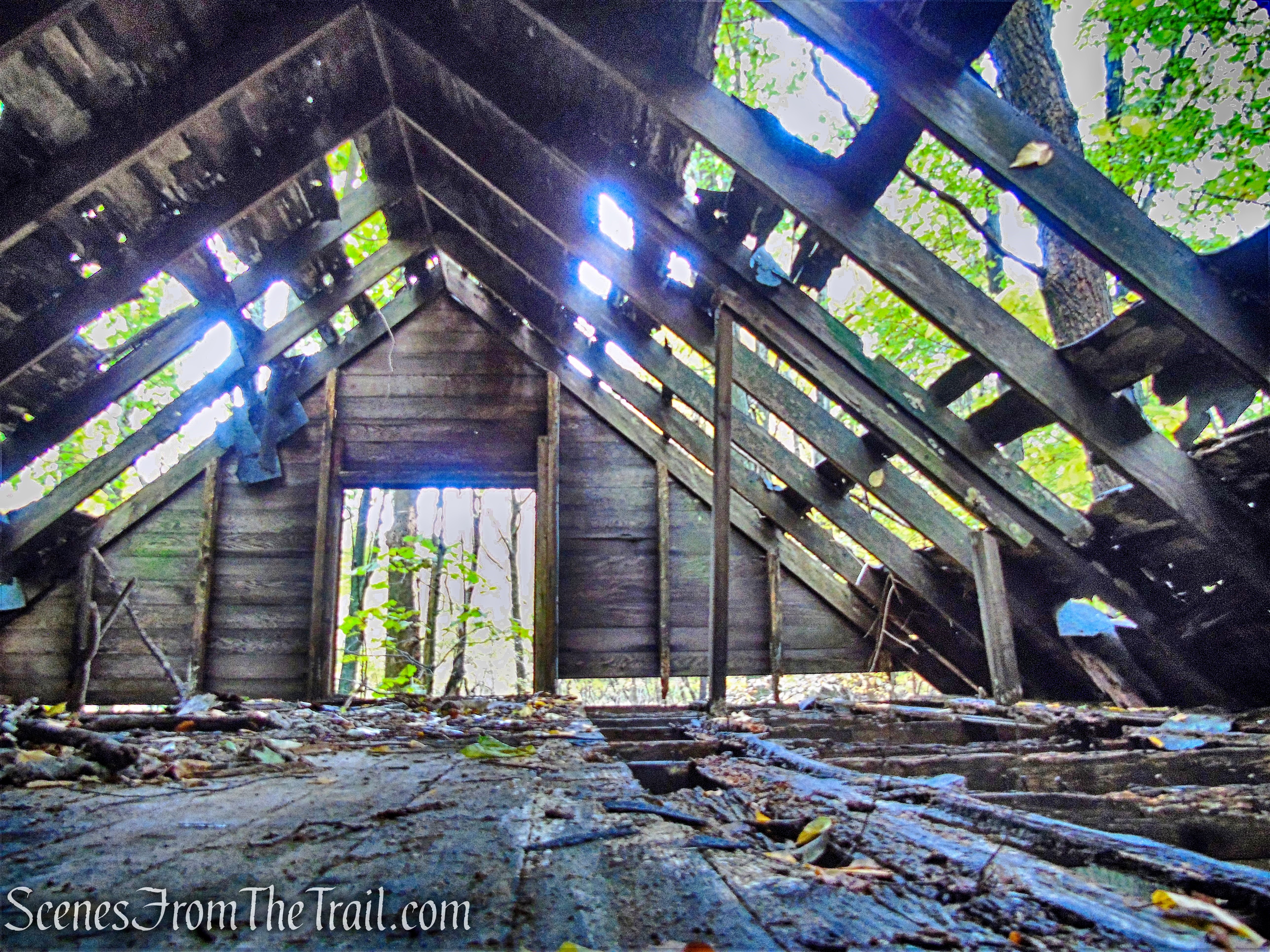
ruins – George’s Island Park
The white blazes continue down the hill, behind the cinder block house.
White Trail – George’s Island Park
The White Trail descends with the Hudson River visible through the trees on the right.
White Trail – George’s Island Park
The trail passes a “brick beach” with great views of the Hudson River.
White Trail – George’s Island Park
Looking northwest from “brick beach.”
White Trail – George’s Island Park
Looking southwest down river, with Sundance Point on the left and Hook Mountain visible further down river on the right.
White Trail – George’s Island Park
Trail 3:
The map shows Trail 3 and Trail 4 as two separate trails, but they are both blazed white and are actually one continuous trail.
White Trail – George’s Island Park
The White Trail becomes a bit overgrown as it heads inland and passes through wetlands.
White Trail – George’s Island Park
The trail travels through a grassy area that is a bit spongy.
White Trail – George’s Island Park
The trail then curves to the left as do the trees.
White Trail – George’s Island Park
White Trail – George’s Island Park
The trail can be swampy in some sections.
White Trail – George’s Island Park
White Trail – George’s Island Park
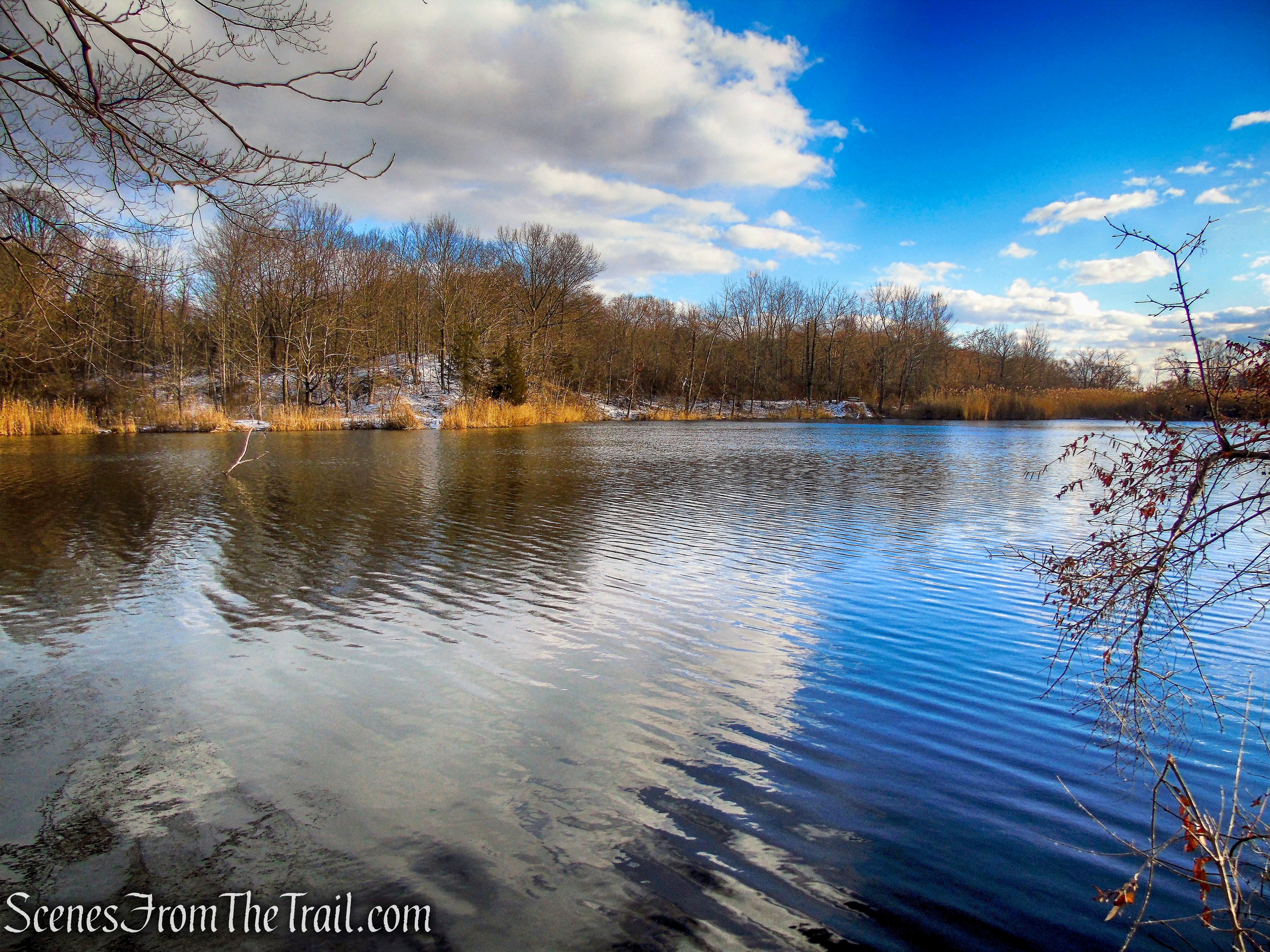
A short distance later it passes by the scenic JK Pond.
White Trail – George’s Island Park
An old brick along the trail that dates back to 1905.
White Trail – George’s Island Park
The White Trail now widens to a woods road as it passes through an area listed on the map as “Boney Hollow.”
White Trail – George’s Island Park
Trail 3 passes the northern end of Whoopee Lake and ends at a T-intersection, near the remnants of the old mining steam engine. The white blazes turn right (Trail 2) and head south. The Blue Trail which heads northeast, turns left.
White Trail – George’s Island Park
Review:
This is a really scenic park with great views of the Hudson River. The trails are fairly well blazed and easy to hike. Off trail exploration is a must and the rewards are worthwhile. This is one of my go to spots in the winter, not just to hike, but to view Bald Eagles as well. In the summer, the crowds flock here for a variety of activities and there is an admission fee. Worth a visit for a few hours well spent in the Hudson Valley.
Pros: Hudson River views, historical features, lesser traveled area in winter, lots of bird activity.
Cons: Some overgrown trails and blowdowns, George’s Island Park map is outdated.
Take a hike!
George’s Island Park
Sources:

Many thanks for the beautiful photos and fascinating information in this visit to George’s Island. I lived at Sunset Road and Dutch Street from 1960 – 67, when I was between the ages of 5 and 12. My older brother and I spent many hours playing by the river and running through the woods with our friends. We clambered around on the rocks at Sundance Point and enjoyed ice skating on Whoopee Lake. We were very lucky to have nature so close, but we knew nothing of the area’s history. In the pre-digital days cameras were a luxury so we took no pictures. I live in the Midwest now and haven’t been to Montrose in many years, but I’m glad to know that the area has been preserved for hiking and enjoying the Hudson. Seeing these vistas again brings back some wonderful memories!
LikeLiked by 1 person