April 29, 2018 – Tomkins Cove, NY
Difficulty: Moderate – strenuous
Length: approximately 4 miles
Max elevation: 1222 ft.– total elevation gain: 770 ft.
Route type: circuit
Map: Harriman-Bear Mountain Trails Map #119
Trailhead parking: Anthony Wayne Recreation Area South Lot
Alternate routes from the same starting point:
West Mountain is a peak that is located in both Orange and Rockland County, NY, just east of the Palisades Interstate Parkway. Most of the mountain is within the boundaries of Bear Mountain State Park, but part of it is in Harriman State Park as well. In November 1923, the Palisades Interstate Park Commission decided that “all of the Park lying west of Bear Mountain (later, west of West Mountain) shall be designated Harriman State Park.” The summit is at an elevation of 1,257 ft. and the western ridge (the section that is part of this hike), is about 1.5 miles long. The narrow ridge offers hikers many fine outlooks both to the west and to the east as the trail jogs from one side of the ridge to the other.
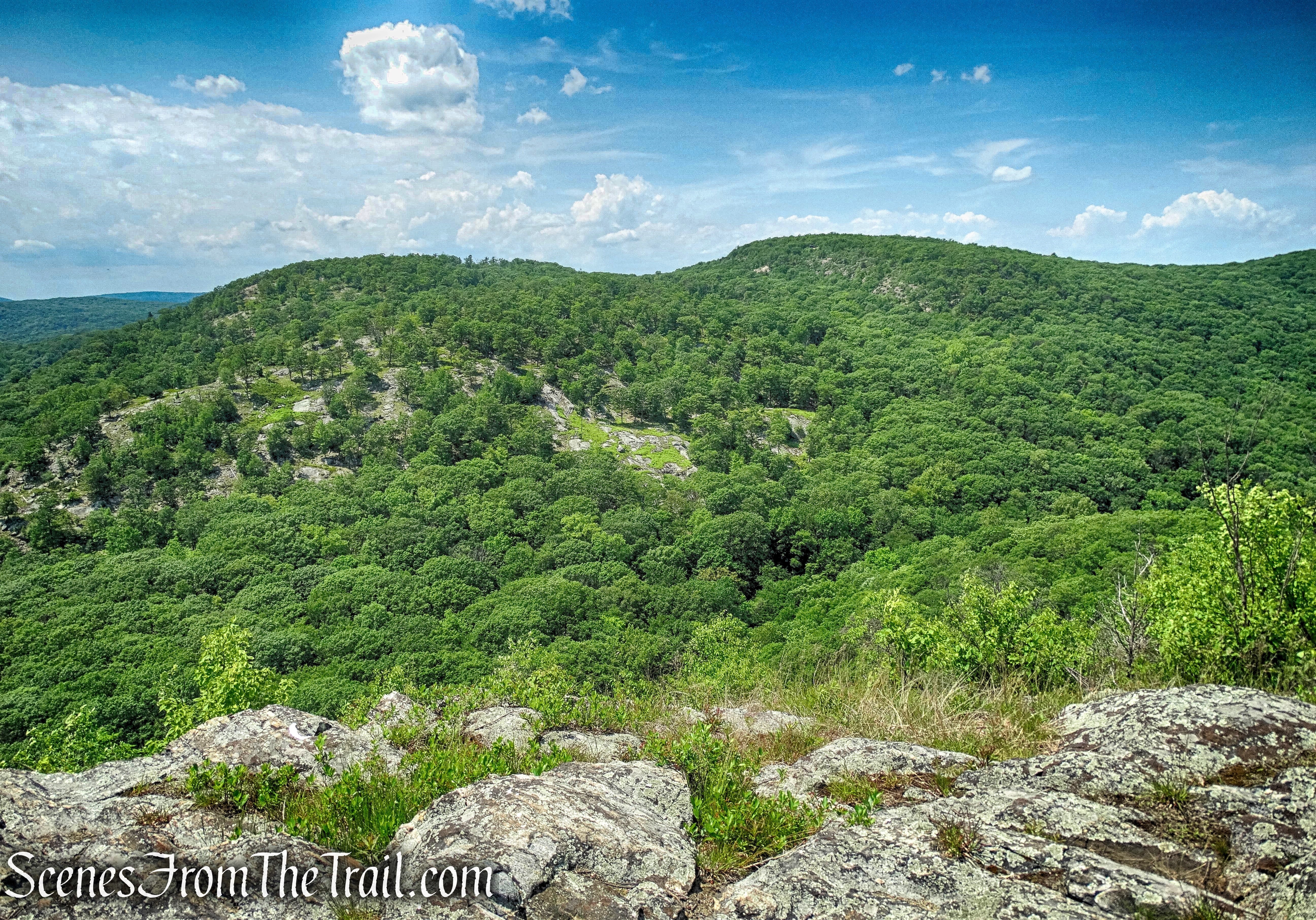
West Mountain as viewed from The Timp
Exactly one year ago to the day of this hike, I did a longer loop of West Mountain. Now I was looking to do a shorter loop with views and this place was worth a return visit. From the ridge there are views in all directions and it was fun to locate and point out the many peaks in the surrounding area that I have already hiked. The mini rock scrambles were also a blast. This hike was done in a counterclockwise direction.
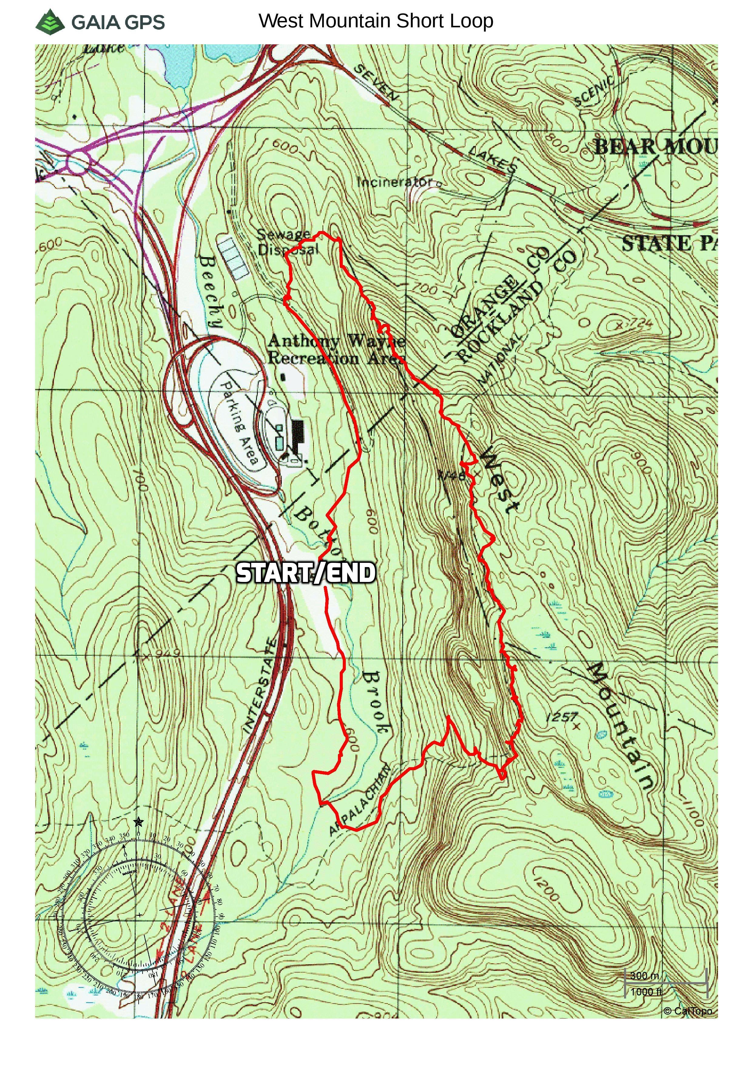
West Mountain Short Loop
A new feature that I have added is the Google Earth Fly-Through. It follows the path that we hiked and it gives you a good idea of the terrain, layout, amount of parking etc. Check it out, it’s pretty cool.
View the Google Earth Fly-Through video of the hike below.
We got a later start than usual due to the early morning rain, but it cleared up and we arrived at the Anthony Wayne Recreation Area shortly before 10:00 am. We walked to the kiosk at the southern end of Parking Area 2 and picked up the Horn Hill Loop Mountain Bike Trail which also runs through both parking lots.
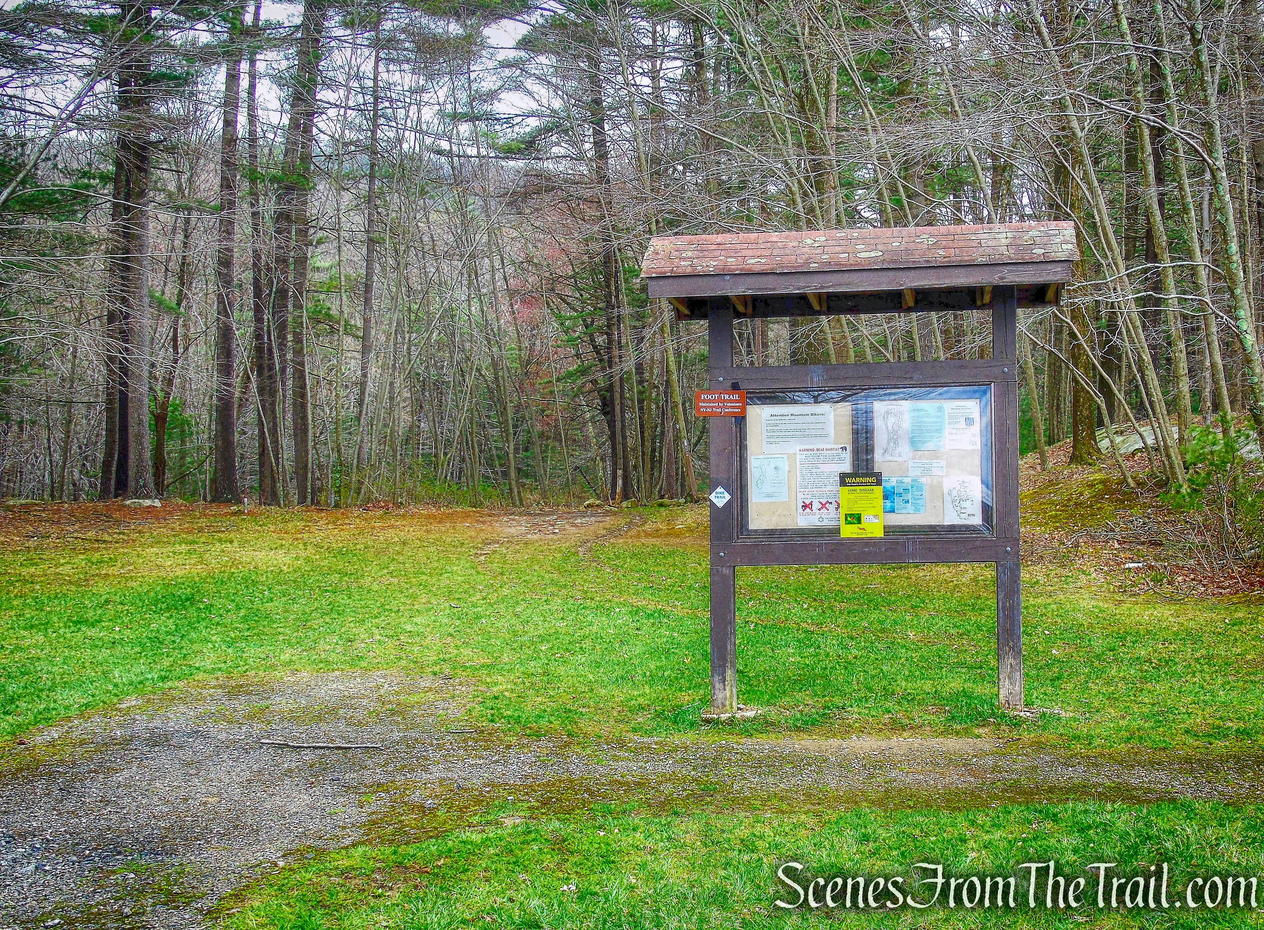
Trailhead – Anthony Wayne South Lot
The 4.8 mile Horn Hill Loop Mountain Bike Trail, with blue-on-white diamond blazes, forms a figure-eight loop which begins and ends here. It is the only trail in Harriman-Bear Mountain State Parks on which bicycles are permitted.
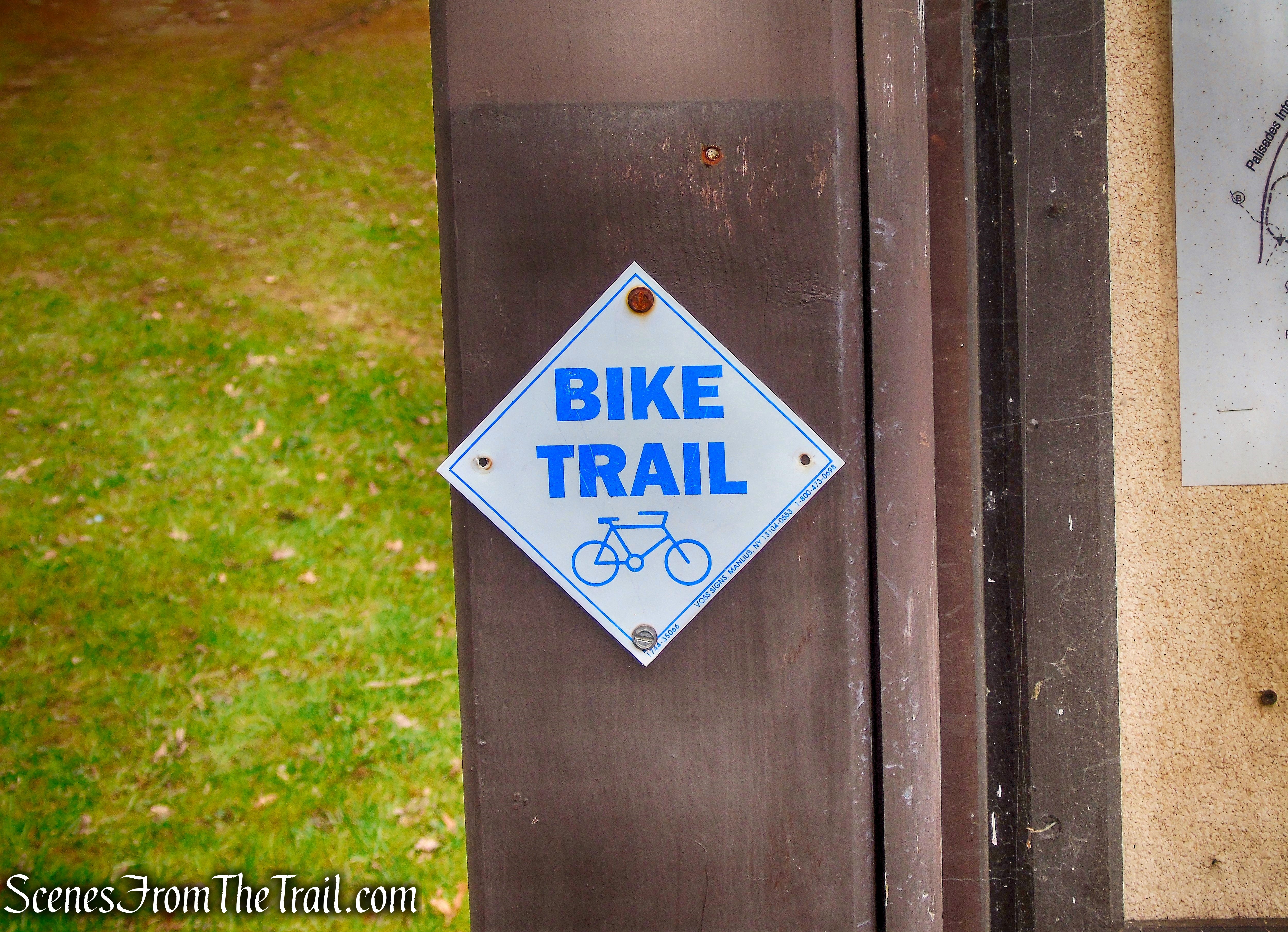
Horn Hill Loop Mountain Bike Trail
The trail enters the woods and travels through a pine forest. With all the rain that fell, the trail was swampy and in some places, large pools of water formed.

Horn Hill Loop Mountain Bike Trail
Shortly after entering the woods, we walked by what appeared to be someone’s art project.
art project? – Horn Hill Loop Mountain Bike Trail
The trail continues through the woods and crosses several bridges.
bridge – Horn Hill Loop Mountain Bike Trail
bridge – Horn Hill Loop Mountain Bike Trail
In about 0.5 mile from the kiosk, the trail comes to an intersection with the white-blazed Appalachian Trail. From this direction, only the back of the sign is visible.
intersection with the Appalachian Trail
intersection with the Appalachian Trail
The section of the Appalachian Trail that passes through Harriman and Bear Mountain State Parks is the oldest section of the trail, completed in 1923. The AT ascends gradually at first…..
Appalachian Trail
Then steepens as it crosses Beechy Bottom West Road (also part of the Horn Hill Loop).
Appalachian Trail at Beechy Bottom West Road crossing.
There are several stream crossings in this area which were made easier by the NY/NJ Trail Conference’s Long Distance Trails Crew.
stream crossing – Appalachian Trail
The Long Distance Trails Crew (LDTC) is made up of volunteers dedicated to the construction and rehabilitation of foot trails along the Appalachian Trail, Long Path and Highlands Trail in New York, west of the Hudson.
Appalachian Trail
The LDTC have relocated some sections of the heavily eroded trail and have installed switchbacks to eliminate some of the steeper sections in this area. Their work began in 2014 and are currently working on phase 3 of the project. After having climbed West Mountain a year earlier via the Ramapo-Dunderberg Trail, I expected the AT to be just as challenging. Thanks to the hard work and sweat of some dedicated volunteers, this ascent was made much easier. After approximately 0.8 mile on the AT, we came to our first view of the day. A rock outcrop alongside the trail made for a good place to stop and take a breather.
view southwest from Appalachian Trail
Nearing the ridge of West Mountain, we came to the section of the AT that is currently being worked on. The new treadway will include water bars and running steps.
Appalachian Trail
Much of the work involves using heavy hand tools and some rigging with a high line (overhead cable) to move heavy rocks.
high line – Appalachian Trail
We climbed the recently installed stone steps as we neared the top of West Mountain.
stone steps – Appalachian Trail
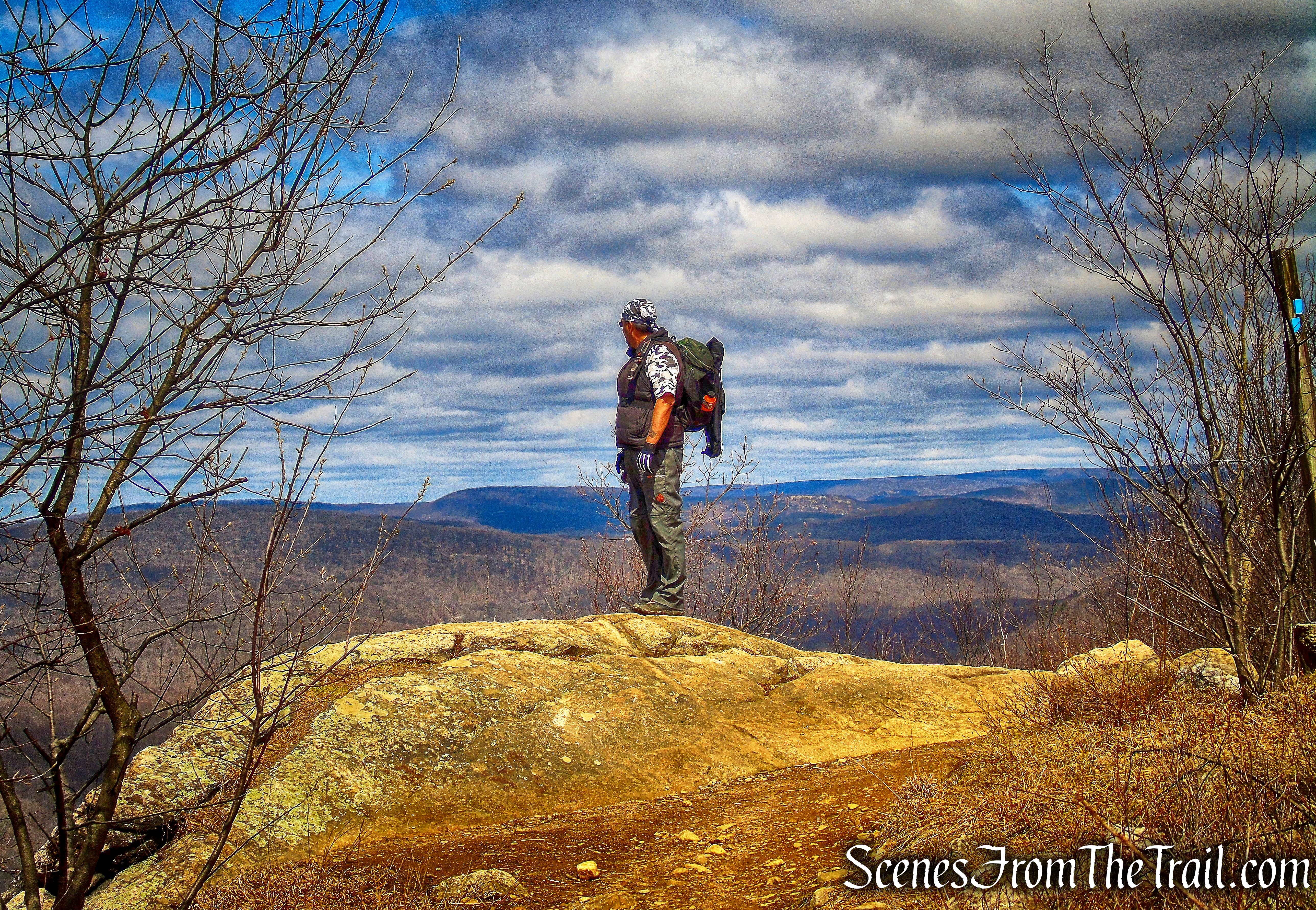
We then reached the junction where the AT meets the blue-blazed Timp-Torne Trail. The rock outcrop affords hikers a great west-facing view, with Black Mountain visible straight ahead.
junction with the Timp-Torne Trail
In approximately the first mile of the AT, we gained about 600 feet of elevation. It was well worth it. The AT now joins the blue-blazed Timp-Torne Trail as it heads north along the edge of the ridge. The Timp-Torne Trail was the second trail built by the new Palisades Interstate Park Trail Conference, in the winter of 1921.
coaligned AT/Timp-Torne Trail
The trail passes another west-facing view, veers slightly right and approaches some massive rock formations.
coaligned AT/Timp-Torne Trail
After passing the rock formations, the trail leads to an east-facing viewpoint. With Anthony’s Nose in the center, surrounded by the rest of the East Hudson Highlands. Bear Mountain is to the left with the tower of the Bear Mountain Bridge peeking out from the Hudson River.
east-facing viewpoint – coaligned AT/Timp-Torne Trail
Continuing north along the ridge, there is a north facing viewpoint, with Bear Mountain and Perkins Tower visible on the summit.
Bear Mountain
The trail then veers to the left and continues along the western edge of the cliffs as it continues heading north.
coaligned AT/Timp-Torne Trail
At another rock outcrop is Balancing Rock, a glacial erratic that looks out of place here.
Balancing Rock – coaligned AT/Timp-Torne Trail
We stopped here and took another short break, admiring the view.
Balancing Rock – coaligned AT/Timp-Torne Trail
A little further north, another large rock outcrop with a great view west of the Harriman Hills.
west-facing view – coaligned AT/Timp-Torne Trail
The trail then travels over some rock ledges…….
rock ledge – coaligned AT/Timp-Torne Trail
and passes through a level area as it approaches some large cliffs.
coaligned AT/Timp-Torne Trail
The coaligned AT/Timp-Torne Trail climbs through the crevices in the large rocks.
coaligned AT/Timp-Torne Trail
The trail then travels over open rock slabs, but in certain spots there is a well worn path that bypasses the more difficult sections…….
coaligned AT/Timp-Torne Trail
with more views along the way.
coaligned AT/Timp-Torne Trail
The trail then comes to a north facing viewpoint, with Bear Mountain directly ahead.
view north of Bear Mountain
Perkins Memorial Tower is clearly visible at the summit.
Perkins Memorial Tower
To the southeast, the Hudson River can be viewed from this spot.
Hudson River
When we reached a y-intersection where the white-blazed Appalachian Trail veers right, we stayed left to remain on the blue-blazed Timp-Torne Trail.
veer left on Timp-Torne Trail
The trail changes from open rock to a rocky footpath over undulating terrain as it passes several more viewpoints.
Timp-Torne Trail
Perkins Memorial Tower from the Timp-Torne Trail
The Timp-Torne Trail passes through some large rock formations……
Timp-Torne Trail
with a short rock scramble just ahead.
Timp-Torne Trail
Another west-facing viewpoint with the Palisades Interstate Parkway and the Anthony Wayne Recreation Area north lot, visible below.
Timp-Torne Trail
The trail then begins a rather steep descent over open rock slabs. Relying on the grip of our boots, this section would be difficult if not hazardous, in wet conditions. There is a dirt path that bypasses some steep sections along this descent.
Timp-Torne Trail
On the way down, there is a great view of Popolopen Torne. The first time I hiked West Mountain, this view was the motivating factor in wanting to hike “The Torne.”
Timp-Torne Trail
At the base of the descent, a view back at the spot we were at, just moments earlier.
Timp-Torne Trail
After another steep descent, we came to an intersection with the red-“F”-on-white blazed Fawn Trail. Here we turned left and began heading west.
Fawn Trail
The Fawn Trail was shown on the first Park trail map in 1920. The Fawn Trail provides an easy route from the Appalachian Trail (AT) and Doodletown Road to the Anthony Wayne Recreation Area on the other side of West Mountain. It is a fairly level trail, and in June it passes through masses of laurels in bloom.
Fawn Trail
The Fawn Trail heads downhill, descending gradually towards the base of West Mountain.
Fawn Trail
The Fawn Trail ends at a junction with the white-blazed Anthony Wayne Trail at Beechy Bottom East Road.
Fawn Trail terminus
We then turned left onto Beechy Bottom East Road, which is also the route of the Horn Hill Loop Mountain Bike Trail. The trail continues straight ahead along the gravel road. The large pipe along the road goes up to a concrete reservoir. We followed this road south until we passed the north parking lot, which is visible through the trees. We then veered right on a park road that leads through a picnic area. We then crossed the bridge over Beechy Bottom Brook and back to the south parking lot, where our hike began.
Beechy Bottom East Road
This is one of my favorite Harriman hikes. Now having done two variations of it, I plan to do it again sometime, but in reverse. The views are nonstop, the terrain is varied and the light rock scrambling is enjoyable. This short loop is challenging, but not to the point of being overwhelming. I truly enjoyed being able to see all the hills in Harriman-Bear Mountain State Parks that I have hiked.
Pros: Views galore, light rock scrambling, varied terrain, well marked trails.
Cons: Some road noise from the parkway, Some sections of the trail can be hazardous when wet or icy.
Take a hike!
West Mountain
Sources:
- Long Distance Trails Crew
- New York-New Jersey Trail Conference
- Myles, William J.. Harriman Trails: A Guide and History – Kindle Edition
