May 5, 2018 – Ringwood, NJ
Difficulty: Moderate to Strenuous
Length: Approximately 5 miles
Max elevation: 973 ft. – total elevation gain: approximately 935 ft.
Route type: Circuit
Map: North Jersey Trails Map #115 – Free map
Trailhead parking: 150 Snake Den Rd, Ringwood, NJ 07456
With more than 5,400 acres, Norvin Green State Forest has one of the largest concentrations of trails in the state. Norvin Hewitt Green, nephew of Ringwood Manor owner Abram S. Hewitt, donated much of this land to the State of New Jersey in 1946. Part of the Wyanokie Wilderness Area, the forest is near Wanaque Reservoir and is home to an extensive trail system built from old logging roads, which can be combined to form a variety of loop hikes. With hills ranging from 400 to 1,300 feet in elevation, Norvin Green provides the avid hiker with multiple scenic vistas. The park is operated and maintained by the New Jersey Division of Parks and Forestry.
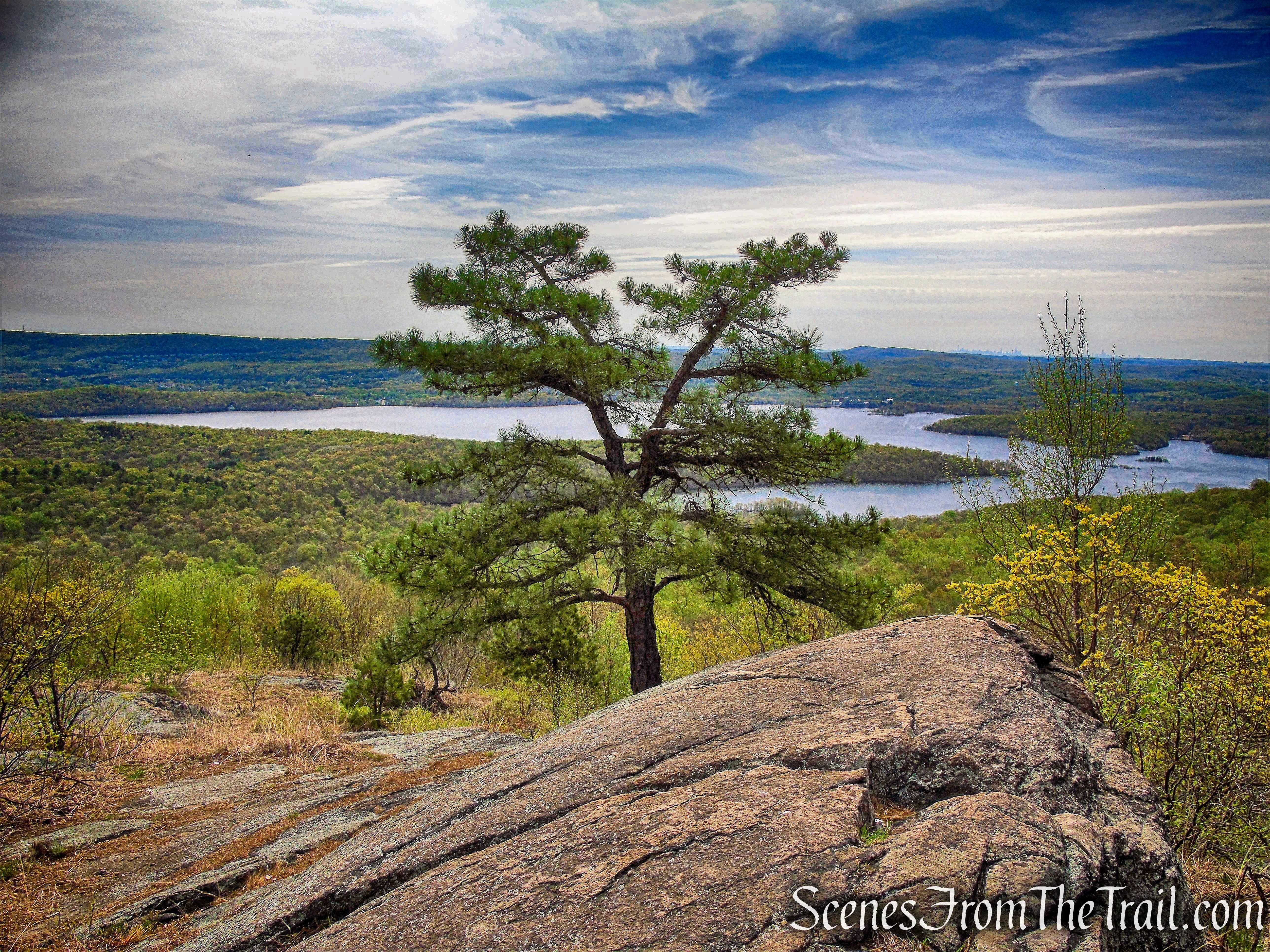
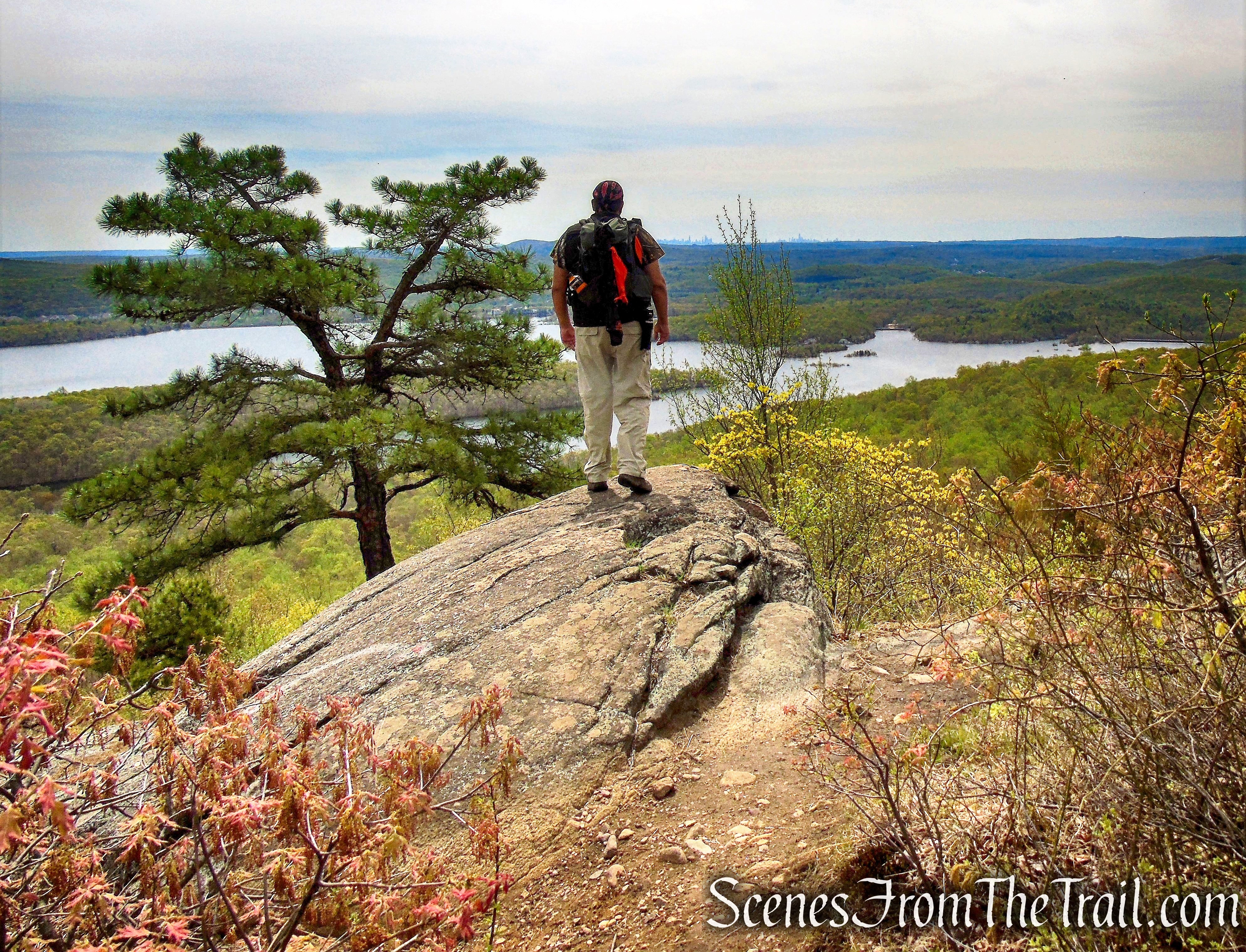
Wyanokie High Point despite its name, isn’t the highest point in the Wyanokies, but it offers one of the finer views in New Jersey. Its nearly bald summit provides 360° views of the surrounding area, including the Wanaque Reservoir and the Manhattan skyline.
Wyanokie High Point
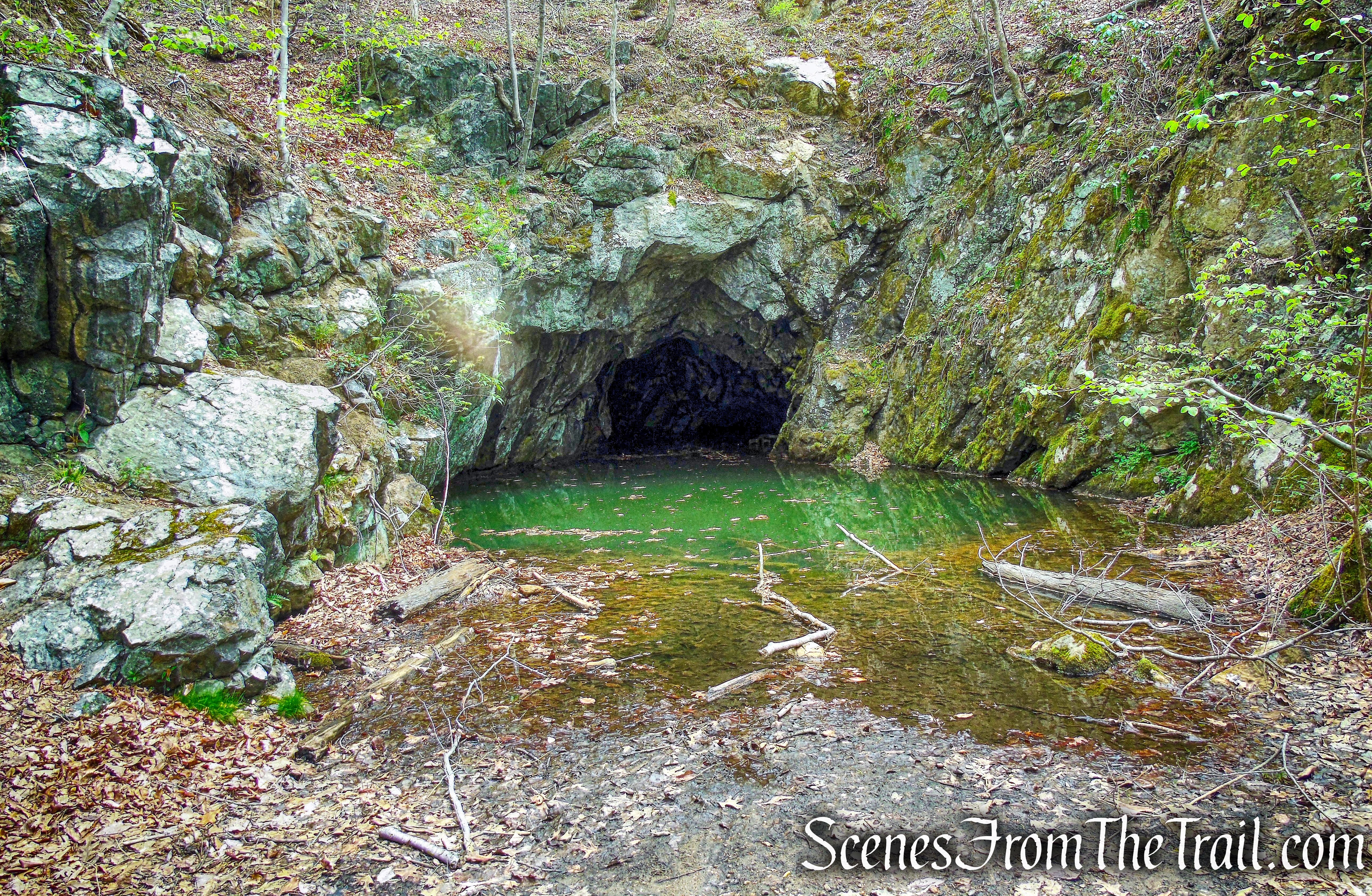
The Blue Mine, which is also known as the London, Iron Hill or Whynockie Mine, undoubtedly received its common name from the varying dark blue color of its ore. This ore deposit was first discovered and opened by Peter Hasenclever around 1765. During the early 19th century, the mine was worked by Peter M. Ryerson. This trench is fifty feet long, twenty-five feet wide and fifteen feet deep, and is filled with water.
Blue Mine – Norvin Green State Forest
I was looking to do a somewhat moderate hike with some views and after a little research, I decided on this hike. This is one of the more popular hiking areas in New Jersey, but does not get nearly as crowded as Harriman State Park. Wyanokie High Point is similar to Popolopen Torne, as that both have a short but steep climb to a bald summit and offer 360° views. The hike didn’t go exactly as planned because we turned when we should have continued straight and included a road walk at the end. The wrong turn took us to another mine that we wouldn’t have found if we stayed on the planned route. This hike was done in a counterclockwise fashion from the New Weis Center.
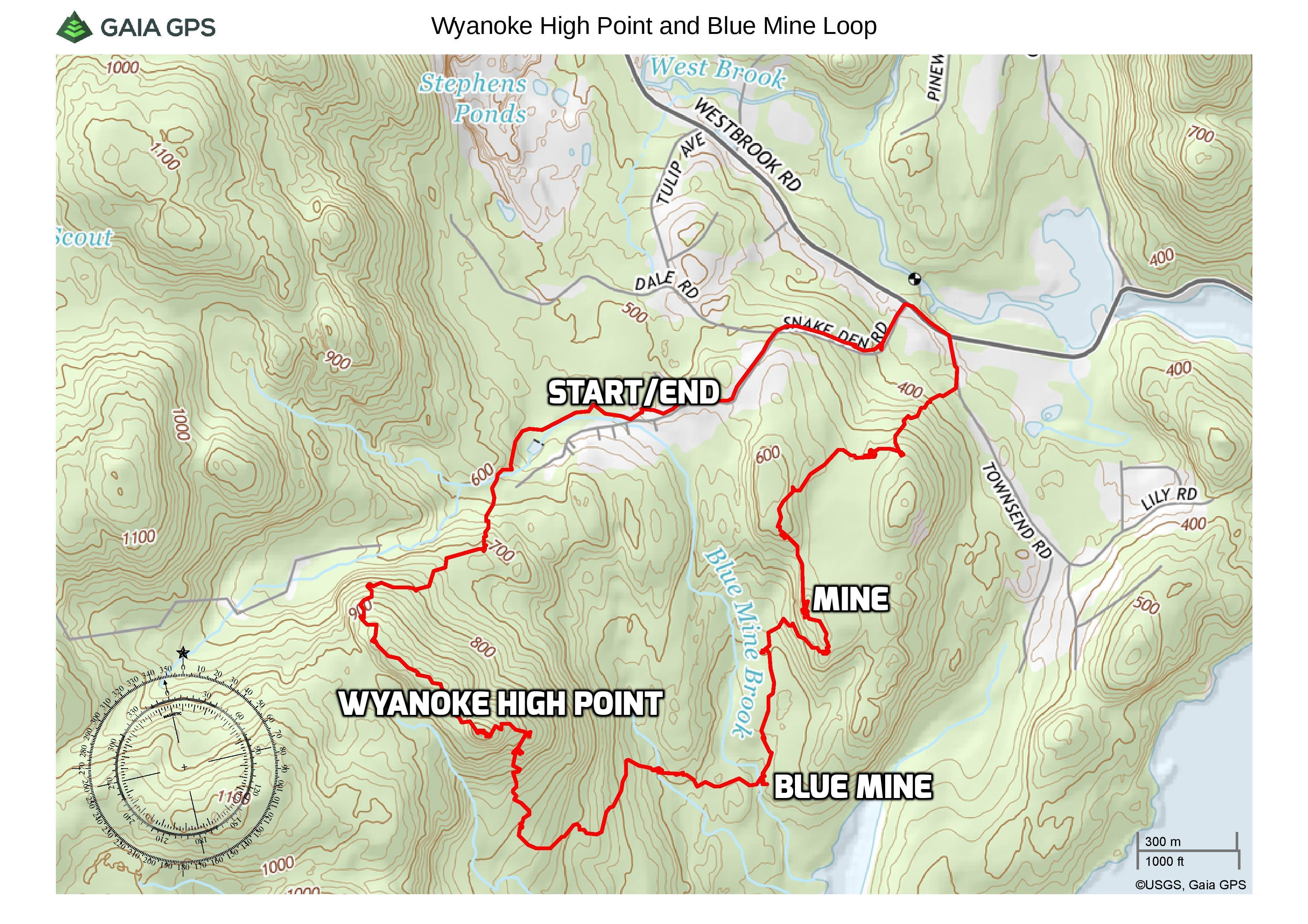
Wyanokie High Pointt and Blue Mine Loop
A new feature that I have added is the Google Earth Fly-Through. It follows the path that we hiked and it gives you a good idea of the terrain, layout, amount of parking etc. Check it out, it’s pretty cool.
View the Google Earth Fly-Through video of the hike below.
The parking area is located just before the entrance to the New Weis Center. The buildings are currently closed to the public, but the parking area is open to hikers.
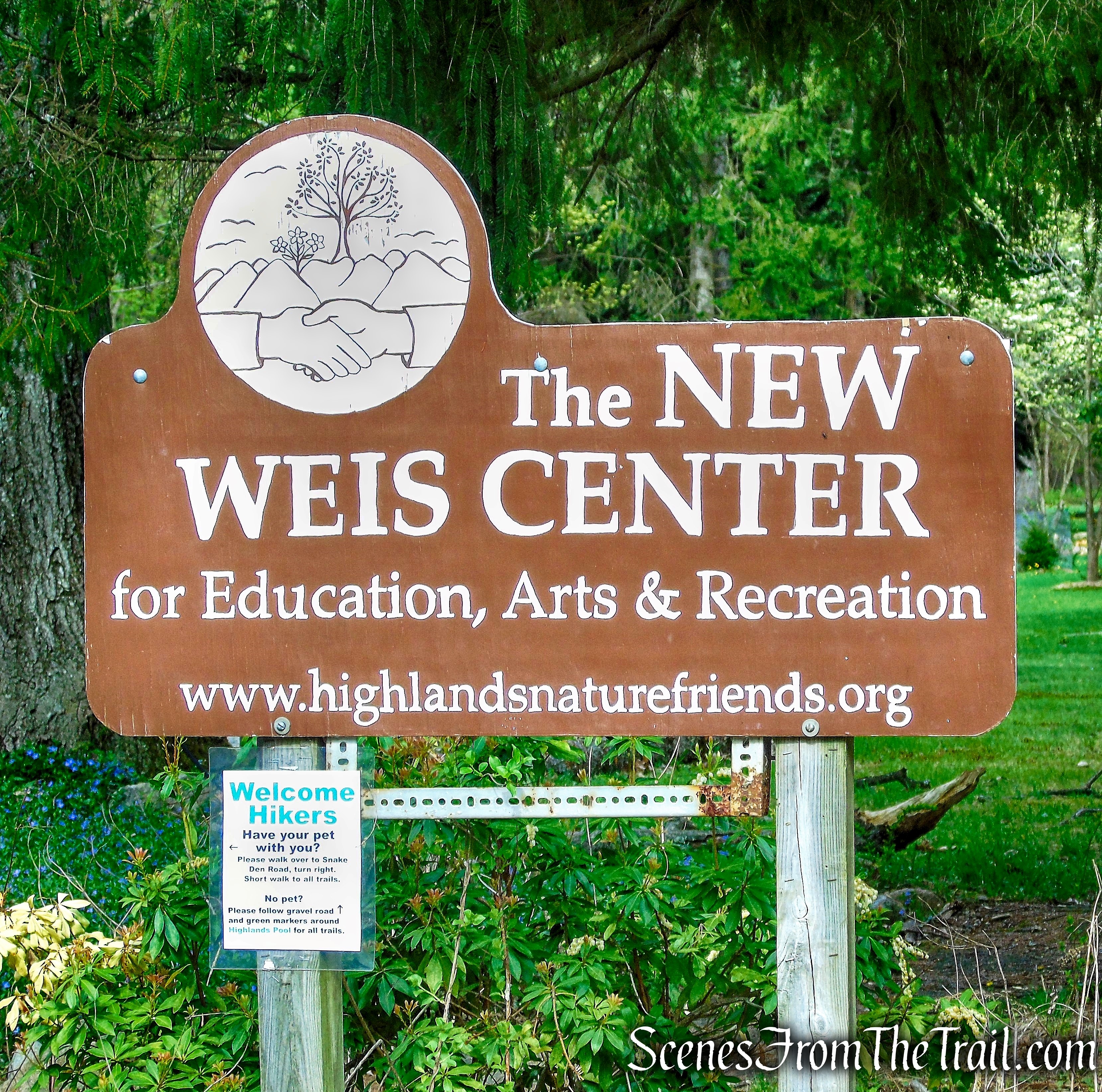
New Weis Center
The hike begins at the western end of the parking area, where a gatepost with triple light-green blaze marks the start of the Otter Hole Trail. We would be following this trail for the first third of a mile (other trails, such as the “L” Trail and the “W” Trail, are co-aligned for part of the way).
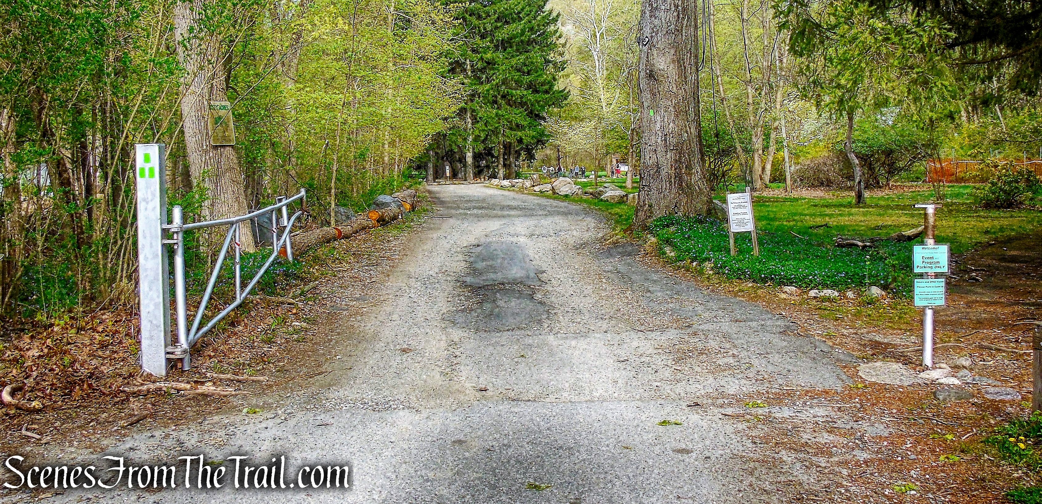
start of the Otter Hole Trail
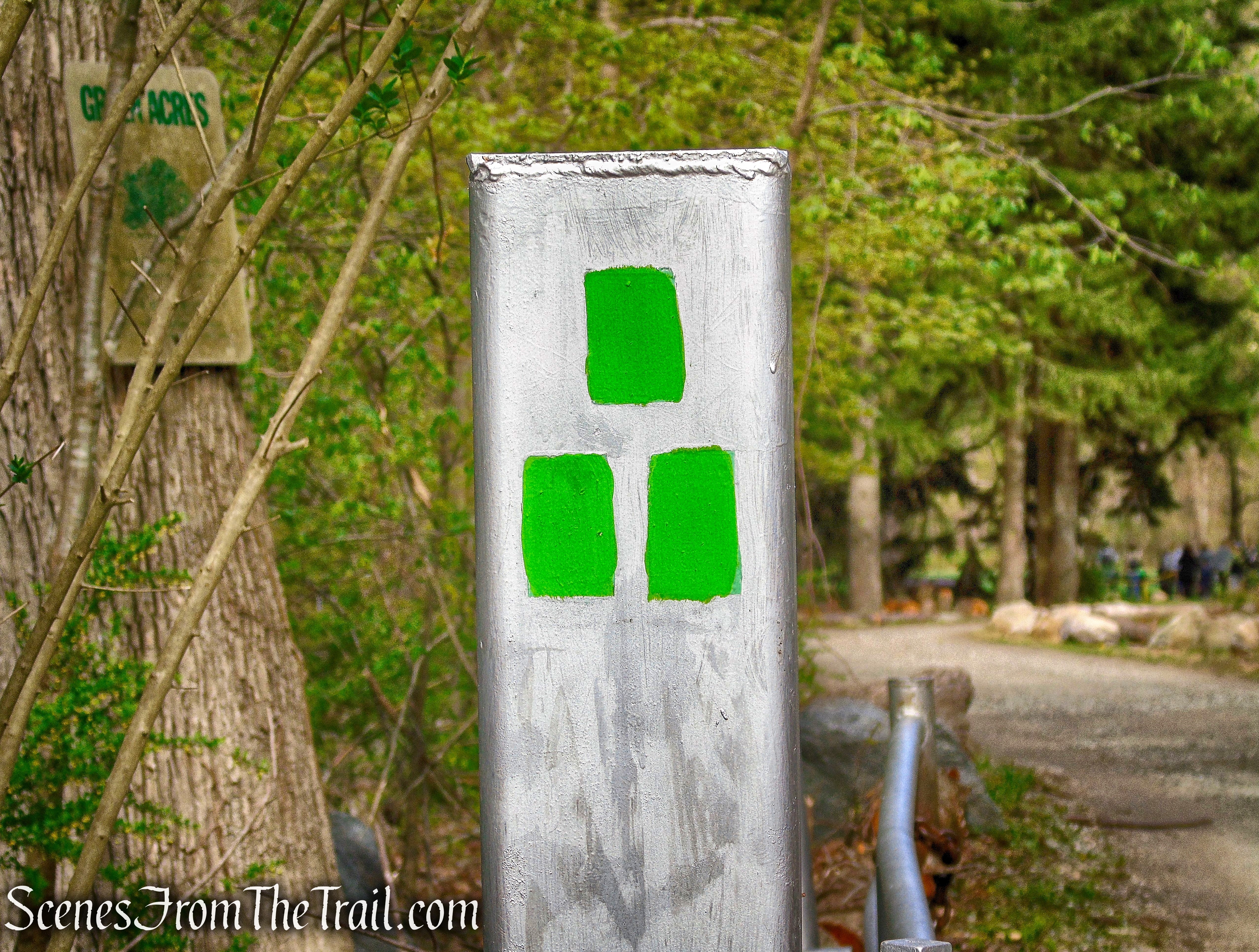
start of the Otter Hole Trail
We continued on the entrance road, following the green blazes. Just ahead is a kiosk and just to the right is the Nature House. The New Weis Center property was a farm in the 1800’s. It was purchased by the Carrigan family in 1866, and the belief is that the old farmhouse (the “Nature House”) dates back to that era, if not earlier.
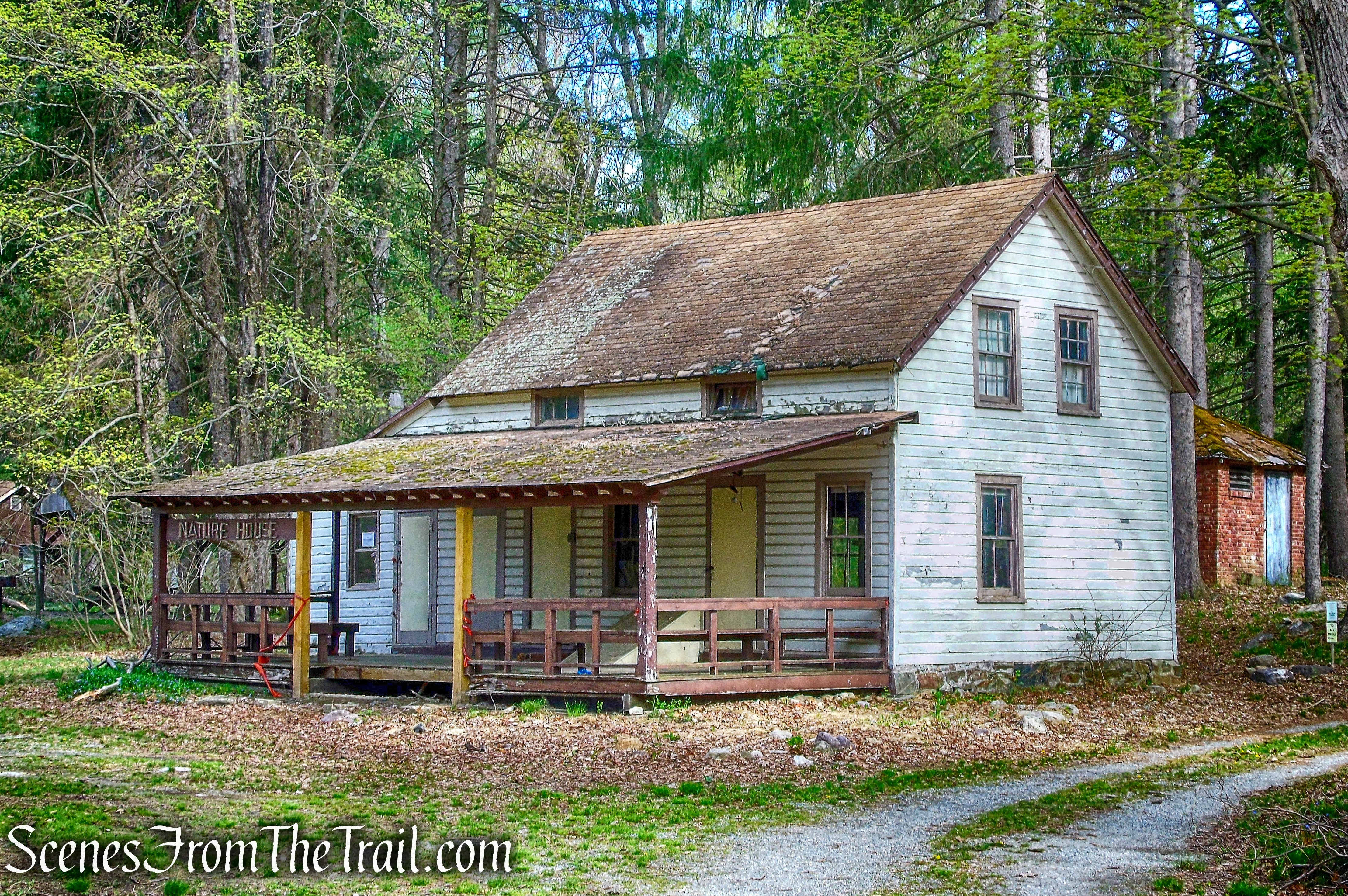
Nature House
The Otter Hole Trail then leaves the entrance road and runs along Blue Mine Brook on a wide footpath, lined with Norway Spruce.
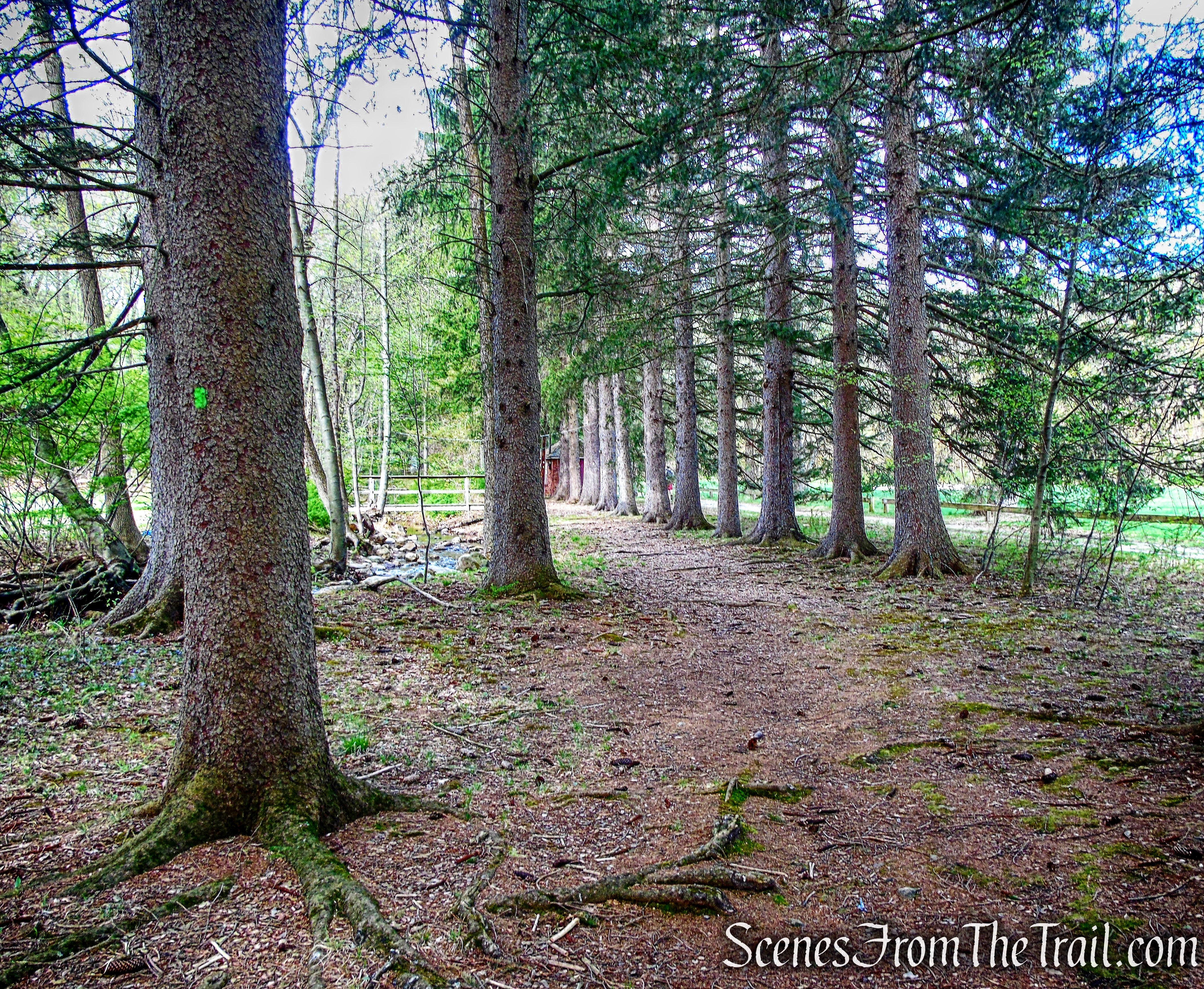
Otter Hole Trail
Soon, the trail bears right to skirt the Highlands Natural Pool. Built about 70 years ago, this pool is fed by the brook and is not chlorinated. The trail briefly joins a dirt road, then bears left and ascends on a footpath and reaches a footbridge.
footbridge – Otter Hole Trail
After crossing a footbridge over Blue Mine Brook, the green-blazed Otter Hole Trail ascends through a rocky area on a footpath.
Otter Hole Trail
The trail reaches a wide woods road, the continuation of Snake Den Road. Here, the Otter Hole Trail turns right and follows the road, but we crossed the road and proceeded ahead to the kiosk.
junction
The co-aligned Mine (yellow-on-white) and Hewitt-Butler (blue) Trails begin here.
start of joint Mine and Hewitt-Butler Trails
The joint trails ascend on a footpath through mountain laurel and then climb more steeply through a rocky area.
joint Mine and Hewitt-Butler Trails
The trails level off and reach a junction where they split. The Mine Trail turns left, but we continued ahead following the blue blazes of the Hewitt-Butler Trail.
continue straight on Hewitt-Butler Trail
After a short level section, the trail begins a steady climb.
Hewitt-Butler Trail
At the top, a rock outcrop to the right of the trail offers a west-facing view, with Assiniwikam Mountain visible to the right (northwest). Just beyond, the white-blazed Macopin Trail begins to the right, but we continued ahead on the Hewitt-Butler Trail. Soon, we came to a balanced rock atop a rock ledge, with views west, east and north.
balanced rock – Hewitt-Butler Trail
balanced rock – Hewitt-Butler Trail
After a relatively level stretch, we reached a junction with the red-on-white-blazed Wyanokie Circular Trail (also the route of the teal-diamond-blazed Highlands Trail).
Wyanokie Circular Trail
The sign on the side of the tree helps point the way.

Wyanokie Circular Trail
Turning left, we followed these trails, which make a short but steep climb to the summit of Wyanokie High Point.
Wyanokie Circular Trail
The trail is steep, but it is not as difficult as it looks.
final ascent to Wyanokie High Point
The last part of the climb is over bare rock, with the trail marked by blazes painted on the rock.
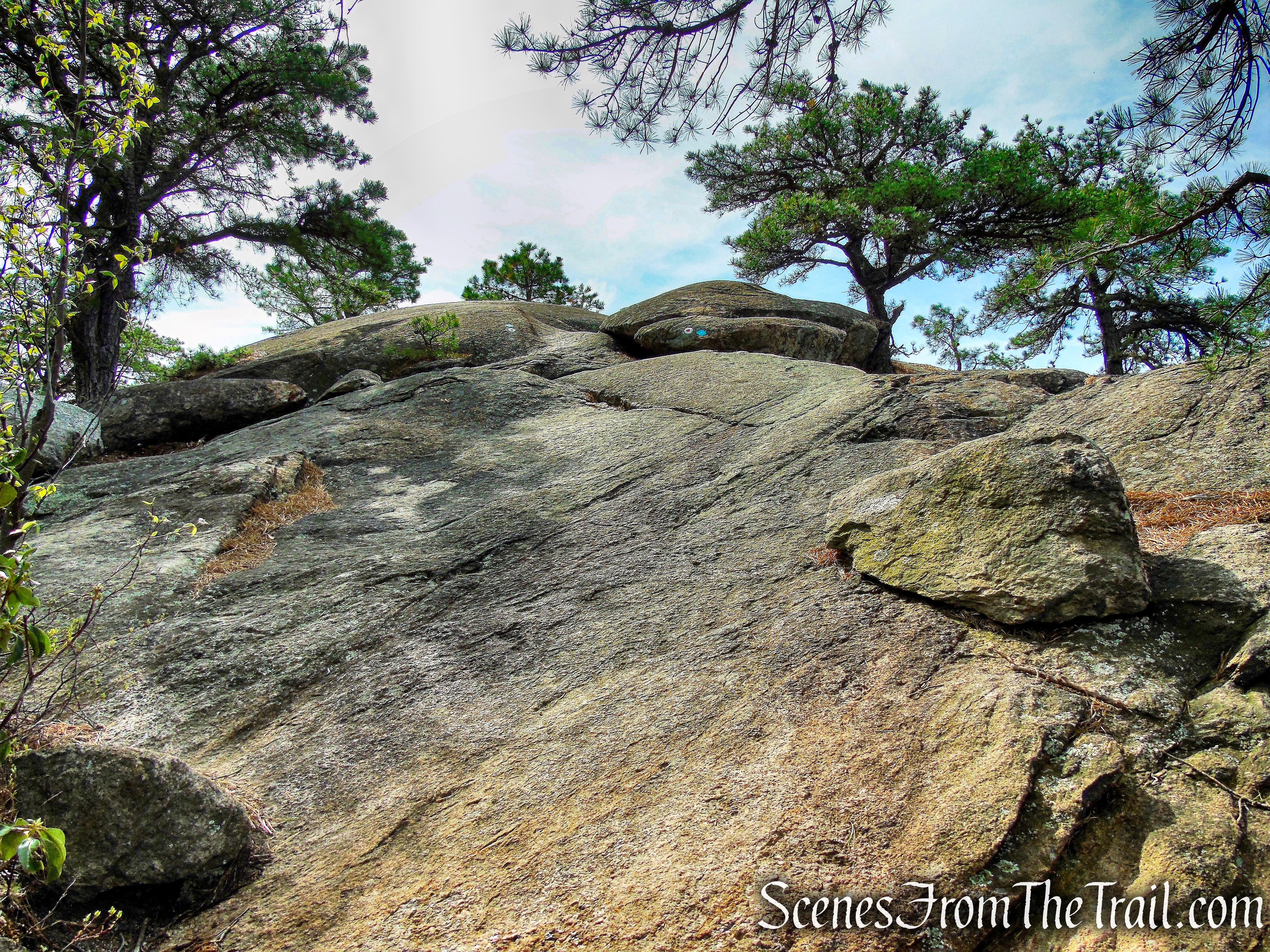
final ascent to Wyanokie High Point
We arrived at the summit and were all alone. I guess timing is everything.
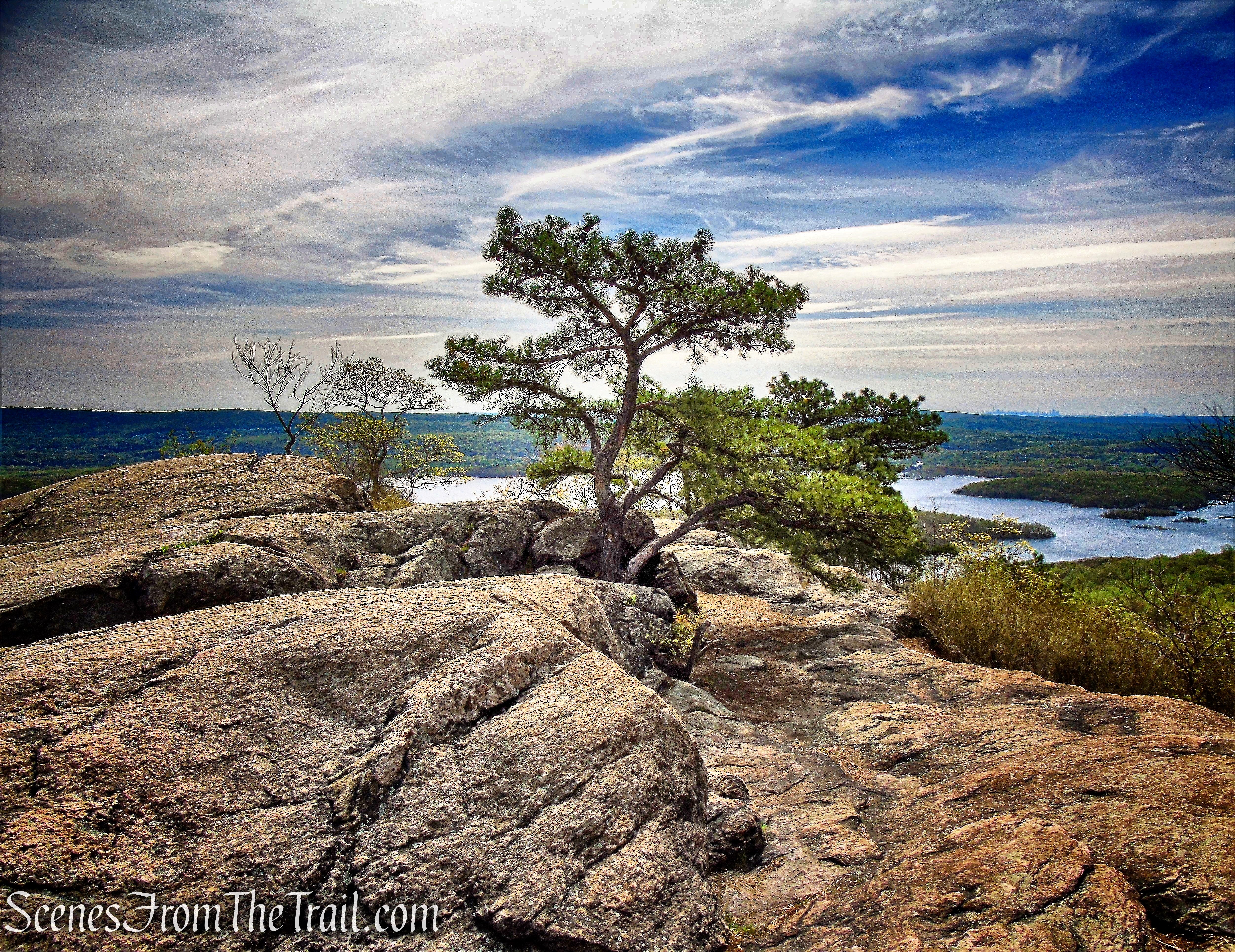
Wyanokie High Point
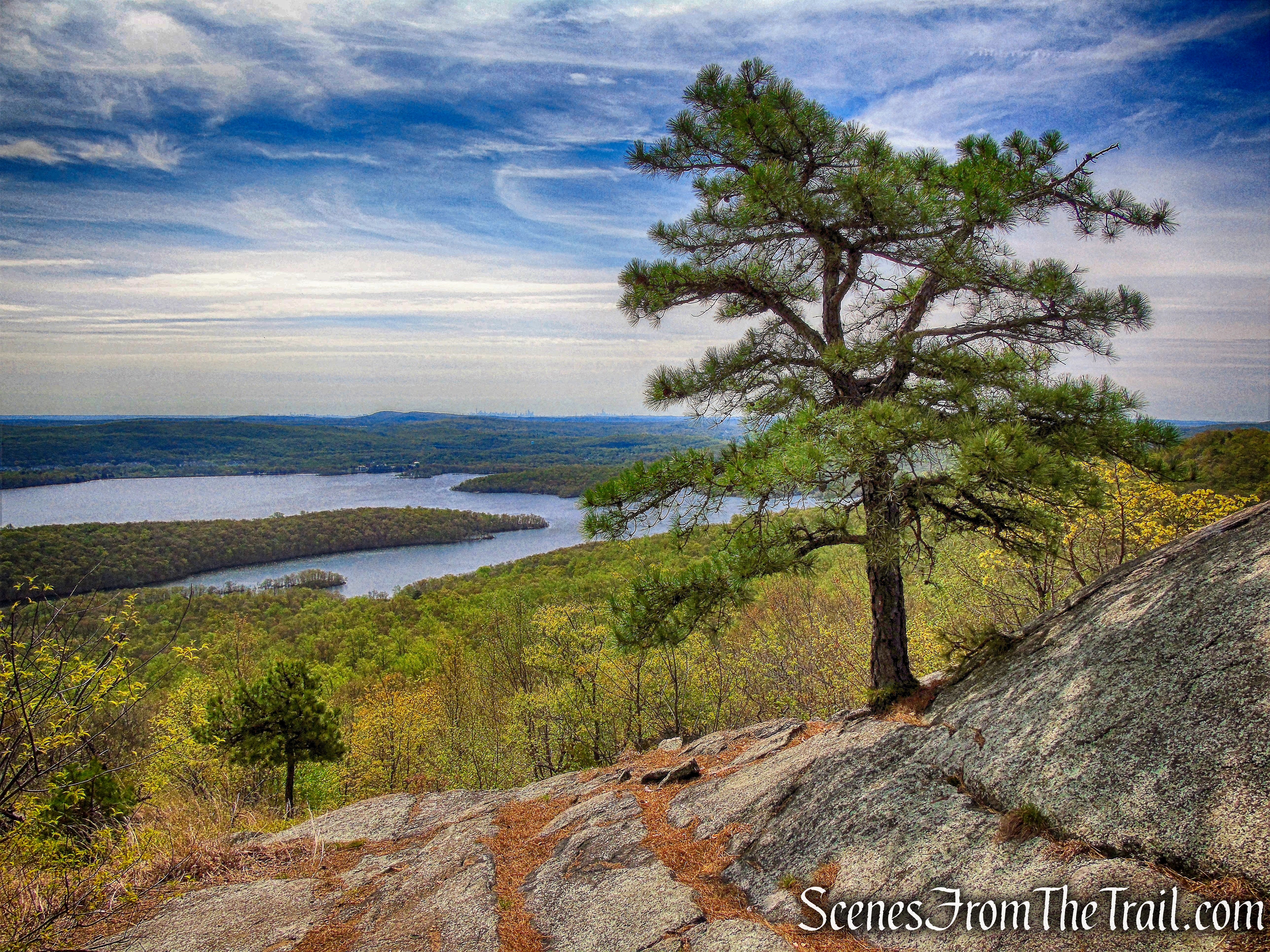
The nearly bald summit offers panoramic views to the southeast over the Wanaque Reservoir. The Wanaque Reservoir is the largest one in New Jersey. It supplies water for Newark, Paterson, Passaic, etc. Work began in 1920, which required replacing 4 miles of railroad and highway. It was completed in 1928 and can hold 27 billion gallons of “drink.” Nine dams hold the water in check.
Wyanokie High Point
On a clear day, the Manhattan skyline may be seen on the horizon.
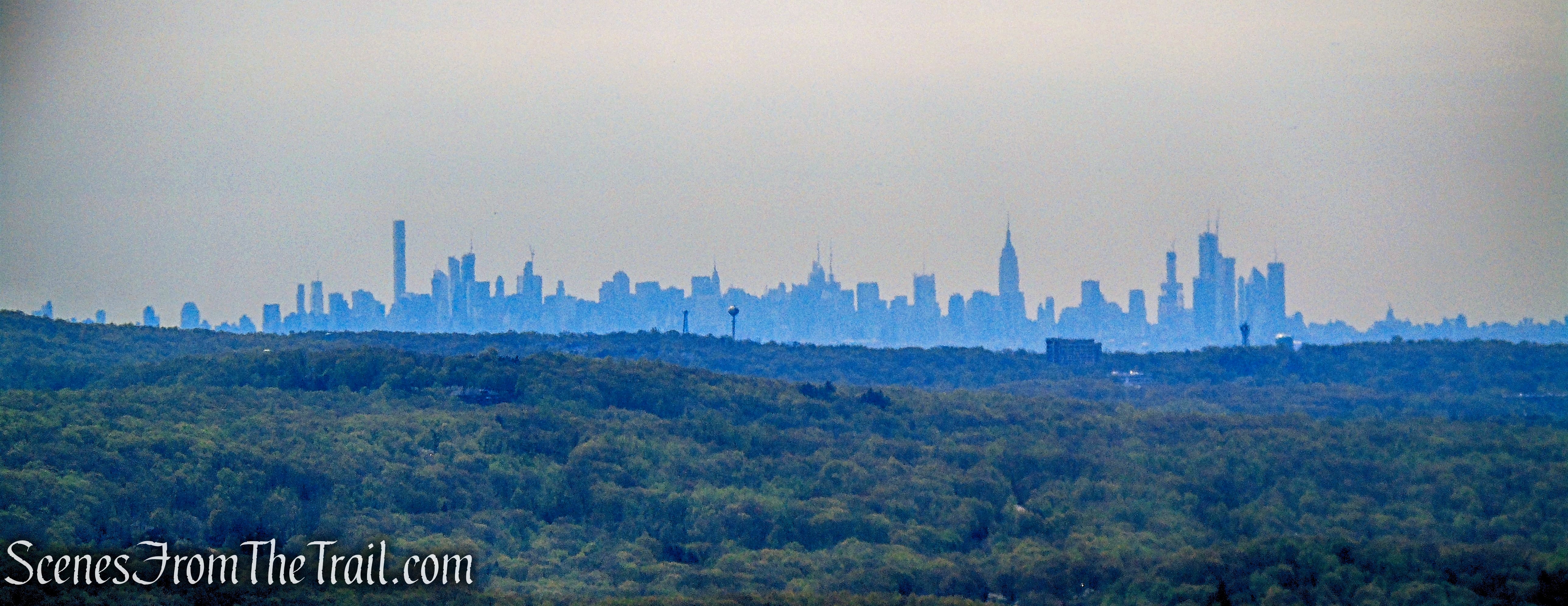
Manhattan skyline – Wyanokie High Point
The true summit of Wyanokie High Point is marked by a protruding steel bar.
Wyanokie High Point
There is also a monument at the summit.
monument – Wyanokie High Point
We stayed at the summit for quite some time enjoying the sunny, but breezy weather. The views here are about as good as it gets. It was nearly noon when other hikers start arriving. That was our cue to get moving. We had enjoyed this spot for long enough and we still had a hike to complete.
Wyanokie High Point
We followed the red-and-white and teal diamond blazes as they descend from the summit, passing more views of the Wanaque Reservoir along the way.
Wanaque Reservoir
The trail eventually goes back into the woods and bears left, with the descent becoming less steep. At the base of the descent, the white-blazed Lower Trail begins to the right. Just beyond, the trail crosses a stream, and soon afterwards, the yellow-on-white Mine Trail joins from the left. We proceeded ahead, now following three different trail blazes.
Wyanokie Circular Trail
A short distance ahead, to the left of the trail, are the ruins of a stone shelter, constructed by members of the Green Mountain Club in the 1930’s.
ruins of a stone shelter
The trail now approaches Blue Mine Brook. Just before reaching the brook, there is a circular mine pit to the right of the trail, with a small pile of tailings (discarded waste rock) to its left. The trail crosses the brook on a wooden footbridge, built as an Eagle Scout project in 2002.
wooden footbridge
Immediately after crossing the bridge, we turned right and proceeded ahead for about 100 feet. To the left is the Blue Mine, filled with muddy water.
Blue Mine – Norvin Green State Forest
This ore deposit was first discovered and opened by Peter Hasenclever around 1765 and was worked intermittently throughout the 19th century. By 1890 it had yielded 800 tons of ore. It was shut down for good in 1905.
Blue Mine – Norvin Green State Forest
A large concrete pad at the entrance to the mine, with protruding iron rods, once served as a base for steam-operated equipment.
concrete pad – Blue Mine
We went back to the footbridge (did not recross it). Just beyond, the teal-diamond-blazed Highlands Trail leaves to the right, but we continued ahead on the joint Mine/Wyanokie Circular Trails, which follow a rocky woods road. Bearing left at a fork and continuing ahead for about a quarter of a mile until the two trails separate. Here, we turned right and followed the yellow-on-white blazes of the Mine Trail, which climbs on a narrow woods road. At the top of a rather steep pitch, the Mine Trail turns sharply right, but we should have continued ahead on the orange-blazed Roomy Mine Trail. Here is where I screwed up. I was under the assumption that when the orange and yellow trails meet, we should follow the co-aligned trails until they split. I was wrong. After a while, I was pretty sure we were off the planned route, but it wasn’t all bad. We hiked through a a beautiful stretch of trail without running into anyone.
co-aligned Mine and Roomy Mine Trails
We also came across another mine that I didn’t know anything about. It could be another adit from the Roomy Mine, but I am not quite sure. While reviewing the track recorded by my GPS, post hike, I discovered that this mine was on the ridge above the Roomy Mine.
UPDATE: In the process of writing this post, I contacted the New Jersey Division of Parks and Forestry and they responded: “the opening you have questioned is not a separate mine but rather a shaft associated with the Roomy Mine itself.” They are going to further explore this matter and will notify me if any additional information arises.
iron mine – co-aligned Mine and Roomy Mine Trails
While checking out this mine, I heard and saw two people down below and was going to climb down to see if the Roomy Mine was down there, but if I was wrong, it would have been a steep climb back.
iron mine – co-aligned Mine and Roomy Mine Trails
Instead we continued on the co-aligned Mine and Roomy Mine Trails until they split. We then followed the orange-blazed Roomy Mine Trail which had several ups and downs, but eventually leveled off.
Roomy Mine Trail
We followed the orange blazes until its terminus at a junction with the teal-diamond-blazed Highlands Trail. There we had a decision to make, take a left on the Highlands Trail out to Townsend Road and road walk back up the hill to the parking area or turn right and end up back near the Blue Mine and then make our way through the woods back to where we started. It was an easy choice. Road walk it was. Once out on Townsend Road, we walked downhill to the stop sign and turned left on Westbrook Road. We then turned left on Snake Den Road. Along the way there were a few interesting things to see.
Townsend Road
Townsend Road
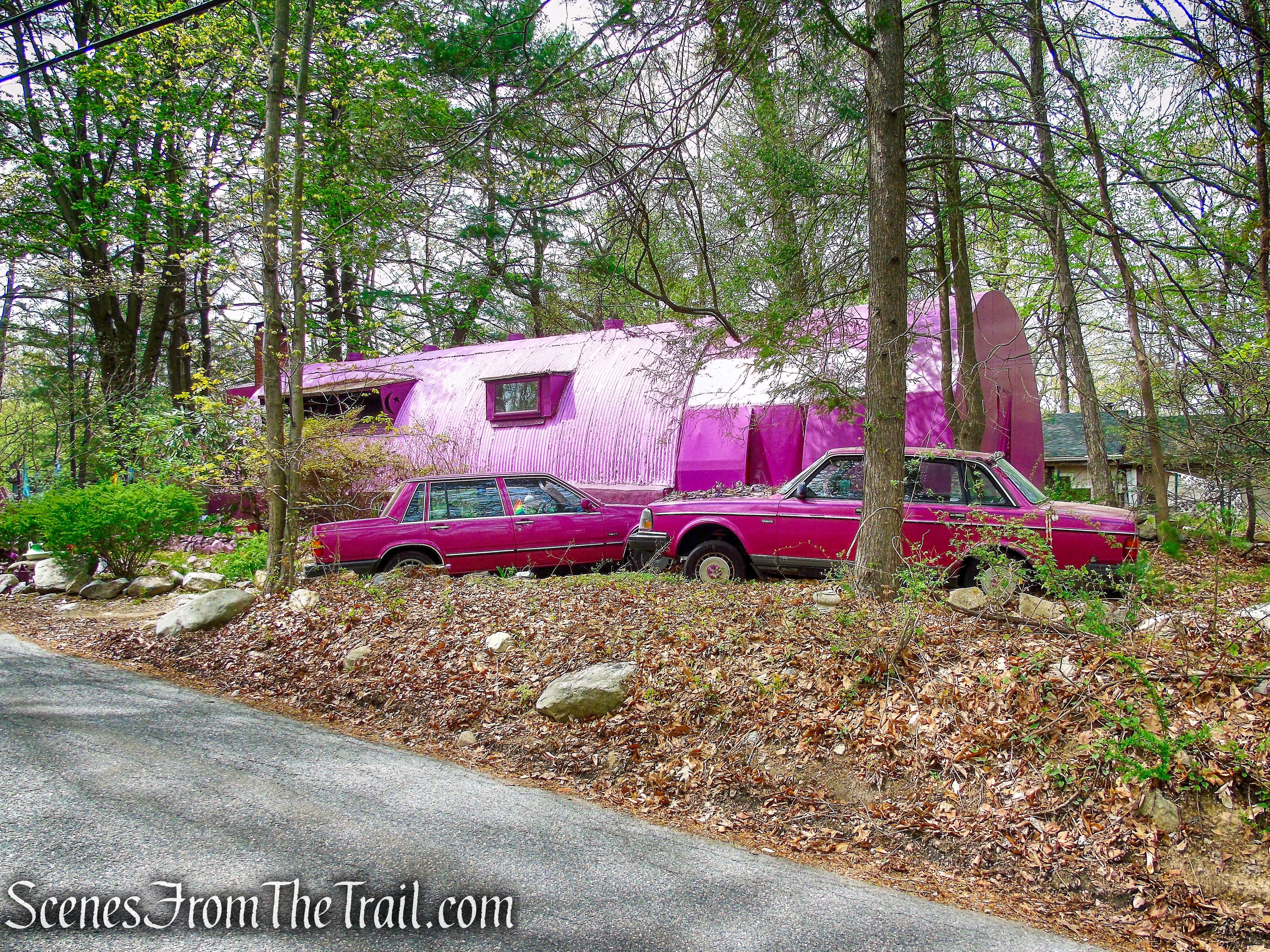
purple quonset hut – Snake Den Road
We then returned back to the parking area, where our hike began. It was about 2:20 pm when we got back and the lot was just about full.
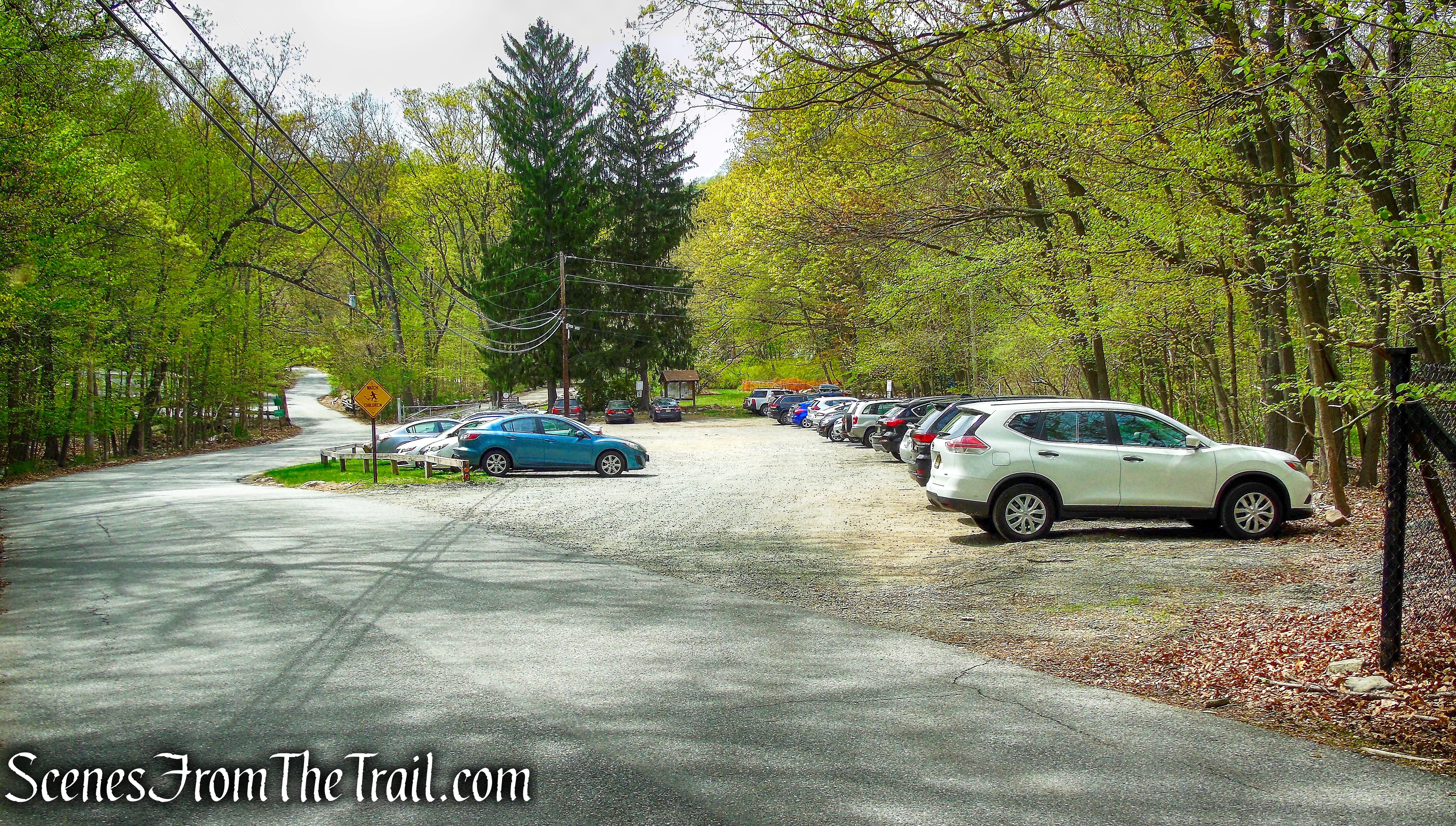
New Weis Center parking – Snake Den Road
Despite the wrong turn, this was a really good hike. I was in a zone and just enjoying being in the woods and not paying attention when I should have. Since the trail we missed and the trail we were on were pretty much parallel, my compass read that we were going in the right direction. Another lesson learned out on the trail. I plan on going back sometime soon and doing a different hike, but visiting the Roomy Mine.
Pros: Well marked trails, gorgeous views, iron mines, rock formations.
Cons: Now they call me “Wrong Way.”
Take a hike!
Wyanokie High Point
Sources:
- New York-New Jersey Trail Conference
- Norvin Green State Forest
- New Weis Center
- Iron Mine Trails – Lenik, Edward J. – Kindle Edition
