September 22, 2017 – Tupper Lake, NY
Difficulty: Easy – moderate
Length: Approximately 2.2 miles
Max elevation: 2280 ft.– total elevation gain approximately 548 ft.
Route type: Out and back
Map: Coney Mountain Trail Map – Adirondack Trail Map
Trailhead parking: NY-30 Tupper Lake, NY 12986
Coney Mountain is a small peak in the Adirondack Region of New York State. At only about 2280 Feet, it offers spectacular 360° views of the area making it a great choice for a short hike. It is part of the 17,140 acre Horseshoe Lake Wild Forest, located mostly on the southern shores of Tupper Lake.
Coney Mountain – Adirondack Park
Coney Mountain is part of the Tupper Lake Triad, a hiking challenge created in 2015 in the Tupper Lake Region of the Adirondacks. Along with Goodman Mountain and Mount Arab, the three family-friendly mountains boast outstanding views of the surrounding mountains and lakes from their summits, which are reached via well-maintained and well-marked state Department of Environmental Conservation trails. After successfully hiking all three peaks, register on the official Triad Roster and receive a patch.
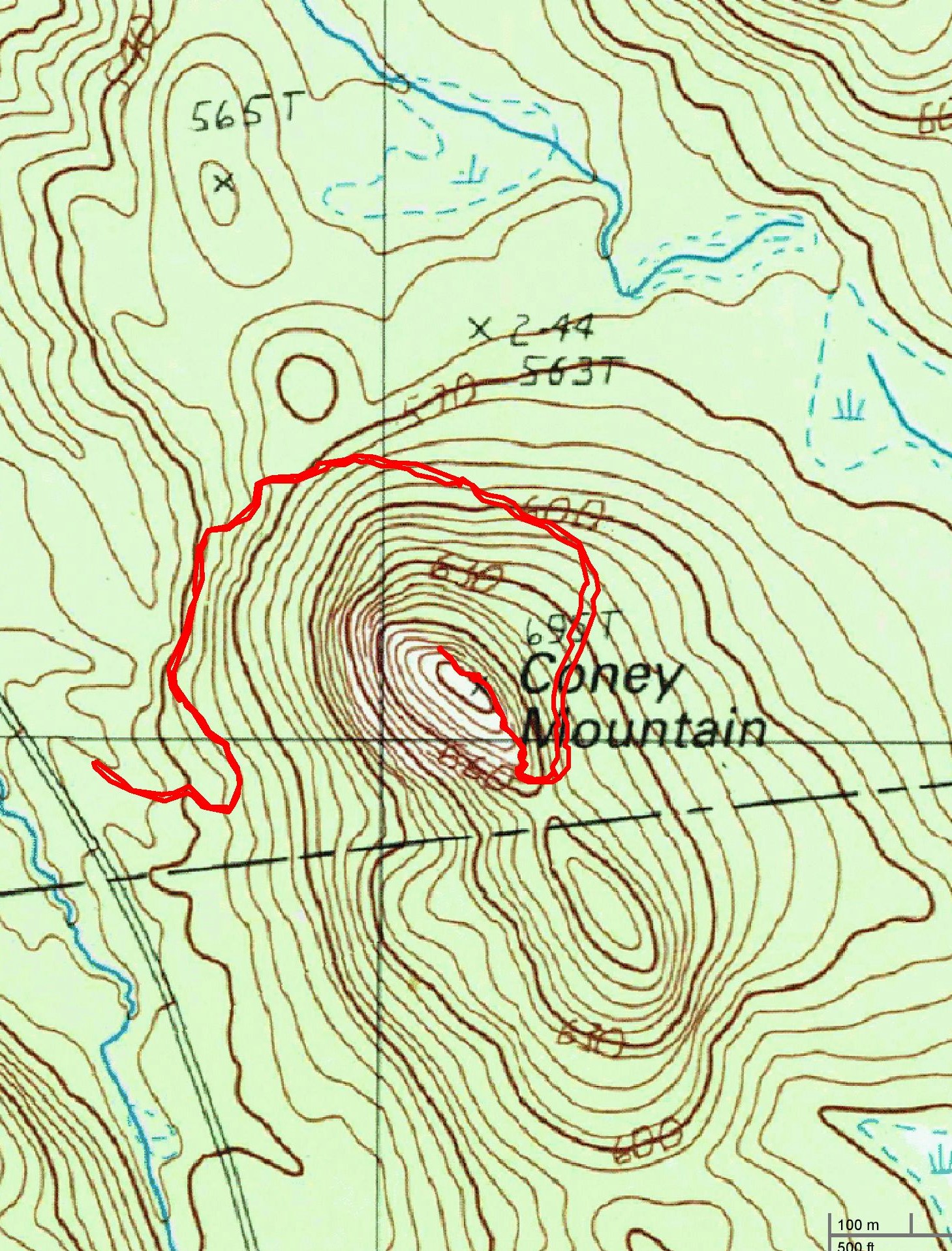
Coney Mountain hike route
View the Google Earth Fly-Through video of the hike below.
I have never been to the Adirondacks and with limited time, I wanted to see and do as much as possible while I was there. These three short hikes are a great introduction to hiking in the Adirondack Region. The Coney and Goodman Mountain trailheads are right down the road from each other, so I decided to tackle these two first. Upon scouting the trailhead the previous evening, I discovered that the parking area for Coney Mountain is smaller, with room for about five cars. I was unsure if road side parking is allowed (it is), so I decided to hike this one first. Arriving at approximately 9:00 am on a Friday morning we grabbed the last parking spot in the lot.
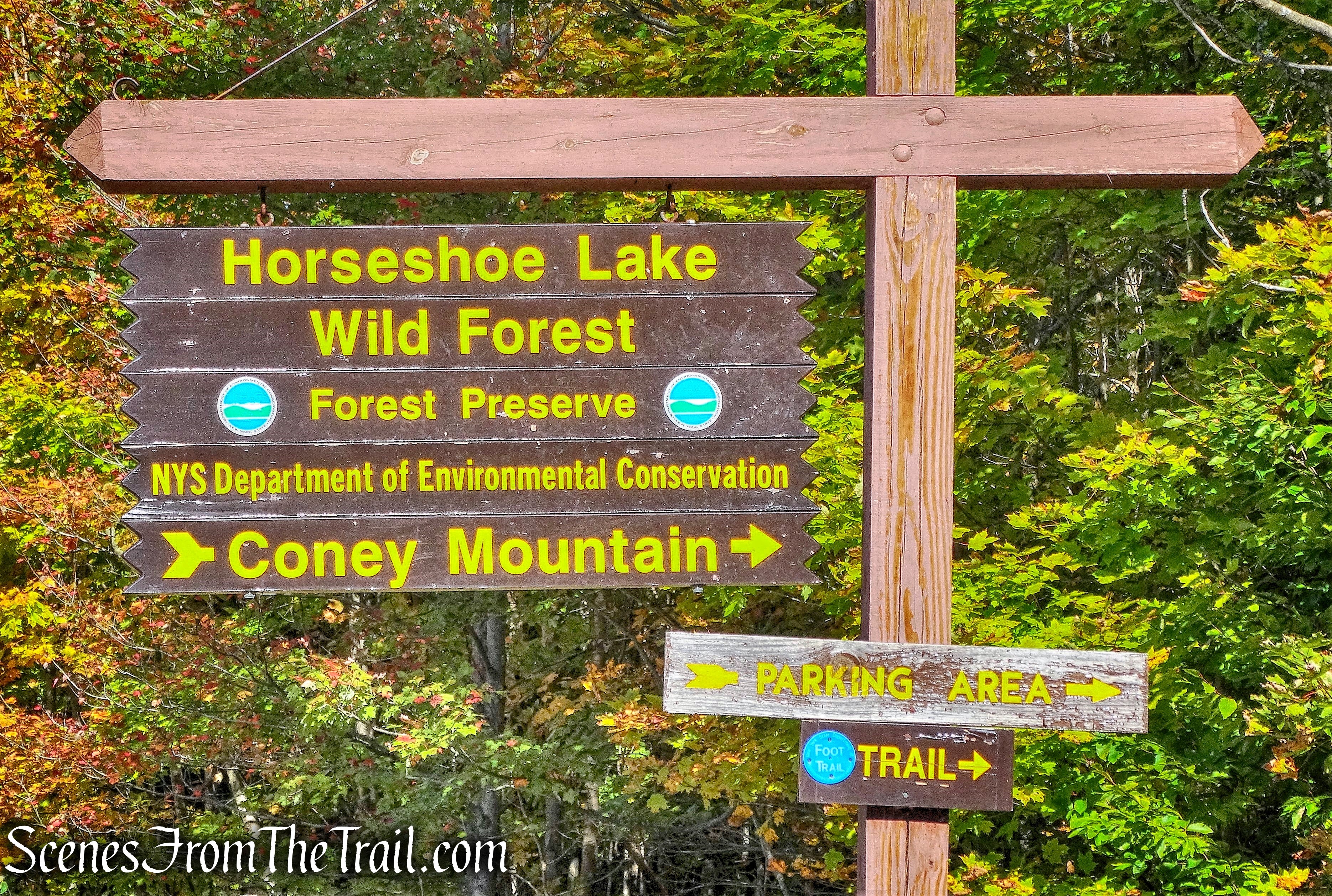
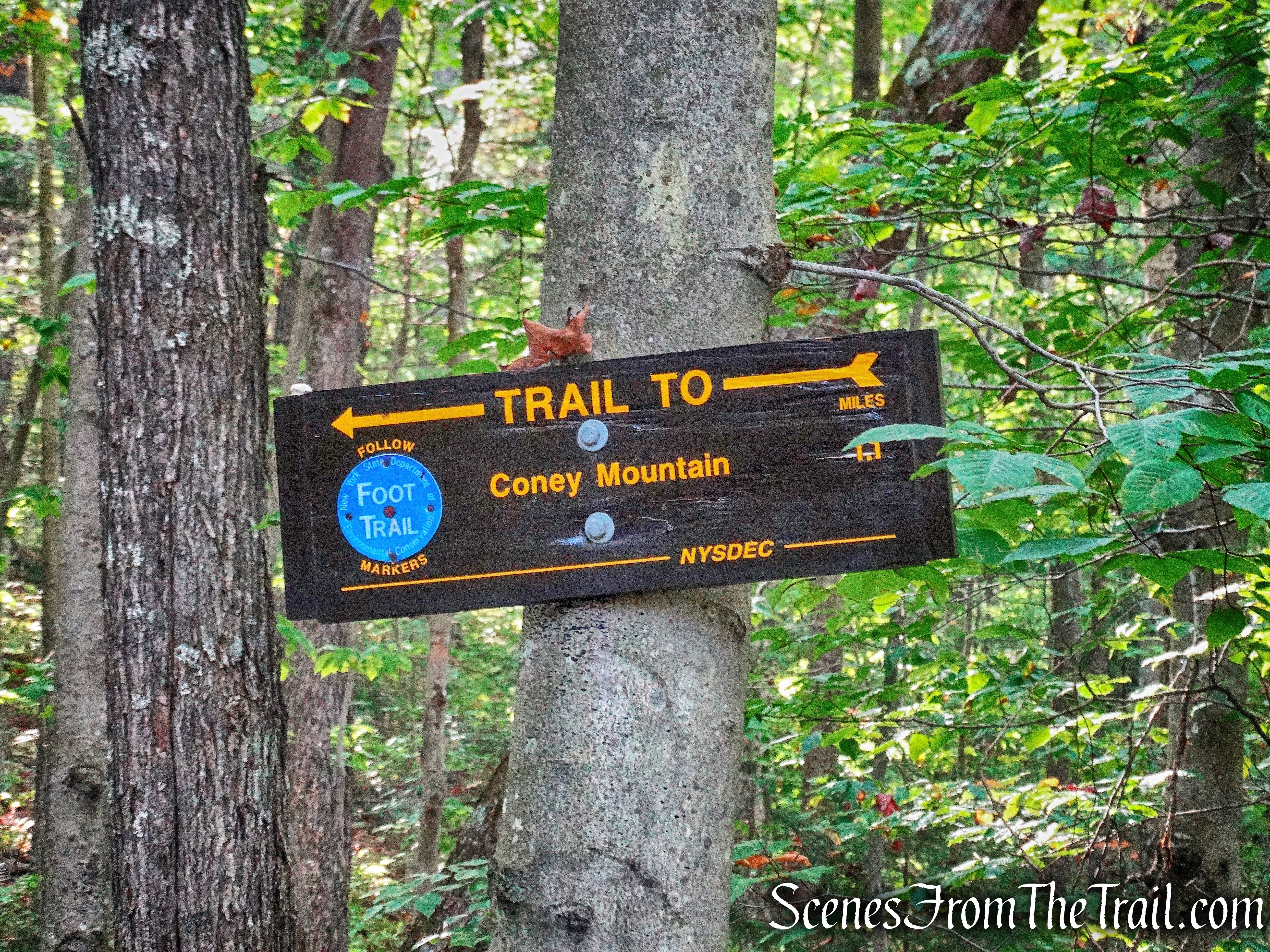
Coney Mountain trailhead
After gearing up, we walked over to the kiosk and signed in at the trail register.
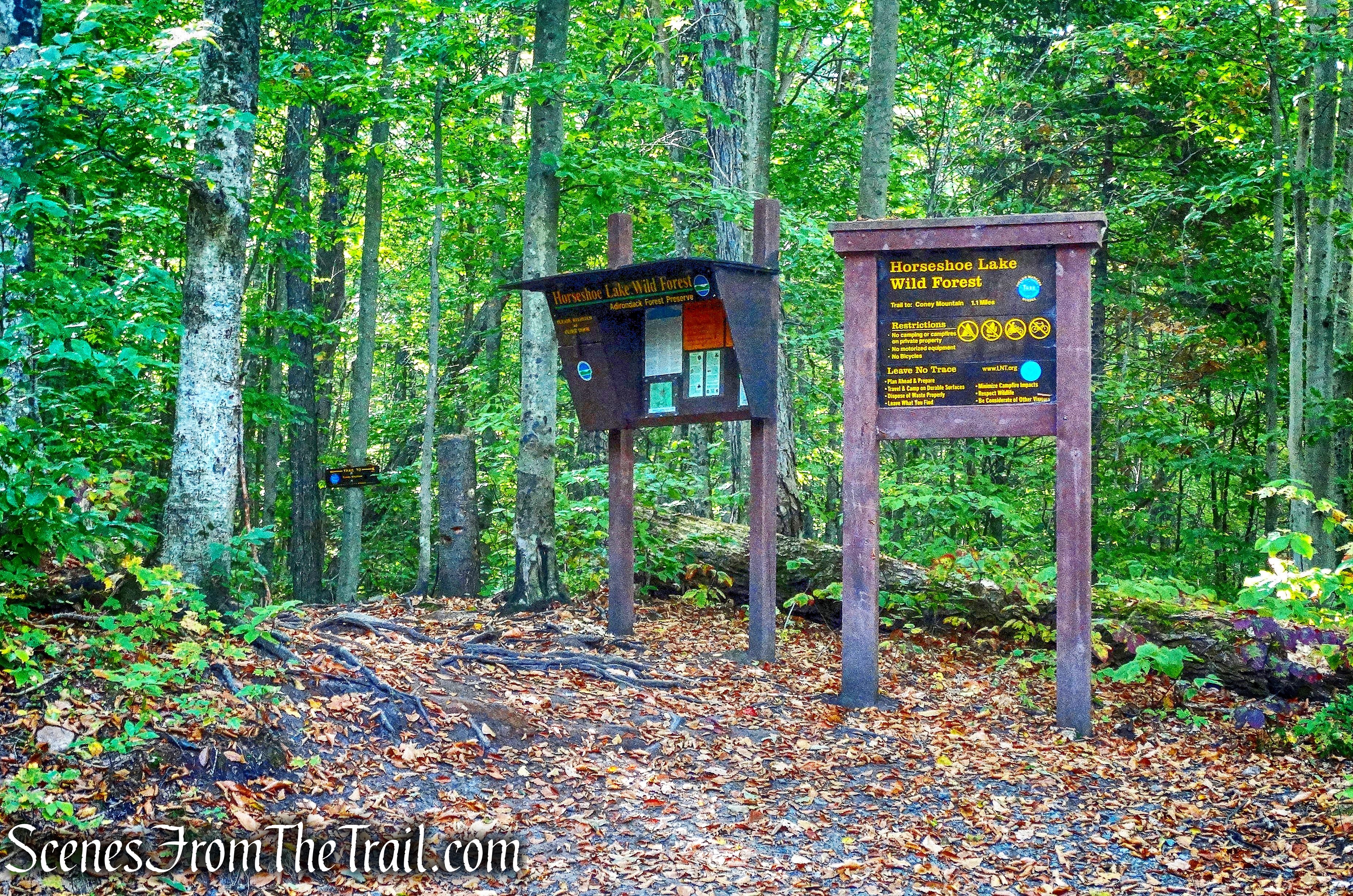
Coney Mountain trailhead
We then began to follow the blue blazes of the Coney Mountain Trail.
Coney Mountain Trail
The trail crosses several wooden planks over a wet area.

Coney Mountain Trail
The trail gradually ascends on a looping route around the foot of the mountain.

Coney Mountain Trail
This new trail was built in the summer of 2009 by a professional trail crew from the Adirondack Mountain Club, working under contract for the NY DEC. This eliminated a short, but very steep bushwhack to the 2280 ft. summit.

Coney Mountain Trail
The new trail, marked with blue DEC trail discs, gradually ascends, but does have a few steep sections along the way.

Coney Mountain Trail
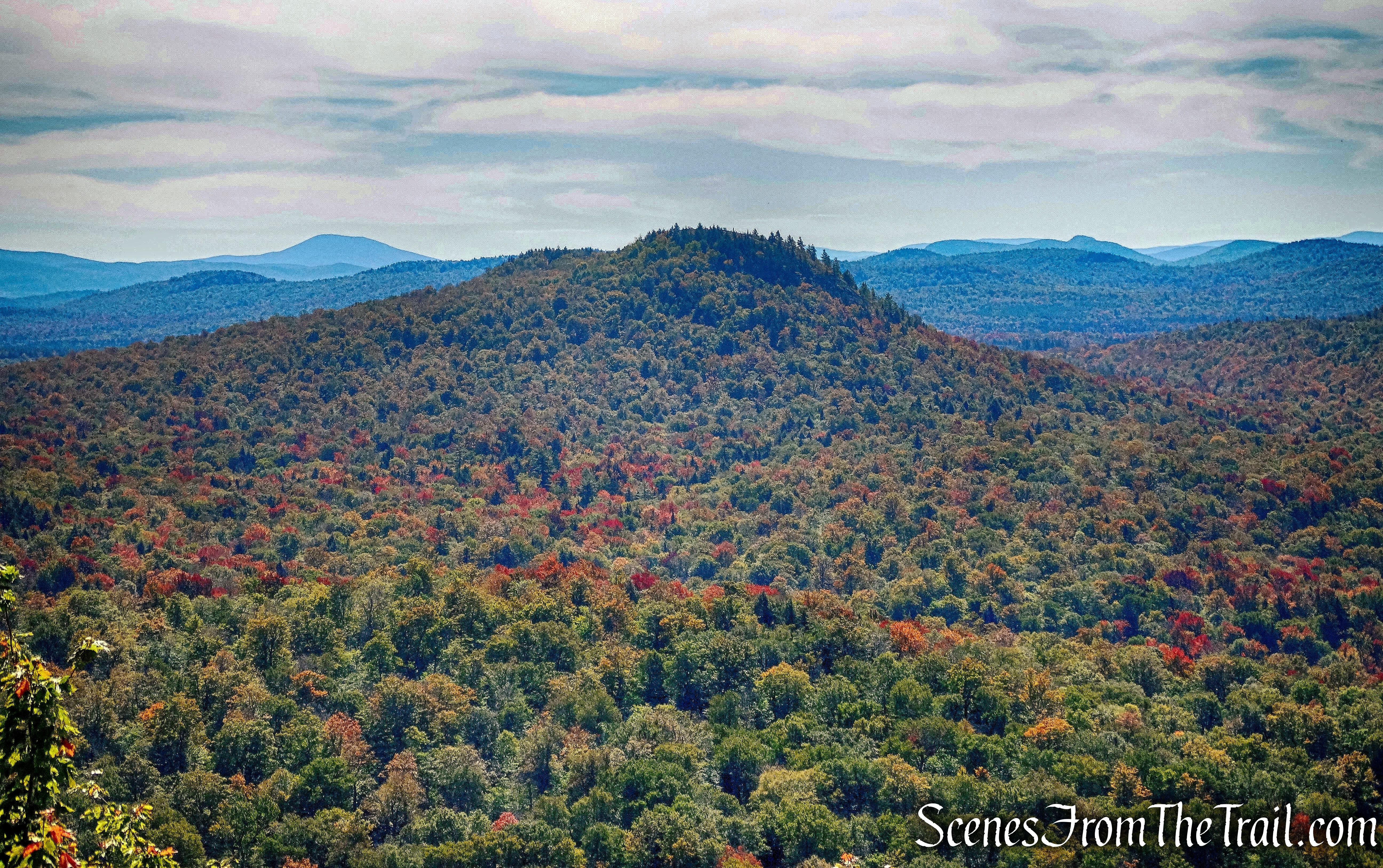
The large, open rock summit, rewards hikers with 360° views. Below is a western facing view from the summit.
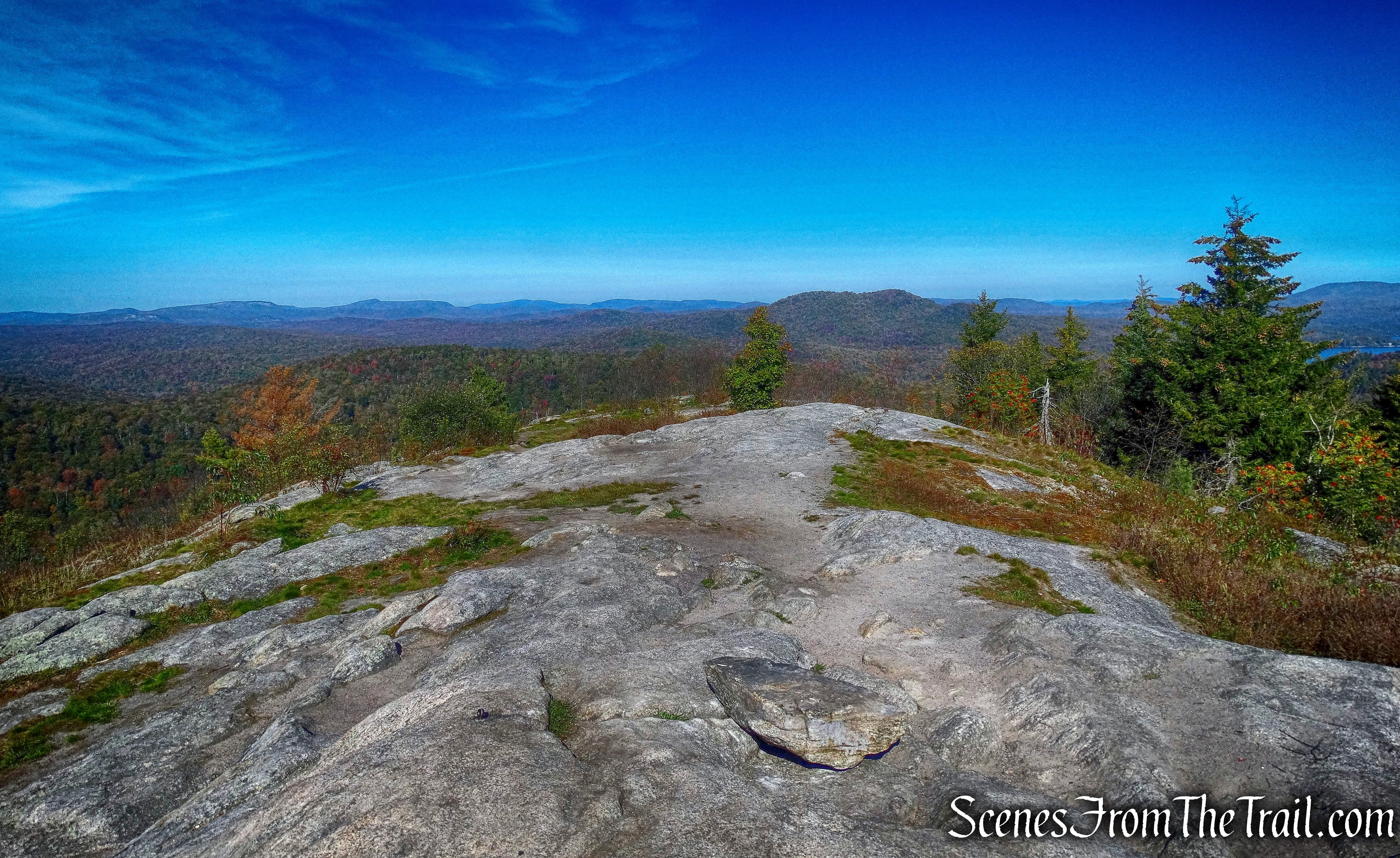
Coney Mountain summit – western facing view
Looking east from the summit, the view is just as good.
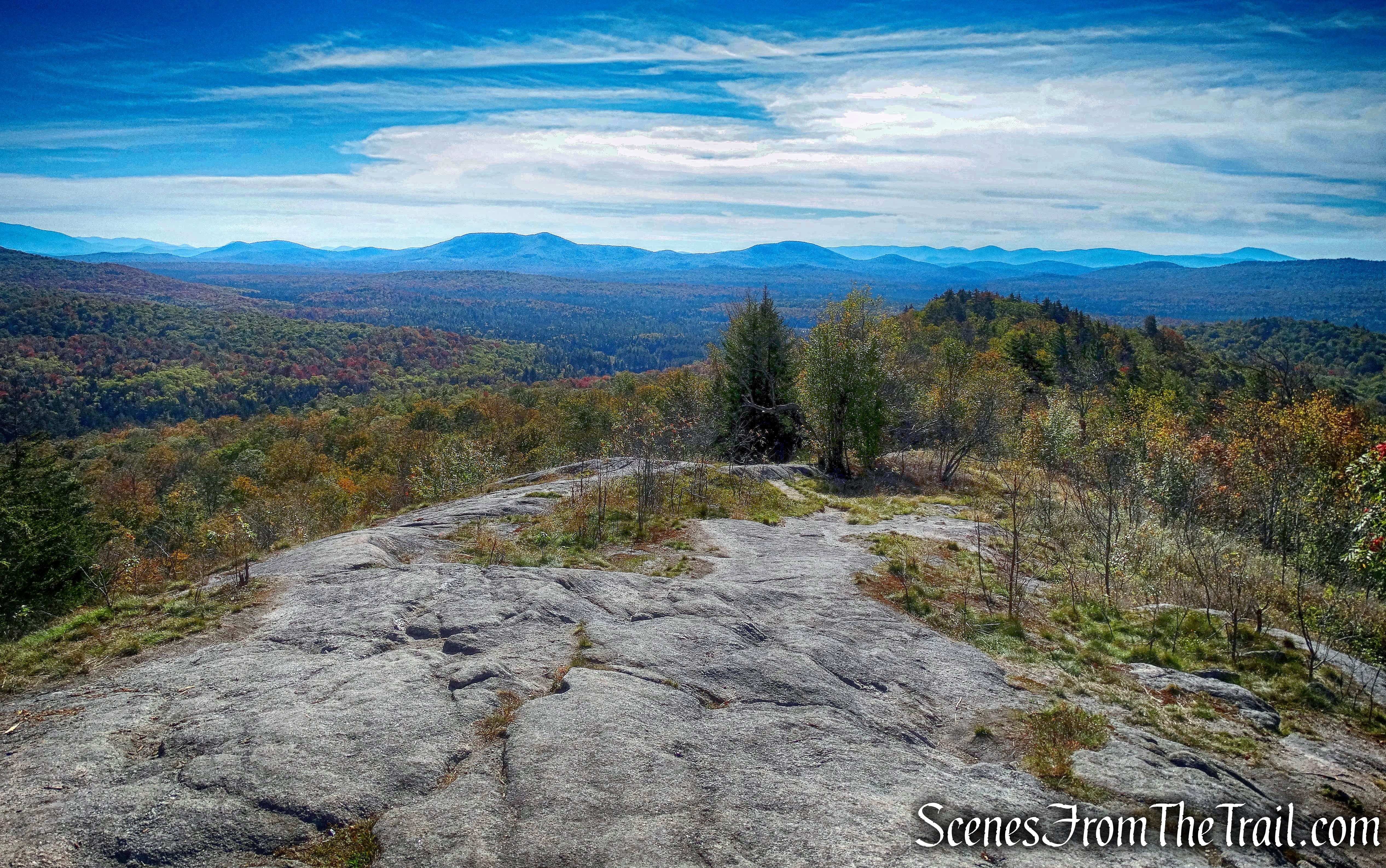
Looking east from Coney Mountain summit
Looking north the High Peaks are visible in the distance.

Looking north from Coney Mountain summit
Sightly northwest, Goodman Mountain, our next destination, is visible, with Tupper Lake just beyond.
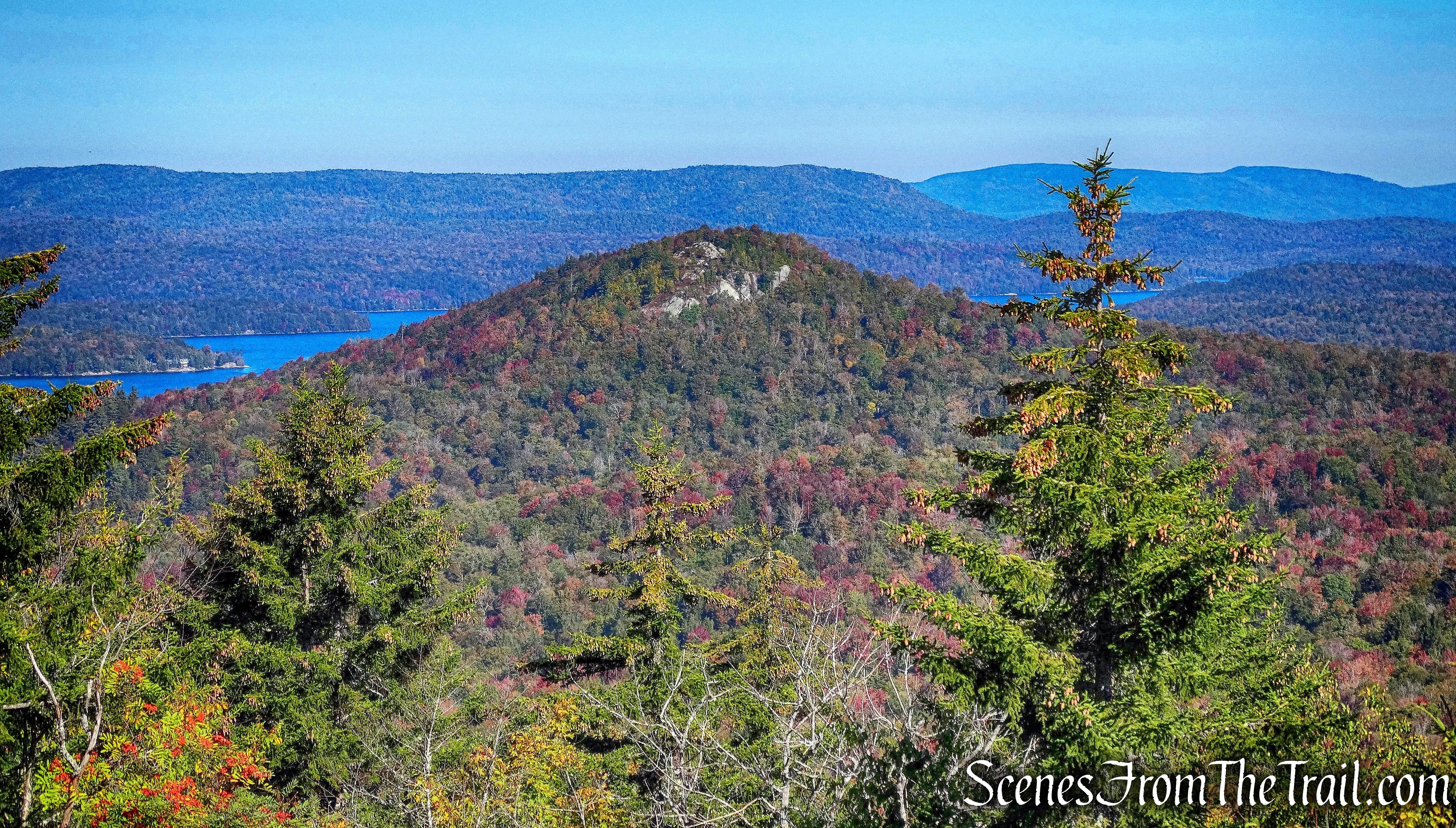
Looking northwest from Coney Mountain summit
I spotted two survey markers at the summit just a few feet apart.
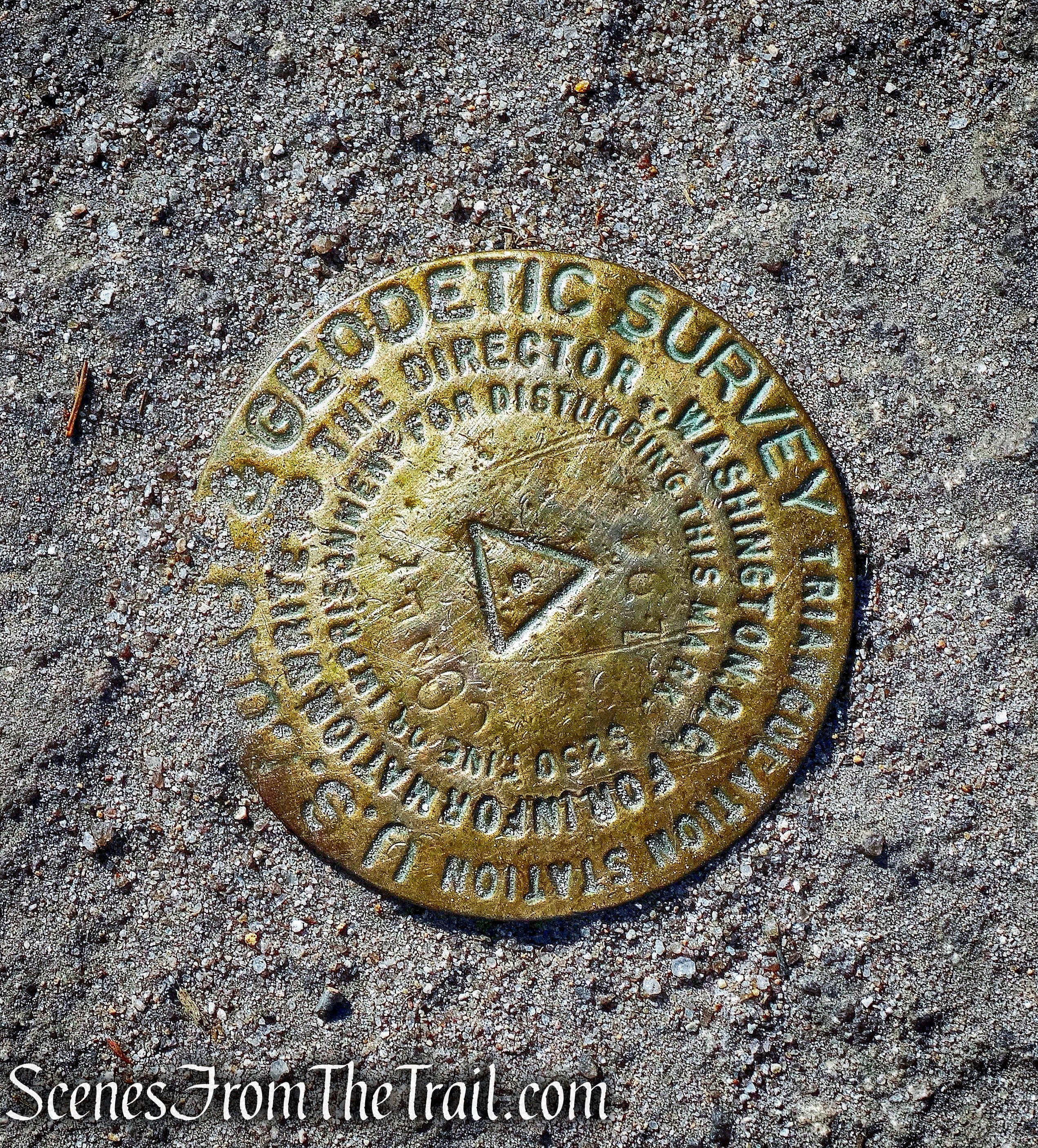
Geodetic Survey marker
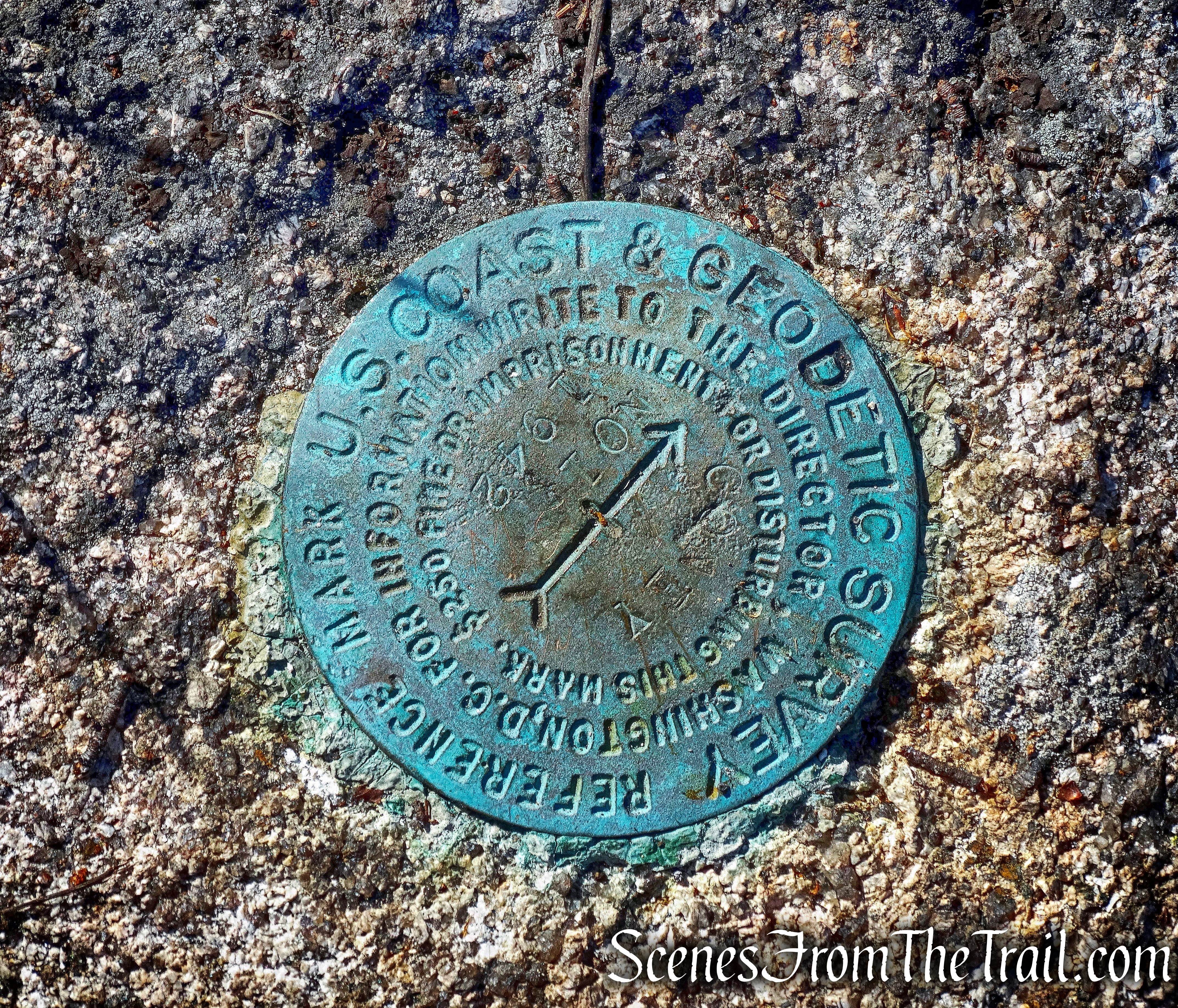
Geodetic Survey marker
The entire time that we were at the summit, we had it all to ourselves. We saw a few hikers descending as we approached the summit and then crossed paths with a lone hiker as we left. Since this is an out and back hike, we retraced our steps back down the mountain. On the way down, we passed a few more small groups of hikers as we neared the parking area. It pays to hit the trail early, especially with the type of views at Coney Mountain. We got back in the vehicle and drove the short distance to the Goodman Mountain Trailhead to begin the second leg of the Tupper Lake Triad, after all, I want that patch.
Pros: Fantastic 360° views, short hike, well blazed, earn a patch.
Cons: Small parking area, does get crowded.
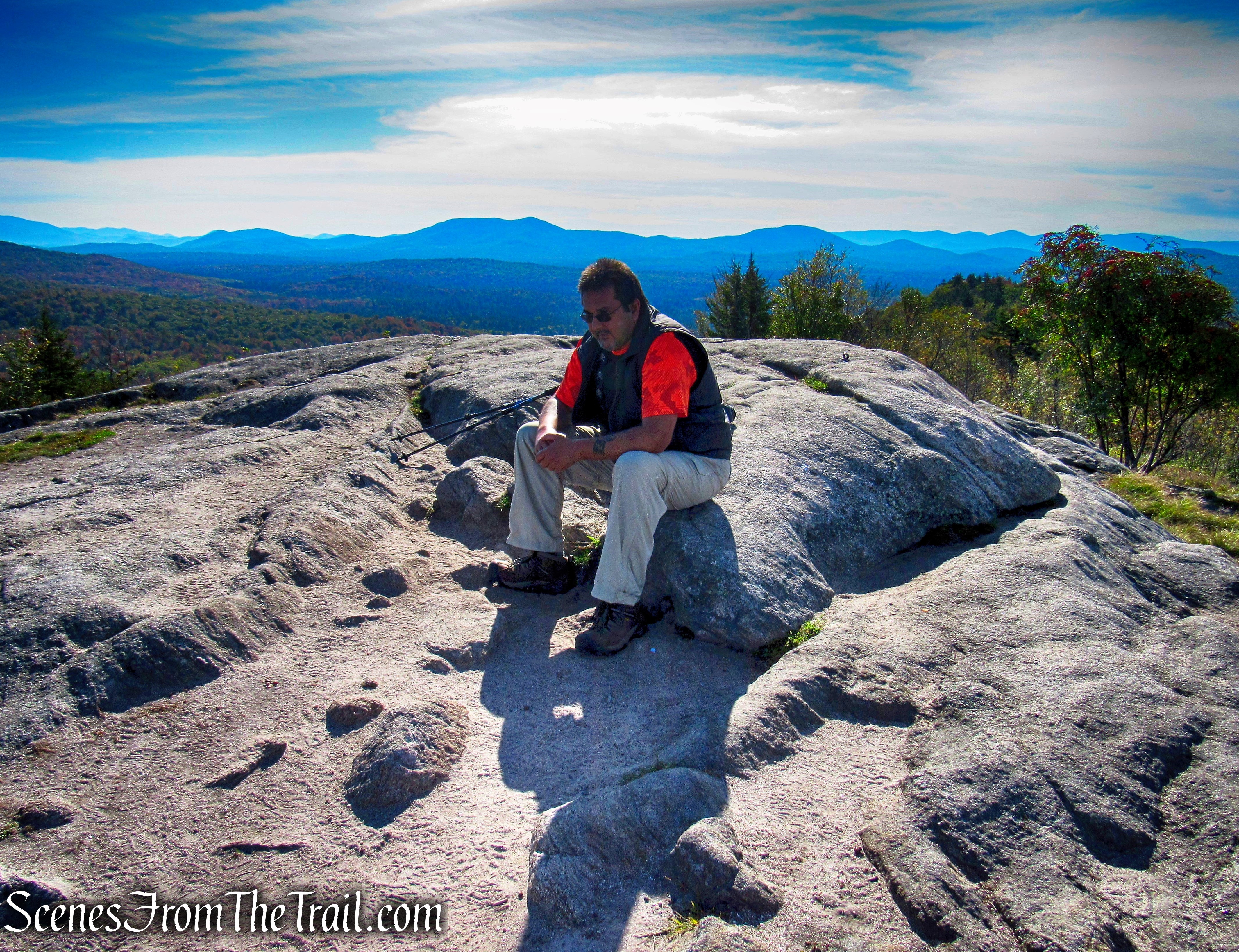
Coney Mountain summit

Beautiful views
LikeLiked by 1 person