August 26, 2017 – Ringwood, NJ
Difficulty: Moderate (rugged terrain)
Length: Approximately 5 miles
Max elevation: 1,084 ft.– total elevation gain approximately 759 ft.
Route type: Circuit
Map: North Jersey Trails Map – NY/NJ Trail Conference web map
Trailhead parking: Crescent Drive, Ringwood, NJ 07456
Norvin Green State Forest is a 4,365-acre state forest situated in the Highlands Region of Northern New Jersey and is part of the Wyanokie Wilderness Area near the Wanaque Reservoir. The 24 miles of existing trails are either old forest roads or new trails constructed by volunteers, which feature rugged terrain, waterfalls, and remains of old iron mines. With hills ranging from 400 to 1,300 feet in elevation, Norvin Green provides the avid hiker with scenic vistas, including the New York City skyline, Burnt Meadow Brook and Lake Sonoma. The property is accessible by foot only.
PLEASE NOTE: Hunting is permitted in designated areas within the park and is subject to Division of Fish and Wildlife regulations.
I wanted to do a hike outside of my usual stomping grounds and came across this hike. From what I read, Norvin Green State Forest is a popular place to hike and thus crowded trails. I decided to check out what is supposed to be a lesser traveled section of the forest. Secluded was more like it, as the only person we encountered the whole day was a trail maintenance worker that we passed near Lake Sonoma. We arrived at the trailhead parking just after 9:00 am on a cool Saturday morning. There is no parking lot, but parking is permissible along the road. The area is deserted and there are no homes close by so leaving valuables in the car is not a good idea. We did this hike counter-clockwise.
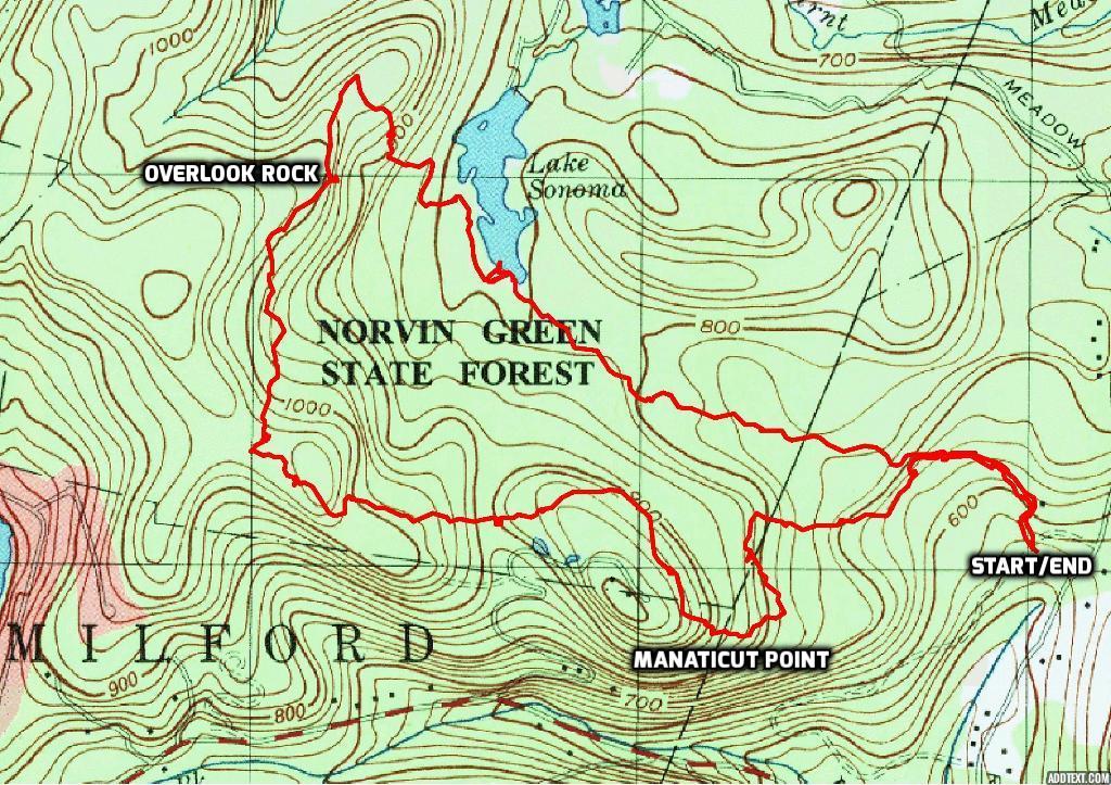
Lake Sonoma/Overlook Rock/Manaticut Point Short Loop – Norvin Green State Forest
A new feature that I have added is the Google Earth Fly-Through. It follows the path that we hiked and it gives you a good idea of the terrain, layout, amount of parking etc. Check it out, it’s pretty cool.
View the Google Earth Fly-Through video of the hike below.
To the left of a huge boulder that is partially obscured by vegetation is the start of the triple black-square-on-yellow blazed Manaticut Point Spur Trail.
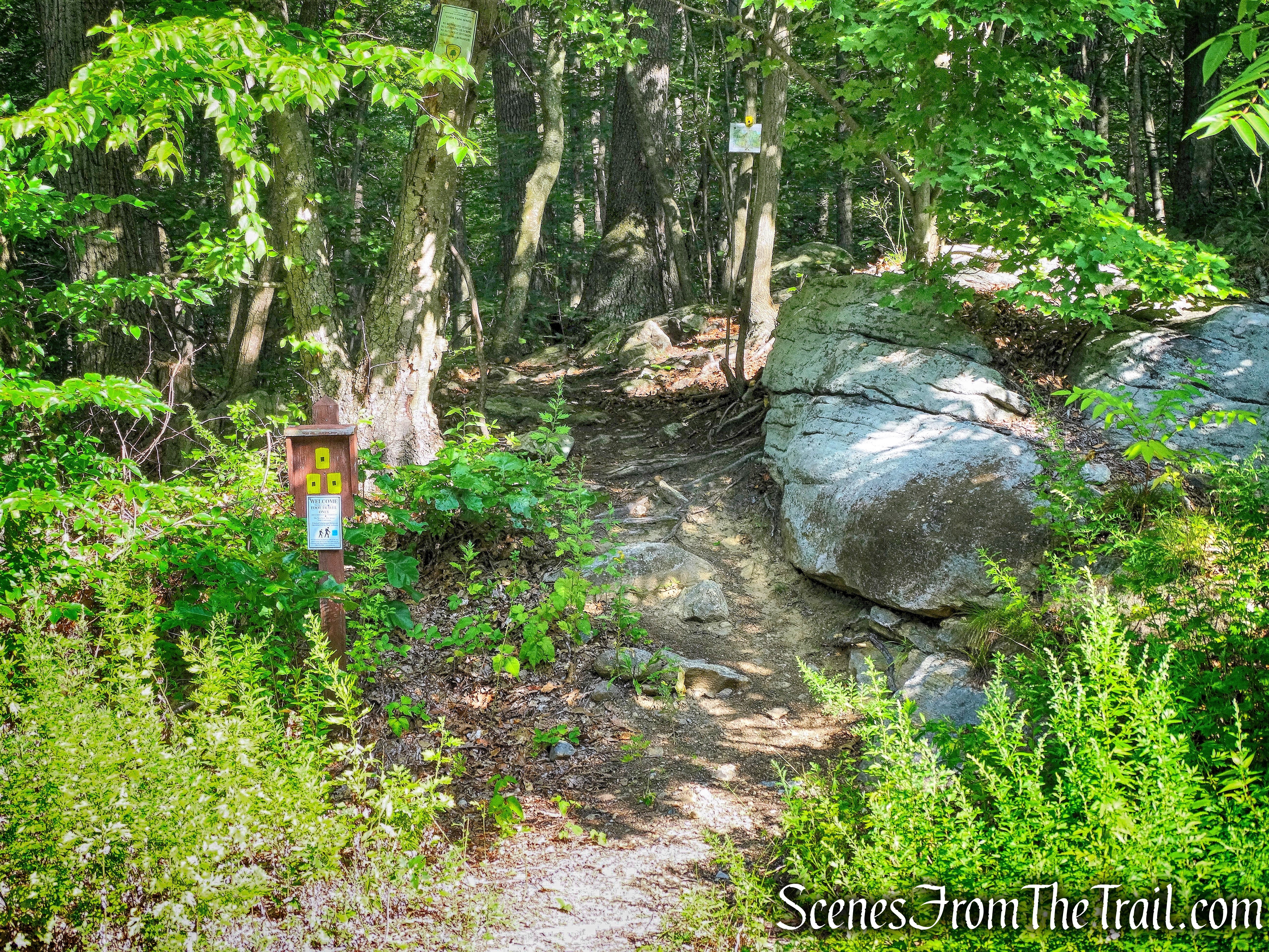
start of the Manaticut Point Spur Trail
We crossed two branches of a dried up stream on rocks and passed some huge rock formations. At another dry stream crossing there is an interesting inverted V-shaped rock formation just to the right of the trail. Although the streams were dry on our hike they may not be at other times as indicated by large rocks that were placed there in order to rock hop the streams.
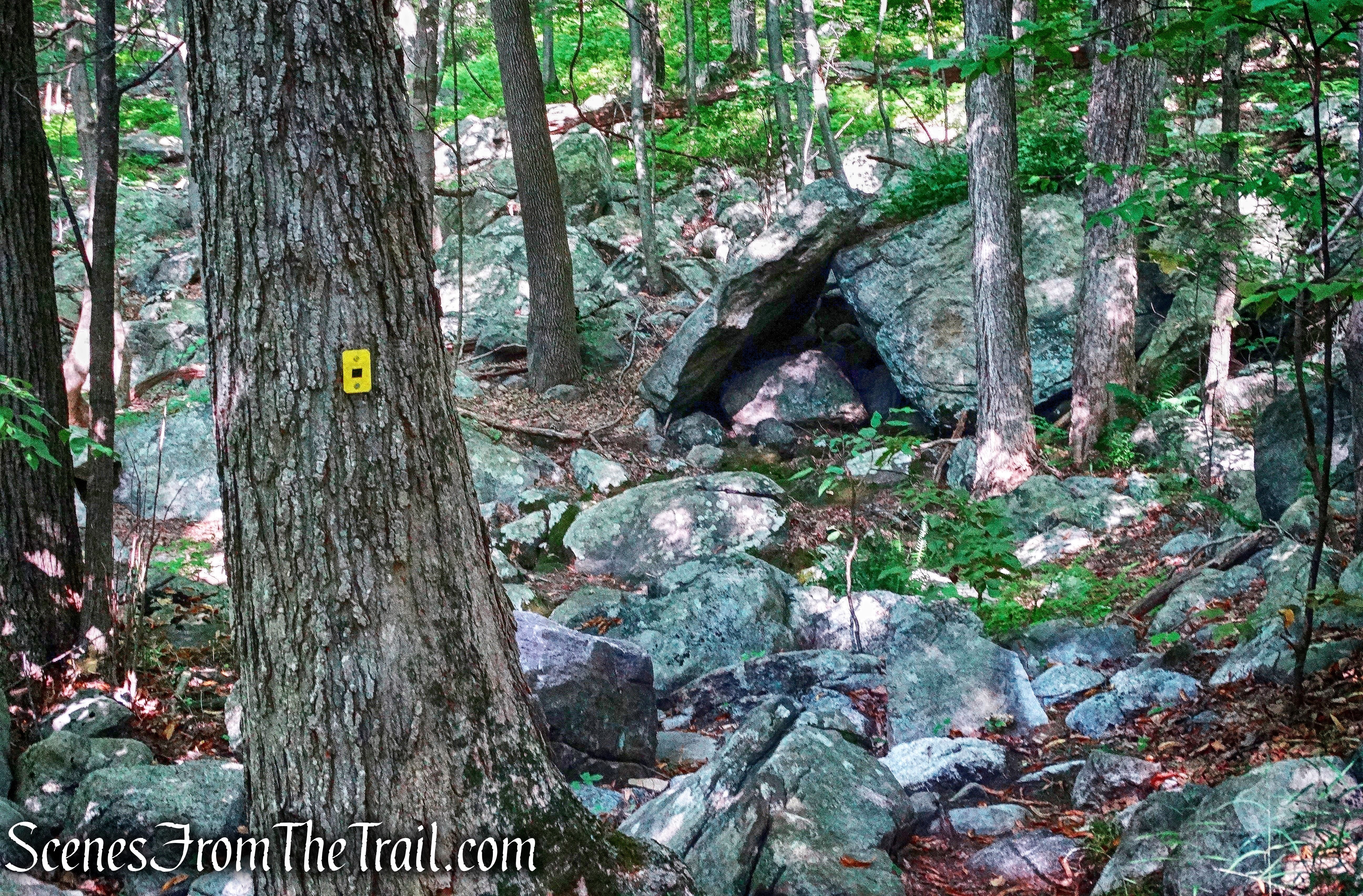
inverted V-shaped rock formation alongside Manaticut Point Spur Trail
After approximately 0.3 miles, the Manaticut Point Spur Trail ends at a junction with the yellow-blazed Manaticut Point Trail. The yellow blazes go to the left and right. We stayed to our right, heading uphill to follow the loop of the Manaticut Point Trail in the counterclockwise direction.
stay right at junction with the yellow-blazed Manaticut Point Trail
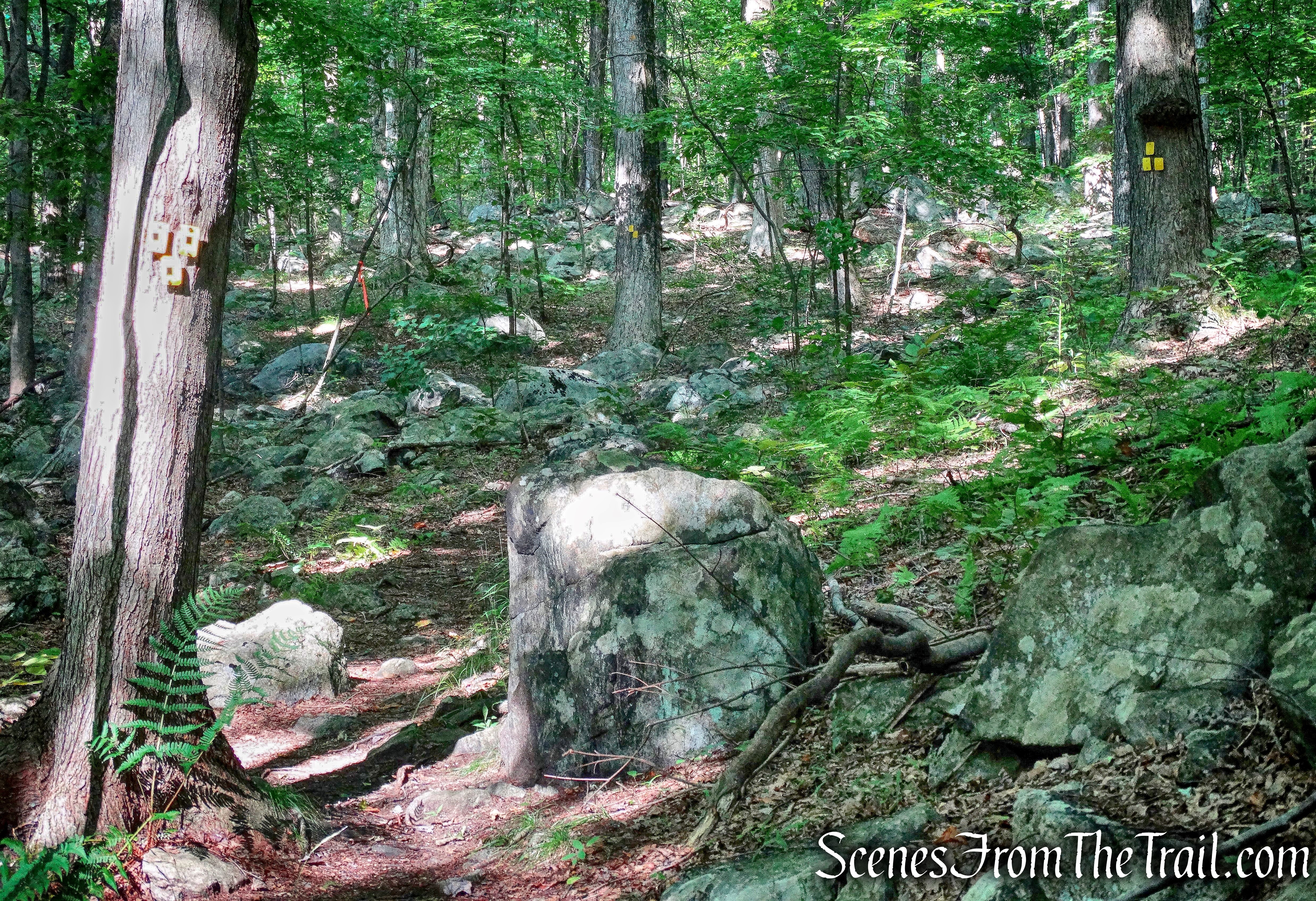
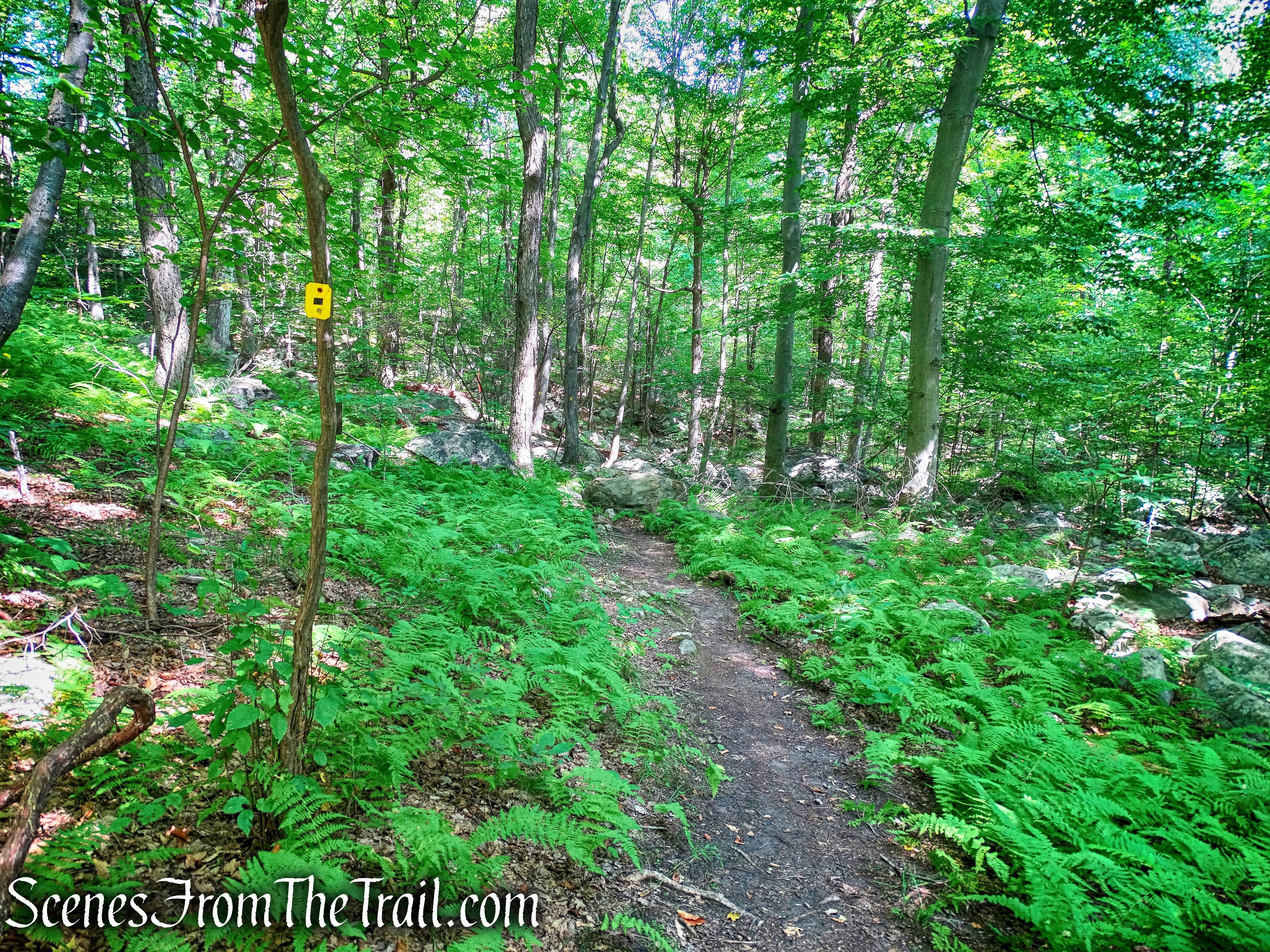
The yellow-blazed Manaticut Point Trail climbs moderately over rocky terrain.
Manaticut Point Trail
About a mile from the beginning of the hike, we passed the start of the orange-blazed Lake Sonoma Trail on the right. A short distance ahead a triple yellow/orange blazed connector trail begins to the left, but we continued following the yellow-blazed Manaticut Point Trail. At this point, we began to see intermittent orange blazes on trees along the yellow-blazed Manaticut Point Trail. At first I was confused, but the yellow blazes followed the orange so we continued on. What heightened my confusion was that almost immediately after seeing the first orange blazes on the Manaticut Point Trail, there were trees laying across the trail that normally indicate that the trail does not go that way. Last week we ran into the same problem at Black Rock Forest and walked right over the trees and had to turn back.
Manaticut Point Trail
The second blowdown was not too far from the first. It made me feel like someone didn’t want us to go this way.
Manaticut Point Trail
The trail then descends to cross the dry inlet stream of Lake Sonoma at a woods road.
dry inlet stream of Lake Sonoma
The Manaticut Point Trail immediately turns right and heads towards the lake. The blazes were partially obscured by branches and we almost missed the turn.
Manaticut Point Trail
In a short distance, we arrived at the shore of Lake Sonoma. The star on the map denotes a viewpoint, but it is a partially obstructed view through the trees. We bushwacked a few feet northwest along the shore, to a rock outcrop that provides a nice view of the lake.
Lake Sonoma
The trail parallels the lake for approximately 1/4 mile, with views of the lake through the trees. The Manaticut Point Trail then recrosses the woods road, briefly parallels a stream (dry), then crosses it.
dry stream on Manaticut Point Trail
The trail then turns sharply left, crosses another woods road, and begins a steady climb.
Manaticut Point Trail
After the initial ascent, the trail bears left, descends briefly then turns left again. It then climbs to reach a junction with the white-blazed Overlook Rock Trail, which joins from the right. Now following both the white and yellow blazes, the trail turns right at the double blazes. Just to the left is Overlook Rock and we climbed up to have a look.
turn left to Overlook Rock
We climbed up to the immense exposed rock slab to check out the view. The steep sloping rock face provides a nice east-facing view.
Overlook Rock
Even though it was only 11:00 am, this was a great spot to relax and have a snack. We had now hiked approximately 2 miles.
view from Overlook Rock
After our break, we climbed down and turned left on the joint white/yellow-blazed trails, heading southwest.
joint Overlook Rock/Manaticut Point Trails
Approximately 1/2 mile from Overlook Rock, the white-blazed Overlook Trail goes off to the right as the blue-blazed Hewitt-Butler Trail comes in from the right and joins the yellow-blazed Manaticut Point Trail, heading east. We turned left and continued following the yellow blazes, now joined by the blue-blazed Hewitt-Butler Trail.
joint Hewitt-Butler/Manaticut Point Trails
The trail descends briefly, then climbs to the crest of the ridge. It heads southeast along the ridge, passing a viewpoint on the right over Saddle Mountain and then descending gradually. Along the way we passed an empty tree stand, a reminder that this is probably not a good hike during hunting season.
empty tree stand
At the base of the descent, there is a small pond on private property to the right.
small pond on private property
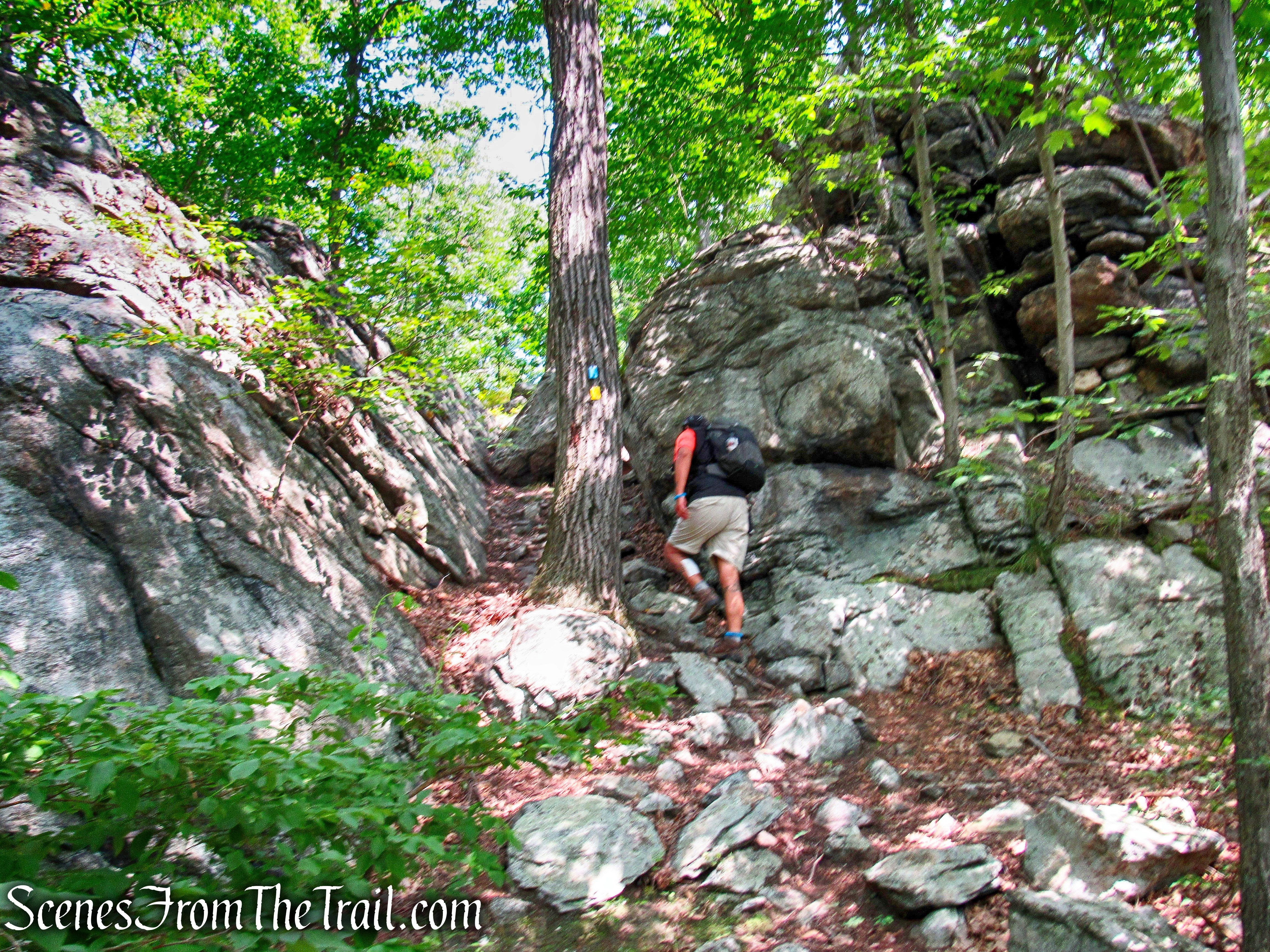
The trail passes through a divide in a rock formation. The people that laid out this trail did a really nice job and were creative. It made this hike interesting and fun.
divide in a rock formation
We passed an area that must border private property with a barking dog up on the hillside. It continued barking well after we passed, but it did not approach us so I am assuming that it was behind a fence. We continued on blue/yellow-blazed trail and ascended to Manaticut Point, an open rock ledge with some open views of the surrounding hills.
Manaticut Point
In the distance, One World Trade Center is visible along with the Manhattan skyline.
Manhattan skyline from Manaticut Point Trail
The trail then descends very steeply over rocks. The double blazes painted on a rock is where the the blue-blazed Hewitt-Butler Trail turns right, but we turned left and stayed on the yellow-blazed Manaticut Point Trail.
turn left and stay on the yellow-blazed Manaticut Point Trail
The Manaticut Point Trail descends gradually at first, levels off somewhat then resumes a steady descent and passes some rock formations on the left.
Manaticut Point Trail
We then arrived at the terminus of the Manaticut Point Trail (3 yellow blazes) and turned right onto the Manaticut Point Spur Trail and followed it back all the way back to Crescent Drive, where our hike began.
Manaticut Point Spur Trail
This was a great hike through beautiful woods and fun trails. The best part about it was that we had the forest all to ourselves. An easy hike to follow, just stay on yellow for the majority of the hike. I’m looking forward to exploring other sections of Norvin Green soon, but not during hunting season. That’s all for today, now get out there and take a hike!
Pros: Secluded trails, Lake Sonoma, scenic views, well marked trails, rock formations.
Cons: Barking dog.
Manaticut Point Trail
