July 17, 2017 – Closter, NJ
Difficulty: Strenuous
Length: Approximately 4.5 miles
Max elevation: 527 ft. – total elevation gain approximately 818 ft.
Route type: Circuit
Map: Hudson Palisades Trails Map #109 – Web Map – Palisades Interstate Park
Trailhead parking: State Line Lookout, Closter, NJ 07624
I did the Giant Stairs Hike just over a year ago and even though I completed the hike, I struggled from the moment I began on the “Giant Stairs” section. I attributed my struggles that day to extremely high heat, humidity and poor air quality. Blah, blah, blah, I know excuses, excuses. I wanted to redeem myself and basically just wanted a “do-over.” I got my chance and even though it was hot and humid on my “do-over,” I did much better.
This is the most challenging hike in Palisades Interstate Park, but it is also a very gratifying one. Although there are many steep sections with uneven steps on this hike in order to navigate the steep cliffs in such a short distance, “Giant Stairs” refers to a mile long section of jumbled boulders that are part of the white-blazed Shore Trail that runs along the Hudson River. Most of which is 100 vertical feet above the river.
According to PIP Museum Technician Eric Nelsen, the Palisades Shore Trail was designated a National Recreation Trail in 1971, though the scramble across that section known as the Giant Stairs, was a known hike as far back as the 1920’s.
We did this hike on a Monday morning to avoid the crowds. We did the hike counter clockwise from State Line Lookout, but it can be done in the reverse as well.
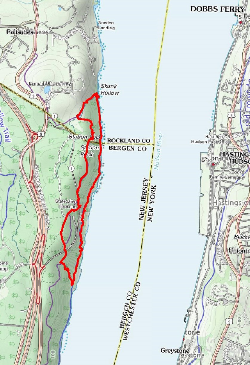
hike route
Arriving shortly before 10:00 am, the large parking lot at State Line Lookout was almost empty. We began at the NW section of the parking lot where there are multiple blazes on a telephone pole.
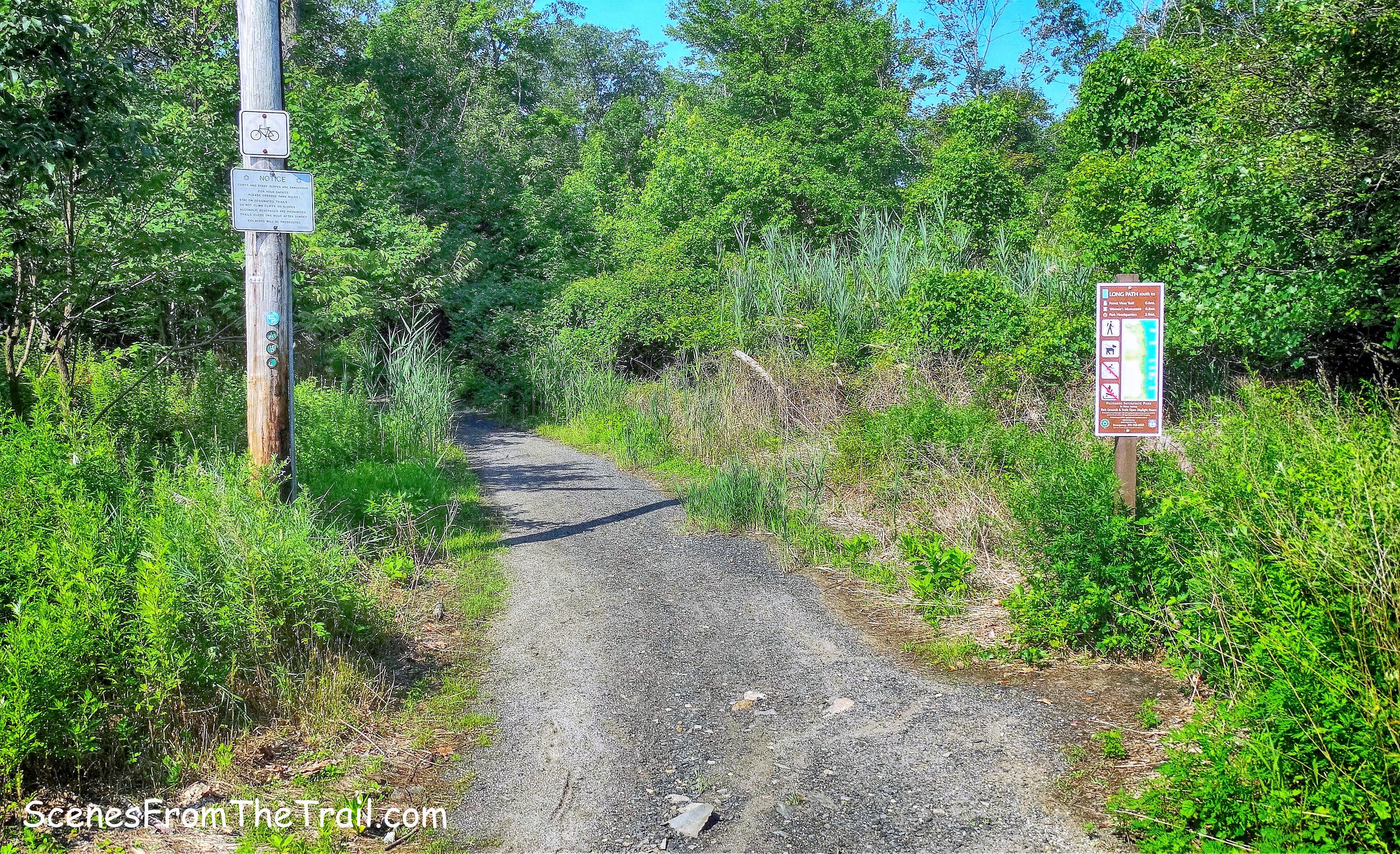
trailhead
We started off by following Ski Trail A, but could have veered left onto the Long Path at this marker. Normally I follow the Long Path from here, but I just wanted to change it up a little. The route we took is slightly longer.
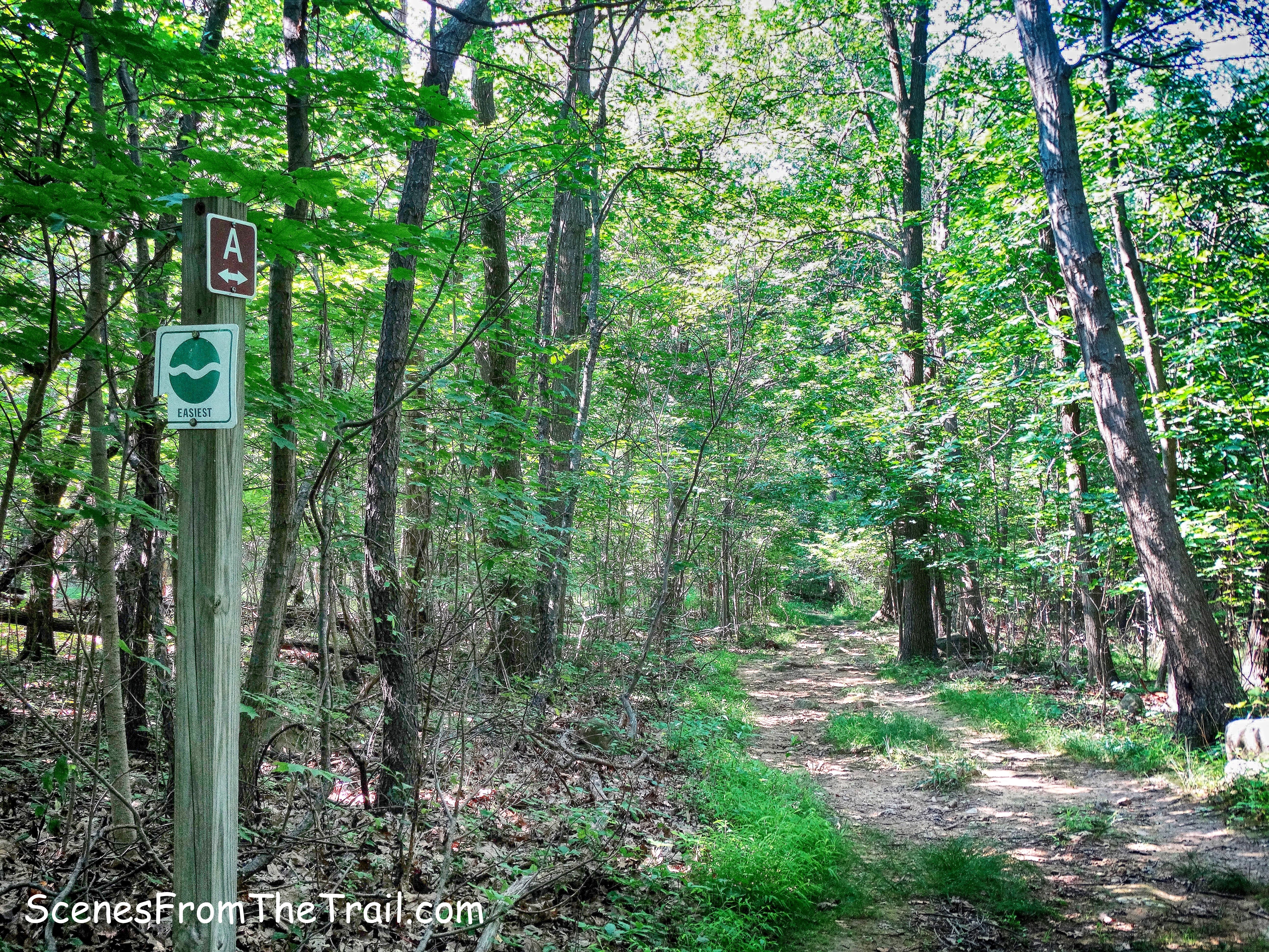
Ski Trail A
Ski Trail A is a woods road which begins parallel to the park entrance road, but then veers away from it a little. When we came to a fork in the road we went left and headed in the direction of the park entrance road and onto the Long Path. The Long Path crosses the road and heads towards the cliffs.
Long Path
The Long Path bends right, heads south along the cliff and past open rock views.
view from the Long Path
The trail then descends steeply on stone steps and comes to a wooden footbridge.
wooden footbridge on the Long Path
After crossing the bridge, the Long Path turns right and continues along the top of the cliffs. We turned left onto the blue/white-blazed Forest View Trail to begin our descent to the river.
blue/white-blazed Forest View Trail
The Forest View Trail descends steeply on uneven stone steps at first…..
Forest View Trail
Forest View Trail
then on narrow and eroded switchbacks.
Forest View Trail
The Forest View Trail ends at the base of the descent, at river level.
end of Forest View Trail
Here we turned left on the white-blazed Shore Trail and began heading north.
white-blazed Shore Trail
In about .3 miles we came to the start of the “Giant Stairs.”
Giant Stairs
The trail begins to ascend on a few well placed stones that act as steps.
Giant Stairs
The Shore Trail climbs about 100 feet over the boulders as it bends north.
Giant Stairs
At times the trail was hard to follow as the white blazes are faded or nonexistent, but just like on any other trail, blazes are sometimes more visible in the other direction. By turning around and looking the other way, we were able to spot a blaze to stay on the right path. A good part of the Giant Stairs section is under tree cover which helps with the hot sun, but there is one long section that isn’t. We rested briefly just prior to tackling the exposed areas so we wouldn’t have to stop in the hot sun.
Giant Stairs
I found the smaller rocks more difficult to navigate because they were ankle breakers.
Giant Stairs
The Shore Trail now enters the woods on a narrow footpath which is eroded in some spots with a steep drop off to the river.
Shore Trail
The Shore Trail descends towards the river and travels over some rocks close to the water.
Shore Trail
The Tappan Zee Bridge is visible in the distance from here as we neared the end of the Giant Stairs.
Shore Trail
We then reached a gate in a chain-link fence that marks the NY/NJ boundary. After passing through it, we were now in Rockland County, NY.
rusted gate on Shore Trail
A short distance after passing through the gate, we came to the ruins of an “Italian Garden.”
Italian Garden ruins
The ruins are from a garden designed by the artist Mary Lawrence-Tonetti.
Italian Garden ruins
I have seen images online of Peanut Leap Cascade with water gushing from the top of the cliff, but both times I have been here it was nothing more than a trickle. Early Spring would be a better time to visit.
Peanut Leap Cascade
The garden was built around 1900 and was inspired by a cliff-edge monastery on Italy’s Amalfi Coast which Mary visited as a teenager.
Italian Garden ruins
What’s left of the pergola that overlooks the river.
pergola ruins
The bench seating is all that remains of the pergola.
pergola ruins
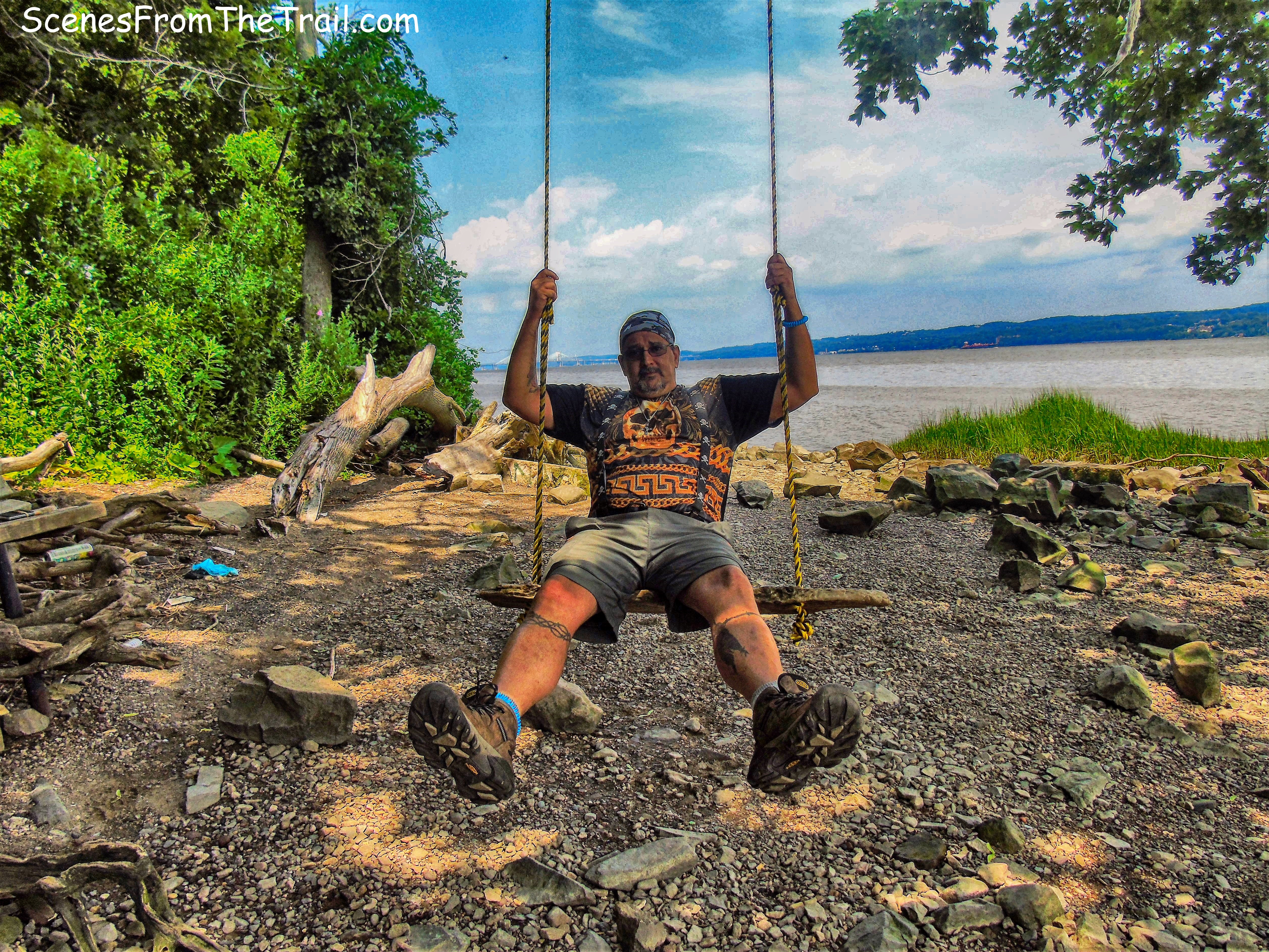
The swing is a nice touch. A good way to unwind after a tough hike.
swing
We hung out here for a while enjoying the cool river breeze and the view.
view north
Even though the most difficult part of the hike was over and we were enjoying a beautiful Hudson River view, the hike was not over yet. After all, we still had to climb about 500 feet of elevation from the river to the top of the Palisades cliffs. The Shore Trail continues past the ruins and turns right.
Shore Trail
The Shore Trail climbs about 250 feet in .3 miles to a junction with the Long Path. Here we turned left and crossed the mostly dry brook that feeds Peanut Leap Cascade on a series of wooden footbridges.
the Long Path
The Long Path continues to climb and then turns right and begins a steeper climb on stone steps.
the Long Path
After climbing the uneven stone steps we came to an area called “High Gutter Point.” High Gutter Point was a historic “pitching place,” where lumberjacks “pitched” logs down the ravine to the river. The name seems to go back to at least the 19th century, I presume because of the gutter-like appearance of the ravine. – PIP Museum Technician Eric Nelsen
We stopped here to catch our breath and take in the view.
High Gutter Point
I also happened to see a survey marker on this trip. I have passed by here numerous times and have never noticed it before.
survey marker
We then entered through the gate of the boundary fence back into New Jersey.
boundary fence
The trail parallels the fence, and at the point where the trail begins to veer to the left, there is a New Jersey Boundary Monument by the fence.
New Jersey Boundary Monument
This stone monument was placed there in 1882 to mark the state line.
New Jersey Boundary Monument
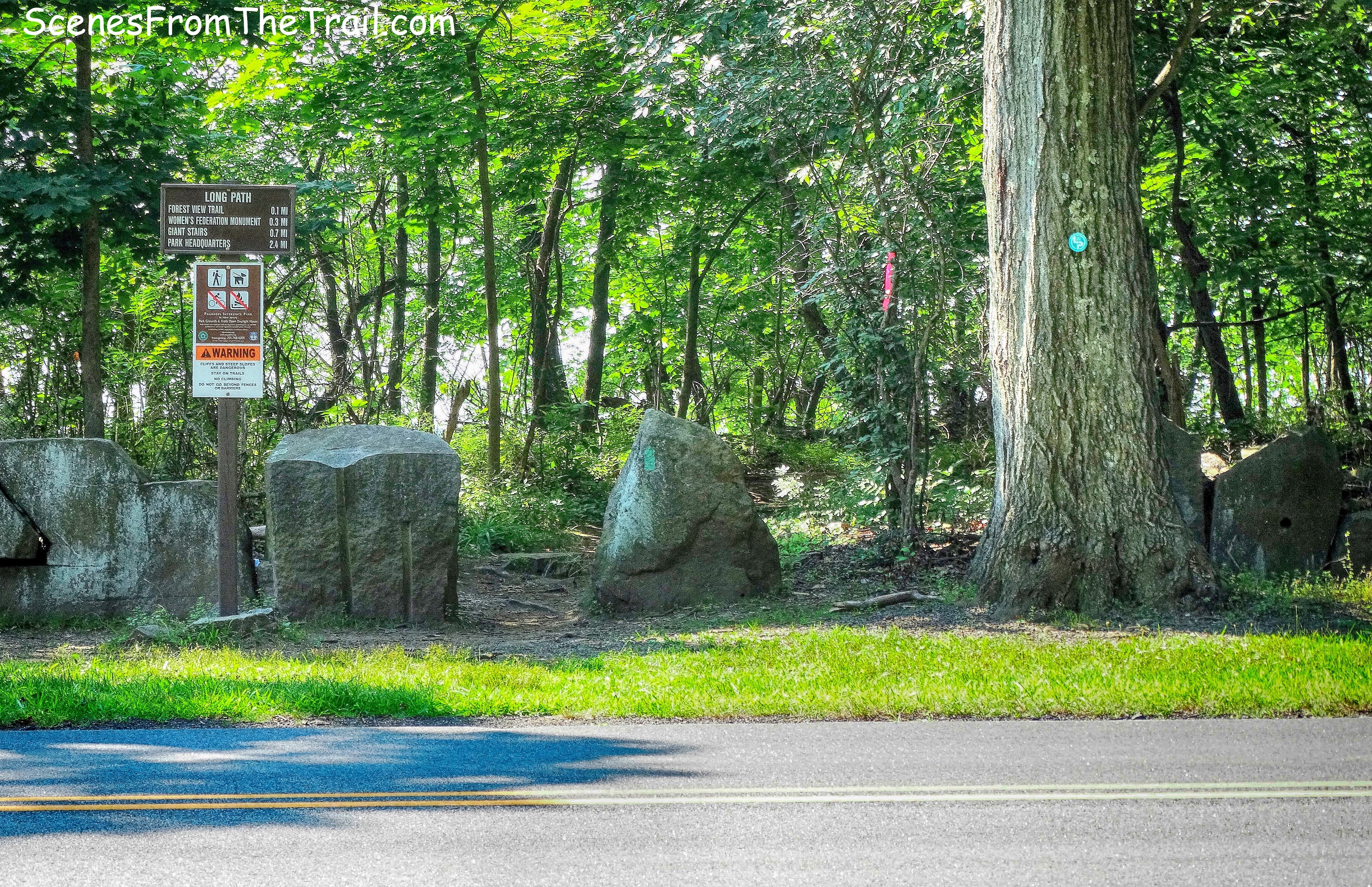
The Long Path continues a gradual climb and comes out at Old Route 9W where it crosses the road.
Long Path at Old Route 9W
We left the Long Path here and walked Old Route 9W to State Line Lookout. This road was built in 1926 and with the construction of the Palisades Interstate Parkway in the 1950’s, Route 9W was shifted to the west. It is now closed to traffic and enjoyed by pedestrians and cyclists.
Old Route 9W
We stopped at the lookout briefly to capture a few images, but we were pretty wiped out by this point.
State Line Lookout
We rested for a minute or two to unwind before we got in the vehicle and take off. I was feeling tired, but pleased with how well I did on the trail compared to last time. I guess the weather conditions were to blame for my lackluster performance last year. I am glad that I came back and did this hike again. Another must do for the avid hiker. That’s it for today. See ya next time, now get out there and take a hike!
Pros: “Giant Stairs,” Hudson River views, Palisades cliffs, ruins, waterfall.
Cons: A lot of Poison Ivy along the Shore Trail.
Take a hike!

Love this hike! Such a fun scramble.
LikeLike
I did this hike last july, somewhat by accident – I was looking for snakes and then went to far to turn back and wound up taking the exact route you describe, though it took several hours and I hit a few thunderstorms while out in the boulder fields which was terrifying. I went alone which I wont do again, but I dont know many people who could handle come of the tougher parts of this hike. I saw several black rat snakes that day, the rocky habitat is perfect for them. The other cool think about the Giant Stairs loop is that its totally surrounded by really urban towns that cant maintin wilderness, so this fragment of nature on the sliver of the Hudson is a real treasure. There are several bald eagles nest as well and I saw a peregrine falcon. You never really look at the palisades the same way again when you drive past after you have done Giant stairs…..
T
LikeLiked by 1 person
Thank you for this detailed description of all the main parts of this hiking trail! About 2 hrs is all my family and I would be able to handle…is there a way to do the beach without doing the rock scramble (giant steps) and double back to starting point within 2 hrs? Thanks for any advice you may have!
LikeLike