May 20, 2017 – Southfields, NY
Difficulty: easy
Length: approximately 4 miles
Max elevation: 1,096 ft.– total elevation gain: 384 ft.
Route type: circuit
Map: Harriman-Bear Mountain Trails Map #119
Trailhead parking: 1369 Kanawauke Rd, Southfields, NY, 10975
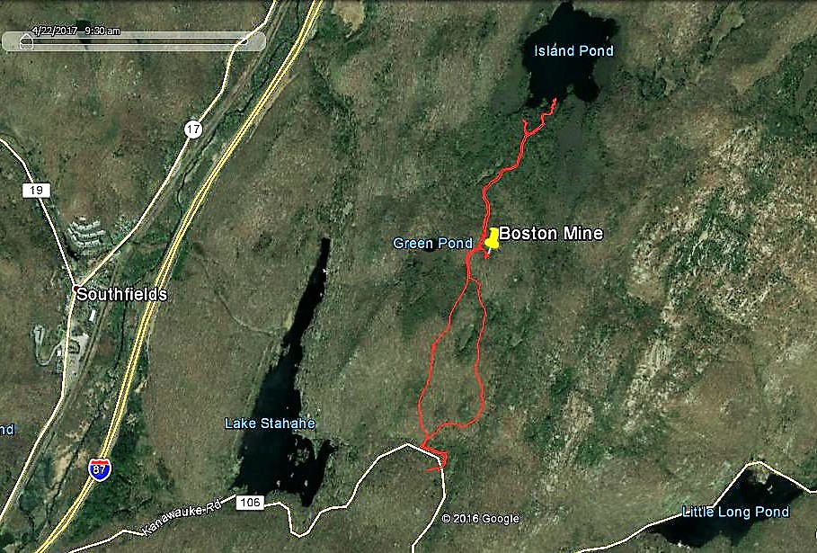
Hike route
Boston Mine, which was last worked in 1880, is one of the more impressive mines in Harriman State park. I have visited this mine before on a longer hike and decided to include it on this hike. Island Pond is a large glacially-made pothole. It drains both north and south. The deepest part of the pond is 126 feet, with depths averaging ninety-one feet in the northern half. It is a beautiful and tranquil place deep in the woods and far away from the hustle and bustle of everyday life.
I was in the mood for an easy, walk in the woods type hike that included several points of interest. This hike fit the bill quite nicely. This would make an excellent hot weather hike, as much of the trails traveled have tree cover. It was a cloudy Saturday morning with temps in the mid 50’s and windy at times. We arrived at the parking area at approximately 9:30 am. There were several cars already there and just room left for a few more. Our hike began on the White Bar Trail, blazed with white horizontal rectangles.
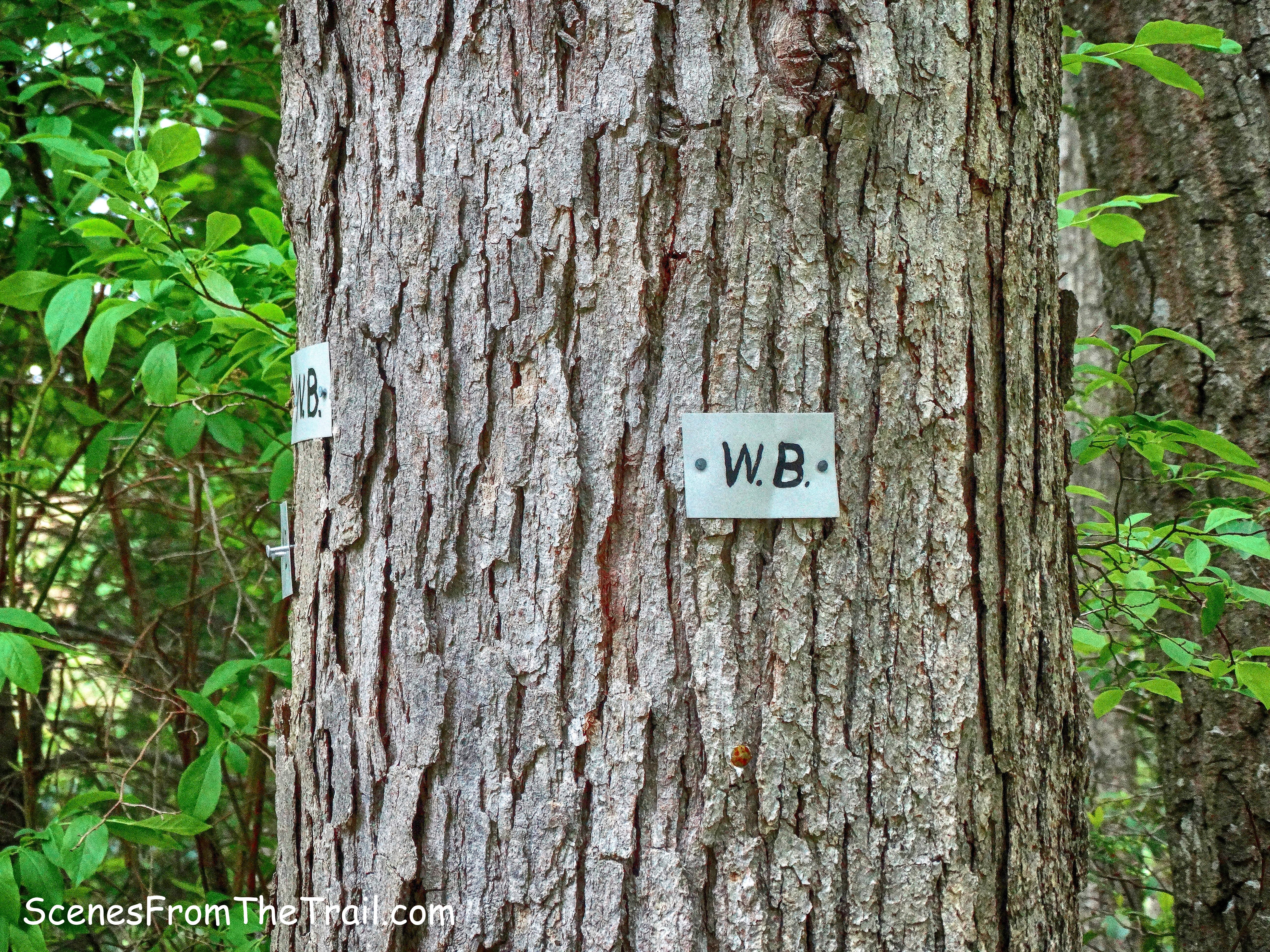
White Bar Trail
The White Bar Trail cuts through the parking area from the south and crosses County Road 106 and heads north into the woods. The White Bar Trail was first marked in 1922 by the Boy Scouts.
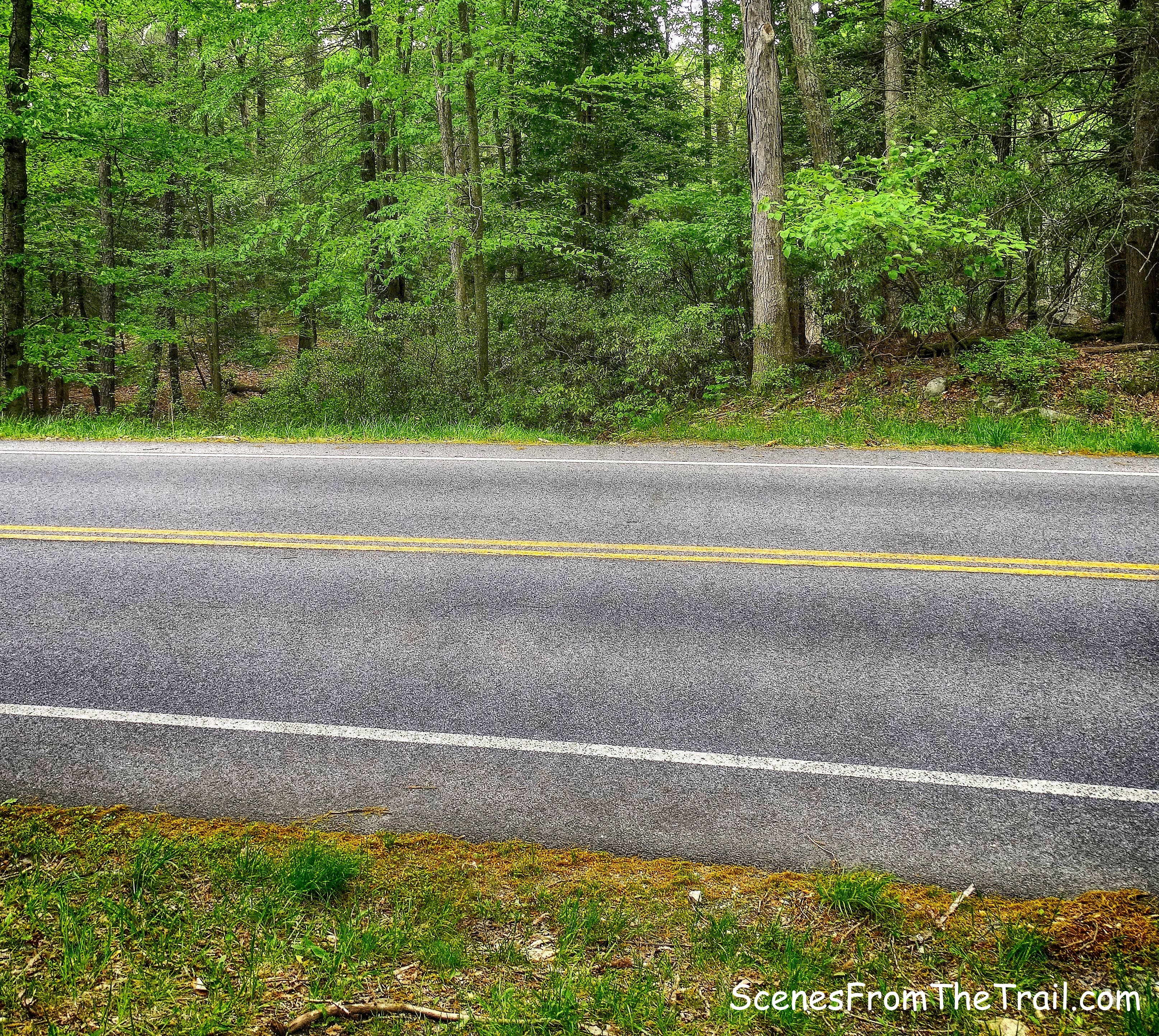
County Road 106
The trail bears left and runs parallel to CR 106 for about 500 feet. This area has a lot of downed trees, but the trail crew that maintains this section of trail have done a good job clearing the way.
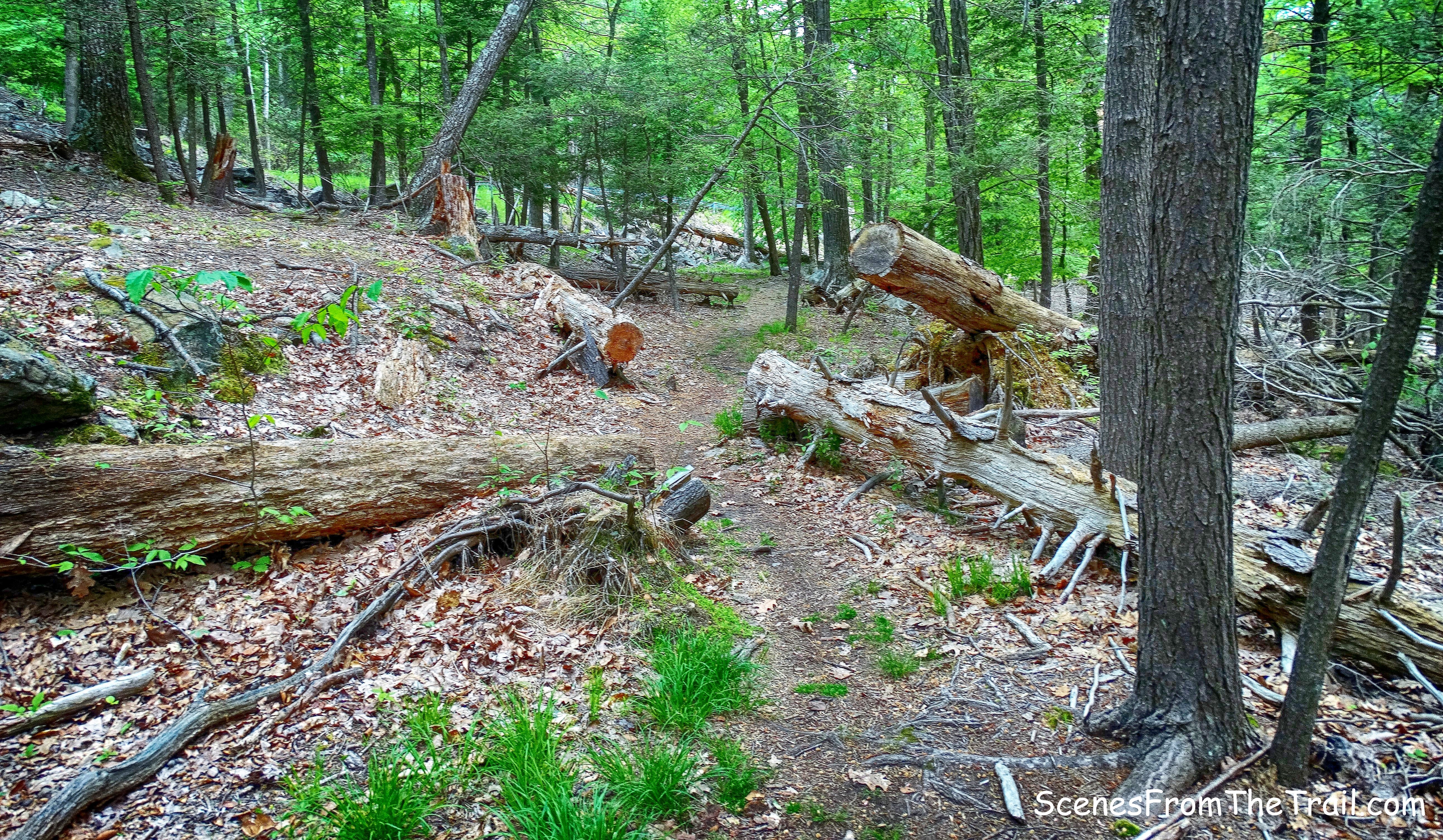
White Bar Trail
The trail then bears right, crosses a stream then arrives at a fork. The left fork is Island Pond Road, which would be our return route. We stayed to the right to continue on the White Bar Trail.
fork – Island Pond Road (left) White Bar Trail (right)
The White Bar Trail continues ahead on a woods road.
White Bar Trail
In a short distance, the Nurian Trail joins from the right, also blazed white, but with vertical blazes. The trail was established in 1929 by Kerson Nurian, a Bulgarian immigrant and an electrical engineer that worked at the Brooklyn Navy Yard. He was among the first trail builders in the Harriman area.
joint White Bar Trail and Nurian Trail
We followed the joint White Bar Trail and Nurian Trail for several hundred feet. When the trails split at a Y-intersection, we veered left and began following the vertical blazes of the Nurian Trail.
Y-intersection
The Nurian Trail follows a footpath over an open area and passes a glacial erratic on the left.
glacial erratic
It then passes through an area filled with pine trees……
Nurian Trail
then continues through dense mountain laurel.
Nurian Trail
About a 1/2 mile from the Y-intersection with the White Bar Trail, the Nurian Trail reaches Island Pond Road. We turned right here, still following the vertical white blazes along the wide woods road.
Nurian Trail/Island Pond Road
The Nurian trail then veers left at a fork, but we stayed to the right and continued on Island Pond Road.
fork – Nurian Trail/Island Pond Road
The yellow-blazed Dunning Trail now joins Island Pond Road from the left. We stayed on the woods road, now blazed yellow.
joint Dunning Trail/Island Pond Road
In a short distance, when the Dunning Trail turns right, we left the road and followed the yellow blazes.
junction – Dunning Trail goes right
After making the right turn to stay on the Dunning Trail, the cut in the hillside leading to Boston Mine is visible straight ahead. The mine opening consists of a large open cut, about 100 feet long, which extends north to south within a low ridge. At its northern end, the open cut becomes a shaft which extends into the rock ridge for about 30 feet.
Lenik, Edward J.. Iron Mine Trails (Kindle Locations 1300-1302). New York – New Jersey Trail Conference. Kindle Edition.
Boston Mine
Approaching the mine cut, we exercised caution as this area is filled with water and topped with leaves. The best way to view the actual mine entrance is by turning right and staying on the Dunning Trail, which goes up around the side of Boston Mine. Veering off the trail, we had a good frontal view of the adit.
Boston Mine
According to historian James M. Ransom, the Boston Mine was worked around 1880. The ore extracted from this mine was sent to the Clove Furnace at Arden, New York to be smelted.
Boston Mine
There where a lot of bugs in this area and I was glad that I applied insect repellent prior to beginning the hike, although they were swarming around my head which I left unprotected. When we were done checking out Boston Mine, we retraced our steps back to the junction of the Dunning Trail and Island Pond Road. We turned right and proceeded to walk north on Island Pond Road.
Island Pond Road
It was a nice easy walk along this woods road which was built in 1905 by Edward H. Harriman.
Island Pond Road
The Arden-Surebridge Trail (A-SB Trail) comes in from the right and joins Island Pond Road. When the joint A-SB Trail/Island Pond Road goes to left, we continued straight onto another unmarked woods road.
straight on unmarked woods road
To this point we had only seen two other hikers that were walking behind us briefly along the A-SB Trail. We walked the unmarked woods road to its terminus at the southern end of Island Pond where there sits the ruins of a cabin.
unmarked woods road
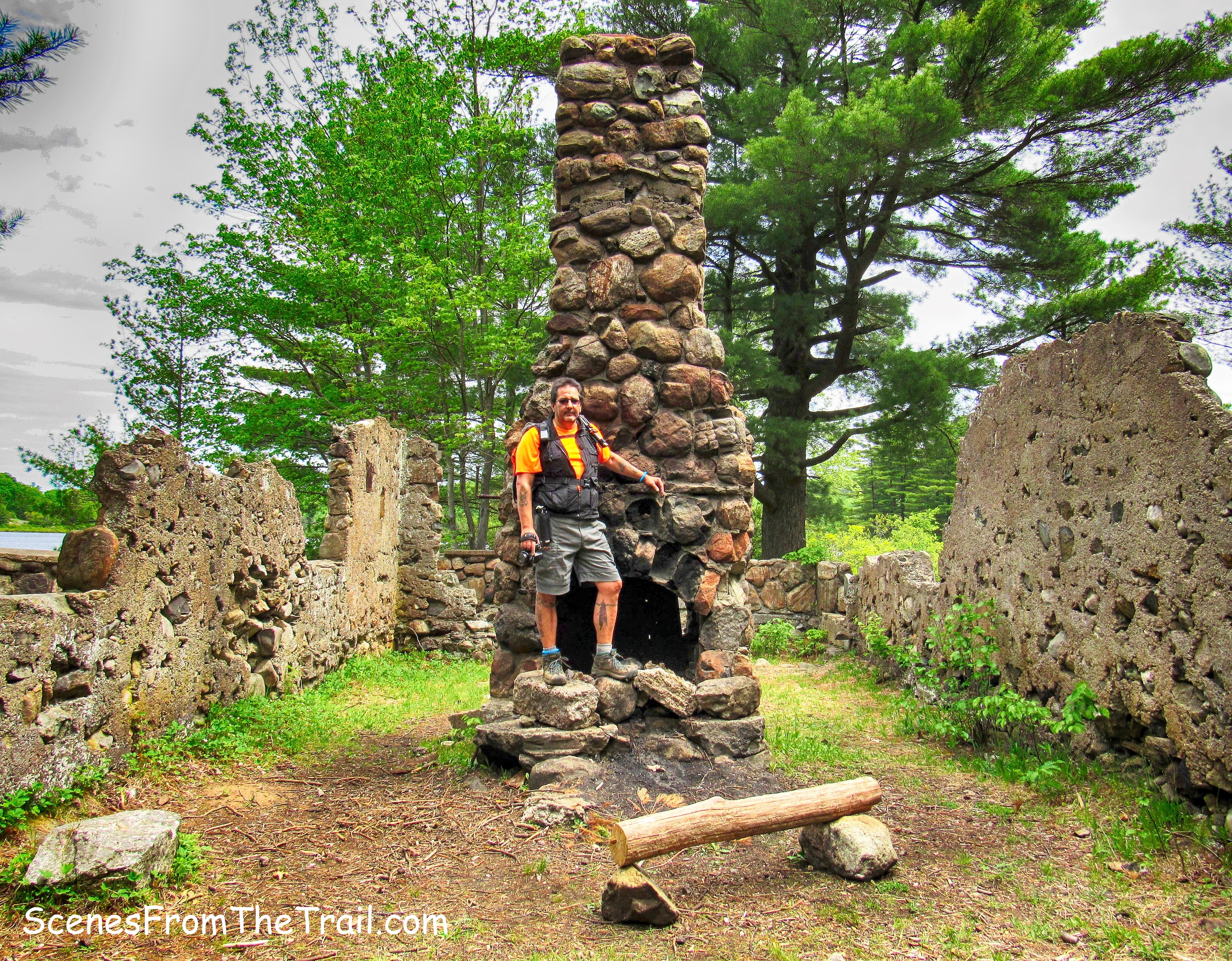
Harriman State Park built this stone cabin circa 1927 for their Park Rangers.
stone cabin ruins
Major William A. Welch, a founder of the New York-New Jersey Trail Conference, entertained visitors here.
stone cabin ruins
Unfortunately, the cabin was burned by vandals on January 1, 1962.
stone cabin ruins
Just beyond the cabin is a narrow footpath that leads to flat rocks which grace the southern shore of Island Pond.
Island Pond
Such a beautiful spot, that even though it was only about 11:30 am, we decided to sit here and have lunch. Luckily for us, not another soul was to be seen or heard while we enjoyed our sandwiches and cookies as well as the scenery.
Island Pond
As picturesque as this place is, the sun would not cooperate nor the wind. Since I was wearing short sleeves and short pants, at times the breeze from the pond was a bit chilly. We then began to retrace our steps back along the unmarked woods road.
unmarked woods road
On the way down to Island Pond, I noticed a trail off to the left with a fallen tree lying across it. Garfield Mine is located down in that area. We decided to venture down that trail and see if we could find it.
unmarked trail
I had forgotten to print the details about the exact location of the mine and the trail was littered with felled trees. The trail seemed to peter out at one point, but later, after reading the details that I had failed to print, the mine is 250 feet down that trail. We were literally just feet from it when we gave up.
unmarked trail
Retracing our steps back to the unmarked woods road, we turned right and continued heading south towards Island Pond Road. The rest of the way back was a pleasant walk in the woods with only a minor hill or two along the way.
Island Pond Road
Island Pond Road ends at County Road 106, about 500 feet from where we parked. We turned left on the White Bar Trail just before reaching the road. This is the section that parallels CR 106 before crossing the road and back to the parking area where our hike began.
Island Pond Road
I hope that you enjoyed this weeks hike and please don’t forget to follow my blog. Feel free to leave any comments or suggestions below as well. Now get out there and take a hike!
Pros: abandoned mines, stone cabin ruins, scenic pond, shaded trails, easy to walk woods roads, mostly level hike, secluded trails.
Cons: Garfield Mine trail is overgrown and hard to follow.
Take a hike!
