February 19, 2017 – Woodbury, NY
Difficulty: Moderate
Length: Approximately 5 miles
Max elevation: 1,320 ft.– total elevation gain 730 ft.
Route type: Circuit
Map: Harriman-Bear Mountain Trails Map
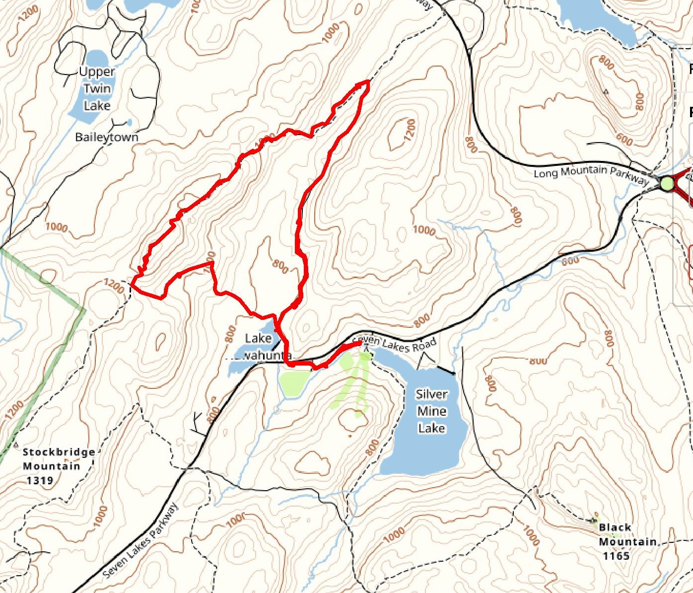
Hike route
This hike was on my calendar for quite some time, but somehow got pushed to the back burner due to weather and other priorities. With an unusually warm President’s Day weekend upon us, I decided to tackle this hike on Sunday morning. I was hoping the warm temperatures would melt away some of the snow from the previous week.
Harriman State Park covers almost 52,000 acres in Rockland and Orange Counties. The network of virtually infinite trail combinations is unrivaled in the New York metropolitan area. It offers hikers more than 235 miles of trails, which include approximately fifty marked trails, more than three dozen woods roads and numerous unmarked trails. It also has a lot of history tucked away in the woods. From its cool rock formations and glacial erratics to the abandoned mines and ruins that dot the landscape, you can always find thought-provoking and visually stimulating sights along the trails.
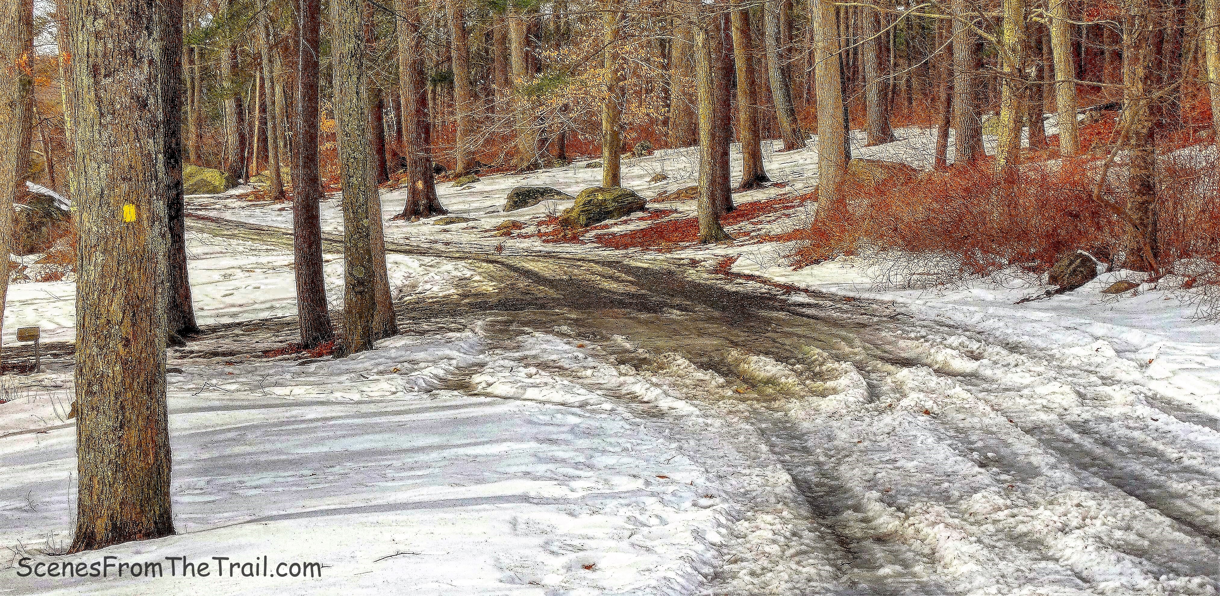
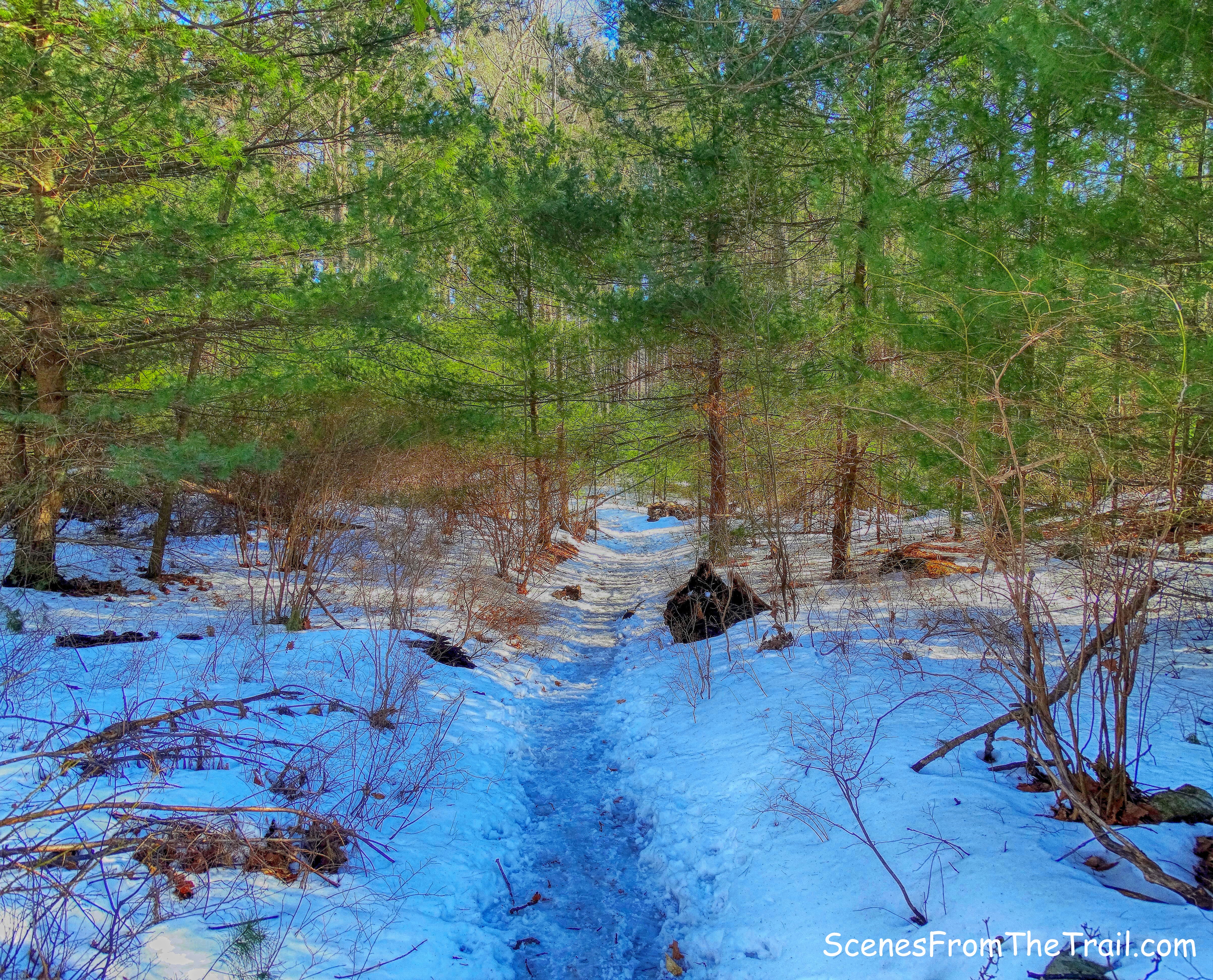
I love exploring the lesser used areas of the park and tend to avoid crowds whenever possible. This turned out to be one of those hikes, at least on this day. We arrived at the Old Silver Mine Ski Center on Seven Lakes Drive at around 9am. The huge parking lot had plenty of spots available, on our arrival and upon our return. We brought along our microspikes and put them on as we began our hike. They came in handy because the trails were either covered with snow and/or slush or muddy and swampy.
We began by heading west, following the yellow-blazed Menomine Trail which led us through a picnic area with Lewis Brook on the left and Seven Lakes Drive to our right.
yellow-blazed Menomine Trail
Just past a cable barrier, the trail turns right and climbs a slope then crosses the paved entrance road to the abandoned parking area for the former Silvermine Ski Area and enters a pine grove. To the right is the gravestone of James H. (“Scobie Jim”) Lewis and other family members, who once farmed the area now covered by Lake Nawahunta. We missed the stone, which lays toppled, but viewed it at the end of the hike. I am curious as to why the tombstone was never placed back on its base.
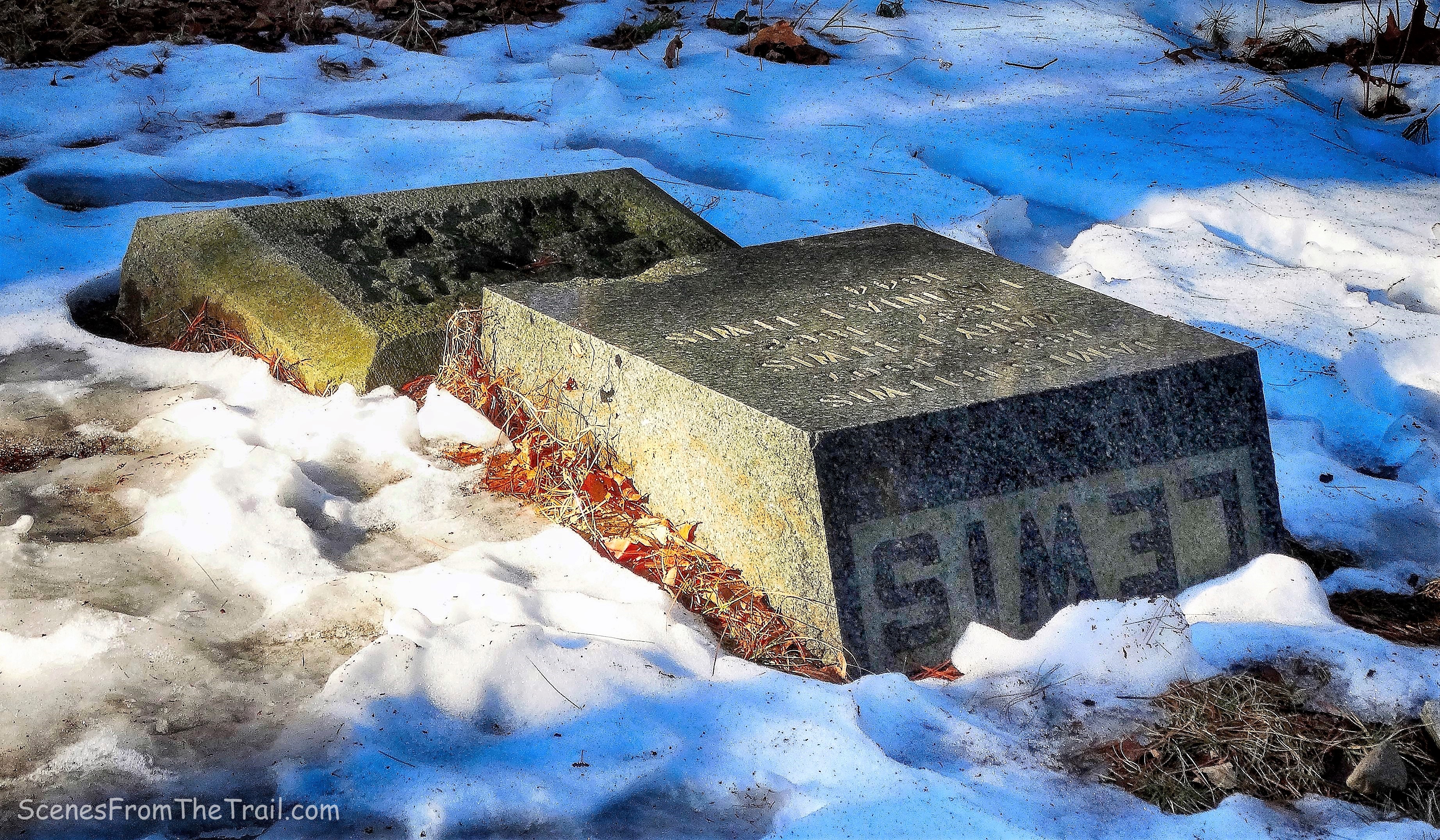
gravestone
The yellow-blazed Menomine Trail crosses Seven Lakes Drive and continues north on a woods road, known as the Nawahunta Fire Road with Lake Nawahunta on our left.
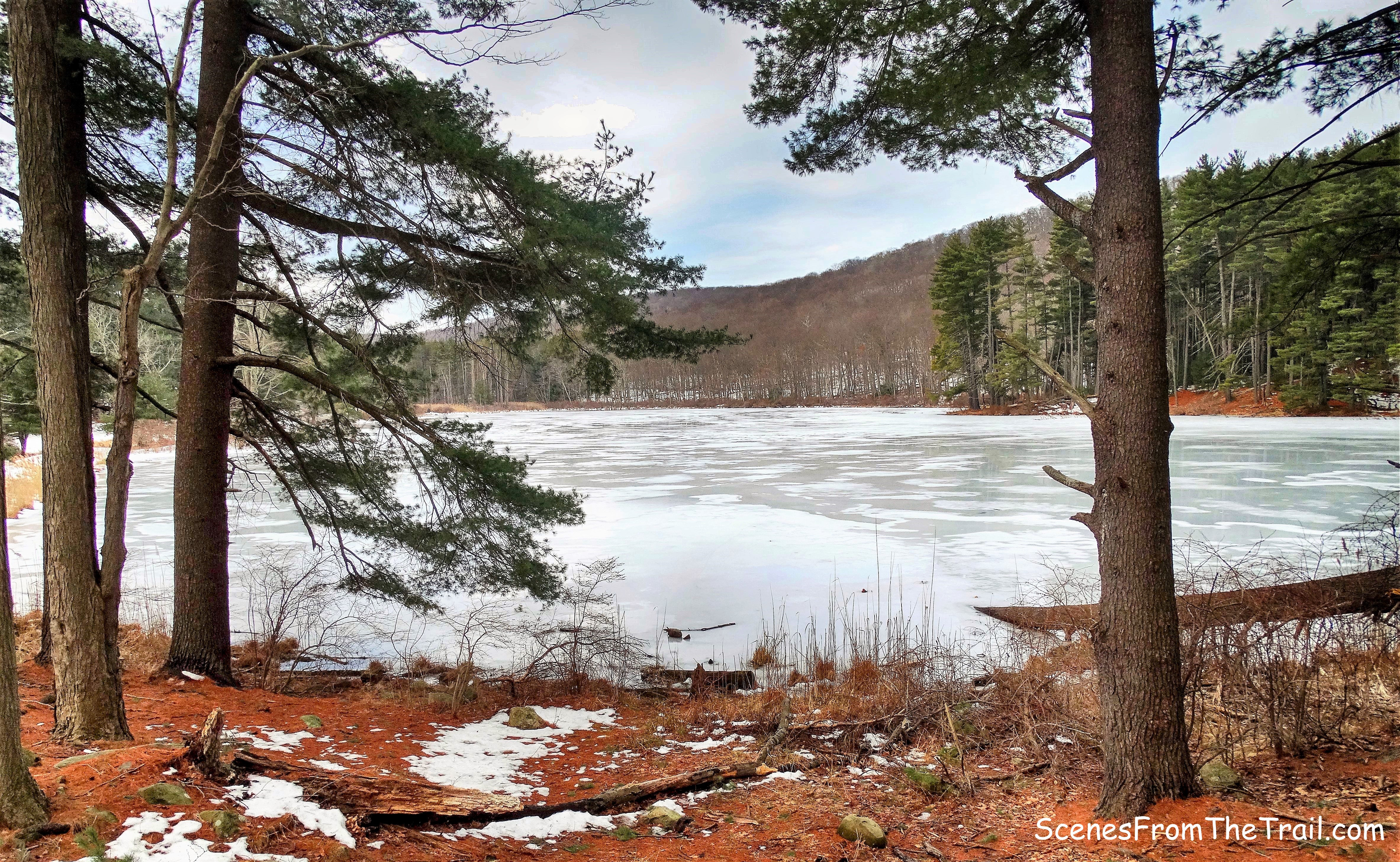
Lake Nawahunta
In a short distance, we came to a fork where the Menomine Trail bears left and the Nawahunta Fire Road splits to the right. We stayed right on the unmarked woods road which was built by the park in 1954. About 750 feet up the trail is the Lewis Mine. The hike description that we were following stated that there was a cairn (pile of stones used as a marker) on the right side of the trail. Well, we walked right by it and the mine opening was not visible from the direction we were coming from. I had my eyes wide open as I searched for the rock cut that led to the mine, but somehow missed it. We stopped and decided to double back to search for the mine. As we retraced our steps we could see the adit of the mine as we got closer. It turns out the cairn was knocked over (we added several stones to make it recognizable) and why we walked right past it. Nevertheless, we found Lewis Mine which is an open cut that is 28 feet long and 8 feet wide. The mine extends into the rock hillside.
Lewis Mine
No information has come to light regarding the ownership and operation of this mine. An 1875 map of this area showing two structures indicates that the property was owned by J.H. Lewis. A subsequent 1909 map also shows the J.H. Lewis holdings, which consisted of 220.5 acres, two structures, and a road. The surface indications at the Lewis Mine suggest that very little ore was removed from this site. Source: Lenik, Edward J. (2013-09-09). Iron Mine Trails (Kindle Locations 1615-1616). New York – New Jersey Trail Conference. Kindle Edition.
Lewis Mine
We did not enter the mine, but did peer inside. I was a little wary that a bear may be hibernating inside. We then continued on the fire road which climbs gradually for about a mile, then descends for a quarter of a mile. In the image below Stockbridge Mountain is visible through the trees.
Nawahunta Fire Road
When we came to a t-intersection, we turned left onto the Aqua-blazed Long Path. As the trail descended a bit, it was somewhat swampy.
Aqua-blazed Long Path
The Long Path began its ascent gradually then became steeper as we neared the summit.
Long Path – Stockbridge Mountain
Just before reaching the summit, we arrived at the Stockbridge Cave Shelter.
Stockbridge Cave Shelter
In 1922 while scouting a route for the Long Path, a 356-mile trail that passes through Harriman State Park, J. Ashton Allis found Stockbridge Cave. It officially became the Stockbridge Cave Shelter in 1928. (Courtesy of NYNJTC)
Stockbridge Cave Shelter
This massive rock formation has several natural caves that can accommodate quite a few people……and a few bears as well.
Stockbridge Cave Shelter
It even has a stone fireplace.
stone fireplace
We relaxed here for a bit, all the while staring at our next steps on the Long Path which entailed climbing along the side of the Stockbridge Cave Shelter. We watched one couple descend, with the woman falling and another couple ascend while slipping and sliding on the way up. Luckily for us we were wearing our microspikes and that made all the difference getting the necessary traction during that short but steep climb.
Long Path
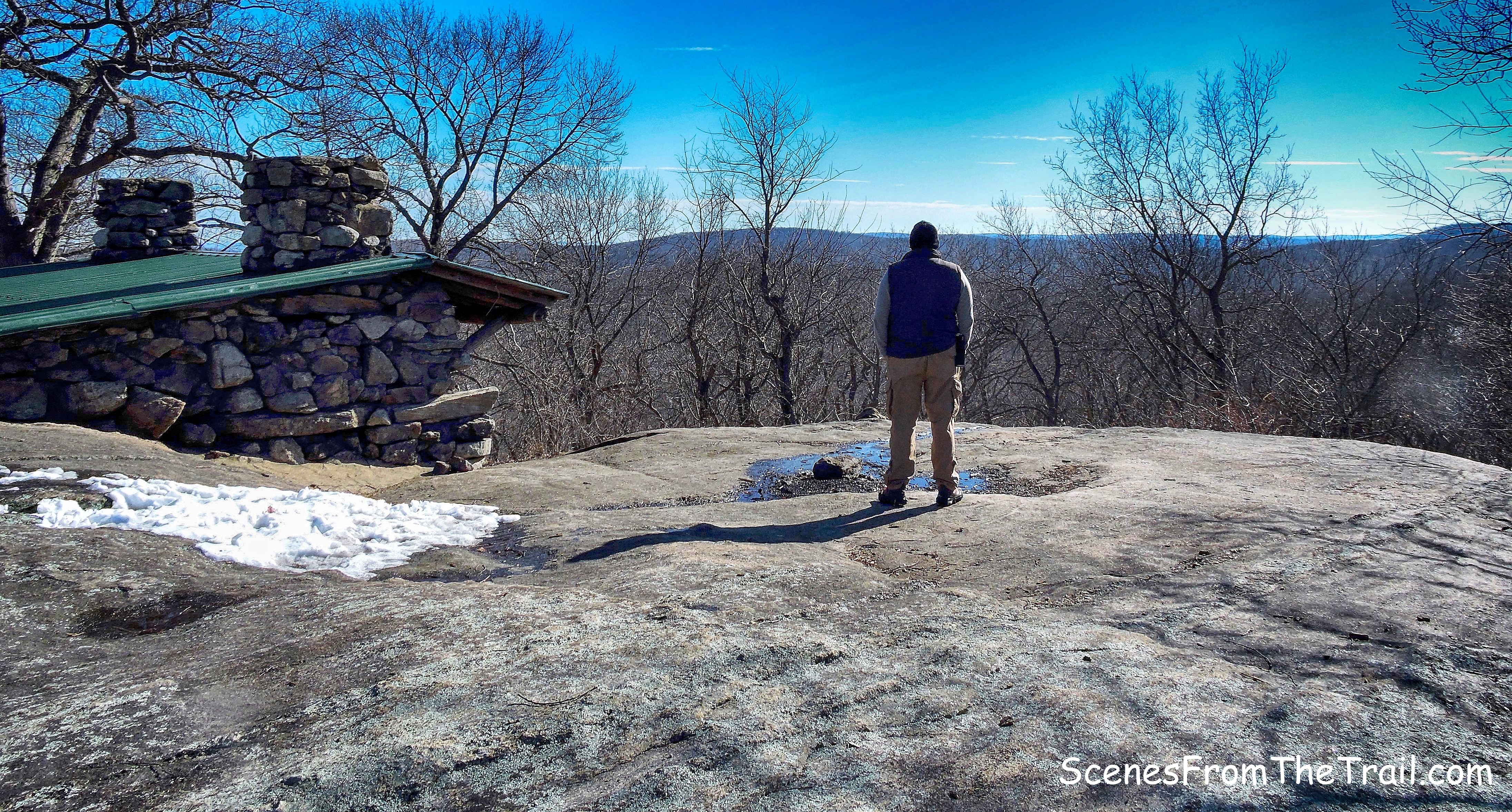
We continued up the Long Path, finally arriving at the summit of Stockbridge Mountain. We planted our weary selves on one of the many glacial erratics that were scattered about like lawn furniture and enjoyed the partial views at 1,320 feet.
Stockbridge Mountain summit
Within feet of the summit is the stone Stockbridge Shelter which was built in 1928.
Stockbridge Shelter
This stone shelter features two fireplaces with chimneys and a green tin roof.
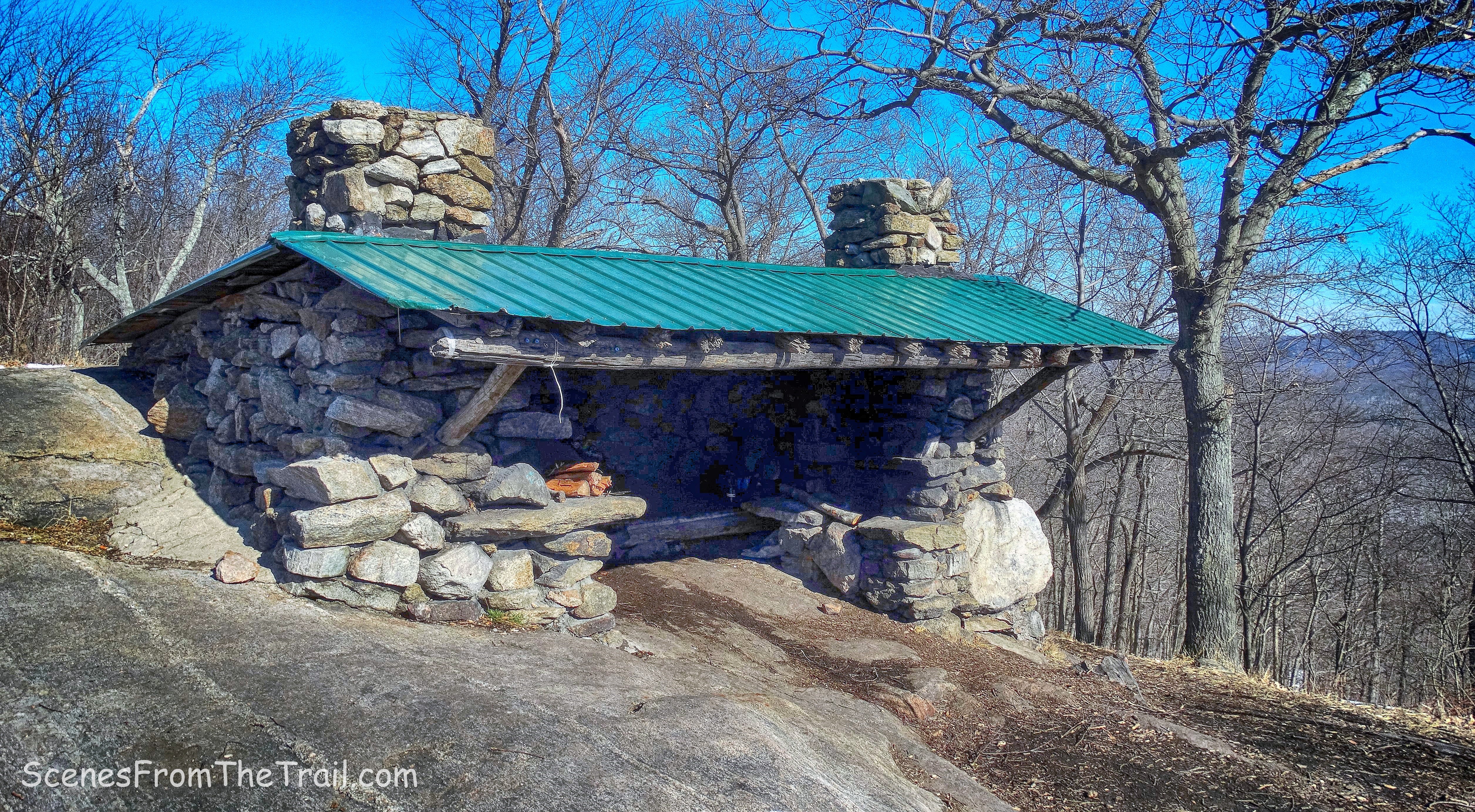
Stockbridge Shelter
From there the Long Path descended steeply and then leveled off a little. We came to a junction with the yellow-blazed Menomine Trail and there we turned left. Hippo Rock, a huge glacial erratic was just ahead on the Long Path, but it involved a small climb up the hill and at this point we were all tired. We just trudged along the Menomine Trail which led us gently back down towards civilization.
yellow-blazed Menomine Trail
We followed the yellow blazes, coming to the section where the fork with the Nawahunta Fire Road is. From there we retraced our steps back to the Silver Mine Picnic Area. My partners in crime grabbed a picnic table at the edge of Lewis Brook while I went to get the vehicle. We then fired up the grill and enjoyed some skirt steak tacos, loaded with cheese, pico de gallo and guacamole. Homemade toasted coconut brownies and caramel chocolate cookie bars were on the menu for dessert. After an exhausting hike, we relaxed, ate and enjoyed the warm February weather while being serenaded by the sweet sounds of the brook.
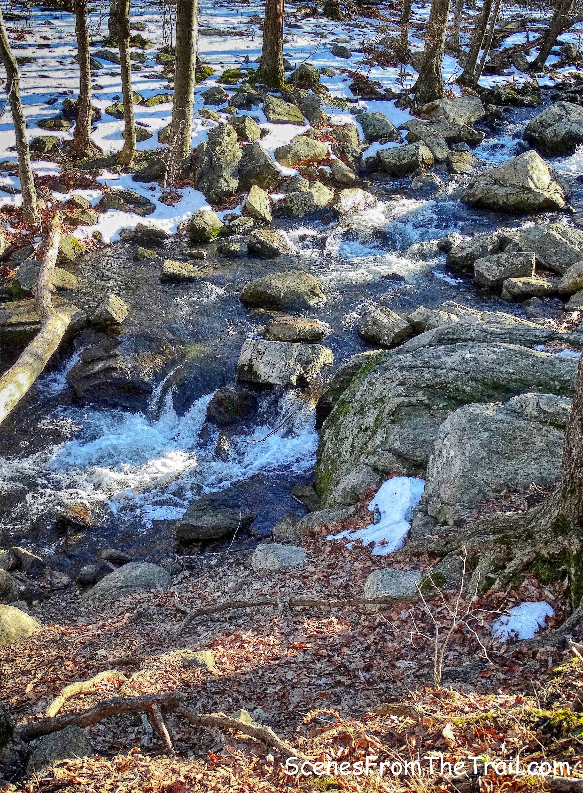
Lewis Brook
Don’t forget to follow my blog and feel free to share my posts with your friends. As always, I welcome any comments or suggestions regarding past or future hikes. Now get out there and take a hike!
Pros: Harriman State Park, abandoned mine, cool rock formations, cave shelter, stone shelter, seasonal views, ample parking.
Cons: seasonal views
take a hike!

Hi, Could the person who wrote this blog please contact me as I am the great great grand daughter of the Lewis grave stone that was off its base and laying on the ground. Thanks, Joan (Lewis) Palicia
LikeLike
The headstone of James H. Lewis and both of his wives was restored by his great-great-grandaughter in late 2017/early 2018.
LikeLiked by 1 person