November 14, 2020 – Washington Depot, Connecticut
Difficulty: Moderate
Length: Approximately 4.5 miles
Max elevation: 841 ft.– total elevation gain approximately 509 ft.
Route type: Circuit
Free Web Map: Hidden Valley Preserve Trail Map 2019
Avenza App Map (FREE): Hidden Valley Preserve Trail Map
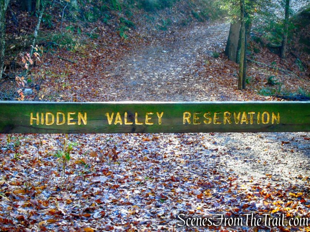
Trailhead parking: 198 Bee Brook Rd, Washington Depot, CT 06794
The preserve is open daily, Sunrise to Sunset
Please Note: There are neither restrooms nor drinking water at the preserve.
Hidden Valley Preserve is “Carry in-Carry out,” Do not litter.
Overview:
Hidden Valley Preserve is a 727-acre tract located northeast of Washington Depot, Connecticut. The property is characterized by densely wooded hillsides cascading into the meandering river below, providing views from the Lookout and Pinnacle. The preserve is crisscrossed by nearly 17 miles of trails that offer a variety of terrain for hiking.
Hidden Valley Preserve
Hidden Valley Preserve is one of three public preserves owned by Steep Rock Association (SRA). Steep Rock Preserve and Macricostas Preserve are the other two. SRA is is a non-profit land trust whose mission is to conserve ecologically and historically significant landscapes in and around Washington, CT and the Shepaug River Valley and to enhance the community’s connection with nature. SRA is entirely funded by donations from visitors.
History:
In the Spring of 1889, just as he was about to break ground on his own country house in Washington, Connecticut, a well-known architect of the period, Ehrick Rossiter discovered that the wooded hillsides in his dramatic view to the west were slated for clear cutting. He bought the threatened land from the timber company and saved forever the 100 acres that now form the heart of the Steep Rock Reservation. During his 36 years of ownership, Rossiter built carriage roads and small river crossings and invited his friends and fellow townspeople to enjoy the wild beauty of this section of the Shepaug River Valley.
In 1925, Rossiter no longer wished to be the sole custodian of Steep Rock and gave the property over to the care of nine of his friends. One of those was Adrian van Sinderen who, at this time, undoubtedly inspired by Rossiter’s preservation motives and civic generosity, was taking similar steps to preserve the natural lands around his home.
By 1928, Adrian Van Sinderen had accumulated 650 acres and named the property “Hidden Valley” after a place in the mountains of Utah, which he had visited on a trip out West.
For the rest of his life, Adrian Van Sinderen remained an active Trustee of Steep Rock, guiding the preserve through many changes, the acquisition of new lands, the planting of new trees and the transition of Steep Rock into a public land trust. It is thus not surprising that in 1963 Adrian Van Sinderen donated 650 acres of Hidden Valley as a gift to Steep Rock Association for the continual enjoyment of the public.
Trails Overview:
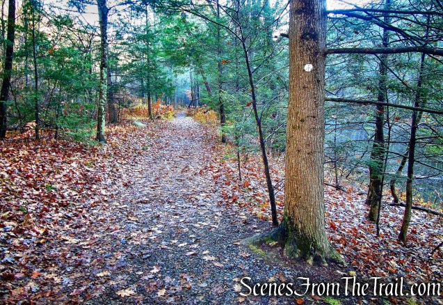
Hidden Valley Preserve offers nearly 17 miles of connecting hiking trails, making it a perfect spot for hikers of all levels. The level trail lying alongside the eastern bank of the river, runs along the old railroad bed. Passenger and freight trains once rumbled through the entire length of the reservation from 1872 to 1948. Trails and woods roads remaining from the Van Sinderens’ equestrian and carriage-driving days criss-cross this tract of hardwoods, pine groves, and hemlocks. The trails are well marked and for the most part, easy to follow. There are some unmarked trails throughout the property that may not appear on the trail map.
An easy loop hike of about 1.5 miles can be done utilizing the Bee Brook Loop and the old railroad bed, crossing both bridges over the Shepaug River.
Please Note: Trails may be periodically closed due to their conditions or to protect plants and wildlife.
Points of Interest:
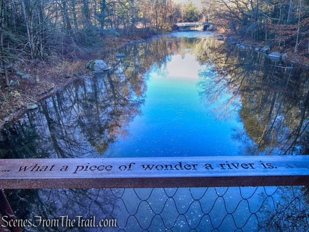
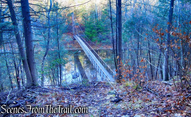
- The Thoreau Footbridge: A cable stayed, mass timber suspension bridge spanning 134′ across the Shepaug River. The bridge deck rises to clear the 500 year flood level and then sweeps 90 degrees as it gently ramps down to the north side of the river. Quotes from Thoreau’s seminal writings, inscribed by water jet into a bench at the cliff base and along the bridge’s steel handrails, offer moments for reflection.

Thoreau Footbridge – Hidden Valley Preserve
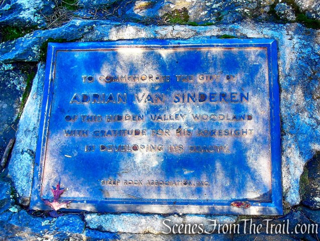
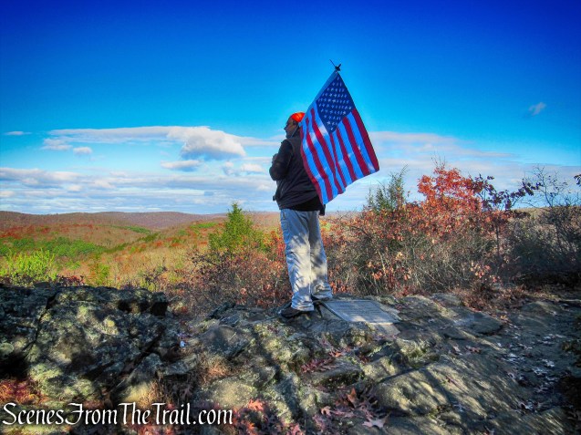
- Pinnacle: A rocky high point that rises to about 841 feet above sea level. The view is stunning with patches of fields and forest placed among the distant hills. A plaque honors Van Sinderen’s donation of the property.
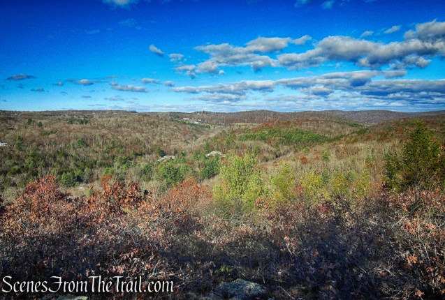
Pinnacle – Hidden Valley Preserve
- The Lookout: is a semi-circular terrace providing scenic views of the valley to the west. It was constructed as a lookout and rest spot along the carriage roads built by Adrian Van Sinderen. Overhung by trees in places, this is a great spot for a picnic.
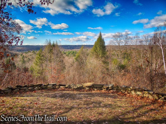
The Lookout – Hidden Valley Preserve
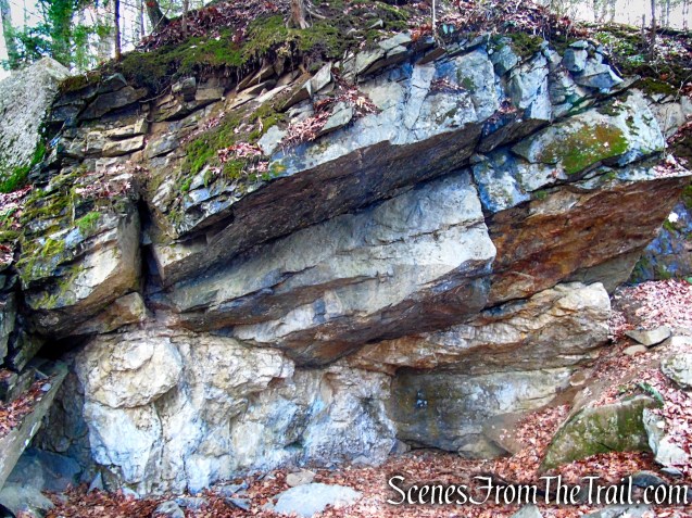
- The Quartz Mine: once helped support a small mining industry in the 19th Century. This surface mine was active from the 1800’s until it was abandoned in 1915. The quartz, used as a filler in paint and as an abrasive, was initially transported from here to the Hudson River by wagon and, later, by train. Quartz normally forms beautiful hexagonal crystals, but the mineral developed at Hidden Valley Preserve as a massive white vein.
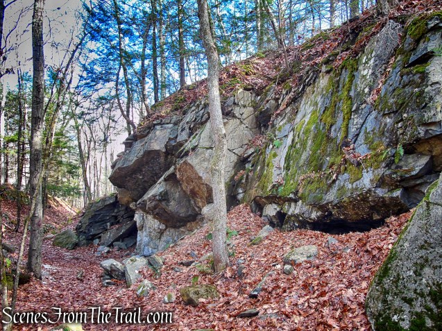
Quartz Mine – Hidden Valley Preserve
- Shepaug River: Deriving its name from the Mohegan word for “rocky water,” the Shepaug River extends for 26 miles across northwestern Connecticut. It originates in Warren and runs south through Washington, Roxbury, and Southbury where it finally joins the Housatonic River.

Shepaug River – Hidden Valley Preserve
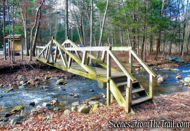
- Stephen C. Reich Memorial Bridge: In 2007, a new footbridge, replacing the 1987 bridge (which in turn replaced one from 1977) washed away in 2005 flooding, was dedicated to the memory of Major Stephen C. Reich, on New Year’s Day. Major Reich grew up in Washington, graduated from Shepaug Valley High School in 1989 and the United States Military Academy at West Point in 1993. He was commanding a U.S. Army Special Forces rescue operation in eastern Afghanistan when his Chinook helicopter was shot down June 28, 2005, killing all 16 aboard.
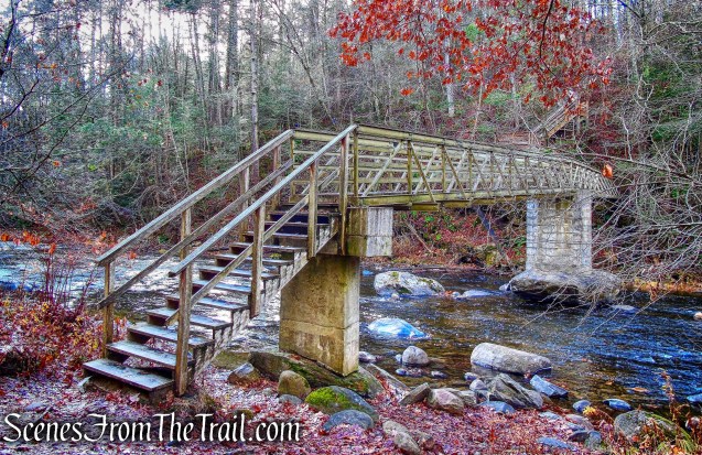
Reich Memorial Bridge – Hidden Valley Preserve
Hike Overview:
This particular hike is a good introduction to Hidden Valley Preserve as it hits all of the main points of interest. This hike begins at the smaller parking area, just north of the main entrance. This parking lot can fit about 12 vehicles if everyone parks correctly. The reason for beginning here was to cross the Thoreau Footbridge early before the place got busy. This hike can also be done from the main parking lot, crossing the Thoreau Footbridge at the end.
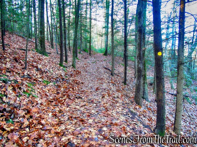
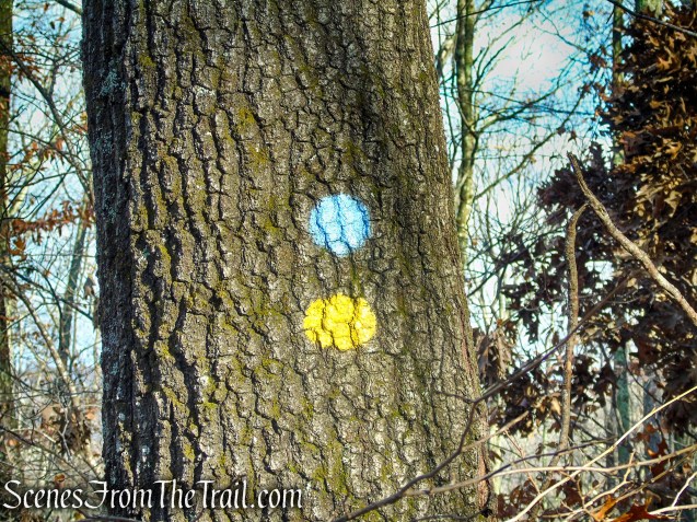
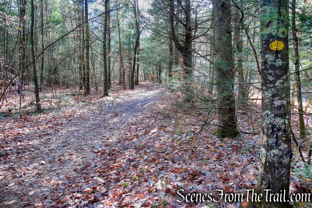
We began and ended the hike on the white-circle-blazed Bee Brook Loop Trail. For most of the hike, we followed the yellow-circle-blazed Van Sinderen Loop Trail. Which climbs to the Pinnacle then heads north across the Lookout and through the Quartz Mine. We also followed the blue-circle-blazed Pinnacle Trail briefly to the viewpoint and utilized the white-diamond-blazed connector trail to reach the river after passing through the Quartz Mine.
This hike was done counterclockwise from Bee Brook Road, just north of the Rt. 47 highway bridge.

Hidden Valley Preserve Loop

elevation profile – Hidden Valley Preserve Loop
The Hike:
The hike begins by crossing the footbridge that spans Bee Brook. In 1976, this small wooden footbridge was built over Bee Brook to allow dry access to the Hidden Valley entrance just north of the Rt. 47 highway bridge.
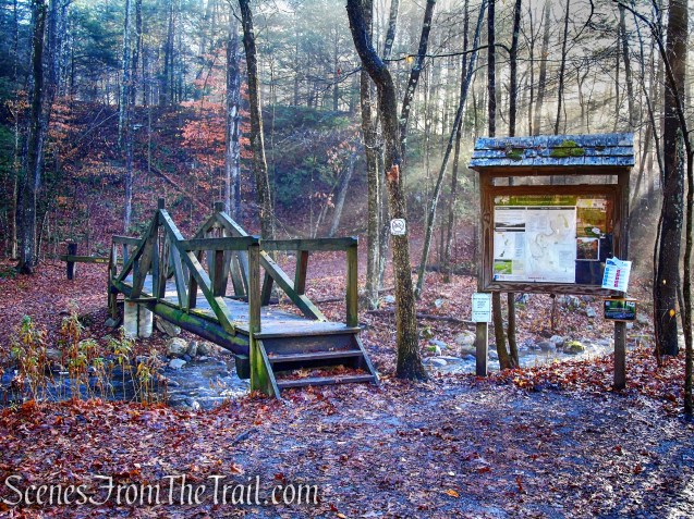
wooden footbridge over Bee Brook
Bee Brook – Hidden Valley Preserve
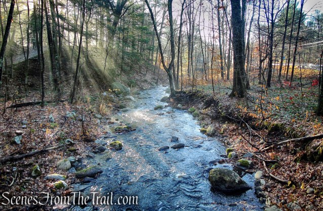
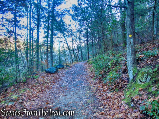
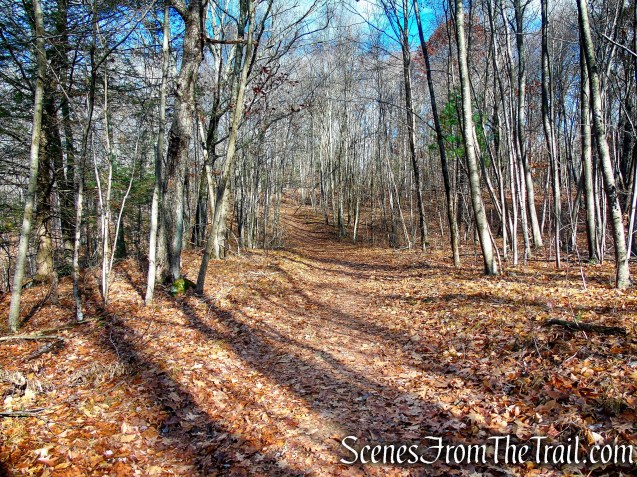
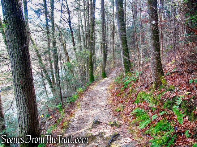
After crossing the small footbridge over Bee Brook, we turned right on the white-circle-blazed Bee Brook Loop Trail which heads uphill on a woods road then descends and parallels the Shepaug River. In about 250 yards, the Bee Brook Loop Trail reaches the Thoreau Bridge. Leaving the Bee Brook Loop Trail, we crossed the 134-ft. suspension bridge to the eastern section of Hidden Valley Preserve.
Bee Brook Loop – Hidden Valley Preserve
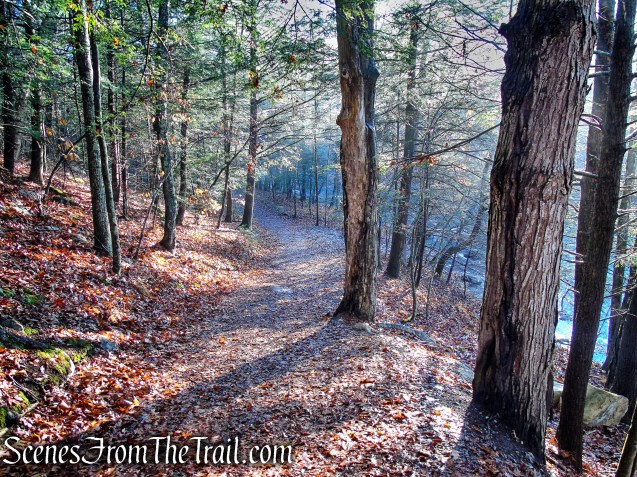
Bee Brook Loop – Hidden Valley Preserve
Bee Brook Loop – Hidden Valley Preserve
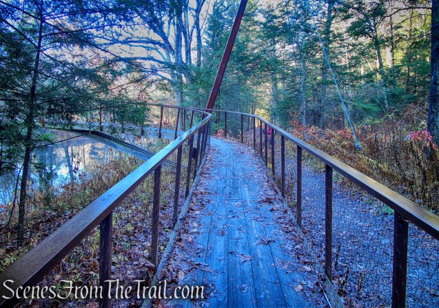
Thoreau Footbridge – Hidden Valley Preserve

Thoreau Footbridge – Hidden Valley Preserve
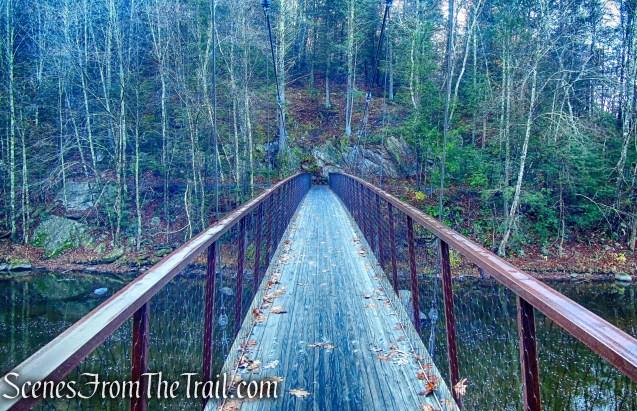
Thoreau Footbridge – Hidden Valley Preserve
Thoreau Footbridge – Hidden Valley Preserve
A cast iron bench on the eastern side of the bridge has a Henry David Thoreau quote that anyone who has explored the woods can relate to: “I went to the woods because I wished to live deliberately, to front only the essential facts of life, and see if I could not learn what it had to teach, and not, when I came to die, discover that I had not lived.”
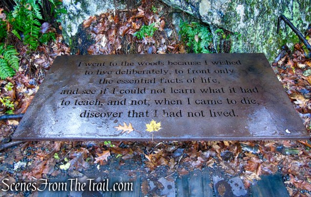
bench on the eastern end of the Thoreau Bridge
“The universe is wider than our views of it.”
Thoreau Footbridge – Hidden Valley Preserve
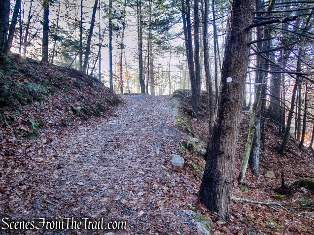
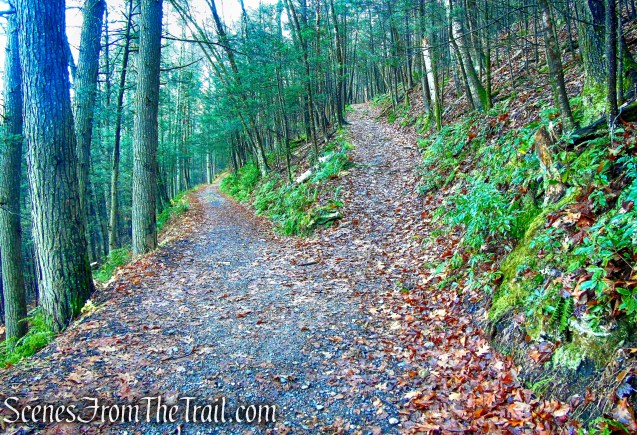
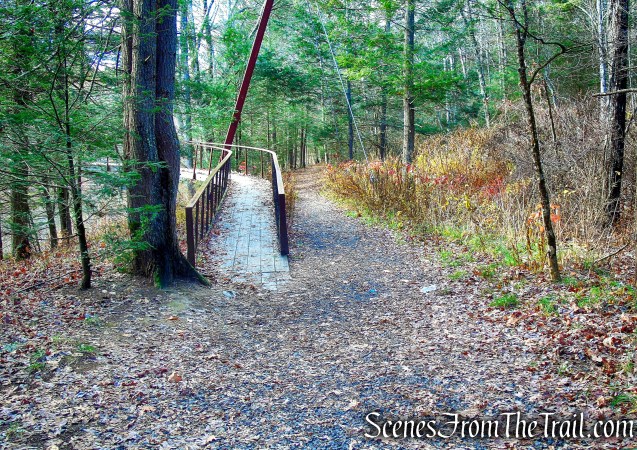
After crossing Thoreau Bridge, we turned right and headed south towards the main entrance. The yellow-circle-blazed Van Sinderen Loop begins here. If starting the hike from this parking lot, this is where you would begin. The Van Sinderen Loop climbs on a woods road, passes through a wooden barrier and continues north with Thoreau Bridge visible through the trees below.
Van Sinderen Loop Trail – Hidden Valley Preserve
Van Sinderen Loop Trail – Hidden Valley Preserve
Van Sinderen Loop Trail – Hidden Valley Preserve
Van Sinderen Loop Trail – Hidden Valley Preserve
A short distance later, the trail comes to a fork and the Van Sinderen Loop Trail splits. This is where the loop portion of the Van Sinderen Loop begins. If you were to follow only the yellow circle blazes, you would end up back at this spot. Although there are no visible blazes on the right fork, it is coaligned with the white-diamond-blazed Connector Trail. I misread the map and continued straight and used an unmarked trail to back track. Take the right fork as it climbs steeply.
bear right at the fork
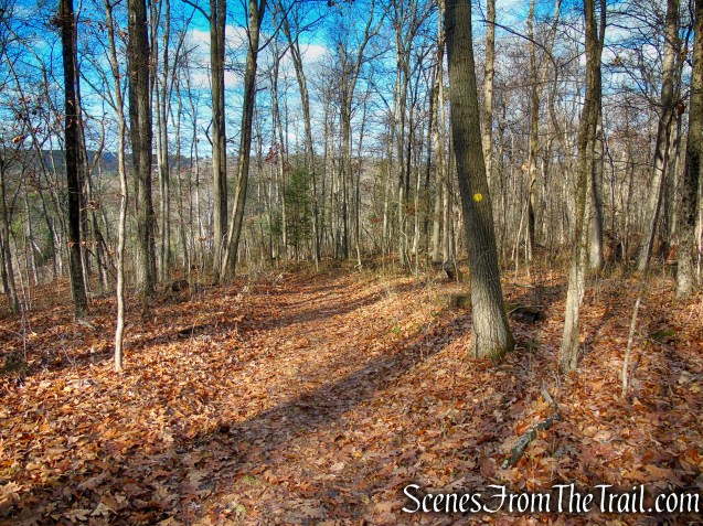
In about another 520 feet, the two coaligned trails split. We turned right to continue following the yellow circle blazes, which continue to climb towards the Pinnacle.
bear right at the fork
Van Sinderen Loop Trail – Hidden Valley Preserve
In about another 275 feet, the Van Sinderen Loop Trail comes to a junction with the blue-blazed Pinnacle Trail. We turned right on the Pinnacle Trail which climbs steeply for about 210 feet and comes out onto a rock outcrop with views to the northwest.
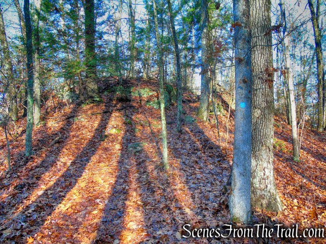
turn right on Pinnacle Trail – Hidden Valley Preserve

Pinnacle Trail – Hidden Valley Preserve
A plaque honors Van Sinderen’s donation of “this hidden valley woodland with gratitude for his foresight in developing its beauty.”
Pinnacle Trail – Hidden Valley Preserve
Pinnacle – Hidden Valley Preserve
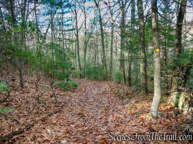
We retraced our steps back to the Van Sinderen Loop Trail which is now coaligned for a short distance with the Pinnacle Trail. When the two trails split, we veered left, following the yellow blazes which descend gradually through the dense woods, soon passing one of the white diamond connector trails on the left.
Van Sinderen Loop Trail – Hidden Valley Preserve

Van Sinderen Loop Trail – Hidden Valley Preserve
Van Sinderen Loop Trail – Hidden Valley Preserve

Van Sinderen Loop Trail – Hidden Valley Preserve
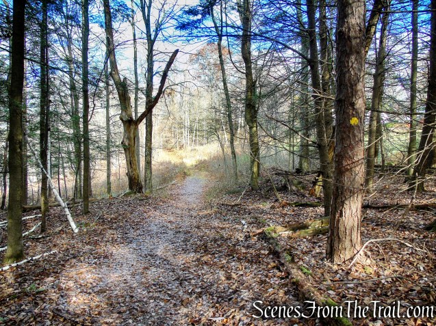
Van Sinderen Loop Trail – Hidden Valley Preserve
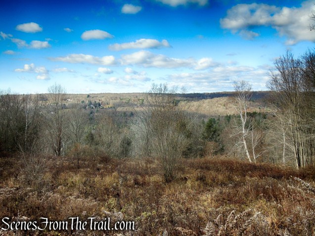
In about 0.4 mile, the Van Sinderen Loop Trail passes through an open field with a private residence to the right and a west-facing viewpoint to the left. The trail reenters the woods, descends, levels off slightly, then climbs again, soon reaching the Lookout, with more west-facing views.
Van Sinderen Loop Trail – Hidden Valley Preserve
Van Sinderen Loop Trail – Hidden Valley Preserve
The circular terrace marked with a small stone wall, showcases a scenic view across the hills of Washington. According to the Steep Rock Association, the Lookout was built by Adrian Van Sinderen as a resting spot along his carriage road. Old houses, fields and farms can be seen in the distant hills.
The Lookout – Hidden Valley Preserve
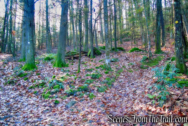
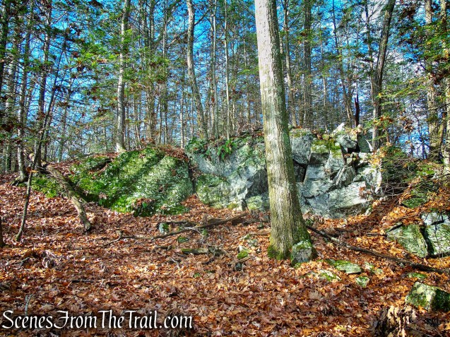
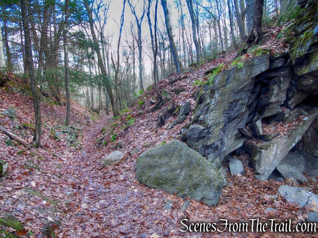
The Van Sinderen Loop Trail descends then levels off, passing junctions with several trails. It then turns left and descends again, heading in a westerly direction. At the base of the descent, the trail turns right and passes through the area of the Quartz Mine.
Van Sinderen Loop Trail – Hidden Valley Preserve
Van Sinderen Loop Trail – Hidden Valley Preserve
Van Sinderen Loop Trail – Hidden Valley Preserve
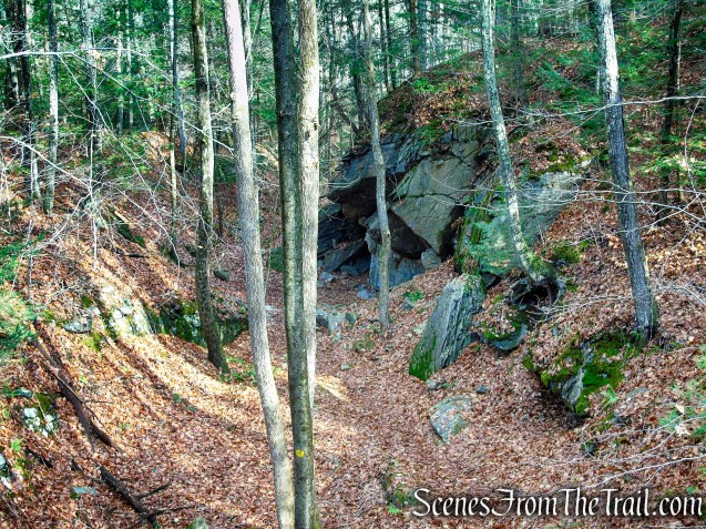
Quartz Mine – Van Sinderen Loop Trail

Quartz Mine – Van Sinderen Loop Trail
Quartz Mine – Hidden Valley Preserve
According to the Steep Rock Association, the mine was active from the 1800’s until 1915, transporting quartz to the Hudson River by wagon and train. The quartz was used as a filler in paint and as an abrasive. A huge vein of quartz remains exposed, and the trail is littered with snow-white tailings that crunch under your boots.
Quartz Mine – Van Sinderen Loop Trail
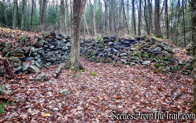
The trail passes through an area that is built up with stone walls and possibly foundations that were associated with the abandoned Quartz Mine.
Van Sinderen Loop Trail – Hidden Valley Preserve
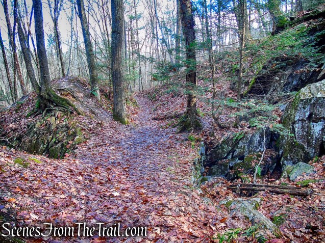
Van Sinderen Loop Trail – Hidden Valley Preserve
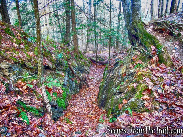
Van Sinderen Loop Trail – Hidden Valley Preserve
Van Sinderen Loop Trail – Hidden Valley Preserve
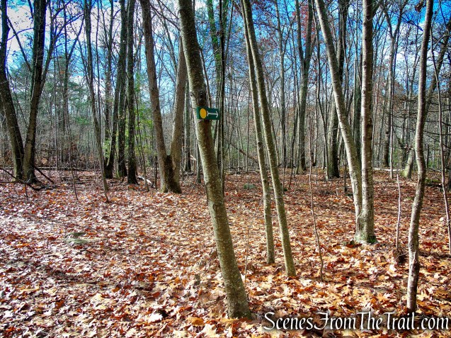
The yellow-circle-blazed Van Sinderen Loop Trail comes to a T-intersection and turns right. We turned left on a poorly blazed white-diamond-blazed connector trail which heads in a southerly direction.
turn left on White Diamond Connector Trail
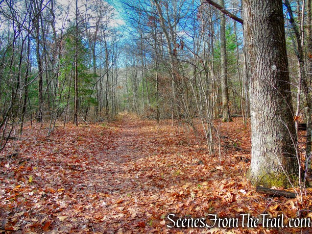
In just under 500 yards, the connector trail ends at a T-intersection with the Van Sinderen Loop Trail. Here we turned left and followed the trail south. This section of the trail runs along the old Shepaug Valley Railroad bed. The 32-mile railroad once known as the “crookedest east of California” with its 200 curves and 32-mile length to cover a route 18 miles long as the crow flies.
turn left on Van Sinderen Loop Trail
A short distance later, the trail reaches the Stephen C. Reich Memorial Bridge. Major Reich was a Washington resident who died in 2005 as part of an Army Night Stalker team that was trying to rescue an eight-member Navy Seal team in Afghanistan. The mission was depicted in the 2014 movie, “Lone Survivor.” A plaque dedicates the bench and bridge to Reich with the quote, “If you would seek his monument, look about you.”
Reich Memorial Bridge – Hidden Valley Preserve
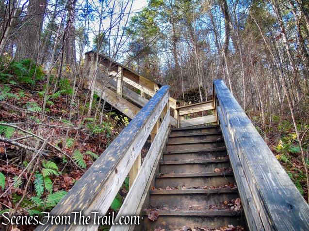
We crossed the bridge and climbed the wooden steps on the western side of the Shepaug River. The bridge connects the Van Sinderen Loop Trail with the Bee Brook Loop.

Reich Memorial Bridge – Hidden Valley Preserve
Shepaug River – Hidden Valley Preserve
Reich Memorial Bridge – Hidden Valley Preserve
After crossing the bridge and climbing the stairs, we turned left on the Bee Brook Loop Trail which soon descends to river level as it heads south.
Bee Brook Loop – Hidden Valley Preserve
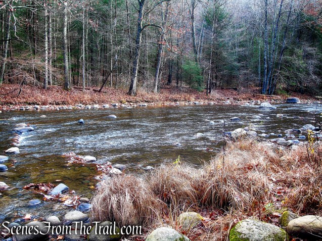
Shepaug River – Hidden Valley Preserve
In about 0.6 mile (from the Reich Memorial Bridge), the Bee Brook Loop Trail passes the Thoreau Bridge. If you parked in the main lot, you would cross the bridge, turn right and head for the parking lot.
Bee Brook Loop – Hidden Valley Preserve
If you began the hike where we did, continue past the bridge for another 250 yards, up and down the hill, cross the small wooden footbridge over Bee Brook and back to the parking area where the hike began.
wooden footbridge over Bree Brook – Hidden Valley Preserve
Review:
A really good hike in a well maintained preserve. The points of interest are plentiful and the landscape is quite scenic. The trails are well marked with the exception of most of the junctions, which could use some blazes closer to the turnoffs. By using the free Avenza Maps app, it makes it much easier to navigate the trails. This is a popular hiking location on weekends, especially on nice days and can get crowded. An early start is recommended or even weekdays to avoid any crowds. The preserve was litter free on the day of our visit, let’s keep it that way. Do not litter, please carry out what you carry in.
Pros:
Scenic landscape, well maintained trails, historical features, scenic views, Thoreau Bridge, Quartz Mine, Pinnacle, Shepaug River.
Cons:
Some junctions are not well marked, can hear some road noise, attracts crowds on nice days.
Take a hike!
Hidden Valley Preserve Loop
Sources:

Quite a nice review of a place I look forward to exploring someday. Thanks!
LikeLiked by 1 person
Thanks for reading.
LikeLike